|


|
Llansadwrn (Anglesey)
Weather:
Snowdonia Snowline Report
You may need to refresh your browser for the latest
version |

|
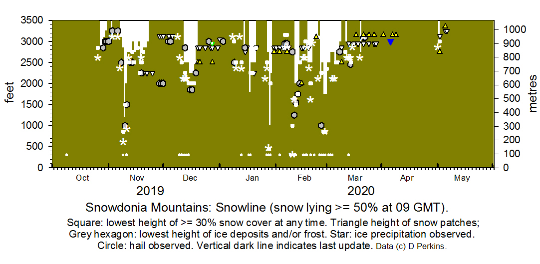
Snowdonia Mountains Winter Season 2019- 20
 Snowline
histogram Snowline
histogram

October 2019
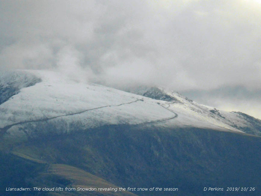
 The first snow was seen on Snowdon on the 26th after the cloud lifted late in the afternoon. The same date as last year (2018).
On the 27th light snow was lying at 0900 GMT on the Carneddau and Snowdon at an average 2850 ft. Snow persisted on Snowdon on the 28th/ 29th with icy deposits remaining on the 30th The first snow was seen on Snowdon on the 26th after the cloud lifted late in the afternoon. The same date as last year (2018).
On the 27th light snow was lying at 0900 GMT on the Carneddau and Snowdon at an average 2850 ft. Snow persisted on Snowdon on the 28th/ 29th with icy deposits remaining on the 30th
November
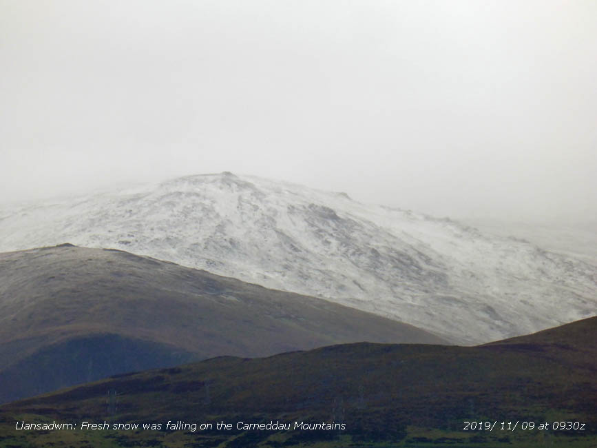
A little snow was seen around Yr Wyddfa on the 2nd with icy remnants on the 3rd. Some ice precipitation was seen on Carnedd Llewelyn on the 6th when Snowdon was enveloped in cloud. There was slight snow was on the Carneddau at 3100 ft on the morning of the 7th and fresh snow fell as low as 2000 ft during the evening.  On the 8th some snow was a low as 2500 ft on the northern slopes of the Carneddau and lying above 2850 ft there and on Snowdon. Fresh snow was falling and settling on Snowdon and the Carneddau Mountains on the morning of the 9th around 1000 ft (300 m) and as low as 850 ft in places. On the 10th snow was lying at 2000 ft with 30% cover at 1500 ft with some as low as 1000 ft at Ogwen. On the 11/12th there was broken snow cover at lower levels with fresh snow falling at higher levels. Fresh snow was lying at 2750 ft on the 13th and as low as 2500 ft where there was a thaw taking place. By the 14th the snowline had risen to 3000 ft with a 30% cover remaining at 2750 ft and remnants at 2500 ft. Further snow on the morning of the 15th left a good cover on Snowdon. On the 17th there was broken snow cover around 2850 ft with lying snow above 3000 ft. On the 18th after fresh falls snow was lying at 2500 ft with 30% cover at 2250 ft. Snow continued falling on the summits above 2500 ft on the 19th with some settling as low as 2250 ft, thereafter with thawing taking place the snowline rose to 2850 ft on the 20/21st then 3000 ft on the 22nd. Snow patches at 2250 ft on the 20th persisted to the 25th. Other small snow patches at 3125 ft with some remnants persisted on Yr Wyddfa and Carnedd Llewelyn to the end of the month helped by severe frost and icing occurring generally above 600 m on the 29/30th. On the 8th some snow was a low as 2500 ft on the northern slopes of the Carneddau and lying above 2850 ft there and on Snowdon. Fresh snow was falling and settling on Snowdon and the Carneddau Mountains on the morning of the 9th around 1000 ft (300 m) and as low as 850 ft in places. On the 10th snow was lying at 2000 ft with 30% cover at 1500 ft with some as low as 1000 ft at Ogwen. On the 11/12th there was broken snow cover at lower levels with fresh snow falling at higher levels. Fresh snow was lying at 2750 ft on the 13th and as low as 2500 ft where there was a thaw taking place. By the 14th the snowline had risen to 3000 ft with a 30% cover remaining at 2750 ft and remnants at 2500 ft. Further snow on the morning of the 15th left a good cover on Snowdon. On the 17th there was broken snow cover around 2850 ft with lying snow above 3000 ft. On the 18th after fresh falls snow was lying at 2500 ft with 30% cover at 2250 ft. Snow continued falling on the summits above 2500 ft on the 19th with some settling as low as 2250 ft, thereafter with thawing taking place the snowline rose to 2850 ft on the 20/21st then 3000 ft on the 22nd. Snow patches at 2250 ft on the 20th persisted to the 25th. Other small snow patches at 3125 ft with some remnants persisted on Yr Wyddfa and Carnedd Llewelyn to the end of the month helped by severe frost and icing occurring generally above 600 m on the 29/30th.
There were 17 days of lying snow above an average 826 m, most since 2016 that had 20 days. Unusually snow was present every day, a statistic not recorded since before 1995, there were 27 days in 2012.
December
On the 1st small snow patches
at 3125 ft persisted until the 6th. Snow fell again during the evening of the 11th and on the morning of the 12th was lying at 2500 ft persisting to the 14th at that altitude.  On the 15th snow was lying at 2250 ft after a fresh fall remaining at that altitude to the 17th, with some as low as 1850 ft. The snowline had risen to 2500 ft on the 18th and 2850 ft by the 19th with remnants as low as 2250 ft. On the 20th there was insufficient snow to record snow lying at 0900 GMT, snow patches were seen on Y Garn at 2850 ft and the northern-cliffs of the Carneddau. Patches were at 2500 ft below the Black Ladders on the 20/22nd with accumulations in higher altitude gullies. There were some old drift lines persisting on slopes. On the 28th a few patches were evident on east-facing slopes of the Conwy Valley. Small patches and pockets of ice remained until the end of the month when unusually high temperatures (16.4C was recorded in Llanfairfechan on the 30th) resulted in the disappearance of most. On the 15th snow was lying at 2250 ft after a fresh fall remaining at that altitude to the 17th, with some as low as 1850 ft. The snowline had risen to 2500 ft on the 18th and 2850 ft by the 19th with remnants as low as 2250 ft. On the 20th there was insufficient snow to record snow lying at 0900 GMT, snow patches were seen on Y Garn at 2850 ft and the northern-cliffs of the Carneddau. Patches were at 2500 ft below the Black Ladders on the 20/22nd with accumulations in higher altitude gullies. There were some old drift lines persisting on slopes. On the 28th a few patches were evident on east-facing slopes of the Conwy Valley. Small patches and pockets of ice remained until the end of the month when unusually high temperatures (16.4C was recorded in Llanfairfechan on the 30th) resulted in the disappearance of most.
January 2020
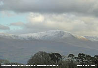
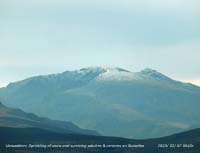
A few remnant snow/ ice patches survived until the 1st of the month on east and north-facing cliffs. Snow was absent until overnight on the 8/9th when there was some ice precipitation at high altitude. On the 10th the fresh snow had all but disappeared by the afternoon with remnants seen as low as 2500 ft on Snowdon (right) and the Carneddau. Snow was absent until overnight on the 8/9th when there was some ice precipitation at high altitude. On the 10th the fresh snow had all but disappeared by the afternoon with remnants seen as low as 2500 ft on Snowdon (right) and the Carneddau. On the 10th further light snowfall left a sprinkling as low as 2250 ft in places with more around the summits (left). Mild conditions and heavy rain on the 11/12th cleared any remaining snow before heavy ice precipitation on a cold front in the afternoon of the 13th followed by slight snow during the evening and night. On the 14th snow was lying over 2750 ft. This had all but disappeared by the 15th with remnants seen mostly on north-facing slopes and cliffs. There was a fresh fall of light snow overnight 26/27th lying above 2750 ft with the most cover on Snowdon and tops of the Carneddau. Further snow on the 28th settled in places as low as 450 ft in places on the northern slopes of the Carneddau in the morning. Light snow on the 29th remained above 2250 ft and most had disappeared on the 30th. Snow patches and old cornices remained on some cliffs until the end of the month.. On the 10th further light snowfall left a sprinkling as low as 2250 ft in places with more around the summits (left). Mild conditions and heavy rain on the 11/12th cleared any remaining snow before heavy ice precipitation on a cold front in the afternoon of the 13th followed by slight snow during the evening and night. On the 14th snow was lying over 2750 ft. This had all but disappeared by the 15th with remnants seen mostly on north-facing slopes and cliffs. There was a fresh fall of light snow overnight 26/27th lying above 2750 ft with the most cover on Snowdon and tops of the Carneddau. Further snow on the 28th settled in places as low as 450 ft in places on the northern slopes of the Carneddau in the morning. Light snow on the 29th remained above 2250 ft and most had disappeared on the 30th. Snow patches and old cornices remained on some cliffs until the end of the month..
February
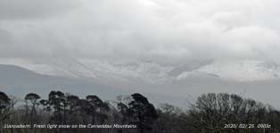
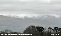
On the 1st there were some small snow patches surviving high on the Carneddau and Snowdon together with some old cornices on cliffs.  Ice precipitation occurred on the 3rd and a sprinkling was left on the NE flank and summit of Snowdon on the 6th that was still present on the 7th. Small snow patches and cornices were surviving on the 8th on Snowdon and the Carneddau surviving the heavy rain associated with Storm Ciara. Snow and snow pellet showers on the afternoon of the 9th left slight coverings as low as 1000 ft including the A5 at Llyn Ogwen. Snow pellets and small snow flakes were also seen in SE Anglesey. On the morning of the 11th after further and ongoing showers of snow and snow pellets light snow was lying around 2000 ft generally on N-facing slopes and as low as 1650 ft in places, 1250 ft elsewhere. The 12th had light snow lying above 2000 ft on the Carneddau with some snow as low as 1500 ft in places. Ice precipitation occurred on the 3rd and a sprinkling was left on the NE flank and summit of Snowdon on the 6th that was still present on the 7th. Small snow patches and cornices were surviving on the 8th on Snowdon and the Carneddau surviving the heavy rain associated with Storm Ciara. Snow and snow pellet showers on the afternoon of the 9th left slight coverings as low as 1000 ft including the A5 at Llyn Ogwen. Snow pellets and small snow flakes were also seen in SE Anglesey. On the morning of the 11th after further and ongoing showers of snow and snow pellets light snow was lying around 2000 ft generally on N-facing slopes and as low as 1650 ft in places, 1250 ft elsewhere. The 12th had light snow lying above 2000 ft on the Carneddau with some snow as low as 1500 ft in places.  On the 13/14th broken snow remained mostly above 2500 ft with many gullies filled with snow above 2000 ft. The heavy rain of Storm Dennis resulted in a rapid snowmelt, but small snow patches and remains of old cornices survived on some cliffs. There were heavy large hail and snow showers on the 16th, snow showers on the 17th and on the 18th slight snow was lying above 2500 ft. Fresh snow fell on the morning of the 20th after the passage of a cold front leaving wet snow as low as 2000 ft on the lower slopes of the Carneddau. On the 21st there was light frozen snow on the highest summits especially Snowdon. After prolonged heavy rain snow cover was absent on the 22nd, there were limited patches of snow remaining in the area of Garnedd Ugain (Crib y Ddysgl). Fresh snow fell overnight leaving a light covering on the 25th as low as 2150 ft on the N-facing slopes of the Carneddau. On the 26th snow was lying above 2500 ft and on the 27th following more snowfall the snowline descended to 1750 ft with some as low as 850 ft, there was snow also on Cadair Idris and the Brecon Beacons. On the morning of the 28th it was snowing around 750 ft with light to moderate accumulations at higher altitude with some drifting likely in places in the strong wind. The 29th was icy cold on the summits, reduced after rain, but lying at 2500 ft with further snow at times covering the highest summits. On the 13/14th broken snow remained mostly above 2500 ft with many gullies filled with snow above 2000 ft. The heavy rain of Storm Dennis resulted in a rapid snowmelt, but small snow patches and remains of old cornices survived on some cliffs. There were heavy large hail and snow showers on the 16th, snow showers on the 17th and on the 18th slight snow was lying above 2500 ft. Fresh snow fell on the morning of the 20th after the passage of a cold front leaving wet snow as low as 2000 ft on the lower slopes of the Carneddau. On the 21st there was light frozen snow on the highest summits especially Snowdon. After prolonged heavy rain snow cover was absent on the 22nd, there were limited patches of snow remaining in the area of Garnedd Ugain (Crib y Ddysgl). Fresh snow fell overnight leaving a light covering on the 25th as low as 2150 ft on the N-facing slopes of the Carneddau. On the 26th snow was lying above 2500 ft and on the 27th following more snowfall the snowline descended to 1750 ft with some as low as 850 ft, there was snow also on Cadair Idris and the Brecon Beacons. On the morning of the 28th it was snowing around 750 ft with light to moderate accumulations at higher altitude with some drifting likely in places in the strong wind. The 29th was icy cold on the summits, reduced after rain, but lying at 2500 ft with further snow at times covering the highest summits.
March
March began with lying snow on the mountains on the 1st at 2500 ft and hail and snow showers. A very cold day on the summits on the 2nd with little in the way of ice precipitation occurring. Fresh snow showers on the 3rd with snow at 2000 ft with further accumulations on the summits. Snow lying at 2500 ft on the 4th and again snow showers occurring at 2000 ft and above during the day. Icy conditions prevailed on the 5th and 6th with ice deposition on Snowdon and Carnedd Llewelyn in particular. Snow lying 2750 ft in places with broken snow and gully snow in others. Light snow fell in the early hours of the 7th just covering the summits with ice remaining at 2750 ft.  Patches remained on the 8th notably at 2500 ft on C. Dafydd, otherwise a few cornices and gully snow surviving. After a little snow on the 9th it turned to rain and by the 10th warmer conditions prevailed. A few snow patches and old cornices persisted when on the 18th when, turning colder after passage of a cold front, there was again a little snow seen covering the summits of the Carneddau Mountains in the afternoon. On the 20-22nd slight snow was seen on the north-east side of C. Llewelyn along with surviving snow patches. Patches remained on the 8th notably at 2500 ft on C. Dafydd, otherwise a few cornices and gully snow surviving. After a little snow on the 9th it turned to rain and by the 10th warmer conditions prevailed. A few snow patches and old cornices persisted when on the 18th when, turning colder after passage of a cold front, there was again a little snow seen covering the summits of the Carneddau Mountains in the afternoon. On the 20-22nd slight snow was seen on the north-east side of C. Llewelyn along with surviving snow patches.
You can view the snowline histograms for previous years here:
 Winter 2019-2020 Winter 2019-2020
 Winter 2018-2019 Winter 2018-2019
 Winter 2017-2018 Winter 2017-2018
 Winter 2016-2017 Winter 2016-2017
 Winter 2015-2016 Winter 2015-2016
You can view complete snowline reports for previous years here:
 Winter 2019-2020 Winter 2019-2020
 Winter 2018-2019 Winter 2018-2019
 Winter 2017-2018 Winter 2017-2018
 Winter 2016-2017 Winter 2016-2017
 Winter 2015-2016 Winter 2015-2016
For earlier archived reports refer to the Site Map.
Notes
Observations
are made as near to 0900 GMT as possible. I have a good view from Llansadwrn,
weather permitting, across the Menai Strait towards the Snowdonia Mountains. I
can see the northern slopes of the mountain range from Moel Eilio (west of Snowdon),
Snowdon summits (Yr Wyddfa and Crib Goch), the Glyderau and Carneddau to Foel-fras and
Drum to the east of the range near the Conwy Valley. With the aid of binoculars I make
daily records that include any ice precipitation observed, the lowest altitude
of snow lying at ( >= 50% cover), at ( >= 30% cover) and snow patches. I aim to update the diagram during the season at least twice weekly if there is any snow.
|


