|
Snowdonia Mountains Winter Season 2015 - 16

October
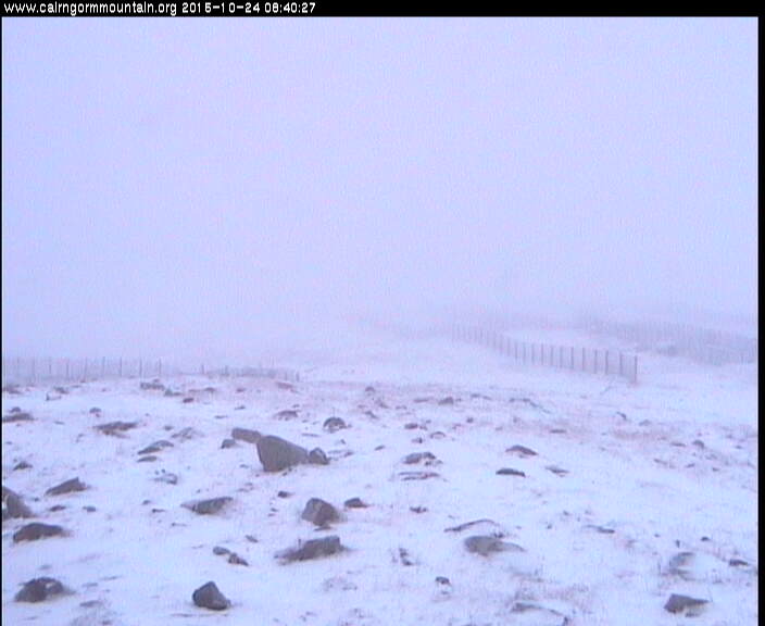
There was snow lying on the 24th on Cairngorm Mountain, Scotland, but had mostly disappeared by the 27th.
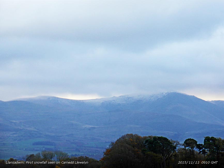
November The beginning of the month was very mild with above average temperatures. Early on the 9th a little snow and/ or snow pellets fell on Cairngorm Mountain, and on the 12th some more fell early in the day. The dates of first snow in Snowdonia have been creeping later in recent years. Based on observations over the last 35-y the median date of first snow is 29 October (13-d late this autumn) and of first lying snow 3 November (8-d late this autumn). The item below is by NASA's Earth Observatory website about snow in the US makes for an interesting comparison.
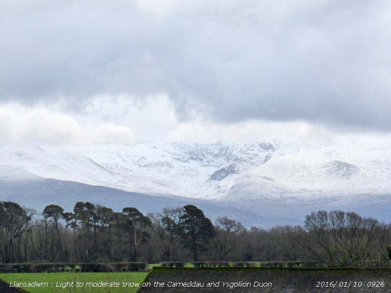
December The month began very mild with no snow on the mountains. Snow had become patchy on Cairngorm also although on the 3rd there was a sprinkling of fresh snow and some further slight falls later. Apart from showery wintry precipitation, sometimes sleet, or snow pellets (11th), and the odd flurry of snow at times, the Snowdonia Mountains have received copious quantities of rain and have been disappointingly free of snow. The 20th began with sleet and snow showers around the summits and in the afternoon frequent squally showers of wet snow pellets at lower levels. There was a light deposit of ice precipitation some summits in the afternoon. Continued very mild with no snow seen - on the morning of the 24th some wintry showers on a cold front. On Christmas Day the 25th Snowdon summit was briefly white with snow. Ending the year on the 31st snow was lying generally above 2750 ft with 30% cover at 2500 ft. January Patches of snow were around the summits at the start of the New Year. On the 4th & 5th patches were frequent above 2650 ft on the Carneddau and in places there were remnant cornices, particularly on Foel-goch. February Areas of snow, old drifts and patches of snow remained in places at the beginning of the month and persisted particularly within the Snowdon Horseshoe and Cwm Glas. Wintry showers at times with scatterings of snow pellets and snow. There was some fresh snow mostly covering the summits of C. Llewelyn, C. Dafydd and Snowdon on the 7th with icy deposits as low as 2250 ft in places. Wintry showers continued on the 8th mostly above 2750 ft . Further ice precipitation at times on the 9th with sleet at low levels and generally settling as snow with light to moderate cover at above 2500 ft. On the 10th light to moderate depths of snow lying above 2500 ft light with some as low as 2000 ft in places. Moderate snow cover over 2650 ft and on top of the Carneddau on the morning of the 11th with some as low as 2250 ft in places. On the 17th fresh snow fell in the early hours at high levels then, as the temperature dropped on a cold front, settled as low as 1800 feet in places. Reduced variable amounts of snow persisted with some broken snow and old drifts and snow patches until the 21st. A few snow patches and old cliff cornices were seen on the 22nd on the Carneddau with some areas of broken snow and patches on Snowdon. There was a light fall of snow pellets and fresh snow lying on the morning of the 23rd on the summits of the Glyderau, Carneddau and Snowdon and fresh snow on the 25th some as low as 1000 ft. Snow cover had reduced by the 27th, but variable amounts of areas of broken snow cover, drifts and some cliff patches and ice remained until the end of the month. March On the 1st there were some areas of broken snow and ice on the Snowdonia summits. On the morning of the 2nd there were hail, sleet and snow showers as low as 300 ft and light to moderate snow falling above 1000 ft settling above 1250 ft in places. Moderate snow with drifting at higher levels. On the 3rd there had been some thawing at lower levels, but around the summits it was below zero with snow falling at times. Overnight on the 3/4th there was snow as low as 350 ft, lying at 450 ft on the 4th with light to moderate falls above 1000 ft and moderate falls over 2500 ft. Snow at lower levels had thawed on the 5th, but there were fresh showers at upper levels with snow lying, deep in places, above 2000 ft including on Cadair Idris. On the 6th further snow showers had topped up moderate to deep snow lying above 1750 ft with 30% cover at 1250 ft and sprinklings as low as 1000 ft. Snow on Moel Eilio and westward hills, moderately deep in places, lying above 1250 ft. Snow showers continuing with temperature -7C on Snowdon summit. Lying snow persisted until the 15th, and areas of shallow snow, some snow drifts and snow patches persisted on Snowdon, Glyderau and Carneddau. On the 26th showers of hail and snow during the afternoon and again on the morning of the 27th left fresh hail and snow as low as 2000 ft on the Carneddau. Thunder-hail 6 mm at 1545 GMT and hail 8-11 mm covering the ground fell in Llansadwrn between 1515 - 1530 GMT.. A little fresh snow fell as low as 1750 ft on the 29th, but soon thawed at that altitude leaving 30% cover above 2000 ft on north-facing slopes. Light snow with old drifted snow in places persisted above 2500 ft until the end of the month and around the summit of Cadair Idris Berwyns Geraint Edwards reported that the first week of March has been the snowiest of the winter so far on the Berwyn Mountains with 4 days of lying snow up to the 8th at Llanarmon Dyffryn Ceiriog. Since the 1st 49.7 mm of rain fell, mostly of snow on the high Berwyns. Winds have been strong to gale force at times and drifting has been significant. Moderate drifts along the ridges facing an easterly direction. There was lying snow in the village of Llanarmon D.C. 870 ft above sea level on the 28th and 29th. On the morning of the 30th there was a thin covering above 1250 ft, the Berwyns were very white, but the evening the snow had melted considerably in the sun especially on south facing slopes. April On the 1st there was broken snow lying above 2750 ft with some icy deposits and small patches as low as 2500 ft with some left on Cadair Idris. Wintry conditions around the summits with stretches of snow in parts. On the 3rd sufficient for 30% cover above 2750 ft and frequent patches at 2500 ft. On the 6th lowest patches were at 2650 ft then on the 7th wintry showers brought fresh sprinklings on the summits. On the morning of the 9th snow was falling and lying as low as 2000 ft on the slopes of the Carneddau as temperatures around the summits were -3C. On the 10th as temperatures rose again reaching 6/7C later in the day broken snow remained lying at 2850 ft with 30% cover at 2500 ft. Diminishing small areas of broken snow with snow patches were persisting on the 15th when fresh snow fell overnight 15/16th. On the morning of the 16th was snow lying above 1250 ft with 30% cover as low as 850 ft on the N-facing slopes of the Carneddau. Light snow lay at 1000 ft on Cadair Idris for a while early in the day, some persisting on the summit.. With on going snow showers on the 17th snow was lying at 2500 ft with a 30% cover at 2250 ft.. Prolonged showers continued through the morning soon thawing at lower levels. persisting on the summit.this remaining on the 18th as broken snow above 2750 ft. Frequent snow patches, some large, persisted above 2650 ff from the 19th and from 2750 ft on the 21st. Patches remained at this level with little change when on the 26th, as frequent showers crossed over the mountains in the afternoon, a dusting of fresh snow was seen on the tops of Carnedd Llewelyn, C. Dafydd and Tryfan. On the 27th overnight snowfall left lying snow at 1750 ft and 30% at 1000 ft including around Llyn Ogwen and Cadair Idris early in the day with some deposits as low as 450 ft. Hail and snow was left temporarily on some road surfaces including the Caernarfon Road into Bangor early in the morning. Further showers on the 28th and 29th and on the 30th snow was still lying at 2000 ft with some as low as 1500 ft including around the summit of Cadair Idris.
May On the 1st there were some areas of broken snow remaining with several snow patches on Carnedd Llewelyn as low as 2650 ft. On the 8th there were at least 10 small patches on Llewellyn at 2750 ft, one at 2650 ft on the Black Ladders and 3 on C. Dafydd. On the 9th small patches remained only on C. Llewelyn 2 of which survived until the 11th at 2750 ft. None of these on the north side of the mountain were seen on the 12th when it was also confirmed that there was none in Y Ffoes Ddyfn 'The Deep Cut' .
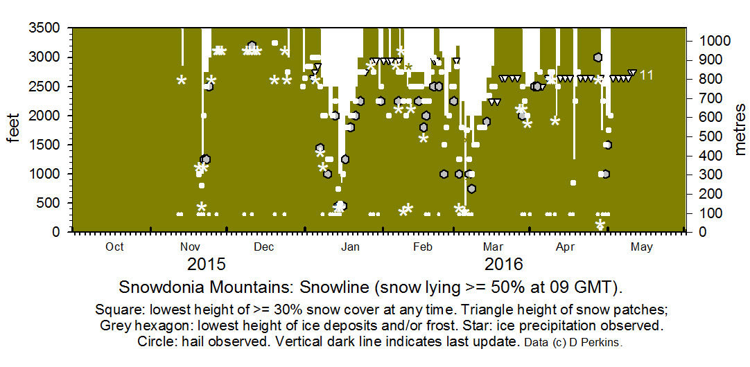
NotesObservations were made as near to 0900 GMT as possible. I have a good view from Llansadwrn, weather permitting, across the Menai Strait towards the Snowdonia Mountains. I can see the northern slopes of the mountain range from Moel Eilio (west of Snowdon), Snowdon summits (Yr Wyddfa and Crib Goch), the Glyderau and Carneddau to Foel-fras and Drum to the east of the range near the Conwy Valley. With the aid of binoculars I made daily records that include any ice precipitation observed, the lowest altitude of snow lying at ( >= 50% cover), at ( >= 30% cover) and snow patches. I updated the diagram during the season and this is the final report for the 1915-1916 season.
|


