|
Snowdonia Mountains Winter 2013 - 14
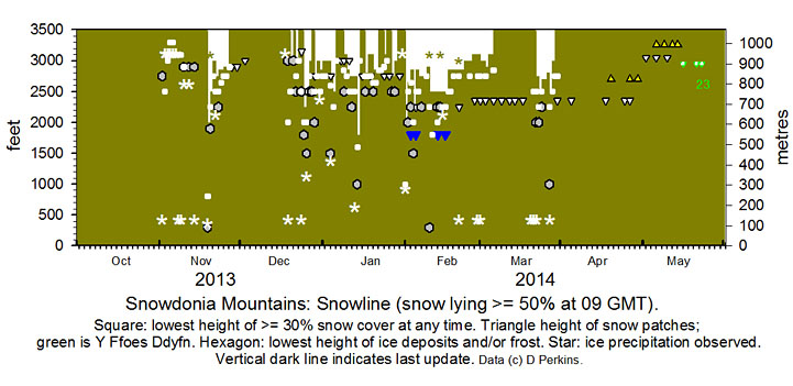
October Slight ice precipitation, snow pellets and snow, fell on Cairngorm, Scotland on the 9th and there was light snow lying on the 10th. Light snow had also fallen at low levels on the 10th in northern Norway and Lapland in northern Finland.
November Snow fell again on Cairngorm on the 2nd and there was ice precipitation associated with thunder showers in Snowdonia in the afternoon. On the 3rd there was snow on Yr Wyddfa and the north-west facing flank of Crib-y-ddysgl as low as 2500 ft late in the afternoon. Sprinklings of snow were also seen on the Carneddau - most on Penyrole-wen and Carnedd Dafydd above 2750 ft, less eastward on the summits C. Llewelyn and Drum over 3000 ft. Following days to the 6th had frequent small amounts of ice precipitation mostly over 3000 ft. On the 8th while there was a moderate amount of snow lying on Cairngorm there was sleet in Snowdonia. On the 9th there was snow over 3100 ft on Yr Wyddfa and sprinklings of snow pellets and snow at 2900 ft on Y Garn and some Carneddau summits. The 14th saw a little hail and snow with scattered remnants on the 15th. There were frequent showers of snow pellets and snow off the Irish Sea overnight 18/19th and on the morning of the 19th snow fell in SE Anglesey settling as low as 800 ft on the eastern Carneddau Mountains, lying above 2000 ft generally and briefly at 1000 ft in places including at Ogwen. There were sprinklings also on Cadair Idris and at Bala. Fresh snow fell early in the morning of the 22nd mainly on the N-facing slopes and summits of the Carneddau and was lying above 2750 ft with smaller amounts as low as 2500 ft. Snow persisted until the 26th at more that 30% cover in places. Snow patches persisted on Yr Wyddfa until the end of the month. DP. Snowfall events: First snowfalls in Snowdonia. Bulletin: Climatological Observers Link, November 2013 523, 11. December A few small patches of old snow remained above 3000 ft on Yr Wyddfa at the beginning of December. Showers of ice precipitation around the highest summits (including Carnedd Llewelyn and Snowdon) on the 18th with small patches left on the ground on the 19th. Further showers of mixed ice precipitation on the morning of the 19th left deposits as low as 300 ft almost covering the ground in places. 
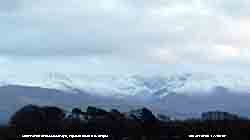
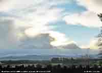
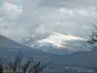
After a cold clear night further precipitation on the 26th left wet snow (photo above right) as low as 1500 ft in places lying above 2500 ft and, with temperatures at or below zero on the summits, icy with light accumulation in places. On the 28th moderate sized snow patches at and above 2750 ft on the Carneddau, Y Garn and Snowdon. Icy around the summits. On the 29th there was lying snow above 2750 ft, light around the summits, with ice as low as 2000 ft. Fresh snow on the 30th and early on the 31st with clearance of cold front (photo left) there was light lying snow above 2850 ft with 30% cover around 2500 ft in the morning. DP. Snowfall events: Sparse snowfall on Snowdonia Mountains in December. Bulletin: Climatological Observers Link, December 2013 524, 17. January
DP. Snowfall events: Frequent snowfalls and thaws in Snowdonia with little accumulation. Bulletin: Climatological Observers Link, January 2014 525, 15. February
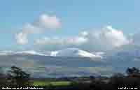
On the morning of the 2nd light snow was lying generally above 2650 ft and was 30% at 2500 ft with a little as low as 2000 ft on the N-facing slopes of the Carneddau with some remaining on Cadair Idris. On the 4th there had been a fresh light fall of snow with 30% cover as low as 2000 ft including capping Moel Eilio and Mynydd Mawr 2290 ft in the W of the range and Drum in the E. Sprinklings were as low as 1500 ft in places near Ogwen. By the 5th snow on slopes was broken at lower levels with patches seen at 2250 ft on the Carneddau and 1800 ft below Mynydd Mawr. A little more snow had fallen overnight 5/6th on the summits and cover persisted on the 7th above 2750 ft with some ice deposits seen as low as 2250 ft. The photograph of snow covered Carnedd Llewelyn (above right taken on the afternoon of the 7th) was the 'most liked' on the Met Office's Weather Observers Website (WOW) in February and featured as the background image on the home page through March. Early on the 10th there were snow showers across the mountains, with sprinklings if ice precipitation as low as 1000 ft in places including Cadair Idris, with lying snow at 2250 ft on the N-facing slopes of the Carneddau. On the 13th snow was lying at 2500 ft with 30% cover at 2000 ft on the Carneddau. There were snow patches as low as 1800 ft in places including Mynydd Mawr. A wall of white cloud had built up S of the mountains in a strengthening SE'ly wind on the morning of the 14th; with little change in the snowline overnight it was snowing around the summits with drifting in blizzard conditions. Further moderate to heavy snow 14/15th overnight gave further accumulations over older snow. During the day several walkers were caught in an avalanche on Snowdon; a man and woman were swept 1000 ft down the mountain near the PYG track burying then in snow. They were rescued by members of the the Llanberis and Aberglaslyn rescue teams and taken to hospital in Bangor by helicopter. On the 16th with little change snow, deep in places, was lying above 2500 ft. By the 17th snow was lying generally above 2850 ft with 30% cover at 2750 ft persisting with deep snow patches and cornices in places. Levels were similar at 09 GMT on the 21st as showers of ice precipitation swept across the mountains on a strong SW'ly wind. Old snow persisted around the summits of the Carneddau and on Snowdon along with snow patches as low as 2500 ft until the end of the month. DP. Snowfall events: Avalanche in Snowdonia. Bulletin: Climatological Observers Link, February 2014 526, 13-14. March
DP. Snowfall events: Changeable lying snow, cornices and snow patches in Wales. Bulletin: Climatological Observers Link, March 2014 527, 12. April The month began with several small to medium size snow patches the lowest N-facing on the Carneddau (medium size) at 2350 ft under Carnedd Dafydd and some larger patches on NE-facing parts of C. Llewelyn, C. Dafydd and Snowdon. Several patches were on N-facing Glyder Fawr. Patches at 2700 ft and above survived to the end of the month. May Several snow patches were surviving on the Carneddau, Glyders and Snowdon on the 2nd. Patches persisted on NE-facing Carnedd Llewelyn until the 10th and on Carnedd Dafydd until the 14th. Patches on Glyder Fawr near to and above the Devil's Kitchen at Cwm Idwal lasted until the 17th. The patch at Y Ffoes Ddyfn 'The Deep Cut', along with remnants in the vicinity, were persisting. By the 21st remnants had melted leaving 2 small patches in the bottom of the cut that by the 23rd following heavy rain had melted. DP. Snowfall events: Late snow patches in Snowdonia. Bulletin: Climatological Observers Link, May 2014 529, 10.
NotesObservations are made as near to 0900 GMT as possible. I have a good view from Llansadwrn, weather permitting, across the Menai Strait towards the Snowdonia Mountains. I can see the northern slopes of the mountain range from Moel Eilio (west of Snowdon), Snowdon summits (Yr Wyddfa and Crib Goch), the Glyderau and Carneddau to Foel-fras and Drum to the east of the range near the Conwy Valley. With the aid of binoculars I make daily records that include any ice precipitation observed, the lowest altitude of snow lying at ( >= 50% cover), at ( >= 30% cover) and snow patches. I aim to update the diagram during the season at least twice weekly if there is any snow.
|


