|
Snowdonia Mountains Winter 2012 - 13
October
November
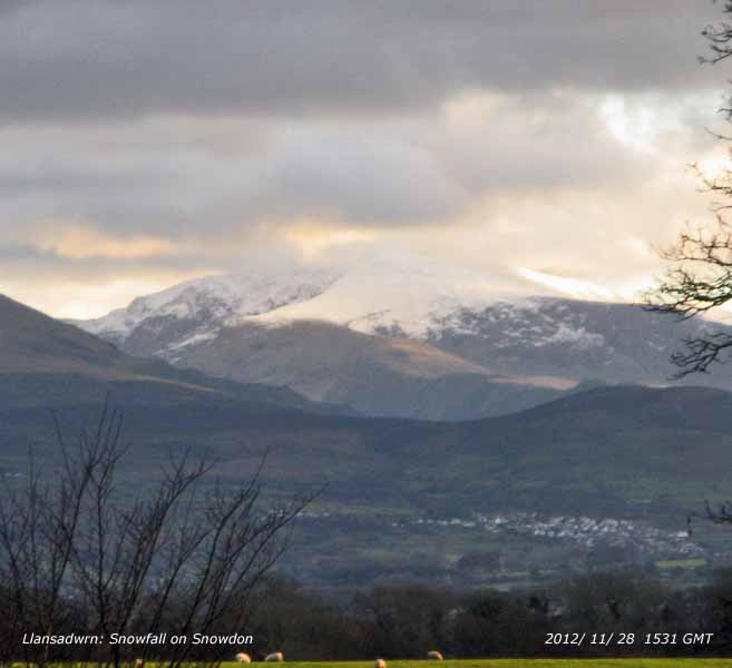
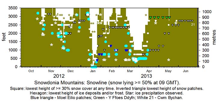
DP. Snowfall events: Snowdonia. Bulletin: Climatological Observers Link, November 2012 511, 12. December Snow was present on the mountains on the 1st and persisted, topped up from time to time with slight falls 1/3rd, during freeze/ thaw conditions. Fresh snow overnight 4/5th left slight snow pellets and snow as low as 1200 ft in places with light snow at 1800 ft, light to moderate in places above 2500 ft. On the 6th with snow showers sweeping across the summits at 0900 GMT in a strong SW'ly wind snow was lying light to moderate cover above 2250 ft (700 m) with sprinklings as low as 1100 ft (325 m) near Ogwen Cottage, and some also on Cadair Idris. Showers continued through the day. On the 7th it was snowing on the tops at first in the morning, light snow cover across the range above 2500 ft including Foel-fras, the Glyderau and Crib-y-ddysgyl. Less snow lying at lower levels (from 2000 ft) on the 8th, but with temperatures below zero overnight on the summits light snow cover remained above 2750 ft. On the 10th levels were little change as in sunshine freezing conditions prevailed across all summits; with frozen snow and ice. The 11th similar levels, snow a little patchier in places on sunny slopes above 2000 ft, some unbroken snow on the tops of the Carneddau, freezing conditions prevalent on the tops and in shade, frost remaining in valleys. Some wet snow fell on the summits on the 14th; broken snow persisting on the central Carneddau, Glyderau including Y Garn, and around Snowdon on the 15/16th. Some ice precipitation late on the 17th left fresh snow on the summits of the Carneddau over 3000 ft with sprinkles on north-facing cliffs and slopes on the 18th. Deep gully snow on Y Garn and Carneddau. Snow mainly broken above the railway on Crib y Ddysgl. By the 21st following rise in temperature and rain only remnant snow was left. There was a little fresh snow on some summits overnight 25/26th. A mixture of ice precipitation late on the 29th left a fresh sprinkling of snow on the summits of the Carneddau, Snowdon and Cadair Idris on the morning of the 30th DP. Snowfall events: Snowdonia. Bulletin: Climatological Observers Link, December 2012 512, 14. January There was a little ice precipitation on the summits on the morning of the 11th. Ice and sprinklings of ice precipitation on summits on the 12th. Intensely cold on the summits (AWS reporting -9C at 09 GMT) with light snow on Yr Wyddfa mostly on NE aspect on the 13th. During the afternoon slight snow at low levels including SE Anglesey (not settling). on the mountains slight wet snow lying at 1000 ft, light snow above 2000 ft. Snow also on summit of Cadair Idris. On the 14th there was lying light snow on the summits and slight snow as low as 2500 ft in places. Further fresh ice precipitation and snow in the afternoon and evening. Light snow was lying generally at 1750 ft and as low as 1000 ft in places and at Ogwen on the morning of the 15th. There was a covering of snow also on Cadair Idris. Light snow remained above 1750 ft on the 16/17th with thawing and rain at 1000 ft on the 17th with snow above 2500 ft with moderate accumulations. On the 18th there was snow falling at sea level settling in Llandegai, Llanfairfechan and Llanberis. There was snow in Dolgellau and Cadair Idris. Light snow accumulations at 1000 ft increasing with light to moderate falls over 2000 ft; blizzard-like conditions in strong E/SE'ly wind the temperature on Snowdon (summit AWS) reported -6C at 09 GMT. Moderate to heavy snow in places including NW Anglesey and A55 to Holyhead with snow on the beach at Rhosneigr, and mountains including Cadair Idris, and around Bala during the day, in SE Anglesey snow settling from 2130 GMT. Snow lying to sea level on the 19th, moderate to heavy accumulations of dry snow on the mountains above 1000 ft. Temperature on Snowdon summit at 09 GMT -7C. Snow at sea level in many places on the 20th, some compaction has taken place, but little thawing taken place, icy. Snow flurries and showers at times around the summits, temperatures continuing sub zero. Similar on the 21st, snow on the foreshore in places and lying snow above 750 ft. Ice precipitation, ice crystals, snow pellets and snow at times. Snow had blown off some slopes of the Carneddau with drifting in places. Moderate accumulations around some summits. Ice precipitation overnight 21/22nd and early on the 22nd; sub zero temperatures reported on Snowdon summit; lying snow generally from 750 ft, remnant snow on the foreshore in places including NW Anglesey. On the 23rd lying snow from 750 ft, snow flurries through the day, ice and remnant snow at all levels and shaded slopes and valleys. Much the same on the 24th, snow and ice generally above 500 ft, remnant snow in places from sea level. By the 25th any snow at sea level had disappeared and heavy rain during the afternoon thawed much of the thinner snow cover; on the summits precipitation was snow. On the 26th snow was much reduced and cover very broken except around the summits. Areas of remnant snow above 2750 ft on the 27/28th. Remnant snow and ice on the 29 - 31st. DP. Snowfall events: North-west Wales. Bulletin: Climatological Observers Link, January 2013 513, 14-15. February The month began with some remnant snow and snow flurries around the summits. On the 2nd there was a sprinkling of fresh snow on northern summits of the Carneddau and Yr Wyddfa, and N-facing slopes as low as 2750 ft. Showers of ice precipitation overnight 4/5th with scattered deposits as low as 300 ft. Slight snow particularly on W-facing slopes above 2000 ft; old snow and ice above 2500 ft. Overnight 6/7th fresh snow light to moderate over 2500 ft, slight from as low as 750 ft in places on the morning of the 7th. Fresh snow overnight 7/8th added to moderate accumulations over 2500 ft and left slight wet snow as low as 1500 ft in places. Gully and old areas of old snow in places with light snow variable from 2000 ft persisted until the 12th. Fresh snow early on the 13th, moderate above 2500 ft at first, with sleet and snow as low as 750 ft at 09 GMT. Soon turning to rain with snow rapidly disappearing at all levels especially in places below 2750 ft by noon. Areas of old broken snow persisted mostly above 2350 ft on 14th and 15th with sprinklings of fresh snow around the highest summits. Light snow, old snow and ice persisting on the 19th mainly around Snowdon and Carneddau, most on Carnedd Dafydd with lesser amounts C. Llewelyn and eastward. Little change up to the 22nd: old snow and ice generally above 2500 ft.. Early on the 23rd showers off the Irish Sea brought ice precipitation (snow pellets and snow flurries) leaving sprinklings mainly on to N-facing slopes and summits above 2500 ft, but as low as 1000 ft at Ogwen and in Cwm Idwal. On the 24th there were fresh falls of mixed ice precipitation as low as 750 ft. Snow was lying at 2750 ft in icy conditions with some remnants at 2000 ft on the 25th and 2500 ft in places on the 26th. Light broken snow remained on some summits over 3000 ft on the 27th and 28th, and on cliffs with gully snow and patches as low as 2350 ft in places. DP. Snowfall events: North-west Wales. Bulletin: Climatological Observers Link, February 2013 514, 11-12. March
DP. Snowfall events: Snowdonia. Bulletin: Climatological Observers Link, March 2013 515, 14-15. April
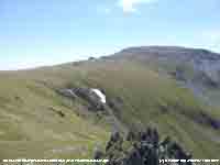
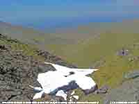
DP. Snowfall events: Snowdonia. Bulletin: Climatological Observers Link, April 2013 516, 10-11. May The month began with frequent snow patches mostly at 2500 ft, or more, but a few remnants were surviving as low as 1000 ft. Ice precipitation as low as 300 ft overnight 15/16th left a sprinkling of fresh snow above 2500 ft on Carnedd Llewelyn and C. Dafydd on the morning of the 16th. A good amount of snow in Y Ffoes Ddyfn (The Deep Cut) 2950 ft at the beginning of the month lasted until after the 17th, but soon melted. Snow patches remained on NW-facing Carnedd Dafydd at 2500 ft near Ysgolion Duon and 2600 ft and 2750 ft above Cwm Bychan near Foel-grach until the end of the month. DP. Snowfall events: Late snow patches on the Carneddau Mountains. Bulletin: Climatological Observers Link, May 2013 517, 11.
June
DP. Snowfall: The last surviving snow patches on the Carneddau Mountains. Bulletin: Climatological Observers Link, May 2013 518, 9. ¤
You can view the snowline histograms for previous years here:
You can view complete snowline reports for previous years here:
For earlier archived reports refer to the Site Map.
NotesObservations are made as near to 0900 GMT as possible. I have a good view from Llansadwrn, weather permitting, across the Menai Strait towards the Snowdonia Mountains. I can see the northern slopes of the mountain range from Moel Eilio (west of Snowdon), Snowdon summits (Yr Wyddfa and Crib Goch), the Carneddau and to Foel-fras and Drum on the eastern end near the Conwy Valley. With the aid of binoculars I make daily records that include any ice precipitation observed, the lowest altitude of snow lying at >= 50% cover and >= 30% cover, together with any snow patches. I aim to update the diagram during the season at least twice weekly if there is snow.
|


