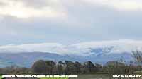
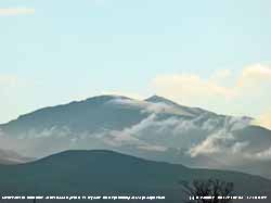
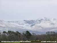
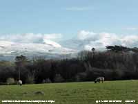
|


|
Llansadwrn (Anglesey)
Weather:
Snowdonia Snowline Report
|

|
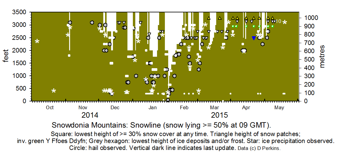
Snowdonia Mountains Winter 2014 - 15
 Snowline
histogram Snowline
histogram
October
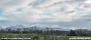
Snow fell on Cairngorm Mountain on the 3/4th, but soon melted. On the 21st there was snow on Cairngorm and during the morning there were wintry showers across the Snowdonia Mountains with snow pellets falling on Anglesey.
November
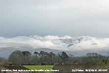
 Frequent showers across the summits on the morning of the 3rd with some ice precipitation during the day and snow later. Light snow also settled on Cairngorm. On the morning of the 4th overnight snow with snow lying at 2000 ft at 0900 GMT, the first of the season. Light to moderate cover on Snowdon and the tops of the Carneddau and a dusting on Cadair Idris. A little ice precipitation was seen on the ground on the morning of the 25th on the highest summits of the Carneddau including C. Llewelyn. Frequent showers across the summits on the morning of the 3rd with some ice precipitation during the day and snow later. Light snow also settled on Cairngorm. On the morning of the 4th overnight snow with snow lying at 2000 ft at 0900 GMT, the first of the season. Light to moderate cover on Snowdon and the tops of the Carneddau and a dusting on Cadair Idris. A little ice precipitation was seen on the ground on the morning of the 25th on the highest summits of the Carneddau including C. Llewelyn.
Snowfall events: First snowfalls in Snowdonia. Bulletin: Climatological Observers Link, November 2014 535, 9-10.
December
 The month began with no snow on the mountains. By the 2/3rd it was colder and there was at times a little ice precipitation leaving scattered remnants around the summits of the Carneddau. There was a slight covering above about 2750 ft on Snowdon (Garnedd Ugain & Yr Wyddfa) on the 3rd and morning of the 4th. Slight snow fell overnight 4/5th on the Carneddau Mountains and was lying above 2750 ft. Showers of snow pellets and snow across Anglesey and the mountains on the 5th and fresh slight snow early on the 6th especially on N-facing slopes of the Carneddau including C. Dafydd and Black Ladders as low as 2000 ft. Ice was reported at higher altitude. During the evening in warm sector air (9.7C on Anglesey and 5C on Snowdon) most of the snow melted. On the 7th snow cover appeared absent at 0900 GMT, but there were wintry showers later around the summits and snow later. On the morning of the 8th slight snow was lying in places around 2500 ft, as low as 2000 ft in some parts, variable due to nature of showery precipitation. The snow had moved up the mountains on the 9/10th lying around 2750 ft with a little fresh snow fallen above 3000 ft. On the morning of the 11th there was fresh slight snow across the Carneddau range including Drum with snow as low as 2250 ft under the Black Ladders. There was a sprinkling also on Cadair Idris. Further snow overnight 11/12th left lying snow above 2000 ft with 30% cover at 1500 ft and slight snow as low as 350 ft on N-facing slopes. The tops were well covered with a little drifting in places. By the morning of the 13th further light to moderate accumulations in places above 2000 ft with some ice precipitation (snow pellets and snow) on the ground as low as 300 ft. By the evening it was all change as warm sector Atlantic-air moved in and temperatures rose reaching 6.8C at midnight on Anglesey and 2C on the summit of Snowdon. By the morning of the 14th a significant thaw at lower levels, but with snow remaining above 2750 ft at 0800 GMT and rain or sleet across the summits. By the 17th, as the warmth continued with temperatures up to 8C on Snowdon, broken snow and snow patches remained. On the the tail end of passage of overnight frontal precipitation a little fresh ice precipitation was seen on the 24th around most summits over 3000 ft. a few patches of remnant snow remain in places including on Garnedd Ugain. On the 26th snow spread across N Wales in the afternoon with snow on the A5 at Ogwen and later the A55 near Rhuallt Hill. On the morning of the 27th light snow lay at generally at 2000 ft with moderate falls in places above 2500 ft. There was also some snow on Cadair Idris. Snow cover remained at heights little changed on N-facing slopes and summits of the Carneddau and Snowdon until the end of the month when it turned warmer. The month began with no snow on the mountains. By the 2/3rd it was colder and there was at times a little ice precipitation leaving scattered remnants around the summits of the Carneddau. There was a slight covering above about 2750 ft on Snowdon (Garnedd Ugain & Yr Wyddfa) on the 3rd and morning of the 4th. Slight snow fell overnight 4/5th on the Carneddau Mountains and was lying above 2750 ft. Showers of snow pellets and snow across Anglesey and the mountains on the 5th and fresh slight snow early on the 6th especially on N-facing slopes of the Carneddau including C. Dafydd and Black Ladders as low as 2000 ft. Ice was reported at higher altitude. During the evening in warm sector air (9.7C on Anglesey and 5C on Snowdon) most of the snow melted. On the 7th snow cover appeared absent at 0900 GMT, but there were wintry showers later around the summits and snow later. On the morning of the 8th slight snow was lying in places around 2500 ft, as low as 2000 ft in some parts, variable due to nature of showery precipitation. The snow had moved up the mountains on the 9/10th lying around 2750 ft with a little fresh snow fallen above 3000 ft. On the morning of the 11th there was fresh slight snow across the Carneddau range including Drum with snow as low as 2250 ft under the Black Ladders. There was a sprinkling also on Cadair Idris. Further snow overnight 11/12th left lying snow above 2000 ft with 30% cover at 1500 ft and slight snow as low as 350 ft on N-facing slopes. The tops were well covered with a little drifting in places. By the morning of the 13th further light to moderate accumulations in places above 2000 ft with some ice precipitation (snow pellets and snow) on the ground as low as 300 ft. By the evening it was all change as warm sector Atlantic-air moved in and temperatures rose reaching 6.8C at midnight on Anglesey and 2C on the summit of Snowdon. By the morning of the 14th a significant thaw at lower levels, but with snow remaining above 2750 ft at 0800 GMT and rain or sleet across the summits. By the 17th, as the warmth continued with temperatures up to 8C on Snowdon, broken snow and snow patches remained. On the the tail end of passage of overnight frontal precipitation a little fresh ice precipitation was seen on the 24th around most summits over 3000 ft. a few patches of remnant snow remain in places including on Garnedd Ugain. On the 26th snow spread across N Wales in the afternoon with snow on the A5 at Ogwen and later the A55 near Rhuallt Hill. On the morning of the 27th light snow lay at generally at 2000 ft with moderate falls in places above 2500 ft. There was also some snow on Cadair Idris. Snow cover remained at heights little changed on N-facing slopes and summits of the Carneddau and Snowdon until the end of the month when it turned warmer.
Warm and cold spells brought variable snow cover in Snowdonia. Bulletin: Climatological Observers Link, December 2014 536, 11-12.
January
The month began with most snow thawed afternoon and overnight 31/1st leaving some remnant broken snow and patches, and some scattered old drifted snow in places on the morning of the 1st mostly above 1750 ft. On the 2nd after heavy rain a little remnant snow and small snow patches remained; temperatures were below freezing again at dawn on the summits. As a depression moved across from the west on the morning of the 3rd precipitation fell as wet snow on the mountains as low as 1800 ft with light snow over 2500 ft.  On the 4th and 5th snow cover lay above 2500 ft and on the morning of the 6th, the trailing edge of a cold front brought a little more snow settling above 2500 ft and on the summits. Overnight 12/13th slight ice precipitation including snow seen in the morning at 0900 GMT on the ground above 2500 ft. Further showers of ice precipitation occurred during the morning observed on the ground at Llyn Ogwen and as low as 750 ft on the Carneddau with a light covering on Yr Wyddfa and Garnedd Ugain. There was a sprinkling also on Moel Eilio and 'The Rivals' Llyn, and 1500 ft on Cadair Idris. Further snow showers across the range in the afternoon, but amounts deposited were small. On the 14th light ice precipitation showers developed again during the morning. By the 15th some remnant snow and patches in places. Showery precipitation overnight 15/16th left a light covering of snow above 2000 ft on the Carneddau mainly in the west, with some scatterings at 1000 ft near Ogwen and a sprinklings on Cadair Idris. There were remnant deposits of hail at 300 ft. Showers of ice precipitation continued during the morning. Snow lay on the 17 - 24th as low as 1750 ft at times before thawing leaving on the 25th some broken snow, patches and ice above 2500 ft. The 28th saw a cold front moving over at from 0730 GMT introducing a polar maritime airstream bringing wintry showers of hail and sleet at low levels, and later flurries of snow on the highest summits during the morning. Gusts of over 100 mph were recorded on Snowdon and Cairngorm and temperatures that had been +5C around 05 GMT fell to -4C. Snow showers during the morning left snow on the ground on the 29th in SE Anglesey for a while, and on the mountains above 450 ft on N-facing slopes. Showers continued through the day, frequent over the summits in the afternoon. There was a period of snow around midnight on the summits and on the 30th variable snow cover was lying about 2000 ft with some around 1250 ft with remnants around 1000 ft and very icy at higher levels. Snow cover and ice remained at a similar altitude to the end of the month. On the 4th and 5th snow cover lay above 2500 ft and on the morning of the 6th, the trailing edge of a cold front brought a little more snow settling above 2500 ft and on the summits. Overnight 12/13th slight ice precipitation including snow seen in the morning at 0900 GMT on the ground above 2500 ft. Further showers of ice precipitation occurred during the morning observed on the ground at Llyn Ogwen and as low as 750 ft on the Carneddau with a light covering on Yr Wyddfa and Garnedd Ugain. There was a sprinkling also on Moel Eilio and 'The Rivals' Llyn, and 1500 ft on Cadair Idris. Further snow showers across the range in the afternoon, but amounts deposited were small. On the 14th light ice precipitation showers developed again during the morning. By the 15th some remnant snow and patches in places. Showery precipitation overnight 15/16th left a light covering of snow above 2000 ft on the Carneddau mainly in the west, with some scatterings at 1000 ft near Ogwen and a sprinklings on Cadair Idris. There were remnant deposits of hail at 300 ft. Showers of ice precipitation continued during the morning. Snow lay on the 17 - 24th as low as 1750 ft at times before thawing leaving on the 25th some broken snow, patches and ice above 2500 ft. The 28th saw a cold front moving over at from 0730 GMT introducing a polar maritime airstream bringing wintry showers of hail and sleet at low levels, and later flurries of snow on the highest summits during the morning. Gusts of over 100 mph were recorded on Snowdon and Cairngorm and temperatures that had been +5C around 05 GMT fell to -4C. Snow showers during the morning left snow on the ground on the 29th in SE Anglesey for a while, and on the mountains above 450 ft on N-facing slopes. Showers continued through the day, frequent over the summits in the afternoon. There was a period of snow around midnight on the summits and on the 30th variable snow cover was lying about 2000 ft with some around 1250 ft with remnants around 1000 ft and very icy at higher levels. Snow cover and ice remained at a similar altitude to the end of the month.
Polar maritime air brought most snow later in the month. Bulletin: Climatological Observers Link, January 2015 537, 13-14.
February
Snow was lying on the 1st around 2000 ft with 30% cover at 1850 ft on the N-facing Carneddau Mountains and 1800 ft on Moel Eilio. There was snow also on Cadair Idris at 1500 ft.  Overnight snow on the 1st/2nd left snow lying in east-central and SE Anglesey in Llansadwrn at 300 ft, with sprinklings as low as 50 ft in Menai Bridge, and light to moderate accumulations on the mountains by morning. There was snow on the A5 at Ogwen and in Llanberis, Dolgellau and around Bala. With temperatures keeping below freezing on the mountains and little heat in the sun snow remained at low altitudes on the 3rd with deep patches of drifted snow and cornices on cliffs at higher levels. On the 4th while remnants remained at 300 ft snow was lying generally above 1250 ft retreating to 1500 ft by the 5th with ice remaining as low as 450 ft in places. On the 6th with the temperature on Snowdon summit -10C snow was lying generally on northern slopes at 1800 ft with 30% cover at 1200 ft. Snow cover, deeper old drifts and cliff cornices remained until the 8th with some ice as low as 1000 ft in places. On the 9th there were small areas of broken snow and widespread snow patches in the west, but a light cover remained on the N-facing slopes of the Carneddau. On the 11th snow was persisted down to between 2000 ft and 1800 ft on the Carneddau especially C. Llewelyn and C. Dafydd and 2250 ft around Drum. Icy deposits were widespread with some old drifted snow and snow patches in places. Snow distribution remained little changed then with some thawing lessened by the 14th lying at 2500 ft on the Carneddau and along the summits at 3000 ft with 30% cover at 2500 ft on the 15th and snow patches on the 16th. Fresh overnight precipitation 16/17th left a light covering lying down to 2500 ft on the 17th and 30% cover above 2250 ft with scatterings of snow pellets as low as 300 ft in places early in the day. From the 18th snow was reducing and on the 19th snow patches remained when there were some snow showers in the afternoon settling above 2500 ft On the 20th there was light lying snow at 2750 ft with scattered ice precipitation at 2500 ft in places. A little more had accumulated by the morning of 21st after overnight ice precipitation showers falling at 300 ft leaving scattered deposits on the ground as low as 1750 ft on the Carneddau below the Black Ladders. Showers continued around the summits during the morning. Remnant areas of snow and snow patches until the 23rd before a little fresh snow on the summits on the morning of 24th showers continuing during the day and again early on the 25th. Snow patches persisted until the end of the month. Overnight snow on the 1st/2nd left snow lying in east-central and SE Anglesey in Llansadwrn at 300 ft, with sprinklings as low as 50 ft in Menai Bridge, and light to moderate accumulations on the mountains by morning. There was snow on the A5 at Ogwen and in Llanberis, Dolgellau and around Bala. With temperatures keeping below freezing on the mountains and little heat in the sun snow remained at low altitudes on the 3rd with deep patches of drifted snow and cornices on cliffs at higher levels. On the 4th while remnants remained at 300 ft snow was lying generally above 1250 ft retreating to 1500 ft by the 5th with ice remaining as low as 450 ft in places. On the 6th with the temperature on Snowdon summit -10C snow was lying generally on northern slopes at 1800 ft with 30% cover at 1200 ft. Snow cover, deeper old drifts and cliff cornices remained until the 8th with some ice as low as 1000 ft in places. On the 9th there were small areas of broken snow and widespread snow patches in the west, but a light cover remained on the N-facing slopes of the Carneddau. On the 11th snow was persisted down to between 2000 ft and 1800 ft on the Carneddau especially C. Llewelyn and C. Dafydd and 2250 ft around Drum. Icy deposits were widespread with some old drifted snow and snow patches in places. Snow distribution remained little changed then with some thawing lessened by the 14th lying at 2500 ft on the Carneddau and along the summits at 3000 ft with 30% cover at 2500 ft on the 15th and snow patches on the 16th. Fresh overnight precipitation 16/17th left a light covering lying down to 2500 ft on the 17th and 30% cover above 2250 ft with scatterings of snow pellets as low as 300 ft in places early in the day. From the 18th snow was reducing and on the 19th snow patches remained when there were some snow showers in the afternoon settling above 2500 ft On the 20th there was light lying snow at 2750 ft with scattered ice precipitation at 2500 ft in places. A little more had accumulated by the morning of 21st after overnight ice precipitation showers falling at 300 ft leaving scattered deposits on the ground as low as 1750 ft on the Carneddau below the Black Ladders. Showers continued around the summits during the morning. Remnant areas of snow and snow patches until the 23rd before a little fresh snow on the summits on the morning of 24th showers continuing during the day and again early on the 25th. Snow patches persisted until the end of the month.
Snowfall events: Snow drifts and cornices began the month and some persisted until the end. Bulletin: Climatological Observers Link, February 2015 538, 8.
March
 The month began with gulley snow patches generally and areas of old snow particularly around Snowdon. On the afternoon of the 1st a band of precipitation moved across from the west falling as light snow above 1250 ft on mountains from Llyn, Snowdon, and Glyderau to the Carneddau, most on the west of the range. The month began with gulley snow patches generally and areas of old snow particularly around Snowdon. On the afternoon of the 1st a band of precipitation moved across from the west falling as light snow above 1250 ft on mountains from Llyn, Snowdon, and Glyderau to the Carneddau, most on the west of the range.  On the 2nd slight snow was lying down to 2000 ft and there was 30% cover with slight snow above 1750 ft with sprinklings as low as 1250 ft in places. Further showers of ice precipitation in the afternoon with sleet as low as 300 ft and settling as snow above 1250 ft. A thin covering of snow persisted to the morning of the 3rd at similar levels. On the 4/5th with most of the rather thin lying snow had quickly thawing there was no cover of lying snow by the 6th and only patches remained. After days of rain by the 8th little gulley snow remained, there were some areas of broken snow on the NW side of Snowdon and some old cornices on the Glyderau. In the afternoon a shower had left a covering of ice precipitation around the summit of C. Llewelyn. On the 9th to the 12th snow patches remained, a few high on the Carneddau and rather more at 2750 ft and above on Snowdon. A band of moderate to heavy rain moved across during the afternoon of the 12th and after 2100 GMT falling temperatures resulted in snow settling above 2000 ft evident on the 13th when light snow was lying above 2250 ft on the Carneddau. Slight snow cover remained until the 15th thereafter disappearing leaving the older, rather fewer and smaller this year, snow patches still persisting on the 21st. On the 24th there were showers of small hail (snow pellets) during the morning in SE Anglesey and moving on to the mountains left ice precipitation on the Carneddau above Llanfairfechan, further showers swept across Anglesey in the afternoon on a NW'ly breeze depositing snow pellets and snow above about 2000 ft more generally on the mountains. On the morning of the 25th slight snow was lying above 2500 ft and as low as 2250 ft on the Carneddau and southwards including high ground on Cadair Idris. On the 26th there was slight snow lying at 2750 ft and 30% at 2500 ft with frequent snow pockets and patches and old drifts especially on Snowdon. By the 27th slight snow cover at 50% was about 3000 ft and 30% at 2650 ft with remnants still at 2500 ft. A thaw on the 28th had reduced snow significantly, but there were still showers of ice precipitation on the summits at times. Old snow drifts and snow patches persisted till the end of the month. On the 2nd slight snow was lying down to 2000 ft and there was 30% cover with slight snow above 1750 ft with sprinklings as low as 1250 ft in places. Further showers of ice precipitation in the afternoon with sleet as low as 300 ft and settling as snow above 1250 ft. A thin covering of snow persisted to the morning of the 3rd at similar levels. On the 4/5th with most of the rather thin lying snow had quickly thawing there was no cover of lying snow by the 6th and only patches remained. After days of rain by the 8th little gulley snow remained, there were some areas of broken snow on the NW side of Snowdon and some old cornices on the Glyderau. In the afternoon a shower had left a covering of ice precipitation around the summit of C. Llewelyn. On the 9th to the 12th snow patches remained, a few high on the Carneddau and rather more at 2750 ft and above on Snowdon. A band of moderate to heavy rain moved across during the afternoon of the 12th and after 2100 GMT falling temperatures resulted in snow settling above 2000 ft evident on the 13th when light snow was lying above 2250 ft on the Carneddau. Slight snow cover remained until the 15th thereafter disappearing leaving the older, rather fewer and smaller this year, snow patches still persisting on the 21st. On the 24th there were showers of small hail (snow pellets) during the morning in SE Anglesey and moving on to the mountains left ice precipitation on the Carneddau above Llanfairfechan, further showers swept across Anglesey in the afternoon on a NW'ly breeze depositing snow pellets and snow above about 2000 ft more generally on the mountains. On the morning of the 25th slight snow was lying above 2500 ft and as low as 2250 ft on the Carneddau and southwards including high ground on Cadair Idris. On the 26th there was slight snow lying at 2750 ft and 30% at 2500 ft with frequent snow pockets and patches and old drifts especially on Snowdon. By the 27th slight snow cover at 50% was about 3000 ft and 30% at 2650 ft with remnants still at 2500 ft. A thaw on the 28th had reduced snow significantly, but there were still showers of ice precipitation on the summits at times. Old snow drifts and snow patches persisted till the end of the month.
Snowdonia: Slight snow cover and fewer snow patches on northern mountains. Bulletin: Climatological Observers Link, March 2015 539, 12.
April
 There were snow patches persisting at the beginning of the month on Snowdon, Garnedd Ugain and Carneddau. There were a few pockets of snow high on the north-facing Carneddau and none this year on Foel-grach or gully above Cwm Bychan as in recent years. There were snow patches persisting at the beginning of the month on Snowdon, Garnedd Ugain and Carneddau. There were a few pockets of snow high on the north-facing Carneddau and none this year on Foel-grach or gully above Cwm Bychan as in recent years.

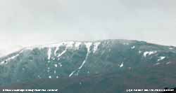
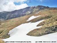
Early on the 2nd there was a little fresh snow seen on Carnedd Llewelyn at 2750 ft and some snow patches were confirmed persisting on the SE-facing slopes including at Y Ffoes Ddyfn 'The Deep Cut' 2950 ft and snow gullies with old cornices on E-facing cliffs (photo left). On the 4th the Deep Cut was found full of snow (the fine photo right) courtesy of Gordon Perkins. After a warm day on the 10th in North Wales (20.3C and 12C on Snowdon) the weather turned cooler again and overnight precipitation left a slight to light fall of snow on the mountains.
On the morning of the 11th there was lying snow at 2500 ft with sprinklings as low as 2000 ft in places enough on the ground to last until the afternoon.  There was little of the fresh snow left on the 12th when there was heavy rain during the morning, but as the temperature fell on a cold front in the afternoon there was fresh light snow on N-facing slopes above 2000 ft in the afternoon . On the 13th slight snow cover remained and was lying at 2450 ft at 0900 GMT with sprinklings as low as 2000 ft. On the 14th the snow had thawed; snow patches remained on Snowdon, Carnedd Llewelyn
and Glyder Fawr. On the 25th after passage of a cold front in the morning with some ice precipitation, in the afternoon rain turned to snow settling as low as 2500 ft that, on the morning of the 26th was lying thinly above 2750 ft on N-facing slopes of the Carneddau and Crib y Ddysgyl, Snowdon. On the 28th and 29th there was a scatterings of fresh snow
at 2500 ft with remnants as low as 2250 ft. Again on the 30th slight snow had fallen on the tops over 2850 ft that was thawing later. There was little of the fresh snow left on the 12th when there was heavy rain during the morning, but as the temperature fell on a cold front in the afternoon there was fresh light snow on N-facing slopes above 2000 ft in the afternoon . On the 13th slight snow cover remained and was lying at 2450 ft at 0900 GMT with sprinklings as low as 2000 ft. On the 14th the snow had thawed; snow patches remained on Snowdon, Carnedd Llewelyn
and Glyder Fawr. On the 25th after passage of a cold front in the morning with some ice precipitation, in the afternoon rain turned to snow settling as low as 2500 ft that, on the morning of the 26th was lying thinly above 2750 ft on N-facing slopes of the Carneddau and Crib y Ddysgyl, Snowdon. On the 28th and 29th there was a scatterings of fresh snow
at 2500 ft with remnants as low as 2250 ft. Again on the 30th slight snow had fallen on the tops over 2850 ft that was thawing later.
Snowdonia: Snow patches and occasional lying snow. Bulletin: Climatological Observers Link, April 2015 540, 9-10.
May
On the 1st there was a 30% cover of snow on the Carneddau and Snowdon at 2950 ft and fresh snow fell on the 2nd as low as 2500 ft and patch broken snow on the 3rd at more than 30% cover and remnants at 2500 ft on N-facing slopes. On the 4th patchy snow remained on cliffs with isolated areas of snow on some of the flatter summit areas of the Carneddau. Snow patches persisted on Garnedd Ugain (Snowdon), Carnedd Llewelyn (N aspect) and in the Deep Cut Y Ffoes Ddyfn (SE aspect) until the 8th and on C. Llewelyn (N aspect) that melted on the 10th. It was confirmed that there was none in the Deep Cut on the 12th.
Snowfall events: Late snow on the Snowdonia Mountains. Bulletin: Climatological Observers Link, May 2015 541, 9-10.
-
You
can view the snowline histograms for previous years here:
 Winter 2013-2014 Winter 2013-2014
 Winter 2012-2013 Winter 2012-2013
 Winter 2011-2012 Winter 2011-2012
 Winter 2010-2011 Winter 2010-2011
-
You can view complete snowline reports for previous years here:
 Winter 2013-2014 Winter 2013-2014
 Winter 2012-2013 Winter 2012-2013
 Winter 2011-2012 Winter 2011-2012
 Winter 2010-2011 Winter 2010-2011
-
For earlier archived reports refer to the Site Map.
Notes
Observations
are made as near to 0900 GMT as possible. I have a good view from Llansadwrn,
weather permitting, across the Menai Strait towards the Snowdonia Mountains. I
can see the northern slopes of the mountain range from Moel Eilio (west of Snowdon),
Snowdon summits (Yr Wyddfa and Crib Goch), the Glyderau and Carneddau to Foel-fras and
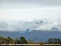
Drum to the east of the range near the Conwy Valley. With the aid of binoculars I make
daily records that include any ice precipitation observed, the lowest altitude
of snow lying at ( >= 50% cover), at ( >= 30% cover) and snow patches. I aim to update the diagram during the season at least twice weekly if there is any snow.
|


