
Llansadwrn (Anglesey) Weather
Diary 2005


|
Llansadwrn (Anglesey) Weather
|

|
Where you see these icons click for a pop-up graphic
![]()
![]()
![]()
![]()
![]()
![]()
![]()
Most pop-up graphics in the diary are self closing on next click of mouse. Javascript must be enabled if you are using some pop-up disabling software or a firewall. Please continue to close older graphics on some other pages as usual; they may go into your toolbar if you click something else first. You can click on most thumbnail images to see a larger version.
![]() 1st: The dry, mild night allowed the many 'New Year' firework displays across the island to take place uninterrupted. By morning it was windier but still dry. Despite the mildness there were still a few patches of snow to be seen on the top of Carnedd Llewelyn. At 09 GMT pressure 1015 mb had fallen as low 959 mb was NE Iceland with closely packed isobars to the NW. Pressure was high (1037 mb) to the S and (1040 mb) in the Atlantic. Split frontal-wave systems were to the W. The morning was mostly overcast with the SW'ly wind backing S'ly and freshening to gale force 8. A rope cloud was over the Irish Sea and was situated just off the Welsh coast at noon. (Satellite image: shows the rope cloud along the cold front over the Irish Sea. The cloud may exhibit a roll-like circulation about a horizontal axis with clouds forming on the ascending leading edge). There were showers of rain from 1230 GMT and from 1330 GMT the temperature began to fall quickly from the 10.3C maximum. In a squall at 1420 GMT there was heavy rain and large ice pellets. Pressure reached it's lowest point of 1005 mb around 15 GMT then the wind veered W'ly. After another light shower of ice pellets at 2000 GMT the night kept dry but mostly cloudy. [Rain 5.5 mm; Max 10.3C; Min 6.8C; Grass 4.8C]
1st: The dry, mild night allowed the many 'New Year' firework displays across the island to take place uninterrupted. By morning it was windier but still dry. Despite the mildness there were still a few patches of snow to be seen on the top of Carnedd Llewelyn. At 09 GMT pressure 1015 mb had fallen as low 959 mb was NE Iceland with closely packed isobars to the NW. Pressure was high (1037 mb) to the S and (1040 mb) in the Atlantic. Split frontal-wave systems were to the W. The morning was mostly overcast with the SW'ly wind backing S'ly and freshening to gale force 8. A rope cloud was over the Irish Sea and was situated just off the Welsh coast at noon. (Satellite image: shows the rope cloud along the cold front over the Irish Sea. The cloud may exhibit a roll-like circulation about a horizontal axis with clouds forming on the ascending leading edge). There were showers of rain from 1230 GMT and from 1330 GMT the temperature began to fall quickly from the 10.3C maximum. In a squall at 1420 GMT there was heavy rain and large ice pellets. Pressure reached it's lowest point of 1005 mb around 15 GMT then the wind veered W'ly. After another light shower of ice pellets at 2000 GMT the night kept dry but mostly cloudy. [Rain 5.5 mm; Max 10.3C; Min 6.8C; Grass 4.8C]
2nd: After a slight shower of ice pellets at 0500 GMT the sky began to clear so that at 09 GMT it was 5/8th covered with layered altocumulus and cumulus clouds. There was a sprinkling of fresh snow on some western mountains including the Glyders but this soon disappeared. Pressure 1022 mb was rising with low (961 mb) E of Iceland in the Norwegian Sea. High (1041 mb) was in the Atlantic NW of Cape Finisterre. The UK was in a strong W/NW'ly showery airstream; NW Scotland saw most showers (with snow on high ground). The day kept dry here with some good sunny spells developing, but it was cloudier by sunset. The night was dry also with broken cloud and was warmer. [Rain 0.0 mm; Max 7.5C; Min 3.1C; Grass 0.6C]
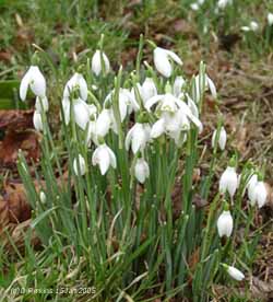
 3rd: With the maximum 7.5C of the past 24-h just before 09 GMT it was a mild morning. Overcast with stratocumulus cloud the WSW'ly wind was force 4/5. Pressure 1030 mb was rising as the high 1042 mb moved into the Bay of Biscay. But low 962 mb off SE Greenland and complex low-pressure 972 mb over Scandinavia kept isobars tight across the UK. The morning was cloudy and dry with a few sunny breaks seen over the mountains towards Llanfairfechan and the Conwy Valley. There was little in the way of snow remaining; just a few small patches on Carnedd Llewelyn (Snowdon was obscured). The first flowers of snowdrops have opened in the garden and there are plenty of holly berries left on trees in the area. They have been stripped in the garden, where there is a multitude of birds, but usually at this time of year all the trees would have been cleared of berries. The are also some primroses in flower on the rockery banks and a few buds have appeared on early daffodils. As pressure began to fall in the afternoon the SW'ly wind strengthened and before midnight was up to gale force 8. [Rain 4.5 mm; Max 9.6C; Min 3.9C; Grass 0.5C]
![]()
![]() 4th: At midnight twin deep lows 951 mb were over the Denmark Strait (between Greenland and Iceland) and Iceland 959 mb with a cold front W of Ireland. With the gale force 8 continuing it was a rough night with gusts up to 60 mph. The weakening cold front moving SE crossed over here between 0700 and 0900 GMT. There was a heavy burst of rain just before 0830 GMT. Pressure was 1014 mb and starting to rise and by 10 GMT the rain had ceased and we were into a clear slot. With the wind moderated and veered W'ly the day turned mostly sunny over Anglesey. Cloud remained longer over the mountains of Snowdonia but here too it lifted towards the end of the afternoon. The evening and night were clear at first, but there was no frost. [Rain 0.4 mm; Max 9.0C; Min 7.5C; Grass 6.7C]
4th: At midnight twin deep lows 951 mb were over the Denmark Strait (between Greenland and Iceland) and Iceland 959 mb with a cold front W of Ireland. With the gale force 8 continuing it was a rough night with gusts up to 60 mph. The weakening cold front moving SE crossed over here between 0700 and 0900 GMT. There was a heavy burst of rain just before 0830 GMT. Pressure was 1014 mb and starting to rise and by 10 GMT the rain had ceased and we were into a clear slot. With the wind moderated and veered W'ly the day turned mostly sunny over Anglesey. Cloud remained longer over the mountains of Snowdonia but here too it lifted towards the end of the afternoon. The evening and night were clear at first, but there was no frost. [Rain 0.4 mm; Max 9.0C; Min 7.5C; Grass 6.7C]
![]()
![]()
![]() 5th: At midnight the frontal cloud was over N France and another low 986 mb S of Iceland was already steaming NE and by 06 GMT was 977 mb just off NW Scotland. The SW'ly wind had been strengthening before dawn and cloud on an active cold front had already encroached bringing a few spots of rain. Activity was confined NW of here and over Scotland rapidly weakened before it reached here. Pressure at 09 GMT was 1016 mb with the SW'ly force 5/6. (Jet stream analysis chart: shows Britain in the firing line for further Atlantic-lows. The strongest winds in the jet stream (perhaps 250 mph) occur about 10 km (c. 30,000 ft), or more, above ground. It is where cold air from arctic meets warm air from the south. This is sometimes called the 'westerly conveyor belt' strengthening and steering areas of low pressure. On this occasion they are being steered towards Britain where we can expect a succession of lows in the next week). The morning was dull, windy with occasional spots of rain. With the SW'ly strengthening to gale force 8 and gusts of 50 mph there was moderate to heavy rain from 1345 to 1500 GMT. With the front passed about 16 GMT the rain had ceased and the wind moderated it was a little brighter before dusk. [Rain 6.1 mm; Max 8.5C; Min 4.0C; Grass 0.6C]
5th: At midnight the frontal cloud was over N France and another low 986 mb S of Iceland was already steaming NE and by 06 GMT was 977 mb just off NW Scotland. The SW'ly wind had been strengthening before dawn and cloud on an active cold front had already encroached bringing a few spots of rain. Activity was confined NW of here and over Scotland rapidly weakened before it reached here. Pressure at 09 GMT was 1016 mb with the SW'ly force 5/6. (Jet stream analysis chart: shows Britain in the firing line for further Atlantic-lows. The strongest winds in the jet stream (perhaps 250 mph) occur about 10 km (c. 30,000 ft), or more, above ground. It is where cold air from arctic meets warm air from the south. This is sometimes called the 'westerly conveyor belt' strengthening and steering areas of low pressure. On this occasion they are being steered towards Britain where we can expect a succession of lows in the next week). The morning was dull, windy with occasional spots of rain. With the SW'ly strengthening to gale force 8 and gusts of 50 mph there was moderate to heavy rain from 1345 to 1500 GMT. With the front passed about 16 GMT the rain had ceased and the wind moderated it was a little brighter before dusk. [Rain 6.1 mm; Max 8.5C; Min 4.0C; Grass 0.6C]
6th: Mostly cloudy overnight but cloudier and windier again at dawn. Pressure was 1022 mb with the low of yesterday 959 mb N Norwegian Sea. The next low in line 968 mb was SW Iceland with a warm front already over Ireland with rain affecting NW Ireland and Scotland. The SW'ly wind was force 5 and low cloud was hugging western mountains in Snowdonia. Rainfall was heavy over the mountains but on Anglesey it was minimal. The day kept cloudy and very windy with slight rain or drizzle at times. The evening and night was windier the SSW'ly reaching gale force 8 with strong gusts by 22 GMT. {Capel Curig 34.4 mm; Valley 0.8 mm} [Rain 2.3 mm; Max 11.3C; Min 4.3C; Grass 0.6C]
 7th: Pressure 1014 mb continued to fall steadily as the gale continued. Strongest from 02 GMT again gale force 8 with gusts of 54 mph reported at RAF Valley. The temperature continued to rise with the maximum of 11.3C recorded between 04 and 05 GMT. At 09 GMT it was 10.6C, visibility was very poor in continuous moderate to heavy rain. Water was beginning to stand on the already saturated soil. Heavy rain over central Wales was moving N; Capel Curig reported 22 mm in 6-h to 06 GMT and 68 mm in the next 6-h. Pressure 1010 mb was falling with complex low-pressure to the N of the British Isles maintaining the strong SW winds. Split cold fronts were lying just to the NW. Pressure was high (1040 mb from Iberia to N Italy. The morning was very wet and blustery with the SW'ly wind touching gale-force. By 1300 GMT 10 mm of rainfall had accumulated. There was rapid cyclogenesis W of Ireland during the morning, the frontal wave-low moving towards the Irish Sea. Heavy rain continued to fall during the afternoon; with water collected on the fields and roads leading to minor flooding. Breaches in the roadside stonewalls, made to relieve flooding on 22 October 2004, were allowing water to flow off the A5025, But kerbing and full drains were contributing to large pools of water on the roadside. At 14 GMT there the River Braint was within it's banks, but the level was rising quickly. But on the mainland the Dyfi Bridge at Machynlleth was flooded
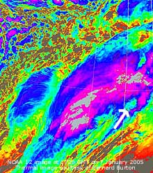
and closed. The Britannia Bridge was closed to high-sided vehicles and was subject to a 20 mph speed limit for others as the SW'ly reached gale force 8 with gusts of 55 mph. Rainfall accumulated here at 21 GMT was 33 mm (since 09 GMT). As heavy rain continued, with patches circulating around the slow-moving low over the Irish Sea. (Thermal satellite image: shows cloud top temperatures, at least as low as minus 60C (pink), of approaching rainstorm and cyclogenic area (blue) ' the bomb' just W of Ireland. There are deep convective clouds S of Iceland. On the small image Anglesey is marked by the white arrow.). As more rain fell runoff from the water-saturated ground increased rapidly. The moat at the castle in Beaumaris had filled up, it had been emptied for renovation, and was in danger or overflowing. In Gwynedd the A55 expressway was partially flooded again at Abergwyngregin. The A470 as well as several houses in Llanwrst were flooded about 19 GMT, for the second time within 12 months, despite deployment of sandbags; the A5 was closed at the Padog Bends near Capel Curig where 134 mm of rain had fallen in the 24-h to 18 GMT. Sandbags were deployed at Trefriw as water began to enter houses. The A470 at Dinas Mawddwy was blocked due to a mudslide. With storm force 10 winds on the Irish Sea the night sailing from Holyhead was cancelled. Northern England and Scotland too have been hit by heavy rain and gales; several roads in Scotland are flooded, or affected by mudslides, including the
 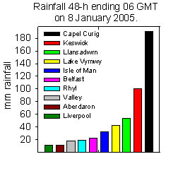 Fort William to Inverness road. Carlisle was completely cut off by flooding; an appeal was made for boats to enable people to be rescued. Some roads on high ground in the North of England were closed because of strong winds. It was a very rough night with winds reaching force 8 to 9, but force 10 around the Irish Sea. Total rainfall for the period 09-09 GMT was 51.6 mm, largest of the month. {Capel Curig 134 mm} (Valley 17.2 mm) [Rain 51.6 mm; Max 10.8C; Min 7.8C; Grass 6.8C]
![]()
![]()
![]() 8th: Pressure at midnight had fallen to 993 mb with the low 980 mb off Clare Island (NW Ireland). Rainfall was very heavy around midnight over Anglesey, Wales and N England, but stopped here close to 0300 GMT. The SW'ly gales continued through the night with the wind starting to veer after 03 GMT and strengthen. Some exceptionally strong winds were reported, around Wales gusts of over 70 mph were frequent Mumbles 81 mph; Isle of Man 84 mph; Valley 75 mph while on Great Dunn Fell (N England) 129 mph was recorded. Rainfall in the mountains of North Wales (Capel Curig 191 mm in 48-h to 06 GMT) led to severe flooding in the Conwy Valley at Llanwrst and Trefriw. A section of the railway line was washed away, the same that was repaired following the October floods. Two people had to be rescued from a car; at 01 GMT an electricity engineer was rescued by boat after spending 2 hours on the top of his van; a woman was rescued at 04 GMT from her car submerged in 4.5 ft of flood water. Flooding was made worse by a tidal surge of 1.0 m recorded at Llandudno by the Proudman Oceanographic Laboratory's tide gauge just after 08 GMT coinciding with the high tide of the 6.9 m at 0828 GMT (8.5 m Liverpool). This would have backed up the considerable quantities of water running off the mountains and down the River Conwy. Beaumaris was flooded for the second time in 11 weeks, but not as severely as on 22 October 2004. The castle moat overflowed across the road and residents were alarmed to see 9 inches of water around the Royal Anglesey Yacht Club and at Green Edge. Water was able to escape through the breach in the sea wall made during the flood of 22 October 2004, as it had not been fully reinstated. There was also 18 inches of water rushing down the hill in Mill Lane, the scene of previous flooding in the town. Beaumaris has seen flooding on 7 occasions since 1981. The road from Beaumaris to Bangor near Gallows Point was closed again due to landslide. Several trees were brought down and roads closed as a result; electricity supplies were also disrupted. Power was not restored to Gaerwen until 13 GMT. Pressure 1022 mb at 09 GMT was rising and the W'ly wind was still force 7 to 8. Some breaks were appearing in the cloud and by 11 GMT it had turned mostly sunny. Since 02 GMT the temperature began to fall to 4.0C as colder air was being brought down from Greenland. This was cold enough for precipitation around the mountaintops in Snowdonia to be wintry once more. A sprinkling of snow was seen on the highest summits including Crib Goch and Snowdon. The afternoon was sunny; convective cumulus clouds developed over the mountains giving the showers but these dispersed later. By evening it was cloudier but kept dry, SW-facing windows are encrusted with dried saltspray being blown right across the island; it was still windy with the SW'ly force 6/7 moderating after midnight. [Rain 0.0 mm; Max 8.9C; Min 4.0C; Grass 2.0C]
8th: Pressure at midnight had fallen to 993 mb with the low 980 mb off Clare Island (NW Ireland). Rainfall was very heavy around midnight over Anglesey, Wales and N England, but stopped here close to 0300 GMT. The SW'ly gales continued through the night with the wind starting to veer after 03 GMT and strengthen. Some exceptionally strong winds were reported, around Wales gusts of over 70 mph were frequent Mumbles 81 mph; Isle of Man 84 mph; Valley 75 mph while on Great Dunn Fell (N England) 129 mph was recorded. Rainfall in the mountains of North Wales (Capel Curig 191 mm in 48-h to 06 GMT) led to severe flooding in the Conwy Valley at Llanwrst and Trefriw. A section of the railway line was washed away, the same that was repaired following the October floods. Two people had to be rescued from a car; at 01 GMT an electricity engineer was rescued by boat after spending 2 hours on the top of his van; a woman was rescued at 04 GMT from her car submerged in 4.5 ft of flood water. Flooding was made worse by a tidal surge of 1.0 m recorded at Llandudno by the Proudman Oceanographic Laboratory's tide gauge just after 08 GMT coinciding with the high tide of the 6.9 m at 0828 GMT (8.5 m Liverpool). This would have backed up the considerable quantities of water running off the mountains and down the River Conwy. Beaumaris was flooded for the second time in 11 weeks, but not as severely as on 22 October 2004. The castle moat overflowed across the road and residents were alarmed to see 9 inches of water around the Royal Anglesey Yacht Club and at Green Edge. Water was able to escape through the breach in the sea wall made during the flood of 22 October 2004, as it had not been fully reinstated. There was also 18 inches of water rushing down the hill in Mill Lane, the scene of previous flooding in the town. Beaumaris has seen flooding on 7 occasions since 1981. The road from Beaumaris to Bangor near Gallows Point was closed again due to landslide. Several trees were brought down and roads closed as a result; electricity supplies were also disrupted. Power was not restored to Gaerwen until 13 GMT. Pressure 1022 mb at 09 GMT was rising and the W'ly wind was still force 7 to 8. Some breaks were appearing in the cloud and by 11 GMT it had turned mostly sunny. Since 02 GMT the temperature began to fall to 4.0C as colder air was being brought down from Greenland. This was cold enough for precipitation around the mountaintops in Snowdonia to be wintry once more. A sprinkling of snow was seen on the highest summits including Crib Goch and Snowdon. The afternoon was sunny; convective cumulus clouds developed over the mountains giving the showers but these dispersed later. By evening it was cloudier but kept dry, SW-facing windows are encrusted with dried saltspray being blown right across the island; it was still windy with the SW'ly force 6/7 moderating after midnight. [Rain 0.0 mm; Max 8.9C; Min 4.0C; Grass 2.0C]
9th: A cloudy start, but still dry. The wind was backing SSW'ly and beginning to strengthen again. Pressure 1013 mb was falling as another deepening Atlantic-low 978 mb W of Ireland approached. A warm front over the Irish Sea had rain on it over S Ireland at 06 GMT this arriving on W Anglesey by 09 GMT. It was still dry here and with a drying wind surface moisture had disappeared but the soil was very plastic and would not take much rain to wet it up again. It is reported that the A55 near Abergwyngregin still has one lane closed due to flooding; this is a long-standing problem that should have been sorted out years ago. Extensive deep flooding was also still affecting Carlisle and surrounding areas. Many hundred homes were also without electricity supply overnight. Travellers were advised to avoid the area. Many roads in Scotland, too many to list, are closed due to 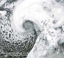 flooding and slides. With higher temperatures snowmelt, and heavy rain falling during the morning,was likely to make matters worse. A ferry blown aground off Scotland by 100 mph winds was still stuck-fast on a sand bank awaiting tugs. It was pulled off during the morning. There was another tidal surge; the POL tide gauge at Holyhead recorded a 0.5 m surge at 2030 GMT enhancing the 5.4 m spring tide (Liverpool 9.2 m). In warm sector air it gradually became warmer through the day the temperature rising to 11.5C around 22 GMT. Then it was blowing gale force 8 with some very strong gusts that were hitting the house like a sledge hammer. There were also showery bursts of heavy rain but amounts were small. The most rain affected S and mid Wales and moving NE missed Anglesey. [Rain 3.0 mm; Max 11.5C; Min 4.4C; Grass 2.2C]
![]() 10th: The gale continued after midnight, with pressure about 1000 mb with the low 962 mb off Cape Wrath, but then slowly moderated as pressure rose through till morning. A weak cold front passed over; at 09 GMT it was a little cooler at 9.2C and pressure was 1006 mb with the low 960 mb N of Scotland. The wind was force 5 SW'ly and the sky clearing to give a sunny morning and afternoon. It became a bit cloudier by dusk, the day's minimum temperature of 7.4C was at 1700 GMT. Later the sky became mostly overcast with the temperature rising. [Rain 0.0 mm; Max 9.9C; Min 8.6C; Grass 7.4C]
10th: The gale continued after midnight, with pressure about 1000 mb with the low 962 mb off Cape Wrath, but then slowly moderated as pressure rose through till morning. A weak cold front passed over; at 09 GMT it was a little cooler at 9.2C and pressure was 1006 mb with the low 960 mb N of Scotland. The wind was force 5 SW'ly and the sky clearing to give a sunny morning and afternoon. It became a bit cloudier by dusk, the day's minimum temperature of 7.4C was at 1700 GMT. Later the sky became mostly overcast with the temperature rising. [Rain 0.0 mm; Max 9.9C; Min 8.6C; Grass 7.4C]
![]()
![]()
![]() .11th: At midnight Atlantic-low 975 mb was well out SW of Ireland tracking ENE. After a quiet night the S'ly wind was back to force 7 by 09 GMT. Pressure 1005 mb was falling with the rapidly deepening low 956 mb W of Shannon, Ireland. An associated warm front was over SW Ireland where it was raining. Here the moderately low ragged clouds were scurrying along on the wind but it was still dry. The morning was bright at first, there was a shower at 1045 GMT, with the wind strengthening to gale force 8 with strong 50 mph gusts by 11 GMT with a warm front over the Irish Sea. At noon the low was 945 mb tracking past N Ireland towards Cape Wrath and the temperature was falling away from the 11.5C maximum. The afternoon was blustery with some more showers of rain as the cold front over at 1345 GMT. There were some bursts of heavy rain and squally winds but this soon passed with some bright and sunny spells developing. The relative humidity fell quickly from near 100% at 1400 GMT to about 70%. The evening continued very windy; as it veered WSW'ly it stepped up a notch to strong gale with 60 mph gusts around 22 GMT. There was a surge tide running and the POL gauge at Holyhead recorded a 0.7 m surge about 23 GMT. This brought the 9.3 m (Liverpool) tide up to 10.4 m and testing sea defences around the coast. In Barra, Outer Hebrides, a gust of 106 mph was recorded just before the anemometer broke! On North Rona 124 mph was reported. Parts of Scotland were described as a 'scene of devastation' with much damage and 3 deaths reported. Over 70,000 homes were without electricity and several flooded. All schools in the Highlands and Western Isles were shut. A fishing boat the Cibeles with 19 mainly Portuguese aboard, registered in Milford Haven, was reported missing 200 miles off the Hebrides. [Rain 2.3 mm; Max 11.5C; Min 7.4C; Grass 5.5C]
.11th: At midnight Atlantic-low 975 mb was well out SW of Ireland tracking ENE. After a quiet night the S'ly wind was back to force 7 by 09 GMT. Pressure 1005 mb was falling with the rapidly deepening low 956 mb W of Shannon, Ireland. An associated warm front was over SW Ireland where it was raining. Here the moderately low ragged clouds were scurrying along on the wind but it was still dry. The morning was bright at first, there was a shower at 1045 GMT, with the wind strengthening to gale force 8 with strong 50 mph gusts by 11 GMT with a warm front over the Irish Sea. At noon the low was 945 mb tracking past N Ireland towards Cape Wrath and the temperature was falling away from the 11.5C maximum. The afternoon was blustery with some more showers of rain as the cold front over at 1345 GMT. There were some bursts of heavy rain and squally winds but this soon passed with some bright and sunny spells developing. The relative humidity fell quickly from near 100% at 1400 GMT to about 70%. The evening continued very windy; as it veered WSW'ly it stepped up a notch to strong gale with 60 mph gusts around 22 GMT. There was a surge tide running and the POL gauge at Holyhead recorded a 0.7 m surge about 23 GMT. This brought the 9.3 m (Liverpool) tide up to 10.4 m and testing sea defences around the coast. In Barra, Outer Hebrides, a gust of 106 mph was recorded just before the anemometer broke! On North Rona 124 mph was reported. Parts of Scotland were described as a 'scene of devastation' with much damage and 3 deaths reported. Over 70,000 homes were without electricity and several flooded. All schools in the Highlands and Western Isles were shut. A fishing boat the Cibeles with 19 mainly Portuguese aboard, registered in Milford Haven, was reported missing 200 miles off the Hebrides. [Rain 2.3 mm; Max 11.5C; Min 7.4C; Grass 5.5C]
12th: At midnight the low was 944 mb near the Faeroe Islands with winds of violent storm force 11 reported. There was no respite here after midnight with sustained gale force 8 wind speed and strong gusts rattling the roof slates. Around 07 GMT it was again pushing strong gale (force 9) with gusts over 60 mph. A tree had been blown down across the telephone cable across the field SW of the weather station. Usually this does not disrupt communications as sufficient slack is allowed in the run of cable to bring it to the ground. At 09 GMT the wind had moderated to force 6 and the sky was almost clear over Anglesey although there was a deep cloud bank over the Snowdonia Mountains. It had turned cold enough again for snow in Scotland that on the strong winds were blizzard-like in places. At 06 GMT the low had started to fill (948 mb) E of the Faeroes. A showery trough was lying over W Scotland continuing the snow showers. Here the morning was bright and occasionally sunny; the wind was drying the ground but the soil was still wet. The Cibeles was found by an RAF Nimrod drifting in heavy seas 180 miles off the coast of Scotland. A Coastguard helicopter from Stornoway rescued 10 of the 19 crew from the fishing boat; it was hoped that a tow could be arranged later. The day was bright with a few sunny spells and moderating wind. There were convective clouds were seen to the NW, but they kept away from here during the day. Snowdonia had some light showers that fell as snow during the evening and night. The night was mostly clear with the wind strength reducing to little or nothing by midnight. [Rain 0.0 mm; Max 7.0C; Min 4.5C; Grass 2.5C]
13th: What a difference 24-h can make with the weather. This morning almost calm and sunny; heavy dew had frozen on the grass with -2.2C frost on the ground, lowest of the month. The birds were singing; a mistle thrush, or storm cock, was in full song in the wood. Rooks were noisy attending to their nests that look rather battered after the gales. They did not look very serious about it, it is a little early to nest but they will do some remedial work from time to time. The change was because a ridge of high-pressure from high 1033 mb over France was crossing the UK. Our low was now over the N Baltic and 976 mb. The next low 965 mb was SE of Greenland and likely to track to the N of Scotland. Pressure here 1027 mb had risen and it was cooler at 1.4C. Several expanding contrails were overhead but these, and a little cirrostratus, soon cleared leaving high cirrus. There was a light sprinkling of snow on most of the mountain summits over 3000 ft. The morning was sunny and almost calm at first but it was cloudier around noon when cumulus clouds developed. The wind backed S'ly and again it was dry here, but the mountaintops had one or two snow flurries. By evening the sky had cleared and there was a ground frost before frontal cloud started to encroach before midnight. [Rain 0.0 mm; Max 9.0C; Min 1.4C; Grass -2.2C]
 14th: Mostly cloudy and warmer with the temperature rising to the 24-h maximum of 9.0C at 09 GMT. Pressure was 1021 mb as mid-Atlantic low 978 mb pushed frontal cloud in from the W. In a S'ly wind there were for a while a few lee-wave clouds in the lee of Snowdon. There were some dark clouds to the NW over Pentraeth at times, but otherwise the morning was bright with the odd glimpse of sunshine. The afternoon was mostly cloudy with some fine spots of rain. During the night frontal cloud edged closer. [Rain 1.2 mm; Max 12.4C; Min 1.5C; Grass -1.2C]
![]() 15th: The was a short spell of light rain from 04 to 0500 GMT and by 09 GMT cloud was broken and it was dry. The overnight minimum of 8.6C was the highest of the month. Pressure was 1016 mb with frontal low (1001 mb) was SW of Ireland having run up from Iberia. It was a mild 12.2C with the maximum 12.4C about 04 GMT. It was a cloudy morning but the temperature rose to 12.9C, the highest of the month. The afternoon had thicker cloud but it was dry but drizzle affected the coast in the W from time to time. The night was overcast and damp with a little drizzle. [Rain 0.8 mm; Max 12.9C; Min 8.6C; Grass 7.8C]
15th: The was a short spell of light rain from 04 to 0500 GMT and by 09 GMT cloud was broken and it was dry. The overnight minimum of 8.6C was the highest of the month. Pressure was 1016 mb with frontal low (1001 mb) was SW of Ireland having run up from Iberia. It was a mild 12.2C with the maximum 12.4C about 04 GMT. It was a cloudy morning but the temperature rose to 12.9C, the highest of the month. The afternoon had thicker cloud but it was dry but drizzle affected the coast in the W from time to time. The night was overcast and damp with a little drizzle. [Rain 0.8 mm; Max 12.9C; Min 8.6C; Grass 7.8C]
16th: The sky was clearer at dawn but there were light showers of rain. Pressure 1014 mb was falling with low 948 mb between S Greenland and Iceland. Pressure continues generally high to the S this keeping the warm S'ly flow of air. Again mild overnight with the air minimum 8.3C. Temperatures are running about 3C above the January average. The Irish Sea was between split frontal cloud and Wales and Scotland was peppered with small showers. The morning was showery, a few blustery and heavy in the force 5 S'ly wind. Cloud cleared in the afternoon giving a sunny afternoon on Anglesey. Cumulus clouds persisted over Snowdonia where it was showery. As the sun set lenticular clouds were seen on the western horizon. It was overcast by 22 GMT and there was rain before midnight. [Rain 9.0 mm; Max 9.5C; Min 8.3C; Grass 6.8C]
17th: Light rain continued until nearly 06 GMT. By 09 GMT the cloud was breaking up and the wind was WSW'ly force 4/5. Pressure 1006 mb was falling with deepening low near Greenland and was bringing colder air from the NW. The morning started mostly cloudy with cloud hanging about 2500 ft across the mountains. A torrent of water could be seen gushing from Cwm Idwal and running down into the Nant Ffrancon. Here the 9.0 mm had made the soil soggy with water pressed out underfoot. The storm cocks were in good voice singing high in the trees, but they will most likely stop if the weather turns cold. The afternoon turned colder and showery with rain and ice pellets from 1330 GMT. By the end of the afternoon there was slight snow lying above 2800 ft on the Snowdonia Mountains. From 1717 GMT there were frequent showers of rain, ice pellets and sleet falling as snow above 1000 ft. [Rain 6.6 mm; Max 8.0C; Min 6.6C; Grass 4.8C]
![]()
![]() 18th: By midnight the temperature was around 2C and later fell to 0.7C, the lowest minimum of the month. Showers turned to snow pellets and a little snow continuing until 04 GMT. It was still overcast at 09 GMT and the wintry showers resumed. Pressure was 995 mb with complex low-pressure 967 mb around Iceland. Atlantic-high 1038 mb was to the SW and was high also over N Africa. Pressure was low in the eastern Mediterranean where there had been a lot of snow in Greece. The snow moved on to the Alps where there has been meagre snowfall this winter with temperatures 3C above average in places. Here there were frequent showers of snow pellets and snow at first during the morning these turning to rain and sleet later. After noon the sky cleared giving a mostly sunny afternoon over Anglesey. It was not so, however, in Merseyside and Cheshire where deep convective clouds driven in off the Irish Sea on the NW'ly gave thunderstorms, downpours of precipitation with Crosby (Liverpool) reporting {27 mm}. David Small reported that roads were left white with hailstones in the Widnes and Runcorn area. Heavy snow and hail were reported in Weston Coyney in Staffordshire as the showers worked their way through the Cheshire Gap to SE England (Satellite image: shows linear convective clouds across England and Ireland. Sferics indicate thundery activity mainly over N Ireland and Merseyside to Birmingham. Through the clouds over Wales snow can be seen, also N England. Snow was as low as 500 ft on the Clwydian hills having fallen during the evening of the 17th.). Low cloud returned here during the evening and night when it became misty with drizzle by morning. [Rain 1.7 mm; Max 6.5C; Min 0.7C; Grass -1.2C]
18th: By midnight the temperature was around 2C and later fell to 0.7C, the lowest minimum of the month. Showers turned to snow pellets and a little snow continuing until 04 GMT. It was still overcast at 09 GMT and the wintry showers resumed. Pressure was 995 mb with complex low-pressure 967 mb around Iceland. Atlantic-high 1038 mb was to the SW and was high also over N Africa. Pressure was low in the eastern Mediterranean where there had been a lot of snow in Greece. The snow moved on to the Alps where there has been meagre snowfall this winter with temperatures 3C above average in places. Here there were frequent showers of snow pellets and snow at first during the morning these turning to rain and sleet later. After noon the sky cleared giving a mostly sunny afternoon over Anglesey. It was not so, however, in Merseyside and Cheshire where deep convective clouds driven in off the Irish Sea on the NW'ly gave thunderstorms, downpours of precipitation with Crosby (Liverpool) reporting {27 mm}. David Small reported that roads were left white with hailstones in the Widnes and Runcorn area. Heavy snow and hail were reported in Weston Coyney in Staffordshire as the showers worked their way through the Cheshire Gap to SE England (Satellite image: shows linear convective clouds across England and Ireland. Sferics indicate thundery activity mainly over N Ireland and Merseyside to Birmingham. Through the clouds over Wales snow can be seen, also N England. Snow was as low as 500 ft on the Clwydian hills having fallen during the evening of the 17th.). Low cloud returned here during the evening and night when it became misty with drizzle by morning. [Rain 1.7 mm; Max 6.5C; Min 0.7C; Grass -1.2C]
19th: Low cloud, intermittent drizzle and very poor visibility started the day. Pressure 1011 mb had risen as high 1042 mb intensified off Iberia, but low 970 mb was between Greenland and Iceland and complex low-pressure over the Norwegian Sea. The Mediterranean low 993 mb had moved to be over Italy. We were still in a W/NW'ly air flow, but weaker. The morning remained dull and overcast then there was light rain on a warm front from about 1100 until 14 GMT when there was fog. The fog cleared by mid-afternoon the W'ly wind strengthened to force 5/6 as a cold front over the Irish Sea edged closer. At 18 GMT low 966 mb was near the Faeroes tracking E. [Rain 4.3 mm; Max 10.4C; Min 2.0C; Grass 0.4C]
20th: A very dull morning under thick stratiform cloud that was to remain all day. Pressure was 1009 mb with complex low-pressure Greenland to S Sweden with low 964 mb off the southern Norwegian coast. A wavy frontal system was lying across N Ireland and Wales and made little progress through the day. Dull, misty, drizzle or light rain and to make it a little more interesting a burst of heavy rain around 1700 GMT associated with a weak cold front. The rest of the night, though mostly cloudy, was dry. [Rain 6.8 mm; Max 10.1C; Min 5.6C; Grass 5.0C]
![]() 21st: A bright start with deep lenticular clouds over Snowdonia. Greater spotted woodpeckers had started drumming in the wood. Altocumulus was streaming quickly overhead from a N'ly direction while there was cirrostratus and stratocumulus clouds to the W. Pressure was 1016 mb with high 1036 mb off Cape Finisterre and low 986 mb was over the Baltic giving snow (Satellite image: shows the vortex of deeply convective clouds approaching S Norway where snow can be seen on the ground.). There was a weakening NW'ly airflow as a low to the W of Ireland edged closer through the day. Frontal cloud that had moved S began to return N so that before noon it was cloudy again. An area of light rain over S Ireland in the morning moved across the Irish sea and affected Anglesey during the afternoon. Amounts of precipitation were small it being mainly fine to heavy drizzle. The evening saw some light rain and this fell as snow over the Snowdonia Mountains. Spectacular displays of aurora were reported from Scotland. N Ireland and Yorkshire around 1910 GMT. It was cloudy and raining here, but they were seen around midnight. Though still partly cloudy, with a bright moon, diffuse variable orangy-red colours were seen to the W, static green colours overhead and to the N. [Rain 0.6 mm; Max 6.4C; Min 3.4C; Grass 0.0C]
21st: A bright start with deep lenticular clouds over Snowdonia. Greater spotted woodpeckers had started drumming in the wood. Altocumulus was streaming quickly overhead from a N'ly direction while there was cirrostratus and stratocumulus clouds to the W. Pressure was 1016 mb with high 1036 mb off Cape Finisterre and low 986 mb was over the Baltic giving snow (Satellite image: shows the vortex of deeply convective clouds approaching S Norway where snow can be seen on the ground.). There was a weakening NW'ly airflow as a low to the W of Ireland edged closer through the day. Frontal cloud that had moved S began to return N so that before noon it was cloudy again. An area of light rain over S Ireland in the morning moved across the Irish sea and affected Anglesey during the afternoon. Amounts of precipitation were small it being mainly fine to heavy drizzle. The evening saw some light rain and this fell as snow over the Snowdonia Mountains. Spectacular displays of aurora were reported from Scotland. N Ireland and Yorkshire around 1910 GMT. It was cloudy and raining here, but they were seen around midnight. Though still partly cloudy, with a bright moon, diffuse variable orangy-red colours were seen to the W, static green colours overhead and to the N. [Rain 0.6 mm; Max 6.4C; Min 3.4C; Grass 0.0C]
![]() 22nd: It was overcast by dawn; there had been a little more rain here, and snow on the mountains where it was lying around 1500 ft across most summits. (Photograph ©: shows view of the Carneddau Mountains from Foel-fras (left) to Nant Ffrancon Pass (right).
22nd: It was overcast by dawn; there had been a little more rain here, and snow on the mountains where it was lying around 1500 ft across most summits. (Photograph ©: shows view of the Carneddau Mountains from Foel-fras (left) to Nant Ffrancon Pass (right).
 The Black Ladders cliffs are well depicted near the centre.).There was a strong deposit of light-brown coloured dust [Munsell colour chart 7.5 YR 6/4], it's source is most likely to have been in North Africa blown out into the Atlantic towards America before heading N then E towards Anglesey. Pressure was 1019 mb with shallow low 1012 mb near Shannon, Ireland. The morning was calm and overcast by moderately thin and high cloud (6000 ft, but was thick enough to give a few more spots of rain. The spots turned to a short spell of light rain by noon. After some more drizzle and rain it was drier by the end of the afternoon. With a maximum of 5.2C it was the coldest day of the month, so far. The evening and night were mostly cloudy. [Rain 1.2 mm; Max 5.2C; Min 1.4C; Grass -0.9C]
![]() 23rd: With the sky starting to clear at dawn it was just cold enough to give a touch of frost on the grass (-0.7C) and for the storm cocks not to sing. Pressure 1034 had risen with high 1038 mb lying to the NW off the Western Isles of Scotland.
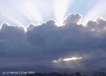
23rd: With the sky starting to clear at dawn it was just cold enough to give a touch of frost on the grass (-0.7C) and for the storm cocks not to sing. Pressure 1034 had risen with high 1038 mb lying to the NW off the Western Isles of Scotland. 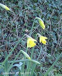 Yesterday's shallow low was 1023 mb over France. The sky was clear over Anglesey; there were cumulus clouds over the Snowdonia Mountains and, with the sun rising behind, displaying spectacular upward and downward crepuscular rays. The day was sunny with a light N'ly wind. (Photographs: looking SE, taken in the afternoon, shows a sunny Llansadwrn with ewes and lambs on the fields, cloud persisted over Snowdonia . There have been new-born lambs since the end of December. Some remarkably early daffodils were spotted in a hedgerow bank).The night was mostly clear but frost-free in the moderately N'ly wind. [Rain 0.0 mm; Max 6.5C; Min 1.1C; Grass -0.7C]
24th: A sunny start to the day but there was a cold-feeling NNE'ly wind. The temperature at 09 GMT was 2.5C (dewpoint -1.8C with 73% relative humidity. The grass was dry and frost-free with the minimum thermometer indicating 0.1C. Pressure was 1036 mb with the high 1043 mb centred just W of Shannon, Ireland. With pressure low to the E of Britain moderately cold air was being drawn over the North Sea. It was a mostly sunny day with clear skies in the afternoon giving the brightest day so far this month. The day's maximum of 4.7C was the lowest of the month. Although still freezing above 1000 ft snow retreated up the mountains in the sunshine and strong wind, possibly due to freeze drying. During the evening cloud moved in off the Irish Sea and there was drizzle and some light rain around 2000 GMT. Later the night was partly cloudy with a bright moon. [Rain 0.2 mm; Max 4.7C; Min 2.0C; Grass 0.1C]
25th: It was overcast at dawn but pressure was still high at 1035 mb with the high 1046 mb anchored to the W of Ireland. The cloudiness was due to a warm front associated with a deep low 972 mb 80 deg N, in the Greenland Sea. Low 996 mb, that brought winter weather to the S France yesterday, was now in the Tyrrhenian Sea off Naples. The morning was disappointingly dull. At 11 GMT a flock of 100 redwings were seen on the field next to the weather station. These are the first seen here this winter (except those from Iceland overflying going S on 10th October 2004), they have kept well to the E because weather has been mild. With colder weather on the east coast they have migrated here. Waxwings have also been reported in Ireland, but we have not seen them here. It continues colder in the E with snow showers from the Midlands to Kent. The afternoon was mostly cloudy but there was a little sunshine at the end. Cloud was broken in the evening but overcast later. [Rain 0.0 mm; Max 6.5C; Min 2.5C; Grass 1.0C]
![]()
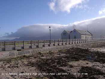 26th: Pressure was still high 1036 mb as the Atlantic-high 1049 intensifying and extending it's influence over N Britain, Iceland and the North Sea. Overcast at dawn with stratocumulus clouds; overhead it was thinning and forming altocumulus. Again frost-free under the blanket with 2.2C on the grass that was slightly wet with dew. During the morning the cloud reformed and was overcast until just before sunset when there was a clearance in the W. For about 30 minutes around 1645 GMT there were fine lenticular clouds on the western horizon. The evening was mostly cloudy; the full moon was seen with halo above a veil of thin cloud at 22 GMT. During the night there was a clear spell before turning cloudy again. There was 3 cm of snow in Dover and snow also fell in N France and as far S as S Italy, Sicily, Libya and Tunisia in North Africa. There was 30 cm of snow reported in Vienna. [Rain 0.5 mm; Max 6.7C; Min 4.0C; Grass 2.2C]
![]() 27th: On a N'ly wind showers were being driven in off the Irish Sea from dawn. The mountains were obscured in cloud above 1500 ft. Pressure was 1033 mb with the high 1047 mb centred 200 miles W of Rockall. The jet stream from the western Atlantic was rounding the high to the N over S Greenland and back S down the North Sea. Lows continue to affect the Mediterranean with low 994 mb currently between Italy and Sardinia . It was warmer here with a temperature of 6.1C than Nice at 3C. The day was bright at times with a little sunshine at times. The evening was mostly cloudy. [Rain trace; Max 7.9C; Min 3.8C; Grass 2.0C]
27th: On a N'ly wind showers were being driven in off the Irish Sea from dawn. The mountains were obscured in cloud above 1500 ft. Pressure was 1033 mb with the high 1047 mb centred 200 miles W of Rockall. The jet stream from the western Atlantic was rounding the high to the N over S Greenland and back S down the North Sea. Lows continue to affect the Mediterranean with low 994 mb currently between Italy and Sardinia . It was warmer here with a temperature of 6.1C than Nice at 3C. The day was bright at times with a little sunshine at times. The evening was mostly cloudy. [Rain trace; Max 7.9C; Min 3.8C; Grass 2.0C]
28th: After a clear spell after midnight it had clouded again by dawn. Tawny owls were hunting around the weather station. By 09 GMT the sky had stated to clear. There was a fresh (force 5) N'ly wind with a temperature of 6.3C (dewpoint 4.7C). Pressure 1026 mb had fallen but the high 1043 mb was still anchored to the W. A showery band had just passed over and the sky cleared rapidly afterwards. By 10 GMT cumulus clouds were passing quickly overhead and the day was mostly sunny with the afternoon clear. A bank of stratocumulus cloud persisted over Snowdonia . [Rain 0.0 mm; Max 7.7C; Min 4.0C; Grass 1.4C]
![]()
![]()
 29th: Overcast at dawn the sky had cleared to 6 oktas by 09 GMT. Pressure 1030 mb was rising slowly and the morning was mostly bright and sunny with passing cumulus clouds in a light NE'ly breeze. The afternoon was sunny at first, with a maximum temperature of 10.5C soon after 1330 GMT, but stratiform cloud in the Irish Sea began to affect the west coast with drizzle and light rain from about 15 GMT. This spread to here by dusk giving a damp and drizzly night. (Satellite images: show stratiform cloud over the Irish Sea edging into W Anglesey, orographic wave clouds. The image of France shows snow cover on the Pyrenees and Alps. Also snow cover on the Massif Central with old volcanic area around the Puy de Dome well depicted. ). {Aboyne, Scotland 12.3C} [Rain 0.1 mm; Max 10.5C; Min 3.6C; Grass 1.7C]
30th: Overcast with low stratus cloud giving a fine drizzle; visibility was poor in mist. Pressure had risen to 1036 mb with the persistent high 1042 mb W of Ireland; it was calm with smoke rising vertically. Pressure remains low 1006 mb over the Mediterranean. The morning started mostly dull and damp; later there was drizzle that became heavy before spells of light rain. By mid-afternoon it was drier with 1 or 2 holes appearing in the thick cloud. The warm January has brought not only early daffodils but now a fresh flowers on The Herbalist rose growing in the garden It has not been without 2 or 3 buds during the winter. There are plenty of primroses, and garden primulas, also in flower. Fuchsias still have leaves and have not died backed as usual. The night was mostly cloudy, mild and dry with little variation in temperature. [Rain 0.6 mm; Max 7.8C; Min 4.3C; Grass 3.8C]
![]()
![]() 31st: Pressure remained high 1036 mb the anchored high 1045 mb to the W. Low 964 mb lies over N Norway with associated frontal cloud N Scotland and Europe. The day kept cloudy, with cloud about 1500 ft on the mountainsides, despite early signs of broken cloud to the W. In the afternoon the cloud was thick enough to give some drizzle at times. Fine spots of drizzle at times in the night. [Rain 0.5 mm; Max 9.4C; Min 6.4C; Grass 5.2C]
31st: Pressure remained high 1036 mb the anchored high 1045 mb to the W. Low 964 mb lies over N Norway with associated frontal cloud N Scotland and Europe. The day kept cloudy, with cloud about 1500 ft on the mountainsides, despite early signs of broken cloud to the W. In the afternoon the cloud was thick enough to give some drizzle at times. Fine spots of drizzle at times in the night. [Rain 0.5 mm; Max 9.4C; Min 6.4C; Grass 5.2C]
1st: Overnight the minimum temperature was 7.5C, the highest of the month. Drizzle turned heavy before dawn so that by 09 GMT 0.5 mm had accumulated. Visibility was very poor (<1 km) in mist and low stratiform cloud. The temperature was 7.7C with 100% relative humidity. Pressure was unchanged at 1036 mb with the high 1045 mb off SW Ireland. The morning was dull and damp with more drizzle; the afternoon was drier but still overcast as was the night. With the cloud blanket continuing the temperature range was very small, only 0.4C. [Rain 0.5 mm; Max 7.9C; Min 7.5C; Grass 6.8C]
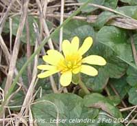 2nd: After a light shower of rain at 07 GMT the sky had cleared a little by 09 GMT. Pressure was 1038 mb with the high 1045 mb still anchored off SW Ireland. The day was a lot brighter with the sky slow to clear further from 6/8 cover. It was mild with the maximum reaching 10.0C. Very early yellow flowers of the lesser celandine were spotted at Aberffraw. Usually these do not appear until the middle to end March. Mostly cloudy later and before midnight. [Rain 0.7 mm; Max 10.0C; Min 4.8C; Grass 4.0C]
3rd: After midnight it was overcast with drizzle turning to slight rain around 04 and 06 GMT. Pressure was almost unchanged but the high 1042 mb had stated to drift S and decline. Off S Iceland there was rapid cyclogenesis on wave fronts tracking towards the Western Isles with a warm front over the NW. At 09 GMT visibility had deteriorated to <500 m (low cloud; moderate fog) and there was slight rain falling through the fine drizzle; it was calm with the temperature 7.8C and relative humidity 100%. The morning kept damp, but visibility improved as the drizzle eased. In the afternoon there was a light to moderate W to SW'ly wind; it was bright with a few sunny spells but the evening and night were mostly cloudy and dry. [Rain 0.3 mm; Max 9.5C; Min 5.6C; Grass 4.4C]
![]() 4th: A change in the weather pattern overnight. At midnight the high 1038 mb had sunk further S and another high 1037 mb was off Nova Scotia. With complex low-pressure to the NW the SW'ly wind had strengthened to force 5 by morning. Frontal cloud was lying to the W of Ireland. At 09 GMT pressure 1029 mb was falling slowly; the morning was mostly cloudy but bright. (Satellite image: shows frontal cloud to the W and N, a cloud-free area between Anglesey and the Isle of Man and orographic waves. ). The afternoon turned showery as rain over Ireland slowly moving across the Irish Sea. The band of rain did not reach here until midnight. The 14.3 mm rainfall made it the second wettest day of the month. {Colwyn Bay 12C}. [Rain 14.3 mm; Max 9.3C; Min 5.6C; Grass 4.2C]
4th: A change in the weather pattern overnight. At midnight the high 1038 mb had sunk further S and another high 1037 mb was off Nova Scotia. With complex low-pressure to the NW the SW'ly wind had strengthened to force 5 by morning. Frontal cloud was lying to the W of Ireland. At 09 GMT pressure 1029 mb was falling slowly; the morning was mostly cloudy but bright. (Satellite image: shows frontal cloud to the W and N, a cloud-free area between Anglesey and the Isle of Man and orographic waves. ). The afternoon turned showery as rain over Ireland slowly moving across the Irish Sea. The band of rain did not reach here until midnight. The 14.3 mm rainfall made it the second wettest day of the month. {Colwyn Bay 12C}. [Rain 14.3 mm; Max 9.3C; Min 5.6C; Grass 4.2C]
 5th: Rain was moderate to heavy between midnight and 0400 GMT on a cold front, then light to 0630 GMT before turning showery. At 09 GMT the sky was just starting to clear to give a bright morning with some sunny spells developing. Pressure was 1014 mb with high 1042 mb in mid-Atlantic and was 1027 mb over Spain and the western Mediterranean. It was just cold enough on the summits of Snowdonia, after passage of the cold front, for wet snow to fall and lie as low as 2400 ft. The day was sunny at times between cumulus clouds that sometimes were towering. A cumulonimbus cloud was spotted later drifting in off the Irish Sea. There was a shower of rain and ice pellets close to 2100 GMT. Mostly the sky was clear with the temperature on the grass falling to -1.9C, stars were brilliantly clear in absence of moonlight and, fortunately here, much extraneous light sources. [Rain 0.7 mm; Max 8.1C; Min 4.9C; Grass 4.6C]
6th: A cloudy and misty start to the day. There was a little (NE'ly) or no wind with complex shallow low-pressure with frontal-wave over the UK. Here pressure was 1020 mb and rising very slowly with elongated Atlantic-high 1036 mb to the SW. The morning kept mostly cloudy but dry. The afternoon was mostly sunny with a maximum of 7.6C. After a red evening sky the night was clear. [Rain trace/fr; Max 7.6C; Min 0.9C; Grass -1.9C]
7th: A touch of airfrost -0.3C, the first this year. Heavy dew (0.5 mm) had frozen on grass (min -3.0C) making the surrounding fields white with the frost. Pressure was still steady on 1020 mb, but the high was sinking S off the chart and the deep low 953 mb W of Iceland likely to bring strong winds. Winds that were light E or SE'ly overnight were soon strengthening from the S. But it was a sunny morning with occasional passing cumulus clouds. The afternoon was mostly sunny and the evening clear at first before becoming mostly cloudy by midnight. [Rain 0.0 mm; Max 8.8C; Min -0.3C; Grass -3.0C]
![]()
![]() 8th: A bright start to the day with 6/8 cover of mostly altocumulus and stratocumulus clouds. Pressure 1020 mb was unchanged, visibility was only moderate in smoke haze and there was a fresh S'ly wind. Low 962 mb was close NW of Iceland. (Satellite images: shows the low near Iceland with bands of frontal cloud to the NW of Anglesey. ).The morning was mostly sunny, but stratocumulus clouds persisted over the snow-capped mountains of Snowdonia into the afternoon. Thin moderately high cloud encroached from the NW by afternoon and there was light rain associated with the weak occluded front from 1830 to 2045 GMT during the evening. The leaves of bluebells in the wood are about 5 cm tall, but I found a few that were larger 10 to 12 cm. Cow parsley is growing quickly and the first cowslip flower has appeared. Primroses too have been in flower, but this is not unusual. Buds of willow have also started to break. [Rain 4.0 mm; Max 10.0C; Min 3.9C; Grass 1.5C]
8th: A bright start to the day with 6/8 cover of mostly altocumulus and stratocumulus clouds. Pressure 1020 mb was unchanged, visibility was only moderate in smoke haze and there was a fresh S'ly wind. Low 962 mb was close NW of Iceland. (Satellite images: shows the low near Iceland with bands of frontal cloud to the NW of Anglesey. ).The morning was mostly sunny, but stratocumulus clouds persisted over the snow-capped mountains of Snowdonia into the afternoon. Thin moderately high cloud encroached from the NW by afternoon and there was light rain associated with the weak occluded front from 1830 to 2045 GMT during the evening. The leaves of bluebells in the wood are about 5 cm tall, but I found a few that were larger 10 to 12 cm. Cow parsley is growing quickly and the first cowslip flower has appeared. Primroses too have been in flower, but this is not unusual. Buds of willow have also started to break. [Rain 4.0 mm; Max 10.0C; Min 3.9C; Grass 1.5C]
9th: After a spell of light rain from 0445 to 0600 GMT it was still overcast but dry at 09 GMT. Continuing mild with the mean 1C above average. Pressure was 1021 mb with complex low 965 mb to the N near Jan Mayen Island and high 1031 mb off Cape Finisterre. Isobars were tight in the N with a strong SW'ly airflow. A developing frontal-wave low was lying to the W of Ireland. The force 5 wind strengthened during the day, that was bright at first under thin cloud, reaching force 6 late in the afternoon. Rain arrived at 1600 GMT, pressure was lowest 1015 mb about 21 GMT, and continued until midnight. {Colwyn Bay and Prestatyn both 12C} (Capel Curig 06-06 GMT 51 mm, Lake Vyrnwy 35 mm) [Rain 12.5 mm; Max 9.2C; Min 6.1C; Grass 4.9C]
![]()
![]()
![]()
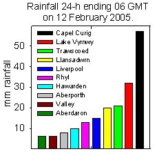 10th: There was further rain from 0445 GMT associated with a weak cold front. The temperature about 8.5C through the night fell slowly to the minimum of 6.2C close to 09 GMT. Pressure was 1019 mb; the overcast cloud was breaking up overhead forming some altocumulus. It was still misty and visibility poor with the mountains obscured. The 'westerly conveyor belt' being re-established (see jet stream chart) and several small lows on frontal waves are to the W and likely to traverse in the next few days.
 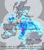 With a sharply defined edge the frontal cloud appeared to be sliding S; the morning was soon sunny and it prompted nearby rooks to start repairing their nests after the January gales. The day was mostly sunny here with the frontal cloud to the S appearing hardly moved. The day's maximum of 10.6C was the highest of the month. Radar tracking of rainfall to the S, however, indicated a W'ly flow associated with a shallow low 1019 mb moving SE during the day. By evening it was cloudier but cleared later in the night. At midnight the low was near the head of the Severn Estuary. [Rain 0.0 mm; Max 10.6C; Min 6.2C; Grass 5.4C]
11th: Clear enough overnight for a touch of ground frost and for mist and fog patches to form in low-lying places across the island. More patches of cloud moved across at dawn and at 09 GMT there was some clearance. The temperature was 3.8C, the minimum for the next 24-h. Pressure 1020 mb was little changed; it was calm, although cloud was moving across from a NW'ly direction, visibility was good. Split warm fronts were shown as lying over the Irish Sea, associated with wavy-low 1004 mb W of Malin Head (Northern Ireland). The brightness did not last long as showery rain arrived at noon; the temperature dipped from 9C to 6C then began to rise in warm sector air to 10.1C, the maximum from 22 to 05 GMT. Rain became moderate to heavy rain from 1530 to 1900 GMT as the first of the bands circulating the low passed over. The second band of rain was from 2200 to 0300 GMT, this was more showery (blustery f6 at times) with some heavy bursts. The 20.3 mm of rain made it the wettest day of the month. [Rain 20.3 mm; Max 10.1C; Min 2.6C; Grass -0.5C]
![]() 12th: At midnight pressure was 1000 mb with the low 996 mb near Malin Head. The rain started to clear away by 05 GMT when the temperature began a shallow fall to 6.5C at 09 GMT. Pressure 1003 mb was rising with a complex clearing sky of layered stratocumulus, altocumulus and banded cirrus. The low was 989 mb in the North Sea off Flamborough Head, the split fronts over the Severn Estuary and English Channel. The wind, just backed NW'ly, was force 4/5 and visibility good although mountains were obscured above 2000 ft. In the 24-h to 06 GMT Capel Curig recorded 57 mm rainfall. With the soil saturated runoff was on the mountains was large; torrents of water could be seen descending mountain streams. The morning was dry, but slow to clear in persistent patchy cloud. After a slight shower of rain at noon the afternoon turned mostly sunny; cumulus clouds were scurrying along on the fresh to strong WNW'ly wind. Mostly clear at first at night. [Rain 3.1 mm; Max 9.3C; Min 3.8C; Grass 3.5C]
12th: At midnight pressure was 1000 mb with the low 996 mb near Malin Head. The rain started to clear away by 05 GMT when the temperature began a shallow fall to 6.5C at 09 GMT. Pressure 1003 mb was rising with a complex clearing sky of layered stratocumulus, altocumulus and banded cirrus. The low was 989 mb in the North Sea off Flamborough Head, the split fronts over the Severn Estuary and English Channel. The wind, just backed NW'ly, was force 4/5 and visibility good although mountains were obscured above 2000 ft. In the 24-h to 06 GMT Capel Curig recorded 57 mm rainfall. With the soil saturated runoff was on the mountains was large; torrents of water could be seen descending mountain streams. The morning was dry, but slow to clear in persistent patchy cloud. After a slight shower of rain at noon the afternoon turned mostly sunny; cumulus clouds were scurrying along on the fresh to strong WNW'ly wind. Mostly clear at first at night. [Rain 3.1 mm; Max 9.3C; Min 3.8C; Grass 3.5C]
![]() 13th: With the wind backing N'ly and strengthening there were frequent squally showers from about 05 GMT. At 0750 GMT minute snow grains (about 1 mm diameter) were hitting windows on the strong wind. Becoming squally there followed a moderate fall of small ice pellets (2-3 mm diameter). At 09 GMT, with trees bending in the gusts, there were falls of soft conical-shaped snow pellets and flurries of snow. Pressure 1010 mb was rising with pressure high 1042 mb SW of Ireland. Deep low 965 mb was over the Baltic. We were in a near-gale (force 7) N'ly polar airflow with showers running in off the Irish Sea (surface temperature about 9.0C). The morning continued with further blustery showers of mixed ice precipitation with the wind strengthening to gale force 8, force 9 at times. At Red Wharf Bay observer Keith Ledson recorded a sustained mean wind speed of 52 mph in a 3-h period 1145 to 1445 GMT. In the storm several trees were brought down and electricity supplies disrupted for over 10 hours. The wind began to moderate late in the afternoon, but was still blowing force 6 well into the evening. [Rain 1.1 mm; Max 6.5C; Min 1.4C; Grass 0.2C]
13th: With the wind backing N'ly and strengthening there were frequent squally showers from about 05 GMT. At 0750 GMT minute snow grains (about 1 mm diameter) were hitting windows on the strong wind. Becoming squally there followed a moderate fall of small ice pellets (2-3 mm diameter). At 09 GMT, with trees bending in the gusts, there were falls of soft conical-shaped snow pellets and flurries of snow. Pressure 1010 mb was rising with pressure high 1042 mb SW of Ireland. Deep low 965 mb was over the Baltic. We were in a near-gale (force 7) N'ly polar airflow with showers running in off the Irish Sea (surface temperature about 9.0C). The morning continued with further blustery showers of mixed ice precipitation with the wind strengthening to gale force 8, force 9 at times. At Red Wharf Bay observer Keith Ledson recorded a sustained mean wind speed of 52 mph in a 3-h period 1145 to 1445 GMT. In the storm several trees were brought down and electricity supplies disrupted for over 10 hours. The wind began to moderate late in the afternoon, but was still blowing force 6 well into the evening. [Rain 1.1 mm; Max 6.5C; Min 1.4C; Grass 0.2C]
14th: Showers of snow pellets were frequent from 05 to 07 GMT but by 09 GMT the sky had stated to clear. Snow was lying on the Snowdonia Mountains at 1500 ft but was as low as 1200 ft in the Passes. Pressure was 1024 mb with high 1041 mb SW Ireland and mature low 981 mb E Baltic. We were still in a N'ly airflow but weakened the cold polar flow being more on the E coasts of Scotland and England. The morning was bright with glimpses of the sun between passing cumulus clouds in a moderating wind. There was a slight shower of ice pellets and rain at 1330 GMT but the rest of the afternoon was dry, mostly sunny but windier again. There was an earth tremor felt right across Anglesey, including Llansadwrn and Malltraeth, and North Wales coast including Bangor and Llanfairfechan at 1844 GMT. There was a distinct rumble (from the ground) and slight shaking; objects rattled on furniture tops and wall shelves for between 8 and 12 seconds before fading away. Preliminary seismic findings by BGS (British Geological Survey) gave magnitude 3.3 (Richter) at a depth of 7.8 km near Colwyn Bay. The evening and night were mostly clear. [Rain 0.2 mm; Max 7.7C; Min 2.6C; Grass 0.2C]
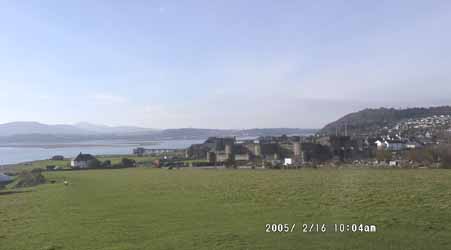 15th: A slight overnight ground frost with frozen water deposits on the grass just lasting unmelted until 09 GMT. Pressure 1028 mb had risen with ridge to Scotland 1029 mb from Atlantic-high 1035 SW of Ireland. Low 985 mb over the Adriatic continues to give wintry weather in the E Mediterranean. The morning was mostly sunny with some cumulus clouds blown along on the cool (3.1C) force 3 NE'ly wind. It was a drying wind (relative humidity 81%) that was beginning to dry the ground surface. There was thin snow lying generally at 1500 ft on the northern slopes of the mountains of Snowdonia, but in sunshine the snowline retreated during the day. A mostly sunny afternoon and clear night. [Rain trace/frost; Max 7.7C; Min 1.9C; Grass -0.1C]
![]() 16th: Overnight air and ground frosts left the grass white with frozen deposits of slight dew and a little hoar frost. Total net deposition (dew and frost) from 1700 to 0900 GMT was 0.3 mm. The minimum was -1.0C, the lowest of the month. Pressure was 1030 mb within high 1031 mb North Wales part of complex-high stretching from mid-Atlantic to N Scandinavia. Pressure is low Europe to the Mediterranean; it continues very cold in Russia and there is much snow in central Europe. Here a sunny start to the day with a lot of cirrus and contrails overhead. On the western horizon frontal cloud could be seen but it was slow to encroach through the morning that was mostly sunny. The afternoon became increasingly murky but it kept dry into the evening. [Rain 1.6 mm; Max 6.9C; Min -1.0C; Grass -4.8C]
16th: Overnight air and ground frosts left the grass white with frozen deposits of slight dew and a little hoar frost. Total net deposition (dew and frost) from 1700 to 0900 GMT was 0.3 mm. The minimum was -1.0C, the lowest of the month. Pressure was 1030 mb within high 1031 mb North Wales part of complex-high stretching from mid-Atlantic to N Scandinavia. Pressure is low Europe to the Mediterranean; it continues very cold in Russia and there is much snow in central Europe. Here a sunny start to the day with a lot of cirrus and contrails overhead. On the western horizon frontal cloud could be seen but it was slow to encroach through the morning that was mostly sunny. The afternoon became increasingly murky but it kept dry into the evening. [Rain 1.6 mm; Max 6.9C; Min -1.0C; Grass -4.8C]
17th: Low cloud overnight gave mist, drizzle and a spell of light rain around 0230 GMT; a weak frontal system passed over. It was mild with the temperature hovering around 6C (the minimum values credited to this date were those current at 09 GMT yesterday 16th). Pressure was 1028 mb and high 1037 mb W of Ireland. By 09 GMT the frontal cloud was over central Wales; the sky was clearing to give a mostly sunny day on Anglesey. Cloud persisted over the mountaintops of Snowdonia. [Rain 0.4 mm; Max 8.8C; Min 1.2C; Grass -1.0C]
![]() 18th: Uniform grey stratus with drizzle at 09 GMT. Intensifying high 1037 mb was anchored to the W while low 988 mb was off the Norwegian coast; pressure here was 1022 mb and under a warm front the morning was wet soon turning to light rain. (The Meteosat 8 image: shows area of high pressure to the W of Ireland and U-shaped frontal cloud moving S across the UK. Convective shower clouds lie to the N while there is stratiform cloud over the Bay of Biscay and France. Iberia is mostly clear. ). From noon things brightened up as a following cold front cleared away SE. With the wind veering NW'ly the afternoon was sunny at first but further cloud moved across later. The evening and night were mostly cloudy but dry.[Rain 4.1 mm; Max 8.4C; Min 3.7C; Grass 0.1C]
18th: Uniform grey stratus with drizzle at 09 GMT. Intensifying high 1037 mb was anchored to the W while low 988 mb was off the Norwegian coast; pressure here was 1022 mb and under a warm front the morning was wet soon turning to light rain. (The Meteosat 8 image: shows area of high pressure to the W of Ireland and U-shaped frontal cloud moving S across the UK. Convective shower clouds lie to the N while there is stratiform cloud over the Bay of Biscay and France. Iberia is mostly clear. ). From noon things brightened up as a following cold front cleared away SE. With the wind veering NW'ly the afternoon was sunny at first but further cloud moved across later. The evening and night were mostly cloudy but dry.[Rain 4.1 mm; Max 8.4C; Min 3.7C; Grass 0.1C]
![]()
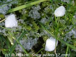 19th: Showers of snow pellets just before and around 09 GMT under cumulus clouds. Fresh snow had fallen on the Snowdonia Mountains around 850 ft with sprinklings low in the Passes. Pressure 1023 mb was rising with the low 1039 mb still W of Ireland and low 995 mb over Scandinavia giving us a N'ly showery flow of air. After the showers the morning was mostly sunny but the afternoon was cloudier and windier. By evening the showers returned; there were several slight showers of 7 mm diameter snow pellets and a little snow at 2120 GMT. The night was mostly cloudy with no further precipitation. [Rain 0.7 mm; Max 6.4C; Min 1.8C; Grass 0.8C]
![]() 20th: A few clear spells overnight allowed a touch of ground frost (-0.6C) despite the wind. The day started bright with some well-developed cumulus clouds in the vicinity and over the mountains where they some were towering. The cloudbase was just touching the summits of the Carneddau where snow was lying at 2000 ft (about 1500 ft at the top of the Nant Ffrancon Pass). Pressure 1023 was unchanged with the cold N/NE'ly polar airflow continuing. The day was mostly sunny with the cold wind persisting through the afternoon. Taking advantage of the drier weather some work in the garden was able to be done, there was plenty to do. Some clouds around at times, but showers kept away with North Wales protected by the Cumbrian Mountains. Showers (snow) were confined mainly to the east coasts of Scotland and England, the Midlands and Irish Sea to off Lands End. The night was partially cloudy. [Rain 0.0 mm; Max 4.0C; Min 0.8C; Grass -0.6C]
20th: A few clear spells overnight allowed a touch of ground frost (-0.6C) despite the wind. The day started bright with some well-developed cumulus clouds in the vicinity and over the mountains where they some were towering. The cloudbase was just touching the summits of the Carneddau where snow was lying at 2000 ft (about 1500 ft at the top of the Nant Ffrancon Pass). Pressure 1023 was unchanged with the cold N/NE'ly polar airflow continuing. The day was mostly sunny with the cold wind persisting through the afternoon. Taking advantage of the drier weather some work in the garden was able to be done, there was plenty to do. Some clouds around at times, but showers kept away with North Wales protected by the Cumbrian Mountains. Showers (snow) were confined mainly to the east coasts of Scotland and England, the Midlands and Irish Sea to off Lands End. The night was partially cloudy. [Rain 0.0 mm; Max 4.0C; Min 0.8C; Grass -0.6C]
![]()
![]() 21st: A slight ground frost overnight (-1.0C) but no sign of any frost the grass being dry. Relative humidity was 77% and has been mostly below 80% for the past 60 hours. Pressure 1015 mb had fallen a little with high 1035 mb W of Ireland lying a bit further N. A wavy front was lying over Ireland with shallow low 1016 mb near Malin Head; we were on the edge of a large area of precipitation to the W (see radar image, also shows the east coast showers very well). It was overcast and by 0945 GMT there was a shower of snow followed by small snow pellets 10 minutes later (usually the snow pellets are a precursor to snow). These wintry showers produce very little water when melted in the raingauge. After another flurry of snow the sky began to clear and there were some good sunny spells through the day. Snow showers were mostly confined to the east and central parts of Britain few if any penetrating to North Wales . A ladybird was spotted on a foxglove plant in the garden. The night was mostly cloudy with one or two clearer spells. [Rain 0.2 mm; Max 4.4C; Min 1.3C; Grass -1.0C]
21st: A slight ground frost overnight (-1.0C) but no sign of any frost the grass being dry. Relative humidity was 77% and has been mostly below 80% for the past 60 hours. Pressure 1015 mb had fallen a little with high 1035 mb W of Ireland lying a bit further N. A wavy front was lying over Ireland with shallow low 1016 mb near Malin Head; we were on the edge of a large area of precipitation to the W (see radar image, also shows the east coast showers very well). It was overcast and by 0945 GMT there was a shower of snow followed by small snow pellets 10 minutes later (usually the snow pellets are a precursor to snow). These wintry showers produce very little water when melted in the raingauge. After another flurry of snow the sky began to clear and there were some good sunny spells through the day. Snow showers were mostly confined to the east and central parts of Britain few if any penetrating to North Wales . A ladybird was spotted on a foxglove plant in the garden. The night was mostly cloudy with one or two clearer spells. [Rain 0.2 mm; Max 4.4C; Min 1.3C; Grass -1.0C]
22nd: A line of wintry showers crossed North Wales just before dawn. There was a slight shower of snow pellets and snow here about 0630 GMT but by 09 GMT it was brighter with a little sunshine breaking through. The force 5 ENE'ly wind felt cold (2.6C) and the grass minimum showed -1.6C, but with no airfrost here it is not yet a 'pipe cracking' easterly. Pressure here 1021 mb had risen a little with the high 1035 mb moved N to near Iceland; another high 1045 mb had developed over N Scandinavia. Low 994 mb was N Iberia (S Bay of Biscay). The morning kept mostly cloudy and there was a slight shower (mixture of snow pellets and small snow flakes) around 13 GMT. The afternoon was brighter with a few sunny spells; the evening was partly cloudy. [Rain 1.1 mm; Max 5.0C; Min 1.1C; Grass -1.6C]
![]()
![]() 23rd: Frequent showers of snow pellets and flurries of snow after midnight; the slight to moderate falls whitening the ground by daybreak. At 09 GMT there was another fall of snow pellets almost covering the ground; cold surfaces (concrete and flat roofs were 100% covered). The pellets, conical shaped 3-4 mm diameter, were dry and crunchy underfoot. A litre of snow pellets when melted produced 167 mls of water (167 kg m-3). Pressure 1020 mb was steady with the NE'ly flow of air well established across the UK giving wintry weather almost everywhere (but more so in the E where there have been 5 to 10 cm falls of snow in places). Complex low-pressure lies to the SE over Europe where there have been further snowfalls. The morning here was bright between the well-developed cumulus and cumulonimbus clouds; the wintry showers continuing. Ice precipitation was building up above 1000 ft on the Snowdonia Mountains with sprinklings slow to melt at lower levels. The afternoon had some sunny spells, and just a few pellets or small snow flakes from time to time. The night before midnight was mostly cloudy with minimal precipitation. [Rain 1.2 mm; Max 4.5C; Min 0.3C; Grass -2.2C]
23rd: Frequent showers of snow pellets and flurries of snow after midnight; the slight to moderate falls whitening the ground by daybreak. At 09 GMT there was another fall of snow pellets almost covering the ground; cold surfaces (concrete and flat roofs were 100% covered). The pellets, conical shaped 3-4 mm diameter, were dry and crunchy underfoot. A litre of snow pellets when melted produced 167 mls of water (167 kg m-3). Pressure 1020 mb was steady with the NE'ly flow of air well established across the UK giving wintry weather almost everywhere (but more so in the E where there have been 5 to 10 cm falls of snow in places). Complex low-pressure lies to the SE over Europe where there have been further snowfalls. The morning here was bright between the well-developed cumulus and cumulonimbus clouds; the wintry showers continuing. Ice precipitation was building up above 1000 ft on the Snowdonia Mountains with sprinklings slow to melt at lower levels. The afternoon had some sunny spells, and just a few pellets or small snow flakes from time to time. The night before midnight was mostly cloudy with minimal precipitation. [Rain 1.2 mm; Max 4.5C; Min 0.3C; Grass -2.2C]
![]()
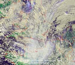 24th: Ice precipitation after midnight; a moderate shower of snow pellets after midnight then light snow from about 01 GMT. This left the ground slightly covered, but it had disappeared by dawn as the temperature rose from the minimum of 0.2C to 2.2C at 09 GMT. The temperature of the soil at 5 cm depth was 2.0C, high enough to thaw the snow. On higher ground than here at 400 ft, where it is a just little colder, snow was lying and continued to accumulate through the morning. In the fresh to strong NNE'ly wind conditions on the Snowdonia Mountains were blizzard-like at times. At Corwen 8 cm of snow was reported to have fallen overnight. On the Pennines, that have been largely protecting North Wales, accumulations have been 5 to 10 cm, but 30 cm has been reported. Pressure 1021 mb was hardly changed, but complex lows and snow-bearing frontal cloud was over Kent bringing more snow into the Midlands during the morning. Here the temperature rose to 2.7C at noon and 3.6C during the afternoon. This was the coldest day of the month but precipitation was mainly of sleet. (NOAA 16 satellite image: shows the slow-moving low 1009 mb with comma-shaped cloud over the English Channel and occluded front stretching into the North Sea. While over Wales, Cumbria and the Irish Sea there are extensive orographic wave clouds). There was further slight precipitation falling as rain, or sleet over Anglesey and the Lleyn Peninsular but above about 500 ft it was wet snow. Amounts of precipitation, when melted, were small being within the 'snow-shadow'. Although it was snowing most of the day across the mountains in the 24-h to 06 GMT Capel Curig had only 2.4 mm. {Copley 18.7 mm with 28 cm lying snow, Buxton 14.0 mm} [Rain 0.2 mm; Max 3.6C; Min 0.2C; Grass -1.0C]
![]()
![]() 25th: Although there was clear spells in the night the air temperature kept above freezing. There was another ground frost -1.5C but no frost was seen on the almost dry grass. At 09 GMT pressure was 1023 mb with the low 1008 mb now in the Bay of Biscay. The swirl of frontal cloud was stretching across Ireland to the Scottish borders. We were in a clearer slot and although visibility was poor in moderate haze there was some sunshine at first. The wind was still ENE'ly but had moderated overnight and was force 3. The morning was turned cloudy for a while but then there was clear sky and sunshine. (Satellite image: shows the comma delineated convective low over the Bay of Biscay and frontal cloud affecting W France. Orographic clouds were again over Wales with frontal cloud, part of the same system, encroaching from the NE). By mid-afternoon (15 GMT) it was overcast with sleet or intermittent slight rain, with a few ice pellets, lasting into the evening but dying out before midnight. [Rain 0.3 mm; Max 5.3C; Min 1.1C; Grass -1.5C]
25th: Although there was clear spells in the night the air temperature kept above freezing. There was another ground frost -1.5C but no frost was seen on the almost dry grass. At 09 GMT pressure was 1023 mb with the low 1008 mb now in the Bay of Biscay. The swirl of frontal cloud was stretching across Ireland to the Scottish borders. We were in a clearer slot and although visibility was poor in moderate haze there was some sunshine at first. The wind was still ENE'ly but had moderated overnight and was force 3. The morning was turned cloudy for a while but then there was clear sky and sunshine. (Satellite image: shows the comma delineated convective low over the Bay of Biscay and frontal cloud affecting W France. Orographic clouds were again over Wales with frontal cloud, part of the same system, encroaching from the NE). By mid-afternoon (15 GMT) it was overcast with sleet or intermittent slight rain, with a few ice pellets, lasting into the evening but dying out before midnight. [Rain 0.3 mm; Max 5.3C; Min 1.1C; Grass -1.5C]
26th: An overcast and frost-free night; the wind backed a little towards the N, but still within the NE'ly sector at 09 GMT, had strengthened to force 5. The first morning in the past week that the dewpoint (1.4C) has been above freezing point. Pressure on 1023 mb was unchanged with high 1043 mb over Greenland with ridge S of Iceland dominating the weather. The frontal cloud over Wales was moving slowly S while other weak fronts were over Scotland. The morning kept overcast but dry with the wind moderating. The afternoon was bright with some sunny spells with the temperature rising to a maximum of 6.3C. The night was mostly cloudy. [Rain 0.0 mm; Max 6.3C; Min 2.3C; Grass 0.8C]
![]()
 27th: One or 2 clearer spells overnight with a ground frost -1.3C, but no sign of any white frost on the dry grass in a fairly dry (RH 80%, dewpoint 1.1C) force 4 NE'ly wind. The sky overhead was partially clearing with altocumulus dominant but a band of stratocumulus was over the Snowdonia Mountains. The freezing level was about 1000 ft, near the average snowline. Pressure 1030 mb had risen as high 1040 mb S of Iceland extended a ridge towards Scotland and S Norway. Pressure continues low 992 mb over the Mediterranean where is is unsettled; further snowfalls have occurred widely from Germany to Bulgaria. In Britain some lowish temperatures overnight in England, but little in the way of any snow. The morning on Anglesey was mostly cloudy but by noon the sky had started to clear giving a sunny afternoon.
With the clearance of cloud there were some spectacular views across the Menai Strait of the snow-capped Snowdonia Mountains; the snow and sun angle revealing interesting topographic features. The evening was clear and calm; the temperature fell quickly on the grass to -5.0C and -0.9C in the air. Deposition of frost by midnight, however, was minimal. [Rain 0.3 mm; Max 6.9C; Min 1.4C; Grass -1.3C]
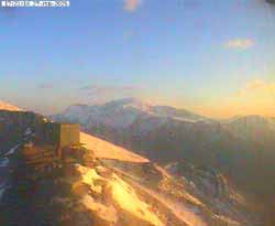
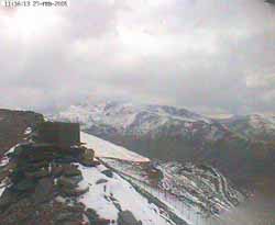 28th: By 04 GMT cloud had encroached and, as a band of precipitation moved across from the NW, there was a moderate fall of small snow pellets that left a thin covering on cold surfaces (0.5 cm on the roof of my car). Around the coast and at lower levels it was drizzle or light rain. At 09 GMT the temperature had risen to 1.7C (dewpoint -0.2C) and the wind was a light W'ly. Pressure 1026 mb had fallen although their was a ridge of high-pressure 1031 mb SW England. Low 1008 mb was in the Norwegian Sea with associated fronts over Scotland. The morning was overcast but kept dry until about 1330 GMT when another band of precipitation moved across, this time sleet or small snow flakes before turning to rain. There was more rain, moderate at times, from 0115 to 0500 GMT associated with a passing cold front. [Rain 6.2 mm; Max 5.9C; Min -0.9C; Grass -5.0C]
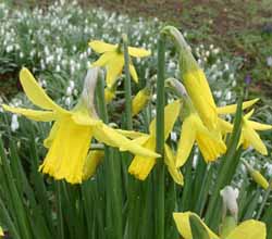 1st: St. David's Day dawned bright, in a clearer and colder slot, after the passing of the cold front that brought
moderate rain in the night that fell as snow on the Snowdonia Mountains. The hailometer showed the impression of some ice pellets. Pressure had just bottomed and was showing sign of rising at 1004 mb. The low 1000 mb was over the Pennines at 06 GMT with fronts heading S. The day was mostly sunny until mid-afternoon when there were frequent showers of snow pellets. At 1635 GMT there was a shower of large-flaked (2-3 cm) wet snow; it did not settle here but did on the mountains. The day was coldest between 1900 and 2100 GMT when the air temperature was 0.0C. There was further snow and snow pellets about 2045 GMT. [Rain 0.7 mm; Max 7.8C; Min 1.2C; Grass -1.5C]
![]() 2nd: A bright start to the day with cloud clearing across Anglesey. Across the Strait under a bank of stratocumulus
cloud the mountains were white with snow down to 600 ft. Snow continued to accumulate above 1500 ft where there are thicker deposits
in freezing temperatures. Pressure 1004 mb was rising with the low 998 mb over East Anglia. Frontal cloud was lying over SE
England and N France giving spells of snow (25 cm was reported on the South Downs, but mostly 5 to 10 cm elsewhere). The morning was sunny in the cool fresh (f5) E'ly wind. Just as windy in the afternoon but convective clouds, driven in off Liverpool
Bay, brought frequent showers of snow pellets. The maximum temperature of 5.3C was lowest of the month. [Rain 0.2 mm; Max 5.3C; Min 0.0C; Grass -2.7C]
2nd: A bright start to the day with cloud clearing across Anglesey. Across the Strait under a bank of stratocumulus
cloud the mountains were white with snow down to 600 ft. Snow continued to accumulate above 1500 ft where there are thicker deposits
in freezing temperatures. Pressure 1004 mb was rising with the low 998 mb over East Anglia. Frontal cloud was lying over SE
England and N France giving spells of snow (25 cm was reported on the South Downs, but mostly 5 to 10 cm elsewhere). The morning was sunny in the cool fresh (f5) E'ly wind. Just as windy in the afternoon but convective clouds, driven in off Liverpool
Bay, brought frequent showers of snow pellets. The maximum temperature of 5.3C was lowest of the month. [Rain 0.2 mm; Max 5.3C; Min 0.0C; Grass -2.7C]
![]() 3rd: Awakened at 0445 GMT by shower of large snow pellets making a noise on the roof. They were conical-shaped and 9 mm in diameter and sparsely covered the ground but produced little in the way of meltwater. Convective cumulus clouds were around at 09 GMT but there were no more showers. Pressure was steady on 1020 mb after rising through the night as frontal-low 1001 mb made it's way into France.
3rd: Awakened at 0445 GMT by shower of large snow pellets making a noise on the roof. They were conical-shaped and 9 mm in diameter and sparsely covered the ground but produced little in the way of meltwater. Convective cumulus clouds were around at 09 GMT but there were no more showers. Pressure was steady on 1020 mb after rising through the night as frontal-low 1001 mb made it's way into France. 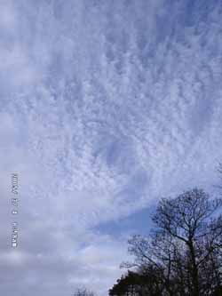 High 1034 mb was more or less anchored to the W; the result was the continuing moderate to fresh N/NE'ly showery airflow
across Britain. The snowfall in SE England caused severe disruption on the roads; over 400 schools were closed in Kent. Here the
day was bright with sunny spells with a maximum temperature of 5.5C. Clear at first after dark with the air temperature
falling to 0.6C and -2.7C on the grass. The encroach of warm frontal cloud before midnight, associated with low 988 mb over
the Norwegian Sea, saw the temperature begin to rise. [Rain 6.0 mm; Max 5.6C; Min 0.3C; Grass -1.8C]
![]()
![]()
![]() 4th: A band of rain arrived at 0130 GMT and was moderate for a while before clearing away by 0315 GMT. The temperature rose to 5.6C, the maximum for the 3rd (09-09 GMT). There were showers at 0630 and 0830 GMT the latter including small ice pellets. This was associated with the following cold front, there was a 2C fall in temperature during the precipitation. At 09 GMT the sky was clearing; a complex of altocumulus, cirrus clouds and contrails passing quickly overhead. The N'ly wind on the surface here had dropped away almost to calm, but soon strengthened during the morning to force 4. Pressure was 1014 mb with high 1035 mb W of Ireland and the low 988 mb Norwegian Sea little changed. (The jet stream is currently bringing air from the coast off Labrador over Greenland and Iceland to Britain. The morning was bright and sunny, but visibility was moderate to poor towards the mountains. In the afternoon it was mostly cloudy but visibility improved to good. There was a slight shower of ice pellets and sleet about 1335 GMT and a heavier one of 4 mm ice pellets at 1825 GMT. Showers petered out after more small ice pellets just before midnight. [Rain 0.4 mm; Max 8.5C; Min 0.6C; Grass -2.7C]
4th: A band of rain arrived at 0130 GMT and was moderate for a while before clearing away by 0315 GMT. The temperature rose to 5.6C, the maximum for the 3rd (09-09 GMT). There were showers at 0630 and 0830 GMT the latter including small ice pellets. This was associated with the following cold front, there was a 2C fall in temperature during the precipitation. At 09 GMT the sky was clearing; a complex of altocumulus, cirrus clouds and contrails passing quickly overhead. The N'ly wind on the surface here had dropped away almost to calm, but soon strengthened during the morning to force 4. Pressure was 1014 mb with high 1035 mb W of Ireland and the low 988 mb Norwegian Sea little changed. (The jet stream is currently bringing air from the coast off Labrador over Greenland and Iceland to Britain. The morning was bright and sunny, but visibility was moderate to poor towards the mountains. In the afternoon it was mostly cloudy but visibility improved to good. There was a slight shower of ice pellets and sleet about 1335 GMT and a heavier one of 4 mm ice pellets at 1825 GMT. Showers petered out after more small ice pellets just before midnight. [Rain 0.4 mm; Max 8.5C; Min 0.6C; Grass -2.7C]
5th: A clearing sky and sunny before 09 GMT (2 oktas). The N'ly wind was force 5 and in a temperature of 4.1C the relative humidity was 70% (dewpoint -0.8C) so it was a drying wind. The grass had dried and although there had been a slight ground frost (-0.4C) no frost was seen. Pressure was 1016 mb with the anchored high 1034 mb W of Ireland. Shallow low 1003 mb and frontal cloud was lying over the North Sea. The morning was mostly sunny although a little cloudier. The wind strengthened
to force 6 in the afternoon that had alternating bands of cloud and clear sunshine. A narrow band of precipitation
moved across Wales from the NE giving a shower of ice pellets here at 1745 GMT. Later the sky cleared and the wind moderated. [Rain 0.1 mm; Max 7.5C; Min 2.3C; Grass -0.4C]
![]()
![]() 6th: Clear and almost calm overnight with frost. The air temperature fell to -2.1C after dawn, the lowest
of month and the winter. The grass minimum at -6.2C also was the lowest; the soil surface was frozen, a rare event these days. There was some whiteness on the grass composed of frozen dew drops and a slight deposition of hoar frost. The sun was up over the mountains by 0705 GMT and was soon melting the frost. At 09 GMT the temperature was 0.8C with dewpoint of -4.2C (RH 69%). Pressure 1032 mb was rising as the high 1033 mb to the W extended its influence over Ireland, Wales and Scotland. The morning was sunny with a light NE'ly wind; visibility was good but there was moderate smoke (pollution) haze. The day was sunny although some cirrus clouds encroached from noon. (NOAA AQUA satellite images: 1: the visible spectrum shows snow on all the high Cambrian Mountains of Wales including Snowdonia and Cader Idris in the N, Plynlimon Range, Black Mountain and Brecon Beacons in the S. It also shows cirrus cloud, smoke (pollution) haze and convective clouds. 2: This image uses channel 7-2-1 to pick out the snow (blue) and clear the haze and much of the cirrus cloud. Snow can also be seen on the Wicklow Mountains in Ireland, the Peak District and Pennines of Northern England, and elsewhere.). The day's maximum was 5.9C giving a mean of 1.9C, the lowest of the month. The sun set around 1640 GMT giving 9 h 35 min of sunshine; it was the brightest day here so far this year (solar radiation 15.1 mv h) although RAF Valley reported only 8.0 h sunshine
being affected by cloud in the afternoon. The night was clear at first with a slight airfrost and ground frost -4.4C. [Rain 0.2 mm; Max 6.0C; Min -2.1C; Grass -6.2C]
6th: Clear and almost calm overnight with frost. The air temperature fell to -2.1C after dawn, the lowest
of month and the winter. The grass minimum at -6.2C also was the lowest; the soil surface was frozen, a rare event these days. There was some whiteness on the grass composed of frozen dew drops and a slight deposition of hoar frost. The sun was up over the mountains by 0705 GMT and was soon melting the frost. At 09 GMT the temperature was 0.8C with dewpoint of -4.2C (RH 69%). Pressure 1032 mb was rising as the high 1033 mb to the W extended its influence over Ireland, Wales and Scotland. The morning was sunny with a light NE'ly wind; visibility was good but there was moderate smoke (pollution) haze. The day was sunny although some cirrus clouds encroached from noon. (NOAA AQUA satellite images: 1: the visible spectrum shows snow on all the high Cambrian Mountains of Wales including Snowdonia and Cader Idris in the N, Plynlimon Range, Black Mountain and Brecon Beacons in the S. It also shows cirrus cloud, smoke (pollution) haze and convective clouds. 2: This image uses channel 7-2-1 to pick out the snow (blue) and clear the haze and much of the cirrus cloud. Snow can also be seen on the Wicklow Mountains in Ireland, the Peak District and Pennines of Northern England, and elsewhere.). The day's maximum was 5.9C giving a mean of 1.9C, the lowest of the month. The sun set around 1640 GMT giving 9 h 35 min of sunshine; it was the brightest day here so far this year (solar radiation 15.1 mv h) although RAF Valley reported only 8.0 h sunshine
being affected by cloud in the afternoon. The night was clear at first with a slight airfrost and ground frost -4.4C. [Rain 0.2 mm; Max 6.0C; Min -2.1C; Grass -6.2C]
7th: Cloud encroached from the N near midnight and brought slight showers of rain by morning. Pressure at 0900 GMT was unchanged on 1032 mb with the high-pressure area centred just to the W. The cloud was breaking up and the morning was bright but showers were lingering in places. There was a strong chorus of birdsong this morning. Mistle thrushes have been singing
for a while but not yet the blackbirds. There is a flock of about 10-12 male blackbirds in the vicinity of the weather station
on most days. We see at least 8 in the garden most mornings at feeding time (after the obs at 09 GMT) but only 2 females.
Today I saw 10 males feeding along side the drive, a female appeared but was continually driven off. Obviously they are
only interested in food at the moment! In the garden raspberry buds have started to unfold. The afternoon and evening were
overcast in S Anglesey, but it kept dry. [Rain 0.1 mm; Max 8.6C; Min -0.1C; Grass -4.4C]
8th: A mild and mostly dry night, no frosts, with a little light rain around 0530 GMT enough to leave concrete damp at
09 GMT. It was still overcast with stratocumulus cloud but visibility was good. There was a little more fresh snow on the mountains
above 2000 ft adding to that still there from previous falls. Pressure was still 1032 mb with high 1037 mb just to the NW
of Ireland and low 994 mb E Baltic. The day was rather dull, as the stratocumulus cloud persisted,with a light N'ly breeze.
Further N there was a hole in the cloud sheet. The first flowers of blackthorn have appeared. The evening was cloudy
at first then cleared for a while around 22 GMT. [Rain 0.0 mm; Max 8.1C; Min 4.5C; Grass 3.2C]
![]()
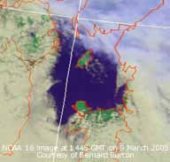 9th: Further cloud cleared after dawn giving a touch of ground frost (-1.0C) and silver frost. (Photograph shows: frozen supercooled water droplets. The air temperature kept up all night (air minimum 2.5C) under cloud, the water droplets were mostly guttation (drops exuded at the tips of the grass leaves (laminae) and along the edges rather than condensation dew. There was light dew deposition as well; micro-lysimeters had a mean net increase of 0.04 mm between 2200 and 0900 GMT, a heavy dew would be at least 10x more, 0.4 mm would not be unusual). At 09 GMT clouds, mostly cumulus, had reappeared and were being blown along on the light N'ly wind. But it was bright and sunny with a temperature of 5.2C. Pressure had risen 1035 mb with the high 1039 mb lying to the NW. The day was mostly sunny; bees were seen for the first time this year on Erica flowers on a sheltered rockery bank in the garden. The temperature in the Stevenson screen was 9.4C, but the bees had chosen the warmest place on the bank. Usually I see them when its sunny and 10C, or more. There were 2 large and 3 or 4 small bumblebees as well as lots of honeybees. Pipistrelle bats were heard paying an unusually early visit to their maternity roost in the house. They usually do not winter there but some could have this year; none have been seen flying yet although a larger brown long-eared bat has been out. The sticky buds on horse-chestnut have started to burst and some were looking quite yellow. Soon after dark frontal cloud encroached from the N and there was a little rain before midnight. (Satellite image: shows the hole in the cloud that gave the Irish Sea a sunny day. Stratocumulus cloud in the S and the frontal cloud in the N that would drift S in the night). {Isle of Man 8.6h, Prestatyn 7.3h, Valley 3.4 h} [Rain 0.2 mm; Max C; Min 2.5C; Grass -1.0C]
10th: As a complex frontal system drifted S in the high pressure there was further drizzle or slight rain at times up
to 09 GMT, but the amount of precipitation was small. Visibility was still poor in the misty low cloud. It had been a milder
night with no frost; the temperature was 6.7C. Pressure 1031 mb had fallen a little with high-pressure 1037 mb to the NW
and 1032 mb to the SE. The cloud soon began to break up, the morning brightened with some sunshine by 11 GMT, but then closed again giving an overcast afternoon. The night was cloudy, mild and dry. [Rain trace; Max 8.5C; Min 3.3C; Grass 0.8C]
![]()
![]() 11th: A band of frontal cloud moving down from the N, associated with complex low-pressure (980 mb) Norwegian Sea
and S Norway, brought showery light rain around 09 GMT. Pressure 1018 mb had fallen with the decline of high to the W (1030 mb). (Weather chart: shows strong winds on the Irish Sea and North Sea, the still low temperatures stretching from Finland to almost the Black Sea and snow falling on Sweden. After a brighter spell the morning became mostly cloudy with a fresh W'ly wind. Another band of cloud brought light rain from 1500 GMT and at 1810 GMT there was heavier rain and ice pellets associated with the weak cold front. Later the sky cleared. [Rain 2.9 mm; Max 8.5C; Min 5.6C; Grass 5.2C]
11th: A band of frontal cloud moving down from the N, associated with complex low-pressure (980 mb) Norwegian Sea
and S Norway, brought showery light rain around 09 GMT. Pressure 1018 mb had fallen with the decline of high to the W (1030 mb). (Weather chart: shows strong winds on the Irish Sea and North Sea, the still low temperatures stretching from Finland to almost the Black Sea and snow falling on Sweden. After a brighter spell the morning became mostly cloudy with a fresh W'ly wind. Another band of cloud brought light rain from 1500 GMT and at 1810 GMT there was heavier rain and ice pellets associated with the weak cold front. Later the sky cleared. [Rain 2.9 mm; Max 8.5C; Min 5.6C; Grass 5.2C]
12th: There was a ground frost (-1.5C) with the air temperature keeping just above freezing (0.6C) before the next batch of precipitation arrived about 0230 GMT. Again rain and some ice pellets here but a little snow falling on the Snowdonia Mountains. Before 09 GMT there were well-developed cumulus clouds with showers in the vicinity and over the mountains. Pressure was 1012 mb with low 983 mb over Denmark. There was a strong flow of air from the arctic bringing the wintry showers. Snow and strong winds in the far N of Scotland brought blizzard-like conditions in places. The high so long anchored off W Ireland had collapsed and, with its blocking effect removed, gives Atlantic-lows the chance to cross the UK once more. The morning was bright with a little sunshine between the passing clouds. Showers in the vicinity during the afternoon (slight fall of snow pellets) and snow showers seen crossing the Carneddau Mountains. Showers continued in the evening before dying out giving longer clear spells. [Rain trace; Max 8.3C; Min 0.6C; Grass -1.5C]
![]() 13th: Clear spell and lessening wind overnight with touch of airfrost (-0.5C) and moderate ground frost (-3.2C).
Slight frozen water deposits on the grass had melted well before 09 GMT when there was a slight shower of rain. With low 990
mb Norwegian Sea pressure 1012 mb was steady within a weak ridge of high-pressure. Low 974 mb was off Newfoundland and SE of Greenland. The morning was mostly cloudy with cumulus clouds in the vicinity and light snow showers over the Snowdonia Mountains. There was a shower of small snow pellets at 1040 GMT. With further snow showers on the mountains during the afternoon there were sprinklings of fresh snow above 1500 ft. In late afternoon sunshine the northern slopes of Snowdon looked particularly white, with the railway track completely covered with snow. The night was partially cloudy with showers soon dying out. Temperatures over the past 13 days have been below average. The mean 4.5C [(-2.3 for March 10-y and 30-y)]. Soil at 30 cm 5.5C (-1.7) and rainfall only 10.8 mm (17%) and [13%] of average. [Rain trace; Max 6.8C; Min -0.5C; Grass -3.2C]
13th: Clear spell and lessening wind overnight with touch of airfrost (-0.5C) and moderate ground frost (-3.2C).
Slight frozen water deposits on the grass had melted well before 09 GMT when there was a slight shower of rain. With low 990
mb Norwegian Sea pressure 1012 mb was steady within a weak ridge of high-pressure. Low 974 mb was off Newfoundland and SE of Greenland. The morning was mostly cloudy with cumulus clouds in the vicinity and light snow showers over the Snowdonia Mountains. There was a shower of small snow pellets at 1040 GMT. With further snow showers on the mountains during the afternoon there were sprinklings of fresh snow above 1500 ft. In late afternoon sunshine the northern slopes of Snowdon looked particularly white, with the railway track completely covered with snow. The night was partially cloudy with showers soon dying out. Temperatures over the past 13 days have been below average. The mean 4.5C [(-2.3 for March 10-y and 30-y)]. Soil at 30 cm 5.5C (-1.7) and rainfall only 10.8 mm (17%) and [13%] of average. [Rain trace; Max 6.8C; Min -0.5C; Grass -3.2C]
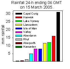
![]() 14th: It was a bright start to the morning with cumulus and cirrostratus cloud. There was a halo phenomenon (2 weak
sundogs) soon after 09 GMT with the sun low in the SE shining through the thin cirrostratus. Pressure 1008 mb had fallen with
low 986 mb over the N North Sea. But with pressure falling in the Atlantic (low 969 mb to the W) fronts already over Ireland
had brought rain. The morning soon clouded over with thicker cloud and, with the S'ly wind strengthening to force 6 to 7,
there were light showers by 1100 GMT. By noon the rain was intermittent turning continuous and moderately heavy later. (NOAA 6 satellite image: shows the mass of cloud over Ireland, the Irish Sea and North Wales that brought the rain. Also the cloud spiral of the low close to S Norway. There is snow on the Alps and Pyrenees.). By 1800 GMT 6.6 mm had fallen, it was back to water in puddles around the station and adjacent fields, and continued until 2030 GMT accumulating 11.5 mm. I did not manage to finish all the jobs around the garden I had planned
to do while it was dry! [Rain 11.5 mm; Max 8.6C; Min 1.4C; Grass -1.6C]
14th: It was a bright start to the morning with cumulus and cirrostratus cloud. There was a halo phenomenon (2 weak
sundogs) soon after 09 GMT with the sun low in the SE shining through the thin cirrostratus. Pressure 1008 mb had fallen with
low 986 mb over the N North Sea. But with pressure falling in the Atlantic (low 969 mb to the W) fronts already over Ireland
had brought rain. The morning soon clouded over with thicker cloud and, with the S'ly wind strengthening to force 6 to 7,
there were light showers by 1100 GMT. By noon the rain was intermittent turning continuous and moderately heavy later. (NOAA 6 satellite image: shows the mass of cloud over Ireland, the Irish Sea and North Wales that brought the rain. Also the cloud spiral of the low close to S Norway. There is snow on the Alps and Pyrenees.). By 1800 GMT 6.6 mm had fallen, it was back to water in puddles around the station and adjacent fields, and continued until 2030 GMT accumulating 11.5 mm. I did not manage to finish all the jobs around the garden I had planned
to do while it was dry! [Rain 11.5 mm; Max 8.6C; Min 1.4C; Grass -1.6C]
15th: The temperature was highest 8.6C, in the introduced warmer air, around 03 GMT. (The minima were on the 14th at 09 GMT). At 09 GMT pressure was 1007 mb with Atlantic-low 957 mb to the W and fronts crossing the UK. The SSW'ly wind was force 6 and the cloud was low over the mountains giving fog on the mid-level slopes. A few remnant patches of snow were seen under the cloud at 2500 ft. The temperature was 8.4C and was the minimum over the next 24-h. After a few spots of rain the morning continued overcast but dry. By noon there was a little showery rain. Keeping overcast and windy, with slowly rising temperature, there were further spots from time to time through the day. It was the dullest day (solar radiation 2.4 mv h) since 21 February (2.1 mv h). [Capel Curig 31 mm 06-06 GMT] [Rain 1.3 mm; Max 10.1C; Min 5.5C; Grass 4.8C]
16th: Dull, very poor visibility with near horizontal rain in the force 7 SSW'ly wind at 09 GMT. Pressure 1008 mb
had risen a little with complex low-pressure to the W but high-pressure was building (1033 mb) over S Europe. The temperature 10.1C was the maximum over the past 24-h. The wind and rain eased during the morning that kept overcast and late in the afternoon it was briefly bright with a glimpse of sunshine raising the temperature to 10.8C. The cloud closed in again later and it
continued windy being strong to gale force 8. Spring-like temperatures occurred elsewhere especially in the S and E, but
it was wet in the Isle of Skye. {Gravesend (Kent) 19.6C, Leuchars (Scotland) 17C, Prestatyn 15C; rainfall Lusa (Skye) 50.6 mm,
Capel Curig 39.6 mm} [Rain 1.3 mm; Max 10.8C; Min 8.4C; Grass 7.8C]
![]()
![]()
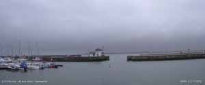 17th: Strong to gale-force S'ly wind again before dawn; thick fog in the low stratiform cloud enveloping the island at 09 GMT. Pressure was 1018 mb with high S Europe 1034 mb. Complex low-pressure to the N continued to bring frontal cloud across from the W. (The jet stream is currently established in a W'ly flow across the UK).
The morning here was foggy (100 - 200 m) with light drizzle on the wind in a temperature of 9.4C, 100% humidity. Over Bangor
there was a partial clearance and a patch of blue sky at 1130 GMT and it was occasionally bright elsewhere along the Menai
Strait and in Caernarfon. On Anglesey it was grey and gloomy all day in the coastal fog and low cloud. Despite this today's
temperatures were the highest of the month and the year so far! [Rain trace; Max 11.8C; Min 9.4C; Grass 9.2C]
18th: It was still grey sky but the cloudbase was higher and touching the tops of the Carneddau Mountains. There were
just a few snow patches to be seen remnants the accumulated falls earlier in the month. Pressure 1027 had risen a little
and the S'ly wind was force 4/5. Although the cloudbase was higher here low cloud, fog and drizzle were still affecting
the W coast of the island. Keeping cloudy here across the Menai Strait the mountains were in sunshine most of the day. During
the evening the sky cleared and the wind fell away, but there was fog by 22 GMT with a halo around the moon. [Rain 0.1 mm;
Max 11.8C; Min 8.7C; Grass 8.5C]
![]()
 19th: There was a heavy deposition of fog and dew on the grass by morning. In an almost clear sky it was sunny as
soon as the sun rose over the mountains, now much further E, at 0645 GMT. Pressure was 1025 mb with high 1027 mb central
England. With complex low-pressure to the W (967 mb S of Greenland and 978 mb W of Brittany) there was a S'ly flow of air from
all the way from North Africa. Dust storms have been prevalent for some weeks but the N'ly flow of air here has kept dust away.
Today there is a plume of dust W of Ireland giving a slightly milky look to the horizon. The morning was calm and sunny, but
there was inversion fog in the Menai Strait. By 1300 GMT the temperature had risen to 19.0C; a light air off the sea from
the NE prevented a further rise in the afternoon. Honeybees and large bumblebees were abundant on flowering Erica
plants in the garden as well as a small tortoiseshell butterfly, in perfect condition, aroused from hibernation by the warmth. Buds were bursting on the Black Hamburg grapevine, the one in the greenhouse - its not that warm yet! But with 18.2 mv h solar radiation it was the brightest day so far this year; it was sunny from 0745 to 1850 GMT (11.2 h). [Rain 0.0 mm; Max 19.0C; Min 4.2C; Grass 2.5C]
![]() 20th: Another sunny start, above the inversion fog that was again thick in the Menai Strait. The grass was
wet with dew (0.24 mm deposited overnight). The photograph looking S shows part of the 6/8th cover of cirrus and cirrostratus. The mountaintops were in the clear of haze and inversion fog. The temperature was 13.1C and it was calm; at Bangor Harbour it was 9C in fog rising to 14C at 1500 GMT. Pressure 1017 mb had fallen with twin Atlantic lows (997 and 979 mb) lying to the W. To the E high 1031 mb was centred near S Sweden/ Denmark with the slow S'ly airflow continuing. A warm sunny day and with a light Föhn-like SE'ly breeze in the afternoon the temperature rose to 23.0C, the highest temperature recorded in March at this station and on this date (20) in Britain . The previous highest was the 21.4C in Rickmansworth, Hertfordshire, in 1938. Some other stations in the area also saw some high temperatures. Treborth (Bangor) had a maximum of 22.2C and Aber (Gwynedd) 21.9C while Red Wharf Bay and RAF Valley had 20.1C and 20.3C respectively. One of the highest March temperatures in the area was 22.8C at Aber (former site) on the 11th in 1957. The highest British March temperature is 25.0C recorded in Cromer, Norfolk on the 29th in 1929 and elsewhere in 1965 and 1968. The daily mean was 15.2C, the highest of the month was also the highest recorded in March. After cooling to minima of 9.8C and 5.2C above the grass just before 2100 GMT the temperature rose to 13.4 C at midnight then to 13.8C over the subsequent 2h. Pipistrelle bats were seen flying at dusk, the first time we have seen them out this year. [Rain 0.0 mm; Max 23.0C; Min 7.3C; Grass 3.4C]
20th: Another sunny start, above the inversion fog that was again thick in the Menai Strait. The grass was
wet with dew (0.24 mm deposited overnight). The photograph looking S shows part of the 6/8th cover of cirrus and cirrostratus. The mountaintops were in the clear of haze and inversion fog. The temperature was 13.1C and it was calm; at Bangor Harbour it was 9C in fog rising to 14C at 1500 GMT. Pressure 1017 mb had fallen with twin Atlantic lows (997 and 979 mb) lying to the W. To the E high 1031 mb was centred near S Sweden/ Denmark with the slow S'ly airflow continuing. A warm sunny day and with a light Föhn-like SE'ly breeze in the afternoon the temperature rose to 23.0C, the highest temperature recorded in March at this station and on this date (20) in Britain . The previous highest was the 21.4C in Rickmansworth, Hertfordshire, in 1938. Some other stations in the area also saw some high temperatures. Treborth (Bangor) had a maximum of 22.2C and Aber (Gwynedd) 21.9C while Red Wharf Bay and RAF Valley had 20.1C and 20.3C respectively. One of the highest March temperatures in the area was 22.8C at Aber (former site) on the 11th in 1957. The highest British March temperature is 25.0C recorded in Cromer, Norfolk on the 29th in 1929 and elsewhere in 1965 and 1968. The daily mean was 15.2C, the highest of the month was also the highest recorded in March. After cooling to minima of 9.8C and 5.2C above the grass just before 2100 GMT the temperature rose to 13.4 C at midnight then to 13.8C over the subsequent 2h. Pipistrelle bats were seen flying at dusk, the first time we have seen them out this year. [Rain 0.0 mm; Max 23.0C; Min 7.3C; Grass 3.4C]
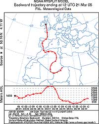
![]() ¤
21st: Overcast with a temperature of 13.0C at 09 GMT. Again calm but there was slight SE'ly intermittently during the morning. Pressure 1005 mb had continued to fall slowly with complex low-pressure in the Atlantic to the W. Warm frontal cloud was lying over Ireland and the Irish Sea and RAF Valley reported light rain at 08 GMT. Visibility was moderate to poor with thick dust haze. There was light rain from noon and it was washing out and depositing a very pale brown fine dust [Munsell colour chart 10YR 7.5/3]. Slight deposits continued intermittently through the afternoon until 18 GMT. Trajectory analysis, using the HYSPLIT model courtesy of the NOAA ARL website, indicated that this dust had been transported in the air from the vicinity of southern Algeria. Dust storms have been raging across much of northern Africa the past months. The MODIS AQUA satellite image shows dust being raised in the vicinity of southern Algeria, Mali and Niger borders on 14 March, close to the trajectory path. Until now the winds have carried the dust out into the Atlantic in a W'ly direction towards the Caribbean. The recent change in the weather pattern introduced a S'ly airflow that brought the dust to Anglesey. There was a little more rain around midnight but it did not wash out any more dust. [Rain 0.5 mm; Max 16.4C; Min 9.8C; Grass 5.2C]
¤
21st: Overcast with a temperature of 13.0C at 09 GMT. Again calm but there was slight SE'ly intermittently during the morning. Pressure 1005 mb had continued to fall slowly with complex low-pressure in the Atlantic to the W. Warm frontal cloud was lying over Ireland and the Irish Sea and RAF Valley reported light rain at 08 GMT. Visibility was moderate to poor with thick dust haze. There was light rain from noon and it was washing out and depositing a very pale brown fine dust [Munsell colour chart 10YR 7.5/3]. Slight deposits continued intermittently through the afternoon until 18 GMT. Trajectory analysis, using the HYSPLIT model courtesy of the NOAA ARL website, indicated that this dust had been transported in the air from the vicinity of southern Algeria. Dust storms have been raging across much of northern Africa the past months. The MODIS AQUA satellite image shows dust being raised in the vicinity of southern Algeria, Mali and Niger borders on 14 March, close to the trajectory path. Until now the winds have carried the dust out into the Atlantic in a W'ly direction towards the Caribbean. The recent change in the weather pattern introduced a S'ly airflow that brought the dust to Anglesey. There was a little more rain around midnight but it did not wash out any more dust. [Rain 0.5 mm; Max 16.4C; Min 9.8C; Grass 5.2C]
![]()
![]() 22nd: The overnight minimum 12.2C, highest of the month was the highest on record in March at this station. A dry start with a patch of blue sky to the W. Pressure had fallen to 995 mb as low 981 mb moving N off
the W coast of Ireland (Shannon at 06 GMT). The S'ly wind force 5 strengthened during the morning and there was a little showery
rain by noon but this soon cleared away. The afternoon was cloudy at first but it brightened later with a little sunshine. The
night was mostly cloudy too. More plants are appearing in flower, along hedgerow banks today there were dandelions, red campions, dog violets and on the hedge more blackthorn (sloe) flowers and a few leaves starting to unfold in one place. In the fields,
farmers taking advantage of the drier spell, have spread manure today were rolling the grass to encourage tillering. Other fields
have been ploughed and sown with barley but seed had not yet germinated. {Aultbea (Highland) 16.7; Hawarden 15.4C; Shap Fell
22.0 mm} [Rain 1.9 mm; Max 14.0C; Min 12.2C; Grass 10.8C]
22nd: The overnight minimum 12.2C, highest of the month was the highest on record in March at this station. A dry start with a patch of blue sky to the W. Pressure had fallen to 995 mb as low 981 mb moving N off
the W coast of Ireland (Shannon at 06 GMT). The S'ly wind force 5 strengthened during the morning and there was a little showery
rain by noon but this soon cleared away. The afternoon was cloudy at first but it brightened later with a little sunshine. The
night was mostly cloudy too. More plants are appearing in flower, along hedgerow banks today there were dandelions, red campions, dog violets and on the hedge more blackthorn (sloe) flowers and a few leaves starting to unfold in one place. In the fields,
farmers taking advantage of the drier spell, have spread manure today were rolling the grass to encourage tillering. Other fields
have been ploughed and sown with barley but seed had not yet germinated. {Aultbea (Highland) 16.7; Hawarden 15.4C; Shap Fell
22.0 mm} [Rain 1.9 mm; Max 14.0C; Min 12.2C; Grass 10.8C]
![]()
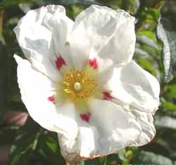 23rd: After a trough that gave showery rain from 01 GMT had passed through the morning was bright, but breezy, with the still S'ly wind force 4 to 5. Pressure 1010 mb was rising with the north-moving low now 972 mb S of Iceland. But other low-pressure centres remain circulating to the SW. Pressure is high 1027 over SE Europe and isobars are fairly close over the UK indicative of the S/SW'ly airflow. The day was mostly cloudy with some good sunshine at times. The first chiffchaff arrived and started singing at 1545 GMT after its long journey. Just about the usual day, last year it was late arriving on the 28th due to northerly headwinds. British and Irish birds migrate south of the Sahara Desert in the autumn, some are thought may overwinter as far as Senegal. This spring it has had an assisted passage on the S'lies from northern Africa, like the Saharan dust. The chiffchaff and dust often arrive together! As another low 987 mb past W Ireland frontal cloud was moving across the UK from the SW. Ahead of the occluded front was an active line of thundery showers. A group of thunderstorms affected SW England during the evening. As the line of showers went over here there was distant thunder at 2245 GMT (an isolated event), a heavy shower of large-dropped rain and a 3C fall in temperature soon after 2315 GMT. [Rain 3.1 mm; Max 15.7C; Min 9.4C; Grass 8.5C]
24th: A bright start with cumulus clouds being blown along on the moderate to fresh (f4/5) S'ly wind. Pressure was 1006 mb with pressure continuing low to the W and high to the E. During the morning the sky cleared and it was mostly sunny into the afternoon. I did not hear the chiffchaff sing today, he is probably feeding and resting after his long journey. Long
it may be, but the bar-tailed godwit, a migratory wader, seems to hold the record for the longest non-stop flight. Reported this week in the New Scientist (26 March 2005) ex The Condor, vol. 107, the bird clocks up am amazing 11,000 kilometres from Alaska to Australia, or New Zealand. Robert Gill, US Geological Survey in Alaska, reports that one species Limosa lapponica baueri appears to do the journey without stopping and with favourable winds in 6 days! Cloudier at night with a little rain around midnight, but there were clearer spells but mist and fog affected some of the coastline and low-lying areas.
{Hawarden 17.5C, Milford Haven 15.1 mm} [Rain 0.2 mm; Max 15.7C; Min 10.0C; Grass 8.4C]
25th: A cloudy but bright morning. At 09 GMT with chiffchaff singing the temperature was 10.7C. Visibility was moderate towards the mountains were low cloud and mist were obscuring the lower slopes. Pressure was 1015 mb with high 1021 mb over France. Low 970 mb was to the SW in mid-Atlantic. The morning was mostly cloudy but bright at times with a light SW'ly breeze. The stratiform cloud in St George's Channel and Irish Sea dispersed in the afternoon giving clear visibility and sunshine in SE Anglesey and eastern Snowdonia Mountains. The night was mostly clear. [Rain 0.0 mm; Max 16.5C; Min 8.8C; Grass 7.8C]
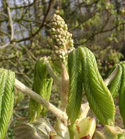 26th: Clear sky at dawn but it was cloudier by 09 GMT. There was moderate dew on the grass measured by lysimeter it was 0.4 mm. Pressure was 1012 mb with complex low-pressure to the S and W. Pressure was high to the N (Greenland 1023 mb)
and N Scandinavia 1025 mb). The day was sunny at first but it was cloudier by noon and sea fog affected north and east coasts.
Fog was also entered the Menai Strait from the NE entrance. Here the afternoon was mostly cloudy but bright with a little
sunshine. {Cardiff 17.9C, London (Northolt) 12.0 mm} [Rain 0.9 mm; Max 12.9C; Min 6.0C; Grass 2.8C]
27th: Low stratiform cloud and mist affected the coasts brought a dull start and set the scene for the day. Pressure was 1010 mb in slack low-pressure over the UK. Cloud and patches of rain circulating around mid-Wales and the borders brought slight rain or drizzle across Liverpool Bay to Anglesey in the afternoon. Some embedded convection gave heavier rain in places including
N England. It was a cool day with the maximum 9.0C, 2C below the average. The night was overcast and at times misty. [Rain 1.0 mm; Max 9.2C; Min 6.3C; Grass 5.0C]
28th: There was a spell of light rain from 02 to 04 GMT and was followed by a grey and misty dawn with very poor visibility. By 09 GMT it was brighter with a little sunshine between developing cumulus clouds. The temperature was 9.2C and was the maximum for the past 24-h. Pressure 1012 mb had risen a little, but slack pressure continued to dominated the weather; low 1009 mb was centred in the southern North Sea encircled by frontal cloud. During the morning the cloud thickened so that at noon it was rather dull. During the afternoon the cloud thinned and by the end it was bright with some sunshine. The night was mostly cloudy. [Rain 0.0 mm; Max 12.3C; Min 6.1C; Grass 4.7C]
29th: Overcast and murky at first with thick haze giving moderate to poor visibility. By 09 GMT the sky was starting to clear and the morning became mostly sunny. It was calm or light ENE'ly. Pressure 1012 mb was unchanged within complex shallow low-pressure over the UK. Despite frontal cloud in the vicinity a hole over the Irish Sea gave a bright and largely sunny day. The salt-tolerant ivy-leaved scurvy grass has started to flower along the edge of the A5025 between Menai Bridge and Pentraeth. The temperature rose to 14.4C during the afternoon, one of the highest in the UK. By evening the cloud returned. There was rain over SW England and South Wales during the day. {Valley 14.2C; Exmouth (Devon) 35.3 mm, Liscombe 23.8 mm, Cardiff 18.1 mm} [Rain 1.0 mm; Max 14.4C; Min 6.6C; Grass 4.5C]
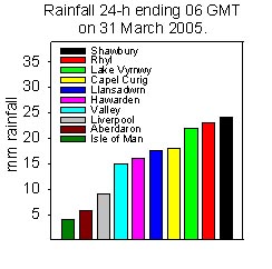 30th: Rain spread NE'wards during the night but did not reach here until about 06 GMT. In low cloud and mist there was light rain that accumulated 1.0 mm by 09 GMT. Pressure 1017 mb had risen with shallow low 1010 mb over the English Channel. Frontal cloud was lying over North Wales and Cheshire giving the rain. The day was wet and misty with a light ENE'ly wind. Cloud was thick and solar radiation was only 2.4 mv h, lowest since the 15th. Rain was light to moderate during the afternoon ceasing about 2230 GMT after 17.6 mm accumulated, the wettest day of the month. In the 24-h to 06 GMT Valley recorded 15 mm and Capel Curig 18 mm but it was wetter in Rhyl that had 23 mm. The wettest day of the month here, bringing the total up to just 60% of the long-term average. {Lake Vyrnwy 26.0 mm, Rhyl 19.8 mm} [Rain 17.6 mm; Max 8.4C; Min 6.1C; Grass 5.2C]
31st: Overcast and misty at dawn then a brighter spell as the cloud dispersed a little before 09 GMT. Pressure 1022 mb had risen with shallow low 1020 mb anchored in the English Channel. Pressure was high 1034 mb over Scandinavia and the Baltic but low in the Atlantic where there were shallow complex systems. With slow-moving frontal cloud persisting the morning was murky with minimal brightness. The afternoon was similar, but there was a brighter spell about 1330 GMT before the cloud and thick haze closed in again for the night. [Rain 1.2 mm; Max 13.5C; Min 5.9C; Grass 4.0C]
![]()
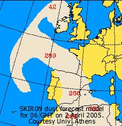 1st: A wet and grey beginning to the month; drizzle then light turning to moderate rain meant my anorak hood was well over my head for the obs at 09 GMT. Visibility was poor although relative humidity was 92% and the misty conditions should be called haze! Pressure 1022 mb was steady still under the influence of high 1035 mb centred near the N Polish - German border. (Satellite image: shows lows 998 mb off Iberia and 992 mb SE Greenland while fronts were massed to the W of Ireland and over the Irish Sea). The rain eased during the morning, but it remained overcast. In the afternoon the cloud was thinner and moderately high being well above the peaks of the Snowdonia Mountains. [Rain mm; Max C; Min 8.3C; Grass 7.4C]
![]() 2nd: After the clearance of some lenticular clouds to the S it was fine and sunny. Pressure 1020 mb was falling although we were still within a ridge of high-pressure from high 1034 mb E Europe. Low 992 mb unchanged had edge eastwards while the low off Iberia had filled 1003 mb and not moved. The morning was sunny although visibility was only moderate. The sky was milky white to the S and W indicative of pollution smoke and/ or dust high in the atmosphere. Dust forecasters using the SKIRON model at the University of Athens showed suspended dust to the S and W of Ireland drifting N. (The NOAA AQUA satellite image: shows plume of smoke haze over the Irish Sea and across to N England. It is likely that there was dust as well.). It was a warm day with the temperature rising to 20.1C in the afternoon, highest of the month, one of the highest temperatures in the UK on the day. At dusk it cooled rapidly before settling around 10C during the night. {Farnborough 19.5C, Liverpool 19.1C, Cardiff 19.0C} [Rain 0.0 mm; Max 20.1C; Min 7.0C; Grass 3.2C]
2nd: After the clearance of some lenticular clouds to the S it was fine and sunny. Pressure 1020 mb was falling although we were still within a ridge of high-pressure from high 1034 mb E Europe. Low 992 mb unchanged had edge eastwards while the low off Iberia had filled 1003 mb and not moved. The morning was sunny although visibility was only moderate. The sky was milky white to the S and W indicative of pollution smoke and/ or dust high in the atmosphere. Dust forecasters using the SKIRON model at the University of Athens showed suspended dust to the S and W of Ireland drifting N. (The NOAA AQUA satellite image: shows plume of smoke haze over the Irish Sea and across to N England. It is likely that there was dust as well.). It was a warm day with the temperature rising to 20.1C in the afternoon, highest of the month, one of the highest temperatures in the UK on the day. At dusk it cooled rapidly before settling around 10C during the night. {Farnborough 19.5C, Liverpool 19.1C, Cardiff 19.0C} [Rain 0.0 mm; Max 20.1C; Min 7.0C; Grass 3.2C]
![]() 3rd: Slight dew and moderate guttation made the grass wet by morning. It was mostly cloudy but bright under mainly cirrus and altostratus clouds. The wind that had been SE'ly veered SSW'ly and the temperature was 13.3C. Visibility was only moderate with the thick milky haze persisting; the dust plume had drifted E during the night and was overhead. Pressure 1014 continued to fall slowly with pressure high 1033 mb to the E and low 992 mb just W of Iceland. A cold front was positioned over Ireland. The morning was mostly bright and sunny at first.
3rd: Slight dew and moderate guttation made the grass wet by morning. It was mostly cloudy but bright under mainly cirrus and altostratus clouds. The wind that had been SE'ly veered SSW'ly and the temperature was 13.3C. Visibility was only moderate with the thick milky haze persisting; the dust plume had drifted E during the night and was overhead. Pressure 1014 continued to fall slowly with pressure high 1033 mb to the E and low 992 mb just W of Iceland. A cold front was positioned over Ireland. The morning was mostly bright and sunny at first. 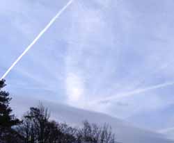 By noon it became increasingly murky and there was fine drizzle by 15 GMT with a trace of light-brown dust deposited. As the cold front moved through there was rain from 20 GMT until 2245 GMT. [Rain 3.2 mm; Max 14.0C; Min 8.2C; Grass 3.5C]
4th: There was a shower just after midnight and at dawn the sky had cleared to cirrus and contrails overhead by 06 GMT. The clearance was brief as by 09 GMT it was overcast with mainly thin cloud brushing the summits of the Snowdonia Mountains. With temperatures close to freezing at times there was the possibility of ice precipitation during the day. Pressure 1017 mb was rising as low 992 mb S of Iceland began to fill as it tracked towards NW Scotland. By midmorning the sky was clearer again but there were some cumulus clouds in the vicinity threatening showers. The first bluebells are out in the wood, several quite tall flowers showing blue open bells. Some sunshine at first in the afternoon before moderately heavy showers of rain and ice pellets fell between 1500 and 1600 GMT with sleet or snow from 1500 ft on the mountains. Once these cleared away the sky cleared giving a sunny evening and at first at night. [Rain 3.6 mm; Max 11.2C; Min 4.2C; Grass 1.9C]
![]() 5th: Light showers returned around dawn moving across the island on the moderate (f4) SW'ly wind. Pressure was 1020 mb and was high to the S and low to the N; the morning was occasionally bright with showers in the vicinity and over the mountains. (The NOAA 16 satellite image: shows jet stream cirrus cloud over S Britain, indicative of the return of the westerly conveyor, and developing frontal system off SW Ireland. ). The afternoon was windier but mainly bright with a little sunshine as the cloud lifted and thinning. A dusting of snow was seen on the top of Carnedd Dafydd but Snowdon, as often, remained obscured in cloud. During the evening cloud encroached as a frontal triple-point over S Ireland approached. There was drizzle and light rain followed by moderate to heavy rain from 2230 GMT as the triple-point moved across the Irish Sea. Before midnight the wind backed S'ly and was blowing strong to gale-force. [Rain 27.5 mm; Max 11.0C; Min 5.2C; Grass 2.8C]
5th: Light showers returned around dawn moving across the island on the moderate (f4) SW'ly wind. Pressure was 1020 mb and was high to the S and low to the N; the morning was occasionally bright with showers in the vicinity and over the mountains. (The NOAA 16 satellite image: shows jet stream cirrus cloud over S Britain, indicative of the return of the westerly conveyor, and developing frontal system off SW Ireland. ). The afternoon was windier but mainly bright with a little sunshine as the cloud lifted and thinning. A dusting of snow was seen on the top of Carnedd Dafydd but Snowdon, as often, remained obscured in cloud. During the evening cloud encroached as a frontal triple-point over S Ireland approached. There was drizzle and light rain followed by moderate to heavy rain from 2230 GMT as the triple-point moved across the Irish Sea. Before midnight the wind backed S'ly and was blowing strong to gale-force. [Rain 27.5 mm; Max 11.0C; Min 5.2C; Grass 2.8C]
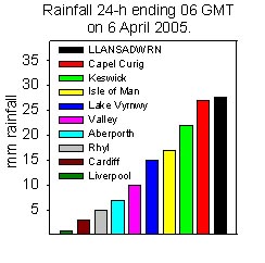 6th: After midnight as the heavy rain continued the S'ly wind increased to gale force 8, touching 9 at times with gusts of 55 mph. By 06 GMT 27.2 mm had accumulated, the rain stopped soon after and the sky began to clear. Some of
 ![]() the newly open leaves of sycamore and horse-chestnut had been torn off the trees and were lying on the ground. With soils still near water saturation there was a little standing water around the weather station and a few pools had appeared on surrounding fields. Pressure was 1003 mb and the wind had veered WSW'ly and moderated to force 5/6. Deepening low 992 mb was off Cape Wrath and split into two off the N of Scotland during the day.
the newly open leaves of sycamore and horse-chestnut had been torn off the trees and were lying on the ground. With soils still near water saturation there was a little standing water around the weather station and a few pools had appeared on surrounding fields. Pressure was 1003 mb and the wind had veered WSW'ly and moderated to force 5/6. Deepening low 992 mb was off Cape Wrath and split into two off the N of Scotland during the day.
![]() The morning was breezy with cumulus clouds scudding along on the force 5 wind in a clear slot after the passage of the cold front. Over the mountains there was a line of stratocumulus clouds and further E towering cumulus clouds. By noon it was cloudier and during the afternoon there were frequent squally showers of rain and a few ice pellets. (The NOAA 12 satellite image shows convective clouds over the NW that brought the showers, the old cold front can be seen clearing the SE).The heaviest, with most ice pellets, was around 1810 GMT. [Rain 10.2 mm; Max 10.6C; Min C; Grass C]
The morning was breezy with cumulus clouds scudding along on the force 5 wind in a clear slot after the passage of the cold front. Over the mountains there was a line of stratocumulus clouds and further E towering cumulus clouds. By noon it was cloudier and during the afternoon there were frequent squally showers of rain and a few ice pellets. (The NOAA 12 satellite image shows convective clouds over the NW that brought the showers, the old cold front can be seen clearing the SE).The heaviest, with most ice pellets, was around 1810 GMT. [Rain 10.2 mm; Max 10.6C; Min C; Grass C]
![]()
![]() 7th: At midnight the low-pressure to the N gathered together again and was near Shetland 982 mb. There was a spell of moderately heavy rain from 0030 to 0200 GMT followed by showers that included ice pellets. Further light rain during the hour before 09 GMT ceased soon after with some breaks appearing in the cloud. Pressure had recently bottomed and had risen a little to 996 mb and the wind had veered to the NW. Low 981 mb had tracked into the S Norwegian Sea with another centre 986 mb off SW Norway. The morning was mostly cloudy with showers in the vicinity and over the Snowdonia Mountains where precipitation was of snow. Snow was seen in Cwm Idwal at 1500 ft and elsewhere some at 2000 ft. The afternoon was windier with the N'ly force 5 to 6 and became brighter with some sunshine later. Cloudy with some clearer spell at night: windy. [Rain trace; Max 9.9C; Min 3.0C; Grass 1.8C]
7th: At midnight the low-pressure to the N gathered together again and was near Shetland 982 mb. There was a spell of moderately heavy rain from 0030 to 0200 GMT followed by showers that included ice pellets. Further light rain during the hour before 09 GMT ceased soon after with some breaks appearing in the cloud. Pressure had recently bottomed and had risen a little to 996 mb and the wind had veered to the NW. Low 981 mb had tracked into the S Norwegian Sea with another centre 986 mb off SW Norway. The morning was mostly cloudy with showers in the vicinity and over the Snowdonia Mountains where precipitation was of snow. Snow was seen in Cwm Idwal at 1500 ft and elsewhere some at 2000 ft. The afternoon was windier with the N'ly force 5 to 6 and became brighter with some sunshine later. Cloudy with some clearer spell at night: windy. [Rain trace; Max 9.9C; Min 3.0C; Grass 1.8C]
![]()
![]() .8th: A bright morning with cumulus clouds blowing in off the Irish Sea on a force 6/7 N'ly. The temperature at 09 GMT was 5.0C (dewpoint -1.6C) giving a relative humidity of 62%. Pressure 1015 mb had risen with the low now 986 mb over the N Baltic. High 1034 mb was W of Ireland and closely packed isobars stretched along the spine of the UK. Cold air, from the icy Arctic Ocean near Spitsbergen and the Barents Sea, was being dragged S as far as Iberia. Winds were strong to gale-force in the N, with frequent hail and snow showers working their way S. Hail and sleet were reported from SW France. With convection increasing during the morning here there were frequent snow pellet showers from 0940 GMT. Frequency increased from noon and turned to snow later. There was a prolonged large-flaked snow shower from 1330 GMT but, with the surface soil temperature on 6.3C, it did not settle here. (Photograph: shows that on the Snowdonia Mountains it was a different picture with snow settling in places as low as 500 ft for a while as snow showers passed over. The day's maximum was 6.7C well below the average of 11.5C on this day. By 15 GMT the sky was clearer and it was mostly sunny and the clear sky continued into the evening; there was ground frost. [Rain 0.2 mm; Max 7.4C; Min 3.1C; Grass 1.5C]
.8th: A bright morning with cumulus clouds blowing in off the Irish Sea on a force 6/7 N'ly. The temperature at 09 GMT was 5.0C (dewpoint -1.6C) giving a relative humidity of 62%. Pressure 1015 mb had risen with the low now 986 mb over the N Baltic. High 1034 mb was W of Ireland and closely packed isobars stretched along the spine of the UK. Cold air, from the icy Arctic Ocean near Spitsbergen and the Barents Sea, was being dragged S as far as Iberia. Winds were strong to gale-force in the N, with frequent hail and snow showers working their way S. Hail and sleet were reported from SW France. With convection increasing during the morning here there were frequent snow pellet showers from 0940 GMT. Frequency increased from noon and turned to snow later. There was a prolonged large-flaked snow shower from 1330 GMT but, with the surface soil temperature on 6.3C, it did not settle here. (Photograph: shows that on the Snowdonia Mountains it was a different picture with snow settling in places as low as 500 ft for a while as snow showers passed over. The day's maximum was 6.7C well below the average of 11.5C on this day. By 15 GMT the sky was clearer and it was mostly sunny and the clear sky continued into the evening; there was ground frost. [Rain 0.2 mm; Max 7.4C; Min 3.1C; Grass 1.5C]
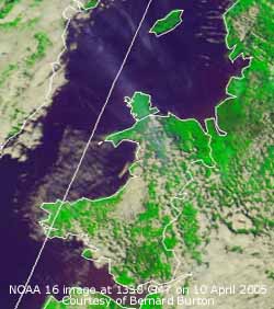 9th: Overnight the air minimum was 0.5C and above the grass it fell to -2.9C, both lowest of the month. Still partly clear at dawn but it soon turned cloudier and was overcast by 09 GMT the wind having backed W'ly and moderated. The temperature was rising and the 7.4C was the highest over the past 24-h but still below average. Pressure had risen to 1027 mb with high 1034 mb to the SW tracking SE with a weakening ridge over the UK. There was a train of lows to the N between S Greenland and Iceland with frontal encroaching from the NW. Rain was over the Irish Sea, N England, S and W Scotland. The morning was cloudy but kept dry until 11 GMT when there was drizzle turning to light rain that lasted into early afternoon. Later on the rain stopped but it kept overcast; the daytime maximum was 7.7C. [Rain 1.0 mm; Max 9.0C; Min 0.5C; Grass -2.9C]
![]()
![]()
![]()
![]() 10th: An overcast grey and misty start with a spell of drizzle and light rain from 0730 GMT. This was easing off at 09 GMT but it was still dull and overcast. Pressure was steady on 1027 mb and the temperature of 9.0C was the highest of the past 24-h, 2.6C below average. The high 1036 mb was still to the SW with low 981 mb near Iceland with associated frontal cloud over the UK. Low stratiform cloud that brought the rain began to lift by 10 GMT and gave way to altocumulus with some blue sky and sunshine. The wind was light to moderate W'ly. (The NOAA 16 satellite image shows the almost clear sky over the Irish Sea with jet stream cirrus streaking across Anglesey. The ground photographs, taken 45 min earlier, show the cirrus above cumulus to the W and S of the weather station. Also shown is a band of frontal cloud, with orographic waves, to the N of Scotland. Air off the Atlantic (surface temperature about 10C) rising over the highlands and cooling formed high clouds (with a cloud-top temperature of -59C, courtesy Bernard Burton) in their lee to the SE. ). The afternoon was increasingly sunny as the cumulus decayed and cleared over Anglesey; the temperature rose to 16.3C. By 18 GMT it was cloudier again. [Rain 0.0 mm; Max 16.3C; Min C; Grass C]
10th: An overcast grey and misty start with a spell of drizzle and light rain from 0730 GMT. This was easing off at 09 GMT but it was still dull and overcast. Pressure was steady on 1027 mb and the temperature of 9.0C was the highest of the past 24-h, 2.6C below average. The high 1036 mb was still to the SW with low 981 mb near Iceland with associated frontal cloud over the UK. Low stratiform cloud that brought the rain began to lift by 10 GMT and gave way to altocumulus with some blue sky and sunshine. The wind was light to moderate W'ly. (The NOAA 16 satellite image shows the almost clear sky over the Irish Sea with jet stream cirrus streaking across Anglesey. The ground photographs, taken 45 min earlier, show the cirrus above cumulus to the W and S of the weather station. Also shown is a band of frontal cloud, with orographic waves, to the N of Scotland. Air off the Atlantic (surface temperature about 10C) rising over the highlands and cooling formed high clouds (with a cloud-top temperature of -59C, courtesy Bernard Burton) in their lee to the SE. ). The afternoon was increasingly sunny as the cumulus decayed and cleared over Anglesey; the temperature rose to 16.3C. By 18 GMT it was cloudier again. [Rain 0.0 mm; Max 16.3C; Min C; Grass C]
11th: Overcast at first but the cloud was moderately high and well over the Snowdonia mountaintops. Visibility was very good and the remnant snow patches could be seen, mostly on Yr Wyddfa fewer on the Carneddau. Pressure 1029 mb had risen although the high to the SW had declined to 1034 mb. A shift in orientation could account for the rise here with the wind backed to SW'ly. Low 990 mb S of Iceland had associated fronts W of Ireland but the morning was dry and occasionally bright. With almost a repeat of yesterday the cloud cleared after noon and it was sunny. But, it was windier and up to force 5 to 6 at times. By the end of the afternoon a patch of cloud encroached and there was a light shower of rain at 1630 GMT. It was cloudy at dusk but the sky had cleared by 21 GMT before a weak cold front moved across in the night. [Rain 2.0 mm; Max 15.4C; Min 7.9C; Grass 6.8C]
![]()
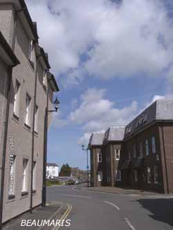
![]() 12th: There was a little rain on the weak cold front as it passed over between 01 and 0230 GMT. It was still overcast at 06 GMT but the sky started to clear by 07 GMT. At 09 GMT with 3/8 cover the morning was mostly sunny. Pressure was 1022 mb and with low 970 mb in the Norwegian Sea and high 1035 mb to the SW the airflow was WNW'ly across the UK. It was cloudier in the afternoon but it was mostly moderately high and thin with the sun shining through; there were no halos seen. During the evening the cloud thickened and there was showery rain from 2000 to 2230 GMT. At 2220 there were a few ice pellets. [Rain 2.5 mm; Max 14.7C; Min C; Grass C]
12th: There was a little rain on the weak cold front as it passed over between 01 and 0230 GMT. It was still overcast at 06 GMT but the sky started to clear by 07 GMT. At 09 GMT with 3/8 cover the morning was mostly sunny. Pressure was 1022 mb and with low 970 mb in the Norwegian Sea and high 1035 mb to the SW the airflow was WNW'ly across the UK. It was cloudier in the afternoon but it was mostly moderately high and thin with the sun shining through; there were no halos seen. During the evening the cloud thickened and there was showery rain from 2000 to 2230 GMT. At 2220 there were a few ice pellets. [Rain 2.5 mm; Max 14.7C; Min C; Grass C]
![]()
![]() 13th: After midnight further spells of drizzle and light rain. Pressure 1009 mb had fallen as a small low 998 mb, formed to the NW, tracked towards the Irish Sea and Anglesey. At 09 GMT there were a few more spots of rain but it was bright with good visibility. Fresh snow had fallen on the Snowdonia Mountains above 2700 ft; deepest was between Foel-fras and Carnedd Llewelyn but most summits were covered. The morning kept mostly cloudy and although the afternoon was slow to clear by 15 GMT it was mostly sunny until dusk. (The NOAA 12 satellite image shows the small low positioned over N Ireland ontrack for Anglesey. The cloud band associated with it stretching S is a frontal trough that brought rain, heavy in places,to the S and W by evening. Also previous frontal cloud can be seen slipping away in the SE).
Then the cloud band associated with the low brought light rain from 2200 GMT through the night. {Cardiff 14.1C; Capel Curig 9.6 mm} [Rain 3.9 mm; Max 10.0C; Min 4.9C; Grass 4.0C]
13th: After midnight further spells of drizzle and light rain. Pressure 1009 mb had fallen as a small low 998 mb, formed to the NW, tracked towards the Irish Sea and Anglesey. At 09 GMT there were a few more spots of rain but it was bright with good visibility. Fresh snow had fallen on the Snowdonia Mountains above 2700 ft; deepest was between Foel-fras and Carnedd Llewelyn but most summits were covered. The morning kept mostly cloudy and although the afternoon was slow to clear by 15 GMT it was mostly sunny until dusk. (The NOAA 12 satellite image shows the small low positioned over N Ireland ontrack for Anglesey. The cloud band associated with it stretching S is a frontal trough that brought rain, heavy in places,to the S and W by evening. Also previous frontal cloud can be seen slipping away in the SE).
Then the cloud band associated with the low brought light rain from 2200 GMT through the night. {Cardiff 14.1C; Capel Curig 9.6 mm} [Rain 3.9 mm; Max 10.0C; Min 4.9C; Grass 4.0C]
![]() 14th: At midnight the low was over N Ireland, but by 06 GMT reached Anglesey 998 mb. It was a misty and grey morning with the cloudbase about 800 ft, or lower. At 09 GMT the barometer had risen a little, 999 mb, and there were signs of the cloud lifting and starting to break. This promise was unfulfilled and the day remained mostly cloudy with spells of showery rain, these were heavy in places across the island. The wind backed SW'ly during the afternoon then veered N'ly by evening. There was a spell of intermittent rain from 2230 GMT. {Tiree Island 16 mm, Isle of Man 15 mm, Valley 11.8 mm} [Rain 5.1 mm; Max 10.3C; Min 4.8C; Grass 4.5C]
14th: At midnight the low was over N Ireland, but by 06 GMT reached Anglesey 998 mb. It was a misty and grey morning with the cloudbase about 800 ft, or lower. At 09 GMT the barometer had risen a little, 999 mb, and there were signs of the cloud lifting and starting to break. This promise was unfulfilled and the day remained mostly cloudy with spells of showery rain, these were heavy in places across the island. The wind backed SW'ly during the afternoon then veered N'ly by evening. There was a spell of intermittent rain from 2230 GMT. {Tiree Island 16 mm, Isle of Man 15 mm, Valley 11.8 mm} [Rain 5.1 mm; Max 10.3C; Min 4.8C; Grass 4.5C]
15th: Light rain at times until about 0530 GMT then spots on the strong (f6) NNE'ly wind. Pressure 1008 mb was rising with the complex low-pressure 1001 mb over N France. A ridge of high pressure from Iceland 1023 mb was lying to the W. The morning continued overcast and windy with some rain in the afternoon coming from that circulating around the slow-moving low-pressure system.. The day's maximum was only 5.9C, the lowest of the month. The N'ly wind strengthened, and was strong to gale-force at first in the night, with a further band of rain from 2300 GMT. It was cold enough to fall as snow on the Snowdonia Mountains. {Newcastle 29.4 mm, Capel Curig 13.4 mm, Solent 12.8C} [Rain 8.5 mm; Max 5.9C; Min 4.9C; Grass 4.2C]
 16th: The overnight rain was just easing off at 09 GMT. The wind had lessened and the temperature was 3.2C with the dewpoint on 3.0C, not quite right for snow here at 300 ft but was so above 800 ft on the mountains. There were moderate accumulations above 2000 ft in central areas of Snowdonia in the Nant Ffrancon Pass and Bethesda. Pressure was 1009 mb close to a low 1004 mb centred over Cumbria. The morning was overcast with low cloud and mist and it was 1530 GMT before it lifted and began to break up; there were some glimpses of sunshine before dusk and clear enough after dark for the air temperature to fall briefly to 0.9C with a touch of ground frost -1.8C. (At Kew Gardens the bluebell collection is in danger from perfoliate Alexanders [Smyrnium perfoliatum] and a big effort is being put in by a team of 300 volunteers to removes the plants. The species was introduced to Kew, probably from the Chelsea Physic Garden, but it is now regarded as a weed as being 5 feet tall dominates the ground excluding light from the bluebells. It is not the same species as the Alexanders [Smyrnium olusatrum] formerly grow as a pot-herb, the young stems taste of celery, now naturalised along some Anglesey roadsides and sea cliffs, see photo on the right taken at the old Almshouses between Llansadwrn and Beaumaris. Can also be seen on the way to Four Crosses). {Newcastle 33.2 mm, Capel Curig 18.0 mm} [Rain 0.9 mm; Max 7.9C; Min 2.2C; Grass 2.1C]
17th: Overcast with moderately high cloud at first but soon thickening to give rain just before 09 GMT. Pressure 999 mb was falling as deepening low 978 mb was tracking W of Ireland. The wind had backed SE'ly, although light to moderate here in the lee of the mountains, strengthened to force 7/8 on the Irish Sea and was force 8/9 off the Western Isles of Scotland. It was a wet day with light to moderate rain continuing on into the night. [Rain 22.5 mm; Max 11.0C; Min 0.9C; Grass -1.8C]
18th: It was still raining moderately up to 09 GMT when 22.5 mm had accumulated. This brought the total for the month to 91.5 mm some 158% of the 30-y average. April, usually one of the drier months of the year, with some days till the end is looking one of the wetter already ranking 12th wettest since 1928. Pressure 990 mb had started to rise a little with frontal wave low 987 mb over Liverpool that tracked N towards Scotland during the day. Low 973 mb had moved to be S of Iceland and associated frontal cloud bands were lying NW - SE across the UK. Moderate rain continued during the morning but turned light by 11 GMT and petered out by 1400 GMT after another 3.7 mm had accumulated. Soon after the sky began to clear and there were some sunny spells before evening. (The composite NOAA satellite image courtesy of Ferdinand Valk shows the low SW of Iceland, and associated warm front over the North Sea, and the wave development on a cold front over the Irish Sea and N England that gave all the rain. Also in the SW approaches can be seen another developing low-pressure centre).
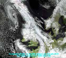 Despite the heavy rain at lower levels snow was still lying with moderate cover above 2600 ft on the Snowdonia Mountains, particularly on the tops and northern slopes of Drum, Foel-fras and Carnedd Llewelyn. Snowdon, initially obscured in cloud, although snow covered appeared to have less and the lower slopes looked rather bare.
![]() The month so far had seen the mean temperature of 8.3C being [-0.3] of the 30-y average. The mean maximum 11.6C is [-1.2] while the minimum of 5.1C is [+0.7]. (The graphic shows rainfall totals for the 48-h to 18 GMT; rainfall was largest over the Snowdonia Mountains and N of here with the Isle of Islay receiving 54 mm and Glasgow 42 mm).{Capel Curig 34.6 mm} [Rain 3.7 mm; Max 9.9C; Min 5.5C; Grass 5.5C]
The month so far had seen the mean temperature of 8.3C being [-0.3] of the 30-y average. The mean maximum 11.6C is [-1.2] while the minimum of 5.1C is [+0.7]. (The graphic shows rainfall totals for the 48-h to 18 GMT; rainfall was largest over the Snowdonia Mountains and N of here with the Isle of Islay receiving 54 mm and Glasgow 42 mm).{Capel Curig 34.6 mm} [Rain 3.7 mm; Max 9.9C; Min 5.5C; Grass 5.5C]
![]()
![]() 19th: A bright and sunny morning with a moderate NE'ly breeze starting to dry the ground. Cloud was high and thin with the sun shining through but as it was mostly altocirrus and no haloes were seen. Snow was still lying above 2600 ft on the northern slopes of the mountains. Pressure 1006 mb had risen in a col between low 997 mb between Lands End and Brest, and 992 mb off Rockall, Scotland. After noon the sky darkened under cumulonimbus clouds and there were spells of moderately heavy rain through the afternoon. Thunder was heard from 1358 to 1405 GMT but the heaviest rain was around 1700 GMT that included some ice pellets. (The NOAA 16 satellite image shows the vortex of the low in the SW approaches and the band of convective clouds that gave outbreaks of thundery rain across North Wales in the afternoon. An occluded front is lying over the North Sea, tracking W, while there is a band of jet stream cirrus over S Scotland and E England). Showers continued into the evening; the night was overcast but dry. {Tiree island 20.7 mm, Aberporth 7.9 mm} [Rain 7.2 mm; Max 9.8C; Min 2.0C; Grass -0.3C]
19th: A bright and sunny morning with a moderate NE'ly breeze starting to dry the ground. Cloud was high and thin with the sun shining through but as it was mostly altocirrus and no haloes were seen. Snow was still lying above 2600 ft on the northern slopes of the mountains. Pressure 1006 mb had risen in a col between low 997 mb between Lands End and Brest, and 992 mb off Rockall, Scotland. After noon the sky darkened under cumulonimbus clouds and there were spells of moderately heavy rain through the afternoon. Thunder was heard from 1358 to 1405 GMT but the heaviest rain was around 1700 GMT that included some ice pellets. (The NOAA 16 satellite image shows the vortex of the low in the SW approaches and the band of convective clouds that gave outbreaks of thundery rain across North Wales in the afternoon. An occluded front is lying over the North Sea, tracking W, while there is a band of jet stream cirrus over S Scotland and E England). Showers continued into the evening; the night was overcast but dry. {Tiree island 20.7 mm, Aberporth 7.9 mm} [Rain 7.2 mm; Max 9.8C; Min 2.0C; Grass -0.3C]
20th: A murky dawn with spells of light rain in a moderate NE'ly breeze. Pressure 1014 mb was still rising slowly but a slow-moving occluded front was lying across North Wales. The morning was very dull, but the rain died out. The afternoon was brighter, as the cloud thinned, and there was a little sunshine by the end but it was overcast again later. {Cardiff 18.6 mm, Skye 15.9C, Capel Curig 6.8C} [Rain 0.2 mm; Max 8.9C; Min 4.5C; Grass 2.5C]
21st: Overcast with the frontal cloud still lying across North Wales, but some thinning occurred soon after 09 GMT. Pressure was 1021 mb with high 1029 mb N of Scotland. It was a dry morning with a few holes in the cloud by 1030 GMT. As the frontal cloud continued to disperse the afternoon was sunny. Clear sky continued into the evening and bats were seen flying around the treetops at dusk. A mostly clear night and dry night, the first dry day since 10 April. {Keswick 16.9C, hardly any rain anywhere} [Rain 0.0 mm; Max 12.4C; Min 5.5C; Grass 5.0C]
![]() 22nd: A sunny morning with high cirrus cloud and hazy (smoke) sunshine. Pressure 1012 mb had fallen although pressure was high over the North Sea from the Norwegian Sea (1023 mb) to N Italy (1021 mb). The problem was that an Atlantic-low 993 mb tracking towards France was brushing SW England and rain in the Channel was affecting Cornwall and N France. Here it was sunny with the temperature rising to 15C by 1030 GMT in a light SE'ly breeze. (The NOAA 14 satellite image shows the spiral of cloud associated with the low to the SW of Ireland and frontal cloud advancing eastward across the UK. At 1442 GMT high cirrus cloud was still over Anglesey.). Although the cloud cover increased and thickened the temperature rose to 17.5C with relative humidity on 53%. By 18 GMT it looked murky to the SW as the frontal cloud encroached, the rain having reached the Lleyn Peninsula. After just a few spots of drizzle in the evening there was light rain from 2100 to 0230 GMT. {London MO 18.7C, Cork 16.9 mm} [Rain 2.7 mm; Max 17.5C; Min 4.6C; Grass 0.8C]
22nd: A sunny morning with high cirrus cloud and hazy (smoke) sunshine. Pressure 1012 mb had fallen although pressure was high over the North Sea from the Norwegian Sea (1023 mb) to N Italy (1021 mb). The problem was that an Atlantic-low 993 mb tracking towards France was brushing SW England and rain in the Channel was affecting Cornwall and N France. Here it was sunny with the temperature rising to 15C by 1030 GMT in a light SE'ly breeze. (The NOAA 14 satellite image shows the spiral of cloud associated with the low to the SW of Ireland and frontal cloud advancing eastward across the UK. At 1442 GMT high cirrus cloud was still over Anglesey.). Although the cloud cover increased and thickened the temperature rose to 17.5C with relative humidity on 53%. By 18 GMT it looked murky to the SW as the frontal cloud encroached, the rain having reached the Lleyn Peninsula. After just a few spots of drizzle in the evening there was light rain from 2100 to 0230 GMT. {London MO 18.7C, Cork 16.9 mm} [Rain 2.7 mm; Max 17.5C; Min 4.6C; Grass 0.8C]
23rd: A dull grey and very hazy morning. Pressure was 1010 mb with twin lows (996 mb) over the Bay of Biscay; there was frontal cloud over Wales and the West Country with rain from Pembrokeshire to London. There was intermittent slight rain during the day that died out by evening. During the night the cloud began to break up. [Rain 0.9 mm; Max 10.9C; Min 7.5C; Grass 6.5C]
24th: A bright morning with the sky slowly clearing as the frontal cloud began to disperse. At 09 GMT there was still 6/8th cover of altocumulus clouds but by 1030 GMT it was mainly sunny, though hazy with a temperature rising to 13.4C in a light E'ly breeze. Pressure 1011 mb was rising with low 999 mb in the Bay of Biscay slow-moving and filling. A sunny day with almost clear sky in the afternoon and evening. [Rain 0.0 mm; Max 13.4C; Min 6.6C; Grass 4.8C]
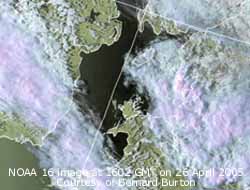
![]() 25th: Patchy cloud had encroached by morning but began to dispersed by 09 GMT. Pressure was 1009 mb with high 1024 mb over Scandinavia. But lows over N France and frontal cloud over the English Channel there was a band of rain stretching from Kent through London towards the Midlands. The morning was mostly sunny although visibility was poor in haze. (The NOAA 16 satellite image shows the frontal cloud over the south just starting to encroach across Anglesey. A cloud vortex can be seen over the western Channel; Scotland and N England had a mostly sunny day, but sea fog affected the NE coast of Scotland by the end of the afternoon). The afternoon here was sunny at first, but cloud encroached and thickened as the front moved N and there was light rain before evening. An holly blue butterfly was spotted in the garden. [Rain 2.5 mm; Max 14.1C; Min 5.6C; Grass 2.5C]
25th: Patchy cloud had encroached by morning but began to dispersed by 09 GMT. Pressure was 1009 mb with high 1024 mb over Scandinavia. But lows over N France and frontal cloud over the English Channel there was a band of rain stretching from Kent through London towards the Midlands. The morning was mostly sunny although visibility was poor in haze. (The NOAA 16 satellite image shows the frontal cloud over the south just starting to encroach across Anglesey. A cloud vortex can be seen over the western Channel; Scotland and N England had a mostly sunny day, but sea fog affected the NE coast of Scotland by the end of the afternoon). The afternoon here was sunny at first, but cloud encroached and thickened as the front moved N and there was light rain before evening. An holly blue butterfly was spotted in the garden. [Rain 2.5 mm; Max 14.1C; Min 5.6C; Grass 2.5C]
![]() 26th: After a little rain and drizzle the sky began to clear during the morning. Pressure 1007 mb had fallen as a shallow low 993 mb off the W coast of Ireland. There was a light shower just after noon but when this cleared away the afternoon was sunny. The haze of past days also cleared and visibility was very good (>20 km) with superb views of the Snowdonia Mountains across the Menai Strait. On the northern mountains there were frequent snow patches remaining some delineating deeper gullies on the Carneddau(The NOAA 16 satellite image shows Anglesey in clear slot stretching from N Ireland to Kent. To the SW was a developing frontal trough associated with the low W of Ireland. Deep convective clouds developed during the afternoon giving heavy showers along the trough (see radar image) and thunderstorms in a few places during the evening).
During the evening the trough line arrived and there was a heavy shower of rain around 1900 GMT. When this cleared the night was partly cloudy with some moonlight. [Rain 2.4 mm; Max 15.0C; Min 8.6C; Grass 8.2C]
26th: After a little rain and drizzle the sky began to clear during the morning. Pressure 1007 mb had fallen as a shallow low 993 mb off the W coast of Ireland. There was a light shower just after noon but when this cleared away the afternoon was sunny. The haze of past days also cleared and visibility was very good (>20 km) with superb views of the Snowdonia Mountains across the Menai Strait. On the northern mountains there were frequent snow patches remaining some delineating deeper gullies on the Carneddau(The NOAA 16 satellite image shows Anglesey in clear slot stretching from N Ireland to Kent. To the SW was a developing frontal trough associated with the low W of Ireland. Deep convective clouds developed during the afternoon giving heavy showers along the trough (see radar image) and thunderstorms in a few places during the evening).
During the evening the trough line arrived and there was a heavy shower of rain around 1900 GMT. When this cleared the night was partly cloudy with some moonlight. [Rain 2.4 mm; Max 15.0C; Min 8.6C; Grass 8.2C]
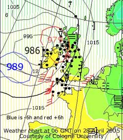
![]() 27th: A bright and breezy morning with fair-weather cumulus clouds scudding overhead in a moderate f5 SSW'ly wind. Over the mountains clouds were more developed and showers could be seen, there was a little ice precipitation on the summit of Snowdon. Pressure 1009 mb had risen through the night as the low off Ireland headed N. Isobars were fairly tight up against high 1021 mb over Spain and the Mediterranean. The day continued with some good sunny spells here but thunder, lightning and small hail was reported in places in S England. (The Meteosat 8 image shows rapid cyclogenesis south-west of Ireland. The developing low tracked NE and deepened as it moved across NW Ireland.). Later it turned cloudier as frontal cloud associated with the low encroached and there was rain from 2230 GMT. [Rain 3.3 mm; Max 14.2C; Min 6.7C; Grass 5.5C]
27th: A bright and breezy morning with fair-weather cumulus clouds scudding overhead in a moderate f5 SSW'ly wind. Over the mountains clouds were more developed and showers could be seen, there was a little ice precipitation on the summit of Snowdon. Pressure 1009 mb had risen through the night as the low off Ireland headed N. Isobars were fairly tight up against high 1021 mb over Spain and the Mediterranean. The day continued with some good sunny spells here but thunder, lightning and small hail was reported in places in S England. (The Meteosat 8 image shows rapid cyclogenesis south-west of Ireland. The developing low tracked NE and deepened as it moved across NW Ireland.). Later it turned cloudier as frontal cloud associated with the low encroached and there was rain from 2230 GMT. [Rain 3.3 mm; Max 14.2C; Min 6.7C; Grass 5.5C]
![]() 28th: The rain eased by 0230 GMT but it was still overcast at 09 GMT. Overnight the air minimum was 9.3C, warmest of the month. The S'ly wind had freshened and was at gale force 8, there were spots of rain on the wind and lots of leaves were being torn off trees, including twigs of horse-chestnut with now fully expanded leaves and just-opening flowers. In anticipation of the gales ferries crossing the Irish Sea out of Holyhead were cancelled and there was a 20 mph speed limit imposed on the Britannia Bridge. Although the cloud broke up, and there were good sunny spells, the wind continued near gale force with gusts of 50 mph. Glass was blown out of a greenhouse in Pentraeth. (The NOAA 12 satellite image at 1652 GMT shows the then maturing low over the Hebrides. There is poorly defined frontal cloud in the S). By evening the wind lessened and continued to moderate through the night. Rainfall was minimal the most occurring in N Scotland. {South Uist 31.9 mm, Stornoway 24.7 mm} [Rain mm; Max 13.8C; Min 9.3C; Grass 7.9C]
28th: The rain eased by 0230 GMT but it was still overcast at 09 GMT. Overnight the air minimum was 9.3C, warmest of the month. The S'ly wind had freshened and was at gale force 8, there were spots of rain on the wind and lots of leaves were being torn off trees, including twigs of horse-chestnut with now fully expanded leaves and just-opening flowers. In anticipation of the gales ferries crossing the Irish Sea out of Holyhead were cancelled and there was a 20 mph speed limit imposed on the Britannia Bridge. Although the cloud broke up, and there were good sunny spells, the wind continued near gale force with gusts of 50 mph. Glass was blown out of a greenhouse in Pentraeth. (The NOAA 12 satellite image at 1652 GMT shows the then maturing low over the Hebrides. There is poorly defined frontal cloud in the S). By evening the wind lessened and continued to moderate through the night. Rainfall was minimal the most occurring in N Scotland. {South Uist 31.9 mm, Stornoway 24.7 mm} [Rain mm; Max 13.8C; Min 9.3C; Grass 7.9C]
29th: A bright morning under layered cumulus, altocumulus and cirrus clouds; there was a moderate SW'ly wind. Pressure was 1016 mb with mature low 984 mb near the Faeroe Islands. A warm front lay to the S this associated with Atlantic-low 992 mb well to the SW. With the sky slowly clearing the day became mostly sunny. Later in the evening frontal cloud encroached from the S. [Rain 8.5 mm; Max 16.3C; Min 8.2C; Grass 6.8C]
30th: The was light rain from 0030 GMT until around 10 GMT then intermittent drizzle, or rain, during the morning. Pressure was 1012 mb with the warm front over Snowdonia making very slow progress N during the day to be over the Isle of Man by 18 GMT. By afternoon it was a little drier but it remained overcast with the thick layer of cloud. It was not a good day for the 10th Annual Plant Sale, held in the garden, in aid of the NSPCC The poor weather did not, however, stop keen gardeners turning out in support, but casual visitors were few. There was further intermittent drizzle before midnight. [Rain 2.5 mm; Max 15.0C; Min 8.4C; Grass 8.2C]
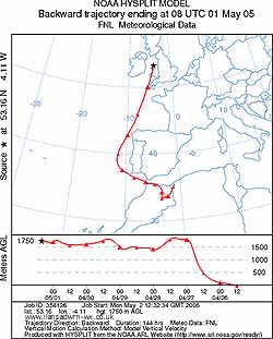 1st: The dull weather continued into May with intermittent drizzle or light rain. There were distant rumbles of thunder between 0530 and 0830 GMT and a burst of heavy rain at 07 GMT as a showery trough passed over. Convective thundery cells had developed over south-west England before midnight and worked their was N during the day before petering out in S Scotland in the afternoon. There had been a light fall of fine pinkish-white to light-brown dust, washed out of the atmosphere by the rain. (Trajectory analysis, using the HYSPLIT model at the NOAA Air Resources Laboratory, indicated that parcels of air arriving at 1750 m over Llansadwrn between 07 and 09 GMT had come from NE Morocco near the Algerian border. It is likely that this air contained the dust that was washed out in the thundery rain. There have, over the past months, been dust storms in northern Africa. Much of the dust had blown out over the Mediterranean in a NE direction depositing dust over a wide area. This time the track took the dust over the Gibraltar Strait into the Atlantic then N past Iberia, Cape Finisterre and Lands End to Anglesey). Pressure at 09 GMT was 1004 mb with the low 998 mb to the SW. More frontal cloud lay over SW Ireland and Lands End but the day brightened here with some sunny spells developing. It was windy with the SW'ly force 5 or 6 at times. Sunny spells lasted into the afternoon with a maximum of 16.5C. It was warm in the south with London having 25.1C. {Central London 25.1C, Fair Isle 7.8C} [Rain 1.4 mm; Max 16.5C; Min 10.6C; Grass 9.0C]
2nd: A further trough passed over around 02 GMT when there was a moderate shower of rain. By dawn this was clearing and it was a bright morning with brief spells of sunshine. Pressure was 1007 mb with the UK surrounded by low-pressure centres (996 mb). Yet another trough brought rain from noon until 1600 GMT before turning showery. Visitors to the island for the Bank Holiday packed up and went home early. At 2.30 pm BST one lane eastbound at the Conwy Tunnel was closed, for safety reasons, as the density of traffic was so high. This delayed homeward progress causing delays of several hours well into the evening. There was a little broken cloud at night. [Rain 3.4 mm; Max C; Min 11.2C; Grass 9.5C]
3rd: A mostly cloudy morning with just a few glimpses of sunshine. Pressure was high (1032 mb) the Atlantic but the UK was still in a low-pressure valley (1006 mb here) and consequently unsettled. The best weather was in the morning as by afternoon the cloud thickened and there was drizzle followed by some spots of rain. The evening was dry but mostly cloudy. [Rain 5.1 mm; Max 15.8C; Min 10.9C; Grass 9.8C]
4th: After clearer sky around midnight frontal cloud encroached from the NW and there was rain from 0300 to 0630 GMT. The sky started to clear just before 09 GMT when pressure had risen to 1023 mb. A ridge from Atlantic-high 1038 mb had moved across. The wind was moderate to fresh N'ly; the morning was soon sunny. Although it was cloudy around noon the sky cleared again during the afternoon. The daytime maximum reached 11.9C. The evening, clear at first with the air temperature falling to 6.3C, became overcast by 21 GMT as cloud on a warm front, associated with a low 989 mb over the Norwegian Sea, encroached from the NW. [Rain 0.0 mm; Max 12.8C; Min 7.7C; Grass 7.5C]
 5th: It was warmer with the temperature 12.8C just before 09 GMT reaching the maximum for the past 24-h. It was mostly cloudy with a light W'ly breeze. Pressure 1024 mb within Atlantic-high 1040 mb; the warm front was over Lands End and Birmingham while a cold front was lying over N Scotland. The morning was occasionally bright with good visibility but the weak cold front moved over in the afternoon giving some light rain. After a shower at 2030 GMT the night became dry with broken cloud. [Rain 0.9 mm; Max 13.8C; Min 6.3C; Grass 4.2C]
![]()
![]()
![]() 6th: A bright morning with sky slowly clearing to fair-weather cumulus over Anglesey, Stratocumulus persisted to the S over the Snowdonia Mountains whose summits were obscured. Under the cloud visibility was very good with only slight haze. Pressure was steady on 1020 mb with Atlantic-high 1034 mb to the SW. (The Meteosat image © EUMETSAT shows complex low-pressure was to the NE with low 990 mb over the Norwegian Sea. Yesterday's cold front was breaking up over S England and N France. There was low stratiform cloud over the Bay of Biscay and central France. A shallow low developing on a triple point W of Malin Head, N Ireland, would bring the spell of rain in the night).The morning was mostly sunny with a gentle W'ly wind but by afternoon it was overcast. The cloud was thin at first and it kept bright, but by 1800 GMT it had thickened with the low 1012 mb near Malin Head. (The photograph, courtesy of Gordon Perkins, shows heavy showers of rain under black cumulonimbus clouds moving across Malltraeth during the evening ). There was showery rain here from 1900 GMT and moderate rain from 2300 GMT. [Rain 8.2 mm; Max 13.6C; Min 6.6C; Grass 4.3C]
6th: A bright morning with sky slowly clearing to fair-weather cumulus over Anglesey, Stratocumulus persisted to the S over the Snowdonia Mountains whose summits were obscured. Under the cloud visibility was very good with only slight haze. Pressure was steady on 1020 mb with Atlantic-high 1034 mb to the SW. (The Meteosat image © EUMETSAT shows complex low-pressure was to the NE with low 990 mb over the Norwegian Sea. Yesterday's cold front was breaking up over S England and N France. There was low stratiform cloud over the Bay of Biscay and central France. A shallow low developing on a triple point W of Malin Head, N Ireland, would bring the spell of rain in the night).The morning was mostly sunny with a gentle W'ly wind but by afternoon it was overcast. The cloud was thin at first and it kept bright, but by 1800 GMT it had thickened with the low 1012 mb near Malin Head. (The photograph, courtesy of Gordon Perkins, shows heavy showers of rain under black cumulonimbus clouds moving across Malltraeth during the evening ). There was showery rain here from 1900 GMT and moderate rain from 2300 GMT. [Rain 8.2 mm; Max 13.6C; Min 6.6C; Grass 4.3C]
![]()
![]() 7th: Rain continued until 0100 GMT with a little more around 05 GMT. At 09 GMT pressure 1015 mb was rising. There were cumulus clouds in the vicinity with the NW'ly wind force 4. The morning was occasionally bright with showers mostly confined to the mountaintops of Snowdonia. There were a few sunny spells in the afternoon and, with most mountaintops clear of cloud, we did not catch any showers until the evening at 1830 and 1930 GMT. (The NOAA 12 satellite image shows that along the E coast from Scotland to East Anglia build-up of convective clouds were greatest and this set off several thunderstorms during the afternoon, see the map of sferics recorded. ). The night was mostly clear and as a result cooler than of late. [Rain 0.3 mm; Max 13.7C; Min 6.4C; Grass 4.3C]
7th: Rain continued until 0100 GMT with a little more around 05 GMT. At 09 GMT pressure 1015 mb was rising. There were cumulus clouds in the vicinity with the NW'ly wind force 4. The morning was occasionally bright with showers mostly confined to the mountaintops of Snowdonia. There were a few sunny spells in the afternoon and, with most mountaintops clear of cloud, we did not catch any showers until the evening at 1830 and 1930 GMT. (The NOAA 12 satellite image shows that along the E coast from Scotland to East Anglia build-up of convective clouds were greatest and this set off several thunderstorms during the afternoon, see the map of sferics recorded. ). The night was mostly clear and as a result cooler than of late. [Rain 0.3 mm; Max 13.7C; Min 6.4C; Grass 4.3C]
8th: Mostly clear before dawn with 1.8C seen on the grass minimum thermometer. As soon as the sun was up convective clouds appeared again and by 09 GMT gave a 7 okta cover. The temperature was 9.4C in a moderate NW'ly breeze. The day was bright with some sunny spells, but there were showers around. There were moderately heavy showers of hail at Abergwyngregin about 1120 GMT and in Gaerwen at 1445 GMT. Both were described as 'pea size' quickly covering the ground. The weather station missed these today but there were some light showers of rain in the afternoon. A few thunderstorms were reported in SE England in the afternoon. During the evening the sky cleared but it was cloudy again around midnight.[Rain 0.2 mm; Max 11.7C; Min 4.5C; Grass 1.8C]
 9th: A bright start with cumulus clouds again in the vicinity. Pressure 1019 mb had risen with high 1026 mb W of Scotland. Pressure was low 1000 mb over the Baltic while an occluded front lay over the North Sea. The morning was mostly sunny with any showers keeping away. [Rain 0.0 mm; Max 10.8C; Min 4.2C; Grass 1.4C]
![]() 10th: A sunny day with few clouds. Pressure 1023 mb had risen with the high drifting over from Ireland during the day. In a light NE'ly breeze the maximum rose to 11.6C. Solar radiation 30.9 mv h was highest of the year so far approaching last year's highest of 32.7 mv h on 13 June. Valley reported {11.1 h} sunshine while the Isle of Man with {14.5 h} was sunniest, the warmest place was Torquay with {16C}. The night was clear with dew forming on the grass. [Rain 0.0 mm; Max 11.6C; Min 3.6C; Grass 0.5C]
10th: A sunny day with few clouds. Pressure 1023 mb had risen with the high drifting over from Ireland during the day. In a light NE'ly breeze the maximum rose to 11.6C. Solar radiation 30.9 mv h was highest of the year so far approaching last year's highest of 32.7 mv h on 13 June. Valley reported {11.1 h} sunshine while the Isle of Man with {14.5 h} was sunniest, the warmest place was Torquay with {16C}. The night was clear with dew forming on the grass. [Rain 0.0 mm; Max 11.6C; Min 3.6C; Grass 0.5C]
11th: Almost calm at dawn the with air temperature down to 3.4C and 0.2C above the dew-covered grass, both lowest of the month. Pressure was steady on 1027 mb with the high 1028 mb centred on Manchester. The sun was shining through cirrostratus clouds and contrails; there was a partial halo at 09 GMT. The day was sunny and the night mostly clear skied. [Rain 0.0 mm; Max 13.0C; Min 3.4C; Grass 0.2C]
![]()
![]() 12th: Another sunny morning with lots of contrails, some forming cirrocumulus, cirrostratus and cirrus clouds. There was a light E'ly wind and the temperature 11.8C and 57% relative humidity at 09 GMT. Pressure 1023 mb had fallen a little as the high moved eastward. Developing low 1008 mb over the Bay of Biscay had frontal cloud moving N while low 1013 mb was S of Iceland. The day was mostly sunny with patchy thin high cirrus cloud only slightly obscuring the brightness of the sun. The thin high cloud cover continued overnight but did obscure the stars. {Belfast 17.8C, Valley 16.6C; Leuchars 14.2h, Valley 13.4h} [Rain 0.0 mm; Max 15.9C; Min 4.5C; Grass 1.0C]
12th: Another sunny morning with lots of contrails, some forming cirrocumulus, cirrostratus and cirrus clouds. There was a light E'ly wind and the temperature 11.8C and 57% relative humidity at 09 GMT. Pressure 1023 mb had fallen a little as the high moved eastward. Developing low 1008 mb over the Bay of Biscay had frontal cloud moving N while low 1013 mb was S of Iceland. The day was mostly sunny with patchy thin high cirrus cloud only slightly obscuring the brightness of the sun. The thin high cloud cover continued overnight but did obscure the stars. {Belfast 17.8C, Valley 16.6C; Leuchars 14.2h, Valley 13.4h} [Rain 0.0 mm; Max 15.9C; Min 4.5C; Grass 1.0C]
![]() 13th: With the moderate E'ly wind continuing the day was again mostly sunny. Pressure 1022 mb was hardly changed with high-pressure located to the N Scotland while it was keeping low to the S over the Bay of Biscay. First early new potatoes have gone on sale at Llanbedrgoch and asparagus at Hooton's farm in Brynsiencyn [Rain 0.0 mm; Max 14.8C; Min C; Grass C]
13th: With the moderate E'ly wind continuing the day was again mostly sunny. Pressure 1022 mb was hardly changed with high-pressure located to the N Scotland while it was keeping low to the S over the Bay of Biscay. First early new potatoes have gone on sale at Llanbedrgoch and asparagus at Hooton's farm in Brynsiencyn [Rain 0.0 mm; Max 14.8C; Min C; Grass C]
14th: Pressure 1021 mb had kept steady through the night along with the moderate wind that was more NE'ly at 09 GMT. The morning was sunny with some lenticular orographic wave clouds over the weather station and to the S. Heavy rain on a warm front over the Cherbourg Peninsula at 06 GMT moved across the English Channel to affect the SW and S coasts of England. Here it was dry and mostly sunny all day into the evening. Solar radiation 32.2 mv h highest this year so far. Mostly clear at night. [Rain 0.0 mm; Max 14.1C; Min 6.8C; Grass 5.2C]
 15th: A bright morning with complex cloud formations mainly altocumulus but cirrus and cirrostratus with partial solar halo was seen. A pity it was light here as there was a high-level geomagnetic storm in progress from 07 GMT. Although near the sunspot minimum a large sunspot, that could be seen with the naked eye at sunset on the 13th, emitted a large coronal mass towards the earth causing the storm. (The image of the sun from the SOHO spacecraft of the intense solar activity taken May 15, 2005, at 7:50 a.m. EDT. It was an an extreme event, measuring G-5 the highest level-on the NOAA Space Weather Scales Possible impacts from such a geomagnetic storm include widespread power system voltage control problems; some grid systems may experience complete collapse or blackouts. Spacecraft operations may experience extensive surface charging; problems with orientation; uplink/downlink and tracking satellites. Satellite navigation may be degraded for days, and low-frequency radio navigation can be out for hours. Reports received courtesy of the NOAA Space Environment Center indicate that such impacts have been observed in the United States).
In North America it was dark and 'fabulous' northern lights were seen as far S as California. Bright blue aurorae were reported over the Niagara Falls. We could at least enjoy continuation of the fine dry weather for a little longer with pressure steady on 1020 mb within a ridge over the UK. High 1033 mb was to the NW while the slow-moving low 1005 mb was over the Bay of Biscay with fronts close to the SW, frontal cloud over Scotland was heading S. Winds were light and variable across the UK, a change from the strong E'lies of past days. It was a sunny morning with a low, for here, relative humidity of 42% (dewpoint 0.4C) at 13.0C at 09 GMT. Descent of dry air resulted in some low humidities being reported in N Britain on higher ground. Capel Curig 38%, Cairngorm 36%, Aboyne 31%, Lough Fea and Strathallen 30%, Great Dunsell 23%. The N also saw the highest temperatures with Strathallen reporting {21.4C}. It was wettest in the S with Scilly having 7.2 mm. Here the day was mostly sunny but the cloud thickened by evening. The night was overcast. [Rain 0.0 mm; Max 14.8C; Min 4.7C; Grass 2.1C]
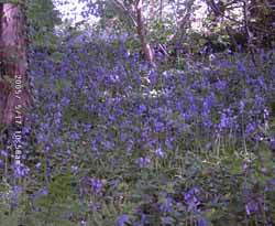 17th: A cool night with air temperature down to 4.6C and 2.2C on the grass. The wind lessened and it was calm in the early hours. Convective clouds developed soon after dawn; by 09 GMT well-developed cumulus and cumulonimbus clouds were in the vicinity there was a shower of 5 mm conical shaped hail. Pressure 1021 mb had risen within a ridge of high-pressure. Low 995 mb lies well out in the Atlantic off Newfoundland and S of Greenland. Pressure remained low 995 mb over the Baltic. The morning was sunny at times; the afternoon mostly cloudy but the sky cleared towards evening that was calm. The maximum temperature was 10.5C, the lowest of the month. {Torquay 11.4h, Valley 11.0h; Torquay 16C} [Rain 0.2 mm; Max 10.5C; Min 4.6C; Grass 2.2C]
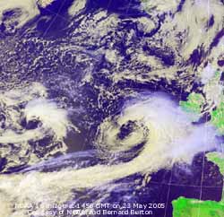
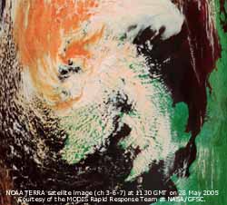
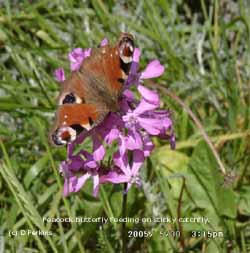 29th: With the low (999 mb) reaching the Norwegian Sea at midnight the wind moderated slowly through the night. By morning pressure 1020 mb had risen, with a ridge of high-pressure extending over S England from the Azores-high, and the wind was W'ly force 3. With cumulus clouds in the vicinity and stratocumulus over the Snowdonia Mountains the morning was frequently sunny. By afternoon most of the convective clouds had dispersed leaving some cirrus and cirrostratus. A pleasant day in the garden today; there was minimal damage to plants the several varieties of Cistus being in full bloom and humming with the sound of bumblebees and honeybees. Sunny into the evening when after sunset the high clouds were firstly lit pink at 20 GMT then pearl coloured by 2130 GMT. At 2230 GMT moderately high altocumulus cloud had drifted across that helped to keep the temperature on the ground above freezing. {Valley, Anglesey 13.1h, Torquay 19C} [Rain 0.0 mm; Max 17.3C; Min 6.3C; Grass 3.6C]
1st: As patchy rain moved across after midnight there were spells of drizzle before light rain commenced around 0830 GMT. Another disappointing beginning to 'flaming June'; low stratus cloud, mist and rain through the morning. Pressure 1017 mb was falling as complex low-pressure to the W moved between declining highs to the N and S. The day was dark and dismal with mist and occasional spells of drizzle; the lowest amount of solar radiation (587 mv h) was recorded since the 15 April. I'm glad I got the grass cut on the 31st May, I was watching the weather, but growth (biomass production) this year is running about 30% less than in 2004. [Rain 9.2 mm; Max 14.6C; Min 10.0C; Grass 7.6C]
![]()
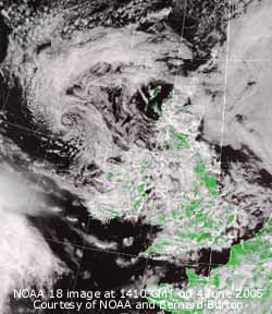 2nd: Intermittent rain from 0030 GMT, with some heavier spells around 0615 GMT, turning to drizzle again before 09 GMT; rainfall accumulated was 9.2 mm over the 24-h period. Again low stratus with mist, RAF Valley reported the cloudbase at 200 ft, it was treetop height here about 60 feet. Pressure 1011 mb was falling with low 993 mb to the W of Ireland. Pressure was high 1025 mb over Greenland and 1020 mb S France. In Nice, that has been having fine weather for over 2 weeks, the temperature was 25C with just a few clouds in the sky at 3500 ft. Here the low cloud and mist persisted through the morning. The afternoon was drier and brighter but kept overcast with a little showery rain around 1600 GMT. There was a spell of rain from 2100 to 2145 GMT with the rest of the night dry. {South Uist 25.2 mm, Capel Curig 21.6 mm}[Rain 1.6 mm; Max C; Min 12.2C; Grass 12.2C]
3rd: A bright morning with some sunny spells between convective cumulus clouds. Although showers were in the vicinity it kept dry here. At 09 GMT pressure 1006 mb was falling as low 992 mb was to the NW; the temperature was 14.0C and the wind SSW'ly force 4. The day kept dry and bright here but showers affected the W of the island in the afternoon. There were thunderstorms in SE England and near continent during the afternoon. The night was mostly overcast. {Margate 31.5 mm, Manston 24.6 mm; London MO 23.4C; Leuchars 9h} [Rain trace; Max 16.2C; Min 11.0C; Grass 10.3C]
4th: Mostly cloudy with a fresh SW'ly winds moving layered cumulus clouds across the sky at a fair speed. They were low enough to be covering the mainland mountains-tops. Pressure 1009 mb was rising with the low to the NW matured and filling 1001 mb; the main low-pressure centre being 999 mb over S Sweden. Weakening frontal cloud was lying curved over Ireland and N England where it was raining. Elsewhere a day of frequent showers with some light ones or spots of rain here during the afternoon. (The NOAA 18 satellite image shows the vortex of the mature low lying to the W of Scotland. There is also a low just S of Greenland and the next low to affect us is SW of Ireland. Convective shower clouds can be seen over Britain, N France and the Pyrenees).
It was mostly dry but overcast at night. [Rain 0.2 mm; Max 15.9C; Min 10.7C; Grass 11.0C]
5th: A bright (at times) morning with a light W'ly breeze, but a few isolated showers were affecting the NW and N coasts of the island. A band of rain (SW Ireland to SW England and the Channel) on a warm front associated with shallow low 1006 mb SW of Ireland began to affect South Wales before 09 GMT. To the S, in the Bay of Biscay, pressure was high 1025 mb but continues low 993 mb Sweden and the Baltic. The brightness disappeared later in the morning and thickening cloud brought a short spell of fine drizzle in the afternoon with the wet weather in the S sliding SE'wards so did not reach here. The night was overcast but dry. [Rain trace; Max 16.5C; Min 10.6C; Grass 9.8C]
 6th: With pressure rising the sky started to clear soon after dawn so it was a sunny morning. Visibility was poor in smoke haze caused by atmospheric pollutants. At 09 GMT pressure was 1023 mb with high 1027 mb developing between Iceland and Cape Wrath, Scotland. Pressure was still high to the S (1025 mb Bay of Biscay) with remnant frontal cloud hanging over the English Channel. Clear sky and sunshine through the day with a light to moderate ENE'ly wind off the sea the temperature rose to a cool 15.9C. By evening remnant frontal cloud encroached from the W and the night was mostly cloudy. At dusk tawny owls were hunting around the weather station to feed fledged offspring calling hungrily from nearby trees. Brown long-eared bats were also seen flying about. {Stornoway 14.0 h Valley 9.6 h Chivenor 16.0 mm Cardiff 9.7 mm Tain Range 22.5C Pembray Sands 18.1C} [Rain 0.0 mm; Max 15.9C; Min 10.3C; Grass 8.6C]
![]() 7th: At midnight the high 1035 mb was sitting nicely over the UK. With mostly clear skies low temperatures (in notably frost-hollows -1C air and -5C above grass) were experienced except here in the west where there was a warming blanket of cloud (grass minimum 6.5C).. Cloud at dawn soon began to disperse and by 09 GMT there was hazy sunshine with a lot of cirrus clouds. Pressure was 1036 mb the highest June value for some years. Later in the morning some cloud, including cumulus, had developed so it was duller into the afternoon. Later the cloud dispersed and it was a sunny end to the day. The wind dropped away at dusk and it was calm and clear. [Rain 0.0 mm; Max 18.2C; Min 9.4C; Grass 6.5C]
7th: At midnight the high 1035 mb was sitting nicely over the UK. With mostly clear skies low temperatures (in notably frost-hollows -1C air and -5C above grass) were experienced except here in the west where there was a warming blanket of cloud (grass minimum 6.5C).. Cloud at dawn soon began to disperse and by 09 GMT there was hazy sunshine with a lot of cirrus clouds. Pressure was 1036 mb the highest June value for some years. Later in the morning some cloud, including cumulus, had developed so it was duller into the afternoon. Later the cloud dispersed and it was a sunny end to the day. The wind dropped away at dusk and it was calm and clear. [Rain 0.0 mm; Max 18.2C; Min 9.4C; Grass 6.5C]
![]()
![]() 8th: At midnight pressure over England was at least 1038 mb. A clear night with dew on the grass but the temperature was well above freezing at 5.0C. A sunny but hazy morning with a light S'ly wind. At 09 GMT pressure was 1036 mb with the high 1038 mb centred over the southern North Sea. A passing sparrowhawk, gliding by over the treetops, was being mobbed by several housemartins. The day was sunny, early cirrus clouds dispersed and haze thinned to give a mostly clear sky until evening.(Today's image from the new NOAA 18 satellite shows mostly clear sky over Anglesey and southern Britain. A patch of low stratiform cloud over the Irish Sea and Isle of Man could be seen through the day from Anglesey while the Snowdonia Mountains were clear. Further stratiform clouds surrounded northern Britain with some limited convection over NE Wales, NE England and Scotland). During the evening the cloud in the NW encroached giving an overcast night. {Church Fenton (N. Yorks) 23C; Oxford 15h, Valley 14.6h} [Rain 0.0 mm; Max 20.6C; Min 8.1C; Grass 5.0C]
8th: At midnight pressure over England was at least 1038 mb. A clear night with dew on the grass but the temperature was well above freezing at 5.0C. A sunny but hazy morning with a light S'ly wind. At 09 GMT pressure was 1036 mb with the high 1038 mb centred over the southern North Sea. A passing sparrowhawk, gliding by over the treetops, was being mobbed by several housemartins. The day was sunny, early cirrus clouds dispersed and haze thinned to give a mostly clear sky until evening.(Today's image from the new NOAA 18 satellite shows mostly clear sky over Anglesey and southern Britain. A patch of low stratiform cloud over the Irish Sea and Isle of Man could be seen through the day from Anglesey while the Snowdonia Mountains were clear. Further stratiform clouds surrounded northern Britain with some limited convection over NE Wales, NE England and Scotland). During the evening the cloud in the NW encroached giving an overcast night. {Church Fenton (N. Yorks) 23C; Oxford 15h, Valley 14.6h} [Rain 0.0 mm; Max 20.6C; Min 8.1C; Grass 5.0C]
![]() 9th: A dull morning overcast with moderately high cloud (well above the mountaintops at first). Pressure was 1034 mb with a new centre in the W; there was little (SW'ly) or no wind. (The NOAA satellite image shows the cloud that persisted all day over the Irish Sea and Anglesey although it did disperse in Cardigan Bay later. To the NW there is frontal cloud with orographic waves over Scotland. Limited convective clouds developed inland during the afternoon with stratocumulus of the mountains). The day kept overcast but it was brighter in the afternoon and the sky almost cleared by evening before turning cloudier again as the front encroached from the NW. It is the season for orchid flowers on Anglesey; seen at Tywyn Aberffraw were the early march orchid, northern marsh orchid, pyramidal and bee orchids. [Rain 0.0 mm; Max 18.8C; Min 9.8C; Grass 6.1C]
9th: A dull morning overcast with moderately high cloud (well above the mountaintops at first). Pressure was 1034 mb with a new centre in the W; there was little (SW'ly) or no wind. (The NOAA satellite image shows the cloud that persisted all day over the Irish Sea and Anglesey although it did disperse in Cardigan Bay later. To the NW there is frontal cloud with orographic waves over Scotland. Limited convective clouds developed inland during the afternoon with stratocumulus of the mountains). The day kept overcast but it was brighter in the afternoon and the sky almost cleared by evening before turning cloudier again as the front encroached from the NW. It is the season for orchid flowers on Anglesey; seen at Tywyn Aberffraw were the early march orchid, northern marsh orchid, pyramidal and bee orchids. [Rain 0.0 mm; Max 18.8C; Min 9.8C; Grass 6.1C]
![]()
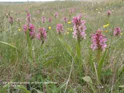 10th: At midnight the high 1036 mb was positioned S of Iceland. By morning with the passage of the weak and broken cold front some breaks were appearing in the stratocumulus clouds. Pressure 1028 mb was falling slowly with the declining high 1034 mb. This had the effect of drawing cool air from the N, particularly along the E coast of England. The wind here was NNE'ly and the temperature a cool 11.4C (dewpoint 9.2C). Further breaks appeared in the cloud during the morning with the temperature slow to rise to 14.5C at 1100 GMT and just managing 15.0C by the afternoon. Partially cloudy at night. [Rain 0.0 mm; Max 15.0C; Min 9.1C; Grass 6.2C]
11th: Some clear spells and mist in low lying areas overnight but mostly cloudy soon after dawn. Pressure had fallen to 1022 mb with high 1027 mb stationed S of Iceland being squeezed by lows 999 mb S of Greenland and 1003 mb over the Baltic. The cool N'ly airflow persisted, but with the sky clearing during the morning it was a sunny day well into the evening. At dusk slight mist formed across nearby fields. {Valley 14.5h} [Rain 0.0 mm; Max 14.9C; Min 8.7C; Grass 7.7C]
![]() 12th: Clear around midnight but then began to cloud over as frontal cloud moved S. It was cold enough at 4000 ft to give a covering of snow on Cairngorm, Scotland. The temperature on the summit of Yr Wyddfa, obscured in cloud, was 3.3C and had been down to 1.9C within the range that snow could occur but none was seen. Almost overcast at 09 GMT with a NW'ly wind. Pressure had continued to fall to 1012 mb with the ridge of high-pressure to the W much weakened. There was a little light rain at 1000 GMT and again at 1300 GMT but the amounts were small (0.2 mm). The maximum temperature was 13.7C, the lowest of the month. The rest of the day was dry and brighter the sky clearing towards evening and clear until after midnight with grass minimum down to 3.4C. [Rain 0.0 mm; Max 13.7C; Min 7.6C; Grass 5.5C]
12th: Clear around midnight but then began to cloud over as frontal cloud moved S. It was cold enough at 4000 ft to give a covering of snow on Cairngorm, Scotland. The temperature on the summit of Yr Wyddfa, obscured in cloud, was 3.3C and had been down to 1.9C within the range that snow could occur but none was seen. Almost overcast at 09 GMT with a NW'ly wind. Pressure had continued to fall to 1012 mb with the ridge of high-pressure to the W much weakened. There was a little light rain at 1000 GMT and again at 1300 GMT but the amounts were small (0.2 mm). The maximum temperature was 13.7C, the lowest of the month. The rest of the day was dry and brighter the sky clearing towards evening and clear until after midnight with grass minimum down to 3.4C. [Rain 0.0 mm; Max 13.7C; Min 7.6C; Grass 5.5C]
![]() 13th: At midnight low 996 mb was lying between Aberdeen and Oslo with frontal cloud giving moderate to heavy rain over NE Scotland. Working its way S rain was affecting S Scotland and N England at 09 GMT. The overnight minimums, air 5.8C and grass 3.4C, were lowest of the month. Thick layered stratocumulus, dull but still dry here. Pressure 1008 mb was falling and it was a cool 10.8C in a moderate W'ly wind. A brighter afternoon with a few glimpses of the sun before cloudier with light rain commencing just before 18 GMT. Further showery or intermittent rain , some moderate bursts, through the night until 04 GMT. [Rain 5.0 mm; Max 15.5C; Min 5.8C; Grass 3.4C]
13th: At midnight low 996 mb was lying between Aberdeen and Oslo with frontal cloud giving moderate to heavy rain over NE Scotland. Working its way S rain was affecting S Scotland and N England at 09 GMT. The overnight minimums, air 5.8C and grass 3.4C, were lowest of the month. Thick layered stratocumulus, dull but still dry here. Pressure 1008 mb was falling and it was a cool 10.8C in a moderate W'ly wind. A brighter afternoon with a few glimpses of the sun before cloudier with light rain commencing just before 18 GMT. Further showery or intermittent rain , some moderate bursts, through the night until 04 GMT. [Rain 5.0 mm; Max 15.5C; Min 5.8C; Grass 3.4C]
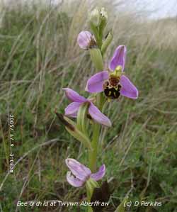 14th: Overcast with cloud below the summits of the Snowdonia Mountains. Pressure was 1007 mb with complex low-pressure (996 - 999 mb) straddling Scotland. Patches of rain were circulating over the Irish Sea, but at 09 GMT we were in a dry area. Keeping cool at 11.0C and the wind a SW'ly force 5 continued the rather unseasonable June weather. The daytime maximum struggled to reach 13.5C and it did not clear until late in the afternoon. After a mostly clear evening it became overcast again at dusk as cloud associated with developing frontal-wave low 998 mb, SW of Ireland, encroached from the SW. {Gravesend, Kent 21.5C, Aldergrove 14.4 mm} [Rain 0.4 mm; Max 14.6C; Min C; Grass C]
![]()
![]() 15th: A band of moderate to heavy rain moved up from the SW towards midnight, but all we got here were showers from 04 GMT giving 0.4 mm rainfall. The wind was S'ly force 6 and we were in a rain-shadow area afforded by the Snowdonia Mountains (see radar image). At 09 GMT it was already warmer with the temperature on 14.6C. Pressure was 1004 mb with the low 999 mb near Dingle Bay, SW Ireland. The morning was mostly cloudy, but there were a few breaks in the cloud promising better later in the day 'rain before seven fine before eleven' so the proverb goes. Well, it was a little late as there were a few bright spells and a little sunshine in the afternoon but, once again, was cloudier by evening. {Heathrow 21.5C Hawarden 21.5C; Tulloch bridge 27.2 mm, Mumbles Head 14.1 mm} [Rain trace; Max 18.5C; Min 10.8C; Grass 9.8C]
15th: A band of moderate to heavy rain moved up from the SW towards midnight, but all we got here were showers from 04 GMT giving 0.4 mm rainfall. The wind was S'ly force 6 and we were in a rain-shadow area afforded by the Snowdonia Mountains (see radar image). At 09 GMT it was already warmer with the temperature on 14.6C. Pressure was 1004 mb with the low 999 mb near Dingle Bay, SW Ireland. The morning was mostly cloudy, but there were a few breaks in the cloud promising better later in the day 'rain before seven fine before eleven' so the proverb goes. Well, it was a little late as there were a few bright spells and a little sunshine in the afternoon but, once again, was cloudier by evening. {Heathrow 21.5C Hawarden 21.5C; Tulloch bridge 27.2 mm, Mumbles Head 14.1 mm} [Rain trace; Max 18.5C; Min 10.8C; Grass 9.8C]
![]() The first 15 days of the month have seen below average rainfall (16.6 mm 25% of the monthly average) and temperatures with the mean 9.6 -0.6 of average. The highest maximum of 20.6C was -4.1 of average. I have prepared a new graphic showing the number of days that the maximum here has been 20C, or more, and 25C, or more since the weather station started in 1979. We do rather poorly for warm summer days in this neck of the woods, this year so far is no exception.
The first 15 days of the month have seen below average rainfall (16.6 mm 25% of the monthly average) and temperatures with the mean 9.6 -0.6 of average. The highest maximum of 20.6C was -4.1 of average. I have prepared a new graphic showing the number of days that the maximum here has been 20C, or more, and 25C, or more since the weather station started in 1979. We do rather poorly for warm summer days in this neck of the woods, this year so far is no exception.
16th: It kept dry here overnight with air temperature no lower than 11.8C. Just before 09 GMT the soil and concrete were dry then low cloud, drizzle and a few spots of rain arrived; it had been affecting the W coast at 07 GMT. Pressure was 1012 mb was rising with high-pressure to the S (1026 mb near Santander, N Spain) but frontal-wave (triple point) was lying near Shannon, Ireland, with associated low 986 mb further W. During the morning the Sly wind was strong (f6) and blustery with fine drizzle continuing. With thick cloud the day was very dull, with solar radiation only 6.3 mv h lowest since the 1st, but drier in the afternoon and through the night. Sea fog affected coastal areas in the W during the day and night. There was little temperature variation through the 24-h period, the thermograph trace hovering within 0.3C of 15.0C. {Hawarden 22.0C, Capel Curig 12.8 mm; Lerwick 21.9 mm} [Rain 0.5 mm; Max 16.2C; Min 11.8C; Grass 10.8C]
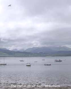 17th: Still overcast with the low stratiform cloud layer, but visibility was a little improved being moderate. Pressure 1024 mb continues to rise with high 1029 mb Brittany. Low 991 mb was W of Ireland with associated warm frontal cloud N of Anglesey over the Irish Sea and S Scotland. The day was dull with the S'ly force 4/5 good for drying washing but not much else. Where the cloud dispersed and the sun broke through it was a different matter. It was sunny, and warm, along the N coast of Anglesey and in Bangor during the afternoon but by evening it was overcast again. The wind force was sustained force 4/5 until after midnight. [Rain 0.1 mm; Max 19.2C; Min 14.7C; Grass 14.6C]
![]()
![]() 18th: The wind slowly moderated through the night but it was still overcast by morning with the cloud thick enough to have given a little drizzle. In the SE of England the blue sky and warmth was being enjoyed early in the day and this gradually spread NW'ward as cloud burnt off during the day. It was sunny here before noon with the temperature rising to 23.0C. Some convective clouds appeared over the station, as a weak sea breeze set in, early in the afternoon but this cleared again allowing the temperature to rise to 24.3C. The daily mean was 19.9C, highest of the month and since 2000 (20.8C) ranking 6th since 1979. (The NOAA 18 satellite image shows cloud just clearing away from Anglesey with high-pressure centred over the North Sea and Mediterranean Sea. Most of France and Europe had a clear sunny day but convective thunderstorm developed later over Spain, the Alps, Algeria and Tunisia in N Africa. To the W can be seen the low S of Iceland with associated cold front off Ireland moving slowly E introducing thundery showers. The N of Britain is covered by an associated warm and occluded fronts that brought some rain there too during the day.).
It was a rare fine warm evening with the temperature keeping up to 18C at 21 GMT. Thunderstorm had broken out over eastern parts of Ireland and the Western Isles of Scotland before midnight. {London MO 30.2C, Hawarden (Flintshire) 29C, Lerwick 14.1C and 10.9 mm} [Rain 0.0 mm; Max 24.3C; Min 15.5C; Grass 15.5C]
18th: The wind slowly moderated through the night but it was still overcast by morning with the cloud thick enough to have given a little drizzle. In the SE of England the blue sky and warmth was being enjoyed early in the day and this gradually spread NW'ward as cloud burnt off during the day. It was sunny here before noon with the temperature rising to 23.0C. Some convective clouds appeared over the station, as a weak sea breeze set in, early in the afternoon but this cleared again allowing the temperature to rise to 24.3C. The daily mean was 19.9C, highest of the month and since 2000 (20.8C) ranking 6th since 1979. (The NOAA 18 satellite image shows cloud just clearing away from Anglesey with high-pressure centred over the North Sea and Mediterranean Sea. Most of France and Europe had a clear sunny day but convective thunderstorm developed later over Spain, the Alps, Algeria and Tunisia in N Africa. To the W can be seen the low S of Iceland with associated cold front off Ireland moving slowly E introducing thundery showers. The N of Britain is covered by an associated warm and occluded fronts that brought some rain there too during the day.).
It was a rare fine warm evening with the temperature keeping up to 18C at 21 GMT. Thunderstorm had broken out over eastern parts of Ireland and the Western Isles of Scotland before midnight. {London MO 30.2C, Hawarden (Flintshire) 29C, Lerwick 14.1C and 10.9 mm} [Rain 0.0 mm; Max 24.3C; Min 15.5C; Grass 15.5C]
![]()
![]() 19th: Overnight the lowest air minimum temperature of 17.6C was the highest in June on record at this station since before 1979, greatly exceeding the 15.9C recorded in 1986 and 1989. The grass was wet mainly due to guttation; the exudation of water at the tips of leaves and not dew. The morning was overcast with thin moderately high cloud blanketing thick haze. At times the sun was just visible and it felt warm in the 20.3C temperature at 09 GMT.
19th: Overnight the lowest air minimum temperature of 17.6C was the highest in June on record at this station since before 1979, greatly exceeding the 15.9C recorded in 1986 and 1989. The grass was wet mainly due to guttation; the exudation of water at the tips of leaves and not dew. The morning was overcast with thin moderately high cloud blanketing thick haze. At times the sun was just visible and it felt warm in the 20.3C temperature at 09 GMT.
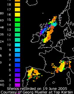 There was a light SE'ly breeze and visibility was poor. Pressure was 1016 mb with low 995 S Iceland; weakening fronts were easing slowly E across W Scotland, Wales and SW England, as high 1024 mb slipped SE over the Netherlands. There was sea fog around the coasts, here the day was dull with moderate fog developing in the afternoon. By 18 GMT the fog cleared to give a fine evening. (The NOAA satellite images, courtesy of Bernard Burton, show that further E in Flintshire and Cheshire convective clouds had started to develop ahead of the front (1st image at 1337 GMT) into large thunderstorms (2nd image by 1710 GMT). These delivered torrential rain and large hail in several places in Cheshire (in Chester hail at least 10 cm diameter covered the ground accompanied by heavy thunder and lightning) and the Midlands before moving NE off over the North Yorkshire Moors and out into the North Sea. The heavy rainstorms (69.2 mm in 3 hours) caused flash floods around Helmsley; small rivers rose feet in minutes sweeping away walls, bridges, gardens and a house. Several properties were under feet of water and people were rescued by RAF helicopter. Motorists abandoned their vehicles and clung to trees before being rescued. The storms were as intense as those experienced in the South of France, well known for delivery tropical-like deluges. In the south of England, where temperatures reaches over 30C, road surfaces were melting and beaches packed with people cooling off in the sea. The North York Moors have seen several flash floods in the past; records show events occurring in the 17th and 18th centuries, before current 'global warming' too). {Hawarden 42.8 mm, London 33C, Eastbourne 15.5h Fair Isle 11C} [Rain 0.0 mm; Max 21.3C; Min 17.6C; Grass 15.3C]
![]()
![]() 20th: Overcast with stratocumulus early on but soon beginning to clear with altocumulus overhead at 09 GMT. Pressure was 1017 mb within a ridge of high-pressure over Wales from Azores high 1024 mb. Low 995 mb was just S of Iceland with attendant cold frontal cloud over the Midland and the SE. A light plume of Saharan dust moved along the Iberian Peninsula and had past Cape Finisterre, but its progress N seems to have stalled. We were to enjoy one of those rare days of pleasantly warm sunny weather as the cloud cleared away before noon leaving a little cirrus and a line of stratocumulus clouds over Snowdonia and the Lleyn Peninsular persisting through the afternoon. Relative humidity fell to 53% in the afternoon (maximum 21.3C) and, with clear air, visibility was more than 50 km and views across to Snowdonia were superb. The evening was clear and with late sunshine local families were out late with, at the summer solstice, it keeping light until after 22 GMT. Later cloud on a cold front over Ireland, associated with a mid-Atlantic low 998 mb, began to advance from the W. [Rain 1.4 mm; Max 21.3C; Min 12.5C; Grass 10.0C]
20th: Overcast with stratocumulus early on but soon beginning to clear with altocumulus overhead at 09 GMT. Pressure was 1017 mb within a ridge of high-pressure over Wales from Azores high 1024 mb. Low 995 mb was just S of Iceland with attendant cold frontal cloud over the Midland and the SE. A light plume of Saharan dust moved along the Iberian Peninsula and had past Cape Finisterre, but its progress N seems to have stalled. We were to enjoy one of those rare days of pleasantly warm sunny weather as the cloud cleared away before noon leaving a little cirrus and a line of stratocumulus clouds over Snowdonia and the Lleyn Peninsular persisting through the afternoon. Relative humidity fell to 53% in the afternoon (maximum 21.3C) and, with clear air, visibility was more than 50 km and views across to Snowdonia were superb. The evening was clear and with late sunshine local families were out late with, at the summer solstice, it keeping light until after 22 GMT. Later cloud on a cold front over Ireland, associated with a mid-Atlantic low 998 mb, began to advance from the W. [Rain 1.4 mm; Max 21.3C; Min 12.5C; Grass 10.0C]
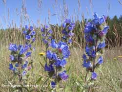 21st: A dull morning with drizzle or light rain being blown across the fields. Together with a short spell of rain from 0515 GMT brought the total rainfall to 1.4 mm. At 09 GMT with brightening skies the rain was already drying off. In fact the soil surface of my undisturbed observation plot looked dry. Concrete was partially wet while the grass was wet from earlier dew and the rain. Evaporation exceeded this value during the past 24h and it will do little to affect the negative soil water balance that is running at 16 mm. (I'm not complaining plants and crops on the vegetable plot, although planted later than usual, are doing well so far this year
 ![]() ). Pressure was 1018 mb with the high slipping S allowing low-pressure to encroached the N of Britain. The morning became mostly sunny by 11.30 BST with a moderate SW'ly wind; the afternoon was sunny at times at first but then cloud encroached from the W. [Rain 0.0 mm; Max 20.3C; Min C; Grass C]
). Pressure was 1018 mb with the high slipping S allowing low-pressure to encroached the N of Britain. The morning became mostly sunny by 11.30 BST with a moderate SW'ly wind; the afternoon was sunny at times at first but then cloud encroached from the W. [Rain 0.0 mm; Max 20.3C; Min C; Grass C]
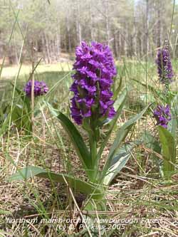 22nd: Overcast at first but soon breaks appeared and the morning turned sunny. Pressure was 1022 mb with the lenticular shaped high 1024 mb SW England. Maturing low 995 mb and cold front were to the W of Ireland tracking NE. It was windy with the S'ly blowing force 5 well into the afternoon. The day gradually became sunnier with early cloud disappearing by mid-afternoon. By evening the wind moderated and it was clear allowing a fine view of the full moon, over the Snowdonia Mountains, at its lowest point in the sky since June 1987. An effect called the Moon Illusion tricks the observer and appears extraordinarily large. Similarly the setting and rising sun appears large against the horizon, but this happens every day. [Rain 0.0 mm; Max 21.5C; Min 13.7C; Grass 12.8C]
23rd: A fine and sunny morning, but still a tad windy the S'ly on force 5. But it was pleasantly warm with the temperature 17.4C at 09 GMT. Pressure was 1019 mb with the high 1020 mb still over SW England but showing signs of decline. The filled low 1004 mb was lying to the NW with associated cold front over Ireland. The morning continued sunny with almost clear skies. The Saharan dust stalled off the Iberian Peninsula on the 20th is on its way N again; at midnight it had moved into the Bay of Biscay heading for our skies. At the moment the sky looks quite blue, but could turn milky if the dust reaches here. The afternoon was clear and sunny, and looking a little hazy by the end of the day, before turning cloudy by evening. During the afternoon thunderstorms developed over N France and had crossed the Channel into SW England by midnight. {Gravesend, Kent 32C; Eastbourne 15.3h, Valley 14.3h} [Rain 0.0 mm; Max 22.5C; Min 12.7C; Grass 11.2C]
![]()
![]() 24th: Thunderstorms made their way across SW England into South Wales and the Midlands by the early hours. Heavy rain and flooding was reported. South Wales was the first to be affected by severe storms; several properties were struck by lightning. In Merton, Gower, a TV aerial was struck at 5.15 am and set the house on fire. Houses were also struck in Barry and Cardiff. The storms moved across S Britain in a series of waves moving E tracked from SW to NE through the day. Here it was overcast and calm early, but by 09 GMT a light N'ly breeze had set in. Pressure was 1015 mb with the low 1012 mb centred near the Channel Islands. The cold front was positioned to the NW over the Irish Sea and although cloudy and murky at times we only had a few drops of 'dusty' rain between 13 and 1430 GMT and occasionally through the afternoon. {Herne Bay 32C and 13.3h; Teignmouth, Devon 52.3 mm, Valley 3.8h} [Rain 0.3 mm; Max 17.3C; Min 12.6C; Grass 10.8C]
24th: Thunderstorms made their way across SW England into South Wales and the Midlands by the early hours. Heavy rain and flooding was reported. South Wales was the first to be affected by severe storms; several properties were struck by lightning. In Merton, Gower, a TV aerial was struck at 5.15 am and set the house on fire. Houses were also struck in Barry and Cardiff. The storms moved across S Britain in a series of waves moving E tracked from SW to NE through the day. Here it was overcast and calm early, but by 09 GMT a light N'ly breeze had set in. Pressure was 1015 mb with the low 1012 mb centred near the Channel Islands. The cold front was positioned to the NW over the Irish Sea and although cloudy and murky at times we only had a few drops of 'dusty' rain between 13 and 1430 GMT and occasionally through the afternoon. {Herne Bay 32C and 13.3h; Teignmouth, Devon 52.3 mm, Valley 3.8h} [Rain 0.3 mm; Max 17.3C; Min 12.6C; Grass 10.8C]
![]()
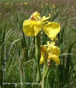 25th: There was a little rain around 0130 GMT and a few spots more about dawn. At 09 GMT soil and concrete were dry while the grass, slightly wet still, was drying rapidly. Pressure 1022 mb had risen as a ridge from Atlantic-high 1033 mb had reached across to NW Ireland and Scotland. The morning was overcast with thin cloud at first but soon breaks appeared and by noon there was hazy sunshine. The wind through the day was a light NE'ly. (The NOAA 12 satellite image at 1622 GMT shows the stratiform layers of slow-moving frontal cloud over Britain, S of a line through the Menai Strait to Scarborough, with good sunshine around Irish Sea coasts. Limited convective clouds had developed over Scotland and the Pennines). {Weymouth, Dorset 23C, Coventry 27 mm} [Rain 0.0 mm; Max 17.9C; Min 12.9C; Grass 12.9C]
26th: A mostly clear but hazy night and a warm sunny morning. Pressure was 1027 mb within ridge from Atlantic-high 1034 mb W of Ireland. The southern frontal cloud had transferred to N France. A shallow low was in the Bay of Biscay and convective storms developing in Normandy with another storm was off Lands End. In the N fronts associated with complex low-pressure around Greenland and Iceland were approaching NW Scotland bring a little rain. Here it was a sunny day with the maximum of 18.5C just after 09 GMT. Relative humidity fell from 96% to 62% then as a sea breeze set in, reinforcing the earlier light NE'ly, rose to 84% where it hovered through the day. By noon the cloud did burn off most of Britain except the far north and later in SE England. [Rain 0.0 mm; Max 18.5C; Min 10.8C; Grass 9.8C]
27th: A sunny day with maximum length of sunshine as there were, rarely, no clouds. There was a cool NE'ly breeze off the sea that kept the temperature to 17.2C. A clear night with 1 or 2 mist and fog patches in low lying areas and the west coast. {Lee on Solent 27C; Isle of man 16.2h Isle of Anglesey 15.6h} [Rain 0.0 mm; Max 21.0C; Min 9.6C; Grass 7.8C]
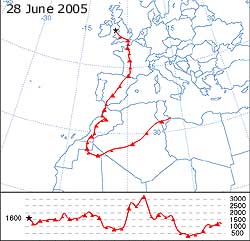 ¤
28th: Sunny again with the temperature rising to 21.0C by 09 GMT, thus becoming the maximum for the past 24-h. Pressure 1017 mb was falling a thundery low moved N from the Bay of Biscay. There was a storm cloud between SW Ireland and SW England with lightning and heavy rain. The storms moved N during the day, but here it was sunny with the temperature rising to 26.6C the highest of the month and the highest since the 27.7C on 2 August 2004. Relative humidity was 40% here but down to 23% reported elsewhere in a downthrust of dry air. Later in the afternoon it was cloudier, the covering remaining thin and bright at first, and increasingly dark and threatening by evening. (The MSG satellite image shows storm clouds over S Ireland, Wales and the Midlands. The vortex of the low can be seen off Brest in Brittany while a frontal disturbance can be seen S of Valentia, S Ireland).
There was moderate thunder and lightning from 1831 GMT (a cloud to ground lightning strike was reported in Llangoed at 1905 GMT) with spells of heavy rain at 1845- and 2100- before turning light up to 2315 GMT. The 12.5 mm rainfall was the largest of the month and brought the total for the month to 31.4 mm [47%].
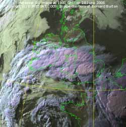 A light reddish-brown dust had been deposited in the rain. (Trajectory analysis, using the HYSPLIT model courtesy of the NOAA Air Resources Laboratory, indicated that a parcel of air arriving at 1600 m over Llansadwrn at 18 GMT had come from north Africa. The most likely pick up point was when the air was about 250 m AGL over northern Mauritania having come from southern Tunisia across the Sahara in Algeria. The route was then over Spanish Sahara, Morocco and high over the Atlas Mountains and across the Gibraltar Strait into Spain, then France, crossing the English Channel and over London to Anglesey). {Jersey 29.8C Capel Curig minimum 4.3C; Bournemouth AP 14 mm, Mumbles Head 7.8 mm}[Rain 12.5 mm; Max 26.6C; Min 11.8C; Grass 9.3C]
¤
¤
29th: No further rain overnight but distant thunder was heard between 04-05 GMT. An overcast and murky morning with moderate visibility. Pressure 1008 mb was still falling with the low 1004 mb off the coast of S Ireland. An occluded front was lying over Wales while the thundery trough had moved N and was giving rain on an arc in S Scotland. After the rain vegetables on the garden plot seemed to have grown overnight, so had the weeds that despite regular hoeing were lurking waiting for moisture! The day kept dry but overcast and dull until evening when a thundery trough arrived just before 1900 GMT, that had worked its way up through England and Wales.
 Distant thunder was heard and there was a little rain and later it became misty. The rest of the night was overcast with no more rain. {Herne Bay, Kent 27C; Trawscoed 22.4 mm, Lake Vyrnwy 20.4 mm} [Rain 0.3 mm; Max 18.9C; Min 13.7C; Grass 11.7C]
30th: After dawn the sky was brightening and there were some sunny spells. But by 09 GMT it was cloudier and the sky was darkening over Snowdonia. Pressure was 1003 mb in a complex system of fronts over the British Isles. Pressure was low 990 mb to the NW and 999 mb to the W and generally low 1007 mb over the Mediterranean too, while high 1020 mb to the SW over the Azores. Soon the dark clouds had moved across and there was a spell of moderate to heavy rain from 0915 GMT further bursts continuing through the morning. By 11 GMT it had turned to drizzle with visibility was down to 100m in hill fog. It was a wet day along the North Wales coast with Colwyn Bay having {30 mm}. In the afternoon there was a rapid clearance here with cumulus clouds developing, but showers kept away with the sky clearing further by evening. (The Menai Suspension Bridge Pont Menai is undergoing extensive refurbishment work that includes removal of all the old paint work by sandblasting and repainting ![]() . Work is proceeding on one half of the bridge at a time taking advantage of the driest part of the year, presently the western side facing the Britannia Bridge, and will not be finished until the autumn. This has meant closure of one carriage way with traffic using the other and has involved a novel approach to the problem - traffic is allowed off the island between 6 am and 2 pm while the return to the island is between 2 pm and 6 am Of course the Britannia Bridge can be used with a 3.5 mile detour, but is subject to delays especially in summer with heavy traffic to and from the Holyhead ferries. The Menai Bridge is used a lot by people living in the south-east corner of the island and the 'suspension shuffle' is a popular way of doing some shopping or business in Bangor. It was not the latest dance routine but involved going off the island to Bangor about 1.30 pm and returning about 2.30 pm. I did it today and took these pictures! Mind you the 5.30 am - 6.30 am shuffle is not popular at all- there's not a lot to do on the island at that time in the morning). {Port Ellen, Inner Hebrides 32.3 mm, Colwyn Bay 30.2 mm; Church Fenton N Yorks 27C} [Rain 7.7 mm; Max 18.3C; Min 13.2C; Grass 11.8C]
. Work is proceeding on one half of the bridge at a time taking advantage of the driest part of the year, presently the western side facing the Britannia Bridge, and will not be finished until the autumn. This has meant closure of one carriage way with traffic using the other and has involved a novel approach to the problem - traffic is allowed off the island between 6 am and 2 pm while the return to the island is between 2 pm and 6 am Of course the Britannia Bridge can be used with a 3.5 mile detour, but is subject to delays especially in summer with heavy traffic to and from the Holyhead ferries. The Menai Bridge is used a lot by people living in the south-east corner of the island and the 'suspension shuffle' is a popular way of doing some shopping or business in Bangor. It was not the latest dance routine but involved going off the island to Bangor about 1.30 pm and returning about 2.30 pm. I did it today and took these pictures! Mind you the 5.30 am - 6.30 am shuffle is not popular at all- there's not a lot to do on the island at that time in the morning). {Port Ellen, Inner Hebrides 32.3 mm, Colwyn Bay 30.2 mm; Church Fenton N Yorks 27C} [Rain 7.7 mm; Max 18.3C; Min 13.2C; Grass 11.8C]
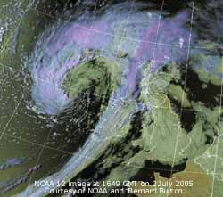 1st: It was bright early on but had become cloudier by 09 GMT. Pressure was 1010 mb with a moist W'ly air flow across Britain. It was a cloudy scene with complex frontal systems giving little chance of any bright weather. There were some spots of rain in Bangor at 11 GMT then it was dry until 13 GMT when low stratiform cloud brought mist and heavy drizzle across the island. There was light rain from 1445 to 2000 GMT with the continuing fine drizzle eventually drying up around midnight. [Rain 3.7 mm; Max 18.5C; Min 12.2C; Grass 10.7C]
2nd: Another overcast morning, but visibility was good although cloud was still low enough to cover the tops of the Snowdonia Mountains. Pressure was 1014 mb with deepening Atlantic-low 991 mb W of Ireland. The morning kept mostly cloudy but a break had appeared above the weather station by 1030 GMT, but these were few. The wind, a force 4 S'ly, freshened during the day and was a blustery force 5/6 during the afternoon. (The NOAA 12 satellite image shows the deepening low to the W of Scotland. At noon the MO analysis indicated the low at 987 mb and 982 mb at 1800 GMT, unusually low for this time of year. The cold front can be seen over Ireland with thick stormclouds off the Western Isles).The weak cold front moved across here about 2330 GMT with the wind force 6/7 and a moderate shower of rain, but in W Scotland heavy rain was experienced. [Rain 2.3 mm; Max 17.6C; Min 14.8C; Grass 14.4C]
![]() 3rd: The wind moderated after the passage of the cold front and then we were into a clearer slot of weather. By 09 GMT cumulus clouds had developed here although it was still clear in the W. Pressure 1015 mb was rising with the low 980 mb near Rockall off NW Scotland. The morning was mostly cloudy with a little sunshine from time to time but the afternoon kept overcast and dull. A series of light showers passed over from about 21 GMT through the night. [Rain 0.8 mm; Max 17.2C; Min 10.6C; Grass 9.1C]
3rd: The wind moderated after the passage of the cold front and then we were into a clearer slot of weather. By 09 GMT cumulus clouds had developed here although it was still clear in the W. Pressure 1015 mb was rising with the low 980 mb near Rockall off NW Scotland. The morning was mostly cloudy with a little sunshine from time to time but the afternoon kept overcast and dull. A series of light showers passed over from about 21 GMT through the night. [Rain 0.8 mm; Max 17.2C; Min 10.6C; Grass 9.1C]
![]()
![]() 4th: A showery morning with occasional glimpses of sunshine. Pressure 1010 mb was rising with the mature low 986 mb off SE Iceland. A minor frontal disturbance low to the N had moved from Ireland over the Irish Sea in the night and another, out of France where there had thunderstorms in the night, was tracking N into the S North Sea. There had been heavy overnight rain in NE France, Belgium and the Netherlands. With over 100 mm rain reported over a wide area; there was flooding and disruption to road and rail services especially around Lille. (The MSG satellite image shows the storm cloud stretching from France over the Netherlands and into the North Sea; the radar image shows the intensity of rainfall).
4th: A showery morning with occasional glimpses of sunshine. Pressure 1010 mb was rising with the mature low 986 mb off SE Iceland. A minor frontal disturbance low to the N had moved from Ireland over the Irish Sea in the night and another, out of France where there had thunderstorms in the night, was tracking N into the S North Sea. There had been heavy overnight rain in NE France, Belgium and the Netherlands. With over 100 mm rain reported over a wide area; there was flooding and disruption to road and rail services especially around Lille. (The MSG satellite image shows the storm cloud stretching from France over the Netherlands and into the North Sea; the radar image shows the intensity of rainfall).
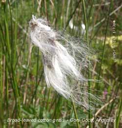 Here a transient ridge of high-pressure was moving in behind the rain. At first the force 3 N/NW'ly wind made the 12.3C temperature feel rather chilly for July but the maximum rose to 18.0C in the afternoon in sunshine when the sky cleared. The evening was clear but frontal cloud encroaching from the W reached here soon after midnight. [Rain trace; Max 18.0C; Min 10.0C; Grass 8.8C]
![]() 5th: A cloudy but dry start with a moderate SSW'ly wind. Pressure 1006 mb at 09 GMT was falling as a low 999 mb developed on a frontal system tracked filling towards the Irish Sea. Rain was already affecting N Ireland, S Wales and SW England. There were a few spots of rain by 0930 GMT then intermittent rain followed by some moderate to heavy rain accumulating 8 mm. By 1300 GMT the rain had stopped, but there was only a partial clearance of the sky and few sunny spells during the afternoon. Pressure was at it's lowest 1002 mb with the low 1001 mb Liverpool Bay at 18 GMT. There was a shower of rain around 22 GMT. (Broad-leaved cotton grass (Eriophorum latifolium) in flower in June/ July. Photographed at Gors Goch on Anglesey this species is found growing in peat on calcareous mires where the pH is neutral or alkaline. Apart from broader leaves it looks a bit like the common cotton-grass (E. angustifolium) a calcifuge plant that grows on acidic peats). [Rain 8.8 mm; Max 18.0C; Min 10.8C; Grass 8.6C]
5th: A cloudy but dry start with a moderate SSW'ly wind. Pressure 1006 mb at 09 GMT was falling as a low 999 mb developed on a frontal system tracked filling towards the Irish Sea. Rain was already affecting N Ireland, S Wales and SW England. There were a few spots of rain by 0930 GMT then intermittent rain followed by some moderate to heavy rain accumulating 8 mm. By 1300 GMT the rain had stopped, but there was only a partial clearance of the sky and few sunny spells during the afternoon. Pressure was at it's lowest 1002 mb with the low 1001 mb Liverpool Bay at 18 GMT. There was a shower of rain around 22 GMT. (Broad-leaved cotton grass (Eriophorum latifolium) in flower in June/ July. Photographed at Gors Goch on Anglesey this species is found growing in peat on calcareous mires where the pH is neutral or alkaline. Apart from broader leaves it looks a bit like the common cotton-grass (E. angustifolium) a calcifuge plant that grows on acidic peats). [Rain 8.8 mm; Max 18.0C; Min 10.8C; Grass 8.6C]
 6th: After a moderate shower of rain at 01 GMT the rest of the night was dry. The moderate NW'ly wind made the 14.7C temperature at 09 GMT feel rather cool around the knees - I refuse to give in to mediocre summer weather and continue to wear shorts. Prospects look better for the end of the week with temperatures likely to rise. At the moment with pressure rising on 1010 mb with the Azores high 1032 mb to the SW. Yesterday's low 1002 mb was over Scarborough on the E coast of England. The morning was mostly cloudy, early brightness was fading as orographic cloud piled up against the Snowdonia Mountains in the NW'ly off the Irish Sea. The afternoon was dull with occasional slight showers of rain. By evening it was a little brighter again with clearer skies. [Rain trace; Max 15.5C; Min 11.5C; Grass 11.0C]
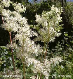 7th: With some clear sky at night minimum temperatures were a little lower (air 9.2C and grass 7.3C both lowest of the month). The minimum was the only one below 10C in the month. A bright start as the jetstream had edged further W and brought clear skies. There were cumulus clouds over Snowdonia but overhead was jetstream cirrus and contrails. Pressure 1018 mb was rising with Azores-high 10312 mb building from the SW. The old low 1004 mb was still in the S North Sea off Dover with associated frontal cloud. Here a mostly sunny morning with a force 3 N'ly wind, but by noon the cloud had moved back and there were spots of rain or drizzle intermittently through the afternoon. The amount of rain was so small that it was evaporating on contact with surfaces - there was none in the raingauge bottle (this is recorded as a trace). The night was cloudy but dry. (The creamy-white flowers of Meadowsweet Filipendula ulmaria typical of summer can be seen along damp hedgerows from late June to September. Prefers neutral or calcareous soils and grows about 100 cm tall. The flowers have a powerful sweet scent, perhaps more pleasant when dried, and formerly used to 'sweeten the air' in buildings. Also used in the past for as a herbal treatment of rheumatism and arthritis ). [Rain trace; Max 17.5C; Min 9.2C; Grass 7.3C]
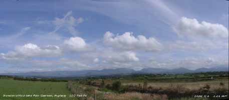 8th: Overcast but bright, an indication of a layer of thinning cloud. Pressure 1022 mb was rising with Azores-high 1029 mb to the SW. Low 993 mb over the Denmark Strait (between Greenland and Iceland) had associated warm fronts over the Irish Sea and W Ireland. Here the cloud was dispersing and there were soon sunny spells, but in W Ireland the cloud was thick enough to give drizzle or light rain. Slowly brightening through the afternoon with almost clear skies by evening with dew forming on grass at dusk. Mist and fog formed in low-lying areas including the Menai Strait by midnight. [Rain 0.0 mm; Max 18.7C; Min 13.3C; Grass 12.7C]
9th: Mist and fog patches soon clearing to give a sunny morning. Pressure 1026 mb was rising within ridge of high-pressure from the Azores. Remnant frontal cloud was still over NW Scotland and Ireland where there were a few spots of rain. Here almost clear skies, just a few cumulus developing well to the S. The afternoon too was mostly sunny with the temperature rising to 22.0C, but some high cloud, remnant of the front moving E, encroached by 18 GMT. The night was clear at times with mist forming across the fields by midnight. {Cardiff 26.4C} [Rain 0.0 mm; Max 22.0C; Min 10.8C; Grass 8.8C]
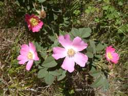 10th: A bright morning with the mist cleared away early before some patchy cloud encroached from the N by 09 GMT. Pressure was 1031 mb with the intensifying high centred over Shannon, Ireland. The temperature had already reached 19.9C with a light NNE'ly breeze and rose to 22.4C during the day. The sky was mostly clear over Anglesey with just a few small cumulus clouds formed over Snowdonia. Visibility was extremely good, in clean air, with excellent views S across the Snowdonia Mountains, Lleyn Peninsula and Bardsey Island 45 miles distant. Rarely the Isle of Man 70 miles to the N and over 90 miles to the NE the Mountains of Cumbria could be seen clearly. The evening and night were clear. (In flower now are wild roses that can be seen best along mature untrimmed hedgerows. The best are always those that escape the mechanical cutter! ).[Rain 0.0 mm; Max 22.4C; Min 14.0C; Grass 12.3C]
![]() 11th: It was a warm night with the minimum 15.3C, highest of the month. Another clear sunny morning with excellent visibility. (The Meteosat MSG image shows Britain under almost cloudless skies at 09 GMT). Pressure was a little higher at 1033 mb and it was clear skies and sunshine through to the end of the day. Here the temperature rose to 24.1C with a gentle NE'ly sea breeze, on the west it was warmer with RAF Valley reporting 27C. During the afternoon some convective clouds developed over S Snowdonia but diminished by evening when smoke (pollution) haze was seen. The night was clear with dew formed on grass. {Valley, Anglesey 15.4h, Bolton and Bournemouth 30C, Cardiff 29.4C} [Rain 0.0 mm; Max 24.1C; Min 15.3C; Grass 12.6C]
11th: It was a warm night with the minimum 15.3C, highest of the month. Another clear sunny morning with excellent visibility. (The Meteosat MSG image shows Britain under almost cloudless skies at 09 GMT). Pressure was a little higher at 1033 mb and it was clear skies and sunshine through to the end of the day. Here the temperature rose to 24.1C with a gentle NE'ly sea breeze, on the west it was warmer with RAF Valley reporting 27C. During the afternoon some convective clouds developed over S Snowdonia but diminished by evening when smoke (pollution) haze was seen. The night was clear with dew formed on grass. {Valley, Anglesey 15.4h, Bolton and Bournemouth 30C, Cardiff 29.4C} [Rain 0.0 mm; Max 24.1C; Min 15.3C; Grass 12.6C]
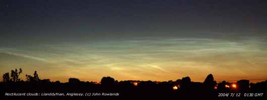 ¤
12th: (If you were up and looking N after midnight you may have seen a spectacular display of noctilucent clouds. This image was taken by John Rowlands at Llanddyfnan, Anglesey about 0130 GMT. The ripples of silvery-blue clouds are the highest in the atmosphere and July is the best month to observe them. About 50 miles high in the mesosphere, they catch the sun long after it has set, and reside in the coldest part of the earth's atmosphere where temperatures can fall as low as minus 200C and winds reach 300 mph.. ). Another clear and sunny morning. With the sea breeze yet to begin the temperature at 09 GMT was 23.1C with the dewpoint 15.9C (RH 64%) so fairly humid. Pressure was 1032 mb with Atlantic-high 1035 now to the W and Ireland. The temperature continued to rise to 27.1C, the highest maximum of the month, about 1045 GMT when the cooling sea breeze cut in reducing the temperature and raising the relative humidity. Visitors to the top of Snowdon have had several days of clear, cloud-free views from the summit. The mountain railways has been doing a brisk trade with smoke from the little trains reaching the summit clearly visible from Anglesey. On the west coast it was clear and sunny all day but on the east localised sea fog affected Red Wharf Bay to Penmon from 1500 GMT. Here, just a few miles inland and at 107 m, it kept mostly sunny till the dusk. (With the sea temperature rising to 20.5C in the shallows on the west coast of Anglesey Jellyfish are beginning to be washed up on the shore. This not very common Chrysaora isosceles was about 20 cm diameter. The 24 dark-spotted lobes on the edge have long tentacles that hang down in the water underneath. In flower now on Anglesey is the dune helleborine orchid Epipactis dunesis. ). {Leuchars, Fife 29.1C, Isle of Man 16.0h; Valley, Anglesey 15.4h Hawarden 28.4C} [Rain 0.0 mm; Max 27.1C; Min 14.5C; Grass 11.9C]
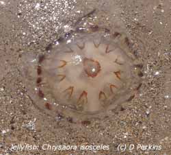 13th: Cloudier this morning but continuing mostly sunny. Visibility was good but hazy. Pressure 1028 mb was falling within a ridge of high-pressure from the now mid-Atlantic high 1034 mb. There was frontal cloud lying to the N and the sky was a mixture of cumulus, cirrostratus and cirrus clouds. The temperature at 09 GMT was 16.3C in a light NNE'ly breeze rising to 18.8C later in the day. {Charlwood, Surrey 30.7C, Cardiff 29.2C; Falmouth, Cornwall 15.2h, Anglesey 10.3h} [Rain 0.0 mm; Max 21.4C; Min C; Grass C]
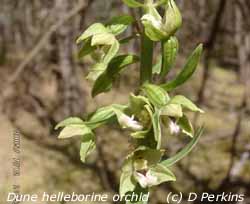 14th: A bright and warmer morning with the temperature rising to 21.4C at 09 GMT, thus becoming the maximum for the past 24-h. There was a 6/8 cover of high mainly altocumulus clouds with occasional sunshine. The wind was a light SSW'ly and pressure had fallen to 1019 mb having lost influence of Atlantic-high 1033 mb receded further SW. Low-pressure to the N had associated frontal cloud, with a little rain, over NW Scotland and Ireland to the Irish Sea. The morning and early afternoon were bright under thin cloud, halo seen, before the cloud thickened by 17 GMT. With no sea breeze developing today the temperature rose to 25.0C, RH 53%. There was a light shower of rain just before midnight. [Rain 0.3 mm; Max 25.0C; Min 14.1C; Grass 11.3C]
15th: A mostly cloudy morning with a light W'ly breeze. Pressure was 1015 mb and although influenced by Atlantic-high 1031 mb there was a shallow low 1005 mb in the North Sea near Bergen and associated weak cold front was lying across Anglesey. Today is St. Swithin's Day so folklore tells us that if there is rain today it will be wet for 40 days, conversely if dry we can expect the dry weather to continue. Well the shower or rain was before midnight and it was a dry day!. With thinning and dispersing cloud in the afternoon it became quite sunny with the temperature rising to 20.2C. By evening it was cloudier once more. [Rain 0.0 mm; Max 20.2C; Min C; Grass C]
16th: Overcast at first there were 1 or 2 breaks in the cloud at 09 GMT. Pressure 1020 mb was rising again as the ridge from the Atlantic-high re-establishing. The wind was a light NE'ly and it was a little cooler with the temperature on 14.5C. The cloud was slow to clear, but it did so by the afternoon turning sunny with moderate smoke haze developing. Mostly clear sky at night. [Rain 0.0 mm; Max 19.8C; Min 13.3C; Grass 12.7C]
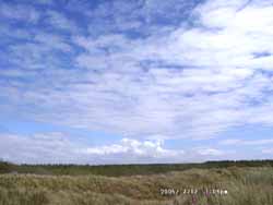
![]() 17th: Clear skies early with remnant patches of frontal stratiform cloud N and S of Anglesey. By 09 GMT some cloud had moved across but the temperature was already 19.8C. Pressure was steady on 1017 mb and there was a light and variable mainly S'ly wind. It was still mostly overcast at noon but started to clear by 14 GMT. In sunshine the temperature rose to 25.1C at 1530 GMT. The evening was clear and did not turn cloudy until after midnight when the wind strengthened to force 5. Duststorms have been raging across north Africa. As weather patterns change dust has blown in various directions inconsistently towards Europe but well S of the Canary Islands consistently W over the Atlantic. [Rain 1.4 mm; Max 25.1C; Min 12.4C; Grass 11.0C]
17th: Clear skies early with remnant patches of frontal stratiform cloud N and S of Anglesey. By 09 GMT some cloud had moved across but the temperature was already 19.8C. Pressure was steady on 1017 mb and there was a light and variable mainly S'ly wind. It was still mostly overcast at noon but started to clear by 14 GMT. In sunshine the temperature rose to 25.1C at 1530 GMT. The evening was clear and did not turn cloudy until after midnight when the wind strengthened to force 5. Duststorms have been raging across north Africa. As weather patterns change dust has blown in various directions inconsistently towards Europe but well S of the Canary Islands consistently W over the Atlantic. [Rain 1.4 mm; Max 25.1C; Min 12.4C; Grass 11.0C]
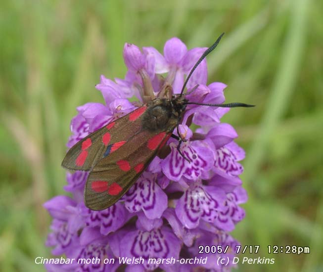 18th: With frontal cloud encroaching from the NW it was overcast by 03 GMT and there was rain from 0530 on a weak cold front. There were a few burst of moderate rain just before 09 GMT before becoming light then drizzle; visibility was poor in mist. Pressure 1006 mb had fallen with low 989 mb W of Rockall and an associated split cold front over St George's Channel and Irish Sea. The morning was dull and damp but the sky stated to clear about noon and early afternoon was mostly sunny. Later it became cloudier again. [Rain 0.0 mm; Max 20.0C; Min 14.0C; Grass 13.0C]
![]() 19th: A mostly cloudy morning with the sky slow to clear. Pressure was 1014 mb with complex low-pressure just to the N of Scotland. Pressure was high 1027 mb to the SW and we were in a cloudy airflow with fresh (f5) W'ly winds. By afternoon the sky was a lot clearer with some good sunny spells developing by evening. (The Meteosat MSG satellite image (c) EUMETSAT shows orographic-wave clouds developed extensively over Britain while sky is clearer over most of the Irish Sea. There is frontal cloud SW of Ireland, convective (shower) clouds NW and low stratiform cloud layers over the S North Sea). North African duststorms continue and currently there are large ones in Mauritania. Winds continue to blow the dust out into the Atlantic towards the Caribbean. [Rain 0.0 mm; Max 18.2C; Min 10.6C; Grass 8.1C]
19th: A mostly cloudy morning with the sky slow to clear. Pressure was 1014 mb with complex low-pressure just to the N of Scotland. Pressure was high 1027 mb to the SW and we were in a cloudy airflow with fresh (f5) W'ly winds. By afternoon the sky was a lot clearer with some good sunny spells developing by evening. (The Meteosat MSG satellite image (c) EUMETSAT shows orographic-wave clouds developed extensively over Britain while sky is clearer over most of the Irish Sea. There is frontal cloud SW of Ireland, convective (shower) clouds NW and low stratiform cloud layers over the S North Sea). North African duststorms continue and currently there are large ones in Mauritania. Winds continue to blow the dust out into the Atlantic towards the Caribbean. [Rain 0.0 mm; Max 18.2C; Min 10.6C; Grass 8.1C]
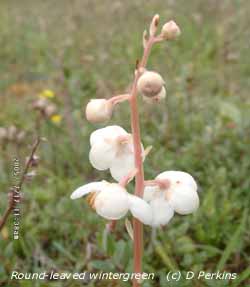
![]() 20th: Overcast at dawn the sky was clearing by 09 GMT. The W'ly wind was still fresh but the morning mostly sunny. Pressure was 1020 mb with high 1030 mb over the Bay of Biscay and frontal cloud lying across S Ireland, South Wales and SW England associated with shallow Atlantic-low 1003 mb S of Greenland. The afternoon was mostly sunny with wispy cirrus clouds high overhead. By 18 GMT cloud had thickened and was overcast overnight. (Photograph: shows the Afon Cadnant at Llandegfan running low after the dry weather. It's source is near Llyn Bodgylched close to the old Almshouses 100 m above Beaumaris). [Rain 0.0 mm; Max 21.9C; Min 12.6C; Grass 10.1C]
20th: Overcast at dawn the sky was clearing by 09 GMT. The W'ly wind was still fresh but the morning mostly sunny. Pressure was 1020 mb with high 1030 mb over the Bay of Biscay and frontal cloud lying across S Ireland, South Wales and SW England associated with shallow Atlantic-low 1003 mb S of Greenland. The afternoon was mostly sunny with wispy cirrus clouds high overhead. By 18 GMT cloud had thickened and was overcast overnight. (Photograph: shows the Afon Cadnant at Llandegfan running low after the dry weather. It's source is near Llyn Bodgylched close to the old Almshouses 100 m above Beaumaris). [Rain 0.0 mm; Max 21.9C; Min 12.6C; Grass 10.1C]
21st: With pressure 1024 mb keeping high, although cloudy at first, by afternoon it had turned mostly sunny. [Rain 0.1 mm; Max 19.8C; Min 10.7C; Grass 7.4C]
![]() 22nd: Overnight a large area of stratiform cloud had encroached and by morning was thick enough to give some fine drizzle. (The amount of rainfall at 09 GMT was only 0.14 mm, enough to wet the grass and concrete but not the soil. With surface (0-5 cm) soil moisture content down to 29% of dry mass it would do nothing to restore this month's water balance that is currently minus 25 mm.
22nd: Overnight a large area of stratiform cloud had encroached and by morning was thick enough to give some fine drizzle. (The amount of rainfall at 09 GMT was only 0.14 mm, enough to wet the grass and concrete but not the soil. With surface (0-5 cm) soil moisture content down to 29% of dry mass it would do nothing to restore this month's water balance that is currently minus 25 mm.
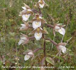 But taking the year so far with rainfall of 476 mm, PE of 234 mm the water balance is 242 mm. Grass and shallow rooted crops are the most susceptible to water stress. Large trees, although transpiring perhaps about 300 litres of water a day, can take up water from great depths in the soil. At present the trees at the weather station show no wilt, as was seen in 1976; grass growth is very slow and mostly by the broader-leaved deeper rooted species, fine grasses like the fescues are hardly growing at all. Some garden crops (e.g. lettuce) have needed watering but I have put no water on potatoes, broad beans (we ate the first beans on the 18th, and very nice they were too) and peas. If there is no significant rain garden peas, that have the first pods formed, will need water to fatten them before long ). Pressure had fallen a little to 1019 mb as low 1007 mb approached the W of Ireland. The drizzle petered out during the morning, but the day kept overcast with thick uniform grey cloud and little or no wind. The day was sunless and solar radiation was only 5.92 mv h, the lowest since 1 June (5.87 mv h); the day's maximum temperature was 15.9C. (The Meteosat satellite image shows in the middle of the Atlantic, W of Africa, a tropical wave. The unusually large low-pressure system contains Saharan dust blown there from the storms raging in Mauritania and elsewhere in N Africa. The dust is likely to reduce visibility over the Caribbean Sea over the next week, having already reached the West Indies, and perhaps be washed out during thunderstorms when the dust-laden air arrives. Some dust will become global, stay in the atmosphere for many months and could eventually be washed out anywhere).
[Rain trace; Max 16.2C; Min 13.2C; Grass 11.0C]
23rd: Another overcast morning, but the cloud (stratocumulus) had some structure today and some thinner patches so it was occasionally bright. At 09 GMT it was bright enough for the temperature to rise to 16.2C, the highest of the past 24-h. The wind was light NE'ly, or variable. Pressure 1009 mb was falling with the developing low 1003 mb off SW Ireland. Slow-moving frontal cloud and some patchy rain affected Ireland and SW England, but seemed to be dying out before reaching Anglesey. Rain made little progress N through the day and the afternoon here was mostly sunny. The evening was clear with hazy sunshine. (Soil moisture today was 29% dry mass, the lowest of the year. Net grass production over the last 9 days has unusually, for here, been close to zero. The grass still looks mostly green, except where soil is very shallow, and it is not wilting). [Rain 0.0 mm; Max 20.7C; Min 13.2C; Grass 12.9C]
![]()
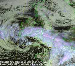 24th: Frontal cloud arrived over Snowdonia about 03 GMT but rain kept to the S. At 09 GMT pressure 1002 mb had fallen with the low 995 mb near the Bristol Channel. (The Meteosat MSG satellite image shows the deepening low off SE Ireland near the Bristol Channel and the swirl of rain-bearing cloud ). Rainfall was heavy in Cork, Ireland {73.7 mm}, South Wales {Sennybridge 30.8 mm}with light rain in a band stretching to London and Kent. Slight rain had reached as far N
 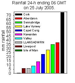 as the Lleyn Peninsular and the SW corner of Anglesey. It was raining in Snowdonia {Lake Vyrnwy 28.6 mm} before but it was dry here until 1330 GMT when there was light to moderate rain until 1900 GMT. Heavy rain was experienced on the Lleyn Peninsula with Aberdaron recording 37.6 mm. Here in rain-shadow we had only 5.9 mm.
 ![]() The night was overcast but kept dry. (The plume of Saharan dust (reported on 17th and 22nd above) had reached the Caribbean Sea Florida, see the GOES 12 satellite image and trajectory analysis on 27th below. There may be some colourful sunsets for a while but if concentrations are high at ground level could enhance human respiratory ailments. The ecology of the Caribbean islands, and the Amazon rainforest, has been influenced positively by the periodic deposition of African dusts. Conversely, some species of Caribbean corals have been negatively affected by the dust).{Cork AP 73.7 mm, Rosslare 53.3 mm, Aberdaron 37.6 mm} [Rain 5.9 mm; Max 16.6C; Min 14.4C; Grass 12.0C]
The night was overcast but kept dry. (The plume of Saharan dust (reported on 17th and 22nd above) had reached the Caribbean Sea Florida, see the GOES 12 satellite image and trajectory analysis on 27th below. There may be some colourful sunsets for a while but if concentrations are high at ground level could enhance human respiratory ailments. The ecology of the Caribbean islands, and the Amazon rainforest, has been influenced positively by the periodic deposition of African dusts. Conversely, some species of Caribbean corals have been negatively affected by the dust).{Cork AP 73.7 mm, Rosslare 53.3 mm, Aberdaron 37.6 mm} [Rain 5.9 mm; Max 16.6C; Min 14.4C; Grass 12.0C]
25th: At midnight the low was 979 mb centred at the head of the Bristol Channel with the heavy rain moving along the S coast of England. Overcast at first, but the cloud was beginning to thin here at 09 GMT. Pressure was 1007 mb with low 999 mb over SE England and the Channel. The Menai Strait Regatta fortnight stated today at Menai Bridge, sailors are hoping for some wind as 14 classes line up in turn this morning near the Suspension Bridge for the starting gun. After a delayed start racing got off in a moderate NE'ly wind giving good tacking towards Bangor pier and runs back to the Suspension Bridge. By afternoon there were some good sunny spells with the sky clearing towards evening. The night was partially cloudy with some clear spells. [Rain 0.0 mm; Max 15.4C; Min 11.0C; Grass 10.5C]
![]()
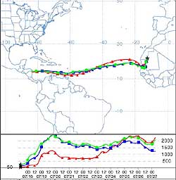 26th: A bright sunny morning with altocumulus overhead soon dispersing. There was a little convective cloud development over the mountains with a line of stratocumulus forming. Pressure 1012 mb had risen with a ridge of high-pressure over Liverpool Bay with Atlantic-high 1025 mb well to the W. (The NOAA 18 satellite image shows the vortex of a small low (triple point) 1011 mb near Rockall, W of Scotland, moving slowly SE. Another vortex of slow-moving low 1002 mb can be seen lying off Iberia. Associated frontal cloud was over Brittany and the Cherbourg Peninsular where there was heavy showery rain. Portugal that has been having a severe drought also had some rain. There was limited convection over Britain but little in the way of rain during the day). The afternoon on Anglesey was sunny under clear skies but the evening became overcast. Although the rainfall radar showed rain over Anglesey at 21 GMT there was none here; a case of it evaporating before reaching the ground. Painting of the Menai Bridge seems to have been going well during the spell of good weather. Part of the western side near the Antelope Inn has been completed and work has started on the east side. Traffic must now do a dogleg run, from side to side of the bridge, as the Anglesey end of the western side has yet to be finished. People in Mumbai (formerly Bombay) in India (a city of more than 15 million inhabitants) have experienced the heaviest recorded monsoon rainfall of 944 mm (no decimal point) or 37.2 inches in one day. At least 500 have been reported missing or dead in the resulting floods and mudslides in Maharashtra State and 273 in Mumbai. Monsoon-related flooding is not unusual in the summer when the heated land surface generates winds that pull warm, moisture-laden air over the Indian subcontinent. Mumbai, India 944 mm. [Rain 0.0 mm; Max 18.8C; Min 10.8C; Grass 9.3C]
![]()
![]() 27th: Overcast at first it was brightening with a little sunshine at 08 GMT. At 09 GMT the sky had 6/8 cover of altocumulus, cirrus and contrails with some convective cumulus over Snowdonia. Pressure was 1010 mb with slow-moving low 1002 mb off Brest, France, with associated frontal cloud lying along the English Channel. During the day the fronts moved slowly N but it kept bright and sunny here under thin cloud until evening. (In the garden in warm sunshine marjoram Origanum vulgare was in full flower and attracting honeybees, 3 species of bumblebee and several butterflies including peacock and green-veined white.). Increasingly hazy; visibility was poor at 18 GMT. By 22 GMT it was still dry here but rain had reached central Wales. (Trajectory analysis, using the HYSPLIT model at the NOAA Air Resources Laboratory, indicated that dust-laden parcels of air leaving Mauritania between 50 and 250 m at 12 GMT on 17th (see also diary on 24th for progress) were transported across the Caribbean Sea and had reached Honduras and Nicaragua by midnight today). {Jersey 22.9C, Rhyl 20.4C, London 15C, Bristol 14C; Plymouth 18.4 mm, Mumbai, India 944 mm} [Rain 23.3 mm; Max 18.6C; Min 12.0C; Grass 11.0C]
27th: Overcast at first it was brightening with a little sunshine at 08 GMT. At 09 GMT the sky had 6/8 cover of altocumulus, cirrus and contrails with some convective cumulus over Snowdonia. Pressure was 1010 mb with slow-moving low 1002 mb off Brest, France, with associated frontal cloud lying along the English Channel. During the day the fronts moved slowly N but it kept bright and sunny here under thin cloud until evening. (In the garden in warm sunshine marjoram Origanum vulgare was in full flower and attracting honeybees, 3 species of bumblebee and several butterflies including peacock and green-veined white.). Increasingly hazy; visibility was poor at 18 GMT. By 22 GMT it was still dry here but rain had reached central Wales. (Trajectory analysis, using the HYSPLIT model at the NOAA Air Resources Laboratory, indicated that dust-laden parcels of air leaving Mauritania between 50 and 250 m at 12 GMT on 17th (see also diary on 24th for progress) were transported across the Caribbean Sea and had reached Honduras and Nicaragua by midnight today). {Jersey 22.9C, Rhyl 20.4C, London 15C, Bristol 14C; Plymouth 18.4 mm, Mumbai, India 944 mm} [Rain 23.3 mm; Max 18.6C; Min 12.0C; Grass 11.0C]
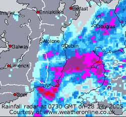
![]() 28th: At 00 GMT midnight the low had moved to be centred near the Scilly Isles and had begun to deepen. A frontal triple point was lying over the Bristol Channel and a warm front moving N over Wales. Rain started here soon after midnight as heavy rain, and thunderstorms, moved up from the Bristol Channel towards St George's and through Wales during the night. Rain was heavy here from 0400 GMT. At 0730 GMT rain was heavier and thunder was heard from 0734 to 0804 GMT. At 09 GMT with cumulonimbus clouds in the vicinity rain was still heavy with 23.3 mm accumulated, the largest 24-h fall of the month credited to the 27th. Another 9 mm accumulated in the next 90 minutes but had then turned light. Pressure was 1006 mb with the low deepened to 998 mb at 06 GMT unmoved close to the Scilly Isles with the triple point over central Wales. (The Meteosat MSG image (c) EUMETSAT shows at 09 GMT the vortex of the low centred near the Scilly Isles and the stormcloud just N of Anglesey over the Irish Sea).
28th: At 00 GMT midnight the low had moved to be centred near the Scilly Isles and had begun to deepen. A frontal triple point was lying over the Bristol Channel and a warm front moving N over Wales. Rain started here soon after midnight as heavy rain, and thunderstorms, moved up from the Bristol Channel towards St George's and through Wales during the night. Rain was heavy here from 0400 GMT. At 0730 GMT rain was heavier and thunder was heard from 0734 to 0804 GMT. At 09 GMT with cumulonimbus clouds in the vicinity rain was still heavy with 23.3 mm accumulated, the largest 24-h fall of the month credited to the 27th. Another 9 mm accumulated in the next 90 minutes but had then turned light. Pressure was 1006 mb with the low deepened to 998 mb at 06 GMT unmoved close to the Scilly Isles with the triple point over central Wales. (The Meteosat MSG image (c) EUMETSAT shows at 09 GMT the vortex of the low centred near the Scilly Isles and the stormcloud just N of Anglesey over the Irish Sea).
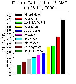 There was a bright spell with a glimpse of sunshine around 13 GMT before another spell of light showery rain. But Birmingham was hit by a tornado about 1330 GMT. Scores of trees were brought down many crushing vehicles and blocking roads. Buildings lost roofs and had other structural damage; some houses were so badly damaged that it is thought they will have to be demolished. Shopping areas were hit by flying debris and roads flooded under the torrential rain. At least 19 people were hurt, 3 seriously, in what was described as one of the severest tornados to affect Britain since the same area was hit in 1931. [Rain 10.7 mm; Max 17.1C; Min 11.2C; Grass 11.0C]
29th: Another overcast and murky morning with very poor visibility just after dawn. By 09 GMT it was a little brighter (the best of the day), visibility had improved to good but the sky was still overcast. Slowly filling low 1006 mb was over North Wales with decaying frontal cloud over the Irish Sea. The W coast of the island stayed brightest and dry until about 1330 GMT. In the SE corner low cloud moved across from the SE bringing drizzle then heavy rain from 1130 GMT until about 1500 GMT. This was followed by intermittent light rain and heavy drizzle bringing the total accumulated by 18 GMT to 12 mm. [Rain 18.3 mm; Max 18.1C; Min 11.5C; Grass 11.3C]
30th: There was further light rain after midnight heaviest between 0330 and 0430 GMT that brought the total rainfall to 18.3 mm. This brought the month's total to 75.6 mm (126% of average). At 09 GMT pressure was 1011 mb, the low still over Wales, was dissipating and would lose it's identity later in the day before reforming over the North Sea. This did not lead to much improvement in the weather and it was a dull and wet beginning to the week-long National Eisteddfod, held this year in the north of Wales at Vaynol (near the mainland end of the Britannia Bridge). Preparations for the Eisteddfod took place under ideal dry and sunny weather; but the heavy rain and traffic to the stands churned up the grass turning it into mud. At least 3000 tonnes of stone had to be brought in to make dry roadways for the hundreds of visitors. The day was sunless, under a low and thick stratiform cloud layer, with a few spots of rain here and there. [Rain 2.0 mm; Max 16.6C; Min 13.5C; Grass 13.4C]
31st: Yet more dismal weather with low stratiform cloud hugging high ground and coasts. Drizzle before 09 GMT had eased off but visibility was only moderate. Pressure 1015 mb was rising with low 999 mb in the middle of the North Sea. There was much cloud over Britain and to the W so little chance of a rapid clearance. The wind was a light N'ly with a showery trough over Wales that produced a shower around 1130 GMT and light rain from 1530 to just after 1700 GMT. The temperature rose only to 14.6C, the lowest maximum of the month. [Rain 2.0 mm; Max 14.6C; Min C; Grass C]

![]() 1st: Low stratiform cloud gave an overcast and dull beginning to the month. Pressure 1020 mb, however, was rising very slowly and there was some structure to the cloud with thinner patches. During the morning there were occasional bright spells and glimpses of the sun, but it was not until mid-afternoon that the sky started to clear. With light N'ly winds courses were shortened in the Menai Strait regatta at Beaumaris. By 18 GMT the sky was almost clear and it was a sunny end to the day. At dusk dew formed on the grass; it was a dry night. [Rain 0.0 mm; Max 15.5C; Min 13.5C; Grass 13.4C]
1st: Low stratiform cloud gave an overcast and dull beginning to the month. Pressure 1020 mb, however, was rising very slowly and there was some structure to the cloud with thinner patches. During the morning there were occasional bright spells and glimpses of the sun, but it was not until mid-afternoon that the sky started to clear. With light N'ly winds courses were shortened in the Menai Strait regatta at Beaumaris. By 18 GMT the sky was almost clear and it was a sunny end to the day. At dusk dew formed on the grass; it was a dry night. [Rain 0.0 mm; Max 15.5C; Min 13.5C; Grass 13.4C]
![]()
![]() 2nd: A bright sunny morning with a complex sky of altocumulus, cirrus, cumulus and contrails. Pressure was steady on 1020 mb but the overnight ridge of high-pressure had slipped SE to be centred in the southern North Sea; low 987 mb was SW of Iceland and an attendant occluded front, and narrow band of rain, was lying over NW Scotland and W Ireland. Here all was set for a good day's racing in the Beaumaris Town Regatta, part of the Menai Strait fortnight, with more wind today. The force 4 to 5 S'ly wind was ideal for a spot of kite flying too. (The NOAA 18 satellite image shows the swirl of low 990 mb S of Iceland with occluded frontal cloud over Scotland, Irish Sea and St. George's Channel. It is clear over central England while there are convective clouds developed over the SE. Following the front is a clear slot and then lines of convective shower clouds).
The afternoon was mostly sunny at first, with abundant fair-weather cumulus clouds scudding along on the breeze. By 1500 GMT it was cloudier and the approaching frontal cloud was seen low in the W; showery rain reached here at 1610 GMT. After a further spell of light showers between 19 and 20 GMT the sky began to slowly clear. (Beaumaris has more of less recovered from the floods of 22 October 2004. This view
2nd: A bright sunny morning with a complex sky of altocumulus, cirrus, cumulus and contrails. Pressure was steady on 1020 mb but the overnight ridge of high-pressure had slipped SE to be centred in the southern North Sea; low 987 mb was SW of Iceland and an attendant occluded front, and narrow band of rain, was lying over NW Scotland and W Ireland. Here all was set for a good day's racing in the Beaumaris Town Regatta, part of the Menai Strait fortnight, with more wind today. The force 4 to 5 S'ly wind was ideal for a spot of kite flying too. (The NOAA 18 satellite image shows the swirl of low 990 mb S of Iceland with occluded frontal cloud over Scotland, Irish Sea and St. George's Channel. It is clear over central England while there are convective clouds developed over the SE. Following the front is a clear slot and then lines of convective shower clouds).
The afternoon was mostly sunny at first, with abundant fair-weather cumulus clouds scudding along on the breeze. By 1500 GMT it was cloudier and the approaching frontal cloud was seen low in the W; showery rain reached here at 1610 GMT. After a further spell of light showers between 19 and 20 GMT the sky began to slowly clear. (Beaumaris has more of less recovered from the floods of 22 October 2004. This view ![]() is of Castle Street looking W from the castle on Regatta Day. Work to refurbish the castle moat, and other work, has been completed
is of Castle Street looking W from the castle on Regatta Day. Work to refurbish the castle moat, and other work, has been completed ![]() and flood control gates have been put in the sea defence around the Green
and flood control gates have been put in the sea defence around the Green ![]() . The gates can be opened if flood water should ever again build up in the town following heavy rain). [Rain 2.2 mm; Max 20.0C; Min 9.8C; Grass 7.0C]
. The gates can be opened if flood water should ever again build up in the town following heavy rain). [Rain 2.2 mm; Max 20.0C; Min 9.8C; Grass 7.0C]
![]()

![]()
![]() 3rd: At midnight low 995 mb was just S of Iceland continuing to track eastward We were into a clear slot about 01 GMT with clear sky and bright stars. By morning a showery trough was over North Wales and Cumbria the strongly convective cumulus clouds producing some showers especially over the mountains. The radar was pockmarked with showers in NW Britain, with a few penetrating to the SE of England, the front having reached the Dover Strait and N France. At 09 GMT with pressure on 1021 mb, and showing a rising trend, there was a moderate to fresh W'ly wind. The day kept dry here, some dark clouds threatening showers from time to time, with some warm sunny spells in the afternoon as the sky cleared. A mostly clear evening with some clear spells at night before cloud encroached. Teasels (Dipascus fullonum) are flowering now and deserved a place in our gardens as this specimen. A large biennial prickly plant up to 2m high carrying perhaps 20 flower heads (5 - 10 cm) it is very attractive to insects including bees, hover flies and butterflies. It has an unusual flowering pattern in that flowers in the middle of the head flower first. Flowering progresses upward and downward and, as the middle flowers wither, become fresh flowers separated into 2 rings at top and bottom as seen in this photograph taken 3 days later
3rd: At midnight low 995 mb was just S of Iceland continuing to track eastward We were into a clear slot about 01 GMT with clear sky and bright stars. By morning a showery trough was over North Wales and Cumbria the strongly convective cumulus clouds producing some showers especially over the mountains. The radar was pockmarked with showers in NW Britain, with a few penetrating to the SE of England, the front having reached the Dover Strait and N France. At 09 GMT with pressure on 1021 mb, and showing a rising trend, there was a moderate to fresh W'ly wind. The day kept dry here, some dark clouds threatening showers from time to time, with some warm sunny spells in the afternoon as the sky cleared. A mostly clear evening with some clear spells at night before cloud encroached. Teasels (Dipascus fullonum) are flowering now and deserved a place in our gardens as this specimen. A large biennial prickly plant up to 2m high carrying perhaps 20 flower heads (5 - 10 cm) it is very attractive to insects including bees, hover flies and butterflies. It has an unusual flowering pattern in that flowers in the middle of the head flower first. Flowering progresses upward and downward and, as the middle flowers wither, become fresh flowers separated into 2 rings at top and bottom as seen in this photograph taken 3 days later ![]() . Soil moisture measured today has risen to 43% dry mass recovering after the rain (27-29 July), from the low 29% dry mass on 23 July. Grass growth (net production) has also resumed with 3.1g per sq. metre determined over the past 11 days. [Rain 0.0 mm; Max 19.1C; Min 11.1C; Grass 8.0C]
. Soil moisture measured today has risen to 43% dry mass recovering after the rain (27-29 July), from the low 29% dry mass on 23 July. Grass growth (net production) has also resumed with 3.1g per sq. metre determined over the past 11 days. [Rain 0.0 mm; Max 19.1C; Min 11.1C; Grass 8.0C]

![]() 4th: It was a mostly cloudy morning with the odd small blue patch and brighter moments. Pressure 1026 mb was rising a little in a ridge of high-pressure 1032 mb SW of the Bay of Biscay. With low 1001 mb to the N of Scotland we were in a moderate SW'ly airflow with a cloud mass associated with a frontal-wave low approaching the W of Ireland that would track across Wales. There was heavy rain over SW Ireland. At first the day was bright at times with glimpses of sunshine. The wind strengthened in the afternoon and there were some spots of rain at 1330 GMT and 1530 GMT as very patchy rain moved across from the west. Heavy drizzle and light rain, with embedded heavier bursts, continued until 0230 GMT. {Valentia, Ireland 16.1 mm} [Rain 6.6 mm; Max 19.1C; Min 12.0C; Grass 10.2C]
4th: It was a mostly cloudy morning with the odd small blue patch and brighter moments. Pressure 1026 mb was rising a little in a ridge of high-pressure 1032 mb SW of the Bay of Biscay. With low 1001 mb to the N of Scotland we were in a moderate SW'ly airflow with a cloud mass associated with a frontal-wave low approaching the W of Ireland that would track across Wales. There was heavy rain over SW Ireland. At first the day was bright at times with glimpses of sunshine. The wind strengthened in the afternoon and there were some spots of rain at 1330 GMT and 1530 GMT as very patchy rain moved across from the west. Heavy drizzle and light rain, with embedded heavier bursts, continued until 0230 GMT. {Valentia, Ireland 16.1 mm} [Rain 6.6 mm; Max 19.1C; Min 12.0C; Grass 10.2C]
![]() 5th: At midnight the triple point of the low 1015 mb was over the Irish Sea off the Lleyn Peninsula. Pressure was lowest 1013 mb about 0230 GMT and after a shower around 0515 GMT the sky stated to clear. At 09 GMT the sky was a complex of cirrocumulus and cumulus clouds and pressure 1020 mb was rising again. The wind was force 3 N'ly with a temperature of 14.2C (dewpoint 11.6C; RH 84%). The morning was mostly cloudy with few sunny spells; the afternoon was sunnier but lines of orographic clouds stretched over S Anglesey from the Snowdonia Mountains until evening. After some weak sunshine it was cloudy again before 21 GMT. {St Athan 18.9 mm, Milford 15.0 mm, Mumbles 10.9 mm} [Rain 0.0 mm; Max 18.9C; Min 12.5C; Grass 12.1C]
5th: At midnight the triple point of the low 1015 mb was over the Irish Sea off the Lleyn Peninsula. Pressure was lowest 1013 mb about 0230 GMT and after a shower around 0515 GMT the sky stated to clear. At 09 GMT the sky was a complex of cirrocumulus and cumulus clouds and pressure 1020 mb was rising again. The wind was force 3 N'ly with a temperature of 14.2C (dewpoint 11.6C; RH 84%). The morning was mostly cloudy with few sunny spells; the afternoon was sunnier but lines of orographic clouds stretched over S Anglesey from the Snowdonia Mountains until evening. After some weak sunshine it was cloudy again before 21 GMT. {St Athan 18.9 mm, Milford 15.0 mm, Mumbles 10.9 mm} [Rain 0.0 mm; Max 18.9C; Min 12.5C; Grass 12.1C]
6th: A cloudy morning but dry, although the rainfall radar was indicating some precipitation. Pressure was 1023 mb with high 1027 mb to the S and low 989 mb S Greenland. Pressure was also low 1005 mb S Sweden and the Baltic. The sky slowly cleared through the day leaving 2 lines of orographic clouds across the island. These too dispersed by evening that was mostly sunny before remnant frontal cloud encroached again. [Rain 0.0 mm; Max 20.2C; Min 11.1C; Grass 9.0C]
7th: A bright morning with overnight cloud dispersing leaving altocumulus and cumulus clouds. The wind was a light N'ly and visibility was good. Pressure was 1022 mb tending to rise in a ridge of high-pressure extending S from high 1027 mb E of Iceland. It was a bit cloudier at noon but this cleared giving a clear, sunny afternoon and evening and the brightest day of the month (solar radiation 25.9 mv h). [Rain 0.0 mm; Max 17.0C; Min 9.4C; Grass 6.8C]
![]()
![]()
 8th: Being mostly clear overnight there was heavy dew on the grass. A sunny morning with a mostly clear sky and very good visibility. Pressure was 1023 mb with the high centred over Ireland and Britain. The wind was light SW'ly and although high cloud increased through the day the temperature rose to 23.2C, but around the coast it was closer to 19C. By 18 GMT thicker frontal cloud, associated with low-pressure S of Greenland had moving over Ireland and into W Scotland, could be seen low in the west. In flower now is the showy soapwort, or Bouncing Bett Saponaria officinalis. A perennial with creeping rhizome, often flore pleno double flowered as in the photograph, a favourite of old cottage gardens named after use as a soap for linen and cloth following crushing the stems in hot water. A Mediterranean plant doing well here, with rising temperatures, usually introduced but possible native in Cornwall and North Wales. The first hints of autumn are seen in the flowering of the autumn gentian Gentianella amarella, about a week earlier than usual. Some leaves on the beech trees at the weather station are already beginning to change from dark-green to a greeny-yellow colour. {Capel Curig minimum 3.4C; Cardiff 23.4C} [Rain 0.0 mm; Max 23.2C; Min 9.0C; Grass 6.1C]
 9th: Another bright and sunny day. At 09 GMT with pressure on 1020 mb the temperature was 18.5C in a light and variable SW'ly breeze. Intermittently there was a NE'ly breeze off the sea, but the temperature reached 20.6C before the sky became overcast about 16 GMT. The rainfall radar indicated rain over Anglesey, but there none reached the ground here. [Rain 0.0 mm; Max 20.6C; Min 11.8C; Grass 9.1C]
![]()
![]()
![]()
![]() 10th: A cloudy morning with low cloud hanging in valleys around the Snowdonia Mountains. Pressure was 1018 mb with multi-centred high 1021 mb lying to the W. Between centres W of Ireland was frontal cloud while more lay down E Scotland and England. Unusually, for the time of year, deep and vigorous low 985 mb was resident over the Baltic. The Meteosat 8 image shows the Baltic low and storm clouds over Germany. The clear area of high-pressure can be seen to the SW of Britain while another cloud mass is associated with low-pressure S of Greenland. This produced, for the second day, storms, strong winds and heavy rain in Helsinki the venue for the World Athletics Championship held there this week. Events continued through most of the rain with water standing on the track. Here the cloud soon lifted and the morning had some good spells of sunshine. Convective clouds developed around noon, some looked dark and threatening rain but again we had a dry day with the temperature rising to 23.3C. When convection cleared the afternoon was mostly sunny with clear skies later and during the evening. The photograph shows the clear and calm Conwy Bay between the mainland and Puffin Island. The patchy low cloud and mist seen further out over Liverpool Bay would move in and envelop Anglesey later. [Rain 0.0 mm; Max 23.3C; Min C; Grass C]
10th: A cloudy morning with low cloud hanging in valleys around the Snowdonia Mountains. Pressure was 1018 mb with multi-centred high 1021 mb lying to the W. Between centres W of Ireland was frontal cloud while more lay down E Scotland and England. Unusually, for the time of year, deep and vigorous low 985 mb was resident over the Baltic. The Meteosat 8 image shows the Baltic low and storm clouds over Germany. The clear area of high-pressure can be seen to the SW of Britain while another cloud mass is associated with low-pressure S of Greenland. This produced, for the second day, storms, strong winds and heavy rain in Helsinki the venue for the World Athletics Championship held there this week. Events continued through most of the rain with water standing on the track. Here the cloud soon lifted and the morning had some good spells of sunshine. Convective clouds developed around noon, some looked dark and threatening rain but again we had a dry day with the temperature rising to 23.3C. When convection cleared the afternoon was mostly sunny with clear skies later and during the evening. The photograph shows the clear and calm Conwy Bay between the mainland and Puffin Island. The patchy low cloud and mist seen further out over Liverpool Bay would move in and envelop Anglesey later. [Rain 0.0 mm; Max 23.3C; Min C; Grass C]
 11th: A bright at times morning with the sun appearing occasionally through low stratiform cloud layers. Visibility was poor in the low cloud mist but later there were some sunny spells as the cloud lifted. Pressure 1016 mb was falling slowly with the Baltic low deepened to 991 mb. By noon there were some cumulus clouds in the vicinity, but these dispersed to give a mostly sunny afternoon and a chance for the temperature to rise to 21.7C. By 17 GMT it was cloudy as a showery trough approached from the W and there was a shower of rain at 18 GMT. A rainbow was seen from Llanfairfechan at 1845 GMT. [Rain 0.6 mm; Max 21.7C; Min 13.8C; Grass 11.1C]
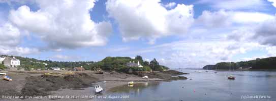
![]() 12th: Mostly cloudy at night but there was a clear spell around 03 GMT. By dawn it was overcast again, but was clearer by 09 GMT. There were some well-developed cumulus clouds and in the NNW'ly wind streams of stratocumulus formed over the Snowdonia Mountains. Pressure was 1017 mb as a ridge passed over from the W. Low 1001 mb was S of Iceland with associated occluded fronts W of Ireland. The day was mostly cloudy with streams of orographic cloud persisting over Wales. The satellite image shows the streams of convective clouds generated as air rose over the Snowdonia Mountains. Similarly over the Cumbrian Mountains and Pennines. [Rain 6.0 mm; Max 18.3C; Min 9.6C; Grass 6.8C]
12th: Mostly cloudy at night but there was a clear spell around 03 GMT. By dawn it was overcast again, but was clearer by 09 GMT. There were some well-developed cumulus clouds and in the NNW'ly wind streams of stratocumulus formed over the Snowdonia Mountains. Pressure was 1017 mb as a ridge passed over from the W. Low 1001 mb was S of Iceland with associated occluded fronts W of Ireland. The day was mostly cloudy with streams of orographic cloud persisting over Wales. The satellite image shows the streams of convective clouds generated as air rose over the Snowdonia Mountains. Similarly over the Cumbrian Mountains and Pennines. [Rain 6.0 mm; Max 18.3C; Min 9.6C; Grass 6.8C]
13th: A wet morning as a band of heavy rain moved across Wales and SW England. Pressure 1013 mb was falling as low 1004 mb tracked SE across the Western Isles of Scotland. There was rain here from 0315 GMT with 2 heavy spells up to 09 GMT, when 6.0 mm had accumulated, and further rain until 1100 GMT. The SW'ly wind was force 5 and visibility very poor. The afternoon saw a few sunny spells, but convective showers were around and we caught a heavy one at 2030 GMT. {Hawarden, Flintshire 41.2 mm, Capel Curig 33.6 mm} [Rain 9.0 mm; Max 19.5C; Min 12.6C; Grass 10.5C]
![]() 14th: We were still in a showery N/NW'ly airstream, a few light showers falling between 02-04 GMT, and the morning was mostly cloudy with a few breaks in the cloud giving glimpses of sunshine. Pressure 1019 mb was rising as high 1028 mb intensified to the SW. The low 1005 mb was on the coast of the Netherlands with frontal cloud making it's way down through France. By afternoon the sky had stated to clear; the evening was clear and with the temperature on the grass falling to 7.6C there was heavy dew. [Rain 0.0 mm; Max 20.0C; Min 11.5C; Grass 8.8C]
14th: We were still in a showery N/NW'ly airstream, a few light showers falling between 02-04 GMT, and the morning was mostly cloudy with a few breaks in the cloud giving glimpses of sunshine. Pressure 1019 mb was rising as high 1028 mb intensified to the SW. The low 1005 mb was on the coast of the Netherlands with frontal cloud making it's way down through France. By afternoon the sky had stated to clear; the evening was clear and with the temperature on the grass falling to 7.6C there was heavy dew. [Rain 0.0 mm; Max 20.0C; Min 11.5C; Grass 8.8C]
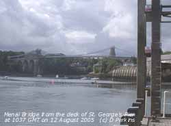
 15th: A calm night but some patchy cloud moved across and by morning the sky was 7/8th covered. Pressure had risen to 1027 mb within the high over S . Britain. Low-pressure had moved SE across Europe to the Adriatic. The sky started to clear soon after 09 GMT and the morning was sunny with the temperature rising to 19.7C in a light W'ly breeze. At noon frontal cloud associated with low-pressure over the Norwegian Sea encroached to give a cloudy afternoon. The cloud was thick enough at 1700 GMT to give a little light rain. The night remained cloudy. [Rain 0.1 mm; Max 19.7C; Min 10.5C; Grass 7.6C]
Mid-month statistics show that temperatures have been lower than the average of the last decade but the long-term warming trend continues. The mean temperature 15.7C was (-0.7) but [+0.3]; the mean maximum was 19.9C (-0.2) and [+0.6]; and mean minimum 11.4C (-1.3) and [0.0]. Rainfall was 24.5 mm (32%) and [30%].
![]() 16th: A disappointingly dull morning with remnant frontal cloud entrapped within the high pressure. Pressure 1024 mb had fallen a little but was still high, 1025 mb central-Wales to Belgium, stretching far to the SW. Massed low-pressure centres lay S of Greenland and Iceland (992 mb) with fronts well to the W of Ireland and over N Scotland. The morning kept dull with little sign of the cloud burning-off here. The western half of Anglesey had clear skies early in the day, but it did not start to clear here until mid-afternoon. The NOAA satellite image shows convective cloud development over Wales and N England, and the sharp divide across Anglesey. The evening and night were clear; the moon low in the southern sky at 21 GMT was coloured light orange. [Rain 0.0 mm; Max 22.8C; Min 13.2C; Grass 11.5C]
16th: A disappointingly dull morning with remnant frontal cloud entrapped within the high pressure. Pressure 1024 mb had fallen a little but was still high, 1025 mb central-Wales to Belgium, stretching far to the SW. Massed low-pressure centres lay S of Greenland and Iceland (992 mb) with fronts well to the W of Ireland and over N Scotland. The morning kept dull with little sign of the cloud burning-off here. The western half of Anglesey had clear skies early in the day, but it did not start to clear here until mid-afternoon. The NOAA satellite image shows convective cloud development over Wales and N England, and the sharp divide across Anglesey. The evening and night were clear; the moon low in the southern sky at 21 GMT was coloured light orange. [Rain 0.0 mm; Max 22.8C; Min 13.2C; Grass 11.5C]
![]() 17th: Clear skies apart from some high cirrus and a few cumulus clouds behind the Snowdonia Mountains to the S. With a light S'ly breeze it was a warm sunny morning with smoke haze developing. Pressure was 1019 mb with the high 1023 mb transferred E over Denmark. Low 982 mb SE Iceland was getting it's act together, and with development on the slow-moving cold front W of Ireland, rain was moving in across the NW Ireland and Scotland. The day was clear and sunny, the temperature rising to 23.7C, before cloud encroached by 17 GMT. There was some broken cloud at night with light-orange coloured moonshine. (Fires have been raging in Portugal and parts of N Spain on and off since July. Following one of the worst recorded droughts, and temperatures of 40C, fires have broken out again in dry woodland. The fire emitting grey smoke near the centre of the image is in the Estrela Mountains. ).
[Rain 0.0 mm; Max 23.7C; Min 13.2C; Grass 11.0C]
17th: Clear skies apart from some high cirrus and a few cumulus clouds behind the Snowdonia Mountains to the S. With a light S'ly breeze it was a warm sunny morning with smoke haze developing. Pressure was 1019 mb with the high 1023 mb transferred E over Denmark. Low 982 mb SE Iceland was getting it's act together, and with development on the slow-moving cold front W of Ireland, rain was moving in across the NW Ireland and Scotland. The day was clear and sunny, the temperature rising to 23.7C, before cloud encroached by 17 GMT. There was some broken cloud at night with light-orange coloured moonshine. (Fires have been raging in Portugal and parts of N Spain on and off since July. Following one of the worst recorded droughts, and temperatures of 40C, fires have broken out again in dry woodland. The fire emitting grey smoke near the centre of the image is in the Estrela Mountains. ).
[Rain 0.0 mm; Max 23.7C; Min 13.2C; Grass 11.0C]
![]() 18th: An overcast morning bright at first with a little weak sunshine through thin cloud. Pressure was 1015 mb with complex low-pressure around Iceland (993 - 994 mb) and a cold front approaching over the Irish Sea. Most of the rain was S of here in St. George's Channel and approaching Lands End. There was lighter rain to the N over S and NE Scotland. The Meteosat image (c) EUMETSAT shows the spiral of cloud SW Iceland associated with the low (remnant former hurricane Irene invigorated again, and cold front over the Irish Sea and Scotland with showers to follow. Thundery troughs are giving some disturbed weather over the Mediterranean. Cloud thickened here during the morning and there was light rain from 14 GMT on the rather weak cold front in the afternoon and the day was sunless. The front livened up over central England where there were some heavy bursts later After sunset the sky began to clear and low mist formed rapidly over the surrounding fields. [Rain 0.4 mm; Max 19.0C; Min 14.4C; Grass 11.7C]
18th: An overcast morning bright at first with a little weak sunshine through thin cloud. Pressure was 1015 mb with complex low-pressure around Iceland (993 - 994 mb) and a cold front approaching over the Irish Sea. Most of the rain was S of here in St. George's Channel and approaching Lands End. There was lighter rain to the N over S and NE Scotland. The Meteosat image (c) EUMETSAT shows the spiral of cloud SW Iceland associated with the low (remnant former hurricane Irene invigorated again, and cold front over the Irish Sea and Scotland with showers to follow. Thundery troughs are giving some disturbed weather over the Mediterranean. Cloud thickened here during the morning and there was light rain from 14 GMT on the rather weak cold front in the afternoon and the day was sunless. The front livened up over central England where there were some heavy bursts later After sunset the sky began to clear and low mist formed rapidly over the surrounding fields. [Rain 0.4 mm; Max 19.0C; Min 14.4C; Grass 11.7C]
19th: Mist and fog in low-lying areas including the Menai Strait looked ghostly white in the moonlight. It was mostly clear skies until morning when, after a little sunshine, a narrow line of showers moved in across Anglesey, Lleyn, Cardigan Bay and Pembrokeshire. Overcast and dry at 09 GMT there was slight rain by 10 GMT but then started to slowly clear. Pressure 1018 mb was rising as a ridge of high-pressure from Azores-high 1032 mb W of Cape Finisterre moved in from the W. With a NW'ly wind cloud was persistent over the mountains and SE Anglesey where sunshine was limited to 2.7h, in the NW it was sunnier with Valley reporting {4.5h}. From 17 GMT could increased again, thickened and there was a light shower of rain about 1945 GMT. [Rain 0.3 mm; Max 17.3C; Min 10.2C; Grass 7.8C]
20th: Mostly cloudy overnight with the few breaks about dawn continuing until 09 GMT. Pressure 1025 mb was rising in the ridge traversing E, but low 973 mb SE Greenland coast had fronts just W of Ireland. The morning kept mostly cloudy, in the N'ly breeze, with rather few sunny spells. By afternoon, with pressure reaching 1027 mb, the sky cleared over most of Anglesey leading to a clear evening and night. [Rain 0.0 mm; Max 20.1C; Min 12.4C; Grass 11.1C]
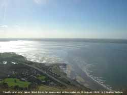 21st: A sunny morning with cirrus clouds overhead, cirrostratus to the W and cumulus to the S. Pressure 1025 mb had fallen with the ridge over Britain giving way to deepening frontal-wave low tracking N to the W of Ireland. The morning was sunny then from noon cloud encroached from the W and was overcast from 15 GMT. There was drizzle and slight rain from 1520 GMT as a warm front passed over. [Rain 11.9 mm; Max 20.8C; Min 10.2C; Grass 7.4C]
![]()
![]() 22nd: At midnight the following cold front was over the Irish Sea and a band of rain with embedded heavier bursts passed over here from 04 to 06 GMT; total rainfall was 11.9 mm. Still overcast at 06 GMT breaks had appeared above the weather station before 09 GMT. Pressure 1019 mb was rising a little in a ridge of high-pressure developing over Ireland.
The weather chart shows the rain falling over SE England and the unseasonable storms over Germany , SE Europe and the Alps where flash floods are reported.
The morning was mostly cloudy with some cumulus clouds in the vicinity with a few showers remaining over the Mountains of Snowdonia. By afternoon there were some good sunny spells; in a moderate NE'ly breeze the maximum only reached 16.9C. The evening and night were clear at first and with the wind falling away heavy dew formed on the grass. The photograph, taken near the summit of Penmaenmawr, shows the NE entrance to the Menai Strait and the exposed Lavan Sands at one of the lowest tides of the year (0.5 m Liverpool). For small craft the navigable channel, the Penmaen Swatch, across the Strait to Penmon and Anglesey can be seen on the right. The Strait narrows at Bangor Pier, top left.
[Rain 0.0 mm; Max 16.9C; Min 13.7C; Grass 13.2C]
22nd: At midnight the following cold front was over the Irish Sea and a band of rain with embedded heavier bursts passed over here from 04 to 06 GMT; total rainfall was 11.9 mm. Still overcast at 06 GMT breaks had appeared above the weather station before 09 GMT. Pressure 1019 mb was rising a little in a ridge of high-pressure developing over Ireland.
The weather chart shows the rain falling over SE England and the unseasonable storms over Germany , SE Europe and the Alps where flash floods are reported.
The morning was mostly cloudy with some cumulus clouds in the vicinity with a few showers remaining over the Mountains of Snowdonia. By afternoon there were some good sunny spells; in a moderate NE'ly breeze the maximum only reached 16.9C. The evening and night were clear at first and with the wind falling away heavy dew formed on the grass. The photograph, taken near the summit of Penmaenmawr, shows the NE entrance to the Menai Strait and the exposed Lavan Sands at one of the lowest tides of the year (0.5 m Liverpool). For small craft the navigable channel, the Penmaen Swatch, across the Strait to Penmon and Anglesey can be seen on the right. The Strait narrows at Bangor Pier, top left.
[Rain 0.0 mm; Max 16.9C; Min 13.7C; Grass 13.2C]
![]()
![]() 23rd: A bright morning with cumulus clouds scudding along on a force 5 SW'ly wind. Above, jetstream cirrus was indicative of the high-speed airflow across the Atlantic. Pressure 1018 mb was falling with low 990 mb Iceland and 1006 mb N Adriatic. By noon the developing frontal-wave low to the W had deepened to 992 mb; the wind here had risen to force 5/6 as storm clouds approached from the NW; there were a few spots of rain from 1400 GMT. The afternoon was increasingly murky with light rain, drizzle and poor visibility, but the wind lessened. Before midnight the wind freshened again with frequent strong gusts. The Meteosat 8 image at noon shows Europe being affected by 2 major storms, one in the NW and the other in the SE where extensive flooding has occurred in the last few days. A warm and humid plume out of the Eastern Mediterranean and N Africa resulted in torrential rain and in S Germany, Austria and Switzerland including the Old Quarter in Berne and Interlaken; there was flooding and landslides with rail, roads links and power supplies cut and 36 people have lost their lives. Steep valleys in the Alps were turned into torrents washing away houses and vehicles. Romania, Bulgaria and Croatia were also hit. [Rain 22.6 mm; Max 16.8C; Min 9.5C; Grass 6.8C]
23rd: A bright morning with cumulus clouds scudding along on a force 5 SW'ly wind. Above, jetstream cirrus was indicative of the high-speed airflow across the Atlantic. Pressure 1018 mb was falling with low 990 mb Iceland and 1006 mb N Adriatic. By noon the developing frontal-wave low to the W had deepened to 992 mb; the wind here had risen to force 5/6 as storm clouds approached from the NW; there were a few spots of rain from 1400 GMT. The afternoon was increasingly murky with light rain, drizzle and poor visibility, but the wind lessened. Before midnight the wind freshened again with frequent strong gusts. The Meteosat 8 image at noon shows Europe being affected by 2 major storms, one in the NW and the other in the SE where extensive flooding has occurred in the last few days. A warm and humid plume out of the Eastern Mediterranean and N Africa resulted in torrential rain and in S Germany, Austria and Switzerland including the Old Quarter in Berne and Interlaken; there was flooding and landslides with rail, roads links and power supplies cut and 36 people have lost their lives. Steep valleys in the Alps were turned into torrents washing away houses and vehicles. Romania, Bulgaria and Croatia were also hit. [Rain 22.6 mm; Max 16.8C; Min 9.5C; Grass 6.8C]
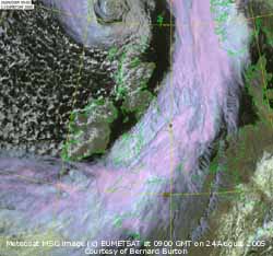
![]() 24th: As the low approached NW Scotland pressure deepened to 969 mb; winds along the Western Isles rose to strong to storm-force. After midnight the SW'ly wind freshened to gale force 8 here by 03 GMT with gusts up to 55 mph. The wind was accompanied by moderate to heavy rain from 0300 to 0800 GMT that contributed most to the 22.6 mm total for the 24-h 09-09 GMT, largest of the month. The low was 964 mb at 06 GMT (lower than the 967 mb recorded during severe gales of 23 August 1957). Pressure here fell only to about 1000 mb indicative of the steep gradient of isobars to the NW. At 09 GMT the temperature 12.6C was at it's lowest under the cold front; pressure 1001 mb had started to rise and the moderated wind veer WNW'ly. It was still overcast but the first breaks appeared overhead at 1030 GMT. The Meteosat MSG image at 09 GMT shows the low to the N of Scotland and the comma-shaped warm front over SE England, the cold front is just about to clearing South Stack on Anglesey. There is a clear slot over the Irish Sea while there are convective showers to the NW.
There were some good sunny spells and a few light showers of rain during the day and into the evening.{Shap Fell 49.6 mm, Capel Curig 40 mm, LLANSADWRN 22 mm} [Rain 0.9 mm; Max 18.8C; Min 12.6C; Grass 12.5C]
24th: As the low approached NW Scotland pressure deepened to 969 mb; winds along the Western Isles rose to strong to storm-force. After midnight the SW'ly wind freshened to gale force 8 here by 03 GMT with gusts up to 55 mph. The wind was accompanied by moderate to heavy rain from 0300 to 0800 GMT that contributed most to the 22.6 mm total for the 24-h 09-09 GMT, largest of the month. The low was 964 mb at 06 GMT (lower than the 967 mb recorded during severe gales of 23 August 1957). Pressure here fell only to about 1000 mb indicative of the steep gradient of isobars to the NW. At 09 GMT the temperature 12.6C was at it's lowest under the cold front; pressure 1001 mb had started to rise and the moderated wind veer WNW'ly. It was still overcast but the first breaks appeared overhead at 1030 GMT. The Meteosat MSG image at 09 GMT shows the low to the N of Scotland and the comma-shaped warm front over SE England, the cold front is just about to clearing South Stack on Anglesey. There is a clear slot over the Irish Sea while there are convective showers to the NW.
There were some good sunny spells and a few light showers of rain during the day and into the evening.{Shap Fell 49.6 mm, Capel Curig 40 mm, LLANSADWRN 22 mm} [Rain 0.9 mm; Max 18.8C; Min 12.6C; Grass 12.5C]
 25th: Infrequent showers and clear spells overnight led to the lowest minimum temperatures (8.4C and 5.7C) recorded since the 13th June. At 09 GMT pressure 1002 had risen a little as the maturing low 968 mb tracked N in mid-Norwegian Sea. Yesterday's fronts were over N France likely to shed eventually further rain over the storm-stricken Alps. We were still in a showery W'ly airstream with western Britain bearing the brunt. The morning was mostly cloudy but bright with most showers (some thundery) confined to the mountains of Snowdonia.
![]()
![]()
![]() The afternoon saw an increase in showers over Anglesey and the Menai Strait as a showery trough moved across. Deep convective clouds and thunderstorms developed further inland. At Wokingham, Berkshire, 25 mm (1 inch) diameter hailstones were reported
The afternoon saw an increase in showers over Anglesey and the Menai Strait as a showery trough moved across. Deep convective clouds and thunderstorms developed further inland. At Wokingham, Berkshire, 25 mm (1 inch) diameter hailstones were reported ![]() . The MSG Satellite image shows a line of convection over the Lleyn Peninsular and Anglesey, and deep cumulonimbus cloud development over SE England and the Wash. The sferics map shows the distribution of lightning confined mainly in the SE. Frontal cloud can be seem over Germany and NE France.
Showers died out here during the night that was partly cloudy. [Rain 0.7 mm; Max 16.6C; Min 8.4C; Grass 5.7C]
. The MSG Satellite image shows a line of convection over the Lleyn Peninsular and Anglesey, and deep cumulonimbus cloud development over SE England and the Wash. The sferics map shows the distribution of lightning confined mainly in the SE. Frontal cloud can be seem over Germany and NE France.
Showers died out here during the night that was partly cloudy. [Rain 0.7 mm; Max 16.6C; Min 8.4C; Grass 5.7C]
26th: At dawn decayed cumulus clouds were over the Snowdonia Mountains and for a while it was bright with a little sunshine. By 09 GMT it was cloudier again and kept so through the morning, although it was clearer on the W of the island. Pressure 1012 mb was rising as high-pressure built from the S. Low 973 mb was a little further N over the Norwegian Sea and continuing to fill. Frontal-wave low 1004 mb was in the Atlantic W of Ireland. The day kept mostly cloudy with just a few spots of rain in the afternoon and night. The maximum temperature of 16.1C was lowest of the month. [Rain trace; Max 16.1C; Min 8.6C; Grass 6.8C]
27th: A cloudy scene with low cloud hugging the mountaintops and some spots of rain around the western coast. Pressure 1015 mb continues to rise slowly and there were a few breaks in the cloud over the weather station. Frontal cloud was lying to the N and S while a shallow low 1007 mb was tracking E off Brest; it may be too far N to bring respite to fire-stricken Portugal. The weather generally over Europe remains disturbed even in the Mediterranean. Deepening low 999 mb S of Greenland at 00 GMT tracking E during the day was SW Iceland 993 mb at 18 GMT. Here there was little sign of the cloud burning off during the morning but it was bright at times. The afternoon was better, the cloud tending to break-up and the temperature rose to 18.6C. [Rain trace; Max 18.6C; Min 12.4C; Grass 10.9C]
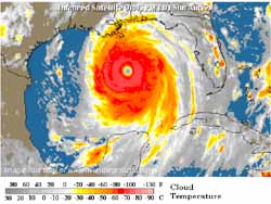
![]() 28th: A mild night with the air minimum falling no lower than 14.0C. At 06 GMT eastward tracking low 986 mb had slowed S of Iceland but coming up against blocking high-pressure to the S isobars had tightened to the NW of here. An associated suite of fronts were within it's circulation and a warm front was over the Irish Sea giving heavy rain in W Scotland. The SW'ly wind had freshened after dawn to force 6 and blustery slight showers of rain were affecting Anglesey and the North Wales coast. Pressure 1018 mb, however, was still rising here. Raindrops being blown along on the wind since dawn did not wet the ground, or raingauge. The morning soon brightened up with some sunny spells between the fast-moving clouds. The afternoon was mostly cloudy with the SW'ly wind strengthening to strong to gale force 8 around 15 GMT. At noon the low was 980 mb (see weather chart). Winds were dangerously strong over the Snowdonia Mountains; Capel Curig reported a mws of 45 mph (force 9) with a gust of 72 mph while on Snowdon the Clogwyn AWS reported a mws of 61 mph (force 10) and gusts up to 79 mph. The winds moderated through the evening. The satellite image, cloud-top temperatures as low as -70C, shows Hurricane Katrina 907 mb, Category 5 with winds more than 155 mph and considerable rainfall (400 mm+), ontrack to hit the coast tomorrow close to New Orleans. Described as potentially catastrophic it is possibly the severest hurricane in the area since Camille in 1969. New Orleans is mostly (3 m) below sea level and a surge tide of over 5.5 m (18 ft) would overwhelm the sea wall (levee) and pumping system; but a surge of 7 to 8 m (25 ft) is possible. The city has been evacuated of all people who could leave. {London 24.4C, Falmouth 13.0h, Colwyn Bay 8.2h, Isle of Skye 52.4 mm} [Rain 8.0 mm; Max 18.5C; Min 14.0C; Grass 13.2C]
28th: A mild night with the air minimum falling no lower than 14.0C. At 06 GMT eastward tracking low 986 mb had slowed S of Iceland but coming up against blocking high-pressure to the S isobars had tightened to the NW of here. An associated suite of fronts were within it's circulation and a warm front was over the Irish Sea giving heavy rain in W Scotland. The SW'ly wind had freshened after dawn to force 6 and blustery slight showers of rain were affecting Anglesey and the North Wales coast. Pressure 1018 mb, however, was still rising here. Raindrops being blown along on the wind since dawn did not wet the ground, or raingauge. The morning soon brightened up with some sunny spells between the fast-moving clouds. The afternoon was mostly cloudy with the SW'ly wind strengthening to strong to gale force 8 around 15 GMT. At noon the low was 980 mb (see weather chart). Winds were dangerously strong over the Snowdonia Mountains; Capel Curig reported a mws of 45 mph (force 9) with a gust of 72 mph while on Snowdon the Clogwyn AWS reported a mws of 61 mph (force 10) and gusts up to 79 mph. The winds moderated through the evening. The satellite image, cloud-top temperatures as low as -70C, shows Hurricane Katrina 907 mb, Category 5 with winds more than 155 mph and considerable rainfall (400 mm+), ontrack to hit the coast tomorrow close to New Orleans. Described as potentially catastrophic it is possibly the severest hurricane in the area since Camille in 1969. New Orleans is mostly (3 m) below sea level and a surge tide of over 5.5 m (18 ft) would overwhelm the sea wall (levee) and pumping system; but a surge of 7 to 8 m (25 ft) is possible. The city has been evacuated of all people who could leave. {London 24.4C, Falmouth 13.0h, Colwyn Bay 8.2h, Isle of Skye 52.4 mm} [Rain 8.0 mm; Max 18.5C; Min 14.0C; Grass 13.2C]
![]() 29th: A dismal morning; heavy drizzle and light to moderate rain under low stratus cloud with poor visibility. The overnight minimum temperature of 15.0C was highest of the month. But pressure 1020 mb was still rising and my Oregon barometer was indicating sunshine as it has for the past 4 days! The low now further N over the Norwegian Sea had deepened further to 969 mb. A weak cold front was lying SW-NE over Anglesey. The morning kept dull with further drizzle until 11 GMT when the cloud began to lift. By noon there were some sunny spells and the sky cleared during the afternoon. It was sunny through to sunset and clear until after midnight with heavy dew on the grass. The satellite image shows Hurricane Katrina over the Gulf of Mexico about to strike the Louisiana - Mississippi - Alabama coastline. In the event the storm tracked 35 miles E of New Orleans close to Biloxi (50,000 inhabitants) making landfall at Category 4 and decreasing rapidly. Much damage was reported including flooding in lower parts of New Orleans where electricity supplies failed making pumping impossible. [Rain 0.3 mm; Max 20.6C; Min 15.0C; Grass 14.9C]
29th: A dismal morning; heavy drizzle and light to moderate rain under low stratus cloud with poor visibility. The overnight minimum temperature of 15.0C was highest of the month. But pressure 1020 mb was still rising and my Oregon barometer was indicating sunshine as it has for the past 4 days! The low now further N over the Norwegian Sea had deepened further to 969 mb. A weak cold front was lying SW-NE over Anglesey. The morning kept dull with further drizzle until 11 GMT when the cloud began to lift. By noon there were some sunny spells and the sky cleared during the afternoon. It was sunny through to sunset and clear until after midnight with heavy dew on the grass. The satellite image shows Hurricane Katrina over the Gulf of Mexico about to strike the Louisiana - Mississippi - Alabama coastline. In the event the storm tracked 35 miles E of New Orleans close to Biloxi (50,000 inhabitants) making landfall at Category 4 and decreasing rapidly. Much damage was reported including flooding in lower parts of New Orleans where electricity supplies failed making pumping impossible. [Rain 0.3 mm; Max 20.6C; Min 15.0C; Grass 14.9C]
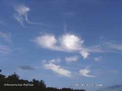 30th: It was overcast by 02 GMT when remnant frontal cloud encroached. Still cloudy at dawn it was brightening at 09 GMT with more lifting and thinning during the morning. Pressure 1024 mb was still rising with high 1028 mb established over Denmark. With the low of the 28th now off N Norway another low 986 mb SW Iceland had taken it's place. Isobars were again tight to the NW, but at the moment we were enjoying some respite within the area of high-pressure. Initially calm and variable the wind became S'ly before noon. As the sky mostly cleared the temperature rose to 25.4C, highest of the month, as relative humidity fell to only 66%. During the evening patches of altocumulus clouds moved across. Those to the S (see photo) were Altocumulus floccus of slightly domed appearance with trailing streamers (virga). It was a perfect day for the black ant found in gardens to mate. Most of the male ants are wingless but the workers monitor the weather and when conditions are right (this afternoon warm and humid) the workers hatch fertile winged males to mate with the queens. During the afternoon hundreds, if not thousands, of winged ants appeared. They neither bite or sting so are not a problem and no doubt achieved their mission. They also provided a surprise meal for housemartins flying overhead. Rescue work has continued in New Orleans where 80% of the city, including the historic French Quarter, is under water following breaches in the levees. Some parts are 6m underwater and the level was rising in others. Those who did not, or could not, heed the warnings to leave before the hurricane struck were being rescued from rooftops by helicopter or boat as most roads were underwater. Over 20,000 took refuge in the Superdome sports stadium and another 15,000 in the Convention Center. Food and fresh water supplies quickly ran out and conditions deteriorated rapidly. There has been loss of life with numbers reported rising through the day and expected to reach thousands. Damage has been reported to oil (refinery) installations that produces 1/4 of the US supplies; the price of crude has jumped to over 70$ a barrel. Damage is extensive also all over Louisiana, Mississippi and Alabama where reported rainfall totals have been over 250 mm in places with one report of over 800 mm. With the storm, later downgraded to a tropical storm, working its way NE further damage was expected. The US Buoy Data Center was evacuated and went off-line.
[Rain 0.0 mm; Max 25.4C; Min 11.7C; Grass 8.8C]
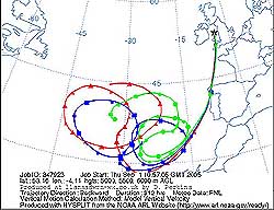
![]() 31st: An overcast but bright morning with cloudbase, at least 5000 ft, well over the tops of the Snowdonia Mountains. The temperature at 09 GMT was 20.2C, dewpoint 17.1C. Pressure 1010 mb was falling with a thundery low 1007 mb off Lands End tracking N. Low 987 mb Iceland had frontal cloud over Ireland. The thundery outbreaks developed quickly working their way up first from SW England into Wales during the morning before dying out. By 1030 GMT as skies darkened there was large-dropped light rain that washed out moderate depositions of Saharan dusts ranging in colour between face-powder pink, pinkish to reddish-grey and reddish-brown. Trajectory analysis, using the HYSPLIT model at the NOAA Air Resources Laboratory, indicated that parcels of air arriving between 5000-6000 m over Llansadwrn at 15 GMT had come from air circulating over the Atlantic ). Dust generated by duststorms across N Africa has been blowing W into the Atlantic has been circulating there caught within a large high-pressure system. The rain and dust deposition continued through into the afternoon, but thunder was not heard. A second line of thunderstorms developed in the English Channel off Plymouth and worked it's way up through central England reaching NE England during the evening. By evening here there was a brief clear slot before more cloud and light showery rain encroached for the night. It was the dullest day of the month with 6.8 mv h solar radiation. [Rain 2.2 mm; Max 21.6C; Min 14.3C; Grass 11.5C]
31st: An overcast but bright morning with cloudbase, at least 5000 ft, well over the tops of the Snowdonia Mountains. The temperature at 09 GMT was 20.2C, dewpoint 17.1C. Pressure 1010 mb was falling with a thundery low 1007 mb off Lands End tracking N. Low 987 mb Iceland had frontal cloud over Ireland. The thundery outbreaks developed quickly working their way up first from SW England into Wales during the morning before dying out. By 1030 GMT as skies darkened there was large-dropped light rain that washed out moderate depositions of Saharan dusts ranging in colour between face-powder pink, pinkish to reddish-grey and reddish-brown. Trajectory analysis, using the HYSPLIT model at the NOAA Air Resources Laboratory, indicated that parcels of air arriving between 5000-6000 m over Llansadwrn at 15 GMT had come from air circulating over the Atlantic ). Dust generated by duststorms across N Africa has been blowing W into the Atlantic has been circulating there caught within a large high-pressure system. The rain and dust deposition continued through into the afternoon, but thunder was not heard. A second line of thunderstorms developed in the English Channel off Plymouth and worked it's way up through central England reaching NE England during the evening. By evening here there was a brief clear slot before more cloud and light showery rain encroached for the night. It was the dullest day of the month with 6.8 mv h solar radiation. [Rain 2.2 mm; Max 21.6C; Min 14.3C; Grass 11.5C]
1st: Overcast at dawn with light showery rain, that included fresh deposits of light to dark reddish-brown dust, but some breaks had appeared in the cloud by 09 GMT. Pressure 1014 was rising again as the frontal-wave low 1004 mb filled over Scotland. Overnight thunderstorms had moved over the North Sea and were petering out. Pressure was high 1023 mb over the Azores to the SW and Baltic 1028 mb. Cold frontal cloud N-S down Britain was reluctant to move off; early hopes of a clearance were dimmed with the morning keeping cloudy and dull. The cloud persisted into the afternoon but clearer sky slowly made it's way across Anglesey from the NW reaching the mainland by evening. The night had several clear spells. [Rain trace; Max 16.8C; Min 13.7C; Grass 13.5C]
2nd: Heavy dew on the grass by morning that was mostly sunny with very good visibility. Pressure 1026 mb was rising over Britain. The day was mostly sunny with the temperature rising to 21.5C. By evening the sky was clear and after sunset was a beautiful peach and azure blue colour. A fine night followed. [Rain 0.0 mm; Max 21.5C; Min 9.7C; Grass 6.7C]
3rd: A sunny morning with the sky partly covered (6/8) with high cirrus, some hooked, and cirrocumulus during the afternoon. Pressure 1028 mb had risen, with the high 1034 mb intensified but moving E over the North Sea, but started to fall slowly during the afternoon. Frontal-wave lows were to the W of Ireland, too far off at the moment to affect the day. The temperature rose steadily through the day in a light SSE'ly breeze, and during the afternoon, reached 26.6C the highest in September on record at this station. At Red Wharf Bay, where the sea breeze kept offshore, observer Keith Ledson recorded 26.2C, also a station record. Previous September highs were 26.4C on the 7th in 1988 and 26.3C on the 5th in 1999. The warmth continued into the evening the temperature at 1830 GMT being 20.0C but cooled to 15.8C later. It was the brightest day of the month (solar radiation 21.5 mv h) and as daylight is declining with the sun lower in the sky we can expect solar radiation to fall through the month. {Jersey AP 27.4C, London 26.3C} [Rain 0.0 mm; Max 26.6C; Min 11.4C; Grass 7.8C]
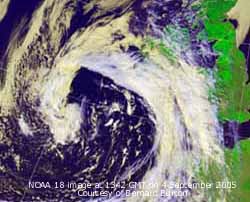
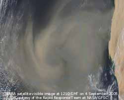 4th: Another sunny and warm morning with the temperature rising to 22.0C at 09 GMT. Pressure 1020 mb had fallen with slow-moving and filling triple-point frontal low off SW Ireland. Under cirrus and cirrostratus clouds the temperature climbed to 28.0C breaking yesterday's September record within 24-h. By 1330 GMT the sky darkened from the W and thunder was heard at 1352 GMT. There was some slight rain that hardly wetted the ground. During the afternoon heavy rain showers moved N from Cardigan Bay crossing the tip of the Lleyn Peninsula but largely missed Anglesey. Another more active band of thundery showers moved across before midnight. Thunder was heard at 2310 GMT and there was a spell of heavy rain from 2315 GMT. At 2342 GMT just to the SE there several cloud to ground lightning strikes and heavy thunder. The rain eased soon after midnight. The NOAA 18 image shows the low off SW Ireland and associated cloud crossing the British Isles. The MODIS TERRA satellite image shows an apparently cloud-free dust vortex off the coasts Western Sahara and Mauritania S of the Canary Islands. Dust has been blowing off N Africa these last months. Some circulates within Atlantic high-pressure systems, some reaches the Caribbean while some reached Anglesey on the 31 August/ 1 September. {London, Northolt 29.7C, Valley 28.2C} [Rain 9.4 mm; Max 28.0C; Min 15.8C; Grass 12.0C]
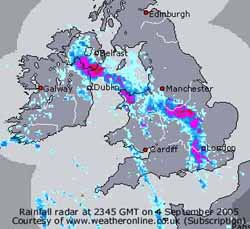 5th: The overnight minimum temperature was 16.2C, equalling the highest in September at this station seen on the 11th in 2000. Overcast with low stratiform cloud; visibility was poor in mist. Pressure was 1013 mb with the low 1013 mb still to the SW. Occluded frontal cloud over Anglesey was slow-moving and the morning kept overcast and dull. There was a sunny spell early in the afternoon when the temperature rose to 21.8C, but thick cloud soon encroached again to give a dull end to the day. [Rain 0.0 mm; Max 21.8C; Min 16.2C; Grass 15.5C]
![]() 6th: The sky cleared after midnight with mist forming on fields and in low lying areas. It was a sunny calm morning, visibility was good with smoke haze. Pressure was 1010 mb in a slack area across the UK. Low 1003 mb was over the Bay of Biscay and deepening low 998 mb S of Iceland. Frontal cloud kept to the W of Ireland (see MSG satellite image) giving a sunny day on Anglesey with the temperature rising here to 24.1C. Cloud formed over the weather station during the afternoon due to convergent airflows. The breeze of the sea from the NE matched a general S - SW'ly flow and convective cloud formed overhead. Later the NE'ly won and the cloud cleared to give a sunny end to the day but was cloudier by midnight. {Valley 12.4h} [Rain trace; Max 24.0C; Min 12.5C; Grass 9.3C]
6th: The sky cleared after midnight with mist forming on fields and in low lying areas. It was a sunny calm morning, visibility was good with smoke haze. Pressure was 1010 mb in a slack area across the UK. Low 1003 mb was over the Bay of Biscay and deepening low 998 mb S of Iceland. Frontal cloud kept to the W of Ireland (see MSG satellite image) giving a sunny day on Anglesey with the temperature rising here to 24.1C. Cloud formed over the weather station during the afternoon due to convergent airflows. The breeze of the sea from the NE matched a general S - SW'ly flow and convective cloud formed overhead. Later the NE'ly won and the cloud cleared to give a sunny end to the day but was cloudier by midnight. {Valley 12.4h} [Rain trace; Max 24.0C; Min 12.5C; Grass 9.3C]
7th: In contrast to yesterday a dull morning with low stratiform cloud giving hill fog about 2000 ft on the Snowdonia Mountains. Pressure was 1008 mb with low 987 mb N Scotland with band of frontal cloud over Irish Sea and Anglesey. There were a few fine spots of rain before 09 GMT and some afterwards. In Bangor there was moderate drizzle by midmorning. In the Mediterranean with low 1006 mb over the Balearic Islands it unsettled with thunderstorms all along the northern coast. Heavy rain in France resulted in flooding in Montpellier and cancellation of trains in the Languedoc - Roussillon region and in Provence, the Alps and C�te d'Azur. In the area near Le Lavandou 2 campsites were evacuated and streets flooded up to 1 m deep.
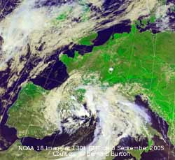 During the afternoon there were some bright, even sunny, spells here but the SW'ly wind freshened to force 6 to 7. By evening it was overcast with a spell of light rain and with passage of a cold front another of moderate rain just before midnight. [Rain 3.1 mm; Max 19.3C; Min 13.9C; Grass 12.0C]
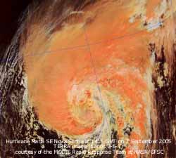 8th: Overcast but under the cloud layer it was very good visibility. Pressure was 1010 mb and the wind light NW'ly but variable through the morning. By afternoon it was brighter, with a brief sunny spell, but then light showers of rain. The NOAA 18 satellite image shows the storm still affecting the Mediterranean and the low SW of Ireland and frontal cloud over Wales. Through the evening a slow-moving band of rain over Wales brought heavy bursts embedded within continuous light rain; there was a spell of moderate to heavy rain from 20 to 02 GMT. [Rain 10.3 mm; Max 17.0C; Min 14.8C; Grass 14.5C]
9th: Overcast with stratiform cloud covering the Snowdonia mountaintops and billowing low cloud was being blown along the Menai Strait on a NE'ly breeze. It was still raining lightly with the heavy rain easing after 02 GMT. Pressure was 1010 mb with frontal-wave low 1004 mb off SW Ireland. Tropical storm (ex-Hurricane) Maria was on the Met Office chart and expected to weaken on passing over colder water as it tracks NE. The TERRA satellite image shows the Hurricane on the 7th when it was SE of Nova Scotia. Maria was moving rather slowly because the strong mid-latitude W'lies were far to the N. Currently the tropical storm is embedded within the deep layer SW'ly flow around a
subtropical ridge. The day was sunless and very dull under a thick layer of cloud with intermittent light rain or drizzle. With 4.6 mv h solar radiation it was the dullest day since 15 April that had 3.7 mv h. [Rain 1.3 mm; Max 16.5C; Min 13.5C; Grass 13.2C]
![]() 10th: More of the same low stratiform cloud and mist making visibility only moderate. But pressure 1012 mb was starting to rise with a ridge of high-pressure developing to the W. Slow-moving shallow low (1001 mb) in the Bay of Biscay was filling, but the associated occluded frontal cloud over the Irish Sea N of Anglesey kept the day once more overcast and sunless. S of the front thunderstorms occurred through the day. Showers of rain moved W'ward towards North Wales, circulating the low, largely petering out before reaching Anglesey. Some large rainfall amounts were reported to the S and W of Britain. The AQUA MODIS satellite image at 1310 GMT shows the tropical storm (ex-hurricane) Maria in mid-Atlantic (S of Greenland and W of Bay of Biscay) tracking slowly NNE. At 12 GMT it was given as 984 mb and was expected to make it's way towards Iceland. As it passes the N of Britain some stronger winds can be expected in the NW towards the end of next week. It was still being tracked by the US NWS National Hurricane Center. {Plymouth 30.7 mm, Cardiff 22.4 mm, Hawarden 18.2 mm} [Rain 0.6 mm; Max 16.7C; Min 15.2C; Grass 14.0C]
10th: More of the same low stratiform cloud and mist making visibility only moderate. But pressure 1012 mb was starting to rise with a ridge of high-pressure developing to the W. Slow-moving shallow low (1001 mb) in the Bay of Biscay was filling, but the associated occluded frontal cloud over the Irish Sea N of Anglesey kept the day once more overcast and sunless. S of the front thunderstorms occurred through the day. Showers of rain moved W'ward towards North Wales, circulating the low, largely petering out before reaching Anglesey. Some large rainfall amounts were reported to the S and W of Britain. The AQUA MODIS satellite image at 1310 GMT shows the tropical storm (ex-hurricane) Maria in mid-Atlantic (S of Greenland and W of Bay of Biscay) tracking slowly NNE. At 12 GMT it was given as 984 mb and was expected to make it's way towards Iceland. As it passes the N of Britain some stronger winds can be expected in the NW towards the end of next week. It was still being tracked by the US NWS National Hurricane Center. {Plymouth 30.7 mm, Cardiff 22.4 mm, Hawarden 18.2 mm} [Rain 0.6 mm; Max 16.7C; Min 15.2C; Grass 14.0C]
![]() 11th: Another overcast morning but the cloud was a little thinner and higher. Pressure 1019 mb was continuing to rise (my Oregon barometer has been indicating sunshine for the past 24-h) and the cloud further thinned during the morning. The wind, however, was N'ly and cloud tends to pile up here against the Snowdonia Mountains and can persist when other places clear. In the early afternoon there were a few brief glimpses of the sun with the temperature rising to 15.5C, but it was not before evening that there was sustained weak sunshine as the sky cleared. The NOAA 18 satellite image shows the powerful mid-latitude depression (ex-hurricane Maria) steaming NNE in the Atlantic 969 mb at noon. The Biscay low has moved to be over the Gulf of Gascony near Biarritz and likely to take further disturbed weather along the Riviera coast. Over Britain remnant frontal cloud was slowly breaking up in the south with a clear slot over N England and S Ireland. [Rain 0.0 mm; Max 15.7C; Min 13.0C; Grass 10.6C]
11th: Another overcast morning but the cloud was a little thinner and higher. Pressure 1019 mb was continuing to rise (my Oregon barometer has been indicating sunshine for the past 24-h) and the cloud further thinned during the morning. The wind, however, was N'ly and cloud tends to pile up here against the Snowdonia Mountains and can persist when other places clear. In the early afternoon there were a few brief glimpses of the sun with the temperature rising to 15.5C, but it was not before evening that there was sustained weak sunshine as the sky cleared. The NOAA 18 satellite image shows the powerful mid-latitude depression (ex-hurricane Maria) steaming NNE in the Atlantic 969 mb at noon. The Biscay low has moved to be over the Gulf of Gascony near Biarritz and likely to take further disturbed weather along the Riviera coast. Over Britain remnant frontal cloud was slowly breaking up in the south with a clear slot over N England and S Ireland. [Rain 0.0 mm; Max 15.7C; Min 13.0C; Grass 10.6C]
 12th: Under a clear sky there was heavy dew on the grass and a low mist formed on nearby fields. In low lying areas, Strait and coast, there were patches of fog. With the rising sun the mist disappeared but convective cumulus clouds formed . There was some convergence occurring overhead at 09 GMT, when it was calm at ground level, before a light NE'ly set in for a time. The temperature had risen to 15.7C so this was the maximum for the past 24-h. Pressure was 1023 mb with a ridge of high-pressure over Britain. The depression ontrack for Iceland was 966 mb with a warm front over N Scotland giving some rain. Later in the morning a S/SW'ly wind dominated and with clouds dispersing, the temperature rising to 22.8C during the afternoon, before turning cloudier again at dusk.
 Michaelmas daisies in the garden are a great attraction to butterflies and other insects. Butterflies have been numerous this year, but this is my first photo of a painted lady. It is a non-European visitor and is unusual in that it breeds continuously in it's homebase in N Africa. Also does not show
 ![]() the underside hind-wing cryptic markings of other hibernating species such as peacock. This example may have bred here from earlier immigrants or hitched a lift on southerly air that brought Saharan dust to Anglesey on 31 August/ 1 September. At the moment it is enjoying the warmth, temperatures currently nearly 4C above the September long-term average, and flowers here. It may soon join in a southerly migration back to Africa as it is killed by frost. But with so few frosts here it is tempting to think that it might overwinter in my log pile, survive and emerge again next year. .[Rain 0.0 mm; Max 22.8C; Min 10.5C; Grass 7.7C]
the underside hind-wing cryptic markings of other hibernating species such as peacock. This example may have bred here from earlier immigrants or hitched a lift on southerly air that brought Saharan dust to Anglesey on 31 August/ 1 September. At the moment it is enjoying the warmth, temperatures currently nearly 4C above the September long-term average, and flowers here. It may soon join in a southerly migration back to Africa as it is killed by frost. But with so few frosts here it is tempting to think that it might overwinter in my log pile, survive and emerge again next year. .[Rain 0.0 mm; Max 22.8C; Min 10.5C; Grass 7.7C]
![]() 13th: A partly cloudy and dry dawn but already breezy. At 09 GMT pressure was still on 1023 mb but the high-pressure centre had intensified 1026 mb and moved to be lozenge-shaped over the English Channel. The depression (ex-hurricane Maria) was 976 mb and just S of Iceland resulting in some closely packed isobars to the NW and a SW'ly force 5 wind. Winds in NW Scotland reached gale force and a slow-moving warm front gave heavy rain there through the day. Here the day was dry, but became overcast with stratiform cloud and the wind strengthened to strong to gale-force. At 1830 GMT up to 300 geese few over the weather station in 4 V-shaped formations with much honking. They go to spend the night on nearby barley fields that have recently been harvested, this photo taken on the 4th following harvest
13th: A partly cloudy and dry dawn but already breezy. At 09 GMT pressure was still on 1023 mb but the high-pressure centre had intensified 1026 mb and moved to be lozenge-shaped over the English Channel. The depression (ex-hurricane Maria) was 976 mb and just S of Iceland resulting in some closely packed isobars to the NW and a SW'ly force 5 wind. Winds in NW Scotland reached gale force and a slow-moving warm front gave heavy rain there through the day. Here the day was dry, but became overcast with stratiform cloud and the wind strengthened to strong to gale-force. At 1830 GMT up to 300 geese few over the weather station in 4 V-shaped formations with much honking. They go to spend the night on nearby barley fields that have recently been harvested, this photo taken on the 4th following harvest ![]() . They fly in most nights and fly away again in the morning. Usually they are smaller in number, tonight's was a record. As the frontal system started to pass over there was some drizzle and light rain just before midnight. {Isle of Skye 103.8 mm} [Rain 1.2 mm; Max 18.5C; Min 12.9C; Grass 9.3C]
. They fly in most nights and fly away again in the morning. Usually they are smaller in number, tonight's was a record. As the frontal system started to pass over there was some drizzle and light rain just before midnight. {Isle of Skye 103.8 mm} [Rain 1.2 mm; Max 18.5C; Min 12.9C; Grass 9.3C]
14th: There was a further spell of light rain around 03 GMT as a weak cold front went over; the temperature declined a little to 12.7C. After a brief glimpse of sunshine after sunrise it was overcast again by 09 GMT. Pressure 1022 mb rose in a weak ridge of high-pressure extended from high 1029 mb over the Bay of Biscay. The depression (ex-Maria) 981 was over the Norwegian Sea and began to loose it's identity over Norway during the day. A shallow Atlantic-low to the W of Ireland, ontrack to cross Anglesey, moved closer rapidly during the day. Cloud cover persisted most of the day over the Irish Sea affecting Anglesey before starting to clear by 17 GMT. There was further heavy rain in Scotland with another {27 mm} falling on the Isle of Skye bring the 48-h total to {131 mm}. The evening was partly cloudy with some moonshine before cloudier before midnight. {Isle of Skye 27.3 mm, Capel Curig 10.0 mm; London, Northolt 25.2} [Rain 10.5 mm; Max 17.1C; Min 12.7C; Grass 10.8C]
15th: At midnight the low was still W of Ireland but by 09 GMT was 1013 mb over Anglesey. The temperature was 16.1C , with 100% relative humidity, and was the highest of the next 24-h. With frontal triple point closeby there was heavy drizzle and light rain before dawn. Embedded within this there were spells of moderate rain resulting in an accumulated 10.5 mm. It was calm and visibility was very poor in mist under a thick layer of uniform grey cloud. The rain eased during the morning to light drizzle as a light W'ly breeze picked up intermittently before settling into a NE'ly. More rain and drizzle continued into the afternoon with the low, and associated frontal cloud, becoming slow-moving over Wales. The day was sunless and very dull day with solar radiation only 3.3 mv h, the lowest since 30 March that had 2.4 mv h. With minimal solar warming the temperature fell gradually through the day. As the low picked up speed again and moved SE towards the Netherlands there was a cloud clearance from the W, but this came after sunset. [Rain 5.5 mm; Max 16.1C; Min 13.0C; Grass 11.1C]
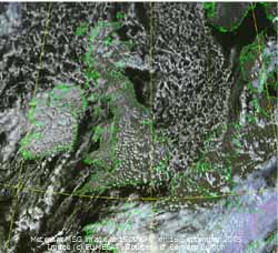
![]() 16th: It was a dry night with few clouds the temperature continuing to fall until the minimum of 9.0C was reached between 05 - 08 GMT. In sunshine at 09 GMT, with 3/8th cover of cumulus clouds, the temperature had risen to 11.0C. With the low over the Netherlands pressure had risen to 1023 mb as Atlantic-high 1035 mb built to the W of Ireland. Visibility in the clear and moderately dry air (74% RH) was a very good with excellent views of the cloud-free Snowdonia Mountains, Lleyn and Isle of Man. Despite the sunshine the temperature rose to only 12.7C, lowest of the month and since the 12.0C on 18 May, a shock to the system after the warmth of at the beginning of the month. The Meteosat MSG image shows open cell marine convective clouds to the NW and E of Britain. Overland fair weather cumulus clouds built up in lines in the S during the afternoon, but development was limited; cover was densest over Ireland. The frontal cloud of yesterday together with a showery trough can be seen over N France. Showers were widespread but it was dry here until just before midnight. [Rain 0.4 mm; Max 12.7C; Min 9.0C; Grass 6.9C]
16th: It was a dry night with few clouds the temperature continuing to fall until the minimum of 9.0C was reached between 05 - 08 GMT. In sunshine at 09 GMT, with 3/8th cover of cumulus clouds, the temperature had risen to 11.0C. With the low over the Netherlands pressure had risen to 1023 mb as Atlantic-high 1035 mb built to the W of Ireland. Visibility in the clear and moderately dry air (74% RH) was a very good with excellent views of the cloud-free Snowdonia Mountains, Lleyn and Isle of Man. Despite the sunshine the temperature rose to only 12.7C, lowest of the month and since the 12.0C on 18 May, a shock to the system after the warmth of at the beginning of the month. The Meteosat MSG image shows open cell marine convective clouds to the NW and E of Britain. Overland fair weather cumulus clouds built up in lines in the S during the afternoon, but development was limited; cover was densest over Ireland. The frontal cloud of yesterday together with a showery trough can be seen over N France. Showers were widespread but it was dry here until just before midnight. [Rain 0.4 mm; Max 12.7C; Min 9.0C; Grass 6.9C]
17th: Lowest temperatures (minimum 6.7C and grass 3.9C) overnight since 13 June (minimum 5.8C and grass 3.4C). With 4 oktas of cumulus and cirrus clouds it was a sunny morning with a light NW'ly breeze. Pressure 1028 mb had risen in a ridge from high 1031 mb SW Ireland. Low 986 mb in the Greenland Sea near Jan Mayan island had associated frontal cloud over Scotland where there was some rain, heavy in the W, during the day. The afternoon was cloudier, with some light patchy rain over the Irish Sea, and between 16 and 17 GMT was thicker giving a few spots of rain. The evening and night were overcast but dry. [Rain trace; Max 15.5C; Min 6.7C; Grass 3.9C]
18th: An overcast morning with cloudbase about 2400 ft covering the high Snowdonia summits. An area of stratiform cloud trapped within high 1029 mb, now beginning to drift S, covered the Irish Sea and much of Wales, N England and Midlands. Pressure here was 1028 mb and the wind a light W'ly. By noon cloud over the Irish Sea dispersed and the afternoon on Anglesey was sunny with clearing skies. The temperature reached 18.0C but not as high as in NE England, where the cloud also cleared. At Bridlington, near Flamborough head on the E coast, 20.4C was recorded. In the annual Great North Run, from Newcastle to Leeds, the weather 'heat and humidity of 70%' was reported as contributing to large numbers dropping out and the deaths of 4 runners. The evening here was mostly sunny although some thin high cloud was encroaching from the W at dusk. The night was partly cloudy and dry. {Bridlington 20.4C} [Rain 0.0; Max 18.0C; Min 11.0C; Grass 10.1C]
![]() 19th: At dawn the sky overhead was clear but cumulus clouds were seen to the S. By 09 GMT it was mostly cloudy with a fresh S'ly wind. Pressure 1022 mb had fallen with low 984 mb E of Iceland. Isobars were closely packed to the NW and frontal cloud and rain were over Ireland. The morning brightened with some sunshine breaking through thin cloud from time to time. By noon the rain was in the middle of the Irish Sea and in some more sunshine the temperature rose to 18.2C. The rain reached here at 1425 GMT; although it was again heavier over Scotland it was only light and intermittent here. The NOAA 18 satellite image shows the cold front lying across Ireland and Scotland just having reached Anglesey. Weather was unsettled in the N Mediterranean with a weak low over the Adriatic and warm front giving rain along the S French coast, Alps, Italy and eastward. [Rain 0.4 mm; Max 18.2C; Min 11.0C; Grass 9.0C]
19th: At dawn the sky overhead was clear but cumulus clouds were seen to the S. By 09 GMT it was mostly cloudy with a fresh S'ly wind. Pressure 1022 mb had fallen with low 984 mb E of Iceland. Isobars were closely packed to the NW and frontal cloud and rain were over Ireland. The morning brightened with some sunshine breaking through thin cloud from time to time. By noon the rain was in the middle of the Irish Sea and in some more sunshine the temperature rose to 18.2C. The rain reached here at 1425 GMT; although it was again heavier over Scotland it was only light and intermittent here. The NOAA 18 satellite image shows the cold front lying across Ireland and Scotland just having reached Anglesey. Weather was unsettled in the N Mediterranean with a weak low over the Adriatic and warm front giving rain along the S French coast, Alps, Italy and eastward. [Rain 0.4 mm; Max 18.2C; Min 11.0C; Grass 9.0C]
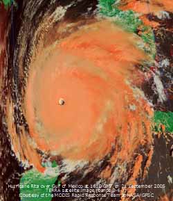 20th: Visibility was very poor around midnight in mist and drizzle. The temperature had risen a little and was 14.7C for several hours until 03 GMT when the drizzle cleared. With a little clearance the temperature resumed it's fall to a minimum of 12.1C. At 09 GMT pressure 1024 mb was rising in a minor ridge from high 1026 mb over the Bay of Biscay. The morning was bright with a few sunny spells developing. Cloudier around noon then a mostly sunny afternoon and evening with very good visibility. Further broken cloud encroached before midnight. [Rain 0.0 mm; Max 17.7C; Min 12.1C; Grass 9.5C]
![]() 21st: A mostly cloudy dawn but by 09 GMT early stratocumulus clouds had given way to cirrostratus and cirrus with some weak sunshine in a light S'ly breeze. Pressure 1020 mb was falling slowly and the wind soon strengthened to force 4/5. The brightness lasted to midmorning before thicker cloud moved in off the Irish Sea by noon. During the afternoon there were several episodes of very fine drizzle, insufficient to wet anything, a bright spell around 14 GMT when the cloud broke up and light rain between 15 - 16 GMT. The night was mostly cloudy but dry. The satellite images show Hurricane Rita over the Gulf of Mexico. Currently category 5 with an estimated central pressure of 897 mb making it one of the 3 severest recorded hurricanes with winds in excess of 175 mph. Landfall predictions suggested the area around Galveston - Houston where low lying parts could be flooded with a surge tide of between 15 and 20 ft. Residents have been told to leave; the NASA Johnson Space Center was evacuated and control of the International Space Station passed to Russia. [Rain 1.1 mm; Max 16.7C; Min 8.8C; Grass 4.7C]
21st: A mostly cloudy dawn but by 09 GMT early stratocumulus clouds had given way to cirrostratus and cirrus with some weak sunshine in a light S'ly breeze. Pressure 1020 mb was falling slowly and the wind soon strengthened to force 4/5. The brightness lasted to midmorning before thicker cloud moved in off the Irish Sea by noon. During the afternoon there were several episodes of very fine drizzle, insufficient to wet anything, a bright spell around 14 GMT when the cloud broke up and light rain between 15 - 16 GMT. The night was mostly cloudy but dry. The satellite images show Hurricane Rita over the Gulf of Mexico. Currently category 5 with an estimated central pressure of 897 mb making it one of the 3 severest recorded hurricanes with winds in excess of 175 mph. Landfall predictions suggested the area around Galveston - Houston where low lying parts could be flooded with a surge tide of between 15 and 20 ft. Residents have been told to leave; the NASA Johnson Space Center was evacuated and control of the International Space Station passed to Russia. [Rain 1.1 mm; Max 16.7C; Min 8.8C; Grass 4.7C]
22nd: A bright morning with hazy sunshine and only moderate visibility. Pressure was 1015 mb with a large area of high-pressure 1029 mb E of the Baltic. Low 988 mb in the Norwegian Sea had frontal cloud to the W with an Atlantic-low 992 mb W of Ireland. In a moderate S'ly the cloud dispersed giving mostly clear skies in the afternoon and evening. Hurricane Rita, still on track to hit the Texas - Louisiana coast 435 miles SE of Galveston Island, was downgraded to Category 4, with 150 mph winds, and could weaken some more. Hurricane force winds could be experienced for 70 miles either side of it's centre track. Over 2 million people were fleeing for higher ground, in sunshine with temperatures around 34C, and had brought the freeways out of Houston to a standstill. [Rain 1.2 mm; Max 19.0C; Min 13.5C; Grass 12.0C]
![]()
![]() 23rd: At midnight the low W of Ireland had moved NNE and was off NW Scotland (988 mb). A weak cold front moved across and produced a little rain (0.7 mm) around 05 GMT followed by a 2.5C fall in temperature; there were heavier pulses of rain to the N and S including S Snowdonia. It was still overcast at 09 GMT but pressure 1007 mb had started to rise in a following ridge of high-pressure. The NOAA 18 satellite image at 12 GMT shows the cold front over E England while the low lies close to the Faeroe Islands, N of Scotland. To the W lay a clearer area with open celled marine convective clouds, but cloud persisted over Wales and W Scotland until dusk. Another Atlantic-low can be seen to the W of Ireland. There is a vortex of high cloud over the Gibraltar Strait. As the ridge developed the sky eventually cleared and the temperature at 21 GMT was 8.4C and dew had formed on the grass. [Rain 0.7 mm; Max 16.4C; Min 13.0C; Grass 11.9C]
23rd: At midnight the low W of Ireland had moved NNE and was off NW Scotland (988 mb). A weak cold front moved across and produced a little rain (0.7 mm) around 05 GMT followed by a 2.5C fall in temperature; there were heavier pulses of rain to the N and S including S Snowdonia. It was still overcast at 09 GMT but pressure 1007 mb had started to rise in a following ridge of high-pressure. The NOAA 18 satellite image at 12 GMT shows the cold front over E England while the low lies close to the Faeroe Islands, N of Scotland. To the W lay a clearer area with open celled marine convective clouds, but cloud persisted over Wales and W Scotland until dusk. Another Atlantic-low can be seen to the W of Ireland. There is a vortex of high cloud over the Gibraltar Strait. As the ridge developed the sky eventually cleared and the temperature at 21 GMT was 8.4C and dew had formed on the grass. [Rain 0.7 mm; Max 16.4C; Min 13.0C; Grass 11.9C]
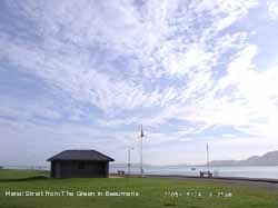 24th: Overnight the air temperature fell to 5.0C, lowest of the month and lowest since 23 May (5.3C), and the grass minimum to 1.5C, lowest since 12 May (1.0C). Pressure was 1019 mb with a small high 1021 mb developed over central England. Low 988 mb had moved closer to Ireland and frontal cloud and rain was affecting the W. Here it was a mostly sunny day; the wind a light SE'ly veered S'ly and freshened to force 5 by the afternoon as the low edged closer. The temperature reached 16.5C and the relative humidity a low of 57%. It turned cloudy by evening. [Rain 1.1 mm; Max 16.5C; Min 5.0C; Grass 1.5C]
25th: There was some rain from midnight to 0315 GMT and with the cloud clearing after dawn it was a sunny morning. There were convective clouds over Snowdonia and a few small cumulus passing over the weather station on a moderate SSW'ly wind. Pressure was 1005 mb with low-pressure 990 mb over the Faeroes. It was cloudier from noon and there was a slight shower late in the afternoon. The night was mostly cloudy but kept dry. [Rain trace; Max 18.0C; Min 9.7C; Grass 7.7C]
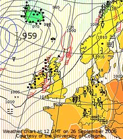
![]() 26th: An overcast morning with a fresh to strong S'ly wind. Atlantic-low 955 mb was S of Iceland and isobars were tightly packed to the NW. An associated warm front was over the Western Isles giving some further heavy rain while a cold front was over W Ireland with a line of heavy showers. Here pressure 1011 mb was falling, but the moderately high thin cloud developed some holes by 10 GMT giving some sunshine in the morning. By afternoon the cloud had thickened and the S'ly wind had strengthened to force 7.
26th: An overcast morning with a fresh to strong S'ly wind. Atlantic-low 955 mb was S of Iceland and isobars were tightly packed to the NW. An associated warm front was over the Western Isles giving some further heavy rain while a cold front was over W Ireland with a line of heavy showers. Here pressure 1011 mb was falling, but the moderately high thin cloud developed some holes by 10 GMT giving some sunshine in the morning. By afternoon the cloud had thickened and the S'ly wind had strengthened to force 7.
![]() As the cold front moved across, invigorated after crossing the Irish Sea, there was rain from 1500 GMT the wind reaching gale force 8 with strong squally gusts of at least 55 mph. Rain was heavy from 1700 - 1730 GMT. There were 2 falls in temperature; 1C at 1445 and 3C at 1800 GMT. Thereafter the wind moderated and the sky started to clear. [Rain 12.5 mm; Max 16.6C; Min 9.2C; Grass 6.0C]
As the cold front moved across, invigorated after crossing the Irish Sea, there was rain from 1500 GMT the wind reaching gale force 8 with strong squally gusts of at least 55 mph. Rain was heavy from 1700 - 1730 GMT. There were 2 falls in temperature; 1C at 1445 and 3C at 1800 GMT. Thereafter the wind moderated and the sky started to clear. [Rain 12.5 mm; Max 16.6C; Min 9.2C; Grass 6.0C]
27th: At midnight the low 966 mb SE Iceland had started to fill. There were some clear spells with a shower at 03 GMT. At 09 GMT pressure had risen to 1009 mb and the sky was almost clear. The SW'ly wind was force 5 and visibility was good but hazy. We were into a showery airstream with a lying trough just to the N. The day was mostly sunny and dry; some convective cumulus were closeby around noon but cleared later. Chiffchaffs are still around and have been quiet for a while. Recently they have been heard, and today our local male bird was chiffchaffing from the top of his favourite willow tree. He has been here for 6 months, but the singing is an indication that he probably soon will be leaving for the Mediterranean. Crossing the Menai Strait and the English Channel the Strait of Gibraltar is no problem. Onward to cross the Sahara in late October, Mauritania and possibly S to Senegal where they will winter. But not all chiffchaffs migrate S, N of here they do but some birds in S Britain stay behind. Britain also has an influx of overwintering birds from Europe and even Siberia, an interesting interchange. .{Isle of Skye 18.9 mm} [Rain 0.0 mm; Max 16.3C; Min 12.2C; Grass 10.3C]
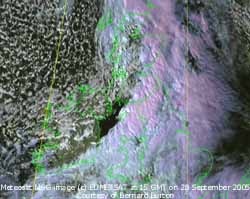
![]() 28th: A bright start but soon cloudier as frontal cloud encroached from the W associated with another low 994 mb NW of Ireland. In the brightness the temperature rose to 13.6C, but the day's mean of 10.4C was only 10.4C, lowest of the month.
Pressure 1016 mb was falling and rain moved on to S Lleyn, Pembrokeshire and Lands End by 10 GMT and was here by 1100 GMT. The afternoon was wet, especially over the Snowdonia Mountains and Cumbria, and windy with the SSW'ly wind force 6 to 7 at times. The rain ceased abruptly at 1600 GMT and the sky soon cleared to give a sunny evening before turning showery around midnight. The band rain reached Kent by 22 GMT. The 24-h rainfall total of 13.1 mm was the largest of the month. The Meteosat MSG satellite image shows the frontal rain-bearing cloud over most of Britain with a sharply defined hind edge of the cold front to the NW with part of the Irish Sea and Ireland is in the following clearance. There are convective shower clouds over Ireland with open celled marine convection to the NW. Compare the satellite image with the rainfall radar of the same time.{Capel Curig 41.6 mm, Shap Fell 33.6 mm} [Rain 13.1 mm; Max 13.6C; Min 7.4C; Grass 4.1C]
28th: A bright start but soon cloudier as frontal cloud encroached from the W associated with another low 994 mb NW of Ireland. In the brightness the temperature rose to 13.6C, but the day's mean of 10.4C was only 10.4C, lowest of the month.
Pressure 1016 mb was falling and rain moved on to S Lleyn, Pembrokeshire and Lands End by 10 GMT and was here by 1100 GMT. The afternoon was wet, especially over the Snowdonia Mountains and Cumbria, and windy with the SSW'ly wind force 6 to 7 at times. The rain ceased abruptly at 1600 GMT and the sky soon cleared to give a sunny evening before turning showery around midnight. The band rain reached Kent by 22 GMT. The 24-h rainfall total of 13.1 mm was the largest of the month. The Meteosat MSG satellite image shows the frontal rain-bearing cloud over most of Britain with a sharply defined hind edge of the cold front to the NW with part of the Irish Sea and Ireland is in the following clearance. There are convective shower clouds over Ireland with open celled marine convection to the NW. Compare the satellite image with the rainfall radar of the same time.{Capel Curig 41.6 mm, Shap Fell 33.6 mm} [Rain 13.1 mm; Max 13.6C; Min 7.4C; Grass 4.1C]
![]() 29th: The graphic shows the position of the Jet Stream at midnight. It's current position is related to the succession of Atlantic-lows that are traversing moving towards of or just S of Iceland and N of Scotland and giving us the unsettled weather pattern. But it was a bright morning although the sky was 5/8th covered with a complex pattern of cirrus, cirrostratus, altocumulus and cumulus clouds. Pressure 1019 mb rose in a small ridge of high-pressure from the S. The day had some spells of sunshine in a light to moderate W'ly wind. At noon another deepening Atlantic-low 970 mb was moving NE towards Iceland. By late afternoon associated frontal cloud encroached and there was intermittent slight rain from 1640 to 00 GMT. The wind had backed S'ly and we were into warm sector air with the temperature rising with a warm front over Anglesey at midnight. [Rain 6.2 mm; Max 16.0C; Min 6.6C; Grass 3.2C]
29th: The graphic shows the position of the Jet Stream at midnight. It's current position is related to the succession of Atlantic-lows that are traversing moving towards of or just S of Iceland and N of Scotland and giving us the unsettled weather pattern. But it was a bright morning although the sky was 5/8th covered with a complex pattern of cirrus, cirrostratus, altocumulus and cumulus clouds. Pressure 1019 mb rose in a small ridge of high-pressure from the S. The day had some spells of sunshine in a light to moderate W'ly wind. At noon another deepening Atlantic-low 970 mb was moving NE towards Iceland. By late afternoon associated frontal cloud encroached and there was intermittent slight rain from 1640 to 00 GMT. The wind had backed S'ly and we were into warm sector air with the temperature rising with a warm front over Anglesey at midnight. [Rain 6.2 mm; Max 16.0C; Min 6.6C; Grass 3.2C]
30th: Overcast with low cloud, moderate fog and fine drizzle. Pressure was 1013 mb with the low 971 mb S of Iceland. The temperature was 15.5C with 100% relative humidity and fog at 0920 GMT. {Isle of Man 24 mm, Capel Curig 24 mm, Isle of Skye 18 mm} [Rain 7.0 mm; Max 16.7C; Min 9.8C; Grass 6.7C]
1st: A mostly dull morning with complex layered clouds. Over the Snowdonia Mountains cloud was low enough to give hill fog and frequent showers. Pressure was 1013 mb with filling low 987 mb over the Norwegian Sea and Atlantic-high 1040 mb to the W. The day was occasionally bright especially in the morning whereas the afternoon was duller with light showers from 1600 GMT. There was a moderate shower around 21 GMT. {Loch Glascarnoch 35 mm, Capel Curig 15 mm} [Rain 2.0 mm; Max 13.5C; Min 9.5C; Grass 7.1C]
2nd: An overcast morning but with pressure 1028 mb rising the cloud started to break up by 1030 GMT. After a few bright moments and glimpses of sunshine it was overcast again by afternoon. Later there cloud darkened and there was slight fine drizzle at 1810 GMT. [Rain trace; Max 15.7C; Min 9.5C; Grass 7.2C]
3rd: Pressure was 1032 mb within a high over S Britain. But it was a case of anticyclonic gloom for the day was overcast with mostly thick cloud. It was calm with smoke rising vertically and no movement in leaves of nearby trees. The day was sunless and solar radiation was only 2.96 mv h. [Rain 0.0 mm; Max 13.0C; Min 10.2C; Grass 9.6C]
![]() 4th: Pressure 1032 mb was unchanged with the high 1033 mb North Wales at 06 GMT drifting E to be 1034 mb over the North Sea at noon. There was a light SE'ly breeze and while the morning was dull the stratiform cloud thinned and broke up a little in the afternoon. Later it was back to the gloom as cloud thickened before dusk. [Rain 0.0 mm; Max 14.3C; Min 9.7C; Grass 9.0C]
4th: Pressure 1032 mb was unchanged with the high 1033 mb North Wales at 06 GMT drifting E to be 1034 mb over the North Sea at noon. There was a light SE'ly breeze and while the morning was dull the stratiform cloud thinned and broke up a little in the afternoon. Later it was back to the gloom as cloud thickened before dusk. [Rain 0.0 mm; Max 14.3C; Min 9.7C; Grass 9.0C]
5th: With the cloud thinning and dispersing overhead it was a bright morning with good spells of sunshine. Pressure 1031 mb was hinting at a decline but was supported by a ridge from the high 1035 mb transferred to the Baltic and intensifying. Low 1000 mb was W of Iberia with associated frontal cloud lying NE towards the Faeroe Islands. The wind was a light SE'ly veered SW'ly during the day before dying away; it was windier to the NW. The day was mostly sunny, the sky clearing in the afternoon; the temperature rose to 18.0C and solar radiation was 14.0 mv h. [Rain 0.0 mm; Max 18.0C; Min 8.2C; Grass 4.1C]
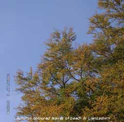 6th: Mostly clear at dawn and a sunny but hazy start to the day; there was heavy dew on the grass and did not dry off in the absence of wind and weaker sun at this time of year. Pressure was 1025 mb with the ridge of high-pressure just covering Anglesey and North Wales. There was a bank of cloud to the S and W and this encroached during the morning and persisted into the afternoon and night. Around the western coast there was a little drizzle but it kept dry here. [Rain 0.0 mm; Max 14.2C; Min 7.5C; Grass 4.1C]
7th: A very dull morning and under thick cloud it was very hazy with only moderate visibility. Pressure was 1017 mb and with pressure high 1021 mb over N Spain and low 968 mb SW Iceland there was a light S/ SE'ly flow of air. There were a few brighter moments here around 11 GMT and one or two sunny spells in Bangor early in the afternoon (lee of Snowdonia Mountains), but it was back to the cloud that was thick enough to give a few spots of drizzle later on. As the low S of Iceland tracked E winds strengthened during the day and an associated cold front brought rain into Ireland and W Scotland by evening. [Rain 4.6 mm; Max 16.6C; Min 10.7C; Grass 11.2C]
8th: There was rain from 0430 GMT as the weak cold front crossed over Anglesey to become slow-moving only reaching Chester at 12 GMT. At 09 GMT pressure was 1011 mb and visibility was moderate to poor in drizzle. By 14 GMT it had brightened and there were some sunny spells during the afternoon with the sky clearing by evening. {Isle of Skye 22 mm} [Rain 0.5 mm; Max 13.6C; Min 10.6C; Grass 10.3C]
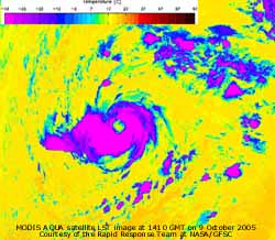 ¤
9th: The night was mostly clear with the temperature above the grass falling to 3.4C, but cloud encroached at dawn and brought some light showers by 09 GMT. Pressure was 1018 mb with Atlantic-low 981 mb to the W of Scotland and associated fronts W of Ireland. There was rain over Northern Ireland and the Western Isles of Scotland. The morning was overcast but the afternoon, maximum 13.7C, was brighter with a little sunshine before further slight showers early in the evening. The S'ly wind was gusty and strong to gale-force during the day and was sustained through the night.
 ![]()
![]() The MODIS AQUA satellite images show the Category 1 Hurricane Vince, the 20th of the season, tracking NE unusually, wait for it, in the Atlantic N of the Canary Islands and close to Madeira towards the Strait of Gibraltar. At 03 GMT at 34.5N 17.8W it was for a few hours classified as Category 1 with estimated sustained wind speeds of 75 mph and a central pressure to be 987 mb. U.S. Hurricane speeds are based on a 1-minute average whereas in Europe we use a 10-min average, so they might be lower by a factor of say 0.88. Sea temperature appeared to be around 23C. It steamed on until 15 GMT when it was down graded to Tropical Storm strength. The MODIS visible spectrum image from the AQUA satellite shows it's position at 1410 GMT, the METEOSAT MSG image at 1700 GMT, while the LST image shows cloud-top temperatures and the warm core 'eye' . {Isle of Skye 36 mm} [Rain trace; Max 15.6C; Min 6.3C; Grass 3.4C]
The MODIS AQUA satellite images show the Category 1 Hurricane Vince, the 20th of the season, tracking NE unusually, wait for it, in the Atlantic N of the Canary Islands and close to Madeira towards the Strait of Gibraltar. At 03 GMT at 34.5N 17.8W it was for a few hours classified as Category 1 with estimated sustained wind speeds of 75 mph and a central pressure to be 987 mb. U.S. Hurricane speeds are based on a 1-minute average whereas in Europe we use a 10-min average, so they might be lower by a factor of say 0.88. Sea temperature appeared to be around 23C. It steamed on until 15 GMT when it was down graded to Tropical Storm strength. The MODIS visible spectrum image from the AQUA satellite shows it's position at 1410 GMT, the METEOSAT MSG image at 1700 GMT, while the LST image shows cloud-top temperatures and the warm core 'eye' . {Isle of Skye 36 mm} [Rain trace; Max 15.6C; Min 6.3C; Grass 3.4C]
![]()
![]() ¤
10th: It was still windy with the S'ly force 6 but it was bright with a little sunshine in a small lee-clearance. Pressure was 1010 mb with low 973 mb E of Iceland over the Norwegian Sea. Pressure was high 1039 mb E of the Baltic and 1021 mb over N Africa. We were in warm sector subtropical air, all the way from the Strait of Gibraltar, with the temperature on 15.6C at 09 GMT, the highest of the past 24-h. A deposit of light brownish-grey Saharan dust was observed on surfaces at the weather station. A further deposit was seen at in rain 14 GMT and subsequently during rainfall of the next 24-h. Trajectory analysis, using the HYSPLIT model at the NOAA Air Resources Laboratory, indicated that parcels of air arriving at 2000 m over Llansadwrn at 14 GMT had come from the Sahara Desert S of the Atlas Mountains in Algeria. Dust storms were active in the area close to the trajectory between 28 - 30 September (see the MODIS AQUA satellite image at 1335 GMT on 29 September
¤
10th: It was still windy with the S'ly force 6 but it was bright with a little sunshine in a small lee-clearance. Pressure was 1010 mb with low 973 mb E of Iceland over the Norwegian Sea. Pressure was high 1039 mb E of the Baltic and 1021 mb over N Africa. We were in warm sector subtropical air, all the way from the Strait of Gibraltar, with the temperature on 15.6C at 09 GMT, the highest of the past 24-h. A deposit of light brownish-grey Saharan dust was observed on surfaces at the weather station. A further deposit was seen at in rain 14 GMT and subsequently during rainfall of the next 24-h. Trajectory analysis, using the HYSPLIT model at the NOAA Air Resources Laboratory, indicated that parcels of air arriving at 2000 m over Llansadwrn at 14 GMT had come from the Sahara Desert S of the Atlas Mountains in Algeria. Dust storms were active in the area close to the trajectory between 28 - 30 September (see the MODIS AQUA satellite image at 1335 GMT on 29 September ![]() ) before moving slowly over Western Sahara and into the Atlantic over the Canary Islands up to the 6th October. After that the airflow speeded up over the Strait of Gibraltar, Iberia and the Bay of Biscay. The day was bright with a few light showers; frontal cloud encroached by 1500 GMT when there was a spell of light rain. There was continuous light to moderate rain from 20 GMT through the night. The TERRA satellite shows ex-hurricane Vince at 1140 GMT ontrack for the Gibraltar Strait and expected to make landfall over S Portugal. At 09 GMT it's pressure was estimated to be 994 mb with sustained wind speeds around 60 mph and was downgraded to a tropical storm. {Isle of Skye 64 mm, London 23C. Abergwyngregin 20.5C} [Rain 21.9 mm; Max 17.5C; Min 10.2C; Grass 9.8C]
) before moving slowly over Western Sahara and into the Atlantic over the Canary Islands up to the 6th October. After that the airflow speeded up over the Strait of Gibraltar, Iberia and the Bay of Biscay. The day was bright with a few light showers; frontal cloud encroached by 1500 GMT when there was a spell of light rain. There was continuous light to moderate rain from 20 GMT through the night. The TERRA satellite shows ex-hurricane Vince at 1140 GMT ontrack for the Gibraltar Strait and expected to make landfall over S Portugal. At 09 GMT it's pressure was estimated to be 994 mb with sustained wind speeds around 60 mph and was downgraded to a tropical storm. {Isle of Skye 64 mm, London 23C. Abergwyngregin 20.5C} [Rain 21.9 mm; Max 17.5C; Min 10.2C; Grass 9.8C]
![]()
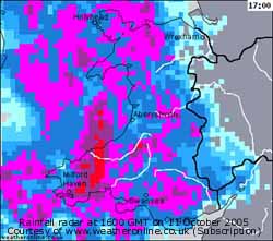 11th: At 09 GMT ex-hurricane Vince crossed over the Algarve in S Portugal into Spain. The NOAA 18 satellite image shows the remnants at 1409 GMT. With a central pressure of 1002 mb it was further downgraded to a tropical depression with sustained wind speeds of 35 mph, force 7, something we are quite used to here. It was a very interesting event, however, with no record of a previous similar landfall in the area.
With frontal cloud moving slowly SE there was rain from about 0030 GMT. The rain was moderate to heavy at times and had accumulated 22.2 mm by 09 GMT. There was complex low-pressure around Iceland 998 mb with complex front lying across N England and Wales.
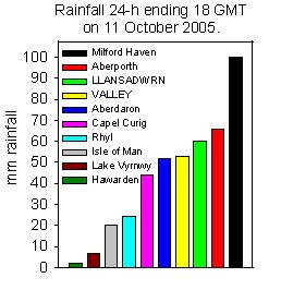 There was very heavy rain from Pembrokeshire to Snowdonia and Anglesey during the morning, it was still raining at noon and by 13 GMT another 18 mm had accumulated (40 mm this event, fields were beginning to have standing water). Rain continued heavy, or very heavy at times, through the afternoon. Thunder was heard closeby at 1649 GMT during a downpour. Rainfall at 18 GMT was 40 mm and brought the total of this event to 62.2 mm. There was some local flooding taking place and a further 6 mm fell before 21 GMT and 5 mm by morning. The 24-h (09-09 GMT) total was 51.1 mm and the total of the event was 73.3 mm. The day was sunless and very dull with low solar radiation of 1.03 mv h the temperature reached 11.7C, the lowest of the month. The heavy rain caused flooding in many villages and roads in parts of Pembrokeshire and Gwynedd. Groeslon, near Caernarfon, was badly hit where it was reported water entered 20 homes. Similarly water entered some houses in Bangor. Several roads were at least partially flooded with water, including some roundabouts that do appear to be vulnerable in heavy rain. The 51.1 mm daily 09-09 GMT total rainfall was largest of the month; rainfall was heavier on the nearby mainland with Abergwyngregin recording 71.2 mm, Blaenau Ffestiniog 60.1 mm and Llandudno 59.7 mm. {Milford Haven 99.9 mm, Valley 52.8 mm} [Rain 51.1 mm; Max 11.7C; Min 10.5C; Grass 10.5C]
12th: The rain ceased about 06 GMT and turned to intermittent drizzle. Pressure was 1008 mb with the frontal system E of here stretching from N England through Cardiff to Plymouth hardly moving through the day. Another sunless day, but the cloud was a little thinner and it was a shade brighter with 3.11 mv h solar radiation and much drier with patches of rain moving N over SW England SE Wales and the Midlands where further flooding was reported. Here we were let off with only intermittent slight drizzle from time to time. {Carlisle 91 mm, Keswick 68 mm} [Rain 0.4 mm; Max C; Min 9.9C; Grass 9.8C]
13th: With slowly clearing sky it was a bright sunny morning. Pressure 1020 mb had risen as a ridge of high-pressure from high 1024 mb W of Iberia. A little cloudier in the afternoon; the day having a maximum of 12.6C. {Hastings, E Sussex 18C; Birmingham 25 mm} [Rain 0.0 mm; Max 12.6C; Min 7.6C; Grass 4.6C]
 14th: With some clear spells at night the minimum was down to 5.5C and 1.9C above the grass, lowest of the month. At 09 GMT the temperature was 9.0C, this was the lowest of the next 24-h. There was heavy dew that was slow to dry off in the weak sunshine of the morning. Pressure was 1028 mb with high 1030 mb over the eastern North Sea that intensified and drifted across to be 1033 mb off Norway by 18 GMT . Complex low-pressure 975 mb was in mid-Atlantic W of Ireland. The sky was mostly covered by thin high cirrus and cirrostratus cloud; there was a cap of low stratocumulus on the Snowdonia Mountains that obscured the tops through the day. Anglesey was mostly sunny with the sky clearing by evening. After cooling at dusk the temperature rose again reaching 15.0C at 2300 GMT. In the garden fruits of Cotoneaster had been ripening and attracted an influx of blackbirds. Blackbirds, few in number in September, renew their interest in the garden in October. Holly berries too have been ripening and, at the moment are in good supply. Once thrushes arrive they usually quickly disappear. The shrub was a seedling that has been allowed to grow, no doubt from a seed dropped by a bird in the past. The leaves are still shiny and green but may develop autumn-tints later on. [Rain 0.0 mm; Max 16.2C; Min 5.5C; Grass 1.9C]
15th: With clear sky continuing after midnight with little or no wind the temperature was unusually slow to decline. At 09 GMT it was 13.8C and the sky clear with visibility moderate in haze (smoke). It kept sunny all day and the temperature rose to 22.3C, one of the highest reported in Britain on the day. {Llansadwrn 22.3C, Red Wharf Bay 21,1C, Farnborough 21.0, Valley 20.8C. Little or no rainfall anywhere}[Rain 0.0 mm; Max 22.3C; Min 9.0C; Grass 6.8C]
![]() 16th: A cloudier day with complex cirrocumulus, altocumulus, and stratocumulus waves and visibility was poor in the haze. Pressure was 1022 mb with high 1042 mb over Scandinavia and Atlantic-low 988 mb to the W. The wind kept a light E'ly and the day dry; it was bright at times with clear sky not far away over the Irish Sea to the N and E. The NOAA 18 satellite image shows frontal cloud to the W with a vortex over the English Channel on a large frontal-wave. Orographic wave clouds can be seen over North Wales and W Ireland. {Aultbea, Highland 21C, Camborne, Cornwall 15.6 mm} [Rain 0.3 mm; Max 18.7C; Min 11.1C; Grass 7.4C]
16th: A cloudier day with complex cirrocumulus, altocumulus, and stratocumulus waves and visibility was poor in the haze. Pressure was 1022 mb with high 1042 mb over Scandinavia and Atlantic-low 988 mb to the W. The wind kept a light E'ly and the day dry; it was bright at times with clear sky not far away over the Irish Sea to the N and E. The NOAA 18 satellite image shows frontal cloud to the W with a vortex over the English Channel on a large frontal-wave. Orographic wave clouds can be seen over North Wales and W Ireland. {Aultbea, Highland 21C, Camborne, Cornwall 15.6 mm} [Rain 0.3 mm; Max 18.7C; Min 11.1C; Grass 7.4C]
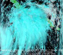 17th: Pressure over Scandinavia had declined to 1039 mb and here only a little to 1020 mb as the filling Atlantic-low 997 mb headed for Greenland. Frontal-wave low 1006 mb was lying SW of Ireland and moved only slowly N through the day. The sky cleared during the afternoon with the temperature rising to 20.3C, one of the highest in Britain. After a clear evening cloud seen in the W at dusk encroached before midnight. Tropical storm Wilma was starting to develop in the Caribbean Sea S of Jamaica and heading for the warmer waters of the Gulf of Mexico. Already causing a surge in oil prices it was the 21st named storm of the season, equalling the highest number recorded in 1933. {Llansadwrn 20.3C, Herstmonceux, Sussex 19.9C, Valley 19.5C. Dunkerswell, Devon 19.0 mm} [Rain trace; Max 20.3C; Min 10.9C; Grass 7.1C]
18th: An overcast and dull morning with rather murky moderate visibility. Pressure 1014 mb continues to decline only slowly with blocking Scandinavia-high 1034 mb in position. To the W there was complex low-pressure with rain-bearing frontal system MW/SE across the UK. Rain over SW Ireland, SW England and S Wales was moving very slowly N; there were a few spots of rain by noon with the afternoon increasingly dull. Rain began to fall about 2015 GMT and was continuous, moderate to heavy at times until next morning. [Rain 33.5 mm; Max C; Min 11.0C; Grass 8.3C]
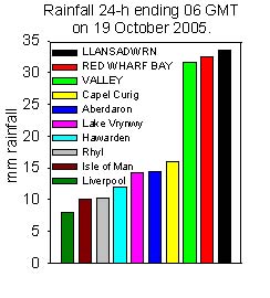 19th: Rainfall ceased about 06 GMT and totalled 33.5 mm. Anglesey had received a soaking with observer Keith Ledson at Red Wharf Bay reporting 32.5 mm and RAF Valley 31.6 mm in the 24-h to 06 GMT. On this occasion totals were moderate in Snowdonia with Capel Curig reporting 16 mm and Aberdaron 14 mm and much less along the North Wales coast to Liverpool (Crosby).
![]() Although soil moisture was still below saturation point there was some water standing on nearby fields, this disappeared later in the day percolating into the soil. Pressure was 1004 mb with a complex wavy-frontal system stretching across N Ireland, North Wales through the Midlands to the Wash. Before 09 GMT there were some breaks in the cloud and a few sunny intervals during the morning. By noon it was overcast again and there was light rain with heavy showery bursts later.
Although soil moisture was still below saturation point there was some water standing on nearby fields, this disappeared later in the day percolating into the soil. Pressure was 1004 mb with a complex wavy-frontal system stretching across N Ireland, North Wales through the Midlands to the Wash. Before 09 GMT there were some breaks in the cloud and a few sunny intervals during the morning. By noon it was overcast again and there was light rain with heavy showery bursts later. ![]() There was torrential rain, making driving difficult, at 1500 GMT on the high level Y Felinheli bypass and Britannia Bridge; there was a lot of surface water on the roads of Anglesey. The rain ceased, before 1800 GMT with a further 8.7 mm measured, then there were a few breaks in the cloud towards midnight. Hurricane Wilma intensified rapidly over the Caribbean Sea reaching Category 5 at 09 GMT today. The GOES 12 satellite image shows Wilma, with it's 5-mile wide eye, at 1500 GMT. An earlier estimate of central pressure of 881 mb is possibly the lowest recorded; later estimates put the pressure at 892 mb with a deal of uncertainty in different models as to it's future track. It was heading for the Yucatan Peninsula, Mexico, then would veer NE towards Florida. {Llansadwrn 42 mm, Valley 33.2 mm} [Rain 9.8 mm; Max 12.3C; Min 10.2C; Grass 9.3C]
There was torrential rain, making driving difficult, at 1500 GMT on the high level Y Felinheli bypass and Britannia Bridge; there was a lot of surface water on the roads of Anglesey. The rain ceased, before 1800 GMT with a further 8.7 mm measured, then there were a few breaks in the cloud towards midnight. Hurricane Wilma intensified rapidly over the Caribbean Sea reaching Category 5 at 09 GMT today. The GOES 12 satellite image shows Wilma, with it's 5-mile wide eye, at 1500 GMT. An earlier estimate of central pressure of 881 mb is possibly the lowest recorded; later estimates put the pressure at 892 mb with a deal of uncertainty in different models as to it's future track. It was heading for the Yucatan Peninsula, Mexico, then would veer NE towards Florida. {Llansadwrn 42 mm, Valley 33.2 mm} [Rain 9.8 mm; Max 12.3C; Min 10.2C; Grass 9.3C]
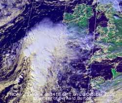 20th: There were some showers of rain through the night, but the morning was bright with a little sunshine. Pressure was 1004 mb with low 991 mb off Cape Wrath, Scotland. A showery trough had passed eastward and there were further low-pressure centres lying in the Atlantic to the SW. A developing low, with considerable convection, was SW of Ireland. The NOAA 18 satellite image at 1418 GMT shows the convective cyclogenic low that was ontrack for the Irish Sea.
By noon it was cloudier and the afternoon saw frequent short showers; a double rainbow was seen just before 1600 GMT.
![]() Hurricane Wilma continued on course to hit Mexico at reduced strength Category 4 with winds up to 150 mph. The GOES 12 satellite image shows Wilma at 1500 GMT. {Capel Curig 16.0 mm} [Rain 5.6 mm; Max 13.7C; Min 8.8C; Grass 6.6C]
Hurricane Wilma continued on course to hit Mexico at reduced strength Category 4 with winds up to 150 mph. The GOES 12 satellite image shows Wilma at 1500 GMT. {Capel Curig 16.0 mm} [Rain 5.6 mm; Max 13.7C; Min 8.8C; Grass 6.6C]
![]()
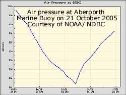 21st: A mostly cloudy morning with persistent showers. At 09 GMT pressure 988 mb was falling with low 980 mb over St. George's Channel and at noon the marine buoy at Aberporth in Cardigan Bay recorded 983 mb. The Meteosat MSG satellite image shows the low with comma-shaped frontal system over the UK. An occluded front is over Ireland with a warm front over Scotland and the North Sea. There is a cold front stretching from SE England to France. Pressure was at it's lowest here 985 mb. The day had frequent showers with a little sunshine from time to time on Anglesey as the Snowdonia Mountains continued to look ominously dark-clouded. There was heavy rain in South and Mid Wales as the low tracked NE. There were further showers during the night. {Sennybridge, Powys 25.8 mm} [Rain 3.3 mm; Max 13.3C; Min 9.3C; Grass 7.5C]
22nd: Overcast at first with little or no wind. Pressure 998 mb was rising in a ridge of high-pressure as yesterday's low 987 mb had crossed the North Sea and was approaching Denmark. At 09 GMT the temperature was 8.5C lowest at this time since 14 May. Overhead the sky was clearing, the stratiform cloud breaking into altocumulus but sunshine was minimal in the morning. The afternoon was sunnier but more cloud encroached for the evening with a shower about 2300 GMT. Snow fell over parts of the Scottish Highlands and Scandinavia, but the colder air did not reach Snowdonia. {Hastings, Sussex 18C, Tenby, Pembs. 7.5h} [Rain 3.3 mm; Max 13.3C; Min 8.3C; Grass 5.6C]
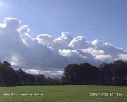
![]()
![]() 23rd: After a shower about 01 GMT some breaks in the cloud by dawn gave a bright morning. Pressure 1009 mb continued to rise in a ridge from the Azores-high 1022 mb lying off the Gibraltar Strait. Pressure was low in the Atlantic 989 mb and S Norway. There was a line of stratocumulus to the S over the Snowdonia Mountains while over Anglesey, with the sky clearing, was mostly sunny with reducing passing fair-weather clouds. By noon it was cloudier again but the afternoon did see some sunshine with a maximum temperature of 14.5C. By dusk frontal cloud had had started to encroach and there was rain from 2030 GMT. The satellite image shows Hurricane Wilma, that has devastated much of the Yucatan Peninsula, Mexico, now joined by Tropical Depression Alpha the 22nd named storm of the season and highest number since 1851. Wilma flooded much of Cancun, damaged buildings designed to withstand hurricanes and washed away many coastal villages. Loss of life reported so far (12) is low due to people taking adequate shelter. Wilma downgraded to category 2 had speeded up and re-intensified to Category 3 and was ontrack to reach Florida in a few hours time. [Rain 32.5 mm; Max 14.8C; Min 7.8C; Grass 4.2C]
23rd: After a shower about 01 GMT some breaks in the cloud by dawn gave a bright morning. Pressure 1009 mb continued to rise in a ridge from the Azores-high 1022 mb lying off the Gibraltar Strait. Pressure was low in the Atlantic 989 mb and S Norway. There was a line of stratocumulus to the S over the Snowdonia Mountains while over Anglesey, with the sky clearing, was mostly sunny with reducing passing fair-weather clouds. By noon it was cloudier again but the afternoon did see some sunshine with a maximum temperature of 14.5C. By dusk frontal cloud had had started to encroach and there was rain from 2030 GMT. The satellite image shows Hurricane Wilma, that has devastated much of the Yucatan Peninsula, Mexico, now joined by Tropical Depression Alpha the 22nd named storm of the season and highest number since 1851. Wilma flooded much of Cancun, damaged buildings designed to withstand hurricanes and washed away many coastal villages. Loss of life reported so far (12) is low due to people taking adequate shelter. Wilma downgraded to category 2 had speeded up and re-intensified to Category 3 and was ontrack to reach Florida in a few hours time. [Rain 32.5 mm; Max 14.8C; Min 7.8C; Grass 4.2C]
![]() 24th: At midnight deepening low 985 mb W of Ireland brought warm moist air and frontal bands across Ireland and Wales. There was moderate to heavy rain with 32.5 mm in the gauge at 09 GMT. This brought rainfall for the month to 169.1 mm (130%) [151%] of average. Pressure had fallen to 998 mb with the low 978 mb tracking NE towards Rockall. The temperature had risen to 14.8C and was the maximum of the past 24-h. The mean temperature for the month was running at 12.1C (+1.6) of average. The S'ly wind was force 6 to 7 and a dry spell, with a few breaks in the low cloud, soon gave way to further light rain during the morning with the heavy rain moved on to N England and SW Scotland. The afternoon saw some further showers with the wind strong to gale-force 8 at times moderating by evening. Some flooding was reported on Anglesey and the River Conwy burst it's banks in Llanrwst. {Capel Curig 70.6 mm, Shap Fell 49 mm, Colwyn Bay 18C} [Rain 10.6 mm; Max 15.5C; Min 10.1C; Grass 7.6C]
24th: At midnight deepening low 985 mb W of Ireland brought warm moist air and frontal bands across Ireland and Wales. There was moderate to heavy rain with 32.5 mm in the gauge at 09 GMT. This brought rainfall for the month to 169.1 mm (130%) [151%] of average. Pressure had fallen to 998 mb with the low 978 mb tracking NE towards Rockall. The temperature had risen to 14.8C and was the maximum of the past 24-h. The mean temperature for the month was running at 12.1C (+1.6) of average. The S'ly wind was force 6 to 7 and a dry spell, with a few breaks in the low cloud, soon gave way to further light rain during the morning with the heavy rain moved on to N England and SW Scotland. The afternoon saw some further showers with the wind strong to gale-force 8 at times moderating by evening. Some flooding was reported on Anglesey and the River Conwy burst it's banks in Llanrwst. {Capel Curig 70.6 mm, Shap Fell 49 mm, Colwyn Bay 18C} [Rain 10.6 mm; Max 15.5C; Min 10.1C; Grass 7.6C]
![]()
![]() 25th: A thundery trough moved across Anglesey and Snowdonia just before 09 GMT. At 09 GMT with cumulonimbus clouds in the vicinity there was thunder with heavy rain and squally wind but no lightning was seen. Pressure was 994 mb with low-pressure 978 mb to the NW. Pressure was high 1024 mb over the Mediterranean while another deep low 979 mb was mid-Atlantic W of Biscay. By 10 GMT the showers had passed and the sky showed signs of clearing but there were further light showers around noon and the afternoon was cloudy. The Meteosat MSG image at 0900 GMT shows the moderately active shower clouds over western Britain with the frontal cloud of yesterday clearing the SE having reached N Europe and the Baltic. {Lake Vyrnwy 35.6 mm, Capel Curig 29 mm, Valley 20 mm} [Rain 6.1 mm; Max 13.5C; Min 10.1C; Grass 8.7C]
25th: A thundery trough moved across Anglesey and Snowdonia just before 09 GMT. At 09 GMT with cumulonimbus clouds in the vicinity there was thunder with heavy rain and squally wind but no lightning was seen. Pressure was 994 mb with low-pressure 978 mb to the NW. Pressure was high 1024 mb over the Mediterranean while another deep low 979 mb was mid-Atlantic W of Biscay. By 10 GMT the showers had passed and the sky showed signs of clearing but there were further light showers around noon and the afternoon was cloudy. The Meteosat MSG image at 0900 GMT shows the moderately active shower clouds over western Britain with the frontal cloud of yesterday clearing the SE having reached N Europe and the Baltic. {Lake Vyrnwy 35.6 mm, Capel Curig 29 mm, Valley 20 mm} [Rain 6.1 mm; Max 13.5C; Min 10.1C; Grass 8.7C]
26th: Overcast at first with some breaks and glimpses of sunshine around 09 GMT. Pressure was 1007 mb with low 968 mb to the SW. With fairly tight isobars on the chart it was a windy day with some showery rain at times (there was a heavy shower around 1510 GMT). At 09 GMT the temperature was 14.5C and was soon 15.5C, the daytime maximum. The temperature was lower during the afternoon, but in warm S'ly air it rose further during the evening reaching 18.8C between 22 and midnight and was the 24-h maximum and the highest temperature recorded at this station on this date in the year. Previous maxima were 20.6C on 23 October 1996 and 18.7C on 5 November 2003. {Guernsey 21C} [Rain 6.3 mm; Max 18.8C; Min 9.6C; Grass 8.9C]
27th: ¤ Overnight the minimum did not fall below the 14.5C set at 09 GMT yesterday. A sunny morning with a temperature of 16.7C at 09 GMT. Pressure was 1004 mb with high 1029 mb over the Adriatic and low 965 W of Ireland. An almost cloudless sky with the frontal cloud associated with the low over Ireland. The wind was generally SSE'ly off the mountains and the temperature reached 24.1C in the afternoon, with the relative humidity falling to a low of 42 % in a Föhn-like wind. It is the second highest temperature recorded in October here and possibly the highest recorded on this date (27) in the year in Britain. The previous highest of 20.3C was at Old Street, London in 1888, data courtesy of TORRO. At nearby Red Wharf Bay, the wind overriding the prevalent sea breeze, observer Keith Ledson recorded 23.4C (50% relative humidity) while in Pentraeth it was 22.9C. On the mainland Abergwyngregin (UCNW, Gwynedd) recorded 23.6C and Llandudno (Conwy) 22.6C. On Snowdon the AWS's reported maxima of 13.1C on the summit, 16.5C (low 69% RH) at Clogwyn and 22.6C (low 26% RH) in Llanberis, data courtesy of First Hydro. The widely reported highest temperature at daily-reporting stations in Wales of 19.8C at Capel Curig was within this group of temperatures, but not the highest recorded. Northwest Wales is not unfamiliar with high autumn and winter temperatures due to Föhn effects. In 1990 on 13 October Pen-y-ffridd Field Station in Bangor recorded 24.8C while 24.5C was recorded at this station in Llansadwrn. The daily mean temperature of 19.3C was the highest in October on record at this station exceeding the previous 19.0C set on the 13th in 1990. Later in the day frontal cloud was seen low in the W and had partially encroached by dusk; the temperature rose again from 16.5C between 18 - 19 GMT to 18.2C at 21 GMT. Evaporation from 2 Piche evaporimeters in the screen averaged 4.3 ml, the highest recorded here in a day, indicative of the drier than usual off-the-mountains wind. {Llansadwrn 24.1C, Red Wharf Bay 23.4C, Abergwyngregin 23.0C, Pentraeth 22.9C, Llanberis (Gwynedd) 22.9C, Kinlochewe, Scotland 22.5C} [Rain 0.5 mm; Max 24.1C; Min 14.5C; Grass 12.3C]
28th: Light showers of rain from 06 GMT, but it was bright with some sunshine at 09 GMT. Pressure was 999 mb with low 961 mb W of Scotland and high 1038 mb E of the Baltic. The remnants of ex-hurricane Wilma and Alpha were in an insignificant looking depression 980 mb on it's way across the Atlantic bringing warm moist air. The depression is forecast to gather strength (deepen) and move up the W of Britain towards Iceland during the weekend. The day was mostly sunny with a fresh to strong S'ly wind and occasional light shower. Speed restrictions on the Britannia Bridge in the afternoon due to high winds led to a long tailback leaving the island. {Crosby, Liverpool 18.5C, Rhyl 17.9C} [Rain 0.5 mm; Max 16.1C; Min 14.2C; Grass 12.4C]
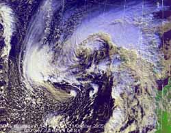
![]() 29th: There was a clear spell in the night but minimum temperatures kept above 11.6C and 8.5C on the grass. Later more showers moved across and at 09 GMT it was mostly cloudy. Pressure was 1003 mb with low 973 mb to the SW the remains of ex-hurricanes Wilma and Alpha deepening to 969 mb by 18 GMT. The depression has followed a familiar track on the charts up the E coast of N America past Nova Scotia and S of Greenland to reach us. There was a little sunshine and a few light showers as the SE'ly wind veering S'ly straightened through the day. The temperature reached 19.0C, one of the highest in Britain on the day, while at Red Wharf Bay 18.2C was recorded. This was only 0.2C short of the British record for this date (29) held by the 19.2C recorded at Coltishall, Norfolk, in 1984. By 21 GMT the wind was strong to gale force 8 with gusts over 50 mph with moderately heavy showers of rain. Speed restrictions were again in force on the Britannia Bridge. Piche evaporation for the 24-h period 09-09 GMT was 3.3 ml. The NOAA 18 satellite image shows the deepening depression tracking N, remnants of ex-hurricane Wilma/ Alpha, SW of Ireland at 1427 GMT. The weather chart shows it's charted position at 1800 GMT with strong to gale-force winds in the SW Approaches and Irish Sea; tidal surges up to 0.8 m were recorded along western coasts. Tides were not at their highest, with a predicted 8.6 m tide at Liverpool about 0930 GMT, but flooding was not reported. {Llansadwrn 19.0, Jersey A.P., 18.7C, Trawscoed 18.0C} [Rain 3.4 mm; Max 19.0C; Min 11.6C; Grass 8.5C]
29th: There was a clear spell in the night but minimum temperatures kept above 11.6C and 8.5C on the grass. Later more showers moved across and at 09 GMT it was mostly cloudy. Pressure was 1003 mb with low 973 mb to the SW the remains of ex-hurricanes Wilma and Alpha deepening to 969 mb by 18 GMT. The depression has followed a familiar track on the charts up the E coast of N America past Nova Scotia and S of Greenland to reach us. There was a little sunshine and a few light showers as the SE'ly wind veering S'ly straightened through the day. The temperature reached 19.0C, one of the highest in Britain on the day, while at Red Wharf Bay 18.2C was recorded. This was only 0.2C short of the British record for this date (29) held by the 19.2C recorded at Coltishall, Norfolk, in 1984. By 21 GMT the wind was strong to gale force 8 with gusts over 50 mph with moderately heavy showers of rain. Speed restrictions were again in force on the Britannia Bridge. Piche evaporation for the 24-h period 09-09 GMT was 3.3 ml. The NOAA 18 satellite image shows the deepening depression tracking N, remnants of ex-hurricane Wilma/ Alpha, SW of Ireland at 1427 GMT. The weather chart shows it's charted position at 1800 GMT with strong to gale-force winds in the SW Approaches and Irish Sea; tidal surges up to 0.8 m were recorded along western coasts. Tides were not at their highest, with a predicted 8.6 m tide at Liverpool about 0930 GMT, but flooding was not reported. {Llansadwrn 19.0, Jersey A.P., 18.7C, Trawscoed 18.0C} [Rain 3.4 mm; Max 19.0C; Min 11.6C; Grass 8.5C]
30th: The overnight minimum of 15.1C was the highest of the month. Showers of rain from 06 GMT and a heavy one at 09 GMT. Pressure was 995 mb with low 964 mb centred off NW Scotland with a twin 974 mb off SW Ireland. The temperature was 15.1C and the S'ly wind was a blustery force 5. By 1030 GMT there were some bright spells as breaks developed in the cloud through the morning. The afternoon cloudier but dry and windy gave was to a mostly evening with a shower of rain around 21 GMT. Afterwards the sky cleared with bright stars visible. [Rain 4.2 mm; Max 16.2C; Min 15.1C; Grass 13.1C]
31st : Clear sky after midnight then partially cloudy until dawn. A bright morning with cirrus, cirrostratus and orographic wave clouds. Pressure was 1000 mb with low 965 mb just S of Iceland. Another low 985 mb off Shannon, Ireland brought frontal cloud with well-developed convective clouds across the Irish Sea during the day. It was mostly sunny until after 15 GMT with a few light or moderate rain showers before dusk. With the sun low in the western sky a rainbow was seen over the weather station at 1620 GMT lasting for about 20 minutes. A heavy shower around 20 GMT and there was a further heavy shower around midnight. The hailometer recorded a few ice pellets, the first and only ice precipitation of the month. {Capel Curig 17.8C, Jersey 17.0C, Cardiff 16.3C; Herne Bay, Kent 21.3 mm} [Rain 11.9 mm; Max 15.9C; Min 11.3C; Grass 8.8C]
October monthly stats: Rainfall of 212.6 mm making it the 6th wettest October in records since 1928, but it was drier than last October 2004! Temperature mean 12.8C was +2.2 on the 30-year average.
1st: A bright morning with a clearing sky and a moderate SSW'ly wind. Pressure was 1006 mb was rising in a small ridge between low 975 mb S Iceland and developing Atlantic-low 969 mb to the SW of Ireland. The morning was mostly sunny with some quickly passing cumulus clouds. We were unlucky and caught a a heavy shower of rain between 1430 and 1500 GMT, otherwise it was a dry and sunny afternoon. The temperature during the day reached 12.7C; some wintry precipitation seen briefly on Tryfan at 3000 ft. As an occluded frontal system moved across Wales there was s spell of moderate to heavy rain from 2330 GMT. {Cardiff/ London 14.9C; Scilly Is. 15.6 mm} [Rain 18.0 mm; Max 14.4C; Min 5.9C; Grass 3.4C]
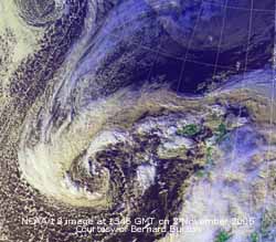 2nd: Rain continued until 02 GMT before turning showery. By 09 GMT pressure that had fallen to 992 mb overnight had risen to 995 mb. After the front we were into a showery airstream with some well-developed convective clouds passing over. There were heavy showers of rain from 08 GMT and ongoing at 09 GMT. There was a little standing water around the weather station and large pools of water on surrounding fields. Visibility was very poor in the rain, but improved later as some bright spells moved across. The NOAA 18 satellite image shows convective clouds over Ireland and North Wales. Mature low 995 mb is S of Greenland while the low associated with the front over SE England and France is in the Atlantic SW of Ireland. The day saw several heavy showers; a torrential shower about 13 GMT accumulated 10 mm in about 5 minutes duration, a rate of over 100 mm per hour. In between there were a few brief sunny spells! The temperature at noon reached a high of 15.5C; it would not have got a mention but for the fact it was the highest of the month. Also, for collectors of miscellaneous data, it was the highest on this date since I started recording here in 1979! But, several stations exceeding this including Liverpool, Crosby, that had 18.5C. Rainfall 09 to 18 GMT was 15.0 mm with more showers during the night. {Liverpool, Crosby 18.7C, Rhyl and Hawarden 18.6C. Capel Curig 39.4 mm, Llansadwrn 32.5 mm} [Rain 18.9 mm; Max 15.5C; Min 7.6C; Grass 6.0C]
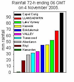
![]() 3rd: At midnight low 979 mb was W of Shannon, Ireland, with strong to gale-force winds in the SW Approaches and English Channel. Showers continued through the night and at dawn was still overcast with low uniform grey stratus cloud, misty with very poor visibility. The overnight minimum temperature of 12.7C was lowest of the month. With the maximum reaching 13.5C it was a very small daily range, only 0.8C. The daily mean of 13.1 was the highest of the month. At 09 GMT pressure was 986 mb, lowest of the month, and the wind S'ly force 5 to 6; there was drizzle and spells of rain through the morning. On the high tide at Holyhead at 1117 GMT there was a 0.6 m surge (Courtesy of POL (Proudman Oceanographic Laboratory tidegauge) and with a lot of water coming down rivers 47 floodwatch warnings had been issued in Wales. In the afternoon and evening, as the low moved N to be over Scotland with an occluded front over Wales, there was more rain, heavy at times. Rainfall accumulated at 22 GMT since 09 GMT was 25 mm and more fell overnight. The rainfall 09-09 GMT total of 35.2 mm was the largest of the month. {Capel Curig 37.4 mm, Llansadwrn 30.9 mm} [Rain 35.2 mm; Max 13.5C; Min 12.7C; Grass 12.0C]
3rd: At midnight low 979 mb was W of Shannon, Ireland, with strong to gale-force winds in the SW Approaches and English Channel. Showers continued through the night and at dawn was still overcast with low uniform grey stratus cloud, misty with very poor visibility. The overnight minimum temperature of 12.7C was lowest of the month. With the maximum reaching 13.5C it was a very small daily range, only 0.8C. The daily mean of 13.1 was the highest of the month. At 09 GMT pressure was 986 mb, lowest of the month, and the wind S'ly force 5 to 6; there was drizzle and spells of rain through the morning. On the high tide at Holyhead at 1117 GMT there was a 0.6 m surge (Courtesy of POL (Proudman Oceanographic Laboratory tidegauge) and with a lot of water coming down rivers 47 floodwatch warnings had been issued in Wales. In the afternoon and evening, as the low moved N to be over Scotland with an occluded front over Wales, there was more rain, heavy at times. Rainfall accumulated at 22 GMT since 09 GMT was 25 mm and more fell overnight. The rainfall 09-09 GMT total of 35.2 mm was the largest of the month. {Capel Curig 37.4 mm, Llansadwrn 30.9 mm} [Rain 35.2 mm; Max 13.5C; Min 12.7C; Grass 12.0C]
4th: After some respite after midnight the moderate to heavy rain returned around 06 GMT. It was raining at 09 GMT when 35.2 mm was measured; this brought the total for the month, in only 3-days, to 72.1 mm, 60% of average. The histogram shows rainfall at selected stations for the 72-h up to 06 GMT. Capel Curig with 97.4 mm tops the list but Llansadwrn was not far behind with 67.8 mm. Wetter than places in Cumbria and Scotland. Remarkably Hawarden, in a rain-shadow area, recorded no rainfall during this period. Pressure 1005 mb was rising with the low 992 mb over the North Sea between Scotland and S Norway. It's circulation responsible for the persistent frontal cloud, with pockets of heavy rain, over Anglesey, North Wales and Cumbria. Colder air was brought down from the N and the temperature at 09 GMT was 9.0C. On the mountains the temperature was between 2 and 3C falling to 0.6C during the afternoon, so that ice precipitation was possible. After a dull morning, with rain petering out, the afternoon was brighter with even a little sunshine with a maximum of 10.1C. It was very wet underfoot with water squeezing out of the saturated surface soil. There was much surface water on local roads and the Afon Braint, with sources on Mynydd Llwydiarth and Llansadwrn, had burst it's banks in places including Pont Crug near Bryncelli Ddu. {Capel Curig 33.6 mm, Liverpool Crosby 12.6 mm, Valley 12.5 mm} [Rain 2.4 mm; Max 10.5C; Min 8.1C; Grass C]
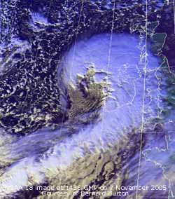 5th: A dull start to the day, but the temperature was rising and at 09 GMT had exceeded yesterday's daytime temperature. Pressure was 1014 mb in a col between 2 cloud-filled weak ridges. A light shower of rain set the scene for the day that saw frequent blustery showers with a few bright, even briefly sunny spells. From 1900 GMT there was light rain and drizzle through to next morning. {Capel Curig 21.0 mm} [Rain 12.5 mm; Max 13.7C; Min 5.1C; Grass 2.1C]
![]() 6th: Overcast at first but there were a few breaks in the cloud at 09 GMT. Pressure was 1005 mb and after passage of fronts overnight the day gradually improved with some good spells of
6th: Overcast at first but there were a few breaks in the cloud at 09 GMT. Pressure was 1005 mb and after passage of fronts overnight the day gradually improved with some good spells of ![]() sunshine by afternoon.
With the Jet Stream in it's current position (see chart courtesy of SFSU Meteorology) we can expect further runs of depressions across Britain over the next days. By evening the next batch of rain on a showery trough moved across. There was light to moderate rain from 2100 GMT with some ice pellets falling just before midnight. {Prestatyn 17C, Liverpool, Crosby 15.7C, Rhyl 14.6C; Bodmin 44.6 mm, Lake Vyrnwy 29.4 mm} [Rain 5.6 mm; Max 12.6C; Min 10.3C; Grass 9.1C]
sunshine by afternoon.
With the Jet Stream in it's current position (see chart courtesy of SFSU Meteorology) we can expect further runs of depressions across Britain over the next days. By evening the next batch of rain on a showery trough moved across. There was light to moderate rain from 2100 GMT with some ice pellets falling just before midnight. {Prestatyn 17C, Liverpool, Crosby 15.7C, Rhyl 14.6C; Bodmin 44.6 mm, Lake Vyrnwy 29.4 mm} [Rain 5.6 mm; Max 12.6C; Min 10.3C; Grass 9.1C]
7th: Clear sky at dawn but before 09 GMT I could see towering cumulus clouds in the W and soon over the Snowdonia Mountains. Pressure was 1012 mb with a developing low in the Atlantic W of Brest tracking NE towards SW Ireland. The convective clouds were soon moving across Anglesey and the morning had frequent light showers of rain with some sunny spells. The NOAA 18 satellite image at 1436 shows the rapidly deepening low 986 mb off Shannon, Ireland, tracking NE. During the afternoon with further occasional showers the S'ly wind freshened and by 1600 GMT was blowing a gale at force 8 touching force 9 at times. [Rain
34.5 mm; Max 12.2C; Min 6.6C; Grass 3.7C]
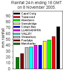 8th: At midnight the low had deepened to 968 mb and was positioned just off Cape Wrath, NW Scotland. Heavy overnight rain resulted in extensive flooding on Anglesey with water entering homes in villages spread across the island. Several rivers and streams had burst their banks including the Braint and Cadnant. Several roads had surface water including alongside the weather station in Llansadwrn, some other roads in Llansadwrn including the road to Beaumaris, and the A545 Cadnant Road to Beaumaris was flooded. The roads between Dwyran and Brynsiencyn was also reported flooded as was Glanhwfa Road in Llangefni and at Trefor. Much of the problem on the roads was due to runoff and blocked or inadequate drains. Long gone are the are the lengthmen who kept the hedges trimmed, ditches and drains open and performed other minor work. BUT, a pilot project to bring them back as 'community workers' has been such a success in the north-west of Anglesey that the scheme is to be expanded! The mainline train services between Holyhead and London were cut by flood water on the track at Gaerwen. The lower part of the garden at the weather station had, like the event of 22 October 2004, a stream running through it from runoff from higher ground.
 ![]() The soils became saturated at the beginning of the month and any rainfall now results in runoff. In the first 7-days this month total rainfall reached 127 mm, the average for November, bringing the total for the year to 1034 mm. Minor flooding was also reported on mainland Gwynedd including the A5 between Menai Bridge and Bangor. Construction workers escaped with their lives when their hut was destroyed in a landslide near Llyn Ogwen. At Groeslon, near Caernarfon, fire appliances again dealt with flooding - the second time within a month (see Diary 11 October). The Environment Agency issued 11 flood warnings and 41 flood watches for Wales. At 0806 GMT a flood warning was posted for the Conwy Valley and at Llanrwst train services on the Conwy Valley line were stopped with flood water on the track. Capel Curig reported 50 mm and Aberdaron 33 mm in the 24-h to 06 GMT. It was a sunless day, with very low (0.76 mv h) solar radiation under the thick cloud, with further spells of somewhat lighter rain at times before the front moved away east. At 2100 GMT there was a slight shower of small ice pellets. During the night drier weather moved across. {St Angelo 79.2 mm, Capel Curig 72.4 mm, Llansadwrn 40.1 mm} [Rain 7.1 mm; Max 12.0C; Min 7.8C; Grass 5.6C]
The soils became saturated at the beginning of the month and any rainfall now results in runoff. In the first 7-days this month total rainfall reached 127 mm, the average for November, bringing the total for the year to 1034 mm. Minor flooding was also reported on mainland Gwynedd including the A5 between Menai Bridge and Bangor. Construction workers escaped with their lives when their hut was destroyed in a landslide near Llyn Ogwen. At Groeslon, near Caernarfon, fire appliances again dealt with flooding - the second time within a month (see Diary 11 October). The Environment Agency issued 11 flood warnings and 41 flood watches for Wales. At 0806 GMT a flood warning was posted for the Conwy Valley and at Llanrwst train services on the Conwy Valley line were stopped with flood water on the track. Capel Curig reported 50 mm and Aberdaron 33 mm in the 24-h to 06 GMT. It was a sunless day, with very low (0.76 mv h) solar radiation under the thick cloud, with further spells of somewhat lighter rain at times before the front moved away east. At 2100 GMT there was a slight shower of small ice pellets. During the night drier weather moved across. {St Angelo 79.2 mm, Capel Curig 72.4 mm, Llansadwrn 40.1 mm} [Rain 7.1 mm; Max 12.0C; Min 7.8C; Grass 5.6C]
![]() 9th: Mostly cloudy after midnight but breaks appeared before dawn when the sky cleared. This resulted in the temperature falling to 3.5C and to 0.1C on the grass. While the thermometer touching grass leaves at 5 cm did not fall below freezing there were frozen water crystals on the flat leaves of buttercup just above the soil. The temperature of the soil 5 cm under bare soil fell to 5.2C (it was 10.2C yesterday) and was 12.5C at 100 cm deep where there is small variation. Pressure 102 mb was rising in a ridge of high-pressure from Azores-high 1038 mb, but low 964 mb S of Greenland is just waiting to bring a suite of fronts with more rain across later. The morning was bright and sunny but cumulus clouds could be seen in the W and the mountaintops were obscured. The temperature on the summit AWS was hovering around freezing point (0.3C at 09 GMT), any precipitation might be described as 'wintry' but I did not see any lying, and the temperature changed little during the day. On Anglesey it was a mostly sunny day with the temperature rising to 10.6C in a light WNW'ly breeze this falling to 4.6C by 1800 GMT. When frontal cloud encroached warm air arrived and the temperature began to rise steadily. There was light to moderate rain from 2300 GMT. The NOAA 18 satellite image shows Britain, western France and the Iberian Peninsula in a clear slot between fronts. The front that gave us all the rain on the 7/8th is over SE France. The next frontal system, associated with the maturing low 964 mb S Greenland, is lying to the NW and had brought rain to N Ireland and W Scotland before 1800 GMT. There is open celled marine convection behind the front S of Greenland and closed convection W of Iberia behind some open cells nearer the coast. {Tenby, Pembs. 8.0h, Valley 5.3h; Milford Haven 10.2 mm} [Rain 8.6 mm; Max 13.0C; Min 3.5C; Grass 0.1C]
9th: Mostly cloudy after midnight but breaks appeared before dawn when the sky cleared. This resulted in the temperature falling to 3.5C and to 0.1C on the grass. While the thermometer touching grass leaves at 5 cm did not fall below freezing there were frozen water crystals on the flat leaves of buttercup just above the soil. The temperature of the soil 5 cm under bare soil fell to 5.2C (it was 10.2C yesterday) and was 12.5C at 100 cm deep where there is small variation. Pressure 102 mb was rising in a ridge of high-pressure from Azores-high 1038 mb, but low 964 mb S of Greenland is just waiting to bring a suite of fronts with more rain across later. The morning was bright and sunny but cumulus clouds could be seen in the W and the mountaintops were obscured. The temperature on the summit AWS was hovering around freezing point (0.3C at 09 GMT), any precipitation might be described as 'wintry' but I did not see any lying, and the temperature changed little during the day. On Anglesey it was a mostly sunny day with the temperature rising to 10.6C in a light WNW'ly breeze this falling to 4.6C by 1800 GMT. When frontal cloud encroached warm air arrived and the temperature began to rise steadily. There was light to moderate rain from 2300 GMT. The NOAA 18 satellite image shows Britain, western France and the Iberian Peninsula in a clear slot between fronts. The front that gave us all the rain on the 7/8th is over SE France. The next frontal system, associated with the maturing low 964 mb S Greenland, is lying to the NW and had brought rain to N Ireland and W Scotland before 1800 GMT. There is open celled marine convection behind the front S of Greenland and closed convection W of Iberia behind some open cells nearer the coast. {Tenby, Pembs. 8.0h, Valley 5.3h; Milford Haven 10.2 mm} [Rain 8.6 mm; Max 13.0C; Min 3.5C; Grass 0.1C]
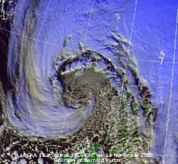 10th: Rain continued until 06 GMT accompanied by the temperature rise reaching 13.0C at 09 GMT. Temperatures on the summits of Snowdonia (Snowdon AWS 8.5C) were above freezing again and the chance of any wintry weather receded. It was a grey sunless day with low stratiform cloud and misty too with poor visibility. Pressure 1022 mb had risen between Azores-Biscay high 1040 mb and low Greenland-Iceland 972 mb. This gave a broad W'ly cloud-filled airflow across the UK but kept dry until 18 GMT when there was heavy drizzle. From 2130 GMT there was a spell of light rain. The eastern end of the North Wales coast saw the highest temperatures, see list. {Aultbea, Highland 28.6 mm, Capel Curig 27.2 mm; Prestatyn 17C, Hawarden 15.8C, Rhyl 15.8C, Liverpool, Crosby 15.3C} .[Rain 4.8 mm; Max 13.5C; Min 4.6C; Grass 2.0C]
![]()
![]() 11th: Rain petered out about 02 GMT and was then showery. The S'ly wind strengthened to strong to gale force 8 by 08 GMT with some strong gusts testing the trees. At 09 GMT pressure 1012 mb was falling with deepening Atlantic-depression 982 mb moving past Malin Head towards NW Scotland. The Met Office had issued a severe weather warning of severe gales for N Ireland, W Scotland and Wales. There were blustery showers during the morning as RAF Valley reported near force 9 winds with gusts of 54 mph. The afternoon had a few sunny intervals between more blustery showers. The Britannia Bridge was closed to high-sided vehicles most of the day with speed restrictions of 20 mph, but the end of the afternoon the wind had moderated allowing a 30 mph speed limit. The strong winds went on to affect Scotland with Western Isles stations reporting sustained storm force 10 winds and on mountains gusts up to 126 mph. At Benbecula a mws of over 40 mph was reported from 11 to 01 GMT, the highest was 63 mph with a gust of 84 mph recorded at 1620 GMT. Many inland part experienced gales with gusts 70 - 80 mph. The Forth Road Bridge was closed to all traffic along with the Erskine and Skye Bridges; strong winds blew through the central lowlands and gale-force winds were experienced on Tayside and in Dundee. Electricity supplies were disrupted leaving a reported 10,000 homes without power. Tidal surges of up to a metre were seen along western coasts. It was a quiet night here the winds having moderated in the S Scotland before midnight. {Isle of Skye 39.2 mm, Capel Curig 35.0 mm}[Rain 3.5 mm; Max 12.3C; Min 11.8C; Grass 11.0C]
11th: Rain petered out about 02 GMT and was then showery. The S'ly wind strengthened to strong to gale force 8 by 08 GMT with some strong gusts testing the trees. At 09 GMT pressure 1012 mb was falling with deepening Atlantic-depression 982 mb moving past Malin Head towards NW Scotland. The Met Office had issued a severe weather warning of severe gales for N Ireland, W Scotland and Wales. There were blustery showers during the morning as RAF Valley reported near force 9 winds with gusts of 54 mph. The afternoon had a few sunny intervals between more blustery showers. The Britannia Bridge was closed to high-sided vehicles most of the day with speed restrictions of 20 mph, but the end of the afternoon the wind had moderated allowing a 30 mph speed limit. The strong winds went on to affect Scotland with Western Isles stations reporting sustained storm force 10 winds and on mountains gusts up to 126 mph. At Benbecula a mws of over 40 mph was reported from 11 to 01 GMT, the highest was 63 mph with a gust of 84 mph recorded at 1620 GMT. Many inland part experienced gales with gusts 70 - 80 mph. The Forth Road Bridge was closed to all traffic along with the Erskine and Skye Bridges; strong winds blew through the central lowlands and gale-force winds were experienced on Tayside and in Dundee. Electricity supplies were disrupted leaving a reported 10,000 homes without power. Tidal surges of up to a metre were seen along western coasts. It was a quiet night here the winds having moderated in the S Scotland before midnight. {Isle of Skye 39.2 mm, Capel Curig 35.0 mm}[Rain 3.5 mm; Max 12.3C; Min 11.8C; Grass 11.0C]
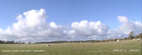 12th: At midnight the low was beginning to fill at 967 mb near Shetland and winds in Scotland were moderating. A mostly cloudy morning here with occasional showers of rain and a little sunshine. Pressure 1012 mb had risen with the filling low 973 mb over the North Sea. The temperature was 7.6C (1.1C on Snowdon summit); there was a light to moderate W'ly breeze. The afternoon was sunnier with lines of cumulus clouds mostly to the S (see photo left) and N over the mountains of Snowdonia in this image
 ![]() . The NOAA 18 satellite was over at 1345 GMT, so you can see what the clouds looked like from above in this image
. The NOAA 18 satellite was over at 1345 GMT, so you can see what the clouds looked like from above in this image ![]() . In the far N of Scotland strong winds continued and with falling temperatures blizzards were forecast. There was lying snow on Cairngorm and the colder air moved S during the day reaching Snowdonia by nightfall. There was a spell of rain from 2030 to 2300 GMT as a front moved it's way SE across Wales. {Milford Haven 13.1C, Loch Glascarnoch, Highland 53.8 mm} [Rain 5.3 mm; Max 11.4C; Min 5.7C; Grass 3.2C]
. In the far N of Scotland strong winds continued and with falling temperatures blizzards were forecast. There was lying snow on Cairngorm and the colder air moved S during the day reaching Snowdonia by nightfall. There was a spell of rain from 2030 to 2300 GMT as a front moved it's way SE across Wales. {Milford Haven 13.1C, Loch Glascarnoch, Highland 53.8 mm} [Rain 5.3 mm; Max 11.4C; Min 5.7C; Grass 3.2C]
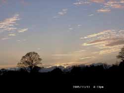 13th: A bright morning with a clearing sky. Pressure 1028 mb was rising as a ridge from Atlantic-high 1041 mb edged across from the W. At first cloud hugged the Snowdonia summits but gradually lifted and cleared through the afternoon that was mostly sunny. The first lying snow of the winter was seen on Yr Wyddfa at about 3300 ft. A cooler day with the temperature reaching 9.5C. Flowers are few in the garden now, but there are a good number still on our large shrubby blackcurrant sage. My attention was drawn by the buzzing of a large bumblebee feeding on the red-coloured flowers. The sage will continue flowering until the first airfrost. It was a clear night. [Rain 0.0 mm; Max 9.5C; Min 6.2C; Grass 3.8C]
14th: A mostly clear sky at night with the first ground frost of the season (-0.5C on the grass); a few days earlier than last year (19th November). Cloud had encroached before dawn, on a warm front, when there was a red sky seen about 0715 GMT. A flock of 20 redwings was seen, the first this autumn, along with a few starlings on a field adjacent to the weather station. The day was overcast and sunless with drizzle and light rain after 18 GMT. [Rain 3.3 mm; Max 11.2C; Min 3.2C; Grass -0.5C]
![]() 15th: There was a spell of light rain from midnight to about 03 GMT accompanied by a rising temperature that reached 11.2C about 0400 GMT, the 24-h maximum. Then the temperature started to fall, with passage of the cold front, and was 8.1C at 0900 GMT. Pressure 1016 mb was rising and with a ridge of high-pressure to the W and low-pressure over the Baltic introducing a cool and showery N'ly airstream. The morning was mostly cloudy with a little brightness developing by the afternoon. The Meteosat MSG satellite image shows the broad band of frontal cloud, that passed over here 14/15th, over the English Channel and N France. To the far N are open celled convective clouds with closed deeper cells in the S affecting N Ireland and Wales. [Rain 0.6 mm; Max 10.2C; Min 7.1C; Grass 5.2C]
15th: There was a spell of light rain from midnight to about 03 GMT accompanied by a rising temperature that reached 11.2C about 0400 GMT, the 24-h maximum. Then the temperature started to fall, with passage of the cold front, and was 8.1C at 0900 GMT. Pressure 1016 mb was rising and with a ridge of high-pressure to the W and low-pressure over the Baltic introducing a cool and showery N'ly airstream. The morning was mostly cloudy with a little brightness developing by the afternoon. The Meteosat MSG satellite image shows the broad band of frontal cloud, that passed over here 14/15th, over the English Channel and N France. To the far N are open celled convective clouds with closed deeper cells in the S affecting N Ireland and Wales. [Rain 0.6 mm; Max 10.2C; Min 7.1C; Grass 5.2C]
![]() 16th: A band of showers crossed North Wales between 0330 and 0530 GMT. Here we had rain and a few ice pellets but over the Snowdonia Mountains, where temperatures on the summit were below freezing, the precipitation fell as snow leaving a thin cover across most of the north-facing summits over 2800 ft by morning. At 09 GMT pressure 1012 mb was rising; there was a moderate to fresh N'ly wind and felt cold in the 5.9C (dewpoint 0.5C). The morning had some sunshine, after another band of light showers, and the afternoon was mostly sunny with jetstream cirrus clearly visible overhead (see polar chart). Temperatures on the mountaintops remained below freezing all day and only reached 7.0C here in Llansadwrn. A little mist formed on the fields at dusk (1645 GMT); a clear evening with a fine view of Mars low in the sky to the SW. [Rain 0.0 mm; Max 7.0C; Min 4.8C; Grass 1.6C]
16th: A band of showers crossed North Wales between 0330 and 0530 GMT. Here we had rain and a few ice pellets but over the Snowdonia Mountains, where temperatures on the summit were below freezing, the precipitation fell as snow leaving a thin cover across most of the north-facing summits over 2800 ft by morning. At 09 GMT pressure 1012 mb was rising; there was a moderate to fresh N'ly wind and felt cold in the 5.9C (dewpoint 0.5C). The morning had some sunshine, after another band of light showers, and the afternoon was mostly sunny with jetstream cirrus clearly visible overhead (see polar chart). Temperatures on the mountaintops remained below freezing all day and only reached 7.0C here in Llansadwrn. A little mist formed on the fields at dusk (1645 GMT); a clear evening with a fine view of Mars low in the sky to the SW. [Rain 0.0 mm; Max 7.0C; Min 4.8C; Grass 1.6C]
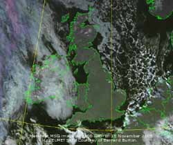 17th: A clear night with moderate ground frost (-3.6C) and a little hoar frost. With the sun rising over the Snowdonia Mountains at 0815 GMT the morning was sunny. Pressure 1018 mb was rising between Atlantic-low 990 mb and complex low-pressure (994 mb) over the Baltic and Europe. The day continued sunny with the temperature rising to 10.0C. By 18 GMT a high-pressure centre 1022 mb had formed over the Faeroe Islands. Clear sky continued into the evening and with falling temperature there was soon frost on the grass. [Rain 0.0 mm; Max 10.0C; Min 1.0C; Grass -3.6C]
![]() 18th: The overnight minimum fell to 0.8C and by morning the fields were white with frost, mostly frozen dew but there was a moderate deposit of hoar frost as well. At 09 GMT the temperature was 1.8C but beginning to rise in the sunshine. Pressure was 1024 mb with intensifying high-pressure 1025 mb centred over the Faeroes and Tayside, Scotland. There was little (ENE'ly) or no wind and visibility was very good, but there was some mistiness and smoke haze in the valley bottom of the Nant Ffrancon Pass, Menai Strait and Liverpool Bay. The mountains looked a frosty-white from here with a little snow remaining still on the summits. It was wall to wall sunshine here (nearly 8 hours), with the temperature reaching 9.4C, although some cloud off the Irish Sea affected the W coast of the island (Valley 3.0 h) before retreating during the night. The Menai Strait was unusually like a mill pond with hardly a ripple on the water. On the mountains the sprinkling of snow diminished through the day as the temperature rose above freezing in the sunshine. The Meteosat MSG satellite image shows almost clear skies over Britain in the high 1027 mb. There is frontal cloud W of Ireland with stratiform cloud over E Ireland and the Irish Sea and open celled marine convection over the North Sea. . {Culdrose 13.4C; Hastings, Sussex 8.5h} [Rain 0.0 mm; Max 9.4C; Min 0.8C; Grass -3.6C]
18th: The overnight minimum fell to 0.8C and by morning the fields were white with frost, mostly frozen dew but there was a moderate deposit of hoar frost as well. At 09 GMT the temperature was 1.8C but beginning to rise in the sunshine. Pressure was 1024 mb with intensifying high-pressure 1025 mb centred over the Faeroes and Tayside, Scotland. There was little (ENE'ly) or no wind and visibility was very good, but there was some mistiness and smoke haze in the valley bottom of the Nant Ffrancon Pass, Menai Strait and Liverpool Bay. The mountains looked a frosty-white from here with a little snow remaining still on the summits. It was wall to wall sunshine here (nearly 8 hours), with the temperature reaching 9.4C, although some cloud off the Irish Sea affected the W coast of the island (Valley 3.0 h) before retreating during the night. The Menai Strait was unusually like a mill pond with hardly a ripple on the water. On the mountains the sprinkling of snow diminished through the day as the temperature rose above freezing in the sunshine. The Meteosat MSG satellite image shows almost clear skies over Britain in the high 1027 mb. There is frontal cloud W of Ireland with stratiform cloud over E Ireland and the Irish Sea and open celled marine convection over the North Sea. . {Culdrose 13.4C; Hastings, Sussex 8.5h} [Rain 0.0 mm; Max 9.4C; Min 0.8C; Grass -3.6C]
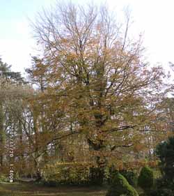 19th: A clear cold night with the minimum 0.3C and -5.6C on the grass, both lowest of the month. Inland and in valley bottoms there was an airfrost; Pentraeth WS reported an air temperature of -2.1C. A veil of cirrus cloud resulted in a coloured halo around the moon at 0715 GMT. It was a sunny morning with the frost melting, but lingered in shadows. Pressure was 1031 mb within high UK, a good time to set your barometers 30.45 inches Hg. There was little or no wind. Sunshine in the afternoon and a clear evening with dew and frost on the grass. [Rain trace/ frost; Max 8.5C; Min 0.3C; Grass -5.6C]
20th: After a clear night cloud encroached at dawn off the Irish Sea and by 09 GMT the temperature had risen to 4.5C. Pressure had intensified a little to 1034 mb within the high over S Britain and Belgium. Most of mainland N Wales and S Britain was sunny with fog persisting in some inland parts of England. After a mostly cloudy morning, with crepuscular rays seen in the Ogwen Valley, the afternoon at times was sunnier. Many trees including the sycamores have dropped their leaves, but the beeches and horse-chestnuts still retain many of theirs with perhaps even more intense gold colours than shown at the beginning of October. Some local ash trees and wild cherry still have most of their leaves which are still green. It was a warmer evening the temperature not falling as quickly until the cloud began to clear before midnight. [Rain tr/ frost; Max 9.8C; Min 1.3C; Grass -4.2C]
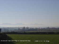 21st: A clear night with ground frost by morning. There was a veil of cirrus clouds and visibility was good but with smoke haze and some mist patches around the coast and low lying parts. The mountaintops of Snowdonia and Lleyn were clearer with a marked temperature inversion. At 09 GMT the temperature recorded by the AWS on the summit of Yr Wyddfa was 8.3C, 5.5C at Clogwyn while in Llanberis it was only 1.4C. Here it was 4.0C the white frost, mainly frozen heavy dew, had stated to melt. Pressure was 1035 mb with the high centred over Wales. The day was sunny with little (NE'ly) or no wind. After sunset (1620 GMT) the sky in the W was a dark peach colour, with azure blue above
 ![]() , that intensified up to about 17 GMT fading slowly but lasting until 18 GMT. In the E the sky was pink coloured darkening from below after sunset as the earth's shadow moved W. The pink colour, known as the 'Belt of Venus' and the result of reflected sunlight from just below the western horizon, had disappeared and the sky was dark overhead well before the peach colour in the W had faded. It is best seen in a cloudless sky, but if there are cirrus clouds they may also be coloured pink. The after-sunset glow was good today because of the high level particles and aerosols (smoke) low in the atmosphere. {Isle of Man 12.1C} [Rain tr/frost; Max 9.8C; Min 3.0C; Grass -2.2C]
, that intensified up to about 17 GMT fading slowly but lasting until 18 GMT. In the E the sky was pink coloured darkening from below after sunset as the earth's shadow moved W. The pink colour, known as the 'Belt of Venus' and the result of reflected sunlight from just below the western horizon, had disappeared and the sky was dark overhead well before the peach colour in the W had faded. It is best seen in a cloudless sky, but if there are cirrus clouds they may also be coloured pink. The after-sunset glow was good today because of the high level particles and aerosols (smoke) low in the atmosphere. {Isle of Man 12.1C} [Rain tr/frost; Max 9.8C; Min 3.0C; Grass -2.2C]
![]() 22nd: Clear skies at first with mist and fog patches in low lying and coastal areas. There was frost on the ground and some concrete surfaces had a glaze of ice formed from condensation of moisture from the air. Heavy dew and frost overnight, measured by a set of small-lysimeters, was 0.7 mm, but there was just a trace around the funnel of the raingauge. Parts of central Britain have had several nights of airfrost (temperatures in places below 5C) with hoar frost. Pressure 1038 mb had risen further with the high centred over N England. Another day of inversion temperatures with the summit of Snowdon reaching 11.8C but exceeded at Great Dunn Fell with 14.7C. Fog and low cloud in Liverpool Bay encroached on the North Wales coast and E Anglesey during the morning. Here, on the western edge of the cloud, it was bright at times with a maximum of 7.4C but relative humidity was high all day. The Meteosat MSG satellite image at noon shows much of central Britain covered with fog or low cloud. Notably N Scotland, most of Anglesey, North Wales, SW England and London and Kent was in the clear. Pressure reached 1040 mb by evening and led to tide levels being 0.25 m lower than predicted. {Great Dunn Fell 14.7C, Yr Wyddfa, Snowdon 11.8C, Valley 9C} [Rain 0.1 mm(dew/frost); Max 7.4C; Min 2.1C; Grass -3.2C]
22nd: Clear skies at first with mist and fog patches in low lying and coastal areas. There was frost on the ground and some concrete surfaces had a glaze of ice formed from condensation of moisture from the air. Heavy dew and frost overnight, measured by a set of small-lysimeters, was 0.7 mm, but there was just a trace around the funnel of the raingauge. Parts of central Britain have had several nights of airfrost (temperatures in places below 5C) with hoar frost. Pressure 1038 mb had risen further with the high centred over N England. Another day of inversion temperatures with the summit of Snowdon reaching 11.8C but exceeded at Great Dunn Fell with 14.7C. Fog and low cloud in Liverpool Bay encroached on the North Wales coast and E Anglesey during the morning. Here, on the western edge of the cloud, it was bright at times with a maximum of 7.4C but relative humidity was high all day. The Meteosat MSG satellite image at noon shows much of central Britain covered with fog or low cloud. Notably N Scotland, most of Anglesey, North Wales, SW England and London and Kent was in the clear. Pressure reached 1040 mb by evening and led to tide levels being 0.25 m lower than predicted. {Great Dunn Fell 14.7C, Yr Wyddfa, Snowdon 11.8C, Valley 9C} [Rain 0.1 mm(dew/frost); Max 7.4C; Min 2.1C; Grass -3.2C]
23rd: Overnight low cloud and mist persisted and 0.05 mm was collected in the copper raingauge. The small-lysimeters measured an 0.14 mm deposition from 18 to 09 GMT. There was no ground frost overnight, grass minimums at this station are for 24-h 09-09 GMT, the -0.2C observation was when the thermometer was reset yesterday morning when it was still frosty. Pressure is still high and was at 1040 mb at 09 GMT, highest of the month; the high's centre, on the 06 GMT chart, over Ireland began to edge W during the day. The low stratiform cloud occasionally showed some small breaks overhead, but visibility remained poor through the day with little or no wind. After a daytime maximum of 6.5C the temperature fell to 5.0C about 18 GMT before rising slowly through the night. Public Health authorities issued an alert, reported on BBC Ceefax, for immuno-compromised people in Gwynedd and Anglesey to make sure they continued to boil their drinking water. There had been an unusual rise in the number of cases of Cryptosporidiosis, a potentially fatal illness that may include severe diarrhoea, vomiting, stomach cramps and fever, that can last several days even weeks. The number of confirmed cases in the area, caused by the waterborne parasite Cryptosporidium, since the beginning of October rose to 72. [Rain trace; Max 9.3C; Min 3.0C; Grass -0.2C]
![]() 24th: A temperature 9.3C at 07 GMT was the maximum of the past 24-h. The NW'ly wind had freshened to force 3/4 and the low cloud and fog had been blown away. There was little change as the sky was overcast with stratocumulus, later cumulonimbus. There had been a few spots of rain but the main precipitation was over Scotland. Pressure had fallen to 1020 mb as the old high 1043 mb had moved to mid-Atlantic S of Greenland. With low 992 mb N Scandinavia cold northerly air was starting to be brought down across Britain. Snow had been reported over the Highlands, and snow showers on Benbecula and in Aberdeen and Dundee during the morning. Four hillwalkers got stranded in heavy blizzards on the plateau of Ben Macdui near Cairngorm and rescue teams were dispatched. A showery trough moved over the Isle of Man (small hail reported) and on to North Wales during the morning and with temperatures starting to fall there was ice precipitation. The second cold front went through about 1215 GMT with squally wind and bursts of rain with the temperature falling to 2.7C. During the afternoon the wind freshened, there were moderate to heavy squally showers of ice pellets and sleet at low levels and snow above 500 ft in Snowdonia. At 1530 GMT there was light 'wet' snow lying at 1000 ft. Small hail was reported in Caernarfon, Gwynedd at 1525 GMT and Llanfairfechan, Conwy at 1600 GMT. During the evening, with the wind strengthening to strong to gale-force 8 and roaring in the trees, showers turned to snow pellets. Up to 7 mm diameter snow pellets, accompanied by thunder and lightning, almost covered the ground at 2324 GMT. [Rain 6.7 mm; Max 8.5C; Min 4.7C; Grass 0.9C]
24th: A temperature 9.3C at 07 GMT was the maximum of the past 24-h. The NW'ly wind had freshened to force 3/4 and the low cloud and fog had been blown away. There was little change as the sky was overcast with stratocumulus, later cumulonimbus. There had been a few spots of rain but the main precipitation was over Scotland. Pressure had fallen to 1020 mb as the old high 1043 mb had moved to mid-Atlantic S of Greenland. With low 992 mb N Scandinavia cold northerly air was starting to be brought down across Britain. Snow had been reported over the Highlands, and snow showers on Benbecula and in Aberdeen and Dundee during the morning. Four hillwalkers got stranded in heavy blizzards on the plateau of Ben Macdui near Cairngorm and rescue teams were dispatched. A showery trough moved over the Isle of Man (small hail reported) and on to North Wales during the morning and with temperatures starting to fall there was ice precipitation. The second cold front went through about 1215 GMT with squally wind and bursts of rain with the temperature falling to 2.7C. During the afternoon the wind freshened, there were moderate to heavy squally showers of ice pellets and sleet at low levels and snow above 500 ft in Snowdonia. At 1530 GMT there was light 'wet' snow lying at 1000 ft. Small hail was reported in Caernarfon, Gwynedd at 1525 GMT and Llanfairfechan, Conwy at 1600 GMT. During the evening, with the wind strengthening to strong to gale-force 8 and roaring in the trees, showers turned to snow pellets. Up to 7 mm diameter snow pellets, accompanied by thunder and lightning, almost covered the ground at 2324 GMT. [Rain 6.7 mm; Max 8.5C; Min 4.7C; Grass 0.9C]
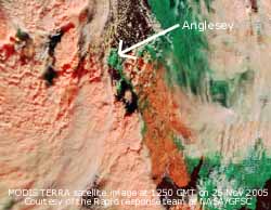
![]()
![]()
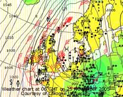 25th:
Showers continued after midnight and at 0145 GMT, with thunder and lightning, conical-shaped snow pellets measuring up to 1 cm diameter fell covering the ground. During one of the storms the Old School in Tynygongl was struck by lightning. By morning snow pellets were still lying (>50% ice cover) on the ground here, Red Wharf Bay and in a swathe to Llanbedrgoch. There was a light cover of ice precipitation on the Snowdonia Mountains generally at 500 ft, but some, especially Olli my grandson, were disappointed not to see the heavy falls of snow that had been forecast. Up to 4 cm of snow pellets was reported in central Snowdonia while light falls were also reported in South Wales and on Dartmoor, SW England, where 5 cm was reported. Low 975 mb that had steamed down the North Sea was stalled over the Netherlands and pressure here had fallen to 996 mb. Frontal cloud, with embedded deep convection, in circulation around the low persistently affected Britain particularly the west. It was a bright morning here with some sunshine, the temperature rising to 5.2C just after noon, and further slight showers of snow pellets and small flakes of snow. On the Prescelly Mountains, Pembrokeshire, 4 people were struck by lightning at 1150 GMT, one flown to hospital and retained overnight. In the afternoon, with the wind again freshening to gale force 8, there were frequent sometimes heavy showers mixtures of rain, hail, sleet with thunder and lightning about 1515 GMT when the temperature fell to the minimum of 2.6C. The NW of Britain was battered by storm force 10 winds. Malin Head, N Ireland, and Kirkwall, Scotland, reported sustained 55 mph and Kinloss, Scotland, 43 mph, and further snow showers during the morning. Heavy snow and blizzards were reported from parts of the Highlands and many roads were closed in Aberdeenshire. Light snow was also reported in the central lowlands and in Edinburgh and showers had reached as far as SE England. Snow was heaviest during the day in the S in Wales and Cornwall where children were left trapped in schools; hundreds of motorists were caught on the A30 on Bodmin Moor; helicopters were brought in to help in the rescue work while most spent the night in temporary accommodation. In Penzance Graham Easterling reported [44.5 mm] of precipitation. The MODIS TERRA image at 1150 GMT shows the extent of snow cover. Processed with bands 3-6-7 snow shows up as bright red and shows the track over Wales and the West Country having missed out Anglesey. Ice crystals in the deeply convective cloud tops to the W shows up reddish-orange or peach colour. There is an active frontal system, possibly a line of convergence, to the west of Anglesey over the Irish Sea to SW England, and closed cell convection to the west of Ireland. Cornwall, still under the deep clouds, continued to have heavy snowfalls. See also the Meteosat MSG image at 12 noon
 ![]() {Altnaharra 33.0 mm, Aberdaron 14.8 mm; Scilly Is. 8.0C} [Rain 9.3 mm; Max 6.5C; Min 0.7C; Grass -0.6C]
{Altnaharra 33.0 mm, Aberdaron 14.8 mm; Scilly Is. 8.0C} [Rain 9.3 mm; Max 6.5C; Min 0.7C; Grass -0.6C]
26th: Showers more or less died out before midnight and the temperature rose slowly from the previous afternoon reaching the maximum of 6.5C at 09 GMT. Pressure 998 mb was rising with the low 980 mb still stalled over the Netherlands, there was another depression centre 991 mb near Bordeaux. Snow up to 17 cm deep was reported in Belgium with 8 cm in Brussels where some flights at the airport were disrupted as well as trees blown down in the strong winds. Here light snow was lying above 1500 ft on the Snowdonia Mountains, it was deeper in a few places having been drifted in the strong winds. Rising temperatures led to an early thaw on the lower slopes. The morning was occasionally bright, cumulonimbus clouds were in the vicinity about 1030 GMT and there were some showers of rain on Anglesey with snow showers on the mountaintops The NW of Britain was still being affected by strong and gale-force winds. In Scotland a train was derailed injuring 9 passengers after hitting a landslide on the track following heavy rains. The afternoon here was duller with fewer showers and moderating wind. {Scilly Is. 10.5C, Milford Haven 9.3C; Tulloch Bridge, Scotland 32.0 mm} [Rain trace; Max 7.1C; Min 2.6C; Grass 0.5C]
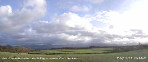 27th: There was a slight shower of small ice pellets at 0345 GMT but there was only a trace at the 09 GMT. The sky was overcast and the wind was a light NE'ly. Pressure was 1001 mb with the maturing low 990 stalled over the Netherlands. There were several bands of showers over Britain; one was S of the Snowdonia Mountains with precipitation falling in a SSW'ly direction. By 1130 GMT it was brighter with some sunny spells developing by afternoon. Occasional snow showers seen around the mountaintops that had a light covering of snow. At 1539 GMT here there was a shower of small (<2 mm ) spherical ice pellets. The evening was almost clear for a while before more wintry showers moved across. [Rain 0.5 mm; Max 6.6C; Min 5.3C; Grass 3.6C]
28th: Frequent showers of snow pellets and a few snowflakes during the morning with some bright spells between when the temperature rose to 5.0C, the lowest maximum of the month. Snow showers across the mountains left swathes of fresh snow that soon disappeared at lower levels but added to the cover above 1800 ft. A large 'white out' snow shower filled the Ogwen Valley about 0940 GMT and as it cleared left sunbeams (crepuscular rays) coloured as the sunlight was refracted through the ice crystals. Pressure was 1001 mb with low-pressure over the North Sea 993 mb and Baltic 986 mb, and high 1031 mb mid-Atlantic S of Greenland. The cold N to NE'ly airflow (4.1C with dewpoint -2.1C at 09 GMT) still covered Britain with frequent wintery showers driven in off the Irish Sea on to Wales and SW England.. The E coast of Scotland and England were similarly affected with some showers penetrating as far as the Midlands. Huge tailbacks with 3h delays were caused on the A40 in South Wales, between St. Clears and Carmarthen, when black ice resulted in 10 crashes. The snow moved on to the Gloucestershire and Cotswolds where causing more chaos on the roads about 17 GMT. More in the way of sunshine here later in the day as showers lessened, but the strengthening moderate to fresh NE'ly felt cold as the temperature fell back to 4C. The evening was mostly clear with a ground frost. [Rain 3.7 mm; Max 5.0C; Min 2.3C; Grass -2.4C]
29th: The air temperature fell to 1.5C and wet bulb temperature to 0.2C (dewpoint -2.3C) by 0230 GMT when a weak frontal system moved in over Ireland from the NW. Ahead of the front there were showers of snow pellets and snow that turned to rain as the wet bulb temperature rose. At 09 GMT it was sleet in a temperature of 2.2C with the wet bulb 2.1C (dewpoint was 1.9C), then light to moderate rain that fell as wet snow at 600 ft in central parts of the Snowdonia Mountains and seen just under lifting low cloud and hill fog between 800-1000 ft. Over 2500 ft, in temperatures of <-3C, the snow accumulated. Pressure 1008 mb was rising in a small ridge, but frontal cloud was moving in association with low 1002 mb to the NW off Malin head. The rain turned showery during the morning with the temperature keeping around 3C. Snow continued to fall in showers on the mountaintops, but there was little below 1000 ft. On Anglesey during the afternoon there were some sunny spells when the temperature rose to 5.2C before some more showers of rain before dusk (1630 GMT) as the temperature fell back. A brief clearer spell allowed the temperature above the grass to fall to -0.3C. A Met Office warning of 'black ice' had been issued for eastern areas of Britain, but here with the encroaching warm front, moving in across the Irish Sea, temperatures rose through the night. Following a rise in the number of cases of Cryptosporidiosis to 87, a statement was issued by Health Authorities. People in 70,000 households living in towns and villages from stretching from Bangor to Caernarfon in Gwynedd, and an area of south Anglesey from Beaumaris, Menai Bridge to Gaerwen and Llanddaniel on Anglesey supplied from the Llyn Cwellyn reservoir, were advised to boil their tap water before use. It was stated that the source of the parasite Cryptosporidium had not been established, but investigations were centred around the Rhyd Ddu Sewage Treatment Works. [Rain 2.6 mm; Max 7.2C; Min 1.5C; Grass -2.1C]
30th: Overcast early then fog developed just before 09 GMT when maximum for the past 24-h of 7.2C occurred. The fog soon dispersed and left a rather damp morning under an overcast sky. The W'ly wind backed SW'ly during the afternoon and was cloudy and dry, there was snowmelt in the higher temperatures of the warm sector air on the Snowdonia Mountains but there was still remnant lying snow at 1800 ft by dusk. By 18 GMT the wind was S'ly and the evening had some light rain between 2015 and 2100 GMT. The number of cases of cryptosporidiosis had risen to 110 by the end of the day. A spokesman for Welsh Water said on BBC Wales News that purification equipment at the Cwellyn reservoir was working and 24-h a day monitoring had not indicated a problem. Nevertheless, Health Service advice is still to boil the water and continue to 9 January when the position will be reviewed. [Rain 1.0 mm; Max 10.5C; Min 2.2C; Grass -0.3C]
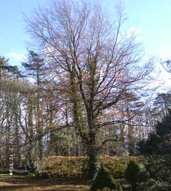
![]() 1st: Temperatures continued to rise in the warm sector air reaching 10.5C at 09 GMT, the maximum of the past 24-h, and went on to reach 11.5C the highest of the month. A mostly cloudy morning with a force 4 to 5 SE'ly wind. Pressure 998 mb was falling quickly with complex low pressure centres 981 mb to the W. There was a cold front moving in across the Irish Sea and there was a band of rain over SW Scotland, Wales and SW England. Not much seemed to be falling over Anglesey at first with the morning keeping overcast, but by afternoon there was light rain with a fresh to strong S'ly wind. The sky cleared in the evening with the grass minimum going down to 0.0C, not a ground frost as -0.1C is required. Later it turned cloudy again with rain spreading up from the SE before midnight. By the end of the day the number of confirmed cases of cryptosporidiosis had reached 123. [Rain 6.0 mm; Max 11.5C; Min 7.2C; Grass 6.2C]
1st: Temperatures continued to rise in the warm sector air reaching 10.5C at 09 GMT, the maximum of the past 24-h, and went on to reach 11.5C the highest of the month. A mostly cloudy morning with a force 4 to 5 SE'ly wind. Pressure 998 mb was falling quickly with complex low pressure centres 981 mb to the W. There was a cold front moving in across the Irish Sea and there was a band of rain over SW Scotland, Wales and SW England. Not much seemed to be falling over Anglesey at first with the morning keeping overcast, but by afternoon there was light rain with a fresh to strong S'ly wind. The sky cleared in the evening with the grass minimum going down to 0.0C, not a ground frost as -0.1C is required. Later it turned cloudy again with rain spreading up from the SE before midnight. By the end of the day the number of confirmed cases of cryptosporidiosis had reached 123. [Rain 6.0 mm; Max 11.5C; Min 7.2C; Grass 6.2C]
![]()
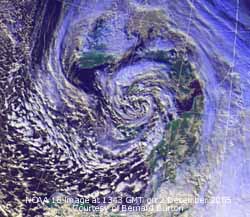 2nd: At midnight the deepening depression 964 mb was off SW Ireland steaming SE with strong winds around it's centre. There was intermittent light rain in the hours up to 09 GMT with only light E'ly winds being close to the centre of the low. Pressure 974 mb was still falling as the deepening depression 962 mb approached the SW Approaches of the English Channel. There was heavy rain in the Channel and patches of rain circulating over Britain. By 11 GMT the rain had stopped here and it was looking brighter and by afternoon there were some sunny spells. A flotilla of lenticular clouds hovered over SW Anglesey most of the afternoon. There was little snow left on the mountaintops after the warmth of the previous days. There was a heavy shower of rain at 1700 GMT and a spell of light to moderate rain commenced at 2300 GMT.
 ![]() The NOAA 18 satellite image shows the still deepening low 960 mb over Brittany at 1343 GMT. Within the vortex were some well developed convective clouds that produced thundery heavy showers over S England. Yesterday's cold front is over France while there is another cloud spiral associated with a low S of Iceland. The number of confirmed cases of cryptosporidiosis reached 138. DNA analyses were being done to establish the parasitic species involved. [Rain 5.8 mm; Max 8.3C; Min 3.5C; Grass 0.0C]
The NOAA 18 satellite image shows the still deepening low 960 mb over Brittany at 1343 GMT. Within the vortex were some well developed convective clouds that produced thundery heavy showers over S England. Yesterday's cold front is over France while there is another cloud spiral associated with a low S of Iceland. The number of confirmed cases of cryptosporidiosis reached 138. DNA analyses were being done to establish the parasitic species involved. [Rain 5.8 mm; Max 8.3C; Min 3.5C; Grass 0.0C]
![]()
![]() 3rd: At midnight the low was centred over Wales and had started to fill (972 mb). There were still some strong winds around it's periphery but here, near the centre, they continued light and variable. The rain eased off around 0100 GMT but there were spells of heavy drizzle leading up to 09 GMT. There were some heavy showers moving in off the Irish Sea these affecting parts of the island. A murky sort of morning with further showers of light rain but sometimes clearing briefly in between. At 09 GMT the pressure here was 977 mb and the low had moved to be over Lancashire on it way to the North Sea. With the temperature again hovering <1C around the Snowdonia summits I saw a little ice precipitation around Y Garn. Other summits were obscured in cloud. Convective clouds developed over North Wales by noon and there were some moderate to heavy showers containing ice precipitation. The Meteosat MSG satellite image shows the convective cloud development over North Wales at 12 noon.
During such a shower between 1315 and 1330 GMT here thunder was heard and the rain contained ice pellets. The showers died out after 1700 GMT and the night was cloudy but dry. [Rain 5.1 mm; Max 7.1C; Min 4.9C; Grass 0.9C]
3rd: At midnight the low was centred over Wales and had started to fill (972 mb). There were still some strong winds around it's periphery but here, near the centre, they continued light and variable. The rain eased off around 0100 GMT but there were spells of heavy drizzle leading up to 09 GMT. There were some heavy showers moving in off the Irish Sea these affecting parts of the island. A murky sort of morning with further showers of light rain but sometimes clearing briefly in between. At 09 GMT the pressure here was 977 mb and the low had moved to be over Lancashire on it way to the North Sea. With the temperature again hovering <1C around the Snowdonia summits I saw a little ice precipitation around Y Garn. Other summits were obscured in cloud. Convective clouds developed over North Wales by noon and there were some moderate to heavy showers containing ice precipitation. The Meteosat MSG satellite image shows the convective cloud development over North Wales at 12 noon.
During such a shower between 1315 and 1330 GMT here thunder was heard and the rain contained ice pellets. The showers died out after 1700 GMT and the night was cloudy but dry. [Rain 5.1 mm; Max 7.1C; Min 4.9C; Grass 0.9C]
4th: Showers resumed about 0630 GMT and by 09 GMT the sky was clearing again. Pressure 987 mb was rising with the low 982 mb having reached the North Sea and was off Dundee at 06 GMT. The cloudbase over the mountains was at 1500 ft during the morning giving hill fog and some precipitation just to the S. Here it was a morning of bright sunny spells with passing dark clouds, but I did not see any precipitation before 14 GMT when it did rain. It was a dull and wet afternoon with showers continuing through the night. [Rain 4.2 mm; Max 8.8C; Min 5.4C; Grass 2.8C]
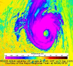 5th: A dull morning low cloud and mist giving poor visibility. Showery rain and some heavy drizzle easing off but remaining overcast. Pressure 997 mb, however, continued to rise with the low-pressure 992 slowly filling over the North Sea. High 1023 mb lay to the SW with a ridge to SW Iceland. With a slow moving occluded front lying Iceland, Irish Sea to the Midlands the day was dull, sunless with low solar radiation (0.8 mv h), and damp with no sign of the cloud clearing by evening. There was intermittent rain from 20 GMT to midnight. Temperatures on the mountain summits falling to just below freezing. The number of confirmed cases of cryptosporidiosis reached 154. [Rain 6.9 mm; Max 6.8C; Min 5.0C; Grass 0.5C]
The hurricane season ended officially on the 30th November but on this MODIS AQUA satellite image we have another, the 26th. When our alphabet ran out the Greek alphabet is used and this one, the 5th letter, is Epsilon. On this LST image the lowest cloudtop temperatures shown pink are less than -43C with the warm core 'eye' clearly depicted. Today Epsilon, a Category I Hurricane, was about 500 miles WSW of the Azores having an estimated central pressure of 982 mb. Sustained wind speeds near the centre were 80 mph, the hurricane force (12) winds extending to a radius of 25 miles and storm force (10) to 115 miles. Some going this far N in the Atlantic in December. Compare with Hurricane Vince, the 20th of the season, was N of the Canary Islands on the 9th October, see Diary ![]() .
.
|
|
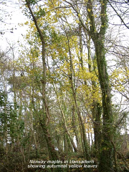 6th: A spell of moderate rain and a few ice pellets between 04 and 05 GMT then there was a little clearing of the sky after dawn. At 09 GMT pressure 1008 mb was still rising with low-pressure 997 mb over the North sea and high 1022 mb off the Iberian Peninsula. There was much remnant frontal cloud over Britain but the morning saw some increasingly bright and sunny spells before noon. There were light showers under a line of stratocumulus across the mountain summits during the afternoon leaving fresh sprinklings of snow
 ![]() . At dusk the sky was almost clear and with little or no wind the temperature was falling. With most of the leaves off the beeches the Norway maples have come into their own in the wood at the weather station. After many elm trees were felled in the 1970's, following outbreaks of Dutch Elm Disease, the Norway maples seeded themselves from 1 or 2 mature trees. In the autumn the wood now takes on a characteristic yellow hue. The woodland floor, coloured brown and bronze with already fallen leaves including sycamore and beech, also turns yellow with fallen maple leaves
. At dusk the sky was almost clear and with little or no wind the temperature was falling. With most of the leaves off the beeches the Norway maples have come into their own in the wood at the weather station. After many elm trees were felled in the 1970's, following outbreaks of Dutch Elm Disease, the Norway maples seeded themselves from 1 or 2 mature trees. In the autumn the wood now takes on a characteristic yellow hue. The woodland floor, coloured brown and bronze with already fallen leaves including sycamore and beech, also turns yellow with fallen maple leaves ![]() . Epsilon seen on this Meteosat 8 image at 1230 GMT, still a Category I Hurricane, had turned S in the Atlantic SW of the Azores off the Strait of Gibraltar
. Epsilon seen on this Meteosat 8 image at 1230 GMT, still a Category I Hurricane, had turned S in the Atlantic SW of the Azores off the Strait of Gibraltar ![]() . The number of confirmed cases of cryptosporidiosis reached 162
[Rain trace/frost; Max 8.2C; Min 4.9C; Grass 1.8C]
. The number of confirmed cases of cryptosporidiosis reached 162
[Rain trace/frost; Max 8.2C; Min 4.9C; Grass 1.8C]
7th: Overnight there was heavy dew and under clear skies this froze leaving the ground white by morning. Dew, measured by lysimeters, amounted to 0.5 mm (18 to 09 GMT) was not recorded in the raingauges. The sky was still clear at 06 GMT, but began to cloud over as frontal cloud encroached from the SW, and was 6 oktas cover at 09 GMT. Pressure 1014 mb 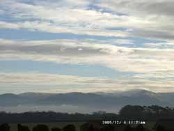 had not long started to fall off yesterday's high as low 975 mb S of Greenland moved E. Associated frontal cloud had moved over Ireland and the Irish Sea. Rain had already began to fall in SW Ireland and this moved E during the day. Although the rainfall radar showed rain here from 1130 GMT it did not reach the ground at first except for a few spots around 1530 GMT. There was light rain from about 17 GMT and with pressure at 22 GMT fallen to 999 mb as a low developed on the front over the Irish Sea. There was intermittent rain from 1900 GMT. [Rain 6.5 mm; Max 7.5C; Min 1.0C; Grass -3.5C]
8th: At midnight the frontal low was over NE Wales and by 06 GMT moved SE to be over SE England on it's way to Normandy in France. An overcast dawn, but it was soon clearing as altocumulus formed out of dispersing stratiform cloud overhead. There was mist in the Menai Strait and visibility was poor; there was a slight SE'ly breeze. The day became increasingly sunny as the cloud dispersed and visibility improved. By dusk the sky was mostly clear. Frontal cloud seen in the W during the afternoon made slow progress E during the evening but it kept dry. [Rain 0.0 mm; Max 8.3C; Min 4.0C; Grass 1.8C]
9th: Overcast and dull under cloud mostly clear of the Carneddau Mountains but low enough to obscure Snowdon Pressure was 1032 mm with highs 1034 mb Bay of Biscay and 1039 mb over the Skagerrak Strait between S Norway and Jutland Peninsula, Denmark. A warm front was lying over the Irish Sea with warm sector air to the S. The front continued to make slow eastward progress and by afternoon had produced only a few spells of light drizzle. The wind kept S'ly and was between force 4 and 5. The snowline on the mountains was about 2800 ft, with most between Foel-fras and C. Llewelyn and around yr Wyddfa. There was little on Tryfan and around the Glyders. Temperatures on Snowdon indicated by the AWS, courtesy of First Hydro, were a little above freezing through the day resulting in a slow thaw.
The number of confirmed cases of cryptosporidiosis reached 186, . [Rain trace; Max 9.8C; Min 4.2C; Grass 0.8C]
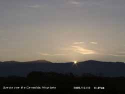 10th: Overcast at dawn but pressure 1036 mb continued to rise. Low stratiform cloud persisted in the W of the island with some drizzle. There was a fresh (f5) SSW'ly wind and the cloud broke up here, and in places along the North Wales coast and over Liverpool Bay, giving some sunny spells before noon. At Rhyl the temperature rose to 12.8C. In the afternoon the cloud reformed bringing just a little fine drizzle before dusk but later cleared. {Altnaharra 13.3C, Rhyl 12.8C} [Rain trace; Max 10.4C; Min 7.9C; Grass 7.2C]
![]() 11th: A mostly clear night but the temperature did not fall below 7.4C and 5.5C above the grass. Pressure was 1038 mb with high 1044 mb over S England and stretching SE towards the Black Sea. The sun had risen over the Carneddau Mountains at 0849 GMT and the day was mostly sunny. During the evening cloud encroached from the NW as a weak cold front passed over; there was briefly some drizzle and light rain around 2130 GMT. The MODIS AQUA satellite image shows
11th: A mostly clear night but the temperature did not fall below 7.4C and 5.5C above the grass. Pressure was 1038 mb with high 1044 mb over S England and stretching SE towards the Black Sea. The sun had risen over the Carneddau Mountains at 0849 GMT and the day was mostly sunny. During the evening cloud encroached from the NW as a weak cold front passed over; there was briefly some drizzle and light rain around 2130 GMT. The MODIS AQUA satellite image shows 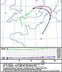 the large area of dark smoke some rising to 9000 ft from the fire, following what was described by fire chiefs as possibly the largest explosion in Europe in 60 years, at the Buncefield Fuel Depot in Hemel Hempstead in Hertfordshire. The explosion happened at 0601 GMT and measured 2.4 on the Richter scale for earthquakes. Forty three people were hurt in the incident. Dispersal of the point source plume of black smoke, that was thick enough to block out the sun, was hampered at first by temperature inversion that trapped some of the smoke in the cold layer near the ground (below a reported 1500 ft). At first the smoke drifted E but the intense heat forced a hole in the inversion letting the smoke disperse over a much wider area above the warm inversion layer as seen on the satellite image. Trajectory analysis, courtesy of the NOAA ARL website, indicated that above the inversion layer at 10,000 ft the smoke moved in a SW'ly direction. {RAF Tain (Dornoch Firth, Scotland) 14.0C, Hawarden 13.2} [Rain 0.2 mm; Max 10.3C; Min 7.4C; Grass 5.5C]
![]() 12th: The temperature at midnight was 9.5C having risen from the 7.3C at dusk on the 11th. Soon the sky started to clear and the temperature falling only 1.5C then more quickly from 05 GMT to the minimum of 4.2C about 08 GMT as the front cleared SE. Pressure had risen further to 1044 mb and once the few remaining clouds over Snowdonia had cleared it was sunshine till sunset at 1550 GMT. Estimated sunshine here was 6.6 h; Valley 5.9h. A clear evening with heavy dew and frost. The NOAA 18 satellite image shows the front over N France and mostly clear sky to the N. The fire at the Buncefield Fuel Depot continued to burn although half of fires had been put under control with application of foam brought in from all over the UK. The plume, with no inversion today, was more characteristic of a point source emission; the narrow black plume was being carried and fanning out in a SW'ly direction towards the English Channel. As the burning fuel are refined products pollution is likely to be less than if it were crude oil burning, but particles of soot will fall to earth somewhere eventually. The smoke is also likely to contain gases such as carbon monoxide, carbon dioxide, and sulphur dioxide. The number of confirmed cases of cryptosporidiosis reached 192, {Tenby, Pembrokeshire 7.0 h} [Rain trace/fr.; Max 7.3C; Min 4.2C; Grass 1.0C]
12th: The temperature at midnight was 9.5C having risen from the 7.3C at dusk on the 11th. Soon the sky started to clear and the temperature falling only 1.5C then more quickly from 05 GMT to the minimum of 4.2C about 08 GMT as the front cleared SE. Pressure had risen further to 1044 mb and once the few remaining clouds over Snowdonia had cleared it was sunshine till sunset at 1550 GMT. Estimated sunshine here was 6.6 h; Valley 5.9h. A clear evening with heavy dew and frost. The NOAA 18 satellite image shows the front over N France and mostly clear sky to the N. The fire at the Buncefield Fuel Depot continued to burn although half of fires had been put under control with application of foam brought in from all over the UK. The plume, with no inversion today, was more characteristic of a point source emission; the narrow black plume was being carried and fanning out in a SW'ly direction towards the English Channel. As the burning fuel are refined products pollution is likely to be less than if it were crude oil burning, but particles of soot will fall to earth somewhere eventually. The smoke is also likely to contain gases such as carbon monoxide, carbon dioxide, and sulphur dioxide. The number of confirmed cases of cryptosporidiosis reached 192, {Tenby, Pembrokeshire 7.0 h} [Rain trace/fr.; Max 7.3C; Min 4.2C; Grass 1.0C]
 13th: Heavy frost on the ground at 07 GMT had stated to melt as temperatures rose under cloud that had encroached. Dew deposited then frozen was 0.7 mm(16-09 GMT). Pressure was 1043 mb with high 1045 over Ireland. Frontal cloud associated with a low 1004 mb NE Iceland lay to the NW. The day was bright at times with a little sunshine during the afternoon. The cloud that was just above the tops of the Carneddau in the morning had sunk below by the afternoon. The temperature had fallen a little by 18 GMT, but during the evening began to rise again. The Menai Suspension Bridge was reopened to two way traffic this week, much to the relief of local residents who had been doing the suspension shuffle, after restoration work begun in February was completed. Costing £2 m the work involved removing all the paint and rust accumulated over 65 years since the last major work. The old paint contained 30 tonnes of lead; the old paint had to be collected and the lead removed by specialist contractors. Five thousand litres of grey paint was used to bring the 1826 bridge back to 'almost new' condition. [Rain trace; Max 8.2C; Min 0.8C; Grass -3.9C]
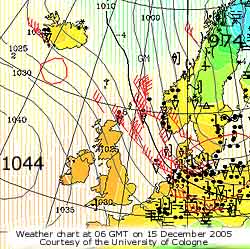 14th: The night, was overcast with a little drizzle before dawn, saw a temperature rising to 8.3C between 07 and 08 GMT, the maximum of the past 24-h. By 09 GMT the sky was clearing in a light N'ly breeze. Pressure was 1037 mb as high 1046 mb persisted W of Ireland. There was little further clearance of the remnant frontal cloud; the morning was brightest with the afternoon duller with a little fine drizzle at times. The number of confirmed cases of cryptosporidiosis reached 203. [Rain 0.1 ; Max 9.1C; Min 3.6C; Grass 1.5C]
![]() 15th: A cloudy night keeping temperatures within a small range and frost-free Pressure was 1029 mb with high 1044 SW of Ireland and complex low 974 mb N Scandinavia and Baltic resulting in a NNW'ly airflow, strongest over the North Sea but light here. The morning kept mostly cloudy occasionally looking brighter but there were few breaks seen. Most of the UK was cloudy at first but the S saw some clearances during the afternoon Here with frontal cloud lying to the to the N cloud persisted into the afternoon. {Cardiff MO 12.9C} [Rain 1.1 mm; Max 10.3C; Min 7.4C; Grass 5.0C]
15th: A cloudy night keeping temperatures within a small range and frost-free Pressure was 1029 mb with high 1044 SW of Ireland and complex low 974 mb N Scandinavia and Baltic resulting in a NNW'ly airflow, strongest over the North Sea but light here. The morning kept mostly cloudy occasionally looking brighter but there were few breaks seen. Most of the UK was cloudy at first but the S saw some clearances during the afternoon Here with frontal cloud lying to the to the N cloud persisted into the afternoon. {Cardiff MO 12.9C} [Rain 1.1 mm; Max 10.3C; Min 7.4C; Grass 5.0C]
![]()
![]()
![]() 16th: Light rain and drizzle between 06 and 0730 GMT was clearing away before 09 GMT. The maximum for the past 24-h was between 05 and 06 GMT the temperature then fell to the minimum of 7.6C at 09 GMT as the first of 2 cold fronts passed over North Wales. Pressure was 1016 mb with high 1040 mb still to the W and complex lows in circulation over the Baltic and North Sea. The force 4 NW'ly wind strengthened to force 5 /6 during the morning that kept bright. During the afternoon some showers moved across E Anglesey and Snowdonia. With the sun low in the W under the cloud at GMT a complete rainbow was seen over Llansadwrn around 1530 GMT. The photographs show the primary rainbow with a weak secondary and Alexander's dark band. There were further light showers during the evening. The number of confirmed cases of cryptosporidiosis reached 214. [Rain 0.6 mm; Max 8.7C; Min 7.6C; Grass 4.6C]
16th: Light rain and drizzle between 06 and 0730 GMT was clearing away before 09 GMT. The maximum for the past 24-h was between 05 and 06 GMT the temperature then fell to the minimum of 7.6C at 09 GMT as the first of 2 cold fronts passed over North Wales. Pressure was 1016 mb with high 1040 mb still to the W and complex lows in circulation over the Baltic and North Sea. The force 4 NW'ly wind strengthened to force 5 /6 during the morning that kept bright. During the afternoon some showers moved across E Anglesey and Snowdonia. With the sun low in the W under the cloud at GMT a complete rainbow was seen over Llansadwrn around 1530 GMT. The photographs show the primary rainbow with a weak secondary and Alexander's dark band. There were further light showers during the evening. The number of confirmed cases of cryptosporidiosis reached 214. [Rain 0.6 mm; Max 8.7C; Min 7.6C; Grass 4.6C]
Mid month the mean temperature was 6.9C and (+1.3) of the December average. The mean minimum of 4.9C was (+1.7) and there had been only 2 ground frosts ( average for December is 15). Rainfall with 35.9 mm is below average and 31% of the December average.
![]()
![]()
 17th: A slowly brightening morning revealing a scattering of snow across many of the summits of the Snowdonia Mountains. With temperatures falling again showery precipitation through the night had been of snow above 1500 ft. Most showers were off the Irish Sea along the W coast of the island and over Lleyn and the western mountains. The east coast of Scotland and England also had frequent showers of snow with the heaviest seen on Norfolk. Pressure was 1024 mb and the wind a 'cold feeling' fresh N'ly. The day started partly cloudy but dry here with some sunshine with the sky cleared during the afternoon which was less windy. The evening was mostly clear with little or no wind. The NOAA 18 satellite image shows broken frontal cloud over Ireland and shower clouds streaming off the Irish Sea affecting Snowdonia, W Wales and SW England. Deeper convection over the North Sea brought snow showers to the E of England during the day. {RAF Coltishall, Norfolk 10.7 mm, Valley 2.6 mm, Aberdaron 2.2 mm} [Rain 0.0 mm; Max C; Min 2.8C; Grass -0.7C]
![]() 18th: Sunrise was 7 minutes later than on the 11th and just about as far W over the mountains, close to Carnedd Dafydd, that it will be being close to the winter solstice. The grass was dry in the morning and if there had been any frozen dew there was no sign of it. The dew measuring lysimeters gave a negative value of -0.4 mm, meaning that since 1630 GMT on the 16th to 09 GMT today there was a net loss (evaporation). But over the month so far PE (potential evapotranspiration) is -4.5 mm, meaning there has been a net gain to the soil of 4.5 mm water (mainly dew) in excess of that measured in rainfall (36.5 mm). We missed out again on the hard frost experienced in other other parts this month; last night central England had -6C air frost and -9C ground frost with considerable hoar frost deposited. The morning started bright and sunny, but the warm front that had been waiting over the Irish Sea moved across before noon. The leaves might have fallen from the trees but The Herbalist rose in the garden still had some flowers. The afternoon was dull with some light rain that turned moderate during the evening. {Isle of Man 10.5C, Valley 10.0C; Isle of Skye 12.5 mm, Capel Curig 9.8 mm} [Rain 6.9 mm; Max 8.7C; Min 1.3C; Grass -1.5C]
18th: Sunrise was 7 minutes later than on the 11th and just about as far W over the mountains, close to Carnedd Dafydd, that it will be being close to the winter solstice. The grass was dry in the morning and if there had been any frozen dew there was no sign of it. The dew measuring lysimeters gave a negative value of -0.4 mm, meaning that since 1630 GMT on the 16th to 09 GMT today there was a net loss (evaporation). But over the month so far PE (potential evapotranspiration) is -4.5 mm, meaning there has been a net gain to the soil of 4.5 mm water (mainly dew) in excess of that measured in rainfall (36.5 mm). We missed out again on the hard frost experienced in other other parts this month; last night central England had -6C air frost and -9C ground frost with considerable hoar frost deposited. The morning started bright and sunny, but the warm front that had been waiting over the Irish Sea moved across before noon. The leaves might have fallen from the trees but The Herbalist rose in the garden still had some flowers. The afternoon was dull with some light rain that turned moderate during the evening. {Isle of Man 10.5C, Valley 10.0C; Isle of Skye 12.5 mm, Capel Curig 9.8 mm} [Rain 6.9 mm; Max 8.7C; Min 1.3C; Grass -1.5C]
19th: It was a dry night and the sky started to clear at dawn resulting in a frost freezing the wet grass. Pressure 1023 mb was rising in a ridge moving across from the W. The morning was bright then sunny before cloud encroached again during the afternoon. The night was cloudy but dry. [Rain 0.3 mm; Max 8.3C; Min 2.4C; Grass -2.2C]
20th: Early showers of rain under a uniform grey stratus. Pressure was 1027 mb with a high 1034 mb SW Germany. Remnant frontal cloud lay to the W and the day kept dull with drizzle at times. The night had frequent light showers of rain. [Rain 3.5 mm; Max 9.2C; Min 3.0C; Grass 0.1C]
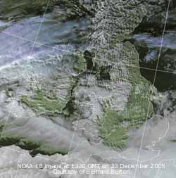 21st: Another dull morning so there was no chance of seeing the sunrise at the winter solstice over the Carneddau Mountains. The temperature at 09 GMT was 9.2C, the maximum of the past 24-h. Visibility was very poor in mist and drizzle and although the drizzle stopped the day was sunless and dull under thick cloud. There was a spell of light rain between 2230 ands 0100 GMT. The number of confirmed cases of cryptosporidiosis reached 219, but the rate of increase had slowed, see graph
 ![]() . [Rain 2.3 mm; Max 10.0C; Min 7.2C; Grass 6.2C]
. [Rain 2.3 mm; Max 10.0C; Min 7.2C; Grass 6.2C]
22nd: Showers of light rain continued up to 09 GMT. Although pressure was 1028 mb it fell later in the day as an Atlantic low 989 mb SW of Iceland tracked E towards NW Scotland. It was a dull sunless day but kept mostly dry under the thick frontal cloud. The SW'ly wind freshened to force 5 by nightfall. Because of the thick cloud there was a very small range of temperature in the day. [Rain 0.1 mm; Max 9.4C; Min 7.8C; Grass 4.8C]
23rd: With broken frontal cloud still lying over central Britain the anticyclonic gloom continued. The overnight minimum of 8.7C was the highest of the month. Pressure was 1024 mb and the cloud remained thick, with a little fine drizzle and occasional light rain, through the day. Solar radiation was only 0.4 mv h, lowest of the month and in the house lights were necessary through the day. A nuthatch in the garden did not seem to mind the dull weather as it started calling for the first time. There was a further spell of light rain from 2300 GMT. The NOAA satellite 18 image shows broken cloud and widespread orographic waves to the N while there is low cloud and fog in the English Channel. . [Rain 2.9 mm; Max 9.6C; Min 8.7C; Grass 6.8C]
24th: Light rain gave way to drizzle about 0100 GMT then the sky started to clear around dawn and fog developed. At 09 GMT pressure was 1026 mb with high 1028 mb centred over Switzerland. Pressure was low 990 mb over the Baltic. There was little or no wind with low cloud and fog patches persistent through the morning. A mistle thrush started to tentatively sing high in a tree near the weather station. The afternoon was cloudy at first but the sky cleared at dusk. The night was clear with a ground frost. {Mumbles, Swansea 12.1C, Trawscoed 4.4 mm, Valley 3.9 mm} [Rain 0.1 (dew/fr)mm; Max 9.2C; Min 7.0C; Grass 3.8C]
25th: Almost clear skies and sunny from 09 GMT. Overnight moisture and dew on grass had frozen white on the ground. There was fog, between the 2 bridges and either side, in the Menai Strait in the morning. The day was mostly sunny with cirrus clouds during the afternoon. The evening was clear at first with a good view of Venus to the SW. It was cloudy by midnight. [Rain trace/frost; Max 6.7C; Min 2.9C; Grass -0.6C]
26th: Overcast at first but brightening for a while before noon. Pressure was 1025 mb with high 1028 mb N Scotland part of high 1035 mb N Scandinavia. Atlantic-low 997 mb was SW of Ireland. Frontal cloud was lying down the spine of Britain with showers being driven on to the E coast by a NE'ly wind. With colder air once again reaching higher levels a band of light snow showers moved across during the afternoon; a sprinkling of snow was seen around the summits of Snowdon. With showers off the now colder North Sea expectations are high to see some snow especially in SE England during the next 48-h. Snow had also fallen on Le Puy de Dome 4800 ft (1463 m) in Les Monts D'Auvergne in central France. [Rain 0.0 mm; Max 5.6C; Min 2.0C; Grass -1.0C]
![]()
![]() 27th: Partly cloudy for a time in the night with the air temperature falling to 0.0C, just not an airfrost, but on the ground -4.5C was recorded. Pressure was 1021 mb with high 1037 mb N Scandinavia and Lapland and low Iberia to the Mediterranean (1001 mb) and Iceland (992 mb). Snow showers were widely reported from Yorkshire and along the E coast of England to East Anglia and Kent and by morning had penetrated into the Midlands and S England giving 5 cm snow in places. There was a sprinkling of snow across the Snowdonia Mountains as low as 2500 ft. Here the morning was mostly sunny with convective clouds seen over Liverpool Bay and S Snowdonia where cumulus were towering. The afternoon was cloudier with occasional slight showers of snow pellets. After another light shower of snow pellets about 1900 GMT the sky cleared giving a frosty night. {Manston, Kent 9.9 mm} [Rain trace; Max 4.0C; Min 0.0C; Grass -4.5C]
27th: Partly cloudy for a time in the night with the air temperature falling to 0.0C, just not an airfrost, but on the ground -4.5C was recorded. Pressure was 1021 mb with high 1037 mb N Scandinavia and Lapland and low Iberia to the Mediterranean (1001 mb) and Iceland (992 mb). Snow showers were widely reported from Yorkshire and along the E coast of England to East Anglia and Kent and by morning had penetrated into the Midlands and S England giving 5 cm snow in places. There was a sprinkling of snow across the Snowdonia Mountains as low as 2500 ft. Here the morning was mostly sunny with convective clouds seen over Liverpool Bay and S Snowdonia where cumulus were towering. The afternoon was cloudier with occasional slight showers of snow pellets. After another light shower of snow pellets about 1900 GMT the sky cleared giving a frosty night. {Manston, Kent 9.9 mm} [Rain trace; Max 4.0C; Min 0.0C; Grass -4.5C]
 28th: The air temperature went below 0C around 0100 GMT. It was a clear frosty morning with the air temperature down to -2.5C and -6.3C on the grass. It was the first airfrost since 13 March (-0.5C). The ground was frozen and some of yesterday's snow pellets were lying around. There was a slight deposition of hoar frost. At 09 GMT the temperature was -1.5C (dewpoint -3.1C) and the pressure was 1020 mb. The ridge of high-pressure from high (1043 mb) N Scandinavia/ Barents Sea persisted, but low 983 mb Iceland had associated frontal cloud over Ireland giving rain in the SW. The morning was clear and sunny with a little cloud over the mountaintops of Snowdonia. The day was sunny but with only 4.0 h above 0C the maximum about noon was 2.6C and lowest of the month. The day's mean was only 0.1C, lowest of the month. At nightfall the temperature dropped quickly. In the 24-h (00-24) there were 20.0 hours of airfrost. [Rain 0.0 mm; Max 2.6C; Min -2.5C; Grass -6.3C]
29th: Light overnight deposition of hoar frost (0.3 mm) as the temperature fell to -3.3C and on the grass to -7.5C, both lowest of the month. At 09 GMT the soil was frozen to a depth of at least 5 cm and was 1.0C at 10 cm. Air temperature was -0.6C but was the minimum recorded during the next 24-h. Some low temperatures occurred in Scotland and inland to the E; Aviemore reported -12.8C, Aboyne -9.9C and RAF Shawbury -9.1C. Pressure 1015 mb was falling as fronts, associated with the low W of Scotland, moved in from the W during the day. The temperature rose slowly and had reached 2.1C at 1530 GMT when there was a spell of light to moderate snow, heaviest between 1800 and 1830 GMT, which covered the ground. The snow had stopped by about 2030 GMT. By 2200 GMT the temperature was 3.6C the snow melting rapidly was gone well before midnight. There were 11.2 h of airfrost in the 24-h (00-24). {Scilly Is. 10.9C, Aviemore -12.8C} [Rain 4.3 mm; Max 8.6C; Min -3.3C; Grass -7.5C]
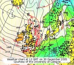 30th: With the wind veered S'ly warmer Atlantic air had replaced the cold northerlies and temperatures rose through the night; the maximum of the past 24-h 8.6C was recorded at 09 GMT. There was a spell of light rain from 03 GMT that had turned to a fine drizzle in poor visibility under uniform grey stratus. Pressure had fallen to 988 mb with deepening low 969 mb at noon S of Iceland. Occluded fronts were lying the length of Britain; precipitation had increased as the cloud moved eastward giving some heavy falls. Amounts of snowfall were generally small, but 5 cm was reported in Dundee and later 2-3 hours of snow with local accumulations of over 10 cm in parts of Scotland, NE and SE England in strong winds off the North Sea. There were problems on the roads with reports of cars being abandoned, sliding into ditches and several accidents. The morning here continued overcast and dull but there were some bright sunnier spells in the afternoon. The night was overcast with showers of rain. {Colwyn Bay 13C; Lough Freugh 41.0 mm, Mumbles 31.6 mm, Isle of Man 20.8 mm; Saunton Sands 1.5h, Valley 1.2h} [Rain 1.8 mm; Max 9.8C; Min -0.6C; Grass -3.3C 24-h, but 0.2C overnight]
31st: Overcast with slight showery rain around 09 GMT as a band of cloud passed over. Pressure was 988 mb with the low 968 mb still lying to the NW. Visibility was good, but the mountains remained obscured in mist and low cloud above 1500 ft. The day was mostly dry until the afternoon that had showery and intermittent light rain from 1600 GMT. As bands of rain continued to move in off the Irish Sea there was light to moderate rain from 0330 GMT and was heavy for a while around 07 GMT. Rainfall during the 24-h (09-09 GMT) was 12.8 mm, highest of the month, over 10.0-h duration gave a wet end to the year. [Rain 12.8 mm; Max 7.2C; Min 6.0C; Grass 3.1C]
Rainfall for the month totalled 71.5 mm 63% of average. It brought the total for the year to 1163.2 mm 105% of the decadal and 113% of the 1971-2000 averages. Temperatures were a little above average with the mean 6.1C +0.5. The annual mean temperature was 10.6C +0.1 on the decadal and +0.7 on the 1971-2000 average.
|
|
|
These pages are designed and written by Donald Perkins © 1998 - 2005 Document first dated 9 February 2005 http://www.llansadwrn-wx.co.uk |