|

Times are GMT (UTC, Z). Observations at this station [ ] are 24-h 09-09 GMT, some others { } occasionally refer to other 24-h periods. UK, and some Wales, extremes (first indications) are given in bold and are usually 21-21 GMT. When averages are referred to (.) compares with the last decade and [.] with the 30-y climatological average [1981 - 2010]. All data are subject to verification and amendment. January 2019
January 1 - a dull and damp beginning to the new year with mostly cloudy sky, moderate misty visibility. Pressure 1037 mb was rising with a high 1038 mb situated over the Celtic Sea. A cold front just to the N was moving slowly southwards. A little drizzle at first and a mild 8.8C that rose just 1 degree to 9.8C during the morning before starting to fall away in the afternoon with the arrival of the weak front with some clearance later reaching 4.4C by midnight (Shoreham 12.1C Kielder Castle 0.4C Loch Glascarnoch 3.6 mm Shap 5.8h) [Max 9.8C Min 7.0V Grass 3.2C Rain 0.2 mm]. The 6th began fine and fairly bright with a light SW'ly breeze, a little sunshine came along just before 1000 GMT. Pressure remained high on 1037 mb here centred on high 1040 mb near Brest. There was a cold front to the N over the North Channel this associated with low 987 mb NE Greenland.
After 04 GMT on the 9th the sky began to clear and the temperature to fall reaching a minimum of 2.3C at 0842 GMT. At 0900 GMT there was a little white frost with the grass minimum reading -0.5C. The sky was almost clear with a little cumulus and old contrails; there was a light air from the NNE. Very fine with very good visibility being able to see the far hills on the Llyn. A lovely day for January fine views of in the afternoon, photo above taken on the footpath from Llansadwrn church to Mynydd Llwyddiarth, and a brief colourful sky in the evening (Scilly 10.2C Bridgefoot -4.9C Tibenham 3.8 mm Aberporth 6.6h) [Max 7.5C Min 2.3C Rain nil]. Yesterday's fine weather did not last to the 10th and it was back to overcast grey skies and very poor visibility. A 'grey to ground day' that we are very familiar with on Anglesey; mist was becoming denser and very fine drizzle commenced. Pressure was on 1033 mb with the high 1034 mb Shannon, Ireland. There was a warm front lying from Cork to Newcastle and moving SSE to be over S Wales and Severn Estuary at noon (Murlough 11.4C Valley 9.7C Benson -6.4C Giants Causeway 2.8 mm Camborne 1.5h) [Max 8.1C Min 1.3C Grass -2.2C].Another cloudy day on the 11th with little wind. There was an air from the NNW and there were aurographic ripples in the cloud sheet. Pressure was steady on 1034 mb with high 1036 mb off SW Ireland with a ridge to the Irish Sea. The day was sunless (Scilly 11.0C Porthmadog 10.3C Topcliffe -0.8C Lerwick 7.6 mm Yeovilton 2.6h) [Max 8.7C Min 5.5C Rain 0.8 mm]. The 12th began overcast with an early rain shower (0534 GMT) on a weak cold front over North Wales associated with low 993 mb over the Norwegian Sea, followed by drizzle so the morning was damp and mild. Overnight the temperature had been 8.7C at 0200 GMT; at 0900 GMT the temperature was 7.6C with 95% relative humidity and pressure was 1025 mb More fine drizzle at times in the afternoon and in warm air the temperature at 1730 GMT was 9.2C continuing to rise and was 9.7C at 2140 GMT. Often Balmoral reports the lowest UK temperature, but today it was the highest (Balmoral 12.8C Min 0.5C Achnagart 50.0 mm Aberdeen 1.6h) [Max 9.7C Min 6.7C Rain 0.2 mm]. Again the 13th was overcast and continued mild. Visibility was moderate with cloud low on the mainland mountain slopes. There was a light W'ly breeze. We had the fourth consecutive sunless day, but mild (Shawbury 13.2C Hawarden 12.4C Baltasound 4.5C Achnagart 52,8 mm Capel Curig 6.4 mm Charterhall 5.4h) [Max 10.0C Min 7.6C Rain 0.2C]. The 14th began mostly cloudy, but it was thinner and it was cooler with the grass minimum reading 0.7C with an air minimum of 5.1C. The first 15-days were unusually dry with just 7.5 mm of rainfall [7%] of the average of the monthly total. Temperatures were on the mild side with the mean 6.4C (+1.1) and [+1.3] of the averages. The 16th saw a return of colder wintry weather. Windy in the night 30 mph recorded at 0025 GMT. At 0900 GMT after recent showers the W'ly wind had moderated and skies were a dark grey and visibility was poor with slight rain. Pressure had been 1001.8 mb at 0600 GMT with arrival of a cold front, resulting in a moderate 3C fall in temperature, and was now steady on 1002 mb. There was a minor clearance by 11 GMT and we had showers of ice precipitation in the afternoon, snow pellets and a few flakes of snow, then a heavy rain shower with ice pellets in sunshine with bright rainbow around 1530 - 1600 GMT.
The 18th began overcast with spots of rain soon after 0900 GMT. Cool 3.8C with overnight grass frost -2.6C. With a SSE'ly breeze it turned out mostly sunny in this part of Anglesey in a lee clearance shown in the panorama photograph above, north of the bank of convective clouds developed over the mountains. There were frequent snow showers across the Snowdonia Mountain range in the afternoon sufficient to form small drifts in the breeze. In SE Anglesey it was sunny and swirling slowly falling ice crystals were observed out of mostly blue overhead sky at 14 GMT (quite rare here). Valley reported nil sunshine today with light rain showers (Scilly 10.9C Kew 7.9C Braemar -10.8C and lo max -3.6C Mumbles Head 28.8 mm Kirkwall 4.7h Aberporth 1.1h). A bright morning on the 19th still with a light SSE'ly breeze becoming intermittent. Pressure 1006 mb was rising with low 1002 mb off NW Ireland dissipating. Complex low 979 mb was off SE Greenland with a cold front over the Atlantic to the W expected to move E towards us later. Fine and fair cloudier later (Chivenor 10.9C Pembrey Sands 9.8C Altnaharra -9.5C Mumbles Head 18.0 mm Stornoway 6.0h Aberporth 1.1h) [Max 7.6C Min 3.3C Grass 0.7C Pptn trace]. The 20th began rather murky with drizzle, but began clearing from the north before 0900 GMT. Pressure 1018 mb was rising with low 988 mb Denmark Strait having a cold front to the west. Pressure was high 1034 mb in mid-Atlantic and low 995 mb over the Gulf of Finland. The morning became mostly sunny, the afternoon turned cloudier then a shower arrived about 1530 GMT and was moderate for a while, but had stopped within 40 minutes. During the evening the sky cleared giving a fine view high in the sky of the very bright 'super moon' before midnight. (Scilly 9.8C Porthmadog 9.3C Kinbrace -9.6C Capel Curig 0.7C Fair Isle 5.6 mm E Malling 7.5h Aberporth 1.6h) [Max 7.0C Min 3.5C Grass -0.7C Rain 0.9 mm].
Fairly cold overnight with snow showers resuming on the morning of the 23rd on the mountains with sleet and snow here at 0900 GMT. The temperature today was 1.2C (dewpoint 0.6C), unlike yesterday it did not settle here, but further deposits were made at a greater altitude on the mountains. On the summit of Snowdon the AWS was reporting -4C with a wind chill of -10C. Snow was lying at 800 ft on the lower slopes of the Carneddau Mountains.
The 26th began with a chance of a brighter day with thin moderate high altostratus, but soon became duller with pressure 1001 mb falling. We were in warm sector air with low 987 mb S Iceland and W of Scotland, but there was a cold front over Shannon. Increasingly windy with rain later in the afternoon and strong to gale-force SW'ly by evening (Phoenix Park 11.1C Yeovilton 11.0C Hawarden 10.7C Cassley 0.1C Achnagart 48.2 mm Capel Curig 22.6 mm Magilligan 0.7h) [Max 9.4C Min 7.5C Rain 21.2 mm]. A cooler feel to the morning on the 28th with remnants of snow pellets still on the ground. The month ended with 70.3 mm of rainfall relatively dry for January (70%) & [69%] of averages, least since 2017. Temperatures ended a little above average the mean 5.3C, lowest since 2015, [(+0.2)] of the averages. Another dull month the sunshine recorded at RAF Valley was 34.8h.
February 2019
February 1 - a wintry morning again with slight snow showers and a temperature of 1.9C and a chilly NE'ly breeze. The ground remained frozen, but frost had not penetrated to 5 cm as the temperature at that depth being 1.3C. On any bare soil ice crystals were seen. The ice tower had more or less disappeared, there was a layer of floating ice with a submerged iceberg where there tower had stood. Bright at times, weak sunshine at first with some sunny spells developing before noon. The panorama below shows snow on the mountains under a line of convective clouds in the afternoon (Scilly 6.6 Porthmadog 5.6C Okehampton -0.5C Braemar Min -15.4C Frittenden 16.6C Katesbridge 74h Aberdaron 5.0h) [Max 5.2 Min -0.7C Grass -1.5C Pptn trace].
The 2nd began brightly after an air frost free night; there had been a ground frost and there were some conical shaped snow pellets lying on grassy areas. Surface soil was frozen and the patch off leeks looked slightly droopy with ' physiological drought'. Visibility was very good and clear; snow was lying on the mountains as low as 1000 ft with the summits well covered and very white. Glimpses of sunshine and a slight shower of snow pellets with small snow flakes at 1320 GMT. There was a line of cloud formed in a zone of convergence over the Irish Sea ending over Pembrokeshire, this had become known as the Pembrokeshire Dangler', it was marked on the Met Office 12 noon synoptic chart. Convergent convective cloud, can be seen in the distance over the Irish Sea from Llansadwrn. Convergence cloud is not exclusive to the Irish Sea, or Pembrokeshire, it can form over Llansadwrn and elsewhere, but has caught the imagination of the press in recent years... (Scilly 7.5C Pembrey Sands 7.3C Tulloch Bridge -12.4C Sennybridge -8.1C Goudhurst 14.4 mm Belfast 8.3h St Athan 6.8h) [Max 5.1C Min 0.4C Grass -2.3C Pptn trace]. Another fine wintry morning on the 3rd after an overnight air frost and a hard ground frost under clear sky; the ground felt solid underfoot. There was a little white frost on the grass and while visibility was good there was cloud and fog on the mountaintops that was lower in the W indicative of encroaching precipitation. Pressure was on 1021 mb in a ridge from Iberia 1031 mb. Complex low pressure mid-Atlantic would encroach from the W to bring warmer air later as the ridge declined. A fine and fairly bright morning on the 6th, although the sky was overcast with an unusually dense upper cloud layer, there was some weak sunshine showing through. Pressure was steady on 1015 mb and high 1030 mb over the Iberian peninsular, low 968 mb S of Greenland and Iceland had associated cold fronts over E Anglia and Kent and the Channel. Some light showers of rain and glimpses of sunshine in the afternoon. Rain before midnight (Herstmonceaux 12.1C Fyvie Castle -2.1C Achnagart 19.2C Belfast 5.1h ) [Max 9.1C Min 4.2C Pptn 19.4C]. A wet and windy night with the rain moderate to heavy at times (up to 23 mm/h) at 0717 GMT in the morning of the 7th including ice pellets. At 0900 GMT 19.4 mm of rain was measured, largest since 26th January. It had stopped raining, visibility was moderate with mist. The ground was wet and the soil soggy and near saturation point for the first time in a while. A patch of blue sky to the west the day continuing breezy with a little sunshine at times in the afternoon. Showers returned in the evening (Hereford 11.0C Fyvie Castle -1.0C Capel Curig 40.0 mm Shoeburyness 7.6h Aberdaron 5.1h) [Max 9.3C Min 2.7C Rain 17.5 mm duration 14 wet hours]. At midnight low 995 mb was over Cardigan Bay resulting in strong to gale-force SW'ly winds on the 8th and continuing wet and misty with poor visibility at 0900 GMT. Mild the temperature 9.3C after an overnight minimum of 5.9C. Pressure 985 mb was falling quickly reaching 983 mb at 1352 GMT. On Snowdon the temperature was 4C and with the rain much snow had melted. Mountain streams were in spate; a lot of water was seen in wet areas of the Ogwen valley. There was a good deal of water in lakes, including Llyn Tegid, Bala) the wind making waves. Blustery, with sunshine and showers in the afternoon, Anglesey Valley sunniest in UK (Linton on Ouse 12.5C Fyvie Castle -2.8C Shap 52.6 mm Capel Curig 52.2 mm Valley 4.9h) [Max 10.3C Min 4.6C Rain 0.8 mm]. There were a lot of noisy sea gulls flying overhead the weather station on the 9th at 0900 GMT, but they did not drown out the storm cock singing high in the swaying branches of the wild cherry. There were a lot of gold finches in the trees as well waiting for me to fill up the sunflower hearts feeder. The obs come first, it was a breezy morning with a temperature of 6.3C. Mostly cloudy with pressure 995 mb rising with a low 959 mb just off N Scotland. The wind moderated by afternoon and there were a few glimpses of sunshine (Kew 11.4C Drumalbin 1.4C Shap 34.8 mm Llysdinam 7.8 mm Leeming 7.0h Hawarden 6.6h Valley 2.2h) [Max 8.2C Min 5.9C Rain 2.3 mm]. It was a showery morning on the 10th with ice pellets at 0900 GMT seen actively marking the hail pad, the overnight minimum 3.3C and 1.1C on the grass. The sky was showing signs of clearing a little and soon it was brighter with the sun breaking through. The first 15-days of the month had a mean temperature of 6.4C [(+1.1)] of average. Rainfall was 56.3 mm (74%) & [72%] of the average total for the month. The 16th began bright and breezy with weak hazy sunshine; visibility was only moderate with moderate haze again partly due to Saharan dust in the atmosphere. Further Saharan dust had been deposited and sampled at 0900 GMT. The temperature was 8.8C and this rose to 11.7C in the afternoon. Pressure was steady on 1018 mb ; there were complex lows 974 mb over the Atlantic W of Ireland with the SE European high 1038 mb (Chivenor 14.2C Hawarden 14.0C Charlwood -2.3C Fair Isle 18.4 mm Capel Curig 3.8 mm Leconfield 8.6h [Max 13.1C Min 7.9C Pptn 0.2 mm].
After midnight on the 17th the temperature here rose to 13.1C, at Gorwel Heights it was 15.6C at 0200 GMT. It had cooled off a little by 0900 GMT 11.3C (73% RH), a very windy day with a gust of 61 mph recorded at Capel Curig (Northolt 15.6C Charlwood -1.3C Tyndrum 13.6C Weybourne 8.3h Aberdaron 5.6h) [Max 11.5C Min 8.7C Rain 1.8 mm]. After some early showers of rain on the 18th the sky had cleared to 2 oktas cover at 0900 GMT. Pressure here was on 1009 mb, and with European high 1030 mb deflecting a low over the Western Isles at 06 GMT moving to be over the Norwegian Sea by 0900 GMT. An occluded front had passed over the Irish Sea in the night and a cold front was than situated over Kent, the Channel and Brest, France. Turning cloudier here later nevertheless it was a bright, but breezy day with some convective cumulus clouds developed over the Snowdonia Mountains in the afternoon it kept dry here (Mt. Batten 12.7C Hawarden 11.3C Bainbridge 1.9C Tyndrum 22.4 mm Capel Curig 11.6C Lerwick 7.3h) [Max 9.6C Min 6.7C Rain 0.2 mm] After the wind had moderated it was a quieter night and the 19th began overcast with moderate visibility, Pressure was on 1016 mb in a minor ridge with low 981 mb to the W of Scotland. The day was fine, with a little mostly weak sunshine at times. Rain continued after midnight on the 20th petering out in the small hours. The day began with a hint of brightness with layered orographic cloud bands overhead. Visibility was moderate and the temperature a mild 9.1C. A very breezy day with a strong SW'ly with the odd light shower of rain. Pressure was on 1012 mb with H 1029 mb SE Europe. We were in warm sector air with a cold front to the W over Ireland associated with low 967 mb SW Iceland. The afternoon was drier then the rain and drizzle returned in the evening and overnight. Wet in Snowdonia; sunless with 12 hours wet hours recorded (Kinloss 14.9C Lerwick 2.8C Capel Curig 30.2 mm Shoeburyness 8.4h) [Max 10.4C Min 6.2C Rain 4.4 mm]. The 21st again began overcast with moderate misty visibility. A blustery SW'ly gusting up to 35 mph. The temperature at 0220 GMT had been 10.4C the maximum recorded for the 20th! Warm tropical air was being transported here from the Caribbean. The sky looked lighter towards Conwy and behind the Snowdonia Mountains there was clear sky and sunshine. Pressure 1022 mb was rising quickly and we did get some sunshine later in the day (Aboyne 18.3C Hawarden 16.1C Fyvie castle -1.0C Capel Curig 12.6 mm Manston 8.6h Hawarden 7.3h Valley 2.4h) [Max 13.5C Min 9.1C Rain nil]. The 22nd began fine and mild for the time of year, the temperature at 0900 GMT was 12.7C (dewpoint 6.5C) with relative humidity of 66%. Pressure 1032 mb was rising quickly with the high 1035 mb over France and Belgium. With 6 oktas of cirrostratus and altocumulus cloud cover there was weak sunshine and good, hazy visibility. During the day the temperature rose to 17.9C at 1342 GMT with RH of 34% the result of a Föhn-like breeze from a S-SE'ly direction off the Snowdonia Mountains. On the 23rd the air temperature at midnight was 14C and relative humidity 44%. The overnight minimum was 12.3C, highest of the month. At 0900 GMT the temperature was 13.9C (dewpoint 4.7C) RH 64%; the maximum reached at 1037 GMT was 15.9C. At Gorwel Heights the maximum was 17.9C with RH 34% and at Gorddinog AWS 17.4C. With no rainfall conditions were quite dry with no dew recorded on grass. The weather was very fine and bright with weak sunshine and 6 oktas cloud cirrostratus cover at 0900 GMT. The morning remained breezy (SSE'ly) before it came on to rain in the afternoon as a cold front moved across the Irish Sea. The cold front was associated with low 976 mb Iceland while there was a deep low 959 mb mid-Atlantic W of Cap Finisterre. At 2300 GMT shallow fog had developed with stars visible (Kew 17.8C Trawsgoed 16.3C S Newington -1.1C Usk -0.9C Tyndrum 6.0 mm E Malling 9.8h Hawarden 5.6h Valley 1.1h) [Max 15.9C Min 12.3C Rain 2.4 mm]. Fog persisted after midnight on the 24th, but began to disperse by 06 GMT. At 0900 GMT it was cooler with a temperature of 5.9C and visibility was good. There had been a touch of ground frost -0.3C on the grass. The sky was almost clear of clouds and the wind was N'ly. A very nice sunny day with many people going to the beaches enjoying the 'summer-like' day, or spending it in the garden (Gogerddan 19.1C Lo Max Leuchars 7.0C Min Braemar -3.2C Rainfall Tiree 1.2 mm Manston 10.0h) [Max 16.9 C Min 3.4C Grass -0.3C Rain 0.2 mm]. Another sunny day on the 25th beginning with 3 oktas cirrus and altocumulus cloud cover at 0900 GMT. There was a light ESE'ly breeze and visibility was very good. Very fine and sunny, no rain. The temperature here rose to 19.5C, highest of the month, relative humidity kept around 30% from noon to 15 GMT (Trawsgoed 20.6C Rhyl 19.0C South Newington -3.9C Harris Quidnish 10.4 mm East Malling 10.3h) [Max 19.5C Min 5.3C Grass 0.7C Rain nil]. The 26th began again with hardly a cloud in the sky and pressure on 1032 mb. There was an inversion haze to be seen over the Menai Strait; during the day several fires were seen on the Snowdonia Mountains with lingering smoke plumes; air pollution levels in parts were moderately high through the day. Maximum today 18.9C at 1510 GMT. After sunset vivid peach sky colorations were seen. Dry almost everywhere in the UK today (Kew Gardens 21.2C Porthmadog 20.8C Lo Max Lerwick 9.5C Min Topcliffe -3.8C Scilly 0.2 mm East Malling 10.4h Valley 10.1h) [Max 18.9C Min 6.0C Grass -0.2C Rain nil]. Well, the 27th began with no clouds recorded at 0900 GMT which is fairly rare for here. Pressure was steady on 1025 mb having declined a little. There was a light S'ly breeze and visibility was poor, with slightly coloured pollution haze, and deteriorated later in the day. There were large mountain fires on the eastern Carneddau Mountains filling the Conwy Valley with smoke that was drifting northwards out to sea about 1430 GMT (Heathrow 19.2C Aboyne -3.8C Lerwick 0.6 mm East Malling 10.6h) [Max 15.8C Min 6.7C Grass -0.2C Rain 0.6 mm]. The month ended on the 28th, no leap year, on a rather damp note. Overcast sky mist with a fine drizzle resulting in very poor visibility. It remained dull and wet all day with little temperature variation along the North Wales Coast. Sunless day (Cavendish 14.5C Lo Max Spadeadam 5.0C Ravensworth -2.8C Okehampton 15.1 mm Libanus 15.0 mm Tibenham Airfield 3.1h Valley nil) [Max 9.6C Min 3.7C Rain 5.6 mm] The month ended with a rainfall total of 78.2 mm (103%) & [99%] of averages. It was the warmest February recorded at this station since recorded began in 1979. The mean 8.3C a remarkable [(+3.0)] on both averages. The maximum 19.5C on the 25th was also a station record.
March 2019
March 1 - began with fog at 06 GMT and although reducing visibility was very poor at 0900 GMT. It was now dry, dull the sky still overcast, but soon brightening up with some weak sunshine breaking through the gloom and glimpses of sunshine by 0940 GMT. Some snow patches on the mainland mountains had survived into March. Pressure was steady on 1019 mb with high pressure 1017 mb over S Norway; there was a complex low pressurise system over southern Denmark Strait. A detached occluded front lay over the Irish Sea. The sticky buds on horse chestnut were swelling; it was too early for bluebells to have appeared in the wood (Trawsgoed 13.6C Lerwick 5.8C Baltasound -0.5C Derrylincornahoule 10.4 mm Belfast 4.7h) [Max 12.4C Min 6.7C Rain 2.3 mm]. A fairly bright morning to start the 2nd, but cloud was developing with convective clouds appearing over the Snowdonia Mountains. Fine, cool with weak sunshine, pressure 1007 mb was falling with low 962 mb W of Ireland tracking NE. There was an occlusion over the east coast of England. Soon thicker clouds came along as the wind freshened bringing rain from mid-afternoon to early evening (Heathrow 15.1C Resallach 7.3C Tain Range -0.5C Capel Curig 27.4 mm Aberdeen 4.7h) [Max 10.4C Min 8.1C rain 4.8 mm]. It had been dry with light breezes overnight and on the morning of the 3rd, but just before 0900 GMT drizzle had started under a uniform grey sky. Very dull and soon light rain with moderate visibility. Pressure 997 mb was falling and with the jetstream lined up across Britain a succession of depressions was expected. Low 989 mb was over the Norwegian Sea N of Scotland and a deepening frontal wave low 989 mb was over the SW approaches to the English Channel. Storm Freya was expected to cross over later and the weather continued wet and windy. It became very dark in the afternoon the poor 90 W m -2 in the morning reducing to 40 W m -2 and the day was sunless. A warm front had arrived by 1600 GMT the temperature rising to 10.1C the maximum for the day; on the trailing edge the temperature fell quickly from 2030 to 2100 GMT this enough to give snow on the Snowdonia Mountains. The centre of f/w low 976.6 mb was over Anglesey at 1800 GMT It was fairly breezy for a time between 1600 and 1930 GMT (35 mph), more extreme winds were experienced N and S of here. At Mumbles Head 76 mph; there was flooding, fallen trees and power cuts in South Wales and SW England. Capel Curig recorded 73 mph; Aberdaron 60 mph; Valley/ Mona 50 mph; Gorwel Heights 45 mph (Cardiff 14.0C Glenanne 5.7C Altnahinch Filters 2.5C Kinlochewe 32.4 mm Capel Curig 23.4 mm Aberdeen 6.5h Valley nil) [Max 10.1C Min 8.2C rain 13.6 mm]. Thunder was heard just before 0200 GMT on the 5th. The morning began mostly cloudy with good or very good visibility. Fresh snow could be seen lying on the Snowdonia Mountains above 2650 ft. It was fine with a cold feeling breeze (gusting 34 mph in the morning)the temperature 7.7C. The day kept mostly cloudy with sunny spells and occasional showery rain, especially along the coast. Light to moderate rain from 1930 GMT petering out just after midnight (Weybourne 13.0C Salsburgh 5.0C Aboyne -6.9C Eskdalemuir 28.4 mm Sunniest Stornoway 9.7h Aberdaron 6.2h) [Max 10.7C Min 3.8C Rain 7.2 mm]. The 6th began dull, damp and breezy and continued so. Pressure was 982 mb with a low 976 mb over Ireland with a cold front over Anglesey and Wales. There was a glimpse of sunshine in the morning, and that was just about it for the day. Showery rain either side of noon and later in the afternoon light rain and drizzle and a little in the evening. The low was 974 mb over the North Channel at 1800 GMT. Wet in S Wales (Pershore 15.0C Dalwhinnie 3.4C Braemar -5.7C Libanus 52.4 mm Camborne 1.5h Hawarden 0.9h) [Max 12.4C Min 6.6C Rain 12.8 mm]. On the 7th rain commenced at 0645 GMT and under leden sky was still rain moderately at 0900 GMT. Rain over the past 24-h was 12.8 mm and with the ground near saturation there was standing water on fields and runoff onto nearby roads. Breezy as well the W'ly force 5; visibility very poor. The rain turned to drizzle in the afternoon; a sunless day (Heathrow 12.5C Dalwhinnie 4.6C Albemarle 1.6C Capel Curig 50.4 mm wettest place in Europe, Camborne 7.3h) [Max 7.1C lowest of the month Min 4.8C Rain 11.0 mm]. Drier overnight with reduction in cloud thickness and some clearer spells allowing ground frost to develop. It was still dry at 0900 GMT on the 8th when then overcast with poor visibility. Pressure was 1009 mb with low pressure 917 mb over the Baltic and 961 mb SE Greenland. There was an occluded front over the Irish Sea and thickening cloud brought rain by 0950 GMT becoming moderate to heavy at times turning lighter with glimpses of sunshine by noon then drizzle and slight rain continuing through till evening (Murlough 12.4C Dalwhinnie 3.7C Dalwhinnie -4.7C Capel Curig 24.4 mm Tibenham 5.2 h Hawarden 0.1h) [Max 8.6C Min 1.6C Grass -3.4C Rain 9.6 mm]. The 9th began with a very blustery W'ly wind gusting 37 mph at 0721 GMT, but the cloud had cleared away and with 3 oktas there was blue sky above and it was sunny. Cumulus clouds were scudding across the sky at a fair rate of knots. Pressure 1007 mb was rising quickly and the temperature 7.6C. Turning cloudier by noon the wind moderated in the afternoon that had some sunny spells (Shoreham 14.7C Fair Isle 4.3C Killylane -0.5C Fair Isle 18.6 mm Aberdeen 9.6h) [Max 10.4C Min 5.3C Rain 12.2 mm]. It was another blustery mostly cloudy morning on the 10th and with a chill in the air. After a recent spell of possibly sleety rain the temperature at 0900 GMT was 4.2C. The ground was waterlogged with some standing water around the weather station. Snow was lying on the Snowdonia Mountains at 1250 ft and as low as 750 ft when looking towards Conwy. Pressure 1007 mb was rising with low 992 mb near the Western Isles and another 997 mb central England. An occluded front lay over the Irish Sea this associated with a chain of depressions over Iceland. The sky cleared slowly with sunny spells developing the temperature rising briefly to 8.5C at 1348 GMT. In the afternoon we were then in a showery airstream with marine convection moving off the Atlantic over Ireland. As it turned colder there was a shower of small snow pellets and snow at 1550 GMT the temperature falling to 2.9C (Shoreham 12.0C Resallach 2.1C Braemar -5.1C Harris Quidnish 21.6 mm Manston 7.8h) [Max 8.5C Min 2.1C Pptn 0.2 mm). A very fine and sunny morning on the 11th with moderate hazy visibility. The temperature was 5.2C and there was no sign of he grass frost -1.2C. Pressure was 1025 mb was rising quickly in a transient ridge in the W of Britain from Biscay-high 1036 mb. Highest pressure 1025.6 was around noon then started to fall; the afternoon was cloudier as thin high cloud encroached giving weak sunshine as frontal cloud moved in off the Atlantic introducing warm moist air. There slight rain at 1745 GMT, the temperature at 1800 GMT was 7.1C, and light to moderate rain from 1900 GMT with strengthening wind (Mount Batten 12.7C Dalwhinnie 4.9C Drumnadrochit -1.5 °C Thomastown 17.2 mm East Malling 10.8h Hawarden 6.9h) [Max 9.7 Min 2.7 Grass -1.2C Rain 27.2 mm largest of the month, duration 14h]. The SW'ly wind gusted to 40 mph at 0034 GMT on the 12th. The temperature continued to rise to 9.5C at 0416 GMT The rain was light to moderate after midnight with a very heavy burst of 65 mm/h at 0428 GMT coupled with the arrival of the cold front at which time the temperature began to fall quickly reaching 3.7C at 0900 GMT. Rainfall was 27.2 mm falling over 14 of the last over the past 24h, largest of the month; at Gorwel Heights 28.4 mm fell. It was still raining, with pools of standing water, petering out by 1045 GMT with the sky clearing to give some sunny spells in the afternoon. Pressure had fallen to 997 mb around 1800 GMT (Exeter 10.9C Braemar 4.6C Dalwhinnie 0.4C Shap 64.4 mm Capel Curig 59.2 mm Kinloss 8.1h Valley 4.1h) [Max 8.3 Min 3.7C Rain 1.2 mm]. Pressure 998 mb began rising on the 13th at 0100 GMT. After a fairly quiet night the day began brightly with a strengthening fresh to strong WNW'ly wind. Pressure 1007 mb was rising quickly with low Gareth 974 mb over the N North Sea, pressure was high 1041 mb NW of the Azores (Bridlington MRSC 13.1C Pennerley 6.5C Wick -0.4C Highest Braemar 29.6 mm Lake Vyrnwy 15.8 mm Boulmer 8.6h) [Max 10.5C Min 3.7C Rain 11.4 mm]. The 14th began mostly cloudy and mild. At 0900 GMT the temperature was 9.0C, pressure 1002 mb was rising quickly and there was a moderated W'ly wind. With the sky clearing and the wind starting to moderate the temperature rose to 11.6C just after noon. The afternoon kept dry; light rain and drizzle at times began during the evening turning moderate to heavy by midnight (St James Park 16.1C Usk 14.1C Dalwhinnie 6.6C Baltasound 0.9C Lake Vyrnwy 33.8 mm Boulmer 9.0h Hawarden 7.0h) [Max 11.6C Min 6.2 Rain 14.6 mm]. Rain became heavy at times in the small hours of the 15th and ceased by 0800 GMT. The morning was overcast and dull, but there were some thinning patches in the cloud. Complex low pressure lay to the N with low 979 mb over the S Norwegian Sea. Pressure was high 1034 mb over Iberia and N Spain. Pressure 1005 mb was rising here and the afternoon turned a little brighter and there were some glimpses of sunshine. The evening was dry, but rain returned by 2200 GMT (Writtle 15.8C Dalwhinnie 3.8C Loch Glascarnoch 0.8C Kinlochewe 31.4 mm Sennybridge 30.8 mm Leuchars 10.1h) [Max 9.8C Min 6.9C Rain 25.7 mm]. The first 15-days of the month a huge rainfall total of 156.6 mm (223%) & [185%] of averages. The mean temperature was 9.9C very close to the averages (0.0) & [-0.4]. There had been only 2 ground frosts (-12.8) of average. Light to heavy rain at rates up to 21.6 mm/h continued to fall all night after midnight on 16th so that at 0900 GMT 25.7 mm was collected. This was the second largest fall of the month with 4 days of the first. The SW'ly was blowing strong to gale and in the continuos rain visibility was very poor. Also very dull and it was to continue so all day total solar radiation was only 1.15 M with the brightest hour from 12 noon registering only 37 W. Runoff from fields was taking place and the local road was awash, very wet also on the Snowdonia Mountains, Capel Curig reporting (137.6 mm) [98.2 mm] with streams in spate flooding some valley bottoms. The Conwy Valley was flooded on the flood plain and Llanwrst was seriously flooded as well as the grounds at Gwydir Castle, one of the finest Tudor houses in Wales. Aber Road in Llanfairfechan was flooded again and roads through the village awash. Gorwel Heights reported 36.4 mm 24-h to 0900 GMT, largest of the month. Pressure 994 mb was still falling with a deepening frontal-wave low 986 mb NW of N Ireland/ North Channel; we were in warm sector air the temperature 9.2C. Pressure was 991 mb at noon falling to 988.2 mb at 1500 GMT before starting to rise . There was no more rain after midnight on the 17th and with pressure rising the sky began to clear and temperatures fall. The air minimum of 1.9C was at 0650 GMT and there was also a ground frost -1.5C. The morning was fine and breezy the WSW'ly force 4 with some sunshine between the cumulus clouds. Pressure was 1003 mb with a low 9623 mb over SW Norway, an Atlantic high 1029 mb was W of cap Finisterre. There was a shower of rain and small ice pellets at 1202 GMT and with darkening sky under deep convection there were two thunder claps heard at 1600 GMT in the direction of the eastern Carneddau Mountains. A little fresh snow was later seen on some of the mountain summits. The sky had cleared in the evening by 2030 GMT (Armagh 12.2C Milford haven 10.7C Balmoral 4.1C Killylane -1.3C Resallach 16.4 mm Capel Curig 8.8 mm Leconfield 9.1h) [Max 10.2C Min 1.9C Grass -1.5C Pptn 1.8 mm]. It was a wet morning to begin the 18th, dull with continuous light rain and poor visibility. The temperature was 6.0C (dewpoint 5.1C) while on Snowdon it was -1C with a mixture of snow, sleet and rain through the day. The afternoon had intermittent light rain that turned to drizzle during the evening (Murlough 13.0C Okehampton 6.2C Loch Glascarnoch -4.7C Altnahinch Filters 9.0 mm Lerwick 10.6h) [Max 8.5C Min 3.1C Grass -1,1C Rain 1.7 mm]. Another overcast and dull morning on the 19th, it was fine, but very damp, a little warmer at 8.5C (95% RH). At 0920 GMT some patches of blue sky were seen to the NW of the station. Pressure was steady on 1026 mb . There was a large area of high-pressure 1035 mb over the Atlantic W of Cap Finisterre. A warm front lay over western Britain this associated with low 978 mb over the Greenland Sea. There was light rain in the afternoon from 16 - 18 GMT (Derrylincornahoule 15.5C Usk 14.3C Lerwick 8.2C Aboyne -3.0C Stonyhurst 5.4 mm Camborne 4.7 h ) [Max 11.2C Min 5.9C Rain 1.6 mm]. On the 20th pressure 1030 mb was rising with high 1034 mb over the Bay of Biscay influencing southern Britain. A warm front lay over Scotland associated with Atlantic frontal-wave low 1005 mb W of Scotland. A detached occluded font lay over the English Channel. The best of the weather with sunshine was east of here, the Midlands, NE England and East Anglia. Visibility was very good, clear, and soon brightening with some weak sunshine developing in a light SSW'ly breeze. To the south of the mountains in the Ogwen Valley at noon it was sunny.
A cold front was situated over the English Channel (Chertsey Abbey Mead 14.2C Aboyne -1.3C Cassley 9.0 mm Kirkwall 9.8h Hawarden 4.1h) [Max 10.6C Min 2.7C Grass -1.2C Pptn trace dew]. The 24th began very fine, sunny and breezy (W'ly) with pressure steady on 1033 mb. High 1037 mb was off SW Ireland while low 996 mb E of Iceland had a cold front over NW Scotland. Overnight the air minimum had fallen to 1.7C and on the grass to -3.6C, the lowest of the month (St James Park 15.1C 5.5C Topcliffe -2.7C Kinlochewe 28.4 mm Lyneham 11.5h ) [Max 11.7C Min 1.7C Grass -3.6C Rain trace]. A little warmer overnight the air minimum was 4.7C with a slight ground frost -0.7C by the morning of the 25th. Fine and bright with a cool NNE'ly breeze. In the mostly sunny afternoon fires were seen burning on the lower slopes of the Snowdonia Mountains (Mumbles Head 14.6C Baltasound 7.6C Kielder Castle -1.2C Fyvie Castle 6.6 mm Morecambe 11.7h Hawarden 10.5h Valley 9.1h) [Max 11.0C Min 4.7C Grass -0.7C Rain nil].
A fine, dry, but dull morning on the 27th with moderate hazy visibility. Pressure 1036 mb was rising with high 1037 mb over the Celtic Sea. The morning brightened and by afternoon it was mostly sunny (Cardiff 16.6C Lerwick 8.6C Llysdinam -1.8C Sennybridge 19.6 mm Exeter 12.0h) [Max 12.9C Min 3.5C Grass -2.2C Rain nil]. With the jetstream situated well to the north and pressure steady on 1037 mb the 28th began very fine and sunny; the high 1038 mb was still over the Celtic Sea. There was little in the way of clouds with just 2 oktas of cumuli. Warm and sunny in the afternoon the temperature reaching 13.7C, second highest of the month. At Gorwel Heights 15.8C was recorded (Fyvie Castle 16.8C Hawarden 16.4C Loch Glascarnoch 8.9C Sennybridge -3.2C Kinlochewe 2.8 mm Aberporth 11.8h) [Max 13.7C Min 4.7C Rain nil]. It was a brilliantly fine morning in Llansadwrn on the 29th, hardly a cloud to be seen with a temperature at 0900 GMT of 8.2C and a light SSW'ly breeze. It was a different matter around the western coast where there was cloud and mist. With the anticyclone 1035 mb transferred to SE Europe pressure here was steady on 1939 mb. A weak cold front lay from the N of Scotland to the NW of Anglesey. It was sunny in the E and SE with mist and fog around south-western coasts. Fires were burning on the Snowdonia Mountains in the afternoon the large amount of smoke visible from the weather station. There was also a mile-long mountain fire that spread into forest at Betwsycoed where a number of property residents were evacuated for their safety; six fire crews attended the scene at the height of the fire (Sheffield 19.0C Lerwick 7.9C Ravensworth -2.3C Kinlochewe 19.2 mm East Malling 12.6h Lake Vyrnwy 12.2h) [Max 13.0C Min 4.6C Rain nil]. Another very fine day on the 30th sunny under high cirrus clouds and a few contrails. Pressure 1023 mb had fallen a little along with the SE European high 1032 mb. A frontal-wave low 1012 mb lay over the Atlantic to the SW and had an associated cold front over Scotland. There was mist and fog in places in the S, otherwise suny. The afternoon was cloudier the wind veering S - NW - N by 17 GMT (Kew Gardens 19.8C Loch Glascarnoch 6.7C Ravensworth -3.9C Achnagart 8.8 mm Wellesbourne 11.1h Hawarden 8.1h) [Max 12.4C Min 2.6C Rain nil]. The 31st began fine with a cool E'ly breeze and was the ninth successive day without measurable rain. The wind had continued veering over night N - E. The sky was mostly cloudy and visibility was good through moderately hazy. Pressure 1027 mb was rising in a ridge from Atlantic-high 1034 mb S of Greenland. A cold front was over central Wales, this associated with low 1012 mb W of Cap Finisterre (Gosport Fleetlands 14.5C Baltasound 7.0C Tulloch Bridge -6.0C Chillingham Barns 0.8 mm Tiree 11.8h Valley 8.0h) {Max 11.8C Min 4.7C Rain nil]. The month ended with a rainfall total of 174.1 mm (248%) & [204%] of averages, largest since 1981 and second largest in March in Llansadwrn records back to 1928. The mean temperature was 7.8C (+1.0) & [+0.8] of averages, highest since 2017 ranked 11th since 1979.
April 2019
April 1 - began on a bright note, although mostly cloudy with some weak sunshine, visibility was good with a light smoke haze. Pressure 1021 mb was falling slowly in a ridge extended from high 1030 mb over the Baltic. The temperature reached 12.9C before noon. Cloud was thick enough around 17 GMT for some slight rain then in the evening turning moderate to heavy by 22 GMT (Gosport Fleetlands 16.9C
Salsburgh 5.0C
Aboyne -5.8 °C
Achnagart 12.4 mm
East Malling 11.5h) [Max 12.9C Min 5.5C Rain 12.6 mm]. The 2nd was altogether a cooler day. Pressure 1005 mb was still falling with a low 998 mb off the Western Isles of Scotland. Cooler air was being drawn in from Arctic regions. At 0900 GMT the temperature was 6.4C (dewpoint 4.7C), 5 oktas of cloud cover, and a light to moderate W'ly breeze. A blackcap was spotted in the trees near the weather station, the first of the season. Fresh snow had fallen overnight on the mountains and we had slight showers of snow pellets at 1005 & 1104 GMT. In spells of sunshine around noon and 15 GMT the temperature reached 9.4C, after which the wind backed NE'ly introducing moderate wintry showers before midnight (Hurn 12.0C
Craibstone 4.6C
Katesbridge -3.1C
Morpeth Cockle Park 21.0 mm
Capel Curig 19.4 mm Tiree 8.4h) [Max 9.4C Min 2.2C Pptn 6.2 mm].
The 5th began overcast and dull with slight rain and moderate to good visibility. Pressure was 997 mb within the influence of complex low 990 mb over the Celtic Sea. After a fairly mild night the 6th began very fine and sunny, but there was a cool ENE'ly breeze. Pressure had risen to 1007 mb and we had a sunny day (Levens Hall 15.3C
Pembrey Sands 14.8C Salsburgh 5.8C
Braemar -5.2C
Cardinham 17.2 mm
Morecambe 11.3h Valley 10.4h) [Max 11.8C Min 5.3C Rain nil]. Another fine and sunny morning on the 7th. Pressure 1010 mb continued to rise in a ridge from high 1037 mb over the Norwegian Sea, there was a warm front over S Scotland; low 1000 mb was at Brest and Atlantic-low 988 mb S of Greenland. Sunny, but visibility was moderate in a thick smoke-haze with some Saharan dust (Porthmadog 16.8C
Dalwhinnie 5.0C
Derrylin Cornahoule 0.6C
Tibenham 5.2 mm
Valley 11.5h) [Max 13.0C Min 4.2C Rain nil]. Much the same on the 8th, fine with more cloud, but mostly sunny here in an E'ly breeze. Pressure was steady on 1011 mb with Norwegian Sea high 1037 mb to the north, low 997 mb FitzRoy in the south frontal cloud over Wales became stalled during the day. Sunniest around noon when the temperature rose briefly to 14.4C, highest of the month so far; 15.3C at Gorddinog AWS (Santon Downham 19.6C
Hawarden 17.0C Valley 13.7C Pateley Bridge Ravens Nest 6.3C
Newton Rigg 1.1C
Shobdon 16.4 mm
Morecambe 12.5h) [Max 14.4C Min 7.6C Rain nil]. The 9th began mostly cloudy with moderate visibility there being thick haze. The haze was a combination of pollution aerosols (smoke) and some Saharan dust. The SKIRON model dust forecast showed dust over Britain reaching as far With some clear sky overnight on the 10th there had been a touch of ground frost -0.9C recorded on the grass. The air temperature had kept up to 2.4C, we have not had an air frost this month so far. Little in the way of clouds first thing, a few did bubble up, but soon dispersed giving another sunny day with solar radiation of 18.74 MJ m -2, highest so far this month. Visibility was very good and frequent snow patches on cliffs could be seen with areas of broken snow remaining on the tops of Carneddau Mountains. Dust collection shown some deposition that included tree pollen which is now increasing (Tulloch Bridge 14.4C
Porthmadog 14.0C Manston 9.1C Fair Isle 5.8C
Braemar -6.8 °C
Highest rainfall Isles of Scilly 4.4 mm
Morecambe 13.0h Aberdaron 12.8h Valley 12.6h Manston 10.7h) [Max 11.1C Min 3.1C Rain nil]. Overnight within a slack area of high pressure from the Scandinavian high 1034 mb there were periods of calm. This with not a lot of cloud led to a chilly night with an air minimum 1.9C and a grass mini mum of -2.4C. The morning of the 11th was fine and bright with 6 oktas cloud cover and some sunshine. Visibility was good with moderate haze (smoke 04 and dust 06). There was a light SE'ly , but cloud was moving overhead from the NNW. Pressure was steady on 1027 mb; low 981 mb SW Iceland had fronts W of Ireland. It was unsettled in the Med with a low 1007 mb Corsica and another 1007 mb over the Black sea making the eastern Med disturbed as well. In Britain it was bright most places except the E Coast and Kent (Achnagart 14.0C
Whitechurch 13.2C Dundrennan 7.6C
Ravensworth -6.1C
Balmoral 1.0 mm
Lyneham 12.9h Hawarden 12.6h) [Max 12.6C Min 1.9C Grass -2.4C Rain nil]. The 12th was very fine and sunny. At 0900 GMT with 3 oktas of cloud cover and a light SE'ly breeze the temperature was 10.4C with 57% relative humidity unusual for here at this time in the morning. The thick haze made visibility just moderate so that the mountains were obscured. Relative humidity continued to hover around 50% all day only rising to 70% in the evening, which is still low for here (Kinlochewe 15.2C
Porthmadog 13.0C Inverbervie 6.0C
Tulloch Bridge -4.6C
Craibstone 1.6 mm
Altnaharra 10.6h Bala 7.6h) [Max 10.4C Min 2.5C Rain nil). The 14h was to be the last dry day of this 9-day spell of weather. The day began dry, but mostly cloudy with a little weak sunshine at times, visibility had improved and was very good with little in the way of the haze that has predominated in the last several days. It was possible to see the snow patches on the Carneddau with quite a lot remaining. It was very dry, the soil surface was dry and so was the grass, no dew or guttation had formed. Evaporation measured by M Piché's evaporimeter in the past 24h was 3.9 mm. Although the temperature was 7.0C (RH 53%) the SE'ly breeze felt cold. Cloud continued to encroach and thicken from the W during the day and the highest temperature was only 9.9C, but relative humidity was 49% (Aultbea 11.8C Porthmadog 10.6C Okehampton 5.0C Ravensworth -5.5C Isles of Scilly 28.8 mm Lerwick 13.0h Hawarden 4.1h Valley 1.0h) [Max 9.9C Min 5.2 Rain nil]. A mostly cloudy morning on the 15th, but it began dry an fairly bright though feeling cold in the ESE'ly breeze. The temperature was 8.2C with a relative humidity of 59%. Pressure remained steady on 1018 mb with low 986 mb to the SW off Brest. There was a warm rain-bearing front over the Celtic Sea making very slow progress. The cloud had thickened by afternoon and produced the first rain for 9 days. The rain turned heavy at 1600 GMT including ice pellets falling at a rate up to 17 mm/h. The evening was drier with some drizzle at times (Heathrow 15.3C Balmoral 6.9C Santon Downham -2.9C Isles of Scilly 32.2 mm Shoeburyness 12.4h Hawarden 5.9h) [Max 11.9C Min 5.2C Rain 9.0 mm]. The first 15-days of the month had rainfall of 37.3 mm (74%) & [59%] of averages. The mean temperature was 7.7C (-1.5) & [-1.2] lower than he beginning of March. There had been 7 (-0.5) ground frosts close to the average. Sunshine at Valley was 72.8h. The 16th began overcast with slight rain, poor visibility. At 0900 GMT pressure 1017 mb was rising with high 1038 mb over the Gulf of Bothnia while low 985 mb S of Iceland had an associated occluded front over the Irish Sea. There was a band of rain slow-moving stretching from the Western Isles over Wales to the Isle of Wight and on to Brittany. This did not go anywhere the rain turning to drizzle then fine drizzle before dying out later in the day, all giving little volume [0.4 mm] (St James Park 17.5C Dalwhinnie 6.9C Santon Downham 1.1C Killowen 12.8 mm Mumbles Head 12.0 mm Weybourne 9.7h Aberdaron 1.0h) [Max 15.2C Min 6.5C Rain 0.4 mm]. Overnight the slow-moving frontal cloud dissipated leaving in the early hours the sky obscured by mist (brume). This was the case at 0900 GMT on the 18th when visibility was poor with the sun was shining very weakly. Pressure 1020 mb was rising with Scandinavian high 1037 mb. There were 2 Atlantic-lows 997 mb to the W and another SW that later moving S caused storms and flooding in Spain and western Med. Here the brume thinned to give a fine and sunny day albeit with smoke (pollution) haze there being moderate to high photochemical aerosols developed in North Wales (Nantwich 19.4C Hawarden 18.5C Gorwel Heights 18.3C Fair Isle 8.6C Katesbridge -0.2C Loch Glascarnoch 3.2 mm East Malling 13.2h) [Max 15.3C Min 8.9C Rain nil]. A very fine morning on the 19th with just a little (1/8) cirrus and cumulus clouds in the sky. It had been a mild night with the air minimum 9.8C while on the grass it had fallen to 4.8C with dew formation. Visibility was only moderate the result of a combination of Saharan dust and pollution aerosols. At 0900 GMT the temperature was 19.9C (dewpoint 9.5C) RH 51%. In the sunshine the temperature rose here to 24.4C at 1321 GMT was one of the highest temperatures of the day in Britain; 23.8C was recorded at Gorwel Heights. This was the second highest temperature on record in April at this station; 25.3C was recorded on the 16th in 2003. A low relative humidity value of 33% was recorded at 1403 GMT. It was a dry day (Gosport Fleetlands 24.2C Gogerddan 24.0C lo Max's Mumbles Head 17.7C Fair Isle 10.7C Min Shap 0.2C Strathallan Trace East Malling 13.6h Hawarden 12.1h) Max 24.4C Min 9.8C Grass 4.8C Rain nil]. Another fine beautiful sunny day on the 20th, a little more high cloud imparting haziness with light variable breezes. Pressure was steady on 1032 mb with high 1034 mb over the N Sea, the weather here better than the Cote d'Azur that remained unsettled. At 0900 GMT 20.1C had been reached after another mild nigh minimum 12.5C. Many visitors took advantage of the fine weather visiting the beaches of Anglesey (Valley 9.9h sunshine) and Snowdonia Mountains (Gosport Fleetlands 25.5C Usk 23.7C Harris Quidnish 11.0C South Newington 0.2C Drumnadrochit 4.0 mm Malling 13.8h) [Max 22.8C Min 12.5C Rain nil]. Similar fine weather on the 21st with pressure on 1021 mb. Pressure was high 1027 mb in the Baltic near Tallin, Estonia and low 993 mb S of Greenland with fronts lying well to the NW of here giving some cloudiness and rain to NW Scotland (Heathrow 24.6C Cardiff 23.4C Fair Isle 10.2C South Newington 0.3C Lerwick 8.4 mm East Malling 13.9h Valley 12.9h). The spell of warm fine weather continued on the 22nd with blue skies and good slightly hazy visibility. Snow patches could be seen on the Carneddau surviving the warmth for the moment. High 1030 mb was over the SE Baltic states while in the west frontal-wave low 992 mb was over Shannon. The Med continued unsettled with low 993 mb NE of Tunis (Northolt 25.0C Cardiff 23.6C lo Max's Mumbles Head 18.0C Fair Isle 10.5C Min Ravensworth -0.9 °C Culdrose 0.2 mm Kirkwall 13.5h Aberdaron 9.7h) [Max 21.5C Min 9.8C Rain nil]. More in the way of moderately high cloud on the 23rd meaning less sunshine (Valley 4.1h), but it was another fine dry day and another warm 20C plus day. Visibility was very good though hazy. The maximum temperature on the summit of Snowdon was 17C and here 20.8C at 1425 GMT while it was 22.3C in Llanfairfechan, Gorwel Heights. Porthmadog bagged the warmest spot with 24.8C ( Porthmadog 24.8C Fair Isle 9.7C Braemar 0.2C Culdrose 1.6 mm Lerwick 11.7h Lake Vyrnwy 6.2h) [Max 20.8C Min 9.8C Rain nil]. The 24th was the sixth and last of the 20C spell of warm weather. It was a mostly cloudy beginning to the 25th with a light S/ SE'ly breeze. We have been having an unusually high frequency of S and SE'ly winds this month. Pressure was steady on 993 mb in a complex synoptic situation with a low 987 mb over the Celtic Sea and another 983 mb NW of Malin Head. An occlusion passed northwards during the morning with following showers developing. There were reports in the morning of cumulonimbus clouds to the S especially over central and south-west England. These spread into S Wales reaching N Wales and N England (Wilmslow) in the afternoon. Thunder was heard from the direction of the Carneddau Mountains between 1325 and 1350 GMT. Light showery rain during the evening, moderate just before midnight (Achnagart 18.9C Rhyl 15.2C Fair Isle 9.3C Redesdale Camp 2.0C Chivenor 22.0 mm Camborne 10.6h) [Max 14.1C Min 7.4C rain 4.2 mm]. It was a wet morning on the 26th with moderate visibility. Low Hannah 987 mb (so named by Met Éireann) was off SW Ireland with pressure here 1002 mb. The afternoon was brighter with a little sunshine breaking through. During the evening the wind strengthened considerably with gales reported at Valley and a peak gust of 81 mph at Aberdaron on the Llyn. At 2206 GMT there was a heavy fall of rain an ice pellets of up to 37 mm/h (Donna Nook 18.2C Lake Vyrnwy 8.5C South Newington 1.0C Threave 33.4 mm Capel Curig 16.2 mm Kirkwall 10.3h Aberdaron 1.5h) [Max 10.7C Min 8.1C Pptn 14.8 mm]. Pressure had been down to 990 mb at 0107 GMT on the 27th and it had been a rough night with the now in leaf trees and garden plants taking a battering. As is usual with gales at this time of year the ground was strewn with shredded leaves and twigs with fresh leaves and flowers still attached. Worst affected were the beech and horse chestnut, ash in flower has yet to develop leaves so was less affected. The low was over the North of England filling at 993 mb and was over Lincolnshire 998 mb at noon when pressure here was 1008 mb. A cooler morning 6.2C at 0900 GMT and was to rise to a maximum of 9.9C. A wet morning and very wet in Snowdonia, by afternoon it was cold enough for some fresh snow to fall above 2000 ft on the mountains. The wind moderated through the day, the day was very dull (Kinlochewe 15.1C Leek 5.2C Loch Glascarnoch 2.2C Capel Curig 98.0 mm Exeter 10.6h Valley 0.0h) [Max 9.9C Min 5.5C Rain 5.1 mm]. The 28th was equally disappointing keeping very dull after thinning cloud at 0900 GMT afforded a little brightness for a while. Pressure 1022 mb continued to rise with the low now 1013 mb over the Wash. Another low 990 mb was SW of Iceland and W of the Western Isles of Scotland. Remnants of a warm front hung around over the Irish Sea giving the dull day, but it was warmer the 10.0C at 0900 GMT rising to 12.9G by 1130 GMT (Kinlochewe 18.6C Usk 16.7C; Okehampton 9.2C Shap 0.3C Leek 14.4 mm Leuchars 11.0h Valley 0.0h)[Max 12.9C Min 6.2C Rain 4.3 mm]. The warm frontal system had not moved away and the 29th was again cloudy. Pressure was steady on 1026 mb and while pressure was high 1029 mb over S Norway the cloud was associated with low 981 mb S Denmark Strait and not going anywhere. There was a SSE'ly breeze and visibility was very good. A little brightness and glimpse of sunshine here, with the temperature rising to 13.7C, this then gave way to an overcast sky, but on the west coast at Aberffraw there was more in the way of sunshine at first before rain set in. Despite the cloud with the SE'ly wind in rain-shadow the day kept dry here and in Llanfairfechan (Achnagart 20.5C Glenanne 9.4C Altnaharra -2.4C Valley 5.8 mm Kinloss 14.7h) [Max 13.7C Min 6.1C Rain nil Valley/ Mona 2.6 mm]. The 30th s\aw little change, again mostly cloudy with a covering of higher altostratus with some lenticularis clouds to the south below. At 0900 GMT the temperature was 13.6C, just 0.1C under yesterday's maximum; today the temperature rose to 16.9C at 1404 GMT despite there being little in the way of sunshine (Altnaharra 19.4C Killylane 9.1C Aboyne -1.6C Murlough 19.6 mm Brize Norton 11.6h Hawarden 8.8h Valley 0.0h) [Max 16.9C Min 9.4C rain 5.0 mm]. The month ended with a rainfall total of 77.5 mm (155%) & [122%] of averages, largest since 2016. The mean temperature was 10.2C (+1.0) & [+1.3] of averages.
May 2019
May 1 - began rather hazy with moderate visibility under a mostly cloudy sky. Pressure was steady on 1019 mb with a low 1007 mb off NW Ireland and W of Scotland. There was a cold front to the W over the Irish Sea; some breaks developed in the cloud and we had a little sunshine. Cloudier again around noon the some more sunshine in the afternoon, but it was turning cooler especially when the sky cleared later in the afternoon and evening (Santon Downham 19.3C Cardiff 16.9C Lerwick 9.3C Santon Downham -0.5C Aviemore 31.2 mm Weybourne 10.7h) [Max 14.3C Min 8.9C Rain 1.6 mm]. The 2nd began with overcast sky and slight rain in the form of prolonged showers that lasted all morning. Pressure was steady on 1016 mb with a detached occlusion charted over the Irish Sea. Low 985 mb was S of Greenland while low 984 mb was over the Gulf of Finland. This had the effect of drawing down Arctic air over the North Sea that was covered with open cell convection. The sky began to clear in the afternoon and visibility became very good. The evening and early part of the night were also clear (Santon Downham 17.7C Lerwick 7.4C Achnagart -1.0C Emley Moor 13.0 mm Tiree 11.0h) [Max 13.2C Min 7.0C Rain 1.2 mm]. A fine morning on the 3rd, but feeling cool in the light N'ly breeze under overcast skies. After an overnight minimum of 6.1C the temperature at 0900 GMT was 9.1C. Pressure was on 1016 mb with low 1015 mb nearby over the Mersey Estuary and an associated weak cold front. There was a brief clearance after noon with some warming sunshine resulting in a maximum of 11.9C at 1252 GMT. Then turning cloudier again with another bright spell mid-afternoon, but the temperature failing to rise above 9.8C (Gosport Fleetlands 16.2C Baltasound 0.0C Shoeburyness 10.2 mm Tiree 10.8h Aberdaron 6.9h Valley 4.6h) [Max 11.9C Min 6.1C Rain 0.2 mm]. It was a fine bright sunny morning on the 4th, but the moderate NNE'ly breeze gave a chill to the 7.3C temperature at 0900 GMT rising from a minimum of 3.0C and 0.9C on the grass. Pressure 1025 mb was rising rapidly and it was a very sunny and dry day. This was the first day of our three-day annual Plant Sale held in aid of the NSPCC. I can't believe we have been doing this now for a quarter of a century, the garden was looking really good with plenty of rhododendrons, azaleas, yellow and orange Welsh Poppies, and primulas in flower. Valley recorded the most sunshine in the UK today 13.4h (Plymouth 14.0C Tulloch Bridge -3.9C Hawarden 10.6 mm Valley 13.4h) [Max 10.8C Min 3.0C Rain nil]. Early on the 5th there was sunshine before the mostly clear overnight sky turned cloudier. There had been a touch of ground frost (-0.4C), but any sign of it had disappeared. The air minimum had been down to 3.0C again, a few noted frost hollows around the country had air frost, and at 0900 GMT was 8.3C. The breeze today was WNW'ly, it was a little more sheltered in parts of the garden, but it was mostly cloudy for a while with a few spots of rain before opening up with sunny spells later in the morning and afternoon. Pressure was steady on 1028 mb with high-pressure 1030 mb over Ireland. There was a low 993 mb over the Cote d'Azur with very unsettled weather in the western Med. Visibility was clear and very good enabling views of the Snowdonia Mountains with several persisting snow patches around the summits (Gosport Fleetlands 14.6C Katesbridge -4.0C Loch Glascarnoch 8.2 mm Bude 14.2h St. Athan 8.4h Valley 7.9h) [Max 11.2C Min 3.0C Rain trace]. The 6th began mostly cloudy after a cool night minimum 3.8C. Pressure was on 1023 mb with high 1025 mb N France. Low 1003 mb was over the Adriatic (unsettled) and low 1003 mb Baltic had associated slow-moving frontal cloud over central Scotland edging southwards. Today Bank Holiday Monday was being billed as the coldest on record, but at least it was dry and fairly sunny here for the last day of the Plant Sale. Mostly sunny in the afternoon into the early evening (Plymouth 13.8C Katesbridge -4.0 °C Pateley Bridge Ravens Nest 10.8 mm Morecambe 12.3h Valley 6.8h) [Max 12.9C Min 3.8C Rain nil]. After midnight on the 7th cloud was encroaching as the temperature reached a minimum of 5.1C at 0024 GMT. By 03 GMT the sky was overcast and remained so at 0900 GMT.
Pressure had risen to 1008 mb on the 10th in a trough between low-pressure over Scandinavia 1000 mb and high-pressure over the Azores and N Africa 1020 mb. A very fine morning on the 11th after clear spells overnight; there was heavy dew, but no frost the grass minimum registering 0.4C. A mostly sunny day and pleasantly warm in the afternoon (Gosport Fleetlands 18.0°C Altnaharra -4.5C Brooms Barn 17.0 mm Prestwick 14.9 h Valley 14.2h) [Max 13.3C Min 3.9C Rain trace]. The 12th was similarly a very fine and sunny day with pressure on 1036.6 mb centred over North Wales. There had been a touch of ground frost the grass minimum down to -0.1C. The soil surface of the recently dug vegetable plot looked dry, but the undisturbed met plot still looked damp (Chivenor 18.4C Cardiff 18.0C Kinbrace -4.6C Baltasound 1.2 mm Eskdalemuir 14.8 ho ) [Max 16.1C Min 3.9C Grass -0.1C Rain nil]. The 13th was a lovely day beginning with very little cloud in the sky, very good visibility and a light Sly breeze. Pressure was on 1040 mb with the centre of the high 1041 mb over The Wash; it was sunny nearly everywhere today. Planted out sweet peas raised in the greenhouse and a sowed a row of Oregon sugar pod peas in the vegetable plot (Aboyne 21.2C Gogerddan 19.8c Santon Downham -1.2C Baltasound 0.8 mm East Malling 14.9h St Athan 14.3h) [Max 18.7C Min 7.7C Grass 3.4C Rain nil]. Another fine morning on the 14th with 3 oktas of high cirrus clouds not affecting the sunshine at 0900 GMT. Pressure 1034 mb was falling slowly with blocking high-pressure now over the North Sea 1038 mb. With Britain more or less cloudfree it was sunny nearly everywhere and warm in the north and north-west (Drumnadrochit 24.0C Gogerddan 21.5C lo Max's Manston 13.2C Mumbles Head 15.9C lo min Altnaharra -1.6 °C Plymouth Trace East Malling 15.4h Hawarden 14.3h) [Max 21.7C Min 7.9C Rain nil]. Another beautiful day on the 15th with just 1 okta of cirrus seen from here to the south of the station at 0900 GMT. Pressure was on 1027 mb with high-pressure now 1032 mb over S Norway; airflow was more from the Continent today via Baltic regions, a change from the Arctic flow of recent days. Frontal cloud over Ireland, where there was some drizzle, kept at bay. The temperature was 18.7C with 52% RH; the soil surface was dry and warming quickly in the bright sunshine being 16.7C at 5 cm depth. At 30 cm it was 13.5C and 12.0C at 1m depth. The air temperature rose to 21.1C in the morning; some cloud passed over early in the afternoon to spoil things a little, but cleared away eastward later (Kinlochewe 25.8C Capel Curig 21.0C Aberporth 16.9C Santon Downham 0.0C Goudhurst 0.2 mm Lerwick 15.6h St Athan 13.6h) [Max 21.1C Min 9.4C Rain 0.8 mm]. The first 15-days of the month had been on the cool side, but dry. Rainfall was just 9.4 mm (13%) & [15%] of averages. The mean temperature was 10.1 (-1.5) & [-1.6]. A very fine morning on the 16th with high cirrus and cirrostratus clouds. In the sunshine it felt warm the temperature at 0900 GMT being 15.6C with 65% relative humidity. A largely sunny day the temperature rising to 18.1C at 1419 GMT so it was nice working on the vegetable plot in the afternoon. While the soil surface if dry there is plenty of moisture at lower depths at the moment. Soil moisture determined yesterday was 45.3% DM down 2% since the beginning of the month (Kinlochewe 22.5C Porthmadog 19.9 C Fair Isle 10.8C Ravensworth 0.3C Kinlochewe 3.0 mm Kinloss 15.5h) [Max 19.1C Min 8.7C Rain nil]. Well we had a little rain on the morning of the 17th and this freshened up the garden especially the border plants which are a mass of bloom at the moment. The rain was slight and gentle and with little wind tall plants, especially the columbine Aquilegia that are prone to being blown over when wet, everything was fine. There are many types that are found in meadows, woodlands, and at higher altitudes throughout the Northern Hemisphere. We have many of the common sort with purple flowers this year having seeded in the perennial border and reverted, but they look spectacular nevertheless. Raining at 0900 GMT under grey skies, but it soon cleared up and the afternoon was fine with some sunshine breaking through. Busy in the garden potting up greenhouse chrysanthemums rooted cuttings for autumn flowering (Achnagart 21.1C Porthmadog 18.9C Braemar -1.3C Isle of Portland 8.4 mm Aberdaron 4.8 mm Kirkwall 15.3h Hawarden 3.6h) [Max 16.2C Min 8.4C Rain 0.2 mm]. The 18th began dull, but fine under stratocumulus and cumulus clouds that were hanging low on the Snowdonia Mountains. Cooler under the cloud the 11.7C at 0900 GMT rising to 13.0C at 1450 GMT. Today it was pricking out lettuce plants into modules in the greenhouse for later planting on the vegetable plot. I find this necessary as the slugs soon eat seedlings germinated on the plot, the larger plants have a better chance of surviving the attack. While peas have been sown in the ground I start runner beans and broad beans in pots in the greenhouse for planting out. Runner beans do not like the chilly night temperatures and are not planted out until the first or second week of June. Aberdaron was the sunniest place today with 7.8h recorded (St James Park 19.8C Altnaharra 4.5C Craibstone 14.4 mm Aberdaron 7.8) [Max 13.0C Min 8.9C Rain 0.3 mm]. It was a rather dull and damp morning on the 19th with grey overcast sky and low cloud on the mountains. There had been some recent slight rain and drizzle, but the soil was still dry although concrete and grass were wet. The temperature was 11.2C with 87% RH; several birds including blackbird, thrush, chiffchaff and blackcap were all singing and bumblebees were very busy on the numerous flowers in the garden. Numbers of bees and flies have increased over the years were have developed the wildlife friendly garden. A few breaks soon appeared in the cloud and some sunshine at times; a few spots of rain of small volume. The sky became very dark later in the afternoon then cleared giving a mostly sunny evening (Wiggonholt 20.1C Mumbles Head 18.7C South Newington 1.8C Exeter Airport 9.4 mm Llysdinam 5.8 mm Bude 8.2 h Aberdaron 7.7h) [Max 13.5C Min 9.4C Rain 0.6 mm]. The 20th was another nice day beginning mostly cloudy, but with clearing sky a mostly sunny day with a light NE'ly breeze. Early morning fog seen in the Menai Strait soon cleared. Pressure 1015 mb was rising with low 1010 mb off the N of Scotland dissipating and a new high 1018 mb at 0900 GMT near Rockall developing through the day (Cavendish 20.5C Sennybridge 2.3C Balmoral 20.6 mm Morecambe 14.3h Hawarden 12.6h) [Max 15.8C Min 8.0C Rain nil]. A generally fine day on the 22nd with pressure steady on 1019 mb with high-pressure 1021 mb over Normandy. Fairly bright the broken complex stratiform cloud with cumulus and altocumulus lenticularis at first to the south. Odd spots of rain occurred in places at times. The rainfall radar showed frequent patches of light rain passing over Anglesey, but the rain falling through warm air of low humidity mostly evaporated before reaching the ground. The precipitation can sometimes be seen as it forms a trail from the cloud called virga precipitation, from the Latin). It's quite a rare phenomenon here occurring mostly over deserts! Brief sunny spells with a pleasant temperature reaching 17.2C (RH 67%) in the afternoon (Heathrow 22.5C Eskdalemuir -1.3C Lossiemouth 22.4 mm Hawarden 0.2 mm Dundrennan 15.4 h) [Max 17.2C Min 9.8C Rain trace]. The 23rd was another fine day, although mostly cloudy at first the cloud was moderate high with some cumuli underneath over mountains to the south. Pressure was steady on 1017 mb, there was a low 1003 mb over the S Norwegian Sea giving unsettled weather to S Norway and the Baltic. Frontal cloud with wave 1013 mb fringed Ireland while pressure was high 1021 mb over most of Europe and 1024 mb over the Azores. The afternoon was bright with spells of sunshine lasting into the evening and feeling pleasantly warm (Heathrow 24.7C Resallach 8.5C Sennybridge 0.9C Resallach 34.4 mm Boulmer 15.4h Lake Vyrnwy 12.6h) [Max 17.8C Min 8.2C Min RH 62% Rain nil]. The 24th began mostly cloudy with weak sunshine and feeling warm. At 0900 GMT it was 14.6C with a light SW'ly wind and moderate hazy visibility. The jetstream was gaining strength to the W and SW. Pressure 1019 mb was rising with low 1002 mb S Norway and an Atlantic-high 1027 mb W of Iberia and 1017 mb over the Adriatic. A fine and bright day with no rain (St James Park 23.2C Cardiff 20.6C Shap -0.6C Resallach 2.6 mm Eskdalemuir 15.1h Aberdaron 6.5h) [Max 17.8C Min 10.4C Rain nil]. A similar day on the 25th mostly cloudy, but fine and feeling warm in weak sunshine with occasional sunny spells. The jetstream had moved to be over Britain and running on to the Straits of Gibraltar. There were a few spots of rain at 1020 GMT and around 15 GMT but not wetting the ground. The soil surface has been looking very dry on both the undisturbed met plot and the vegetable garden. Soil moisture determined today in the top 10 cm had dropped to 31.3% from 45% 10-days ago. On the met plot it was 10.5% below the permanent wilting percentage for the local soil; wilting has been seen in local vegetation and grass has been growing there being plenty of moisture at depth in the profile (Teddington Bushy Park 24.5C Cardiff 21.4C Braemar 0.8C South Uist 18.2 mm St Athan 11.4h) [Max 17.3C Min 10.0C Rain 8.9 mm]. A grey and damp morning on the 27th, but there were some glimpses of sunshine with 7 oktas cloud cover. Pressure was on 1010 mb with an occluded frontal system to the north with lows 1007 mb N Ireland and 999 mb North Sea. There was a N worse - S better split in the weather, we seemed in the middle edging towards the worse weather. This proofed true as the sun disappeared and we had slight drizzle turning to light to moderate rain in the afternoon, Well, the garden does need it... (Teddington Bushy Park 20.1C Usk 17.9C Kinbrace 2.6C Hull East Park 20.6 mm St Athan 9.4h) [Max 15.6C Min 9.7C Rain 3.6 mm]. On the 28th pressure 1014 mb was rising quickly and the jetstream had become fragmented. There was complex low-pressure 994 mb to the N over the Norwegian Sea and Baltic while pressure was high 1027 mb to the S over the Atlantic W of Cap Finisterre. There was a plunge of cooler air from the N, but we had quite a nice day, pleasant in the sun a bit chilly in the N'ly breeze (Frittenden 18.9C Cardiff 18.5C Achnagart 1.0C Cavendish 15.2 mm Prestwick 13.1h Aberdaron/ Valley 11.1h) [Max 15.4C Min 8.6C Rain 0.4 mm]. On the 29th the jetstream had regained its strength and was active to the SW high over France to the Med which continues rather unsettled. Slight rain and drizzle at first, becoming drier late morning and early afternoon only to return mid-afternoon turning moderate to heavy later. The sun did not appear all day and cloud hug low about 1000 ft over the Snowdonia Mountains (Shoeburyness 18.5C Usk 16.0C Tulloch Bridge -3.5C Capel Curig 18.4 mm Loch Glascarnoch 10.3h) [Max 14.7C Min 6.9C Rain 13.4 mm]. The 30th was a disappointing day, dull, wet and blustery. Pressure here was 1017 mb. The jetstream was situated over Britain with low pressure to the N and high pressure to the S 1028 mb over Biscay. It was mild with the tempersture at 0900 GMT 13.9C and this rose to 18.9C at 1300 GMT. The drizzle and slight rain, and a somewhat heavier shower, did not produce much volume the total collected was 0.5 mm. It was warm and sunny in the SE (Heathrow 24.8C Hawarden 21.2C Baltasound 2.2C Salsburgh 24.4 mm Lerwick 11.4h) [Max 18.9C Min 10.6C Rain 0.5 mm]. The 31st began much the same with overcast skies with a fine drizzle turning to slight rain at times. Pressure 1021 mb was rising with an Atlantic-low 996 mb S of Iceland. A cold front was lying over NW Ireland and Scotalnd. Ocassionally it would brighten up and there were a few glimpses of sunshine, but mostly it was a pretty poor day (Sheffield 21.6C Cardiff 21.3C Kirkwall 3.7C Dunstaffnage 40.6 mm Camborne 9.8h) [Max 16.2C Min 12.8C Rain 0.8 mm]. The month ended with a rainfall total of just 39.1 mm (53%) & [63%] of averages, lowest since 2016. The mean temperature was 11.5C (0.0) & [-0.2] of averages.
June 2019
June 1 - A disappointing beginning to the month with overcast skies, dull and wet with moderate to poor visibility. Pressure was on 1019 mb with a snaking slow-moving warm front lying over S Ireland across the Irish Sea to Anglesey associated with a low in mid-Atlantic. There was high-pressure 1026 mb over Europe and it was sunny and warm in the S and SE, here it did become drier in the afternoon and the sun did come out in Llanfairfechan (Heathrow 27.6C Cardiff 23.6C Katesbridge 4.6 °C 7.0 mm Mona 2.2 mm East Malling 14.0h St. Athan 6.8h) [Max 18.8C Min 11.9C Rain 2.8 mm].
It had been fairly dry and cloudy overnight, but showery rain had returned by morning on the 5th with poor visibility. Pressure 1001 mb was slowly rising with low 999 mb closeby over the North Channel and an accompanying occluded front over Anglesey. At Beaumaris it was cloudy and breezy making the water of the Menai Strait a bit choppy, but it was dry. Cloud and rain was slow to clear in Llansadwrn, but eventually in early afternoon the rain stopped and the sky began to clear and there was a little sunshine (Heathrow 19.8C Baltasound 4.1C Derrylin Cornahoule 24.8 mm St Athan 10.0h) [Max 13.3C Min 7.7C Rain 0.2 mm]. The 6th pressure was on 1007 mb with a low 1003 mb at Malin Head; pressure was high 1017 mb over France. The day began brightly, fine and cool the temperature at 0900 GMT 11.6C. Overnight the temperature on the grass had fallen to 3.4C the lowest of the month. Early a cumulonimbus cloud was spotted over the mountains to the S, cumulus were still in the vicinity and within 15 minutes there was a shower of rain. After that the sky soon cleared giving a largely sunny day with Valley reporting 15.6h of sunshine, most in Britain (Heathrow 21.0C Usk 17.7C Swyddffynnon 1.6C Tain Range 15.6 mm Valley 15.6h) [Max 16.2C Min 7.7C Rain 1.1 mm]. In contrast the 7th began overcast with moderately high cloud and very good visibility. The early hours had been calm, but the there was an ENE'ly breeze and spots of rain just before 0900 GMT. Continuing dull rain set in by the afternoon and continued light to moderate unabated through the evening occasionally heavy. The rain was heaviest in Llanfairfechan. A sunless day [Preswick 20.4C Aboyne 0.6C Gorwel Heights 41.0 mm Liscombe 38.2 mm Bala 37.0 mm Rhyl 36.6 mm Capel Curig 31.2 mm Mona 16.4 mm [Max 14.0C Min 7.4C Rain 22.2 mm]. Rain continued after midnight on the 8th becoming lighter with drizzle at times in the early hours. Rain for the 24-h to 0900 GMT was 22.2 mm, the largest of the month. In Llanfairfechan 41.0 mm was recorded in the same period. It was dull and overcast with a SW'ly breeze. The day was mostly cloudy with one or two slight showers of rain or drizzle with some sunshine in the afternoon, Valley 3.8h (Heathrow 20.3C Baltasound 4.2C Stormont Castle 34.6 mm Almondsbury 10.7h) [Max 13.3C Min 9.8C Rain 1.2 mm]... The 15th began again on a dull and breezy note with glimpses of sunshine. Low 1002 mb was over the North Channel with a frontal system over Cumbria and central England. Pressure here was 1008 mb and the morning continued breezy, but turned brighter and again in the afternoon as the sky cleared some more. A dry day until just before midnight (Weybourne 21.1C Hawarden 18.6C Derrylin Cornahoule 1.4C Killowen 24.2 mm Aberdaron 11.4h) [Max 16.9V Min 10.4C Rain 0.6 mm]. The first 15-days of June were rather cool and wet. Rainfall equalled the usual monthly rain the 71.6 mm mm (87%) & [106%] of averages. The mean temperature was 12.0 (-2.3) & [-1.9] and most noticeable were the low maxima with a mean 14.8C [(-3.0)] of averages. The 16th continued with similar weather; pressure here was 1011 mb with low 1000 mb W of Ireland and another another 1004 mb near Cape Wrath the latter having an occluded front over southern Norway. Breezy with some bright spells early, showers in the morning, windy with a little sunshine in the afternoon before more heavier showers from 1615 GMT (18 mm/h at 1700 GMT) and rain in the evening (Heathrow 21.4C Kielder Castle 1.1C Capel Curig 21.6 mm Tiree 9.7h) [Max 16.8C Min 8.8C Grass 6.9C Rain 10.7 mm]. Breezy again on the 17th the SW'ly moderate to strong with a mostly cloudy sky. Pressure 1013 mb had risen a little pressure 1022 mb increasing over S Baltic States; low 1002 mb S Norwegian Sea had cleared its associated cold front SE across Wales. Again breezy, but a dry day with sunny spells with the breeze moderating by evening [Heathrow 22.7C Cairnwell 4.5C Aultbea 14.0 mm Weybourne 12.3h] [Max 17.5C Min 11.1C Grass 10.5C Rain nil]. A mostly cloudy morning at first on the 18th, but dry. Still breezy and although soon bright at times with some sunshine here and the North Wales Coast. Further S remained cloudy. To the N around Irish Sea coasts and the Isle of Man it was clear and sunny (Frittenden 22.1C Achnagart 20.0 mm ) [Topcliffe 20.9C Aboyne 3.4C Weybourne 17.4 mm Dundrennan 13.8h Ronaldsway 13.7h Belfast 9.7h Valley 5.1h Aberporth 0.0h] [Max 18.7C Min 10.8C Rain nil]. Low 998 mb was off NW Scotland, pressure here at 0900 GMT on the 20th was 1011 mb and rising with an occluded front moving away south-eastwards. Showery rain after midnight gave way to some early sunshine on the morning of the 20th and a fine and sunny afternoon (Frittenden 21.5C Katesbridge 2.5C Frittenden 16.2 mm Morecambe 12.4h) [Max 19.4C Min 10.9C Rain 0.8 mm]. Some clear sky overnight contributed minima of 7.9C in the air and 5.5C on the grass in the morning. At 0900 GMT on the 21st there were 3 oktas of cumulus clouds over the mountains to the S; pressure had risen to 1019 mb in a minor ridge from high 1021 mb over Brest, France. Very fine, sunny and feeling warm in sunshine and a gentle WSW'ly (Heathrow 22.4C Katesbridge 1.2C Achnagart 12.6 mm Aberdaron 15.5h) [Max 18.5C Min 7.9C Grass 5.3C Rain nil].
Another cool night on the 22nd with grass minimum down to 5.3C on the morning of the 22nd; pressure was 1022 mb with high 1025 mb SE North Sea. Atlantic-low 998 mb was W of Brest to the SW. Very fine and sunny with some cirrus clouds over Anglesey and convective clouds developing in the afternoon mainly over the mountains, but dispersing by evening (Northolt 23.8C Hawarden 23.0C Braemar 0.1C Kinbrace 7.0 mm Manston 14.8h Valley 13.7h) [Max 19.3C Min 7.3C Grass 5.3C]. A somewhat warmer night, a combination of warm S'ly air and cloud, resulted in an air minimum of 12.6C and 11.7C on the grass. Fine and feeling warmer at 0900 GMT on the 23rd in a light SE'ly breeze the temperature was 17.2C with relative humidity briefly of 59%; visibility was very good and clear. There was a mass of cloud lying to the SW associated with low 995 mb W of the Scilly Isles with multiple fronts. Pressure was high 1026 mb W Baltic and here steady on 1017 mb and we were in warm sector air. At first there was some very weak sunshine at times before the cloud thickened and relative humidity rising to 95% through the day. There was rain from about 1530 GMT in the afternoon this continuing moderate to heavy at times in poor visibility until just before midnight (Shoreham 25.4C Porthmadog 22.6C Braemar 5.4C Capel Curig 19.6 mm [22.0 mm, Rhyl 6.8 mm] Lerwick 14.5h) [Max 19.6C Min 12.6C Rain 16.0 mm]. The 24th began overcast and warm moist air and poor visibility. There was a glimpse of the sun looming through the cloud, but that was all. Pressure was on 1015 mb with Atlantic-low 1005 mb W of the English Channel and high-pressure 1031 mb S Norway. The day remained very humid and sunless; sporadic thunderstorms broke out along the Welsh Borders in late afternoon and evening. (Santon Downham 26.3C Llysdinam 23.5°C Dalwhinnie 6.9C Edinburgh Gogarbank 44.4 mm Camborne 7.2h) [Max 22.1C Min 13.3C Grass 13.3C Rain trace]. The 25th was similarly dull and humid after fog just after midnight visibility was poor. Atlantic-high 1040 mb had a ridge to W Scotland and pressure here was 1020 mb at 0900 GMT with a temperature of 15.0C and 93% RH. . ... Pupils from Ysgol Friars in Bangor today completed their Duke of Edinburgh Silver three day / two night expedition from Beddgelert to Llanfairfechan in very poor conditions described as 'disgustingly humid' [Max 22.5C Min 14.1C Grass 14,2C Rain 0.4 mm]. The 26th At 0900 GMT pressure was on 1029 mb, the jetstream unusually little changed in position maintaining weather systems in a train currently from the Gibraltar Strait area to the Baltic with a plume of warm dust laden air from Africa; there was a balancing Atlantic-high 1040 mb S of Iceland. The temperature was 16.1C (dewpoint 13.8C) RH 86% in the morning with good visibility. Bright and sunny conditions developed quickly here, a few lenticular cumuli were seen briefly developed in the lee of Mynydd Llwydiarth. In the W then the N there was extensive low cloud. The dominant wind direction today was NNE and the maximum temperature here was 22.1C and at Porthmadog 24.7C the UK highest. Maxima recorded by the AWS in Llanfairfechan were 19.8C at Gorwel Heights and 20.9C at Gorddinog (Porthmadog 24.7C Lo max Lake Vyrnwy 14.6C Fylingdales 11.3C Lo min Braemar 1.3C Ryhill 5.4 mm Tiree 16.1h Valley 11.6h) [ Max 22.1C Min 13.3C Rain nil]. By the 27th the cloud had completely cleared here and the sky remained clear all day which is quite rare, some cloud remained in the N and E. Extensive dust from the Sahara was high in the atmosphere this imparting an odd colour to the blue of the sky and a white looking sun. Over Morecambe Bay some low level smoke haze was visible, visibility westward from here was very good. With the arrival of the warm air the 17.6C temperature at 0900 GMT felt pleasantly warm. Pressure was steady on 1029 mb with lows 1012 mb to the SW and 1015 mb Spain. Atlantic-high 1037 mb was W of Scotland with a ridge extended to northern Britain. The temperature in the afternoon rose to 23.8C here; 24.4C at Gorwel heights and 25.4C at Gorddinog (AWS). Temperatures in Europe rose to 44.1C in Turkey and 41.3C in Carpentras, France (Porthmadog 27.1C Ravensworth 2.3C Loftus 0.2 mm Kinloss 17.0 hours Valley 15.7h) [Max 23.8C Min 12.5C Rain nil]. The unusual heat plume from Africa on the 28th resulted in record temperatures were recorded in France [Nimes 44.4C] with the 'canicule' reportedly resulting in some deaths, and record June temperatures also in Britain. Again the day started here cloudless, very fine, very warm. The sun again looking 'white' with high levels of Saharan dust in the atmosphere, although visibility at ground level here was very good. The temperature rose to 30.6C in the afternoon here and 30.0C at Gorddinog among the highest in Britain. The 30.6C recorded here was the earliest in the year and only the seventh 30C-plus to be recorded since records began in 1979 (Achnagart 30.0C Gorddinog 30.0C Porthmadog 29.5C Gorwel Heights 29.3C Mona 29.2C Valley 27.3C lo max Fair Isle 11.6C min Shap 6.0C Charterhall 0.2 mm Morecambe 15.3h Valley 14.2h) [Max 30.6C Min 15.6C Rain nil]. In contrast to yesterday the 29th began with the sky overcast and light variable wind settling to SW'ly. Visibility was moderate to poor as soon there were large spots of rain. Weather was still fine, sunny and hot in the SE, the Midlands and South Wales. We only get isolated hot days on Anglesey, usually followed by a thunderstorm. Sferics were seen over E Ireland then to the N, S of Dublin moving N to near Belfast. Later the storms mover NE to E Scotland and the the North Sea and eventually reaching S Norway. An isolated sferic was spotted S of Snowdon at 1020 GMT, but no thunder was heard here. Pressure here was 1015 mb with the thundery low 1003 mb S of Iceland and W of the Hebrides and a cold front over W Britain and Anglesey. The highest temperature of the day 18.6C occurred at 0900 GMT; the day kept dull and sunless here although Valley did see 1.9h sunshine, the temperature falling through till midnight. There was a light shower of rain just before midnight (Northolt 34.0C Usk 29.9C Redesdale Camp 8.1C Edinburgh Botanic Gardens 15.8 mm East Malling 15.6h St Athan 7.6h) [Max 18.6C Min 14.9C Rain 0.2 mm]. The 30th began cooler and breezy, and yes dull. It was sunny in East Anglia. Pressure 1014 mb was rising with yesterday's cold front low 999 mb S Norway. We had an occluded front over the Irish Sea while pressure was high 1023 mb E Adriatic. Later things did brighten up and we had some sunny spells in the afternoon (Heathrow 25.1C Hawarden 21.3C Braemar 8.9C Baltasound 22.4 mm Wattisham 13.8h Hawarden 9.7h Valley 6.6h) [Max 18.9C Min 13.6C Rain nil]. The month ended with a rainfall total of 100.1 mm (136%) & [148%] of averages, largest since 2017. The mean temperature was 14.0C (-0.3) & [0.1] of averages. The 204.6h sunshine at RAF Valley was lowest since 2017, but 25th highest on the Anglesey record since 1931.
July 2019
July 1 - A dull morning and feeling fresher although the temperature was 13.5C (dewpoint 11.2C) at 0900 GMT. Pressure 1020 mb was rising with an Atlantic-high 1029 mb lying to the SW, but there was an occluded front over N Wales. It turned brighter during the morning and there were glimpses of sunshine in the afternoon then a sunny evening (Frittenden 23.1C Cardiff 20.7C Loch Glascarnoch 8.6C Resallach 17.0 mm
Manston 11.5h) [Max 18.2C Min 12.1C Rain nil]. A fine morning on the 2nd, mostly cloudy, but bright with some glimpses of sunshine and continuing dry. Visibility was very good and clear. It was a largely sunny afternoon the cloud clearing to give a sunny evening (Gosport Fleetlands 23.9C Usk 21.8C Loch Glascarnoch 11.3C Sennybridge 3.2C Resallach 6.0 mm Bude 15.2h Aberporth 12.6h Valley 9.1h) [Max 18.4C Min 9.6C Grass 6.4C Rain nil]. Another fine and sunny day on the 3rd with Valley reporting 14.6h. Pressure was on 1030 mb and rising with a high 1031 mb situated just W of Ireland. Pressure was low 996 mb over the Baltic (Northolt 23.7C Porthmadog 23.1C Katesbridge 1.7C Fair Isle 5.6 mm Shap 15.3h Valley 14.6h) [Max 17.6C Min 8.7C Grass 5.4C Rain nil]. The sky was mostly clear overnight, we still have a good view of the milky way, and there were just 3 oktas of cloud cover on the morning of the 4th that began fine and feeling warm in the sunshine. The morning of the 6th began miserably with the sky overcast, poor visibility and slight rain The rain had produced 1.0 mm and the garden was in need of it. Pressure was on 1015 mb and a low 998 mb S Norway had an occluded front over Anglesey and a cold front over the Isle of Man. It was quite dull with drizzle under the thick layer of cloud the weather sliding eastwards on the front that was making only slow progress south. It had stopped raining by 1230 GMT , but it kept dull until late afternoon when, for a short while, in the brief sunshine it felt pleasantly warm the temperature reaching 17.3C at 1623 GMT, before turning cooler as the sky cleared (Otterbourne Water Works 26.3C Tyndrum 5.3C Nottingham 5.0 mm Prestwick 13.5 h Valley 4.9h) [Max 17.3C Min 12.9C Rain 0.3 mm]. Overnight the sky was clear with stars visible, until about 02 GMT when cloud encroached. At 0900 GMT on the 7th the sky was mostly cloudy, but pressure 1018 mb was rising. High-pressure 1022 mb was now to the W of the N of Scotland and the cold front stretched over SW Ireland, Cornwall and Belgium. The morning turned brighter with sunny spells developing, it was mostly cloudy around noon with the afternoon sunnier again (Plymouth 25.3C Katesbridge 1.6C Thorney Island 5.0 mm Aldergrove 15.0 h) [Max 18.1C Min 8.3C Grass 6.0C Rain nil]. The 8th began promisingly, fine and feeling warm in weak sunshine through 6/8th moderately high cloud. Pressure too 1021 mb was rising with high-pressure over central England. The fly in the ointment was a warm frontal system over Ireland associated with Atlantic-low 1007 mb S of Iceland. Cloud with rain was pushing in over the Irish Sea towards Anglesey, most appeared to be evaporating off South Stack with just slight drops of rain reaching here, not enough to wet the ground. The highest temperature 19.6C was reached at 1146 GMT, the afternoon was similarly fairly dull with more slight dampening rain falling during the evening. A much nicer day in Cardiff (Cardiff Bute Park 24.8C Altnaharra -0.4C Lough Fea 7.2 mm Hawarden 0.2 mm Bude 14.2h St Athan 11.0h Valley 1.8h) [Max 19.6C Min 9.6C Grass 6.0C Rain 0.1 mm]. Another cloudy day on the 9th with a little weak sunshine at first then overcast and fairly dull in anticyclonic gloom. Pressure remained high on 1021 mb in a ridge from sea area FitzRoy 1023 mb. Mostly dry again with a few spots of rain in the afternoon before the sky lightened with glimpses of sunshine late and in the evening (Heathrow 25.8C Cardiff 23.8C Lo Max Fair Isle 12.5C Baltasound 4.4C Dunstaffnage 41.4 mm Rhyl 1.6 mm Bude 15.2h Valley 0.9h) [Gorwel Heights 21.1C] [ Max 20.0C Min 12.9C Grass 11.9C Rain trace].
The 10th dawned fine though mostly cloudy it was fairly bright with very good visibility with cloud on the Snowdonia Mountains above 1900 feet. Breezy at first the S'ly force 4 to 5. Moderating through the morning and with a little sunshine at times, the cloud lifting from the mountaintops, it felt warm in the garden now resplendent with summer blooms. Turning cloudier again later there was a little gentle light rain in the evening that nicely refreshed the garden (Heathrow 26.7C Usk 24.8C Gorwel Heights 22.9C Baltasound 7.1C Cassley 42.0 mm Exeter 11.3 h) [Max 20.7C Min 15.1C Rain 1.6 mm]. There were few clouds to be seen on the morning of the 15th that began very fine and sunny and very dry. Some cumuli were formed over the mountains and over Liverpool Bay, but overhead the station it was clear. It was warm, the temperature at 0900 GMT already 20.8C (dewpoint 15.2C), visibility was good with slight haze. Pressure was on 1022 mb with high 1024 mb central England. Low 1001 mb was over the Atlantic SE Greenland having a cold front off Ireland. The best of the weather today was in the west and north. Keeping sunny the temperature rose to 23.8C highest of the month, so far (Bainbridge 25.1C Usk 24.8C Kinbrace 4.2C Baltasound 1.4 mm Stornoway 13.7h) [Max 23.8C Min 13.0C Rain nil]. The first 15-days of June were very dry with only 3.5 mm of rain just (4%) & [5%] of averages. The mean temperature was 13.6C close to normal [(-0.2)] of averages. It has been sunny so far with RAF Valley reporting an above average 7.1h of sunshine each day. The 16th again began very fine and warm. Pressure had fallen a little, but was steady on 1020 mb. High-pressure NE of the Azores had a ridge reaching Land's End. Low 998 mb S of Iceland had a cold front over NW Scotland, the North Channel and SE Ireland. This was already bringing wet weather to these parts, but for us, it was a beautiful sunny day. At first some convection build up over mountains to the S, and over the Irish Sea to the W. A few towering cumulus threatened, then subsided leaving a line of clouds persisting over the mountains through the day. Cirrus clouds were evident to the west. A stronger S'ly breeze, the 19.6C at 0900 GMT reached a maximum of 22.9C at 1352 GMT; 24.5C was recorded at Gorwel Heights. Sunny evening (Cavendish 27.4C Cardiff 25.2C Lo Max Lerwick 12.9C Cavendish 5.3C Fyvie Castle 16.4 mm Bala 1.0 mm Shoeburyness 14.6h Valley 13.4h) [Max 22.9C Min 14.2C Rain nil].
The 17th began brightly with a little mostly weak sunshine, but it was blustery the S'ly breeze picking up (force 5). Pressure was on 1013 mb with the complex Icelandic low 997 mb lying to the NW. We were still in warm sector air (17.3C 78% RH) with the warm front over Ireland and an occlusion to the N over the Western Isles. There were a few spots of rain from 10 GMT with the maximum temperature 19.1C at 1116 GMT. Thereafter the temperature began to fall slowly and there was showery rain after 15 GMT. The rain turned moderate to heavy after 20 GMT falling at a rate up to 11 mm/h just before 2100 GMT. Well it was good for the garden that has been very dry for a while (Santon Downham 26.7C Swyddffynnon 6.6C Millport 22.2 mm East Malling 9.2h) [Max 19.1C Min 12.6C Rain 8.6 mm]. A cold front passed over Anglesey at midnight on the 18th when the temperature was 14.4C this falling to 12.6C at 0500 GMT. Rainfall for the past 24-h recorded at 0900 GMT was 8.6 mm the most since 23 June. Pressure was on 1009 mb with low 993 mb between Iceland and Scotland. The cold front was over central England and the weather was showing signs of clearing up a little with the cloud at times thinning and breaking, a line of convective cumuli had formed over the mountaintops by 10 GMT. There were glimpses of sunshine through the morning, and the afternoon was mostly sunny and remaining dry until after midnight (Heathrow 24.8C Fair Isle 15.0C Tulloch Bridge 6.4C Fyvie Castle 22.2 mm Capel Curig 7.0 mm [3.6 mm] Morpeth Cockle Park 11.3h) [Max 19.5C Min 12.6C Rain 10.0 mm]. Rain came along at 0400 GMT on the 19th and turned heavy by 0830 GMT. It was still raining at 0900 GMT when visibility was poor and 10.0 mm had fallen. A mostly wet day unfit for outside activities apart from a brief bright interlude with a glimpse of sunshine in the afternoon. More rain in the evening, heavy just before midnight falling at up to 54 mm/h. Generally rather warm, 22.0C in Thanet, and very wet in Capel Curig [39.0 mm] and places around the Severn estuary (Manston 22.0C Katesbridge 6.2C St. Athan/ Almondsbury, Bristol 40.0 mm Lerwick 9.9h Aberdaron 1.3h) [Max 19.1C Min 14.2C Rain 10.6 mm] Cloudy overnight with a little rain after midnight on the 20th, but brightening a little after dawn. At 0900 GMT pressure 1004 mb was rising quickly, there was low-pressure 998 mb N of Scotland and SE Iceland and occlusion over the Irish Sea. A cold front was lying over SE England and Brittany. Pressure was high 1021 mb over the Balkans and 1015 mb over the Baltic. The wind was light and WNW'ly, visibility was moderate and misty, there had been a glimpse of sunshine, but this had disappeared and there was intermittent drizzle. This dried up, but the day kept mostly cloudy and dull with the breeze strengthening (Heathrow 25.6C Loch Glascarnoch 10.4C Shoreham 37.2 mm Capel Curig 14.4 mm Tiree 11.0h) [Max 19.7C Min 14.3C Rain 1.4 mm]. Pressure 1017 mb was rising on the 21st, but a passing shower on a gusty trough gave several minutes rain around 0900 GMT. Low 998 mb was S of Iceland with a warm front over Ireland. We were in warm moist tropical air from the Azores region. Soon sunny spells developed, but it became increasingly breezy. At 1800 GMT the low was 996 mb off the Hebrides with the warm front over the Irish Sea. It began to rain about 1830 GMT soon turning moderate to heavy (heaviest a rate of up to 22 mm/h at 2023 GMT) until after midnight (Writtle 25.2C Cardiff 23.7C Topcliffe 6.7C St Bees Head 31.2 mm Mona 9.4 mm Herstmonceux 9.4h) [Max 19.7C Min 13.2C Rain 17.6 mm]. The weather continued blustery on the morning of the 22nd with a moderate to strong SSW'ly breeze. With a temperature of 17.9C at 0900 GMT it was feeling warm a flow of air from the tropics. Pressure 1017 mb was rising with high 1024 mb over the Atlantic off Iberia and 1025 mb S Europe with a settled Mediterranean. Low 995 mb was SE Iceland and low 994 mb W off Ireland. The afternoon brightened up here, but there was a fair amount of cloud and a few spots of rain, the temperature rising to 22.2C with a warm evening (Cavendish 30.5C Fair Isle 12.2C Achnagart 93.4 mm Capel Curig 40.2 mm Manston 13.1h Hawarden 10.8h) [Max 22.2C Min 16.1C Rain 0.2 mm]. The temperature at midnight on the 23rd was 17.5C and the morning was sunny and warm being 20.9C at 0900 GMT. Pressure was unchanged on 1017 mb with low 998 mb S of Iceland W of Scotland. There was a cold front lying Rockall and closeby W Ireland. Pressure was high 1023 mb over Europe with low-pressure 1014 mb over the Bay of Biscay. Record breaking temperatures were experienced in France with 41,2C recorded at Bordeaux Here the temperature rose to a moderate 24.8C in the afternoon and became quite close at 75% RH. Thunderstorms developed over the Cherbourg Peninsula in the early evening and spread across the Channel to S Wales then N Wales by 2323 GMT when thunder was heard. There was vivid lightning seen to the S over the Snowdonia Mountains, but there was little in the way of rain and no hail (Northolt 33.7C Cardiff 31.4C South Newington 10.6C Resallach 15.0 mm Swyddffynnon 0.8 mm Dyce 14.8h) [Max 24.8C Min 16.2C Rain 0.3 mm]. Thunder and lightning continued for a while after midnight on the 24th again with little precipitation, heavy hail was reported having fallen at Lligwy, Anglesey about 0025 GMT when there was loud thunder was heard here. By the morning it was sunny with a little cumulus observed at 0900 GMT. It was still warm, the overnight minimum had been 15.8C and it was then 20.4C rising to a daytime temperature of 21.6C at 1630 GMT in the afternoon when with relative humidity of 80%. Storms continued to the NE, East Anglia and N Scotland. Pressure was on 1010 mb with low 999 mb SE Iceland with a cold front brushing the Western Isles, Wales, Cornwall and Brest. In the wings over the Atlantic to the SW there was deep low 987 mb. The morning had turned cloudier by 1030 GMT and the sky was overcast at 11 GMT. A little sunshine developed in the afternoon, but there was also a slight shower of rain. Today's maximum temperature was recorded at 0900 GMT tomorrow (Writtle 34.3C Cardiff 26.7C Braemar 11.9C Cardiff Bute Park 27.4 mm Hurn 13.5h) [Max 25.2C Min 15.8C Rain trace]. The 25th began with hardly a cloud in the sky, just a few small cumuli were spotted over the Carneddau Mountains. Very fine and hot being 25.2C 64% RH at 0900 GMT in a moderate to fresh S'ly breeze. Sunny, the temperature rising to 29.6C at 1250 GMT 54% RH, highest of the month and the fourth highest July temperature recorded here; celebrated by opening a bottle of rosé wine and sitting in our beautiful garden in shade to drink it. It was cooler at Gorwel Heights in Llanfairfechan at 26.8C. The highest temperature recorded in Llansadwrn is 34.9C on 19th July 2006, the previous day was 32.6C. A new British record highest temperature of 38.7C was recorded today at the Cambridge Botanic Garden the Met Office confirmed, beating the previous highest of 38.5°C recorded in Faversham, Kent, in August 2003 (Cambridge Botanic Garden 38.7C Gogerddan 31.2C Lo Max Fair Isle 16.4C Ravensworth 10.5C Charsfield 9.8 mm Bala 13.2h) [Max 29.6C Min 15.3C Grass 12.0C Rain 0.2 mm]. Pressure 1009 mb was rising on the morning of the 26th that was fine and breezy with sunny spells. Overnight the air minimum temperature did not fall below 18.3C, highest of the month. There were a few spots of rain at 0930 GMT, but not enough to wet the ground, otherwise the day continued mostly cloudy and sunny at times. In the Alps the Tour de France cycle race had to be shortened as in torrential rain and thunderstorms landslides blocked the road in places. Spectators had to run for their lives as a mudslide crossed the road where they were waiting for the race to pass by (Charsfield 29.1C Shobdon 13.1C Boulmer 18.2 mm Aberdaron 11.4h) [Max 21.6C Min 18.3C Rain trace]. In contrast to past days the next two were most disappointing weatherwise. The 27th began overcast and dull with a WNW'ly breeze, moderate hazy visibility and still warm with a temperature of 16.4C at 0900 GMT. Pressure was steady on 1010 mb with an extensive 'heat low' 1003 mb developed over SE Europe. It was dry at first the temperature rising to 17.8C at 1130 GMT, then there was some rain later in the afternoon (Hurn 24.8C Cardiff 24.0C Lo Max Leek 14.6C Derrylin Cornahoule 7.8C Herstmonceux 50.0 mm Hawarden 7.8 mm Lerwick 14.9h St Athan 8.3h) [Max 17.8C Min 13.7C rain 2.0 mm]. The 28th saw a pretty miserable morning with slight rain and drizzle and the day remained sunless. Cooler with the highest daytime temperature here 15.6C at 1430 GMT. In NE England storms brought torrential rain and flash flooding as rivers burst their banks including the the River Bollin in Cheshire. A major tributary of the River Mersey rises in Macclesfield Forest at the western end of the Peak Distric. Heavy rain in Wilmslow 42 mm resulted in standing water in areas along Styal Road. Rochdale had 91 mm of rain (Hurn 24.7C Cardiff 22.8C Scolton Country Park 8.8C Rochdale 91.0 mm Lerwick 14.5h ) [Max 18.6C Min 11.2C Rain 0.3 mm]. The 29th was a much brighter and dry day on Anglesey. Little in the way of clouds in the morning, 3 oktas of cumulus at 0900 GMT. A fine and sunny day with Valley the sunniest place having 12.7h. Pressure was on 1008 mb, there was a wavy frontal system 1005 mb over N England and a developing low 988 mb W Biscay N of Cap Finisterre (Wellesbourne 26.7C Usk 24.5C Libanus 7.3C Port Ellen 30.2 mm Valley 12.7h) [Max 18.6C Min 14.4C Rain nil]. A fine and bright morning on the 30th and after a dry day the soil surface on the met plot was again dry. There was a light to moderate NE'ly breeze, some lenticular altocumulus clouds formed to the S of the station with towering cumulus over the Snowdonia Mountains. Visibility was hazy and moderate. Pressure was 1004 mb with low 994 mb over Plymouth, this was expected to move NE over central England to Lincolnshire then the North Sea. Low 1007 mb was N Scotland and the only high on the Atlantic chart appeared to be 1037 mb over the Norwegian Sea. Rain showers in the afternoon, very heavy rain 80 mm/h in the evening at 2030 GMT the wind veering SW'ly (Hull East Park 26.8C Valley 22.1C Lo max Okehampton 15.0C Kielder Castle 7.4C Liscombe 41.8 mm Swyddffynnon 27.4 mm Dyce 10.4h Valley 5.5h) [Max 21.3C Min 14.3C Rain 21.4 mm]. Further rain after midnight and at 0819 GMT 16 mm/h on the 31st brought the rainfall total at 0900 GMT for the past 24-h to 21.4 mm, largest of the month. The rain ceased shortly after here, but the sky remained overcast and dull resulting in a sunless day. Following further heavy rain upstream the River Dean flooded and closed Styal Road in Wilmslow and also affected the National Trusts Quarry Bank Mill property. The Dean rises at Longclough also in Macclesfield Forest, it is impounded by the dam at Lamaload before running into the Bollin between Styal and Quarry Bank Mill. WilmslowAstro weather station reported that the total rainfall for July was 161.6 mm (Heathrow 24.9C Pembrey Sands 21.4C Dalwhinnie 9.1C High Mowthorpe 45.8 mm Capel Curig 16.2 mm Yeovilton 10.0h ho ) [Sennybridge 34.0 mm Capel Curig 24.0 mm] [Max 17.7C Min 14.0C Rain trace]. The month ended with a rainfall total of 76.1 mm (81%) & [109%] of averages, largest since 2017. The mean temperature was 16.7C [(+1.0)] of averages. The provisional 181.5h sunshine at RAF Valley was lowest since 2016, but 23rd highest on the Anglesey record since 1931.
August 2019
August 1 - A great After a mild night the air minimum 14.2C at 0507 GMT the morning of the 4th began grey and dull and rather damp. Pressure was steady on 1011 mb with a low 1001 mb W of Ireland and an occluded front over Wales. There was a slight shower of rain at 0920 GMT, but it brightened up by the afternoon that was sunny and warm the temperature just getting to 20C by 1500 GMT The sun came out when I sat in the garden to have a beer late in the afternoon and watched the butterflies. Thunderstorms developed in NE England during the evening. We had rain from 2300 GMT (Writtle 27.5C Hawarden 24.0C Altnaharra 7.3C Dundrennan 56.4 mm Milford Haven 13.0 mm Tibenham 6.4h) [Max 20.0C Min 14.2C Rain 4.8 mm]. Rain after midnight to 02 GMT on the 5th, light to heavy at 0020 GMT. A breezy fresher morning the SSW'ly blowing force 4 to 5. Towering cumulus were seen with rain showers on the mountains seen in good visibility. Pressure was on 1007 mb with low 988 mb W of Malin Head. There was a cold front situated over central England we were in a fresher flow of air. The morning continued bright at times and the afternoon turned out fine and pleasantly sunny in the garden good enough to fire up the barbecue (Heathrow 26.5C Castlederg 10.2C Kinlochewe 27.2 mm Whitechurch 11.4 mm Aberdaron 13.7h Valley 10.9h) [Max 19.9C Min 12.6C Rain 2.4 mm]. Once again an overcast morning on the 6th with a strong SW'ly wind, moderate visibility and rain in sight on the Snowdonia Mountains. Low 997 mb was still near Malin Head an there was an occluded frontal system over the Irish Sea. At 0900 GMT with pressure on 1003 mb the temperature was 16.1C. The afternoon was brighter and there was some sunshine. It was nice at Penmon and the best weather was in NE Wales (Cavendish 25.4C Hawarden 22.7C Aboyne 7.0C Shap 39.8 mm Shoeburyness 11.2h Hawarden 10.9h) [Max 19.4C Min 14.0C Rain 1.1 mm].
The 7th was similar beginning dull and overcast. The low 995 mb had moved to the North Sea near Aberdeen with an occluded front over N Wales. Like yesterday it cleared up by the afternoon that was quite sunny though breezy, especially on The Cob at Malltraeth where the tide was rising over the saltmarsh; a flock of 50 curlews took off and flew north, it was good to see such a good number as they have become scarce in some parts. Three little egrets were also spotted and a few mallard. The breeze moderated during the evening. A dry day (Holbeach 25.1C Usk 22.0C Katesbridge 6.9C Aviemore 44.2 mm St Athan 12.8 mm Morecambe 10.8 hour ) [Max 19.2C Min 13.8C Rain nil]. Some clearer sky overnight the temperature on the grass dipping to 9.3C with a heavy dew formation on the morning of the 8th. A bright start though mostly cloudy with moderately thin high altostratus and cirrus clouds with sunny spells in the afternoon. There was showery rain after 2230 GMT [Max 21.1C Min 12.7C Grass 9.3C Rain 5.3 mm]. Rain continued after midnight on the 9th up to just before 06 GMT when the sky began to clear. At 0900 GMT there was just 2 oktas of cumulus clouds and a force 4 SSE'ly wind. It had been a mild night the air minimum 16.1C and feeling warm the temperature was 19.4C, but soon turning cloudier especially over the mountaintops. Considering the unseasonable synoptic situation it was not a bad day here; pressure was 994 mb and soon falling with a deep low 981 mb SW Ireland centred near the Fastnet Rock at noon. Some spots of rain at times and feeling warm when sunny with a maximum of 22.3C at 1330 GMT. Heavy showery rain during the late evening (Weybourne 27.6C Gogerddan 23.4C Kirkwall 7.8C Shap 49.8 mm Llysdinam 44.0 mm Tibenham 5.8h) [Max 22.3C Min 16.1C Rain 9.2 mm]. Pressure continued to fall after midnight on the 10th reaching 987.8 mb at 0105 GMT. At 06 GMT the low was 987 mb over the North Channel and by 0900 GMT pressure here 992 mb was rising the low being over N England 990 mb at noon. A grey day very dull, breezy and wet at times with 14 wet hours recorded in the 24-h mostly after midnight. A gust of 60 mph was recorded at Mumbles Head. A sunless day [Capel Curig 53.4 mm] (Strathallan 24.4C Aboyne 9.2C Spadeadam 71.4 mm Capel Curig 48.2 mm Manston 8.0h) [Max 16.2C Min 15.4C Rain 15.3 mm] [Capel Curig 53.4 mm]. On the 11th at midnight the unseasonable low 993 mb over the southern Norwegian Sea. Rain and showers had ceased with pressure 1008 mb rising quickly at 0900 GMT in a trough with occluded front over the Irish Sea with a following cold front Ireland and NW Scotland. Rainfall over the past 24-h was 15.3 mm over 14 wet hours duration. The breeze was light and was WNW'ly, the sky overcast with cloud base about 1500 ft on the Snowdonia Mountain slopes with misty good visibility at ground level. There was a shower of drizzle at 0920 GMT followed by glimpses of sunshine (Benson 25.2C Loch Glascarnoch 9.2C Auchincruive 63.0 mm Capel Curig 20.8 mm Hurn 11.1h) [Max 16.5C Min 13.3C Rain 0.8 mm]. A fine and bright morning on the 12th with pressure risen to 1015 mb with low 996 mb NE Iceland. Chilly overnight the air temperature 7.2C at 0418 GMT falling to 5.6C on the grass, a taste of autumn to come having reached the peak of the annual average temperature curve and being on the slippery downward slope. There was a cold front charted over the southern Irish/ Celtic Sea at 06 GMT with another front stretching along the English Channel/ Denmark/ S Norway, the latter produced a remarkably long line of thunderstorms along the coastline from Brittany to the Netherlands during the morning. Here very good visibility with a light WNW'ly breeze and mostly sunny. Large convective clouds developed around noon one looked particularly threatening for a while, but lost its puff and frizzled out. More convection in the evening resulting brief downpours around 1830 GMT in Llanfairfechan (80 & 71 mm/h at Gorwel Heights and Gorddinog respectively) and Carneddau Mountains, but not in Llansadwrn (Benson 22.9C Lo Max Fair Isle 13.1C Tulloch Bridge 3.0C St Catherine's Point 23.0 mm Morecambe 10.6h St Athan 9.7h Valley 8.3h) [Max 17.9C Min 7.2C Grass 5.6C Rain trace]. Another fine morning on the 13th with mostly clear spells another chilly night with the air temperature down to 8.6C and 5.0C on the grass lowest with 7 July since 9 June 4.5C. Cloud was increasing at 0900 GMT with backlit towering cumuli in the vicinity to the SE of the station. Pressure was on 1018 mb in a minor ridge with high 1025 mb N Spain rapidly dispersing. Low 989 mb was just off the southern tip of Greenland and deepening low 1005 mb SE Iceland. The day was cloudy at times with sunny spells keeping dry until the evening when there were showers then light to moderate rain (Heathrow 23.4C Katesbridge 2.0C Preston Moor Park 19.8 mm Morecambe 11.4h Valley 10.0h) [Max 18.3C Min 8.6C Grass 5.0C Rain 4.8 mm]. A dull and wet morning on the 14th, slight rain at 0800 GMT turned heavy for a while before ceasing around 0900 GMT. Pressure 1007 mb was falling quickly as deepening low 999 mb tracked N past NW Ireland towards the Cape Wrath. Best of the day's brightness was at 0945 GMT reaching 524 W and the highest temperature 17.2C at 1134 GMT. Slight showery rain continued at times through the day which was sunless (Castlederg 21.5C Aboyne 3.0C Wainfleet 30.4 mm Lerwick 11.8h Hawarden 0.9h) [Max 17.2C Min 12.9C Rain 2.2 mm]. At midnight on the 15th low 998 mb was over the Western Isles and there was a minor ridge W of Ireland that moved over the Irish Sea through the night. At 0900 GMT pressure 1012 mb was rising and the morning began fine and bright with very good visibility although the sky was mostly cloudy. The breeze was light W'ly and the 15.4C temperature at 0900 GMT did not feel cool. Soon some more sunshine and the afternoon mostly sunny had a late maximum of 18.9C at 1523 GMT the painted lady butterflies in the garden seem to have moved on, but there were some of the old faithfuls still around... (Heathrow 23.5C Usk 21.2C Baltasound 7.3C Kinlochewe 14.6 mm Aberporth 11.5h Valley 9.8h) [Max 18.9C Min 13.4C Rain 5.4C]. The first 15-days of August had 54.3 mm of rainfall (58%) & [62%] of averages. Temperatures were a little above average the mean 16.3C (+1.2) & [+0.7] of averages. It has been sunny at times with RAF Valley reporting an above average 6.1h of sunshine each day despite 2 sunless days. A very dull morning on the 16th with continuous slight rain after moderate to heavy rain at 0630 GMT. Pressure 1003.7 mb was falling quickly with low 978 mb S of Iceland having cold fronts over the Irish Sea. The SSW'ly wind was moderate to strong and gusts of 55 mph were recorded at Capel Curig and 48 mph at Aberdaron and the Isle of Man. Rain continued heavy at times in the afternoon. Some brightness appeared by the end of the afternoon, but no clear sunshine was seen. Rainfall over 7 hours duration totalled 19.0 mm, largest in a day in the month (Killowen 23.3C Rhyl 19.3C Santon Downham 6.2C Capel Curig 36.6 mm Aldergrove 5.9h Aberdaron 1.8h) [Max 17.2C Min 14.2C Rain 19.0 mm].The 17th began fine and breezy, mostly cloudy and with moderate to good visibility though somewhat hazy. Pressure 1001 mb was rising with low 977 mb W of the N of Scotland, we were in a brisk showery SW'ly airstream, we had just a few spots of rain during the day. Very windy at times with strong gusts in the afternoon which was sunny at times (Heathrow 24.1C Cardiff 20.5C Balmoral 7.6C Achnagart 24.0 mm Aberdaron 11.5h Valley 10.5h) [Max 18.3C Min 13.7C Rain trace]. The 18th began fine and bright with a gusty S'ly wind. Pressure on 999.8 mb was rising slowly after bottoming at 998.9 mb at 0510 GMT. Low 984 mb was off the Western Isles at 06 GMT and there was a showery trough over western Britain and an occluded front over the North Channel. We caught some light showers about 1730 GMT they were more intense in Llanfairfechan (Holbeach 22.6C Low Max Spadeadam 14.5C Topcliffe 8.5C Achnagart 41.6 mm Aberporth 11.0h Valley 9.7) [Max 17.9C Min 12.4C Rain trace]. On the 19th pressure 1011 mb was rising still rising with low 990 mb Norwegian Sea and Atlantic-high 1026 mb N of the Azores and W of Cap Finisterre. The fly in the ointment was a shower trough over the Irish Sea and some rain over S Ireland. In the event it was not a bad day as cloud on the lower slopes of the C (13.3C dewpoint) at 0900 GMT. Snowdonia Mountains lifted and we had just a few spots of light rain. The day was bright with sunny spells in the afternoon (Cavendish 23.4C Hawarden 19.7C Balmoral 7.6C Dunstaffnage 15.6 mm East Malling 10.9h Bala 8.3h)[Max 18.1C Min 11.2C Rain 0.3 mm]. Fairly cool for August overnight the air minimum 10.1C and 6.9C on the grass with dew formed on the morning of the 20th. It was bright with some sunshine coming along, good visibility and a light WSW'ly breeze. Less sunshine in the afternoon with light showery rain in the evening (Heathrow 22.8C South Newington 5.7C Blencathra 17.6 mm Capel Curig 12.6 mm Odiham 11.6h Aberporth 6.5h) [Max 18.3C Min 10.1C Rain 1.3C]. It was a bright and breezy morning on the 21st with pressure steady on 1024 mb. Low 990 mb was S of Iceland with a warm front off the E coast of Scotland. We were in warm sector air with a temperature of 15.5C (dewpoint 13.3C) visibility was moderate to good with thick haze. Some light showers in Bangor at 10 GMT, but it kept dry in Llansadwrn. Picked 1 1/2 lb of blackberries (blackberries are always weighed in the old fashioned way!) around the lanes in the afternoon enough for a blackberry and apple crumble and to freeze some for the winter. Light to moderate showers of rain in the evening around from 1700 GMT till after midnight with a strengthening gusty wind. Keeping rather cool still in the north-west, much warmer in the south and south-east (Cavendish 24.4C Cardiff 21.5C Braemar 2.9C Tyndrum 24.8 mm Shoeburyness 11.9h) [Max 17.8C Min 4.4 mm]. The 22nd continued the very disappointing August weather being very dull, misty and sunless. Pressure was on 1020 mb with low 993 mb W of Cape Wrath with a frontal triple-point over N Wales and N England. Very wet in Snowdonia {06 Sat image] (Cavendish 25.8C Cardiff 22.2C Aboyne 2.6C Capel Curig 49.0 mm East Malling 13.6h) [17.8C Min 14.2C Grass 12.9C Rain 0.4 mm]. A dull unpromising morning on the 23rd with grey stratiform cloud, mist and rain. Pressure was steady on 1023 mb with a ridge of high-pressure extended from high 1031 mb over E Europe, while low 999 mb S of Iceland and W of Scotland had frontal systems over the Atlantic. While it was dull in the western fringes it was sunny in the E and SE. A clearance was seen in the S by 0915 GMT when rain petered out with some sunshine, this was gone in a flash and overcast conditions prevailed until late in the afternoon when some sunshine returned (Hull East Park 28.1C Cardiff 24.7C South Newington 8.9C Achnagart 26.8 mm Capel Curig 5.4 mm Waddington 13.4h St Athan 12.4h Valley 1.8h) [Max 21.7C Min 15.3C Rain trace]. In contrast the 24th began very fine, sunny and warm. The temperature at 0900 GMT was 21.7C after an overnight minimum of 13.1C. Pressure was 1018 mb with a low 1002 mb SE Iceland and frontal cloud over N Ireland and W Scotland. Southern fine weather prevailed and we had a very nice day. The temperature rose to 26.1C, highest of the month (Heathrow 30.7C Gogerddan 28.8C South Newington 5.1C Altnaharra 2.6 mm Wellesbourne 13.2h Hawarden 13.7h Valley 10.4h hours ) [Max 26.1C Min 13.1C Rain nil]. The 25th dawned with thick fog and though thinning was still moderate fog at 0900 GMT when the sky was visible; Snowdon was in the clear. The grass was very wet with dew and fog deposition, but none was seen in the raingauge. The temperature at 0900 GMT was 17.1C (dewpoint 16.1C RH 94%. The fog was slow to clear, but by afternoon it was fine and sunny again with a maximum of 21.9C, nothing like yesterday, but it kept reasonably warm in the evening and was 17.8C at midnight (Heathrow 33.3C Hawarden 28.6C Braemar 7.0C Baltasound 2.0 mm Glasgow 12.h Lake Vyrnwy 12.8h Valley 6.4h) [Max 21.9C Min 15.5C Rain nil]. Fine and sunny on the 26th though with thick smoke (pollution) haze imparting moderate visibility. Pressure was steady on 1019 mb with the jetstream N of Britain and a low 975 mb Iceland. Soon the sky turned mostly cloudy here in E Anglesey, and along the North Wales Coast including upslopes of the Carneddau Mountains. To the E of the mountaintops in the Ogwen Valley the weather was sunny as was the W and NW of Anglesey (Heathrow 33.2C Bala 25.5C Braemar 6.8C South Uist 9.0 mm East Malling 13.2h Valley 11.5h) [Max 21.4C Min 13.4C rain nil]. A fine and bright morning on the 27th though hazy sunshine with moderate haze and good visibility. Pressure remained unchanged steady on 1019 mb and the temperature at 0900 GMT 16.9C. There was a low 1014 mb over Normandy with a showery trough over the English Channel and thunderstorms over Brittany and Cherbourg, A cold front was affecting Scotland and Ireland with cloud encroaching N Wales. It turned cloudier here, but there were patches of blue sky and sunshine in NW Anglesey and at Aberffraw in the afternoon. There was a fine display of Ladys tresses orchids to be seen on short grass areas on fixed dunes at Aberffraw (Heathrow 33.4C Usk 25.1C Aboyne 5.1C Holbeach 22.4 mm East Malling 12.8h Aberdaron 6.8h Valley 5.9h) [Max 21.2C Min 12.2C Rain 4.6 mm]. It was raining early on the 28th under uniform grey stratus cloud with poor to moderate visibility. The temperature was 13.6C, the overnight minimum, at 0900 GMT as there was a cold front over Wales associated with a frontal-waves near the Western Isles. The rain stopped and the morning brightened by about 11 GMT and there was some sunshine later in the afternoon (Santon Downham 27.0C Loch Glascarnoch 9.4C Harris Quidnish 35.0 mm Tiree 6.9h Valley 6.1h) [Max 17.6 Min 13.6C Rain 0.2 mm]. A much better morning on the 29th beginning brightly with a brisk SW'ly breeze. Visibility was moderate with haze increasing and the sky soon became overcast and the force 5 SW'ly was blustery. Pressure was on 1015 mb with low 999 mb over the Norwegian Sea having an associated cold front N-S over central England.. A showery trough lay over Ireland. The afternoon was mostly fine, but there were a few spots of rain at 1320 GMT. The wind strengthened to force 7 during the afternoon, keeping dull there were more spots of rain later, in all the spots were of insignificant volume ( Heathrow 24.7C Braemar 3.2C Tyndrum 15.8 mm Mumbles Head 3.4 mm Shoeburyness 11.1h St Athan 8.2h) [Max 18.7C Min 12.3C Rain trace]. It was a very dark morning on the 30th with the sky overcast with thick cloud. Surprisingly the soil surface, concrete and grass was dry at 0900 GMT. There was a moderate to strong drying S'ly breeze with a temperature of 16.9C that was to rise to 17.7C. The day remained dull and sunless, the wind strengthened again to force 6/7, perhaps even stronger on the exposed side of the shelter belt trees and high ground. A few slight showers of spots of rain at times. wet in Scotland (Cavendish 25.7C Frittenden 8.4C Kinlochewe 60.0 mm Capel Curig 1.4 mm East Malling 11.5h) [Max 17.7C Min 15.6C Rain 4.4 mm]. A bright start with a clearing sky at 0900 GMT on the 31st after recent rain on a cold front (heavy burst 31 mm/h at 0756 GMT and minimum temperature 12.9C at 0833 GMT, associated with low 997 mb Western Isles, that had crossed over the Irish Sea. Pressure 1006 mb was rising, the afternoon was mostly cloudy with a moderate to strong WSW'ly wind with some sunshine at times. There was moderate shower at 18 GMT as the wind suddenly moderated. Wet in Scotland again and a hot day in Thanet (Manston 26.1C Charlwood 8.6C Achnagart 69.4 mm East Malling 8.8h) [Max 17.6C Min 12.9C Rain 1.2 mm]. The month ended with a rainfall total of 90.2 mm (96%) & [104%] of averages, largest since 2017. The mean temperature was 16.3C (+1.3) & (+0.7) of averages. The provisional 179h sunshine at RAF Valley was most since 2015, ranking 19 on the Anglesey record since 1931.
September 2019
September - The month began on a bright and breezy note. Pressure 1018 mb was rising with a low 984 mb E Norwegian Sea and a high 1028 mb W FitzRoy influencing our weather. We had a cooler W/NW flow of air and at 0900 GMT a moderate W'ly breeze. The temperature was 13.1C rising to 17.6C in the early afternoon (Frittenden 21.8C Topcliffe 5.3C Resallach 31.2 mm St Athan 12.0h) [Max 17.6C Min 8.6C Grass 5.4C Rain 0.2 mm]. A similarly bright morning on the 2nd with a moderate SW'ly breeze. Six oktas of cumulus cloud cover that was increasing. Pressure was steady on 1022 mb with an Atlantic- high 1029 mb off Cap Finisterre. A frontal-wave low 1005 mb was W of Scotland with warm fronts lying to the N of Anglesey; a rather wet day and little in the way of sunshine. Slow-moving hurricane Dorian category 5 hit the Bahamas in the Caribbean reported to be the strongest recorded there causing much devastation and loss of more than a thousand lives. Picking up again it was tracking towards Florida. In the event it headed N towards Canada and Nova Scotia where it caused more damage (Heathrow 23.6 Lerwick 12.3C, Aboyne 0.0C, Achnagart 42.2 mm, East Malling 10.4 h) [Max 17.2 Min 10.1 Grass 6.4C Rain 3.4 mm]. The 3rd dawned dull with over cast skies and there was early drizzle and light rain. Then dry, but keeping dull and sunless, the evening was wet from 1930 GMT with heavy rain just before 21 GMT (falling at a rate up to 23 mm/h) (Cavendish 24.2C Hawarden 21.1C Kinbrace 3.5C Eskdale Muir 22.8 mm Capel Curig 17.2 mm Wittering 8.9h ) [Max 16.1C Min 13.1C Rain 11.4 mm]. 4th: (Shoeburyness 21.3C Cardiff 18.3C Aboyne 4.4C Harris Quidnish 33.8 mm Gogerddan 10.8 mm Camborne 9.2h Aberdaron 7.4h) [Max 17.2C Min 9.7C Rain 0.2 mm]. 5th: (St. James Park 19.4C Warcop 2.1C Harris Quidnish 13.0 mm Shoeburyness 11.9h Aberdaron 10.3h) [Max 17.3C Min 8.5C Rain 0.4 mm]. 6th: (Pershore 21.2C Frittenden 4.0C Achnagart 32.8 mm Sennybridge 9.8 mm Charterhall 7.1h Lake Vyrnwy 4.6h) [Max 18.0C Min 12.1C Rain nil]. 7th: (Usk 20.1C Tulloch Bridge 3.7C Aviemore 2.4 mm Prestwick 12.2h Aberdaron 7.6h) [Max 17.6C Min 10.7 Rain nil]. 8th: (Plymouth 19.6C Cardiff 19.2C Aboyne -1.6C Tiree 4.8 mm Odiham 11.5h St Athan 10.6h) [Max 16.8C Min 7.4C Grass 4.8C Rain 17.8 mm]. 9th: A burst of rain between 1530 - 1700 GMT fell at a rate up to 18 mm/h. (Murlough 18.0C Milford Haven 17.3C Santon Downham 1.6C Chivenor 35.6 mm Sennybridge 28.0 mm Lerwick 10.8h) [Max 15.9C Min 11.6C Rain 2.4 mm]. 10th: Dull and cool at first with air minimum of 9.1C at 0614 GMT. Pressure 1021 mb rising slowly the temperature rising to 12.2C at 0900 GMT. High 1029 mb was near the Azores with a ridge to SW Ireland and the Irish Sea. Low 1023 mb was near Bordeaux; in the Charente Maritime also clear early with a temperature of 7.4C it soon turned cloudier, but cleared up again in the afternoon when sunny the temperature rising to 16.5C. Bright and sunny on Anglesey with fair-weather cumuli in the afternoon. The SW'ly strengthened through the day. A warm front associated with low 983 mb S of Iceland lay over the Irish Sea at 18 GMT; the temperature 12.5C rising with light to moderate rain from 2300 GMT (Heathrow 21.9C Cardiff 19.5C Min Katesbridge 0.3C Tiree 21.2 mm Mona 8.2 mm Camborne 8.5h Aberdaron 7.5h Valley 6.2h) [Max 16.5C Min 9.1C Grass 6.6C Rain 5.8 mm] . The wind continued to strengthen after midnight on the 11th until 03 GMT with the temperature rising to 15.7C. A cold front passed over the Irish Sea with heavy rain falling at up to 30 mm/h at 0349 GMT and 5.6 mm was recorded by the gauge at 0900 GMT. The wind had moderated and pressure 1016 mb was rising after reaching a low of 1013 mb at 0334 GMT. The sky was clearing and there was a rough sea running around the coast. Dry with sunny spells in the afternoon (Bedford 24.6C Usk 21.3C Min Houghton Hall 8.5C Achnagart 22.8 mm Sennybridge 15.6 mm Aberdaron 8.5h) [Max 18.7C Min 12.1C Rain 0.4 mm]. At 06 GMT on the 12th a frontal-wave low 1015 mb over Shannon, Ireland, was tracking towards N England. Pressure here at 0900 GMT 1023 mb was rising slowly. With a warm front over the Irish Sea it was cloudy and breezy morning with slight misty rain, a little brighter at 11 GMT before thickening again giving a sunless day. Showery rain at the end of the afternoon as a cold front passed over at 1700 GMT producing a cyclonic wind (Cavendish 26.8C Santon Downham 6.1C Fair Isle 13.6 mm Capel Curig 12.2 mm Shoeburyness 9.4h) [Max 16.8C Min 13.4C Rain 2.6 mm]. A bright start on the 13th with the high-pressure 1037.5 mb at 0900 GMT within high 1038 mb S Ireland and and Wales. Convective clouds developed in the afternoon with convergence SW-NE breezes at the weather station with short sunny spells; the maximum temperature was 17.6C at 1448 GMT. A dry day. Storms developed over the Balearic Islands and Spain where a tornado was reported (Gosport Fleetlands 23.1C Katesbridge 0.2C Cassley 9.4 mm Lyneham 12.3h) [Max 17.6 Min 8.0C Rain nil]. Pressure remained high 1033 mb on the 14th, but was falling as the elongated high 1036 mb, over Belgium extended to Wales and southern Britain, weakened. At 0900 GMT the temperature was 15.2C rising to 18.6C. Wet in Scotland, warm in the south of England (Heathrow 24.0C South Newington 0.8C Kinlochewe 50.6 mm Lyneham 12.2h Aberporth 12.0h) [Max 18.6C Min 8.2C Rain 0.2 mm]. A dull and damp morning on Anglesey on the 15th with rain falling in the north of the island. Pressure was on 1026 mb, but a slow-moving cold front over N Wales and NE England made for a miserable day. Overcast with drizzle at times through the morning, thinner cloud around noon, thickening in the afternoon with a spell of light to moderate rain from 17 GMT as a band of rain, with a cold front associated with low 982 mb over the Baltic, over N Wales. The temperature at 1720 GMT was 11.7C, but this was to rise to 14.1C at midnight. South of the frontal cloud the day was sunny and warm (St James Park 26.9C Usk 23.3C South Newington 3.4C Mona 8.2 mm Manston 11.8h St Athan 2.9h Valley 0.0h) [Max 13.9C Min 12.9C Rain 17.4 mm]. The first 15-days of the month had 62.2 mm of rainfall (63%) & [66%] of averages. Temperatures were a little below average the mean 13.7C [-0.1] of the 1981-2010 average. The highest maximum 18.7C was 3 degrees below the decadal average. Rain continued after midnight on the 16th petering out by 01 GMT, but remained drizzly to daybreak. Yesterday's band of cloud over Wales and central Britain was still hanging around in the morning and was slow moving S or to disperse. The temperature had risen to 16.1C at 1445 GMT then, as the cold front began to move off, to fall to 8.6C just before midnight (Cardiff 21.7C Kielder Castle -0.1C Sutton Bonington 12.0 mm Trawsgoed 9.8 mm Morecambe 10.3h) [Max 16.1C Min 11.7C Rain nil]. It was a dry and bright morning on the 17th with pressure 1028 mb rising within an Ireland/ Britain high 1030 mb. There was a little cloud over the mountains with very good visibility. Sunny at times continuing on into the evening which was fine and clear on Anglesey with a little cloud remaining over the Carneddau (Gosport Fleetlands 20.9C Katesbridge 0.5C Baltasound 2.8 mm Lyneham 11.8h St Athan 10h Gosport Fleetlands 20.9 °C Lowest maximum temperature Loch Glascarnoch 10.6 °C Lowest minimum temperature Katesbridge 0.5 °C Highest rainfall Baltasound 2.8 mm Sunniest Lyneham 11.8 hoursalley 9.7h) [Max 17.3C Min 8.4C Rain nil]. Another dry and sunny day on Anglesey on the 18th with the jetstream well to the N pressure 1032 mb here was still rising within an Anglesey/ Wales/ UK high 1032 mb. Cool overnight the air minimum down to 7.3C, lowest of the month and lowest since the 6.6C on 10 June. Very good visibility with a light N/ NE'ly breeze through to evening that was clear with just a little haze. Cloud edged S over Scotland over N England and NE Wales by evening. Sunshine at Valley today 11.6h was the highest of the month (Killowen 21.7C Usk 20.8C Min South Newington 0.2C Sennybridge 2.4C Cassley 19.2 mm East Malling 12.2h Aberporth 12.0h Valley 11.6h) [Max 19.1C Min 7.3C Grass 5.0C Rain nil]. At midnight on the 19th the Meto synoptic chart gave the centre of the high as Anglesey. Early in the morning there were patches of fog around the coastline and in the Menai Strait. At 0900 GMT pressure was 1032.5 mb within the British high centred over the Welsh Borders, it's not often one can say that especially in September, dominating the weather in France as well. Low 995 mb S of the Denmark Strait was having no influence at all on the weather here Another fine sunny day (Coton-in-the-Elms 22.5C Santon Downham 1.5C Kirkwall 2.8 mm Bala 0.2 mm East Malling 12.2h Aberdaron 11.8 h Valley 11.6h) [Max 20.9C Min 8.3C Grass 5.3C Pptn 0.1 mm]. Well, much the same on the 20th although pressure 1025 mb had declined a little as our high moved SE over Europe. In the wings to the W were several low-pressure systems 992 mb with a thick band of cloud S of Iceland and W of Shannon, Ireland. It did not make any difference here today; very fine and sunny all day with the temperature rising from an overnight low of 11.1C to 23.6C (Kinlochewe 25.3C Lo max Fair Isle 14.4 °C Min Tulloch Bridge -0.3C Wych Cross 0.2 mm East Malling 12.0h Aberporth 11.9h Valley 11.4h) [Max 23.6C Min 11.1C Rain nil]. Very fine again with mostly clear skies over Britain on the 21st the temperature 18.6C here at 0900 GMT rising to 26.2C in the afternoon, highest in September since 26.4C in 2011 and 28.0 in 2005. Relative humidity was down to 47% at 1210 GMT in the Föhn-like SSE'ly breeze. Valley reported a maximum temperature of 27.4C (53% RH) in a SE'ly breeze, provisionally highest maximum in the UK. Cooler in Llanfairfechan, Gorwel Heights 24.7C and Gorddinog AWS 26.1C (Valley 27.4C Mona 26.1C Braemar 0.5C Whitechurch, Pemps. 12.6 mm Kinloss 11.7h Hawarden 10.9h Valley 9.4h) [Max 26.2C Min 11.6C Rain nil]. By the 22nd the weather had changed. Pressure had fallen to 1009 mb as low 978 S of Iceland introduced a band of cloud associated with a frontal-waves triple-point NW of Ireland. A cold front lay from Pembrokeshire over the Charante Maritime, France. there were numerous shower troughs were developed over Britain while high 1023 mb was over the Pyrenees. Thunderstorms developed in N England and Manchester Airport early in the day. The day was mostly cloudy here, with showers around noon, a glimpse of sunshine around 13 GMT and further showers around 16 GMT; it was cooler than of late (Weybourne 27.7C Lo max Lerwick 11.1C Min Braemar 0.7C Derrylin Cornahoule 39.8 mm Lake Vyrnwy 11.8 mm Tibenham Airfield 7.3h Aberporth 4.3h Valley 1.8h) [Max 19.1C Min 16.9C Rain 1.2 mm]. As pressure 1007 mb continued to fall at 0900 GMT on the 23rd the sky was mostly clear over Anglesey at first, after a recent shower, although the Snowdonia Mountains were cloud covered. There was a band of rain over S Ireland and Cornwall on a warm front associated with low 975 mb S of Iceland. There was showery rain in the afternoon with little in the was of sunshine (Lossiemouth 21.5C Porthmadog 18.7C Exeter 7.4C Capel Curig 22.8 mm Waddington 6.5h Valley 2.6h) [Max 17.4C Min 11.1C Rain 6.2 mm]. On the 24th there were storms affecting S Wales and the English Channel on a cold front associated with the low 984 mb near Shannon, Ireland, Pressure here had bottomed out at 996.9 mb at 0828 GMT. There was light to moderate rain here the temperature 15.4C (dewpoint14.3C). In heavy rain there was a landslide in S Wales and flooding in Aberdare. Although pressure was still falling, and it was breezy, the afternoon cleared up and there was some sunshine. The temperature rose to 17.7C, before more showery rain fell after 17 GMT (Kinlochewe 22.3C Cardiff 19.3C Aboyne 5.4C Boscombe Down 55.8 mm Tredegar 40 mm Katesbridge 4.9h) [Max 17.7C Min 14.2C Rain 2.4 mm]. On the 25th pressure 999 mb was rising with the remnants of H Humberto now 995 mb central England. The sky was grey and overcast on Anglesey, but there was brightness E of the Carneddau Mountains and in the afternoon the cloud broke up and there were glimpses of sunshine. From 15 GMT pressure was falling again; there was a spell of moderate to heavy rain from 2100 GMT to midnight (Heathrow 22.2C Katesbridge 5.5C Okehampton 33.4 mm Trawsgoed 20.4 mm Stornoway 4.8h) [Max 16.9C Min 11.8C Rain 10.2 mm]. The wind freshened as pressure continued to fall after midnight on the 26th reaching a low of 995 mb at 03 GMT. Complex low 984 mb was S of Iceland and W of Scotland with a shower trough over the Irish Sea and a cold front over central England, the Channel and NW Brittany. A strong SW'ly wind persisted through the mostly cloudy day only moderating during the evening (Santon Downham 21.5C Lerwick 12.2C Altnahinch Filters 9.8C Lake Vyrnwy 37.0 mm Shobdon 7.0h) [Max 16.4C Min 12.2C Rain 6.6 mm] . A wet and windy morning on the 27th and it was raining at 0900 GMT pressure reaching a low of 994 mb. Low 989 mb SE Iceland had an associated shower trough over Wales. The temperature was 13.7C and varied through the day in showers reaching its highest 14.6C at 1513 GMT There was little in the way of sunshine the day was dull with blustery spells of moderate to heavy rain heaviest up to 75 mm/ h falling briefly at 1250 GMT (Santon Downham 19.1C Lo Max Salsburgh 12.2C Altnaharra 2.9C Lake Vyrnwy 51.2 mm Shoeburyness 5.1h) [Max 14.6C Min 12.2C Rain 15.4 mm]. A windy day on the 28th with gusts up to 45 mph at Aberdaron. Wet and windy on Anglesey, heavy over the Snowdonia Mountains. Llyn Tegid at Bala was overflowing flooding the car park at the visitor centre Complex low-pressure 996 mb charted over the British Isles, pressure here 1005 mb soon began to fall. A dull day with a spell of moderate to heavy rain overnight from 1830 GMT (Manston 20.9C Strathallan 3.3C Scolton Country Park 34.0 mm Charterhall 8.9h) [Max 15.6C Min 11.5C Rain 16.8 mm]. The wet and windy weather continued on the 29th with a depression over Anglesey, pressure was at its lowest 989 mb on an occluded front at 0616 GMT rising quickly 991 mb at 0900 GMT. The temperature at 0534 GMT was 15.6C the maximum of the 29th. The temperature at 0900 GMT was 12.6C rising to 14.7C in the afternoon. In a strong N'ly wind and high tide just before noon the sea was pounding the shore at Llanfairfechan damaging the sea defences. The lake at Bala was still overflowing with the visitor centre car park flooded. The day was dull with mist and slight rain or drizzle throughout (Weybourne 20.8C Tyndrum 4.1C Stonyhurst 51.8 mm Capel Curig 45.0 mm Aberdaron 4.2h) [Max 14.7C Min 11.2C Rain 1.4 mm]. The sky was almost clear before dawn, but cloud soon appeared so that at 0900 GMT there were 7 oktas cover. It was misty around the coast and low lying fog was in the Menai Strait. Water in Llyn Tegid was beginning to recede exposing more of the visitor centre car park. The day kept dull with a band of heavy rain in the afternoon ceasing before midnight. The rainfall for the 24h (09-09 GMT) was 24.2 mm, largest of the month Mona, Anglesey [22.4 mm] and Valley [22.6 mm]. Wet in Snowdonia with Capel Curig reporting [43.8 mm] and Lake Vyrnwy [35.4 mm] (Thorney Island 19.0C Katesbridge 2.7C Capel Curig 34.6 mm Lerwick 6.5h) [Max 14.2C Min 9.2 mm Rain 24.2 mm]. The month ended with a rainfall total of 146.7 mm (148%) & [153%] of averages, largest since 2012 ranking 17 in Llansadwrn records since 1928. The mean temperature was 14.2C (+0.5) & (+0.4) of averages. The provisional 140.7h sunshine at RAF Valley was most since 2015, ranking 22 most sunny September on the Anglesey record since 1931.
October 2019
October - began dull and wet with a low 993 mb over the Celtic Sea. The barometer had bottomed out at 995 mb at 0154 GMT and at 0900 GMT was rising on 997 mb. It was calm with slight rain in moderate visibility. Llyn Tegin at Bala was still flooding the car parking area and there was severe flooding at Laxey on the Isle of Man. Although there was brightness to the N in Llansadwrn the day was sunless (Trawsgoed 21.3C Kinbrace -1.8C Carlisle 41.2 mm
Tredegar 27.6 mm Glasgow 8.7h) [Max 15.2C Min 12.1C Rain 1.0 mm]. The sky had cleared overnight and on the morning of the 2nd it had been cool with an air minimum of 6.1C and 2.4C on the grass. Cloud had encroached by dawn but at 0900 GMT there were 3 oktas and clearing here although the mountains remained mostly cloudy. Pressure 1020 mb was rising with high 1022 mb just W of Iberia and complex low-pressure 987 mb over the Baltic. Hurricane Lorenzo category 5 was at latitude 40 degrees N just W of the Azores, it was the strongest and most easterly hurricane to reach this region. Cloudier again here around noon then brighter late afternoon and evening (Plymouth 16.7C Tyndrum -2.7C Baltasound 8.2 mm Hawarden 0.6 mm East Malling 11.4h Hawarden 6.3h) [Max 13.6C Min 6.1C Grass 2.4C Rain nil]. It had been cool overnight night and on the 3rd the air temperature had been down to 4.1C and 0.9C on the grass. At 06 GMT with a SSE'ly breeze the sky was clear here and it was misty with the sky taking on an odd pink colouration. Moderately high cloud had encroached from the W, bringing a little rain to parts, the main rain area was W Ireland. Pressure 1016 mb was falling quickly and ex-hurricane Lorenzo 969 mb was off SW Ireland. High 1023 mb was over N France near the Belgium border, and high 1027 mb N Norwegian Sea. There was slight rain here just after noon and moderate to heavy rain in the evening with the wind gusting to 32 mph here, 40 mph at Gorddinog (1728 GMT) and 39 mph at Gorwel Heights (1841 GMT) where the temperature reached 16.5C at 1900 GMT (Plymouth 16.3C
Mumbles Head 15.7C Dalwhinnie -2.9C Finner, Ireland [49.0 mm] Thomastown 25.0 mm
[28.6 mm] Capel Curig 18.4 mm] Scolton Country Park 14.6 mm Stornoway 5.2h Bala 0.9h) [Max 14.1C Min 4.1C Grass 0.9C Rain 18.6 mm]. Very dull and wet on the 4th looking grey to ground with moderate to very heavy rain moving SE across the Irish Sea from N Ireland. Continuous rain was heaviest here around 0815 GMT when falling steadily up 9.2 mm/h . The 5th was overcast with moderately high cloud just touching the mountaintops of Snowdonia. A warm front associated with low 964 mb SE Greenland lay over the Irish Sea. At 0900 GMT the temperature was 13,2C RH 88%. It had been dry overnight, the morning remained dry, but rain came along just after 16 GMT. (Bude 17.7C Altnaharra -2.7C Murlough 24.8 mm Scolton CP 18.4 mm Lerwick 5.5h St Athan 0.7h) [Max 15.1C Min 11.2C Rain 9.6 mm]. A bright morning on the 6th with a light SW'ly breeze. Pressure 1012 mb was rising in a minor ridge from high 1026 mb W of Iberia. There were showers with sunny spells over the Snowdonia Mountains (Pershore 18.5C Braemar 7.2C Tibenham 47.2 mm Lake Vyrnwy 12.0 mm St Athan 9.5h) [Max 14.8C Min 10.9C Rain 3.2 mm]. There was rain after midnight on the 7th with pressure falling from 1015 mb to 1008 mb by 0900 GMT. It was breezy the S/SE'y force 5 with a temperature of 13.0C; it was windy too at Gorwel Heights the SE'ly gusting 37 mph at 0616 GMT with the temperature 16.1C at 0900 GMT. At 1324 GMT a temperature of 18.1C was recorded. The day was mostly dry, a few spots of drizzle at times, and sunless (North Wyke 17.5C Rhyl 17.1C Marham 4.9C Culdrose 27.2 mm Magilligan 6.4h Bala 0.5h) [Max 16.3C Min 9.8C Rain 0.3 mm]. A fine and largely sunny morning on the 8th after some slight showers of rain before 0900 GMT. There were some towering cumulus clouds in the vicinity but the sky was clearing and the morning and afternoon mostly sunny. Pressure 1002 mb was falling slowly with low 963 mb between SE Iceland and NW Scotland. The afternoon was bright and breezy gusting up to 26 mph and there was a brief heavy shower at 1630 GMT. The Michaelmas daisy has a mass of flowers in the garden at the moment, flowering a little later this year, and was attracting many butterflies. Five red admirals and four commas as well as a painted lady were seen (Kew Gardens 18.0C Fyvie Castle 4.6C Achnagart 51.2 mm Sheffield 8.1h Valley 6.1h) [Max 14.4C Min 11.5C Rain 2.2 mm]. A mostly cloudy morning with early showers on the 9th with a heavy shower around 0900 GMT that included ice pellets. There was a slow-moving low 975 mb over N Scotland and we had a strong SW'ly airflow packed with showers. The temperature was 9.5C rising to 13.8C in the afternoon that was mostly sunny. There was further light showery rain from 17 GMT into the evening (Hurn 16.8C Altnahinch Filters 6.2C Achnagart 39.6 mm St Athan 33.0 mm Leconfield 6.3h Aberdaron 5.8h Valley 4.8h) [Max 13.8C Min 9.5C Rain 3.6C]. The sky was overcast at dawn on the 10th, but at 0900 GMT there was patch of blue sky overhead. Pressure was on 1008 mb with lows 981 Norwegian Sea and 985 mb S Iceland W of Scotland. A bright and breezy morning the WSW'ly force 5, there was a very rough sea running at Rhosneiger. An area of rain associated with a warm front was approaching over the Irish Sea. Yellow warnings had been issued for rain in Wales (except Anglesey) and the Manchester area. A wet, windy and sunless day (Hurn 17.7C South Newington 4.2C Tyndrum 34.6 mm Capel Curig 23.8 mm Manston 8.1h Hawarden 2.1h Valley 0.0h) [Max 14.1C Min 9.3C rain 13.5 mm]. At 03 GMT on the 11th there was a burst of very heavy rain that fell at a rate of up to 100 mm/h. At 0900 GMT the sky was still overcast with grey moderately high cloud just touching the Snowdonia mountaintops. The level of water in Llyn Tegid, Bala, was rising again, where 37 mm of rain had fallen, partially flooding the car park at the visitor centre. Brighter in the afternoon with some glimpses of sunshine and a few spots of rain (Cromer 17.7C Baltasound 4.8C Achnagart 51.4 mm Bala 37.0 mm Charterhall 8.2h Valley 3.1h) [Max 14.8C Min 10.6C Rain 0.2 mm]. A bright morning on the 12th with 5 oktas of cirrus and cumulus clouds. Pressure 1005 mb was rising and the weather was the best in the NW today. The sky cleared over Anglesey and it was a dry mostly sunny day, a line of cumulus clouds persisted over Snowdonia (Myerscough 16.3C Katesbridge 1.3C Swanage 21.4 mm Gogerddan 10.8 mm Dyce 9.5h Valley 7.3h) [Max 15.8C Min 8.0C Rain 2.2 mm]. Although the sky had been clear overnight with a bright hunters' moon, by the morning of the 13th it was back to normal with the sky overcast and raining. Pressure was 999 mb was falling and reached its lowest 997.6 at 1300 GMT when the wind that had been light and suddenly strengthened. The rain light to moderate turned heavy (18 mm/h) at 1249 GMT before soon easing and brightening a little, but there was no sunshine (Manston 18.4C Aboyne -2.9C Aberdaron 37.4 mm Lerwick 7.1h Aberporth 2.9h Valley 0.3h) [Max 12.7C Min 8.8C Rain 11.4 mm]. Overnight once again the sky was clear for many hours with a bright moon. By the morning of the 14th the sky was covered with fairly thin moderately high cloud with weak sunshine at times. Pressure was on 1006 mb with low 996 mb over the Celtic Sea tracking towards S England 999 mb at 18 GMT. A dry day with no bright sunshine. Once again the sky cleared at night with the bright moon shining (Manston 17.3C Valley 15.4C Kinbrace -0.9C Little Rissington 20.4 mm Sunniest Dyce 7.4h Hawarden 0.5h) [Max 14.1C Min 8.4C Rain nil]. The 15th began mostly cloudy, but fine and feeling fresh. Visibility was clear and very good. The breeze was ESE'ly and light. It was a very nice sunny afternoon when several butterflies were seen again on the Michaelmas daisy. These included red admiral, small tortoiseshell, comma and painted lady (St James Park 17.7C Aviemore -1.3C Scarborough 13.0 mm Mumbles head 9.4 mm Loch Glascarnoch 7.3h Aberdaron 5.1h) [Max 16.8C Min 7.6C Rain 1.0 mm]. The first 15-days of the month had 70.2 mm of rainfall (64%) & [55%] of averages. Temperatures were a little above average the mean 11.9C (+0.4) & [+1.1] of averages. The highest maximum 16.8C was 3 degrees below normal. A fine and cool morning on the 16th with moderate to good visibility. It was hazy and the mountains were visible as just outlines where cumulus clouds were building bringing showers of rain. Pressure 999.8 mb was rising with a low 969 mb S of Iceland and W of Scotland, there was an occluded from lying W of Scotland over the Isle of Man to Thanet. Here mostly sunny although cloud did build around noon producing a shower or two. Butterflies were on the Michaelmas daisy and one or two birds were around, There are rather few in the garden at the moment, we have seen male and female spotted woodpeckers on a peanut feeder, a robin that frequents the vegetable plot as I clear away the finished rows of peas, and a few tits in the trees. It seems they have no need for additional feeding at present the weather mild (Shoeburyness 18.0C Aviemore 1.1C Machrihanish 27.8 mm Aldergrove 9.2h Aberdaron 8.4h) [Max 14.2C Min 9.1C Rain 1.4 mm]. The sky kept clear at first overnight and on the 17th, turning cloudier there was a moderate shower at 0356 GMT, but the air minimum at 0500 GMT was 8.8C and on the grass it had fallen to 4.0C after clearing. The wind had backed S'ly and was force 4 at 0900 GMT soon strengthening and becoming blustery. Pressure was on 1001 mb with a depression 977 mb W of Scotland. There were numerous shower troughs in the SW and convective clouds developed with cumulonimbus in the vicinity. Showers and rain in the afternoon from 16 GMT that fell briefly at a rate up to 25 mm/h. In all there were 7 sharp showers during the 24-h (09-09z) in which 12.7 mm of rain fell over 10 wet hours duration (Cardiff Bute Park 16.5 C Kinbrace -4.4C Valley 20.8 mm [29.0 mm] Mona [19.2 mm] Capel Curig [14.6 mm] Morpeth 8.9h Valley 3.5h) [Max 12.2C Min 8.8C Grass 4.0C Rain 15.4 mm]. It was still showery on the 18th with the latest just stopping at 0900 GMT. Pressure was low 993.7 mb with a depression 989 mb over Shannon at 06 GMT moving eastward towards the Irish Sea. Pressure was lowest 991 mb at 1656 GMT as the depression passed over on its way to the North Sea. Frequent showers again during the day with a few sunny intervals (Herstmonceux 16.0C Katesbridge 0.5C Dundrennan 44.0 mm Usk 35.8 mm Lerwick 5.7h) [Max 11.6C Min 7.8C Rain 21.4 mm]. Heavy rain at 0243 GMT beating on the slates at a rate up to 73 mm/h or as the AWS said 'raining cats and dogs'. A very dull and wet day on the 19th with grey to ground overcast sky at 0900 GMT with rain and poor misty visibility. A depression 994 mb was over Morecambe Bay and pressure here 998 mb was rising. Mona reported (22.2 mm rain 21-21z) and the fall measured here in the same period was (21.8 mm). A sub 10C day as well, the 9.9C being the lowest since the 8.7C on 8th May 'At 0900 GMT with slight rain visibility was deteriorating moderate to poor; the temperature was 7.1C. Pressure 991.6 mb was falling rapidly reaching 984.9 at 1409 GMT, Slight intermittent rain continued, moderate for a time in the afternoon, through till 18 GMT. The temperature struggled to rise to 8.7C at 1442 GMT, this was the lowest May maximum since the 8.5C in 1997 and was 5th lowest on record here; 1979 had 7.2C on 1st and 2nd; and 1983 had 7.2C on the 1st' (Plymouth 16.6C Cardiff 15.5C Low max Braemar 8.1C Kielder Castle -0.8C Edinburgh Botanic Gardens 31.0 mm Mona 22.2 Llansadwrn 21.8 mm Almondsbury 8.0h) [Max 9.9C Min 7.2C Rain 21.4 mm]. A fine morning on the 20th with very good visibility and some towering cumulus clouds over the Snowdonia Mountains. Pressure 1014 mb was rising quickly with an Atlantic-high 1029 mb N of the Azores having a ridge to Iceland dominating the weather. There was low pressure 1001 mb over S France and S Norway. There was a cool fresh feeling N'ly breeze and sunny spells through the day (Langdon Bay 14.1C Mumbles Head 13.6C Sennybridge -0.1C Fylingdales 11.8 mm Capel Curig 3.0 mm St Athan 7.4h) [Max 11.3C Min 7.9C Pptn 0.3 mm]. A rather dull mostly cloudy morning on the 21st, but it soon started to brighten up with some sunny spells developing particularly in the afternoon. Pressure was 1024 mb with high 1028 mb W of Cap Finisterre having a ridge to NW Britain giving us settled weather. Pressure was low 1010 mb over Belgium while depression 989 mb had moved over Iceland. The light N'ly breeze lessened late in the afternoon with the temperature falling away to <9C by evening. Wet in SE England (Chivenor 15.2C Tulloch Bridge -5.5C Manston 17.0 mm Katesbridge 8.2h Aberdaron 5.9h) [Max 11.9C Min 8.6C Rain nil]. The 22nd was a fine dry day starting mostly cloudy with a light SSW'ly breeze and pressure steady on 1022 mb. Pressure was low 966 mb over the Norwegian Sea with high-pressure 1024 mb over France with a ridge t S Britain. Visibility was very good and clear; a few patches of blue sky overhead at 0900 GMT expanded to give a little sunshine in the afternoon (Wiggonholt 17.1C Mumbles Head 16.0C Topcliffe -1.0C Lerwick 21.8 mm Herstmonceux 8.0h) [Max 12.2C Min 7.4C Rain nil]. The 23rd began very fine with sunny spells, a temperature of 10.9C and a drying S'ly breeze (83% RH). A band of rain on a cold front lay in the W from Ireland to Scotland associated with a low 992 mb over Rockall. Pressure 1013 mb here was falling. A low 1004 mb was near Biarritz, France, there had been storms resulting in flooding in S France and Catalan, Spain. The day kept dry, with the later afternoon turning mostly cloudy (Chivenor 16.0C Rhyl 14.8C Shobdon -0.5C South Uist 32.6 mm Camborne 8.2h Bala 8.1h Valley 1.0h) [Max 13.5C Min 9.2C Rain 0.3 mm]. After some light showers of rain after dawn on the 24th the sky began to clear leaving a line of cumulus clouds over the Snowdonia mountaintops. Pressure 1003 mb was rising a little; low 981 mb over the Norwegian S had an associated cold front charted at 06 GMT over N England, Wales and Cornwall. An associated low 985 mb over Rockall had a frontal system over N Ireland and W Scotland. The morning was fine and bright with weak hazy sunshine the sky clearing to give a sunny afternoon when the temperature rose to 14.2C. Later moderate rain fell from 1730 GMT becoming heavy at 1743 GMT just before thunder was heard at 1746 GMT (Cardiff 16.4C Shawbury 3.6C Achnagart 23.8 mm Capel Curig 8.0 mm Dyce 6.4h Valley 6.3h ) [Max 14.2C Min 9.8C Rain 5.6 mm]. On the 25th an Atlantic warm front, associated with a large tropical depression 980 mb over the Azores, brought an overcast sky with moderate rain and very poor visibility before 0900 GMT. Pressure here was 1009 mb with a frontal-wave low 1001 mb developed over Cardigan Bay. To the N low 977 mb over the Faeroes had brought cooler weather to Scotland with snow falling on Cairngorm Mountain A wet day ensued with 23 of the 24 hours (09-09 GMT) recorded at 'wet'. The day was sunless and also quite dark under a thick blanket of cloud with 0.97 MJ m -2 solar radiation the lowest of the month, the maximum temperature was only 8.7C, lowest of the month so far. Total rainfall was 34.8 mm, largest of the month (Bude 17.1C St Athan 16.0C Katesbridge -3.6C Libanus 52.4 mm Kinloss 8.2h Valley 0.0h ) [Max 8.7C Min 5.4C Rain 34.8 mm]. A grey and wet morning on the 26th with a temperature of 5.8C at 0900 GMT. Pressure was on 1007 mb with lows 997 mb Azores and 984 mb Fair Isle. The ground was soggy underfoot with a few small puddles developing. A slow-moving warm front was over the Severn estuary, it was warmer and wetter in South Wales and cooler here where air from Polar regions was being drawn down around the depression over the Norwegian Sea (Frittenden 19.2C St Athan 15.5C Balmoral -2.6C Libanus 70.0 mm Kinloss 7.9h Aberdaron 2.0h) [Max 8.2C Min 5.8C Rain 1.2 mm]. A much brighter day on the 27th with sunshine developing later. It was still a cool 5.3C at 0900 GMT when visibility was a misty moderate to good after a ground frost (-1.0C). Pressure had risen to 1025 mb with an Atlantic-high 1028 mb W of Ireland. Complex low-pressure 993 mb was over the Baltic while Hurricane Pablo was NE of the Azores W of Iberia. Dublin had 8.8h sunshine and it was a warmer day here with a maximum of 12.3C ( Milford Haven 13.4C Katesbridge -1.7C Bala -0.4 Cassley 37.0 mm Leconfield 8.9h Lake Vyrnwy 8.4h Valley 7.6h) [Max 12.3C Min 3.3C Grass -1.0C Pptn trace]. With pressure steady on 1027 mb after a cool night the 28th was another fine and mostly sunny day. Visibility was very good here in contrast to central and SE England where there was mist and fog. There was mist on Llyn Tegid, Bala. Pressure was high 1036 mb SW Iceland, N Africa 1020 mb and Black Sea 1021 mb. Pressure was low 997 mb at the Cap Nord, Norway. Hurricane Pablo was W of Cap Finisterre (Langdon Bay 14.2C Valley 11.5C Katesbridge -4.4C Fyvie Castle 9.4 mm Morecambe 9.2h Valley 8.5h ) [Max 9.5C Min 4.6C Rain nil]. Hardly a cloud in the sky to begin the 29th, a very fine if cool morning after heavy dew and a touch of ground frost. Pressure 1028 mb was rising with high 1035 mb situated between Iceland and Scotland. Ex-hurricane Pablo appeared to being absorbed into complex low-pressure 971 S Greenland losing its identity. A band of cloud and rain was encroaching the SW Approaches. A mostly sunny afternoon here the temperature rising to 10.1C; Valley was the sunniest place today with 9.0h. Breezy in the evening (Santon Downham 13.4C Hawarden 11.3C Kinbrace -5.0C Isles of Scilly 20.2 mm Valley 9.0h ) [Max 10.1C Min 3.5C Grass -0.3C Rain nil]. A cloudier morning than of late on the 30th, but it was mostly high level cirrus with some cumulus over the mountains. Contrails could be seen to the NE over Liverpool Bay. Heavy dew, but no overnight frost. There was a light ENE'ly breeze and the temperature reached 11.3C, warmer at Valley 12.4C with 4.2j sunshine (Kew Gardens 13.2C Valley 12.3C Resallach -5.6C Culdrose 19.4 mm Prestwick 8.4h Hawarden 5.0h) [Max 11.3C Min 5.4C Grass 1.6C Rain nil]. The 31st began brightly with some sunshine the sky clearing at 0900 GMT. There was a S'ly breeze with 4 okras of altocumulus lenticularis, cumulus and cirrus clouds. Pressure was steady on 1018 mb; the jetstream was fragmented at present. Pressure was high 1029 mb over the North Sea/ SE Baltic region while low-pressure 1007 mb was to the W over the Atlantic. An occluded front lay over Wales to the S of here and it was cloudy with mist and rain in S England and S Ireland. It was fine and sunny in East Anglia, N England and W Scotland. Not too bad here either, but the day was sunless at Valley (Camborne 15.3C Altnaharra -6.2C St Athan 18.0 mm Eskdalemuir 7.7h) [Max 13.4C Min 5.8C Rain 6.0 mm]. The month ended with a rainfall total of 165.0 mm (150%) & [128%] of averages, largest since 2014 ranking 14 in Llansadwrn records since 1928. The mean temperature was 10.5C (-0.9) & (-0.3) of averages, lowest since 2012. The provisional 95.7h sunshine at RAF Valley was most since 2017, ranking 38th dullest on the Anglesey record since 1931.
November 2019
November - the 1st began dull and wet, one of those grey sky to ground days. Drizzle and slight rain in the morning here, although nothing was showing on rainfall radar. Pressure 994.7 mb was falling quickly with a depression 991 mb over Shannon, Ireland. A breezy afternoon the SW'ly wind gusting to 30 mph. There was heavy rain at 1900 GMT and further light to heavy rain through the night (North Wyke 16.9C Altnaharra -2.7C Killowen 33.6 mm Capel Curig 25.8 mm Stornoway 3.2h Valley 0.0h) [Max 13.7C Min 9.4C Rain 17.2 mm ].
The rain turned moderate to heavy in the small hours of the 4th, but had ceased by 0900 GMT. The sky had started to clear a and cloud was above the mountaintops with good visibility giving a clear view of the Carneddau Mountains where no snow was seen. The jetstream was established S of the British Isle over France and Iberia. Pressure 981 mb was rising within a large low with centre situated near Cork, Ireland, covering an area from Iceland to the Med. A cold front lay over France and the sea in Biscay was very rough indeed. There were showers in the vicinity, but here in the west the weather was best with Cardiff the warmest and Valley Anglesey sunniest places (Cardiff 13.6C Shobdon 2.2C Balmoral 32.0 mm Valley 4.4h ) [Max 10.1C min 6.7C Rain 3.4 mm]. On the 5th it was fairly bright with 6 oktas cloud cover at 0900 GMT. There was a force 5 N'ly breeze and this made it feel cool although the temperature was 9.3C. There was a convergence stretching over the North Channel, Irish Sea, Cardigan Bay, Scilly Islands to west of Brest. Pressure 1002 mb was rising quickly with a low 991 mb over Caen, France, moving south, introducing stronger winds and cooler air from the N. It was cold enough to have produced a little snow on Cairngorm Mountain this morning but, none in Snowdonia. Visibility was excellent in clean air especially in the afternoon with clear views of Llyn. The air temperature began to fall after 14 GMT and reached 5.5C at 2230 GMT. Thereafter the wind was light and blowing from the south-west (Cardiff 14.4C Kinbrace -0.4C Albemarle 21.6 mm Capel Curig 9.0 mm Loch Glascarnoch 5.6h ) [Max 10.1C Min 7.7C Rain 5.0 mm]. The 6th began overcast, after rain in the small hours, with moderately high cloud just above the summits of the Carneddau Mountains, but Yr Wyddfa on Snowdon a little higher was covered. Pressure 1004 mb was falling slowly and the sky was getting darker as the cloud thickened. We were in a fairly slack area of pressure between high-pressure 1-35 mb over the Atlantic and low-pressure E Baltic 992 mb. There was rain approaching from the W, but it kept dry until a slight shower in the middle of the afternoon until a spell of light to moderate rain arrived in the evening. There was a small 2.9 deg temperature range during the sunless day (Plymouth 12.7C Altnaharra 2.4C Min Loch Glascarnoch -4.6C Culdrose 21.4 mm Aberdaron 18.2 mm Lerwick 6.0h) [Max 8.4C Min 5.5C Rain 2.2 mm). A fine and bright morning on the 7th at first gave way to thickening cloud, spots of rain then slight rain by 11 GMT. Sferics were recorded near Dublin at 1130 GMT. A frontal-wave low had developed over Ireland, passing over North Wales pressure was lowest 989.8 mb at 0555 GMT here and at 0900 GMT was rising 991 mb. The low was then over central England 989 mb. There was an associated band of heavy rain to the N and E of here producing flooding in Yorkshire, Sheffield was badly hit again after 72.8 mm of rain had fallen. It was sunny in S England for a time, but cumulonimbus clouds with heavy showers were developing all along the S coast. Winds were strong to the W over the Atlantic, Biscay and Charente Maritime. During the evening as a frontal system passed over, preceded by heavy rain there was a sudden strengthening of the wind between 18 to 19 GMT from almost calm to 27 mph, this was associated with a rise in temperature from 5.1C to the day's maximum of 8.0C. The event was similarly recorded at Gorddinog and Gorwel Heights (Gosport Fleetlands 12.2C Magilligan -1.0C Sheffield 72.8 mm Porthmadog 25.6 mm Ross-on-Wye 7.1h Aberporth 3.0h) [Max 8.0C Min 4.7C Rain 8.4 mm]. A fine and sunny morning on the 8th and feeling fresher in the NNE'ly breeze. Fresh snow had fallen on the mountains above 2850 ft and elsewhere in Wales. Pressure 1011 mb was rising quickly with a complex low-pressure system SE England and France. High 1028 mb W of Iberia had a ridge to the W of Ireland and we were benefiting from this. The best of the sunshine was in Wales (Valley 8.1h sunniest place) and W Scotland. It was sunny all day here with solar radiation of 6.32 M and 8.1h at Valley. There was mist and fog in SE England (Scilly 11.9C Kinbrace -4.5C Gringley on The Hill 15.2 mm Bala 6.0 mm Valley 8.1h) [Max 9.5C Min 5.0C Rain 3.4 mm]. A colder night than of late with a touch of air and ground frost, but the sky was overcast and slight precipitation had been falling since 07 GMT on the morning of the 9th. Heavy precipitation fell at 0805 GMT, unidentified wet ice precipitation that did include marks typical of snow pellets was recorded by the hailometer, there was snow lying at 1000 ft on the Snowdonia Mountains and as low as 850 ft in places. At 0900 GMT slight rain was falling and visibility was moderate, but improving. The day continued dull and rather cold (Bude 10.9C Braemar -7.0C Murlough 40.0 mm Whitechurch 22.4 mm Manston 7.0h St Athan 0.9h)[Max 8.2C Min -0.4C Grass -4.4C Pptn 3.4 mm]. The 10th began very fine and sunny with a N'ly breeze and pressure 1017 mb was rising. There had been slight precipitation in the night, either side of midnight, when the air temperature was around 3.8C. Further snow had fallen on the mountains. Sunny, but in the afternoon moderately high cloud encroached this thickening by evening when there was a spell of rain from 1900 GMT (Cavendish 12.0C Altnaharra -7.5C Derrylin Cornahoule 11.6 mm Lake Vyrnwy 8.0 mm Shoeburyness 7.7h Hawarden 6.8h) [Max 7.9C Min 2.7C Grass -0.6C Rain 16.5 mm]. Precipitation continued after midnight on the 11th and around 01 GMT turned very heavy and included ice pellets falling at a rate up to 36 mm/h, the temperature falling to 3.4C. Showers continued these included snow pellets, the hail pad was marked by both ice and snow pellets (Swanage 11.2C Balmoral 2.4C Aviemore -0.7C min Threave 33.6 mm St Athan 6.0h) [Max 7.8C Min 3.4C Grass 1.5C Rain 1.5 mm]. A grey morning on the 12th with moderate rain and ice pellets falling at 0900 GMT just in time for the observer to get wet. Pressure 995 mb was falling quickly with low 983 mb over the N North Sea and an associated occluded front over the Irish Sea. Visibility was very poor in mist and rain. A sunless day and rather dark the highest solar radiation measured at 1340 GMT was only 163 W m -2 (Swanage 10.9C Braemar -2.8C Capel Curig 31.0 mm East Malling 5.2h) [Max 8.3C Min 5.0C Rain 7.2 mm]. On the morning of the 13th there had been a slight shower of rain just before 0900 GMT. A bright morning with a little weak sunshine appearing through mountain cloud of just 3 oktas mainly cirrus and cumulus. With the mostly clear sky overnight there had been a touch of ground frost (-1.1C). Pressure 999 mb was falling quickly with a low 989 mb over the S North Sea. Affecting the NW was low 989 mb S of Iceland and W of Scotland. An intermittent gentle S'ly breeze developed and the sky turned cloudier before noon, but it kept dry. Fresh snow had fallen on the Snowdonia Mountains as low as 2500 ft and in S Wales heavy snow resulted in a multi-vehicle accident and closure of a 12 mile section of the A470 in Powys between Merthyr Tydfil and Libanus (Hurn 10.8C Loch Glascarnoch -6.7C Whitechurch (Pembs) 20.2 mm Kinloss 6.3h) [Max 7.8C Min 2.2C Grass -1.1C Rain trace]. The first 15-days of the month had 73.7 mm of rainfall (52%) & [58%] of averages. Temperatures were a little below average the mean 7.2C (-1.9) & [-0.5] of averages. The highest maximum 13.7C was 1.4 degrees below normal. On the 16th low 1000 mb over Brittany, France, was still dominating the weather in SE Europe and N Africa. In Britain we had a minor ridge from the Azores high 1039 mb with pressure here 1009 mb rising; there was little benefit gained as cloud associated with the Brittany low resulted in a dull sunless day day on Anglesey. After a heavy shower in the night slight rain at first, then after a heavier shower mainly dry until the evening when there was more rain. Thermometers in the soil profile 5 cm to 100 cm deep all read <10C at 0900 GMT for the first time this season (Bude 10.7C Altnaharra -5.4C Chillingham Barns 15.0 mm Wittering 4.3h) [Max 8.2C Min 6.3C Rain 5.2 mm]. The weather was much the same on the 17th although the day did begin a little brighter. Cloud was just on the tops of the Snowdonia Mountains, there were a few breaks, and visibility was very good. Pressure 1013 mb was rising with an Atlantic-high 1024 mb W of Ireland. On the mountains broken snow lay above 2850 ft with the highest summits covered. It was a damp morning with little signs of the sky clearing Most of southern Britain was misty while Scotland was sunny in the S with showers in the north (Scolton Country Park 11.0C Braemar -4.7C Rhyl 23.4 mm Prestwick 6.1h Aberdaron 2.0h Valley 0.1h) [Max 8.9C Min 5.4C Rain 2.1 mm]. A fine and mostly sunny morning on the 18th after a touch of ground frost (-1.1C) with good visibility and a light N'ly breeze. Pressure was steady on 1019 mb, in a ridge from high 1026 mb Iberia, in a slack area between deep low 967 mb S Greenland and low 1003 mb Denmark. Quite a bright day with weak sunshine with some spells of sunshine in the afternoon (Milford Haven 11.3C Tulloch Bridge -8.6C Baltasound 5.4 mm Morecambe 7.8h Valley 7.1h) [Max 8.7C Min 2.5C Grass -1.1C Rain nil]. A colder night as starting with clear skies the air temperature went down to 0.6C and there was a moderate ground frost -3.5C. The sky had clouded over, there was a pink colouration after dawn, then a grey sky and with a SE'ly breeze with orographic waves at 0900 GMT on the 19th. Visibility was very good, fog around the coast had cleared, but mist and fog persisted for a while in central England. Snow was lying on the mountains above 2750 ft with some as low as 2250 ft in places. There was some weak sunshine in the morning, slight showers of rain and glimpses of sunshine in the afternoon before turning dull with a strengthening breeze in late afternoon and rising temperature through the night(Armagh 11.4C Milford Haven 10.9C, Braemar -9.9C Ballypatrick Forest 11.4 mm Weybourne 6.3h Bala 1.3h) [Max 10.1C Min 0.6C Grass -3.5C Pptn trace]. The sky was overcast on the morning of the 20th, but fine and dry. There was a moderate SE'ly breeze and the temperature recently 10.1C was 9.9C the breeze at 76 % RH was drying the leaf litter in the wood and grass was dry also. Pressure was on 1007 mb and starting to fall with a low 989 mb W of Shannon and a high 1027 mb S Norway moving north. Unsettled in the Mediterranean with low 1009 mb over the Adriatic Sea. It kept cloudy here, but the Midlands and East Anglia were sunny. The temperature fell slowly during the day reaching 5C about 20 GMT. The day was sunless. It was very windy in Llanfairfechan during the evening, the SE'ly wind off the mountains was gusting to 41 mph at Gorwell Heights at 2140 GMT and 53 mph at Gorddinog at 2220 GMT (Scilly 11.9C Valley 10.5C Redesdale Camp -4.1C Cardinham 27.4 mm East Malling 4.8h Valley 0.0h) [Max 9.9C Min 6.2C Rain nil]. The light SE'ly persisted through the night with the temperature hovering around 5C dropping only to 3.7C around 07 GMT on the 21st when there was a touch of ground frost under some clear sky. At 0900 GMT the temperature was 5.7 with 72% RH and concrete and grass were dry. In Llanfairfechan the strong SE'ly wind off the mountains was persisting and at Gorwel Heights there was a gust of 37 mph at 0500 GMT, at Gorddinog 53 mph was recorded at 0750 GMT . Very fine with altocumulus lenticularis clouds to the S of the station, haze hung low over the Menai Strait and there was a little sunshine before cloud increased for the day later thickening. A dry day with just a little dampness in the air towards dusk and early evening (Scilly 12.0C Ravensworth -2.8 C Plymouth 22.0 mm Dundrennan 3.8h Aberporth 0.4h) [Max 7.4C Min 3.7C Pptn trace]. A bright morning on the 22nd with cloud decreasing at 0900 GMT. Two curious buzzards flew low over me while making observations at the screen, their flypast at treetop height is a regular thing, but today they were lower. With an E'ly breeze lenticula clouds were evident together with cirrus and cumulus. A fine day with sunny spells here, Valley reported light rain showers in the afternoon (Swanage 12.0C Milford Haven 10.1C Drumnadrochit -0.3C Dunkeswell 24.6 mm Tiree 2.4h Valley 2.4h) [Max 9.5C Min 4.1C Rain 1.6 mm]. On the 23rd there was a deep Atlantic-low complex 984 mb off the Gironde giving bad weather to the Charente Maritime. There was an occluded front over the Celtic and Irish Sea and this gave us a dull, sunless and wet day. At 0900 GMT it was raining slightly and visibility was very poor, pressure 995 mb was rising. Late in the afternoon there was a clearance in the west, but it did not reach here (Plymouth 12.8C Drumnadrochit 1.3C Exeter 28.2 mm Mumbles Head 20.4 mm Bude 0.9h) [Max 8.8C Min 5.7C Rain 2.4 mm]. It was another day of dull misty weather almost everywhere on the 24th so we were not singled out for having it. Pressure was steady on 1002 mb with an Atlantic-low 978 mb off SW Ireland and an associated occluded front over the Irish Sea. Extra-tropical cyclone Sebastien downgraded from a tropical storm to an extra-tropical storm N of the Azores and was heading towards the UK. It was mild 7.9C and 95% RH at 0900 GMT and there was very little wind just an air from the SSE indicated by smoke drift. The day was sunless. Bad weather continued in France, low 998 mb was over Sardinia and there was serious flooding in S France (Hurn 13.8C Gogerddan 13.6C Altnaharra 0.5C Aberdaron 19.6 mm Kinloss 3.1h) [Max 9.8C Min 6.7C Rain 3.4 mm]. The dull, wet and mild weather continued on the 25th as low 989 mb near Shannon had an occluded front over the Irish Sea. A dismal day, very damp, it seemed to be raining most of the time (9 wet hours recorded), but the cloud did lift a little in the afternoon (no sunshine) to reveal that a few small snow patches were surviving the mild 5C conditions on the mountaintops (Pershore College 14.6C Cardiff 14.2C Aviemore 4.3C Craibstone 22.6 mm Whitechurch 17.2 mm Bude 3.0 h) [Max 12.6C Min 7.9C Rain 6.0 mm]. The 26th began rather misty with moderate visibility after early rain. It was mild the temperature at 0900 GMT 9.1C; most snow had meted on the mountains, but there were some snow patches remaining. Pressure 988 mb was falling with a depression 971 mb near the Fastnet Rock SW Ireland and an occluded front over S Wales. There were strong winds around the English Channel with he Isles of Scilly reporting a gust of 51 mph. Although it was quiet in Llansadwrn with a force 3 ESE'ly it was more lively in Llanfairfechan with a gusts of 36 mph recorded at Gorwel Heights and 40 mph at Gorddinog. Little in the way of sunshine today (Pershore 14.6C Aviemore 4.3C Craibstone 22.6 mm Bude 3.0h Valley 0.5h) [Max 12.4C Min 7.7C Rain 7.2 mm]. A grey day dawned on the 27th with slight rain and drizzle. Earlier rain had been moderate to heavy. Rain petered out by 10 GMT, but mist was lingering and there was for in parts of NE England, and Tayside Scotland. Pressure was steady on 984 mb with low 977 mb over the Severn Estuary tracking ENE to be over Lincolnshire at 18 GMT. The sky brightened before noon when there were some glimpses of sunshine (St James Park 12.7C Drumalbin 0.7C Charsfield 23.4 mm Whitechurch 16.8 mm Dundrennan 5.7h Valley 0.7h) [Max 9.2C Min 7.9C Rain 0.8 mm]. Another grey day on the 28th with a fine drizzle under low cloud. Continuing mild with 8.2C at 0900 GMT 97% RH. Soon we had a shower of rain the beginning of a wet sunless day (Swanage 12.4C Kinbrace 1.1C Chillingham Barns 23.0 mm Tiree 5.0h) [Max 8.9C Min 5.0C Rain 2.9 mm]. In contrast the 29th dawned clear and frosty with extensive white frost, and very good visibility. Pressure 1017 mb was rising quickly with highs 1026 mb Iceland and Greenland with a ridge to the Irish Sea and Anglesey. There was a cold front over the Severn Estuary stretching eastward to Thanet. With complex low 981 mb over the Baltic cold air was being drawn down over the North Sea. Low temperature on the Snowdonia Mountaintops had produced extensive frost to low levels and icing as low as 2000 ft that looked like snow in the morning sunshine, the icing persisted for several days (Scilly 12.0C Low max Bala 0.7C Low min Tyndrum -6.0C Fylingdales 7.6 mm Scolton 1.8 mm East Malling 7.5h Aberdaron 7.2h Valley 6.9h) [Max 8.1C Min 1.0C Grass -3.4C Pptn nil]. A cold mostly clear night producing extensive frost with silver frost on the morning of the 30th with the grass minimum down to -3.6C. but no air frost here. Hardly a cloud in the sky at 0900 GMT and very good visibility the mountaintops still covered with ice and frost. A lovely sunny day here, but wet and windy in the Scilly Isles, SW England and The Isle of Wight. Fog again affected central and SE England (Scilly 11.2C Balmoral -3.3C Min Tyndrum -9.7C Scilly 11.6 mm Morecambe 7.1h Valley 6.7h) [Max 7.8C Min 0.4C Grass -3.6C Pptn trace]. The month ended with a rainfall total of 105.6 mm (74%) & [84%] of averages, largest since 2014 ranking 33rd lowest in Llansadwrn records since 1928. The mean temperature was 7.1C (-2.0) & (-0.6) of averages, lowest since 2016. Provisional sunshine at RAF Valley was (48.9h) lowest since 2017, ranking 27th dullest on the Anglesey record since 1931.
December 2019
There was a colourful red sky over the mountains when the sky above the Carneddau was clearer, a shepherds' warning. Then at 0900 GMT on the 5th low cloud in the W had descended and rain was in sight! Pressure 1016 mb was falling. The high of previous days had sunk S and was 1032 mb over the Azores with a declining ridge to Brest. Frontal cloud associated with low 977 mb was strung out along western Britain. A wet and sunless day (Rhyl 13.9C Low max Lerwick 5.3C Low min Lerwick 3.9C Sennybridge 28.8 mm Sheffield 1.7h) [Max 10.7C Min 3.7C Rain 6.0 mm]. The 6th began overcast with intermittent showers and drizzle, a wet and windy morning. At 0945 GMT some breaks appeared in the cloud, but improvement was short lived, thick cloud and rain showers soon returned (Rhyl 13.9C Lerwick 3.9C Sennybridge 28.8 mm Sheffield 1.7h Hawarden 1.0h) [Max 10.6C Min 7.3C Rain 3.7 mm]. On the 8th pressure 996 mb was falling again as a very deep complex low 956 mb low-pressure system Storm Atiyah stretched from Greenland to the Baltic including Britain. A fresh W'ly breeze with gusts of 33 mph here resulted in rough seas around the coastline and 55 mph at Capel Curig There were thundery showers in the vicinity, one or two heavy, including one at 1330 GMT at Penhesgyn. Later sferics were recorded near Liverpool. Atiyah was off the Western Isles 970 mb at 1800 GMT and moved rapidly to the North Sea off Wick at midnight. (Hurn 11.7C Braemar 1.5C Cassley 48.6 mm Capel Curig 36.8 mm Boulmer 5.4h ) [Max 7.8C Min 6.3C Rain 2.8 mm]. There was a spell of light to moderate rain from 2300 to 0100 GMT on the 9th pressure 987 mb was at its lowest at 0037 GMT, the wind which had been moderating soon veered N-NE'ly. At 0900 GMT pressure 1013 mb was rising rapidly and it was a bright fair morning with a NNE'ly breeze. High 1033 mb was over the Atlantic off Iberia with a ridge to the W moving across here. The Norwegian Sea was packed with marine convection. A fine and sunny day, but there was more bad weather S of Greenland heading our way courtesy of the jetstream (Swanage 11.4C Tyndrum 0.3C Capel Curig 20.0 mm Wellesbourne 6.6h Valley 5.5h [5.7h] ) [Max 9.8C Min 5.5C Rain 2.4 mm]. It was a wet and windy day on the 10th with strong to gale SSW'ly winds. Gusting to 46 mph here, 58 mph at Gorwel Heights and 63 mph at Capel Curig a branch was blown off a horse chestnut tree about 1030 GMT blocking the drive to Gadlys. Warm sector air the temperature rising to 12.0C at 1447 GMT just before the arrival of a cold front. Moderate to heavy rain in the afternoon, a shower of snow pellets about 17 GMT with the temperature falling to 5.5C by 1855 GMT; a sunless day (Bude 14.2C Topcliffe -4.3C Tyndrum 69.0 mm Capel Curig 57.0 mm East Malling 0.3 h Valley 0.0h) [Max 12.0C Min 2.5C Grass -1.9C Rain 14.2 mm]. There were some clear spells overnight, but the morning of the 11th was a mostly cloudy one. Unidentified ice precipitation was recorded with snow pellets and there was a fresh fall of snow on the Snowdonia Mountains above 2500 ft. Pressure 1000 mb with a low 949 mb SE Iceland traversing the N of Scotland to the Norwegian Sea. There were cumulus clouds in the vicinity these developing during the morning into towering versions later with the odd cumulonimbus in the eastern mainland. Fine, cooler some slight showers with sunny spells in the afternoon (St Catherine's Point 9.7C Mumbles Head 7.9C Alice Holt Lodge -0.7C Aviemore 30.0 mm Weybourne 5.8h Aberdaron 2.2h ) [Max 6.9C Min 4.3C Pptn 4.8 mm]. A cold night with showers of ice precipitation including snow pellets, the hailometer was well marked. A dull overcast morning on the 12th the temperature 6.9C, maximum of the past 24-h, after a minimum of 1.8C and -2.0C on the grass. Pressure 985 mb was falling with low 959 mb Norwegian Sea, a trough to the W and fronts over the Irish Sea and Wales. Wet and windy sunless day, slight rain turning moderate to heavy around noon and light to moderate in the evening (Scilly 11.3C Frittenden -2.7C Port Ellen 26.2 mm Swyddffynnon 24.6 mm Kirkwall 3.3h Aberdaron 0.2h) [Max 7.8C M in 1.8C Grass -2.0C Rain 16.4 mm]. The 13th was another dull and sunless day. Pressure 979 mb was rising, the daylight hours mostly dry with strengthening W'ly breeze backing SW'ly later. A shower of ice precipitation around 19 GMT (Scilly 12.1C Aviemore -2.9C Capel Curig 31.2 mm Hurn 5.5h Aberdaron 2.2h) [Max 6.9C M in 5.2C Pptn 0.8 mm]. After a breezy night the morning of the 14th began with a slight shower of rain at 0900 GMT, but the hail pad was marked by small hail pellets that fell around 01 GMT. A blustery cold day with cumulus and cumulonimbus clouds in the vicinity. Fresh snow was seen as low as 2000 ft on the Snowdonia Mountains. During the evening thunder was heard at 2245 GMT associated with storms that had developed a little earlier on Llyn (Swanage 11.1C Tulloch Bridge -3.5C Glasgow 22.6 mm Brize Norton 4.4h Aberdaron 2.7h ) [Max 6.1C Min 4.1C Grass 0.1C Pptn 4.0 mm]. A brighter morning on the 15th when at 0900 GMT the temperature was 3.4C, a W'ly breeze and good visibility. There were frequent ice precipitation showers through the day. A thunderstorm on a cold front associated with low 982 mb Shannon between 2120 and 2125 GMT, and 2131 GMT produced more thunder hail. At 2200 GMT large 11 mm hail fell and covered the ground (Scilly 10.7C Pembrey Sands 10.1C Min Kinbrace -3.6C Stonyhurst 27.0 mm Weybourne 5.6h Valley 0.3h) [Max 6.7C Min 3.1C Grass -0.1C Pptn 10.4 mm].
The first 15-days of the month had 83.2 mm of rainfall (52%) & [69%] of averages. The highest maximum 12.0C was 0.5 degrees below normal. There were 6 days with ice precipitation of various sorts, but no snow. Rain continued after midnight on the 16th ceasing after 03 GMT when the sky began to clear. A touch of ground frost early -0.5C with the air minimum fallen to 3.0C. Pressure at 0900 GMT 997 mb was rising, with lows 978 mb Western Isles and 995 mb over the Atlantic to the SW. The temperature was 3.7C with 88% RH, the sun had yet to rise. A few cumulus clouds with good views of the Snowdonia Mountains with snow lying at 2250 ft, but some was as low as 1850 ft. There was a shower front over Northern Ireland, but the day kept sunny and dry (Scilly 10.6C Lo Max Altnaharra -3.1C Lo Min Altnaharra -5.8C Tyndrum 22.2 mm Valley est. 6.4h Katesbridge 5.8h Dublin 6.5h) [Max 7.3C Min 3.0C Grass -0.5C Rain nil]. There was a slight white frost early on the 17th and water had frozen overnight, but with encroaching cumulus and altocumulus clouds, 5 oktas at 09 GMT, and temperature rising from 0.6C to 3.0C it was slowly disappearing. The sun was still hidden and did not put in much of an appearance all day. Slight showery rain at times, heaviest in the evening (Scilly 10.2C Lo Max Altnaharra -1.2C Lo Min Altnaharra -6.4C Machrihanish 16.2 mm Aberporth 4.7h Dublin 0.1h) [Max 6.0C Min 0.6C Grass -3.4C Rain 1.8 mm]. A brilliant red sky early in the morning on the 18th though spectacular was not a good sign. At 0900 GMT the sky was overcast covered with moderately high altostratus with under layers of cumulus and stratocumulus. The snowline was on 2500 ft with 30% cover as low as 2000 ft. Pressure 1004 mb was falling with a low 971 mb over the Celtic Sea at noon. Low 966 mb was in the wings off SW Ireland this pushing a cold front our way. The SSE'ly wind strengthened during the afternoon the cold front over Cardigan Bay at 1800 GMT. Gusting to 40 mph here and 54 mph at Gorwel Heights 1950 GMT;the temperature here rising to a Föhn-enhanced 12.3C at 2049 GMT. The effect gave 12.6C at Gorwel Heights later in the night 0320 GMT (Bude 13.3C Porthmadog 12.6C Lo Min Loch Glascarnoch -7.2C Banagher Caugh Hill 34.8 mm East Malling 3.6h Sunless N Wales) [Max 12.3C Min 2.0C Grass -1.6C Rain 1.2 mm]. A fine mild morning on the 19th with 3 oktas of cloud mainly over the mountains. At 0900 GMT the temperature was 9.3C up from 6C at 07 GMT in a light SSW'ly breeze. Cumulus clouds were in development and crepuscular rays were seen in the direction of Nant Ffrancon. Pressure was on 992 mb with complex low 967 mb lying to the north-west, there was a band of rain over central and S England, while pressure was high 1024 mb Verona and 1027 mb Morocco. By afternoon the sky had darkened with slight drizzle and showery rain from 1400 GMT moderate to heavy (44 mm/h at 1450 GMT). The wind strengthen in the evening reaching 52 mph in Capel Curig. Low 975 mb was over the North Channel at midnight, 981 mb here (Teddington Bushy Park 13.8C Gogerddan 12.4C Gorwel 12.2C Min Lentran 1.9C Libanus 43.0 mm Altnaharra 2.6h Hawarden 0.4h Dublin 0.0h) [Max 11.3C Min 5.3C Rain 4.5 mm] Overcast skies on the 20th, fine but dull in the morning pressure steady on 979 mb. Cloud kept the mountaintops hidden all day. Wet and warm in SE England with low 974 mb over The Wash at noon with an occluded front slow-moving over Wales and England. Weather poor in France and Spain where floods occurred yet again in the latter. A little brightness here in the afternoon and a flash of sunshine as the sun set in the evening appearing under the blanket of cloud. It turned colder during the early evening 4.4C then warmer again after 20 GMT (Manston 11.1C Cassley 2.4C Wych Cross 28.4 mm Pembrey Sands 19.8 mm Camborne 2.8h Aberporth 2.6h) [Max 7.6C Min 5.2C rain 1.7 mm]. Some clear spells came along after midnight on the 21st, but there were some showers as dawn approached and these continued through the day. At 0900 GMT in one of the clearer spells the temperature was 6.6C up from a 4.4C minimum. Some sunshine with a maximum of 8.4C. The wind S'ly at first backed E'ly late in the cloudier afternoon (Swanage 11.6C Magilligan -1.0C Wiggonholt 23.4 mm Libanus 17.0 mm Kinloss 5.3h) [Max 8.4C Min 4.4C Rain 0.5 mm]. The morning of the 22nd had a cool dampness about it. Nothing unusual in the temperature was 6.3C and relative humidity 90% to explain the feeling. There were some blue patches to the NE over Red Wharf Bay and there was a light SW'ly breeze. Much of the mountain snow had disappeared leaving patches the lowest at 2500 ft under the Black Ladders cliffs. Later the cloud thickened and there was some misty slight rain by evening (Hurn 11.4C Lo Max Cassley -0.9C Lo Min Altnaharra -6.6C Herstmonceux 13.0 mm Aberdaron 5.2h) [Max 8.4C Min 4.2C rain 1.6 mm]. Similar day on the 23rd mostly cloudy and spots of rain at 0900 GMT with pressure 1005 mb rising. Low 986 mb was near the Western Isles and pressure was high 1029 mb S Spain. Low 982 mb was N of the Azores. Again it felt cool in the moderate to strong W'ly breeze; some glimpses of sunshine in the afternoon, The lowest snow patches left were seen today were at 2850 ft on the Carneddau. Some buds were spotted on a Welsh Poppy in the garden (Scilly 11.5C Cardiff 10.4C Kinbrace -7.5C Dunstaffnage 20.0 mm Capel Curig 5.6 mm Shoeburyness 6.2h) [Max 9.6C Min 5.2C Rain 0.4 mm]. Christmas Eve the 24th and it was just a little milder 8.8C at 0900 GMT. Mostly cloudy, but there was some blue sky overhead the station, with a light to moderate SW'ly breeze; visibility was moderate. A glimpse of sunshine about 1130 GMT (Exeter 12.6C Cardiff 12.1C Kinbrace -7.5C Libanus 25.4 mm East Malling 5.8h Aberdaron 2.2h) [Max 9.6C Min 5.2C Pptn 0.4 mm]. Christmas Day the 25th dawned fine with a little frost on the grass (-1.2C) and sunny later with a light S'ly breeze. The brightest hour of the month occurred in the hour after noon with 177 MW -2 . Pressure 1025 mb rose in a ridge from high 1030 mb Spain and 1029 mb Tunisia. A low 985 mb was in waiting over the Atlantic to the SW (Gosport 12.2C Porthmadog 10.4C Gorwel 10.1C Kinbrace -8.1C Resallach 6.4 mm Hawarden 1.0 mm East Malling 7.2h Lake Vyrnwy 5.8h Valley 4.8h) [Max 9.3C Min 3.0C Rain 1.6 mm]. Boxing Day the 26th was wet with a light SE'ly breeze. It was very windy in Llanfairfechan with gusts of 40 and 41 mph recorded at Gorwel Heights and Gorddinog around 07 GMT. Pressure 1011 mb was falling with low 881 mb Shannon having an associated warm front over North Wales. The day was dull with occasional rain and or drizzle (Exeter 12.6C Milford Haven 10.6C Altnaharra -3.4C Liscombe 25.6 mm St Athan 12.0 mm Magilligan 0.7h Valley 0.3h) [Max 9.2C Min 2.7C Rain 1.2 mm]. Dull with grey skies on the 27th, but mild the temperature at 0900 GMT 9.2C with 95% relative humidity. Pressure 1026 mb was rising as low 986 mb S of Iceland brought a warm front to the west from SW England, Wales and the Western Isles of Scotland. We did have some weak sunshine around noon, but nothing clear to count as sunshine. In Llanfairfechan in the afternoon after sunset between 1650 and 1700 GMT the Achnagart 14.8C Bala 12.9C Writtle 1.7C Achnagart 36.2 mm Morecambe 0.8h Valley 0.0h temperature rose to 14.5C at both Gorwel Heights and Gorddinog AWS, the highest on the day. The record stands at 16.7C in Llanfairfechan in 2015 (Achnagart 13.0C Rhyl 12.2C Hereford -0.6C Achnagart 16.6 mm Herstmonceux 1.3h Valley 0.0h) [Max 11.2C Min 8.4C Rain 0.2 mm]. The 28th was again overcast and sunless on Anglesey. With high 1042 mb centred near The Bridge between Norway and Denmark pressure here was steady on 1031 mb. Complex low 981 mb was over the Atlantic SE Greenland while low 974 mb was E Norwegian Sea. The thin cloud cover was moderately high with the mountaintops exposed, with good visibility snow patches were seen around several summits at 2850 ft and as low as 2500 ft at the Black Ladders. Some weak sunshine before noon with possibly glimpses of the sun at times. The Föhn-enhanced AWS temperatures in Llanfairfechan where 15C or higher from 1510 GMT to 2230 GMT reaching after dark 15.3C at 2100 GMT at Gorddinog and 15.8C at 2150 GMT at Gorwel Heights. Both exceeded the highest temperature reported today. The UK record stands at 16.8C in Long Lawford, Warwickshire in 1974 (TORRO) (Achnagart 14.8C Bala 12.9C Writtle 1.7C Achnagart 36.2 mm Morecambe 0.8h Valley 0.0h) [Max 11.4C Min 8.9C Rain nil]. Another windy day on high ground on the 29th the SSW'ly force 6 with Capel Curig reporting gusts up to 54 mph. Yet again moderately high cloud with weak sunshine at times and staying mild 8.8C at 0900 GMT. Pressure had fallen a little and was steady on 1029 mb, the high 1043 mb over E Europe. Low 973 mb Iceland had an associated cold front NW of N Ireland and Scotland. There were fine spots of rain at times, weak sunshine at 1235 GMT and a glimpse of sunshine later as the sky began to clear from the west giving a red coloured sunset. After midnight (30th) the temperature at Gorwel Heights at 0330 GMT was 14.9C and 15.2C 0840-0850 GMT the maximum of the 24-h 09-09 GMT (Achnagart 13.4C Mumbles Head 11.1C Levens Hall 2.2C Harris Quidnish 15.2 mm St Athan 5.2h) [Max 9.4C Min 8.5C Rain trace]. In contrast to recent mornings the sky on the 30th was mostly clear, just 2 oktas of rather distant cumulus clouds. Very fine weather at 0900 GMT the temperature 8.1C, but still rather breezy the SSW'ly force 6 on the exposed side of the trees. Soon cloud encroached from the west where the sky looked dark. Some remarkable Föhn-enhanced temperatures occurred in Llanfairfechan the highest 16.4C at Gorwel Heights (Relative humidity 47%) at 1020 GMT with the sun yet to rise over the mountain, that exceeded the previous UK daily 94-y old record of 16.1C held at Wistanstowe in Shropshire, about 2 miles north of Craven Arms, since 1925 (Source: TORRO). The 16.4C record temperature was also observed by David Lee at Gorddinog (Bude 12.6C Rhyl 11.9C Santon Downham -2.3C Resallach 17.8 mm Mona 0.6 mm Shoeburyness 7.1h Hawarden 6.2h) [Max 9.9C Min 7.2C Rain 0.4 mm].
The month ended with a rainfall total of 100.9 mm (63%) & [84%] of averages, lowest since 2018 ranking 33rd lowest in Llansadwrn records since 1928. The mean temperature was 6.7C (+0.5) & (+1.4) of averages, highest since 2014. Provisional sunshine at RAF Valley was (48.9h) lowest since 2017, ranking 27th dullest on the Anglesey record since 1931. The year ended with a total rainfall of 1223.8 mm (107%) & [113%] of averages, largest since 2017. The wettest month was March with 174.1 mm and the driest May with 39.1 mm. The annual mean temperature was 10.7C (+0.2) & [+0.4] of averages highest since 2014. The warmest month was was July with a mean 16.7C [(+1.0)] of averages and the coldest January with a mean 5.3C [(+0.2)] of averages. The highest daily temperature was 30.6C on the 28th of June and the coldest -2.4C on the 31st January. There were 6 days with air frost and 64 days with ground frost..
|
|||||||||||||||||||||||||||||||||


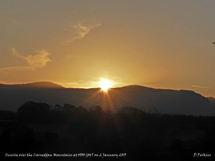


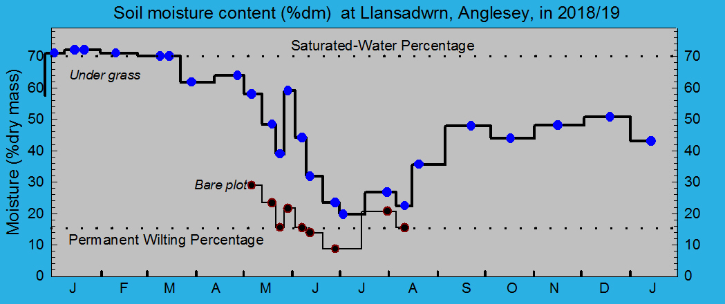


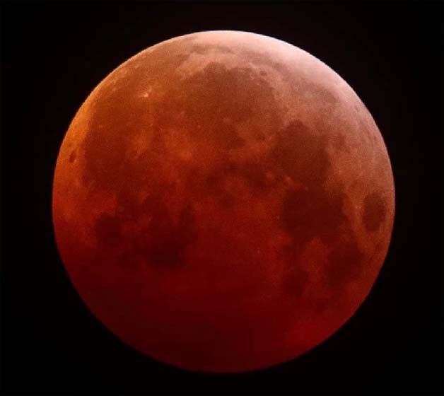


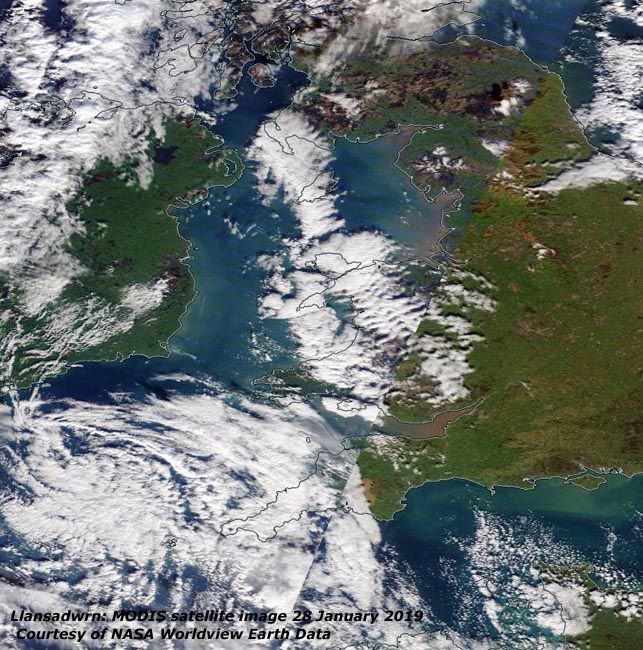
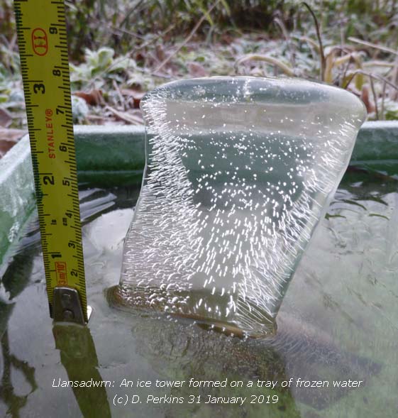

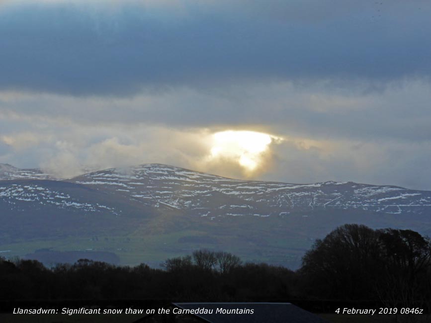
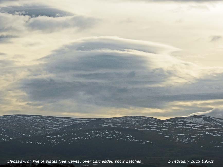
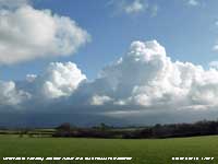

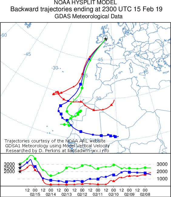

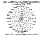
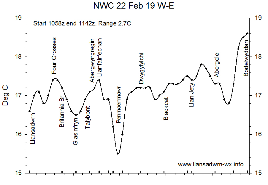
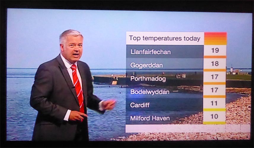
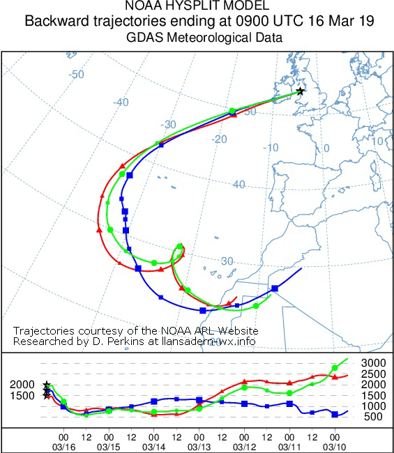
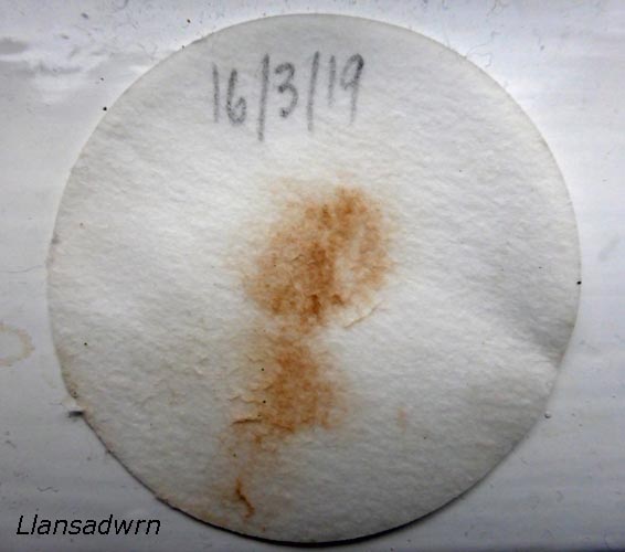
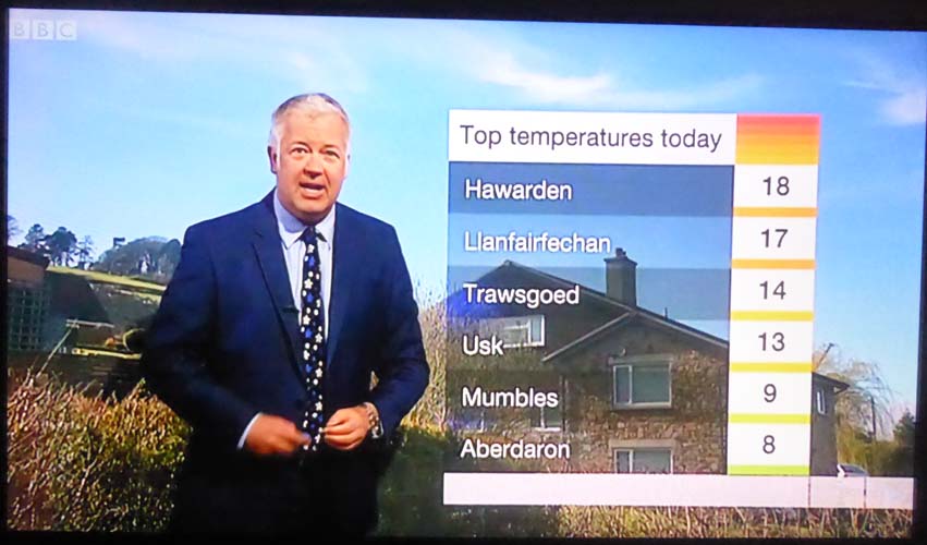
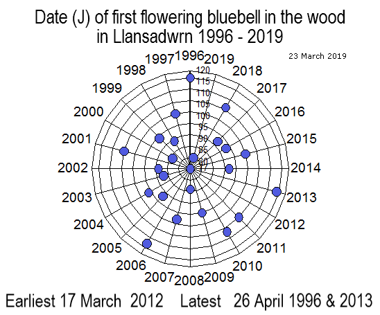
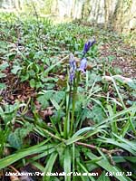
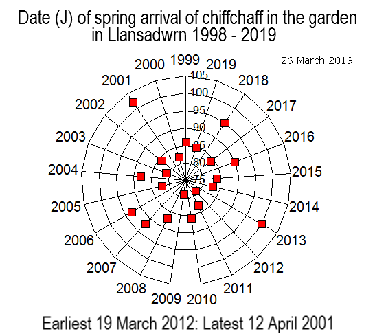
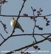
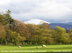


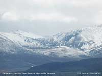
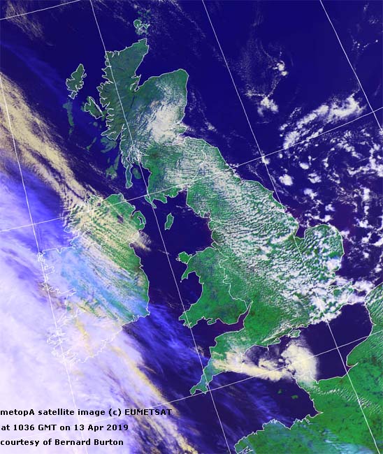
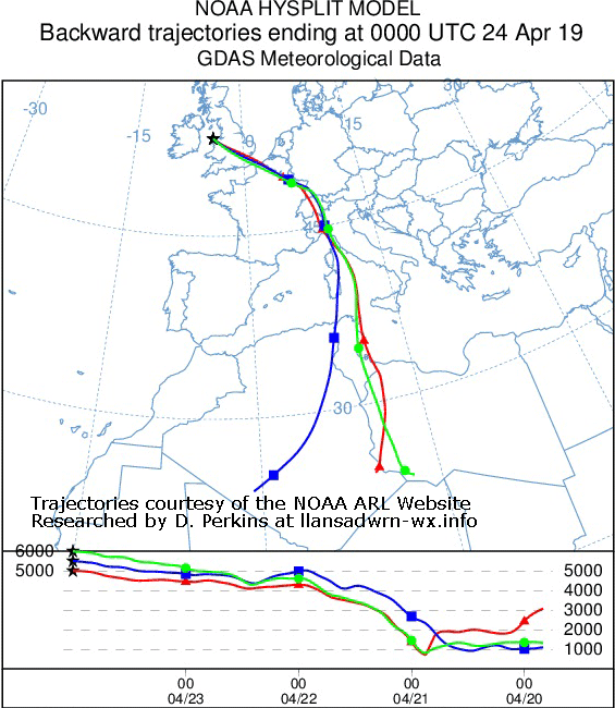
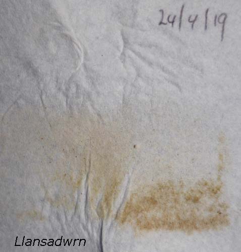
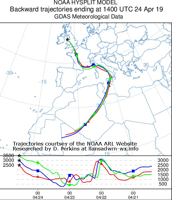
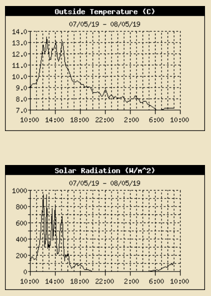

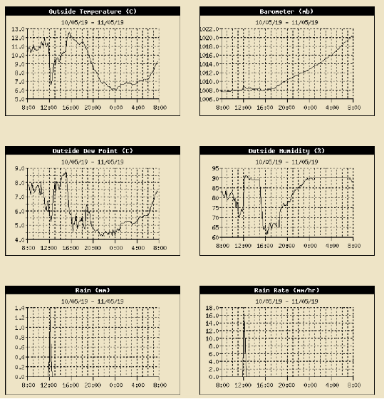




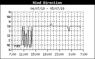
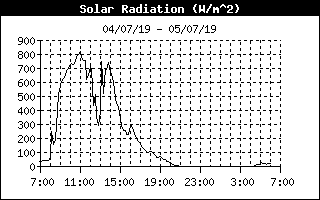


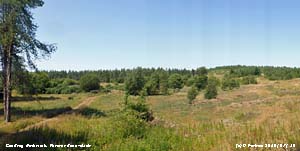
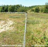


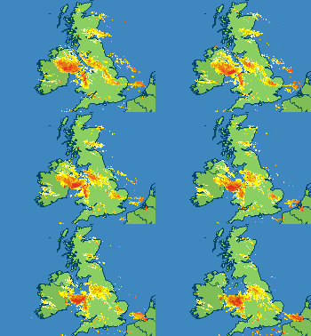 At 0900 GMT 18.6 mm of rain had fallen in the past 24-h and there was some standing water in places. Remnants of H Lorenzo had mostly fizzled out and was slow-moving over the Irish Sea reaching Cardigan Bay at noon, pressure here was fairly steady on 1010 mb. There had not been much wind near the centre of the low, gust 21 mph overnight. Brighter later in the afternoon and evening the breeze moderating further. The low tracked over S Wales 1006 mb at 18 GMT towards the Channel and then the Netherlands (Hurn 18.2C Salsburgh 5.9C Trawsgoed 18.6 mm [17.2 mm] Capel Curig [7.6 mm] Kirkwall 7.6h) [Max 15.1C Min 8.8C Rain 3.4 mm].
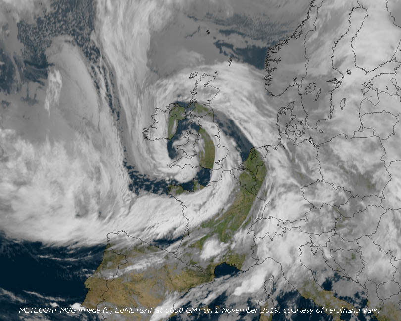




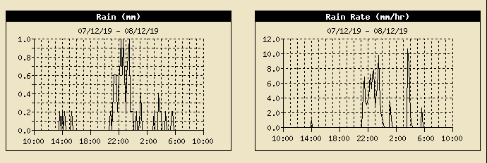

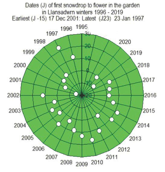
 The last day of the year the 31st began brightly with a light NNE'ly breeze and a little sunshine. Cloud was spilling over the tops of the Snowdonia Mountains where there were a few snow patches just about surviving the mild weather. The sky was clearing a little and there was some sunshine later. The first appearance of an open snowdrop flower was recorded in the garden on the 31st December (graphic left). The date is recorded when a flower is fully developed (right), low green shoots with white tips have been seen for a while. Flowering 7 days later than last winter (1918/19), 6 days before the median date on 5 January, it was the fifth earliest appearance on record. Several plants had flowers about the garden, even a blackberry