|

|
Llansadwrn (Anglesey)
Diary 2013
|

|

January 1 - A bright beginning to the New Year with a touch of ground frost,-0.2C on the grass minimum thermometer, but you had to look carefully to see some white frost on the flat leaves of buttercup between the grass. There were a few cumulus clouds and a bank of cloud over the Snowdonia Mountains that remained obscured all day. A few green leaves of snowdrops were showing through, together with some early daffodils near the garden shed. Soon the sun had risen above the mountain cloud and the morning was sunny. Pressure 1006 mb was rising quickly under the influence of a ridge of high-pressure from Azores high 1029 mb to the west.  The afternoon was cloudier with some sunny spells the temperature reaching 7.9C in a light south-westerly breeze. Fields around Llansadwrn remain very wet, after the wet December, with pools of standing water on many with manuring and ploughing postponed. Roads are a little drier, but water can still be seen on the verges on minor roads where drains have not been not cleared for years.
The 2nd was overcast with mist and drizzle the effect of a warm front along western Britain. During the morning there was a fall of a reddish-yellow coloured dust. Backward trajectory analyses, using the HYSPLIT model courtesy of the NOAA Air Resources Laboratory, indicated that parcels of air arriving over Anglesey at 1100 GMT originated from south of the Sahara desert in north Africa. The dust took an Atlantic route, around an area of high-pressure over the Bay of Biscay and Cape Finisterre. The temperature at 0900 GMT was 8.0C and rose through the day reaching 10.9C at 2242 GMT. At Gorwel Heights the temperature was 14.5C between 2240 and 2250 GMT, one of the highest in Britain. Kinlochewe reported 14.3C and Rhyl 13.4C up to 2100 GMT. Further on the 3rd Gorwel Heights recorded 14.3C at 1330 GMT exceeding that reported by Hereford 12.7C and Rhyl 12.5C. In comparison the maximum temperature in Llansadwrn on the 2nd was 10.9C and on the 3rd 10.1C. The highest temperatures recorded in Britain on the 2nd and 3rd of January are 15.6C including at Colwyn Bay and Llandudno.

The 4th began overcast with a uniform grey stratiform cloud. At 09 GMT there was a fine drizzle and spots of rain with poor to moderate visibility. The sky was brighter looking towards Conwy and the mountains. The cloud was to hang over Anglesey all day, but it was sunny on the mainland, on the mountains and in Llanfairfechan.  The photograph (left, click for larger) was taken under the cloud at 1330 GMT showing bright sunshine on the mainland and the dark, drizzly conditions in Llansadwrn. A photograph taken from Gorwel Heights (right) at 1652 GMT with late afternoon sunshine and blue sky above Anglesey.
 This is not a particularly rare event, Anglesey and coastal areas, and Llansadwrn in the SE corner in close proximity to the Snowdonia Mountains, is frequently enveloped in cloud/ fog sometimes for days at a time. Today the stratiform cloud layers were extensive over many parts of western Britain This is not a particularly rare event, Anglesey and coastal areas, and Llansadwrn in the SE corner in close proximity to the Snowdonia Mountains, is frequently enveloped in cloud/ fog sometimes for days at a time. Today the stratiform cloud layers were extensive over many parts of western Britain
 this satellite image captured just 7 minutes later the photograph above left. The day was frustrating because of the closeness to sunshine just 'across the water' or 'river' both local expressions for the Menai Strait; and Penmon, Beaumaris and Llandudno that were also sunny. The MODIS TERRA satellite image around noon shows the extent of clear sky along the North Wales coast and Welsh borders . The effect produced some interesting contrasting statistics. In the clear Hawarden reported highest sunshine 3.5h and highest maximum temperature
12.4C (range 2.9C), Crosby 10.4C (range 2.8C), Rhyl 11.5C (range 2.5C) while under the cloud here a maximum of 9.8C (range 1.2C) while Valley reported a maximum of 9.8C (range 0.4C) and nil sunshine, nearby RAF Mona reported a maximum of 9.2C with a range of only 0.1C. this satellite image captured just 7 minutes later the photograph above left. The day was frustrating because of the closeness to sunshine just 'across the water' or 'river' both local expressions for the Menai Strait; and Penmon, Beaumaris and Llandudno that were also sunny. The MODIS TERRA satellite image around noon shows the extent of clear sky along the North Wales coast and Welsh borders . The effect produced some interesting contrasting statistics. In the clear Hawarden reported highest sunshine 3.5h and highest maximum temperature
12.4C (range 2.9C), Crosby 10.4C (range 2.8C), Rhyl 11.5C (range 2.5C) while under the cloud here a maximum of 9.8C (range 1.2C) while Valley reported a maximum of 9.8C (range 0.4C) and nil sunshine, nearby RAF Mona reported a maximum of 9.2C with a range of only 0.1C.
|
 On the 7th the maximum temperature recorded at Gorwel Heights, Llanfairfechan, was 13.9C at 2020 GMT and exceeded the reported Met Office UK maximum of 12.1C at Magilligan, N Ireland. Temperatures enhanced by Föhn-like winds off the mountains are frequent along the North Wales coast including Llanfairfechan. Temperatures during the spell 1 - 3 January, the 5th and 7th have all exceeded UK maximum temperatures (provisional first indications). The graphic (left) shows a comparison of the daily maximums for the UK, Gorwel Heights and Llansadwrn. Today's maximum in Llansadwrn was 10.4C (difference 3.5C) and for the UK +1.8C. One of the highest temperatures recorded in the UK at this time of year was the 18.3C at Aber and 18.2C in Llandudno on 10 January 1971.

 The 9th dawned bright and sunny in Llansadwrn. A calm morning with variable directions shown by chimney smoke. There was extensive white frost on grass and fields with the grass minimum indicating -1.6C a moderate frost. The whiteness was due to frozen deposits of water, there was no hoar in the garden. Just 2 oktas of cloud cover, cumulus and altocumulus, and very good visibility except that the Menai Strait was full of inversion fog deepest between the bridges, but extending from Beaumaris to Caernarfon.
A sunny day [Valley reported 6.5h of sunshine, but [7.5h at Aberporth], some cirrus and contrails in the sky with lenticular altocumulus in the west towards sunset. A frosty evening and night with little or no wind.
The 9th dawned bright and sunny in Llansadwrn. A calm morning with variable directions shown by chimney smoke. There was extensive white frost on grass and fields with the grass minimum indicating -1.6C a moderate frost. The whiteness was due to frozen deposits of water, there was no hoar in the garden. Just 2 oktas of cloud cover, cumulus and altocumulus, and very good visibility except that the Menai Strait was full of inversion fog deepest between the bridges, but extending from Beaumaris to Caernarfon.
A sunny day [Valley reported 6.5h of sunshine, but [7.5h at Aberporth], some cirrus and contrails in the sky with lenticular altocumulus in the west towards sunset. A frosty evening and night with little or no wind.


A fine sunny morning on the 11th. Pressure was steady on 1018 mb with complex lows to the NW and low 996 mb W of Ireland. We were in a clear slot between fronts so it was opportune to make the most of the sunshine. Although the grass minimum had been down to -2.2C the fields were not looking very white. Visibility was good although there was some inversion mist in the Menai Strait. The afternoon was bright with sunny spells, but later turning cloudy with intermittent rain from 1700 to 2000 GMT [1.3 mm] and mostly cloudy overnight.
The warmth of the first days of the month had brought out the first flowers of the winter heliotrope  (and close up right), snowdrops
and just two blue crocus . The snowdrops were a few days later than the median flowering date of 7 January between 1996 and 2012. The latest flowering was the 23rd January in 1997 (graphic above left). The earliest was in the final year of a succession of 3 years when snowdrops remarkably flowered in December (31 Dec 1999; 27 Dec 2000; and 17 Dec 2001).
(and close up right), snowdrops
and just two blue crocus . The snowdrops were a few days later than the median flowering date of 7 January between 1996 and 2012. The latest flowering was the 23rd January in 1997 (graphic above left). The earliest was in the final year of a succession of 3 years when snowdrops remarkably flowered in December (31 Dec 1999; 27 Dec 2000; and 17 Dec 2001).
 A bright and sunny calm morning with smoke rising vertically from chimneys on the 16th. Visibility was very good with a little haze, the ground was frozen with the air temperature down to -1.2C overnight and -4.8C on the grass and there were remnant snow pellets otherwise any water including dew drops frozen, There was snow on the mountains above 1750 ft, a good cover was seen on the tops especially Carnedd Llewelyn. Fields in Llansadwrn remain very wet with standing water on many and in wheel ruts (right), and are not attractive to birds preferring the drier ones (below left starlings taking to the air). On the 18th snow was falling on many parts of Britain including SW England and S Wales causing disruption to travel.
  Snow had been forecast and the Met Office issued a rare red warning. Snow fell in Snowdonia and was lying at 1000 ft at 0900 GMT and with temperatures still falling there light to moderate accumulations in Llanberis and the road to Pen-y-pass was soon difficult. On the mountaintops there were blizzard-like conditions with strong SE'ly wind and temperatures down -6C. The A5 at Capel Curig and Ogwen was treacherous as snow settled during the morning. In Llansadwrn there were flakes of snow through the morning, the A55 to Holyhead had snow and was described as just passable at noon. At 09 GMT the temperature in Llansadwrn was 1.4C falling to 0.2C at noon; at Gorwel Heights -0.9C, f5 SE'ly gusting to 44 mph, and it was snowing. Flakes of snow continued in Llansadwrn, mostly small sometimes large, but not settling as it was at 1000 ft and above on the mountains and NW Anglesey on the beach. In the afternoon light snow started settling and at 2130 GMT moderate snow accumulated on the ground with some more just after midnight. South Wales as forecast had the most snow: 26 cm was registered at Sennybridge. The M4 was closed for a time because of snow. Snow had been forecast and the Met Office issued a rare red warning. Snow fell in Snowdonia and was lying at 1000 ft at 0900 GMT and with temperatures still falling there light to moderate accumulations in Llanberis and the road to Pen-y-pass was soon difficult. On the mountaintops there were blizzard-like conditions with strong SE'ly wind and temperatures down -6C. The A5 at Capel Curig and Ogwen was treacherous as snow settled during the morning. In Llansadwrn there were flakes of snow through the morning, the A55 to Holyhead had snow and was described as just passable at noon. At 09 GMT the temperature in Llansadwrn was 1.4C falling to 0.2C at noon; at Gorwel Heights -0.9C, f5 SE'ly gusting to 44 mph, and it was snowing. Flakes of snow continued in Llansadwrn, mostly small sometimes large, but not settling as it was at 1000 ft and above on the mountains and NW Anglesey on the beach. In the afternoon light snow started settling and at 2130 GMT moderate snow accumulated on the ground with some more just after midnight. South Wales as forecast had the most snow: 26 cm was registered at Sennybridge. The M4 was closed for a time because of snow.
 Snow overnight left a blanket on the ground and plants, trees and pots looking like a Christmas Card on the 19th. Putting on warm clothing I was 2 minutes late opening the door. The 'back door robin' was awaiting me for his usual tit-bits I place on a table nearby, so he was caught on camera! A lot to do this morning, firstly start melting the snow in the 'official' raingauge by putting funnel and can in the greenhouse. Measuring the depth, several readings between 11 and 12 cm and sample taken for density measurement, but in places nearby 14 cm. Other birds were flying in, they know the time too, but they must wait a little longer. Stevenson screen readings 0905z temperature -0.5C (86% RH), maximum thermometer 1.5C and minimum -2.0C, the Piche evaporators tubes had frozen so need to be thawed out, greenhouse again. The grass minimum was covered with snow, so it was not a very low reading -1.2C as can be expected if over snow. Soil thermometers were under snow, so were cleared and read 1.3C at 5C, 1.8C at 10 cm, snow was replaced on top. Earth thermometers in tubes, found and cleared, read 2.5C 20C; 3.7C 30 cm; 5.0C 50 cm; and 6.6C at 100 cm, snow replaced. State of ground observations, snow lying 100%, visibility, view of mountains partially obscured by haze and cloud bank, moderate to good. The wind was E'ly force 2/3. The snow had melted, precipitation measured 4.1 mm, funnel and dry bottle replaced; then collected 125 ml of water from the lysimeter receiver , none was replaced as the tank was snow covered. I saw 7 male blackbirds near the compost heap on the way to the mountain snow observation post. Feeders refilled with black sunflowers and the bird-table cleared of snow and seeded, a patch of ground was cleared for ground feeders and food applied. Out with the camera, a few more shots of the snow on the weather station and round and about, 2 mallards were seen on a small pond, curlew were heard, flocks of starlings were gathering in the beech trees. Water baths were frozen so fresh water was put out in a ground tray, then in for a warm-up and hot cup of coffee. Through the window I could see blue tits, great tits, coal tits and nuthatches on the feeders, the starlings were seen under the beach tree where snow was least, and 50 or more gathered on the ground feeding area, soon more arrived. Also under the beech on a hanging feeder was a greater spotted woodpecker. Sparrows (12, or more) and chaffinches were on the usual table, female blackbirds under the hedge where they get their supply tit-bits. A fine morning with some weak sunshine. Cloudier in the afternoon, no precipitation up to 1600 GMT, air temperature was 0.5C, but the snow was crisp and it was freezing on the ground. Still fine, but cloudy at 2200 GMT with the air temperature hovering just above zero.
A very dull quiet morning with overcast skies on the 20th. Snow was lying (average 6.5 cm) on the ground although the main roads looked clear. A short spell of sunshine around 11 GMT then with patches of blue sky overhead there were minute ice crystals in the air. These continued for about an hour then turned to small snow flakes for several hours with none settling on bare ground. With snow was still lying (4 cm) on the 21st with between 70 to 95% cover on fields (still on the shore at Rhosneigr), there was a spell of moderate snow from 08 GMT (falling at a rate of 1.2 mm/h at 0837 GMT) that by 0900 GMT had accumulated 0.5 cm of fresh snow on the snow board. Temperature was 0.2C (dewpoint -0.3C) 96 %RH; soil temperature at 5 cm was 0.9C and at 100 cm had fallen to 6.3C. Some bright and sunny spells during the morning, little or no wind.  In the afternoon, from a mostly clear blue sky, minute elongated ice crystals were falling gently for at least an hour from 1400 GMT. Glinting in the sunshine, and wafting about in a gentle breeze, I did not see an halo effects, but noticed a slightly damp feeling on my face. The evening was clear and frosty the minimum temperature recorded by the grass thermometer, currently over snow, of -6.6C. Snow was still lying more than 50% on some fields around the weather station on the 22nd. A bright morning with a shower of snow pellets and snow flakes at 0930 GMT. Pressure 999.7 mb was rising slowly with pressure low 998 mb over Ireland and Brittany and high 1026 mb over S Norway. In the afternoon sunshine, the temperature rising from a minimum of -2.8C to 5.6C, about 100 lapwings were seen together with 10 fieldfares on 'church field'. Muck spreading was taking place on another rather wet field, but most fields remain unworkable. The 23rd saw remnant snow still on the ground in Llansadwrn, on the shore at Rhosneigr and elsewhere. There was snow on the lower slopes of the Carneddau that had lying snow above 750 ft. In the afternoon, from a mostly clear blue sky, minute elongated ice crystals were falling gently for at least an hour from 1400 GMT. Glinting in the sunshine, and wafting about in a gentle breeze, I did not see an halo effects, but noticed a slightly damp feeling on my face. The evening was clear and frosty the minimum temperature recorded by the grass thermometer, currently over snow, of -6.6C. Snow was still lying more than 50% on some fields around the weather station on the 22nd. A bright morning with a shower of snow pellets and snow flakes at 0930 GMT. Pressure 999.7 mb was rising slowly with pressure low 998 mb over Ireland and Brittany and high 1026 mb over S Norway. In the afternoon sunshine, the temperature rising from a minimum of -2.8C to 5.6C, about 100 lapwings were seen together with 10 fieldfares on 'church field'. Muck spreading was taking place on another rather wet field, but most fields remain unworkable. The 23rd saw remnant snow still on the ground in Llansadwrn, on the shore at Rhosneigr and elsewhere. There was snow on the lower slopes of the Carneddau that had lying snow above 750 ft.  A dull morning with some flurries of snow around the coast, the afternoon was bright with glimpses of sunshine and a flurry of snow at 1600 GMT. A flock of redwings were seen in a field on 'peacock hill' and the lapwings were in 'church field' again, but when I saw them some were taking off and flying over the road heading north. The birds use several fields hereabouts. I have seen flocks across Anglesey including nearby Pentraeth and Llanbedregoch They prefer pastures of long-standing rather than newly reseeded and cereal crops; mature pastures have most invertebrate fauna. When looking for them wind direction is important; I find them on the lee side of hedges taking advantage of any shelter they can find. Lapwings were on 'church field' again on the 25th, here as close a photo as I could get . The 27th was a windy day and I was lucky enough to see a large group (80) of fieldfares and redwings on a field in the lee of a hedge near the village. Moles are active throwing up earth hills along drier roadside verges and at the base of walls, no doubt sorting themselves out after the flooding. A dull morning with some flurries of snow around the coast, the afternoon was bright with glimpses of sunshine and a flurry of snow at 1600 GMT. A flock of redwings were seen in a field on 'peacock hill' and the lapwings were in 'church field' again, but when I saw them some were taking off and flying over the road heading north. The birds use several fields hereabouts. I have seen flocks across Anglesey including nearby Pentraeth and Llanbedregoch They prefer pastures of long-standing rather than newly reseeded and cereal crops; mature pastures have most invertebrate fauna. When looking for them wind direction is important; I find them on the lee side of hedges taking advantage of any shelter they can find. Lapwings were on 'church field' again on the 25th, here as close a photo as I could get . The 27th was a windy day and I was lucky enough to see a large group (80) of fieldfares and redwings on a field in the lee of a hedge near the village. Moles are active throwing up earth hills along drier roadside verges and at the base of walls, no doubt sorting themselves out after the flooding.
There was a little snow left on fields and in shady places around the garden on the morning of 25th. Bare soil had been clear of snow, but frozen, on the past 3 mornings. The lowest temperatures during the current cold spell in the soil profile reached today were 0.3C at 5 cm; 0.6C at 10 cm; 1.2C at 20 cm; 2.5C at 30 cm; 3.8C at 50 cm; and 5.8C at 100 cm, but continued to fall to 5.5C on the 26 -28th. So far this year, the soil at 5 cm had not frozen, in January 2010 -0.5C and January 2011 -0.3C was reached. The day started with pressure 1011 mb falling rapidly dull with a few spots of rain intermittent until 1400 GMT before rain commenced. From 1500 to 0100 GMT rainfall was moderate to heavy at times as a cold front passed over, the sky then clearing with temperature and wind decreasing. Rainfall 24-h to 09 GMT on the 26th was [15.5 mm] here with [36.0 mm] falling in Capel Curig; the 'warm rain' had melted all the snow here and much of the mountain snow.
 On the sunny morning of the 27th lawn grass and the drier fields looked green and lush, with no browned patches. Cereals in fields planted in the autumn, just before the wet weather, have germinated and sprouted green. Some wet areas have not done well and fields that were not ploughed in time remain waterlogged and unworkable. By 1500 GMT cumulus clouds had encroached and from 1530 GMT there were moderately heavy showers of small wet snow pellets. Sferics were recorded to the S and W, but no thunder was heard. Later the sky cleared and there was another ground frost. By the morning of the 28th pressure 1001 mb was falling with complex lows 960 mb to the W and NW of here. The wind already f5 SW'ly strengthened by afternoon being strong to gale-force as rain started. Highest PWS gust recorded were 44 mph here, 56 mph at Gorwel Heights and 62 mph in Llandegfan. Capel Curig reported 85 mph, Valley 65 mph. As usual the 30 mph speed restriction was in force on the Britannia Bridge. On the sunny morning of the 27th lawn grass and the drier fields looked green and lush, with no browned patches. Cereals in fields planted in the autumn, just before the wet weather, have germinated and sprouted green. Some wet areas have not done well and fields that were not ploughed in time remain waterlogged and unworkable. By 1500 GMT cumulus clouds had encroached and from 1530 GMT there were moderately heavy showers of small wet snow pellets. Sferics were recorded to the S and W, but no thunder was heard. Later the sky cleared and there was another ground frost. By the morning of the 28th pressure 1001 mb was falling with complex lows 960 mb to the W and NW of here. The wind already f5 SW'ly strengthened by afternoon being strong to gale-force as rain started. Highest PWS gust recorded were 44 mph here, 56 mph at Gorwel Heights and 62 mph in Llandegfan. Capel Curig reported 85 mph, Valley 65 mph. As usual the 30 mph speed restriction was in force on the Britannia Bridge.
|

 The Ciudad de Cadiz, an Airbusonboard ro-ro cargo vessel, transports Airbus wings, Made in Wales at Airbus in Broughton in Flintshire, to Toulouse in France. At the height of the storm in 60 mph gusts the 125 m ship with a crew of 23 broke free of its moorings and was driven on to a sandbank in the Dee estuary. At 0730 GMT today (28th) the ship was making 14.7 kt on a heading NNE off the Pembrokeshire islands. After rounding Anglesey it was making 14.4 kt off Lynas at 2000 GMT and 13.9 kt off Llanddulas at 2100 GMT. It docked at Mostyn at 2215 GMT to load completed wings. The Ciudad de Cadiz, was pictured (left) keeping the Phare la Tour de Cordouan to starboard in the Gironde estuary, off Royan, in western France in October last. It has two sister ships the similar looking City of Hamburg Airbusonboard , and the Ville de Bordeaux AirbusA380onboard (right), both pictured in the Gironde in September last year. Attempts to refloat the Ciudad de Cadiz were made with the assistance of tug St David and on the high tide around 0100 GMT on the 31st, and again in strong wind at 1315 GMT, that had an advantage of an additional 0.8 m surge due to the weather, with the tug Whalsa Lass. Both attempts failed. Another attempt was made on the afternoon high tide on the 1st February using 3 tugs; St. David, Whalsa Lass, Kingdom of Fife with Smit Donau standing by. Despite some realignment and small movement the attempt again failed. With tides falling there may not be another of today's depth until the 11th February.
|
Another overcast morning on the 29th, visibility was very good at first, but with rain sweeping across the mountains from the west it was not long before there were spots of rain in Llansadwrn and visibility moderate. Pressure 997 mb was falling quickly with low 959 mb W of Scotland. A wet and windy day; a warm front lying N Wales to Kent gave way to a cold front in the afternoon. Strengthening wind with high gusts 67 mph in Aberdaron, 50 mph in Llandegfan, and 48 mph at Gorwel Heights at 1604 GMT as the cold front passed through. By evening the wind had moderated. After a shower of ice pellets on the morning of the 30th the sky cleared rapidly. Low 958 mb was N Scotland, where there were storm force winds, pressure was high 1032 mb over Spain and here 999 mb rising slowly. Sunny in the morning; we were on the southern edge a 'stream' of showers crossing the Irish Sea and Isle of Man heading for N England. Windy too, the Britannia Bridge was closed to HSV's with a 20 mph in operation, and it was difficult to walk along the lanes in the strong wind in the afternoon. Capel Curig reported high gust of 81 mph. No birds were seen on the fields, but the moles were busy with numerous hills being put up. A lot of debris accumulating over several days, dead branches and twigs, on the roads. At 0234 GMT on the 31st a sudden onset of high wind, vivid 'white' lightning and heavy rain 11 mm/h. Lasting about 10 minutes with a high gust of 57 mph recorded by the anemometer above the roof. Oddly, although the lightning flashes were local thunder was not heard perhaps because it was quiet and the noise of the wind too great. In the clear sky light of morning it was seen that a large branch of a Norway maple had been snapped off and the ground was littered with broken branchlets and twigs. Pressure 1004 mb was rising rapidly with low 984 mb S Iceland and N Scotland and high pressure 1034 mb intensifying over Spain. A 30 mph speed restriction was in operation on the Britannia Bridge, but it was a sunny morning. A sparrowhawk was seen perched for a long while sheltered in the wild garden enjoying the sunshine. Sunny spells in the afternoon before another thunderstorm, several loud (this time) thunder cracks and lightning at 1707 GMT with a burst of heavy rain and ice pellets falling at a rate up to 47 mm/h. High gusts reported today included 77 mph at Capel Curig, 75 mph at Valley, 45 mph at Gorwel Heights and Rhyl, and 42 mph Hawarden.
February 1 - The month began with clearing blue skies; some cirrostratus obscuring the sun at first (no halo seen) then sunny until noon when cloud encroached (an occluded front wrapped around a low over the North Channel tracked SE across N Wales) bringing a spell of rain [3.1 mm] from 1300 GMT. Light SW'ly at first veering N'ly by 1500 GMT, drier later with broken cloud into the evening.
On the 2nd the sky started to clear after dawn and at 0900 GMT there were 5 oktas of cumulus clouds and very good visibility, a N'ly breeze air being drawn from Scotland.  Pressure 1020 mb was rising quickly in a transient ridge from Azores high 1038 mb. Variable amounts of convective clouds through the day that was sunny at times and at sunset. The evening was mostly cloudy thickening with a spell of light to moderate rain from 02 GMT on the 3rd petering out to fine drizzle by morning. Misty with poor visibility, the [4.7 mm] rain enough to make the ground wet and muddy again on the dull sunless day. The snowdrops have been looking well when the sun shines and on the 4th I spotted the first spring Narcissi in flower along the road towards the village of Llansadwrn on a bright, but windy afternoon. The wind had been strengthening since morning; low 957 mb was SE Iceland and with high 1038 mb over the Azores and we were in a cool showery airstream increasingly from the North. Moderate wintry showers between 2100 and 2230 GMT were rain and soft hail (wet snow pellets), one at 2203 GMT falling at a rate of 4.6 mm/h. Early on the 5th a showery trough off the Irish Sea brought showers of snow pellets and a little snow with a scattering still on the ground at 0900 GMT. Bright to start with cumulus clouds in the vicinity. Snow on the mountaintops, heavy on the Crimea Pass that required snowploughing to keep the road open, a sprinkling on Cadair Idris. Cloudier by noon and a little more snow turning to sleet for a while around 1230 GMT. The 6th was a brighter day, drier day with passing fair-weather cumulus clouds with a cool N'ly breeze. The temperature rose to 6.7C, but in the wind the apparent (wind chill) temperature was 4.2C. A clear evening at first, becoming cloudier later as a showery trough moving in off the Irish Sea at midnight. Pressure 1020 mb was rising quickly in a transient ridge from Azores high 1038 mb. Variable amounts of convective clouds through the day that was sunny at times and at sunset. The evening was mostly cloudy thickening with a spell of light to moderate rain from 02 GMT on the 3rd petering out to fine drizzle by morning. Misty with poor visibility, the [4.7 mm] rain enough to make the ground wet and muddy again on the dull sunless day. The snowdrops have been looking well when the sun shines and on the 4th I spotted the first spring Narcissi in flower along the road towards the village of Llansadwrn on a bright, but windy afternoon. The wind had been strengthening since morning; low 957 mb was SE Iceland and with high 1038 mb over the Azores and we were in a cool showery airstream increasingly from the North. Moderate wintry showers between 2100 and 2230 GMT were rain and soft hail (wet snow pellets), one at 2203 GMT falling at a rate of 4.6 mm/h. Early on the 5th a showery trough off the Irish Sea brought showers of snow pellets and a little snow with a scattering still on the ground at 0900 GMT. Bright to start with cumulus clouds in the vicinity. Snow on the mountaintops, heavy on the Crimea Pass that required snowploughing to keep the road open, a sprinkling on Cadair Idris. Cloudier by noon and a little more snow turning to sleet for a while around 1230 GMT. The 6th was a brighter day, drier day with passing fair-weather cumulus clouds with a cool N'ly breeze. The temperature rose to 6.7C, but in the wind the apparent (wind chill) temperature was 4.2C. A clear evening at first, becoming cloudier later as a showery trough moving in off the Irish Sea at midnight.
A moderate shower of mixed ice precipitation at 0418 GMT (6.4 mm/h) on the 7th. A mostly cloudy morning with wet snow as low as 750 ft on the lower slopes of the Carneddau mountains. Brighter for a while as the sun began to rise over a bank of mountain clouds. Pressure 1021 mb was falling slowly in a ridge of high-pressure. Pressure was high 1037 mb W of Cape Finisterre and Norway 1013 mb. Turning dull by noon as a band of rain from Scotland to Cornwall moved in from the west. At 2241 GMT, during a shower of snow pellets, there was the first of 2 earth tremors the rumbling sounding like a heavy lorry passing on the road and slight window vibrations. The BGS gave the position 15 km S of here in Caernarfon Bay Mag. 2.3 and 26 km SW at 22.44 GMT Mag. 1.9. The effects were apparent continuously for about 4 minutes.
With the Ciudad de Cadiz still aground on a sandbank (see diary January 28) at Mostyn on the 8th the Ville de Bordeaux at the quay to collect the Airbus wing(s) to take to Pauillac, Port of Bordeaux, France. A dull day with fresh snow on the mountains as low as 1500 ft. Pressure 1023 mb was still rising in the ridge from declining high 1034 mb off Cape Finisterre/ Iberia, but began falling from 1024 mb by noon. Keeping dull the afternoon was breezy and dry, the NE'ly breeze veering slowly SW'ly through the evening and night with pressure falling. A warm front encroached from the W during the evening introducing showery rain before midnight. The Ville de Bordeaux departed from Mostyn and was off the Great Orme at 2322 GMT on its way to Holyhead for a full inspection of the hull. On the morning high tide of the 9th around 0939 GMT (9.4 m Liverpool) the Ciudad de Cadiz was refloated, with the tugs Union Diamond, St. David and Whalsa Lass in attendance, and moored at the quay in Mostyn. The Ville de Bordeaux was nearing St George's Channel. A dull and damp morning under grey skies the rain that had commenced around 04 GMT was light and turning to drizzle at 0900 GMT. The 6.2 mm sufficient to wet up the ground that was muddy with small pools of water. The day was dull and sunless with drizzle and rain accumulating 7.2 mm. More of the same on the 10th, continuous light rain petering out at 2200 GMT, another 7.3 mm.
After some broken cloud overnight the 11th began brighter with a strengthening E'ly breeze. Visibility was only moderate with much haze. It was keeping cold on the Snowdonia mountaintops, the AWS on Snowdon reported -8C at 09 GMT this morning while here it was 1.6C. Snow was lying at 2500 ft with some as low as 2000 ft in places. Altocumulus and a few lenticular altocumulus clouds at first then clearing to give a mostly sunny afternoon the temperature rising to 4.6C. The 12th began dull and overcast and was 1.0C at 0900 GMT with thick haze. There was a short spell of of ice crystals blowing about on a slight SE'ly breeze about 1030 GMT, then drier but keeping overcast. Little or no wind through the day.

On the 13th with low 977 mb S Iceland pressure here was steady on 1015 mb. An occluded front lay from N Wales to NW Scotland and precipitation early in the day was sleety, but falling as snow on the mountains above 750 ft. The SSE'ly wind was force 3/4 here out of the shelter of the woodland, but blowing force 6/7 at Valley. Snow was moderate at 2500 ft on Snowdon at 0900 GMT. Precipitation turned to moderate to heavy rain through the day. With soils saturated it was not long before local roads were awash. Major drainage works are proceeding on the A55 between Llandegai and Talybont the scene of recent closures due to flooding under conditions similar to today. A warm front to the W over the Irish Sea brought heavy rain and rising temperature such that by noon much of the fresh mountain snow that had fallen thawed. The wind veered SW'ly and it was a wet and windy evening. The temperature here reached a maximum of 8.3C at 2000 GMT and was 8.2C at midnight. Rainfall in the 24-h ending 09 GMT was 32.1 mm.
At 0900 GMT on the 14th it was not raining, the temperature 5.6C and a few blue patches were appearing in the sky, just enough to patch a sailor's trousers. Standing water had disappeared, but it was soft and muddy underfoot. Pressure 1009 mb was rising quickly with low 986 mb tracking E and filling over the Faeroe Islands. The sky did not clear before noon, there were some spells of hazy sunshine in the afternoon with light breezes the temperature rose to 8.8C. It was sunnier on the NW coast of the island with 6.0h reported. After a fine night, with slight ground frost [-0.9C] and moderate dew and silverfrost on the grass in the morning of the 15th, pressure 1020 mb continued rising slowly with high developing 1028 mb over the Bay of Biscay. Cloud cleared over Anglesey, but hung around the mountaintops until late in the afternoon. Visibility poor to moderate at first improved to good or very good later. A sunny day and with the temperature rising to 8.9C a few honey bees were seen on the heather banks in the garden. Sunnier in this part of the island today. The Ciudad de Cadiz was spotted off South Stack at 1330 GMT seemingly doing trials. The evening was partly cloudy but cleared about 2130 GMT with no siting of the asteroid passing close to Earth. Starting overcast, but fairly bright, on the 16th, the thin moderately high cloud beginning to disperse with some sunshine breaking through. Pressure steady on 1022 mb wit h high 1026 mb France. A warmer day the temperature rising to 10.6C by afternoon. Cloudier again by evening. h high 1026 mb France. A warmer day the temperature rising to 10.6C by afternoon. Cloudier again by evening.
Another fine morning on the 17th, good but hazy visibility. Loud drumming by a lesser spotted woodpecker on a nearby very resonant branch of a tall tree; a lot of twittering by smaller birds in the still leafless trees liking the sunshine. Mistle thrushes are also singing, 2 pairs are set up at either end of the wood. The Ciudad de Cadiz was located passing Sevenstones to starboard at 0600 GMT, going into Falmouth at 1130 GMT and about midnight out of the Channel past Brest. A sunny day, the temperature rising to 10.6C brought more honeybees with louder humming on to the heather. A fine peach and azure blue coloured sky after sunset.
More of the same on the 18th. Pressure 1018 mb rising slowly with the high 1028 mb now over the southern North Sea. Good visibility, but very hazy with some Saharan dust high in the atmosphere moving in north-east from the Continent. Sunny all day, hardly a cloud in the sky, the temperature rising to 12.1C in the afternoon, highest of the year so far. Even more honeybees on the heather with more flowers opening on the rockery banks; the first starry, white-centred blue flower of 'Glory of the snow' was spotted opening nearby, a few days earlier than 2012 on the 22nd and close to 2011 on the 16th. Some early bluebell leaves in the wood are 10 - 15 cm tall, and primroses are beginning to flower. A fine evening with another peach coloured sky after sunset. With a ridge of high-pressure persisting over Britain and pressure here steady on 1020 mb the 19th began with mostly clear skies. Just 3 oktas of cirrus clouds, moderate to good hazy visibility and calm. There was a light white frost on grass (grass min -3.8C); air temperature was 3.0C rising to 10.5C during the afternoon. Warm enough for honeybees to be out on the heathers and to tempt a single red admiral butterfly from hibernation. There was another peach and azure coloured sky for an hour after sunset.
At Aberffraw on the 19th many of the dune slacks were flooded with water (above, click twice to enlarge), not unusual following a wet winter, but this year the water seemed deeper and more extensive. This is the willow slack and here the 'middle slack' . It was unusual to see the 'main slack' with standing water on it and especially at the top or NE end . The 'Australian' Murray Grey cattle, I counted more than a hundred', keeping out of the water were 'doing a good job' grazing the dune system see diary entry for 14 November 2011 about the grazing ecology. With the tide out the sand across the beach was very wet (below) with water seepage from the slacks. The beach gatherers who every year remove litter had not yet been so there was a small amount of the usual plastic jetsam after the winter storms . A small tree trunk had been washed up as well , but cut-back of the sand dunes had been small this year. I expected, it being mid February, not see any flowering plants and could not find any, but mosses and lichens looked green and fresh after the rains.
Clear sky on the morning of the 20th with moderate visibility with smoke haze that included pollutant aerosols and dust. There was a light white frost, the grass minimum down to -4.1C overnight. Pressure was steady on 1020 mb with Scandinavian high 1038 mb. A cold front was aligned along the E coast of England moving westward and was over Morecambe Bay at noon arriving here around 1800 GMT. Satellite images showed a cloud covered Britain except Irish Sea coastlines and NE Ireland. A cooler day although the temperature did reach 9.6C at 1130 GMT. No honeybees were seen, but woodpeckers were drumming frequently in the wood.
There was a moderate to heavy dustfall between 1800 GMT and 0900 GMT on the 21st. Samples collected were mixed colours and texture; a fine pinkish-white to pinkish-grey with some dark reddish-grey and a dark grey more gritty dust. It's source is being investigated.
March 1 - The fine spell of weather St. David's Day began with hazy sunshine and plenty of small 'species' daffodils in the garden and a good supply of leeks in the vegetable plot. Patches of fog at times in places around the coast, here poor visibility at first improved by afternoon and the evening was clear. A maximum temperature of 8.2C was reached in the afternoon and honeybees were out again on the heathers.
 With clear skies overnight there was a slight air frost -0.2C and moderate ground frost -5.0C on the grass on the morning of the 2nd, a water equivalent of 0.13 mm of dew and frost was recorded. There was nothing in the copper raingauges, but a little was collected in the black plastic Davis gauge as usual. Pressure was steady on 1030 mb within the UK high; a cold front N of Scotland associated with low 978 mb Norwegian Sea was drifting south. A calm morning with hazy sunshine, just a little cloud developed in the afternoon (max 8.4C) before clearing later. Although pressure had fallen 1024 mb it was steady and the 3rd kept mostly sunny and with little wind (max 9.7C). With clear skies overnight there was a slight air frost -0.2C and moderate ground frost -5.0C on the grass on the morning of the 2nd, a water equivalent of 0.13 mm of dew and frost was recorded. There was nothing in the copper raingauges, but a little was collected in the black plastic Davis gauge as usual. Pressure was steady on 1030 mb within the UK high; a cold front N of Scotland associated with low 978 mb Norwegian Sea was drifting south. A calm morning with hazy sunshine, just a little cloud developed in the afternoon (max 8.4C) before clearing later. Although pressure had fallen 1024 mb it was steady and the 3rd kept mostly sunny and with little wind (max 9.7C).  The high 1026 mb had moved E towards Germany and was steady on 1014 mb here on the 4th. Weak sunshine under cirrostratus clouds with a partial halo circle at 0900 GMT. Extensive moderate white frost, grass min -5.2C with dew/ frost 0.15 mm; there was a trace melted in the copper raingauge funnel. Visibility was good with smoke haze with some shallow fog in low-lying areas soon clearing. Cirrus clouds increased in the afternoon; with a maximum temperature of 10.4C here (12.2C in Porthmadog) there were plenty of honeybees buzzing around and feeding on the heather banks. It was a rare clear sky morning on the 5th, I did see a passing disappearing contrail. Visibility was was poor, with moderate smoke haze and a little dust with a slight coloured dry deposit of Saharan dust collected. The floating pontoon at Beaumaris pier has been repaired after being damaged by the storm on 14 December 2012. At the Health Center a healthy looking plant of Rosemary was in flower against a warm sunny wall . An introduced southern European aromatic herb grows well near the sea, here in close up . A sunny day (max 10.4C again, but Trawsgoed recorded 17.5C; the record for today stands at 19.4C recorded in N Yorkshire in 1950 ), cirrus and moderately high altostratus encroached later so that the evening was overcast. The high 1026 mb had moved E towards Germany and was steady on 1014 mb here on the 4th. Weak sunshine under cirrostratus clouds with a partial halo circle at 0900 GMT. Extensive moderate white frost, grass min -5.2C with dew/ frost 0.15 mm; there was a trace melted in the copper raingauge funnel. Visibility was good with smoke haze with some shallow fog in low-lying areas soon clearing. Cirrus clouds increased in the afternoon; with a maximum temperature of 10.4C here (12.2C in Porthmadog) there were plenty of honeybees buzzing around and feeding on the heather banks. It was a rare clear sky morning on the 5th, I did see a passing disappearing contrail. Visibility was was poor, with moderate smoke haze and a little dust with a slight coloured dry deposit of Saharan dust collected. The floating pontoon at Beaumaris pier has been repaired after being damaged by the storm on 14 December 2012. At the Health Center a healthy looking plant of Rosemary was in flower against a warm sunny wall . An introduced southern European aromatic herb grows well near the sea, here in close up . A sunny day (max 10.4C again, but Trawsgoed recorded 17.5C; the record for today stands at 19.4C recorded in N Yorkshire in 1950 ), cirrus and moderately high altostratus encroached later so that the evening was overcast.
 The morning of the 6th was overcast, the first since 23 February, and there were fine spots of intermittent drizzle. The grass minimum 1.4C recorded no frost, the first night since 25/26th February and only the 3rd since 10/11th February. During this fine dry spell measured overnight dew and frost deposition has amounted to a water equivalent of 2.65 mm; this not recorded by raingauges, and leads to under-recording of PE (potential evapotranspiration) recorded by the lysimeter unless added to the precipitation input. Pressure had fallen to 1000 mb with complex lows 978 mb W Biscay. A warm front was over the Bristol Channel and the temperature here 8.1C (dewpoint 5.4C; RH 83%). A light to moderate deposition of a pinkish-white to pinkish-grey and a dark reddish-grey dust was collected at 0900 GMT. More dust fell in rain during the morning, a trace observed at noon looked a reddish-brown colour, as the warm front moved N over Anglesey to become slow-moving over the Irish Sea. Light rain at times through the dull day. The origin of the dustfall was investigated by backward trajectory analysis using the HYSPLIT dispersion model, courtesy of the NOAA ARL Website. Parcels of air arriving over Anglesey between 500 and 2500 m AGL at 0900 GMT came off the Atlantic near the Canary Islands before passing over Morocco and Algeria, S of the Atlas Mountains in N Africa, the likely source of the dust. Trajectories during the morning, as further dust fell, came from further south in N Africa. At 10 GMT over Western Sahara and at 12 GMT from central Algeria and may account for the change in observed colour. Rainfall today was 7.5 mm, the most since the 32.1 mm deluge on the 13 February.
The 7th continued with overcast skies and more rain Pressure was steady on 997 mb with low 973 mb W of the English Channel. Dull and misty from the start, and no sign of the sun, but the mistle thrush was singing not minding the rain at all. Another 11.0 mm of rain today; the rain was sufficient to make the soil surface wet and muddy again. On the 3rd soil moisture was determined and found to be an average 67% dry mass (range 60% to 75%) the saturated water percentage of the soil at the weather station is 72%. So despite the drier spell the soil keeps near or above water saturation. Not windy.
 The 8th too began overcast and dull with spots of rain. Pressure 995 mb was rising slowly: frontal wave low 982 mb was SW Ireland with a shower trough over Wales and an occluded front over the Irish sea to the north. In an E'ly breeze a blue patch developed in the lee of the mountains to the S and there were a couple of sunny spells in the afternoon. The City of Hamburg (Airbusonboard) was spotted at Mostyn again today. The evening became cloudier with showers of rain in a light ENE'ly breeze. Pressure 1002 mb was still rising slowly on the 9th, but it was another cloudy and damp misty day with poor visibility. Drizzle in the morning, drier in the afternoon. Still overcast on the 10th. Pressure 1008 mb was rising slowly with low 985 mb over the Bay of Biscay. Local weather, however, was determined by a cold front associated with frontal-wave low 998 mb over the Netherlands heading south across N Wales. The 8th too began overcast and dull with spots of rain. Pressure 995 mb was rising slowly: frontal wave low 982 mb was SW Ireland with a shower trough over Wales and an occluded front over the Irish sea to the north. In an E'ly breeze a blue patch developed in the lee of the mountains to the S and there were a couple of sunny spells in the afternoon. The City of Hamburg (Airbusonboard) was spotted at Mostyn again today. The evening became cloudier with showers of rain in a light ENE'ly breeze. Pressure 1002 mb was still rising slowly on the 9th, but it was another cloudy and damp misty day with poor visibility. Drizzle in the morning, drier in the afternoon. Still overcast on the 10th. Pressure 1008 mb was rising slowly with low 985 mb over the Bay of Biscay. Local weather, however, was determined by a cold front associated with frontal-wave low 998 mb over the Netherlands heading south across N Wales.  Cooler than of late just 2.2C (dewpoint 0.9C) at 0900 GMT; there was a 50% chance of ice precipitation and by 0930 GMT there were indeed 30 minutes of small snow flakes not settling here, but leaving a sprinkling on the mountains especially Drum and Foel-fras, less on more western mountains and Snowdon. Intermittent very small flakes continued through the morning, but by afternoon the sky was brighter with a little sunshine. Cold in the E'ly moderate breeze with significant wind-chill. Cold overnight with the air temperature minimum -1.6C and wind chill of -6C. The 11th dawned bright, but still cold at 0900 GMT -0.6C (dewpoint -5.5C) with a high (off the scale) 'rule of thumb' indication of ice precipitation. Cumuli were scudding along on the fresh NE'ly breeze and it felt bitterly cold (wind chill -5C). In South Wales in the 40's this wind was called a 'pipe-cracker' as, in the days of poor house insulation and heating, water pipes frequently froze and burst. Sunny spells in the morning, by afternoon we caught some showers of snow and snow pellets from about 1300 GMT; heavy snow at 1500 GMT the temperature sharply fell 3C and in f6/7 blizzard-like conditions covering the ground (the gritter 'getting the message' went up the road at 1545 GMT). Birds seen feeding (on double-rations today) and taking fresh water in the garden included, as well as the usual blackbirds, robins, a large population of sparrows (more than 20), several bramblings, chaffinches, long-tailed tits, a pied wagtail and just over the hedge in the fields 100+ redwings. For good measure 2 collared doves turned up, later a third had appeared.
 Showers of snow pellets and snow after midnight and at 07 GMT on the 12th had cleared away by 0900 GMT to give a mostly sunny morning and afternoon with a few cumulus clouds. Good or very good visibility, less windy, but still feeling chilly with a maximum of 5.7C. Showers of snow pellets and snow after midnight and at 07 GMT on the 12th had cleared away by 0900 GMT to give a mostly sunny morning and afternoon with a few cumulus clouds. Good or very good visibility, less windy, but still feeling chilly with a maximum of 5.7C.
 The 13th continued the wintry shower theme with snow flurries with snow pellets before 0900 GMT. Pressure was steady on 1013 mb with Atlantic-high 1034 mb to the W and complex lows 994 mb over the Mediterranean with the jetstream was lined up over the Gibraltar Strait. The weather was keeping very cold in N Scandinavia and W Russia with minima of -30C in parts. Here a touch of frost overnight and some fresh snow on the mountains under towering cumuli. A flock of about 60 lapwing flew over the station in a SE direction. Snow flurries continued through the morning. A distant rumble of thunder at c. 14 GMT, sunny spells and another flurry of small flaked snow at 1800 GMT. More of the same on the 14th with extensive white frost on grass in the morning (air min -2.0C and grass -5.4C) weak sunshine with 6 oktas cloud cover in the morning. Pressure steady on 1018 mb with low 993 mb SE Iceland becoming significant introducing a more SW'ly airflow. Warmer max 7.2C with light rain at times in the afternoon, the field next to the weather station was being ploughed. The 13th continued the wintry shower theme with snow flurries with snow pellets before 0900 GMT. Pressure was steady on 1013 mb with Atlantic-high 1034 mb to the W and complex lows 994 mb over the Mediterranean with the jetstream was lined up over the Gibraltar Strait. The weather was keeping very cold in N Scandinavia and W Russia with minima of -30C in parts. Here a touch of frost overnight and some fresh snow on the mountains under towering cumuli. A flock of about 60 lapwing flew over the station in a SE direction. Snow flurries continued through the morning. A distant rumble of thunder at c. 14 GMT, sunny spells and another flurry of small flaked snow at 1800 GMT. More of the same on the 14th with extensive white frost on grass in the morning (air min -2.0C and grass -5.4C) weak sunshine with 6 oktas cloud cover in the morning. Pressure steady on 1018 mb with low 993 mb SE Iceland becoming significant introducing a more SW'ly airflow. Warmer max 7.2C with light rain at times in the afternoon, the field next to the weather station was being ploughed.
Rain early on the 15th brought precipitation up to 8.1 mm for the 24-h ending 0900 GMT; enough to give small pools of standing water. Cold enough to fall as snow on the mountains above 2500 ft. Low 989 mb was off NW Scotland and pressure here was 1000 mb with a cold front over the Irish Sea and N Wales. Overcast at first with light rain brighter in the afternoon with some sunny spells when the temperature rose to 8.8C here and 9.5C at Gorwel Heights. Convective clouds were over Snowdonia in the afternoon (panorama above) with cumulonimbus seen developing in the W, one with anvil passing to the S of the station at 1600 GMT. Precipitation was heavy in Capel Curig {27.8 mm}, we had showers of rain with ice pellets 2100-2200 GMT. Pressure was 991 mb was with a low over the Irish Sea on the morning of the 16th with a lot of 'weather' in its circulation. A slight shower around 0925 GMT and one or two sunny spells in the morning the temperature rising to 7.1C just after noon, cloudier later with scattered clouds into the now lightening evening. Could not see the comet Pan Starrs now above the horizon in the W after sunset. After midnight on the 17th frequent wintery showers of snow pellets and later wet snow (17 mm/h at 0616 GMT), the temperature fell to 0.8C at 0745 GMT, continuing up to 0900 GMT. Moderate falls of snow above 2500 ft on the western Snowdonia Mountains with light snow as low as 1000 ft, Llandegai and Llyn Ogwen, where soon thawing. The precipitation of 7.3 mm here was again sufficient to produce small pools of water around the garden and adjacent recently ploughed field. Pressure was 989 mb with the low slow-moving 987 mb Isle of Man. A few sunny spells breaking through in the morning, cloudier in the afternoon with the odd shower of rain. Further snow showers with snow pellets after midnight and a fresh topping-up fall on the Snowdonia Mountains by the morning of the 18th. Snow was lying at 1800 ft, but there were light coverings as low as 1000 ft at Llyn Ogwen. Bright with a little sunshine, cold E'ly breeze, but temperature rising to 7.4C just after noon. The 19th was a dry, but mostly overcast day with rather murky moderate visibility with smoke haze, some sunshine later (maximum 7.9C) and little wind. Pressure was steady on 997 mb within a low-pressure system 995 mb SW Approaches and S Britain. Stronger winds in NE Scotland with snow, heavy in places. On the 20th pressure 1006 mb was rising and the morning still mostly cloudy with moderate visibility and murky haze. A slight overnight ground frost (-1.3C) and recent showers of rain clearing around 09 GMT. There was fresh snowfall on the mountains as low as 1000 ft. After a brief sunny spell at 1100 GMT it dull again, brighter by 1545 GMT (maximum today 6.6C) then the sky clearing as evening approached temperature falling with another light ground frost (-1.2C) overnight.
On the 21st a breezier morning the ESE'ly a chilly feeling 3.6C at 0900 GMT. Bright to start with much cirrus cloud and weak sunshine, thickening cloud through the morning as fronts moved into S Ireland, S Wales and SW England. Large rainfall totals reported were Exeter AP [40.6 mm], Culdrose [40.2 mm], Cardinham [35.2 mm] and Milford Haven [30.6 mm]. To the first day of spring March has been a cold month, so far with spring 'on hold'. Bluebell leaves in the wood had reached 10-15 cm tall on the 18th February, they have not grown much since. The first flowers were seen last year on the 17th March although there was fresh snow on the mountains at 2500 ft. Temperatures to the 20th this March have been well below the monthly averages begun at this station in 1979. The mean running at 4.8C (-2.4) & [-2.1] is the lowest as is the mean maximum running at 7.8C (-2.9) & [-2.5] with the mean minimum 1.8C (-2.0) & [-1.8] just scraping into 2nd position with 1979 a little lower at 1.5C. It is remarkable that March 2012 had the largest positive anomaly since 1979.
On the 22nd there was a heavy precipitation event, a combination of rain, sleet and wet snow, in Llanfairfechan. Precipitation to midnight on the 21st at Gorwel Heights was 9.4 mm and during the night in SE'ly winds reaching 54 mph there was extremely heavy precipitation, at 0220 GMT (up to 202 mm/h) and at 0740 GMT (up to 185 mm/h) accumulating 55.4 mm by 09 GMT making [64.8 mm 09-09 GMT on 22nd, largest any day since before March 2011, and 103.8 mm 48-h to 09 GMT on the 23rd]. A remarkably similar fall was reported by David Lee (pers. e-mail) reported 100.0 mm in the 48-h to 09 GMT on the 23rd, [62.6 mm 24-h to 09 GMT on the 22nd] at his station in Llanfairfechan.  There was heavy rain in N Ireland at Katesbridge {67.2 mm 24-h ending 21 GMT on 22nd}, more in SW England including Plymouth [26.8 mm]. Rainfall in Llansadwrn and Capel Curig was [7.6 mm] while Valley reported [27.2 mm], Mona [20.0 mm], Aberdaron [14.0 mm] and Rhyl [12.4 mm]. Rain, sleet or snow continued most of the day and by midnight (86.4 mm 00-00 GMT) had accumulated at Gorwel Heights. The AWS in Llandegai reported (37.9 mm 00-00z), Bodorgan AWS reported (86.9 mm 00-00z) and Plas Dol-y-Moch, Blaenau Ffestiniog (84.8 mm 00-00z). Heavy snow was falling on the mountains above 1000 ft with light deposits as low as 500 ft in places. Deep snow with drifting in the strong to gale-force E'ly winds led to cornice build up overhanging N- and W-facing cliffs and there were warnings of avalanche. The A5 was blocked in several places including at Corwen and Froncysyllte due to snow and fallen trees. Trains to Chester were disrupted by fallen electricity cables (the line is not electrified) and many properties were without power supply, Scottish Power saying that reconnection was difficult because of the weather conditions. The A55 from Conwy to Chester in light snow was passable with care, but mountain roads were difficult some being blocked with drifts. Anglesey remained clear of any lying snow. Precipitation was heavy again at Gorwel Heights between 1720 GMT (up to 295 mm/h) and 1740 GMT (up to 256 mm/h) temperature 0.8C (dewpoint (0.1C) wind SE'ly force 7 gusting 47 - 49 mph. There was heavy rain in N Ireland at Katesbridge {67.2 mm 24-h ending 21 GMT on 22nd}, more in SW England including Plymouth [26.8 mm]. Rainfall in Llansadwrn and Capel Curig was [7.6 mm] while Valley reported [27.2 mm], Mona [20.0 mm], Aberdaron [14.0 mm] and Rhyl [12.4 mm]. Rain, sleet or snow continued most of the day and by midnight (86.4 mm 00-00 GMT) had accumulated at Gorwel Heights. The AWS in Llandegai reported (37.9 mm 00-00z), Bodorgan AWS reported (86.9 mm 00-00z) and Plas Dol-y-Moch, Blaenau Ffestiniog (84.8 mm 00-00z). Heavy snow was falling on the mountains above 1000 ft with light deposits as low as 500 ft in places. Deep snow with drifting in the strong to gale-force E'ly winds led to cornice build up overhanging N- and W-facing cliffs and there were warnings of avalanche. The A5 was blocked in several places including at Corwen and Froncysyllte due to snow and fallen trees. Trains to Chester were disrupted by fallen electricity cables (the line is not electrified) and many properties were without power supply, Scottish Power saying that reconnection was difficult because of the weather conditions. The A55 from Conwy to Chester in light snow was passable with care, but mountain roads were difficult some being blocked with drifts. Anglesey remained clear of any lying snow. Precipitation was heavy again at Gorwel Heights between 1720 GMT (up to 295 mm/h) and 1740 GMT (up to 256 mm/h) temperature 0.8C (dewpoint (0.1C) wind SE'ly force 7 gusting 47 - 49 mph.
Snow was still falling on the 23rd with whiteout above 1000 ft on the mountains. Today we were having continuous small flakes of snow, not settling, in a moderate E'ly wind during the morning that was occasionally bright. There was light snow on the Great Orme, Llandudno and mainland coast near Conwy. Too much snow at the ski area on Cairngorm; closed with access roads impassable due to blizzard conditions. Alton Towers Theme Park on the Staffordshire Moorlands was also closed due to the snow. Pressure rising slowly was 1010 mb with the slow-moving low filling 982 mb SW of Ireland with an occluded front over the Irish Sea and S Britain. Precipitation at Gorwel Heights 24-h to 09 GMT today was [39.0 mm] and in Llansadwrn just [7.1 mm] comparing with Pentraeth AWS (8.9 mm 00-00z on the 22nd and 5.1 mm 00-00z on the 21st). Almost continuous snow flakes, not settling here, until late afternoon; mostly wet snow at Gorwel Heights at first, with whiteout at a higher level above the village. The temperature falling below zero at Gorwel Heights from 1830 GMT (wind chill -5.6C).
 Another very cold day on the 24th with a biting moderate to strong E'ly wind. At 0900 GMT the temperature was -0.3C wind chill -3.3C. There were a few patches of blue in the lee of the mountains at times, but no sunshine. Spells of snow flakes and snow grains, but nothing settling on the ground the surface of bare soil remaining frozen all day. The temperature struggled to reach 0.9C at 1634 GMT, the lowest day time temperature recorded in March at this station since 1979 when 1.0C was recorded on the 16th. The maximum at Gorwel Heights was 1.0C. Where there was snow lying many places from around 1000 ft recorded ice days; after a minimum of -4.2C at Lake Vyrnwy the maximum reached was -3.3C.
On the 25th temperatures were a little higher and at 0900 GMT had risen to 1.2C so, by convention, becoming the maximum of the 24th. The 24th was therefore the second coldest day in any March since before 1979, but being a few days later became the lowest maximum on this date in the year beating the previous lowest 6.5C in 1986. A bright and sunny morning with the sky clearing leaving cumulus clouds. Snow was seen as low as 500 ft on the Carneddau Mountains, little changed these past several days, and still on the Great Orme.  Several roads remain closed including the A5 between Corwen and Llangollen, Penypass on Snowdon and the Horseshoe Pass. Most in Wales have had their electricity restored, but thousands in N Ireland, N England, Scotland and Isle of Arran, where generators have been taken, are still without. A sunny day on Anglesey with 7.9 h duration recorded at Valley. A sunny evening with clouds casting shadows across the snow on the mountains. The 26th dawned with several wintry showers leaving a scattering of small snow pellets (< 2 mm) on the ground and flakes of snow here and persistently on the mountains. A slight shift in wind direction to ENE was bringing showers across the narrowest land surface from the North Sea to Liverpool Bay and then on to Anglesey. Pressure was steady on 1018 mb with the high pinned to S Norway 1032 mb declining. Sunny between the flurries of snow. In Porthmadog the temperature rose to 5.2C and 4.3C here and 3.8C at Gorwel Heights, Kirkwall was the highest with 6.5C and Lerwick sunniest with 6.3h.
Snow flurries with small snow pellets around 02 GMT and before 09 GMT on the 27th the small deposits had disappeared by morning leaving bright blue flowers of 'glory of the snow' without any on rockery banks. Overnight minimum -0.4C and -2.0C on the grass. Pressure was steady on 1016 mb and it was a bright morning with just good visibility in thick smoke haze. Snow showers arrived at noon with large flakes and continued in the afternoon; one intense enough to reduce visibility to <100 m, but lasting only briefly on the ground. Subsequent showers turning to small flakes and by evening the sky was mostly clear with falling temperatures. Many roads are still blocked by deep snow drifts including at Penypass, the Denbigh Moors and the A543 from Pentrefoelas to the Sportsman's Arms (they used to do very 'good bacon and eggs' there). Valley 4.1 h sunshine, but Manston 10.0h; Porthmadog 5.9C here 4.4C and 3.4C at Gorwel Heights. The 28th similar, less windy so not feeling quite as cold. Pressure 1016 mb was unchanged in the ridge from high 1020 mb Norwegian Sea. Large Atlantic-low 949 mb S of Greenland, threatening the west, was making little progress eastward. Mostly sunny and with the sun higher in the sky with radiation more intense the 5.6C temperature out of the wind more pleasant. Gorwel Heights 5.4C, Mumbles Head 7.3C. Keeping very cold on the mountains, sometimes as low as -10C on the summit of Snowdon, snow and ice amounts little changed. Deep drifts including on the railway line to the summit of Yr Wyddfa where snow was being cleared by a mechanical excavator dwarfed by the height of the drifts. Another cold night 28/29th with the air minimum -2.9C and -6.2C on the grass. Slight frost was still on ground vegetation in the morning that was again sunny with just a few clouds over the mountains. A ridge of high-pressure was persisting over N Britain, from high 1021 mb Norwegian Sea, pressure here 1013 mb. Being kept to the W of Ireland was low 967 mb S of Greenland. A few small cumuli appeared in the afternoon otherwise sunny. Temperature 5.9C and if you found a sheltered spot pleasant; did some more digging on the vegetable plot. The soil surface looks dry and the local farmer having harrowed the field adjacent to the weather station put on some fertiliser. It will be interesting to see what he sows; usually it is pasture, but over the years there have been cereals.  A fine night, bright moon, heard tawny owls out and about. It's difficult to believe, but the Atlantic-low 968 mb S of Greenland seems to be filling and moving W towards Nova Scotia on the 30th at 0900 GMT. Pressure here 1014 mb was rising slowly with pressure building 1017 mb Scotland. GFS forecasts indicate more of the same weather for the next week at least. Sunny, hardly any cloud, but keeping cool in the light ENE'ly breeze, 2.1C rising to 5.7C by noon. Snow persisting with little change on the mountains. The 31st was sunny with 3 oktas of cirrus with streaks, contrails and to the W altostratus associated with an occluded front giving some precipitation in SW Ireland. The cloud encroached in the afternoon, but the day kept dry. The field was being harrowed today the operation producing some dust off the surface dry soil. There is plenty of moisture in the soil, under grass the moisture content sampled on the 29th was 69% dry mass, close to the saturated water percentage of 70% for the local soil A fine night, bright moon, heard tawny owls out and about. It's difficult to believe, but the Atlantic-low 968 mb S of Greenland seems to be filling and moving W towards Nova Scotia on the 30th at 0900 GMT. Pressure here 1014 mb was rising slowly with pressure building 1017 mb Scotland. GFS forecasts indicate more of the same weather for the next week at least. Sunny, hardly any cloud, but keeping cool in the light ENE'ly breeze, 2.1C rising to 5.7C by noon. Snow persisting with little change on the mountains. The 31st was sunny with 3 oktas of cirrus with streaks, contrails and to the W altostratus associated with an occluded front giving some precipitation in SW Ireland. The cloud encroached in the afternoon, but the day kept dry. The field was being harrowed today the operation producing some dust off the surface dry soil. There is plenty of moisture in the soil, under grass the moisture content sampled on the 29th was 69% dry mass, close to the saturated water percentage of 70% for the local soil
At the end of the month the mean temperature was 3.9C and was the lowest in the station's March records since 1979 (graphic left) and 0.1C lower than the Valley mean temperature for March 1962 (4.0C). Using a Llansadwrn/ Anglesey temperature series the mean temperature in Llansadwrn equalled that of 1962 ranking 2nd lowest since 1942. While snow was present every day on the Snowdonia Mountains in March, lying snow (50% cover at 0900 GMT) was absent for 8 days at the beginning. Snow fell from the 10th with heavy falls on 20- 22nd as low as 250 ft on the mainland, but not on Anglesey that remained snow-free. Despite these falls the March mean snowline altitude (MSA) of 1763 ft was not as low as several years in the recent past ranking 8th since 1980 . Notably 1887 with an MSA of 1340 ft; 1990 of 1375 ft and 2001 of 1620 ft.
April 1 - Continuing the cold E'ly winds of March the day began mostly cloudy with an occluded front lying to the south-west. There was a flock of redwings on the 'cricket field' to the SW and there was no sight or sound of the chiffchaff yet this season. The median date of the bird's arrival in the garden over the past 14-years is the 26th of March: the earliest was last year on the 19th March and the latest 12 April in 2001. Pressure was steady on 1013 mb with complex low 976 mb off SW Ireland. Overnight a touch if air frost -0.4C and a hard dry ground frost -4.1C there was no sign of frost. Good visibility with a few sunny spells and a maximum temperature of 5.4C. A dustfall was collected, but no need of trajectories. It was from the adjacent field and more of the same during the day as the farmer was drilling seed and this seemed to produce more dust than previous activities. The sky cleared again during the evening with temperatures falling. Almost clear sky overnight and at dawn of the 2nd with again air -0.8C and ground frosts -2.6C; there was slight white frost this morning. Pressure 1018 mb was rising slowly with the high 1023 mb S Norwegian Sea. The Med was keeping unsettled with low 994 mb over the Tyrrhenian Sea and jetstream persistent over the Gibraltar Strait. Visibility was very good and at Beaumaris, with the flag on the lifeboat station taut in the stiff breeze, fine views of Snowdonia, the Lleyn Peninsula and remnant snow on the tops of the Rivals Yr Rifl mountains. Snow on the Carneddau was a little patchier with vegetation appearing where thin remnant snow had disappeared. A few clouds in the middle of the day; finished digging the vegetable plot except where leeks are planted, but too cold I thought to plant the potatoes just yet.
 The 3rd continued sunny and with a touch less breeze the temperature in the afternoon rose to 9.9C and relative humidity a low of 54% at 1500 GMT. Another drying day, the surface soil of vegetable plot and planted up fields looking very dry.
  With continuing night frosts, wind and increasingly strong sunlight grass is not growing and beginning to look desiccated, a yellowish-brown colour, with leaf die-back despite there being water enough in the soil. Trees remain dormant even early sycamore and the sticky buds of horse chestnut are not bursting. Soil temperatures near the surface do rise from a low base in the morning; today at 5 cm depth rising from 0.8C at 0800 GMT to 13.3C at 1400 GMT and falling back to 5.6C at 2100 GMT. At 10 cm deep from 2.0C at 0800 GMT to 10.8C at 1600 GMT falling back to 6.5C at 2100 GMT, but they are well below average for the beginning of April so seed germination may be delayed. Usually when having dug the vegetable plot weed seedlings soon appear; none this year yet. The LANCE MODIS satellite image (chs. 7-2-1, left) shows the distribution of snow (blue) across Wales and streets of capped convective cumuli (white) streaming from the NE across N England. This image shows the cloud streets and the distribution of snow in N Ireland, the Isle of Man and Pennines
. For comparison the image right, looking at the Carneddau Mountains from Llansadwrn, was taken at 1059 GMT. With continuing night frosts, wind and increasingly strong sunlight grass is not growing and beginning to look desiccated, a yellowish-brown colour, with leaf die-back despite there being water enough in the soil. Trees remain dormant even early sycamore and the sticky buds of horse chestnut are not bursting. Soil temperatures near the surface do rise from a low base in the morning; today at 5 cm depth rising from 0.8C at 0800 GMT to 13.3C at 1400 GMT and falling back to 5.6C at 2100 GMT. At 10 cm deep from 2.0C at 0800 GMT to 10.8C at 1600 GMT falling back to 6.5C at 2100 GMT, but they are well below average for the beginning of April so seed germination may be delayed. Usually when having dug the vegetable plot weed seedlings soon appear; none this year yet. The LANCE MODIS satellite image (chs. 7-2-1, left) shows the distribution of snow (blue) across Wales and streets of capped convective cumuli (white) streaming from the NE across N England. This image shows the cloud streets and the distribution of snow in N Ireland, the Isle of Man and Pennines
. For comparison the image right, looking at the Carneddau Mountains from Llansadwrn, was taken at 1059 GMT.
Another sunny day on the 4th, but there was a moderate breeze from the NE and although the temperature at 0900 GMT was 4.0C the wind chill was -0.4C. A moderate amount of dust was blowing off the cultivated field. With the cold weather continuing I was using a reserve log pile for the house having finished the logs prepared for the winter! It was pleasant working in the greenhouse out of the wind. Started taking chrysanthemum cuttings, buds of the the Black Hamburg grape have burst open. Maximum temperature 8.1C. The 5th was a sunny day too and a little warmer with a maximum 8.4C. Mountain snow was brilliantly white, with patches of ice here and there sometimes glinting in reflected sunlight, before turning pink on the summits as the sun set in the evening. A large number of redwings are still on the field to the S of the weather station, a hare also spotted. No signs that the redwings are leaving yet and still no chiffchaff, with northbound summer migrants facing headwinds, delayed somewhere enroute. A peacock butterfly was seen in the garden. Clear sky overnight with air temperature down to -1.1C and to -5.3C on the grass with a slight to moderate white frost on fields early in the morning, remnants in shady areas at 0900 GMT on the 6th. Pressure was high 1027 mb rising slowly. Calm early now light E'ly breeze, good or very good visibility with light smoke haze. Sunny. No dust collected this morning: no chiffchaff and the redwings are still here. Cirrus clouds associated with the jet stream increased during the day. In the afternoon the 'Llansadwrn cloud' developed following wind shift from NNE to SW eventually disappearing when the wind returned NE'ly. Several large bumblebees were seen for the first time this year, some honeybees were buzzing on the now past its best pinkish red winter flowering heathers, there are abundant white spring heathers, but they prefer the pink ones. A single peacock butterfly was seen in the garden and more fritillaries are flowering in the meadow area. Clear and frosty night.
A moderate white frost on the fields on the 7th at 0600 GMT (air min -0.8C; grass min -4.7C) had disappeared before 0900 GMT as the sky become overcast with altostratus cloud. The cloud thin enough for some weak sunshine. The breeze was a light S'ly and visibility moderate to good in smoke haze with moderately high levels of ozone 104 µg per m-3 (courtesy of Welsh Air Quality Forum website). Pressure 1021 mb was steady with low 994 mb SW of the Celtic Sea. The morning bright, bumble bees were about, but no chiffchaff. The sun remained behind the thin cloud all day, so was technically a 'sunless day'. I note a day of sunshine if there has been 6 minutes, or more, of bright sunless, enough to leave a mark on the chart of a Campbell Stokes 'glass sphere' sunshine recorder.
 The 8th was another hazy day with poor to moderate visibility and thick smoke haze. A bright day with sunshine with cirrus and cumulus clouds. A clear sky above Scandinavia allowed scrutiny of the snow cover and ice on the Gulf of Bothnia.
  Not completely frozen over this year, but there are still large patches of ice covering the brackish water of the gulf. It's still very cold with snow at Kemi, Finland (right), with ice in the harbour kept open by the icebreakers. Fine and sunny today after a minimum of -17C, a temperature of -8C rising to a maximum of 1C. Here our minimum was 1.3C rising to double figures 10.1C just after noon; later it was a little less murky with sunny spells. A dull morning on the 9th, there had been a touch of ground frost (-0.6), but there was no sign of frost on the grass. All surfaces were dry as the E'ly wind persisted. Pressure was steady on 999 mb with low 987 mb near Brest with occluded fronts over the English Channel and Bristol Channel moving NE. Continuing murky with poor visibility. The sun began breaking through during the morning, sunshine was minimal and the day mostly grey. Redwings were still in the field and there were no chiffchaffs. Today the grass fields were having the heavy roller treatment. A little warmer the temperature rising to 10.9C. We could do with the heavy roller on the lawns; moles have been very active this year and have made a network of tunnels, and a few mole hills, that I try and flatten out. The fields look relatively mole-free at present, I think they are all in the garden. The main reason for rolling the fields is to encourage tillering of the pasture grasses.
 Mostly cloudy on the 10th and visibility remains very poor and murky. No redwings on the fields and a chiffchaff was heard in the garden at 0800 GMT, later than usual, but 2 days earlier than the latest garden arrival date 12 April 2001 (graphic left). My monthly notes for April 2001 reported that it 'was the 6th wettest in records since 1928 and temperatures continued to be below average, the 4th month in succession'. Change seems on the way this year as the jetstream has edged N to here. Low 989 mb was to the SW and an occluded front stretched over Cardigan Bay and the Isle of Wight; a few spots of rain before 0900 GMT then more spots or rain and slight rain through the morning. Brighter in the afternoon, but mostly murky with the rain just sufficient to damp down the dust. A little more rain on the morning of the 11th under overcast skies with poor visibility. Briefly brighter early in the afternoon then some more spots of rain; light SE'ly breeze lessening overnight and calm at times. Little was heard of the chiffchaff today; feeding and resting after its long journey. A dull and damp morning on the 12th with fine drizzle before 09 GMT. Warmer 7.1C and just a little variable breeze, very poor visibility. Pressure was low 992 mb at 02 GMT and was rising rapidly on 995 mb with low 993 mb central S England. Spots of rain during the morning then brightening with a glimpse or two of sunshine in the afternoon. The chiffchaff was in good voice today; seems to have settled back into the garden. The temperature this afternoon reached 10.4C. The cold weather in southern Britain has been reflected around our shores. Temperature in the S North Sea off E Anglia is 4.4C and in Cardigan Bay 7.1C while off the N Scotland it is 10.0C and the North Cape 5.0C. The Atlantic off Portugal is a better place for a dip at present 14.6C; the highest is the Mediterranean Sea off the N African coast 18.0C, but St Tropez is cooler 13.5C.
 The 13th heralded a big change in the weather. The first noticeable effect was the temperature at 0900 GMT; in a light SE'ly breeze a barmy 10.6C (dewpoint 5.3C) that was the highest of the past 24-h. A look at the sky: It was a complex sky with several altocumulus lenticularis clouds hovering to the SE of the weather station in the lee of the still snowy Snowdonia Mountains, high jetstream cirrus, a few cumuli and significantly some ripples in altocumulus clouds known as a mackerel sky overhead that - from the days of sailing ships - is taken as a warning to 'shorten' sail as stormy weather was approaching. The barometer 1007 mb was falling with vigorous low 950 mb slow-moving W of Ireland deepening to 943 mb at noon. A little sunshine at first before turning cloudy with showery rain morning and afternoon. Little change in temperature through into the night; the SSW'ly was strengthening and the night wet and windy.
|

 The snake's head fritillaries that we have established in a 'meadow area' in the garden seem to have flourished in the winter weather. Well, they are a species of alpine meadow and floodplain so the wet and cold suits them. The area was flooded several times autumn/ winter and they started flowering in the recent cold spell of weather. Scarce in the UK, probably introduced (1736), the species is on the IUCN European Red List. Named by the Swedish botanist Carl Linnaeus in 1753, it is common in damp grassland and meadows subject to winter flooding. Grassland improvement and use of fertilisers has lead to a reduction in habitat. We do have a recent problem in the garden, the invasive lesser celandine, seen in the foreground, is a menace. Just one or two plants along the hedgerows and garden have increased rapidly in the last 10-y.. The plant seeds profusely and forms small tubers, that remain in the ground overwinter, grows early in the spring and dominate large patches of ground. It has spread on lawns and along paths in the wood, and because it can dominate the ground flora, including ivy, steps are being taken to reduce it by digging up the tubers, and where possible cutting it back to reduce vigour and before it seeds.. The snake's head fritillaries that we have established in a 'meadow area' in the garden seem to have flourished in the winter weather. Well, they are a species of alpine meadow and floodplain so the wet and cold suits them. The area was flooded several times autumn/ winter and they started flowering in the recent cold spell of weather. Scarce in the UK, probably introduced (1736), the species is on the IUCN European Red List. Named by the Swedish botanist Carl Linnaeus in 1753, it is common in damp grassland and meadows subject to winter flooding. Grassland improvement and use of fertilisers has lead to a reduction in habitat. We do have a recent problem in the garden, the invasive lesser celandine, seen in the foreground, is a menace. Just one or two plants along the hedgerows and garden have increased rapidly in the last 10-y.. The plant seeds profusely and forms small tubers, that remain in the ground overwinter, grows early in the spring and dominate large patches of ground. It has spread on lawns and along paths in the wood, and because it can dominate the ground flora, including ivy, steps are being taken to reduce it by digging up the tubers, and where possible cutting it back to reduce vigour and before it seeds..
|
 The beginning of the month continued the cold weather of March. We have had our share of cold starts to April, notably 1986, 1994 and 2000. The beginning of the month continued the cold weather of March. We have had our share of cold starts to April, notably 1986, 1994 and 2000. Statistics for the first 13-days of the month since 1979-2012 give a mean of 8.1C; 2013 has a mean temperature of 5.7C |-2.4| equal lowest with 1986. Compared with the month as a whole 5.7C is (-3.8) & [-3.2] of averages, higher than March's 4.0C, but as low as March 2006. My monthly notes for April 2006 reported 'the beginning of the month saw the coldest weather with snow falling on the 8th and 9th and hail on the 3 days 6 - 8th. As a whole 'very sunny, above average rainfall... drier and warmer after mid-month, but turned colder again at the end... temperatures struggled to reach average'. Cold Marches and Aprils delay the development of flowering of spring plants. No sign of the native bluebells Hyacinthoides non-scripta (no Spanish ones here that are 'invading' many British gardens) flowering yet this April; there are plenty of leaves. The latest flowering dates of bluebell I have a record over the last 16-years (graphic left) is 26th April 1996 and 25th April 2006, the earliest was last year on 17th March; this photo was taken on the 19th April 2011 . Statistics for the first 13-days of the month since 1979-2012 give a mean of 8.1C; 2013 has a mean temperature of 5.7C |-2.4| equal lowest with 1986. Compared with the month as a whole 5.7C is (-3.8) & [-3.2] of averages, higher than March's 4.0C, but as low as March 2006. My monthly notes for April 2006 reported 'the beginning of the month saw the coldest weather with snow falling on the 8th and 9th and hail on the 3 days 6 - 8th. As a whole 'very sunny, above average rainfall... drier and warmer after mid-month, but turned colder again at the end... temperatures struggled to reach average'. Cold Marches and Aprils delay the development of flowering of spring plants. No sign of the native bluebells Hyacinthoides non-scripta (no Spanish ones here that are 'invading' many British gardens) flowering yet this April; there are plenty of leaves. The latest flowering dates of bluebell I have a record over the last 16-years (graphic left) is 26th April 1996 and 25th April 2006, the earliest was last year on 17th March; this photo was taken on the 19th April 2011 .
The 14th dawned overcast, wet and windy; light to moderate rain heavy at times. The SW'ly force 5/6 here, force 7 around the coast with rough water; light to moderate rain poor visibility. Gales on the mountains with high gusts recorded 75 mph at Capel Curig 49 mph at Gorwel Heights, 38 mph here. A pine tree had blown down in a nearby the field. The 10.7 mm rain was enough to wet up the soil producing a few small puddles by 09 GMT. After bottoming out 999.6 mb at 0622 GMT pressure 1002 mb was rising slowly the low 961 mb filling W of Ireland. Light to moderate rain; the temperature never below 11C over night was 11.7C at 0800 GMT had stated to fall 10.2C at 0900 GMT with the approach of a weak cold front. The wind moderated a little and there was a 2C fall in temperature then the sky brightened with sunny spells into the afternoon (max struggling to reach 12.8C) that continued very blustery with the wind strengthening again. In the SE of Britain airflow from S Europe briefly gave folk a taste of summer the temperature rising to 22.0C in Manston, Kent.
 Windy overnight 14/15th and a grey blustery start to the 15th. Pressure 1011 mb was rising and there were a few breaks in the cloud; the afternoon continued breezy was bright with some sunshine the temperature rising to 13.4C and 14.3C at Gorwel Heights. Hawthorn in the hedgerows is greening-up and willow is already in flower. A vigorous low was steaming northwards W of Ireland and was 975 mb off Shannon at 1800 GMT. At Gorwel Heights a peak gust of 61 mph was recorded at 2230 GMT; and during the day at Capel Curig 66 mph and Cairngorm 97 mph. Windy overnight 14/15th and a grey blustery start to the 15th. Pressure 1011 mb was rising and there were a few breaks in the cloud; the afternoon continued breezy was bright with some sunshine the temperature rising to 13.4C and 14.3C at Gorwel Heights. Hawthorn in the hedgerows is greening-up and willow is already in flower. A vigorous low was steaming northwards W of Ireland and was 975 mb off Shannon at 1800 GMT. At Gorwel Heights a peak gust of 61 mph was recorded at 2230 GMT; and during the day at Capel Curig 66 mph and Cairngorm 97 mph.
 The first white flowers of blackthorn were spotted in a hedgerow along the A5025 on the 15th. More were also seen along the the A5 into Bangor opposite Nantporth the new Bangor City FC ground . The median flowering date in Llansadwrn is the 22 March, so it was 24 days late this year. The earliest flowering date in my records (graphic left) is the 27 February 2007 and the latest 16th April 2010, just a day later than this year. On the morning of the 16th bright and sunny, but very windy; touching gale-force in places especially on high ground. Speed restrictions were in force on the Britannia Bridge. The low was 979 mb near Rockall and pressure here rising rapidly on 1007 mb. Sunny, but breezy through to evening when the wind moderated. A sunny day at Valley the 12.0h was sunniest in Britain. Respite did not last more than the day as yet another low 982 mb was tracking slowly NNE on the 17th. The low W of Ireland with triple point, the warm front was over Anglesey at 0900 GMT 11.5C (dewpoint 10.2C). Pressure was 1004 mb falling rapidly. It was a blustery morning with 43 mph showing on the roof-top anemometer, so it was a case of holding on to your hat, in my case my hard hat as there was tree debris flying about. The SW'ly was force 6/7 and there was fine drizzle and poor visibility. It was a very rough sunless day the strong wind persisting into the afternoon. A gust of 57 mph coupled with a temperature of 15.2C, highest of the year so far, was registered at 1230 GMT at Gorwel Heights in Llanfairfechan. There was a speed limit of 20 mph on the Britannia Bridge and was closed to high-sided vehicles. A very rough night with gale-force winds continuing well after midnight with gusts here up to 50 mph and Gorwel Heights 57 mph at 0340 GMT. The first white flowers of blackthorn were spotted in a hedgerow along the A5025 on the 15th. More were also seen along the the A5 into Bangor opposite Nantporth the new Bangor City FC ground . The median flowering date in Llansadwrn is the 22 March, so it was 24 days late this year. The earliest flowering date in my records (graphic left) is the 27 February 2007 and the latest 16th April 2010, just a day later than this year. On the morning of the 16th bright and sunny, but very windy; touching gale-force in places especially on high ground. Speed restrictions were in force on the Britannia Bridge. The low was 979 mb near Rockall and pressure here rising rapidly on 1007 mb. Sunny, but breezy through to evening when the wind moderated. A sunny day at Valley the 12.0h was sunniest in Britain. Respite did not last more than the day as yet another low 982 mb was tracking slowly NNE on the 17th. The low W of Ireland with triple point, the warm front was over Anglesey at 0900 GMT 11.5C (dewpoint 10.2C). Pressure was 1004 mb falling rapidly. It was a blustery morning with 43 mph showing on the roof-top anemometer, so it was a case of holding on to your hat, in my case my hard hat as there was tree debris flying about. The SW'ly was force 6/7 and there was fine drizzle and poor visibility. It was a very rough sunless day the strong wind persisting into the afternoon. A gust of 57 mph coupled with a temperature of 15.2C, highest of the year so far, was registered at 1230 GMT at Gorwel Heights in Llanfairfechan. There was a speed limit of 20 mph on the Britannia Bridge and was closed to high-sided vehicles. A very rough night with gale-force winds continuing well after midnight with gusts here up to 50 mph and Gorwel Heights 57 mph at 0340 GMT.
The morning of the 18th was brighter with a clearing sky and moderate to strong SW'ly wind. It was a day of sunshine and 'April showers'. With the rise in temperatures there were signs of spring. The recently cultivated field adjacent to the weather station is sprouting green and a flock of pigeons is losing interest in it. Some swollen damson buds are opening, several plant of naturalised comfrey are flowering on the woodland edge and I spotted the first violet flower on the rockery steps. Despite closer proximity to the mountains in the Gorwel Heights microclimate the Föhn-like winds and lee-sunshine make a difference and plum trees encouraged to flower sooner were shredded in the recent winds. There are patches of snow on the mountains as low as 750 ft and there is a chill in the wind, especially out of sunshine. Today's maximum was 11.4C here and 12.1C at Gorwel Heights.
 cheiri.") On the 19th with a high 1034 mb intensifying off Cap Finisterre there was a ridge to the UK and pressure here 1028 mb was rising quickly. The jetstream had temporarily fragmented while an upper trough over Wales and central England was moving away south-eastwards. The breeze was veering and was W'ly at 0900 GMT becoming NE'ly by afternoon. There were some cumuli over Snowdonia, some well-developed at first, but Anglesey was in the clear and it was sunny with 12.3h at Valley. A pair of swallows was seen flying overhead, the first of the season here. Maximum 12.2C (1530 GMT) here, but only 9.2C (1630 GMT) at Gorwel Heights exposed to the dominant WNW'ly wind falling to 4.9C at 2200 GMT.
On the 19th with a high 1034 mb intensifying off Cap Finisterre there was a ridge to the UK and pressure here 1028 mb was rising quickly. The jetstream had temporarily fragmented while an upper trough over Wales and central England was moving away south-eastwards. The breeze was veering and was W'ly at 0900 GMT becoming NE'ly by afternoon. There were some cumuli over Snowdonia, some well-developed at first, but Anglesey was in the clear and it was sunny with 12.3h at Valley. A pair of swallows was seen flying overhead, the first of the season here. Maximum 12.2C (1530 GMT) here, but only 9.2C (1630 GMT) at Gorwel Heights exposed to the dominant WNW'ly wind falling to 4.9C at 2200 GMT. The halophytic ivy-leaved scurvy grass Cochleria danica was seen in flower on the A5025 approaching the Llansadwrn junction and upon entering Benllech, a month later than 2012. Usually found near the sea is now well established flourishing along our salt-treated roads (photo left), for more information on the plant and its unusual habitat go here. A fine and almost clear sky morning on the 20th with a little cirrus from expanded contrails and 1 or 2 small cumulus clouds. Pressure was steady on 1032 mb within high 1035 UK. The jetstream was held to the NW, but unlikely to stay there for long. Making most of the sunny, but rather breezy, day I worked on the vegetable plot getting ready for planted and resisting the temptation until conditions warm up. Although soil temperatures at all depths are rising they are all <10C; the 30 cm 'yardstick' depth reading 9.2C this morning was 1.3C below average, and the mean is running 3.3C below the monthly average. Ground frosts have been 11, equalling that of 2001 and 2008 highest on record for April, and there might be more. A maximum of 13.4C and 13.2 at Gorwel Heights; Hawarden topped the Wales list at 15.9C. The halophytic ivy-leaved scurvy grass Cochleria danica was seen in flower on the A5025 approaching the Llansadwrn junction and upon entering Benllech, a month later than 2012. Usually found near the sea is now well established flourishing along our salt-treated roads (photo left), for more information on the plant and its unusual habitat go here. A fine and almost clear sky morning on the 20th with a little cirrus from expanded contrails and 1 or 2 small cumulus clouds. Pressure was steady on 1032 mb within high 1035 UK. The jetstream was held to the NW, but unlikely to stay there for long. Making most of the sunny, but rather breezy, day I worked on the vegetable plot getting ready for planted and resisting the temptation until conditions warm up. Although soil temperatures at all depths are rising they are all <10C; the 30 cm 'yardstick' depth reading 9.2C this morning was 1.3C below average, and the mean is running 3.3C below the monthly average. Ground frosts have been 11, equalling that of 2001 and 2008 highest on record for April, and there might be more. A maximum of 13.4C and 13.2 at Gorwel Heights; Hawarden topped the Wales list at 15.9C.
It was back to grey skies, poor visibility and light rain on the morning of the 21st lasting until afternoon, due to a cold front moving slowly SE over the Irish Sea. The afternoon was brighter with some sunshine apart from a shower of rain around 1830 GMT. A few buds had appeared on some of the more bluebells in the wood.  EUMETSAT at 12 GMT on 23 April 2013, courtesy of Ferdinand Valk.") Breezier here on the 22nd; strong winds in the N North Sea with low 967 mb near Iceland. Mostly dull with drizzle and slight rain in the morning dying out by afternoon. Brighter towards evening with a little sunshine. Flowers on an elm tree that has survived the 1970 outbreak of Dutch Elm Disease and still healthy ash were open, no leaves on either yet. The 'yellow candles' on the horse chestnut are larger, but leaves have been slow to develop this year. The swollen buds on Bardsey and Anglesey apple trees are beginning to open.
A bright morning on the 23rd as pressure 1019 mb was rising. Low 973 mb was over the Norwegian Sea while pressure was high 1025 mb Spain and Black Sea. Today winds were strongest along the S Norwegian coastline. Becoming overcast and dull brighter again later in the afternoon. A warm front over the Celtic Sea was moving NE associated with frontal system France, Netherlands and Baltic; orographic waves were frequent over mountains of Wales, Cumbria and Scotland (see MSG satellite image left, courtesy of Ferdinand Valk). Closed and open cell marine convection can be seen N of Scotland. Clear in SE England the temperature in East Malling rising to 21.3C, here 13.7C was the highest, but at Gorwel heights 15.7C was reached during the afternoon. Breezier here on the 22nd; strong winds in the N North Sea with low 967 mb near Iceland. Mostly dull with drizzle and slight rain in the morning dying out by afternoon. Brighter towards evening with a little sunshine. Flowers on an elm tree that has survived the 1970 outbreak of Dutch Elm Disease and still healthy ash were open, no leaves on either yet. The 'yellow candles' on the horse chestnut are larger, but leaves have been slow to develop this year. The swollen buds on Bardsey and Anglesey apple trees are beginning to open.
A bright morning on the 23rd as pressure 1019 mb was rising. Low 973 mb was over the Norwegian Sea while pressure was high 1025 mb Spain and Black Sea. Today winds were strongest along the S Norwegian coastline. Becoming overcast and dull brighter again later in the afternoon. A warm front over the Celtic Sea was moving NE associated with frontal system France, Netherlands and Baltic; orographic waves were frequent over mountains of Wales, Cumbria and Scotland (see MSG satellite image left, courtesy of Ferdinand Valk). Closed and open cell marine convection can be seen N of Scotland. Clear in SE England the temperature in East Malling rising to 21.3C, here 13.7C was the highest, but at Gorwel heights 15.7C was reached during the afternoon.
 Little change on the 24th, under uniform grey stratiform cloud there was intermittent drizzle at first. Became dry by afternoon, but no clearance in the sky; an area of rain over the Irish Sea to the NW making no progress southwards. Brightening the day I spotted on the roadside
in Llansadwrn flowering honesty (garden escape) both the purple (right) and the rarer white form
. Flowers are fragrant; seed heads formed later in the season are used by flower arrangers. The area of rain to the NW edged closer while moving over the North Sea on the 25th; light to moderate rain from 0800 GMT |6.4 mm from midnight to noon| [4.4 mm] in low cloud with very poor visibility.
Little change on the 24th, under uniform grey stratiform cloud there was intermittent drizzle at first. Became dry by afternoon, but no clearance in the sky; an area of rain over the Irish Sea to the NW making no progress southwards. Brightening the day I spotted on the roadside
in Llansadwrn flowering honesty (garden escape) both the purple (right) and the rarer white form
. Flowers are fragrant; seed heads formed later in the season are used by flower arrangers. The area of rain to the NW edged closer while moving over the North Sea on the 25th; light to moderate rain from 0800 GMT |6.4 mm from midnight to noon| [4.4 mm] in low cloud with very poor visibility.  A trace of reddish-brown dust was seen falling at 0900 GMT. Later a sample of the dust that fell between 0900 and 1200 GMT was collected . This had been forecast by the University of Athens SKIRON model as a band of dust moving SE across the UK originating from a pool of Saharan dust over the Atlantic. Trajectory analyses using HYSPLIT, courtesy of the NOAA ARL Website, confirmed this route. By afternoon the front had cleared away SE and there was sunshine to end the day.
 At first light on the 26th around 0600 GMT tawny owls were heard together with the first robin and blackbird singing. Although air temperature kept up to 1.9C there was a ground frost with a minimum of -1.5C and the field looked lightly white before the sun rose. By 0900 GMT the sky was cloudier with cumulus clouds moderately towering over the mountains. A light NW'ly breeze and good slightly hazy visibility.
Pressure was steady on 1019 mb with low 1008 mb near Shetland. Atlantic high (large) was 1046 mb S of Greenland while the Med continues unsettled with low 1011 mb W Mediterranean. A fine sunny morning and a tour of the wood, with a hint of fragrance from the black poplar tree's opening buds, revealed that the first bluebell had opened so (almost) equalling the latest date 26 April in leap year 1996 (J117). This year, being not leap year, the JDay is 116 so defers to 1996 being 1 day later must be ranked number 2, that's statistics for you! A pair of swallows was seen overhead again; no house martins yet. By afternoon there were some beefy cumuli in the vicinity and soon spots of rain then showers of rain and small ice pellets at 1500 GMT and at Gorwel Heights at 1528 GMT. More, heavier at 1753 GMT (falling a a rate up to 17 mm/ h). The ice precipitation resulted in transient sprinklings of snow on the summits of the Carneddau and Snowdon. Showers continued after midnight; and at 0100 GMT on the 27th some ice pellets left the hailometer heavily marked with small indentations. In the morning with just 3 oktas cloud cover it was sunny, but there was a persistent NE'ly breeze all day. The temperature today rose to 9.9C; planted 4 rows of Arran Pilot potatoes, they usually do well here. Clear evening, good views of the mountains, slight ground frost -0.7C before cloud encroached around midnight. At first light on the 26th around 0600 GMT tawny owls were heard together with the first robin and blackbird singing. Although air temperature kept up to 1.9C there was a ground frost with a minimum of -1.5C and the field looked lightly white before the sun rose. By 0900 GMT the sky was cloudier with cumulus clouds moderately towering over the mountains. A light NW'ly breeze and good slightly hazy visibility.
Pressure was steady on 1019 mb with low 1008 mb near Shetland. Atlantic high (large) was 1046 mb S of Greenland while the Med continues unsettled with low 1011 mb W Mediterranean. A fine sunny morning and a tour of the wood, with a hint of fragrance from the black poplar tree's opening buds, revealed that the first bluebell had opened so (almost) equalling the latest date 26 April in leap year 1996 (J117). This year, being not leap year, the JDay is 116 so defers to 1996 being 1 day later must be ranked number 2, that's statistics for you! A pair of swallows was seen overhead again; no house martins yet. By afternoon there were some beefy cumuli in the vicinity and soon spots of rain then showers of rain and small ice pellets at 1500 GMT and at Gorwel Heights at 1528 GMT. More, heavier at 1753 GMT (falling a a rate up to 17 mm/ h). The ice precipitation resulted in transient sprinklings of snow on the summits of the Carneddau and Snowdon. Showers continued after midnight; and at 0100 GMT on the 27th some ice pellets left the hailometer heavily marked with small indentations. In the morning with just 3 oktas cloud cover it was sunny, but there was a persistent NE'ly breeze all day. The temperature today rose to 9.9C; planted 4 rows of Arran Pilot potatoes, they usually do well here. Clear evening, good views of the mountains, slight ground frost -0.7C before cloud encroached around midnight.
With just a few days to the end of the month the mean temperature 7.3C was [-1.6], a little lower than 2012 [-1.4] and lowest since 1986 [-2.1], making it one of the 5 coolest Aprils in 72 years (graphic left) this position not changing by the end of the month see my monthly report .

 You could see the mountains clearly at 0800 GMT on the 28th, but soon were obscured with rain driving across the fields. We were in a brisk W'ly airflow the result of low 988 mb over the Norwegian Sea and Atlantic-high 1036 mb, with an occluded front over Anglesey and N Wales. With maximum temperature of just 9.4C a blackcap had returned to the garden, they don't seem to overwinter here as in some parts, and was singing in the still flowerless and leafless wild cherry tree. Buds had formed on the Welsh poppies in the garden.
A bright start on the 29th with moderate to good visibility. The photo (above left) was taken with cumulus clouds over the town centre of Llangefni, resplendent with memorial clock tower, the county town of Anglesey.
The photo here is of the old railway station that still has a recognisable platform and rusty rails, but no trains these days. The River Cefni flows through the town from Llyn Cefni, its source, through Malltraeth Marsh and the Cefni estuary to the sea at Malltraeth Sands.
The photo (right) is of the upper reaches of the river just downstream of the town. The weather turned cloudier from noon before dispersing later to give clear sky in the evening with light winds. A maximum of 13.4C here; there was heavy snow in Spain.
You could see the mountains clearly at 0800 GMT on the 28th, but soon were obscured with rain driving across the fields. We were in a brisk W'ly airflow the result of low 988 mb over the Norwegian Sea and Atlantic-high 1036 mb, with an occluded front over Anglesey and N Wales. With maximum temperature of just 9.4C a blackcap had returned to the garden, they don't seem to overwinter here as in some parts, and was singing in the still flowerless and leafless wild cherry tree. Buds had formed on the Welsh poppies in the garden.
A bright start on the 29th with moderate to good visibility. The photo (above left) was taken with cumulus clouds over the town centre of Llangefni, resplendent with memorial clock tower, the county town of Anglesey.
The photo here is of the old railway station that still has a recognisable platform and rusty rails, but no trains these days. The River Cefni flows through the town from Llyn Cefni, its source, through Malltraeth Marsh and the Cefni estuary to the sea at Malltraeth Sands.
The photo (right) is of the upper reaches of the river just downstream of the town. The weather turned cloudier from noon before dispersing later to give clear sky in the evening with light winds. A maximum of 13.4C here; there was heavy snow in Spain.
On the 30th with firmer ground more cattle had been put on to the fields around Llansadwrn. Some early beech trees are beginning to developed fresh bright green leaves. Alexanders was in full flower at the Almshouses on the road to Beaumaris. Garden rhododendrons were late flowering this year. Mostly sunny at first, a few towering cumuli were seen over the mountains. There were plenty of snow patches to be seen on the mountains on last day of April, these on NW-facing slopes of Carnedd Dafydd . Somewhat cloudier here by noon then clearing again later. A sunny evening with the temperature on the ground falling under a clear sky with a slight frost developing.
May 1 - A fine and bright morning; clear skies overnight and a touch of ground frost (-0.7C). By 0930 GMT it was turning cloudier as a (dry) cold front moved SE over the Irish Sea bringing just a few spots of rain to the Ogwen Valley by noon. Pressure was steady on 1025 mb and visibility very good. By 1230 GMT the front was clearing leaving a sunny afternoon, the temperature rising to 14.4C highest of the year so far; 15.6C at Gorwel Heights. Sunshine continued into the evening. A female chiffchaff had arrived in the garden and was seen taking water in the afternoon.; Beech, with its fresh bright-green foliage and hazel are coming into leaf and orange tip butterflies were seen.  The fine weather continued on the 2nd as trees began to show more leaves opening across the fields that, now the ground is firm enough, are being grazed by cattle. Pressure was steady on 1025 mb, 2 oktas of cirrus and contrails. After a slight ground frost (-0.6C) it was sunny with very good visibility, the temperature rising to 15.9C (15.4C at Gorwel Heights). Two blackcaps were heard singing and 2 small tortoiseshell butterflies seen. Crop spraying of cultivated fields in the afternoon the farmer taking advantage of very light wind conditions.
The 3rd was disappointingly cloudy after previous days of sunshine. Pressure was high 1025 mb NW of Cape Finisterre; pressure here was steady on 1018 mb. The cloud was associated with a warm front over Malin and central Scotland sliding north-east. It was breezy in the afternoon force 4/5 with a maximum temperature of just 13.1C (20.8C was reached in St. James Park in London), but kept dry. Slight rain (0.4 mm) associated with the front fell between 01 and 03 GMT on the 4th. The sky was beginning to slowly clear at 09 GMT; several cluster flies had gathered in the Stevenson Screen. All the soil temperature thermometers to 1 m depth were reading 10C or more this morning, the first time this year. The 5 cm read 12.5C and the 100 cm just 10.0C. Sunny spells in the afternoon, but a cooler day with a maximum of 12.9C (13.8C at Gorwel Heights). The plum tree in the garden was beginning to flower. Overcast with a little rain before 0900 GMT on the 5th. Visibility was moderate to poor, but cloud started to lift by 1015 GMT. Fine and mostly sunny afternoon, but breezy. The sky clear later and in the evening. The fine weather continued on the 2nd as trees began to show more leaves opening across the fields that, now the ground is firm enough, are being grazed by cattle. Pressure was steady on 1025 mb, 2 oktas of cirrus and contrails. After a slight ground frost (-0.6C) it was sunny with very good visibility, the temperature rising to 15.9C (15.4C at Gorwel Heights). Two blackcaps were heard singing and 2 small tortoiseshell butterflies seen. Crop spraying of cultivated fields in the afternoon the farmer taking advantage of very light wind conditions.
The 3rd was disappointingly cloudy after previous days of sunshine. Pressure was high 1025 mb NW of Cape Finisterre; pressure here was steady on 1018 mb. The cloud was associated with a warm front over Malin and central Scotland sliding north-east. It was breezy in the afternoon force 4/5 with a maximum temperature of just 13.1C (20.8C was reached in St. James Park in London), but kept dry. Slight rain (0.4 mm) associated with the front fell between 01 and 03 GMT on the 4th. The sky was beginning to slowly clear at 09 GMT; several cluster flies had gathered in the Stevenson Screen. All the soil temperature thermometers to 1 m depth were reading 10C or more this morning, the first time this year. The 5 cm read 12.5C and the 100 cm just 10.0C. Sunny spells in the afternoon, but a cooler day with a maximum of 12.9C (13.8C at Gorwel Heights). The plum tree in the garden was beginning to flower. Overcast with a little rain before 0900 GMT on the 5th. Visibility was moderate to poor, but cloud started to lift by 1015 GMT. Fine and mostly sunny afternoon, but breezy. The sky clear later and in the evening.
Two days of summer-like weather. The 6th dawned fine and bright though breezy. Just 3 oktas of altocumulus with 1 or 2 lenticular clouds to the S of the station, an indication of a southerly airflow. A mostly sunny day the temperature rising to a pleasant warmish 16.9C at 1444 GMT (16.1C at Gorwel Heights). Temperatures elsewhere reached my threshold for a warm summer day, Hawarden (Flintshire) 20.4C and 22.2C in St. James Park in London. A fine, but cool evening. The 7th was a different morning entirely with a warm continental feel. The temperature at 0900 GMT, the highest of the past 24-h) had already reached 18.2C (dewpoint 6.9C; RH 48%) in a light SE'ly breeze. A summer day; sunny and warm the temperature rising to 22.2C (Gorwel Heights 21.6C). Warmest in N Wales (Hawarden 22.9C) and Liverpool (Crosby 23.7C). Oak leaves are beginning to appear; wild cherry had started to flower in the garden and was more advanced in woodland along the Menai Strait adjacent to the A5 into Bangor.
Temperatures in the North Sea by the 6th had risen since 11th April (see Diary) and today reached 7.2C; 5.1C in S Baltic and 5.9C at North Cape while the Barents Sea was only 2.7C and Kemi at the head of the icy Gulf of Bothnia 1.1C. Cardigan Bay water was 7.4C while the Gulf Stream in the Atlantic W of Ireland was 13.3C. To find somewhere warmer to put a toe into go to Portugal 17.0C; Gibraltar Strait 17.6C; St Tropez 16.6C and E Mediterranean 20.0C.
It was back to normal on the 8th with a low 990 mb over Donegal Bay pressure here was 998 mb. A warm night 16.3C at 1150 GMT had fallen to 11.9C (dewpoint 10.2C, RH 89%) at 0900 GMT. It was a mostly cloudy morning with the odd spot of rain soon turning blustery showery rain. Brighter in the afternoon with a little sunshine breaking through at times (max 12.9C). Windy, force 5 with 31 mph gusts. Worsening weather on the 9th as the low taking a liking to Donegal Bay was deepening 983 mb with pressure here 997 mb falling rapidly. Strengthening SSW'ly wind force 6/7 at 0900 GMT, raining and poor visibility. Fresh leaves on trees being shredded, torn off swaying branches littering the ground. Wind gusted 51 mph (1203 GMT) at Gorwel Heights; the afternoon continued with blustery showers with a few bright spells as the wind moderated. Gales recorded at Mumbles (highest gust 71 mph), Aberdaron, Anglesey (Mona gust 57 mph) and Capel Curig (gust 67 mph). Little improvement on the 10th overcast misty rain and moderate visibility, less windy with brief bright spells in the drier afternoon. The 11th had wintry showers on the mountains and Anglesey. Several moderate to heavy showers of small hail (ice pellets 2 - 3 mm) in the morning and afternoon (26 mm/ h at 1350z) (ice pellets up to 4 - 5 mm falling 31 mm/h at 1710z) the temperature falling 5/6C during showers; today's maximum was 12.1C. There was a clear view of the mountains at 0800 GMT on the 12th (overnight air minimum here 4.3C), snow patches were persisting, but there was no fresh snow. Within the hour cloud had descended and it was raining as a warm front moved in across the Irish Sea. The cool (max 10.5C) sunless day was wet (6.2 mm) and windy. Keeping up the moderate breeze temperatures on the 13th were little different with a maximum of 10.6C. Pressure was steady on 1010 mb with low 975 mb between Iceland and NW Scotland tracking eastward. A cold front was over the English Channel and we were in a showery W'ly airflow. There was a sprinkling of fresh snow on the mountaintops with the Snowdon summits AWS reporting -1C at 09 GMT. The air temperature was 8.1C (dewpoint 4.7C) with little chance of ice precipitation here. There were some brighter spells, odd glimpses of sunshine and slight showers often no more than a few spots of rain with a trace recorded. A day for the greenhouse and potting shed sowing runner bean seeds and pricking out lettuces. There is no way that runner beans with crop well here unless plants are raised in the greenhouse and planted out in the first or second week of June to maximise the short growing period. We can have some cold days and nights in June; this year its likely to be the second or third week! The 14th was a little brighter, overnight grass minimum 2.9C, but continuing cool just getting into double digits with a maximum of just 10.0C, lowest of the month, so far. Kept warm mowing the lawns. Sub-10C temperatures in May are not unrecorded here, 9.6C on 16th in 1979 and 9.9C in 1995; 8.9 on 17th 1995; 9.8C on 19th 1996; and 9.7C in June 1996. Helens Bay, Ireland, today reported a maximum of 14.9C and Tiree Island, just to the N of here, 11.1h of sunshine.
|

 The bluebells in the wood (left) have now reached their peak after their slow start (see diary 26th April). At this time of year the canopy has not closed over and on a sunny day the woodland floor is dappled with light and shade with the bluebells, viewed from a distance, imparting a blue haze to the ground (right). There are also patches of Ramsons (Allium ursinum), the wild garlic, and this has been flowering exceptionally well this year giving starry flowered patches of white in the wood (good to include in salads) and giving a strong unmistakable garlic-like smell as you walk by. Also making most of the sunlight that is still able to make it to the ground and attracting pollinating insects including hoverflies, butterflies (few about at present) and beetles.
|
The 15th was bright and breezy with a moderate N'ly. Some sunshine in the afternoon and the temperature rose to the dizzy heights of 13.6C, 2 degrees below the average for May. The Bardsey apple tree and crabs are now a mass of flowers, the Anglesey 'pig's snout' has yet to open fully, a few bees about today so hopeful. The wind was strong enough to be tearing leaves and small twigs from sycamore and beech trees; ash trees are just beginning to come into leaf and will need monitoring for ash disease due to infection by the Chalara fraxinea fungus recently confirmed as affecting mature trees in Ferryside in Carmarthenshire, SW Wales. Previously seen in young imported material in various parts of SE England and E Scotland in 2012. We don't have many ash trees here, unlike elms that we used to have before 1970. Over 70 trees had to be felled here, and burned or stripped of bark (by compulsory order), in a hopeless attempt to stop the spread of Dutch elm disease. Showers after midnight on the 16th with ice precipitation (up) possibly snow pellets (or small ice pellets) imprinted on the hailometer here (Gorwel Heights 20 mm/ h at 0150 GMT 3.8 mm falling) with slight snow seen on Carnedd Dafydd and Llewelyn at 0900 GMT in clear visibility. Increasingly sunny during the morning with fair weather cumulus clouds. Cloudier later with spots of rain at 1730 GMT slight showers in the evening; unexplained short break in electricity supply at 1924 GMT.
 On a visit to Bodnant garden on the 17th rhododendrons were flowering in the Dell. During the 26/27th November 2012 storm parts of the garden were reported being damaged.
  The torrent of water in the River Hiraethlyn, that runs through the narrow ravine of the Dell, a not unusual occurrence in such a ravine following a very large rainfall event. The photo (left) shows the now tranquil river that, in November, the water level topped the bridge causing damage and this and another bridge were still closed on this day for repairs. Staff had done a good job in restoring washed away paths and replanting in places. The most noticeable, a small part of the total, was the ravine-side in this photograph
where it seems to have been necessary to remove some large trees. Despite the storm the garden as a whole was looking as good as ever and there was plenty to see. The Dell has some fine old trees including this perfectly shaped giant redwood dating from 1876
and this magnificent elderly tall 'Peter Veitch' magnolia that was in full flower. The Laburnum Arch had yet to flower, but on the sunny well drained soil at the base of the wall of the curved stepped pergola this wonderfully fragrant pink Rhododendron edgeworthii was in full flower (and close-up right. Introduced by Joseph Hooker in 1849 collected from the forests of the Himalayas (grows c. 10,000 ft) and named after a Mr. M. P. Edgeworth, Commissioner of Multan, Bengal. According to the National Trust, Bodnant website they were offering a ' once-in-a-lifetime opportunity ... for a very special person to become [their] new head gardener'..
The torrent of water in the River Hiraethlyn, that runs through the narrow ravine of the Dell, a not unusual occurrence in such a ravine following a very large rainfall event. The photo (left) shows the now tranquil river that, in November, the water level topped the bridge causing damage and this and another bridge were still closed on this day for repairs. Staff had done a good job in restoring washed away paths and replanting in places. The most noticeable, a small part of the total, was the ravine-side in this photograph
where it seems to have been necessary to remove some large trees. Despite the storm the garden as a whole was looking as good as ever and there was plenty to see. The Dell has some fine old trees including this perfectly shaped giant redwood dating from 1876
and this magnificent elderly tall 'Peter Veitch' magnolia that was in full flower. The Laburnum Arch had yet to flower, but on the sunny well drained soil at the base of the wall of the curved stepped pergola this wonderfully fragrant pink Rhododendron edgeworthii was in full flower (and close-up right. Introduced by Joseph Hooker in 1849 collected from the forests of the Himalayas (grows c. 10,000 ft) and named after a Mr. M. P. Edgeworth, Commissioner of Multan, Bengal. According to the National Trust, Bodnant website they were offering a ' once-in-a-lifetime opportunity ... for a very special person to become [their] new head gardener'..
The 20th dawned overcast and dull with a light N'ly breeze. Pressure 1016 mb was steady with a slow-moving warm front over North Wales associated with low 1005 mb over the Baltic, pressure was high 1034 mb N of the Azores. Dry the past 24-h; the grass was wet with dew drops (guttation) at the tips of the leaves. Visibility was only moderate in smoke and dust haze; some brighter spells otherwise dull and quite dark at times. Under thickening cloud there was with fine drizzle in the evening enough to wet concrete, but not show on rainfall radar. Glasgow was sunniest 10.1h while it was warmest in Strathallen 22.3C. Drizzle again on the morning of the 21st. Pressure was high 1035 mb over the Atlantic W of Ireland with a cold front, associated with low 1001 mb Norwegian Sea, over the Irish Sea. The afternoon was sunny for a while, in a clear slot, before turning cloudier again. Maximum temperature 13.6C, highest 18.3C at Llysdinam. A bright cool morning on the 22nd the temperature at 0900 GMT in a N'ly breeze was 10.3C (dewpoint 6.6C). Pressure 1023 mb was rising slowly with high 1037 mb W of Ireland with lows 995 mb Skagerrak and 996 mb Tyrrhenian Sea the Mediterranean continuing to be unsettled. A detached cold front lay over Wales and SW England moving south-eastwards. Variable amounts of cloud, sunny at times. During the dry evening the wind moderated and was almost calm but cool (7.5C), brown long-eared bats were out at 2045 GMT, but the pipistrelles had not appeared from their maternity roost by 2115 GMT. A showery trough drifting S from Scotland brought squally winds and a sharp shower of rain and small ice pellets rattling on N-facing windows at 2217 GMT.
 Despite the lone 'summer day' on the 7th the mean of the first 22 days of the month continued to be on the cool side of what is normal for May (11.7C). So far the mean 10.3C was -1.4, based on the 1980 - 2010 climatological average. Lowest since 1996 and ranking 11th coolest since 1942, so far. The coolest May here was in 1979 mean 8.8C (-2.9) and followed a cold end to April with snow falling on the Snowdonia Mountains on 30 April and to low level on the 3rd of May, particularly on the eastern Carneddau. Hail and snow showers were frequent at the weather station on the 3rd and 4th. The cold weather had affected the food supply of and nesting of birds; unusually great and blue tits were seen taking bees on white flowering heathers in the garden. Despite the lone 'summer day' on the 7th the mean of the first 22 days of the month continued to be on the cool side of what is normal for May (11.7C). So far the mean 10.3C was -1.4, based on the 1980 - 2010 climatological average. Lowest since 1996 and ranking 11th coolest since 1942, so far. The coolest May here was in 1979 mean 8.8C (-2.9) and followed a cold end to April with snow falling on the Snowdonia Mountains on 30 April and to low level on the 3rd of May, particularly on the eastern Carneddau. Hail and snow showers were frequent at the weather station on the 3rd and 4th. The cold weather had affected the food supply of and nesting of birds; unusually great and blue tits were seen taking bees on white flowering heathers in the garden.
Another 5 days of May and the mean (to the 27th) had fallen to 10.1C ranking 9th coolest since 1942. We did have 2 sunny days on the 25th and 26th and the temperature rising to 15.4C and 15.9C respectively, but the minima were 4.5C and 5.7C. The 27th was sunless (Manston had 14.7h), and wet (11.5 mm) with light to moderate rain from 0445 to 1515 GMT, windy and cool with a maximum of 11.0C. Rainfall for the month continues on the dry side of average with a total so far of 45.1 mm (61%) & [73%] of averages. Total for the year is running at 296.4 mm lowest since 2010, ranking 11th since 1928. With the front of yesterday transferred to the SE the morning of the 28th had brightened up with a little weak sunshine breaking through by 11 GMT. There were areas of fresh ice precipitation to be seen early in the day on the N-facing Carneddau Mountains as well as some lingering snow patches.
On the 29th woken by rumble of an earth tremor at 0316 GMT, resembling the passing of a heavy lorry and vibrations of house and windows lasting perhaps 12 seconds, or so. The British Geological Survey reported a tremor of magnitude 3.8 at a depth of 8 km 53 km SW of here near Pwllheli, Llyn Peninsula, and at 0320 GMT Mag 1.7 . There were previously some tremors Mag 1.7 around 0100 GMT at the same location. It was the largest earthquake in North Wales since the Mag 4.3 on 18th August 1984. It was the most significant of recent events noticed here since the tremors 5 km SW of Bangor, Gwynedd on 1 September 2010, and on 7th February this year 2 tremors 15 km S of here in Caernarfon Bay Mag. 2.3 and 26 km SW at 22.44 GMT Mag. 1.9 . I remember well the largest earthquake recorded on mainland Britain, epicentre just 20 km W of the current quake, of Mag 5.4 at 0656 GMT on 19th July 1984 with its frequent after shocks continuing for some weeks. See also the European-Mediterranean Seismological Centre's (EMSC) report of today's event here that gave a Mag of 4.0, 76 km to the SW.
 Climatological spring 2013 (March to May) was shaping up to be one of the coolest in recent years. I expected temperatures to rise at the end of the month, but no. With only 2 days to go, as of the 29th, the mean 7.1C [-2.1] was the lowest since before 1942 (Llansadwrn comparatively extended series). Other cool springs were 1979 7.2C [-2.0] and 1951 [-1.9]. On the 30th the temperature at 0900 GMT was 10.8C (dewpoint 9.1C) and pressure 1015 mb rising slowly; it was a cloudy morning with a cool N'ly breeze. There were slight showers of rain in the afternoon before sunny spells and a sky clearing late afternoon giving a sunny evening. The highest temperature was just 14.1C; St Athan recorded 19.5C and Glasgow 21.3C. The morning of the 31st began foggy at 05 GMT that soon cleared as the sun rose; a light SW'ly breeze and a temperature of 14.2C at 0900 GMT 0.1C above that of yesterday. Climatological spring 2013 (March to May) was shaping up to be one of the coolest in recent years. I expected temperatures to rise at the end of the month, but no. With only 2 days to go, as of the 29th, the mean 7.1C [-2.1] was the lowest since before 1942 (Llansadwrn comparatively extended series). Other cool springs were 1979 7.2C [-2.0] and 1951 [-1.9]. On the 30th the temperature at 0900 GMT was 10.8C (dewpoint 9.1C) and pressure 1015 mb rising slowly; it was a cloudy morning with a cool N'ly breeze. There were slight showers of rain in the afternoon before sunny spells and a sky clearing late afternoon giving a sunny evening. The highest temperature was just 14.1C; St Athan recorded 19.5C and Glasgow 21.3C. The morning of the 31st began foggy at 05 GMT that soon cleared as the sun rose; a light SW'ly breeze and a temperature of 14.2C at 0900 GMT 0.1C above that of yesterday.  A sunny morning and afternoon and, even with a light NE'ly off the sea, the temperature rose to 18.4C and this was enough to raise the monthly mean to 10.7C. This nudged the spring mean to 7.2C, thus equalling spring 1979, the coldest since since before 1942 (graphic left). Maxima today Cardiff 22.3C, St James Park, London 23.7C A sunny morning and afternoon and, even with a light NE'ly off the sea, the temperature rose to 18.4C and this was enough to raise the monthly mean to 10.7C. This nudged the spring mean to 7.2C, thus equalling spring 1979, the coldest since since before 1942 (graphic left). Maxima today Cardiff 22.3C, St James Park, London 23.7C
June 1 - A clear sky overnight with a minimum air temperature of 6.1C and 2.5C on the grass. At dawn cloud encroached and by 0900 GMT was the sky was overcast. Pressure 1027 mb was rising with the ridge over Britain persisting. A little brighter later and with some sunshine breaking through the temperature reached 15.6C. A brighter morning on the 2nd with pressure steady on 1031 mb in a ridge from with Celtic Sea high 1033 mb 6 oktas cumulus and altocumulus clouds. Very good visibility; sunny spells later in the afternoon.  Mostly sunny on the 3rd and as the wind backed from SSW to NNE'ly it was SE'ly at 0900 GMT with a temperature of 15.8C (dewpoint 10.6C) 71 % relative humidity rising to 18.1C at 1130 GMT. A few cumulus clouds developed over the Snowdonia Mountains below a capping inversion around 5000 ft. After a mostly clear night high cloud was increasing before 0900 GMT on the 4th; very good visibility. Mostly sunny on the 3rd and as the wind backed from SSW to NNE'ly it was SE'ly at 0900 GMT with a temperature of 15.8C (dewpoint 10.6C) 71 % relative humidity rising to 18.1C at 1130 GMT. A few cumulus clouds developed over the Snowdonia Mountains below a capping inversion around 5000 ft. After a mostly clear night high cloud was increasing before 0900 GMT on the 4th; very good visibility. 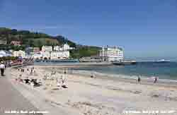 High 1034 mb was over Wick, Scotland and pressure here was steady a little lower on 1030 mb. A mostly sunny day with cirrus and patchy moderately high clouds at times. A light NE'ly breeze was enhanced during the afternoon by a sea breeze dying away again during the evening. Maxima today 18.7C at Gorwel Heights, 19.3C here and 22.9C in Porthmadog. Noctilucent clouds were seen after midnight on the 5th.
A sunny morning with a thin covering of cirrus clouds with contrails. Sunny all day with smoke haze increasing; a maximum of 17.5C at noon with a sea breeze in the afternoon. Almost cloud-free on the 6th with some altostratus in the far west. Scattered clouds developed in the afternoon. At Llandudno in the morning (right) there was a cool NE'ly breeze off the sea, but holiday makers were determined to have a good day on the beach. Llandudno usually is warmer when winds are westerly; the place to be today was in the Conwy Valley at Bodnant being sheltered from the breeze was warm and sunny. Llansadwrn 19.1C, Capel Curig 20.2C, Gorwel Heights 20.3C, Gogerddan 21.8 °C, Solent 25.0 °C High 1034 mb was over Wick, Scotland and pressure here was steady a little lower on 1030 mb. A mostly sunny day with cirrus and patchy moderately high clouds at times. A light NE'ly breeze was enhanced during the afternoon by a sea breeze dying away again during the evening. Maxima today 18.7C at Gorwel Heights, 19.3C here and 22.9C in Porthmadog. Noctilucent clouds were seen after midnight on the 5th.
A sunny morning with a thin covering of cirrus clouds with contrails. Sunny all day with smoke haze increasing; a maximum of 17.5C at noon with a sea breeze in the afternoon. Almost cloud-free on the 6th with some altostratus in the far west. Scattered clouds developed in the afternoon. At Llandudno in the morning (right) there was a cool NE'ly breeze off the sea, but holiday makers were determined to have a good day on the beach. Llandudno usually is warmer when winds are westerly; the place to be today was in the Conwy Valley at Bodnant being sheltered from the breeze was warm and sunny. Llansadwrn 19.1C, Capel Curig 20.2C, Gorwel Heights 20.3C, Gogerddan 21.8 °C, Solent 25.0 °C
The 7th was another warm and sunny day. Pressure was steady on 1025 mb and at 09 GMT the temperature was 16.9C and was to rise to 20.2C and 20.9C at Gorwel Heights while Valley sheltered from the NE'ly breeze reached 22.2C and 24.7C in Porthmadog. Llanbedrgoch potatoes have been on sale now for 2 weeks and today 2 kg were selling for £5 competitively priced compared with Jersey Royals in the supermarkets; my earlies are not yet ready on the garden plot. With high 1028 mb settled over northern Britain (here 1023 mb) the 8th again started fine with not a cloud in the sky at 09 GMT. There was a rare 'continental' feel to the air this morning at 18.7C and 64% relative humidity. Rising today to 20.8C here and 22.3C at Valley. Similar on the 9th, sunny with few cloud; 19.8C here, 20.4C at Gorwel Heights and 22.2C in Porthmadog. It was too good to last, on the 10th cloud had encroached and it was dull with a light SW'ly breeze, but dry. Visibility was moderate with smoke haze. Pressure was 1014 mb in an elongated ridge of high pressure (1018 mb). The jetstream was poised to the SW with a frontal wave 1002 mb SW Ireland. The wind backed NE'ly during the afternoon and there was a bright spell with a little weak sunshine around 1500 GMT. It was 23.4C at Achnagart in Aberdeenshire today, 16.3C here and 17.6C at Gorwel Heights after 4 days with 20C, or more.
On the 11th the weather had deteriorated; it was dull and breezy with 'spits and spots' of rain all day (2.2 mm). Similar on the 12th, windy light to moderate rain at times with a brief brighter spell and glimpse of sunshine in the afternoon before more moderate by evening. More volume today 13.7 mm recorded over 14 h duration; Gorwel Heights [2.6 mm], Isle of Man [11.8 mm], Capel Curig [19.8 mm]. On the 13th there was fog between 05 and 06 GMT and at 0900 GMT in drizzle visibility was poor. Rain turning moderate to heavy during the morning beginning to ease by noon with a drier and brighter afternoon and evening. Another 12.2 mm recorded over just 6 h duration; Gorwel Heights [9.6 mm], Capel Curig [13.6 mm] . Not much better on the 14th, overcast slight rain (1.9 mm) and poor visibility, while the 15th began bright and breezy, the SW'ly a noisy force 5 making larger tree branches sway, and was a mostly sunny cooler day (maximum 14.7C here 17.1C at Gorwel Heights) with slight showers of rain during the evening.
Despite the more 'normal' warmer sunny days at the beginning the mean temperature for the first 15-d was 9.4C (-1.3) & [-0.6] of averages. The mean maximum 17.3C (-0.8) & [-0.5] of averages with the highest maximum 20.8C on the (-3.7) based on the last 10-y average. Soil temperature at 30 cm 14.8C was (-1.4). Rainfall 32.3 mm is close to average for 15-d (44%) & [48%] but the annual total 336.0 mm is running 113 mm below the long-term average and 179 mm below that of 1945, the driest year in Llansadwrn since before 1928. Sunshine at Valley was 127h 74% of the 30-y monthly average so far.
The 16th and 17th continued similar, not a lot of rain, but mostly cloudy and maxima 17.7C and 17.4C respectively. The 18th began fine and sunny with a cool NE'ly breeze, but the temperature rose to 20.4C by noon (21.2C at Gorwel Heights in Llanfairfechan). Visibility was good but hazy, a dry day. The 19th was again overcast and calm at first brightening with some sunshine later (maximum 17.7C, 16.3C at Gorwel Heights) and kept dry.

 It was a fine sunny morning on the 25th and a few fair-weather cumulus clouds to be seen across the Menai Strait at Beaumaris. There was a light SW'ly breeze, but enough to stretch out the flag on the lifeboat station. Castle Street was quiet shoppers and holidaymakers yet to arrive, look here for a view of the castle walls and moat
. At 0900 GMT pressure 1029 mb was rising and there was a temperature of 14.9C (dewpoint 11.5C) and a relative humidity of 80%. A sunny, but breezy day, the maximum temperature 17.7C just after noon and 19.2C at Gorwel Heights in Llanfairfechan At Kew Gardens the maximum was 21.3C
It was a fine sunny morning on the 25th and a few fair-weather cumulus clouds to be seen across the Menai Strait at Beaumaris. There was a light SW'ly breeze, but enough to stretch out the flag on the lifeboat station. Castle Street was quiet shoppers and holidaymakers yet to arrive, look here for a view of the castle walls and moat
. At 0900 GMT pressure 1029 mb was rising and there was a temperature of 14.9C (dewpoint 11.5C) and a relative humidity of 80%. A sunny, but breezy day, the maximum temperature 17.7C just after noon and 19.2C at Gorwel Heights in Llanfairfechan At Kew Gardens the maximum was 21.3C
The 26th began very murkily with fine drizzle around dawn then lifting by 0830 GMT. There was a light SW'ly breeze and by 0900 GMT was NE'ly and the sky had begun to slowly clear with moderate visibility.
 Weak sunshine with stratocumulus and diminishing cumulus clouds gave way to clear sunny spells then clear sunshine later in the afternoon and the temperature rose to 16.7C (16.6C at Gorwel Heights). There were a lot of bumble bees on the flowers in the garden, rather fewer honeybees were seen and butterflies were absent. Convective clouds were dominant over England, clearer here, Heathrow had a maximum of 22.5C and Glasgow 14.6h of sunshine. At 2228 GMT there were a series of earth tremors in quick succession situated 56 km SW of here just on the NW tip of the Lleyn Peninsula; the British Geological Survey (BGS) gave the largest of Mag 2.4 and 2.8 at 8.0 km deep and EMSC a Mag 3.0 at 9.0 km deep for the largest tremor. Evident for around 30 secs of so rumblings were heard and slight vibrations felt here in Llansadwrn. The graphic left, courtesy of BGS, shows the locations where the quakes were felt in North Wales. This was the 3rd significant event this year following on from the Mag 2.3 on 2nd February and Mag 3.8 on 29th May. Hmm... Weak sunshine with stratocumulus and diminishing cumulus clouds gave way to clear sunny spells then clear sunshine later in the afternoon and the temperature rose to 16.7C (16.6C at Gorwel Heights). There were a lot of bumble bees on the flowers in the garden, rather fewer honeybees were seen and butterflies were absent. Convective clouds were dominant over England, clearer here, Heathrow had a maximum of 22.5C and Glasgow 14.6h of sunshine. At 2228 GMT there were a series of earth tremors in quick succession situated 56 km SW of here just on the NW tip of the Lleyn Peninsula; the British Geological Survey (BGS) gave the largest of Mag 2.4 and 2.8 at 8.0 km deep and EMSC a Mag 3.0 at 9.0 km deep for the largest tremor. Evident for around 30 secs of so rumblings were heard and slight vibrations felt here in Llansadwrn. The graphic left, courtesy of BGS, shows the locations where the quakes were felt in North Wales. This was the 3rd significant event this year following on from the Mag 2.3 on 2nd February and Mag 3.8 on 29th May. Hmm...
It was back to overcast sky and more rain on the 27th. Very dull under a thick uniform grey stratiform cloud layer the rain continued at times most of the sunless day and there was fog for about an hour from 1700 GMT. Maximum 13.7C and rainfall 7.6 mm; summer continuing in the southern Britain with Cardiff having 20.8C and Solent 21.6C. A rerun on the 28th; overcast uniform grey thick cloud no precipitation at first, but setting in during the morning becoming moderately heavy for a spell around 1300 GMT when breezy before the SW'ly backed NE'ly as the rain petered out. Sunless day with 2.3 mm rainfall. On the 29th ravens were croaking on their favourite tall pine tree and there were some breaks in the cloud with one or two sunny spells developing by afternoon. A dry day. The 30th was a blustery day with a moderate S'ly wind. Pressure 1021 mb was falling slowly at 09 GMT; the temperature 14.7C (dewpoint 12.5C) and visibility was good. Dry at first with some dampness on the wind, little temperature variation and eventually slight rain as a weak cold front passed over around 1830 GMT. The wind had reached force 6 before quickly moderating.
June ended with a total of 58.3 mm rainfall (79%) & [86%] of averages. The mean temperature 13.5C (-0.9) & [-0.4] was highest since 2011 and ranked 33 since 1942. It was sunniest at Valley since 2010 and the 10th sunniest June on the Anglesey record since 1930.
July 1 - and not a lot of change to the unsettled weather pattern. Pressure 1012 mb was steady with low 989 mb was N of Scotland and we were in a moist westerly airflow under stratiform cloud. Complex lows S of Greenland were tracking briskly eastward. Drizzle and a shower of rain just before 09 GMT with poor visibility. Some more slight showers with bright spells later and a clearing sky towards evening. On the 2nd pressure 1007 mb was falling slowly with the next low 989 mb W of Scotland with a frontal wave near Cork, Ireland. The morning starting overcast and dry the S'ly breeze picked up to moderate to fresh with showery rain arriving between 13000 & 1400 GMT, at 1630 GMT and from 2130 to midnight. A heavier burst at 2140 GMT fell at a rate up to 16 mm /hour. Total rainfall was 11.9 mm. The day's maximum of 14.6C was lowest of the month; the 18.2C at Gorwel Heights was also lowest of the month. The 3rd was overcast and dull well into the afternoon, but began to clear from the W around 15 GMT reaching within the hour to give a sunny end to the day.

 On a visit to Aberffraw Dunes on the 3rd the willow slack flooded with water earlier in the year had dried and looking very green with new growth (left). On the fixed dunes where the effect of winter grazing by Murray Grey cattle (see diary 19 February) is beginning to be noticeable there was a fine display of pyramidal orchids (above). On the dune slacks other orchids delayed by low spring temperatures were beginning to appear. The early marsh orchid (right), about 6 weeks later than usual, and massed marsh helleborines were just beginning to flower and here in close-up together with an early marsh orchid . Here is a close-up of the flowers of the marsh helleborine . Growing nearby was an orchid that had many of the characteristics of the Welsh marsh orchid described by R H Roberts in 1961, now very scarce . On the beach there were many stranded 'moon' jellyfish with more in the water. This 11 cm diameter example showing the characteristic 4 horseshoe shaped purplish coloured gonads . There were a few larger ones up to 30 cm diameter probably 'compass' jellyfish in poor condition. It is unusual to see so many jellyfish on the beach this early in the year possibly due to warmer waters in the south, but their numbers may fluctuate in natural cycles
With another low 986 mb S of Iceland on the 4th an associated cold front brought a short burst of heavy rain and 29 mph wind at 0700 GMT. At 0900 GMT fine rain and drizzle was easing and we were in low stratiform cloud with very poor visibility. With the SW'ly wind moderating by noon the sky was brightening and brought a sunny afternoon. The first sweetpeas are appearing and there were small bumblebees around the garden hopefully visiting the broad beans on the vegetable plot that are a mass of flower. The temperature rose to 19.6C at 1512 GMT, but in Llanfairfechan the maximum was 21.3C at 1534 GMT. Some patchy cloud encroached later in the afternoon becoming mostly cloudy in the evening.
Cloudy began to clear after dawn on the 5th with pressure 1029 mb rising at 0900 GMT. The temperature was 16.2C with a light SW'ly breeze, good, but very hazy visibility. Pressure was high 1030 mb centred off the Scilly Isles and low 982 mb SE Iceland with a warm front over central Scotland. A sunny day with valley reporting 12.1h sunshine and solar radiation here 24.04 MJ m -2. On the 6th high pressure 1031 mb covered most of southern Britain and here was steady on 1029 mb. A patch of broken cloud affected west Wales in the morning that was mostly sunny here. In Llanfairfechan the temperature rose to 21.6C while Heathrow had one of the highest 28.1C. The hot sunny weather continued in most inland parts on the 7th while Scotland and western and eastern coastal fringes kept cooler; Cardiff had 28.3C and Hurn 29.7C with 22.3C at Valley, Hawarden had 15.1h sunshine and Wattisham saw 15.2h. Much of the same on the 8th with North Wales and Ireland (unusually) seeing more of the higher temperatures and lower on the E coast of England with some cloud drifting in off the North Sea in the morning burning away by afternoon. Gorwel Heights in Llanfairfechan had a maximum temperature of 25.5C, Cardiff 27.9C, Shannon 28.4C and Solent 29.6C. The 9th began warm with hazy sunshine again with high pressure 1033/ 1034 mb stable over southern Britain and Ireland with temperatures exceeding 28C in many places, highest 29.6C in the Solent and 28.4C in Shannon. Highest here and Llanfairfechan was 25.5C with 27.9C in Cardiff.
The 19th had the highest maxima and minima of the month 26.9C and 16.6C in Llansadwrn and 27.6C and 18.3C at Gorwel Heights in Llanfairfechan.
|
 High temperatures continued to be mostly in southern Britain and were 28C, or more, somewhere, on 19 consecutive days between the 6 -24th (only missing out by 0.4C on the 25th) and 30C for 7 days 13 - 19th. The highest reported by the Met Office was on the 22nd when 33.5C was recorded at both Heathrow and Northolt. Highest temperatures here were on the 19th; 29.3C at Valley; 27.6C at Gorwel Heights in Llanfairfechan and 26.9C in Llansadwrn. High temperatures continued to be mostly in southern Britain and were 28C, or more, somewhere, on 19 consecutive days between the 6 -24th (only missing out by 0.4C on the 25th) and 30C for 7 days 13 - 19th. The highest reported by the Met Office was on the 22nd when 33.5C was recorded at both Heathrow and Northolt. Highest temperatures here were on the 19th; 29.3C at Valley; 27.6C at Gorwel Heights in Llanfairfechan and 26.9C in Llansadwrn.
|
The 21st was the 18th day without measurable rain and would have qualified as an absolute drought. The terminology introduced by G. J. Symons in 1887 is no longer used officially, it required a minimum of 15 days none of which was credited with 0.2 mm, or more. Today many other definitions are used in different environmental contexts. The drought was broken on the 22nd with just 0.2 mm of rainfall recorded. It was a cloudy warm and humid day.  The temperature at 0900 GMT was 23.0C (dewpoint 19.0C, 78% RH) rising to 25.4C. There was a shower of rain also at 1245 GMT on the 23rd; this produced 0.4 mm. It had been a cloudy cooler morning, 17.8C at 0900 GMT (dewpoint 17.4C, RH 97%) and the day's maximum 21.3C on a rather dull day. The 24th began brighter, but showery with some hazy sunshine and a light S'ly breeze. Pressure here was 1012 mb with a shallow low W of Ireland 1002 mb and associated fronts moving towards the Irish Sea. There was a slight shower of rain during the afternoon and with a warm front arriving during the evening rain from 2300 GMT produced 8.7 mm by morning. After a heavy shower before 09 GMT on the 25th it was a mostly sunny, but breezy (S'ly) morning, and sunny afternoon with some clouds in the vicinity, maximum 21.1C. At Gorwel Heights in Llanfairfechan a stack of clouds (pile of plates) developed in the afternoon in the lee of Garreg Fawr (photo above left) remaining stable for over an hour. The photo is looking towards SE in the general direction of the force 3 - 5 breeze; the temperature was 22.0C (dewpoint 13.2C, 58% RH). The stacks are unusual for the number of elements that can be seen usually being smoother in outline. On the 26th there were well developed cumulus clouds at first these reducing by 0900 GMT when, with 5 oktas, cover was variable. The day was mostly cloudy and bright with some spells of mainly weak sunshine and a maximum 21.9C. Gravesend with 27.9C and Cardiff 24.8C continued rather warm. Morecambe was sunniest 13.5h while Drumalbin in Lanarkshire had {21.8 mm} rainfall.. The temperature at 0900 GMT was 23.0C (dewpoint 19.0C, 78% RH) rising to 25.4C. There was a shower of rain also at 1245 GMT on the 23rd; this produced 0.4 mm. It had been a cloudy cooler morning, 17.8C at 0900 GMT (dewpoint 17.4C, RH 97%) and the day's maximum 21.3C on a rather dull day. The 24th began brighter, but showery with some hazy sunshine and a light S'ly breeze. Pressure here was 1012 mb with a shallow low W of Ireland 1002 mb and associated fronts moving towards the Irish Sea. There was a slight shower of rain during the afternoon and with a warm front arriving during the evening rain from 2300 GMT produced 8.7 mm by morning. After a heavy shower before 09 GMT on the 25th it was a mostly sunny, but breezy (S'ly) morning, and sunny afternoon with some clouds in the vicinity, maximum 21.1C. At Gorwel Heights in Llanfairfechan a stack of clouds (pile of plates) developed in the afternoon in the lee of Garreg Fawr (photo above left) remaining stable for over an hour. The photo is looking towards SE in the general direction of the force 3 - 5 breeze; the temperature was 22.0C (dewpoint 13.2C, 58% RH). The stacks are unusual for the number of elements that can be seen usually being smoother in outline. On the 26th there were well developed cumulus clouds at first these reducing by 0900 GMT when, with 5 oktas, cover was variable. The day was mostly cloudy and bright with some spells of mainly weak sunshine and a maximum 21.9C. Gravesend with 27.9C and Cardiff 24.8C continued rather warm. Morecambe was sunniest 13.5h while Drumalbin in Lanarkshire had {21.8 mm} rainfall..

 On a visit to Aberffraw Dunes on the 26th vegetation on the fixed dunes had become dry during the spell of warm weather. In places grasses were flowering and were dominant (left) where previously the large population of rabbits kept the sward well trimmed. While the fixed dunes were dry the vegetation in the dune slacks were moist and looked very green (above panorama). In places the dwarf willow had grown a lot responding to winter moisture and summer warmth; it was also filling deep old vehicle tracks. The very rare native dune helleborine (Epipactis dunensis) was flowering
( close up right). Plants were recorded here on 17th July 2006 and every year subsequently; this time more than 15 plants were seen at 2 known locations. The plant also occurs, untypically under pine trees in Newborough Forest. There were fresh plants of the marsh helleborine and a few late pyramidal orchids still flowering. On a sand hummock in a dune slack round-leaved wintergreen was just starting to come into flower and here in close up . A single painted lady butterfly was seen .
On a visit to Aberffraw Dunes on the 26th vegetation on the fixed dunes had become dry during the spell of warm weather. In places grasses were flowering and were dominant (left) where previously the large population of rabbits kept the sward well trimmed. While the fixed dunes were dry the vegetation in the dune slacks were moist and looked very green (above panorama). In places the dwarf willow had grown a lot responding to winter moisture and summer warmth; it was also filling deep old vehicle tracks. The very rare native dune helleborine (Epipactis dunensis) was flowering
( close up right). Plants were recorded here on 17th July 2006 and every year subsequently; this time more than 15 plants were seen at 2 known locations. The plant also occurs, untypically under pine trees in Newborough Forest. There were fresh plants of the marsh helleborine and a few late pyramidal orchids still flowering. On a sand hummock in a dune slack round-leaved wintergreen was just starting to come into flower and here in close up . A single painted lady butterfly was seen .
On the 27th with a moderate overnight dewfall and wet grass the day began bright with 6 oktas of cumuli and cirrus, good but hazy visibility. Pressure 1008 mb was falling slowly as storms developed over northern France in the afternoon. Keeping cool here with a maximum of 20.8C, but 28.9C at Heathrow and Hawarden 25.6C and 23.6C at Gorwel Heights where there were heavy shower at 1948 GMT (41 mm/h) and 2220 GMT (52 mm/h) [18.8 mm]. Here some slight showers in the evening and night [4.8 mm]. Leek Thorncliffe, Staffordshire {49.8 mm}.
 Continuing with another showery day with spells of hazy sunshine on the 28th slight in the afternoon heavier in the evening (142 mm/h at 1907 GMT) and before midnight [13.5 mm] and [12.2 mm] in Llanfairfechan, [20.6 mm] in Capel Curig. Porthmadog reported {23.0 mm} and it was wet in Carlisle {83.8 mm} and still warm in the SE with 26.1C at Norwich. A drier day on the 29th after a few early spots of rain sunny spells becoming mostly sunny in the afternoon. The 30th began unpromisingly with scattered clouds and showers over the Snowdonia Mountains. A breezy day, but warm in the sunshine as cloud burnt off during the afternoon, especially in the west of Anglesey, leaving a line of cumuli over the mountains. Maxima 20.9C here and 22.1C in Llanfairfechan. Continuing with another showery day with spells of hazy sunshine on the 28th slight in the afternoon heavier in the evening (142 mm/h at 1907 GMT) and before midnight [13.5 mm] and [12.2 mm] in Llanfairfechan, [20.6 mm] in Capel Curig. Porthmadog reported {23.0 mm} and it was wet in Carlisle {83.8 mm} and still warm in the SE with 26.1C at Norwich. A drier day on the 29th after a few early spots of rain sunny spells becoming mostly sunny in the afternoon. The 30th began unpromisingly with scattered clouds and showers over the Snowdonia Mountains. A breezy day, but warm in the sunshine as cloud burnt off during the afternoon, especially in the west of Anglesey, leaving a line of cumuli over the mountains. Maxima 20.9C here and 22.1C in Llanfairfechan.
On the 30th a visit was made of Newborough Forest and the sand dune system bordering Malltraeth Bay. After the dry weather there was not a lot of water in the pool that has been filling with iris and other plants in recent years. The main dune slack, that had been left unforested, has been invaded with naturally seeded pine trees from the forest and this had led to further habitat degradation of what was a prime botanical site. This is very disappointing as the seedlings could have been removed. The amount of tree growth can be seen here and on an area of dune that was clear felled in recent years ; natural regeneration has taken place here since. Of interest on the slack were several plants of the very rare dune helleborine
not previously seen here, and nearby a single plant of an orchid displaying many of the characteristics of the Welsh marsh orchid first identified by R. H. Roberts. This orchid now appears to be absent from the coastal marsh near the Cefni estuary, due to recent tree planting schemes, but plants having many of the characteristic of that described by Roberts have been seen at Aberffraw (Diary 3rd July 2013). There were many marsh helleborines and several common spotted orchids. This common spotted variety was white, with faint flecks of purple and had unspotted leaves.
A developing frontal-wave low SW Ireland with a warm front over mid Wales brought overcast skies and moderate rain at 08 GMT on the 31st. Rain eased and it was brighter by 11 GMT for a while, but a band of heavy rain was over Cardigan Bay at noon and this moved over Snowdonia in the afternoon. There was light to moderate rain here in the afternoon blowing across the fields on a moderate to fresh SW'ly wind [16.8 mm was largest of the month]; Gorwell [12.8 mm], but Capel Curig [43.6 mm].
July ended with a mean temperature of 17.7C [(+1.9)], highest since 2006 and the third warmest July on record here since 1941. Even with the 16.8 mm on the last day rainfall 59.6 mm was below average (64%) & [85%]. The 421.6 mm rainfall since January remains below the total 459.2 mm reached in July 1945 and well below the long-term average 527.1 mm. It was a remarkably sunny month at Valley (311.4 h), the sunniest month of any on record (K&Z adjusted) since 1931..
 August 1 - and a dull and damp morning after the overnight rain with 16.8 mm collected in the raingauge at 0900 GMT, the most since the 32.1 mm on 13th February. It has been an unusually dry year so far and the rain was welcome in the garden. Birds have been struggling in many parts to find food and water; here they fare better than some places the blackbirds being able to turn over leaf debris in the wood and thrushes hunt for snails along the damp moss covered stone walls. Water is always provided and is in great demand. There has been competition between the blackbirds and me as to harvesting the blackcurrant crop. There are plenty; having got enough in stock I will leave some to ripen further for the blackbirds! The cereal crops in adjacent fields are ripening and attracting flocks of pigeons. The 'cannons' have started, they do not fire at night (usually), to keep the birds away. A low 999 mb was anchored to the NW and the jetstream positioned over Britain; an warm front was slow-moving over Ireland and NW Scotland and we were on the cloudy fringe. Overnight the temperature did not fall below 16.5C and rose to 22.3C during the day, but I did not see any bright sunshine. In the hot and sunny SE the temperature at Heathrow rose to 34.2C, the highest reported this year, so far. Sunny Cardiff had a temperature of 28.7C; it was wet in Scotland with {23.8 mm} falling at Eskdalemuir.
On the 2nd a bright morning with showers in the vicinity. There were a few spots in Beaumaris around 0900 GMT. Here 18.7C (dewpoint 15.7C) and pressure 1003 mb rising slowly; low 987 mb was stationed off the Western Isles with strong winds in its showery circulation. A fine but very windy day; the SW'ly (f6 at times) very gusty in the afternoon swaying the large branches of trees in full leaf at this time of year. A maximum of 20.9C was reached just after noon, 23.2C at Gorwel Heights was highest of the month, and the day kept dry. Valley reported 13.3h of sunshine just exceeded at Boulmer 13.7h. Jellyfish continue to cause problems on Anglesey beaches; 4 people were stung on Lligwy Beach; Coastguards gave first aid and advise people not to go in the sea. Another bright and breezy morning on the 3rd with pressure 1011 mb rising rapidly. Low 986 mb was tracking N near Rockall; the wind was SW'ly f5 and there were fair weather cumulus clouds overhead with some towering cumuli over the Snowdonia Mountains. The wind gusty again in the mostly sunny afternoon with 'beefy' cumuli to the S edging closer at times dispersing before evening; cooler with a maximum of 19.4C. Valley topped the sunshine league again with 12.3h while Norwich AP had the highest temperature 25.4C.  Moderate showery rain after midnight and slight showers before 0900 GMT on the 4th [2.1 mm] set the scene for the day. Pressure was steady on 1015 mb, but a developing frontal-wave low was over the Bristol Channel and brought heavy rain first to S Wales especially over the Brecon Beacons and Black Mountains [Mumbles Head 46.0 mm] and later Snowdonia as it tracked towards Anglesey. During the afternoon there were intense pockets of rainfall over S Snowdonia and rain was heavy here at 1350 GMT falling at a rate up to 30 mm/h. It was not as windy today except in showers when in poor visibility rain was driving across the fields on a moderate SW'ly breeze; rain had eased to drizzle by 1930 GMT. At midnight on the 5th pressure 1011 mb was falling slowly with the low moving over Cardigan Bay. Very heavy rain started at 0030 GMT reaching a peak rate of 121 mm/h at 0120 GMT reducing to heavy rain at 0300 GMT continuing to 0500 GMT then intermittently heavy, or very heavy 28 mm/h at 0710 GMT, only easing just before 0900 GMT. Rainfall 09-09 GMT, an extreme rainfall event, was 89.2 mm the largest 24-h fall (over 16 hours) recorded in August at this station (established 1979), beating the 41.0 mm on 14 August 2007, and exceeding the previous record 86.0 mm on 22 October 2004. (The highest 24-h rainfall event in Llansadwrn was the 137 mm recorded in a 3-h fall during a thunderstorm on 10 August 1957). Rain died out during the morning and the began clearing in the afternoon to give a sunny end to the day. Remarkably there was little in the way of standing water at the weather station where soil is free-draining. There was water on the A5025 at Henffordd (flood signs were out) and water ingress affected a property in Pentraeth leaving several inches of water. Water up to a foot deep was reported on parts of the A55 and that the fire service attended flooding in Menai Bridge and Caernarfon; the River Conwy bursts its banks at Llanwrst. Worst affected were the valleys in S Wales in the Rhondda and Bridgend areas and Port Talbot, and W Cornwall where flooding of roads and property was extensive including Newquay Community Hospital, and in Crantock and Perranporth.
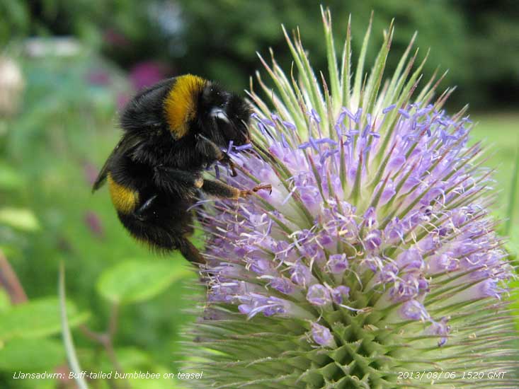 A better day on the 6th brightening up from 08 GMT and with moderately high cloud and a few cumuli the day was mostly sunny. Cool overnight with heavy dew the air minimum down to 9.1C and 5.0C on the grass lowest since 27th June. Visibility was very good and clear so that the Lleyn Peninsula could be seen. The rain had gone some way to restore the water balance of the soil. A better day on the 6th brightening up from 08 GMT and with moderately high cloud and a few cumuli the day was mostly sunny. Cool overnight with heavy dew the air minimum down to 9.1C and 5.0C on the grass lowest since 27th June. Visibility was very good and clear so that the Lleyn Peninsula could be seen. The rain had gone some way to restore the water balance of the soil. 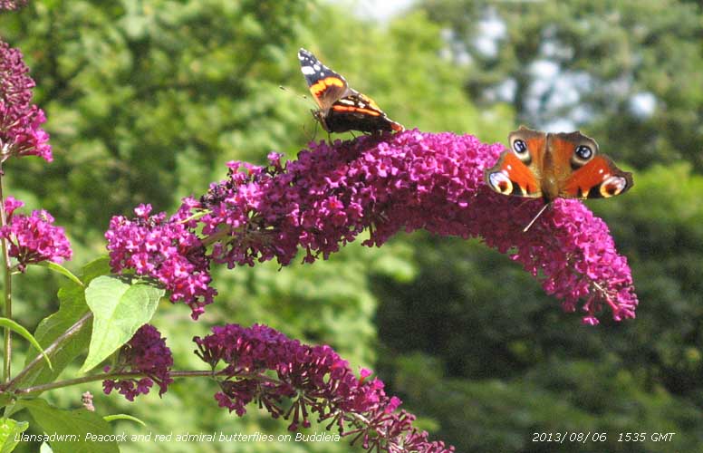 With the buddleia and large areas of marjoram on the rockery banks in flower the garden seemed full of bumble bees; several species including at least 50 buff-tailed on marjoram on the rockery banks and teasels. A few tree bumblebees a species that arrived in Britain in 2001 and have been spreading north have been spotted in the garden. The latter was favouring flowers on the Fuchsia magellanica (the hedge fuchsia) and tall tree heathers. Butterflies, that have been few and far between, turned up in good numbers. At least 4 peacocks and 6 red admirals were counted on the buddleia. One comma, a blue and wall brown were also spotted. A dry day with a maximum of 18.9C; Kew Gardens 23.8C. The 7th was also dry and although cloudy at times, with dark clouds to the S and SE of the mountains, Anglesey remained in the clear and Valley again headed the sunshine list with 14.2h. Maximum here today 20.6C and again plenty of bees and butterflies were seen. A bright morning with good visibility on the 8th after heavy dew and a grass minimum of 8.5C. Soon turning duller with thicker cloud encroaching from the west, but there was no rain. Some bright sunny spells in the afternoon, maximum 20.4C here, 21.8C at Gorwel Heights with Charlwood 25.5C, then as cloud thickened in the evening a shower of rain at 2030 GMT then light to moderate rain fell on an occluded front until 0100 GMT on the 9th. Overcast at first with a strengthening SW'ly breeze the frontal cloud clearing to the E coast and N Sea it was a bright morning, some weak sunshine with high cloud and good visibility; cumulus clouds persisted over the Snowdonia Mountains. A mostly sunny day, dry day with scattered clouds in Chester le Street, County Durham, for the start of the England-Australia Ashes Test Match. This photo is of Australia's Chris Rogers, on 41 facing Graeme Swann, England went on to beat Australia on the fourth day despite some heavy showers of rain. Cooler with a maximum of 18.0C in Llansadwrn; 19/20C in Chester Le Street and East Malling 25.0C. With the buddleia and large areas of marjoram on the rockery banks in flower the garden seemed full of bumble bees; several species including at least 50 buff-tailed on marjoram on the rockery banks and teasels. A few tree bumblebees a species that arrived in Britain in 2001 and have been spreading north have been spotted in the garden. The latter was favouring flowers on the Fuchsia magellanica (the hedge fuchsia) and tall tree heathers. Butterflies, that have been few and far between, turned up in good numbers. At least 4 peacocks and 6 red admirals were counted on the buddleia. One comma, a blue and wall brown were also spotted. A dry day with a maximum of 18.9C; Kew Gardens 23.8C. The 7th was also dry and although cloudy at times, with dark clouds to the S and SE of the mountains, Anglesey remained in the clear and Valley again headed the sunshine list with 14.2h. Maximum here today 20.6C and again plenty of bees and butterflies were seen. A bright morning with good visibility on the 8th after heavy dew and a grass minimum of 8.5C. Soon turning duller with thicker cloud encroaching from the west, but there was no rain. Some bright sunny spells in the afternoon, maximum 20.4C here, 21.8C at Gorwel Heights with Charlwood 25.5C, then as cloud thickened in the evening a shower of rain at 2030 GMT then light to moderate rain fell on an occluded front until 0100 GMT on the 9th. Overcast at first with a strengthening SW'ly breeze the frontal cloud clearing to the E coast and N Sea it was a bright morning, some weak sunshine with high cloud and good visibility; cumulus clouds persisted over the Snowdonia Mountains. A mostly sunny day, dry day with scattered clouds in Chester le Street, County Durham, for the start of the England-Australia Ashes Test Match. This photo is of Australia's Chris Rogers, on 41 facing Graeme Swann, England went on to beat Australia on the fourth day despite some heavy showers of rain. Cooler with a maximum of 18.0C in Llansadwrn; 19/20C in Chester Le Street and East Malling 25.0C.
Another breezy day on the 10th the SW'ly f5/6 becoming bright with sunny spells and clear sky for a while from noon; breezy f5/6. There was a slight shower of rain around 2200 GMT. Keeping cool in the north-west, maximum here 18.7C while 23.0C at Heathrow. Wettest at Trawsgoed {5.0 mm}, sunniest at St Athan 8.1h; Valley 1.6h The breeze was picking up again at 09 GMT on the 11th. Bright, sometimes sunny, with a light shower of rain at 1100 GMT clearing sky later although cumulus clouds once again persisted over Snowdonia.  Cooler with a maximum of 17.8C, but 24.8C in Shoeburyness; Cluanie Inn {25.4 mm}; St Athan 11.6h sunshine. On the 12th pressure 1017 mb was rising slowly, but the morning began overcast and very dull. By 1015 GMT it was brighter with a little sunshine breaking through. Despite a few spots of rain around 1430 GMT the afternoon was bright with sunny spells the temperature rising to 18.8C. The garden flowers, buddleia and marjoram, are still attracting numerous bees and butterflies. Joining them today was the first painted lady seen in the garden this year. There was a moderate shower of rain at 1800 GMT. It was a damp and dull morning for the start of the 2-day Anglesey Show on the 13th with ragged low cloud. The Show is held near RAF Mona that recorded {4.0 mm}, the most in Britain, but the cloud began to left during the morning with some sunny spells coming along and it was a fine afternoon. The Show is held annually near RAF Môna that recorded {4.0 mm}, the most in Britain; a minimum of 11.0C rising to 17.4C in the afternoon. The 2nd day also began unpromisingly with dull overcast skies most of the day before clearing in the evening. Attendance was greater perhaps because not only was the weather unsuitable to go to Anglesey's fine beaches but, Prince William (coming to the end of his tour of duty as a Rescue Helicopter Pilot at RAF Valley) was visiting and might have made a difference. After an overnight minimum of 11.5C at Môna the temperature rose to 18.7C with drizzle or slight rain at times [1.4 mm]. Heaviest rainfall in Wales was at Mumbles Head {14.0 mm} the result of a warm front, and triple-point in Cardigan Bay. Thick fog between 05 and 08 GMT on the 15th then the sky partially cleared just before 0900 GMT, but there were cumulus clouds in the vicinity and over the mountains. Pressure was 1015 mb with lows 999 mb slow-moving Finland, and 988 mb Denmark Strait. There was a large high-pressure area 1025 mb over the Azores and Mediterranean. We were in a breezy warm humid airflow (16.8C dewpoint 16.5C, RH 98%) the SW'ly force 5/6. After the brief clear-slot spell there was mist and rain blowing across the island most of the day with fog returning before midnight. Fine and sunny weather persisted away from the north-west with 26.1C at Norwich AP and 23.6C at Hawarden Wet in North Wales [16.0 mm] here; Capel Curig [37.6 mm]; and Aldergrove {45.6 mm}. The 16th began fine and mostly sunny with a clearing sky, good visibility and pressure 1014 mb rising slowly. Grass was wet after yesterday's rain, fog and recent dew the temperature down to 9.6C on the grass. A dry day the temperature rising to a pleasant 19.3C with little wind. Plenty of flowering plants in the garden were attracting butterflies and bees. Wet in mid Wales with locally heavy rain {Trawsgoed 47.0 mm}, flooding in Corris and a landslide on the A487 near Esgaergeiliog, Gwynedd, closing the road. There were flood warnings in operation for the Dyfi (some flooding of agricultural land near Machynlleth) and Rheidiol rivers and alerts on the Vyrnwy and Teifi. Continuing warm in the SE Brize Norton 24.8C and Usk 24.7C with Rhyl 20.9C.
The first 16-days had a mean temperature of 16.0C [(0.4)] a little above averages. The highest 22.3C on the 1st, however, was running (-2.0). Due largely to the 89.2 mm on the 4th accumulated rainfall 121.1 mm, most sine 2004, was (146%) & [151%] of the August average. Sunshine at Valley 81h had been about average.
The 17th dawned overcast with ragged low cloud. Pressure 1006 mb was falling quickly with low 979 mb NW of Scotland. An occluded front over Ireland at 0900 GMT was moving eastward. Dull with spots of rain on the force 5/6 S'ly introduced a wet and windy day with moderate to heavy rain from 1030 GMT heaviest, 26 mm/h at 1043 GMT, and only stopping around 1430 GMT. The sky began to clear after 18 GMT with glimpses of sunshine and less wind. The wind was strong enough during the day to bring some apples off the Bardsey apple tree and to make the line of runner beans heel over. At Capel Curing rainfall was [25.0 mm] and at Shap Fell [31.4 mm]. The maximum temperature here was 16.9C while it reached 23.2C at Norwich AP. On the 18th pressure 1008 mb was rising with the low 980 mb over the Norwegian Sea N of Scotland. Mostly cloudy and with visibility only moderate, some bright spells with glimpses of sunshine and spots of rain morning and afternoon. Kew Gardens reported a maximum temperature of 25.7C here managing just 17.8C, but 5.5h sunshine at Valley. A dry day on the 19th with sunny spells and a maximum of 17.8C and again Kew Gardens was highest at 24.4C and Manston sunniest with 12.1h. In this garden I lifted the last of the Aran Pilot potatoes; with the soil on the dry side the job was easier than usual the potatoes not needing cleaning and drying before storage. Despite the cold spring and summer drought I was pleased with the crop. Again taking advantage of the dry day some logs were cut and the winter store of dry wood topped up. Pressure was steady on 1027 mb on the 20th and with scattered cumuli under cirrus clouds there some sunny spells especially in the afternoon. Visibility was moderate in haze with Saharan dust in the air. A little warmer today the temperature reaching 19.7C, but not as warm as Writtle with 25.5C. During the late evening the clouds cleared away and there was bright moonlight by 22 GMT. By the morning of the 21st the sky was overcast again with low stratiform cloud and poor visibility with mist and rain blowing across the fields on a light to moderate S'ly wind. Brighter in the afternoon with a few glimpses of sunshine. Maxima today Writtle in Essex 27.2; Gorwel Heights 22.7C enhanced lee-effect; and Llansadwrn 19.1C. The sky was clearer at midnight with moonshine through cirrus with halo.
On the 22nd a low 984 mb W of Ireland was tracking N while pressure here at 0900 GMT was steady of 1019 mb. The grass was wet with guttation dew and the air warm and humid 17.1C (dewpoint 16.1C). There were signs of the cloud breaking up, but clear sky was at a premium here. To the NE over Red Wharf Bay, Penmon and beyond to Liverpool Bay there was blue. In the few sunny spells breaking through the persistent Llansadwrn cloud (seen on the left of the photograph above and below left) it was pleasantly warm with light breezes. Sunnier too in Llanfairfechan and the foothills of the Carneddau Mountains that were in a lee-clearance. 
 Temperatures were reversed here today 19.2C at Gorwel Heights and 21.0C in Llansadwrn. Chivenor in N Devon was warmest with 26.5C and Stornoway sunniest with 13.5C with Valley reporting 8.4h. On the 23rd after early morning fog and some slight rain at 08 GMT a day with little in the way of sunshine. Keeping mostly cloudy there were spells of weak sunshine, glimpses of bright sunshine. A light shower of rain about noon, drizzle and slight rain at dusk and light to moderate rain later. Charlwood 28.6C. There was not a lot of change to begin the 24th. Ragged low cloud with misty views of the mountains at first. Soon brighter, with glimpses of sunshine, clearing sky evening and night. A dry day here, but it was the turn of the SE for rain. It was a washout at the Oval for the England - Australia test match, not a ball bowled with rain all day in the London area. Kenley [41.6 mm] and Shoeburyness [58.4 mm].
On the 25th there were small earthquakes in the Irish Sea 86 km NE of here off Blackpool at 0538 GMT Mag 2.4 and 0958 GMT Mag 3.2 that were felt in Lancashire and Cumbria, but not here. Pressure was 1018 mb with Atlantic-high 1025 mb SW of Ireland and low 1009 mb NE France and Italy. Overnight the air minimum went down to 9.2C (10.1C at Gorwel Heights lowest of the month). There was heavy dew with the grass minimum reading 5.4C. It was a sunny day with just a small cumulus cloud visible at 0900 GMT; a light SSW'ly breeze at first. Some convergent cloud developed overhead at times in the morning. In the afternoon with a NE'ly breeze off the sea the cloud disappeared, but it was increasingly hazy. Clear calm evening. A maximum of 18.5C at Gorwel Heights, 19.3C here; 22.5C in Porthmadog and 25.0C at Solent. Valley had 12.6h sunshine.
 One of those rare clear skies on the morning of the 26th with fog at 06 GMT soon clearing with hazy moderate visibility. A light S'ly breeze and again convergent cloud built up overhead (sea breeze front) for a while in the morning, but when a 10 mph sea breeze picked up at from the NE the cloud cleared to give a sunny afternoon the temperature rising to 21.6C. Lifted 2 rows of potatoes for winter storage, it was quite a good crop considering the cold spring and summer drought. Gorwel Heights 21.2C, Capel Curig 22.6C, Porthmadog 24.7C and Solent 26.6C. St Athan 12.2 h, Valley 8.9h sunshine.
In complete contrast to yesterday the 27th dawned dull and overcast. An occluded front was over the Irish Sea and the morning mostly cloudy. Brighter by afternoon, moderate visibility with Saharan dust haze, and a sunny end to the day and calm overnight. A dry day with a maximum of 19.2C. Usk 23.6C; Solent 26.1C and 11.4h of sunshine in Leconfield. A bright morning on the 28th, 3 oktas cloud cover with very good almost clear visibility the dust haze having moved away. The ravens, after being absent for a while, were back in the tallest pine tree surveying the scene.  In Bangor a sunny morning with cafe tables unusually out on the High Street continental-style, people taking advantage of the fine day. The new multi-million pound Performing Arts Centre for Bangor University and Theatr Gwynedd is now under construction. In the afternoon cut up more logs for the winter store, you can't have too many dry logs on hand. It was back to a very dull and damp morning on the 29th. The slight rain was hardly wetting the ground and soon it was brighter with a few sunny spells in the afternoon. Hawarden 22.5C, Heathrow 24.7C. On the 30th it was noticeable that the number of beech leaves falling from the trees had increased. It was breezy force 3/4 S'ly and dull at first, but soon we were in a clearer slot the occluded front over Wales starting to move away. Pressure remains high 1017 mb here with high 1030 mb S Greenland and low 1010 mb over Tunisia. A maximum of 18.7C here, but it rose to 23.1C in a Föhn-like wind at Gorwel Heights second highest of the month (0.1C down on the 2nd). Hawarden 23.3C and Cavendish 25.8C. Another earthquake in the Irish Sea off Blackpool on the 31st 0636 GMT Mag 2.6. Pressure 1027 mb was the highest of the month with Atlantic-high 1034 mb west of the Celtic Sea. Overnight minimum down to 7.8C and 3.0C on the grass, both lowest of the month. Cloudy to start the day with some sunny spells developing in the afternoon. There was a cool W'ly breeze and a maximum temperature of 17.8C. On the sunny rockery banks butterflies and bees were plentiful. Picked blackberries from wild areas of the garden. Cardiff 19.4C, St Athan 11.9h sunshine. Solent 23.0C, Hurn 11.9 h.
The month ended with a mean temperature of 15.8C [(+0.2)] lowest since 2011, but one of the 11 highest since 1979. Rainfall was 136.6 mm due largely to the 89.2 mm on the 4th the largest daily fall in any month at this station. Sunshine at Valley was 162.9h lowest since 2010.
September 1 - And a dull cooler beginning to the month; overcast with low cloud on the mountains in a light W'ly breeze. Pressure was high 1030 mb within the high 1034 mb over the Celtic Sea as a low 998 mb traversed the Norwegian Sea. A warm front was slow-moving lying to the north-west. At 09 GMT 13.6C (dewpoint 10.7C) and rising to just 14.7C at 1300 GMT in a brighter spell with a glimpse, behind cloud, of weak sunshine. Low 20's today were the best at Usk 20.8C and highest Heathrow 22.3C. Although cloudy in the high pressure there was little in the way of rain except in the north where {20.8 mm} fell in Lerwick. Similar on the 2nd, but the cloud thick enough for mist and fine drizzle resulting in poor visibility. Soon turning drier and by afternoon brighter with one or two sunny spells then the sky clearing by evening that was sunny.  Harvesting of the barley crop sown in the spring, in the field adjacent to the weather station, began in the afternoon. Cool with a maximum of 14.6C, but reached 21.7C at Gorwel Heights, 24.1C at Hawarden and a warm 26.2C at Heathrow. Wet in the north again; {24.4 mm} at Resallach. More gloom to begin the 3rd, and the cloud thick enough to produce light drizzle enough to dampen concrete and grass, but making no impression on the dry soil. Robins were singing. As has been the pattern these last days, brighter in the afternoon with sunny spells coming along and a clearing sky by evening. Starting at 16.6C at 09 GMT rising to 19.2C at 1340 GMT, but warmer at Gorwel Heights 22.9C in a SSE'ly Föhn-like wind, second highest of the month; 23.9C at Hawarden and 26.8C at Frittenden in Kent. A bright and fine morning on the 4th with very good, clear visibility enabling views as far as Bardsey Island. After a cool night, air minimum 10.7C, there was moderate dew on the grass, minimum 6.9C. Six oktas of moderately high thin cloud with weak sunshine. In Beaumaris there was a light breeze with slight ripple on the sea. Quieter now, after the busy holiday period, the town was beginning to return to the locals. A warm afternoon the temperature rising to 22.6C, highest of the month, one of only 2 days to reach 20C. It was also the brightest day of the month with global solar radiation 13.40 MJ m -2. Harvesting of the barley field was completed and the straw collected in the large bails that are used these days. Unseasonably very warm in southern Britain; 28.5C at Heathrow; Hawarden 25.4C and Rhyl 23.9C;21.3 Capel Curig and 21.1C at Gorwel Heights with introduction of NW'ly breeze in the afternoon. The warm weather continued on the 5th in the south; temperatures commonly 27C to 29C with the highest 30.0C at Manston that also had 12.5h sunshine. In contrast, heralding a large change in the weather, the north-west was having passage SE of a cold front associated with low 1000 mb N of Scotland. The wind light SW'ly at first soon N'ly (0900 GMT) and calm at 1800 GMT. Cloudy with mist and drizzle with slight rain in the morning with temperatures falling through the day: At Gorwel Heights the temperature at 0100 GMT was 15.6C and was 9.6C at 2240 GMT. Cooler, and wet and windy again on the 6th as the cold front moving eastward lay along the spine of England and, crossing the Channel to NE France and Belgium where there were early day thunderstorms. A thundery trough developed over the SW Approaches and tracking N over the Celtic Sea produced heavy rain in North Wales coastal areas later in the day; Llansadwrn [26.5 mm], highest of the month, Rhyl [41.0 mm]; [Mona 32.4 mm]; Gorwel Heights [10.6 mm], Capel Curig [11.4 mm]. Harvesting of the barley crop sown in the spring, in the field adjacent to the weather station, began in the afternoon. Cool with a maximum of 14.6C, but reached 21.7C at Gorwel Heights, 24.1C at Hawarden and a warm 26.2C at Heathrow. Wet in the north again; {24.4 mm} at Resallach. More gloom to begin the 3rd, and the cloud thick enough to produce light drizzle enough to dampen concrete and grass, but making no impression on the dry soil. Robins were singing. As has been the pattern these last days, brighter in the afternoon with sunny spells coming along and a clearing sky by evening. Starting at 16.6C at 09 GMT rising to 19.2C at 1340 GMT, but warmer at Gorwel Heights 22.9C in a SSE'ly Föhn-like wind, second highest of the month; 23.9C at Hawarden and 26.8C at Frittenden in Kent. A bright and fine morning on the 4th with very good, clear visibility enabling views as far as Bardsey Island. After a cool night, air minimum 10.7C, there was moderate dew on the grass, minimum 6.9C. Six oktas of moderately high thin cloud with weak sunshine. In Beaumaris there was a light breeze with slight ripple on the sea. Quieter now, after the busy holiday period, the town was beginning to return to the locals. A warm afternoon the temperature rising to 22.6C, highest of the month, one of only 2 days to reach 20C. It was also the brightest day of the month with global solar radiation 13.40 MJ m -2. Harvesting of the barley field was completed and the straw collected in the large bails that are used these days. Unseasonably very warm in southern Britain; 28.5C at Heathrow; Hawarden 25.4C and Rhyl 23.9C;21.3 Capel Curig and 21.1C at Gorwel Heights with introduction of NW'ly breeze in the afternoon. The warm weather continued on the 5th in the south; temperatures commonly 27C to 29C with the highest 30.0C at Manston that also had 12.5h sunshine. In contrast, heralding a large change in the weather, the north-west was having passage SE of a cold front associated with low 1000 mb N of Scotland. The wind light SW'ly at first soon N'ly (0900 GMT) and calm at 1800 GMT. Cloudy with mist and drizzle with slight rain in the morning with temperatures falling through the day: At Gorwel Heights the temperature at 0100 GMT was 15.6C and was 9.6C at 2240 GMT. Cooler, and wet and windy again on the 6th as the cold front moving eastward lay along the spine of England and, crossing the Channel to NE France and Belgium where there were early day thunderstorms. A thundery trough developed over the SW Approaches and tracking N over the Celtic Sea produced heavy rain in North Wales coastal areas later in the day; Llansadwrn [26.5 mm], highest of the month, Rhyl [41.0 mm]; [Mona 32.4 mm]; Gorwel Heights [10.6 mm], Capel Curig [11.4 mm].
The river Loire pictured above, the largest French river, meanders some 1012 km, from the Ardeche in the eastern Massif Central, to enter the Atlantic at St Nazaire.  With 85 km still to go to reach the sea (left) is at this time of year at a low level. Nevertheless the flow of water is significant and in the narrowed buoyed channels fast moving with whirlpools. Delightful as it looks swimming is not allowed. The flat-bottomed punts with a pointed bow and large outboard, often seen taking advantage of eddies when going upstream (below right) are the local boat used on the river
  . This photo shows the deposited graded gravel stones and sand deposited on the south bank and the line of mature vegetation the likely last flood line. In places alluvial mud is deposited and in September was dried and cracked . Several plants of Atriplex sp and grasses had grown there and on gravel and sand the purple sperge a plant typical of sea shores that does occur rarely in southern Britain and Channel Islands. On the flood plain were plants of the field eryngo , not found in Britain, that look a bit like sea holly, here in close-up . Also a mass of the cocklebur (French: Lampourde glouteron)
, a plant of sandy beaches and riverbanks around the Mediterranean, the plants here in close up probably Xanthium strumarium ssp italicum that grow N of the Mediterranean basin.
. This photo shows the deposited graded gravel stones and sand deposited on the south bank and the line of mature vegetation the likely last flood line. In places alluvial mud is deposited and in September was dried and cracked . Several plants of Atriplex sp and grasses had grown there and on gravel and sand the purple sperge a plant typical of sea shores that does occur rarely in southern Britain and Channel Islands. On the flood plain were plants of the field eryngo , not found in Britain, that look a bit like sea holly, here in close-up . Also a mass of the cocklebur (French: Lampourde glouteron)
, a plant of sandy beaches and riverbanks around the Mediterranean, the plants here in close up probably Xanthium strumarium ssp italicum that grow N of the Mediterranean basin.
At midnight a frontal-wave low was developing over the Irish sea and by morning of the 7th the a low 1006 mb was over the North Channel with shower trough moving across Wales; a wet and breezy day and much cooler than of late; after an overnight minimum of 8.2C at Gorwel Heights, lowest since 3rd June, the maximum reached just 11.4C at 1440 GMT, lowest since 24th May. The maximum at Valley was 12.6C, with little sunshine 0.4h, and Capel Curig 10.6C with [13.0 mm] rain. Places in the S kept summer warmth with Weybourne highest at 20.8C. Wettest was St Bees Hd. [25.8 mm], sunniest was Manston 10.3h. The low, not moving far, was 1009 mb over N Ireland at midnight. The early autumnal coolness was kept in the N on the 8th with overnight frost in Redesdale -0.3C, and after another night of sub 10C temperatures (Gorwel Height 9.0C) began showery within low 1009 mb over N Ireland, and brightened through the day with a little sunshine in the afternoon and evening raising the temperature to 16.3C. Heavy showers, some thundery, were widespread in the west and south. Manston 20.3C; wet in parts including W & S Wales Aberporth [21.4 mm], Sennybridge [19.8 mm], Gorwel Heights (12.4 mm), Mumbles Hd. [12.0 mm]: Dry and sunny in Aberdeen 11.9h & Leuchars 10.4h.
The 9th began with a low steaming eastward along the English Channel, a trough over S England and an occluded front over NW France with light rain as far S as the Charente Maritime clearing by the evening. Showers developed widely in Scotland and NE England in the afternoon. With some weak convective clouds persisting over the mountains of Snowdonia it was a mostly sunny and dry day on Anglesey and North Wales coastal areas. Bournemouth 20.8C; High Wycombe [16.2 mm]; Aberporth 8.3h, Valley 8.1h. On the 10th with lows over the North Sea 1008 mb tracking SSE, and the Netherlands, the day began showery over the Snowdonia Mountains and with cloud increasing was mostly cloudy, but dry on Anglesey. After an early morning minimum of 12.8C in a WNW'ly breeze it was cool and dry at Gorwel Heights, maximum 14.5C at 1140 GMT. Yeovilton 20.2C; Sule Skerry [11.5 mm]; Glasgow 10.5h. Dull and mostly cloudy (little or no sunshine anywhere) with slight rain or drizzle at times on the 11th as a warm front, associated with low pressure over the Western Isles, tracked south-east across the Irish Sea as yesterday's low moved further E across the S North Sea. Light to moderate rain in Llanfairfechan in the afternoon 6.4 mm to midnight. Castlederg NI 18.7C; Cardinham [10.0 mm]. Another mostly cloudy day on the 12th with a warm front slow-moving across Wales with drizzle or light rain at times. Gorwel Heights 20.9C, Yeovilton 20.2C, Weybourne [9.2 mm], Prestwick 9.1h. The 13th saw little change with a frontal-wave low over the English Channel. Widespread heavy rain in the S, showery rain in the N and little or no sunshine. Thorney Is. 20.9C; Northolt [30.8 mm]; Waddington 3.6h. A bright morning on the 14th with scattered clouds with a little sunshine through the morning, especially E of the Great Orme, with showers at times in Snowdonia. Overnight an air minimum of 7.4C was 1 of 2 lowest of the month. A mostly sunny afternoon on Anglesey; Valley 9.3h. Pressure was 1019 mb rising slowly in a ridge of high-pressure over western Britain during the day. Complex lows 1007 mb and frontal systems lay to the E over the North Sea with a cold front moving SE across France. The Charente Maritime was overcast with pressure 1016 mb falling slowly to 1009 mb light rain in the morning with embedded bursts of heavy rain in the afternoon along the line of the front; Nantes [26.7 mm] and Avord [44.0 mm]. In W France too temperatures even S of the river Loire, maximum 18.7C today near Royan, 16.9C in Nantes, are lower than usual for the time of year. Temperatures are near the normal further S; highest 27.8C in Montelimar. At Gorwel Heights in a WNW'ly breeze the day was dry with a maximum temperature of 14.6C at 1500 GMT while in Kenley (London) a low maximum of 12.4C was recorded. The most sunshine and highest temperatures were in the N in Scotland with 9.6h in Glasgow and 19.6C in Eskdalemuir.
A cool evening on the 14th, with an air minimum 7.8C the 3.4C on the grass was lowest of the month. A wet and windy day on the 15th as frontal cloud associated with a deep low 980 mb near Iceland moved across from the west. By afternoon the warm front was over SE England and the cold front over Wales (high gusts Gorwel Heights 34 mph at 0950 GMT; Valley 43 mph 2050 GMT) clearing North Wales by 1500 GMT introducing a cool showery airflow with some sunny spells {Valley 2.3h}. The highest temperature here today was 15.3C and in Rhyl 18.9C while 16.4C was reached at Gorwel Heights. Wettest were Tulloch Bridge [32.8 mm], Cluanie Inn in Scotland with{52.8 mm}and Lake Vyrnwy [15.6 mm]; sunniest Belfast 4.5h. With deep low 963 mb N of Scotland on the 16th the autumnal cold plunge continued with a showery NW'ly airflow from Arctic Spitzbergen. The temperature at Gorwel Heights rose from a minimum of 7.9C to 12.3C
soon after noon. The highest UK maximum was on Thorney Island 16.9C and sunniest was Heathrow on 9.4h.
It was wet in the Lake District
18.4 mm falling in Keswick. Low 974 mb had tracked SE a little and was N of Wick and still pulling down the cool Arctic air from Russia via Spitzbergen in the NW'ly airflow at 0000 GMT on the 17th. A frontal-wave low 994 mb over the Atlantic was drawn into the cool flow overnight and was over N Ireland at 0900 GMT, placing a warm front over the Irish Sea; western Britain was wet and windy from the start. At Gorwel Heights pressure fell from 1003 mb at midnight, with a heavy shower at 0302 GMT up to 33 mm/h, and was 999 mb (09 GMT) and a temperature 10.4C fell quickly in moderate to heavy rain to 7.8C by 1030 GMT, a total of 6.0 mm falling by 1130 GMT [10.6 mm]. The temperature recovered to the day's (00-00z) maximum of 10.7C at 1530 GMT as pressure continued to fall to 995 mb at 1700 GMT before starting to rise.
In September 2012 10.6C was recorded on the 25th and the 10.7C in Llansadwrn was the lowest September maximum in 34-years. The 09-09z maximum at Gorwel Heights, however, was 11.4C. The day was sunless at Valley. Heavy rain moved across Wales
[Sennybridge 39.8 mm] and later S England [Herstmonceux 23.8 mm]. Yeovilton and Hurn had the highest temperatures
17.9C; lowest were seen in Dublin 10.0C and Glen Ogle 8.2C, but on mountains a taste of winter with Aonach Mor 3.0C and Cairngorm a min of -0.6C and a max of 1.6C. Aviemore was sunniest 6.4h. Low 995 mb was over the Netherlands with an associated occluded front over the English Channel and cold front over central France on the 18th. A bright morning around Irish Sea coasts with orographic cloud over the mountaintops of Wales and closely packed marine closed and open cells to the NW. Pressure 1007 mb was rising in a transient ridge. Few clouds in the morning on Anglesey increasing to scattered clouds by the afternoon with a light to moderate WNW'ly breeze. After a minimum of 8.8C the temperature rose to 14.0C at Gorwel Heights in the afternoon. Solent 18.0C; Baltasound {19.0 mm}; Edinburgh 10.2h. Overnight Atlantic-low 991 mb S of Iceland brought thickening frontal cloud and rain on the 19th moving ESE first over western Ireland then Irish Sea and western Britain. Light to moderate rain, with heavy bursts, and gusty wind (26 mph at Gorwel Heights at 0912 GMT) at first; the receding edge of frontal cloud was was over the Irish Sea at 0900 GMT with low 995 mb off the Western Isles. With brighter weather soon following the rain stopped around 1000 GMT with pressure rising from a low of 1002 mb sunny spells developed with few clouds by the afternoon becoming clear over Anglesey as an orographic line of cumuli persisted over the Snowdonia Mountains with a few in the lee of the Great Orme. After a minimum of 9.9C the temperature at Gorwel Heights rose to 15.1C by 1330 GMT and in Llansadwrn to 17.4C. Under clear sky a cool evening in Llansadwrn with the temperature on the grass falling to 3.9C, second lowest of the month, there was heavy dew. Pershore 20.2C; Dublin 7.4h, Valley 6.9h.
The 20th began mostly cloudy with a little sunshine braking through orographic cloud in western Anglesey and Snowdonia. With low 980 mb SE Greenland and low 1004 mb N Sea pressure 1018 mb was rising slowly in a ridge of high-pressure associated with high 1026 mb W Iberia. A frontal-wave low was off SW Ireland. Cloud persisted in the afternoon with little or no sunshine except in the lee of mountain slopes . Temperatures a little lower than of late with 19.4C the maximum in St James's Park in the sunnier southern England; Bristol 7.9h. With orographic clouds persisting over Snowdonia and low stratiform cloud off the Irish Sea it was a dull morning on Anglesey on the 21st. Pressure was steady on 1020 mb in ridge from high 1025 mb Bay of Biscay. Frontal-wave low was sailing eastward along the English Channel. In a dominant ESE Föhn-like breeze the North Wales coast (and N central England) was warm and sunny; from an overnight minimum of 10.7C (2045 GMT on the 20th) the temperature rose to 23.0C in Llanfairfechan, highest of the month, 22.4C in Hawarden (Rhyl n/a), Hereford 22.5C. Newport (Salop) in Shropshire with 23.1C was overall highest. Aberporth 5.7h, Valley 0.1h. Stratocumulus cloud and fog was affecting southern Britain and N France on the morning of the 22nd, within high 1030 mb N Italy and France, persisting into the afternoon in S Wales, S England and central France. Western France, central northern England and parts of N Wales were sunny. Warmest were Donna Nook and Coningsby 24.4C, Aberdaron 22.9C Hawarden 22.3C with 11.2h sunshine. Pressure was steady on 1025 mb at 0900 GMT on the 23rd within a ridge from high 1028 mb over Belgium and N Italy. Stratiform cloud and fog covered much of Britain and across the Channel to N France leaving the east coast from E Anglia to Scotland in the clear. By afternoon cloud had cleared from most of Wales {St Athan 5.6h}, except the north {Hawarden 0.0h}, S England and N Scotland {Kirkwall 6.0h}. Under the cloud and fog temperatures were low 16.7C at Mona and 17.2 at Gorwel Heights, but rose to 23.8C in Whitechurch (Pembrokeshire) and 24.9C at Trawsgoed. On the 24th low 994 mb was anchored in the Atlantic N of the Azores, pressure at 0900 GMT was steady on 1016 mb and the temperate at Gorwel Heights 16.3C. A bright and sunny morning in Snowdonia and along the North Wales coast and parts of west Wales at first, but much of Britain remained under the stratiform cloud and fog. Soon turning cloudier, as convective clouds developed over the Irish Sea, with the temperature falling away to 14.7C at Gorwel Heights by afternoon the day keeping dry. Charlwood 23.7C; Manston 12.5h. By the 25th the Atlantic-low had deepened 989 mb, but was still slow-moving off Cape Finisterre Pressure was 1012 mb at 0900 GMT in a slack area between the low and high 1026 mb near Iceland. A cold front over Scotland moved southwards during the day. Showery rain in the early hours; fog and sheets of low stratocumulus cloud covered much of Britain most of the day. The day was sunless on Anglesey, brighter on the mainland later in the afternoon. Charlwood 22.4C; St Athan 5.6h. On the 26th with high 1026 mb over the Norwegian Sea a front band of cloud was sliding south-eastwards over North Wales while a frontal-wave low was over the Severn Estuary was moving NE over South Wales by afternoon. A breezy morning the SE'ly gusting to 26 mph at Gorwel Heights at 0700 GMT. Pressure at 0900 GMT was steady on 1015 mb. Mostly cloudy and dull, breezy in the SE'ly with a little showery rain in the evening. St Hellier 23.0C, Northolt 20.3C; Wattisham 8.6h. With little change in pressure (1015 mb) it was less windy on the 27th with a fine and day. At Gorwel Heights the temperature rose to 21.8C at 1420 GMT a shade behind that recorded in Jersey, but in Llansadwrn 22.0C was reached equalling the Jersey maximum. Valley had 21.0C and 6.8h sunshine. Jersey 22.0C; Hawarden 19.4C and 8.8h. By the 28th the high 1021 mb had settled over southern Scandinavia pressure had fallen to 1008 mb. Atlantic-low 994 mb slowly filling remained anchored off Cape Finisterre along with the jetstream. The best of the fine and sunny weather was in the north while in the south, with lingering frontal cloud, it was mostly cloudy with thundery showers. Rising from an overnight minimum of 12.5C the temperature at Gorwel Heights rose to 19.1C in the morning. Bright and breezy in the afternoon the SE'ly gusting to 32 mph at 1600 GMT. Prestwick 21.7C; Exeter [16.8 mm], Sherkin Is. [34.4 mm], Morecambe 11.0h, Valley 20.4C, 6.0h.
The last days of the month were very windy. With low 979 mb S of Iceland and intensifying high 1025 mb S Sweden on the 29th the UK was in a strong ESE'ly airflow. Low 1003 mb over Brittany, tracking E and filling, had associated fronts over the Channel and western France. Pressure at 0900 GMT was 1008 mb with a moderate to strong E'ly breeze gusting to 38 mb at Gorwel Heights at 0730 GMT. Fine, bright and breezy all day with a 24-h mws of 10.4 mph. Sunny in the west with 8.5 h at Valley with warm spots at Aberporth and Pembrey Sands 20.5C. By evening frontal cloud was encroaching from the west. Aberporth/ Pembrey Sands 20.5C; Scilly [4.6 mm]; Wittering 10.7C. The 30th continued very windy with the Scandinavian high 1026 mb and Atlantic low 979 mb still anchored S of Iceland. Continuing windy overnight at Gorwel Heights with a gust 31 mph at 0030 GMT. Dull and overcast with occluded fronts over Ireland, the south-west and Wales; it was bright with sunshine in Scotland and eastern England. At 0900 GMT pressure was 1005 mb and the wind ESE'ly moderate to fresh; the 24-h mws at Gorwel Heights was 10.3 mph, but just 0.3 mph in Llansadwrn with a peak gust of 6 mph. Sunless at Valley, it was the dullest day of the month in Llansadwrn with global solar radiation just 2.69 MJ m -2.
The month ended with a mean temperature of 13.8C (-0.5) & [-0.2]of averages highest since 2011. Rainfall was 80.7 mm, lowest since 2009 ranking 27th since 1928. Sunshine at Valley was 100.2h lowest since 1977.
October 1 - And the spell of windy weather continuing with high 1027 mb persisting over Scandinavia with Atlantic low 979 mb not changed to the south-west. Another very windy night at Gorwel Heights with pressure 1006 mb at 0900 GMT the ESE'ly fresh to strong. A windy day the 24-h mws 18.7 mph and peak gust 36 mph at 0950 GMT. Maximum temperature at Gorwel Heights 16.2C, but at Valley 19.7C with 2.8h sunshine. Sunniest was Scotland where Kinloss reported 10.5h. Wettest was Ballypatrick [23.0 mm] and in the south-west Cardinham [18.0 mm]. Strong winds persisted after midnight, gusting to 36 mph at 0100 GMT.  It was an overcast morning on the 2nd, with N Wales lying between occluded fronts, and a little less windy with little or no sunshine. The Atlantic-low to the SW 986 mb had up-anchored and was off SW Ireland and although filling pressure here at 0900 GMT was little changed at 1006 mb. Gorwel Heights 24-h mws 11.0 mph. Wet in N Ireland with {42.0 mm} falling at Stormont Castle. Warmest were Heathrow with 22.0C and in Wales, Trawsgoed 21.2C while in Llansadwrn it reached 19.2C highest of the month. Little in the way of sunshine just 0.4h in Bala while in the N Lerwick recorded 3.8h. By midnight the Atlantic low 991 mb was steaming N off Shannon bringing an associated occluded front over the Irish Sea with drizzle or light rain. A dull morning on the 3rd with pressure fallen to 1004 mb moderate to heavy rain fell on Anglesey during the afternoon becoming lighter and turning to misty drizzle by evening as the wind became light. A developing thundery low off Iberia 997 mb tracking N, with an associated cold front over the Channel and France introduced widespread thunderstorms during the day in the Pyrenees, SW France and Brittany, spreading into SW England by noon Lleyn and W Anglesey later. Rainfall at Aberdaron was [59.8 mm], Valley [49.2 mm] and Llansadwrn [18.0 mm] was largest of the month. The 4th began overcast and wet with poor visibility; rain falling heavily in Llanfairfechan up to 17 mm/h at 0700 GMT. Low 1002 mb was over Morecambe Bay at 0900 GMT with occluded fronts northwards from Anglesey and SE towards Cheshire. The rain eased off during the morning, winds were light SE'ly, but the day kept cloudy and damp and was sunless. A little brighter with moderate to good visibility to start the day on the 5th. Pressure 1020 mb had risen and as cloud thinned some sunshine later in the morning. A sunny afternoon the temperature reaching 16.5C here, 17.7C at Gorwel Heights in Llanfairfechan and 19.3C in Cardiff the highest being 20.1C at Thorney Island. A cloudier day on the 6th as a weak Atlantic-frontal system moved over the Irish Sea. Mostly cloudy with a moderate to fresh S'ly breeze; after some weak sunshine (max 16.5C) the cloud thickened bringing drizzle and light rain soon after 1500 GMT continuing until midnight then misty accumulating [1.5 mm] by next morning. Aultbea [13.4 mm], Capel Curig [12.2 mm]. After early morning fog patches it was a fine sunny day in the Midlands and southern Britain with 8.4 h sunshine in Hawarden and 10.6h sunshine in Little Rissington and Bristol. In many places the temperature was in the high teens (19.6C in Llanfairfechan, highest of the month) and was 20C at the Roman City at Wroxeter (below) and reached 20.6C in Exeter. It was an overcast morning on the 2nd, with N Wales lying between occluded fronts, and a little less windy with little or no sunshine. The Atlantic-low to the SW 986 mb had up-anchored and was off SW Ireland and although filling pressure here at 0900 GMT was little changed at 1006 mb. Gorwel Heights 24-h mws 11.0 mph. Wet in N Ireland with {42.0 mm} falling at Stormont Castle. Warmest were Heathrow with 22.0C and in Wales, Trawsgoed 21.2C while in Llansadwrn it reached 19.2C highest of the month. Little in the way of sunshine just 0.4h in Bala while in the N Lerwick recorded 3.8h. By midnight the Atlantic low 991 mb was steaming N off Shannon bringing an associated occluded front over the Irish Sea with drizzle or light rain. A dull morning on the 3rd with pressure fallen to 1004 mb moderate to heavy rain fell on Anglesey during the afternoon becoming lighter and turning to misty drizzle by evening as the wind became light. A developing thundery low off Iberia 997 mb tracking N, with an associated cold front over the Channel and France introduced widespread thunderstorms during the day in the Pyrenees, SW France and Brittany, spreading into SW England by noon Lleyn and W Anglesey later. Rainfall at Aberdaron was [59.8 mm], Valley [49.2 mm] and Llansadwrn [18.0 mm] was largest of the month. The 4th began overcast and wet with poor visibility; rain falling heavily in Llanfairfechan up to 17 mm/h at 0700 GMT. Low 1002 mb was over Morecambe Bay at 0900 GMT with occluded fronts northwards from Anglesey and SE towards Cheshire. The rain eased off during the morning, winds were light SE'ly, but the day kept cloudy and damp and was sunless. A little brighter with moderate to good visibility to start the day on the 5th. Pressure 1020 mb had risen and as cloud thinned some sunshine later in the morning. A sunny afternoon the temperature reaching 16.5C here, 17.7C at Gorwel Heights in Llanfairfechan and 19.3C in Cardiff the highest being 20.1C at Thorney Island. A cloudier day on the 6th as a weak Atlantic-frontal system moved over the Irish Sea. Mostly cloudy with a moderate to fresh S'ly breeze; after some weak sunshine (max 16.5C) the cloud thickened bringing drizzle and light rain soon after 1500 GMT continuing until midnight then misty accumulating [1.5 mm] by next morning. Aultbea [13.4 mm], Capel Curig [12.2 mm]. After early morning fog patches it was a fine sunny day in the Midlands and southern Britain with 8.4 h sunshine in Hawarden and 10.6h sunshine in Little Rissington and Bristol. In many places the temperature was in the high teens (19.6C in Llanfairfechan, highest of the month) and was 20C at the Roman City at Wroxeter (below) and reached 20.6C in Exeter.
 The land around Wroxeter, in Shropshire, near the River Severn had already been settled and farmed before the Romans came to Britain and built a fortress there in the late 50s AD called 'Vinconium' for the 14th Legion and later on the 20th Legion. The land around Wroxeter, in Shropshire, near the River Severn had already been settled and farmed before the Romans came to Britain and built a fortress there in the late 50s AD called 'Vinconium' for the 14th Legion and later on the 20th Legion.  The photo above looking towards Wenlock Edge shows what is known as the Old Work, a fragment of the 7 m high wall on the south side of the Baths Basilica. This structure, is one of the largest built anywhere by the Romans. The Romans found that the cooler wet weather of the north was unsuitable for their 'naked exercising' conducted in the open in warmer climes, and covered the area with a ridged roof. It was sunny with a temperature of 20C here today. The photo left is looking across the remains of the bathhouse complex towards the Old Work wall. In 2010 a Roman Town House was recreated and the building of it featured in a BBC television series. Looking west the town house can be seen standing the other side of 'Watling Street' in the photo right. The Roman Watling Street linking London, Wroxeter, Chester, North Wales and elsewhere was based partly on ancient tracks already established by Britons. The large site is in the care of English Heritage and is well worth a visit . The photo above looking towards Wenlock Edge shows what is known as the Old Work, a fragment of the 7 m high wall on the south side of the Baths Basilica. This structure, is one of the largest built anywhere by the Romans. The Romans found that the cooler wet weather of the north was unsuitable for their 'naked exercising' conducted in the open in warmer climes, and covered the area with a ridged roof. It was sunny with a temperature of 20C here today. The photo left is looking across the remains of the bathhouse complex towards the Old Work wall. In 2010 a Roman Town House was recreated and the building of it featured in a BBC television series. Looking west the town house can be seen standing the other side of 'Watling Street' in the photo right. The Roman Watling Street linking London, Wroxeter, Chester, North Wales and elsewhere was based partly on ancient tracks already established by Britons. The large site is in the care of English Heritage and is well worth a visit .
A wet and windy day began day on the 7th with poor visibility improving moderate to good by 0900 GMT when drier. Pressure was 1023 mb with massed fronts over Ireland moving slowly eastward through the day; there was little or no sunshine. The wind freshened during the evening and there was light to moderate rain [4.5 mm] on a cold front from 2300 GMT to 0100 GMT when the wind moderated. A damp and dismal morning on the 8th after mist and drizzle with moderate fog. Pressure 1023 mb was rising and by 0930 GMT the murk was lifting and there were 1 or 2 small breaks appearing in the stratiform cloud layer. There was little in the way of further improvement with just the odd brief glimpse of sunshine during the day. After early slight showers and a glimpse of sunshine on the 9th cloud cover increased towards 0900 GMT. Cloud was low on the mountains where it was misty. Brighter by 10 GMT with clear blue patches seen to the NE over Red Wharf Bay as the stratocumulus thinned overhead with some weak sunshine. A band of slight rain passed over at 1130 GMT and there were slight showers in the afternoon. Maximum temperature was 15.5C. Colder air in the north and there was ice precipitation, a mixture of snow pellets and snow, on Cairngorm in the morning where it was -3C. On the summit of Snowdon the temperature was 6C and no ice precipitation.
Visibility was very good on the morning of the 10th. With 6 oktas cloud cover, a mixture of cumulus and orographic stratocumulus piling up against the mountains in a moderate to fresh NNE'ly wind. Crepuscular rays were seen moving rapidly like search lights across the slopes of the Carneddau Mountains. Pressure 1026 mb was rising with Atlantic-high 1034 mb S of Iceland while pressure was low 1000 mb over the Baltic resulting in the cool N'ly airflow. At present the jetstream is fragmented. The day remained mostly cloudy with a fresh breeze. Many leaves are now falling from the trees; drab sycamore in particular, together with colourful beech although remaining leaves have not yet developed much autumnal colour. A cool day, the maximum temperature was 10.7C, lowest of the month. Another dull day on the 11th with little or no sunshine. The cloudbase against the Snowdonia Mountains was at 2750 ft and visibility below good. Although disposition of the high and low had changed (high 1033 mb Scotland and low 1010 Germany) we still, had a NE'ly airflow. The fresh NE'ly breeze was sustained all day, but there was no rain. It was wet in southern England where Herstmonceux measured [61.6 mm]. Even duller on the 12th as pressure kept steady on 1024 mb. The high 1036 mb had moved over the S Norwegian Sea and there was a low 1012 mb over the Charente Maritime, France. Fronts lay over S England and the Channel and it was wet again in the south Cardinham [18.0 mm] and sunny in the north, Tiree 10.3h. Similar on the 13th, a little brighter under thin moderately cloud altostratus for a while. Low 1003 mb was slow-moving over the Thames estuary as high 1031 mb over the Norwegian sea declined; here pressure 1016 mb was falling slowly. The NE'ly breeze had moderated and there was a mixture of slight showers and brief sunny spells through the day.
While low 1005 mb remained over the southern North Sea on the 15th pressure here 1012 mb was rising unusually in a ridge from Arctic-high 1028 mb that was to give us a largely fine day with very good visibility. Some convective cloud encroached later in the morning here and over the Snowdonia Mountains for a while. The afternoon on Anglesey was mainly sunny with a line of cumuli persisting over Snowdonia. Exeter 17.0C; Culdrose & Plymouth 18.0 mm; Tiree 10.1h.

 It was a good day to travel on the Welsh Highland Railway (WHR) from Caernarfon to Porthmadog the weather enhancing some spectacular views of the Snowdonia Mountains and lakes. The line goes through Aberglaslyn Pass (right) where there is a series of tunnels alongside the Afon Glaslyn whose source is Glaslyn on Snowdon. The river flows about 26 km from Snowdon to Porthmadog where it passes through reclaimed marshland (panorama above) and goes under the Cob before entering the sea. The 25 mile long narrow-gauge WHR line has recently reopened after restoration and makes possible, by changing trains at Porthmadog , the further 13.5 mile journey to Blaenau Ffestiniog on the Ffestiniog Railway.
Some clear spells overnight with dew on the grass the temperature fell to 4.5C. By dawn on the 16th the sky was cloudier with a vivid red sky in the east. Well you know what the proverb says and today it was true. Atlantic-low 982 mb was S of Iceland and pressure here 1003 mb was falling rapidly with a deepening frontal-wave low developed over the Celtic Sea and was over St George's Channel at 0900 GMT. The S'ly wind was already backing and it had started to rain at 0805 GMT as the frontal system encroached to give a wet and windy morning. At Gorwel Heights a wind gust of 48 mph was recorded at 1119 GMT with pressure falling to 994 mb at 1249 GMT. With the centre of low in the vicinity the wind was cyclonic before settling to SW'ly at 1300 GMT and continued freshening during the afternoon. During the evening a band of heavy showery rain passed over bringing a brief deluge; rain fell at a rate of up to 92 mm/h at Gorwel Heights at 1933 GMT and here 101 mm/h at 2000 GMT. Trawsgoed 17.2C; Valley [26.2 mm], Llanfairfechan [21.4 mm] largest of the month, Llansadwrn [11.0 mm]; Aberporth 6.2h, Valley 1.8h. After midnight clearer sky allowed the temperature on the grass to fall to 4.3C with mist across the fields on the morning of the 17th. At 0900 GMT it was very damp with condensation on the dry bulb in the Stevenson Screen and moderate visibility. The sky was cloudier with cumulus clouds forming the day was bright with sunny spells (maximum 15.7C) as the convective clouds diminished. Michaelmas daisy is one of the last plants flowering in the garden, the buddleia having finished, and today the large plant was attracting 8 red admiral butterflies. In Llanfairfechan (maximum 16.3C) up to 20 butterflies were seen on Michaelmas daisy. Lines of cumulus clouds (streets) formed over SE Anglesey and mountains in the afternoon, there were a few spots of rain, otherwise Anglesey was sunny (Valley 6.4h). It was back to overcast skies on the 18th with a shower of rain at 08 GMT. At 09 GMT it was calm with pressure 1011 mb falling slowly. Pressure was low to the west (Atlantic-low 985 mb S of Iceland) and low 992 mb tracking eastward over the Baltic while pressure was high 1025 mb N Italy with ridge to the UK. A dull sunless day; visibility was good at first but deteriorated later in the morning as a band of rain moved across from the south-west [11.8 mm]. Another windy day at Gorwel Heights the moderate to strong SE'ly off the mountains gusting to 41 mpg. Much the same to begin the 19th, overcast at first with some lighter cloud patches in the west. The large Atlantic low 985 mb was to the west and high 1029 mb was over N Africa. Visibility was good, but misty with RH on 97%. A little weak sunshine during the morning and a short spell of sunshine at 1230 GMT before dark clouds encroached bring heavy showers in Snowdonia and light rain here. Kirkwall [35.2 mm], Aberdaron [18.0 mm], Llansadwrn [12.7 mm].
The 20th was a day of frequent moderate to heavy showers of rain, glimpses of sunshine with rainbows reported. Continuing mild the maximum 14.2C. A cumulonimbus cloud was spotted to the SE of the station at 1630 GMT. Showers continued into the evening [13.7 mm]. Overnight the temperature did not fall below 11.1C and 8.5C on the grass. No rain until 0800 GMT on the 21st and by 0900 GMT heavy rain  and very poor visibility. Pressure 997 mb was falling rapidly and the wind light NE'ly freshening turned SW'ly by 1030 GMT; rain eased as the warm front over Ireland, N Wales and the Wash quickly moved north. Wettest was Capel Curig with [23.6 mm]; warmest Pershore College 17.9C and Hawarden 17.6C. It was very dull and wet on the 21st. At 0900 GMT pressure 997 mb was falling quickly, the wind light NE'ly and there was heavy rain. Low 981 mb was W of Ireland with a warm front stretching from Ireland across N Wales to the Wash. With the wind turning SW'ly by 1030 GMT the rain eased as the breeze freshened and soon blustery with showers. The afternoon remained dull (max 16.7C at 1214 GMT) with spots of rain at times as the wind gusted to 27 mph. Showers continued to midnight. Strathallen [37.6 mm], Sennybridge [30.8 mm], Capel Curig [24.4 mm], Valley [21.8 mm] and Llansadwrn [10.5 mm]. Rhyl saw the highest temperature with 19.2C and Gorwel Heights had 17.8C. Much the same on the 22nd with low 978 mb off Shannon, Ireland and pressure here steady on 989 mb. A mild night again with 14.2C recorded at 0135 GMT and was 15.1C at 0615 GMT falling to 14.5C at 0900 GMT. The temperature on the summit of Snowdon was 11C with prospect of first snow seeming remote. Blustery with spots of rain at first then a little weak sunshine as cloud thinned and glimpses of sunshine with slight showers in the afternoon with a maximum temperature of 16.7C. Towering cumuli and cumulonimbus were seen to the SW at 1600 GMT. Mumbles [30.6 mm] and Capel Curig [28.0 mm]. The best weather today was in Jersey with St Helier reporting a maximum of 19.5C and 4.0h of sunshine (Gorwel Heights 17.8C again). Mild and cloudy overnight with recent showers, but with pressure 993 mb rising quickly on the morning of the 23rd a drier day was in prospect. Low 978 mb was N of Scotland at 0900 GMT. An occluded front over the Irish Sea was moving E and clearing Anglesey. There was packed open celled marine convection to the northwest. A few breaks appeared at 0900 GMT when 10.3C (dewpoint 9.7C) RH 96% in good to very good visibility although views of Lleyn were misty. With morning high tides sea were rough around western coast with large waves on the beach at Rhosneiger. Some bright spells with glimpses of sunshine developed during the morning; more sunshine in the afternoon then later, with cumuli in the vicinity, there was a light shower. Following recent heavy rainfall on the Snowdonia Mountains (Capel Curig 225 mm so far this month; 99.2 mm in Llansadwrn) there was a large landslide on the A498 between Penygwryd and Llyn Gwynant that closed the road. Keswick [14.6 mm]. and very poor visibility. Pressure 997 mb was falling rapidly and the wind light NE'ly freshening turned SW'ly by 1030 GMT; rain eased as the warm front over Ireland, N Wales and the Wash quickly moved north. Wettest was Capel Curig with [23.6 mm]; warmest Pershore College 17.9C and Hawarden 17.6C. It was very dull and wet on the 21st. At 0900 GMT pressure 997 mb was falling quickly, the wind light NE'ly and there was heavy rain. Low 981 mb was W of Ireland with a warm front stretching from Ireland across N Wales to the Wash. With the wind turning SW'ly by 1030 GMT the rain eased as the breeze freshened and soon blustery with showers. The afternoon remained dull (max 16.7C at 1214 GMT) with spots of rain at times as the wind gusted to 27 mph. Showers continued to midnight. Strathallen [37.6 mm], Sennybridge [30.8 mm], Capel Curig [24.4 mm], Valley [21.8 mm] and Llansadwrn [10.5 mm]. Rhyl saw the highest temperature with 19.2C and Gorwel Heights had 17.8C. Much the same on the 22nd with low 978 mb off Shannon, Ireland and pressure here steady on 989 mb. A mild night again with 14.2C recorded at 0135 GMT and was 15.1C at 0615 GMT falling to 14.5C at 0900 GMT. The temperature on the summit of Snowdon was 11C with prospect of first snow seeming remote. Blustery with spots of rain at first then a little weak sunshine as cloud thinned and glimpses of sunshine with slight showers in the afternoon with a maximum temperature of 16.7C. Towering cumuli and cumulonimbus were seen to the SW at 1600 GMT. Mumbles [30.6 mm] and Capel Curig [28.0 mm]. The best weather today was in Jersey with St Helier reporting a maximum of 19.5C and 4.0h of sunshine (Gorwel Heights 17.8C again). Mild and cloudy overnight with recent showers, but with pressure 993 mb rising quickly on the morning of the 23rd a drier day was in prospect. Low 978 mb was N of Scotland at 0900 GMT. An occluded front over the Irish Sea was moving E and clearing Anglesey. There was packed open celled marine convection to the northwest. A few breaks appeared at 0900 GMT when 10.3C (dewpoint 9.7C) RH 96% in good to very good visibility although views of Lleyn were misty. With morning high tides sea were rough around western coast with large waves on the beach at Rhosneiger. Some bright spells with glimpses of sunshine developed during the morning; more sunshine in the afternoon then later, with cumuli in the vicinity, there was a light shower. Following recent heavy rainfall on the Snowdonia Mountains (Capel Curig 225 mm so far this month; 99.2 mm in Llansadwrn) there was a large landslide on the A498 between Penygwryd and Llyn Gwynant that closed the road. Keswick [14.6 mm].
A ridge of high-pressure from Mediterranean-high 1021 mb on the 24th brought a welcome fine day. At 0900 GMT pressure 1012 mb was rising and it was a bright calm morning with very good visibility. With clear sky overnight grass was covered with heavy dew; the air minimum was down to 6.5C and the 0.8C on the grass was lowest of the month. Scattered clouds at first gave way to a few by afternoon that was mostly sunny with a maximum of 14.0C. The sunshine brought out 2 comma and 2 red admiral butterflies on the Michaelmas daisy. While it was not windy here Gorwel Heights was experiencing its strong off the mountain SE'ly gusting to 31 mph. Kew Gardens was warmest with 18.4C, but Porthmadog reported 17.6C. Sunniest in Boulmer 8.7h and Hawarden 6.6h. Overnight low 990 mb SW of Ireland brought some light rain on an occluded front early on the 25th. At 0900 GMT the rain had ceased and the sky was clearing rapidly leaving cumuli over the Snowdonia Mountains. The low 991 mb had moved quickly to be near Malin Head; pressure here was 997 mb and the temperature 12.7C (dewpoint 13.0C). The clear slot was brief and the day was mostly cloudy, breezy with moderate to heavy showers of rain. It was less windy by evening. Gravesend was the warmest spot today with 19.6C, Cardiff was 18.8C, Gorwel Heights 17.6C while it reached 15.9C in Llansadwrn. It was wet at Lake Vyrnwy {38.2 mm} and Shap Fell {40.4 mm}. The 26th dawned dull with low cloud on the mountains, but visibility was very good under the cloud. The cloud an occluded front was associated with low 984 mb over the Norwegian Sea. Pressure here was was 999 mb in a transient ridge from the west, but low 960 mb S of Iceland was tracking towards NW Scotland and the SSW'ly wind freshened through the day. The afternoon continued breezy with gusts 28 mph, but was a little brighter with showers; a bright rain bow was seen across the fields. The Met Office had been confidently forecasting a deep depression developing in the Atlantic (not much to show on the published charts at present just a frontal-wave) and supported by the jetstream to arrive over the UK overnight 27/28th. Winds were expected to be strongest 70-80 mph, or more, S of the low, tracking towards the Severn Estuary. With Shipping Forecasts for the Channel sea areas for violent storms, perhaps hurricane force, Brittany Ferries had already cancelled most of their crossings to and fro France by the evening. Heavy rain was expected especially to the north of the low's centre and forecaster were warning (yellow and amber) of damaging winds with trees and power lines likely to be brought down with consequential disruption to transport. Tredegar {24.4 mm}
Overnight there were blustery heavy showers of rain and ice pellets (falling a rate up to 131 mm/h at 0200 GMT). At 0900 GMT on the 27th pressure was 991 mb still influenced by the low 963 mb NW Scotland. The 'storm' low was still a small affair (frontal wave) 999 mb S of Iceland at 0600 GMT chart. A bright and breezy start to the day (SW'ly force 5/6) with showers of rain dying out soon after 09 GMT as the sky cleared. With pressure rising to 985.5 mb the wind slowly moderated and the afternoon had sunny spells with a shower of rain at 1530 GMT. Pressure started falling again at 1700 GMT the wind continuing to moderate through the evening, there was rain before midnight [9.5 mm]. It was a different matter further south - the storm, named St Jude's Storm keeping a little to the south than expected, first affected NW France and the Channel, then the south-west coast of England. Considerable damage was reported with trees that were still bearing leaves brought down and power supplies interrupted. Cluanie Inn {32.2 mm}, Lake Vyrnwy {25.8 mm}.
At midnight the low was 981 mb over the Severn Estuary moving rapidly eastward and by 0900 GMT on the 28th was 972 mb over the North Sea. Pressure here was lowest 982.2 mb at 0331 GMT and had risen to 986.6 mb. Cooler; the temperature was 8.9C (dewpoint 8.3C) 96% RH. A cloudy morning, moderate visibility with low cloud and mist on the mountains. A light W'ly breeze as the sky clearing a little allowed some weak sunshine then some glimpses of sunshine before a shower of rain at 1100 GMT. The Sandettie lightship in the Channel reported a wind speed of 69 mph at 0900 GMT. Bright with light showers and rainbow seen here at 1620 GMT. The storm moved on to affect Sussex, Kent and London in the early hours. A teenager was swept away by the sea at Newhaven and 2 people were reported killed by falling trees and a further 2 people in a gas explosion caused by a fallen tree. The Met Office reported a gust of 99 mph recorded at the Needles on the Isle of Wight at 0800 GMT. At 1800 GMT still deepening low 969 mb had reached the Baltic with storm force winds hitting S Sweden and Denmark. Cardiff {54.0 mm}, Trawsgoed [21.4 mm], Capel Curig [16.8 mm], Llansadwrn [0.7 mm].
A clear sky early on the 29th with a little more cloud at 0900 GMT, but a sunny morning. Air temperatures overnight were 6.8C and 7.3C in Llanfairfechan, lowest of the month so far. Pressure 1008 mb was rising quickly as a ridge of high-pressure moved across from the west of Ireland. There were some towering cumuli over Snowdonia with a few small cumuli overhead. A shower trough was lying to the north-west with packed convection behind. A mostly sunny day with a shower and bright rainbow circling the weather station in the afternoon. The highest temperature here today was 11.4C, but 14.6C was recorded in Swanage and 13.5C in Cardiff. It was wet in Resallach {36.2 mm} and sunny at Leuchars 8.4h. The 30th began bright enough, but becoming cloudier with cirrus overhead and a line of cumuli, some were towering, over the mountains. The minimum temperature was 5.3C, lowest of the month and on the grass 1.2C. In Llanfairfechan the minimum temperature was 7.3C, lowest of the month. Glimpses of sunshine with a maximum of 13.1C reached soon after 11 GMT. Increasingly windy during the morning with spots of rain on the wind under an overcast sky at 1300 GMT and near gale-force southerly in the afternoon. A lot of leaves and twigs were brought down; there are very few beech nuts this year (none hitting the windows) and very few conkers much to the disappointment of children who have been looking for them. South Uist [15.8 mm], Llansadwrn [2.9 mm]. On the 31st we were still in a showery airflow associated with low 972 mb S Iceland. Pressure here at 0900 GMT was 1013 mb and the temperature 10.9C (dewpoint 9.6C) rising from a minimum of 8.7C at 0516 GMT. The lowest temperature on the grass was 3.8C so we have got through the month without ground frost. Some ice precipitation on Cairngorm at 0900 GMT; none has been seen on Snowdonia mountains so far this season. The breeze picked up during the morning with a little weak sunshine at first, glimpses of bright sunshine with light showers early and late afternoon [0.8 mm]. Loch Glascarnoch [23.8 mm], St Catherine's Point 14.7C, Edinburgh 5.5h sunshine.
The month ended with an above average mean temperature of 12.6C (+1.3) & [+1.7] highest since 2006 with near average rainfall 137.9 mm (97%) & [107%] largest since 2008. Sunshine at Valley 72.5h was on the low side being the 13th dullest since 1931.
November 1 - A cooler morning under uniform grey stratiform cloud with light rain soon becoming moderate. The lowest air minimum temperature overnight was 8.9C and was the highest of the month. With low 978 mb between Iceland and NW Scotland pressure here was 1008 mb. It was much less windy with slack pressure to the south with new lows deepening in the wings to the south-west (1001 mb Biscay and Atlantic 993 mb at noon). Rain in the morning died out and with thinning cloud there was weak sunshine from time to time. From 1500 GMT it was calm and remained so into the evening and night.  The highest daytime temperature here was 9.7C with 15.0C at Heathrow. Aberporth [21.2 mm], Capel Curig [4.8 mm], Llansadwrn [3.0 mm]. The breeze resumed around 04 GMT on the 2nd and with pressure 993 mb falling rapidly at 0900 GMT there was a force 5 southerly. Low 978 mb was over Shannon while pressure was high 1023 mb over Spain. A frontal system was moving across the Irish Sea and I just managing to complete the obs by 0910 GMT before the rain arrived. Light at first with a heavy burst (15 mm/h) at 1037 GMT with gusty wind (31 mph and 41 mph in Llanfairfechan) followed by a rapidly clearing sky the blue-slot lasted just 20 minutes giving way to fast moving clouds, some sunshine and blustery showers. From noon heavy showers with wind gusting to 50 mph, at 1257 GMT heavy thunder and lightening closeby the station with violent shower of rain and ice pellets (61 mm/h), the storm continued with gusty wind and further thunder and lightening until 1335 GMT. Thunder, lightning and ice pellets were reported at Gorwel Heights. Lightning damaged the comms socket here, but weather station computers protected by anti-surge units survived. Many instances of similar damage reported in the area; in Llanddona a house suffered blackening of the wall from socket and 'fried' the TV. The low was 977 mb over the North Channel at 1500 GMT while pressure here was lowest 982.7 mb at 1530 GMT. The highest wind speeds were in S and W Wales with a gust of 90 mph recorded at Mumbles Head and 80 mph at Aberdaron while 60 mph was recorded at Valley and Amlwch and 53 mph at Mona. In S Wales there was considerable damage with trees down and disruption of power supplies. Huge seas and spray were seen along the coastline from Pembrokeshire to South Stack on Anglesey. The M4 was closed for a while when a caravan overturned. The old Severn Bridge was closed while there were speed restrictions on the new crossing, the Cleddau and Britannia bridges most of the day. Two drivers had narrow escapes when trees fell on their cars. Cardiff 13.9C, Llansadwrn 11.8C, Altnaharra [47.0 mm], Capel Curig [25.4 mm], Llansadwrn [12.5 mm largest of the month], Hawarden 2.5h. The highest daytime temperature here was 9.7C with 15.0C at Heathrow. Aberporth [21.2 mm], Capel Curig [4.8 mm], Llansadwrn [3.0 mm]. The breeze resumed around 04 GMT on the 2nd and with pressure 993 mb falling rapidly at 0900 GMT there was a force 5 southerly. Low 978 mb was over Shannon while pressure was high 1023 mb over Spain. A frontal system was moving across the Irish Sea and I just managing to complete the obs by 0910 GMT before the rain arrived. Light at first with a heavy burst (15 mm/h) at 1037 GMT with gusty wind (31 mph and 41 mph in Llanfairfechan) followed by a rapidly clearing sky the blue-slot lasted just 20 minutes giving way to fast moving clouds, some sunshine and blustery showers. From noon heavy showers with wind gusting to 50 mph, at 1257 GMT heavy thunder and lightening closeby the station with violent shower of rain and ice pellets (61 mm/h), the storm continued with gusty wind and further thunder and lightening until 1335 GMT. Thunder, lightning and ice pellets were reported at Gorwel Heights. Lightning damaged the comms socket here, but weather station computers protected by anti-surge units survived. Many instances of similar damage reported in the area; in Llanddona a house suffered blackening of the wall from socket and 'fried' the TV. The low was 977 mb over the North Channel at 1500 GMT while pressure here was lowest 982.7 mb at 1530 GMT. The highest wind speeds were in S and W Wales with a gust of 90 mph recorded at Mumbles Head and 80 mph at Aberdaron while 60 mph was recorded at Valley and Amlwch and 53 mph at Mona. In S Wales there was considerable damage with trees down and disruption of power supplies. Huge seas and spray were seen along the coastline from Pembrokeshire to South Stack on Anglesey. The M4 was closed for a while when a caravan overturned. The old Severn Bridge was closed while there were speed restrictions on the new crossing, the Cleddau and Britannia bridges most of the day. Two drivers had narrow escapes when trees fell on their cars. Cardiff 13.9C, Llansadwrn 11.8C, Altnaharra [47.0 mm], Capel Curig [25.4 mm], Llansadwrn [12.5 mm largest of the month], Hawarden 2.5h.
The 3rd began bright with cumulus and cumulonimbus in the vicinity at 0900 GMT. Pressure 998 mb was rising with low 972 mb retreating over the North Sea. Visibility was moderate to good with cloud and mist on the Carneddau and Glyderau with crepuscular rays shining in the Nant Ffrancon Pass. A slight shower of rain
set the scene for the day with sunny spells and more slight showers into the afternoon of no significant volume [0.2 mm]. Maximum here was 10.7C with 14.2C recorded in Bude. Wet in Scotland with {52.0 mm) at Lerwick and [28.2 mm] at Baltasound. With some clear sky overnight we had the first ground frost of the season on the 4th with the grass minimum thermometer registering -1.0C. There had been 185 days frost free since the last on 2 May. Just 3 oktas of cloud cover with towering cumulus and cumulonimbus moving on to the North Wales coast and into the Cheshire gap at 0900 GMT. Pressure 994 mb was rising rapidly with a transient weak ridge W of Scotland from high 1004 over Greenland. A few light showers here, but heavy showers with hail were reported on the A55 resulting in several crashes and lane closures. In afternoon sunshine (max 10.8C) red admiral butterflies and hover flies were seen again on flowering ivy in the garden. Behind the showery airflow an occluded front was moving in across SW Ireland and this was seen in the west about 1500 GMT not arriving overhead until late evening and after the temperature on the grass had fallen to -0.7C. Highest temperature was in Cardiff 12.8C (St Athan 7.6h) and wettest in E Malling {26.8 mm} and sunniest in Waddington 8.6h.


Ivy is flowering now in the garden and hedgerows (left). It is one of the latest plants to flower and now that the Michaelmas daisy has finished insects are seeking out the ivy. In recent days several red admiral butterflies (right) and hoverflies have been seen when the sun was shining.
It was overcast and dull with intermittent light rain on the morning of the 5th with misty poor visibility. A few breaks in the cloud appeared for a time around 1130 GMT, but there was no sunshine. The highest temperature today was 9.3C at 1715 GMT and the rainfall total was just 0.3 mm. Wetter in SW England with Liscombe reporting {19.0 mm} and Mumbles in S Wales {13.8 mm}.  Eumetsat on 7 November 2013, courtesy of Bernard Burton.")
The dull and damp weather continued on the 6th with light rain from 0830 GMT in little wind. Pressure was steady on 997 mb with low 971 mb SW Iceland and high 1024 mb N of the Azores and 1027 mb N Africa. A warm front stretched over the Severn Estuary to Normandy while a frontal-wave low 996 mb SW Ireland was tracking towards Cardigan Bay. The light rain and or drizzle all through the sunless day [7.6 mm]. The sky began to clear by midnight and temperatures to fall the air temperature to 4.1C at 0325 GMT and -0.5C on the grass. Liscombe {25.0 mm}, Sennybridge [21.8 mm}. It was a fine sunny morning on the 7th with just 1 or 2 cumuli over the mountains. Cloud was in the west and some patchy cloud appeared overhead by 10 GMT. There was a shower of rain at 1230 GMT otherwise sunny, but breezy in the afternoon. Category 5 super-typhoon Haiyan was east of the Philippines (satellite image left courtesy of EUMETSAT and Bernard Burton). The typhoon, the most severe recorded, went on to strike the east coast of the Philippine islands resulting in a 5 m surge tide and causing immense damage, wiping out many towns and thousands of lives were lost. It was dull and overcast on the morning of the 8th with pressure steady on 1003 mb. Low 982 mb was N of Scotland while pressure remained high 1031 mb over the Azores. A light shower of rain at 0700 GMT and there was a SE'ly breeze at first with the cloudbase around 3100 ft on the mountains. Temperatures on the summit of Snowdon were between -2C and +2C and cold enough for ice precipitation to occur. Such precipitation has been intermittent over the past few days with slight deposits seen from time to time. There is an impressive amount of snow on the Cairngorms. Some sunny spells and light showers including ice pellets during the afternoon. At 1915 GMT there was a heavy fall of up to 7 mm spherical white opaque hail
(H5) enough to cover the ground and heavily mark the hailometer. A sub-10C day the maximum was 9.8C at 1432 GMT and a minimum of 3.8C at 2048 GMT. Gravesend 14.3C; Achnagart {24.8 mm}; Kinloss 5.5h. Showers continued just after midnight with more small hail. Then the sky cleared so that the temperature on the grass fell to -1.2C. A bright morning on the 9th with towering cumuli in the vicinity and over the mountains, visibility was very good. At 0900 GMT remnants of the large hail were still on the grass, mossy areas and fallen leaves, but non left on concrete (grass min -1.8C). Snow was seen over 3100 ft on Yr Wyddfa with only sprinklings on the Carneddau and Glyderau. A sunny morning with showers of rain and ice pellets in the afternoon
(maximum 10.8C) and evening at 1955 GMT when falling at a rate of up to 16 mm/h. Scilly 13.3C, Rhyl and Gorwel Heights 10.9C, Aboyne min -5.9C. St Athan {18.8 mm}; Dyce 7.0h.
Bright again on the 10th with 3 oktas cover of cirrus, contrails and cumuli seen to the NE heading in the direction of the Cheshire Gap; some mist in low lying places early in the day. Pressure e 1017 mb was rising in a ridge over the Celtic Sea to the Faeroes. Overnight the lowest air minimum was 2.3C well above the lowest seen at Katesbridge -5.6C, but there had been a ground frost here -1.8C. A sunny day, the temperature reached 10.6C at 1228 GMT. Frontal cloud W of Ireland began to encroach in the west by 16 GMT, but took a while to reach here being overcast at 2100 GMT. At midnight the pressure 1018 mb was falling quickly and went to 1013 mb at 0520 GMT.  Maximum temperatures 15.8C at Shap, 15.7C at Gorwel Heights, 13.0C in the Scilly Isles and 12.5C in Llansadwrn. The 11th began overcast with uniform grey cloud, visibility was very poor in drizzle. There was no ground frost (lowest 0.2C) and the temperature was 12.5C, the highest of the past 24-h. In a Föhn-effect wind at Gorwel Heights, Llanfairfechan, the temperature at 0836 GMT reached 15.7C [by convention credited to the 10th] and at Shap Fell [15.8C] was reported. The temperature just after 0900 GMT was 15.6C this maintained until 0920 GMT this being credited to today's date. Pressure 1015 mb was rising with low 955 mb Denmark Strait and high 1033 mb Cap Finisterre. We were in warm sector air, a frontal-wave on the cold front associated with the low developed over Anglesey around 1500 GMT. Today's maximum temperature at 1250 GMT was 13.7C, highest of the month. There was a slow-moving low 994 mb was over the Adriatic and there was very rough water on the western Mediterranean during the day (graphic left courtesy of the University of Athens). The day here kept dull and sunless with slight drizzle and showers of rain. Exeter 16.0C, Gorwel Heights 15.6C, Rhyl 15.5C; Mumbles Head {25.6 mm}; Tiree 5.0h. A fine sunny morning on the 12th with little or no wind a westerly drift indicated only by chimney smoke. Visibility was moderate in mist, the early shallow fog on the fields having cleared. Pressure 1027 mb was rising with Atlantic-high 1036 mb off SW Ireland. A mostly sunny day with a little patchy cloud at times early in the afternoon (Valley 7.1h). Pembrey Sands 14.0C, Katesbridge min -1.2C; Cassley {24.0 mm}; Bristol 7.3h. The sky was becoming cloudier on the morning of the 13th after an overnight ground frost (-1.4C). Visibility was very good with slight haze. Snow was absent on the mountains. Pressure was steady on 1032 mb with Atlantic-high 1037 mb extended to southern Britain. A cold front was lying west of Ireland, associated with low 982 mb SW Iceland tracking NE and the morning became cloudier as the SW'ly breeze strengthened as the front edged closer. The temperature at 1300 GMT was 9.8C and later declined to 8.5C before rising again to 10.0C the day's maximum at 2005 GMT. Bude 12.3C; Cluanie Inn {23.8 mm}. On the 14th we were in a strong showery NW'ly air flow courtesy of low 987 mb Norwegian Sea and Atlantic-high 1042 mb off SW Ireland.
  Showers overnight including 2 - 4 mm ice pellets 19 mm/h at 0530 GMT. Strong to gale-force winds were being felt through the North Channel and western shores with Malin Head reporting 59 mph. The temperature at 0900 GMT was 6.6C (dewpoint 4.4C) and we had another shower of rain and ice pellets at 1025 GMT with the convective clouds going on to affect Snowdonia, otherwise bright with glimpses of sunshine. Heavy convective showers continuing coming off the Irish Sea passed through the Cheshire Gap affecting the Midlands during the morning (see satellite image right). Regenerating over the still relatively warm English Channel convection also moved into northern France . The afternoon mostly cloudy was bright at times with glimpses of sunshine. The wind persisted between NNW and NNE, but began to moderate by the end of the afternoon and evening that remained overcast. Cluanie Inn {25.6 mm}. Showers overnight including 2 - 4 mm ice pellets 19 mm/h at 0530 GMT. Strong to gale-force winds were being felt through the North Channel and western shores with Malin Head reporting 59 mph. The temperature at 0900 GMT was 6.6C (dewpoint 4.4C) and we had another shower of rain and ice pellets at 1025 GMT with the convective clouds going on to affect Snowdonia, otherwise bright with glimpses of sunshine. Heavy convective showers continuing coming off the Irish Sea passed through the Cheshire Gap affecting the Midlands during the morning (see satellite image right). Regenerating over the still relatively warm English Channel convection also moved into northern France . The afternoon mostly cloudy was bright at times with glimpses of sunshine. The wind persisted between NNW and NNE, but began to moderate by the end of the afternoon and evening that remained overcast. Cluanie Inn {25.6 mm}.
The 15th began overcast with moderately high altostratus cloud leaving the snowless mountaintops in the clear. A quiet morning with little or no wind; mild, temperature 7.2C (dewpoint 6.2C) pressure steady on 1035 mb with the Atlantic-Celtic Sea high 1040 mb to the southwest.
A sunless day here, but it was clear sky to the SE over England with 6.9h at Lyneham. Fyvie Castle had the highest temperature 13.9C. Similar day on the 16th overcast and dull with pressure steady on 1032 mb with a cold front lying to the north-west. The maximum today was 10.7C. The sky cleared briefly at dusk with the sun set at 1614 GMT it was a surprise to see such a vivid colouration (below) at 1753 GMT lasting some 5 minutes.
After a misty dawn the 17th began more promisingly with some thinning patches in the cloud. The sky did not clear and cloud remained stubbornly attached to the mountain summits and lingered a while in valleys and passes. Pressure 1027 mb was falling slowly, we were in a large slack pressure area with a weak slow-moving cold front in the vicinity. There was little or no wind and the day dull and again sunless. Valley reported 3 consecutive sunless days. On the 18th there was a cooler NW'ly breeze the Arctic airflow being drawn around Atlantic-high 1035 mb S of Iceland as low 980 NE Norwegian Sea deepened. The cold front was moving slowly away SE; the temperature at 09 GMT was 7.1C (dewpoint 6.7C) and visibility was very good in the clean air. Not much in the way of sunshine the temperature reaching 8.8C just after noon. There was a shower of snow pellets late in the evening. Scilly Is. 11.5C; Edinburgh 5.2h, Valley 0.6h.  The 19th gave a taste of winter with showers on to North Wales off the Irish Sea. The minimum temperature overnight was 1.2C, lowest of the month. Snow pellets and snow fell at 0830 GMT this settling on the mountains across the Menai Strait at 800 ft. At 0900 GMT the temperature was 1.8C (dewpoint 1.2C) and pressure 1015 mb. To the west was Atlantic-high 1031 mb with low 988 mb tracking east near Iceland this resulting in a flow of Arctic air. There was light snow was lying at 1000 ft at Ogwen with some on the A5. Snow also fell at between around Bala, Corwen and Pentrefoelas making driving tricky in places. Precipitation [6.6 mm] died out and the afternoon had some sunny spells the temperature keeping to a rather low 6.2C. A cold night in places at Tyndrum -5.2C; unusually South Uist had the highest temperature 8.9C; Wittering was sunniest 7.5h; Kinlochewe was wettest {18.2 mm}. In the western Mediterranean low 991 mb caused severe flooding, damage to property and bridges, and loss of life (at least 18). It was reported that 450 mm of rain had fallen in 24-h.

 The autumn is a good time to spot fungi and at the weather station I found numerous small ivory white fungi on moss growing in a N-facing crack on a sycamore tree Likely to be Mycena flavoalba that has caps 6 - 7 mm diameter, gills were numerous about 20 (left), the fungi were 12 - 14 mm tall. Older material turns a yellowish-white. Also, under beech amongst fallen leaves and ivy was a group of common ink caps The partially scaly caps were a dirty grey colour and 7 - 10 cm tall. This fungus is poisonous if consumed with alcohol. I think I will give them a miss!
A bright start to the morning of the 20th: the temperature at 0900 GMT was 5.2C (dewpoint 4.2C); pressure 1003 mb was falling with low 990 mb now over the N North Sea with the jetstream axis running N - S over Britain; and visibility moderate to good. The ground underfoot felt soggy for the first time this autumn. Moderate to strong N'ly winds were bringing along showers of mixed wet ice precipitation and we had a moderate one at 1000 GMT. Showers continued over the Snowdonia Mountains in the afternoon that was bright at times with some sunshine between (temperature 7.8C noon). By afternoon the N'ly wind had freshened and by evening was strong to near-gale in exposed places Twigs and leaves were being blown off the trees the unusually exposed N side of the woodland; usually it is the SW-facing side that suffers. Several large potted plants (bay trees) were blown over during the evening. Bude 10.9C, Benson -6.5C; Cluanie In {32.4 mm}; Prestwick 4.5h. The 21st dawned bright and breezy after a light shower of rain. Convective clouds had formed a bank over the mountains with the lower slopes misty. As the sun rose above the mountain cloud there were some sunny spells. The breeze moderated through the day that was cool with a maximum of 7.8C in the afternoon. Scilly 10.1C, Loch Glascarnoch -2.5C. On the 22nd there was precipitation around dawn and it was cold enough to to fall as snow as low as 2500 ft on N-facing slopes and summits of the Carneddau Mountains. A few small breaks in the cloud in the morning and a light NE'ly breeze. Sunny at times, but a light shower of rain at 1230 GMT wetted the ground. Little or no wind and evaporation so damp all afternoon. Variable cloud, clear at times in the evening with moisture on the grass freezing. The maximum today was 6.6C, lowest of the month (Porthmadog 9.9C); rainfall 1.0 mm (Manston 11.4 mm); sunshine Hawarden 7.5h, but Cambourne 8.0h was the most..
Overnight ground frost minimum -3.5C, lowest of the month, with slight frost remaining on the 23rd at 0900 GMT. Bright and sunny early with a plethora of contrails in the south-eastern sky and mist in the Menai Strait and snow capped mountaintops (click on photo above). Stratocumulus over Ireland and over the Irish Sea drifted across the island from the west by 1030 GMT and was thick enough to later on produce spots of rain at times. Maximum 7.4C; trace of precipitation recorded rain collection bottle was dry. Scilly 10.3C, Sennybridge -5.5C, St Athan 6.6h . Pressure 1034 mb continued to rise slowly on the 24th and the sky was still overcast. Visibility was very good, but the day was sunless and dull with little or no wind. Temperatures at all depths in the soil profile down to 1 m were all reading <10C for the first time this autumn. They range from 5.1C at 5 cm to 9.9C at 1 m deep. The highest temperature today was in the north at South Uist 10.6C, it was 7.8C here and 8.7C at Milford Haven and 10.6 in . Bude had 5.1h of sunshine.
A brighter start on the 25th with 6 oktas cover of long expanded contrails to the SW with some cirrus clouds. There had been a ground frost -2.5C and there were frozen deposits of water on grass at 0900 GMT. No air frost here yet: Capel Curig -2.9C and Braemar -8.1C. Pressure was 1042 mb and still rising within the high 1042 mb over Ireland. Weak sunshine turned to sunny spells with a maximum of 7.5C before noon (Gorwel Heights 6.9C 1940 GMT). In the sunshine snow was seen capping the Snowdonia mountaintops with >30% cover above 2750 ft. A dry day. Valley reported nil sunshine, Hawarden 6.2h and Morecambe Bay 6.3h. Tiree saw the highest temperature 9.6C. Some patches of blue with some clear sky to the NW at 0900 GMT on the 26th did not reach here, but Valley reported just 0.1h sunshine. Pressure remained high 1041 mb within the high 1043 mb over the Celtic Sea. It was another dull day with little or no wind. Visibility was good with haze obscuring a view of Bardsey Island. There was a light shower of rain at 1645 GMT with spots for another 30 minutes. Kinlochewe (possible Föhn) reported a maximum of 13.2C with Rhyl on 9.5C and here 8.2C (Gorwel Heights 8.9C at 2330 GMT). Sunny in Odiham 7.2h. Not much different on the 27th with skies overcast at 0900 GMT. Under the cloud no ground frost (min 3.1C) and a misty morning giving moderate visibility. The temperature was 8.7C (dewpoint 8.4C) 98% relative humidity. The day was dull and damp, little or no wind, a few spots of rain at times, and yes, it was sunless. Wittering had 5.1h. Boulmer 13.4C, Porthmadog 11.3C and just 9.3C in Llansadwrn with 0.1 mm rainfall.  More of the same on the 28th, overcast uniform grey cloudsheet and very poor visibility in drizzle and calm. Pressure 1037 mb was rising slowly within the Wales/ Ireland high
1038 mb. We were in warm sector air (8.9C (dewpoint 8.3C) 97% RH) with the warm front over N France and the cold front over the North Channel. A dull and damp sunless morning and afternoon. Scilly 11.1C, Valley 10.8C, Gorwel Heights 10.5C. Similar again on the 29th with pressure 1028 mb falling with low 994 mb over the S Norwegian Sea and high 1041 mb W of Ireland the tightening isobars around Scotland indicative of strengthening winds. It was blustery as a cold front passed over, remaining leaves on the trees being blown away. The last leaves on trees here are lime, Norway maple and elm ( 1 or 2 surviving the Dutch elm disease) that all turn a nice yellow colour unlike drab sycamore. The colourful beech leaves have all fallen. Sunless day here. Boulmer 5.8h; Cluanie Inn {31.4 mm}. A brighter morning on the 30th with cirrus and contrails overhead and a few cumulus clouds. Visibility was good and a few patches of snow were seen around the summit of Snowdon where it was icy. Sunny after noon and a red admiral butterfly was seen on S-facing stonework of the house. Cloud had encroached again by 1500 GMT, remaining clear over Conwy with mist formed in the Menai Strait, and there was slight rain at dusk. Cardiff 11.0C; Bristol 7.1h, Valley 2.2h.
More of the same on the 28th, overcast uniform grey cloudsheet and very poor visibility in drizzle and calm. Pressure 1037 mb was rising slowly within the Wales/ Ireland high
1038 mb. We were in warm sector air (8.9C (dewpoint 8.3C) 97% RH) with the warm front over N France and the cold front over the North Channel. A dull and damp sunless morning and afternoon. Scilly 11.1C, Valley 10.8C, Gorwel Heights 10.5C. Similar again on the 29th with pressure 1028 mb falling with low 994 mb over the S Norwegian Sea and high 1041 mb W of Ireland the tightening isobars around Scotland indicative of strengthening winds. It was blustery as a cold front passed over, remaining leaves on the trees being blown away. The last leaves on trees here are lime, Norway maple and elm ( 1 or 2 surviving the Dutch elm disease) that all turn a nice yellow colour unlike drab sycamore. The colourful beech leaves have all fallen. Sunless day here. Boulmer 5.8h; Cluanie Inn {31.4 mm}. A brighter morning on the 30th with cirrus and contrails overhead and a few cumulus clouds. Visibility was good and a few patches of snow were seen around the summit of Snowdon where it was icy. Sunny after noon and a red admiral butterfly was seen on S-facing stonework of the house. Cloud had encroached again by 1500 GMT, remaining clear over Conwy with mist formed in the Menai Strait, and there was slight rain at dusk. Cardiff 11.0C; Bristol 7.1h, Valley 2.2h.
A dry month the 71.8 mm rainfall (55%) & [57%] of averages and very dull the 48.5 h sunshine duration at Valley lowest since 2004. The mean temperature was 7.2C (-1.1) & [-0.5] ranking 13th lowest since 1979. No air frost (-0.7), but 12 ground frosts (+5.2) were recorded.
December 1 - began on a dull note with drizzle and although slightly brightening at 0900 GMT when visibility was very good under the cloud at 2500 ft on the mountains. The day kept overcast with drizzle and spots of rain resuming later in the afternoon. Sunless. Maximum here and at Gorwel Heights was 9.9C, Valley 10.9C. Much the same on the 2nd that began overcast and kept dull with no sunshine, but it was a dry day. Cloudiness continued overnight and for the sixth night there was no ground frost. Although overcast with thin cloud the morning of the 3rd was pleasantly bright with some weak sunshine at times. A few yellow coloured leaves remain on line, Norway Maple and elm. Pressure was 1029 mb in a ridge of high-pressure 1039 mb from SE Europe. Maxima today were 8.9C here, 9.8C at Gorwel Heights (2350 GMT) and 10.5C at Valley with the 11.8C at Achnagart the highest. Just after midnight a cold front passed over and with moderate to heavy rain up to 8.0 mm/h [5.6 mm here 24-h to 09 GMT] at Gorwel falling at 24 mm/h [11.0 mm]; temperatures began falling from 9.1C and by 0817 GMT on the 4th was 6.8C. An overnight ground frost -1.8C with silver frost on the grass. High 1043 mb was S of Iceland with a ridge to S Ireland. Bright and calm with occasional airs from the north pressure 1031 mb was rising and the sky clearing to give a mostly sunny day with Valley reporting 5.1h and Boulmer 6.2h sunshine. Loch Glascarnoch {14.0 mm}; Llansadwrn {8.0C}, Swanage 11.0C.
 On the 5th pressure 1019 mb was falling quickly at 0900 GMT as deepening low 987 mb at 0000z between N Scotland and Iceland tracked rapidly eastward to be 974 mb off Wick at 0600 GMT
and 972 mb off S Norway at 0900 GMT. The Met Office had issued amber storm warnings high damaging winds
including North Wales, Scotland, N England and east coastal areas to Norfolk and Thanet, Kent. With wind speeds gusting in Scotland up to 93 mph at Altnaharra (higher on mountains 112 mph Great Dunn Fell in the Pennines) the driver of a lorry was killed when it overturned crushing 2 cars on the on the A801 in East Lothian, rail services were suspended, buildings were damaged, trees brought down and electricity supplies disrupted to 100,000 properties. In Nottingham a man was killed by a falling tree in a park. To the north Tiree Island reported 81 mph, Capel Curig had 77 mph and gusts over 50 mph occurred on Anglesey (Valley 57 mph) and North Wales (Rhyl 53 mph). A severe storm surge was also forecast and flood alerts issued for the east coast and Irish Sea including Red Wharf Bay. Scotland and North Wales were first hit coinciding with a high spring tide of 9.9 m (32 ft) Liverpool Gladstone at 1224 GMT; a surge of c. 0.8 m was recorded by the National Oceanographic Centre's tide gauge at Llandudno
On the 5th pressure 1019 mb was falling quickly at 0900 GMT as deepening low 987 mb at 0000z between N Scotland and Iceland tracked rapidly eastward to be 974 mb off Wick at 0600 GMT
and 972 mb off S Norway at 0900 GMT. The Met Office had issued amber storm warnings high damaging winds
including North Wales, Scotland, N England and east coastal areas to Norfolk and Thanet, Kent. With wind speeds gusting in Scotland up to 93 mph at Altnaharra (higher on mountains 112 mph Great Dunn Fell in the Pennines) the driver of a lorry was killed when it overturned crushing 2 cars on the on the A801 in East Lothian, rail services were suspended, buildings were damaged, trees brought down and electricity supplies disrupted to 100,000 properties. In Nottingham a man was killed by a falling tree in a park. To the north Tiree Island reported 81 mph, Capel Curig had 77 mph and gusts over 50 mph occurred on Anglesey (Valley 57 mph) and North Wales (Rhyl 53 mph). A severe storm surge was also forecast and flood alerts issued for the east coast and Irish Sea including Red Wharf Bay. Scotland and North Wales were first hit coinciding with a high spring tide of 9.9 m (32 ft) Liverpool Gladstone at 1224 GMT; a surge of c. 0.8 m was recorded by the National Oceanographic Centre's tide gauge at Llandudno  . Sea was breaking over the sea wall in Llanfairfechan (left); there was minor damage to the sea wall, but further along the 'cob' a section of the recently constructed Wales Coastal Footpath between Llanfairfechan and Abergwyngregin was completely washed away leaving tree trunks and stones scattered along the coast. Rhyl was one of the worst affected locally the strong onshore wind wind and surge tide flooding the town with sea water: 400 people had to leave their homes and many evacuated by RNLI lifeboats. Mainline train services between Holyhead and Chester were disrupted as sea water and huge amounts of debris covered the track. Fortunately, there had been no heavy rain to swell the rivers. Wind speed increased eastward St Bees Head 81 mph, Liverpool, Crosby 66 mph and East Midlands 65 mph. On the east coast gusts were generally over 50 mph, but here the storm surge was the problem and with more than 40 severe flood warnings in place in Great Yarmouth, Norfolk coast one of the places hardest affected, police advised residents of 9,000 homes to evacuate ahead of the high tide. At Whitby, North Yorkshire, where there was flooding, the NOC tide gauge indicated a surge during the evening of about 1.5 m.
  Further south at Lowestoft, on the Norfolk coast, the surge just before midnight was 2.0 m and at Dover, where the harbour was closed for a while due to a power cut, just after midnight a 1.6 m surge was recorded
. Seven homes on a clifftop at Hemsby, Norfolk, collapsed into the sea along with the lifeboat station. The Lincolnshire village of Boston was flooded as 250 people were evacuated when sea defences were breached. Flooding also occurred in Skegness, Lincolnshire, and towns in Kent including Faversham, Seasalter, Sandwich and Broadstairs where 1000 residents had been evacuated during the night, but allowed to return in the morning. The Medway tunnel was closed as a precaution; Halling Marsh close to the Medway was also flooded. The Thames Barrier was closed during the day to protect London.
Further south at Lowestoft, on the Norfolk coast, the surge just before midnight was 2.0 m and at Dover, where the harbour was closed for a while due to a power cut, just after midnight a 1.6 m surge was recorded
. Seven homes on a clifftop at Hemsby, Norfolk, collapsed into the sea along with the lifeboat station. The Lincolnshire village of Boston was flooded as 250 people were evacuated when sea defences were breached. Flooding also occurred in Skegness, Lincolnshire, and towns in Kent including Faversham, Seasalter, Sandwich and Broadstairs where 1000 residents had been evacuated during the night, but allowed to return in the morning. The Medway tunnel was closed as a precaution; Halling Marsh close to the Medway was also flooded. The Thames Barrier was closed during the day to protect London.
Storm surges are caused by a combination of low pressure systems and strong winds pushing the sea up against coastlines. The Irish Sea, with Atlantic-lows and winds blowing through the North Channel or St George's Channel, and the North Sea as winds and low pressure systems move south from the Norwegian Sea are particularly at risk. If the surge occurs at spring tides, and this combination seems to frequently to happen, the surge increases the height of the already high tide as this year. A fourth factor affecting rivers and estuaries is rainfall. Heavy rain on mountains swells rivers, this extra water can be held-back by high tides and storm surges to make the problem even worse, but was absent this time around. The storm surge has been reported as the largest in 60 years following the disastrous 1953 floods. With accurate forecasts, and flood defences installed since, the Environment Agency said 800,000 homes in England had been protected.
The 6th was a dull and sunless day the cloudy sky at 0900 GMT had one or two thinning breaks, but these soon closed over. Some clear sky overnight with minimum air temperature 2.2C with a ground frost -2.5C on the grass. Pressure 1029 mb was rising with high 1035 mb near the SW Approaches and the low was now 964 mb over the Baltic resulting in high winds and water levels. The Netherlands had been on full alert with flood barriers in place, but seemed to weather-the-storm successfully. Here light SW'ly winds, good but misty visibility. Mild, Milford Haven 11.8C, but cold to start the day in Dalwhinnie at -6.0C. Aberporth saw 0.5h sunshine with the most in Odiham 6.3h. Brighter on the 7th after recent spells of drizzle and rain, light SW'ly winds and the temperature at 0900 GMT on 7.6C was highest of the past 24-h, Pressure was steady on 1025 mb with high 1032 mb over France and low Baltic 984 mb St Petersburg, Russia. A warm front was N-S over the UK: cloud was on the mountaintops that were snowless apart from the odd flurry. Turning bright with glimpses of sunshine in the afternoon when the temperature reached 8.8C. Cardiff 11.2C, Cluanie Inn {20.8 mm}, Wittering 3.5h.

In the garden a lot of snowdrop leaves were poking up through the grass and leaf-litter and there are small catkins on the hazel, elsewhere there are bigger catkins and on alder as well. There are many plants with flowers including bloody cranesbill Geranium sanguineum, Welsh poppy, white Cistus, red sage Salvia greggii and rose The Herbalist. We do a count of flowers seen in the garden at the end of November and this year spotted 46. In the exceptional warm November 2011 we counted 80 or more. We usually count on the red salvia flowering until the first significant snows ( photo 2001 on Home page) .
Overcast skies on the 8th after recent drizzle and spots of rain. Pressure was 1022 mb with high 1030 mb was still over France while low 965 mb Denmark Strait was resulting in a SW'ly airflow. The temperature was 9.5C, highest of the past 24-h and not to be exceeded today. Bright at times with glimpses of sunshine. Sunny at Aberporth 6.4h, Valley 0.7h. Warm in Achnagart 13.4C & Trawsgoed 12.1C, but 12.3C at Gorwel Heights. Wet again at the Cluanie Inn 51.2 mm. We were under ragged stratiform clouds on the 9th with misty moderate visibility and recent drizzle. Seen against the western Snowdonia mountains there were crepuscular rays and the sky was brighter with some sunshine coming along by afternoon. Breezy at times. Highest temperatures were 14.2C in Chillingham Barns, Northumberland, and Hawarden 13.1C. There was a spectacular red sky over the mountains on the morning of the 10th that with colour gone by 0900 GMT there was a 6 okta cover of altocumulus and cumulus clouds. Bright with weak sunshine as the rise rose above clouds capping the mountains. Bright with sunny spells and a temperature of 10.8C and 13.1C at Gorwel Heights at 1530 GMT exceeding Milford Haven 11.7C and Rhyl 11.0C. Kinlochewe had the highest 14.2C. After midnight with the wind SSE'ly one or two white lee-waves clouds were seen hovering for some hours, against a lighter sky, diminishing in size by dawn of the 11th. A quiet morning light SSE'ly breeze and swarms of gnats were about the garden. At 0900 GMT 8.2C (dewpoint 3.8C) 74% RH and a bright day with plenty of mostly weak sunshine taking advantage of the day to get the' big ladder' out and finish cleaning high windows, gables and rainwater gutters not possible in windy conditions. Most of the tree debris has finished and with absence of many beech nuts this year the gutters should remain clear. Maximum temperature 12.8C, highest of the month. Llanfairfechan 17.0C, Shoreham min -3.1C; Manston 6.8h, Aberporth 0.5h.
Just after midnight on the 12th the weather got interesting as a Föhn wind developed; the Föhn is rare in Llansadwrn, but common in Llanfairfechan. The temperature rose here to 12.8C (Stevenson screen 12.7C) at 0010 GMT the relative humidity (RH) falling to 43% with 16.9C & 23% RH at Gorwel Heights at 0140 GMT. David Lee reported that at his station, also in Llanfairfechan, 17.0C (Stevenson screen at 0126 GMT) & 24% RH were recorded. These were the highest in the UK 24-h 09-09 GMT exceeding the MetO provisional readings 15.5C at Achnagart and 13.6C in Rhyl . The highest UK temperature on this date is a 'perhaps doubtful' 17.4C recorded at Cape Wrath in 1984 (TORRO). Interestingly the highest given for the 14th is 16.8C recorded at nearby Aber in 1972; the 11th Llanfairfechan observations would have claimed this record! Other nearby PWS observations accessed; Llandudno 14.7C (31%); Llandegfan 14.3C (36%) at 0040 GMT and Pentraeth 12.3C (48%). Temperatures continued elevated at Gorwel Heights through the day: At 1650 GMT 15.7C, 16.0C at 2040 GMT and again between 0020 & 0030 GMT 15.3C on the next day the 13th the highest in Llansadwrn being 12.0C and Valley 11.9C. Llanfairfechan (Gorwel) 16.0C, Magilligan 15.0C, Rhyl 13.5C; Capel Curig [30.0 mm], Eskdalemuir [28.2 mm]; Herstmonceux/ Wattisham 1.5h.
The 13th began overcast and dull with drizzle and intermittent slight rain. The grass minimum was reading a high 10.7C with the air minimum 11.3C. The cloudbase was low and there was moderate fog (visibility <500 m). Sunless, but 1 or 2 brighter spells (Valley 0.3h). A small temperature range the maximum here 12.0C. Llanfairfechan (Gorwel) 15.3C, Kinloss 15.0C, Rhyl 13.6C, Capel Curig 12.6C; Loch Glascarnoch [13.0 mm]. On the 14th with pressure 1015 mb falling quickly the day began bright, but already breezy the S'ly force 5/6. Low 976 mb was W of Ireland while high 1036 mb was over Spain. The result was a strong SW'ly airflow across the UK with gales in the northwest, Scotland, N Ireland and North Wales. The hard hat was out for the 0900 obs with a MetO yellow warning in operation. With the wind strengthening there was much debris (twigs, small dead branches and beech nuts) from the trees flying about. Force 7/8, or more, gusting 45 mph here, 85 mph in Capel Curig, 69 mph on Snowdon, 67 mph in Valley, 63 mph in Llandegfan, 61 mph at Gorwel Heights & Mona. Fallen trees block the A5 and the road to Llanwrst in Conwy Valley at Talycafn. Oh, I haven't mentioned the moderate to heavy rain (falling at rates up to 51 mm/h) and totalling [14.5 mm]. The wind moderated later in the afternoon and evening. Rhyl 13.3C, Llanfairfechan (Gorwel) 13.2C, Capel Curig [44.4 mm], largest in Europe today; Wattisham 5.1h.
On the morning of the 15th the wind was picking up again and already force 5/6. Pressure 1011 mb was falling quickly with low 948 mb S Iceland tracking eastward and high 1036 mb Spain and 1039 mb Austria. Gusts of 52 mph were recorded at Gorwel Heights (1030 GMT) and 50 mph in Llandegfan. Cloud was above the tops of the Carneddau that were bare of snow. Intermittent rain the afternoon with heavy bursts at 1550 GMT 16 mm/h and (moderate/ heavy showers 1710 to 1730 and (heavy 28 mm/h between 0230 & 0300 GMT) with [15.6 mm] measured at 0900 GMT over 17h duration. It was still raining and the wet grass minimum was reading 5.5C compared with 5.8C in the Stevenson screen. With 'storm rainfall' totalling 28 mm there were puddles of standing water indicating near water saturated soil. It was wet in Snowdonia the 33.8 mm at Capel Curig was again the largest in Europe, Valley had 16.0 mm. Gorwel Heights at 1440 GMT the temperature was 14.4C while the Rhyl maximum was 14.2C and Cardiff 14.3. Highest in Britain was 14.7C at Bude. Temperatures kept above 10C here and 12C in Llanfairfechan during the night until 05 GMT when, with passage of a cold front and upper wave, began to fall to 5.6C here just before 0900 GMT on the 16th. Pressure was rising 1010 mb with low 953 mb Norwegian Sea and 963 S Iceland while intensifying high 1042 mb was over Austria. As the rain petered out and wind moderated there was some weak sunshine and a glimpse of clear sunshine around noon, when the temperature rose to 7C, and further weak sunshine in the afternoon.
Light winds and clearer overnight sky led to ground frost on the morning of the 17th. There were extensive frozen water deposits on grass (min -3.5C) that was melting in sunshine at 0900 GMT (4.0C, dewpoint 2.8C). Pressure 1023 mb was rising slowly with slack pressure 1024 mb over southern Britain while a frontal band was over northern France and the Netherlands. Atlantic-low 964 S of Greenland tracking towards Iceland was the one to watch with associated frontal systems approaching the west. Pressure soon began to fall and the SE'ly air gave way to a light SSW'ly breeze. Mostly weak sunshine and by noon cumulus clouds had encroached and were soon obscuring Snowdon (photo above), but Anglesey enjoyed more weak sunshine. Cooler the maxima 8.4C here and 9.0C at Gorwel Heights ending 9-day spell of above 10C temperatures. The temperature began to rise from 2100 GMT and at 0900 GMT on the 18th was 9.7C, the highest of the past 24-h, and 13.1C at Gorwel Heights and a gust of 55 mph at 0547 GMT. ") Overcast with an occluded front over the Irish Sea; there had been showers of rain (0.8 mm) and there was a moderate strong S'ly breeze, visibility moderate with rain in sight. No overnight frost. Pressure 1001 mb was falling with low 946 mb Denmark Strait rapidly deepening low 973 mb off SW Ireland. Another shower of rain at 0910 GMT, but brighter with glimpses of sunshine by 1130 GMT. There was a high spring tide at 1100 GMT in the Menai Strait with a 0.5 m surge at Holyhead (courtesy of NOC) the sea defences around the island Ynys Gored Goch, lying between the bridges, were again being tested. During the afternoon there were blustery showers as the wind strengthened. The temperature rose
to a maximum of 12.4C here at 1700 GMT and 14.3C at Gorwel Heights in another Föhn-enhanced wind off the mountains {Rhyl 12.4C, Bude 12.5C}.
The highest temperature recorded on this day in the past is 18.0C at Abergwyngregin in 1972. Gusts up to 68 mph (1629z) were recorded at Gorwel Heights, in Llanfairfechan, 59 mph in Llandegfan and 47 mph in Llansadwrn and Rhyl (63 mph at Valley and 69 mph in Capel Curig) just ahead of a cold front when temperature fell 3.5C here and 7.4C in Llanfairfechan to 6.9C by 1930 GMT. Later on Valley and Capel Curig reported gusts of 75 mph and 81 mph. Rain and ice pellets fell in at rates up to 245 mm/h in Llanfairfechan (1741z) and here at a rate up to 90 mm/h (1832z). Pressure fell to 980 mb at 1829 GMT. with the low 954 mb near Malin Head. It had been a rough afternoon in North Wales with 30 mph speed restriction on the Britannia Bridge, power cables brought down and blocking the A4080 in Brynsiencyn. Several roads were underwater including Conwy Road in Llandudno. There was flooding in Dolgellau (A496) and Bala. There was flooding in South Wales with fallen trees and loss of power supplies; several roads were closed. The old Severn Bridge was closed due to high winds and Whitechurch in Pembrokeshire had {44.8 mm} rainfall. Winds moderated after passage of the front to give a quieter night. Capel Curig [20.2 mm], Rhyl [15.4 mm], Llansadwrn [13.2 mm] Overcast with an occluded front over the Irish Sea; there had been showers of rain (0.8 mm) and there was a moderate strong S'ly breeze, visibility moderate with rain in sight. No overnight frost. Pressure 1001 mb was falling with low 946 mb Denmark Strait rapidly deepening low 973 mb off SW Ireland. Another shower of rain at 0910 GMT, but brighter with glimpses of sunshine by 1130 GMT. There was a high spring tide at 1100 GMT in the Menai Strait with a 0.5 m surge at Holyhead (courtesy of NOC) the sea defences around the island Ynys Gored Goch, lying between the bridges, were again being tested. During the afternoon there were blustery showers as the wind strengthened. The temperature rose
to a maximum of 12.4C here at 1700 GMT and 14.3C at Gorwel Heights in another Föhn-enhanced wind off the mountains {Rhyl 12.4C, Bude 12.5C}.
The highest temperature recorded on this day in the past is 18.0C at Abergwyngregin in 1972. Gusts up to 68 mph (1629z) were recorded at Gorwel Heights, in Llanfairfechan, 59 mph in Llandegfan and 47 mph in Llansadwrn and Rhyl (63 mph at Valley and 69 mph in Capel Curig) just ahead of a cold front when temperature fell 3.5C here and 7.4C in Llanfairfechan to 6.9C by 1930 GMT. Later on Valley and Capel Curig reported gusts of 75 mph and 81 mph. Rain and ice pellets fell in at rates up to 245 mm/h in Llanfairfechan (1741z) and here at a rate up to 90 mm/h (1832z). Pressure fell to 980 mb at 1829 GMT. with the low 954 mb near Malin Head. It had been a rough afternoon in North Wales with 30 mph speed restriction on the Britannia Bridge, power cables brought down and blocking the A4080 in Brynsiencyn. Several roads were underwater including Conwy Road in Llandudno. There was flooding in Dolgellau (A496) and Bala. There was flooding in South Wales with fallen trees and loss of power supplies; several roads were closed. The old Severn Bridge was closed due to high winds and Whitechurch in Pembrokeshire had {44.8 mm} rainfall. Winds moderated after passage of the front to give a quieter night. Capel Curig [20.2 mm], Rhyl [15.4 mm], Llansadwrn [13.2 mm]
Another day another weather system. The 19th began bright with 6 oktas of cirrus, altocumulus and cumulus clouds that were towering over Snowdonia. At first a light SW'ly breeze that started picking up as an active shower trough passed over with strong gusts of wind (37 mph 1150z), 49 mph in Llandegfan at 1133 GMT. We had mixtures of large hail h5 (6-7 mm), snow pellets h3 and sleet, heavy at times (> 10 mm/h at 1134 GMT) the gauge heater not being able to melt the precipitation quickly enough, and 15 mm/h at Gorwel Heights. The temperature fell 3C to 3.3C in Llansadwrn and to 3.6C at Gorwel Heights in the trough. Snow was seen near Llyn Ogwen and there was >30% on the ground above 2000 ft on the mountains in the afternoon. Later there were glimpses of sunshine and some clear sky was seen later at night with a slight ground frost -0.7C recorded (credited 20th). Heavy rain today in Cannes, France [127 mm], Capel Curig [6.8 mm], Llansadwrn [5.0 mm].
A bright morning on the 20th with some snow on the mountains. By noon there were spots of rain and the afternoon again turned wet and windy the SW'ly, force 6 with strong gusts 47 mph (52 mph at Gorwel Heights 1940 GMT), strengthening later with heavy rain with ice pellets at times 13 mm accumulating by 2200 GMT. There was a 30 mph speed restriction on the Britannia Bridge: Wind turbines were generating 5.9 GW of electricity 17% of UK demand during the evening. Shap Fell [57.4 mm] had the largest rainfall in Europe, Capel Curig [47.0 mm], Llansadwrn [15.0 mm]; Manston 6.0h, Valley 0.2h sunshine. The temperature in Llansadwrn at 2345 GMT was 10.8C and at 0540 GMT on the 21st it was 11.8C at Gorwel Heights (both maxima credited to the 20th). Pressure had risen in the night 1008 mb, but was falling again and was 1004 mb at 0900 GMT. Low 954 mb was over Iceland while high 1037 mb was over Spain. The result, tight isobars over Britain with the wind picking up as a cold front passed over. The strong squally wind gusted to 44 mph, with the temperature falling sharply from 9.9C in heavy rain (14 mm/h), it was very noisy with even large trees bending in the wind. Within 12 minutes the squall had passed and the sky brightened with a glimpse of sunshine. There were further blustery showers in the afternoon and from 1555 GMT almost continuous rumbles of thunder when at 1621 GMT there was torrential rain and ice pellets (85 mm/h). During this event the temperature fell 4C to 5.7C and the pressure bottoming out at 994 mb. Pressure rose during the quieter mostly cloudy evening with a spell of moderate rain around 03 GMT. Llansadwrn [14.0 mm], maximum 10.4C. The sky was brightening from dawn on the 22nd with 4 oktas cover of altocumulus with cumulus moderately developed over the mountains at 0900 GMT. Minima were 4.8C and 1.9C on the grass, currently 5.4C (dewpoint 2.4C). Pressure 1002 mb was rising slowly from 999 mb at 0450 GMT with low 959 mb was over Iceland and with the jetstream nicely set up over southern Britain more of the same stormy weather was expected. Yesterday's trough was over SE England and we had a somewhat better day here, the SW'ly wind was light to moderate with sunny spells in the morning. There was slight fresh snow on the mountaintops above 2750 ft. Cloudier later with cumuli in the vicinity and there was a light shower of snow pellets at 1409 GMT with the afternoon bright at times as the wind slowly moderated. Maximum temperature 7.6C and 4.8 mm precipitation. Pressure rose to 1007 mb at 2100 GMT then began to fall. Tyndrum {30.4 mm}.
The 23rd was very wet and windy here and in southern Britain. At Gorwel Heights the wind was gusting to 63 mph and in Capel Curig to 88 mph one of the highest on this day. Rain was moderate to heavy at times through the very dull sunless day with solar radiation a low 0.51 MJ m -2 . The high winds and heavy rainfall and flooding caused widespread disruption to road, rail and air travel. Ports in S Britain were either closed or had restricted sailings in or out. Ferries on Channel crossings or Irish Sea were badly affected. The Brittany Ferries ship from Bilbao, Spain had to ride out the storm at sea off Brest. Electricity supplies to many were cut as power lines were brought down. Many trees were uprooted including along railways lines adding to the problems. Wind and rain here eased for a time at midday only to strengthen again in the afternoon. Rainfall in Llansadwrn was [19.8 mm] largest of the month, while at Llandegai [42 mm] and Trofarth, Conwy Valley 117 mm had fallen. A woman died in in a fast flowing stream at Nant Ffrancon, Bethesda, when she went to check on the water supply to nearby houses. A man also died in Cumbria as a result of the storm. The wind moderated during the evening and the very low pressure bottomed at 964 mb at 2323 GMT. Bude 13.3C, Hawarden 12.4C; Kenley [69.2 mm], Shap Fell [59.2 mm], Capel Curig [51.4 mm], Tredegar {50.2 mm}.
 After a quieter night the wind was picking up again on the morning of the 24th. Pressure was steady on 969 mb with the low staring to fill 932 mb off Cape Wrath at 0900 GMT. After a quieter night the wind was picking up again on the morning of the 24th. Pressure was steady on 969 mb with the low staring to fill 932 mb off Cape Wrath at 0900 GMT.  Broken sky after dawn, but showers were in sight and we soon had light snow pellets and snow that sprinkled the mountains above 2500 ft. Earlier moderate size snow patches were seen around the summits of Carnedd Llewelyn and Snowdon. At Gorwel Heights at 0925 GMT there was a flash of lightning with hail falling, sizes up to 10 mm diameter (left), covering the ground. At 1253 GMT another hail shower was spotted approaching the hillside above Llanfairfechan along the Menai Strait (photo above right) and in the strong wind took just 2 minutes to reach the observer who took cover while it passed (photos courtesy of Gordon Perkins). Glimpses of sunshine in Llansadwrn and another blustery shower of snow pellets at 1100 GMT with the wind still strengthening gusting to 45 mph. Further blustery showers (gusts >40 mph) of ice precipitation (snow pellets at 1650z) through the afternoon with the occasional glimpse of sunshine. Pressure was rising and the wind moderating from mid afternoon; there was a very heavy shower at 2014 GMT that fell at a rate up to 41 mm/h. The TBR recorded 8 precipitation events of varying type and intensity through the day and 2 or 3 more including more snow pellets after midnight. St Catherine's Point 10.5C, Cluanie Inn {57.4 mm} Broken sky after dawn, but showers were in sight and we soon had light snow pellets and snow that sprinkled the mountains above 2500 ft. Earlier moderate size snow patches were seen around the summits of Carnedd Llewelyn and Snowdon. At Gorwel Heights at 0925 GMT there was a flash of lightning with hail falling, sizes up to 10 mm diameter (left), covering the ground. At 1253 GMT another hail shower was spotted approaching the hillside above Llanfairfechan along the Menai Strait (photo above right) and in the strong wind took just 2 minutes to reach the observer who took cover while it passed (photos courtesy of Gordon Perkins). Glimpses of sunshine in Llansadwrn and another blustery shower of snow pellets at 1100 GMT with the wind still strengthening gusting to 45 mph. Further blustery showers (gusts >40 mph) of ice precipitation (snow pellets at 1650z) through the afternoon with the occasional glimpse of sunshine. Pressure was rising and the wind moderating from mid afternoon; there was a very heavy shower at 2014 GMT that fell at a rate up to 41 mm/h. The TBR recorded 8 precipitation events of varying type and intensity through the day and 2 or 3 more including more snow pellets after midnight. St Catherine's Point 10.5C, Cluanie Inn {57.4 mm}
 With the sky clearing after midnight moisture on the grass froze (grass minimum -3.0C). Christmas morning the 25th was bright, but becoming cloudier towards 0900 GMT. Pressure 979 mb was rising rapidly with the low filling 942 mb over the Norwegian Sea. It was still very windy in the N of Scotland, S England and Kent. Here, calm or light variable airs and good somewhat misty visibility. Snow was just visible on the Carneddau Mountains as low as 1800 ft with light snow on the summits. The sky was becoming clearer again on Anglesey by mid morning, cloud was persisting over the Snowdonia Mountains. A mistle thrush was heard singing for the first time this season at 1000 GMT. We have yet to see any winter migrants. A chilly, 2.0C at 0850 GMT, lowest minimum of the month, but dry and bright day the temperature reaching 6.0C at 1211 GMT, and 6.4C at Gorwel Heights both lowest of the month. A shower in the evening then clearing sky. Milford Haven 9.4C, Cassley {98.2 mm}, Waddington 6.3h.
  The air temperature fell to 1.8C and on the grass -3.4C in the early hours, but there was no sign of frost on the ground at 0900 GMT on Boxing Day the 26th. Pressure 993 mb was rising rapidly with filling low 968 mb Norwegian Sea and low 984 mb over the Ligurian Sea. Low 968 mb was winding up W of Ireland lining up out next blow. The bright start was spoiled by encroaching showery trough and precipitation was in sight. The temperature was 3.7C (dewpoint 2.6C) and by 0915 the precipitation, a mixture of mostly rain and wet snow pellets later rain with some snow crystals. Ice precipitation was settling at 1800 ft on the lower slopes of the Carneddau and this would have been snow at higher elevations where on the summits temperatures were below freezing. A day of bright spells, slight showers in the morning and glimpses of sunshine with a maximum of 6.3C. The sky was overcast at dusk as the next frontal system began crossing the Irish Sea. At 1800 GMT pressure 990 mb was still falling rapidly and the SSE'ly wind was strengthening. Gusting to 45 mph here and 69 mph at Gorwel Heights before midnight.
  The temperature here and at Gorwel was 9.9C. The shipping and inshore forecasts at midnight gave gales for all sea areas and force 9 to 11 for Irish Sea and inshore. Pressure 980 mb was still falling rapidly with the low 944 mb near Malin Head. The wind roaring in the trees continued into the early hours and veering SW'ly strengthened here and gusted 60 mph. Gusts of 109 mph were reported at Aberdaron, 89 mph in Capel Curig, 77 mph at Valley, 70 mph at Llandegfan and 59 mph at Gorwel Heights before 0900 GMT when pressure 969 mb had started to rise (lowest 965.6 mb at 0557 GMT) as the low 946 mb approached the Western Isles of Scotland. Westerly-facing windows of the 'weather house' were encrusted with dried salt blown off the Sea. Strong gale to storm force winds during the morning; Bangor High Street and Caernarfon Road had to be closed due to roofing slates being blown about and at least 4500 properties on Anglesey were reported to be without power. Trees were brought down closing roads, including on the A5 between Menai Bridge and the Britannia Bridge that was restricted to 20 mph and closed to HSV's, and a large tree uprooted in the field near the weather station. The wind slowly moderated through the day and night as pressure continued to rise. The temperature here and at Gorwel was 9.9C. The shipping and inshore forecasts at midnight gave gales for all sea areas and force 9 to 11 for Irish Sea and inshore. Pressure 980 mb was still falling rapidly with the low 944 mb near Malin Head. The wind roaring in the trees continued into the early hours and veering SW'ly strengthened here and gusted 60 mph. Gusts of 109 mph were reported at Aberdaron, 89 mph in Capel Curig, 77 mph at Valley, 70 mph at Llandegfan and 59 mph at Gorwel Heights before 0900 GMT when pressure 969 mb had started to rise (lowest 965.6 mb at 0557 GMT) as the low 946 mb approached the Western Isles of Scotland. Westerly-facing windows of the 'weather house' were encrusted with dried salt blown off the Sea. Strong gale to storm force winds during the morning; Bangor High Street and Caernarfon Road had to be closed due to roofing slates being blown about and at least 4500 properties on Anglesey were reported to be without power. Trees were brought down closing roads, including on the A5 between Menai Bridge and the Britannia Bridge that was restricted to 20 mph and closed to HSV's, and a large tree uprooted in the field near the weather station. The wind slowly moderated through the day and night as pressure continued to rise.
Light showers of rain after midnight (0.4 mm), more significantly in Llanfairfechan (1.2 mm, min 5.2C) then a fine morning on the 28th with light WSW'ly breeze. There were backlit cumuli over the mountains otherwise cirrus and altocumulus. Water deposits on the grass were still frozen (minima: grass -1.3C, air 3.9C). The temperature was 4.2C (dewpoint 3.0C) at 0900 GMT, visibility was just good with haze. Pressure 992 mb was rising quickly with the low filling 965 mb S Norwegian Sea with high 1033 mb Azores and high-pressure 1016 mb Italy. A greater spotted woodpecker drummed loudly nearby, but the mistle thrush did not sing today. Mostly sunny (Valley 4.8h) with a maximum temperature of 7.1C just before noon and dry. Swanage 10.2C, Cluanie Inn {42.2 mm}, Wattisham 6.4h.  The 29th began bright with backlit cumuli over the mountains. A ground frost overnight with some frozen deposits if water evident at 0900 GMT. Pressure 1013 mb had risen with a ridge from Iberia. A few cumulus clouds to the NE over Liverpool Bay, cirrus and contrails forming and soon disappearing again. So a fairly clear sky with sunshine into the afternoon the temperature reaching 7.8C. There are not many plants in flower in the garden at this time of year. The winter flowering Jasmine (right) is an exception reliably flowering now. Winter flowering heathers, especially December Red is also in flower on the rockery banks and looks great in what ever sunshine we have. There are 1 or 2 Welsh poppies surviving along with some Fuchsia. Turning cloudier before dusk, light shower of rain 16z) as the wind strengthened and the temperature rose reaching 8.7C at 2100 GMT and 9.5C by midnight as a warm front, associated with low 955 mb, pushed in across Ireland. The was light to moderate rain from 2100 GMT through the night, the temperature still rising, accumulating 17.2 mm by morning, second largest of the month. In Llandegai 55 mm had fallen and at Trofarth, Conwy Valley 23 mm. There were puddles of water around parts of the garden. At 0900 GMT on the 30th the S'ly wind was near gale-force with strong gusts recorded at Gorwel Heights 54 mph, Llandegfan 57 mph and Capel Curig 77 mph as a cold front passed over. A 30 mph speed restriction was in force on the Britannia Bridge. Bursts of blustery heavy rain - nice for the doing the obs! The temperature fell from 10.6C to 5.4C with rain falling at up to 53 mm/h at 0936 GMT and pressure bottoming at 990 mb. The wind soon moderated and the rain petered out by 1130 GMT. Eskdalemuir [38.2 mm], Capel Curig [23.4 mm]; Rhyl 11.4C, Llansadwrn 10.6C; Thomastown 4.0h, Aberporth 1.7h. New Year's Eve the 31st began overcast with uniform grey cloud and warm sector air the temperature 9.7C at 0634 GMT before another cold front arrived. A blustery S'ly wind 37 mph and heavy rain [8 mm/h; 11.3 mm past 24-h] followed by a fall in temperature to 4.9C by 0900 GMT with rapidly moderated wind speed. Pressure was 994 mb with low 963 mb Iceland and the cold front over Cardigan Bay and Anglesey. Brighter with sunny spells early in the afternoon then cloudier and showery (14 mm/h at 1623 GMT) the temperature falling from 3C from 7.7C. In the 24h to midnight 19.6 mm of rain. Capel Curig [23.2 mm], Llansadwrn [10.5 mm]; Swanage 11.3C; Bude 4.4h, Aberporth 3.2h, Valley 1.9h.
The month ended with a mean temperature of 7.3C [(+1.9)], highest since 1988, rank 2. The December mean maximum 9.6C was the highest station record back to 1979. Rainfall was 170.3 mm (130%) & [141%], lowest since 2011 ranking 14th since 1928. Sunshine at Valley was 34.7h (74%) & [73%) of K&Z adjusted values.
The year ended with total rainfall of 1018.9 mm (88%) & [94%] of averages, lowest since 2010 ranking 29th in Llansadwrn since 1929. The mean temperature was 9.9C equal (2012), lowest since 2010 (-0.5) & [-0.2] of averages..
12.15
|
 "Rainfall accumulated 24-h up to 06 GMT on 14 Feb 2013. SYNOP & local sources.")
 "Water standing on a lane in Llansadwrn.")
 "The Anglesey cloud viewed from the mainland at 1119 GMT.")
 "Under-the-cloud in early afternoon.")
 "Anglesey still under cloud at 1652 GMT.")
 "Comparison maximum temperatures UK, Gorwel Heights and Llansadwrn.")
 "Inversion fog in the Menai Strait near the Britannia Bridge.")
 "Skyscape early afternoon.")
 "Petasites fragrans. Winter heliotrope. Naturalised, roadside.")
 "Dates of first flowering snowdrop in the garden in Llansadwrn winter 1996-2013")
 "A waterlogged field in Llansadwrn.")
 "Flock of starlings take to the air.")
 "Snow on the fields of Llansadwrn, but the mountains were obscured.")
 "Two minutes late and the robin awaits me.")
 "View of snow covered Snowdonia Mountains on a fine day.")
 "Snowdrops in the snow.")
 "Group of lapwings on church field.")
 "View across fields towards Gadlys Tower with mountains beyond.")
 "A waterlogged currently unworkable field in Llansadwrn. View towards Holyhead Mountain.")
 "Ciudad de Cadiz, Airbusonboard, cargo ro-ro in the Gironde estuary, France.")
 "Ville de Bordeaux AirbusA380onboard in the Gironde estuary, France.")
 "Cumulus clouds over Snowdonia on a clear afternoon.")
 "Roadside Narcissi: Harbingers of spring in Llansadwrn..")
 "First flower in the garden of Glory of the snow. Chionodoxa luciliae.")
 "Flooded dune slacks at Tywyn Aberffraw with Murray Grey cattle grazing.")
 "Wet sand at Aberffraw beach due to water seepage from flooded dune slacks.")
 "Purple Lenten Rose flowerinfg in the garden.")
 "The pontoon at Beaumaris pier had been repaired after storm damage.")
 "Backward trajectory analysis of air arriving over Anglesey at 09 GMT on 6 March 2013. Researched on the NOAA ARL Website.")
 "White Lenten Rose flowering well in the garden.")
 "Sprinkling of fresh snow on the mountains.")
 "Primroses have been flowering in the garden.")
 "Snow on the mountains with towering cumuli.")
 "Convective clouds over snow clad Snowdonia Mountains.")
 "Mean temperature annomalies for March.")
 "Rainfall accumulated 48-h up to 09 GMT on 23 March 2013. Provisional data SYNOP & local sources.")
 "A different white world across from the green fields of Anglesey.")
 "Clouds casting shadows across the snow on the Carneddau.")
 "Mean temperature annomalies for March 1979-2013.")
 "Snowy mountains across the Strait 'tween lifeboat station and Chimney Corner.")
 "LANCE MODIS TERRA image on 3 April 2013 courtesy of the Rapid Response Team at NASA/GFSC.")
 "Carneddau snow with cumuli on 3 April 2013.")
 "NOAA 19 image at 1138 GMT on 8 April 2013, courtesy of Bernard Burton.")
 "Kemi Harbour, courtesy of the City of Kemi, Finland.")
 "Dates of arrival of the chiffchaff in the garden in Llansadwrn 1998-2013.")
 "Lenticular altocumulus and snowy Carneddau Mountains.")
 "Snake's head fritillary: Rare in the wild on European Red List.")
 "Snake's head fritillary in the garden meadow.")
 "Dates of flowering of bluebell in the wood in Llansadwrn 1996-2013.")
 "Mean temperature annomalies for March 1979-2013.")
 "Some peak gusts recorded on 15th April 2013. Provisional data SYNOP & local sources.")
 "Dates of flowering of blackthorn in Llansadwrn 1996-2013.")
 "Fritillaries flourishing after winter flooding and cold weather.")
 "Wallflower.Erysimum (formerly Cheiranthus) cheiri.")
 "Cochleria danica on the roadside near Castellior.")
 "Meteosat MSG image (c) EUMETSAT at 12 GMT on 23 April 2013, courtesy of Ferdinand Valk.")
 "Purple form honesty roadside in Llansadwrn.")
 "Dates of flowering of bluebell in the wood in Llansadwrn 1996-2013.")
 "Llangefni town centre with clock tower.")
 "River Cefni downstream of Llangefni.")
 "The Green on a calm morning in Beaumaris; cumulus clouds over the Snowdonia Mountains.")
 "Trees beginning to leaf as cattle graze the fields.")
 "Bluebells in dappled shade in the largely regenerated woodland with mature trees.")
 "Close up of bluebells at their best.")
 "Bodnant garden: In the Dell.")
 "Tranquil River Hiraethlyn and flowering rhodendrons")
 "The fragrant pink Rhododendron edgeworthii.")
 "The first 22 days mean temperature annomaly back to 1942 compared with 1981-2010 climatological average.")
 "The first 27 days mean temperature annomaly back to 1942 compared with 1981-2010 climatological average.")
 "Spring mean temperature annomaly back to 1942 compared with 1981-2010 climatological average.")
 "Spring mean temperature annomaly back to 1942 compared with 1981-2010 climatological average.")
 "Trees nearly fully in leaf in Llansadwrn.")
)
 "Recently renovated Laburnum Arch at Bodnant.")
 "Flowers on the Laburnum at Bodnant.")
 "Meani Strait at Beaumaris rising tide.")
 "Castle Street on a quiet sunny morning.")
 "Castle Street Beaumaris.")
 "Where the earthquakes in the Lleyn Peninsula where felt, courtesy of British Geological Survey.")
 "Pyramidal orchids on fixed dune at Aberffraw.")
 "The now dried willow slack.")
 "Early marsh orchid later than usual..")
 "Maximum temperatures in July. UK maxima first indications courtesy of MetO & SYNOP reports..")
 "Lee-wave cloud stacks seen from Gorwel Heights.")
 "The middle slack at Aberffraw dunes was damp and green in the dry weather")
 "Flowering grasses on the drier parts of Aberffraw dunes.")
 "Dune helleborine growing on Aberffraw dunes.")
 "Menai Strait at Beaumaris with showers clearing away over Snowdonia.")
 "Newborough Forest and Dunes behind Malltraeth Bay.")
 "Garden and weather station.")
)
)
 "The England-Australia Ashes Test Match at Chester Le Street.")
 "Cumulus clouds form backcloth for Jodrell Bank radio telescopes.")
 "NE entrance of the Menai Strait, Puffin island and Llanfairfechan seen from the Carneddau Mountains.")
 "In Llansadwrn under cloudy skies a field of wheat ready for harvest.")
 "Hedgerow")
 "Sea breeze. High windspeed chart for 26 August 2013.")
 "New Performing Arts Centre under construction in Bangor.")
 "Harvesting spring sown barley in filed next to weather station.")
 "River")
 "River Loire looking W 85 km to the sea.")
 "Loire river punts.")
 "View across the site of the Baths Basillica at Wroxeter Roman City.")
 "View across the bathhouse complex towards the Old Work wall.")
 "View west towards the recreated Roman Town House.")
 "The Afon Glaslyn estuary at Porthmadog Cob.")
 "Steaming towards the Aberglaslyn Pass on the WHR.")
 "The Aberglaslyn Pass.")
 "Some peak gusts recorded on 2 November 2013. Provisional data SYNOP & local sources.")
 "Ivy is covered with fresh flowers.")
 "red admiral butterfly on flowering ivy..")
 "MetopA image (c) Eumetsat on 7 November 2013, courtesy of Bernard Burton.")
 "Significant wave heights 12 GMT on Mediterranean Sea, courtesy of University of Athens.")
 "LANCE MODIS TERRA image on 14 November 2013 courtesy of the Rapid Response Team at NASA/GFSC.")
 "Vivid sky colouration after sunset.")
 "First significant snowfall on the Carneddau Mountains.")
 "The small white fungus Mycena flavoalba cap just 6 - 7 mm.")
 "Common ink cap fungus.")
 "A plethora of contrails to the south-east.")
 "Fallen lime leaves")
 "Sea breaking over the sea wall in Llanfairfechan.")
 "Tidal elevations at Lowestoft courtesy of National Oceanographic Centre accessed 7/12/13..")
 "Bloody cranesbill Geranium sanguineum still flowering.")
 "Looking over the RSPB Nature Reserve at Conwy.")
 "Cumulus clouds encroaching from the south-west..")
 "Rainfall radar 1800z courtesy of meteoradar.co.uk (Meteox.com)")
 "Hail shower approaching along the Menai Strait T-120 seconds.")
 "Hail stone 1 cm diam that fell at Gorwel Heights.")
 "Christmas flowering greenhouse Mayford Perfection chrysanthemums.")
 "Snow on the Carneddau Mountains.")
 "Tree in field near the weather station uprooted in storm.")
 "Yellow winter flowering Jasmine.")