|

|
Llansadwrn (Anglesey) Weather
Diary 2011
|

|
Click once on camera and graphic icons to see the image (some panoramas need another click again to enlarge). Javascript
must be enabled.
Times are GMT (UTC, Z). Observations
at this station [ ] are 24-h 09-09 GMT, some others { } occasionally refer to other 24-h periods, extremes
(first indications) are given in bold and are usually 21-21 GMT. When averages are referred to (.) compares
with the last decade and [.] with the new 30-y climatological average [1981 - 2010]. All data are
subject to verification and amendment.
January
February
March
April
May
June
July
August
September
October
November
December
1st: Overcast with uniform grey skies and very poor, misty visibility to greet the New Year. A little brighter after noon with thinner cloud appearing from the North. Slight rain from 1845 to 2000 GMT falling as snow on the mountains. . [Rain 1.0 mm; Max 7.8C; Min 4.9C; Grass 3.4C]
2nd: Briefly brighter with a glimpse of the rising sun through moderately high altostratus clouds over the mountains. Visibility was very good and a sprinkling of fresh snow was seen above 2000 ft centrally on the Carneddau and at 1250 ft on Y Garn. There was some too on the NE-facing flank of Crib y Ddysgyl. Pressure was 1031 mb within the high 1032 mb centred near Malin Head. The day kept dull, with a light NE breeze at times in the afternoon and becoming cooler with introduction of drier air from the North. Little change in the evening and night. [Rain 0.0 mm; Max 3.2C; Min 1.0C; Grass 0.0C]
3rd: Calm with grey overcast skies. The temperature at 09 GMT was 0.1C (dewpoint -2.6C; 82% relative humidity) with the pressure risen to 1026 mb. During the morning the cloud thinned and by noon it was bright with glimpses of weak sunshine. Clearer skies in the afternoon with sunny spells; by 1430 GMT low cloud and haze moved back into the western end of the Menai Strait had reached Bangor and later Llansadwrn. [Rain 0.3 mm; Max 4.0C; Min -0.1C; Grass -1.0C]
4th: A little rain around 0630 GMT and a mostly cloudy morning with some weak sunshine as the sun rose over the Carneddau. There was soon a slight shower of rain and the morning keeping mostly cloudy. Although the cloudbase rose above the mountaintops in the afternoon it remained dull. Temperature and the SW'ly wind became moderate to strong during the evening, with a little rain at 2330 GMT, as a warm front encroached. [Rain 2.0 mm; Max 6.6C; Min -0.9C; Grass -4.2C]

|
5th: Heavy drizzle then intermittent rain from 03 GMT ceasing just before 09 GMT. Pressure was 995 mb as a low 984 mb tracked across the North Channel. With a cold front was moving SE breaks started appearing in the cloud and soon the morning was brighter with sunny spells coming along in a clear slot. There was a slight shower of rain around noon and the afternoon was breezy with more sunny spells. It was pleasant enough to gather leaves in the garden and cut back and tidy up the chrysanthemum plants that have now finished flowering in the greenhouse. Before the end of the afternoon it was cloudier, but it kept dry. Variable cloud cover in the evening. [Rain trace; Max 6.2C; Min 3.3C; Grass 2.6C]
6th: Scattered or broken cloud allowed the temperature on the grass to fall to -1.7C with an air minimum of 0.9C. Overcast by morning with little or no wind. The cloud was moderately high with most mountain summits in the clear. Showers of rain in the morning, brighter with some sunshine in the afternoon with a light to moderate NE'ly breeze. The lawn grass continues to look very yellow, no sign yet of any regrowth after the December cold spell. I did find some early daffodil leaves beginning to appear in a sheltered corner of the garden, but there was no sign of snowdrops which in some recent years would have been in flower. [Rain 1.0 mm; Max 4.8C; Min 0.9C; Grass -1.7C]
7th: Overcast, the cloud thick enough to produce a little fine drizzle and with mist very poor visibility. The precipitation soon petered out and the sky was brighter by noon and darkening again by 1500 GMT with some more spots of rain. Moderate to heavy rain from 1545 GMT to 2130 GMT. [Rain 7.2 mm; Max 7.8C; Min -1.0C; Grass -3.7C]
8th: Moderate showery rain from just before 01 GMT with a small ice pellets sounding loudly on the slate roof around 0345 GMT. By morning the sky was clearing, 5 oktas of cumulus clouds at 09 GMT. The temperature was 0.2C (dewpoint -0.4C) and with the grass minimum indicating -2.7C there was a glaze of ice on the grass, but not concrete. Pressure was 995 mb with low 981 mb Western Isles. We were between an occluded front stretched from Cornwall through Wales to N Humberland and a cold front over Ireland. The day kept fine and bright with some sunny spells. [Rain 0.0 mm; Max 5.8C; Min 0.1C; Grass -2.7C]
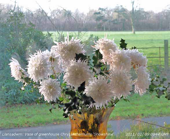 9th: The snow had all disappeared, but a vase of greenhouse Chrysanthemums 'Snowshine' is a reminder of of the view from this window in December
  . It was a fine morning with few clouds around and a light W'ly breeze. There was a slight white frost on the grass, dew having frozen with a temperature of -1.6C. Pressure 1009 mb was rising in a transient ridge as low 974 mb moved away over the Norwegian Sea. The day was mostly sunny, but cloud persisted over the mountaintops that still had some snow on the summits and plenty of patches at 1000 ft on the N-facing slopes of the Carneddau. By evening cloud began to encroach. [Rain 1.0 mm; Max 8.1C; Min 0.2C; Grass -1.6C] . It was a fine morning with few clouds around and a light W'ly breeze. There was a slight white frost on the grass, dew having frozen with a temperature of -1.6C. Pressure 1009 mb was rising in a transient ridge as low 974 mb moved away over the Norwegian Sea. The day was mostly sunny, but cloud persisted over the mountaintops that still had some snow on the summits and plenty of patches at 1000 ft on the N-facing slopes of the Carneddau. By evening cloud began to encroach. [Rain 1.0 mm; Max 8.1C; Min 0.2C; Grass -1.6C]
10th: Mostly cloudy and windier from midnight with showers of rain around 06 GMT. At 09 GMT the S'ly wind was force 5/6 with slight rain and poor visibility. Pressure 1005 mb was falling with low 991 off S Ireland while pressure was high 1023 over Switzerland. An occluded front stretched from Lands End over Wales, the Isle of Man and N Ireland. The day kept overcast and dull with light rain at times, the wind moderating later and almost dying away by midnight. [Rain 3.9 mm; Max 8.5C; Min 2.0C; Grass -1.5C]
11th: At midnight low 991 mb was tracking E over the N Irish Sea with showery rain petering out. By morning it was still overcast but the cloud was thinning a bright patch was seen over Red Wharf Bay and towards Llandudno. The low with little change in pressure was over the North Sea off Newcastle and pressure here 1006 mb was rising. The occluded front was over central England. Soon brighter with sunny spells, but there were showers in the vicinity and we had a few spots from a dark looking cloud around 1100 GMT. The afternoon was cloudier with broken cloud in the evening with strengthening wind and showery rain by 2300 GMT. [Rain 6.9 mm; Max 9.0C; Min 5.0C; Grass 3.8C]
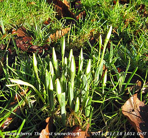
12th: Light rain at times after midnight and thick fog (visibility < 100 m, code 1 ) in low cloud at 09 GMT. The temperature had just reached a maximum of 9.0C soon after 06 GMT falling to 8.6C at 09 GMT with relative humidity of 100%. With rising temperatures the first snowdrops were beginning to appear in grass, short leaves, but 1 or 2 buds already showing white. The fog began to clear at 1030 GMT but light rain continued through the afternoon easing around 1900 GMT. [Rain 10.6 mm; Max 9.9C; Min 2.8C; Grass 0.0C]
13th: Light rain from midnight through until 0400 GMT. Low cloud thick fog again this morning, unusual to have it 2 days running. In 2010 there were just 2 mornings with fog at 09 GMT. Little variation in temperature over the past 24-h (range 8.6 - 9.8C). Pressure 1006 mb was rising slowly close to a slow-moving frontal-wave. Fog was slow to lift as light rain or drizzle petered out, but had cleared to moderate fog by noon. The afternoon kept overcast and dull with a light SSW'ly breeze. [Rain 2.4 mm; Max 9.7C; Min 8.6C; Grass 7.8C]
14th: Overcast with moderately low cloud, moderate rather misty visibility. Rain between 05 and 06 GMT along with a moderate SW'ly breeze, somewhat drier at 09 GMT, with pressure on 1003 mb with low 973 mb SW Iceland. Bright with glimpses of sunshine in Beaumaris during the morning and becoming sunny here in the afternoon. Showers of rain persisted on the Snowdonia Mountains with Anglesey mostly clear. Some scattered clouds in the evening with the temperature on the grass falling to 1.0C, cloudier before midnight. [Rain 12.9 mm; Max 9.7C; Min 8.5C; Grass 8.1C]
15th: From midnight overcast with strengthening S'ly wind, strong to near gale-force at times, and light to moderate rain from 0100 GMT with a heavy burst around 05 GMT of 23 mm per hour. An unpleasant morning, slight rain, a blustery SW'ly wind with moderate visibility. There were more snowdrops appearing, still looking rather short, but the grass was already greening up. Rain continued through the day, moderate to heavy at times, up to 31 mm per hour. Over 112 mm of rain was recorded in Capel Curig (21 - 21 GMT). Rivers in Gwynedd were full to bursting their banks and there was some flooding in the Conwy Valley near Llanwrst. Houses were also reported flooded in Bala and Bala and Pentrefoelas. A canoeist drowned after capsizing in the River Ogwen, another escaped reaching the banks safely. There was respite in the rain from 2100 GMT. [Rain 11.8 mm; Max 10.0C; Min 5.3C; Grass 1.0C]
The first 15-days had 61.0 mm of rainfall (59%) and [60%] of average and 72 h duration. The mean temperature was 5.1C (-0.3) moving decadal average, and [0.0] of the updated climatological average [1981 - 2010].
 16th: Very windy the SSW'ly wind reaching gale force at times. Rainfall resumed at 03 GMT and was continuous, turning moderate to heavy at 07 GMT, to 09 GMT. It was very windy with gale warnings in operation for all sea areas around Britain. Here the force 6 SSW'ly was moderating and rain eased off by 11 GMT and it was brighter by noon with a glimpse of sunshine early in the afternoon that kept mostly cloudy. A brambling was taking food on the bird table. During the evening, as a weak cold front moved across from the NW, the sky cleared with temperature falling to 7.0C up to midnight . [Rain 1.7 mm; Max 9.5C; Min 8.9C; Grass 8.4C]
17th: A few clouds after midnight, but the temperature continued to fall to a minimum of 4.0C and 1.5C on the grass. At 09 GMT pressure 1018 mb was rising and with jetstream cirrus seen clearly overhead, moderately high cloud was clearing to give a sunny morning. A frontal-wave low was over the SW Approaches with frontal cloud over Biscay and along the Channel. It was wet in the Scilly Isles with 33 mm reported in the 24-h to 2100 GMT. Calm, or very light breezes here from the NW and good visibility. The grass on the lawn and fields is looking much greener especially the finer leaved fescue grasses. There are plenty of snow patches remaining on the northern slopes of the Carneddau Mountains with the lowest lying about 2250 ft. There was a very red sky in the West at 1650 GMT. [Pptn trace dew; Max 9.9C; Min 4.0C; Grass 1.5C]
18th: There was fog in the western end of the Menai Strait, patches of 'shallow' fog on the fields at 09 GMT. The temperature was 0.5C with 100% relative humidity and the sky almost clear with some backlit cumulus on the mountaintops. Pressure 1029 mb continued to rise . A few small fair-weather cumulus appeared briefly overhead around 10 GMT. There was heavy frozen dew on grass and a little rime on the raingauge. A cold morning for the ewes and recent born lambs in the field adjacent to the weather station. In sunshine the frost soon melted and the temperature rising to 7.2C. Soil moisture determined today was 68% dry mass close to the water saturation point 70%. It has, so far, been a dry winter and we have not seen the free draining soil saturated with water. Some field gateways and low-lying fields are wetter and I have seen standing water on these. A mistle thrush sang nearby for a while at 4 pm spurred on by the fine sunny day; 6.9h of sunshine was reported at Valley. [Pptn tr dew & fog; Max 7.2C; Min 0.3C; Grass -3.2C]
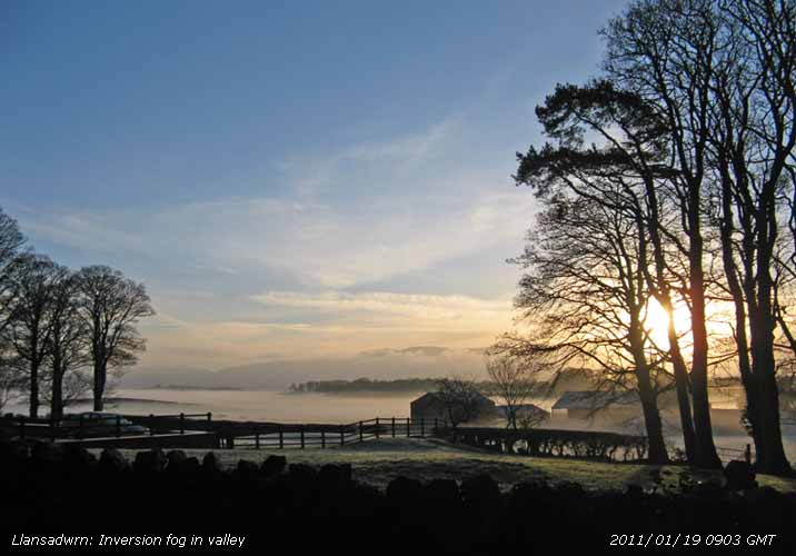 19th: Clear and frosty overnight and mist started to form over extensive white frost on the fields at 0730 GMT and soon developed into shallow fog. To the SE of here fog filled the bottom of the dry valley. Deposition of rime was more extensive. Pressure 1037.3 mb used to intensify near the centre of the high over Wales. A sunny morning and with the temperature rising the fog dispersed. Visibility was good, but haze developed in the W later clearing, a few clouds appeared by the end of the afternoon. With little or no wind under clear skies it was another frosty night. [Rain 0.0 mm; Max 7.7C; Min 0.6C; Grass -2.6C]
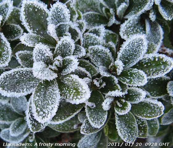 20th: Clear and sunny, no fog here this morning, just a little altocumulus over the mountaintops. Fields were white with frost and there was hoar frost was on tall vegetation in the garden. Frost deposition, measured since an hour before sunset yesterday, was the water equivalent of 0.28 mm. Pressure was a little higher at 1038.4 mb within a high including N Ireland and Wales. Temperatures on Snowdon in the night were -10C and were -4C at 09 GMT when it was 0.5C here. During the day there was some cloud at times, but it was mostly sunny. The evening began with clear skies then freezing fog developed with ice precipitation, ice crystals, snow grains and slight snow. Valley (automatic) reported freezing fog from 20 GMT, then falls of snow grains with sleet just before midnight. [Rain 0.2 mm; Max 5.7C; Min 0.5C; Grass -4.2C]
21st: A cloudier day starting off with 7 oktas cover of fog related stratus off the sea. Overnight 0.3 mm of ice deposition was recorded and there were small ice crystals still on the frozen ground. There was a fresh sprinkling of ice precipitation (fog-snow?) seen on the eastern Carneddau range. Pressure was steady on 1042 mb. There were some long spells of sunshine when the cloud temporarily moved away during the morning, but the afternoon and early evening were mostly cloudy. Catkins on hazel are well out here and along the A5025 near the Four Crosses. Between 22 and 23 GMT the sky cleared. [Pptn tr frost; Max 4.3C; Min -0.8C; Grass -3.5C]
22nd: An overcast misty morning with moderate visibility. It was calm with occasional light airs from the North and with little change the day kept dull and misty with a maximum temperature of 3.5C. Fog developed before dusk. [Pptn tr dew & fog; Max 4.5C; Min -0.1C; Grass -1.6C]
23rd: Overnight no air frost with just a touch of ground frost. With scattered altocumulus and stratocumulus clouds the temperature at 09 GMT had risen to 4.5C, the highest of the past 24-h. The sun was seen rising behind cloud (for the records does not count as bright sunshine) over the mountains, and that was the brightest part of the day. Soon overcast and although the cloudbase lifted off most mountaintops in the afternoon, the day was sunless. [Rain 0.0 mm; Max 6.2C; Min 1.4C; Grass -0.3C]
24th: No frost overnight and an overcast dull morning suggestive of anticyclonic gloom. Even the birds were quiet, there has been no spring chorus, but there is usually a lot of twittering. Pressure 1037 mb was falling very slowly with the centre of the high drifting away over W Ireland 1042 mb. There were thinner patches in the cloud, but try as I did I could see no blue. More snowdrops were emerging in colder parts of the garden while earlier ones were standing tall with plenty of flowers. Recent gales had broken a limb from a horse chestnut tree, taking advantage of the dry weather I spent the afternoon cutting it up as logs for the fire. Little or no wind and another sunless day. [Rain 2.0 mm; Max 7.0C; Min 4.0C; Grass 2.8C]
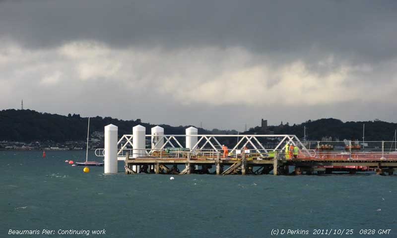
25th: A misty moisty morning with light rain and poor visibility. Pressure 1022 mb was falling as the high 1037 mb of previous days had moved far in to the Atlantic allowing a jetstream to curl around it bringing a NW'ly airflow. Rain petered out in the morning, but began again at noon continuing lightly until after 1400 GMT when it turned to drizzle. A sunless day. [Rain 4.8 mm; Max 7.7C; Min 4.5C; Grass 3.5C]
26th: After midnight the cloud began to break and by morning the sky was clear overhead with persistent cloud on the mountaintops where a little was falling above 2500 ft. The snow was mainly along the summits from Foel-fras to Penyrole-wen although Carnedd Dafydd has less. Pressure 1015 mb was rising again between high 1033 mb W of Ireland and high 1015 mb over Scandinavia resulting in a N'ly flow over Britain. Snow showers continued over the mountains and the sky turned cloudier on Anglesey with just a few spots of rain in the afternoon. There were some breaks in the cloud during the evening that remained dry. [Rain trace; Max 5.4C; Min 3.2C; Grass 1.1C]
27th: Mostly cloudy, except for a lee clearance to the SW of here, the wind a moderate NE'ly There was an occluded front lying to the NW over the North Channel, but here the day was fine with sunny spells developing around noon. Dark clouds passed over between 16 - 17 GMT without precipitation and the sky cleared during the evening with the return of night frost. [Rain 0.0 mm; Max 4.6C; Min 1.2C; Grass -1.1C]
28th: An almost clear sky with some cumulus over the mountaintops and far over Liverpool Bay. The grass was slightly white with frost the minimum reading -4.5C. The ground surface was frozen with the temperature at 5 cm depth 1.0C. Water continues to be frozen in the garden so it was necessary to provide fresh water for the birds. A sunny day, but with a light to moderate E'ly wind there was a chill. Best sunshine was around Irish Sea coasts, N Wales and Cumbria. A fine peach and azure blue sky lasted at least an hour after sunset. [Aberporth 8.6h] [Rain 0.0 mm; Max 3.5C; Min -1.5C; Grass -4.5C]
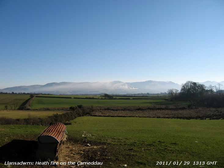 29th: A clear sky with visibility moderate to good in smoke haze with the mountains only just visible the tops a little clearer. There was a light E'ly breeze and the temperature -2.1C (dewpoint -4.0C) giving a relative humidity value of 86%. The temperature on the grass had fallen to -8.0C; there was light white frost on the grass with 0.26 mm recorded. A dry and sunny day, the cold most noticeable if you were in the wind. There was a heath fire on the mountains in the afternoon with the smoke drifting NE'wards whereas the wind here was NE'ly. A clear evening with temperatures again falling away quickly. [Rain 0.0 mm; Max 2.0C; Min -3.8C; Grass -8.0C]
30th: Another fine and sunny morning with the overnight minimum down to -3.7C although it had fallen to -6.4C in Pentraeth. The white frost on grass and fields was more extensive this morning and the soil temperature at 5 cm depth had fallen to -0.3C.
A sunny morning with little or no wind, the anemometer cups were not turning the direction determined only by chimney smoke. Turning cloudier by the afternoon the sky was overcast at 1500 GMT. [Rain 0.0 mm; Max 4.4C; Min -3.7C; Grass -8.0C]
31st: The sky was still overcast and visibility was only moderate with the mountains obscured. The cloud and mist was at low level as the mountaintops were in the clear and sunny although the temperature on Snowdon was -9C at 09 GMT. Here it was 0.6C (dewpoint -0.5) but rose slowly through the day into the evening. A change in the weather pattern was on its way with Atlantic-low 965 mb midway between and S of Greenland and Iceland. The westerly jetstream has for some weeks been giving us a miss, but all was to change as the low began moving towards Scotland. A dull day, but the cloud did lift enough to see that there was a slight cover of snow persisting mainly between Foel-grach and Carnedd Llewelyn with large old snow patches below Ysgolion Duon at 2250 ft. Occasional drumming by a great spotted woodpecker in the wood; woodpeckers are frequent visitors to the feeders. By evening as the temperature continued to rise pressure was falling and the S'ly wind strengthened. [Rain 9.5 mm; Max 7.4C; Min -2.9C; Grass -6.1C]
The month ended with a mean temperature of 4.3C, (=) highest since 2008, was (-1.1) of the decadal and [-0.8] of the new 1981 - 2010 climatological average. Total rainfall was 79.2 mm, highest since 2009, one of the 28 lowest since 1929, was (77%) and [78%] of average. At Valley there were 73.5h of sunshine, sunniest since 2006, rank 11 on the K&Z adjusted Anglesey record since 1930, average (119%) decadal and [127%] 1981 - 2010. Sunniest 8.1h on 28th; 9 sunless days.


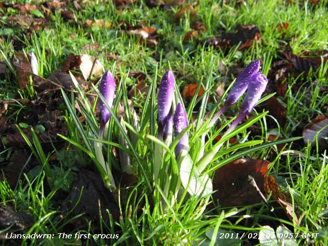 1st: The temperature had risen through the night with a warm front passing over at midnight, and the following cold front brought fog, with the sky obscured in the morning. The fog tended to lift then return before eventually clearing later in the morning to give a sunny day. A hazy view of the mountains in the afternoon revealing patches of snow, somewhat smaller now, on the Carneddau and Snowdon. The evening was partly cloudy with a frontal cloud mass to the NW of Ireland. {Tyndrum 24.2 mm, Capel Curig 11.0 mm} [Rain trace; Max 11.6C; Min 0.6C; Grass -0.1C]
2nd: Dull and overcast with spots of rain on the window before 09 GMT. Slight rain at times in the morning, with a moderate to fresh SSW'ly wind, turning moderate to heavy around noon. The afternoon kept dull the clearing sky approaching from the W not quite reaching here by dusk (1730 GMT). No sunshine here although Valley reported 0.5h. {Tyndrum 48.4 mm, Capel Curig 15.8 mm}[Rain 2.2 mm; Max 9.2C; Min 6.0C; Grass 3.8C]
3rd: With a clearing sky at dawn the mistle thrush was singing at 0720 GMT. With pressure steady on 1022 mb the morning became quickly sunny and sunshine continued into the afternoon. A frontal-wave in the Atlantic S of Iceland began to develop and deepening rapidly during the afternoon. At 18 GMT it was 970 mb W of Scotland and with tightening isobars the wind strengthened to near gale-force resulting in a 20 mph speed limit on the Britannia Bridge. A gust of 91 mph was recorded at Clogwyn Station on Snowdon at 1745 GMT. It was a rough evening and night with gale force winds. {Tyndrum 39.4 mm, Lake Vyrnwy 14.4 mm} [Rain 0.9 mm; Max 9.4C; Min 3.1C; Grass 0.3C]
4th: At midnight the low 948 mb was N of Scotland. After a lull winds strengthened again during the morning. The Britannia Bridge was closed to high-sided vehicles resulting in queues at the Menai Suspension Bridge as wide loads were squeezed through the narrow arches. Pressure here was 1007 mb and, in the midst of the westerly conveyor belt driven by the jetstream, the SSW'ly wind was force 6/7 with strong gusts at 09 GMT. Storm force winds, with gusts over 100 mph, were reported from several stations on high ground in North Wales (Clogwyn Station 92 mph, Lake Vyrnwy 89 mph, Aberdaron 83 mph and Capel Curig 68 mph) and Scotland (Cairngorm 112 mph, Aonach Mor 105 mph). [Rain 17.7 mm; Max 10.3C; Min 4.0C; Grass 2.8C]
 5th: Gales and high gusts continued after midnight until the cold front arrived at 0340 GMT. The temperature was 9.8C and began falling as the wind suddenly dropped and very heavy rain began to fall at 0345 GMT at 64 mm per hour. At 09 GMT the temperature was 7.6C with moderate rain and very poor visibility. Rainfall accumulated was 17.7 mm, pressure 1010 mb was rising with rain easing and stopping about 1130 GMT (total event 22 mm) . Less windy in the afternoon then strengthening again before evening. [Rain 18.0 mm; Max C; Min 7.4C; Grass 6.9C]
6th: Another blustery morning the trees bending in the S'ly wind force 7 at 09 GMT, but it was not raining. Ragged lowish clouds with visibility poor, the mountains have been obscured for some days. The meandering front was still over the Irish Sea and out in the Atlantic a low was to develop on it and head our way. There was slight rain at times in the morning, but the afternoon drier until 1600 GMT when there was moderate rain until 2200 GMT. At 1800 GMT the rapidly developing low on the front was 997 mb in the Atlantic SW of Ireland. Continuing very windy, gale force at times into the night. [Rain 9.8 mm; Max 10.2C; Min 7.6C; Grass 7.3C]
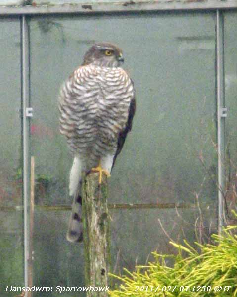 7th: At midnight deepening low 993 mb was off SW Ireland heading quickly NE'wards. Very gusty wind around 0330 GMT, with rain beating against the windows, and another rough morning. It was out with the hard hat for the delayed observations at 0910 GMT. It was too bad to venture out earlier with tree debris flying about and danger of slates being blown off the roof. Pressure 999 mb had fallen with the low 991 mb over the North Channel. The Britannia Bridge was again closed to high-sided vehicles that were being diverted to the Suspension Bridge. A man was found dead near a submerged vehicle in Corwen after the river burst its banks. The wind died down by noon and the afternoon was fine, but sunless. A sparrowhawk paid a visit, no doubt attracted by the small birds around the feeders, perching on an old garden fork put out to prevent the robins fouling the raingauges. It has been awhile since we have seen a sparrowhawk, having found the garden I don't expect it will be the last this winter. A glimmer of sunshine as the sun set under cloud sheet in the West. There were light showers of rain here at 1715 and 1900 GMT then the sky began to clear and moisture froze on the grass. [Rain 0.2 mm; Max 8.5C; Min 8.0C; Grass 7.3C]
8th: More or less a clear sky with spectacular colours before the sun rose over the mountains. After showers last evening (0.2 mm) there was heavy dew and measured deposits (0.32 mm) had frozen (grass minimum -3.0C). There was a sprinkling of fresh snow mostly on the summits 'plastering' the cliffs between Foel-grach and C. Llewelyn, and on Crib-y-ddysgl (Snowdon). Patches are getting sparse, but there is a medium sized one below Ysgolion Duon and several larger on cliffs above Llyn du'r Arddu. Although high cirrus clouds increased it was a mostly sunny day with light breezes. Cloudier in the evening with a little drizzle and rain from 2000 GMT. [Rain 3.0 mm; Max 9.7C; Min 0.5C; Grass -3.0C]
 9th: Overcast with drizzle and rain since 06 GMT , moderate visibility. Overnight the temperature did not fall below 7.9C. Pressure 1013 mb was soon falling with a slow-moving low 994 mb S of Greenland and complex frontal systems lying over western Britain. Winter Heliotrope was spotted flowering on the roadside on the way to Bangor. Somewhat drier in the afternoon, but keeping dull under thick cloud. Light showers of rain from 1645 GMT then moderate to heavy rain from 2100 GMT and a burst of very heavy rain up to 28 mm per hour at 2330 GMT with a pressure low of 1009 mb. [Rain 14.5 mm; Max 12.0C; Min 1.4C; Grass -0.3C]
10th: The rain continued until 0330 GMT then with pressure rising clearer weather began moving in from the north-west. The sky was clearing at dawn and a low mist formed on the fields at 0730 GMT soon developing into fog. Before 09 GMT this cleared away leaving some fog in the E Menai Strait and cloud over the mountaintops. With altocumulus overhead the morning became bright with sunny spells coming along by 1030 GMT. Pressure was 1012 mb in a (ridge) high over the North Channel; there was little of no wind. A mostly sunny afternoon, cloudier by evening then overcast. Soil moisture measured today was 58% dry mass, down from the 69% seen in January. [Rain 0.8 mm; Max 9.4C; Min 5.3C; Grass 3.4C]
11th: Thick cloud brought slight rain from 0130 GMT and again at 0330 GMT. Although there was broken cloud at dawn by 09 GMT cloud was increasing, but visibility was very good. The morning was dry under the moderately high cloud, but by afternoon thicker cloud brought drizzle and light rain at times. The evening and night were overcast with frontal cloud, and triple point, over Anglesey. There was a burst of heavy rain (8.4 mm per h) at 2040 GMT. [Rain 3.7 mm; Max 10.7C; Min 4.9C; Grass 2.3C]
12th: At midnight the frontal system was over the Mersey and after a light shower of rain at 0300 GMT the sky began to clear slowly. Pressure was 1011 mb with a weak ridge moving in from the West. At 09 GMT visibility was moderate in mist; there were cumulus clouds around and cover was variable with a little weak sunshine through the morning here and turning cloudier in the afternoon with barometer falling and wind strengthening. It was sunnier on the W coast of the island Valley reporting 6.3h. [Rain 0.4 mm; Max 9.3C; Min 4.3C; Grass 1.0C]
13th: At midnight deep low 936 mb S of Iceland was slow-moving and had filled to 942 mb by 06 GMT. An associated occluded front was moving across the Irish Sea and was over Anglesey at 09 GMT. Pressure 991 mb was falling and we had low ragged clouds overhead and a fresh S'ly wind, but the morning kept dry. Light rain in the afternoon, cold enough to fall as snow on the summits of the mountains, was heavier around 17 GMT (8 mm per hour) easing to light intermittent with drizzle later. [Rain 4.8 mm; Max 8.9C; Min 5.2C; Grass 3.8C]
14th: Intermittent light rain from 03 GMT falling as snow on the mountains and by morning lying above 2000 ft on the Carneddau Mountains. At 09 GMT there were snow showers and crepuscular rays in the Nant Ffrancon Pass with snow seen at 1000 ft near Cwm Idwal. Spots of rain here then brightening with sunny spells between cumulus clouds. Sunnier in the afternoon the sky mostly clearing by evening. [Rain 0.2 mm; Max 7.5C; Min 2.6C; Grass 0.4C]
15th: Clear overnight with ground frost (-2.8C), but the lowest air temperature was 0.0C. Turning quickly cloudy after dawn with a strengthening E'ly breeze. Precipitation was in sight at 09 GMT (4.9C, dewpoint 0.8C 70% chance of ice precipitation) likely to be of snow on the mountains, but just a few spots of rain here. Brighter with a little sunshine by 1030 GMT, but the afternoon was cloudier and there was rain between 2000 and 2300 GMT. {Valley 10.2C and 2.7h, Stornoway 6.9h} [Rain 0.6 mm; Max 9.7C; Min C; Grass C]
The first 15-d had 76.8 mm rain, nearly reaching the monthly average totals (95%) and [98%]. The mean air temperature 6.9C was (+1.5) and [+1.7] of the monthly average.
16th: The sky cleared during the night and it was a sunny morning with a little cloud on the mountaintops hiding a fresh sprinkling of snow. Pressure was 991 mb with a group of Atlantic-depressions off SW Ireland (972 mb). We were between occluded fronts over N Scotland and another moving into Cornwall. A sunny morning then some weak sunshine early in the afternoon before thickening cloud brought a dull end and rain by evening. The first 'Glory of the Snow' was spotted coming up in the garden. [Rain 1.3 mm; Max 9.6C; Min 3.3C; Grass 0.0C]
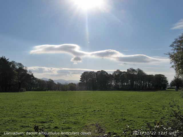
17th: The sky was clear early but by 09 GMT was cloudier with 5 oktas of altocumulus, briefly some lenticular to the S, and altocumulus and cirrus overhead. An occluded front lay to the W over the Irish Sea, N Ireland and S Scotland and it was soon dull with intermittent drizzle and slight rain from 1130 am. On the mainland at Llanfairfechan it was brighter with a little sunshine in the afternoon before the drizzle moved across from Anglesey at dusk. [Rain 0.1 mm; Max 7.8C; Min 3.4C; Grass 0.1C]
18th: A bright morning with mostly thin cloud with weak sunshine. There was little or no wind here and the day was fine until increasingly thicker clouds moved across by late afternoon. There was dampness in the air and although a band of rain was shown moving E on the rainfall radar, in rain-shadow there was none here until 2200 GMT. It was wetter and windy in Llanfairfechan the SE'ly breeze gusting to 40 mph. Wet in Snowdonia, N Ireland and Scotland. {06-06z Ballypatrick For. 35 mm, Machrihanish 23 mm, Capel Curig 21 mm, Valley 8 mm, Llanfairfechan 6.7 mm} [Rain 2.3 mm; Max 9.7C; Min 4.1C; Grass 0.7C]
19th: A clearing sky leading on to a fine and mostly sunny day with little or no wind. {Trawsgoed 11.8C, Aberporth 4.9h} [Rain trace dew; Max 12.2C; Min 5.3C; Grass 4.5C]
20th: A mostly cloudy, but bright morning with weak sunshine. There had been very heavy dew overnight and the ground was damp and raingauges covered in condensation. Remnants of an occluded front were lingering along the E coast of Britain. A fine day, little or no wind with weak sunshine continuing in the afternoon and a fine partly cloudy evening. [Rain 0.4 mm; Max 10.4C; Min 1.2C; Grass -0.6C]
21st: Broken cloud and a bright morning with weak sunshine. Another day with little or no wind, if there was any it was generally from the SE which according to previous form is a rare direction, but recently we seem to have been having it more frequently. A fine morning, but thicker cloud did produce a little fine drizzle in the afternoon along with a few heavier spots of rain at times. Another day with no bright sunshine. [Rain 0.3 mm; Max 10.0C; Min 3.0C; Grass 0.1C]
22nd: Overcast with mist and rain in a light SSW'ly wind. A complex series of frontal systems lay over Britain and gave a generally dull day. Dry by midmorning but the wind strengthened reaching force 4 early in the afternoon when I was installing a new anemometer above the roof of the house, then moderated by dusk. [Rain 2.0 mm; Max 9.1C; Min 5.0C; Grass 1.9C]
23rd: A grey overcast morning with light to moderate rain 2.0 mm in the gauge at 09 GMT with rain petering out during the morning. Keeping overcast, dry and windy in the afternoon with the temperature here 10.6C, but rising to 14.7C in Llanfairfechan only beaten in the UK by Murlough, on NE coast of N Ireland, with 14.9C. There was rain from 1500 GMT, moderately heavy at 1600 GMT as a cold front passed over, then foggy with visibility < 150 m into the evening. The fog had cleared leaving broken clouds with stars shining through by midnight. {Murlough, Co. Antrim 14.9C, Llanfairfechan 14.7C Capel Curig 9.5C, Lusa 31.6 mm, Mumbles Hd. 19.2C} [Rain 2.0 mm; Max 10.6C; Min 6.8C; Grass 5.9C]
24th: With low 964 mb near Iceland and high-pressure 1050 mb over N Russia where it is intensely cold there were strong winds over the Norwegian Sea and N North Sea. Light to moderate SW'ly wind here with pressure on 1019 mb. Keeping dry there was some broken cloud and became bright with the odd sunny spell, but sunnier in Llanfairfechan and along the North Wales coast. While the temperature here reached 10.9C the recently established Llanfairfechan AWS, in the Föhn-like SSW'ly wind, recorded 14.0C during the afternoon, then rose again to 14.6C around 2040 GMT and was still 13.7C at midnight. Some higher temperatures have been recorded at Aber (e.g.. 16.5C, 5 Feb 1990) under similar conditions in the past, current data are unfortunately not reported. {21-21z. St James Park 15.3C, Llanfairfechan 14.6C, Hawarden 13.3C, Aberporth 2.4h} [Rain 0.6 mm; Max 10.9C; Min 7.1C; Grass 5.6C]
25th: Wet and windy with fog developing by 1145 GMT then cleared within an hour. The SW'ly wind force 4/5 in the morning moderated in the afternoon, but the sky kept overcast. The was moderate to heavy rain here from 2030 GMT (max rate 5.4 mm/h) and at Llanfairfechan between 2320 & 2350 GMT (max rate 23.2 mm/h at 2330 GMT). {Llanfairfechan 13.9C, Hawarden 13.0C, Valley 0.0 h} [Rain 9.1 mm; Max 10.2C; Min 8.0C; Grass 7.6C]
26th: After a heavy burst of rain (5.8 mm/h) at 0419 GMT rain eased off around 06 GMT and by 09 GMT the sky was beginning to clear. Cloud was still low (800 ft) on the lower slopes of the Carneddau and the tops remained obscured all day, but visibility moderate to good improved as sunny spells came along during the morning. More sunshine in the afternoon, but the breeze felt cold although the temperature reached 10.2C here and just 8.6C in Llanfairfechan. A clear evening. {Mumbles Hd. 10.9C, Llanfairfechan 8.6C, Lake Vyrnwy 13.4 mm, Valley 7.7h} [Rain 1.6 mm; Max 11.3C; Min 6.5C; Grass 5.9C]
27th: Clear skies at first overnight allowed a touch of ground frost (-1.4C) to develop before an occluded front brought some rain from 06 GMT. Pressure 1021 mb had risen as Atlantic-high 1034 mb W of the Bay of Biscay intensified. Light W'ly winds at first with a change to NNE'ly by 1000 GMT. Bright in the morning with sunny spells before noon the clearing some more in the afternoon over Anglesey with cloud persisting over the mountaintops. A clear sky in the evening a meteor was seen heading towards the mountains (NE to S) at 1858 GMT fading over the Straits and there was a fine view of the International Space Station (ISS) overhead at 1903 GMT. Clear with a NNE'ly breeze. {St. Athan 9.7C, Valley 7.4h} [Rain 0.0 mm; Max 8.5C; Min 1.4C; Grass -1.4C]
28th: Mostly clear with what looked like some white frost on the fields at 07 GMT, but the grass minimum indicated 0.8C so it was probably the light reflecting on heavy dew. A sunny start to the day, cumulus clouds over the mountaintops and low cloud in the E associated with a detached occluded front over central England. Pressure 1034 mb continued to rise with high 1035 mb located W Ireland. A few cumulus cloud developed overhead during the morning breaking up the sunshine then the afternoon was increasingly sunny with the wind very light. A clear evening with the ISS seen again overhead at 1930 GMT and would be at varying times over the next week if clear. {Milford Haven 10.2C, Aberporth 9.7h} [Rain 0.0 mm; Max 8.7C; Min 2.6C; Grass 0.8C]
It was the 3rd warmest February since before 1979. The mean temperature 7.0C, highest since 1998, was (+1.7) and [+1.8] of average. Rainfall 96.5 mm, highest since 2004 ranking 23 since 1928, was (119%) and [123%] of average. At Valley sunshine totalled 72.4h (87%) and [91%] of average, highest since 2009 rank 46 since 1930, highest 8.9h on the 28th and here were 7 sunless days.


1st: DYDD DEWI SANT: Unlike last year following the warmer than average February there were daffodils in the garden to photograph and pick on St. David's Day. There were good leeks as well, so you take your choice. Reports on the BBC Farming Programme said that leeks in 'England' had been badly affected by the cold weather with extensive rot inside the stalk. With hardly a cloud in the sky there was a touch of white frost on the grass this soon melting away in the sunshine. A pair of mistle thrushes were seen feeding on the field edge adjacent to he garden. A sunny day with a clear evening. {Pembrey Sands 9.7C, Aberporth 9.7h} [Rain trace dw/fr; Max 9.6C; Min 1.0C; Grass -2.7C]
2nd: Another sunny and calm morning with heavy white frost deposits on the ground; 0.28 mm was recorded on the dew-pad. There was a little cloud in the east and there were no contrails seen. West Wales was again the best for sunshine it being a fine sunny day. The wind was a light SW'ly turning NE'ly at 17 GMT. Another clear evening and frosty night. {Aboyne 12.1C, Aberporth 10.1h} [Rain trace dw/fr; Max 10.3C; Min -0.2C; Grass -3.5C]
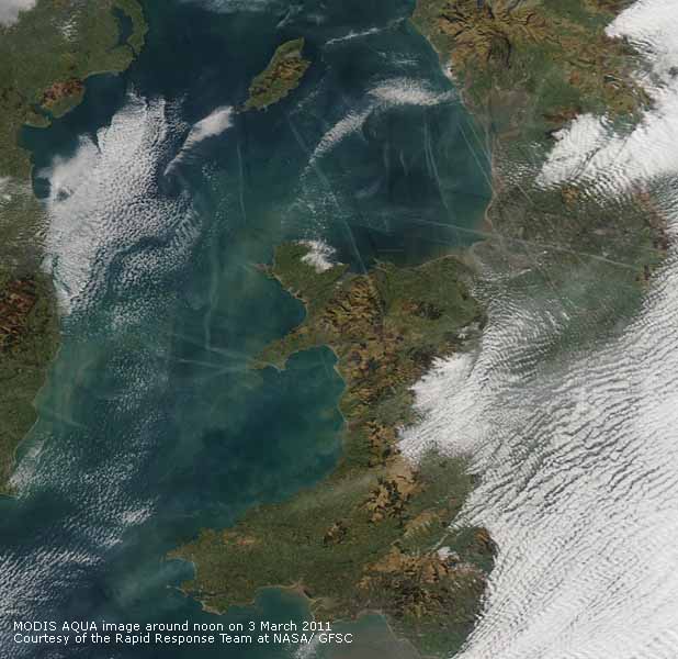
 3rd: White frost on the grass with 0.32 mm recorded, the highest of the current fine spell. Pressure was 1038 mb with high 1039 mb S Scotland where a weak cold front was traversing southwards. Visibility was poor with moderate smoke haze persisting and being flagged as moderate at the Marchlyn Mawr reservoir 2100 ft where an instrument recording ozone (Welsh Air Quality Forum) measured just over 100 μg per m-3 . Otherwise a blue sky but an estimated 4 oktas cover of jetstream cirrus, other cirrus and large contrails overhead the station (See set of images left). Two crossed at different levels, they were long and spreading; for contrails to form in the sky the temperature must be low enough and for there to be enough moisture in the air for ice crystals to form. An unusual day as I do not usually record so many. Contrails were widely distributed over the Irish Sea, Liverpool and Morecambe Bay and Merseyside. (See the MODIS AQUA satellite image right, courtesy of the Rapid Response Team at NASA/ GFSC). There is much debate as to what effect, if any, contrails have on our climate; in the three days after the September 11 terrorist attacks in America, when all commercial air traffic was banned, the average daily temperature range increased. This finding has subsequently been questioned and more work need to be done. A climate survey project starting this month, organised by OPAL in conjunction with the Met Office, the RMetS, ICL, Natural History Museum and others may help. Contrail spotters are wanted to send in observations. I looked at the website and as usual saw a sparse response from North Wales and decided to send in records from here. It was a remarkable day the large spreading contrails at times obscuring the sun and affecting solar radiation. I say affecting because a few to scattered clouds increase the global solar radiation received on the ground by reflection. There is often much more radiation on a cloudy day than one with a perfectly clear blue sky. A fine evening and with a little cloud and remnant contrails in the West the pastel to pink colours persisted at least an hour after sunset. {Milford Haven 11.8C, Lusa 2.4 mm, Camborne 10.3h, Aberporth 10.2h}[Rain 0.0 mm; Max 7.4C; Min 0.8C; Grass -2.0C]
4th: A cloudier morning with 6 oktas cover of stratocumulus with a hole to the SE of here in which 2 contrails, of the short fading away type, could be seen. Little in the way of white frost at 0900 GMT but the pad recorded 0.13 mm deposited overnight. Low level haze was seen at the western end of the Menai Strait, it was clearer in the E. A number of contrails were seen from Beaumaris. A cloudier day here with sunny spells morning and afternoon and far fewer contrails; of note were 2 drifting across the sky from the NE about 1630 GMT. Light variable winds cloud increasing later. [Rain 0.0 mm; Max 12.3C; Min 1.0C; Grass -2.4C]
5th: Overcast in the morning, dull with light winds. A flock of redwings and starling were seen on the field across the road from the station. The cloud was thinner and the sky brighter by noon with a brief spell of weak sunshine. The cloud thickened again in the afternoon, as a weak frontal system passed over, there were fine spots of drizzle felt in the air between 1745 and 1900 GMT not enough to wet the ground. {Castlederg 11.3C, Valley 9.3C, St. Athan 2.5h} } [Rain trace; Max 8.4C; Min 2.6C; Grass 0.0C]
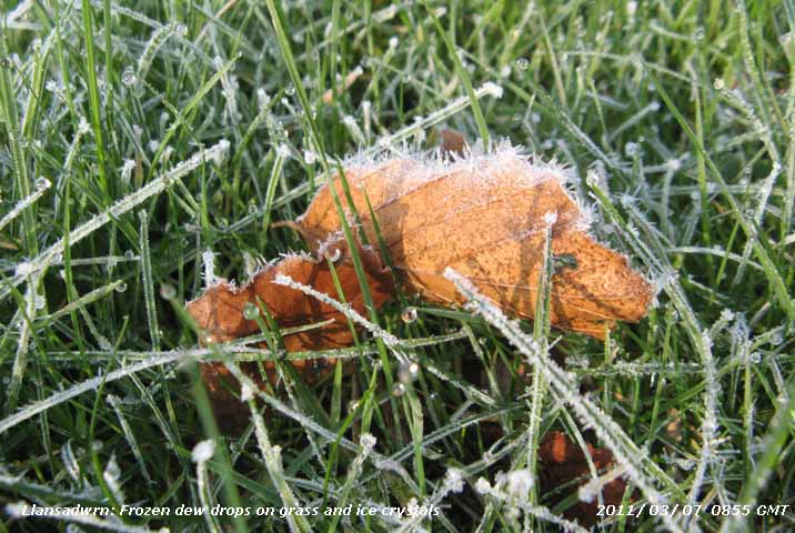 6th: There was a mackerel sky to the S at 0700 GMT and cloud continued to decrease slowly up to 09 GMT. Although the grass minimum had fallen to -1.1C overnight I did not see any frost. The grass was wet with dew drops and concrete was dry. Visibility was good though slightly hazy and 2 short contrails were visible to the NE. The day was soon sunny with few clouds until a band of broken cloud encroached from the SW by 1500 GMT. A few sunny spells until sunset when the sky became overcast, but broke up before midnight. [Rain 0.0 mm; Max 8.7C; Min 1.6C; Grass -1.1C]
7th: Under a clear sky frost developed with the air temperature falling to -0.3C and to -4.2C on the grass. Frozen and supercooled dew drops (silver frost) were glistening on the tips of grass leaves and there were crystals on fallen leaves. In haze visibility was only moderate and soon the sky cloudier until clearing again by 1130 GMT. Pressure was steady on 1032 mb, but the high had drifted eastward and was 1039 mb over the Netherlands. It was a sunny afternoon with very light variable breezes. With no measurable rain since 26th February soil moisture determined today had reduced a little to 54% dry mass from the 58% on 10th February.
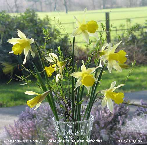
An article in the RHS Journal The Garden March 2011 describes some of the 415 Heritage cultivars collected by Duncan and Kate Donald at Loch Ewe, NW Scotland. We have a number of daffodils growing here that we know have been in the garden for at least 50-years (See vase of daffodils below right). It is possible that they are some that were planted before 1930, back to the 1850's. This daffodil  is the first of the Old Garden varieties to flower. It looks similar to the William Backhouse (1807 - 1869) 'Emperor' slightly tousled yellow-trumpet cross that created a sensation in its day, one of several featured in the article. It is certainly beautiful, and one of out favourites in the garden. Our Old Garden varieties appear throughout the spring into summer and more may feature in these pages as the season progresses! {Trawsgoed 10.0C,max, Capel Curig -6.1 min, Aberporth 10.6h} [Rain 0.0 mm; Max 9.3C; Min -0.3C; Grass -4.2C] is the first of the Old Garden varieties to flower. It looks similar to the William Backhouse (1807 - 1869) 'Emperor' slightly tousled yellow-trumpet cross that created a sensation in its day, one of several featured in the article. It is certainly beautiful, and one of out favourites in the garden. Our Old Garden varieties appear throughout the spring into summer and more may feature in these pages as the season progresses! {Trawsgoed 10.0C,max, Capel Curig -6.1 min, Aberporth 10.6h} [Rain 0.0 mm; Max 9.3C; Min -0.3C; Grass -4.2C]
 8th: The sky was still clear at 0715 GMT then small cumulus clouds began to form and along with some encroaching altostratus lead to a bright morning with mostly weak sunshine. No contrails were seen. Pressure 1020 mb was falling quickly and a cold front was approaching N Ireland and W Scotland. A windy afternoon the SW'ly force 4/5 with sunny spells at first becoming overcast and dull by 1600 GMT. Rain with snow over high ground had moved on to N Ireland and Scotland, but measurable rain did not reach here until after midnight. (St James Park 12.7C, Hawarden 11.1C, Kinlochewe 38.8 mm, Aberporth 7.4h} [Rain 0.3 mm; Max 9.0C; Min -0.3C; Grass -4.0C]
9th: Showers in the night at 01 GMT and 03 GMT, marks on the hailometer were typically made by ice pellets. There was also ice precipitation on the Snowdonia mountaintops. The sky was clearing at 09 GMT and several long expanded contrails were seen lying NW-NE across the sky. The wind was light SW'ly with cumulus clouds moving from the West. Bright with sunny spells and light showers of rain in the morning. Cloudier and windier in the afternoon (SW'ly force 4/5) with another shower at 1830 GMT and more following after 2200 GMT into the night. {Langdon Bay 12.3C, Milford Haven 10.2C, Glasgow 17.0 mm, Lake Vyrnwy 6.4 mm, Dyce 9.1h, Aberporth 8.1h} [Rain 2.4 mm; Max 10.2C C; Min 4.6C; Grass 2.0C]
10th: Crepuscular rays were spread widely across the Snowdonia range with cloud decreasing towards 09 GMT. Pressure was 1008 mb with low 981 mb N Scotland and associated cold front near Holyhead at 07 GMT. We were in a brisk showery SW'ly airstream with the wind force 4/5 through the day. We had frequent showers, but in between when the sun appeared the temperature momentarily rose to 11.5C. At 1650 GMT there was a heavy shower of rain and ice pellets that fell at a rate of up to 35 mm per hour. {Weybourne 14.1C, Hawarden 13.0C, Capel Curig 10.6 mm, At Athan 5.2h} [Rain 4.0 mm; Max 11.5C; Min 6.3C; Grass 6.0C]
11th: Mostly cloudy with thicker cloud and spots of rain at 1115 GMT. Some fresh snow was seen at 2500 ft on the northern slopes of the Carneddau and particularly around Carnedd Dafydd. A dull sunless day with light to moderate rain from 1230 to 1400 GMT then drier, but kept dull and overcast. Japan suffered a magnitude 9.0 earthquake at 2346 GMT and 20 minutes later a devastating 10 m tsunami that destroyed several villages on the coast and damaging 6 nuclear power stations at Fukushima Daiichi. The stations powered down, but backup systems to circulate cooling water failed within an hour. Ground levels in some parts sunk by over 1 m resulting in the tidal wave overwhelming coastal defenses, where present, and water containing debris, including houses turned to matchwood, penetrating several miles in land. The death toll was expected to be 10's of thousands, initial estimates put over 400,000 homeless, millions left without electricity, fuel, water and food, and there were fears of leakage of radioactive materials from Fukushima. {St James Park 12.6C, Shap 20.2 mm, Dyce 8.8h} [Rain 2.4 mm; Max 8.5C; Min 3.5C; Grass 0.4C]
12th: Overcast with uniform grey stratus cloud and rain was insight at 09 GMT. It arrived here within 15 minutes so most of the obs were completed 'in the dry'. Pressure 1000 mb was falling slowly with low 996 mb passing over the Irish Sea. Associated frontal cloud was slow-moving through the day that remained sunless. The temperature rose and fell several times. There was rain at times becoming persistent from 1600 GMT until after midnight. Leaves were opening on a small hawthorn tree in the wood. The Japanese government declared an emergency at the nuclear site at Fukushima following a series of failures in backup systems to keep the reactors cool. There were reports of emissions of 'small' quantifies of radioactive iodine and caesium. People living within a 20-kilometre radius were being evacuated. [Rain 5.1 mm; Max 8.2C; Min 6.3C; Grass 6.0C]
13th: The rain petered out after 0300 GMT and with the sky clearing rapidly it was a bright morning with very good, clear visibility. Overnight there has been a fresh fall of snow on the mountains and this was lying as low as 1800 ft below Ysgolion Duon on the Carneddau. There was light snow across the range from Drum in the east to Moel Eilio in the West including some at Cwm Idwal at 1200 ft. There were a few short, but expanded contrails to the S drifting towards the mountains. It was sunny, but a few more clouds appeared around noon and it felt chilly in the breeze without much sun in the afternoon. The sky was clearing again by 1600 GMT, a sunny end to the afternoon and the evening clear and frosty until showers arrived between 2300 and midnight. At 2340 GMT the rain falling at 9.4 mm per hour included small ice pellets. {Monks Wood 14.7C Charterhall 24.6 mm, Lerwick 6.2h} [Rain 1.1 mm; Max 8.4C; Min 1.4C; Grass -0.7C]
14th: Little in the way of clouds at 0700 GMT with slight white frost on the grass fields (grass minimum -2.7C). There was an Atlantic-ridge (1024 mb) to the NW and pressure here 1016 mb was rising quickly within a complex low pressure area centred over the Irish Sea with an occluded front N Ireland and Scotland. By 09 GMT cloud had increased, mainly over Snowdonia. There was a little more snow in places, mainly in the West around Snowdon with thin snow looking patchy on the E of the range. A mostly sunny morning with a few cumulus clouds appearing and a mostly sunny afternoon although there was some thin cloud giving weak sunshine encroached before 1600 GMT. . {Northolt 13.0C, Hawarden 11.3C, Salsburgh, Lanarkshire 23.8 mm, Monks Wood 9.9h, Valley 7.6h} [Rain 0.6 mm; Max 11.5C; Min 0.5C; Grass -2.7C]
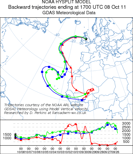
 15th: Overcast at night with an encroaching warm front band of rain approaching from the East. Only light variable winds here, NE backing SW (max 8 mph), while at Llanfairfechan the force 4/5 S - SE wind gusted to 30 mph just after midnight. There was drizzle and light rain here from 0500 GMT and traces of a pink to reddish-brown coloured dust likely to be of Saharan origin were observed at 09 GMT. Collected sample was MUNSELL® soil colour chart (2.5YR 8/3; 6/3, dry). Backward trajectory analyses (left), using the HYSPLIT model, courtesy of the NOAA ARL Website, indicated that parcels of air arriving over Anglesey between 500 and 1500 m AGL originated in north Africa, along the Greenwich Meridian S of the Atlas Mountains in Algeria near the Moroccan border. A dull morning under thick cloud with light to moderate rain into the afternoon washing out more dust. Another sample collected at 1600 GMT, when the rain had stopped, was a similar pink to reddish-brown colour and the north African origin was confirmed by additional backward trajectories.. Still overcast, but a little brighter in the West before dark. By midnight there was broken cloud with some clear sky. The Japanese Prime Minister said that radiation levels at Fukushima Daiichi were 'very high' and that there was risk of more emissions. The evacuation zone was increased to 30-kilometres. Radiation had been detected 240 kilometres away in Tokyo but officials stated that levels were not a threat to public health. Rescue teams were still searching tsunami debris for trapped people, but hopes were fading of finding more people still alive. {Lee on Solent 17.8C, St. Athan 15.3C & 4.0h, Inverbrevie 29.6 mm, Aberdaron 16.8 mm} [Rain 3.0 mm; Max 6.1C; Min 4.8C; Grass 3.0C]
The first 15-days had just 18.9 mm of rainfall (28%) and [22%] of the March averages. The mean temperature 5.8C was [(-1.2)] of average. .
16th: A touch of ground frost, but the sky was cloudier by morning and the air temperature no lower than 2.3C. There was low stratiform cloud and fog over S Britain off the North Sea and we were on the edge of it. It was misty in coastal parts, but here although we saw cloud from time to time it was mostly bright and sometimes sunny. The west coast of the island was sunnier, with Valley reporting 6.3h. The cloud sheet moved across here before 1600 GMT giving an overcast end to the day. At Fukushima Daiichi workers, who had to temporarily leave the area when levels of radioactivity were too high, were desperately trying to prevent a nuclear meltdown of the reactor cores where the cooling systems have failed. Reports indicated that 70% of the fuel rods in No. 1 reactor had been damaged and 33% in No. 2. Officials were considering the use of helicopters to drop water on the stricken reactors. {Cardinham 17.3C, Mumbles Hd. 15.4C, Kinloss 11.0h, Valley 6.3h} [Rain trace fog & dew; Max 10.0C; Min 2.3C; Grass -0.1C]
17th: It was bright with weak sunshine at 0700 GMT as the sun rose to the E of the Carneddau in the direction of Conwy. Then cloud thickened and it was overcast at 09 GMT with drizzle and light rain. A cold front was lying to the NW while remnant frontal cloud was over central England. The drizzle petered out by noon and the afternoon was bright with weak sunshine and sunny spells. As pressure rose through the day the light SW'ly breeze backed NNE during the morning, briefly was NW'ly in the late afternoon before returning NNE. Variable cloud amounts cleared late in the afternoon resulting in a clear calm evening and night with a ground frost. {Pershore 13.0C, Milford haven 11.0C, Tiree 9.2h, Aberporth 2.7h} [Rain 0.4 mm; Max 8.5C; Min 2.3C; Grass -1.0C]
 18th: The sky was overcast at 07 GMT, but it was soon clearing and by 09 GMT it was sunny. Frosty in low-lying places with air temperatures down to -1.8C in Bala and -7.5C in Braemar. Pressure 1023 mb was rising slowly and visibility was good with slight haze. There was little or no wind at first then a light SW'ly during the morning cumulus clouds began to develop overhead. In the afternoon with a light NE'ly breeze the clouds moved away to the SW of the station and it was mostly sunny. The first white flowers of blackthorn in the hedges were spotted alongside the slip road off the A55 near Llanfairpwll while along the A5025 towards the Four Crosses buds of pussy willow were open. Hawthorn hedges were being to look greener as the leaf buds had begun to open. A mostly clear evening, there were views of the nearly full Moon that is at its closest to Earth for 20-years, but turned cloudier by midnight. {Killowen 13.7C, Pembrey Sands 11.1C, Bala -1.8C, Bulmer 9.5h, Valley 9.6h} [Rain 0.0 mm; Max 11.5C; Min 2.5C; Grass -1.2C]
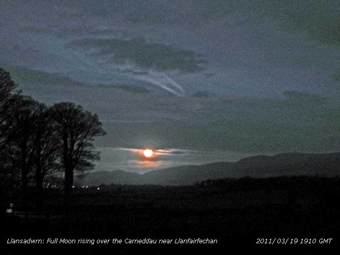
19th: Mostly cloudy after midnight but with broken cloud at 07 GMT it was bright with the rising sun appearing from time to time. There was patchy cloud over N Wales and Cheshire and the morning bright with sunny spells. Turning cloudier again in the afternoon and by the time the Moon had risen at 1910 GMT over the Carneddau Mountains in the direction of Llanfairfechan, now full and closest to Earth, only a brief sighting was made under the cloud sheet. {Hawarden 13.7C, Sennybridge -4.9C, Aberporth 10.0h} [Rain 0.2 mm; Max 12.6C; Min 3.0C; Grass -0.9C]
20th: Cloud persisted overnight and although there were some breaks near the Great Orme the sky was still overcast here. The SW'ly was force 4/5 and rain showers were in sight crossing between here and the mountains, we had a few spots at 0927 GMT. Dull all day and sunless, but the brighter weather with some sunshine spread from Llandudno along the mainland coast to Llanfairfechan and Bangor by evening. {Helen's Bay 15.5C, Hawarden 14.3C, Llanfairfechan 13.2C} [Rain trace; Max 9.5C; Min 5.0C; Grass 3.0C]
21st: Pressure 1034 mb was rising slowly with high 1034 mb over the Celtic Sea, there was a remnant frontal system over SE England. Here the stratiform cloud sheet continued to cover Anglesey and the mountaintops giving hill fog. Visibility was good under the cloud that slowly lifted through the morning with some breaks appearing by afternoon and was clearest between 15 - 16 GMT when briefly the mountaintops were clear. There were some patches of snow left on cliffs at 3050 ft just below the summit of C. Llewelyn, and a little alongside and above the Snowdon railway line. Nothing like the deep snow patches that lasted into June last year. Soon cloudier again. {Bridlington 17.2C, Milford haven 14.2C, Llanfairfechan 13.9C, Mumbles Hd. 1.4 mm} [Rain 0.0 mm; Max 14.1C; Min 5.5C; Grass 1.4C]
22nd: A much brighter morning with cloud decreasing leaving just 3 oktas cover by 09 GMT. Pressure 1039 mb was still rising in the high over S Britain. A sunny morning, a chiffchaff the first of the season for me, was heard singing in Bangor at the top of the High Street. I expect it will not be long before one 'crosses the water' arrives in Llansadwrn. In compensation comma and peacock butterflies were seen around the garden and the glory-of-the-snow is a mass of flowers on the rockery bank. Buds of willow are opening as are the horse-chestnut that are fit to burst. Cloudier around the middle of the day as with a wind shift from SW to NE led to some cloud formation overhead the weather station. Later the wind returned to SW and we had a fine sunny afternoon and evening. {Bridlington 18.3, Trawsgoed 15.9C, Llanfairfechan 13.9C, Shawbury 10.2h, Valley 9.7h} [Rain 0.0 mm; Max 15.9C; Min 6.5C; Grass 3.0C]
23rd: High pressure 1042 mb and cloud cleared to give a mostly sunny, but hazy day with the temperature rising to 16.1C. {Durham 18.7C, Trawsgoed 18.2C, Aberporth 11.3h} [Rain 0.0 mm; Max 16.1C; Min 6.2C; Grass 1.8C]
 24th: Not a cloud in the sky, hazy with only moderate visibility. The first chiffchaff of the season here was heard at 0916 GMT. It's song was not strong and it spent it's time going around trees in the vicinity, but returning to a favourite suggesting it knew the location well. Sunshine with haze increasing in the afternoon, some high clouds encroached from the SW later in the afternoon. {Wisley 18.3C, Trawsgoed 18.0C, Aberporth 10.7h} [Rain 0.0 mm; Max 14.8C; Min 6.4C; Grass 1.2C]
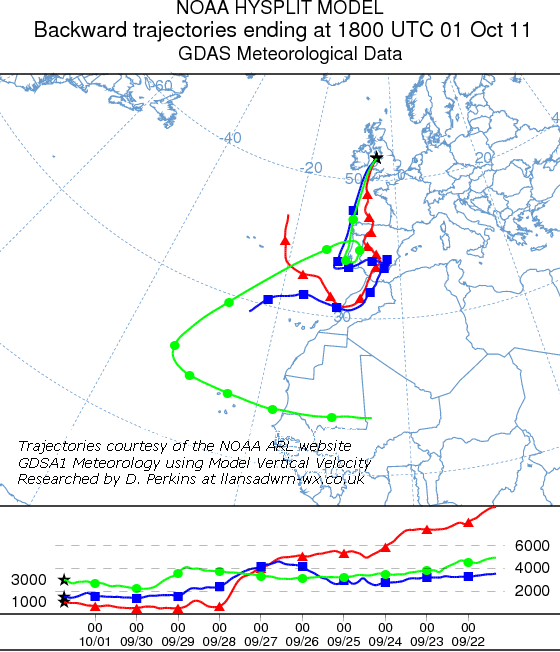
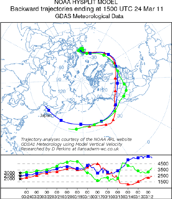
25th: A bright morning with hazy sunshine. Visibility was very poor and the sky milky blue an indication of various suspended pollutant aerosols, including fine dust particles, and possibly radioactive constituents from Fukushima. Backward trajectory analyses (example left), using the HYSPLIT model, courtesy of the NOAA ARL Website, indicated that parcels of air arriving over Anglesey at 1500 GMT today, between 1500 and 2500m AGL, took the Polar route moving 230° around the globe from the vicinity of Fukushima Daiichi between the 12th & 14th just after the earthquake when the nuclear reactors were damaged.
Pressure 1023 mb was falling slowly with the high 1029 mb centred S Iceland. The chiffchaff was singing strongly this morning.
A few clouds clearing later in the afternoon with the haze reduced, but enough to obscure a clear view of the mountains and any remaining snow patches. No contrails were seen overhead today. Soil moisture today was 55% dry mass. Grass was mown today and light coloured cattle are grazing an adjacent field. {Chivenor 19.6C, Sennybridge 17.5C, St. Athan 11.2h} [Rain trace; Max 11.3C; Min 4.8C; Grass 1.9C]
26th: The grass looked very white at 07 GMT, the temperature on the grass had fallen to -1.8C while the air temperature had not fallen below 1.4C here, but Pentraeth AWS reported -0.9C. Automatic sensors at Valley reported precipitation at 03 GMT with fog and snow grains at 06 GMT. There was a trace of precipitation here which must be recorded as UP (unidentified precipitation) as no visual observation made and there were no marks on the hailometer (small hydrometeors do not usually make a mark). The frosted, but melted at 09 GMT, dew pad recorded a deposit of 0.19 mm. A similar event here was on the evening of 20th January when in freezing fog (air temperature -0.8C) ice crystals formed and were deposited. There was a slight light-browny grey deposit on the roof of the Stevenson screen, origin as yet not investigated. A mostly bright morning with long sunny spells (hazy) in the afternoon with the sky clearing. Clear evening. {Middle Wallop 17.6C, Milford haven 16.2C, Valley 7.0h} [Rain 0.0 mm; Max 12.0C; Min 1.4C; Grass -1.8C]
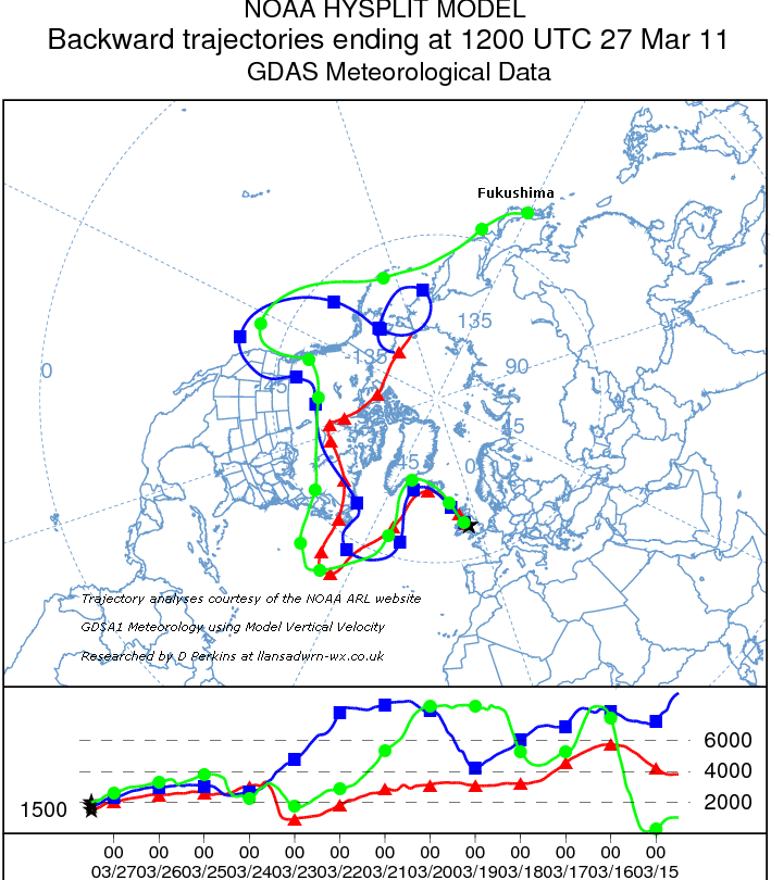 27th: A white frost on grass soon after dawn, soon disappearing on the bright sunny morning, with 0.25 mm deposition recorded on the dew pad. Still very hazy giving poor visibility persisting through the day. Scattered cumulus clouds, but mostly clear overhead the station with no contrails seen. Pressure was 1025 mb with high 1021 mb S Iceland and low 1006 mb Bay of Biscay. Air flow was clockwise around the high and Saharan dust was still in suspension was on its periphery. No deposits were seen this morning and there had been no rain to wash it out. Interestingly, backward trajectory analyses, using the HYSPLIT dispersion model, courtesy of the NOAA ARL Website
showed that Polar air circulation had brought parcels of air between 500 and 2000 m AGL to Anglesey from close to Fukushima, possibly containing traces of radioactive particles. The route was
across Canada, the Atlantic S of Nova Scotia, then N again via S Greenland and Iceland to Anglesey at noon. Traces of radioactive iodine had already been reported in Alaska. [Trace dew & frost; Max 11.0C; Min 3.3C; Grass -0.1C]
28th: Another fine morning with hazy sunshine. There was extensive white frost on the grass at 06 GMT (grass minimum -1.7C; 0.26 mm dew/ frost had been deposited) and dense shallow fog, 2 m high with smooth top, formed on the field. Tops of trees behind could be seen above, but not below the fog being so dense. By 09 GMT the fog had disappeared and it was a mostly sunny day. A few cumulus clouds appeared from time to time; winds were light and variable. Visibility was moderate to good, the haze increased through the day with aerosols and dust particles in the air. Traces of radioactive iodine originating from Fukushima
were reported in Glasgow, Oxford and elsewhere. [Rain 0.9 mm; Max 14.1C; Min 2.2C; Grass -1.7C]
 29th: Cloud was breaking a little and thinner patches appearing at 0900 GMT after rain between 0500 & 0600 GMT. There was a light deposit of mixed colour pink to dark reddish-grey dust on the roof of the Stevenson screen 29th: Cloud was breaking a little and thinner patches appearing at 0900 GMT after rain between 0500 & 0600 GMT. There was a light deposit of mixed colour pink to dark reddish-grey dust on the roof of the Stevenson screen  and garden furniture. MUNSELL® soil colour chart (5YR 7/3, 4/1 moist, collected dry sample similar range of colours). Although of a similar pink hue it contained a much darker grey dust of different origin. Pockets of dust have circulated within high-pressure in parts of NW Europe since the 15th and this event may include remnants. Backward trajectory analyses (left), using the HYSPLIT model, courtesy of the NOAA ARL Website, indicated that air over Llansadwrn from midnight came from a wide area including near Fukushima, but suggest that some parcels at 2500 ft AGL at the onset of rain at 0500 GMT may have originated in eastern Algeria near the Tunisian border and be the source of this dust. Becoming mostly bright with weak sunshine and the odd glimpse of clear sunshine before turning duller by midafternoon when there was a little fine drizzle at times. [Rain 1.1 mm; Max 13.6C; Min 5.2C; Grass 3.0C] and garden furniture. MUNSELL® soil colour chart (5YR 7/3, 4/1 moist, collected dry sample similar range of colours). Although of a similar pink hue it contained a much darker grey dust of different origin. Pockets of dust have circulated within high-pressure in parts of NW Europe since the 15th and this event may include remnants. Backward trajectory analyses (left), using the HYSPLIT model, courtesy of the NOAA ARL Website, indicated that air over Llansadwrn from midnight came from a wide area including near Fukushima, but suggest that some parcels at 2500 ft AGL at the onset of rain at 0500 GMT may have originated in eastern Algeria near the Tunisian border and be the source of this dust. Becoming mostly bright with weak sunshine and the odd glimpse of clear sunshine before turning duller by midafternoon when there was a little fine drizzle at times. [Rain 1.1 mm; Max 13.6C; Min 5.2C; Grass 3.0C]
30th: Overcast skies and light to moderate rain. Pressure 1006 mb was steady with highs 1027 mb Iberia and 1018 mb Scandinavia and low 969 mb S Greenland. A series of frontal systems were passing over from the West. The rain petered out during the morning and the afternoon was drier although there were some spots of drizzle at times. The cloud lifted and there were a few glimpses of sunshine. The cloud briefly almost clearing the mountaintops revealed that there were 3 or 4 small snow patches still surviving near the summit of Carnedd Llewelyn. {Hawarden 14.2C, Capel Curig 7.0 mm, Aberporth 4.1h} [Rain 6.2 mm; Max 12.5C; Min 8.4C; Grass 7.4C]
31st: At midnight low 986 mb was W of Shannon tracking for Malin Head with a warm front lay over S Wales heading NE. It was a windy night and there was a burst of heavy rain at 0358 GMT, 22 mm/h, and with passage of a following cold front a gust of 45 mph was recorded at 0507 GMT. A wet and windy morning at first, with 30 mph speed limit on the Britannia Bridge, moderating by noon. The afternoon was dry occasionally bright, even a glimpse of sunshine. By evening the wind was picking up again. {Hawarden 15.7C, Capel Curig 19.2 mm, St. Athan 6.4h} [Rain 1.7 mm; Max 13.7C; Min 7.8C; Grass 7.8C]
The driest March since 1993, rank 7 in Llansadwrn since 1928. The 29.4 mm rainfall was (44%) and [35%] of the averages. Since mid-month temperatures picked-up and the mean temperature finished on 7.2C, highest since 2009 rank 15 since 1979, was [(+0.3)] based on both decadal and 1981 - 2010 averages. A very sunny month at Valley the 168.1h (125%) & 148%] of average, highest since 1955 ranking 4 on the Anglesey record (K&Z adjusted) since 1930. Sunniest day was on the 27th with 10.7h and there were 2 sunless days. In the cloudier Llansadwrn with 5 sunless days mean global solar radiation was 8.18 MJ m-2, brightest day was the 26th with 13.41 MJ m-2. Brightest hour was from 1200 GMT on the 28th having 648 W m-2.


1st: Overcast with uniform grey low stratiform cloud. The SSW'ly wind was force 4/5 gusting to 35 mph and a burst of rain at 0741 GMT fell at a rate of 24 mm/h and there were 14.0 mm recorded up to 09 GMT. Pressure 1011 mb was steady and the day was windy and dull with further spots of rain at times. Sunless. [Lossiemouth 19.4C, Llanfairfechan 17.7C, Valley 11.9C, Capel Curig 28.4 mm] {Hawarden 15.7C, St Athan 3.4h} [Rain 14.0 mm; Max 12.4C; Min 10.1C; Grass 9.8C]
 2nd: In strong Föhn-like S'ly wind gusting to 43 mph off the mountains the temperature in Llanfairfechan rose to 17.7C around 0200 GMT, the highest temperature of the year there so far (Previous Föhn-like
event 24 February). In Llansadwrn thunder was heard from 0200 until 0220 GMT, heavy rain 33 mm/h with close thunder at 0210 GMT. After the rain a bright morning with visibility improving to good, but cloud still hugging the mountaintops. There had been another fall of pinkish-white to light reddish-brown Saharan dust. A sample collected at 09 GMT was MUNSELL® soil colour chart 5YR 8/2; 6/4, dry). Dust was reported (Wil) in Bethel, Llangristiolus, on a car and deposited on house windows.
Trajectory analyses at the time of the rainfall, using the HYSPLIT dispersion model at the NOAA ARL website, were indeterminate for the source, but indicated rapid transport (within 24-h) in a finger-plume from a pool of Saharan dust heading N off the Iberian Peninsular. This was accurately forecast (graphic above left) to encroach the Celtic and Irish Seas by the University of Athens SKIRON model accessed at 0959 GMT yesterday (1). the wind had moderated and during the morning cloud began to lift with sunny spells breaking through. By early afternoon the mountaintops were clear and I could see just one very small patch of snow left on Carnedd Llewelyn in the afternoon. The evening turned cloudier and the night overcast. [Rain 0.1 mm; Max 14.5C; Min 9.1C; Grass 9.1C]
3rd: A mild night with temperatures not falling below 9.1C. Pressure 1011 mb was rising slowly and the morning bright with some glimpses of sunshine. Clearer skies later in the afternoon evening. Bluebell leaves had grown large (30 cm, or more) in the wood with no sign of any flowers. Today the first bluebell buds, white at this stage no blue yet, but on the smaller leaved plants in the wood. Perhaps the larger plants will not flower this year, in which case the woodland will not look as colourful as the previous 2-years that have seen many flowers. The first flowers are also appearing on the lower branches of wild cherry and while there are plenty of buds on alpine clematis as yet they remain closed. {Hawarden 14.1C, Capel Curig 10.0 mm, St Athan 7.1h} [Rain 0.1 mm; Max 13.3C; Min 7.4C; Grass 5.7C]
4th: Cloud began to encroach by 03 GMT, but it was dry until a band of rain that was over Ireland at 0630 GMT moved quickly across the Irish Sea arriving here just before 09 GMT. A blustery morning the SW'ly force 4/5 (gust 41 mph at 1137 GMT) with light to moderate rain. Wet and windy, drier for a time then more of the same. The first swallow was spotted at the weather station. Rain moderate to heavy from 2200 GMT. {Murlough 17.8C, Hawarden 13.7C, Capel Curig 27.8 mm, St Athan 1.1h} [Rain 15.8 mm; Max 10.5C; Min 3.9C; Grass 0.2C]
5th: Overcast with a force 4/5 SW'ly;y wind, in mist visibility was very poor. Pressure 1013 mb was rising slowly, but the day kept overcast and dull. In Llanfairfechan with the wind off the mountains the temperature rose to 16.4C. Several swallows were seen near the Almshouses, on the way to Beaumaris, where Alexanders was in full flower along the roadside. Wet in Snowdonia. {Dyce 17.9C, Llanfairfechan 16.4C, Hawarden 16.1C, Tyndrum 51.2 mm, Capel Curig 38.0 mm} [Rain 10.0 mm; Max 12.2C; Min 10.0C; Grass 9.8C]
6th: Pressure 1022 mb was rising slowly. A bright morning with 6 oktas of moderately high altocumulus (with lenticularis to the SE in lee of the mountains) and high jetstream cirrus very slowly clearing. A few long expanding contrails were seen briefly at 0820 GMT to the NE of the station. Bright with weak sunshine and some clear sunny spells into the afternoon. Windy the force 5 SW'ly not moderating through the day. In Llanfairfechan, in the Föhn-like wind the temperature rose to 18.7C, highest of the year so far. Here we reached 16.0C; we need the wind to be more S'ly, or SE'ly to see the effect in Llansadwrn. From 15 GMT the sky mostly cleared and it was clear into the evening, but still windy. {Santon Downham 23.9C, Hawarden 19.3C, Llanfairfechan 18.7C, Tyndrum 75.0 mm, Valley 8.2 mm, Aberporth 10.6h} [Rain 0.3 mm; Max 16.0C; Min 7.5C; Grass 5.5C]
7th: Overcast with mist and fine drizzle. A cold front associated with low 988 mb over the Baltic was lying over the Irish Sea and Anglesey. The drizzle stopped by 11 GMT and it was a little brighter as the cloud thinned, but no sunshine was seen. Later in the afternoon the drizzle returned although it was brighter in the W. Most of the UK was warm and sunny. After dark the sky did clear and starts were seen. {St. James Pk 22.7C, Milford Haven 17.9C, Baltasound 3.2 mm, Valley 2.4 mm, St. Athan 10.4h} [Rain 0.5 mm; Max 13.0C; Min 7.5C; Grass 5.5C]
8th: Mist and fog developed after 03 GMT and in the morning it was still lingering (here at 06 GMT) around the coast and Menai Strait. It was sunny on the mountaintops, but at 09 GMT fog was burning off and cumulus clouds developing, although visibility was still poor, and we had some sunny spells. {Sennybridge 20.1C, St. Athan 12.0h} [Rain 0.0 mm; Max 18.0C; Min 6.8C; Grass 3.5C]
9th: There was scattered high cirrus clouds, and contrails in the sky at 09 GMT, and it was a fine and sunny day with the temperature rising to 23.0C in the afternoon. The highest recorded this early in the year since the 23.0C during a Föhn wind event on 20 Mar 2005, 23.0C was also recorded on 14th April 2003 and went on in a 4-day spell of fine weather to reach 25.3C on the 16th. [Rain 0.0 mm; Max 23.0C; Min 7.8C; Grass 5.3C]
10th: No clouds seen at 09 GMT with good, but hazy visibility and the milky white sky indicative of Saharan dust in the atmosphere. Hazy sunshine, cloudier over the mountains of Snowdonia during the day. Haze increased late in the afternoon. Orange tip butterflies (males) were seen in the garden; buzzards are frequently seen at the moment, sometimes 2 or 3 enjoying a thermal, flying near or through the wood and garden, or perching on a nearby treetop. I am still hoping to see a red kite here that since reducing to between 15-20 pairs in mid Wales in the 1960's has staged a comeback following conservation legislation and introduction of 'new blood'. Birds were reintroduced and there has been, since the 1990's, a remarkable increase in numbers in many parts of Britain. Birds of prey are still killed in some places including Scotland where every year at least 30 birds of prey including golden eagle are found dead. [Rain 1.0 mm; Max 20.3C; Min 11.2C; Grass 7.9C]
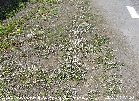 The halophytic ivy-leaved scurvy grass Cochleria danica usually found near the sea is still flourishing along our salt-treated roads. Spotted in 2003 (Wx-Watch page) along the A5025 following salt treatment through the hard winter was growing profusely
  near Castellior. . near Castellior. .
11th: A weak cold front moving on to western shores brought a few spots of rain from 08 GMT and a shower of rain around 09 GMT. Clearing, brighter with a little sunshine just before 1100 GMT then turning cloudier with a few/ scattered cumulus clouds developing. A red admiral butterfly was spotted in the garden. Rain kept away until evening when there was a shower. {Shoeburyness 21.5C, Mumbles Hd. 15.9C, Kinlochewe 10.2 mm, Porthmadog 2.6 mm, Manston 10.6h, St Athan 8.5h} [Rain 1.2 mm; Max 14.3C; Min 8.5C; Grass 5.9C]
12th: Mostly clear overnight with the air temperature falling to 2.8C and to 0.2C on the grass, both lowest of the month. This should not have caused any problem in the garden; the early potatoes are through but being in ridges on a slight slope any cold air would have drained away. There looked very well this morning. In the past with more frequent frosts they would have been covered with broadsheet newspapers, now difficult to come by, during the previous evening. A modern length of garden fleece is on standby just in case! Cloudier since dawn with fair-weather cumulus developing cover was 5 oktas at 09 GMT. The wild cherry was in full bloom today the opening flowers having reached the top; it will not be long before the leaves being to open. The Bardsey apple tree is in full flower too so I hope there are some bees around for effect pollination.. The sky was quite blue today and the clouds began to disperse to give a fine mostly sunny day. {St James Park 15.8C, Pembrey Sands 13.8C, Yeovilton 12.6h, Aberporth 12.3h} [Rain 0.7 mm; Max 14.0C; Min 2.8C; Grass 0.2C]
13th: Clouding over after midnight there was slight rain from 0500 GMT amounting to 0.7 mm by morning. Mostly cloudy at 09 GMT poor to moderate visibility with a blustery SSW'ly wind and intermittent slight rain dying out. An occluded front lying over Ireland and the Western Isles moved south-east. A fine afternoon the sky remaining mostly covered with a cool wind keeping the temperature to a maximum of 11.2C in common with other places in Wales. {Hawarden 11.2C, Capel Curig 7.6 mm, St Athan 2.0h} [Rain 0.8 mm; Max 11.2C; Min 5.8C; Grass 5.3C]
14th: Overcast skies (an occluded front over the Irish Sea) with some thinner patches was slow to clear, but it was bright with a few glimpses of sunshine before noon. A trace of coloured dust deposited with a darker deposit, but as the local farmer had been spreading fertilizer it was probably contaminated. It was a warmer day with the temperature rising to 15.8C in the afternoon one of the highest in Wales. The wind dropped in the evening and it was calm between 1900 and 0200 GMT. {Aboyne 17.7C, Milford Haven 14.1C, Capel Curig 1.0 mm, St Athan 6.0h} [Rain 0.0 mm; Max 15.8C; Min 6.5C; Grass 6.3C]
15th: Mostly cloudy with a light SSW'ly breeze. A similar slightly coloured dust deposit with grey overtones. Soon becoming bright with sunny spells it was another fine day. Soil moisture determined today was 58% dry mass and the grass had been growing at a rate of 8 g per square metre per day. This is becoming the peak time for grass growth, if there is sufficient moisture in the soil, with flowering tillers appearing biomass increases can be substantial. The local farmers have been rolling the grass fields to encourage tillering. By 2200 GMT it was mostly cloudy with a 'mackerel sky' overhead a sign of instability and perhaps rain. {Killowen 17.7C, Milford Haven 15.3C, Manston 8.2h, St Athan 4.0h} [Rain 0.0 mm; Max 16.1C; Min 9.0C; Grass 8.0C]
The first 15-days had 44.7 mm of rainfall (65%) of the decadal average and {71%} of the 30-y average. The mean temperature was 11.3C [(+2.4)] well above the monthly averages.
16th: It was bright with some weak sunshine, but overcast and dull at 09 GMT. Pressure 1023 mb was rising slowly within an elongated high-pressure area 1025 mb stretching from N of the Azores to N Europe. A decaying occluded front was lingering over S Scotland, the Irish Sea to Lands End and soon delivered a few spots of rain. The afternoon was bright with a few glimpses of sunshine and in light winds the 16.8C temperature felt pleasantly warm. [Rain trace; Max 16.8C; Min 7.0C; Grass 4.5C]
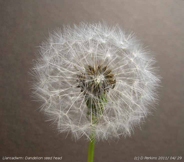 17th: A sunny morning with cirrus clouds and a long contrail overhead. The grass was wet with dew with the grass minimum thermometer reading 1.3C overnight. Visibility was very good and the day sunny with the temperature rising to 16.0C. Lesser celandine flowering now has become a menace in the garden. Just one or two plants 10 years ago along the hedgerows and garden have increased rapidly in recent years possibly encouraged by increased temperatures. The plant seeds profusely and forming small tubers, that remain in the ground overwinter, grows early in the spring and dominate large patches of ground. It has spread on lawns and along paths in the wood, and because it can dominate the ground flora, including ivy, steps are being taken to reduce it, or hopefully eliminate it in the garden The tubers must be dug up if possible, and where possible I am cutting it back to reduce vigour and before it seeds. [Rain 0.0 mm; Max 16.0C; Min 5.5C; Grass 1.3C]
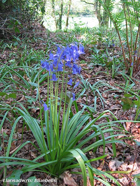 18th: Scattered altocumulus and cumulus clouds and a fine sunny morning with a light ESE'ly breeze. The temperature at 09 GMT was 16.0C (dewpoint 6.9C) the relative humidity 55% and falling to 49% as the temperature rose to 19.7C during the day. The grass was more or less dry, there being just guttation droplets at the end of leaves. Continuing bright with sunny spells and moderate to good visibility. Flowers are opening on horse-chestnut, primroses continue to flower profusely and there are masses of cowslips and yellow and orange Welsh poppies the garden is very colourful. {Blackpool 19.9C, Porthmadog 19.7C, Camborne 12.6h, St Athan 9.5h} [Rain 0.0 mm; Max 19.7C; Min 7.9C; Grass 4.6C]
19th: A clear sky today, but visibility was poor with smoke haze; Saharan dust was affecting Scandinavia and SW Ireland could also be in the vicinity. Contrails were seen to the N of the station. Relative humidity in the night did not go above 80% and with no rain the soil surface for the 4th morning was recorded as dry; there was a little guttation seen on grass and Alchemilla leaves. Bluebells in the wood are now coming out at 'the top' of the wood. This is a raised area that I cleared of a fallen tree and brambles earlier in the year. There is a view, on a clear day, of the sea in Red Wharf Bay from here. A sunny day, cirrus clouds increased in the afternoon and there was a light NE'ly breeze that died away in the clear evening. {St James Park 25.4C, Porthmadog 22.2C, Dunstaffnage 14.2h, Valley 12.4h}[Rain 0.0 mm; Max 16.7C; Min 8.6C; Grass 3.5C]
20th: Another clear sky day with hazy sunshine. Visibility was poor with moderate amounts of photochemical; aerosols in the atmosphere. The wild cherry tree in the garden in fully out and with its open branch structure looked spectacularly graceful in the morning sunshine. There was a light NE'ly breeze and contrails were seen from time to time drifting across the sky. [Rain 0.0 mm; Max 20.3C; Min 9.3C; Grass 4.5C]

|
21st: Yet another clear sky morning. Sunny and the temperature 17.7C (dewpoint 10.9C) at 09 GMT. Wide expanding contrails passed over from the NE. Convective cloud developed to the SW during the afternoon that turned mostly cloudy with sunny spells. Haze persisted and visibility was very poor. The evening was clear and sunny, but still hazy. A large fire, believed to have been started deliberately, was burning on the Brecon Beacons in S Wales. {Heathrow 26.3C, Gogerddan 24.5C, Coleshill 12.9h, St Athan 12.3h} [Rain 0.0 mm; Max 21.0C; Min 9.8C; Grass 5.3C]
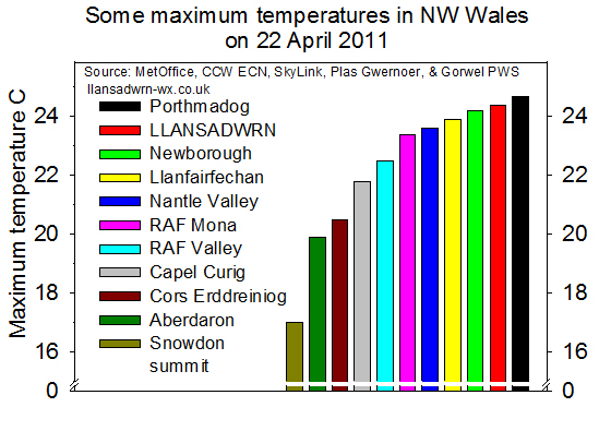 22nd: A sunny and warm day with 3 oktas of cirrus and cirrostratus lying to the S at 09 GMT and a light SE'ly breeze. There was moderate smoke (pollution) haze the level reported by the instruments at Marchlyn Mawr 160 µg ozone m-3 (courtesy of the Welsh Air Quality Forum). Ozone is formed in the atmosphere under the action of bright sun light (hence called photochemical smog) on nitrogen oxides emitted principally from motor vehicles. Ozone levels were moderately high over most of Wales and this spread to England with high levels in London the smog worst seen for many years. The temperature was already 20.3C (dewpoint 9.5C). Some convective cloud formed by 11 GMT and there were scattered clouds around during the afternoon, but it kept bright with sunny spells. The temperature rose to 24.4C during the afternoon the second highest temperature recorded at this station on this date in April since records began in 1979. The highest is 25.3C recorded on the 16th in 2003. In Llanfairfechan the temperature rose to 23.9C and in Porthmadog to 24.7C. {St James Pk. 26.9C, Manston 13.0h, Valley 6.9h} [Rain 0.2 mm; Max 24.4C; Min 13.9C; Grass 9.6C]
23rd: An overcast day with slight showers of rain from 05 GMT the few drops in the raingauge only amounting to 0.2 mm at 09 GMT. Cold fronts approaching from the NW after midnight, associated with shallow low 1002 mb off W Scotland and low 1005 mb Gibraltar Strait, were slow-moving over the Irish Sea and Scotland. A few more spots of rain during the morning becoming brighter in the afternoon as the cloud thinned, but did not break. The light wind SW'ly at first veered N then NE, the cloud and cooler northern air gave a dull sunless day and more lower temperatures the day's maximum just 12.2C. In S Britain sunshine and high temperatures continued with thunderstorms developing in places. {Wisley 27.8C, Sennybridge 21.6C, Santon Downham, Suffolk 20.6 mm, Bristol AP 12.8h, St Athan 12.4h} [Rain 0.1 mm; Max 12.2C; Min 10.6C; Grass 7.8C]
24th: The sky cleared during the night, the temperature on the grass falling to 0.4C, and it was a much brighter morning with a few cirrus clouds, mostly to the S, at 09 GMT. Visibility was very good, almost clear, with little haze. Pressure 1022 mb was rising in a ridge extended from the Azores high, but fronts were poised to the W. It was calm with light variable airs at first settling to a light to moderate NE'ly later and, although mostly sunny, the temperature kept down to 16.5C. Continuing warm and sunny in the S, a few degrees warmer than places in the western Mediterranean that continues unsettled. {Solent 25.3C, Mumbles Hd. 21.1C, Camborne 13.2h, Valley 12.9h} [Rain 0.0 mm; Max 16.5C; Min 4.6C; Grass 0.4C]
25th: A fine and sunny morning with a few cirrus clouds overhead and stratocumulus over the mountaintops. The grass was slightly wet with guttation droplets at the tips of the leaves. A sunny day, the light to moderate NE'ly breeze persisted through the day with showers of bud scales falling from the tall trees that are rapidly coming into full leaf. Cirrus clouds predominated in the afternoon and thicker cloud encroached from the W by midnight. {Solent MRSC 24.0C, Thorney Is. 22.2C, Pembrey Sands 20.1C, Norwich AP 13.2h, Valley 12.7h} [Rain 0.4 mm; Max 12.5C; Min 6.9C; Grass 2.8C]
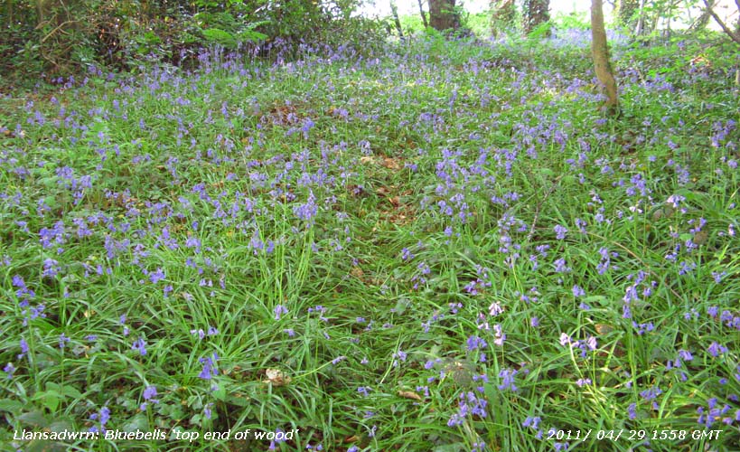
26th: Overcast and raining in the morning, but it was very slight and was hardly enough to wet the ground. Pressure was 1029 mb with high 1035 mb over Scotland with a cold front lying from Cork, S Ireland, over Wales to the North Sea. A dull sunless day with a few spots of rain at times, we could do with a lot more in the garden. {Solent 20.7C, Milford Haven 18.8C, Valley 1.6 mm}[Rain 0.1 mm; Max 11.3C; Min 7.2C; Grass 3.5C]
27th: Overcast skies began to break in the morning to give a mostly sunny day on the side of the island, the low cloud and mist lingering longer on the west coast, and a clear evening and night. There were many flying ants about. {Solent 19.8C, Porthmadog 17.4C, Aberporth 11.5h} [Rain 0.0 mm; Max 14.4C; Min 8.5C; Grass 7.3C]
28th: With clear skies overnight the temperature on the grass dropped down to 0.9C. Clear sky at 09 GMT with good visibility and slight smoke haze;grass was still wet with dew (0.2 mm recorded). Clear skies continued all day, 3 contrails were seen above Beaumaris at 0810 GMT, solar radiation reached 23.49 MJ m-2
, highest of the month. There was a cool NE'ly breeze and the temperature rising to just 13.0C. A clear evening and night.
{Castlederg 19.5C, Pembrey Sands 18.8C, Valley 0.2 mm & 13.6h} [Rain 0.0 mm; Max 13.0C; Min 6.0C; Grass 0.9C]
 29th: The day began with almost clear skies, a small cumulus cloud was spotted to the SSW at 09 GMT. There had been heavy dew (0.26 mm), but this had almost dried off in the light NE'ly breeze at 09 GMT. Pressure was 1017 mb in a ridge from Scandinavian-high 1031 mb with decaying frontal cloud lying to the south-east. Later the morning turned cloudier with sunny spells, but the sky cleared again in the afternoon. A cool NE'ly breeze persisted while the temperature rose to 16.7C. The breeze lessened by evening. Soil moisture determined today had fallen to 45% dry mass, the first signs of moisture stress shallow rooted plants were beginning to appear although the grass was green and growing at a rate of nearly 9 tonnes per hectare. {Isle of Skye 22.1C, Porthmadog 21.1C, Lerwick 14.5h, Valley 11.9h} [Rain 0.0 mm; Max 16.7C; Min 7.0C; Grass 2.3C]
30th: A sunny but hazy morning, the sky looking very milky. The haze was due to a combination of Saharan dust and pollutant aerosols in the air, visibility was only moderate as a result. There was a persistent force 2/3 NE'ly breeze and, although the temperature rose to 17.4C, it felt cool if you were in the breeze and very pleasant if you were sheltered. The day was dry here, showers affected SW England, Cornwall and Brittany. {Hurn 22.3C, Pembrey sands 22.0C, N. Wyke 11.0 mm, Dunstaffnage 14.8h, Aberporth 11.8h} [Rain 0.0 mm; Max 17.4C; Min 9.3C; Grass 8.2C]
In common with many places it was the warmest April on record. The mean temperature was 11.9C (+2.6) and [+3.0] the highest here since before 1979 when records began. The mean maximum was 15.8C and the mean minimum 7.9C. The highest maximum 24.4C was (+5.4). Rainfall was 45.3 mm highest since 2008, but one of the 28 driest in Llansadwrn since 1928. At RAF Valley there were 211.1 h of sunshine (125%) & [134%] of average, lowest since 2009 (188h), but ranking 5th sunniest on the Anglesey record since 1930. Sunniest day was on the 28th with 13.6h, there were 5 sunless days. .


1st: After the warmth of April the morning the 10.5C temperature and NE'ly breeze felt chilly still in shorts for the obs at 09 GMT. Pressure was 1012 mb with high 1035 mb North Cape and lows 1000 mb near Brest and the Iberian coast 999 mb and Italy. Bands of showers were affecting Cornwall, but it was a fine mostly sunny and breezy day. Moderate deposition of dust and pollen. The temperature rose to 20.5C during the afternoon with relative humidity down to 25% at 1540 GMT and 27% at 1700 GMT, at Gorwel Heights, in Llanfairfechan, a low of 19% was recorded while at Valley 15% RH was reported. A clear evening except for a little cloud edging in from the S around 2100 GMT. Fires in the Mourne Mountains Co. Down are reported to have caused immense damage. Fires are also burning for the third day on moorland in Lancashire. {Porthmadog 21.2C, Culdrose 13.2 mm, Tiree 15.0h, Valley 12.2h} [Rain 0.0 mm; Max 20.5C; Min 7.8C; Grass 6.1C]
2nd: The dry spell continued with a moderate to heavy deposition of dark coloured dust and local pollen; the soil surface was very dry. Altocumulus lenticularis in the morning giving way to persistent mainly cirrus clouds in the afternoon. An E'ly breeze rushing in the tall trees, sheltered in the garden but was force 4/5 in exposed places near the village in the afternoon. A long wavy contrail was spotted overhead at 1410 GMT. Sunny and warmer in the north-west. {Kinlochewe 20.4C, Pembrey Sands 19.2C, Camborne 8.2 mm, Tiree 14.9h, Valley 13.7h} [Rain 0.0 mm; Max 18.6C; Min 7.3C; Grass 5.3C]

|
3rd: Fine and mostly sunny, cirrus clouds overhead with a line of cumulus clouds over the mountains. Three very broad wavy contrails were seen overhead and to the NE and over Red Wharf Bay at 0720 GMT. At Beaumaris Castle at 0842 GMT persistent spreading contrails forming and merging with cirrus clouds were photographed  . Visibility was very good with almost clear views of Snowdonia and, from another vantage point, the Lleyn Peninsular. There was a heavy deposit of dust at the weather station. It was a windy morning at Gorwel Heights, Llanfairfechan, the E'ly gusting to 38 mph moderating in the afternoon. A sunny afternoon and evening. {Porthmadog 17.9C, Kinloss 15.0h, Valley 13.5h} [Rain 0.0 mm; Max 15.8C; Min 5.0C; Grass 3.1C] . Visibility was very good with almost clear views of Snowdonia and, from another vantage point, the Lleyn Peninsular. There was a heavy deposit of dust at the weather station. It was a windy morning at Gorwel Heights, Llanfairfechan, the E'ly gusting to 38 mph moderating in the afternoon. A sunny afternoon and evening. {Porthmadog 17.9C, Kinloss 15.0h, Valley 13.5h} [Rain 0.0 mm; Max 15.8C; Min 5.0C; Grass 3.1C]
4th: Weakly sunny through cirrostratus and cirrocumulus overhead; high clouds were increasing to the south-west. Dust deposits were moderate. Little wind here, but windy again at Gorwel Heights gusting to 28 mph at 0624 GMT with relative humidity down to 30%. Here at 09 GMT the temperature was 12.8C (dewpoint -1.2C) RH 38%. Pressure was 1020 mb with Atlantic- low 988 mb lying to the WSW with an occluded front over S Ireland. Soil water determined today averaged 31% dry mass with 1 sample as low as 24% dry mass; grass was beginning to show signs of yellowing. Arctic sea ice was reported to be least on record since 1979. {Porthmadog 19.9C, Aberporth 10.9h} [Rain trace; Max 18.8C; Min 6.0C; Grass 1.8C]
5th: Valley reported showers of rain at 0300 GMT and light rain and drizzle from 07 GMT. Here it was just a trace and the soil, concrete and grass are still dry with a light deposit of dust. Pressure was steady on 1015 mb with high 1026 mb Germany and Atlantic-low 991 mb S Iceland/ Wt of Brest. An occluded front lay over Anglesey and western Britain. Overcast with a few spots of rain at 1000 GMT and a shower of rain of about 2 mm in the afternoon turning bright with glimpses of sunshine later. Dull again by evening. {Heathrow 21.5C, Rhyl 18.3C, Dundrennan 14.4 mm, Capel Curig 8.2 mm} [Rain 4.4 mm; Max 15.5C; Min 10.0C; Grass 7.8C]
6th: Showers of rain before 09 GMT and 4.4 mm was recorded, the most since 5 April. Rain showers continued on the mountaintops where cloud was on the lower slopes. Rain in the afternoon with a few bright spells and glimpses of sunshine. The temperature rose to 19.5C. Windy moderating by evening. {St James Park 25.3C, Hawarden 21.6C, Tiree 15.8 mm, Odiham 11.4h} [Rain 1.8 mm; Max 19.5C; Min 11.8C; Grass 10.7C]
  7th: Most cloudy with some dark looking clouds in the vicinity, but there had been a little sunshine earlier. Low 979 mb was still over the Atlantic to the SW with a cold front over Ireland and 'Spanish Plume' heading N over Brittany into the Channel and SW England. Pressure 1008 mb was falling slowly and it was a muggy 17.0C (dewpoint 13.7C) at 09 GMT. The day had showers and bright or sunny spells until thunder was heard from 1749 GMT increasing frequency heading northwards. At 1759 GMT as black clouds approached there was very heavy rain with sparse, rapidly melting, large clear hailstones 10 mm diameter. Rate of precipitation were 80 mm per hour here and at Llanfairfechan 91 mm per hour. Almost continuous thunder was heard until 1815 GMT. Very heavy rain, and large hailstones, were reported in Llansadwrn and Pentraeth villages, descriptions reported varied from marble to golfball size! Boscombe Down reported 28.8 mm rainfall, RAF Valley 26.8 mm while RAF Mona had 14.4 mm. {Weyborne 25.4C, Gogerddan 21.6C} [Rain 13.5 mm; Max 19.0C; Min 12.3C; Grass 10.1C]
8th: Heavy showers continued after midnight (0240z 39 mm/h and 0450z 36 mm/h), but it was bright with sunny spells as the cumulus clouds scudded along on the moderate SSW'ly breeze at 09 GMT. A blustery day with frequent slight showers continued through the morning and there were spots of rain in the afternoon. After the rain soil moisture had risen to 38% dry mass and the grass looked greener. {Norwich AP 23.9C, Hawarden 18.7C, Braemar 32.4 mm, Camborne 13.2h, Valley 9.6h} [Rain 0.7 mm; Max 17.5C; Min 10.0C; Grass 9.6C]
9th: Frequent blustery showers of rain at first with a complex sky(6 oktas) including cumulus, altocumulus and cirrus clouds. Pressure was 1016 mb with slow-moving low 985 mb S of Iceland with a showers trough over the Irish Sea. As the showers died out the morning was bright with sunny spells, but another prolonged heavy shower came along at 1320 GMT with rain falling at a maximum rate of 22 mm/h during a 40-min spell. During the shower the temperature fell from the day's maximum of 17.1C to the minimum of 10.0C. Bright again afterwards as the blustery S'ly wind persisted. {Cromer 22.5C, Hawarden 17.6C, Mumbles Hd. 14.6 mm, Kirkwall 13.0h, Valley 7.9h} [Rain 7.5 mm; Max 17.1C; Min 10.9C; Grass 8.8C]
10th: Frequency of showers increased again after midnight heavier between 0150 and 0210 GMT (21 mm/h). Keeping mostly cloudy with a gusty SW'ly wind during the morning become brighter with sunny spells in the afternoon with the gusty wind E'ly force 4/5 at times. {Gravesend 22.4C, Hawarden 18.4C, Tyndrum 24.4 mm, Lake Vyrnwy 5.0 mm, E Malling 13.3h, Valley 9.9h} [Rain trace; Max 16.5C; Min 10.0C; Grass 9.2C]
11th: With complex low-pressure lying to the NW with a showery trough within its circulation. At 09 GMT it was mostly cloudy and there had been a recent slight shower of rain here, frequent over the mountaintops. Spots of rain continued, but nothing very heavy came along. Soon brightening with sunny spells by 1030 GMT continuing into the afternoon that was very breezy the force 4/5 SSW gusting to 25 mph. {Bridlington 19.3C, Hawarden 18.0C, Tyndrum 21.8 mm, Aberporth 5.6h} . [Rain trace; Max 16.1C; Min 10.2C; Grass 8.7C]
12th: A bright patch of sky in the W early in the morning had disappeared at 09 GMT so that it was overcast. Low 1005 mb was N of Scotland and with a trough stretching from N Ireland to the Western Isles showers were predominately in the N. The jetstream seems to have taken up a position overhead, or just to the N with unsettled weather likely to continue. The morning was dull, but as the cloud thinned in the afternoon it was brighter and eventually a clear sunny spell arrived. Not lasting long the end of the afternoon became dull and the sky looking threatening again by 1800 GMT. {Heathrow 19.3C, Porthmadog 15.2C, Kinlochewe 27.6 mm, Aberporth 9.2h} [Rain 0.0 mm; Max 13.8C; Min 9.1C; Grass 7.0C]
13th: Low 1004 mb N of Scotland was not moving very far and with a remnant cold front lying S Ireland to Isle of Man and NW England we continued to be in the showery SW'ly airstream. Overcast with layered clouds, with some cumulus seen at 09 GMT. Soon a slight shower of rain, spots on the window, but not much on the dry ground. Mostly fine with minimal brightness, perhaps a flash of weak sunshine now and then. Two showers of slight rain in the afternoon with winds gusting to 22 mph, then a heavy shower with a fall of 3-4 mm ice pellets, that heavily marked the hailometer. Rate of fall at 1752 GMT was 31 mm/h here and 22 mm/h in Llanfairfechan accompanied by a 4.0C fall in temperature. Precipitation fell as snow on the summits of Carnedd Llewelyn, C Dafydd and Crib-y-ddysgl on Snowdon 'white caps' being seen during the evening when cloud lifted and the sky began to clear. Last May (2010) there was a sprinkling of snow on the mountains on the 12th & 13th during similar, but cooler, weather with persistent snow-patches. {Gravesend 19.8C, Hawarden 16.0C, Capel Curig 9.0 mm, Aberporth 5.9h} [Rain 3.1 mm; Max 13.5C; Min 6.6C; Grass 2.9C]
14th: Showers continued after midnight (0404 GMT 4.2 mm/h) and still mostly cloudy, obscuring the mountaintops, sunny spells came along by 09 GMT. Pressure 1021 mb was rising slowly with high 1035 mb developing NNE of the Azores. The low of previous days, anchored N of Scotland, had moved eastward over the S Norwegian Sea. A shower trough lay over N Wales and Cumbria. It was a day of sunny intervals and frequent showers, some heavy ones were reported along the A55 coast road early in the afternoon. There was a heavy shower here 15 mm/h at 2040 GMT. {Solent 18.9C, Mumbles Hd. 15.2C, Loch Glascarnoch 29.8 mm, Capel Curig 7.8 mm, St Athan 8.6h} [Rain 3.6 mm; Max 13.6C; Min 4.6C; Grass 1.0C]
15th: A wet morning with moderate rain falling at 09 GMT. A detached warm front was moving only very slowly over the Irish Sea resulting in drizzle and light rain at times through the day. It was moderately breezy as well, so an unpleasant sunless day. {Hurn 17.3C, Milford Haven 14.4C, Cluanie Inn 19.4 mm, Capel Curig 9.0 mm St Athan 3.9h} [Rain 3.5 mm; Max 12.0C; Min 6.2C; Grass 3.0C]
The first 15 days of May had a mean temperature of 12.5C, above, but much closer to the averages [(+0.8)], compared with exceptionally warm April. Rainfall was 38.1 mm (54%) and [61%] of the averages.
16th: Another dull, damp and sunless day. A frontal-wave low 1003 mb was N of Scotland and an occluded front lay over Malin and the Western Isles. Breezy (SW force 3/4) with drizzle and/ or rain most of the day, moderate rain between 1300 - 1500 GMT and further moderate rain 2000 - 2300 GMT with lessening wind. {Frittenden 21.2C, Sennybridge 15.8C, Dunstaffnage 34.0 mm, Capel Curig 5.6 mm, Aberporth 6.1h} .[Rain 5.8 mm; Max 12.5C; Min 8.9C; Grass 9.0C]
17th: Low cloud was blowing on to the lower slopes of the western mountains with visibility poor to moderate. There was very fine drizzle in mist at 09 GMT and there had been little variation in temperature (12.5C) overnight. A slow-moving occluded front over St George's Channel and Wales with a moist W'ly airflow. The precipitation began to peter out and the sky was brighter as cloud thinned in the afternoon, but remained overcast. Despite the cloudiness the temperature rose to 17.0C and in Llanfairfechan to 17.8C at 1319 GMT. [Shoeburyness 19.5C, Llanfairfechan 17.8C, Hawarden 17.4C, Capel Curig 8.6 mm, Valley 1.8h] [Rain 6.7 mm; Max 17.0C; Min 10.5C; Grass 10.2C]
18th: Overcast with uniform grey stratiform cloud with moderate, rather misty visibility. Cloud cover gave a mild night with an air minimum of 9.2C and on the grass 9.8C which was unusually high. Normally lower than the air temperature or rarely in cloudy nights a point or 2 above, the +0.6 was unusual, but not surprising with the surface soil temperature (bare plot) at 5 cm 12.6C at 09 GMT. Brightening during the morning becoming sunny in the afternoon with lessening wind and clearer sky by evening. Wild roses are now flowering profusely in the hedgerows. {Norwich AP 20.6C, Hawarden 16.5C, Gogerddan 8.4 mm, Aberporth 6.2h} [Rain 0.0 mm; Max 15.3C; Min 9.2C; Grass 9.8C]

|
19th: After almost clear sky around dawn cumulus clouds were developing before 09 GMT. Under clear skies the grass temperature had fallen to 1.6C well below the air temperature of 5.0C (a more normal situation, see yesterday). Pressure 1019 mb was falling slowly with twin lows 987 mb and 989 mb to the N we were still in the Atlantic SW'ly airstream. A fine day with light SW'ly breeze, cloudier in SE Anglesey, but mostly sunny with some cirrus clouds moving into the W during the afternoon. {Charlwood 21.5C, Hawarden 15.6C, Sennybridge 0.6 mm, Aberporth 10.6h} [Rain trace; Max 15.0C; Min 5.0C; Grass 1.6C]
Along the banks of the River Cefni the yellow iris is in flower  with yellow buttercup, a few flowers of the Burnet rose and red poppy were also seen. A few orchids were spotted with yellow buttercup, a few flowers of the Burnet rose and red poppy were also seen. A few orchids were spotted  and on the saltmarsh thrift (sea-pink) and on the saltmarsh thrift (sea-pink)  and sea milkwort and sea milkwort  were in full flower adding colour between the still winter-browned sedges. Lady's mantle (Alchemilla sp) was growing and in flower along several of the rides in the forest. It was a surprise to find very early plants, no flowers just yet, of the rare dune helleborine appearing in the forest were in full flower adding colour between the still winter-browned sedges. Lady's mantle (Alchemilla sp) was growing and in flower along several of the rides in the forest. It was a surprise to find very early plants, no flowers just yet, of the rare dune helleborine appearing in the forest  . Not usually found until July, an indication of the effect of the exceptionally warm April. On the best remaining 'unplanted', but rather dry dune-slack, habitat for several rare species including varieties of orchids and later in the summer grass-of-Parnassus; early flowers of wintergreen and some 'electric-blue' damsel flies were seen. Common blue butterflies and fritillaries were frequent together with a few small skippers. This slack continues to be further degraded by gorse and regenerating pine and birch trees that have have grown up over the last 15-years and could have been removed at minimal effort and cost . Not usually found until July, an indication of the effect of the exceptionally warm April. On the best remaining 'unplanted', but rather dry dune-slack, habitat for several rare species including varieties of orchids and later in the summer grass-of-Parnassus; early flowers of wintergreen and some 'electric-blue' damsel flies were seen. Common blue butterflies and fritillaries were frequent together with a few small skippers. This slack continues to be further degraded by gorse and regenerating pine and birch trees that have have grown up over the last 15-years and could have been removed at minimal effort and cost  . Nearby, mysterious neatly-formed earthworks (sand-works?) have appeared, every 50m or so, along the deep drainage ditches surrounding one of the planted dune slacks . Nearby, mysterious neatly-formed earthworks (sand-works?) have appeared, every 50m or so, along the deep drainage ditches surrounding one of the planted dune slacks  . In only one of them was water seen in the bottom. A sand-bridge now blocks the deep (c. 2 m) ditch, on one of these an orchid was found growing on the disturbed sand . In only one of them was water seen in the bottom. A sand-bridge now blocks the deep (c. 2 m) ditch, on one of these an orchid was found growing on the disturbed sand  . The sand-works may be an attempt to raise the water table and provide access for animals. Pine branches were also seen placed in another ditch. In open situations (at Aberffraw for example) such ditches soon fill with willow and blown sand. Here, because of the trees blown sand is much less and the process does not occur at the same rate . . The sand-works may be an attempt to raise the water table and provide access for animals. Pine branches were also seen placed in another ditch. In open situations (at Aberffraw for example) such ditches soon fill with willow and blown sand. Here, because of the trees blown sand is much less and the process does not occur at the same rate .
20th: Overcast skies and slight rain from 0830 GMT was not wetting the re-dried soil surface, but starting to wet concrete and grass at 09 GMT. Pressure was 1015 mb and there was a cold front across S Ireland, the Irish Sea and S Scotland. With a blustery wind slight rain continued with showers heavier in Llanfairfechan (23 mm/h) at 11 GMT and over the mountains. The afternoon was brighter with a glimpse of sunshine. A cool day with the temperature rising to 12.8C at 1600 GMT. {Shoeburyness 20.1C, Hawarden 17.7C, Capel Curig 10.2 mm, Llanfairfechan 5.0 mm, Aberporth 9.5h} [Rain 1.6 mm; Max 13.6C; Min 8.9C; Grass 8.8C]
21st: Signs of the sky clearing towards 09 GMT as the force 4/5 SSW'ly wind strengthened gusts making the trees now in full leaf sway violently. Complex lows were W of Ireland and a warm front associated with developing low 994 mb had a band of rain over Ireland. Another band of rain associated with low 991 mb S of Iceland was affecting W Scotland. Another wet and windy day for NW Britain with the SE hanging on to dry sunny weather. The morning bright at first with a little sunshine at times continued windy with skies darkening before 11 GMT with rain over the Irish Sea. The S'ly wind force 4/5 gusted to 28 mph at 1511 GMT. At 2100 as pressure 1006 mb was falling rapidly as a cold front passed the SW'ly wind gusted to 29 mph (33 mph in Llanfairfechan) with heavy rain 25 mm/h at 2150 GMT. {Hawarden 19.9C, Cluanie Inn 53.4 mm, Capel Curig 8.6 mm, St Athan 2.5h}[Rain 8.4 mm; Max 14.5C; Min 8.2C; Grass 6.4C]
22nd: After a rough night it was fine and sunny at 06 GMT, but soon clouded over again with showers in sight passing over the mountaintops. Pressure 1008 mb was rising with low 989 mb N of Scotland. A shower trough was over the Western Isles and Wales while the cold front was over the North Sea and touching Kent. Fine and windy, with a glimpse of sunshine at 1030 GMT. Spots of rain at times, otherwise brief sunny spells with the moderate SW'ly breeze moderating later in the afternoon that was clear and sunny for a while. Cloudier again later. [Rain 1.8 mm; Max 15.5C; Min 8.2C; Grass 6.5C]
23rd: Frequent showers of rain Some briefly heavy (33 mm/h at 1018 GMT), sunny spells and strong to gale force winds into the afternoon tearing leaves, twigs and small branches from the swaying tall trees (gust 39 mph at 1220 GMT). The west coast of Wales, Ireland and W Scotland were taking a battering from the unseasonable strong winds. Ten ships, including bulk carriers and the heavy lifting platform Rambiz and tug, were sheltering from the high winds and heavy seas most of the day at the Lynas anchorage in Red Wharf Bay. Sunny at the end of the afternoon before turning cloudier again. {Peak gusts Capel Curig 73 mph, Valley 61 mph (mws 32.0 mph), Mumbles Hd. 58 mph, Hawarden 43 mph} {Hawarden 16.2 mm, Capel Curig 23.2 mm, Valley 7.5h} [Rain 6.2 mm; Max 14.2C; Min 9.5C; Grass 8.5C]
24th: A bright morning with the sky clearing from dawn, visibility was mediate with misty low cloud at first on the mountain slopes. Keeping quite cloudy here the sky was clearer on the west coast [Valley 11.3h]. A windy day with light to moderate SW'ly breeze that was bringing the breakers into Aberffraw Bay. Several marsh and northern marsh orchids were seen on the dune slacks. Flowers of marsh orchids nearest the sea appeared damaged probably by wind and salt spray in the gale yesterday. Those further away were undamaged. There were plenty of plants appearing of the dune helleborine, no flowers yet, the most I have seen here more than in Newborough Forest so far this year. {St James Park 19.8C, Hawarden 17.4C, Cluanie Inn 22.0 mm, Bristol 14.8h, Aberporth 13.4h} [Rain 0.0 mm; Max 15.9C; Min 7.0C; Grass 5.2C]
25th: Fine and bright, but the strong winds continuing. Low 997 mb, with tight isobars, was positioned off NE Ireland tracking towards the Irish Sea, between Atlantic-high 1035 mb and high 1031 mb central Europe. The SSW'ly wind was moderate to fresh with strong gusts. At Llanfairfechan the temperature rose to 18.6C and relative humidity dropped to 30% just before noon, while here it was 15.8C with RH 57%. A cold front over the Irish Sea made headway eastward during the afternoon. {Hawarden 19.4C, Aberporth 8.1h, Valley 2.9h} [Rain 5.6 mm; Max 16.5C; Min 7.2C; Grass 4.2C]
26th: Overcast with ragged stratiform clouds. There had been a recent heavy shower of rain (31 mm/h) and briefly a little weak sunshine at 09 GMT, visibility was moderate with rain in sight. Pressure 1004 mb was beginning to rise from 1002 mb as the low(1000 mb) over the Irish Sea at 06 GMT made slow progress eastward towards the North Sea. It was mostly wet and windy during the morning, the afternoon though overcast was drier with a maximum temperature of 12.1C. {Milford Haven 15.2C, Capel Curig 20.6 mm, St Athan 3.4h, Valley 0.3h} [Rain 1.2 mm; Max 12.1C; Min 9.2C; Grass 8.8C]
27th: A bright morning with a light NW'ly breeze blowing cumulus clouds across the sky. Pressure here had risen to 1020 mb with the low 998 now over the Baltic. Another low 993 mb was E of Iceland. Pressure was high 1036 mb N of the Azores. The day was bright with sunny spells and a few spots of rain as the wind strengthened during the afternoon. [Rain 2.0 mm; Max 13.8C; Min 7.8C; Grass 7.3C]
28th: Overcast skies with low ragged stratus at 09 GMT. Recent showers of rain, but visibility was good under the low cloudbase of about 1500 ft on the mountainsides. Pressure 1010 mb was falling again with complex low 985 mb S of Iceland and associated cold front over Wales. Small patches of blue sky were seen over the west coast and here around noon, but I did not see much in the way of bright sunshine although 1.5h were reported at Valley. There were spots of rain at times at first on the light to moderate SW wind that strengthened later in the day. {Coningsby 19.7C, Hawarden 17.1C, Cluanie Inn 21.4 mm, Trawsgoed 9.4 mm, Leuchars 11.9h, Aberporth 5.3h} [Rain 0.3 mm; Max 14.5C; Min 10.1C; Grass 9.5C]
29th: A misty and dull start to the day with a moderate to fresh SW'ly wind. There had been a little drizzle around 05 GMT, but the sky still overcast looked a little lighter at 09 GMT. There were complex low-pressure centres (983 mb) E of Iceland and a frontal low 989 mb off the Western Isles to the Irish Sea did not look promising for the day. During the afternoon there was a little weak sunshine in the lee of the Llansadwrn ridge the Black Horse, although brighter and keeping dry I did not see similar at the weather station and a sunless day was noted. The wind moderated later in the day. {Charsfield 22.5C, Hawarden 18.4C, Cluanie Inn 24.4 mm, Manston 9.6h, Valley 0.8h} [Rain 1.6 mm; Max 16.1C; Min 10.6C; Grass 10.3C]
30th: Another overcast and dull morning after a calm night. There was a shower of rain at 03 GMT and slight rain from 06 GMT, but at 09 GMT there were just a few spots left to fall. With misty low cloud hanging over the Snowdonia Mountains clearance was slow until 1115 GMT when the sky brightened bringing some sunshine. The afternoon was fine and mostly sunny with a temperature of 15.5C in light SSW'ly breeze. {Milford Haven 14.3, Sennybridge 14.8 mm, Lerwick 13.7h, Aberporth 7.4h, Valley 4.9h} [Rain 0.1 mm; Max 15.5C; Min 8.6C; Grass 7.9C]
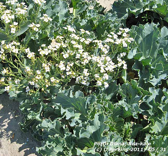 31st: A fine morning after a cool night the air temperature down to 4.9C and to 1.0C on the wet-with-dew grass. Scattered clouds at first decreased but with cumulus clouds persisting there was sunshine before noon. Convective cloud developed overhead again in early afternoon before clearing away later to give a mostly sunny late afternoon and evening. On Holy Island (Ynys Gybi) on the north-west coast of Anglesey it was much sunnier and, although breezy at times, there was a holiday atmosphere on the beaches at Trearddur Bay and Porth Diana 31st: A fine morning after a cool night the air temperature down to 4.9C and to 1.0C on the wet-with-dew grass. Scattered clouds at first decreased but with cumulus clouds persisting there was sunshine before noon. Convective cloud developed overhead again in early afternoon before clearing away later to give a mostly sunny late afternoon and evening. On Holy Island (Ynys Gybi) on the north-west coast of Anglesey it was much sunnier and, although breezy at times, there was a holiday atmosphere on the beaches at Trearddur Bay and Porth Diana  . There were not many takers for the water unless in a wet-suit, as the temperature in the Irish Sea is at best 13C, but as 'dippers' know can be higher when coming in over warm sand on a sunny day, which it was not because the high tide was at 0915 GMT and was receding. Growing on the sea shore at Porth Diana was sea-kale Crambe martima Bresych y Môr . Usually occurs on shingle banks it is very local on Anglesey only found in a few places. The leaves look just like the kale you eat. Here is a close up of the flowers . There were not many takers for the water unless in a wet-suit, as the temperature in the Irish Sea is at best 13C, but as 'dippers' know can be higher when coming in over warm sand on a sunny day, which it was not because the high tide was at 0915 GMT and was receding. Growing on the sea shore at Porth Diana was sea-kale Crambe martima Bresych y Môr . Usually occurs on shingle banks it is very local on Anglesey only found in a few places. The leaves look just like the kale you eat. Here is a close up of the flowers  . {St James Park 18.9C, Hawarden 16.1C, Aberporth 14.1h, Valley 12.5h} [Rain 0.0 mm; Max 16.8C; Min 4.9C; Grass 1.0C] . {St James Park 18.9C, Hawarden 16.1C, Aberporth 14.1h, Valley 12.5h} [Rain 0.0 mm; Max 16.8C; Min 4.9C; Grass 1.0C]
Rainfall for the month totalled 79.4 mm (113%) and [128%] of average, largest since 2009 ranking 29 since 1928. In parts of southern Britain spring rainfall totals have been the least for 100-years (Met Office). Here spring rainfall was 154.1 mm, largest since 2008 and more than in 2010 (133.9 mm) and considerably more than the 80.2 mm of driest in 1990 ranking 19th since 1928. For the wettest Spring in Llansadwrn look back to 1947 that had 352 mm.
The May mean maximum 15.7C was (+0.2) and (-0.2] of average while the highest 20.5C on the 1st was (-3.2). The May mean temperature 12.1C (+0.3) and [+0.4] of average was highest since 2008 ranking 9 since 1979. Spring had the highest mean temperature 10.4C on record since 1979. The mean minimum 6.6C equaled 1999, the mean maximum 14.2C ranking 3 equaled 1988 but beaten by 1990 with 14.8C.
It was the dullest May since 2003; sunshine duration at RAF Valley was 175.0h with 2 sunless days (88%) and [90%] of average. Sunniest day was on the 2nd with 13.7h, preceded with 12.1h on the 1st and followed by 13.5h on the 3rd. The 31st with 12.5h was another sunny day.


1st: The first day of glorious June was overcast with low stratiform cloud blowing on to the western hills and coast off the Irish Sea. With rain in sight visibility was only just good. Low 987 mb lay close to Iceland while high 1034 mb was over the Bay of Biscay resulting in a strong SW'ly airflow. Remnant frontal cloud was affecting western Britain. There was fine drizzle in Bangor at first then getting windier some brighter weather came along with brief sunny spells by 1045 GMT. It was wet in W and N Scotland where at Kinlochewe 48 mm fell. Young tawny owls were hooting in trees near the weather station at 2100 GMT with the light evenings waiting for darkness to fall. {E Malling 22.4C, Hawarden 18.8C, Llanfairfechan 19.8C, Kinlochewe 48.4 mm, Wattisham 14.4h, Aberporth 5.4h} [Rain trace; Max 17.5C; Min 9.5C; Grass 7.6C]
2nd: Low cloud and mist persistently affecting lower slopes of the mountains and coastal areas, dull with spots of fine drizzle with moderate visibility. Pressure was 1036 mb in high-pressure centred over Anglesey at 09 GMT. Brighter during the morning with sunny spells by noon and the sky clearing later in the afternoon. In Llanfairfechan it was a cool 14C during the afternoon and evening that was mostly clear with little wind. {Dyce 25.4C and 15.9h, Porthmadog 23.2C, St Athan 11.9h} [Rain 0.0 mm; Max 19.1C; Min 10.4C; Grass 6.6C]
3rd: A fine, warm and sunny morning the temperature 19.1C (dewpoint 13.7C). Short contra were observed to the NE, visibility was good or very good. A warm sunny day with no clouds overhead the weather station; the temperature rose to 21.8C here, 22.9C in Llanfairfechan, 25C Newborough Forest and 26.1C in Porthmadog. {Solent 27.4C, Porthmadog 26.1C, Waddington 15.9h, Valley 15.5h} [Rain 0.0 mm; Max 21.8C; Min 10.3C; Grass 7.0C]
4th: Sea fog affected coastal areas including Penmaenmawr and Llanfairfechan at first in the morning. Stratiform low cloud began to breakup forming cumulus clouds after 09 GMT with sunny spells developing as the cloud further burnt-off. There was a light NE'ly breeze and with a sunny afternoon the temperature rose to 19.0C. {Solent 28.1C, Porthmadog 25.4C, Aberporth 13.8h} [Rain 0.0 mm; Max 19.0C; Min 11.6C; Grass 9.9C]
5th: Overcast skies with a light E-NE'ly breeze. We were in a col between pressure 1015 mb high-pressure 1036 mb over the Atlantic S of Greenland and high 1013 mb over Spain. There was a detached cold front over Ireland and we had a few spots of rain at 1000 GMT in what was a rather dull morning . There were storms in the Mediterranean region and at Le Luc near St Tropez 24 mm of rain fell. During the day heavy rain fell over N Ireland. By late afternoon as the wind turned SSW'ly brighter weather moved in giving a fine sunny evening. {Charsfield 19.7C, Porthmadog 19.1C, Ballypatrick Forest 28.4 mm, Valley 9.4h} [Rain trace; Max 17.0C; Min 11.0C; Grass 9.6C]
6th: Signs that the sky was about to clear were evident just before 09 GMT. A remnant frontal system over Wales and the West overnight in a complex pattern soon gave way to brighter weather with sunny spells by noon. The 5 oktas of cumulus cloud cove over Llansadwrn, in light winds, persisted into the afternoon. With the wind oscillating between NNE and SW varying amounts of convergent cloud eventually cleared and there was a sunny end to the day. {Shobdon 19.2C, Wisley 29.8 mm, Camborne 11.6h, Bala 10.6h} [Rain 4.2 mm; Max 16.2C; Min 8.0C; Grass 6.4C]
7th: Slight rain from 03 GMT and recent showers with sunny spells before 09 GMT. Low 996 mb was stationed near Malin Head and we were in a moderate SSW'ly breeze. Rain was in sight and the morning continued to have bright and sunny spells and light showers of rain. By afternoon cloud had lifted from mountaintops of the Carneddau, but Snowdon in the West remained covered. It was cool in the breeze, the temperature rising to 15.2C. More light showers at 2100 and 2300 GMT. {Hawarden 17.3C, Capel Curig 9.0 mm, Herstmonceux
11.3h, Valley 7.7h} [Rain 0.8 mm; Max 15.2C; Min 9.0C; Grass 7.8C]

|
8th: A slight shower at 0630 GMT, then much of the same. Mostly cloudy with bright or sunny spells and slight showers of rain. Cloud persisted on mountaintops into the afternoon, somewhat sunnier later in the afternoon with showers returning in places (A55 near Aber at 2000 GMT) during the evening. {Hawarden 18.2C, Capel Curig 13.4 mm, Kirkwall 11.3h, Aberporth 7.2h}. [Rain 0.1 mm; Max 15.7C; Min 9.0C; Grass 7.6C]

 9th: A mostly cloudy morning with the cloudbase about 2000 ft. Visibility was good or very good under the cloud. Sunny spells and a little cloudier after noon then clearing later. Convective clouds (towering Cu and Cb) persisted over the mountains of Snowdonia with virga and occasional precipitation reaching the ground. Mike Peacock reported 'several sharp showers of hail on the Migneint above Ffynnon Eidda. They weren't particularly large hailstones, but they certainly stung!' It was sunny W of Caernarfon in the afternoon at Foryd Bay with clear views of the Lleyn Peninsula, Bardsey, Fort Belan and the western entrance to the Menai Strait, Abermenai and Llanddwyn Island. Cloud from a decaying cumulonimbus encroached late in the afternoon, but clear skies persisted over SE Anglesey. Light showers developed by 2300 GMT. {Charlwood 19.4C, Milford Haven 15.2C, Aberporth 13.2h} [Rain 1.5 mm; Max 15.0C; Min 6.7C; Grass 4.9C]
 10th: Light showers continued after midnight, rain here, but if falling on the mountains ice precipitation was possible as the temperature at times was -3C on the summits. A bright morning the sky a complex of cumulus, cumulonimbus, altocumulus and cirrus clouds, and very good visibility. Recent showers of hail were reported at RAF Valley on automatic at 0850 GMT. At 09 GMT pressure here was 1014 mb with low 1002 mb was off NW Scotland and showers were within its circulation. Dark shower clouds crossed the Snowdonia range around noon producing hail (ice pellets were reported on the lower slopes of the Carneddau
  ) and hail and snow on the summit of Snowdon reported on the BBC Wales website . Last year late snow patches were still surviving on the Carneddau Mountains and in the 'Deep Cut' on Carneddau Llewelyn in June. Not so this year although there are patches in the Scottish Highlands. No precipitation in Llansadwrn where the day with variable cloud and light winds SW - NE - SW sunny spells and the temperature rising to just 12.3C, rather cooler than one expects in June. A sunny evening under mostly clear skies. {Weybourne 17.6C, Hawarden 15.4C, Stornoway 15.0h, Valley 11.1h}[Rain 0.2 mm; Max 12.3C; Min 6.4C; Grass 4.0C] ) and hail and snow on the summit of Snowdon reported on the BBC Wales website . Last year late snow patches were still surviving on the Carneddau Mountains and in the 'Deep Cut' on Carneddau Llewelyn in June. Not so this year although there are patches in the Scottish Highlands. No precipitation in Llansadwrn where the day with variable cloud and light winds SW - NE - SW sunny spells and the temperature rising to just 12.3C, rather cooler than one expects in June. A sunny evening under mostly clear skies. {Weybourne 17.6C, Hawarden 15.4C, Stornoway 15.0h, Valley 11.1h}[Rain 0.2 mm; Max 12.3C; Min 6.4C; Grass 4.0C]
11th: After early showers of rain, hardly dampening the dry soil, the sky began to slowly clear during the morning with some sunny spells between convective cumulus clouds persisting in a cloud street SE across Anglesey. The origin of the cloud was at Aberffraw, and the W of the island had a mostly sunny afternoon (Valley 11.9h) with the SE of the island, Llansadwrn and the Carneddau Mountains, under the expanded cloud street. By late afternoon the cloud decreased giving a sunny end to the day. {Gravesend 19.4C, Milford Haven 16.2C, Stornoway 15.2h, St Athan 13.4h, Valley 11.9h} [Rain 1.4 mm; Max 16.6C; Min 5.4C; Grass 1.7C]
12th: Overcast with a mass of rain-bearing clouds already affecting SW England and S Wales. At first the cloud was moderately high and slight rain began at 0830 GMT. By 09 GMT it was light to moderate (5.6 mm/h max) and continued so most of the day. Somewhat in rain shadow here, calm at times with only a light SE'ly breeze, rainfall was 15.6 mm. In Llanfairfechan rainfall was similar (16.2 mm), but the SE'ly wind off the mountains was stronger throughout the day; mws about 20 mph (force 5) with peak gusts of 35 mph. Rain eased about 16 GMT when the wind started moderating in Llanfairfechan and to increase here in Llansadwrn as the wind turned SW'ly force 4/5 during the evening. A dull sunless day. {St Athan 15.5C & 43.8 mm, Haytor 49.4 mm, Stornoway 15.2h, Valley 0.8h} [Rain 15.6 mm; Max 13.8C; Min 5.0C; Grass 1.8C]
13th: Overcast at first, but the cloud was thinning and at 09 GMT there was a little weak sunshine breaking through with cloud beginning to lift from the Snowdonia Mountains. Pressure here was 1009 mb with low 1000 mb off Aberdeen over the North sea. A patch of blue sky appeared by 0925 GMT and some sunny spells developed through the day with the sky clearing later in the afternoon and was clear at 1730 GMT. This has been the pattern in this spell of unsettled weather rather cool weather; air temperature anomalies are running (-1.8) and [-1.3], and soil (-1.1) based on the June averages. Rainfall for the year is 356.6 mm, this is running below that of 1945 that was the driest year in Llansadwrn having a total of 390.4 mm at the end of June. {Hawarden 18.1C, Capel Curig 13.4 mm, Tiree 9.2h, Aberporth 8.1h} [Rain 0.0 mm; Max 17.6C; Min 9.5C; Grass 9.1C]
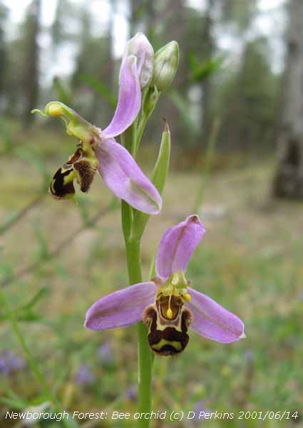 14th: With Atlantic-low 982 mb W of Ireland and S of Iceland a ridge of high-pressure was crossing Britain giving respite from the unsettled weather. It was a mostly sunny day, high cloud encroached on to the west coast in the afternoon bringing some weak sunshine at times. {Charlwood 23.4C, Hawarden 21.4C, Leconfield 14.1h, Aberporth 12.6h} [Rain mm; Max 21.1C; Min 8.3C; Grass 4.8C]
15th: Thicker cloud had encroached overnight and there was a spell of light rain around 03 GMT; it was another rather dull overcast morning with a few spots of rain or drizzle at times. Pressure was 1011 mb with a low 988 mb was S of Iceland and associated cold front over Ireland. Later some brighter spells with a little sunshine in the afternoon and early evening before thicker cloud encroached before dusk. {Norwich AP 23.6C, Hawarden/ Llanfairfechan 20.6C, Capel Curig 4.6 mm, Tiree 6.6h, Valley 3.3h} [Rain mm; Max C; Min 12.2C; Grass 9.9 C]
The first 15 days have had 40% of the June average rainfall (26.1 mm) while temperatures have been on the cool side. The mean 12.9C was (-1.5) and [-1.1] of the monthly average and in the soil at 30 cm deep 15.2C running (-1.0).
16th: After rain between 04 and 06 GMT, with a clearing shower at 0630 GMT, it was a brighter morning but there were towering cumulus clouds in the vicinity. Pressure was 1008 mb with the low S Iceland deepening 983 mb while a frontal-wave low was over the North Sea near Aberdeen. Although cloud persisted on the mountaintops with mist on the lower slopes visibility was moderate to good and the morning bright. By afternoon it was mostly sunny, but very windy the gusty SSW'ly force 5. A line of cumulus persisted over the mountains and the sky turned cloudier again here by 1730 GMT. Soil moisture under grass measured today was little changed at 45% dry mass. {Hawarden 18.5C, Wisley 18.8 mm, Sennybridge 6.8 mm, Tiree 12.9h, Valley 10.8h} [Rain trace; Max 16.8C; Min 10.0C; Grass 9.5C]
17th: Overcast skies again this morning with a gusty force 4/5 S'ly wind. There were persistent spots of rain on the wind, but just a trace in the raingauge. The low now 989 mb was nearer W Scotland and pressure here 1002 mb falling. Another low 994 mb was in the Bay of Biscay off Brest with a warm front SW England and Brittany. A cold front over the Irish Sea ensured an unsettled day the spots of rain turning moderate to heavy from 1600 GMT ending at 2100 GMT after a heavier burst (8 mm/h) of rain and a few ice pellets. {Hawarden 17.4C, Killowen 34.6 mm, Milford haven 15.2 mm, Lerwick 15.5h, Bala 0.9h} [Rain 8.1 mm; Max 15.7C; Min 10.2C; Grass 8.9C]
18th: Mostly cloudy and less windy, but a towering cumulus was seen briefly passing to the SE of the station. Not much in the way of brightness breaking through here during the morning although it was sunny along the NW coast. Some sunshine did reach here just before noon for a while, then sunny again later in the afternoon and evening. Breezy, the wind dying down during the evening and night. {Hawarden 18.0C, St Athan 8.6 mm, Stornoway 14.8h, Valley 9.2h. [Rain 0.0 mm; Max 17.0C; Min 9.0C; Grass 6.5C]
19th: A mostly cloudy start to the day with stratocumulus and cumulus clouds in layers overhead. Pressure 1011 mb was rising slowly in a ridge extending from S Ireland and SW England between Atlantic-low 1002 mb and low 995 mb over the Baltic. A fine breezy day, with orographic cloud persisting over Llansadwrn and SE Anglesey into the afternoon. Frequent sunny intervals with cloud cover 6 acts up to 1500 GMT before diminishing. Almost clear skies elsewhere with 11.5h of sunshine recorded at Valley, most in Britain. Unusually, the last 12 days (since the 8th) have seen the most sunshine duration reported in the NW of Britain. Stornoway with 4 days and Tiree Island with 3 days top the list. {Writtle 19.9C, Hawarden 18.3C, Llanfairfechan 18.2C, Boulmer 12.4 mm, Rhyl 2.8 mm,, Valley 11.5h} [Rain 0.0 mm; Max 17.5C; Min 9.6C; Grass 6.3C]
20th: Clear sky overnight with just a few clouds developing by 09 GMT. Pressure was steady on 1012 mb in a slack pressure area between Atlantic-low 998 mb to the SW and low 994 mb over the Baltic. The jetstream persistently covers S Britain and N France with the unsettled weather continuing. There was little or no wind and it was sunny and warm (AWS 17.7C) until 0945 GMT when convergent cloud once again developed overhead. Then more general cloudiness around noon before a few more sunny spells and large spots of rain for 30 minutes from 1530 GMT, not amounting to very much at first. Rain commenced around 1700 GMT and was intermittent or showery through the evening. Well, Waddington in Lincolnshire with today's highest sunshine duration of 12.6h has a similar latitude as Anglesey (see comment of yesterday). {Santon Downham 21.7C, Hawarden 21.7C, Mumbles Hd. 12.2 mm, Waddington 12.6h, Valley 7.9h} [Rain 5.2 mm; Max 17.2C; Min 8.0C; Grass 3.9C]
21st: There was a heavy shower of rain just after midnight (38 mm/h). A dull morning with stratiform cloud low on western mountains and poor to moderate visibility. Occluded frontal cloud over Ireland and the North Channel was associated with an Atlantic-low 999 mb to the West. Another low 984 mb was near Kemi, at the head of the Gulf of Bothnia. The morning brightened only slowly with a few sunny spells by noon. A breezy afternoon force 4/5 gusting to 29 mph at 1300 GMT and 31 mph in Llanfairfechan. The wind turbines in NW Anglesey were turning all except the group near Parys Mountain. Wind run in Llansadwrn was 225 miles while in Llanfairfechan, more sheltered on this occasion, 60 miles (00-00z). There was intermittent slight rain from 1930 to 2300 GMT. Sunshine headed further S today with Yeovilton, Somerset, recording 8.8h. {Hawarden 19.3C, Strathhallan 32.4 mm, Capel Curig 14.2 mm, Yeovilton 8.8h, Valley 4.1h} [Rain 2.7 mm; Max 17.3C; Min 11.8C; Grass 11.8C]
 22nd: Little variation in the temperature around 12C overnight under overcast skies. A mostly cloudy morning with one or two thinner patches closing over by 09 GMT. Pressure was 1005 mb with low 1001 mb central Scotland (where wet) and N England associated with low 989 mb N Sweden. A vortex trough was off Lands End (see MSG satellite image). There was a glimpse of sunshine around 1230 GMT and 1520 GMT, otherwise dull with spots of rain. A little brighter for a while around 1700 GMT, but there was a short heavy shower of rain at 1937 GMT (28 mm/h). {Holbeach 20.6C, Hawarden 19.3C, Glasgow 22.0 mm, Sennybridge 15.6 mm, Bristol 7.7h, Aberporth 5.8h} [Rain 4.0 mm; Max 15.7C; Min 11.8C; Grass 11.5C]
23rd: An overcast and dull morning although visibility was good under cloud that was hanging around 1600 ft on the slopes of western mountains. A light WSW'ly breeze and the sky brightened by 1045 GMT with a little sunshine breaking through at times. The afternoon remained mostly cloudy with brief glimpses of sunshine until later when fair weather cumulus diminished. A mostly sunny evening. [Rain 3.4 mm; Max 17.2C; Min 10.2C; Grass 9.0C]
24th: Precipitation developed in the vicinity around 03 GMT, there was a burst of heavy rain and ice pellets (39 mm/h) recorded at 0331 GMT. Radar images indicated that precipitation moved eastward over Carnedd Llewelyn and towards Conwy. A sprinkling of ice deposits (possibly snow) was seen at 06 GMT, but disappeared before 09 GMT. Pressure was high 1027 mb over Iberia and W France, but with the jetstream persistently over Britain complex Atlantic-lows W of Ireland (996 mb), with associated warm fronts, brought rain on to SW Ireland during the morning. Although mostly cloudy visibility was very good at first, the cloud thickening covered the summit of Snowdon at 1400 GMT and brought spots of rain on the window here by 1430 GMT. There was moderate to heavy rain between 1500 - 2000 GMT and another spell from 2300 GMT. [Rain 15.0 mm; Max 14.0C; Min 7.9C; Grass 4.7C]
25th: Rain continued until 0400 GMT and there was fog before dawn and moderate fog at 06 GMT in low cloud. The cloud, fog and fine drizzle was blowing along on a moderate SW'ly breeze at treetop height (80 ft). There was frontal-wave over Ireland and an associated warm front over the Irish Sea moving very slowly eastward. A dull, and damp and sunless day. [Rain 0.1 mm; Max 20.0 C; Min 9.8C; Grass 9.4C]
26th: A bright and sunny start to the day, but before 09 GMT cloud was increasing. Altocumulus lenticularis clouds were positioned to the S and SE before more general cloud moved across Anglesey from wavy frontal systems associated with low 993 mb S of Iceland. There was a warm light to moderate S'ly breeze and the temperature at 09 GMT was 19.7C (dewpoint 15.5C). Turning cloudier through the morning there were just occasional small breaks allowing glimpses of sunshine early in the afternoon before the cloud diminished before evening. Despite the cloudiness on Anglesey, it was sunny in many other places, the temperature rose to 25.5C, highest in June since 26.3C in 2009, and in Llanfairfechan to 27.7C. {St. James Pk. 29.2C, Hawarden 27.7C, Cluanie Inn 27.4 mm, Porthmadog 0.6 mm, Camborne 15.2h, St. Athan 12.5h} [Rain trace; Max 25.5C; Min 13.5C; Grass 12.6C]
27th: After midnight the sky was clear with stars visible before becoming obscured before dawn. Overcast with a thin layer of uniform grey stratiform cloud with a temperature of 14.6C (dewpoint 14.2C; 98% RH) at 09 GMT. Visibility was poor in mist and there had been some dust-laden slight rain.
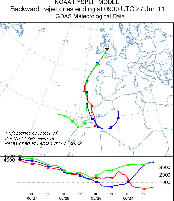 Light deposits of pinkish-grey to light reddish-brown dust (MUNSELL® colour chart 5YR 6.5/2.5; dry) were collected at 09 GMT and similar at 09 GMT on the 28th. Slow-moving dust was in the air over North Wales between 0400 GMT and 1800 GMT today. Backward trajectory analyses, using the HYSPLIT model courtesy of the NOAA Air Resources Laboratory, indicated that parcels of air arriving over Anglesey at 0900 GMT between 4000 and 4500 m above ground level moving past Iberia and over the Bay of Biscay was over north-west Africa 3-days ago and was likely to be the source of the dust. The most likely spell of deposition, along with spots of rain and slight rain was around 0430 - 0630 GMT, during the afternoon 1300- 1400 GMT and again around 1600 - 1700 GMT Light deposits of pinkish-grey to light reddish-brown dust (MUNSELL® colour chart 5YR 6.5/2.5; dry) were collected at 09 GMT and similar at 09 GMT on the 28th. Slow-moving dust was in the air over North Wales between 0400 GMT and 1800 GMT today. Backward trajectory analyses, using the HYSPLIT model courtesy of the NOAA Air Resources Laboratory, indicated that parcels of air arriving over Anglesey at 0900 GMT between 4000 and 4500 m above ground level moving past Iberia and over the Bay of Biscay was over north-west Africa 3-days ago and was likely to be the source of the dust. The most likely spell of deposition, along with spots of rain and slight rain was around 0430 - 0630 GMT, during the afternoon 1300- 1400 GMT and again around 1600 - 1700 GMT  . Duncan Brown reported traces of dust having fallen in Waunfawr along with a recent sighting (26th) of a hummingbird hawkmoth, while Huw Holland-Jones on his way to Bangor reported yellowy orange coloured sand in spots of rain drying on his car windscreen around 1300 GMT . Duncan Brown reported traces of dust having fallen in Waunfawr along with a recent sighting (26th) of a hummingbird hawkmoth, while Huw Holland-Jones on his way to Bangor reported yellowy orange coloured sand in spots of rain drying on his car windscreen around 1300 GMT  . Dust moved eastward during the day and there were reports of deposition during the evening near Cranwell in Lincolnshire following thunderstorms. In Wokingham, Berkshire, Bernard Burton reported a few brief spots of rain until 1700 GMT, and again between 05 and 06 GMT on the 28th, not enough to dampen the roads, but leaving a quite thick dusty deposit on cars etc. . Dust moved eastward during the day and there were reports of deposition during the evening near Cranwell in Lincolnshire following thunderstorms. In Wokingham, Berkshire, Bernard Burton reported a few brief spots of rain until 1700 GMT, and again between 05 and 06 GMT on the 28th, not enough to dampen the roads, but leaving a quite thick dusty deposit on cars etc.
The morning was dull and damp with little or no wind. Increasingly duller through the day with cloud thickening and slight rain, heaviest around 1630 GMT when more pinkish-grey dust was deposited. A sunless day. {Gravesend 33.1C, Llysidinam, Powys 26.0C, Craibstone 18.6 mm, St Athan 5.2 mm, Wattisham 12.0h, Bala 6.1h} [Rain 0.2 mm; Max 15.4C; Min 13.7C; Grass 10.1C]
28th: A mostly sunny morning with scattered cirrus clouds with old expanded contrails, then turning cloudier as convective cumulus clouds formed to the South resulting in fewer sunny spells. After noon the sky cleared again to give a sunny late afternoon and evening. Despite the sunshine in the light to moderate W'ly breeze it was another cool day here the maximum 16.7C, but keeping warm in SE England. {Frittenden, Kent 27.9C, Bute Park 20.8C, St Athan 0.2 mm, Aberporth 15.0h} [Rain 0.0 mm; Max 16.7C; Min 7.4C; Grass 3.0C]
29th: Pressure here was 1023 mb with a trough 1010 mb over Scotland and high 1033 mb NE of the Azores. There was moderate to heavy dewfall on grass A remnant occluded frontal system lay to the W and the morning had scattered cumulus with sunny spells. The afternoon was similar with patchy cloud and sunny spells until late afternoon when the sky cleared to give a clear evening. A warmer day the temperature rising to 18.0C here and 19.4C in Llanfairfechan. {Bute Park 18.6C, Tredegar 3.2 mm, Morecambe 15.0h, Aberporth 13.6h} [Rain 0.0 mm; Max 18.0C; Min 9.1C; Grass 6.1C]

|

30th: At 06 GMT the sky was covered with low stratiform cloud, but this was burning off by 09 GMT with 6 oktas cover as cumulus clouds in lines or streets developed over central and SE Anglesey (photo left on the banks of the Afon Ffraw) and seen on this MODIS AQUA satellite image  . The day though fine remained mostly cloudy here with frequent bright or (fewer) sunny intervals. In the W of the island at Porth Cywfan (photo above) it was mostly sunny, but breezy but patchy cloud associated with convection over N Ireland (see the satellite image) drifting across the Irish Sea, encroached later in the afternoon. {Bute Park 19.9C, Rhyl 0.6 mm, St Athan 15.1h} [Rain 0.0 mm; Max 18.5C; Min 9.2C; Grass 5.9C] . The day though fine remained mostly cloudy here with frequent bright or (fewer) sunny intervals. In the W of the island at Porth Cywfan (photo above) it was mostly sunny, but breezy but patchy cloud associated with convection over N Ireland (see the satellite image) drifting across the Irish Sea, encroached later in the afternoon. {Bute Park 19.9C, Rhyl 0.6 mm, St Athan 15.1h} [Rain 0.0 mm; Max 18.5C; Min 9.2C; Grass 5.9C]
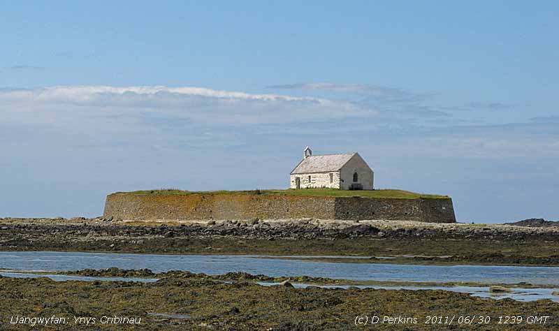  The 12th century St. Cwyfan's church, Llangwyfan, is on the small tidal island of Cribinau that is cut off at high tide. The church is surrounded by a retaining was linked to the mainland with a causeway. The local rock formations are mildly-basic limestone and graphite schists. Around headlands to the S, towards the offshore rock Carreg-y-trai a favourite perch for sea birds, has fine coastal heath and a rectilinear pattern of turf-topped dry stone walls
  . At this time of year the wall are very colourful with masses of pink wild thyme, thrift, English stonecrop and wild carrot. The grassy heath, not grazed for a while, has small patches of the cross- leaved heath Erica tetralix developing on it . . At this time of year the wall are very colourful with masses of pink wild thyme, thrift, English stonecrop and wild carrot. The grassy heath, not grazed for a while, has small patches of the cross- leaved heath Erica tetralix developing on it .
Temperatures in June were below average, the mean 13.4C was lowest since 1999 ranking 9th since 1979, (-1.1) of the decadal and [-0.5] of the 30-y averages. The highest maximum 25.3C highest since 2009 (26.3C), however, was (+0.5). The lowest minimum 5.0C lowest since 2001 (3.5C) was (-1.3) while the soil at 30 cm depth 15.4C was (-0.8). Rainfall of 65.5 mm, highest since 2009, was close to the averages (101%) and [97%] bringing rainfall for the first 6-months of the year to 395.3 mm ([36%)} below the long-term-average of 450 mm
It was a sunny and windy month at RAF Valley. Sunshine duration was 221.1h, lowest since 2009 but ranking 10 on the Anglesey record (K&Z adjusted values) since 1930, (119) and [129%] of average with the sunniest day on the 3rd with 15.5h and 2 sunless days. The mean wins speed was 13.8 mph, the highest since 1998 (13.2 mph), (+3.3) and [+3.6] of average.


1st: After being calm overnight a fine bright morning with very good and clear visibility. The soils surface was dry and dew was drying off in the light N'ly breeze. The afternoon fairly cloudy, but bright with lessening sunny spells at the end of the afternoon. A clearing sky during the evening. [Rain 0.0 mm; Max 15.5C; Min 8.5C; Grass 5.0C]
2nd: An excellent display of noctilucent clouds to the N starting before midnight and continuing up to 03 GMT. Also seen my David Small who emailed saying the mother of pearl clouds,seen N of Chester at 0345 GMT. were splendid. Overnight the air minimum temperature was 7.7C and on the grass was 4.3C, both lowest of the month. At 09 GMT the temperature had risen to 15.3C (dewpoint 7.3C) and there had been moderate to heavy dew on the grass. So much so that the grassy fields just after dawn looked frost-like white, but the grass minimum had fallen only to 4.3C. It was a fine sunny day, just a few clouds developed for a short while here during the afternoon, then clear sky. {Bute Park 23.0C, Lo max Aberporth 17.1C, Lo min Bala 2.5C, Morecambe 15.7h, Aberporth 15.3h} [Rain 0.0 mm; Max 19.2C; Min 7.7C; Grass 4.3C]
3rd: A mostly sunny day. Visibility was very good and SW'ly breezes were light. [Rain 0.0 mm; Max 22.6C; Min 9.0C; Grass 4.9C]
4th: Another sunny morning, visibility was good to very good with slight smoke haze thickening through the day. Moderately high levels of ozone >110 μg per m-3 were being recorded at Marchlyn Mawr (courtesy of Welsh Air Quality Forum). At 09 GMT the temperature was 20.0C (dewpoint 10.5C, RH 54%) and there was a light S'ly breeze. High cloud encroached, mostly cirrus, that did not reduce solar brightness by very much. During the afternoon the temperature rose to 24.7C, and 24.3C in Llanfairfechan, highest of the month. A fine bright evening turning cloudier later. {Cambridge Niab 26.0C, Hawarden 25.8C, Scilly 0.2 mm, Manston 14.7h, St Athan 11.0h, Valley 10.3h} [Rain 0.2 mm; Max 24.7C; Min 12.2C; Grass 7.9C]
5th: Overnight the minimum air temperature did not fall below 14.8C, highest of the month. A cloudy, damp and windy morning with spots of rain from 0715 GMT. High ozone levels > 130 μg per m-3 were being reported at Marchlyn Mawr. An occluded frontal system over the Irish Sea, associated with low 989 mb W of Malin Head, was moving slowly eastward and there were spots of rain on the blustery SSE'ly wind. The spots of rain continued into the afternoon when there were some brighter spells before a few sunny spells came along by 1515 GMT. [Rain 5.8 mm; Max 18.4C; Min 14.6C; Grass 11.8C]
6th: Rain from 0230 to 0250 GMT, very heavy at 0239 GMT (40 mm/h). Pressure was 1001 mb with low 994 mb off SW Ireland. We were still in the showery airflow and some well developed towering convection persisted over the Snowdonia Mountains, although Anglesey remained mostly sunny. A breezy day with some spots of rain in the afternoon and a heavy burst at 1950 GMT (28 mm/h). Thunder was heard starting at 2312 GMT and getting closer and heavier with lightning seen just before midnight.
{Marham 21.7C, Braemar 38.0 mm, Pembrey sands 24.0 mm, Manston 11.1h, Valley 7.0h} [Rain 8.8 mm; Max 18.2C; Min 11.3C; Grass 7.2C]
7th: Thunder and heavy rain 0010 - 0030 GMT fell at a rates of 42 mm/h and 113 mm/h during a 20-min spell. A bright morning with the sky clearing a little, but there were some 'beefy' cumulus clouds remaining over the mountains. The Met Office had a yellow warning out for N Ireland where there were heavy showers of rain during the day. Although cloudy at times it kept dry here, but there were showers of rain in Llanfairfechan during the day. Despite the rain the surface soil on the vegetable plot was drying again during the afternoon. I dug up some potatoes, a reasonable crop, but a bit down because of the dry weather. Peas are doing well, flowering, and there are some early pods coming along. {Cranwell 21.7C, Hawarden 20.1C, Lough Fea 28.4 mm, Lake Vyrnwy 14.2 mm, Kirkwall 9.5h, Valley 9.2h} [Rain 2.8 mm; Max 18.3C; Min 10.8C; Grass 9.9C]
8th: Overcast at dawn when a mistle thrush was singing, briefly trying to clear at 09 GMT with some small breaks appearing. It was calm with pressure here 997 mb within low 996 mb over the Irish Sea. We were still in the showers in circulation of the low, rain was in sight over the western mountains and it was not long before we caught one. The Met Office had a yellow warning out for N England and according to TORRO conditions were right for tornadoes central and southern Britain, a lesser chance here and in the North. A tornado was reported in Bognor Regis about 08 GMT damaging some houses. Another was reported and filmed at 1445 GMT in Westhoughton, a village near Bolton, some roof tiles were removed during the event. There was a slow-moving heavy shower here before noon (21 mm/h at 1131 GMT). After noon it was brighter with a glimpse of sunshine. The mistle thrush was singing again for a long while at 21 GMT. {Hawarden 18.8C, Walney Is. 35.4 mm, Pembrey Sands 22.2 mm, St. Athan 6.8h} [Rain 6.3 mm; Max C; Min 9.9C; Grass 7.0C]
9th: A bright morning with cumulus clouds in the vicinity, some were towering SSE of the station over the Snowdonia Mountains. Visibility was good with low cloud on the on westward mountainslopes. A mostly sunny day here with cloud decreasing in the afternoon giving a mostly clear evening. {Coleshill 23.0C, Lentran, nr. Inverness 33.4 mm, Aberporth 13.5h} [Rain 0.0 mm; Max 21.3C; Min 12.0C; Grass 10.5C]
10th: Another fine sunny bright morning again with cumulus clouds in the vicinity. Pressure was 1017 mb and there was a light S'ly breeze and good visibility. Convective cloud developed over mountains mainly to the SE. Dark clouds were seen during the morning and there was a sharp shower in Llanfairfechan between 1030 - 1100 GMT falling at a rate of 20 mm/h at 1050 GMT. There were showers also along the A55 early in the afternoon, but showers kept away from here resulting in another warm dry day. {Gravesend 24.4C, Cassley 20.8 mm, Rhyl 6.2 mm, Valley 9.9h} [Rain 0.0 mm; Max 21.6C; Min 11.9C; Grass 9.2C]

|
 11th: Pressure 1017 mb continued to rise and there was another fine bright day. Today a light N'ly breeze at first settling to a NE'ly through the day. Cumulus clouds, some moderate towering seen to the S and W at first, and patches of blue sky gave way to mainly cirrostratus encroaching from the W in the afternoon. A weak complete 22° solar halo, no parhelia, was seen during the afternoon from 15 GMT at Aberffraw.
On the drier fixed dunes at Tywyn Aberffraw red bartsia Gorudd was prominent while on some of the earlier succession damper dune slacks the marsh helleborine Caldrist y Gors (above) was prominent, although not as much this year possibly due to the dry weather. The flowers can be seen here in close up  . .
High cloud thickened late in the afternoon, well above the mountaintops that in very good visibility stood out very clearly. Another dry day, but cooler day. {Heathrow 24.6C, Drumnadrochi by Loch Ness 23.6 mm, Prestwick 14.7h} [Rain 0.0 mm; Max 16.7C; Min 12.C; Grass 9.3C]
12th: Overcast with good but moderately hazy visibility. Low 989 mb was S of Greenland and low 1007 mb over the Baltic. A warm front was over the English Channel. With persistent high cloud including cirrostratus, altostratus and some cumulus. Rather dull at first with occasional weak sunshine. Cloud thinned at times later giving weak sunshine with a 22° solar halo (no dogs) during the afternoon. I did not see any bright sunshine. During the late evening the sky began to clear and there was a hazy orangy coloured view of the moon at 22 GMT onwards. {Plymouth 21.7C, Mumbles Hd. 1.8 mm. Tiree 11.4h, Valley 4.6h} [Rain 0.0 mm; Max 17.5C; Min 11.0C; Grass 7.2C]
13th: Overnight the sky was mostly clear and there was moderate dew on the grass by morning. Lowest air temperature here was 11.0C, but a frost -0.8C was reported in Kinbrace. A little mist formed in low-lying areas and patches of around parts of the coast, but these soon cleared. Mostly sunny with any remaining cloud dispersing, but there was a cool feeling NE'ly breeze, very good visibility. Solar radiation 26.84 MJ m -2 was highest of the month; there were [15.2h] of sunshine recorded at Valley. Honeysuckle in hedgerows and woods are in full flower. Buddleias have started flowering in the garden and usually attract many butterflies, but I could only find 1 red admiral. {Castlederg 23.3C, Milford Haven 20.2C, Bute Park, Cardiff 2.0 mm, Leuchars 15.4h, Valley 15.3h} [Rain 0.0 mm; Max 17.0C; Min 11.0C; Grass 8.2C]
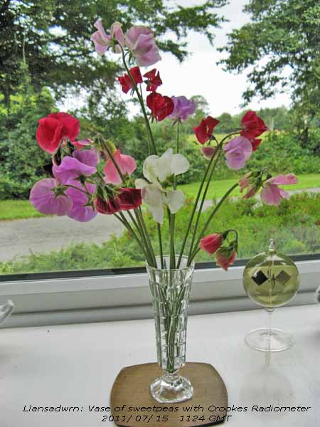 14th: Another fine and sunny day with clear sky up to 09 GMT. The temperature had risen to 17.0C in the screen and was the maximum observed over the past 24-h. There was a light SSW'ly breeze at first this strengthening a little through the day. A little cloud formed overhead from noon, and just a little cirrus in the W, but a line of cumulus cloud persisted over the Snowdonia Mountains through the afternoon, cloudbase well over the tops, that began to disperse by 1700 GMT leaving cloud at the head of the Nant Ffrancon Pass. A mackerel sky was seen overhead towards and after midnight. {Pershore 24.2C, Llanfairfechan 23.5C, Aberporth 15.0h} [Rain 0.0 mm; Max 22.9C; Min 9.5C; Grass 4.8C]
15th: A fine and mild night with an air minimum of 13.0C, in Llanfairfechan 13.7C, and a sunny start to the day. Pressure 1015 mb was falling slowly as complex low pressure systems and fronts in the West began to encroach. By 09 GMT cloud was increasing and the SSW'ly wind beginning to pick up. The morning remained bright and warm until just before 1100 GMT when darker clouds were seen in the West. The first spots of rain were seen at 1125 GMT; slight showery rain at times in the afternoon, heavier later and windy. With the vase of sweetpeas picked from the garden is a Crookes Radiometer. Invented by the physicist Sir William Crookes in Victorian Times. In an evacuated glass ball are 4 pivoted vanes, one side is black and the other silvery. In sunlight the vanes spin, very fast in bright sunlight and slower when cloudy stopping at night. An accurate early solar radiation instrument; the number of spins is related to the amount of energy reaching the ground. {Heathrow 25.3C, Manston 11.8h, Bala 3.4h} [Rain 7.7 mm; Max 18.4C; Min 13.0C; Grass 11.3C]
The first 15-days had rainfall of 31.6 mm (37%) and [45%] of the averages. A cool beginning to July with the mean temperature 15.1C was (-0.7) and [-0.6] and soil at 30 cm depth 16.9C (-0.6).
16th: Overcast with low cloud on the mountains the base about 1500 ft at 09 GMT. Violent showers of rain, falling at 77 mm/ h in Llanfairfechan at 0643 GMT, and after a moderate burst here at 0852 GMT had more or less stopped in time for the obs. Low 998 mb was slow-moving over NW Scotland with the jetstream reestablished over S Britain. A dull morning as a band of rain moved eastward. Some bright spells with glimpses of sunshine at first in the afternoon, a short clear spell then cloudier again with more showers of rain moderately heavy at 1900 GMT. Wet in Snowdonia {Capel Curig 23 mm}, but wetter in the Scottish Highlands {Eskdalemuir 58 mm}. Flooding occurred in Perth where streets were turned into rivers during a 1-h downpour, Glasgow, Edinburgh and the Highlands Region. In Aberfeldy 53 mm fell in 30 minutes causing flooding, house, garden and road damage. {Killowen, Co. Down 21.3C, Hawarden 19.9C, Eskdalemuir 58.4 mm, Capel Curig 22.6 mm, Stornoway 9.2h, Valley 4.6h} [Rain 5.8 mm; Max 17.8C; Min 12.9C; Grass 12.5C]
17th: Frequent showers of rain from midnight to 0230 GMT then rain from 0530 to 0630 GMT. Again not raining for the obs at 09 GMT, the sky was overcast with lighter patches. Pressure was 991 mb, with the low 984 mb slow-moving S of Edinburgh, a temperature of 13.5C and a WSW'ly breeze. A glimpse of blue sky about 0915 GMT, but that was the brightest as soon with thicker cloud and falling temperature light to moderate rain from 1030 GMT. Rain continued throughout most (16 h duration) of the very dull, sunless day. Solar radiation under the thick cloud was only 3.44 MJ m -2 and RAF Valley glimpsed just 0.4h sunshine. The maximum temperature 13.8C was lowest of the month. It was a wet day with 20.2 mm accumulated midnight to midnight here and 31.4 mm in Llanfairfechan. (09-09 GMT totals were 17.5 mm here, 24.8 mm in Llanfairfechan, both largest of the month) Very wet in Snowdonia with Capel Curig reporting {64.8 mm 21-21 GMT}. {Glasgow 21.4C, Milford haven 18.6C, Capel Curig 64.8 mm, Leuchars 8.3h, Valley 0.4h} [Rain 17.5 mm; Max 13.8C; Min 11.2C; Grass 8.2C]
18th: Overcast skies, there had been a few spots of rain on the windows earlier, at 09 GMT it was very damp, but not raining. A thrush was hear hammering a snail on one of its anvils somewhere in the garden. Pressure 995 mb was rising slowly but the low 984 mb was little change except it had crept out over the North Sea off the Tay Estuary, Scotland. Glasgow was to have the best weather with a maximum of 21.8C and 8.1h sunshine. Another dull day here, the result of an occluded front hovering over the Irish Sea. Light rain around 14 GMT then a heavy shower (33 mm/h) at 1534 GMT, an attempt to brighten up around 1615 GMT failed miserably and there was another shower (15 mm/h) at 1830 GMT. Wet again in Snowdonia with Capel Curig having {43.6 mm, totaling 131 mm over the past 73-h }. Some broken cloud appeared before midnight giving fleeting views of the moon to the south-east. {Hawarden 17.5C, Capel Curig 43.6 mm, Aberporth 0.2h} [Rain 6.6 mm; Max 13.9C; Min 12.0C; Grass 11.7C]

|
19th: Very poor visibility in heavy drizzle and light rain. A spell when it was not raining around 09 GMT in light variable, but generally NNE'ly breezes. Pressure 1005 mb continues to rise slowly as the low 996 mb over the North Sea approaches the southern tip of Norway. Most of Europe is within its influence, fronts reaching the S of France and Mediterranean producing thunderstorms and heavy rain this morning. Here drizzle and light rain at times during the morning. A bit brighter with some broken cloud around 16 GMT, but it did not last long and soon overcast again. {Cardiff Bute Park 20.8C, Aberporth 2.8 mm, Valley 0.2h} [Rain 6.7 mm; Max 14.3C; Min 11.5C; Grass 8.8C]
20th: A calm morning with pressure steady on 1009 mb and very good visibility. A chink of blue sky seen at 09 GMT and some sunny spells came along by 1030 GMT. Complex low-pressure centres over Britain and Brittany with fronts over SW England and NW France giving some rain. The jetstream is pretty far S for the time of year, over N France and Mediterranean giving unsettled weather. Here it was dry and by afternoon with the sky overhead clearing a sunny end to the day. The sunshine brought out the butterflies, that have been absent these last few days. On marjoram flowering now on rockery banks, and buddleias, were seen 4 red admirals, small tortoiseshell, small and large white,and meadow brown butterflies. A little cloud persisted over the Snowdonia Mountains till evening, but on the west coast Valley clocked up 9.6h bright sunshine, the highest on the day. Temperatures were on the cool side with Writtle, near Chelmsford squeezing 20.0C while it was wet in Albemarle, NE England, having had {30.8 mm}. {Writtle 20.0C, Cardiff 19.3C, Albemarle 30.8 mm, Valley 9.6h} [Rain 0.0 mm; Max 15.5C; Min 10.2C; Grass 6.9C]
21st: Another grey morning, a little brightness early on gave way to thicker cloud and spots of rain before noon. A detached occluded front was hovering over N Wales and the Midlands, going nowhere very slowly. Pressure 1015 mb was rising slowly; low 1008 mb was over NE France while pressure was high 1021 mb S Iceland. Swallows were seen most of the day flying low and feeding over the pasture field adjacent to the weather station. In the afternoon some heavier drops were wetting the ground then, turning brighter by 1500 GMT, some sunny spells before the end of the afternoon. Cloudier later bringing showery light rain before midnight. { Exeter 21.6C, Cardiff BP 20.5C, Cranwell 12.0 mm, Porthmadog 10.4 mm, Tiree 12.0h, Aberporth 8.1h} [Rain 0.8 mm; Max 15.1C; Min 9.6C; Grass 7.3C]
22nd: A dull calm morning with good visibility. Cloud was low enough to give a misty look across to the mountains. High 1031 was N of the Azores and low 994 mb was over the Baltic; pressure here was 1019 mb. By afternoon the cloud had thinned, it was brighter and some sunny spells developed. The wind kept light and variable. {Solent 21.3C, Porthmadog 18.8C, Astwood Bank, Reddich 21.6 mm, Tiree 15.2h, Valley 8.9h} [Rain 0.0 mm; Max 17.5C; Min 11.6C; Grass 10.9C]
23rd: A bright morning with well developed cumulus clouds in the vicinity together with cirrus and a long expanded contrail. There was very heavy dew on the grass, the grass minimum having fallen overnight to 5.4C, and moisture was dripping off roof slates. Visibility was good, but hazy. David Small reported seeing a funnel cloud over the Dee estuary during the morning on one of the webcams on Hilbre Island. A sunny day and with the sky clearing during the afternoon and evening leaving a little cloud over the mountaintops. {Exeter AP 21.5C, Pembrey Sands, Coventry 10.8 mm, Glasgow 15.8h, Valley 14.2h} [Rain 0.0 mm; Max 20.1C; Min 8.3C; Grass 5.4C]
24th: Clear at first overnight with cloud developing after dawn starting to thin and clear again from 5 oktas cover by 09 GMT. Low 992 mb was over the North Sea, but pressure was 1013 mb being influenced by high 1029 mb N of the Azores. There was frontal cloud over SW Ireland and SW England, but with cloud decreasing here the day became sunnier and the temperature rose to 21.1C in the afternoon moderated by a light breeze. At 1600 GMT the sky was clear of cloud and visibility was very good,but broken cloud appeared around midnight. {Pershore 24.0C, Cardiff 21.1C, Baltasound 15.8 mm, Glasgow 15.9h, Bala 13.6h} [Rain 0.0 mm; Max 21.1C; Min 11.6C; Grass 5.8C]
25th: Scattered clouds were increasing by morning. Frontal cloud edging in from Cardigan Bay on a SSW'ly breeze during the morning began to clear in the afternoon the breeze turning NE'ly off the sea kept the temperature down to 18.4C. {Hurn 25.0C, Cardiff 23.2C, Lerwick 5.0 mm, Odiham 12.3h, Bala 7.4h} [Rain 0.0 mm; Max 18.4C; Min 10.3C; Grass 6.7C]
26th: Keeping dry overnight with some dew on the grass, a fine start with a few clouds decreasing up to 09 GMT. The temperature was 15.7C (dewpoint 12.4C) though it felt cool in the NE'ly breeze that comes off the sea in Red Wharf Bay, rising to 18.5C in the afternoon. Mostly sunny with good visibility through the day. During the evening mist and low cloud formed reducing visibility on the ground to moderate although stars could still be seen . {Exeter 24.1C, Mumbles Hd. 23.2C, Bala 0.6 mm, Tiree 16.0h, Valley 13.2h} [Rain 0.0 mm; Max 18.5C; Min 11.7C; Grass 8.4C]
27th: A clear night, with fog persisting around the coast in the early hours, and a sunny morning with just 1 okta of cloud cover to the S near the mountains 09 GMT. Pressure 1022 mb was rising in a narrow ridge (1023 mb) over the UK with low-pressure 1016 mb Germany and low 992 mb near Iceland. A warm front W of Ireland was making little progress eastward. There was a light cool NE'ly breeze at first the temperature rising from an overnight minimum of 12.7C to 21.2C during the day. It was a calm and still evening and night with good visibility. {Aviemore 25.0C, Cardiff 23.3C, St Angelo 4.0 mm, Aberdaron 0.2 mm, Kinloss 15.8h, Aberporth 13.2h} [Rain 1.6 mm; Max 21.2C; Min 12.7C; Grass 9.4C]
28th: By midnight the frontal system to the West had started to move across Ireland and over W Scotland bringing rain. A muggy night, the air temperature at midnight was 13.7C (dewpoint 13.2C) and there was little or no wind while in Llanfairfechan it was 17.4C (dewpoint 12.7C) before starting to fall and relative humidity increasing from the 74%. At 09 GMT high 1034 mb was W of Ireland, pressure here was 1025 mb and low 1011 was over the Baltic and St Petersburg. The frontal system moving over W Britain had a triple point over the North Channel with intermittent rain from 05 GMT; heavy drizzle was observed at 1025 GMT. Temperatures at 09 GMT were 14.2C (dewpoint 13.5C 95% RH) and in Llanfairfechan 14.8C (dewpoint 14.6C 94% RH) continued to fall to minima of 12.9C (13.1C AWS) around noon and in Llanfairfechan 13.2C at 1350 GMT. A dull sunless day with temperatures hovering just above these minima through the afternoon and overnight. {Sutton Bonington 26.0C, Cardiff 23.7C, Valley 7.0 mm & 4.4h} [Rain 2.6 mm; Max 15.1C; Min 13.1C; Grass 9.8C]
29th: Overcast skies and very dull, but the temperature was rising a little reaching 15.1C at 09 GMT, the maximum of the past 24-h. Visibility was poor, but the cloud associated with an occluded front straddling W Wales and SW England was soon thinning. Pressure was still 1025 mb with the high 1029 mb off NW Ireland. Warmer today temperatures reaching 18.7C here and 18.8C in Llanfairfechan. After the near calm conditions it was windier with a run of 82 miles recorded in Llanfairfechan, from a dominant SE'ly direction, and 32 miles here from a dominant NE'ly direction.. {Chivenor 22.7 & 8.4 mm, Gogerddan 21.2C, Glasgow 11.3h, Valley 2.3h} [Rain 0.0 mm; Max 18.7C; Min 12.9C; Grass 12.7C]
30th: A fine and sunny morning on the W coast of Anglesey with many on the beach at Rhosneiger. Somewhat cloudier in SE Anglesey and over the Carneddau Mountains at first soon burning off leaving hazy sunshine, good visibility and a warm pleasant day the temperature rising to 21.7C. {Crosby 23.9C, Hawarden 23.1C, Mumbles Hd. 2.4 mm, Morecambe 14.1h, Valley 6.5h} [Rain 0.0 mm; Max 21.6C; Min 11.2C; Grass 7.4C]
31st: Overnight an occluded frontal system had encroached from the West and at 09 GMT was lying over the North Channel and St George's Channel. Cooler and windier the S'ly force 3/4 at 09 GMT. The sky was overcast and dull, a dry but sunless and hazy day with some drizzle and light rain during the evening. {Sutton Bonington 26.8C, Cardiff 23.4C, Heathrow 12.5h, Aberporth 0.9h} [Rain 0.3 mm; Max 18.8C; Min 13.8C; Grass 11.3C]
Rainfall was 67.8 mm (79%) of the decadal, but [97%} of 30-y average. Temperatures were below average with the mean 14.8C (-1.0) of the decadal and [-0.9] of the 30-year average. The highest maximum 24.7C was (-1.5) and the lowest minimum 7.7C (-0.7) with the lowest grass minimum 4.3C (-1.1). It was a sunny month at Valley the 233.3 h duration, (146%) and [140%], was highest since 2006 ranking 5th on the Anglesey record since 1930 (K&Z adjusted values). There were 10 days with 10h, or more, the sunniest had 15.5h on the 3rd and there were no sunless days although 2 recorded just 0.1h. .


1st: A dull beginning to August. Low 993 mb was S of Iceland and W of Scotland with high-pressure 1018 mb over N Germany. Occluded fronts lay either side of western Britain and occasional brighter spells in thinning cloud did not result in clear sunshine. Spots of rain early in the afternoon then a spell of fine drizzle later did not do much wetting of the ground. Remaining very dull with little or no wind {Gravesend 29.1C, Cardiff 22.2C, Loch Glascarnoch 11.4 mm, Hawarden 6.2 mm, Watisham 11.2h, Valley 1.0h} [Rain 2.4 mm; Max 19.5C; Min 14.5C; Grass 14.2C]
2nd: Pressure 1013 mb was rising, but the sky was still overcast. A frontal-wave low was over the Irish Sea and the North Channel and at 09 GMT it was raining moderately. Visibility was very poor in the low stratiform cloud, mist and rain. A plume of Saharan dust was forecast by the SKIRON model to be over Kent. Dust was shown off Iberia a few days previously; none was observed here. By noon there was an improvement with some sunny spells developing as breaks appeared in the cloud and the SSW'ly breeze strengthened for a while around 14 GMT. Sunny spells until about 1515 GMT when cloudier then some further sky clearance into the evening and overnight. {Monkswood 28.8C, Hawarden 22.8C, Inverbrevie 25.0 mm, Rhyl 8.6 mm, Lyneham 10.2h, Valley 8.8h} [Rain 0.3 mm; Max 20.2C; Min 14.6C; Grass 14.2C]
3rd: Cloudier towards dawn, but there had been under clear skies a heavy dew on the grass (min 8.6C). There were 6 oktas cloud cover at 09 GMT with cumulus clouds increasing. It was bright with sunny spells and light winds through the day with clear sky for a while in the evening before a mass of cloud encroached from the SW around midnight Continuing hot in SE England and there had been flash flooding in parts of NE England and strong winds were reported to have brought down a tree in Dunnington; Goole in Yorkshire seemed badly affected; the fire station was among several places needed to be pumped out. {Gravesend 30.3C, Hawarden 24.7C, Leconfield, Yorks 26.2 mm, Herstmonceux
11.5h, St Athan 9.7h} [Rain 8.2 mm; Max 20.7C; Min 10.6C; Grass 8.6C]
 4th: Rain was heavy becoming moderate from 0200 - 0530 GMT. A low was slow-moving ENE over the North Channel 1005 mb, pressure here was 1007 mb, had fronts wrapped around it and a mass of cloud and rain moving over the Isle of Wight and N France. Another cloud mass with heavy rain was over NE Scotland and moving S over the Pennines and there were heavy showers down the eastern England. The dust, shown over Kent yesterday, was shown today over S Sweden. Here the sky was starting to clear, cloud lifting from the mountaintops, the day becoming fine and sunny by afternoon the temperature rising to 21.6C, highest of the month, and Valley clocking up 5.1h of sunshine, highest in Britain on the day.. {Helens Bay 23.1C, Hawarden 22.9C, Wych Cross, E Sussex 28.4 mm, Porthmadog 18.8 mm, Valley 5.1h} [Rain 0.0 mm; Max 21.6C; Min 14.0C; Grass 13.4C]
5th: A bright morning with cumulus clouds developing at 09 GMT. A light variable breeze, difficult to determine its general direction but settling westerly. Dry overnight soil and concrete surfaces were dry and the grass hardly wet with a slight dew. With cloud lifting from the mountaintops with scattered clouds there were sunny spells, cloudy was thicker here and over the Carneddau while it was thinner to the NW and almost clear over SW Anglesey. Just a few glimpses of sunshine in the afternoon becoming mostly cloudy later. There are now several butterflies around the garden, I counted 5 red admirals, 1 peacock, 1 comma and 1 small skipper. Mostly on the marjoram and
buddleias, moving to different parts of the garden as the sun moved around, together with numerous flies, several small and medium sized bumblebees and, yes some honey bees too. Our neighbour has recently installed a hive so we look forward to more,and it's good of course for pollination too. {London, St James Park 25.6C, Bute Park, Cardiff 21.8C, Baltasound 34.6 mm, Aberporth 10.8h} [Rain 0.4 mm; Max 19.6C; Min 13.0C; Grass 12.0C]
6th: Overcast and dull around dawn with a slight shower of rain at 0645 GMT enough to wet the ground. A further spell of light rain that was falling at 09 GMT, carried on and with mist visibility was moderate. Britain was under sheets of stratocumulus cloud and France under a thick mass of cloud. Heavy rain was falling in NE Scotland. The rain eased here during the morning and there were a few glimpses of sunshine. A little more sunshine in the afternoon and evening that was dry here. During the day well-developed cumulus clouds persisted over the mountains to the SE of the station. There was an associated heavy short shower in Llanfairfechan at 1110 GMT (50 mm/h) and a spell of rain from 2030 - 2100 GMT with several bursts falling up to 22 mm/h; the day's rainfall amounting to 7.5 mm. A wet day in NE England. {Weybourne 21.9C, Cardiff 19.3C, Albemarle 37.2 mm, Sennybridge 11.2 mm, Stornoway 11.5h, Valley 5.5h} [Rain 3.8 mm; Max 18.9C; Min 11.5C; Grass 9.2C]
 7th: Some light rain from 0100 - 0315 GMT, but it was sunny at 09 GMT with 5 oktas cloud cover. Cumulus clouds were moderately developed over Snowdonia, these diminished by afternoon,but returned during the evening. Sunny spells during the afternoon with a light SW'ly breeze, the butterflies were around the garden often seen sunning themselves on warm sheltered surfaces. The maximum screen temperature was 18.6C and solar radiation reached a high of 1034 W -2 . The sky was clear overhead for a while during the evening, cumulus clouds were seen over the mountains. Almost 24-h of continuous rain in Scotland around Inverness and region resulted in further flash flooding of roads and homes. {Gravesend 22.2C, Lentran, Inverness 61.4 mm, Manston 9.9h} [Rain 0.0 mm; Max 18.6C; Min 11.0C; Grass 9.5C]
8th: Convective clouds off the Irish Sea moving on to the North Wales coast around midnight brought a heavy burst of rain in Llanfairfechan at 0033 GMT falling at a rate of 107 mm/h accumulated 4.2 mm. A bright dawn, with glimpses of sunshine gave way to cloudier conditions by 09 GMT when the last blue patch, hardly enough to patch a sailor's trousers, disappeared. Pressure 1007 mb was rising slowly with low 990 mb off SW Norway. The low was beginning to drag cooler air from the North. There was a front over NE Scotland, where it was still raining, and a detached occluded front was making its way S across the Irish Sea. Dry at first but with thickening cloud there were some spots of rain. Brighter before noon then a dry afternoon with sunny spells. The wind variable here between WSW and NNE, generally NW'ly and cooler in the evening. {Writtle 22.3C, Pembrey sands 19.1C, Fyvie Castle 30.6 mm, Camborne 10.2h}, St Athan 6.4h} [Rain 0.2 mm; Max 18.2C; Min 10.8C; Grass 7.8C]
9th: Bright soon after dawn then cloudier and dull by 09 GMT. We were in a ridge of high-pressure 1034 mb from high 1030 mb over the Bay of Biscay. Low 991 mb was over the Gulf of Bothnia, there were strong N'ly winds blowing over the North Sea, while low 996 mb was S of Greenland. Soon some weak sunshine and occasional clear spells of sunshine during the afternoon. Butterflies were out when it was sunny and I spotted 3 commas on buddleia
the most seen this year. A fine and sunny day with light NW'ly winds for the Anglesey Show at the Mona showground; events were enjoyed into the evening. Clear sky for a while then cloudier by late evening as a mass of rain-bearing frontal cloud began to move in from the West. {Solent 22.4C, Leconfield 3.2 mm, Morecambe 13.9h} [Rain 1.1 mm; Max 17.0C; Min 10.6C; Grass 7.4C}
 10th: Dry at first then showery rain from 05 GMT, as the warm front arrived, bringing moderate amounts of pink to light reddish-brown Saharan dust via the Atlantic. A drier interlude then thickening cloud, rain and strengthening SW'ly wind force 4 to 6 with gusts of 29 mph. Pressure 1018 mb was falling rapidly. It was lashing down at 1100 GMT, with traces of Saharan dust deposited, battering garden plants that have been a picture these last days. Tents were being blown down at the Anglesey show, several exhibitors were packing up and the Grand Parade was cancelled. On the Britannia Bridge a 30-mph speed restriction was in force all day into the night. {Cambridge 24.4C, Millport 56.6 mm, Capel Curig 43.6 mm, Llansadwrn 27.8 mm, Charlwood 11.2h} [Rain 37.3 mm; Max 15.5C; Min 11.5C; Grass 10.3C]
11th: Further downpours of rain through the night, it was particularly rough at 0142 GMT with rain falling at a rate of 61 mm/h. It was still raining slightly by morning with misty low cloud and very poor visibility; the 30-mph speed limit was still in force on the Britannia Bridge although the wind here was moderating. Some damage in the garden, the weight of water with the gusty winds breaking sweetpeas and several stems of potted 'autumn/ winter flowering' chrysanthemums on hard standing at the greenhouse, but lupins in the herbaceous borders were still standing! Rainfall for the past 24-h was 37.3 mm , the largest in a day in August at this station since before 1979, just beating the 37.2 mm on August 26th 1992. It was also the wettest any day here since 25th October 2008 that had 52.8 mm. At 11 GMT the 'storm' total here was 40 mm and in Llanfairfechan 32 mm. Remained dull and overcast all day, sunless. {Pershore 24.3C, Preston Moor Park 43.0 mm, Stornoway 10.6h} [Rain 6.4 mm; Max 16.9C; Min 14.2C; Grass 13.8C]
12th: A shower of rain around 0230 GMT and further spots of rain early in the day in addition to fine drizzle from time to time. Pressure was steady on 1009 mb with low 995 mb off NW Ireland with high-pressure over Norway. Overnight the air minimum temperature did not fall below 14.9C, highest of the month. A light SSE'ly breeze at 09 GMT, good visibility with cloud on the mountaintops. Dull, the cloud thick enough to give a little more rain during the morning. We were in warm sector air between a warm front positioned over S Ireland and an occluded front over NW England. Drier in the afternoon with a glimpse of sunshine around 1445 GMT, then a return to the dull overcast weather. {Hawarden 20.7C, Pembrey Sands 4.4 mm, St Athan 0.8h} [Rain 3.7 mm; Max 17.7C; Min 14.9C; Grass 14.2C]
13th: Little had changed, still overcast with air temperature 14.6C. The overnight minimum was 13.0C, but the grass minimum had not fallen below 13.5C and was currently reading 15.0C and the soil at 5 cm depth 16.0C. There had been recent slight showers and there were spots of rain in low cloud and mist giving poor visibility. An occluded front over Ireland was moving eastward across the Irish Sea. By afternoon it was brighter and for a while windy as a little sunshine broke through. Cloudier again later and during the evening. {Gravesend 24.9C, Lerwick 22.4 mm, Kinloss 5.8h} [Rain 0.3 mm; Max 18.5C; Min 13.0C; Grass 13.5C]
14th: A slight shower of rain around midnight and by morning some broken cloud and glimpses of sunshine. An occluded front lying Scotland to Anglesey was moving eastward and by afternoon there were some sunny spells. A darker cloud crossed over about 1400 GMT and a few spots of rain were felt, then some more sunshine. When the sun is out the butterflies soon appear, when cloudy they first seek warm surfaces including the observer drinking his cup of tea. Today 6 red admirals were seen on the Buddleia together with commas and others, no peacocks were seen. A cloudier evening and broken cloud at 22 GMT with partial moonlight, the first seen for some nights that have been persistently overcast. {Writtle 23.4C, Bencartha 7.4 mm, Camborne 11.0h}
[Rain 0.1 mm; Max 18.4C; Min 12.8C; Grass 12.1C]
 15th: A bright morning with cumulus and cirrus clouds decreasing, a mostly sunny day especially on the N side of the island. Pressure was 1015 mb with alight WSW wind and good visibility. By afternoon frontal cloud over Ireland in the morning (see Meteosat MSG image left) had advanced over Anglesey and the sky was cloudier, but still bright, by 1500 GMT. Cloud thickened and there was rain from 1900 GMT turning heavy for a while during the evening (up to 17 mm/h at 2028 GMT) before becoming light and intermittent. {Cambridge 23.5C, Hawarden 21.1C, Capel Curig 6.4 mm, Lerwick 14.5h, Valley 7.0h} [Rain 7.6 mm; Max 19.4C; Min 10.0C; Grass 7.1C]
The first 15-d had 53.7 mm of rain (59%) and [62%] of the monthly average total. While maximum temperatures had been on the cool side, averaging 18.8C (-0.2) and [-0.4], the mean 15.6C was average.
16th: A wet and windy start to the day, at 09 GMT the rain had stopped a patch of blue sky appeared by 1045 GMT but the sky did not open up. At noon it was briefly brighter with a glimpse of sunshine. Low 1000 near Iceland was slow-moving and a complex frontal system over the North Channel and Irish Sea was moving E. After a slight shower of rain around 3 pm the afternoon was brighter with cumulus clouds developing over the Snowdonia Mountains as the sky slowly cleared over Anglesey giving a fine and sunny evening. {Hawarden 21.6C, Walney Island 17.8 mm, Capel Curig 15.8 mm, Manston 8.4h, Valley 5.9h} [Rain 0.3 mm; Max 18.4C; Min 12.5C; Grass 12.3C]
17th: A bright and calm morning with scattered cumulus and cirrus clouds and weak sunshine. Pressure was 1019 mb; a frontal wave low 1014 mb was developing off Cape Finisterre that was to bring heavy thundery rain to the S of England and near continent. Some clear sunshine in the afternoon and very good clear visibility in the evening with good views of mountain cliffs in the low evening sunshine. {Milford Haven 20.3C, Morecambe 14.1h, Valley 10.8h} [Rain 0.0 mm; Max 15.8C; Min 9.5C; Grass 6.6C]
18th: Another bright morning the NE'ly breeze was picking up at 09 GMT. Altostratus cloud was moderately high and thin and there was some weak sunshine. The sky soon turned cloudier and remained cloudy with rain on a trough later in the afternoon. During the evening the sky began to clear from the W giving a mostly clear and cool night. {Trawsgoed 20.8C, Shap 3.3C, Isle of Portland 58.6 mm, Camborne 8.8h} [Rain 1.9 mm; Max 15.7C; Min 10.3C; Grass 6.1C]
19th: Clear sky overnight with the temperature on the grass down to 5.9C. Bright soon after dawn, but already overcast at 09 GMT. Pressure 1018 mb was rising slowly as an occluded front traversed the Irish Sea. Dull, but dry then windier in the afternoon becoming bright with some weak sunshine at times. With moderately high cloud there were showers of large spotted rain across Anglesey, including Cemaes, in the afternoon, but not enough to wet the ground. A windy day with strong to gale-force winds around the coast Campers at Aberdaron had to abandon and return home when a tent pole broke. A speed restriction of 30 mph was in force on the Britannia Bridge into the evening. There were brief sunny spells in the evening. {Sutton Bonington 23.5C, Wattisham 11.3h} [Rain 0.1 mm; Max 18.1C; Min 8.8C; Grass 5.9C]
20th: Variable cloud cover at first as the Sly breeze picked up after dying down overnight. Mainly cirrus, cumulus and altocumulus clouds increasing to overcast during the afternoon becoming misty with slight rain showers then rain from 2300 GMT. {Cranwell 24.5C, Hawarden 21.9C, Glasgow 11.3h, Valley 2.2h} [Rain 7.0 mm; Max 17.8C; Min 12.0C; Grass 9.3C]
21st: Rain petered out around 02 GMT, but the sky was still overcast in the morning with low stratiform cloud on the mountaintops. We were in a ridge of high-pressure 1022 mb, but cloud affected western coasts most of the day. At 09 GMT rain was in sight and soon at the station. Light rain was intermittent with drizzle through the morning; the afternoon was drier and brighter with the temperature reaching 20.0C. {Shoeburyness 26.4C, Hawarden 23.0C, Capel Curig 6.8 mm, Camborne 10.3h} [Rain 0.5 mm; Max 20.0C; Min 12.7C; Grass 11.3C]
22nd: A bright morning with cloud decreasing and sunny spells developing. There had been heavy overnight dew although minimum temperatures had been no lower than 12.1C in the air and 10.0C on the grass. Visibility was good with slight haze. Cumulus clouds persisted over Snowdonia with the peaks clear and sunny at times; Anglesey had a few clouds during the afternoon clearing for a while in the evening before cloud encroached again by midnight. {Cardiff 22.7C, St Athan 11.3h} [Rain 0.0 mm; Max 17.6C; Min 12.1C; Grass 10.0C]

|
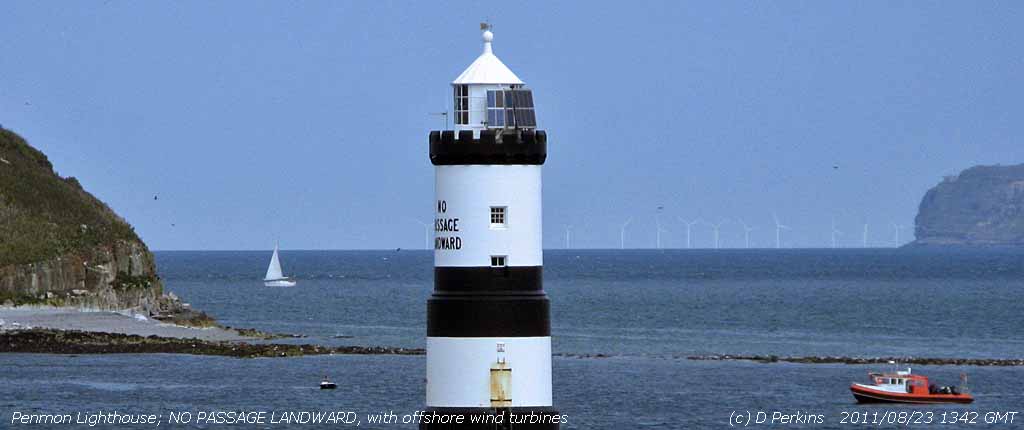 23rd: A cloudy morning, but the altostratus was moderately high and the mountaintops in the clear. Mild and dry overnight and feeling warm in the 17.1C temperature at 09 GMT. The grass was only slightly wet with guttation drop at the tips of the leaves. During the morning the cloud thinned further and it was bright, but sunshine was at a premium. It was sunnier at Penmon and eastward towards the Great Orme and Llandudno. The offshore wind turbines on the flats near Rhyl could be seen. With the tide rising there were several fishermen on the rocks and beach hoping for mackerel, but they were unlucky. A flock of tern were diving for fish just offshore near the lighthouse at one stage, but they moved off without coming inshore. A painted lady butterfly
  , the first I have seen season, was spotted on the grassy heath on the limestone cliffs near Trwyn Dinmor, Penmon. The butterflies may have hitched a lift on the southerly airflow from the continent in recent days bringing Saharan dust over France into SE England and on to North Wales. Painted ladies breed all the year round in north Africa and make their way North in the summer. Numbers this year have so far been small. Cloudier towards the end of the afternoon with light showers developing after dark between 22 and 23 GMT. {Gogerddan (Aberystwyth) 22.2C, Katesbridge 1.1C, Frittenden 16.4 mm, Lerwick 10.7h} [Rain 0.9 mm; Max 19.3C; Min 13.1C; Grass 11.8C] , the first I have seen season, was spotted on the grassy heath on the limestone cliffs near Trwyn Dinmor, Penmon. The butterflies may have hitched a lift on the southerly airflow from the continent in recent days bringing Saharan dust over France into SE England and on to North Wales. Painted ladies breed all the year round in north Africa and make their way North in the summer. Numbers this year have so far been small. Cloudier towards the end of the afternoon with light showers developing after dark between 22 and 23 GMT. {Gogerddan (Aberystwyth) 22.2C, Katesbridge 1.1C, Frittenden 16.4 mm, Lerwick 10.7h} [Rain 0.9 mm; Max 19.3C; Min 13.1C; Grass 11.8C]
24th: A slight shower at 06 GMT A patch of blue sky had disappeared by 09 GMT and there was another shower of rain. Visibility was moderate and slight showers continued on an occluded front associated with low 994 mb W of Ireland. By afternoon it was windier and the sky started to clear and was almost clear at 17 GMT on Anglesey although clouds persisted over the mountaintops. {Cranwell 24.1C, Aboyne 2.0C, Kinlochewe 23.2 mm, Dyce 8.3h, Valley 7.6h} [Rain 1.4 mm; Max 17.6C; Min 11.8C; Grass 9.9C]
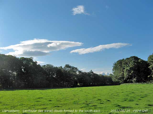 25th: Occasional cloud overnight, with a light shower at 02 GMT, and cooler with a minimum air temperature of 9.5C falling to 6.4C on the grass. With a SE'ly breeze some altocumulus lenticularis clouds formed in the lee of the mountains. At 09 GMT the lenticular clouds had disappeared, visibility was very good. Pressure was 1007 mb with low 993 mb off SW Ireland tracking SSE. A fine and sunny morning before turning cloudier by noon. An area of heavy rain over Cardigan Bay, associated with an active trough in circulation of the low, moved towards Lleyn and Anglesey in the afternoon. Valley reported thunder with rain hourly from 1300 GMT and a Cb was seen approaching here at 1400 GMT. When under the dark cloud at 1423 GMT thunder was heard to the NW followed by showery rain. Further lighter showers at 17 and 21 GMT. [Rain 2.8 mm; Max 17.8C; Min 9.5C; Grass 6.4C]
26th: Calm and still most of the night, cool too for the time of year, but a bright morning with cumulus and altocumulus clouds some low enough to be touching the mountaintops of Snowdonia. Pressure was 1005 mb and the UK was surrounded by complex lows and associated frontal systems none going anywhere very quickly. Thunderstorms developed during the day in parts. In South Wales prolonged thunderstorms resulted in flash flooding in Neath, Baglan and Port Talbot, 2 ft of flood water was reported with vehicles inundated and property flooded out. A dry sunny day, Valley reported 9.0h sunshine, until 2250 GMT when we caught a heavy shower (up to 27 mm/h) of 2.2 mm. {Langdon Bay 19.8C, Hawarden 19.2C, Redesdale Camp 39.0 mm, Milford Haven 25.2 mm, Valley 9.0h} [Rain 2.9 mm; Max 16.7C; Min 9.5C; Grass 5.8C]
27th: Recent showers of rain were stopping just before 09 GMT. Low cloud began to lift, moderate visibility was improving and small breaks appeared overhead. Sunny spells, then another slight shower with cloudier skies. Llanfairfechan had a heavy burst at 1043 GMT (up to 45 mm/h). Sunny spells again later in the afternoon. A quiet mostly calm night. {Killowen 21.0C, Cardiff 18.4C, Fair isle 24.4 mm, Rhyl 11.8 mm, Morecambe 9.5h, St Athan 8.3h} [Rain 0.5 mm; Max 15.4C; Min 9.5C; Grass 5.8C]
28th: A bright morning with a few sunny spells. Another cool morning 12.7C (dewpoint 10.2C) at 09 GMT with a light W'ly wind. Deep low 990 mb was off NE Scotland bringing strong winds to the east-coast and North Sea and heavy showers within its circulation. Sunny at times here with just a few drops of rain in the afternoon. Showers fell on the mountains and Mike Ellis reported slight hail on Glyder Fawr about 1300 GMT. A few butterflies were seen in the garden including comma, red admiral and speckled wood. Dark clouds were seen again over the Carneddau during the evening and Llanfairfechan caught a showery burst at 1957 GMT (up to 14 mm/h). {Cardiff 19.1C, Sennybridge 9.6 mm, St Athan 8.9h} [Rain trace; Max 16.8C; Min 9.5C; Grass 5.5C]
29th: Overnight the minimum air temperature fell to 7.9C and on the grass to 3.8C (with heavy dew), both lowest of the month. Pressure 1019 mb was rising slowly with a high 1024 mb developing over SW Ireland, low 989 mb was over S Norway. We were in a cool WNW'ly airflow. A large number of swallows and housemartins were flying above the weather station. A mostly overcast dull day. {Milford Haven 17.7C, Rhyl 1.0 mm, Aberporth 8.6h} [Rain 0.1 mm; Max 14.8C; Min 7.9C; Grass 3.8C]
30th: Very dull under overcast skies. Cloud was low on the mountaintops and as low as 1500 ft, but visibility was very good and clear later in the day. There was broken cloud near Holyhead and this eventually arrived here late afternoon and evening when it was sunny. A dry day, but the maximum temperature 14.7C was lowest of the month. Later cloud encroached once again . {Mumbles Head 17.6C, Rhyl 2.2 mm, Valley 2.8h} [Rain trace; Max 14.7C; Min 11.2C; Grass 10.7C]
31st: A little drizzle that had just about dampened concrete was drying off at 09 GMT. There was a chink of blue sky, but had not got any larger in the past hour. A light NE'ly breeze set in during the morning and by afternoon it was brighter with a little sunshine. A much clearer sky came along in the evening giving a sunny end to the month. {Mumbles Head 19.6C, St Athan 4.9h} [Rain 0.0 mm; Max 15.4C; Min 8.7C; Grass 4.3C]
With a mean temperature of 14.7C [(-1.0)] of average, just 0.1C higher than August 2010, it was 9th lowest since before 1979. The mean maximum 17.8C was lowest since 1992 and the highest maximum 21.6C 4th lowest. The lowest grass minimum 3.8C was 4th lowest since before 1986. Rainfall 90.4 mm, highest since 2009, was average ranking 44 lowest since before 1928. It was a dull month with sunshine duration at Valley 138.6h (92%) and just [86%] of the 30-y average. Sunniest day was on the 17th with 10.9h and there were 2 sunless days
1st: A fine sunny morning and a dry mostly sunny day with the temperature reaching 22.0C, exceeding any maximum in August. Just the cloud cloud in the sky in the afternoon, but towards evening a mackerel sky developed to the West indicative of a change in the weather. It was the sunniest day of the month at Valley with 11.4h duration. Here, solar radiation was also highest of the month with 16.48 MJ m -2. {St Helier 25.5C, Chivenor 23.1C} [Valley 11.4h] [Rain 0.0 mm; Max 22.0C; Min 9.4C; Grass 4.7C]
2nd: A fairly bright morning with just a chink of blue sky showing at 09 GMT. Under the cloud visibility was moderate with smoke haze; the ozone monitor at Marchlyn Mawr reservoir 2100 ft (Welsh Air Quality Forum) measured just over 110 μg per m-3 . A band of rain was slow-moving on a frontal system over NW Ireland to central Scotland. Windy force 6/7 around the coast and mountains later in the evening and night. [Rain 3.6 mm; Max 20.0C; Min 13.3C; Grass 10.5C]
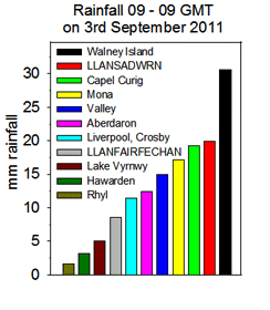 3rd: The rain arrived around 0500 GMT, light to moderate through the morning. Low 981 mb just S of Iceland was the remnant of Hurricane Irene that caused the flooding , devastation and loss of live on the east coast of the USA and Canada. High 1026 mb was near the Azores and we were in a SW'ly airflow. Cold fronts were slow-moving over the Irish Sea with the jetstream, encircling Irene to the S, over Britain. At 09 GMT there were 3.6 mm in the gauge and another 19.9 mm during the day only easing off after 2200 GMT. The total for the event totaling 23.6 mm, not quite the 'inch'. Several locations along the North Wales coast were in rain-shadow including Rhyl 1.6 mm, Hawarden 3.2 mm and Llanfairfechan 8.6 mm. Llansadwrn 19.9 mm and Capel Curig 19.2 mm were the largest local falls while Walney Island had 30.6 mm. [Rain 19.9 mm; Max 15.7C; Min 14.6C; Grass 13.5C] 3rd: The rain arrived around 0500 GMT, light to moderate through the morning. Low 981 mb just S of Iceland was the remnant of Hurricane Irene that caused the flooding , devastation and loss of live on the east coast of the USA and Canada. High 1026 mb was near the Azores and we were in a SW'ly airflow. Cold fronts were slow-moving over the Irish Sea with the jetstream, encircling Irene to the S, over Britain. At 09 GMT there were 3.6 mm in the gauge and another 19.9 mm during the day only easing off after 2200 GMT. The total for the event totaling 23.6 mm, not quite the 'inch'. Several locations along the North Wales coast were in rain-shadow including Rhyl 1.6 mm, Hawarden 3.2 mm and Llanfairfechan 8.6 mm. Llansadwrn 19.9 mm and Capel Curig 19.2 mm were the largest local falls while Walney Island had 30.6 mm. [Rain 19.9 mm; Max 15.7C; Min 14.6C; Grass 13.5C]
4th: A bright morning, but cloud was increasing up to 09 GMT. Cumulus clouds were in the vicinity but any showers kept away with some good sunny spells from noon into early afternoon. Cloudier before 1500 GMT with spots of rain and a shower from 1600 GMT as the sky darkened. There were frequent showers from 2330 GMT with a gusty wind. {Shoeburyness 21.5°C; Camborne 13
mm} [Rain 6.8 mm; Max 17.4C; Min 9.0C; Grass 6.3C]
5th: Showers eased at 07 GMT and there was some brightness just before 09 GMT. Showers were in sight on the mountains and we had spots of rain and a heavier burst at 0920 GMT. Low 999 mb was over the Isle of Man and we were under a spiral of an occluded front moving eastward. Pressure 1005 mb was rising rapidly and by noon, with a freshening breeze, the sky began to clear over Anglesey to give some sunshine into the afternoon. By 15 GMT with thicker clouds encroaching slight rain began soon turning heavier with the SW'ly strengthening to force 5/6. Rain on a warm front associated with low 984 mb off NW Ireland moved across during the night. Very wet in Snowdonia and the Pennines. [Shoeburyness 20.6C, Katesbridge 1.2C, Capel Curig 82.4 mm, Shap 50 mm, Manston 7.5h] [Rain 17.5 mm, Llanfairfechan 21.6 mm; Max 16.6C; Min 9.7C; Grass 8.5C]
6th: Gale-force winds after midnight with Valley reporting mws up to 43 mph (gusts 53 mph) from 0100 to 0400 GMT. At 06 GMT visibility was < 500 m (moderate fog) with rain driving across the fields. At 0613 here rain fell at a rate up to 25 mm/h with wind gusting to 35 mph while at Gorwel Heights rain fell at a rate up to 42 mm/h at 0617 in a 30 mph with 'storm rain' totaling 38 mm. Gales continued in the English Channel resulting in cancellation of several cross channel ferries. At 09 GMT pressure 999 mb was rising rapidly and during observations the rain stopped for a while, then resumed with heavy blustery showers through the sunless day. The maximum temperature 13.2C was lowest of the month. {Holbeach 19.6C, Capel Curig 66.4 mm, Leeming 8.5h} [Rain 8.2 mm; Max 13.2C; Min 10.8C; Grass 10.2C]
7th: Showers continued after midnight, some heavy, in Llanfairfechan at 0310 GMT rain fell at a rate of up to 49 mm/h. A dull morning with recent spots of rain and with low cloud on the mountaintops a rain shower was in sight at 09 GMT. Bright at times then turning cloudier and windier with more spots of rain after noon before rain from 1500 and turning heavy from 1740 to 1810 GMT (up to 16 mm/h) then light and showery ending 1910 GMT. {Cluanie Inn 28.4 mm} [Rain 9.2 mm; Max 14.0C; Min 11.1C; Grass 10.8C]
8th: While doing the obs I heard a chiffchaff singing for a while, probably on its way S for the winter. First heard on 22 March, today was to be the last of the season. Overcast, dull and damp with mist and low cloud on the mountains much of the day. A little brighter in the afternoon then cloud thickened as a warm front moved across from the south-west.. [Rain 1.2 mm; Max 16.1C; Min 10.9C; Grass 10.2C]
9th: A dull morning with overcast skies and a fresh to strong S'ly wind with drizzle and light rain. Pressure was 1007 mb with low 981 mb W of Ireland. The afternoon was brighter with the wind moderating a little. By 17 GMT the sky was duller and the wind strengthening again. At Gorwel Heights in Llanfairfechan the temperature in the Föhn-like force 4 S'ly wind at 1700 GMT had risen to 22.0C. Temperatures fell back during the evening in light N'ly breezes, but became elevated again as the force 4 S'ly resumed at 2300 GMT reaching 19.9C at midnight. {Wainfleet 24.8C, Hawarden 21.3C} [Rain 0.1 mm; Max 18.8C, Llanfairfechan 22.0C; Min 12.9C; Grass 12.8C] 22.0C,
10th: Elevated temperatures continued through the night at Gorwel Heights, at 0140 GMT reaching 20.3C and not falling below 20C till afternoon. At 09 GMT the temperature was 20.5C (dewpoint 15.3C0 and here in Llansadwrn it was 18.1C (dewpoint 15.2C) in a strong Sly wind. There was intermittent slight rain although the sky was looking somewhat lighter than yesterday. Low 971 mb was tracking N off NW Ireland and pressure here was 996 mb. In the afternoon there were sunny spells and some showers of rain; continuing windy F3/4 into the evening. {Leconfield & Weybourne 25.0C} [Rain 1.4 mm; Max 18.6C, Llanfairfechan 20.9C; Min 15.1C; Grass 14.7C]
11th: At midnight low 958 mb (ex Hurricane Katia) was S of Greenland tracking rapidly towards SW Ireland. With yesterday's low was 997 mb off the Western Isles of Scotland winds were strong to near gale-force around the coast. At 09 GMT pressure was 998 mb with low Katia 970 mb deepening 966 mb by noon S of Iceland. Katia had begun as thunderstorms over W Africa on 26th August, headed towards the Caribbean then moved along the eastern seaboard of N America before turning NE off the Gulf of St Lawrence reaching SW Ireland today. The gusty SW'ly wind continued strong to gale with a few sunny intervals with some rain around noon. The afternoon was dry into the evening when there was a spell of light rain from 2100 GMT. Peak gusts were 58 mph at Aberdaron, 57 mph at Capel Curig and 47 mph at Valley and Llanfairfechan. The 24-h mean wind speed (mws) at RAF Valley was 32.4 mph. {Gravesend 22.1C, Cardiff 19.2C; Shap 26 mm, Tredegar 13.4 mm} [Rain 5.8 mm; Max 16.3C; Min 12.2C; Grass 10.1C]
12th: Low 966 (ex Katia, described by the Met Office as a post-tropical cyclone) was off W Ireland at midnight and winds strengthened in the early hours moving N towards W Scotland by 0600 GMT. The wind reaching gale force with strong gusts (81 mph at Capel Curig, 73 mph at Aberdaron, 62 mph at Rhyl, 55 mph at Valley. The 24-h mean wind speed (mws) at RAF Valley was 33.4 mph, here 17.0 mph. A large amount of twigs and dead wood lay on the roads in Llansadwrn indicative of gale-force winds. The road from Llansadwrn to Beaumaris was closed on Red Hill for most of the day for removal of 3 or 4 large trees that had fallen across the road between the old stone bridge and the school. The A5 between Llanfairpwll and Menai Bridge was also affected by a fallen tree as was the A470 near Maenan Abbey in the Conwy Valley. While gales continued on high ground and exposed coasts into the evening the wind moderated only a little in the afternoon. The Britannia Bridge had speed restrictions and was closed to high-sided vehicles and the morning Holyhead to Dun Laoghaire ferry was cancelled. The North Wales coast was on flood alert; there was a 0.5 m surge at Holyhead (courtesy of POL) on the high spring tides around 1100 GMT and near midnight.. There was no rain recorded in Llansadwrn or Llanfairfechan 09-09 GMT. [Wattisham 22.9°C, Eskdalemuir 23.2 mm, Capel Curig 2.6 mm] [Rain 0.0 mm; Max 17.0C; Min 12.0C; Grass 11.6C]
13th: The sky began to clear after midnight and continue clearing after dawn. At 09 GMT cover was 3 oktas and pressure 1008 mb was rising. There was still a fresh to strong SW'ly breeze around high 1029 mb N of the Azores and with low 977 mb over Norway isobars remained tight. The day continued windy with sunny spells through to the afternoon, the wind moderating a little by the evening. {Manston 20.5°C, Tulloch Bridge 28 mm} [Valley 8.8h] [Rain 0.4 mm; Max 16.1C; Min 10.6C; Grass 7.6C]
14th: A mostly cloudy and dull morning with moderate visibility and a moderate SW'ly breeze. There was a slight shower of rain before 09 GMT. The afternoon was brighter with a little sunshine breaking through, but the sky turned cloudier again by evening though stars and moon were seen at 2115 GMT in good or very good visibility. {Heathrow and Manston 20.0 C, Loch
Glascarnoch and Keswick 13 mm} [Rain 0.2 mm; Max 15.3C; Min 10.9C; Grass 7.9C]
15th: A brighter morning with good visibility on what was going to be a dry day. Pressure had risen to 1021 mb in a high 1023 mb over the UK between lows 999 mb W of Ireland and 984 mb N Finland. The temperature at 09 GMT was 14.0C (dewpoint 11.2C) and although it felt warm in the sunshine the temperature rose to just 14.9C. Dry in Llansadwrn, but there were showers in Benllech and Amlwch around noon. A much less windy day, calm at times. {Charlwood 21.3°C, Crosby and Rhyl 0.8 mm.} [Rain 0.0 mm; Max 14.9C; Min 9.2C; Grass 5.2C]
The first 15 days had 74.3 mm of rain (73%) and [77%] of the monthly averages. The mean temperature 14.1C was (-0.1) and [+0.3] of the averages
16th: A bright start to the day, but with low 989 mb S of Iceland pressure 1011 mb had fallen and cloud increased steadily through the morning as an occluded frontal development pushed on to western Wales. There was a very heavy shower of rain from 1230 GMT that fell at a rate up to 86 mm/h between 1250 and 1300 GMT. Further sunny spells in the afternoon and another heavy shower at 2200 GMT (96 mm/h). [Gravesend 23.4C, Walney Is. 35.0 mm, Redesdale 25.8 mm, Capel Curig 20.0 mm, Llanfairfechan 15.4 mm, Rhyl 5.2 mm] [Rain 21.0 mm; Max 15.8C; Min 10.3C; Grass 5.8C]
17th: An other burst of heavy rain at 0310 GMT (rate of 128 mm/h, highest of the month) and 0420 GMT (20 mm/h). One or more of these showers contained ice pellets as the hailometer was marked when observed at 09 GMT tracking eastward. Rainfall 09-09 GMT today was 21.0 mm. Cloud had been increasing in the 3-h up to 09 GMT and there was yet another shower (30 mm/h). pressure was 1002 mb with low 993 mb NW Scotland. A cool morning being 10.9C at 09 GMT with a moderate to fresh S'ly breeze. The day continued with bright spells, a little sunshine and as a trough moved across more showers of rain and ice pellets 1320-1330 GMT (26 mm/h). A hail shower was also reported in Beaumaris at 1315 GMT. That was the last of the showers as the rest of the afternoon and evening was fine. Broken cloud at 2100 GMT with good to very good visibility. [Gravesend 19.8C; Capel Curig 27.6 mm, Llanfairfechan 16.0 mm] [Rain 11.6 mm; Max 13.4C; Min 10.3C; Grass 8.8C]
18th: Showery rain from just after midnight and continuing into the morning. It was raining at 09 GMT with the temperature on 11.4C another cooler autumnal day with a maximum of 14.8C. The rain soon ceased but the day kept mostly cloudy and was bright at times with convective clouds predominating in the afternoon. {Cranwell 18.1°C; Sennybridge 14.0 mm} [Rain 0.6 mm; Max 14.8C; Min 9.1C; Grass 4.7C]
19th: A dull overcast morning with light rain and moderate to poor visibility. Low 972 mb W of Iceland had associated warm front to the W that moved across slowly through the day. The day under the thick cloud was sunless and solar radiation 3.35 MJ m -2. was lowest of the month. [Manston 20.1C, Spadeadam 23.2 mm, Capel Curig 14.8 mm, Aberdeen 8.0h, Valley 0.0h] [Rain 8.7 mm; Max 15.3C; Min 8.8C; Grass 3.8C]
20th: Another grey and dull and damp morning with poor visibility and raining at 09 GMT. A cold front moved SE over Wales with a wave developed over the Mersey while brighter weather lay to the north-west. By 1100 GMT the sky was starting to clear and it was a fine and bright afternoon until 1300 GMT when cloud began to increase again. [Weybourne and Exeter
AP 20.5C] [Rain 0.6 mm; Max 15.5C; Min 11.2C; Grass 11.2C]
21st: A bright morning with cloud increasing as a cold front, associated with low 980 mb N of Scotland, encroached from the north-west. A windy day with a heavy shower of rain as the cold front passed over at 1630 GMT (up to 33 mm/h), with little change in temperature, then some glimpses of sunshine before evening. A windy day with a 24-h mws of 10.8 mph, at Valley 15.6 mm and a 24-h mws of 25.8 mph peak gust 47 mph. [Manston 21.2C; Skye 35.2 mm, Valley 15.6 mm & 1.7h] [Rain 2.4 mm; Max 16.0C; Min 9.2C; Grass 5.6C]
22nd: A bright start with a moderate to fresh SW'ly wind and moderate visibility. Overnight the air minimum temperature had been down to 8.1C and on the grass 2.8C, both lowest of the month. Pressure had risen to 1008 mb between low 990 mb Norwegian Sea and high 1025 mb Azores to Biscay. A warm front lay to the SW and this moved NE during the morning to be over Anglesey at 1500 GMT producing just a few spots of rain and light rain at Rhoscefnhir and the approaches Benllech. The sky started to clear during the evening and was 5 oktas cover at 1950 GMT with very good visibility. {Gravesend 19.9C; Loch Glascarnoch 14 mm} [Rain trace; Max 19.2C; Min 8.1C; Grass 2.8C]
23rd: Complex low-pressure 984 mb lay to the W of Ireland and pressure 1016 mb was falling slowly. At 09 GMT the sky was mostly cloudy and visibility moderate. Brighter later in the morning and afternoon with little sunshine breaking through. A windy day the 24-h mws in Llanfairfechan was 10.0 mph and at Valley 24.9 mph. {Jersey, St Helier
26.0C, Skye 27 mm{ [Valley 2.3h] [Rain 3.6 mm; Max 16.8C; Min 14.6C; Grass 8.6C]

24th: During the night cloud had encroached off the Irish Sea and an occluded front lay over Wales to NE England. The sky at 09 GMT was overcast and there was continuous drizzle that slowly cleared during the morning. By afternoon it was bright with sunny as cloud cover reduced to 3 oktas the temperature rose to 18.1C. Later the sky cleared and the S'ly breeze reduced as the front drifted eastward. {Gravesend 21.6C} [Rain 1.8 mm; Max 18.1C; Min 12.4C; Grass 10.3C]
 25th: Overnight the minimum fell to 10.8C and on the grass to 5.4C, but since dawn cloud had been increasing with cloud associated with a warm front encroached off the Irish Sea. Pressure was 1011 mb and there was a moderate to fresh S'ly breeze, good but slightly hazy visibility. This cloud soon cleared and the morning was bright with the sun breaking through. The afternoon fine and sunny at first clouded over rapidly as a cold front encroached from the West. There was a shower at 1520 GMT as a dark cloud approached then it was briefly brighter again. Still windy continuous rain commenced at 1740 GMT, when the clouds were very dark and solar radiation reduced to zero, with very heavy bursts (42 mm/h at 1900 GMT; 23 mm/h at 2000 GMT; 43/52 mm/h at 2110-20 GMT; 22 mm/h at 2140-50 GMT) until 2250 GMT when the wind moderated. In all 27.8 mm fell over 5.2 h duration averaging 5.4 mm/h the 24-h total being largest of the month. Rainfall in Capel Curig was 21.0 mm (12-24z) 14.2 mm fell in Llanfairfechan and just 0.6 mm at Valley. The A5025 was flooded again at the turn off to Llandegfan at Henfordd; measures to stop this happening seemed to have failed. [Gravesend 23.0C, Autltbea 28.8 mm, Capel Curig 23.4 mm] [Rain 27.8 mm; Max 18.7C; Min 10.8C; Grass 5.4C]
26th: The cold front cleared Anglesey between 03 and 06 GMT when calm and under clear sky mist formed on surrounding fields. The air temperature had fallen to 8.4C and to 3.2C on the grass. Visibility was very good, but after the rain the ground was very damp. At 09 GMT in sunshine a mass of red holly berries were seen, no signs yet of the mistle thrushes and blackbirds that usually feed on them. Birds in the garden are rather few and far between at this time of year. Pressure 1019 mb was rising. Turning cloudier with variable amounts of cloud around noon, but some sunny spells in the afternoon with solar radiation reaching 11.74 MJ m -2 highest since the 2nd. {Gravesend 24.0C, Cardiff 19.6C, Resallach
25.0 mm, Capel Curig 10.4 mm, Dyce 9.4h, Valley 7.0h} [Rain 0.0 mm; Max 16.7C; Min 8.4C; Grass 3.2C]

|
27th: Pressure 1026 mb continued to rise with high 1030 mb developing over Europe with low 977 mb S of Greenland with associated fronts lying to the NW. A cloudy morning with altocumulus lenticularis to the SE, and over the Menai Strait  seen from Beaumaris looking towards Penmaenmawr, with darker clouds to the West. With tight isobars on the chart to the NW the S'ly wind was moderate to strong, The temperature at 09 GMT was 15.3C and the few sunny spells developed briefly into clear sunshine with the temperature rising to 18.9C and 19.3C in Llanfairfechan before cirrostratus encroached.. A partial solar halo was seen at 1340 GMT then the cirrus cleared away to give a sunny evening with little or no wind. {Gravesend 24.6C, Hawarden 23.2C, St Athan 10.1h} [Rain 0.0 mm; Max 22.1C; Min 11.5C; Grass 8.1C] seen from Beaumaris looking towards Penmaenmawr, with darker clouds to the West. With tight isobars on the chart to the NW the S'ly wind was moderate to strong, The temperature at 09 GMT was 15.3C and the few sunny spells developed briefly into clear sunshine with the temperature rising to 18.9C and 19.3C in Llanfairfechan before cirrostratus encroached.. A partial solar halo was seen at 1340 GMT then the cirrus cleared away to give a sunny evening with little or no wind. {Gravesend 24.6C, Hawarden 23.2C, St Athan 10.1h} [Rain 0.0 mm; Max 22.1C; Min 11.5C; Grass 8.1C]
 28th: A clear cloudless morning and with pressure on 1022 mb it was to be a fine sunny day. The temperature at 09 GMT was 22.1C (dewpoint 16.8C) and in Llanfairfechan a remarkable 24.6C, these were the maxima of the past 24-h. There was a moderate to fresh SSE'ly breeze here and a light to moderate SSE'ly breeze in Llanfairfechan. A small cumulus cloud was seen briefly to the South. There were high spring tides this week, the 10m (Liverpool) high tide at 11 am tested the sea defences at Ynys Gored Goch (left) that lies between the bridges in the Menai Strait. Warm moist tropical air was moving up from the S and temperatures continued to rise reaching 26.4C, highest of the month, and 26.9C in Llanfairfechan in the still windy afternoon. It was cooler on the coast with 22.6C recorded at Valley. In the SE in Gravesend the temperature rose to 27.1C. Smoke haze developed through the day with the instrument at Marchlyn Mawr reservoir 2100 ft (Welsh Air Quality Forum) measuring an ozone level of 125 μg per m-3. The breeze died away during the evening and the temperature in Llanfairfechan just before midnight was 20.2C here it was 19.2C. {Jersey 27.3C, Gravesend 27.1C, Hawarden 26.3C, Lyneham 11.3h, Aberporth 11.2h, Valley 10.9h} [Rain 0.0 mm; Max 26.4C; Min 12.6C; Grass 10.0C]
29th: Overnight the minimum air temperature was 16.8C, highest on record here, and on the grass 14.4C. In Llanfairfechan the minimum was 18.3C. A cloudier morning with altocumulus and lenticular clouds and some mackerel sky overhead. Visibility was poor in thick smoke haze with 122 μg per m-3 ozone recorded at Marchlyn Mawr. A bright morning with variable amounts of cloud and sunny spells. The sky looked cloudier in the W while Llandudno was sunny. The afternoon was sunny, less windy, and there was a clear evening. Today's maximum was 25.1C and in Llanfairfechan 22.9C where a little cloudier. Unusually warm in NE England as well with 25C reported at the airport, but in Kew Gardens the temperature reached 28.8C, highest since 1895. {Kew 28.8C, Hawarden 26.1, Valley 19.5C, Wattishan 11.0h, St Athan 10.3h, Valley 4.6h} [Rain 0.0 mm; Max 25.1C; Min 16.8C; Grass 14.4C]
30th: After a mild night, minima 16.3C and 12.0C on the grass, a calm morning at first before a SSW'ly breeze developed by 09 GMT. Visibility was good with smoke haze and Marchlyn Mawr was reporting ozone of 140 μg per m-3. Altostratus cloud was seen to the W and this gradually encroached resulting in mainly weak sunshine with some clear sunny spells and a gusty wind. The temperature rose to 24.0C here and 26.1C in Llanfairfechan. {Sutton Bonington 29.2C, Colwyn Bay 27.5C, Hawarden 27.4C, Llanfairfechan 26.1C, Valley 20.6C, Yeovilton 10.8h, Aberporth 9.6h, Valley 5.6h} [Rain trace; Max 24.0C; Min 16.3C; Grass 12.0C]
The month ended with a rainfall total of 152.4 mm (149%) and [159%] of the averages wettest since 2004 ranking 16 since 1928. It was the largest fall in any month since July 2010 (182.1 mm). Bolstered by some high temperatures at the end of the month the mean 14.6C was highest since 2006 (+0.3) and [+0.7] of the averages. A dull month overall the 107.6 h sunshine duration [(84%)] at Valley lowest since 2000.


1st: Well, overnight the minimum was 15.6C, highest since 15.9C on 9th in 1995 and 3rd highest on record (16.4 on 1st October 1985) and on the grass 13.6C. Not bad for the 1st October with a temperature of 17.2 C at 09 GMT. The sky was mostly covered with moderately high cloud with a patch of blue to the south-west. Smoke haze was still around although visibility was good. There was a slow moving warm front over the Irish Sea, but it was fine and sunny in the SE over much of England. The morning was fairly dull, but brighter with a few weakly sunny spells later, the afternoon mostly cloudy with a little slight rain in the evening. The maximum temperature was 22.1C, highest of the month. {Gravesend 29.9C, Hawarden 28.2C, Lyneham 10.6h} [Rain 0.1 mm; Max 22.1C; Min 15.6C; Grass 13.6C]
 2nd: Keeping mild overnight the minimum 15.2C and 17.5C at 09 GMT and did not rise much more. Overcast skies with a little rain from 0935 GMT. There was a trace of pinkish-red coloured dust deposited in overnight rain likely to be of Saharan origin. Backward trajectory analyses (left), using the HYSPLIT model, courtesy of the NOAA ARL website, indicated that parcels of air arriving over Anglesey between 1000 and 3000 m AGL originated in western Africa. In late September there were several dust storms around the 23rd in Mauritania and some of this dust may have been transported to Anglesey. The warm front in the W was slow-moving over the North Channel, Irish Sea, Wales and NE England. The weather continued fine and sunny to the south-east. {Coningsby 29.3C, Cardiff 27.1C, Helens Bay 23.4 mm, Valley 8.0 mm, Wattisham 10.8h, St Athan 8.6h} [Rain 4.5 mm; Max 17.7C; Min 15.2C; Grass 13.5C]
3rd: A red sky was briefly seen E of Conwy at 06 GMT. The morning was again dull with a moderate SSW'ly wind. Visibility was moderate with haze, although the ozone levels had fallen Saharan dust may also have contributed. A further slight deposit of coloured dust was detected at 0900 GMT. Hurricane Ophelia was tracking past Newfoundland at 06 GMT and was S of Greenland at 18 GMT filling to 994 mb. Here pressure was 1019 mb between complex lows 994 mb to the NW and high 1029 mb over Spain. The morning was dull becoming brighter with a few sunny spells towards afternoon. In Llanfairfechan the maximum temperature of 22.0C was highest of the month. Increasingly windy during the day, as weak cold fronts passed over, moderating late afternoon and evening. I picked a large punnet of strawberries, now that the birds and wood mice have lost interest in them - not bad for October. The warm weather with the now adequate soil moisture (56% dry mass) no doubt swelled and ripened the strawberries as well increasing the growth of grass. Grass sampled today had grown at a rate of 7.5 g dry mass m -2 d -1, the most since the spring flush in April. {Coningsby 28.3C, Hawarden 26.0C, Yeovilton 9.9h, Aberporth 3.7h} [Rain 0.0 mm; Max 18.8C; Min 14.8C; Grass 14.0C]
4th: A much cooler night with the minimum 8.4C and a bright morning with light SW'ly wind good visibility. Low 962 mb was over the Norwegian Sea and pressure here was 1019 mb. Weak sunshine then glimpses of bright sunshine allowing the temperature to rise to 13.9C, much lower than of late. During the evening the temperature began to rise as a warm front that had been over Pembrokeshire slid north-eastwards. In Llanfairfechan at 2240 GMT the temperature was 16.3C, the day's maximum. {Cambridge 21.7C, Cassley 27.8 mm, Shawbury 8.1h, Valley 15.1C & 0.4h} [Rain 1.2 mm; Max 15.1C; Min 8.4C; Grass 5.5C]
5th: At midnight the temperature had risen to 14.4C and continuing to rise reached 15.1C at 09 GMT, the maximum of the past 24-h. Pressure 1012 mb was falling and the fresh to strong gusty SW'ly wind freshened through the day until 1500 GMT when a gust of 40 mph was recorded. The daily mws was 14.6 mph. There were gales at Aberdaron (with gust of 61 mph) and Capel Curig (gust 62 mph). Spots of rain turned to light rain from 1700 GMT, but the wind had already started to moderate. A heavy burst of rain in Llanfairfechan between 1840 and 1900 GMT fell at a rate up to 38 mm/h. Work was being done today clearing drains on the A5025 at Henfordd where road was flooded on 25th September. Heavy shower of rain and medium sized ice pellets (24 mm/h) at 1840 GMT. A sunless day. Tawny owls were heard in the trees at 2220 GMT. [Rain 6.4 mm; Max 15.9C; Min 11.8C; Grass 11.3C]
6th: A severe weather warning of strong winds for Anglesey and the North Wales coast had been issued by the Met Office. Under a clearing sky at 0900 GMT the 9.6C temperature felt chilly in the force 4/5 W'ly wind. Pressure here was steady on 1009 mb with complex low 974 mb NE Norwegian Sea while pressure remained high over the Atlantic W of Iberia. Strong to gale-force winds were experienced on the Irish Sea and North Sea. The day had bright or sunny spells and showers, mainly a few spots, as the wind veered WNW'ly and strengthened to a gusty strong to gale force around the north-west coast, headlands and mountains. Torrential rain and hail with thunder and lightning was reported by Evan in Llandudno between 16 - 17 GMT. Several butterflies were seen around the garden including speckled woods. Favouring the Michaelmas daisy were 5 red admirals and small a small tortoiseshell. [Rain 0.6 mm; Max 13.2C; Min 7.3C; Grass 5.2C]
7th: A few breaks were appearing in the cloud by morning and although mist and low cloud was on the mountain slopes visibility was good. Pressure 1020 mb was rising, the high 1035 mb W of Biscay and low 962 mb deepened over N Sweden. Strong winds persisted over the S Norwegian Sea, but here it was less windy. Bright with some sunny spells and a few sots of rain and a light shower in the afternoon before some clear sky towards dusk. There was a short heavy shower in Llanfairfechan (17 mm/h) around 2100 GMT . Turning cloudier later and overcast at night. [Rain 1.1 mm; Max 14.0C; Min 9.1C; Grass 7.2C]
 8th: A miserable morning with low stratiform cloud, heavy drizzle and light rain on a warm front stretching from the Western Isles past Anglesey through St. George's Channel, but it was much less windy. A slow-moving warm front was lying from the Western Isles through the Irish Sea and St George's Channel. Drizzle and slight rain through the morning, the afternoon was drier with a brief brighter spell around 1530 GMT before thicker cloud again bringing more rain between 1630 and 1900 GMT turning showery later. In Llanfairfechan the day's maximum temperature was 15.9C at 2120 GMT. [Capel Curig 12.6 mm, Valley 16.5C & 4.2 mm] [Rain 6.3 mm; Max 15.1C; Min 8.5C; Grass 5.5C]
9th: Showery until 0230 GMT and skies still overcast at 0900 GMT with cloud hugging the mountaintops. A slight deposit of pinkish-red colour Saharan dust was collected. Backward trajectory analyses (left), using the HYSPLIT model, courtesy of the NOAA ARL website, indicated that parcels of air arriving yesterday around 1700 GMT over Anglesey between 1000 and 1500 m AGL again came from western Africa with Mali being a possible origin. There was a light to fresh S'ly breeze that persisted most of the day strengthening in the afternoon. There was a little brightness again later then dull with drizzle by the end of the afternoon. Windy all night. {Fittenden 22.6C, Usk 19.3C, Llanfairfechan 18.9C, Stoneyhurst 28.6 mm, Herstmonceux
4.2h} [Rain trace; Max 16.5C; Min 10.5C; Grass 10.1C]
10th: Very dull and overcast with uniform grey stratiform cloud; little variation in temperature overnight the minimum not falling below 13.9C. There were spots of rain on a very gusty fresh to strong SW'ly wind. There was a further trace of the pinkish-red Saharan dust deposited. A wavy front lay to the N of here, stretching from the Atlantic to the North Sea. Gales were recorded at Aberdaron (with gust 58 mph) and Capel Curig (with gust 61 mph) and there was a 30 mph speed restriction in force on the Britannia Bridge. Another sunless day with spots of rain and drizzle. Just after noon a cold front went through with a 3.5C fall in temperature here and 2.5C fall in Llanfairfechan at 1230 GMT. The daily mws was 15.1 mph with a maximum gust of 35 mph. There was a persistent steady wind through the night with 30 mph speed restriction on the Britannia Bridge. {Charlwood 21.2C, Banagher Caugh Hill 34.6 mm, Manston 6.2h} [Rain 0.6 mm; Max 15.0C; Min 13.9C; Grass 13.2C]
11th: Another mild night with the minimum on 14.3C. A trace of the Saharan dust was observed again. The PM10 monitors on Anglesey have been indicating enhanced concentrations, up to 130 μg per m-3 was recorded at Llynfaes on Anglesey (courtesy of the Welsh Air Quality Forum) and is likely to be due to the Saharan dust. Overcast, with a light SSW'ly breeze, the wriggling frontal system stuck over North Wales stretching across Ireland over Merseyside to the North Sea. It was dull with drizzle and slight rain persisting as far as the headland at Penmaenmawr, but becoming dry along the North Wales coast. There was persistent rain in the Manchester area moderately heavy at times. Dry and sometimes bright along the North Wales coast in the afternoon the temperature reaching 19C in places. [Manston 20.7C, Hawarden 19.0C, Valley 0.0h] [Rain 2.6 mm; Max 15.0C; Min 14.3C; Grass 13.8C]
 12th: A dull and damp morning, but drier and brighter by afternoon with a glimpse of sunshine before turning cloudier again with shower of rain at 1816 GMT. (6 mm/h) moving on to Llanfairfechan at 1850 GMT where heavier falling at a rate of up to 24 mm/h (3.6 mm in all). It is a good time of year to find fungi, several puff-balls (left) have appeared in the wood. There was broken cloud at midnight. [Cambridge 20.7C, Valley 18.4C, 2.9h, Stornoway 9.1h] [Rain 1.1 mm; Max 16.7C; Min 13.6C; Grass 13.4C]
13th: The sky cleared after midnight and mist and fog developed at dawn. There was dense shallow fog of 3m on the fields at 06 GMT, for 30 minutes, and more persistent thick fog was reported along the Menai Strait and on the Bridges. There was little or no wind at 09 GMT, the anemometers were not turning but a slight SE flow was detected by smoke drift. Pressure was 1028 mb and we were in a slack area between high 1029 mb over the North sea and high 1027 mb over Biscay. Low 960 mb was slow-moving SE Greenland with fronts waiting in the wings W of Ireland. The afternoon was pleasantly warm in sunshine in Beaumaris where locals and visitors were enjoying the sunshine. Mostly cloudy in the evening and night. [Trawsgoed 19.8C, Hurn 6.0h, Valley 5.8h] [Rain 0.0 mm; Max 19.1C; Min 10.1C; Grass 6.5C]
14th: A mostly cloudy morning with good visibility and a light SSE'ly breeze. Low 973 was still SE Greenland with highs 1036 mb Denmark and 1030 mb Biscay fending off fronts over Ireland edging over the Irish Sea during the dull sunless day. Drizzle and light rain was reported at Valley from 11 GMT, but it was dry here. The maximum temperature in Llanfairfechan was 16.8C at 2210 GMT during a Föhn-like SE'ly breeze, the 3rd occasion this month for the day's highest temperature to be in the late evening. [Altnahara 18.9C, Cardiff 17.7C, Lyneham 10.0h, St Athan 5.6h, Valley 0.0h] [Rain 0.0 mm; Max 16.2C; Min 11.5C; Grass 7.6C]
15th: A clearing sky in the morning with a light S'ly breeze leaving some patchy altocumulus(weakly formed lenticular) in the lee of the mountains. Low 997 mb was SE Greenland with high 1031 mb over the Atlantic pressure here 1023 mb was steady and enough to keep a cold front over Ireland and western Scotland away for the day. Mostly sunny with the temperature rising to 18.3C. Frontal cloud began to encroach during the evening. [Chivenor 18.7C, Rhyl & Llansadwrn 18.3C, Manston 10.2h, Bala 9.3h] [Rain 6.5 mm; Max 18.3C; Min 10.1C; Grass 7.9C]
The first 15-days had 31.0 mm of rainfall just (22%) and [24%] of average. It had been warm with the mean temperature 14.1C [+3.3] of average.
16th: There was rain, moderate at times, between 0200 and 0500 GMT. A bright morning, the sky at first clearing then turning cloudier towards 09 GMT. Ravens were croaking in tall 'look out' trees nearby. Pressure 1022 mb was rising as broken frontal cloud associated with low 986 mb S Iceland moved south-east. Butterflies continue around the garden when the sun shines, today 2 commas and several red admirals. The afternoon continued bright with sunny spells into early evening as the wind strengthened cloud encroaching from the W before midnight. {Brize Norton 18.9C, St Bees Hd. 21.2 mm, Wattisham 9.2h, Valley 6.0h} [Rain 4.6 mm; Max 16.0C; Min 9.8C; Grass 7.2C]
17th: A heavy shower of rain (rate of up to 93 mm/h) with strong gusty wind at 0255 GMT. At 09 GMT overcast with ragged moderately low cloud. .Pressure was 1012 mb soon falling rapidly and the SW'ly wind strengthening force 5/6 with strong gusts. A 30 mph speed limit was in force on the Britannia Bridge. The morning was occasionally bright with light showers of rain into the afternoon. With the barometer falling rapidly to 1002 mb with the wind reaching its peak of 42 mph at 1622 GMT the cold front began passing over the station. With the wind dropping to almost calm rainfall was heaviest 103 mm/h at 1644 GMT. The temperature began to fall quickly from near its maximum 12.8C to 7.0C at 1700 GMT then more slowly to 4.8C at 2100 GMT. In Llanfairfechan at Gorwel Heights passage of the front, about 30 minutes later, was similarly marked by the wind peaking at 41 mph (1710 GMT) and falling temperature. Intense rainfall at a rate up to 281 mm/h (1750 GMT) produced 'instant standing water on lawn, concrete running like a stream'. Rainfall 24-h (09-09 GMT) in Llanfairfechan was 14.2 mm, largest of the month. A gust of 70 mph was recorded at Valley. {Gravesend 18.4C, Cardiff 16.2C, Cluanie Inn 40.6 mm, Manston 6.5h} [Rain 8.2 mm; Max 12.8C; Min 9.4C; Grass 7.8C]
18th: There were no marks on the hailometer after the very heavy rain of yesterday, but patchy ice precipitation was seen on the summits of Carnedd Llewelyn and C. Dafydd. Frequent showers of hail on the mountains through the day. Pressure 1008 mb was rising slowly and with the low 979 mb over the Norwegian Sea we were in a cooler showery airstream from Arctic regions. With some clear sky at times overnight the temperature on the grass went down to 2.5C. A light gusty W'ly wind this morning beginning to strengthen; visibility was good to very good. A treecreeper was spotted going over lichen covered tree trunks while there were noisy groups of long-tailed tits among finer leafy branches (not seen on the feeders yet). After an initial heavy leaf fall, the leaves that are left appear more tenacious surviving the recent strong winds and are showing moderate autumn tints. A few sunny spells with a few spots of rain during the afternoon. There was a heavy shower (23.8 mm/h) that did include ice pellets, clearly marking the hailometer, at 1859 GMT. {St James Park 14.5C, Cassley 38.8 mm, Bristol 9.0h} [Rain 2.6 mm; Max 11.7C; Min 5.4C; Grass 2.5C]
19th: A cooler night the air temperature falling to 4.5C and 0.1C on the grass. Pressure 1018 mb continued to rise as the low over the Norwegian Sea 969 mb tracked towards the North Cape. Pressure was high 1032 mb over the Atlantic. Showers were in sight, again wintry over the mountaintops where snow was later reported above 3100 ft. A shower of rain near 09 GMT, a rainbow was seen, and frequent showers (16.8 mm/h at 1148 GMT) with some sunny spells through the day. The maximum temperature here was 10.2C while in Llanfairfechan it was 9.6C at 1500 GMT. At 1811 GMT there was a heavy shower of rain and ice pellets up to 5 mm diameter (29.0 mm/h). {Solent 14.7C, Altnahinch F. 17.6 mm, Glasgow 8.6h} [Rain 3.7 mm; Max 10.2C; Min 4.5C; Grass 0.1C]
20th: Overnight the first ground frost of the season (-0.4C), the last was on 28th May (-0.3C) giving 143 frost-free days . A sunny morning with much cirrus and contrails in the sky and soon cumulus cloud forming caps on the mountaintops. Pressure was steady on 1028 mb in a ridge extending northwards over the S Norwegian Sea, but it would be transient as low 989 mb E of Iceland with associated frontal systems was encroaching W of Ireland. A fine morning with variable amounts of cloud and a few sunny spells extending into the afternoon. Before evening rain-bearing cloud on a warm front to the north-west encroached bring a little rain and rising temperatures through the night. {Scilly 13.9C, Tiree 14.0 mm, Manston 8.3h} [Rain 2.8 mm; Max 11.7C; Min 3.6C; Grass -0.4C]

21st: A spell of rain between 01 and 05 GMT. The morning was overcast and dull with cloud lower on the mountains in the West, less so in the East, but the summits of the Carneddau remained cloud covered. Slight showers and a few sunny spells in the afternoon with the wind strengthening (gust 30 mph in Llanfairfechan at 1210 GMT. {Lossiemouth 16.5C, Dunstaffnage 30.4 mm, 5.7h} [Rain trace; Max 13.0C; Min 6.5C; Grass 6.5C]
22nd: The sky began to clear after midnight and was still almost clear at 0900 GMT. Low 981 mb was SW Iceland and developing Atlantic- low 996 mb was to the SW. Pressure 1010 mb was falling slowly as a frontal wave over moved eastward through the morning. By 1500 GMT cloud had encroached and the S'ly wind force 4/5 strengthened. Aberdaron and Capel Curig reported gusts of 45 mph while Llanfairfechan and Aberporth reported 39 mph. {Scilly 15.5C, Llanfairfechan 15.3C, Cluanie Inn 57.0 mm, Wattisham 9.4h, Aberporth 7.4h} [Rain 17.6 mm; Max 14.1C; Min 10.0C; Grass 8.0C]
23rd: Rain from 0100 - 0800 GMT on a cold front clocked up 17.6 mm, largest of the month. An overcast and sunless day with a strong SSE'ly wind in the afternoon gusting in Llanfairfechan to 36 mph at 1344 GMT, the temperature reaching 18.7C at 1430 GMT, and 41 mph at 2110 GMT. A wet day in Ireland with 36.6 mm at Valentia and 18.5 mm in Dublin (00-00 GMT) {Pershore 20.3C, Killylane NI 33.2 mm, Manston 8.9h} [Rain 2.8 mm; Max 17.5C; Min 9.8C; Grass 9.4C]
24th: Overcast, but briefly bright at 0930 GMT before becoming dull again. Rain was heavy in Cornwall where 68 mm fell in Cardinham on Bodmin Moor, Milford Haven, Pembrokeshire 55.0 mm, and Ireland in Dublin 69.1 mm, where there was extensive flooding, and Casement 82.2 mm (00-00 GMT). Rainfall here in the shadow of the Snowdonia Mountains was 3.2 mm and in Capel Curig 2.0 mm. [Lusa 18.5C, Cardinham 61.2 mm, Manston 7.2h] [Rain 3.2 mm; Max 14.6C; Min 12.6C; Grass 12.1C]
 25th: Overcast at first with showery rain. Work to refurbish Beaumaris Pier was continuing under rather dark skies, but soon the sky starting to clear with some sunny spells developing during the morning and longer spells in the afternoon. Showers over the mountains, transient ice precipitation was seen on the summit of Carnedd Llewelyn. {St James Park 17.9C, High Mowthorpe 17.6 mm, Milford Haven 15.6 mm, St Athan 6.2h} [Rain 7.4 mm; Max 13.2C; Min 8.1C; Grass 3.8C] 25th: Overcast at first with showery rain. Work to refurbish Beaumaris Pier was continuing under rather dark skies, but soon the sky starting to clear with some sunny spells developing during the morning and longer spells in the afternoon. Showers over the mountains, transient ice precipitation was seen on the summit of Carnedd Llewelyn. {St James Park 17.9C, High Mowthorpe 17.6 mm, Milford Haven 15.6 mm, St Athan 6.2h} [Rain 7.4 mm; Max 13.2C; Min 8.1C; Grass 3.8C]
26th: Heavy showery rain with cumulonimbus clouds in the vicinity at 09 GMT. A blustery morning with more showers and with 1 or 2 sunny spells in between. A heavy shower of rain and ice pellets at 1636 GMT (up to 35 mm/h). Localised heavier showers at Valley [10.8 mm], Mona [20.4 mm] and Thorney Island [52.2 mm]. [Cardiff 14.9C, Thorney Is. 52.2 mm, Mona 20.4 mm, Valley 1.4h, St Athan 6.2h] [Rain 6.8 mm; Max 12.2C; Min 6.5C; Grass 2.0C]
27th: Mostly cloudy with a light drift from the North. Keeping overcast and sunless, but dry through the dry the temperature rising to 12.8C. There was a little drizzle around coastal headlands in the morning and some more, with light rain from 1730 GMT around the Bridges and here at 1800 GMT. The sky began clearing from the W in the evening with a glimpse of deep orange coloured sunshine under the cloudsheet as the sun set. Calm and clear at night. {Porthmadog 14.4C, Exeter 30.2 mm, Cardiff 23.4 mm,Valley 0.7h} [Rain trace; Max 12.8C; Min 7.3C; Grass 3.3C]

|
28th: As the sky cleared overnight temperatures were lower than of late the down to 4.4C in the screen and a touch of ground frost -0.2C. The had been a heavy dew on the grass. Still clear at dawn, but a patch of cirrostratus was moving across the sky at 09 GMT. Pressure 1022 mb was rising in a ridge of high-pressure crossing from the West. Weak sunshine at first, then the cloud cleared giving a deep blue sky and clear sunshine. At Red Wharf Bay the shingle spit was nearly submerged at the equinoctial high tide. The afternoon was mostly sunny, but breezy. Clear sky continued into the evening and night. [Cardiff 14.7C, St Athan 8.8h, Valley 5.5h] [Rain 0.0 mm; Max 12.7C; Min 4.4C; Grass -0.2C]
29th: The sky was mostly clear until before dawn when encroaching frontal cloud resulted in a red sky from 0630 GMT. A breezy morning with a S'ly strengthening force 4 to 6 during the day. Cloud was low on the mountains with frequent showers and just spots mainly fine drizzle here before noon. Lows 974 mb were S of Iceland and off Nova Scotia while high 1036 mb was over Russia. Pressure here at 0900 GMT 1013 mb fell to 1009 mb at 1550 GMT before rising again. During the afternoon there was a spell of rain on an occluded front from 1600 to 1800 GMT with heavy bursts of rain (47 mm/h at 1650 GMT and 30 mm/h at 1740 GMT). In Llanfairfechan heaviest rain was 30 mm/h at 1730 GMT. Rainfall of 40 mm in the 24-h to midnight fell in the Nantlle Valley, at a rate of up to 64 mm/h. {Porthmadog 15.4C, Tyndrum 58.4 mm, Capel Curig 22.8 mm, Llanfairfechan 11.2 mm, St Athan 0.3h} [Rain 11.0 mm; Max 13.3C; Min 7.1C; Grass 5.8C]
30th: A bright morning with the sky clearing. Cloud and mist persisted on mountaintops in the W, visibility was moderate, while the summits of the Carneddau were in the clear. Damp at first, but with sunny spells and a strengthening SW'ly breeze the afternoon was drier. In Llanfairfechan the temperature rose to 17.9C at 1530 GMT. After falling away at dusk the air temperature here began to rise again during the evening reaching 15.4C at 2200 GMT. In the NE United States from West Virginia to Maine an unseasonable early snowfall left up to 81 cm of snow in places breaking all records. Millions were without electricity and many still-in-leaf trees, including in Central Park New York, were brought down with the weight of snow. [Cardiff 18.0C, Llanfairfechan 17.9C, Pembrey Sands 11.8 mm, St Athan 3.5h} [Rain 1.7 mm; Max 15.4C; Min 11.0C; Grass 10.0C]
31st: A blustery morning with a mostly cloudy sky with drizzle and spots of rain on the moderate to fresh S'ly breeze. At 0900 GMT pressure 1007 mb was falling slowly as a cold front over Ireland, associated with complex low 978 mb S of Iceland, moved eastward during the day. The afternoon continuing breezy was bright with sunny spells before the front arrived. In Llanfairfechan the temperature rose to 18.3C at 1410 GMT. There was rain from 1800 GMT. Another wet day in the Nantlle Valley having 36.3 mm (to midnight) bringing the months rainfall up to over 268 mm (courtesy of Plas Gwernoer AWS). In contrast, in rain shadow on the other side of the mountains, Llanfairfechan rainfall was 76.6 mm (to midnight), a demonstration of the marked rainfall gradient found across the Snowdonia mountains. {Kinloss 19.3C, Llanfairfechan 18.3C, Trawsgoed 17.0C, Whitechurch 19.0 mm, Valley 1.6h} [Rain 8.8 mm; Max 16.5C; Min 12.5C; Grass 11.6C]
The month ended with rainfall of 112.2 mm (78%) and [87%] of average, highest since 2008 ranking 38th lowest since 1928. The mean temperature 12.4C (+1.0) and [+1.6] of average was highest since 2006 ranking 5th highest since 1979. It was the least sunny October for over 40-years. Sunshine duration at Valley was 60.6 h, lowest since 1968, (60%) and [62%] of average (K&Z adjusted values). The sunniest day was on the 15th with 7.0h and there were 7 sunless days.


1st: Overnight rainfall petered out after 0100 GMT and the sky began to clear. A sunny morning with a very light WSW'ly breeze indicated by chimney smoke drift. Sunshine into the afternoon, a red admiral was seen in the garden. {Gravesend 16.7C, St Athan 19.2 mm, Aldergrove 8.2h}
[Rain 0.0 mm; Max 14.0C; Min 7.4C; Grass 4.8C]
2nd: Pressure 998 mb was falling and, with a large complex low 968 mb over the Atlantic W of Ireland and high 1027 mb SE Europe, we were in a SSE'ly airflow. At 09 GMT the temperature was 13.1C and had been rising slowly since 1800 GMT yesterday. There were 5 oktas cover of lenticular altocumulus, cirrus and cumulus clouds and good, but hazy visibility becoming very good by afternoon. Bright with sunny spells in the morning, a bit cloudier and windier in the afternoon 120 miles run, but a gust of 40 mph in Llanfairfechan at 1529 GMT with daily wind run 250 miles. There was a little rain from 2000 GMT in the evening. {Northolt 16.5C, Valley 16.3C, Whitechurch 8.2 mm, Leconfield 6.7h, Valley 2.4h} [Rain 0.9 mm; Max 16.1C; Min 8.8C; Grass 7.6C]
3rd: Mostly cloudy with some red sky at 0730 GMT. Pressure 985 mb was still falling at 09 GMT, there was a little weak sunshine and a temperature of 14.5C. Overnight the air minimum temperature had not fallen below 13.1C, highest of the month highest in November since 13.5C in 1997 ranking 2nd on record since 1979. The temperature then rose to 17.7C here, and in Llanfairfechan and Porthmadog, and was highest in November since 2003 (18.2C) and 2nd highest at this station since before 1979. This was the 2nd highest temperature in November at this station since 1979. Variable amounts of cloud in the afternoon, a sunny spell then big spots of rain under dark clouds around 1500 GMT. Pressure had fallen to 983 mb then started to rise and the sky to clear with scattered clouds by evening and a few overnight. {Llandudno 18.6C, St James Park 18.0C, Porthmadog & Llanfairfechan 17.7C, Tredegar 16.8 mm, Aberporth 2.8h} [Rain 0.2 mm; Max 17.7C; Min 13.1C; Grass 11.4C]
4th: Bright after dawn, but the sky was cloudier by 09 GMT with an occluded front lying northwards from Snowdonia. Pressure had risen to 989 mb with the complex low 969 mb to the NW and declining high 1026 mb over Europe. Fine and bright with a little weak sunshine at first here although showers were persistent over the mountains in the morning. A light shower around noon and a mostly cloudy afternoon with little or no wind. Heavy showers again today in the Midlands and South Wales where there was flash flooding in places. {St James Park 16.9C, Rhyl 15.7C, Tredegar 14.4 mm, Aberporth 3.5h} [Rain 0.4 mm; Max 14.6C; Min 9.5C; Grass 6.5C]
5th: A fine morning with much high wavy cirrus overhead and one 'sun dog" (RH parhelia) together with wide expanding contrails all seen at 09 GMT. A cloud bank ran across the tops of the Snowdonia Mountains and towering cumulus were seen in the far West. Pressure 1010 mb was rising rapidly and there was not much wind, a few clouds in the evening and night. {Gravesend 15.0C, St Athan 13.7C, Dunstaffnage 17.6 mm, Kinloss 7.9h, Valley 6.9h} [Rain 0.0 mm; Max 12.8C; Min 5.9C; Grass 2.1C]
 6th: Hardly a cloud to be seen and a morning with very good but hazy visibility. Heavy dew had formed and 0.26 mm was measured by drosometer. Pressure 1027 mb was still rising in the high developed over the UK. It was unsettled in the Mediterranean with a low 996 mb 'a tropical depression' over the Balearic Islands (see NOAA 19 satellite image left). France had little or no sunshine at all and severe storms generated along it's southern coast. A large area was affected between the Pyrenees and the Alps with huge quantities of debris and tree trunks piled on beaches. There were river valley floods and 5 storm-related deaths reported. A few local clouds developed here in the afternoon, but cleared away by evening giving a mostly clear night. {Cardiff 13.1C, Trawsgoed -1.5C, Manston 1.2 mm, Aberporth 8.7h} [Rain trace; Max 11.5C; Min 5.8C; Grass 3.0C]
7th: Under the clear sky temperatures dropped and with heavy dew (0.33 mm by drosometer) there was extensive white frost with the grass minimum -1.0C, lowest of the month. Shallow fog developed in some places but soon cleared. The air minimum temperature had fallen to 2.8C, lowest of the month and highest since 2.9C in 1997 ranking 3rd highest on record. A sunny morning with autumn colours showing up well on those trees that still have some leaves. Most beech leaves have fallen, but remaining horse-chestnut has vivid colours. Pressure 1027 mb was starting to fall as the high 1030 mb moved over the N North Sea by noon. Low 966 mb was SW Iceland with slow moving low 1004 mb still over the Balearic Islands. Calm at first with a light NE'ly developing as cloud from the SE encroached soon after noon giving an overcast, but dry afternoon and evening. {Kinlochewe 14.9C, Mona 12.3C, Redesdale Camp -6.2C, Mona -1.8C, Aldergrove 8.4h, Valley 6.8h} [Rain 0.0 mm; Max 12.8C; Min 2.8C; Grass -1.0C]
8th: Dry overnight and a hint of brightness at first with thinner patches of cloud, but these thickened before noon and there were spots of drizzle in Bangor. Similar here in the afternoon, the mountains remained hazy and there were some spots of drizzle around 15 GMT, but not enough to dampen the ground. The day's maximum was 11.2C. Sunless every where except the N of Scotland. {Scilly 13.5C, Milford Haven 12.2C, Braemar -3.3C, Aviemore 6.6h, Valley 0.0h} [Rain trace; Max 12.4C; Min 5.0C; Grass 1.6C]
9th: Continuing mild under cloud overnight the temperature rising to 12.4C at 09 GMT being the 24-h maximum. Low 977 was W of Ireland and high 1030 mb was over Scandinavia and we we in a gentle SSE'ly airflow. At Gorwel Heights, Llanfairfechan, in a Föhn-like wind the temperature reached 16.3C at 1030 GMT. A glimpse of weak sunshine here in the morning then turning dull again before noon as showery rain arrived from the W on weak cold fronts. A heavier shower around 2100 GMT then broken cloud by midnight. {Llanfairfechan 16.3C, St James Park 16.1C, Porthmadog 14.6C, Helens Bay 22.4 mm, Tredegar 15.2 mm, Aberporth 0.5h} [Rain 3.2 mm; Max 12.4C; Min 8.8C; Grass 5.9C]
10th: After a mild night the sky was clearing towards dawn bringing a sunny morning with a gentle SSE'ly breeze. Pressure 1016 mb was rising slowly with complex low-pressure over the Atlantic (low 980 W Iceland and low 988 mb W of Biscay) and high 1035 mb over the Baltic. A mostly sunny day with light winds of dominant SSE direction. Cloudier in the evening, but some clear sky after midnight. {Herstmonceux 16.7C, Gogarddan 15.9C, Tiree 7.1h, Valley 6.9h} [Rain 0.0 mm; Max 16.5C; Min 8.8C; Grass 5.7C]
11th: It was windy night (force 5) at Gorwell Heights with gusts 34 mph at midnight and 35 mph at 0800 GMT. After a quiet night here becoming windier by 09 GMT from SSE with a lee cloud hole developed S of the station enlarging to give sunshine here by 1000 GMT. Pressure 1010 mb was falling slowly with slow-moving low 984 mb off SW Ireland. Sunny, or weak sunshine for a while as a hole developed in cloud to the S of the station in the lee of the mountains. Soon turning cloudier and windier by late afternoon. A heavy shower (6.5 mm falling at a rate up to 24 mm/h) at 1947 GMT. {Bridgefoot & Llanfairfechan 15.8C, Gogarddan 15.4C, Whitechurch 20.2 mm. Aviemore 7.2h, Valley 0.7h}[Rain 8.8 mm; Max 14.8C; Min 9.8C; Grass 6.0C]

 12th: Showery rain at 0545 GMT fell at a rate up to 17 mm/h. There was a line of cumulus clouds over the mountains, one towering, otherwise clear sky at 09 GMT. Pressure 1021 mb was rising with lows 991 mb W of Rockall and 990 mb W of Cape Finisterre. With high 1039 mb we continued to be in the mild S'ly airflow. Sunny, a little cloud around noon, then sunny again in the afternoon and a mostly clear evening. There were a few clouds overnight. {Wigonholt, W Sussex 17.8C, Gogarddan 16.3C, Llanfairfechan 15.2C, Bala 6.2h, Valley 5.7h} [Rain 0.0 mm; Max 15.3C; Min 9.5C; Grass 6.5C]
13th: A force 5 ESE'ly Föhn-like wind with gusts of 34 mph at Gorwel Heights at 0328 GMT with a temperature of 14.8C at 0457 GMT rising to a maximum of 15.2C at 0730 GMT. The wind, though lighter reached here with the temperature at 0357 GMT rising to 15.3C. A flotilla of lenticular clouds formed at 0730 GMT in the lee of the Carneddau Mountains was brightly coloured by the sun yet to rise. We have to wait a while here for sunrise at this time of year, today it was 0805 GMT. The clouds soon lost the pinkish-red colour, but they persisted well into the afternoon that was mostly sunny. A patch of thin cloud encroached from the SW with weak sunshine before clearing by evening. It was windy again in Llanfairfechan with a gust of 38 mph at 1940 GMT. {Tregarth 19.2C, Otterbourne WW 18.1C, Valley 18.0C & 5.0h} [Rain 0.0 mm; Max 16.0C; Min 8.5C; Grass 4.6C]
 14th: Continuing windy at Gorwel Heights in Llanfairfechan with gusts up to 32 mph at 0114 GMT the temperature was 15.7C at 0407 GMT. A colourful, sunrise over the Carneddau Mountains with a little sunshine at first before turning cloudier with some altostratus and cirrostratus, but keeping bright. A partial halo with left-hand sun-dog was seen at 1330 GMT. A cloud bank was seen to the NE, the sky to the E and SE with thin high cloud kept bright with weak sunshine. At Aberffraw the herd of over 200 cattle, cows, sucklers and steers, were grazing the fixed dunes and common. For centuries cattle traditionally grazed the Aberffraw and Llangadwaladr commons, but in recent years commoners (38, except 1) relinquished their rights. Grazing is important to maintain the SSSI sand dune ecosystem, this task was done by rabbits until myxomatosis took hold and although there are pockets of rabbits remaining there are far fewer numbers than 30 years ago. In the last 10-years previously cropped vegetation has increased, but in an agreement with CCW the area is now grazed by the fine herd of docile 'Australian' Murray Grey beef cattle. Grazing which is open-range on the commons is done during the day, the animals are rounded up at night as it would be too dangerous for them to be crossing the roads. The meat is being sold under an 'Anglesey Wildlife Friendly Produce' label through local butchers. [Llanfairfechan 15.7C, Aultbea 15.6C, Kinloss -0.3C, Tiree 7.1h, Valley 2.6h] [Rain 0.0 mm; Max 12.3C; Min 7.0C; Grass 3.4C]

|
15th: A sunny and calm morning with mist and shallow fog in some low-lying areas early soon disappearing. There was moderate dewfall the grass minimum having been down to 0.1C. Pressure 1018 mb was steady frontal systems hanging fire to the West. A sunny day, good or very good visibility and light variable direction breezes. A lone red admiral butterfly appeared and was sunning it self on the Stevenson screen in the afternoon.. A clear evening. [Bridgefoot 14.8C, Valley 13.9C, Aviemore -2.2C, Valley 7.5h] [Rain 0.0 mm; Max 13.6C; Min 4.5C; Grass 0.1C]
The first 15-days were dry with just 13.4 mm [11%] of average and sunny Valley reporting 61.9h of sunshine [106%] of average. Temperature were above normal with the mean 11.0C (+2.8) and [+3.3] of average. The mean maximum 14.3C was [+3.9].
16th: The sky was still mostly clear at 07 GMT and altocumulus clouds were tinged pink at 0730 GMT then turning cloudier as a patch of grey cloud drifted over from the W by 09 GMT. A touch of frost (-0.5C) with 0.28 mm dew collected by the drosometer, there was a trace of condensation on the black plastic Davis raingauge the TB had tipped recording 0.2 mm. Copper gauges were dry. Clear sky could be seen to the NE over Liverpool Bay, visibility was good but somewhat misty. The jetstream was still fragmented, but poised in mid-Atlantic. Low 993 mb was W of Ireland and a long wavy front stretched from SW Ireland to the Charente Maritime and on to the Med. Rain reached Lands End by 11 GMT. The patch of cloud overhead opened up during the morning to give some sunshine before noon and early afternoon. The first early daffodil shoots were just emerging above ground in the garden. Turning cloudier later with some light rain on a weak front during the evening (c. 2100 GMT) and becoming breezy by midnight. [Swanage 13.6C, Llanfairfechan 12.9C, Tain Range -3.9C, Culdrose 14.8 mm, Kinloss 6.9h, Valley 0.5h] [Rain 0.8 mm; Max 12.1C; Min 3.6C; Grass -0.5C]
17th: A mild night, as the sky began to clear there was a small fall in temperature from 10.3C at 0330 GMT to 8.5C at 0500 GMT then increased again, The 24-h minimum was the 6.2C recorded at 09 GMT yesterday. Pressure was 1014 mb with complex low 979 mb W of Ireland and 986 mb SE Greenland while pressure was high 1023 mb over the Baltic. We were still in the S'ly airstream that was to strengthen to fresh to strong through the day and was consistently near gale force around western the coast and headlands. There was heavy rain over Ireland and the Western Isles and cloud associated with the system soon encroached, but it kept dry. At Gorwel Heights, Llanfairfechan, there was a gust of 35 mph at 1140 GMT while here it reached 31 mph at 1853 GMT. Temperatures continued to rise slowly, it was 12.0C at midnight and 13.7C in Llanfairfechan rising to 14.3C at 0110 GMT. {Gravesend 16.2C, Cardiff 14.1C, Tain Range -2.6C, Islay 27.6 mm [Skye 40.4 mm], Yeovilton 6.8h, Valley 0.6h} [Rain 1.0 mm; Max 13.0C; Min 6.2C; Grass 4.4C]
18th: A windy night with little variation in temperature. Overcast with cloud low on western mountain slopes. With complex low over the Atlantic 986 mb and high 1029 Hungary we were still in the moist moderate to fresh S'ly airflow. At Gorwel Heights there were gust of 30 mph at 0142 GMT, 25 mph at 1021 GMT and 26 mph at 1236 GMT. A little brightness with a glimpse of sunshine appeared during the morning and afternoon, with moderate to strong wind sustained until evening. The temperature at Gorwel Heights was 14.4C at 09 GMT, 15.9C at 1310 while here the maximum reached 14.8C at 1123 GMT. There was broken cloud during the evening and few clouds by 03 GMT. {St James Pk. 15.9C, Rhyl 15.3C, Tyndrum 42.6 mm, Manston 7.0h, Aberporth 0.5h} [Rain 0.0 mm; Max 14.8C; Min 9.9C; Grass 8.5C]
 With 15.0 mm to date this November has been the driest here since 1945 (11.4 mm). From January to June rainfall totals ran closely to 1945, the driest year in Llansadwrn since before 1928, but with more rain in August to September the total crept back to the long-term-average With 15.0 mm to date this November has been the driest here since 1945 (11.4 mm). From January to June rainfall totals ran closely to 1945, the driest year in Llansadwrn since before 1928, but with more rain in August to September the total crept back to the long-term-average  . The stylized graphic on the left shows the dynamics of rainfall, evaporation and water balance. Soil moisture reached a low point of 31% dry mass at the beginning of May (well above the permanent wilting percentage that is 15% in the local soil), but the above average rainfall went towards restoring the balance and soil moisture . The stylized graphic on the left shows the dynamics of rainfall, evaporation and water balance. Soil moisture reached a low point of 31% dry mass at the beginning of May (well above the permanent wilting percentage that is 15% in the local soil), but the above average rainfall went towards restoring the balance and soil moisture  . Potential evapotranspiration (PE) was highest in June and reduced the balance again despite average rainfall. November has so far been dry again reducing the water balance. As PE is much lower at this time of year, there has been little affect on soil moisture currently 62% dry mass. There was plenty of time left this month, normally a wet one, for some more rain! . Potential evapotranspiration (PE) was highest in June and reduced the balance again despite average rainfall. November has so far been dry again reducing the water balance. As PE is much lower at this time of year, there has been little affect on soil moisture currently 62% dry mass. There was plenty of time left this month, normally a wet one, for some more rain!
19th: A brighter morning with scattered clouds and the sun rising above the Carneddau at 0822 GMT. Visibility was good with light smoke haze. Pressure 1012 mb was rising slowly, high 1029 mb was persisting over Hungary while deep low 953 mb was close to S Greenland. The sky cleared towards dusk and a lovely peach coloured sky continued after sunset for about an hour. Today I inspected and cleaned out the bird nest boxes around the garden. Nine of 14 had nests (64% occupancy rate), 2 had stacked nests indicating multiple broods while 2 had some problems during the season, 1 with an unhatched egg and 2 small skeletons, and another contained 2 dead great tit chicks  . Sparrows did well, taking over 2 nest boxes and using their apartment in a gable of the house as usual for several broods. The boxes will be inspected again before the spring to look for signs of winter roosting use. {Otterbourne WW 15.9C, Gogarddan 15.4C, Wattisham 7.8h, Aberporth 3.6h} [Pptn tr dew; Max 14.8C; Min 8.1C; Grass 3.8C] . Sparrows did well, taking over 2 nest boxes and using their apartment in a gable of the house as usual for several broods. The boxes will be inspected again before the spring to look for signs of winter roosting use. {Otterbourne WW 15.9C, Gogarddan 15.4C, Wattisham 7.8h, Aberporth 3.6h} [Pptn tr dew; Max 14.8C; Min 8.1C; Grass 3.8C]
20th: Clear sky overnight and it was still mostly clear at 0730 GMT. Overnight the air minimum was 6.5C and 2.0C on the grass. Low 959 mb was SE Greenland, but pressure here was steady on 1018 mb with high 1030 mb over the Adriatic Sea with a ridge to the UK. Calm, with variable direction airs mainly SE'ly indicated by chimney smoke; anemometers were not turning. Moderate visibility, mist in low-lying areas lifting forming cumulus cloud during the morning. There were 1 or 2 bright spells and the odd glimpse of sunshine, but less than 6 mins. Light breezes mainly S - W. Overcast by evening with dark clouds looming to the West. A band of light showery rain moved North over Wales during the evening. Fog affected the E and S of Britain during the day delaying flights at Heathrow and Leeds.
{Chivenor 15.4C, Redesdale Camp -1.4C, Trawsgoed 14.1C, Manston 6.9h, Valley 0.0h} [Rain 0.8 mm; Max 12.0C; Min 6.5C; Grass 2.0C]
 21st: A bright morning with the sky starting to clear before 09 GMT. Mild overnight the air minimum 7.6C and another calm morning. Increasingly bright with a band of wavy cirrocumulus moving across, but then not clearing any more. We were in a ridge from Azores high 1032 mb, there was a warm front over Ireland. A few sunny spells, little or no wind, and turning cloudier again in the afternoon with slight rain here from 1630 - 1800 GMT and 2300 - 0030 GMT, heavier at Valley.{Edinburgh 14.6C, Whitechurch 28.4 mm} [Valley 22.0 mm, Mona 7.4 mm, Capel Curig 6.0 mm] [Rain 4.7 mm; Max 13.0C; Min 7.6C; Grass 5.0C]
22nd: Mostly cloudy and still mild with little or no wind, but smoke was drifting from the North. Pressure 1019 mb was rising rapidly influenced by the ridge from Azores high 1036 mb reaching as far as the Irish Sea. With low 967 mb S Iceland some cooler air from the N was being drawn in from Greenland. There was a little ice precipitation on Ben Nevis and Cairngorm around noon, but it did not reach Snowdonia. There were some sunny spells by 10 GMT and a mostly sunny afternoon with a clear evening at first with the temperature falling to 4.7C and 0.0C on the grass. Before frost developed scattered clouds encroached and the temperature began to rise. {St Athan 12.9C, Tredegar 9.8 mm, Valley 5.6h} [Pptn tr dew; Max 12.0C; Min 7.2C; Grass 6.4C]
23rd: There was a glimpse of red sky over Conwy at 0700 GMT otherwise under patchily thin stratocumulus clouds it was a dull morning. The temperature at 09 GMT was 11.2C and with little variation got to 12.2C at 1230 GMT, later to 12.3C at 2100 GMT. At Gorwel Heights the maximum was 12.2C at 2020 GMT. Windy, force 4/5 here during the afternoon with a gust of 28 mph at Gorwel Heights at 1639 GMT. There was a little drizzle and slight rain from 1600 GMT with showers of rain from 2300 GMT. {Scilly 13.7C, Valley 13.2C, Cluanie Inn 47.6 mm, Manston 5.0h} [Rain 0.6 mm; Max 12.3C; Min 4.7C; Grass 0.0C]
24th: Rapidly developing low 967 mb was off W Scotland at 09 GMT with pressure here was 1022 mb. A bright morning with scattered clouds layered clouds. Strong winds in the afternoon with gusts of 43 mph at Gorwel heights at 1643 GMT and later here 40 mph at 2035 GMT. South-westerly gales were reported at 1800 GMT around the North Wales coast with gusts of 61 mph at Capel Curig, 55 mph at Valley (and 32 mph at Gorwel Heights).. In the North of Britain winds were stronger, force 11 on Aonach Mor (gust 106 mph) and Cairngorm (gust 107 mph). At 2340 GMT a cold front passed over with sudden falls in temperature (5.0C) and high wind speed from 40 mph to 5 mph and burst of rain 30 mm/h. The front moved on to Gorwel Heights 27 min later (0007 GMT) with falls in temperature (4.5C) and high wind speed 25 mph to 5 mph and burst of rain 40 mm/h. Such is the wealth of data that can be obtained from AWS's these days. Some very high gusts were experienced in the North, the 126 mph at Akraberg lighthouse (325 ft asl) was widely reported in the media. Cairngorm had 112 mph and Aonach Mor 106 mph. Belmullet in Ireland reported 74 mph while Capel Curig had 71 mph. {Lossiemouth 14.7C, Capel Curig 26.8 mm, Woodford 4.0h} [Rain 9.1 mm; Max 12.4C; Min 11.0C; Grass 9.8C]
25th: The wind here was light after midnight, but began picking up again by morning. Bright at first turning cloudier and feeling cooler in force 3/4 SW'ly and 6.7C (dewpoint 4.4C) at 09 GMT. Pressure 1020 mb was rising slowly, the low now 946 mb was over the Norwegian Sea E of Iceland. Pressure was high 1033 mb Cape Finisterre and Iberia. Some glimpses of sunshine, but with a gusty wind (25 - 32 mph at Gorwel Heights). For the first morning this month there were no Cistus flowers open. There was a little snow on Cairngorm and Ben Nevis, but I could see none on the Snowdonia Mountains. It was dry until around noon when there were a few spots of rain. The afternoon was cloudier and much windier again, it was difficult to walk along the exposed lanes in Llansadwrn. The storm produced moderate tidal surges in the north-west, 0.8 m at Stornoway on morning and evening tides; the Irish Sea was not affected on this occasion. Gales and storm force winds were again reported. Highest gusts reported today were 89 mph at Cairngorm and Aonach Mor. Capel Curig had 62 mph, Mona 50 mph, (Llansadwrn 32 mph). {Usk 12.3C, Cluanie Inn 28.6 mm, Capel Curig 24.8 mm, St Athan 3.7h} [Rain 0.3 mm; Max 11.2C; Min 5.5C; Grass 2.4C]
26th: The temperature kept rising through the night, and it was still very windy in the morning. There were strong gusts of wind here 35 mph (0610z) and at Gorwel Heights 28 mph (0715z) and this set the pattern for the day. At 09 GMT it was mostly cloudy with spots of rain on the force 4/6 SW'ly (Capel Curig was reporting gale force wind). Low 958 mb off the N Norwegian coast was showing little signs of movement while high 1035 mb was over N Spain. The jetstream is now nicely positioned over N Britain. The days continued very windy with slight showers of rain. During the evening the wind strengthened, strong to gale-force at times. A gust of 48 mph was recorded here at 2217 GMT, Valley reported 55 mph at 2250 GMT while the summit of Snowdon had 89 mph at 2335 GMT. The Britannia Bridge was closed to HGV's and there was a 20 mph speed limit in force. {Hawarden 14.3C, Cassley 88.0 mm, Capel Curig 20.2 mm, Aberporth 0.7h} [Rain 0.7 mm; Max 12.5C; Min 5.5C; Grass 1.2C]
27th: A gust of 95 mph was recorded at 0135 GMT on the summit of Snowdon. At 0220 GMT the 270 ft, 1798 gt freighter Swanland on route from Llandulais to Cowes, Isle of Wight, with a cargo of quarry stone, split in two and sank in heavy seas with the loss of 6 lives 10 miles off Bardsey Island after being overwhelmed by an enormous wave. Two of the Russian crew were rescued by a Sea King based at Valley, co-piloted Flt Lt William Wales, in a big operation involving several ships, the Porth Dinllaen and Pwllheli lifeboats, and helicopters. The Swanland left Llandulais, near Abergele which it visited on a regular basis, on the 26th and was underway off the Great Orme at noon on the 26th before rounding Anglesey sometime around midnight. Peak gusts reported after midnight were 78 mph in Capel Curig and 76 mph at Aberdaron. By 09 GMT the wind had moderated here and veered W'ly, but the tops of the trees that have now lost nearly all their leaves, were swaying on the windward side of the woodland. A bright morning with some sunshine continuing into the afternoon with a partly clearing sky. With sunshine again today several Cistus flowers opened. I also spotted some Michaelmas daisy flowers on fresh growth at the base of a large clump. A few clouds after dusk becoming breezy yet again later. {Cardiff 12.1C, Kinlochewe 39.2 mm, Capel Curig 28.0 mm, Aberporth 5.9h} [Rain 0.0 mm; Max 11.1C; Min 7.2C; Grass 4.0C]

 It is not unusual see the odd plant still flowering in the garden in the autumn, but this November the variety of species and numbers of flowers has been remarkable. Cistus has opened new flowers nearly every day and drifts of yellow and orange Welsh poppy on the rockery banks have been spectacular. I noted over 80 plants in flower throughout the month and the only one missing from the list
  on the 30th was the Nerine bowdenii that had naturally died back. One or two flowers are sometimes seen on Azaleas in the autumn, this year there have been many on several varieties. Most are garden varieties, but there have been several native species including abundant red campion, herb Robert and a few brambles. At Tywyn Aberffraw on the 14th a dune pansy and Burnet rose were seen. There has not yet been an air frost, but that is not unusual here in November. on the 30th was the Nerine bowdenii that had naturally died back. One or two flowers are sometimes seen on Azaleas in the autumn, this year there have been many on several varieties. Most are garden varieties, but there have been several native species including abundant red campion, herb Robert and a few brambles. At Tywyn Aberffraw on the 14th a dune pansy and Burnet rose were seen. There has not yet been an air frost, but that is not unusual here in November.
28th: Turning cloudy before dawn, but no rain up to 09 GMT. Brighter looking towards the Nant Ffrancon Pass where there were some crepuscular rays, and Conwy. Pressure 1019 mb was falling rapidly with low 969 mb S Iceland and high 1028 mb Spain and 1032 mb S Europe. We were still in the strong SW'ly airstream. The morning brightened with a little sunshine breaking through. The afternoon was dull again with strengthening SW'ly wind. We were in warm sector air and the temperature after falling to 8.4C at 1630 GMT began to increase reaching a maximum of 12.4C at 2100 GMT. [Rain 3.2 mm; Max 12.4C; Min 4.3C; Grass -0.3C]
29th: At midnight the wind reached strong gale force 9 with gusts 68 mph in Capel Curig and gale force 8 at Aberdaron. Another rough night with Valley reporting force 8 every hour (gusting 58 mph) while gusts here reached 47 mph and 48 mph in Llanfairfechan. A 30 mph speed restriction was in force on the Britannia Bridge. At 0900 GMT pressure 995 mb was still falling rapidly with low 959 mb Norwegian Sea and frontal-wave low 985 mb over the Western Isles with line convection over Ireland. A high-gust and tornado watch was issued by TORRO with larger probabilities for events occurring in Wales and N England. A blustery morning with the cold front arriving on the West coast of Anglesey just before noon marked by torrential downpours and high gusts of wind. A violent squall, described by several Daily Newspapers as a 'tornado' and 'twister hits Wales' and illustrated by archive images of waterspouts (one looked suspiciously like the waterspout photographed off the Great Orme) hit the SW-facing Sandy Beach Caravan Park at Llanfwrog, on the exposed shoreline of Holyhead Bay, and damaged 5 touring and a static caravan. It was reported that one was lifted in the air and turned over, another lost it roof and others severely damaged. Despite the park being closed for the winter it was said in the press that 'families feared for their lives' and 'holiday makers run for cover'. The barometer here bottomed at 990.3 mb at 1215 GMT and there was a burst of heavy rain (39 mm/h) at 1218 GMT and the wind, that had been up to 36 mph most of the morning, dropped and veered W'ly. Gorwel Heights saw a burst of rain at 1223 GMT up to 63 mm/h. Temperatures slower to fall today reached 5.5C at 1558 GMT here and 5.6C at 1618 GMT at Gorwel Heights. The front continued eastward and a woman was hurt by flying debris in what was described as a 'cloudburst and tornado' hit part of Heaton Moor in Greater Manchester at 1425/1430 GMT. Several chimneys were damaged, one collapsed, and trees brought down with streets littered with debris. Damage was also reported in Blackburn. Later the sky lightened a little here, but the day was the dullest of the month. The wind strengthened again during the evening. The day's rainfall of 13.5 mm was largest of the month. {Hawarden 14.7C, Glasgow 59.4 mm, Capel Curig 25.2 mm, Aldergrove 1.4h} [Rain 13.5 mm; Max 11.8C; Min 8.4C; Grass 7.4C]
 The month ended with a rainfall total of 58.0 mm and a potential water balance of 46.5 mm. The total January to November was 876.1 mm, still running below the long-term average 966.8 mm The month ended with a rainfall total of 58.0 mm and a potential water balance of 46.5 mm. The total January to November was 876.1 mm, still running below the long-term average 966.8 mm  . The stylized graphic on the left shows the dynamics of rainfall, evaporation and water balance at the end of the month, not dissimilar to that of the 19th (above), shows an increased water balance. While the northern and western Britain have an excess of moisture there is a lack of rainfall in the southern of Britain and if winter rains are not forthcoming then soil moisture and ground water supplies could remain low into the summer. . The stylized graphic on the left shows the dynamics of rainfall, evaporation and water balance at the end of the month, not dissimilar to that of the 19th (above), shows an increased water balance. While the northern and western Britain have an excess of moisture there is a lack of rainfall in the southern of Britain and if winter rains are not forthcoming then soil moisture and ground water supplies could remain low into the summer.
30th: Strong to gale force winds after midnight with Valley reporting SW'ly force 8 from 0300 GMT. Pressure at 0900 GMT was 1015 mb as a deepening low developed off W Ireland swung N to be off the Western Isles 982 mb. The wind had moderated and the the morning brightened with some short-lived sunshine. A cooler day the maximum 10.5C was lowest of the month, but highest in November on record at this station. Cloudier in the afternoon with showery rain and blustery rain in the evening and with strengthen wind a 30 mph speed limit was in force on the Britannia Bridge. A 44 mph gust of wind was recorded in Llanfairfechan at 2300 GMT. {Gravesend 13.3C, Cluanie Inn 43.2 mm, Wattisham 6.4h} [Rain 9.8 mm; Max 10.5C; Min 5.1C; Grass 2.1C]
The monthly mean temperature of 10.3C (+2.1) and [+2.6] was the highest on record since 1979. The mean maximum of 13.4 (+2.6) and [+3.0] was also highest on record while the mean minimum 7.2C (+1.5) [+2.2] was pipped into 2nd place by the 7.9C of 1994. It was a relatively dry month the 58.0 mm, just (42%) and [46%] of average, least since 1983 (38.9 mm) and 10th driest since 1928. No ice precipitation fell during the month. It was a sunny month too the 77.9 h sunshine at Valley, most since 2009 and 5th highest on the Anglesey record since 1930 (K&Z adjusted values), was (134%) and [136%] of average despite there being 6 sunless days. The sunniest day was on the 6th having 7.9h.


1st: A bright morning, but soon cloudier with some weak sunshine. A little ice deposition was seen around the summit of Carnedd Llewelyn and cliffs eastward. In the garden there were gnats swarmed near the Stevenson screen and a raven croaking in its favourite tall tree. The water bath was in demand with a robin and blackbird bathing in succession while I was doing the obs. A cooler morning at 3.5C (dewpoint 2.2C) indicating by 'rule of thumb' a 25% chance of ice precipitation. The hailometer was unmarked and remained so all day. Cloud was moderately high, I only saw weak sunshine at times although the cloud did lift from the mountains by 3 pm. I missed seeing a fall of snow at dusk at 4 pm, that was spotted and reported by John Williams, above 2500 ft mainly on the Carneddau, also the Glyders, Carnedd y Filiast and the Elidirs. {Gravesend 12.7C, Cluanie Inn 38.8 mm, Dyce 5.1h} [Rain 0.2 mm; Max 7.6C; Min 3.3C; Grass -0.3C]
2nd: An overcast morning with a glimpse of weak sunshine as the sun rose over the Carneddau after 08 GMT. At 09 GMT there were spots of rain and cloud was on the mountaintops, but I could see a little fresh snow just under the cloudbase at 2800 ft at 1030 GMT. A little brighter during the morning with weak sunshine then turning breezy with thicker cloud in the afternoon bringing slight rain from 1700 - 2100 GMT it was heavy in Benllech at 1915 GMT. [Rain 14.2 mm; Max 10.0C; Min 1.1C; Grass -3.3C]
3rd: Rain, with strong gusts of wind (27 mph ), was heavy between 0110 and 0150 GMT falling at a rate up to 15.4 mm/h at 0122 GMT here and 109 mm/h at 0130 GMT in Llanfairfechan. There were 14.2 mm in the raingauge in the morning in Llansadwrn, the most since 22 October. The ground was a little soft underfoot after the rain. After a few spots of rain earlier the day was dry with a little sunshine at times although cloud persisted on the mountaintops. {Frittenden 13.0C, Capel Curig 28.8 mm, Lyneham 6.1h} [Altnaharra 15.4 mm, Capel Curig 13.0 mm] [Rain 0.8 mm; Max 8.0C; Min 4.1C; Grass 2.8C]
4th: There were a few light marks on the hailometer this morning most likely as a result of a shower at 0500 GMT. At 0900 GMT (6.6C dewpoint 4.2C) a shower was in sight on the mountains and there were spots of rain here at 0920 GMT . The sky clearing slowly from the W before another shower of rain and ice pellets at 1143 GMT as a showery trough passed over Anglesey. There were more showers between 20 and 21 GMT with ice pellets recorded at 2020 GMT. {Swanage 11.4C, Capel Curig 26.6 mm, Dyce 5.5h, St Athan 0.4h} [Rain 2.6 mm; Max 6.4C; Min 5.3C; Grass 3.2C]
5th: Temperatures on the summit of Snowdon were between -3 and -4C and there was light snow lying on the mountains at 1800 ft in the morning, as low as 1200 ft in places and heavy white frost was seen at Llyn Ogwen at 0820 GMT. A fine, but cloudy morning and opportunity was taken to service the Casella natural siphon autographic raingauge. Normally very reliable the float mechanism had been sticking and a good clean out and polish up was necessary - the job took about an hour. The morning was bright with a little weak sunshine, perhaps the odd shaft of clear sunshine breaking through. There was not much wind in the garden and some pink Cistus flowers were half open and white ones were fully open. I put the lemons trees were put in the greenhouse for the winter and pruned the vine. There was a good crop of lemons this year. The snow on the mountains persisted into the afternoon, but there was much less of it at 1500 GMT. {Isle of Portland 9.5|C, Sheffield 13.8 mm, Lyneham 6.1h} [Rain 1.0 mm; Max 5.0C; Min 2.0C; Grass -1.0C]
6th: More showers of ice precipitation overnight with remnants found on the ground at 0900 GMT. Marks on the hailometer indicated pellets between 4 - 5 mm diameter having fallen around 0445 GMT. Fresh snow on the mountains lay at 1800 ft and as low as 1200 ft at Ogwen and Llanberis Pass while it was at 2000 ft on eastern parts of the range. There were indications of some drifting in places at the highest levels in strong winds around the summits. Low 977 mb was over the southern North Sea while high 1034 mb was W of the Gibraltar Strait. A frontal trough was lying to the NW and we had more rain and ice pellets at 1146 GMT (4.6C, 21 mm/h and 16 mph breeze). The temperature rose in the afternoon, there were a few sunny spells, turning cloudier and windier later with squally showers (27 mph at 2033 GMT) {Scilly 11.0C, Milford Haven 10.4C, Capel Curig 13.0 mm, St Athan 1.2h} [Rain 4.7 mm; Max 7.7C; Min 2.8C; Grass -0.5C]
7th: The temperature had risen to 8.0C (AWS) a few minutes after midnight then fell sharply in a squally shower to 3.9C at 0452 GMT here, and at Gorwel Heights 0429 GMT 8.4 mm/h and gust of wind 26 mph. The hailometer was well marked by 2 - 3 mm sized pellets. The sky had scattered cumulus clouds and some were 'puffing up' over the mountains where snow was lying (80%, but thin at 2800 ft, and lower at 2000 ft on the central Carneddau. There had been recent snow showers on some tops. Visibility was good or very good with a little haze towards the Lleyn peninsular. Low 987 mb was N of Scotland and high 1034 mb over Spain, we were experiencing a strong westerly airflow. The morning was breezy with some sunny spells with the afternoon and evening keeping dry. {Milford Haven 9.6C, Llansadwrn 8.0C at 0007z, Cluanie Inn 35.4 mm, St Athan 5.4h} [Rain 5.0 mm; Max 10.3C; Min 4.0C; Grass 1.2C]
8th: A strengthening force 6/7 SW'ly wind at dawn with a gust of 48 mph at 0732 GMT, pressure 1001 mb was falling rapidly at 09 GMT with the temperature risen to 10.3C, the maximum of the past 24-h. Atlantic low 964 mb had tracked NE and was off W Scotland with a warm front over Wales and cold front over W Ireland. The Met Office had issued a rare red severe weather warning of damaging wind and snow for parts of central Scotland. Here just a yellow warning of strong winds. The 30 mph warnings on the Britannia Bridge were set at 09 GMT and changed to 20 mph and closed to high-sided vehicles at 1206 GMT although HGV's still seemed to be crossing. A gust of 40 mph was recorded at Gorwel Heights at 1133 GMT and pressure here reached a low point 996.4 mb at 1154 GMT. With gusts reaching (98 mph) on Snowdon the cold front arrived here at 1211 GMT with a sudden downpour of rain reaching 66 mm/h (no ice precipitation this time) that looked almost horizontal crossing the fields. The postman called soon after and said he was 'glad to be having his break' in his van at the time. Shoppers in Llanfairpwll were soaked to the skin, one woman going to a nearby charity shop and to buy dry clothes. The A4085 near Caernarfon was closed for a time the result of a fallen tree. A blustery at times afternoon with light showers, including small ice pellets at 1530 GMT, light and occasional quieter spells in what was a sunless day. The 30 mph speed limit remained on the Britannia Bridge all day. An AWS at 4085 ft (1245 m) on Cairngorm, operated by Heriot-Watt University Physics Department,
recorded a mws of 112 mph and a gust of 149 mph just after noon. The Met Office reported a gust of 165 mph on Cairngorm. By evening after closure of many schools, bridges and roads at least 60,000 properties were reported by Scottish Power Companies to be without electricity. There was flooding too in some areas including Cumbria. The storm was being compared with the Boxing Day storm of 1998; we got off lightly on this occasion. [Rain 2.7 mm; Max 11.0C; Min 3.8C; Grass -0.5C]

|
9th: A bright morning with backlit cumulus clouds over the mountains, some were moderately towering. Sunny spells developed the convective clouds continued to predominate in the afternoon over Snowdonia while more isolated clouds drifted across on the WNW'ly wind with spectacular displays of upward and downward sloping crepuscular rays. There were showers over the mountains leaving patches of light snow while in Llansadwrn there were showers of 2 - 3 mm snow pellets, heaviest around 1530 GMT whitening the ground for a few minutes when the temperature dropped to 3.3C. There was another shower at 2120 GMT of more snow pellets, almost covering the ground and this time with some flakes of snow. The sky became partly clear later in the night. [Rain 0.5 mm; Max 6.1C; Min 3.2C; Grass -0.8C]
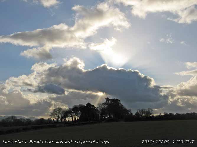 10th: Another shower of ice precipitation at 0200 GMT, snow pellets and possibly snow. In the morning slight snow was lying on the Carneddau Mountains at 1800 ft and as low as 100 ft at Llyn Ogwen. Most was lying in the West of the range and on Snowdon. With the temperature on the ground falling to -4.0C there were some pellets remaining frozen on the grass and there was ice on the bird's bath. The temperature at 09 GMT was 1.5C (dewpoint 0.7C). A fine day ensued with some sunny spells with a maximum temperature of 6.5C in the afternoon. Later the temperature, after an evening fall, was to rise as a rain-bearing front approached.. [Rain 14.2 mm; Max 8.8C; Min 0.0C; Grass -4.0C]
 11th: Rain moderate to heavy from midnight. The temperature had risen to 8.8C between 06 and 07 GMT before falling to 09 GMT 7.1C as a front passed over and the rain eased. The 14.2 mm rain had made the ground very soggy underfoot. Some of the local fields where the soil structure is not free draining as here had pools of water on them on the 9th. A dull overcast morning, the afternoon brighter but with showers of rain. Gorwel Heights in Llanfairfechan had up to 29 mm/h falling at 1610 - 1620 GMT. {Scilly Is 11.1C, Capel Curig 35.4 mm, Tiree Is 2.4h} [Rain 1.7 mm; Max 7.5C; Min 1.5C; Grass -1.3C]
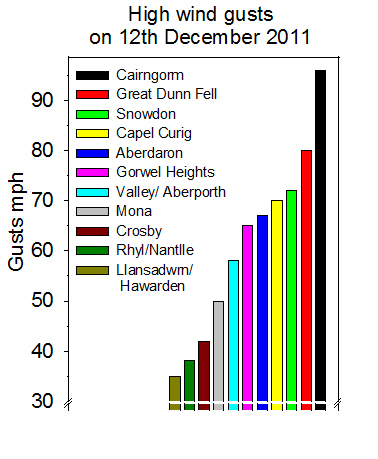 12th: A showery morning with slight snow falling on the mountains as low as 2500 ft. Here some ice precipitation marks on the hailometer indicative of small ice pellets. Visibility was poor in rain at 09 GMT with a temperature of 4.7C. Pressure was 1002 mb, but would soon start falling rapidly as low 967 mb W of Scotland deepened. Overcast and raining by 1500 GMT with the S'ly wind strengthening. The wind was particularly strong at Gorwel Heights in Llanfairfechan from the SSE force 7/8 with gusts over 50 mph from 1800 GMT, highest 65 mph at 1836 GMT, off the local mountains (Garreg Fawr 1168 ft). This was coupled with passage of a warm front and torrential rain that fell at a rate of up to 175 mm/h, highest of the month {14.2 mm 00-00z; Nantlle 40.9 mm}. Quieter in Llansadwrn highest gust 35 mph, but later at 2326 GMT we had the cold front with rain and ice pellets up to 5 mm diameter falling at rate up to 52 mm/h the temperature falling quickly by 4C. Lowest barometer reading was 977.6 mb at 2320 GMT. [Scilly 11.6C, Milford Haven 10.0C, Llanfairfechan 10.9C, Boscombe Down 35.8 mm, Capel Curig 34.2 mm, Mona 16.6 mm, Aberporth 2.4h] [Rain 17.0 mm; Max 9.7C; Min 2.0C; Grass -1.2C]
13th: Showers continued after midnight, some with ice precipitation. Deep patches and broken snow lay on the mountaintops with frequent light wintry showers. Low 984 mb was off the Western Isles with pressure here 1002 mb that began to fall again by 1030 GMT. The SW'ly wind was strengthening to strong to gale-force with gusts up to 44 mph; high-sided vehicles were prohibited on the Britannia Bridge with a 20 mph speed restriction. A fine dry day here, bright at times, but the wind was unrelenting through to midnight with scattered clouds and some clear spells with bright moonlight overnight. [St Catherine's Point 9.7C, Tulloch Bridge 35.4 mm, Valley 2.3h] [Rain 0.0 mm; Max 5.3C; Min 3.5C; Grass 1.3C]
14th: The gale-force wind continued until just after midnight then it moderated and the the speed limit on the Britannia Bridge reverted to 30 mph during the night. A fine bright morning with weak sunshine and backlit cumulus clouds over the mountains, some moderately towering. There were some sunny spells in the afternoon as the cloud lifted from the tops of the Carneddau by 1600 GMT, but not Snowdon. As low 981 mb SW Ireland began tracking across the Irish Sea thundery showers encroached, with isolated sferics in the area, a distant rumble of thunder was heard at 1700 GMT. Valley reported recent rain showers at 2150 GMT and there were a few ice pellets and 2 rumbles of thunder here at 2242 GMT. {Mumbles Hd. 8.3C, Usk 15.4 mm, Aberporth 0.4h} [Rain 2.8 mm; Max 5.5C; Min 2.6C; Grass -0.2C]
15th: The barometer reached 986.8 mb at 0116 GMT then began to rise. There were showers with small ice pellets from 03 GMT. At 09 GMT pressure 995.6 mb was rising rapidly the low heading for the North Sea; precipitation was in sight to the S with a dark cumulonimbus cloud moving over the Snowdonia Mountains depositing snow as low as 2000 ft. Light showers continued through the morning, with occasional bright spells and light W/SW'ly breezes, into the afternoon with small ice pellets. Some clear sky appeared in the evening, but was overcast by 2100 GMT. {St Catherine's Point 9.9C, Capel Curig 19.0 mm, Glasgow 5.5h} [Rain 1.8 mm; Max 6.1C; Min 2.0C; Grass -0.6C]
The first 15-days had 69.2 mm precipitation (61%) and [57%] of the month's average. Temperatures were close to normal with the mean 5.2C (0.0) and [-0.1]. Days with hail were 11 this was (+4.2) of average..
16th: Overnight and early morning showers of snow pellets down to sea level, and snow at higher levels on the mountains where it was lying as low as 1200 ft in places at 0900 GMT. Conditions were tricky on the A55 approaching the Britannia Bridge with snow pellets on the road and, as precipitation moved eastward, cars were skidding off the road on Rhuallt Hill in a covering of snow at 1100 GMT. Snow reported later in Manchester. Overnight the minimum temperature had fallen to -0.7C giving the first air frost of the winter. The last air frost here was on 8 March with 281 days frost-free between. Snow pellets showers here at 0915 GMT and further frequent showers of rain and 'wet' conical snow pellets at times through the day. {Camborne 7.9C, Aberdaron 6.3C, Machrihanish 22.0 mm, Llysdinam 19.2 mm, Hurn 4.9h, St Athan 4.1h} [Rain 4.5 mm; Max 5.0C; Min -0.7C; Grass -4.2C]
17th: Showers of ice precipitation after midnight and there were some conical pellets on the grass at 0900 GMT. Variable cloud cover , the sky showing signs of clearing with a light WNW'ly breeze. The mountaintops were cloud covered, but snow could be seen around 2250 ft on the Carneddau and 1250 ft on NE-facing cliffs under Y Garn where gullies looked packed with snow. It was reported a man was killed in an avalanche when attempting to descend one of the gullies. The temperature at 0900 GMT was 3.0C (dewpoint 2.0C) and rose during the day to 5.2C. There was a brief sunny spell at 11 GMT then showers with some more sunny spells during the afternoon. Mistle thrushes were heard 'chirring' in the trees, but being cold no singing yet. They are too late for holly berries, as there were all taken by blackbirds some weeks ago. The evening was mostly clear with little or no wind. {Culdrose 8.4C, Capel Curig 14.2 mm, Hurn 6.0h} [Rain 1.5 mm; Max 5.2C; Min -0.1C; Grass -2.6C]
 18th: Cloud increasing from dawn; a regular pattern of waves in moderately high cloud, spotted to the SE at 0815 GMT. There were some ice covered snow pellets on the ground. Precipitation was in sight at 0900 GMT with visibility deteriorating from good to poor, and it was not long before rain arrived. By afternoon it was brighter with some sunshine, but the sky turned cloudier again during the evening with showery rain from 17 GMT. {Cardiff 9.0C, Capel Curig 17.2 mm, St Athan 4.6h} [Rain 4.3 mm; Max 5.5C; Min 0.3C; Grass -3.4C]
19th: Light to moderate rain from 05 GMT and it was still raining at 0900 GMT. The ground was very soft underfoot and pools of water were larger in nearby fields. The temperature was rising and the 5.5C was the highest of the past 24-h. The rain had melted some of the mountain snow, but snow remained at 2500 ft with broken snow down to 1500 ft in places. Visibility was poor or very poor at times with rain continuous during the morning when it was very dull. Scottish Power contractors were here trimming trees around overhead power cables. We were without electricity from 0915 GMT through till late afternoon. The rain ceased by 14 GMT and the sky was brighter before dusk. {Isle of Portland 11.0C, Milford Haven 10.5C, Gogarddan 19.0 mm, Valley 0.6h} [Rain 9.2 mm; Max 8.5C; Min 2.0C; Grass -1.1C]

|
20th: Overcast and dull with cloud thickening and descending on the mountains from the West. Broken snow remained at 2700 ft and as low as 1500 ft in Cwm Idwal. Work on restoration of Beaumaris pier, opened in 1846, was continuing behind schedule. Piles for the floating pontoon are in place and the shelter is now being replaced. There will be new decking that will be returned to its former width  . Some showery rain before noon; the afternoon had slight drizzle at times. It was a very dull day with little or no wind. [Rain 4.1 mm; Max 10.5C; Min 3.7C; Grass 0.0C] . Some showery rain before noon; the afternoon had slight drizzle at times. It was a very dull day with little or no wind. [Rain 4.1 mm; Max 10.5C; Min 3.7C; Grass 0.0C]
21st: The temperature at 0900 GMT was 10.5C, the highest of the past 24-h, and on this dull and sunless day was to rise just another 0.1C reaching 10.6 by 1100 GMT. At Gorwel Heights in Llanfairfechan the temperature, enhanced by a Föhn-effect, reached 13.1C at 1950 GMT, but in Rhyl it reached 14.4C highest in Britain on this day. [Rhyl 14.4C] [Rain trace; Max 10.6C; Min 4.3C; Grass 2.2C]
22nd: Bright at first with the sky partially clearing on this the shortest day. Continuing mild in warm sector air the temperature 9.5C at 0900 GMT. The afternoon was overcast with drizzle that seemed to be confined mainly to Anglesey. By evening the SW'ly wind was strengthening with a gust of 33 mph. At Gorwel Heights in Llanfairfechan enhanced by a Föhn-effect the temperature reached 13.3C at 1810 GMT, one of the highest in Wales on this day. {Rosehearty 14.1C, Hawarden 12.8C, Lusa 18.0 mm, Manston 5.8h} } [Rain 11.5 mm; Max 11.0C; Min 8.4C; Grass 5.7C]
23rd: Windy after midnight (gust 38 mph) and moderate to heavy rain from 0430 GMT and still raining in the morning, the ground was very wet underfoot. At 09 GMT a cold front was passing over and the temperature had dropped to 8.1C, the lowest of the past 24-h and was to be the maximum of the next 24.h. The moderate rain soon eased, but another sunless day ensued with showery rain. The temperature at noon was 5.6C and there were small ice pellets and rain at 1435 GMT (heaviest 12.4 mm/h) and 1830 GMT. At dusk the sky was brighter in the West and this clearance reached during the evening with a touch of ground frost (-0.5C) and the air temperature falling to 2.5C around midnight. {Cardiff 11.8C, Capel Curig 42.6 mm, Kinloss 4.5h} [Rain 6.3 mm; Max 8.1C; Min 8.1C; Grass 8.0C]
24th: After midnight cloud encroached and the temperature began to rise and was 6.1C at 09 GMT. Overcast with slight rain at first, a little brighter by 0930 GMT for a while as the SW'ly breeze strengthened during the morning. The afternoon was dull, breezy but kept dry until evening when it was wet and windy. The population of sparrows had increased, there were at least 12 at the feeding table this morning. Several winter heliotropes are now in flower, 2 or 3 Welsh poppies remain and some other garden plants still have a few flowers but reduced in numbers after the air frost on the 16th . {Hawarden 10.6C, Llanfairfechan 9.9C, Llansadwrn 8.8C 21z } [Rain 6.4 mm; Max 10.0C; Min 2.5C; Grass -0.5C]
25th: Christmas Day dawned dull and grey with a fresh to strong SW'ly wind gusting to 42 mph at 1250 GMT (SSW'ly 38 mph at Gorwel Heights at 1210 GMT). No crisp deep snow on the ground this year! With low 957 S of Iceland we were in warm sector air and the temperature had slowly increased through the night and was 10.0C, highest of the past 24-h. Low cloud and mist hung around most of the day here, but lifted for a time coastal areas on the west-coast. There was clear sunshine in a lee-clearance in Llanfairfechan; the temperature rose to 13.9C, one of the highest recorded in Wales, in a Föhn-effect at 1830 GMT the wind gusting to 26 mph. A 30 mph speed limit was in force on the Britannia Bridge all day. {Aberdeen 15.1C, Llanfairfechan 13.9C, Hawarden 13.6C, Tyndrum 39.2 mm, Capel Curig 25.6 mm, Kinloss 1.5h, Valley 0.4h} [Rain 0.2 mm; Max 11.4C; Min 6.1C; Grass 5.1C]
 26th: A spell of drizzle and slight rain around 0500 GMT that deposited a moderate amount of Saharan dust. A sample collected at 0900 GMT was pinkish-white to light reddish-brown in colour MUNSELL® soil colour chart (2.5YR 8/2; 7/3, dry) and could be seen dried on parked vehicles. Backward trajectory analyses (left), using the HYSPLIT model, courtesy of the NOAA ARL website, indicated that parcels of air arriving over Anglesey, in a narrow band at 500 m AGL, after crossing the Atlas Mountains traversed the Saharan desert in central Algeria between 17/18 December before moving over northern Mali on the 19th, Mauritania on the 20th and on to cross Western Sahara reaching the Canary Islands on the 21st. Parcels were over the Azores on the 24th then moved rapidly towards S Ireland and St George's Channel arriving over Anglesey on the 26th around 05 GMT. The dust was also detected by pollution monitors that measure roadside particles on Anglesey between 05 and 06 GMT (provisional data courtesy of the Welsh Air Monitoring Forum website); at Brynteg a peak of 168 μg per m-3 total suspended particulates was recorded while at Llynfaes 191μg per m-3 was recorded. Spots of rain on the wind that was SW'ly force 5/6 and a 30 mph speed limit was in force on the Britannia Bridge all day. Dull here, but bright on the mainland becoming less windy by evening and overnight. [Aberdeen 15.5C, Hawarden 13.8C, Llanfairfechan 12.7C, {Kinlochewe 89 mm} Capel Curig 13.6 mm, Valley 0.0h] [Rain 2.3 mm; Max 11.5C; Min 9.8C; Grass 9.6C]
27th: Little variation in the temperature under thick cloud overnight with light rain falling between 02 and 08 GMT. Still overcast at 0900 GMT with good visibility, but misty looking towards the mountains. Deep low 985 mb was W of Shannon tracking NE while a warm front was just N of here. Strengthening SW'ly wind again today, the 30 mph speed restriction on the Britannia bridge was restored just before midnight. [Hawarden 12.3C, Llanfairfechan 11.1C, Capel Curig 9.8 mm, Valley 0.0h] [Rain 8.5 mm; Max 9.4C; Min 8.5C; Grass 7.8C]
28th: The deep low 970 mb was off NW Scotland at 0900 GMT with northern parts receiving a battering from the storm force winds. Pressure here was 1015 mb and the W'ly winds were now much lighter. Windy after midnight (36 mph gust at 0253 GMT) and as a cold front passed over the temperature falling from 9.3C at 0304 GMT to 3.3C at 0818 GMT. There was a burst of heavy rain and ice pellets at 0436 GMT (up to 25 mm/h). At Gorwel Heights in Llanfairfechan there was a gust of 41 mph at 0039 GMT and a burst of heavy rain 66 mm/h at 0443 GMT the temperature falling from 10.7C at 0124 GMT to 2.8C at 0915 GMT. In a clear slot it was a brightening morning with some sunshine developing before turning cloudier again later. Lesser celandine, that has become a problem weed, was already growing in profusion in some places in the garden. {Manston 11.6C, Llanfairfechan 10.7C, Cluanie Inn 75.2 mm, Boulmer 4.1h, Valley 3.2h} [Rain 6.5 mm; Max 7.2C; Min 5.6C; Grass 3.3C]
29th: A spell of light rain from 02 to 06 GMT and there were spots of rain at 0900 GMT. Pressure 1019 mb was falling slowly from the 1024 mb around midnight. A blustery morning with a moderate to fresh W'ly wind with slight rain at times. A 30 mph speed limit on the Britannia Bridge was kept until evening when the wind moderated. There were breaks in the cloud with some clear spells around midnight when tawny owls were about. [Rain 0.6 mm; Max 8.5C; Min 4.5C; Grass 2.0C]
30th: Another overcast misty morning with spots of rain that continued intermittently during the morning, a mistle thrush tried a few bursts of song about 1115 GMT. Rain was heavier at times in the afternoon and with the ground now saturated with water there was surface water running at the sides of local roads. [Rhyl 12.3C, Llanfairfechan 12.2C, Capel Curig 12.0 mm, Valley 0.0h] [Rain 6.2 mm; Max 10.5C; Min 4.5C; Grass 0.4C]
31st: A mild end of the year, 10.2C here at 09 GMT and 6C on the summit of Snowdon. Visibility was good at low levels, but a thick layer of cloud hung between 2000 and 2500 ft on the mountainsides. [Llanfairfechan 13.5C, Hawarden 13.3C, Capel Curig 18.8 mm, Valley 0.4h] [Rain 5.1 mm; Max 11.1C; Min 5.3C; Grass 4.7C]
The month ended with rainfall of 146.4 mm (129%) & [121%] of averages highest since 2006 and ranking 23 since 1918. A mild month with the mean 6.0C (+0.7) and [+0.6] of averages, =highest since 2007. It was the 2nd dullest December on the Anglesey record (K&Z adjusted values) sunshine of only 21.3h at Valley just beating the 14.4 h (15.5h by Campbell-Stokes) in Holyhead in 1931.
|
 9th: The snow had all disappeared, but a vase of greenhouse Chrysanthemums 'Snowshine' is a reminder of of the view from this window in December
 6th: There was a mackerel sky to the S at 0700 GMT and cloud continued to decrease slowly up to 09 GMT. Although the grass minimum had fallen to -1.1C overnight I did not see any frost. The grass was wet with dew drops and concrete was dry. Visibility was good though slightly hazy and 2 short contrails were visible to the NE. The day was soon sunny with few clouds until a band of broken cloud encroached from the SW by 1500 GMT. A few sunny spells until sunset when the sky became overcast, but broke up before midnight. [Rain 0.0 mm; Max 8.7C; Min 1.6C; Grass -1.1C]
  8th: The sky was still clear at 0715 GMT then small cumulus clouds began to form and along with some encroaching altostratus lead to a bright morning with mostly weak sunshine. No contrails were seen. Pressure 1020 mb was falling quickly and a cold front was approaching N Ireland and W Scotland. A windy afternoon the SW'ly force 4/5 with sunny spells at first becoming overcast and dull by 1600 GMT. Rain with snow over high ground had moved on to N Ireland and Scotland, but measurable rain did not reach here until after midnight. (St James Park 12.7C, Hawarden 11.1C, Kinlochewe 38.8 mm, Aberporth 7.4h} [Rain 0.3 mm; Max 9.0C; Min -0.3C; Grass -4.0C]
  22nd: A sunny and warm day with 3 oktas of cirrus and cirrostratus lying to the S at 09 GMT and a light SE'ly breeze. There was moderate smoke (pollution) haze the level reported by the instruments at Marchlyn Mawr 160 µg ozone m-3 (courtesy of the Welsh Air Quality Forum). Ozone is formed in the atmosphere under the action of bright sun light (hence called photochemical smog) on nitrogen oxides emitted principally from motor vehicles. Ozone levels were moderately high over most of Wales and this spread to England with high levels in London the smog worst seen for many years. The temperature was already 20.3C (dewpoint 9.5C). Some convective cloud formed by 11 GMT and there were scattered clouds around during the afternoon, but it kept bright with sunny spells. The temperature rose to 24.4C during the afternoon the second highest temperature recorded at this station on this date in April since records began in 1979. The highest is 25.3C recorded on the 16th in 2003. In Llanfairfechan the temperature rose to 23.9C and in Porthmadog to 24.7C. {St James Pk. 26.9C, Manston 13.0h, Valley 6.9h} [Rain 0.2 mm; Max 24.4C; Min 13.9C; Grass 9.6C]
 29th: The day began with almost clear skies, a small cumulus cloud was spotted to the SSW at 09 GMT. There had been heavy dew (0.26 mm), but this had almost dried off in the light NE'ly breeze at 09 GMT. Pressure was 1017 mb in a ridge from Scandinavian-high 1031 mb with decaying frontal cloud lying to the south-east. Later the morning turned cloudier with sunny spells, but the sky cleared again in the afternoon. A cool NE'ly breeze persisted while the temperature rose to 16.7C. The breeze lessened by evening. Soil moisture determined today had fallen to 45% dry mass, the first signs of moisture stress shallow rooted plants were beginning to appear although the grass was green and growing at a rate of nearly 9 tonnes per hectare. {Isle of Skye 22.1C, Porthmadog 21.1C, Lerwick 14.5h, Valley 11.9h} [Rain 0.0 mm; Max 16.7C; Min 7.0C; Grass 2.3C]
  31st: A fine morning after a cool night the air temperature down to 4.9C and to 1.0C on the wet-with-dew grass. Scattered clouds at first decreased but with cumulus clouds persisting there was sunshine before noon. Convective cloud developed overhead again in early afternoon before clearing away later to give a mostly sunny late afternoon and evening. On Holy Island (Ynys Gybi) on the north-west coast of Anglesey it was much sunnier and, although breezy at times, there was a holiday atmosphere on the beaches at Trearddur Bay and Porth Diana
 9th: A mostly cloudy morning with the cloudbase about 2000 ft. Visibility was good or very good under the cloud. Sunny spells and a little cloudier after noon then clearing later. Convective clouds (towering Cu and Cb) persisted over the mountains of Snowdonia with virga and occasional precipitation reaching the ground. Mike Peacock reported 'several sharp showers of hail on the Migneint above Ffynnon Eidda. They weren't particularly large hailstones, but they certainly stung!' It was sunny W of Caernarfon in the afternoon at Foryd Bay with clear views of the Lleyn Peninsula, Bardsey, Fort Belan and the western entrance to the Menai Strait, Abermenai and Llanddwyn Island. Cloud from a decaying cumulonimbus encroached late in the afternoon, but clear skies persisted over SE Anglesey. Light showers developed by 2300 GMT. {Charlwood 19.4C, Milford Haven 15.2C, Aberporth 13.2h} [Rain 1.5 mm; Max 15.0C; Min 6.7C; Grass 4.9C]
  10th: Light showers continued after midnight, rain here, but if falling on the mountains ice precipitation was possible as the temperature at times was -3C on the summits. A bright morning the sky a complex of cumulus, cumulonimbus, altocumulus and cirrus clouds, and very good visibility. Recent showers of hail were reported at RAF Valley on automatic at 0850 GMT. At 09 GMT pressure here was 1014 mb with low 1002 mb was off NW Scotland and showers were within its circulation. Dark shower clouds crossed the Snowdonia range around noon producing hail (ice pellets were reported on the lower slopes of the Carneddau
  14th: With Atlantic-low 982 mb W of Ireland and S of Iceland a ridge of high-pressure was crossing Britain giving respite from the unsettled weather. It was a mostly sunny day, high cloud encroached on to the west coast in the afternoon bringing some weak sunshine at times. {Charlwood 23.4C, Hawarden 21.4C, Leconfield 14.1h, Aberporth 12.6h} [Rain mm; Max 21.1C; Min 8.3C; Grass 4.8C]
 11th: Pressure 1017 mb continued to rise and there was another fine bright day. Today a light N'ly breeze at first settling to a NE'ly through the day. Cumulus clouds, some moderate towering seen to the S and W at first, and patches of blue sky gave way to mainly cirrostratus encroaching from the W in the afternoon. A weak complete 22° solar halo, no parhelia, was seen during the afternoon from 15 GMT at Aberffraw.
 14th: Another fine and sunny day with clear sky up to 09 GMT. The temperature had risen to 17.0C in the screen and was the maximum observed over the past 24-h. There was a light SSW'ly breeze at first this strengthening a little through the day. A little cloud formed overhead from noon, and just a little cirrus in the W, but a line of cumulus cloud persisted over the Snowdonia Mountains through the afternoon, cloudbase well over the tops, that began to disperse by 1700 GMT leaving cloud at the head of the Nant Ffrancon Pass. A mackerel sky was seen overhead towards and after midnight. {Pershore 24.2C, Llanfairfechan 23.5C, Aberporth 15.0h} [Rain 0.0 mm; Max 22.9C; Min 9.5C; Grass 4.8C]
  23rd: A cloudy morning, but the altostratus was moderately high and the mountaintops in the clear. Mild and dry overnight and feeling warm in the 17.1C temperature at 09 GMT. The grass was only slightly wet with guttation drop at the tips of the leaves. During the morning the cloud thinned further and it was bright, but sunshine was at a premium. It was sunnier at Penmon and eastward towards the Great Orme and Llandudno. The offshore wind turbines on the flats near Rhyl could be seen. With the tide rising there were several fishermen on the rocks and beach hoping for mackerel, but they were unlucky. A flock of tern were diving for fish just offshore near the lighthouse at one stage, but they moved off without coming inshore. A painted lady butterfly
  25th: Occasional cloud overnight, with a light shower at 02 GMT, and cooler with a minimum air temperature of 9.5C falling to 6.4C on the grass. With a SE'ly breeze some altocumulus lenticularis clouds formed in the lee of the mountains. At 09 GMT the lenticular clouds had disappeared, visibility was very good. Pressure was 1007 mb with low 993 mb off SW Ireland tracking SSE. A fine and sunny morning before turning cloudier by noon. An area of heavy rain over Cardigan Bay, associated with an active trough in circulation of the low, moved towards Lleyn and Anglesey in the afternoon. Valley reported thunder with rain hourly from 1300 GMT and a Cb was seen approaching here at 1400 GMT. When under the dark cloud at 1423 GMT thunder was heard to the NW followed by showery rain. Further lighter showers at 17 and 21 GMT. [Rain 2.8 mm; Max 17.8C; Min 9.5C; Grass 6.4C]
  28th: A clear cloudless morning and with pressure on 1022 mb it was to be a fine sunny day. The temperature at 09 GMT was 22.1C (dewpoint 16.8C) and in Llanfairfechan a remarkable 24.6C, these were the maxima of the past 24-h. There was a moderate to fresh SSE'ly breeze here and a light to moderate SSE'ly breeze in Llanfairfechan. A small cumulus cloud was seen briefly to the South. There were high spring tides this week, the 10m (Liverpool) high tide at 11 am tested the sea defences at Ynys Gored Goch (left) that lies between the bridges in the Menai Strait. Warm moist tropical air was moving up from the S and temperatures continued to rise reaching 26.4C, highest of the month, and 26.9C in Llanfairfechan in the still windy afternoon. It was cooler on the coast with 22.6C recorded at Valley. In the SE in Gravesend the temperature rose to 27.1C. Smoke haze developed through the day with the instrument at Marchlyn Mawr reservoir 2100 ft (Welsh Air Quality Forum) measuring an ozone level of 125 μg per m-3. The breeze died away during the evening and the temperature in Llanfairfechan just before midnight was 20.2C here it was 19.2C. {Jersey 27.3C, Gravesend 27.1C, Hawarden 26.3C, Lyneham 11.3h, Aberporth 11.2h, Valley 10.9h} [Rain 0.0 mm; Max 26.4C; Min 12.6C; Grass 10.0C]
  10th: Another shower of ice precipitation at 0200 GMT, snow pellets and possibly snow. In the morning slight snow was lying on the Carneddau Mountains at 1800 ft and as low as 100 ft at Llyn Ogwen. Most was lying in the West of the range and on Snowdon. With the temperature on the ground falling to -4.0C there were some pellets remaining frozen on the grass and there was ice on the bird's bath. The temperature at 09 GMT was 1.5C (dewpoint 0.7C). A fine day ensued with some sunny spells with a maximum temperature of 6.5C in the afternoon. Later the temperature, after an evening fall, was to rise as a rain-bearing front approached.. [Rain 14.2 mm; Max 8.8C; Min 0.0C; Grass -4.0C]
  11th: Rain moderate to heavy from midnight. The temperature had risen to 8.8C between 06 and 07 GMT before falling to 09 GMT 7.1C as a front passed over and the rain eased. The 14.2 mm rain had made the ground very soggy underfoot. Some of the local fields where the soil structure is not free draining as here had pools of water on them on the 9th. A dull overcast morning, the afternoon brighter but with showers of rain. Gorwel Heights in Llanfairfechan had up to 29 mm/h falling at 1610 - 1620 GMT. {Scilly Is 11.1C, Capel Curig 35.4 mm, Tiree Is 2.4h} [Rain 1.7 mm; Max 7.5C; Min 1.5C; Grass -1.3C]
  12th: A showery morning with slight snow falling on the mountains as low as 2500 ft. Here some ice precipitation marks on the hailometer indicative of small ice pellets. Visibility was poor in rain at 09 GMT with a temperature of 4.7C. Pressure was 1002 mb, but would soon start falling rapidly as low 967 mb W of Scotland deepened. Overcast and raining by 1500 GMT with the S'ly wind strengthening. The wind was particularly strong at Gorwel Heights in Llanfairfechan from the SSE force 7/8 with gusts over 50 mph from 1800 GMT, highest 65 mph at 1836 GMT, off the local mountains (Garreg Fawr 1168 ft). This was coupled with passage of a warm front and torrential rain that fell at a rate of up to 175 mm/h, highest of the month {14.2 mm 00-00z; Nantlle 40.9 mm}. Quieter in Llansadwrn highest gust 35 mph, but later at 2326 GMT we had the cold front with rain and ice pellets up to 5 mm diameter falling at rate up to 52 mm/h the temperature falling quickly by 4C. Lowest barometer reading was 977.6 mb at 2320 GMT. [Scilly 11.6C, Milford Haven 10.0C, Llanfairfechan 10.9C, Boscombe Down 35.8 mm, Capel Curig 34.2 mm, Mona 16.6 mm, Aberporth 2.4h] [Rain 17.0 mm; Max 9.7C; Min 2.0C; Grass -1.2C]


 3rd: The rain arrived around 0500 GMT, light to moderate through the morning. Low 981 mb just S of Iceland was the remnant of Hurricane Irene that caused the flooding , devastation and loss of live on the east coast of the USA and Canada. High 1026 mb was near the Azores and we were in a SW'ly airflow. Cold fronts were slow-moving over the Irish Sea with the jetstream, encircling Irene to the S, over Britain. At 09 GMT there were 3.6 mm in the gauge and another 19.9 mm during the day only easing off after 2200 GMT. The total for the event totaling 23.6 mm, not quite the 'inch'. Several locations along the North Wales coast were in rain-shadow including Rhyl 1.6 mm, Hawarden 3.2 mm and Llanfairfechan 8.6 mm. Llansadwrn 19.9 mm and Capel Curig 19.2 mm were the largest local falls while Walney Island had 30.6 mm. [Rain 19.9 mm; Max 15.7C; Min 14.6C; Grass 13.5C]