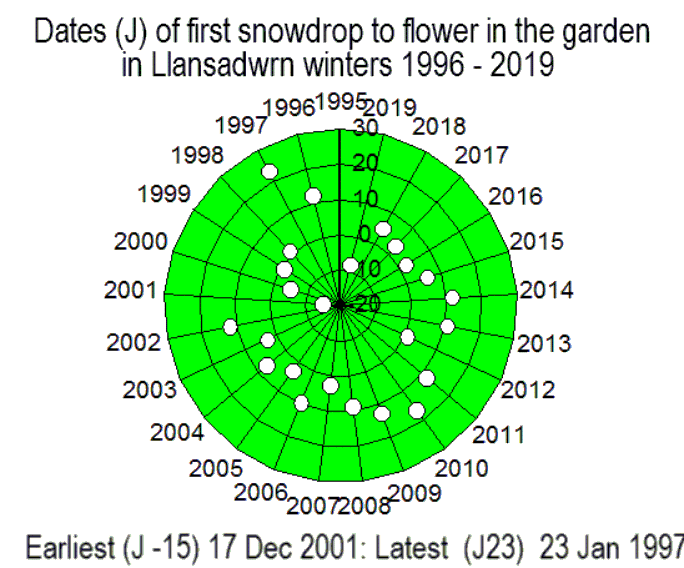
|

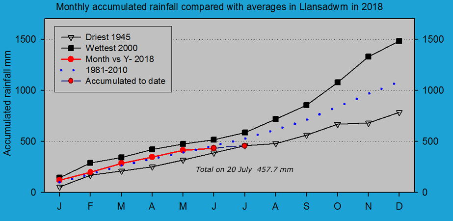
Times are GMT (UTC, Z). Observations at this station [ ] are 24-h 09-09 GMT, some others { } occasionally refer to other 24-h periods, extremes (first indications) are given in bold and are usually 21-21 GMT. When averages are referred to (.) compares with the last decade and [.] with the new 30-y climatological average [1981 - 2010]. All data are subject to verification and amendment. January 2018
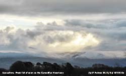
January 1 - a fine and bright morning with moderate to good visibility. There were snow patches as low as 2250 ft on the Carneddau Mountains and there was a fresh sprinkling of snow above 2750 ft. Overnight an air minimum of 3.8C with a touch of ground frost. Mistle thrushes were making chirring noises in the trees, but there has been little singing from them so far this winter, A fresher feel to the 5.2C temperature in a light SW'ly breeze. A few sunny spells then turning cloudier during the middle of the day with some glimpses again later in the afternoon [Max 7.6C Min 3.8C Grass -0.2C Rain 8.8 mm]. The 2nd began overcast with a blustery force 4/5 SSW'ly wind. With the soil near saturation point any rain results in some standing water around the garden and it was trickling in one or two places. Visibility was moderate in slight rain that began to ease soon after 09 GMT. It was 6.8C this morning after a ground frost of -1.2C, but there was no frost to be seen. It was very dull, but there were some brighter spells with odd glimpses of sunshine later. Low 962 mb S Denmark Strait giving warm sector air with a following cold front and triple point S Ireland. Atlantic-low 995 mb was W of Brest, France. With very cold weather in N America the jetstream was set up to deliver some stormy weather to our parts. Becoming windy with named storm Eleanor approaching. Pressure 1001 mb had been falling quickly reaching 990 mb at 1800 GMT. With the wind gusting to 43 mph at Gorwel Heights the temperature rose to 10.7C at 1130 GMT while at Gorddinog AWS, with the wind gusting again at 43 mph, the temperature rose to 11.7C at 2020 GMT and here 10.6C with gusts of 37 mph at the same time. Rainfall 09-09 GMT today was 14.0 mm, Mona had 14.8 mm and Capel Curig 40.0 mm [Max 10.6C Min 3.1C Grass -1.2C rain 14.0 mm]. Windy overnight and still blowing on the 3rd at 0900 GMT force 6 where exposed to the WSW'ly the leafless trees still affording a good deal of shelter in the garden.
A bright start on the 9th with some fog lingering in low lying areas. Air minimum of -1.4C and -5.3C on the grass with more frost on the grass and a little hoar on some plants and the rims of the copper raingauges slightly rimed. The ground was frozen with the 6 cm soil thermometer reading 0.1C. Some plants including purple sprouting broccoli and leeks were slightly temporarily wilted, physiological drought. The heater was not on in the black AWS TBR and this was particularly frosty and when this melted about 1100 GMT the bucket tipped; turgor returned to the wilted plants by afternoon. Pressure 1005 mb continued to fall with high now 1040 E Baltic region and low 949 SW Iceland with a cold front W of Ireland. Turning cloudier with frontal cloud encroaching across the Irish Sea. The daytime maximum was about 7.5C, the temperature rose later reaching 9.0C just before midnight and was the day's maximum [Mona Min -4.4C Capel Curig -2.9C] [Max 9.0C Min -1.4C Grass -5.3C Pptn 0.2 mm].
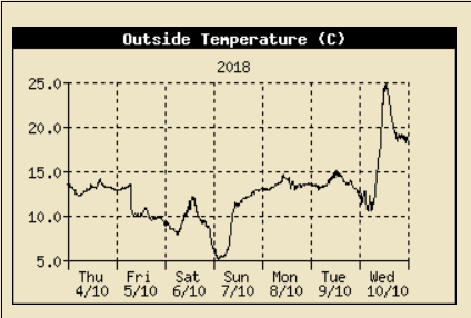
After a mild night with rain on the mountains not helping the meagre snow cover the 10th was a fine sunny day after a spectacular sunrise between Carnedd Llewelyn and C. Dafydd. The first 15-d of the month had 48.5 mm precipitation (42%) & [48%] of the monthly averages, largely due to the 23.2 mm on the 14th, while the mean temperature 5.0C was (-0.4) & [-0.1] of averages. The 16th began brightly with a cool WSW'ly breeze and a temperature of 3.2C at 0900 GMT. Moderate to good visibility with convective cumulus clouds in the vicinity, a cumulonimbus was spotted at 0945 GMT. Pressure 993 mb was rising with low 974 mb S Norway and a cold front over Brittany. With low 951 mb E Iceland we were in a strong W'ly shower packed airflow. Slight showers of wet soft hail (h3), heaviest at 1305 GMT [Max 4.8C Min 3.2C Grass -0.2C Pptn 1.4 mm].
Another overcast, dull and wet day on the 23rd, poor visibility in slight drizzle and rain in the morning. Ground saturated with some standing water in places, rather unpleasant [Tulloch Bridge 51.4 mm Capel Curig 34.2 mm] [Max 10.6 Min 6.6 Rain 9.0 mm]. Pressure had fallen to 995.5 mb at 0449 GMT on the 24th and there were strong gusts of wind here 44 mph 0510 GMT, 45 mph at Gorddinog at 0409 GMT and earlier at Gorwel Heights 53 mph 0143 GMT. Low 959 mb off the Western Isles, named Georgina by Met Éireann. High gust were recorded including at Great Dunn Fell 112 mph; S. Uist 85 mph, Capel Curig 83 mph, Mona 75 mph; and Valley 63 mph. The system had an associated cold front that passed over Anglesey at 0500 GMT resulting in the gusty wind, bursts of very heavy rain of up to 54 mm/h here and a 4 degree temperature fall. Still breezy at 0900 GMT with a fresh feel to the 6.9C temperature. Brighter in the afternoon with sunny spells as the wind moderated [Max 9.3 Min 6.2C Pptn 0.4 mm]. A brighter fresher morning on the 25th with a temperature of 5.1C at 0900 GMT. Low 987 mb was near the Western Isles and we were in a very showery airstream. Dark sky to the west with cumulonimbus in the vicinity. We had a slight shower of ice pellets 2-3 mm diameter at 0832 GMT. There were thunderstorms in S Snowdonia and particularly Pembrokeshire where damaging winds were reported [Max 6.8C Min 5.1C Rain 4.9 mm]. Overnight the sky had cleared and there was a slight ground frost with no precipitation since midnight.
At 0900 GMT on the 26th it was very fine with just 2 oktas cloud cover mostly obscuring the Snowdonia mountaintop with a few cumuli staring to form overhead.
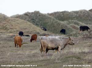
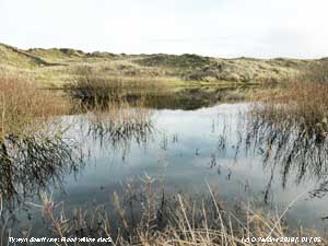
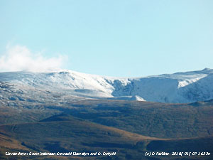
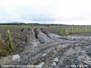
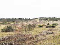
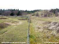
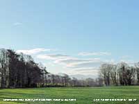
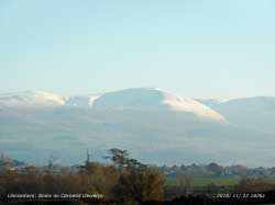
The 30th began fine and bright with good, slightly misty visibility. There is an absence of any significant snow patches on the N-facing slopes of the Carneddau, just some ice remnants around the summits over 3100 ft. Soon turning dull as cloud encroached from the W, but it kept dry. The panorama photograph above shows the water-filled south pool in Newborough Forest, gorse in bloom. The surface vegetation and soil on the adjacent former dune slack site (below left), the habitat of rare plant species, was quite dry with the water table below 15 cm. Ponies were eco grazing inside the fenced pool area. The photo right shows the marked effect of the grazing on the vegetation inside and outside the enclosure. During the evening the temperature began to rise, the wind strengthened and there was some rain [Max 7.2C Min 2.0C Rain 8.1 mm]. At midnight on the 31st the temperature was still rising reaching 7.2C, the maximum, at 0251 GMT ahead of cold fronts associated with low 981 mb N of Scotland. The month ended with a total rainfall of 121.8 mm (114%) & [120%] of averages, largest since 2016, ranking 34th in the 90-years of Llansadwrn records. The mean temperature 5.5C was lowest since 2015. Sunshine at RAF Valley was 59.5h.
February 2018
February 1 - a fine
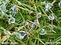
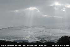
mostly cloudy morning with cumulus, cumulonimbus clouds and crepuscular rays in views towards the Snowdonia Mountains. There were a few unmelted ice pellets scattered on the grass with the grass minimum thermometer reading -0.6C. The soil could be described as soft and muddy, the temperature at 5 cm depth 3.0C and down at 100 cm it was 7.3C. Pressure 1007 mb was rising quickly with low 975 mb over the N North Sea and we had a showery NW'ly airflow. It was sheltered in the garden, but in the breeze the 4.0C felt cool. Mostly cloudy with a few glimpses of sunshine and missing the showers it kept dry [Max 6.9C Min 2.5C Rain nil]. Similar on the 2nd beginning bright with altocumulus and some towering cumuli to the S over the mountains, Fine and dry, the soil surface was soft but firming up for the first time for a while (Cardiff 9.7C) [Max 8.9C Min 4.1C Grass 1.7C Rain 4.2C]. The wind picked up after midnight with light to moderate rain on the 3rd and by 0900 GMT 4.2 mm had accumulated. The soil surface was then wet and muddy again. Mostly cloudy, but thinning overhead, with moderate visibility. Dull, with a raw feeling in the morning and frequent showers and brief sunny spells in the afternoon. Woodpeckers drumming in different parts of the woodland. Snow on the mountains over 2000 ft with some drifts in places on Snowdon. Showers in the evening, rain and wet snow pellets ]Max 6.3C Min 3.1C Pptn 1.2 mm]. The temperature at 0900 GMT on the 5th was 0.6C (dewpoint -1.8C) 84% RH. Bare soil surface was frozen and there was ice on water, but grassy areas were soft. Mostly cloudy, crepuscular rays and glimpses of weak sunshine. Pressure was 1031 mb in a temporary ridge extended from Baltic high 1037 mb. Light N'ly airs, very good visibility slight haze, though cold a nice day. There was a widespread snow cover in France except coastal fringes [Max 3.5C Min -1.5C Pptn 2.0 mm].
On the 6th it was snowing at 0900 GMT with 2 cm of lying snow. There was moderate snowfall on the Snowdonia Mountains. Snow was widespread on Anglesey except the coastal fringe and was absent in Beaumaris petering out at the top of Red Hill. The 9th began brightly with 5/8th cloud clearing after passage of a cold front that brought sleet and snow pellets around 0650 GMT. A fine morning, but very wet underfoot after the 19.1 mm of rainfall measures at 0900 GMT. Misty, but good visibility and it was feeling cold in the NW'ly breeze the air temperature 1.8C (dewpoint 1.2C) and RH 96%. Pressure 1011 mb was rising in a ridge from Azores high 1038 mb. Fine afternoon with clear views of the snow on the Carneddau Mountains with the snowline on 1500 ft and some seen as low as 450 ft [Max 6.8C Min 1.4C Grass -0.8C Pptn 11.7 mm]. It was overcast on the morning of the 10th with a moderate SSW'ly wind and light to moderate rain. There was moderate fog so visibility was bad. Pressure 1004 mb was falling rapidly with a warm front over the Irish Sea, associated with low 967 mb Iceland, and a frontal wave over Cardigan bay and another developing low W of Ireland. Pressure had fallen to 997 mb at 1800 when the low 990 mb was over Dublin, reaching its lowest here 991 mb about 2100 GMT. As the soil is completely saturated runoff water from fields made the roads very wet; a dreadful day altogether (Hawarden Max 12,4C Benson Min -6.5C Capel Curig 45.2 [46.3 mm] mm Kinloss 3.9h) [Max 9.3C Min 0.4C Grass -4.0C Pptn 8.7 mm]. A colder day on the 11th with flurries of ice precipitation including at various times snow grains (1010 GMT), snow pellets (vs) and snow flakes (incl. 15 GMT) all of little volume when melted. A bit brighter morning with our resident storm cock (Mistle thrush) singing nearby, the temperature 2,4C. The ground was soft and muddy underfoot, the standing water of yesterday drained away. Pressure 1002 mb was rising with low 976 mb now North Sea with the fronts translocated to France. There was a shower trough in the west and central England and the SE mostly sunny. Bright with some sunny spells in the afternoon (Shoreham 8.4C Loch Glascarnoch -4.5C) [Max 4.6C Min 2.3C Grass 0.2C Pptn 0.2 mm]. A bright and chilly morning on the 12th with a WNW'ly breeze with pressure steady on 1013 mb. No air frost, but ground frost of -4.2C enough to freeze the surface of water in the garden and slight white frost on grass and some roofs. Very fine and sunny day [Max 6.3C Min 0.3C Grass -4.2C Pptn 5.1 mm]. On the 13th a deep trough arriving at 07 GMT resulted in a temperature fall to 1.2C by 08 GMT and as rain turned to sleet here a fresh fall of snow on the mountains where it was lying at 450 ft. The temperature on Snowdon at 0900 GMT was -6C with a wind chill of -19C, here it had recovered to 2.8C and with a NNW'ly breeze. Pressure 994 mb was rising rapidly. There was light to moderate snow at Ogwen, Llandegai and Bethesda. Bright with sunny spells in the afternoon [Max 6.8C Min 1.2C Grass 0.0C Pptn 0.9 mm]. As the barometer 995 mb was falling again on the 14th S'ly winds were strong to gale-force in exposed places. Mostly cloudy with precipitation in sight at 0900 GMT when 4.1C. Spots of rain by 0920 GMT, blustery all day. High gusts of wind in Llanfairfechan at Gorwel Heights 54 mph and Gorddinog 52 mph. A portacabin was blown off a lorry on the A55 going E just before the Aber turnoff; the road was closed in the small hours next day to effect recovery (Bude 11.5C Topcliffe Min -7.6C Shap 21.6 mm Thomastown 3.3h) [Max 8.5C Min 0.3C Grass -4.3C Pptn 3.5 mm]. The first 14-d of the month had 67.0 mm precipitation (89%) & [85%] of the monthly averages, largely due to the 19.1 mm on the 9th, while the mean temperature 3.9C was (-1.6) & [-1.4] of averages. There had been 11 grass frosts and 7 days with ice precipitation. A fine, but cool breezy morning on the 15th with a moderate to strong WSW'ly. There were towering cumulus clouds over the mountains where there were wintry showers on broken snow, lines of old drifts and patches frequent as low as 2500 ft. Some weak sunshine and moderate visibility with an inversion in the Menai Strait. Becoming less windy, mostly sunny in the S and E [Max 6.9C Min 3.5C Grass -0.3C Pptn 1.0 mm]. Some light rain and drizzle overnight then an early sky clearance on the morning of the 17th before cloud began to increase again at 0900 GMT. Pressure 1019 mb was rising and the temperature was a mild 5.1C; gnats were flying about the garden. As cloudy no frost developed overnight. Fine, with weak sunshine at first, visibility was just good in mist. It had been dry overnight in Llanfairfechan. Fine views of the mountain snow in the afternoon as visibility improved with the snowline at 2750 ft with remnants as low as 1800 ft in places [Max 9.4C Min 4.5C Grass 1.5C Rain 0.1 mm].
Mostly cloudy on the 18th, fine with very good visibility after a slight shower at 0400 GMT; there was a very light ESE'ly breeze. There were some lenticular clouds forming in the lee of the mountains and around the summits under a upper layer of altostratus. Pressure was steady on 1019 mb , fine with very good visibility here, but mist and fog formed in central England and S Scotland. A trough from low 964 mb just S of Greenland was approaching the W while pressure over the Continent was high 1029 mb over SW France. Kept fine into the afternoon. (N. Wyke 12.8C Aboyne Min -4.6C Islay 10.4 mm Manston 7.7h) [Max 9.5C Min 3.5C Grass -0.6C Rain 4.3 mm]. Overcast and mild overnight minimum temperature on the morning of the 19th read 4.9C and no ground frost. In fact the grass minimum thermometer read 5.5C with surface soil warm for the time of year, 7.1C at 5 cm depth. It was moderately foggy, very damp 98% RH and a temperature of 8.5C at 0900 GMT. Pressure 1019 mb was rising, we were in warm sector air with a warm front running down the spine of the UK, with a ridge from high 1027 mb W of Iberia. There was a cold front lurking W of Ireland associated with low 963 mb SW Iceland. Cleared up in the afternoon when bright (Cardiff 14.2C Baltasound Min 1.0C Harris Quidnish 10.0 mm Glasgow 3.7h) [Max 11.0C Min 4.9C Grass 5.5C Rain 0.7 mm]. A much better day on the 20th for doing things out of doors. Starting with the 9 o'clock obs it was pleasant at the instruments. Buzzards were in the vicinity calling out and soon appeared over the wood. The temperature 5.2C with a gentle NNE breeze and sunny. Visibility was moderate with some mist and there had been heavy dew on the grass with a touch of frost after earlier rain. The afternoon although a little cloudier was mostly sunny [Valley 8.6h sunniest] so able to do some tidying up work around the garden. The snowline on the mountains had retreated to mostly broken snow above 3100 ft with snow patches as low as 2000 ft on the Carneddau (Strathallen 12.0C Katesbridge Min -0.9C Dundrennan 8.9 mm Valley 8.7h) [Max 9.6C Min 4.1C Grass -0.4C Pptn trace]. Another reasonable day on the 21st with 6/8th cloud cover at 0900 GMT composed of high banded cirrus, cirrocumulus, cumulus and altocumulus clouds. Good to very good visibility slightly misty in the E. High 1032 mb was over Scotland with pressure here steady on 1029 mb. Somewhat cloudier in the afternoon, cloudier in the east [Max 7.1C Min 2.8C Grass -1.2C Pptn nil]. Similar on the 22nd with very little cloud around at 0900 GMT. Pressure was on 1025 mb with a ridge from S Norway to the Celtic Sea and south-westward Low 969 mb was SE Greenland with fronts S of Iceland to the W of Ireland. It was windy in NW Scotland. Enthusiastic studying of the models suggests possibility of some very cold weather developing with very cold E'ly winds. It's a while since we had 'pipe cracking' easterlies. Underfoot with little or no rain for a few days grassy areas were soft, but firming up after being sodden for a long time. With temperature on the grass down to -3.4C there was only very slight white frost, but much silver frost to be seen Another dry day, very fine and sunny (Scilly 8.6C Mona 7.2C Shap Min -5.4C Bude 9.3h Valley 3.3h) [Max 7.1C Min 1.2C Grass -3.4C Pptn nil]. A brief red sky early on the 23rd and turning cooler with the minimum temperature 1.9C and under mostly clear sky -7.0C on the grass. A slight white frost on grass with a little hoar had developed. A nice sunny day, some more work in the garden in the fine afternoon (Kinlochewe 8.1C Mona 7.1C S. Newington Min -7.1C Sennybridge -5.6C Yeovilton 9.4h Valley 8.7h) [Max 8.5C Min -1.9C Grass -7.0C Pptn nil]. Another fine and sunny morning on the 24th with just 2 oktas cloud cover, cirrus and cumulus. Visibility was moderate with smoke haze and there had been an overnight air frost -2.9C and -7.3C on the grass and with fairly dry air only slight white frost and silver frost. Soil was frozen hard, looking surface dry, and was down to 0.7C at 5 cm deep. Currently the air temperature -0.8C (dewpoint (-3.3C) Fine, sunny and colder (Pembrey Sands 8.9C Mona Min -5.5C Pentraeth -4.9C Valley -4.7C & 9.7h) [Max 6.7C Min -2.9C Grass -7.6C Pptn nil). One of those quite remarkable February days, on the 25th, we can have here when the weather is fine. Hardly a cloud in the sky, which is a good start, and a gentle E'ly breeze. Very fine, with very good visibility. Pressure 1027 mb was rising with high 1052 mb central Norway/ Sweden. At midnight on the 27th the air temperature had fallen to -2.3C and soon after ice precipitation began to fall and the temperature to rise. There was snow settling by about 0530 GMT and by 0900 GMT there was an average depth of 3 cm of lying snow. The temperature was then 0.8C (dewpoint -0.1C) and the snow eased by about 0930 GMT. Flurries, including snow grains and snow pellets, continued through the morning into the afternoon between glimpses of sunshine, heaviest snow grains around 1530 GMT (Derrycornahoule 6.2C Usk 3.8C Wych Cross Min 2.5C Morpeth 8.4 mm Rhyl 3.8 mm Camborne 8.5h) [Max 1.9C Min -2.3C Frost 13.5h Pptn 0.3 mm]. The month ended with a total precipitation of 76.7 mm (102%) & [98%] of averages. The mean temperature 3.9C was (-1.6) & [-1.3] of averages. Sunshine at RAF Valley was 115.4h.
March 2018
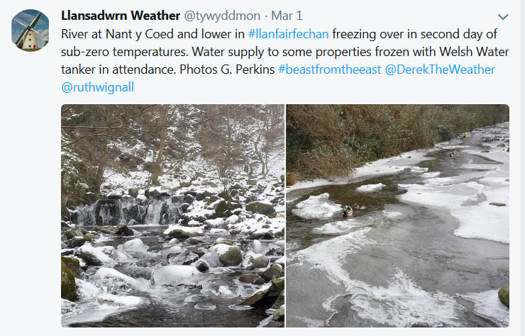
March 1 - another cold day. Overnight minima air -5.1C and on the grass -6.7C. Flurries of ice precipitation mostly ice crystals and snow grains unusual to see so much of these types here. The 6th began dull and overcast with a temperature of 3.7C at 0900 GMT. There was a little fresh snowfall on the mountains above 2500 ft. Low 984 mb was over the Irish Sea, but pressure here 986 mb was rising. Soon becoming brighter with a glimpse of sunless, this was short lived with drizzle and slight rain setting in [Max 6.5C Min 3.4C Rain 1.1 mm]. A fine brighter day altogether on the 7th with a cool SW'ly breeze and weak sunshine. Pressure 992 mb was rising with low pressure 985 mb near the Western Isles. Rain continued after midnight on the 10th and was moderate to heavy at times. Rainfall accumulated in the 24-h to 0900 GMT was 14.8 mm; Capel Curig reported 20.0 mm and Rhyl 4.8 mm. The sky was overcast with the cloud base low on the mountains with low level mist over the Menai Strait. Pressure was on 998 mb with Atlantic-low 966 mb S of Iceland and W of sea area FitzRoy. A warm front was tracking N over the UK introducing warm tropical air and it felt muggy after the cold Siberian air of recent days; the warm air and rain had thawed much of the snow at low levels. The air temperature was 11.3C (dewpoint 10.9C) 97% RH. The ground was very wet underfoot and there was standing water in places; the soil temperature at 5 cm deep had risen to 7.6C after being frozen on the 1st and 2nd of the month. A cold front was over the W coast of France and storms had been triggered off Iberia and SW Spain. Some showers and brighter spells through the day with a Föhn enhanced temperature at Gorddinog in Llanfairfechan amongst the highest in the UK today (Kew Gardens 15.3C Rhyl 15.0C) [Gorddinog AWS 15.6C Gorwel Heights 14.7C Capel Curig 13.4 mm] [Max 14.0C Min 2.9C Grass 0.1C Rain 2.1 mm]. The 11th began mostly cloudy with a light SSE'ly breeze with wavy altocumulus and cumulus clouds occasionally bright. Pressure was on 992 mb with low 972 mb off Brest at 0900 GMT. Fine with glimpses of sunshine in the morning, cloudier with slight rain in the afternoon (Wiggonholt 15.3C Trawsgoed 14.4C Slobdon Min -0.5C Harris Quidnish 17.6 mm Tiree 6.4h) [Max 12.3C Min 3.3C Grass -0.5C Rain 6.5 mm]. The 12th saw the jetstream established well to the S over the Gibraltar Strait with low 981 mb over the isle of Wight and an occluded front over North Wales. Overcast skies and an ENE'ly breeze, cooler again at 5.6C, light rain easing and moderate misty visibility. There was a ridge of high-pressure W of Ireland with complex lows S of Greenland while high-pressure was 1025 mb over Morocco and 1031 mb Russia/ Siberia. It was dull and wet with slight rain in the afternoon. There was a clearance from the W about 1600 GMT and a flash of sunshine then turning colder a reduction from the day's maximum 7.3C of 3.5 degrees as the sky cleared to the minimum 3.8C. At 1800 GMT pressure was with low 978 mb over the Wash and occluded front over the Irish Sea associated with low 973 mb S Iceland (Bournemouth 12.5C Tyndrum Min -2.5C Sheffield 28.6 mm Hawarden 18.0 mm Tiree 7.3h) [Max 7.3C Min 5.1C Rain 0.8 mm]. On the 13th pressure 1007 mb was rising and it was a fine morning with some sunshine breaking through the 8 oktas of altocumulus and cumulus clouds. Visibility was good, but misty and the temperature 5.2C with 97% RH. A weak ridge of high-pressure was crossing the UK from high 1024 mb N Africa while a complex low lay over the Atlantic to the NW. A fine, sunny and dry day, there were plenty of primroses in flower in the garden although there have been a few to be found all year. [Max 11.1C Min 3.8C Grass -1.5C Rain nil]. In contrast the 14th was an overcast day. Pressure 996 mb was falling quickly with low 966 mb off SW Ireland with a warm front over the Irish Sea. The cloud was thin and the morning was brighter at times, but sunless. Breezy in Llanfairfechan at Gorwel Heights where the wind was gusting 45 mph at 1249 GMT. Cloud had thickened by afternoon and there was slight drizzle and rain. Blackthorn was seen in flower in Bangor [Max 10.6C Min 4.4C Grass -0.6C Rain 2.6 mm].
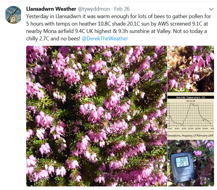
After a spell of light rain the 15th began overcast and a tawny owl was hooting in the wood at 0900 GMT. The temperature was 7.4C and pressure 984 mb was rising. Cloud had started to lift by 0930 GMT and visibility was very good and clear. Snow patches could be seen at 2500 ft and the summits were still in cloud and had snow flurries. It was very fine and sunny in the afternoon the temperature reaching 15.1C at 1410 GMT in a Föhn enhanced SSE'ly breeze; many bees were seen gathering pollen on the heathers on the rockery banks (Porthmadog 15.9C Tyndrum 34.6 mm Libanus 22.2 mm) [Valley 14.1C 5.4h, Mona 14.6C Gorwel 13.8C] [Max 15.1C Min 6.8C Rain 11.0 mm]. The first 15-d of the month had 61.5 mm precipitation (797%) & [732%] of the monthly averages. The mean temperature was 5.1C on the cool side (-1.8) & [-1.9] of averages. There had been 4 air frosts and 6 grass frosts and 4 days with snow falling. A thoroughly wet morning on the 16th and as the soil remains saturated much standing water around. At 0900 GMT 11.0 mm was measured when it was still raining. Pressure 995 mb was rising with large areas of low-pressure to the NW 980 mb SE Greenland while high 1036 mb was over N Scandinavia with tight isobars and strong winds over the North Sea. Models suggest that we will have another cold plunge at the weekend and a MetO yellow warning for strong gusty winds for tomorrow; and a yellow warning of more snow for S Wales received as writing. Not the dry quiet March we sometimes have in these parts. The temperature at 0900 GMT was falling on 6.8C, light to moderate rain with poor visibility. By afternoon it was brighter with some sunshine the temperature rising to 10.9C warm enough for some bees to forage on the heathers [Max 10.9C Min 6.7C Rain 7.6 mm]. Overnight the E'ly breeze strengthened and the air temperature dropped to 1.3C by the morning of the 17th when overcast and dull. There was some fine ice precipitation on the wind. At 0900 GMT pressure 1010.9 mb was rising with high 1041 mb over S Norway and a low 997 mb near Brest, France. Patches of snow were affecting parts of E and SE England where the air temperature was -3C. Here in the west the moderate to strong wind was roaring in the trees sunny spells developed.
. The 22nd was again fine and bright with some weak sunshine with moderately high cloud just touching some mountain summits. A frost-free night with an air minimum of 4.1C/ The temperature at 0900 GMT was 7.2C (dewpoint 4.9C) Cloud was increasing at 0900 GMT with pressure 1020 mb falling, but it was fine and bright at first turning duller later.
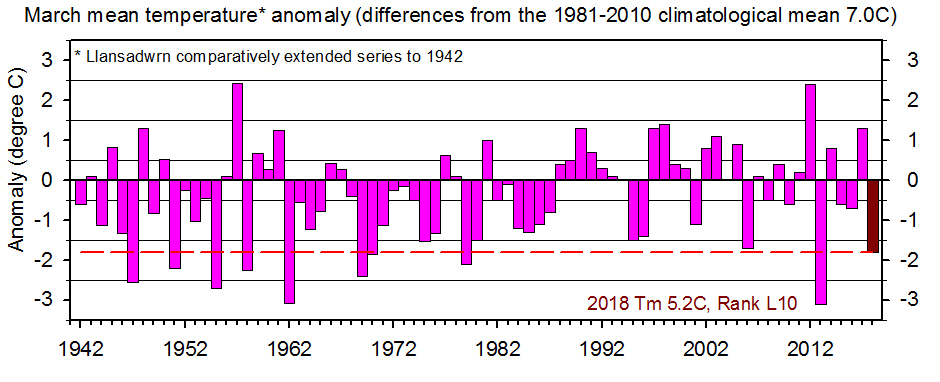
The month ended with a total precipitation of 87.5 mm (110%) & [103%] of averages. The mean temperature 5.2C was (-1.7) & [-1.7] of averages the third lowest in 40-years and tenth lowest back to 77-years in 1942. Sunshine at RAF Valley was 108.3h lowest since 2006 and ranked 30th on the Anglesey record since 1931.
April 2018
April 1 - began fine and bright with a cold E'ly breeze. Some sunshine under 6 oktas of cirrus clouds and some expanded contrails. Some cumuli were developing over the mountains and the NE over Red Wharf Bay. Pressure was on 1014 mb in a col between Atlantic-low 992 mb S of Iceland and low 990 mb E Europe. Pressure was high 1021 mb over Greenland and 1040 mb over N Africa. A band of rain approaching from the SW, already over SW Ireland and Lands End was expected to turn to snow on high ground as it met colder air. The morning remained sunny while the afternoon partly sunny turned cloudier as thicker cloud encroached. There was drizzle and slight rain here, light to moderate in Llanfairfechan, from about 21 GMT [Gorwel Heights 41.6 mm] [Max 7.0C Min 1.4C Grass -1.5C Pptn 10.8 mm]. Overnight moderate to heavy rain in Llanfairfechan with 41.6 mm falling at Gorwel Heights, much of this fell as snow at higher altitudes with a good covering at Llyn Ogwen on the morning of the 2nd. Pressure 994 mb was falling with a low 988 mb steaming through St George's Channel. Precipitation rain and wet snow at altitude continued for a while before petering out and even on Snowdon, that has in recent days kept very icy, the temperature had risen to 5C by afternoon. Here the temperature rose to 10.6C just after 1500 GMT. A cool and wet beginning to the month the first two days having 21.8 mm of rain compared with 22.0 mm for the whole month last year [Max 10.6C Min 2.4C Rain 11.0]. A misty moisty morning again on the 3rd with recent rain just ceasing at 0900 GMT, Visibility was only moderate with rain continuing across the mountains in the distance. It was brighter, but there was a gusty SSE'ly wind. The afternoon turned fine and continuing breezy, warmer with some glimpses of sunshine [Max 12.5C Min 4.1 Rain 2.4 mm]. After showers of rain overnight the 4th began with a little N'ly or no wind at all. At 0900 GMT it was 9.5C, but there was a shower of rain then further light rain in the afternoon. Pressure was steady on 989 mb with a low 984 mb situated near Lands end. The temperature rose to 12.1C at 1046 GMT then began too fall reaching 6C at 15 GMT and 3.6C by 18 GMT to midnight [Max 12.1C Min Rain 1.6 mm].
Pressure on the 11th was steady on 1009 mb and it was a dull morning here although brighter looking towards Conwy. There was a low over NE Spain and this brought unseasonable cool air and caused some very rough seas along the S coast of France. With a high 1032 mb over the E Baltic states we still had the cool E'ly airflow with very poor visibility. Brightening up in during the morning with some weak sunshine the temperature just got up to 10.45C at 1130 GMT before some thicker cloud encroached. Brighter again in the late afternoon and a little more sunshine (Wales: Porthmadog 14.0C Mona Min 5.4C St Athan 8.6 mm Valley 1.4h) [Max 10.2C Min 6.3C Rain nil]. A bright start on the 12th with poor visibility in moderate smoke and dust haze. There was weak sunshine at first with a maximum of 10.2C before turning cloudier with spots of slight rain setting in during the afternoon (Achnagart 16.8C Porthmadog 15.2C Lerwick 13.0h Aberdaron 2,.6h) [Max 10.2C Min 5.8C Rain 0.2 mm]. A miserable morning on the 13th with thick cloud, drizzle and very poor murky visibility. The temperature at 09 GMT was 7.0C with 96% RH. No improvement during the very dull sunless day that had low solar radiation. The daytime maximum was 8.1C at 1345 GMT (Milford Haven 13.7C TxLo Lake Vyrnwy 7.2C Baltasound Min -0.8C Sutton Bonington 18.4 mm Bude 3.2h) [Max 11.0C Min 5.7 Rain 0.7 mm]. Well we were due for a better day and the 14th turned out to be very nice. Beginning brighter the temperature had risen and was 10.8C at 0900 GMT and the sky was clearing slowly. Pressure was 1015 mb with low 974 mb S Iceland and W of Brest. A ridge to SE England from high 1024 mb N Italy. The wind backed SW to NE during the afternoon and we experienced a Föhn breeze the temperature rising to 16.0C at 1320 GMT (Northolt 19.5C Trawsgoed 17.9C Charlwood 11.3h Aberporth 10.1h) [Max 16.0C Min 6.9 Rain 0.2 mm]. It was too much to expect two nice days and the 15th was business as usual with overcast skies and slight rain or drizzle at times, but it was much milder with the temperature 14.6C above average despite lack of sunshine. A close call today according to spaceweather.com a 'Tunguska-class asteroid about the size of a football field flew through the Earth-Moon system. 2018 GE3 was discovered just the day before as it plunged inward from the asteroid belt' . The Tunguska impact of 30 June 1908, destroyed 2000 square kilometres of conifer forest in a sparsely populated region of the Central Siberian Plateau, had the energy of a large hydrogen bomb, but no meteorite crater associated with it has been positively identified. (Wales: Porthmadog 17.2C Aberdaron 2.6h) [Max 14.6C Min 8.8C Rain 1.3 mm]. The 16th began brightly with a strong S'ly wind whipping up the sea along western shore, it was very rough at Rhosneiger. Pressure here was on 1008 mb with a deep Atlantic-low 946 mb S of Greenland and W of lands End. Pressure was high 1032 mb over the Black Sea region. A mostly sunny day [Max 13.4C Min 8.2C Rain 3.1 mm]. There was showery rain after midnight on the 17th with 3.1 mm accumulated by 0900 GMT. Overcast sky and strong to gale force S'ly wind with slight rain on the wind. It was a beautiful day all over France with coast to coast sunshine, and models indicate the good weather was heading our way, I can't wait [Max 13.3C Min 10.0C rain 3.1 mm]. A rare morning on the 21st with no cloud that I could see, and very good visibility with just slight haziness. The MetO issued a yellow warning for thunder storms for North Wales from 4 pm, but it kept sunny here until evening when towering cumuli were seen over the mountains to the SE and the sky darkened and there were spots of dusty rain around 20 GMT. Storms did develop, but well to the E and moved up to Cumbria. Other larger storms developed N France and moved across to IoW, S England and the Midlands (Bude 24.9C Trawsgoed 24.7C Aboyne Min -2.6C St Catherine's Point 8.2 mm Aberdeen 13.2h Aberporth 12.2h) [Max 20.8C Min 6.6C Rain 0.3 mm]. On the 22nd there was a little rain from 07 GMT and at 0900 GMT there was slight rain and mist with moderate visibility. There was a slight deposit of pinkish white dust likely to be of Saharan origin. The morning was dull and breezy at times with a cold front passing over. There was some sunshine mid to late afternoon before cloud encroached again with some spots of rain (Gravesend 25.0C Usk 17.3C Otterbourne WW 26.6 mm Manston 12.0h Aberporth 5.7h) [Rain 0.1 mm]. The 23rd began dull and overcast with altostratus clouds and good to very good visibility somewhat hazy. Pressure was steady on 1014 mb with a low 989 mb over the Norwegian Sea and high 1020 SE France we had a SW'ly airflow. There was a glimpse of sunshine in the afternoon before cloud thickened and the wind began to strengthen. Our busy road was closed again today for repairs. This time it was resurfacing the junction on to the A5025 - I took the opportunity to walk its length top to bottom in the absence of traffic (Heathrow 16.7C Charlwood Min 3.8C Cluanie Inn 16.6 mm Shoeburyness 9.1h) [Max 12.0C Min 7.5C Rain 0.1 mm]. Another very dull and wet day on the 24th with slight rain from the off. The cloud level was low and visibility moderate with in mist and rain. Pressure 1012 mb was falling with low-pressure to the N 983 mb and high-pressure to the S with the jetstream set up to deliver more of the same in a SW'lt air flow. There was a frontal wave low over St George's Channel, not good news, and rain turned moderate to heavy at times in the afternoon giving us the wettest day of the month. A front passing over between 16 and 17 GMT reduced the temperature then we had 10 to 15 minutes of sunshine. The low reached Merseyside 1001 mb at 1800 GMT (Gravesend 18.5C Aboyne Min 3.5C Gogerddan 25.8 mm Tiree 10.3h Bala 0.4h) [Max 9.5C Min 7.4C Rain 15.8C] The month ended with a rainfall total of 62.3 mm (80%) & [98%] of averages. The mean temperature 9.4C was (+0.4) & [+0.5] of averages highest since 2014 ranking 10 since 1979. Sunshine at RAF Valley was 140.6h lowest ranked 23rd lowest on the Anglesey record since 1931, but was highest since 2016.
May 2018
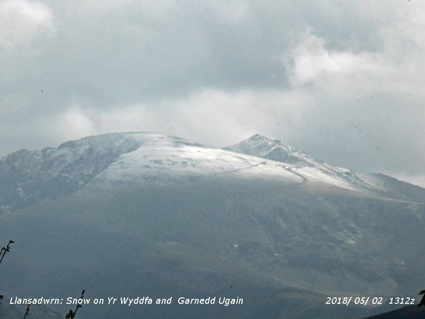
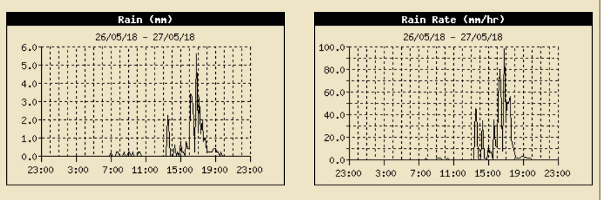
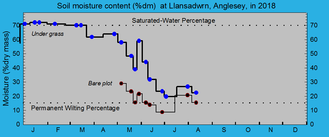
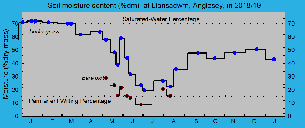
May 1 - began brightly with some sunshine and a line of convective clouds above the Snowdonia mountaintops. Pressure was 1007 mb in a declining ridge of high-pressure with a trough, from low 983 mb N of Iceland, with frontal cloud W of Ireland. Visibility that was poor to moderate in haze earlier had improved to good by 0900 GMT. The temperature had been as low as 3.6C in the early hours, but in sunshine was rising and reached the maximum of 10.8C at 0920 GMT, By 1230 GMT cloud had encroached and thickening spots of rain with spells of slight rain in the afternoon and evening [Max 10.8C Min 3.6C Rain 12.0 mm]. With strengthening wind a band of light to moderate rain arrived at midnight on the 2nd turning heavy (8 mm/h) at 0217 GMT. It was raining at 0900 GMT with 12.0 mm in the raingauge the temperature at the minimum 6.7C. Visibility in the rain was moderate, but improved as the rain ceased and some patches of blue sky appeared by 11 GMT as the front was clearing. The 5th began fine and sunny and feeling warmer with the temperature at 0900 GMT 13.6C the maximum of the past 24-h. There was mist and fog around coasts and in the Menai Strait, but this cleared up here to give a nice sunny day, but not so on the coast where at RAF Valley recorded sunshine was zero. Pressure had risen to 1025 mb with a high 1029 mb over Denmark and with low-pressure 979 mb to the N it was windy in the NW of the UK. Pressure was also low over the Med 1009 mb Sardinia (Otterbourne WW 23.7C Tn Logan Bot Gdns 9.9C Achnagart Min 9.4 mm Morpeth 14.4h St Athan 14.0h) [Max 17.2C Min 7.8C Rain nil]. Fog developed after midnight on the 6th and was thick, visibility of 100 m at 0630 GMT, then began to clear so that at 0900 GMT visibility was good though slightly misty. Fog persisted for a while longer along the coast. The temperature was 13.9C with a RH of 98%. Pressure 1024 mb was falling with high 1029 mb over the Baltic while a frontal wave 1013 SW Ireland had an associated frontal band over Scotland. A sunny and warm day with the temperature rising to 20.7C (Heathrow 26.3C Santon Downham Min 2.0C Harris Quidnish 9.6 mm Boulmer 14.4h) [Max 20.7C Min 6.1C Rain nil]. Another sunny and warm day on the 7th with cirrus clouds developing overhead visibility was good, but hazy. The soil surface was dry with some small cracks; soil moisture determined today was 58% dm under grass, but had dropped to 29% dm on the bare met plot. Pressure continued to fall and was 1019 mb at 0900 GMT with a low 1013 mb off NW Ireland having a warm front over Scotland and a cold front SW Ireland (Northolt 28.7C Usk 25.7C Whitechurch Min 3.6C Tulloch Bridge 7.2 mm Shoeburyness 14.2 h Hawarden 13.4h) [Max 20.1C Min 8.4C Rain nil]. The 8th began mostly cloudy with some lee breaks in a S'ly breeze, but these did not last very long. With pressure on 1009 mb there was a low 988 mb SW Iceland with frontal cloud bands over the Irish Sea. There was some drizzle on western coasts and spots of rain here at 1015 GMT and with thickening cloud slight rain and mist at first in the afternoon before turning fine with some sunny spells later. A clear evening with a good sighting of Jupiter in the sky to the SSE (Gravesend 27.6C Lo Tx Valley 12.3C Kinbrace Min 4.3C Dundrennan 7.6 mm Mona 4.6 mm Odiham 12.6h Hawarden 7.3h) [Max 13.3C Min 8.3C Rain 1.6 mm]. A dull and rather cool day on the 9th with the sky overcast as a result of an occluded front over the Irish Sea [Max 11.5C Min 6.7C Rain 2.9 mm]. The 10th began with a fresh fell to the morning it being 9.3C at 0900 GMT. Pressure was on 1014 mb with a high 1025 mb off Iberia and a weak ridge extending to Wales at noon, while a low 973 mb SE Iceland had an associated cold front over East Anglia and France. The afternoon was fine with some sunshine, but breezy [Max 13.5C Min 5.2C Grass Min 2.0C Rain nil]. Disappointingly dull and breezy on the 11th. Pressure 1010 mb was falling with a low 978 off the Western isles of Scotland with a thick frontal cloud mass over Ireland and the Irish Sea. Showers of rain in the afternoon, heavy at 18 GMT (Gravesend 18.9C Aboyne Min -2.9C Banagher Caugh Hill 13.8 mm W'church 9.8 mm Manston 11.5h Aberporth 1.5h Valley 0.1h) [Max 14.7C Min 7.3C Rain 2.0 mm]. A brighter day on the 12th, but still on the cool side with cool air drawn from the north. Pressure 1014 mb was rising with low 986 mb off the Western Isles and high 1032 mb Azores; there was a small disturbance off Brest. Five oktas of a complex sky with a line of cumulus forming over the mountaintops by 10 GMT. The afternoon was fine with some sunshine, but kept rather cool (Hull 19.0C Katesbridge Min -1.7C Cambridgeniab 14.4 mm Stornoway 14.9h Aberdaron 10.9h Valley 10.1h) [Max 13.8C Min 5.4C Rain nil]. A fine morning on the 13th pressure 1015 mb was rising with hardly a cloud in the sky the day remaining sunny it was warmer and kept dry. The temperature rose from 12.8C at 0900 GMT to 16.7C at 1246 GMT [Max 16.7C Min 6.1C Rain nil]. Another very fine and sunny morning on the 14th with pressure 1023 mb rising in a ridge from high 1032 mb N of the Azores.
A mostly cloudy start to the 16th with a rather cool feeling strengthening NNE breeze. There followed slight intermittent drizzle with the sky becoming darker as cloud thickened. A dull afternoon at first then with the sky clearing later some sunshine before the end of the day (Glasgow 17.9C Pembrey Sands 16.2C Braemar Min -0.9C Shobdon 8.2 mm Rhyl 7.0 mm Prestwick 15.0h Valley 6.8h] The first 16-days were relatively dry with 22.3 mm of rainfall (32%) & [36%] of the monthly average. Temperatures despite two warm days on the 6th & 7th remained on the cool side with the mean 11.0C [(-0.7%)] of average.
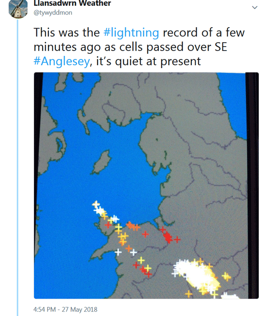
After a cool night the minimum 6.2C at 0159 GMT and 2.4C on the grass it was a fine morning on the 17th with 6 oktas cover of cirrus and cirrostratus resulting in mainly weak sunshine. Visibility was very good, almost clear, so that Bardsey was visible. We still had the cool NE'ly breeze, but with pressure steady on 1030 mb the day kept mostly sunny and dry [Max 15.3C Min 6.2C Grass 2.4C Rain nil]. With high pressure 1027 mb over Lincolnshire and pressure here steady on 1026 mb on the 18th the run of settled weather continued. Moisture on the grass (minimum 3.5C) was mainly of guttation, the exuding of moisture at the tips from the grass leaves, rather than condensation dew. This soon dried off in the warm sunshine it being 15.0C at 0900 GMT. Bands of frontal cloud were W of Ireland, but they did not encroach [Max 18.0C Min 7.4C Grass 3.5C Rain nil]. It was sunny everywhere on the 19th except the far NW of Scotland. It was one of those rare mornings here when I could not see any cloud in the sky and with a light SSE'ly breeze it was very pleasant. Visibility was very good with a slight haze and the temperature rose to 19.2C at 1212 GMT. On the west coast at Malltraeth Sands it was about 15C with a light breeze. With cirrostratus a solar halo was seen before cloud began to thicken from the west [Max 19.3C Min 6.7C Grass 3.5C Rain nil]. Moderately high thin cloud had encroached overnight so that on the 20th the day began bright, with a few breaks allowing glimpses of mostly weak sunshine. Pressure was on 1021 mb with low 972 mb Iceland with associated weak frontal bands encroaching the west with a wave over Rockall. Pressure was high 1028 mb over the Baltic. The temperature at 0900 GMT was 15.9C (dewpoint 10.2C) RH 69%. The day was mostly cloudy, but there was no rain. The soil surface in the garden was looking very dry. Soil moisture determined today was 48.4% dm under grass and 21.6% dm on the bare met plot. The permanent wilting percentage for the local soil is 15.2% dm (Sheffield 24.3C Sennybridge Min 1.9C Thomastown 12.4 mm Waddington 14.0C) [Max 17.1 Min 9.5C Rain nil]. A mostly cloudy morning on the 21st with thinning patches in the cloud sheet there was a little weak sunshine. Pressure was steady on 1018 mb with high 1020 mb E Baltic. There was a long frontal band in the W that stretched from the Norwegian Sea over Shetland and SW Ireland to the Atlantic off Iberia. Visibility was good, but smoke haze was increased through the day, some hazy sunshine in the afternoon (Pershore 24.5C Banagher Caugh Hill 28.0 mm Sheffield 14.8h Hawarden 13.0h Valley 6.8h) [Max 18.0C Min 9.7C Rain nil]. A nice day on the 22nd beginning sunny with a temperature of 13.2C at 0900 GMT that rose to 17.5C at 1422 GMT with 17.8C recorded at Gorwel Heights. Very warm in Porthmadog with a Föhn-enhanced 25.0C maximum. The seventh consecutive day here without measurable rainfall; a wet day in SE England (Porthmadog 25.0C Resallach Min -0.2C Manston 10.6 mm Rostherne 14.5h Aberdaron 13.1h Valley 12.5h( [Max 17.5C Min 7.2C Grass 5.9C Rain nil]. More of the same lovely weather on the 23rd starting with some cirrus clouds, hazy sunshine and a temperature of 14.1C at 0900 GMT. Pressure 1026 mb was rising with high 1029 mb over the Tay estuary. Sunny in the W with the E coast having haar off the N Sea. Very fine and sunny with a sea breeze in the afternoon. For the second day Porthmadog had the highest UK maximum temperature of 24.0C (Porthmadog 24.0C Gorddinog AWS 21.3C Morecambe 15.5h Valley 14.9h) [Max 18.4C Min 9.4C Grass 7.3C Rain nil]. Well we had had our ration of sunny weather and on the 24th the sky was mostly cloudy with thickening cloud, moderately high. Pressure was steady on 1023 mb with the Scandinavian high now 1032 mb over the Gulf of Bothnia. A showery trough had developed over S Britain and thundery lows were developing over Iberian and the Med and likely to head north. Dullest day here since the 11th (Bridgefoot 25.2C Hawarden 22.4C and 4.8h Lyneham 22.8 mm Morecambe 15.5h Valley 0.6h) [Max 16.6C Min 11.9C Rain 0.1 mm]. Again a cloudy, but continuing dry morning on the 25th with good visibility although with moderate smoke haze. Pressure was on 1021 mb with a thundery trough developed in the S moving N, at present it was best in the north-west. Fine, not cold, the temperature 14.0C and fairly bright with some weak sunshine at times. There were some spots of rain at times before a spell of slight to moderate rain in the afternoon, most since the 15th (Tyndrum 24.1C Porthmadog 20.6C Winterbourne (Mids) 24.1 mm Libanus 18.0 mm Tiree 14.7h Valley 3.0h) [Max 18.6C Min 11.6C Rain 2.0 mm]. Fine with a cool feeling NE'ly breeze on the 26th, mostly cloudy at 0900 GMT. Pressure was steady on 1023 mb with a high 1036 mb over the Norwegian Sea. A thundery low 1011 mb was over Bordeaux and weather in France was bad with thunderstorms and damaging hail. Not much in the way of sunshine here, a slight shower in the afternoon about 14 GMT [Bournemouth 27.3C Hawarden 23.0C Northolt 18.4 mm Stornoway 15.7h] [Max 18.5C Min 12.2C Rain 1.2 mm]. The 27th began with thunder, lightning and light rain showers encroaching from the SE from 07 GMT. The MetO had already issued a yellow be-prepared warning for S UK including SE Anglesey. At 0900 GMT the temperature was 16.1C (dewpoint 14.3C) RH 89% and there was a NE'ly breeze. A thundery low moving N from Bordeaux was off Brest 1010 mb and a thundery trough developed from the SE through the Midlands to Anglesey during the morning. Pressure was high 1033 mb central Norwegian coast. The 28th proved to be a much better day beginning misty with poor visibility, but with hardly a cloud in the sky. Pressure 1020 mb was rising with a low 1015 mb in the SW Approaches. Frontal bands were W of Ireland associated with low 1003 mb NE Iceland. Pressure was high 1034 mb over Finland. A fine day with warm sunshine here (Valley 13.0h), sea fog affected some coasts in the W including Rhosneiger at first. The temperature rose here to the highest of the month 22.1C and 22.4C at Gorwel Heights (Cavendish 27.3C Hawarden 24.9C Braemar Min 3.5C High Wycombe 6.2 mm Kinloss 15.9h Aberdaron 13.9h) [Max 22.1C highest of the month Min 12.3C Rain nil]. A cloudless sky on the morning of the 29th with a light NE'ly breeze off the sea strengthening in the afternoon taking the edge of the temperature. Visibility was poor with thick haze developed, but in the E and SE of England mist and fog was persistent. Pressure was steady on 1020 mb with high 1031 mb over the Norwegian Sea. Thundery troughs were over the Dover Strait and Charente Maritime, France. Sunshine and temperatures were again best in the north-west (Achnagart 27.5C Porthmadog 26.7C Altnaharra Min 4.1C Frittenden 26.8 mm Stornoway 15.9h Valley 15.1h) [Max 20.2C Min 13.4C Rain nil]. A cloudier day on the 30th with 6 oktas cloud cover at 0900 GMT. The temperature was 15.1C (dewpoint 13.3C) and visibility was poor with smoke aerosols and dust. Pressure was on 1014 mb with occluded fronts associated with a thundery low 1009 mb Brest affecting S England from Cornwall to the Wash with current precipitation. Here not too bad a day with a maximum of 18.0C, warmer in Llanfairfechan Gorwel Heights 20.9C, but Porthmadog having 21.7C. Slight showers of rain came along in the evening (Achnagart 25.9C Kinbrace Min 3.9C Westonbirt 25.2 mm Loch Glascarnoch) [Max 18.0C Min 11.8C Rain 0.4 mm]. A warmer start to the 31st with a temperature of 17.4C at 0900 GMT (dewpoint 16.5) with relative humidity of 94%. Pressure was on 1015 mb with a low 1011 mb over the Celtic Sea introducing warm moist air. Troughs and unsettled weather continued in France with the Continent being particularly unsettled for the time of year with what seems like a succession of thunderstorms. Storms moved from France into the UK and were slow-moving in the Midlands, around Gloucester and and S Wales. Storms headed N, but were halted by the mountains dying out in S Snowdonia. No thunder was hear here although we did have moderate to heavy showers in the evening (Altnaharra 25.6C Porthmadog 24.7C Brize Norton 37.8 mm Scolton CP 10.6 mm Lerwick 13.8h Valley 4.1h) [Max 21.1C Min 13.7C highest of the month Rain 5.2 mm]. The month ended with a rainfall total of 66.0 mm (94%) & [106%] of averages, largest since 2015. The mean temperature 12.6C was (+1.0) & [+0.9] of averages lowest since 2016 ranking H8 since 1942, but H7 since 1979. Sunshine at RAF Valley was 231.6h, lowest since 2015, but lowest ranked H10 on the Anglesey record since 1931.
. June 2018
June 1 - Overcast skies and warm 17.2C and humid 98% RH at 0900 GMT. Pressure was on 1017 mb with a low 1016 mb off NW Ireland with a thundery trough over the Irish Sea. Pressure was high 1026 mb over the eastern Baltic states. The sky darkened and thunder was heard from 1045 GMT. There was more thunder in the afternoon to the E of here from 1310 GMT. There were one or two bright spells with glimpses of sunshine, otherwise dull and damp. During the evening fog developed and became thick later before reducing just before and after midnight (Aboyne 26.8C Hawarden 24.8C Aboyne Min 8.0C range 18.8C Salsburgh, North Lanarkshire 29.8 mm Aberdeen 14.6h) [Max 20.2C Min 14.6C Rain 11.5 mm]. The 2nd began mostly cloudy with some weak sunshine through a thinning cloud sheet. Visibility was very poor in mist, but it was fairly warm the temperature at 0900 GMT was 14.7C RH 98%. Pressure was steady on 1018 mb with a low 1003 mb off SW Ireland and an associated frontal system over the Celtic sea. A bit brighter in the afternoon with a glimpse of sunshine when the temperature reached 19.6C and a dry day (Tyndrum 25.6C Katesbridge Min 7.6C Fylingdales 33.2 mm Hawarden 19.6 mm Exeter 13.4h) [Max 19.6C Min 13.2C Rain nil]. A brighter morning on the 3rd with a very light N'ly breeze setting in at 0900 GMT. Pressure 1021 mb was rising with a low 1016 mb East Anglia and convergence line on the Pennines. Low 1007 mb Celtic sea had remnant frontal cloud here and the SW. The strengthening breeze felt rather cool and the sky kept mostly cloudy at midday before becoming sunnier later in the afternoon and evening (St James Park 27.1 Usk 25.4C Sennybridge Min 11.9 Tyndrum 24.0 mm Bournemouth 15.2h Aberporth 14.9h) [Max 18.6C Min 11.0C Rain nil]. Another very fine and sunny day on the 4th with a light NE'ly breeze. Haze was thick and visibility moderate. Pressure was steady on 1018 mb with a low 1011 mb near Cap Finisterre. There was a shower trough over Scotland and the Borders with the weather is best in the west today. It was still very unsettled in France and the Med with ongoing thunderstorms (Porthmadog 26.6C Loftus Min 11.7C Tyndrum 5.0 mm Valley 15.2h) [Max 21.2C Min 11.4C Rain nil]. Continuing the fine weather on the 5th, but feeling a little fresher today the temperature at 0900 GMT 14.8C under thin moderately high cloud. Visibility remained poor in haze with mostly weak sunshine here. A weak cold front lying over the Isle of Man was responsible, but there was no precipitation here (Castlederg 23.2C Porthmadog 22.4C Millport 1.8 mm Stornoway 16.3C Valley 10.0h) [Max 17.6C Min 12.3C Rain nil] A very fine and sunny day on the 6th, it was warmer being 17.3C at 0900 GMT. Visibility was only moderate in haze and there were 3 oktas cloud cover of mainly cirrus, cirrocumulus and contrails (Porthmadog 24.3C Loftus Min 11.3C Fylingdales 1.4 mm Prestwick 15.6h Hawarden 15.1h) [Max 19.4C Min 10.8C Rain nil]. On the 7th the sky was clear of any cloud and visibility was good with only slight haze. Some very small cumuli were seen over the mountains to the S at 1030 GMT. The weather was again best in the west with the Midlands and S England cloudier. Pressure was steady on 1018 mb in a slack area between high-pressure 1029 mb S Iceland and low-pressure over most of Europe and the Med (1014 mb Brest) [Max 19.5C Min 11.4C Rain nil]. A fine but mostly cloudy start on the 8th, there was thick haze again with moderate visibility. The breezy afternoon had some sunshine spells. The soil surface is very dry 44% dm under grass and on the bare met plot it was down to 15% dm with the top 2 cm with just 11% dm, see the graphs here. (Derrylincornahoule 23.8C Porthmadog 22.8C Pennerley 18.2 mm Tredegar 13.4 mm Kinloss 12.4h Aberdaron 7.0h) [Max 20.2C Min 12.3C rain nil]... The first 15-days were dry with 17.5 mm of rainfall (21%) & [36%] of the monthly average. Temperatures were generally on the warmer side with the mean 15.5C [+1.6] of the 30-year average. Dull with slight rain and drizzle from the start on the 16th with very poor visibility. The garden could do with some rain with 3.0 mm recorded at 0900 GMT, but it will take more to restore the water balance of the surface soil. Brighter and drier in the afternoon (Weybourne 21.6C Hawarden 20.2C Killylane 16.4 mm Capel Curig 14.0 mm Lerwick 12.3h) [Max 16.7C Min 9.4C Rain 2.5 mm]. Overcast and dull with low cloud on the Snowdonia Mountains on the 17th with a complex of frontal systems over Britain. Low 1005 had moved over the N Sea while low 985 mb S of Greenland was moving eastward. Pressure was high 1032 mb Azores and 1021 mb E Baltic (Scampton 20.2C Tulloch Bridge Min 2.0C Scolton CP 4.8 mm Kirkwall 6.1h Aberporth 2.5h) [Max 17.4C Min 11.4C Rain nil]. The 18th remained mostly cloudy but there was some weak sunshine at times. Low 977 mb was SE Iceland, but pressure 1017 mb was rising with high 1031 mb Azores to the Bay of Biscay. Moderate fog developed late in the evening (Heathrow 26.6C Salsburgh Min 8.9C Cassley 8.4 mm Shoeburyness 10.0h) [Max 16.7V Min 11.7C Rain 0.5 mm]. Another dull day in this part of Anglesey on the 19th which kept enveloped in cloud and mist in the afternoon. It was brighter in Beaumaris and on the mainland in Llanfairfechan, and NW Anglesey where there was some sunshine. Here, a sunless day (Writtle 25.6C Usk 22.0C Katesbridge Min 3.5C Derrylincornahoule 16.6 mm Lerwick 9.2h Hawarden 5.6h) [Max 17.0C Min 10.0C Rain 0.9 mm]. An Atlantic-high 1029 mb was S of Greenland, but it began very dull again on the 20th with mist, moderate visibility and slight drizzle. A cold front over Wales associated with low 1007 mb Tay Estuary resulted in a temperature fall of 4C between 10 and 15 GMT before recovering later becoming brighter with a little sunshine (Teddington 26.3C Dalwhinnie Min 6.6C Edinburgh Botanical Garden 33.6 mm Capel Curig 18.2 mm Lerwick 12.0h Aberdaron 6.5h) [Max 16.1C Min 13.9C Rain 0.5 mm]... The 26th began very fine and warm the temperasture at 0900 GMT already 24.2C with 53% relative humidity. Just 3 oktas of cirrus and some contrails in the sky with very good visibility. Pressure was on 1026 mb with the high the UK high centred just off Aberdeen, Scotland. A mass of frontal cloud could be seen low in the sky to the NW off N ireland, but it did not encroach here. It was the warmest day of the month with 27.8C. Somewhat cloudy beginning the 27th, but warm. At 0900 GMT with pressure steady on 1026 mb the temperature was 24.1C with a relative humidity of 48% and here was a light ENE'ly breeze. The month ended with a rainfall total of 21.9 mm (26%) & [32%] of averages, least since 1988. The mean temperature 16.0C was (+1.9) & [+2.1] of averages highest a the station since before 1979. Sunshine at RAF Valley was 291.8h, most on the Anglesey record since 1931.
July 2018
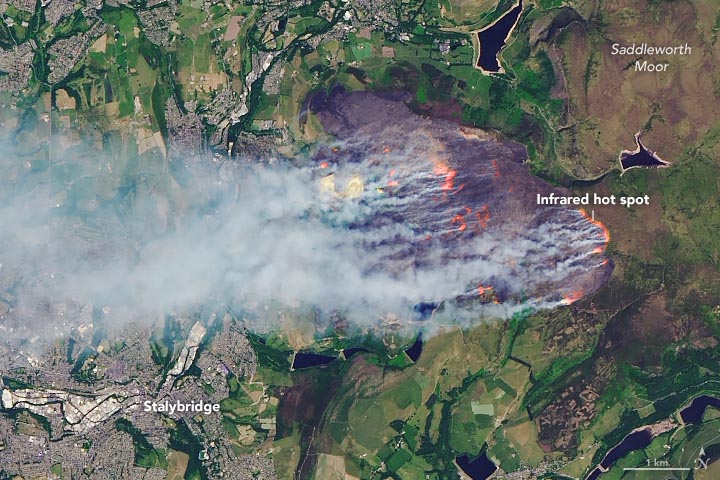
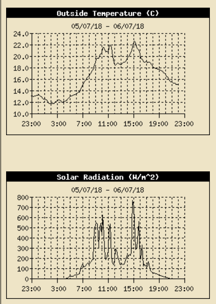
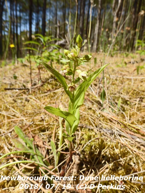
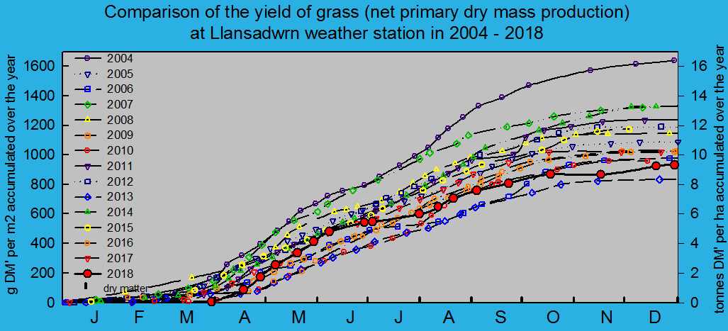
July 1 - continued with the heatwave. Very fine and sunny pressure 1015 mb was rising with a few cirrus clouds to start and some more by afternoon. A thundery low 1007 mb had developed over Biscay and storms moved from central France through Brittany into in the Channel and affected parts of SW England and S Wales for a time. (Heathrow 31.8C Porthmadog 31.0C Okehampton 20.6 mm Mumbles Head 10.0 mm Morecambe 16.4h Valley 15.1h) [Max 23.5C Min 13.3C Rain nil]. Much the same on the 2nd with little in the way of cloud. Pressure 1019 mb was rising with high 1023 mb over Scandinavia with a ridge to Scotland from Azores high 1032 mb. Thunderstorms continued over France. Wild fires were reported on Bangor Mountain, at Carmel near Caernarfon and Newborough Forest seemingly set by camping stove, but was extinguished by attending North Wales Fire and Rescue Service (Bournemouth 31.1C Porthmadog 30.7C Valley 25C Middle Wallop 5.4 mm Cardiff 0.2 mm Morecambe 16.2 Hawarden 15.5h) [Max 23.8C Min 13.4C rain nil]. Hardly a cloud in the sky on the morning of the 3rd that was very fine with very good visibility. Haze increased through the day and a distinct layer was seen against the mountains by evening. At Aberffraw the fixed dunes were looking very dry with few of the usual plants, including thymes and pansies, putting on their usual show. The willow slacks were still green and I was pleased to find plants of the rare dune helleborine Epipactis dunensis although these too were dried and not flowering or in their usual numbers as they should. The sea temperature when 1 m deep was 22C on the incoming neep tide at 3 pm with an air temperature of 24C. There were a few purple jellyfish about 10-12 cm diameter with thick tentacles swimming in the water below the surface (Porthmadog 30.1C Kinbrace 4.3C Culdrose 0.8 mm Morecambe 16.3h Valley 16.0h) [Max 22.6C Min 13.1C Rain nil]. Similar again on the 4th, very fine with good visibility not clear as their was light haze. At 0900 GMT the grass is dry, but earlier there is slight guttation at the tips of leaves in the greener areas. Some grass on shallow soil is dry and yellowing as are the roadsides that look more like the southern French autoroutes. The local farmer began cutting grass on an adjacent field today and completed the operation and gathering in the day. It is the 14th day without measurable rain and with soils now very dry grass growth has slowed markedly and yields are less than normally expected. Soil under grass has a moisture content of 19.7% dry mass while on the bare met plot it has fallen to 15.4% dm. Some mature trees on shallow soils are showing some signs of early wilting and vegetables need irrigation every day (Giants Causeway 29.1C Porthmadog 27.5C Katesbridge 4.7C St Athan 8.0 mm Morecambe 16.4h Valley 15.5h) [Max 25.2C Min 13.8C Rain nil]. A lovely fine day on the 5th starting with just 2 oktas cloud cover a small cumulus and cirrus, but haze had thickened and visibility was moderate. Pressure 1017 mb was rising in high-pressure W of Ireland with a weak cold front lying over N Ireland and Scotland. There was a thundery low over Brittany and during the day 7 cm diameter hail fell on the Charente, France. Many properties had their tiles roofs considerably damaged. Glasshouse panes were shattered and car windscreens broken as well as damaging crops and vines. At Aberffraw the fixed dunes were dry and yellowed with the usual flowering plants in short supply, even thymes that normally are brilliant at this time of year were poor. The plants of the dune helleborine were still not opening their flowers in the parched conditions. High tide was at 3 pm and the water temperature out a 1 m depth was a pleasant 22C just right for a dip. The air temperature at Valley was 19.2C, but probably warmer in the sun on the beach sheltered from the off shore breeze. There were a few jellyfish swimming below the surface of the water, purple coloured with some thick tentacles (Coton-in-the-Elms 31.2C Usk 29.1C Ravensworth 6.1C Resallach 2.2 mm Morecambe 15.7h) [Max 21.8C Min 13.8C Rain nil]. An almost cloudless morning on the 7th, very fine, sunny and warm at 0900 GMT 19.9C soon 20C. Pressure remains steady on 1025 mb with high 1025 mb over the North Sea. There were lows 1003 mb Denmark Strait, 1017 mb Spain and 1013 mb Tunisia, but nothing to concern us on Anglesey. Again we got some convergence cloud formation overhead through the day, until 1300 GMT we had mostly S'ly breezes and the temperature rose to 24.7C by 1214 GMT. Then cooling a little as the sea breeze arrived from the NE and later to rise again and with the breeze dying away in the evening it was very pleasant and 20C until 8 pm (Charlwood 31.5C Usk 29.6C Tulloch Bridge 0.9C Morecambe 16.0h Hawarden 15.1h Valley 13.8h) [Max 24.7C Min 14.1C Rain nil]. Again little cloud to be seen on the 8th, very fine and mostly sunny and feeling very warm. At 0900 GMT with pressure steady on 1017 mb with high 1028 mb positioned off SW Ireland the cold front over N Scotland and W of Ireland keeping in the wings. A little of the Llansadwrn convergence cloud formed at times, but it did not stop the temperature rising to 26.4C, the highest of the month. Soil surfaces very dry with small cracks as no rain for 17 days, the grass is not growing. Picked the first sweet pea flowers for the house and Oregon sugar pod mange-touts for dinner (Coton-in-the-Elms 31,6C Usk 31.3C Bala Min 8.4C Aboyne 4.8 mm Shawbury 15.7h Hawarden 15.4h) [Max 26.4C Min 14.1C Rain nil]. A bright and warm morning on the 15th with a pleasant 20.1C at 0900 GMT. Six oktas cloud cover with some moderately developed cumuli in the vicinity, along with altocumulus and cirrus, with a gusty SSW'ly breeze at times . Continued dry and breezy with sunshine in the afternoon and a maximum of 23.1C. The wind run for the 24h was 147 miles, most this month so far, continuing the high evaporation rates. Mostly cloudy during the evening with frontal cloud encroaching associated with low 993 mb S Iceland at midnight, that had been giving rain in Ireland, moving over the Irish Sea. Some light rain and or drizzle from 2245 GMT with a temperature of 17C (Santon Downham 30.8C Redesdale 7.2C Thomastown 23.0 mm Bournemouth 15.1h) [Max 23.1C Min 15.8C Rain 3.9 mm]. The first 15-days were dry with just 5.1 mm of rainfall (5%) & [7%] of the monthly average. Temperatures had continued on the warmer side with the mean 18.3C (+2.6) and [+2.5] of the averages. Slight rain and drizzle continued after midnight on the 16th and by morning I was able to measure 3.9 mm of rain. The rain had ceased, but the morning remained dull and damp with little or no wind. Pressure was on 1014 mb with a band of frontal cloud crossing associated with low 994 mb S Iceland. Further showers in the afternoon heaviest 11 mm/h at 1256 GMT, then mostly cloudy into the evening with a glimpse of sunshine later. A colder day than of late the temperature around 16C, continuing warm in the S with Aberporth the wettest (Gravesend 31.5C Usk 25.4C Katesbridge 9.1C Aberporth 19.6 mm Herstmonceux 12.0h) [Max 16.2C Min 13.5C Rain 8.1 mm]. Brighter start to the day on the 17th with the stratocumulus cloud beginning to break up with sunny spells developing rather slowly. Pressure was on 1015 mb with low 1010 mb over the North sea. It was the afternoon before some reasonable spells of sunshine came along with a gentle breeze to dry the ground (Gravesend 25.8C Usk 23.3C Braemar 5.9C High Mowthorpe 13.6C Herstmonceux 12.1h Valley 7.0h) [Max 20.0C Min 12.9C Rain nil]. A cloudy very dull morning on the 18th with good , but hazy visibility, there was a little rain after 09 GMT. Pressure was on 1017 mb with a low 1015 mb Belfast, little (SW'ly) or no wind. Wales and the western fringes were covered with detached occluded frontal cloud not going far anytime soon. It did clear up in the afternoon with some sunny spells developing (Kew 26,8C Ravensworth 4.4C Porthmadog 5.6 mm Aberdaron 9.5h) [Max 20,2C Min 13.3C Rain 0.1 mm].
A very fine morning on the 19th, warm and sunny at 0900 GMT 18.7C (dewpoint 13.3C). An encroaching rain-bearing frontal cloud crossing the Irish Sea on the 20th brought dull, grey skies with slight rain from 0630 GMT. The 4.7 mm collected by 0900 GMT was welcome in the garden, but not enough to restore the water balance. The day kept overcast and sunless with further light to moderate rain in the evening. Mostly sunny and warm in the SE with a few scattered showers (Hull 28.4C Ravensworth 4.5C Drumnadrochit 27.0 mm Valley 9.4 mm Yeovilton 10.3h) [Max 16.3C Min 12.4C Grass 8.5C Rain 3.5 mm]. The month ended with a rainfall total of 47.2 mm (48%) & [68%] of averages, least since 2006 ranking 5th in Llansadwrn records since 1928. The mean temperature 17.4C was (+1.8) & [+1.7] of averages highest since before 2013 rank 5th in station records since 1979. Sunshine at RAF Valley was 265.3h, most on the Anglesey record since 2013 and 4th on the Anglesey record since 1931.
August 2018August 1 - Fine, warm and breezy, but a mostly cloudy day some spots of rain in the morning with precipitation in sight on the mountains, brighter at times in the afternoon. A spell of light rain during the evening and a rising temperature through the night and was 16.3C at midnight (Santon Downham 26.9C South Newington Min 7.4C Killowen 21.4 mm Capel Curig 2.2 mm Shoeburyness 12.9 hours) [Max 19.6C Min 13.8C Rain 1.6 mm]. On the 2nd the sky was overcast and it was dull and muggy. Cloud was low on the Snowdonia Mountains and on Anglesey there was slight intermittent drizzle. At midnight the temperature was 16.3C and at 0900 GMT was 17.7C with 97% RH. The day remained cloudy until later in the afternoon when it was a little brighter with a glimpse of sunshine (Gravesend 30.6C Hawarden 26.8C Frittenden Min 9.4C Braemar 20.2 mm Capel Curig 5.0 mm) [Max 19.9C Min 17,3C Rain 0.1 mm]. Early in the day on the 3rd there was fog in Caernarfon Bay and along the W coast including Valley that was on military RED (runway closed until after noon). Here visibility was poor, sky looking grey to ground, with slight rain and or drizzle from about 0830 GMT. It was like that most of the day, there was one brighter spell late in the afternoon. Llanfairfechan had some sunshine with the temperature at Gorwel Heights 22C. During the evening an unusual dry thick fog developed, was not wetting any surfaces. The AWS temperature at 1900 GMT was 18.0C with 94% RH and at midnight it was 16.6C and 97% RH. Evaporation (PE) from M Albert Piche's evaporimeter in the Stevenson screen was zero today although the AWS calculated ET was 0.87 mm, lowest since 27 May 0.49 mm (Kew 33.2C Balmoral Min 11.1C Inverbervie 19.0 mm E. Malling 14.1h) [Max 19.5C Min 17.3C Rain 0.2 mm]. Thick fog continued after midnight on the 4th, but had cleared by 04 GMT. It was cloudier on the 6th, feeling warm as the cloud was thin moderately high altostratus allowing weak sunshine to penetrate. Pressure steady on 1016 mb with some sunny spells later in the afternoon and into the evening. A change was in the offing with low 996 mb S Iceland with a complex of frontal cloud over Ireland. Pressure was high 1019 mb over the Azores, 1016 mb Spain and 1021 mb Europe. Temperatures remained high in France (38C in Sarlat), Spain and Portugal [Max 21.5C Min 14.2C Rain 1.0 mm]. Dull and grey on the 7th with moderate to heavy drizzle and poor visibility. The drizzle had eased by 0900 GMT, although brightening a little the sky remained overcast. The change had arrived with a weak cold front slow moving over Wales and the West all down to low 991 mb lying to the NW. High-pressure 1020 mb continued over SE Europe and 1023 mb Azores. A thundery low 1009 mb off SW France was introducing some stormy weather there early in the day. Some sunny spells in the afternoon, fine a little cooler, turning cloudier by evening. Hot on the Continent with 43C recorded in Spain with a low minimum of 30.5C in Portugal. Cognac in France had 36.9C and Paris 34C. Within the Arctic Circle Ny Alesund had a max of 9.1C and min 4.1C while Svarlbard had a max 11.0C and a min 4.9C (Teddington 32.5C Hurn min 10.0C Achnagart 14.8 mm E Malling 14.1h) [Max 21.5C Min 11.2C Rain 1.0 mm]. The 10th began with some sunshine and showers more like April than August. Just a few spots at first then there was a heavier show at 0950 GMT that fell at a rate up to 63 mm/h; some hail was seen in the rain in Llanfairfechan. Pressure was steady on 1014 mb with a ridge to the W from Azores high 1028 mb. Showery trough were over several parts of Britain including Scotland and the South West. Low 997 mb SE Greenland had warm sector tropical air while there was a low 997 mb over the Baltic. A cooler feeling day with passing clouds, but feeling pleasantly warm the temperature rising to 18.0C in the afternoon during sunny spells (Bristol 21,2C Braemar 0.7C Hertmonceaux 49.8 mm Prestwick 11.2h Aberporth 10.4h) [Max 18.0C Min 9.9C Rain 3.5 mm]. A warm night with the temperature above 17C until the minimum of 16.3C at 0619 GMT on the 12th. The 13th began very dull and misty with spells of heavy drizzle. Pressure 1008 mb was rising with a frontal wave 1004 mb over the N Sea off Newcastle and to the W a cold front associated with low 995 mb S tip of Greenland while pressure remains high 1024 mb over the Azores. The afternoon was brighter with sunny spells slowly developing(Teddington 25.6C Cardiff 23.3C Castlederg 8.6C Albemarle 24.0 mm Morecambe 7.9h) [Max 20.7C Min 13.1C Rain 0.3 mm]. Overcast skies again on the morning of the 14th that was slow to show any clearing. There was a little sunshine for a while later in the afternoon. Blackberries in the hedgerows are earlier this year and I picked 2 lb along the lanes (Heathrow 26.6C Baltasound 6.7C Kinbrace 7.2 mm Odiham 5.8h Aberdaron 4.9h) [Max 20.8C Min 15.9C Rain 3.8 mm]. Another grey to ground morning on the 15th with very poor visibility and at times driving rain across the fields on a brisk SSW'ly breeze. Llansadwrn stayed sunless enveloped in low cloud and mist while it was bright with some sunshine in Llanfairfechan, Conwy and along the North Wales coast. A blustery wet evening. It was very wet on the Snowdonia Mountains (Coningsby 26.5C Hawarden 23.7C Kinbrace 10.9C Capel Curig 53.6 mm Weybourne 9.3C Hawarden 2.3h) [Max 17.9C Min 15.6C Grass 15.3C Rain 9.0 mm] The first 15-days had 35.9 mm of rainfall (36%) & [41%] of the monthly average. Temperatures had continued on the mild side with the mean 16.7C (+1.6) and [+1.1] of the averages. Overcast at dawn, but brightening up before 0900 GMT on the 16th with the sky starting to clear. Cooler overnight the air minimum 10.8C and 8.5C on the grass. Pressure was steady on 1010 mb in a trough from low 992 mb SE Iceland. Pressure remains high 1031 mb over the Azores and 1024 mb N Africa. Some passing cumuli with brief sunny spells in the morning and good hazy visibility. The afternoon had sunny spells, breezy and was dry (Pershore 21.6C Kinbrace 4.4C Sennybridge 20.6 mm Aberdeen 11.2h Aberdaron 10.6h) [Max 17.8C Min 10.8C Rain nil]. Overcast skies with a light to moderate SW'ly breeze and good, but hazy visibility at first on the 17th. About 60 geese flew past the weather station heading SE to NW today. Sometimes they fly in the reverse direction, they are looking for fields of harvested cereals enroute across the island. Pressure was on 1018 mb with a low 984 mb SW Iceland and a warm front over the Irish Sea. Hurricane Ernesto was over the Atlantic S of Greenland on track for Shannon, Ireland. Spots of rain then slight rain and drizzle in the afternoon (Heathrow 23.7C Santon Downham 5.3C Tyndrum 20.0 mm Mona 6.2 mm Shoeburyness 11.8h) [Max 17.3C Min 11.0C Rain 3.4 mm]. Similar day on the 18th with overcast skies, sometimes quite dark under the thick layer of mainly stratocumulus cloud. There was one brighter spell in the afternoon, but no sunshine was seen here. In Llanfairfechan at Gorwel Heights in sunshine the temperature at 1250 GMT reached 23.7C, highest of the month. Hurricane Ernesto over the Atlantic was S of Iceland still tracking towards Ireland (Bridlington MRSC 25.0C Hawarden 23.8C Lerwick 10.5C Derrylincornahoule 12.2 mm Kinloss 7.9h) [Max 19.3C Min 13.3C Rain 2.6 mm]. Overcast again on the 19th, mild with very fine drizzle and poor visibility at first in the morning, brighter and drier in the afternoon. Pressure 1015 mb was rising with ex-hurricane Ernesto 1009 mb having reached N Ireland at midnight. Pressure was high 1025 mb over FitzRoy (Heathrow 28.3C Tain Range 5.5C Charterhall 25.4 mm Capel Curig 11.0 mm Manston 6.6h Aberdaron 5.7h) [Max 19.0C Min 16.1C rain 0.1 mm]. The 20th also began overcast and dull, very mild and muggy the temperature at 0900 GMT 18.7C with 95% RH. From 0920 GMT there was a spell of drizzle and slight rain with the afternoon drier with bright spells and one or two glimpses of sunshine when it felt pleasantly warm (Heathrow 26.2C Hawarden 23.7C Tyndrum 4.3C Topcliffe 10.4 mm Tiree 9.8h Aberdaron 2.8h] [Max 20.1C Min 16.2C rain 0.2 mm]. And the 21st began no different, fine and mild, but she sky was overcast with thickening cloud low on the Snowdonia mountaintops. Pressure was generally slack over the UK here 1019 mb and low to the NW with a ridge over the Netherlands from continental high 1023 mb. There was a sunny spell in the afternoon when it was pleasantly warm drying the wet grass (Northolt 27.6C Altnaharra 4.5C S Uist 14.6 mm Shoeburyness 10.3h Lake Vyrnwy 7.6h) [Max 20.7C Min 14.3C Rain nil]. The 22nd began fine and mild, but there was an area of rain over the Irish Sea that had encroached by 0930 GMT bringing slight rain and drizzle, turning to light rain and fog during the morning. The day's maximum 18.4C was at 0908 GMT. A weak cold front associated with low 989 mb over the Norwegian Sea moved slowly across during the afternoon (Coningsby 27.0C Hawarden 24.2C Loch Glascarnoch 22.4 mm Gogerddan 12.8 mm Weybourne 11.3h) [Max 18.4C Min 16.7C Rain 3.2 mm]. A brighter day on the 23rd though showery. Pressure 1013 mb was falling quickly with low 998 mb SE Iceland with a cold front over the North Channel at 06 GMT. A cool showery airstream was being drawn in form Arctic regions E of Greenland giving us a taste of autumn. There was a slight shower of rain around 10 GMT and a spell of rain with gusty breezes at midday and a heavy burst of 9 mm/h at 1320 GMT. The sky cleared later in the afternoon with a maximum of 15.2C at 1544 GMT, lowest since 11 May (14.7C), giving a clear sunny evening the temperature 11.4C at 2100 GMT (Manston 24.2C Aboyne 5.2C Waddington 17.0 mm Trawsgoed 11.4 mm Tiree 7.6h) [Max 15.2C Min 10.3C Rain 2.7 mm]. The bright cool showery weather continued on the 24th with towering cumuli in the vicinity at 0900 GMT. Pressure was steady on 1013 mb with low 995 mb Norwegian Sea. The cold fronts had cleared through and were over France and we were in a brisk W'ly showery airflow; a ridge of high-pressure lay to the west. We had an electrical outage from 1115 to about noon then bands of thundery showers encroached in the afternoon. Rumbles of thunder were heard and there was an intense burst of rain and ice pellets at 1420 GMT. By late afternoon the showers had passed by and the evening was clear and sunny (Heathrow 21.0C Aboyne 2.9C Keswick 18.6 mm Sennybridge 11.0 mm Charterhall 9.4h Valley 7.1h) [Max 16.1C Min 9.8C Pptn 3.7 mm]. Another bright morning on the 25th after a cool night with the air minimum 8.4C lowest since 23 June (8.3C) and a grass minimum of 5.2C. Pressure 1016 mb was rising as a ridge of high-pressure passed over in the afternoon; low 990 mb was over NE Norwegian Sea. Again cumuli with some towering in the vicinity with a slight shower at 0940 GMT then fine and becoming sunny in the afternoon as cloud decreased (Gosport 20.5 Kielder Castle 1.9C Pershore 10.6 mm Bala 7.4 mm Morecambe 12.9h) [Max 17.8C Min 8.4C Grass 5.2C Rain 4.6 mm]. The 26th began overcast, dull and wet with light to moderate rain at 0900 GMT. Pressure 1003 mb was falling quickly with a low 990 mb off the Western Isles and a frontal wave over the Irish Sea. Rain turned heavier at 0945 GMT falling at rates up to 8 mm/h here and 16 mm/h at Gorwel Heights. The wind had fallen calm, but was soon picking up and it had stopped raining with 8.8 mm accumulated in the event. A cloudy day almost everywhere today (Hereford 20.4C Rhyl 19.5C Fyvie Castle 3.2C Mumbles Head 40.2 mm Lerwick 1.5h Aberporth 1.5h) [Max 17.8C Min 8.4C rain 4.6 mm]. A miserable day on the 26th beginning very dull with moderate rain at 0900 GMT. Pressure 1004 mb was falling with a deep cloud mass to the NW and frontal wave over the Irish Sea. The SE'ly breeze was picking up and there were heavier bursts of rain up to 8 mm/h here at 0945 GMT and 16 mm/h at Gorwel Heights. We were not alone as it was mostly cloudy everywhere in the UK today with a lot of rain in parts of South Wales, Not the dullest day of the month, but the 4.90 MJ m -2 was 3rd (Hereford 20.4C Fyvie castle 3.2C Mumbles head 40.2 mm Lerwick 1.5h Aberporth 0.5h) [Max 17.4C Min 10.6C Rain 4.6 mm]. Not much brighter on the morning of the 27th either, but pressure 1009 mb was rising with low 994 mb N North Sea with cold fronts crossing in a W'ly airflow. A patch of blue sky did not indicate better weather to come and the day remained cloudy here with the odd spot of rain at times (Santon Downham 20.5C Drumnadrochit 3.8C Islay 10.4 mm Leuchars 6.7h Valley 1.5h) [Max 16.6C Min 11.8C rain trace]. Continuing the overcast and dull weather at first on the 28th with a light to moderate SSW'ly breeze. A little brighter in the afternoon with a glimpse of sunshine and feeling warm in warm sector air. Pressure was steady on 1016 mb with low 988 mb S Iceland having fronts over NW Scotland, there was a cold front waiting in the wings (Gravesend 22.0C Aboyne 2.5h Harris Quidnish 12.4 mm Herstmonceaux 3.6h) [Max 16.8C Min 11.7C Rain 2.1 mm]. , The cold front had arrived over Wales on the 29th and pressure 1017 mb was rising. Low 993 mb was over the Norwegian sea while pressure was high 1026 mb over the Azores. The temperature was 11.9C with 91% RH and there was slight rain and drizzle after a recent shower, but soon petered out with some sunshine coming along after 10 GMT when cumuli were seen developing. Wet in the SE (Bristol 21.7C Katesbridge 2.4C Manston 19.0 mm Rhyl 3.4 mm Kinloss 11.3h Aberdaron 9.0h) [Max 17.9C Min 10.8C Rain trace]. A fine and bright morning on the 30th with very good visibility. There were 6 oktas of cumuli, altocumuli and cirrus clouds with some mostly weak sunshine. We were in a ridge of high-pressure from high 1026 mb Azores, low 970 mb S of Greenland had frontal waves over the Atlantic. A dry day! (Frittenden 21.3C Usk 19.5C Eskdalemuir 1.1C Prestwick 3.8 mm Leconfield 11.0h) [Max 17.0C Min 9.6C Grass 4.9C Rain nil].
And another dry day on the 31st and sunny and warm too with not a cloud to be seen overhead. Overnight largely with clear sky the air minimum had fallen to 9.3C 3rd coolest of the month, and to 4.7C on the grass lowest of the month and since 1 May (3.6C). At 0900 GMT pressure was on 1023 mb within UK high 1025 mb and the temperature a pleasant 16.0C 69% RH. Low 977 mb was SE Greenland, but for now the warm front was over Ireland. A few small cumuli appeared and disappeared over the mountains in the morning, a sunny afternoon (Valley 10.1h & 20.2C, Mona 20.4C) with the temperature rising to 21.1C. Late in the afternoon cloud from the front over the Irish Sea began to encroach the west coast of the island at Aberffraw, left of panorama photograph above (Hampton WW 22.7C Trawsgoed 21.9C Braemar -1.3C S Uist 1.4 mm Lerwick 12.9h) [Max 21.1C Min 9.3C Grass 4.7C Rain nil].
The autumn flowering gentian (left) was beginning to flower as was the 6 cm tall exquisite lady's-tresses orchid (right)
The month ended with a rainfall total of 62.3 mm (63%) & [72%] of averages, least since 2010 ranking 23rd in Llansadwrn August records since 1929. The mean temperature 15.8C was (+0.7) & [+0.2] of averages highest since 2006. Sunshine at RAF Valley was 131.8h, least since 2008 ranking 14th on the Anglesey record since 1931.
September 2018September 1 - The fine day end to August was not to continue as the day began dull, but still pleasantly warm. There were a few spots of rain at 0925 GMT and these were to occur from time to time when under thicker cloud. Pressure was 1023 mb with low 983 mb Denmark Strait with a cold front lying Malin to N Scotland. An occluded front was charted over the Irish Sea while pressure was high 1027 mb over the Netherlands. It was sunny in the SE and warm on the E coast (Hull 25.2C Redesdale 3.7C Dundrennan 9.2 mm Shoeburyness 12.7h) [Max 19.5C Min 13.0C Rain 0.3 mm]. Dull and wet on the 2nd with very poor visibility under leden skies. Dry until about 06 GMT when there was fine drizzle this turning to light rain by 0900 GMT. Pressure was on 1022 mb with low 1002 mb E Iceland. There was a frontal wave over Shannon with an occluded front over Wales. The S'ly breeze freshened for 5/6 at times in the afternoon that was bright with glimpses of sunshine (Topcliffe 26.1C Frittenden 5.4C Scolton CP 8.4 mm Wittering 12.6h Aberporth 4.6h) [Max 19.5C Min 16.9C Rain 4.2 mm]. The 3rd began very dull and damp with moderate misty visibility. A complex of weather fronts lay over the UK between low 987 mb S of Spitzbergen and high 1035 mb to the south-west over the Atlantic. It did clear up by afternoon with some sunshine that extended into the evening (Otterbourne 24.9C Usk 21.9C Altnaharra -0.2C Charterhall 19.4 mm Weybourne 11.3h Valley 8.0h) [Max 16.6C Min 12.0C Rain trace]. A much brighter day on the 4th, lingering frontal cloud in the morning cleared by afternoon which was fine with a drying breeze, good visibility and sunny (Gosport 23.4C Porthmadog 20.9C Braemar -2.5C Winterbourne 7.0 mm Aberdaron 11.8h) [Max 16.8C Min 12.1C Rain nil]. The 5th was a mostly sunny day in coastal parts of the north-west beginning here with hardly a cloud in the sky. Temperatures continue to be above 20 degrees in the south, here on the cool side. Wet in the SE today (Gosport 23.8C Eskdalemuir 0.9C Manston 13.2 mm Morecambe 12.0h Valley 11.3h) [Max 18.6C Min 9.5C Grass 6.3C Rain 4.1 mm]. Dull and wet again on the 6th with a light N'ly breeze, visibility was poor in rain. Pressure was 1025 mb with a low 1014 mb off Wick, Scotland. The afternoon cleared up fine with sunny spells developing with a clear sky overhead by the evening temperatures were falling (Heathrow 22.6C Braemar -0.4C Salsburgh 15.8 mm Altnaharra 10.3h [Max 15.5C Min 11.9C Grass 8.8C Rain 0.9 mm]. Under clear skies it was cooler overnight the air minimum dropping to 7.0C, equal lowest since 21st June, and on the grass to 4.3C, lowest since 21st June (3.7C) by the morning of the 7th when cloudier. At 0900 GMT the temperature was 11.8C (dewpoint 9.5C) and there was a light W'ly breeze. Some sunshine at times and keeping dry. Air frosts are now occurring in Scotland notably at Braemar and Eskdalemuir (Heathrow 20.4C Eskdalemuir -0.5C Walney Island 12.2 mm Shoeburyness 10.9h) [Max 15.7C Min 7.0C Grass 4.3C Rain 19.0 mm]. There was rain from 03 GMT and on the morning of the 8th it was raining cats and dogs just before 0900 GMT (21 mm/h at 0736 GMT) with 19.0 mm recorded. Visibility was very poor and there was a SW'ly breeze. Pressure was little changing in a slack area between a low 998 mb W of Scotland and low 1008 mb over the North Sea. We were in warm sector air with a triple point over the North Channel. It was a mild 14.4C rising to 16.5C and with moderate rain light to moderate rain continuing most of the morning accumulating another 5.6 mm by noon. The afternoon became a little brighter when the rain ceased, but the day was sunless (Heathrow 21.0C Tulloch Bridge 2.6C Capel Curig 34.0 mm Stornoway 10.2h) [Max 16.7C Min 11.8C Rain 9.8 mm] .. The 15th began fine and a little cooler with the cloud breaking up giving a little sunshine at times. Little change in the 7 oktas of cloud cover, but cumuli were developing over Snowdonia. Visibility was moderate to good with some haze. Pressure 1022 mb was rising with low 988 SW Iceland with frontal cloud lying over the Irish Sea to the North Sea. Pressure was high 1026 mb where the weather was beautiful with temperatures 24C to 26C on the west coast (Heathrow 22.1C Balmoral 1.7C Cluanie Inn 14.4 mm Shoeburyness 9.6h) [Max 17.2C Min 11.8C Grass 7.0C Rain 3.6 mm]. The first 15-days had 77.7 mm of rainfall (79%) & [81%] of the monthly average. The mean temperature 14.3C was (+0.6) and [+0.5] of the averages for the month. The 16th began overcast with heavy rain 22 mm/h at 0819 GMT that had eased to slight rain and drizzle by 0900 GMT. Visibility was poor with mist and drizzle and there was a light WSW'ly wind. Pressure 1013 mb was rising with a low 989 mb near Handa Island N Scotland. Ex hurricane Helene was over the Atlantic S of Iceland and W of Iberia heading our way with warm moist tropical air (Cambridgeniab 24.3C Frittenden 8.0C Achnagart 34.2 mm Capel Curig 33.6 mm Wattisham 8.3h) (Max 17.2C Min 13.8C Rain 0.2 mm]. Another cloudy morning on the 17th with a misty view as cloud was lying low on the foothills of the Snowdonia Mountains. Pressure 1010 mb was falling as Helene 987 mb was approaching SW of Ireland. The SSW'ly wind picked up somewhat in the morning, remaining mostly cloudy with some glimpses of sunshine in Beaumaris and Llanfairfechan in the afternoon. The highest temperature here was 19.2C, but at Gorwel Heights it reached 21.2C. Blustery at times with warm tropical air 18.6C in the evening and overnight ; Helene remnants 990 mb over the Bristol Channel at midnight (Santon Downham 26.9C Topcliffe 5.0C Harris Quidnish 43.2 mm Mumbles Head 4.6 mm Shoeburyness 10.8h) [Max 19.5C Min 10.8C Rain 2.2 mm]. Ragged low cloud began the day on the 18th, but after recent rain the sky looked a little brighter at 0900 GMT. Pressure 999 mb was rising quickly after being lowest 990 mb at midnight. A blustery SW'ly breeze through the day which was mostly cloudy with little in the way of sunshine or rain (Coningsby 23.3C Pateley bridge 9.2C Tyndrum 34.2 mm Shoeburyness 6.4h) [Max 18.9C Min 14.8C Rain 0.2 mm]. Named storm Ali 975 mb over Shannon brought very wet and windy weather on the 19th to Ireland, the north-west and Scotland. Pressure here 999 mb was falling quickly and there were strong gusts just before 0900 GMT here 45 mph and 55 mph at Gorddinog and 53 mph at Gorwel Heights, strong enough to split an oak tree near Ffordd Gwyllt in Llanfairfechan. At Mace Head and Killowen Ireland 91 mph was recorded, the highest gust on record in September. At Valley a gust of 61 mph was recorded. A torrential downpour of short duration fell at a rate up to 113 mm/h here at 1036 GMT. Very rough seas around the coastline (Marham 24.6C Tain Range 5.2C Cluanie Inn 70.6 mm Shoeburyness 6.6h) [Max 16.9C Min 14.2C Rain 2.8 mm]. The 20th began overcast and fine, but dull and a large area of rain was lying to the south-west. Pressure 1009 mb was falling with low 980 mb N Isles of Scotland and a warm front over S England. Soon light to moderate rain that persisted all day except for a break between 17 and 18 GMT. In the evening there were very heavy bursts of rain, the rain continued after midnight. Rainfall 24h beginning at 0900 GMT was 34.5 mm, largest of the month (Heathrow 21.9C Glenanne 4.6C Sennybridge 72.0 mm Kinloss 7.4h Valley 0.0h) [Capel Curig 75.2 mm Gorwel Heights 51.6 mm][Max 16.1C Min 10.8C Rain 34.5 mm]. . The month ended with a rainfall total of 121.3 mm (123%) & [126%] of averages, least since 2016 ranking 31 in Llansadwrn September records since 1929. The mean temperature 13.5C was (+0.2) & [+0.3] of averages lowest since 2015. Sunshine at RAF Valley was 131.8h, highest since 2015 ranking 29th on the Anglesey record since 1931.
October 2018October 1 - A very fine and bright morning with good visibility and a little haze. Pressure 1029 mb was rising and the temperature at 0900 GMT was 10.2C (dewpoint 7.7C) 85% RH. The afternoon was also bright with some glimpses of sunshine the temperature rising to 14.6C. There are slight to moderate autumn colours developing on beech and other native trees; horse chestnut are well coloured. Showery rain with intermittent slight rain and drizzle during the evening (Swanage 16.7C Shap -2.1C Dunstaffnage 20.0 mm Manston 9.2h) [Max 14.8C Min 4.4C Rain 2.0 mm]. Light showery rain continued after midnight on the 2nd, but had cleared away by morning leaving low cloud on the mountaintops of Snowdonia. Dry later and early in the afternoon with glimpses of sunshine then showers of rain came along between 16 and 18 GMT (Swanage 21.1C Baltasound min 5.1C & Rain 15.2 mm Leuchars 9.2h Aberdaron 0.8h) [Max 16.0C Min 9.9C Rain 1.2 mm]. With pressure on 1027 mb the 3rd began rather damp, but the sky was brightening nicely although cloud was slow to lift from the mountaintops. High 1030 mb was over Biscay and the Celtic Sea and we had a flow of warm moist tropical air. A mild 13.3C (dewpoint 13.1C) 98% RH and a SSW'ly breeze. Soon brighter with some sunshine in the afternoon (Exeter 21.1C Tulloch Bridge 2.6C Kirkwall 12.6C Bristol 10.4 h Aberporth 4.4h) [Max 16.6C Min 11.5C Rain 0.6 mm]. A remarkable day on the 10th beginning with cloudless skies and even at 0900 GMT the temperature was 15.4C often what one could expect in the summer. The first 15-days had 86.1 mm of rainfall (68%) & [67%] of the monthly average. Temperature were above average with the mean temperature 12.8C was (+1.4) and [+2.0] of the averages for the month. It was back to dull and wet weather on the 16th, poor visibility with slight rain and drizzle in the morning. The temperature had risen overnight to 12.9C at 0900 GMT. Pressure was on 1013 mb with a low 967 mb S Iceland having various frontal systems over Ireland and the Irish Sea. There was some blue sky to be seen over Rhosneiger and this spread over to this corner of the island by the afternoon when there were interesting lee wave clouds to be seen S of the weather station (Santon Downham & Rhyl 17.3C Eskdalemuir 0.0C Achnagart 6.2 mm Capel Curig 5.4 mm Shoeburyness 8.7h Aberporth 3.3h) [Max 16.0C Min 9.0C Rain 2.3 mm]. A calm and misty moisty morning on the 17th with a little showery drizzle and slight rain in the morning. Pressure was however rising quickly and the band of slow moving frontal cloud drifted southwards by the afternoon allowing some sunshine to break through (Herstmonceaux 19.5C Usk 18.1C Aboyne 1.1C Achnagart 7.4 mm Belfast 8.0h Aberdaron 4.4h) [Max 13.3C Min 6.8C Grass 2.1C rain 0.3 mm]. A very fine morning on the 18th with 5 oktas cloud cover and a very light, but cool NE'ly breeze the air temperature at 0900 GMT 9.6C 83% RH. Pressure 1030 mb was rising with a finger of high-pressure over the UK from Azores high 1031 mb. There was an occlusion over the English Channel, but here bright with sunny spells, with a sunny afternoon. Local farmer Arwyn Jones, Plas, has won the Sheep Innovator of the Year competition at the British Farming Awards (St. Catherine's Point 17.4C Mumbles Head 15.9C Katesbridge -4.0C Lerwick 1.4 mm Morecambe 9.9h Aberporth 9.7h) [Max 15.6C Min 5.7C Rain nil]. A nice morning again on the 19th, mostly cloudy, but fine and bright with weak sunshine then bright sunny spells. A dry 24-h with a heavy dew on the grass at first before drying off in the light S'ly breeze (Mt. Batten 18.0C Milford Haven 17.1C Ravensworth -2.5C Achnagart 12.5 mm Waddington 8.9h) [Max 15.6C Min 5.7C Rain nil]. Continuing the fine spell the 20th began with few clouds and moderate hazy visibility. Pressure 1030 mb was still rising with high 1031 mb nearby over the Mendip Hills. Mostly sunny with the temperature rising to 16.1C in the afternoon here and to 18.2C at Gorwel Heights, Llanfairfechan The border country and England was misty with fog in places (Fyvie Castle 20.4C and 0.3C min, Dunstaffnage 10.2 m East Malling 9.5h) [Max 16.1C Min 10.8C Rain tr]. Well we had three fine and dry days so I can't complain too much when the 21st began overcast with slight rain and drizzle. Visibility was poor with a cold frontal system over Anglesey. The morning was dull, but the front cleared through by 1630 GMT (Cavendish 20.5C Usk 19.8C S. Newington 3.0C Achnagart 25.4 mm Porthmadog 6.4 mm Shoeburyness 9.5h) [Max 13.9C Min 12.1C rain 3 .8 mm]. The 22nd began with an almost clear sky and with the air minimum down to 5.5C and 2.5C on the grass there was heavy dew. It was calm with an intermittent N'ly air. There were one or two small cumuli to the NE over Red Wharf Bay and E of the Carneddau Mountains. Beautiful autumn morning, second sunniest day of the month at Valley having 8.5h; cleaned and sterilised the squirrel feeding boxes, they have been taking hazel nuts (Mt. Batten 15.2C Cardiff 15.1C Katesbridge -2.0C Baltasound 23.2 mm Exeter 9.5h St. Athan 9.1h Valley 8.5h) [Max 13.6C Min 5.5C Rain nil]. Back to the autumnal gloom under overcast skies on the 23rd, but it was dry though mostly dull with one brighter spell in the afternoon. Very red sunsets were reported in S. Wales and on Gower, not here though more's the pity (Inverbrevie 17.8C Usk 17.0C S Newington 0.5C Resallach 70.8 mm Boulmer 7.9C St. Athan 4.9h Valley nil) [Max 12.6C Min 7.8C Rain nil]. A similar morning on the 24th, overcast and calm or variable airs. Visibility just good and a temperature of 10.2C. Pressure was high centred off SW Ireland and on 1033 mb here. Low 979 was over the Baltic (Latvia) with a frontal system running down the North Sea. It continued fine here, but dull all day and it was sunless. Sunny mid Wales and S England (Gosport 19.7C Pembrey sands 2.8C Resallach 16.6 mm Lyneham 9.0h Lake Vyrnwy 8.9h Valley nil) [Max 11.9C Min 9.6C Rain trace]. Same again on the 25th the skies being overcast and almost calm conditions, there was smoke drift from the N. Soon the cloud was thick enough to produce drizzle obscuring the mountains above 1000 ft. The temperature hovered around 10C all day [max 10.7C] into the evening to midnight (Bridlington 16.9C Cardiff 14.0C Bournemouth -0.7C Resallach 23.6 mm Leconfield 7.9h St. Athan 5.2h Valley nil) [Max 10.7 Min 9.0C Rain 1.4 mm]. At midnight on the 26th the temperature began to fall as a cold front, associated with a low 1001 mb over the N North Sea, passed over Anglesey. Pressure 1015 mb at 0000 GMT falling gently to a low of 1013 mb at 0600 GMT. At 0900 GMT the temperature was 6.2C after a minimum of 5.5C at 0345 GMT. Fronts and frontal troughs moved SE across the UK introducing Arctic airflow from the N; with cumulonimbus in the vicinity there were recent showers of wet snow pellets here and of ice pellets at Gorwel Heights. In between some glimpses of sunshine then heavier showers of ice pellets at 1422 GMT (2-3 mm diam) and 1608 GMT enough to almost cover the ground producing little in the way of volume of water. Showers of rain and ice pellets were penetrated the Cheshire gap on to the Wirral during the morning (Swanage 12.8C Pembrey Sands 10.8C Tyndrum 0.4C Fyvie Castle 24.8 mm [Capel Curig 18.6 mm] Morecambe 7.8h [Valley 2.2h[ [Max 10.4C Min 5.1C Pptn 0.2 mm]. The 27th had a fine and bright morning with cooler temperatures; at 0900 GMT, 5.7C dewpoint 5.0C. The day kept dry, but it was breezy with high wind chill especially on the ramparts of Caernarfon Castle in the afternoon where fine views of the surrounding countryside and Anglesey can be obtained (Langdon Bay 10.4C Porthmadog 9.3C Sennybridge -3.3C Cromer 17.8 mm Prestwick 8.8h Hawarden 7.2h [Valley 7.0h] [Max 8.6C lowest of the month, Min 5.0C Rain nil]. Another very fine and chilly day on the 28th with 6.7C at 0900 GMT and a moderate drying E'ly wind. Sunny spells mitigated the wind chill especially in sheltered lanes, but where exposed up on the Llansadwrn-Gadlys ridge it felt very cold indeed although the maximum at 9.9C was a little higher today. Wet in the SE (Glasgow 11.4C Porthmadog 11.2C Gogerddan -3.8C Manston 19.4 mm Aberdaron 8.9h Valley 6.8h) [Max 9.9C Min 5.2C rain 0.2 mm]. The sky was almost cloudless on the morning of the 29th, it had been cold overnight the grass minimum down to -4.4C lowest of the month. There was expensive white frost on the grassy fields, the air temperature just 0.1C. There was early mist/ fog at Llyn Tegid, Bala. A sunny afternoon (Langdon Bay 10.7C Porthmadog 9.9C Katesbridge -5.9C Islay 11.2 mm Exeter 9.1h Aberporth 8.6h Valley 8.3h) [Max 8.9C Mon 0.1C rain nil]. Another fine chilly day on the 30th, again overnight frost -4.4C on the grass with an air temperature just 0.3C, calm with low inversion haze over the Menai Strait. At 0900 GMT pressure steady on 1001 mb with a temperature of 2.7C dewpoint 5.0C rising to 9.6C in the afternoon sunshine (Scilly 11.7C Shap -7.3C Mona -3.7C Manston 9.2 mm St. Athan 8.8h Valley 8.4h) [Max 9.6C Min 0.3C Grass -4.4C Rain nil]. The 31st and the last day of autumn began mostly cloudy and remained so all day. Breezy S'ly and drying the leaves and litter layer in the wood; there are a few bluebell corms showing green showing under the leaves. Pressure 1003 mb was rising with low 988 mb off the Western isles and an occluded front over the irsih sea. There were some very small spots of rain between 10 and 11 GMT but, did not wet the ground; there was a little sunshine here at times not so at Valley where it was sunless. During the evening there was rain here with thunderstorms in S Wales dying out and not reaching here. We were in rainshadow much of the time and did not have the large falls recorded elsewhere (Isle of Portland 14.5C Trawsgoed 12.8C Aboyne -6.5C St. Bees Head 23.4 mm Aberporth 21.6 mm [Valley 21.0 mm, Aberdaron 19.2 mm Mona 13.6 mm Capel Curig 8.4 mm Rhyl 3.6 mm ] [Max 11.0C Min 2.7C Rain 11.5 mm] The 10th had an October record breaking maximum temperature of 25.3C. The mean temperature 11.1C was [(-0.1)] of averages lowest since 2015. The month ended with a rainfall total of 109.9 mm [(86%)] of averages, least since 2016 ranking 38 in Llansadwrn records since 1928. Sunshine at RAF Valley was 101.6h 129% of the decadal average.
November 2018November 1 - A very fine and sunny beginning to the month here with very good visibility. The 6th began overcast with spots of rain at 0900 GMT. It was mild at 13.1C and an overnight minimum of 8.3C. A rather dull day, breezy at times, central England had mist and fog. The morning brightened up after 0930 GMT and with a SSE'ly Föhn-like breeze the temperature rose to 16.5C, Gorwel Heights 15.3C Valley 14.7C Mona 14.6C. Showery rain later in afternoon and evening (Manston 17.2C Trawsgoed 15.3C Braemar 2.0C Scolton CP 20.2 mm [Camborne 28.8 mm Capel Curig 13.4 mm Rhyl 1.6 mm] Weybourne 3.6h Valley 1.3h) [Max 16.5C Min 8.3C Grass 4.2C Rain 5.6 mm]. Showery rain moderate to heavy at times after midnight on the 7th, but a bright morning with 5 oktas mostly cumulus cloud cover at 0900 GMT. Still mild at 11.8C with a blustery wind S'ly veering W'ly as a frontal system passed over from 11 GMT. Pressure was on 985 mb with low 958 mb S Greenland and frontal system North Channel to Cardigan Bay and cold front over Ireland. The temperature rose to 12.6C around noon then began to fall reaching a minimum of 8.4C around 18 GMT before starting to rise again. I saw 5 curlew on a permanent pasture field in lower Black Horse lane, flying off with their familiar call. I used to see a lot more in this area, they have become rarer in recent years. Showery rain from 15 GMT (Myerscough 15.1C Hawarden 13.6C Odiham 3.3C Ballypatrick For. 40.0 mm Scolton CP. 38.0 mm Exeter 1.8h Hawarden 0.9h) [Max 12.6C Min 10.9C Rain 4.8 mm]. There were showers of rain overnight, but the morning of the 10th was fine and bright, but visibiliy was moderate to poor. A cooler morning with 9.0C at 0900 GMT. Pressure 988.5 mb was rising with a low 962 mb between S of iceland and NW Scotland. There were numerous showery troughs around and the day turned out very showery, it was a good afternoon to watch rugby on TV Wales beating Australia 9-6 at Cardiff, with the stadium roof closed, for the first time in 10-years. The AWS recorded 16 showers and clocked up 16.6 mm through the 24-h 09-09z (Kew 15.8C Pembrey sands 13.2C Topcliff 2.9C Goudhurst 40.6 mm Capel Curig 21.4 mm Magilligan 6.4h) [Max 12.7C Min 6.9C rain 16.6 mm]...
The first 15-days had 86.2 mm of rainfall (61%) & [68%] of the monthly average. Temperature were well above average with the mean temperature 10.0C was (+1.1) and [+2.3] of the averages for the month.
A mostly cloudy morning on the 20th with wintry showers, wet small snow pellets and a rainbow at 0900 GMT, a further shower of rain at 18 GMT (Islay 9.0C Kinloss -0.2C Hull 17.2 mm Bala 6.4 mm Tiree 6.4h) [Max 7.1C Min 5.2C Grass 3.3C Rain 3.5 mm] .
The sky had turned mostly cloudy by dawn on the 24th, but it had started to disperse by 0900 GMT. Visibility was poor in haze and there was not much improvement through the day with mountains obscured. Pressure 1014 mb was rising with low 1002 mb off Lands End with an occluded front over the Channel. Pressure was high 1033 mb Greenland and Iceland region. The cloud mostly cleared during the morning that was then sunny with a maximum of 8.1C. Hazy sunshine in the afternoon in the lee of the mountains with light E'ly breeze (Scilly 11.4C Porthmadog 9.5C Bridgefoot -2.2C Isle of Portland 38.2 mm Tiree 5.7 Valley 1.0h) [Max 8.1C Min 2.6C Grass 0.0C Rain nil Dew 0.26 mm]. A fine and sunny morning on the 25th the haze had cleared and visibility was good with a little mist at lower levels. Frost-free overnight the air minimum 3.2C and 1.0C on the grass. Pressure was steady on 1014 mb with a low 999 mb over the Charente Maritime, France. Mostly sunny then turned cloudier later; again it kept dry (Scilly 10.0C Porthmadog 9.5C Resallach -3.9C High Mowthorpe 13.2 mm Valley 5.9h) [Max 8.0C Min 3.2C Grass 1.0C Rain nil].
Clear sky at times overnight, and around 06 GMT, but it was mostly cloudy by 0900 GMT on the 26th after a touch of ground frost -0.5C with an air minimum of 2.6C then risen to 5.0C. Pressure was 1016 mb in a lingering ridge from Arctic-high 1030 mb in the region of Iceland and Greenland. Over the Atlantic to the W low 973 mb with frontal systems approaching Ireland. The Med was unsettled with low 999 mb over the Adriatic. Clear views of the mountains in the afternoon with a little snow and ice capping Snowdon and the highest Carneddau summits. A flock of 50 curlews with a few lapwings were seen on fields near Blackhorse Lane in the afternoon (Scilly 11.6C Usk 9.6C Shap -5.3C Morpeth 10.0 mm Dundrennan 6.5h) [Max 8.1C Min 2.6C Grass -0.5C Rain nil]. There was a red sky over the Carneddau Mountains around 8 GMT on the 27th on the fine mostly cloudy morning. Overnight there had been a ground frost of -3.4C with an air minimum of 1.0C. At 0900 GMT there was a moderate SE'ly breeze and a temperature of 7.4C (dewpoint 0.9C RH 63%). With the wind strengthening there was showery rain in the afternoon with some sunny spells. More curlews and lapwings were seen on fields alongside Blackhorse Lane (Bude 12.5C Milford haven 11.6C Aviemore -5.1C Scolton 31.8 nn Morpeth 4.0 h Aberporth 1.2h) [Max 13.6C Min 5.6C Grass 1.5C rain 4.0 mm] After a fairly quiet night the morning of the 28th had become breezy with the approach of Portuguese-named storm Diana. Pressure 994 mb was falling rapidly with the low 964 mb just W of Shannon, Ireland at 06 GMT having closely packed isobars to the SW. The Met Office had issued yellow warnings of wind and by noon with showers of rain there were high gusts reported by the Llanfairfechan AWS's Gorddinog 56 mph and Gorwel Heights 63 mph. A 30 mph speed restriction was on the Britannia Bridge and closed to high-sided vehicles, but there were many running the gauntlet; Police tweeted that over 100 were counted in the first hour of the ban taking place. Capel Curig reported a peak gust of 89 mph; Valley & Mona 69 mph; Rhyl 61 mph. A blustery day with showers at times, somewhat sheltered wind (gust 45 mph) and rain by the mountains. Pressure rose in the evening reaching 998.8 mb at 2310 GMT (Rhyl 15.8C Föhn Bala 1.8C Keswick 47.4 mm Whitechurch 21.6 mm Aviemore 1.8h Hawarden 0.4h) [Max 14.6C Min 5.6C Rain 8.2 mm]. It was business as usual on the 29th with pressure dropping rapidly as a small frontal-wave low steamed through St. George's Channel to Anglesey arriving at 0900 GMT. The strong SW'ly wind had fallen light then backed around the compass from just before 03 GMT to 06 GMT before strengthening again. After midnight the temperature first fell slowly to 9.3C at 0440 GMT then began to rise rapidly in warm air to 13.9C at 0820 GMT; at 0900 GMT it was 13.4C. There was moderate to heavy rain from 0330 GMT. Strong to gale-force SW'ly wind at 0900 GMT, it was pretty rough outside, poor visibility in near horizontal rain. High gusts recorded again in Llanfairfechan 62 mph at Gorwel Heights and 57 mph at Gorddinog; Capel Curig 67 mph; Valley 60 mph; and 40 mph here. At 0930 GMT the wind moderated quickly again as the temperature fell on a cold front. At 1120 GMT the temperature reached a low of 7.7C (a range of 6.2C). Showery rain continued including ice pellets at 1447 GMT and 1712 GMT when thunder was heard. The evening was drier with the sky clearing a little from time to time (Leeming 14.8C Rhyl 13.9C Killylane 4.8C Libanus 43.0 mm Bude 2.5h) [Max 13.5C Min 8.6C Pptn 14.0 mm]. A breezy morning on the 30th with a mostly cloud covered sky. Pressure 1002 mb was rising quickly with low 959 mb mid-way between Scotland and Iceland with pressure high 1048 mb over Russia where it is very cold. A little weak sunshine at first, it was fine and sunny over most of the Midlands, towering cumulus clouds were developing over the Snowdonia Mountains in the morning. A few glimpses of sunshine in the afternoon with some 'spits and spots' of rain at times (Frittenden 12.7C Altnahinch 2.9C Achnagart 52.6 mm Tredegar 10.8 mm Wellesbourne 6.5h) [Max 9.0C Min 6.4C Grass 3.3C Rain 1.4 mm]. The month ended with a rainfall total of 119.3 mm (85%) &[95%] of averages, least since 2016. A mild month the mean temperature 8.7C highest since 2015 was near the decadal average (-0.2), but above [+1.0] the 30-y climatological average. A fairly sunny month with 119.3h recorded at RAF Valley.
December 2018December 1 - A dull and damp morning, lowish cloud, mist and rain. Pressure 996 mb was falling quickly with low 993 mb S Ireland. There was a SSE'ly breeze and there was a modest lee effect, with the sun breaking through at 0920 GMT for a while before disappearing again for the rest of the day. Showery rain in the evening, heavy at 2145 GMT (Exeter 15.2C Rhyl 13.2C Kielder Castle -0.4C Liscombe 19.0 mm Scolton CP 15.8 mm Tiree 2.6h Valley nil) [Max 12.0C Min 8.5C Grass 8.0C Rain 8.4 mm]. Another dull morning on the 2nd with intermittent slight rain in poor misty visibility, the RH was 99% and a force 4 SW'ly. A bit drier at first in the afternoon, but came on to blow with rain about 1430 GMT (Kew gardens 15.9C Rhyl 14.8C Lossiemouth -3.7C Threave & Capel Curig 20.8 mm Lerwick 2.9h Valley 2.0h) [Max 12.5C Min 8.5C Rain 16.3 mm]. Third morning in a row on the 3rd to be overcast, dull and it was raining. There had been heavy rain in the night 0318 GMT 13 mm/h when 2.2 mm fell in an hour. Water was beginning to pool on the ground and roadsides were awash, a sign the soils are near saturation. Entrances to fields where soil structure is poor now all have standing water on them. At 06 GMT frontal-wave low 992 mb was over St. George's Channel and pressure 995 mb here was rising quickly at 09 GMT. There was a train of depressions on the Atlantic jetstream, one 991 mb over the Azores, heading our way. Pressure was high 1028 mb Spain, 1018 mb Greenland and 1028 mb Russia. The afternoon cleared up fine with some sunshine, cooler (Otterbourne 14.6C Katesbridge -1.1C Sennybridge 31.0 mm Charterhall 6.0h) [Max 8.9C Min 7.5C Rain 0.6 mm]. A change the morning of the 4th, it was very fine and sunny in a lee effect with a smoke drifting SSE'ly breeze. Some clear spells overnight in this part of the island had resulted in rapidly falling temperature that had frozen rain on the grass covering the minimum thermometer -1.7C. Similar icy conditions had occurred on the NE Snowdonia Mountains. Pressure 1021 mb was rising (Scilly Is. 12.6C Valley 8.4C Redesdale -6.2C Whitechurch Pembs. 8.8 mm Kinloss 4.7h) [Max 6.2C Min 2.3C Grass -1.7C Rain 8.8 mm].
The 9th began bright and sunny after light small hail showers (hail pad marked) in the early hours. Just a few clouds in the sky although I could see some cumuli developing to the SW. The NW'ly wind direction was indicated by smoke drift as the anemometers were not turning. Visibility was good. Pressure 1009 mb was rising with low 974 mb over the Baltic giving a cool N'ly airflow 6.2C at 0900 GMT. High 1033 mb over Iberia developed a ridge towards the UK later; it was sunny in the NE and there were showers in the SE. The weather turned cloudier during the morning showers were developing over the Isle of Man and drifting towards the Wirral, and over Wales with lines stretching to France. The Atlantic to the W and the North Sea were packed with open marine convection (Swanage 12.6C Tyndrum -1.0C Capel Curig 31.6 mm Dundrennab 6.0h Hawarden 2.7h) [Max 9.1C Min 6.0C Pptn 1.6 mm]
The first 15-days had 86.8 mm mm of rainfall (57%) & [72%] of the monthly average. Temperatures were generally on the warmer side with the mean 7.5C [+2.2] of the 30-year climatological average.
After dawn on the 13th a red sky began to develop over the Snowdonia Mountains at 0750 GMT. The colour was unusual and by 8.20 a.m. when the photograph was taken could be described as flaming, but within a few minutes it had subsided. An unusual colour was seen at other locations across N Wales (Duncan Brown, pers comm). The colouration resembled in some respects the colours seen during the red sun event of 16 October 2017 (Diary) caused by the scattering of light by a mixture of Portuguese wildfire smoke and Saharan dust. Dust forecast models (SKIRON) by the University of Athens had predicted a localised finger of dust over western Britain. Also here was some dry air around for at 0900 GMT the temperature was 5.2C (dewpoint -3.0C) and a relative humidity of 55% in Llansadwrn where the breeze was SE'ly off the mountains. It was noted that there had been a slight deposit of a grey coloured dust and in combination with European smoke might have caused the light scattering effect on this occasion. (Scilly 9.5C Milford haven 7.6C Charlewood -2.5C Scilly 11.4 mm E. Malling 7.0h) [Max 5.6C Min 4.7C]. Some clear sky overnight had allowed a touch of frost to appear on the grass (-0.5C) on the morning of the 17th when it was fine and bright. A little snow could be seen on the highest Snowdonia summits with backlit cumuli above. Soon turning cloudier the temperature 5.4C at 0900 GMT was to rise with the approach of warm sector tropical air from the region of the Azores during the day and into the night reaching 11.5C by 2100 GMT (Bude 12.4C Gogerddan 11.7C Aboyne -3.6C Tyndrum 12.2 mm E Malling 6.9h) [Max 12.4C Min 5.2C Grass -0.5C Rain 2.4 mm]. Strong gale-force winds affected Anglesey and N Wales on the morning of the 18th with 61 mph recorded at Capel Curig and Gorwel Heights, and 56 mph at Gorddinog, Llanfairfechan, with 63 mph at RAF Valley. Power cuts were reported due to cables down in parts of Anglesey. It had been a mild night with the temperature rising on a warm front to 12.4C at 04 GMT in Llansadwrn. Pressure had fallen to 997 mb at 0900 GMT when the temperature was 10.4C. The morning was very blustery, I had a job to stand at my Stevenson Screen taking the obs and hold on to my hat with a terrific roaring in the trees hereabouts, but the wind had moderated by noon he slight rain continuing with poor to moderate visibility. A sunless day (Aultbea 12.7C Cranwell 1.3C Cluanie Inn 65.4 Tredegar 40.2 mm Tiree 0.6h) [Max 10.5C Min 5.2C Pptn 10.6 mm]. Showers in the night some with wet snow pellets, but before 09 GMT on the 19th the sky was clearing and a little snow could be seen on the high summits of Carnedd Dafydd and C. Llewelyn. The temperature was 5.9C (dewpoint 3.0C) and at first the morning was bright with some sunshine. Soon convective clouds developed with towering cumuli and the odd cumulonimbus was spotted. Gathering dark clouds after noon with a heavy shower of rain and ice pellets at 1226 GMT that fell at a rate up to 56 mm/h. It did not clear up again after that with successive lines of showers moving in off the Irish Sea into the evening (Mt. Batten 10.7C Tain range -3.0C Capel Curig 38.4 mm Lyneham 5.2h) [Max 8.9C Min 5.2C Rain 13.0 mm]. The 20th began fine and fairly dull with the sky mostly cloudy, but it brightened soon after 0900 GMT. A misty moisty morning on the 21st, dull and damp with moderate visibility. A mild 6.7C at 0900 GMT with pressure 995 mb rising quickly after a low of 991 mb at 06 GMT. The low was over Wales and pressure was high 1034 mb over Spain. The day remained dull with drizzle and slight rain at times (St. James Park 13.1C Altnaharra -3.3C Gogerddan 26.0 mm Bournemouth 3.3h) [Max 9.8C Min 6.2C rain 7.2 mm]. Early on the 22nd at 0413 GMT there was a heavy shower of rain and ice pellets that fell at a rate up to 62 mm/h. The morning was still showery and dull, but brightened later for a while with glimpses of sunshine. Pressure 1012 mb was rising with a ridge of high pressure advancing from the west with high 1034 mb Iberia. There was a low 999 mb off the N of Scotland. It was sunny the the south-east (Swanage 12.2C Mumbles head 11.6C Fyvie Castle -3.6C Cluanie Inn 24.0 mm Shoeburyness 5.8h) [Max 9.7C Min 6.7C Rain 8.2 mm]. A heavy shower had fallen at 0131 GMT on the 23rd and the morning began with overcast skies and poor misty visibility. Pressure was on 1013 mb with a low near Anglesey while pressure remained high 1033 mb over Spain. A 'grey day' with little brightness the total solar radiation recorded being 0.71 MJ m -2, third dullest of the month, and no sunshine (Exeter 13.9C Aboyne -2.6C Okehampton 25.2 mm Porthmadog 14.4 mm Tiree 2.7h) [Max 6.9C Min 3.0C Rain 1.8 mm]. The 24th began with some brightness, but cool with almost a ground frost the thermometer reading 0.3C. There was high pressure over the UK and was 1031 mb here. Mist and fog had developed over much of England and the Welsh borders. Very fine, bright and calm, one of those morning when sounds carries a long way and train horns on the line to Bangor could be heard; unusually the birds were quiet too.
There was a little sunshine and the day kept dry (Scilly 12.2C Valley 9.8C Tyndrum -6.0C Camborne 8.4 mm Morecambe 5.9h Hawarden 3.6h) [Max 9.6C Min 3.8C Rain nil]. The 25th Christmas Day was cloudy, a little warmer and sunless (Achnagart 13.6C Gogerddan 11.7C Aboyne -8.4C Tredegar 2.0 mm Tibenham 4,7g) [Max 11.1C Min 4.3C Pptn 0.2 mm]. The 26th began overcast with mist and fog in places especially in coastal areas. The cloud was thin enough locally for a little weak sunshine at first (Tain Range 12.9C Rhyl 11.5C Fyvie Castle -1.8C Achnagart 21.2 mm Leeming 1.8h) [Max 10.5C Min 9.3C Rain nil]. There was little change on he 27th with skies remaining cloudy and dull. Pressure 1027 mb was still influenced by high 1035 mb over Europe. The day was dry before a little rain fell overnight (Killowen 12.7C Frittenden -0.8C Kinlochewe 2.8 mm Porthmadog 1.2 mm Camborne 6.1h) [Max 10.0C Min 8.2C Rain 0.6 mm]. Pressure had fallen to 1027 mb around midnight on the 28th, but at 0900 GMT was rising quickly on 1029 mb. Pressure was high 1035 mb over Iberia and low 981 mb over the Denmark Strait this having a frontal system lying over the Western isles and Irish Sea. Weather was brightest in central England and N Scotland. Here rain was in sight and arrived here at 0915 GMT. The morning had slight rain and drizzle, the afternoon was a little drier, but still had fine drizzle most of the time. Mild (Hawarden 12.8C Goudhurst -1.8C Achnagart 17.4 mm Sennybridge 1.6 mm Boulmer 4.5h) [Max 10.6C Min 7.8C Rain 2.8 mm]. Mild overnight around 10C most of the time and on the 29th at 0900 GMT it was still 10.0C with 100% relative humidity. It was misty with poor visibility and with a very fine drizzle. Pressure was on 1030 mb with a high 1037 mb over Biscay. A low 1008 mb was over NW Scotland moving towards the North Sea. The afternoon turned out better with the sky clearing and there was some sunshine (Usk 14.1C Aboyne 0.2C Cluanie Inn 26.0 mm Capel Curig 7.4 mm Edinburgh 4.3h Valley 3.2h) [Max 11.0C Min 8.9C Rain 0.3 mm]. The best thing about the 30th was that I heard a mistle thrush singing at 0900 GMT while making the observations. Another dull and sunless day with drizzle on and off all day, not amounting to much volume, but making it unpleasant. And yet pressure 1035 mb was rising with a high now over central France 1037 mb. There was a warm front along the spine of the UK the mild air transported from the Mediterranean region. Topcliffe had a temperature range of 12.5C (Topcliffe 13.3C Hawarden 12.5C Topcliffe Min -0.8C Achnagart 14.6C Morpeth 2.3h) [Max 10.8C Min 6.5C Rain 0.2 mm]. The last day of the year the 31st was no different with skies overcast and no sunshine. Pressure 1036 mb was still rising with a high 1039 mb over Lands End (Aboyne 13.5C Topcliffe 1.8C Cluanie Inn 26.0 mm Aberdeen 2.6h Valley nil) [Max 9.6C Min 8.1C Rain 0.2 mm]. The month ended with a rainfall total of 147.2 mm (96%) &[122%] of averages, largest since 2015. A very mild month the mean temperature 7.8C although just 0.1C lower than 2017 was (+1.9) and [+2.4] of averages. It was a very dull month the 19.8h of sunshine recorded at RAF Valley was lowest since 1931 on the Anglesey record (Campbell-Stokes corrected values). 12.7#
|
||||||||||||||||||||||||||||||||||


