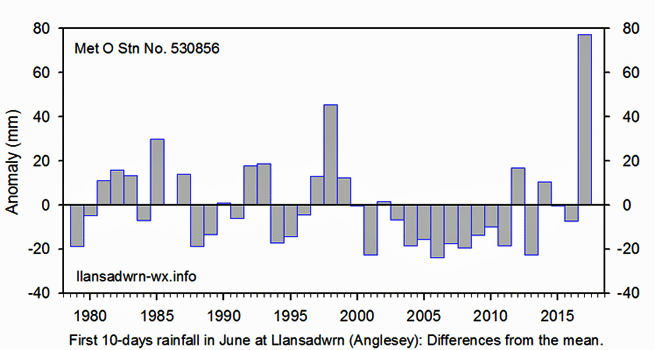
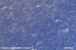
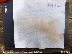
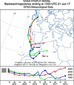
|

Times are GMT (UTC, Z). Observations at this station [ ] are 24-h 09-09 GMT, some others { } occasionally refer to other 24-h periods, extremes (first indications) are given in bold and are usually 21-21 GMT. When averages are referred to (.) compares with the last decade and [.] with the new 30-y climatological average [1981 - 2010]. All data are subject to verification and amendment. January 2017
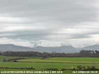
A complete change on the 6th with overcast sky, rain had started in the last hour and low cloud and mist was moving in from the west. Pressure was on 1031 mb with high 1043 mb over Germany rainfall would be mostly light, and low 965 mb was N of Iceland. There was a large area of light, but patchy, rain moving across Wales. Wet and windy in the afternoon, not worth going outside. [Max 9.7C Min -0.5C Grass -5.0C o/n -1.0C Pptn 7.2 mm]. Thick fog developed overnight, it was thick at midnight on the 7th and was still thick at 0900 GMT. Temperature 9.0C and 100% relative humidity. A very damp morning, trees were dripping moisture like being in a rain forest; and a dull and sunless day [Max 10.0C Min 6.7C Grass 6.0C Pptn 0.7 mm]. Similar on the 8th, very damp indeed ; temperature 8.3C RH 97%, no or little variable direction wind. Pressure was slack over Britain, 1032 mb here rising slowly with a high 1035 mb Atlantic near Brest, France. Sunless again today. [Max 9.5C Min 8.0C Rain 9.2 mm]. And another dull day on the 9th, but pressure 1014 mb was falling quickly with low 969 mb just S of Iceland and a cold front over the Irish Sea. A change in the weather was to be expected and the Met Office had issued what were to be a rapidly changing series of yellow warnings for Anglesey and North Wales of strong 55 mph wind and snow showers later in the week, and perhaps thundersnow that raised several headlines in the popular press - What was thundersnow? A brighter afternoon with a little sunshine; a slight shower later[Max 8.9C Min 7.4C Rain 3.5 mm]. The 10th began fairly brightly, nothing eventful in the night and no snow on the ground on the mountaintops. A pair squirrels were feeding at one of the feeding stations. Cloud was fairly thin and dry at first with some slight rain coming along at times in the afternoon [Max 9.8C Min 4.6C Grass 0.2C Rain 1.1 mm]. A bright morning on the 11th after a slight shower of rain. Pressure was on 1012 mb with lows 966 over the Norwegian sea and 962 mb Greenland Sea. Cold fronts were lying over Wales and SW England. Crepuscular rays were seen shining on the lower slopes of the Carneddau and there were flurries of snow around the summits. The temperature highest 9.8C at 0130 GMT was falling and was 6.6C (dewpoint 3.5C at 0900 GMT. Breezy from the west. Bright afternoon with the temperature continuing to decline reaching 4.4C at 1815 GMT [Max 7.1C Min 6.1C Pptn 1.4 mm]. The first 15-days were on the mild side despite the minor colder intrusion having a mean temperature of 5.5C [(+0.4)] of averages. Rainfall of 33.7 mm below the averages for the month (31%) & [33%]. It was again mild overnight with a minimum of 7.6C on the 16th having some slight rain at times after midnight. Pressure 1029 mb was rising with resident high 1035 mb off Cap Finisterre having a ridge towards the UK. Low 959 mb NE Greenland had a remarkably long associated cloud band extending running over the Norwegian Sea and UK, W France, and the Med to N Africa. Very dull to begin with, cloud base was between 800 and 1000 ft on the mountains this persisting all day. A little lighter before noon and dry, but dull in the afternoon [Max 9.3C Min 7.6C Grass 7.5C Rain 0.3 mm]. The 17th began with the sky obscured in moderate fog and a fine drizzle. There was not a lot of wind and the ground and vegetation remained very wet all day [Max 8.3C Min 4.3C Grass 2.6C Rain 0.9 mm]. Similar day on the 18th, but at least the sky could be seen and it was overcast. A bit misty with moderate to good visibility and spots of rain at 0900 GMT. Pressure was on 1038 mb with a low 991 mb Norwegian Sea and dominating high 1041 Germany surrounded by a horseshoe shaped jetstream. Very dull, damp and sunless [Max 8.5C Min 6.3C Rain 1.5 mm]. Continuing the same weather on the 19th, Anglesey was enveloped in low cloud, it was overcast, dull, very poor visibility and sunless. Small 1.3C temperature range. It was brighter on the other side of the Menai Strait with Llanfairfechan at times in sunshine [Max 7.7C Min 6.4C Rain 0.3 mm]. In complete contrast the sky had cleared at dawn on the 20th and there was just a little cloud to the NE over Liverpool Bay and a few small clouds over the mainland mountaintops. The minimum 4.6C was at 0900 GMT with the barometer steady on 1035 mb in high 1041 mb over SE Europe. A very fine and sunny day with Aberporth reporting 8.0 h of sunshine and Valley 6.6h with a UK highest maximum of 10.0C. A nice twilight with peach and azure blue colours [Max 8.8C Min 4.6C Grass 0.5C Rain nil]. Another sunny day on the 21st after an overnight minimum of 0.5C and a ground frost minimum of -4.9C. The grass had frozen dewdrops with only a slight white frost on the fields earlier. Visibility was very good with some inversion smoke below 1500 ft seen in the eastern end of the Menai Strait. A fine and sunny afternoon, but cloud was seen encroaching in the west before sunset [(Valley 7.6h Bridgefoot 9.1C Porthmadog 8.7C) [Max 7.2C Min 0.5C Grass -4.9C Rain nil]. Well, the fine sunny weather it did not last and on the 22nd it was back to being overcast with poor visibility. Pressure continued to be high on 1024 mb with high 1037 mb SE Europe. There was a low 1005 mb over the Med; low 969 mb was over the Norwegian Sea and 969 mb in the Atlantic S of Greenland. There was some showery precipitation in S Snowdonia and a line of showers over Cardigan Bay to the tip of SW Anglesey. Here, very dull and sunless with a little slight rain in the afternoon [Max 4.5C Min 0.7C Grass -4.1C Pptn trace]. A fine and bright start on the 23rd and the grass minimum had read -2.5C, but there was no white frost seen at 0900 GMT. Pressure was steady on 1027 mb with high 1028 mb stationed over the Channel near Dover. A sunny afternoon although it did turn cloudier later with a fine evening [Max 9.5C Min 1.8C Grass -2.5C Pptn trace]. The 24th began fine, but with moderate visibility. Flights at Heathrow were affected by fog for the second day, with 100 flights reportedly cancelled. Pressure 1024 mb had declined a little with low 980 mb W of Scotland tracking N and high 1029 mb over France. It was windy to the NW where isobars were tightest. Here no trouble with fog, a fine but breezy morning, very windy around noon before moderating, an overcast and sunless day [Max 9.0C Min 4.2C Pptn trace]. A very fine and sunny morning on the 25th with no overnight frost. Pressure was low to the W (965 mb SE Greenland) and high to the E (1033 mb Germany) so there were tight isobars over W UK, but frontal cloud was to the west over Ireland encroaching the over Irish Sea and N of Scotland, sea fog and stratocumulus off the North Sea encroached SE England. There was a little that affected tip of Pembrokeshire and W Anglesey (Valley 1.8h). Otherwise, most of southern Britain, including Llansadwrn and Llanfairfechan was in the clear with Aberporth returning the highest sunshine at 7.9h. The 5.88 MJ m -2 solar radiation was the second highest of the month [Max 9.0C Min 6.0C Pptn nil]. Clear sky overnight and the morning of the 26th was very fine and frosty with a minimum of -1.3C and -6.5C on the grass (equal lowest of the month with the 5th). Calm or sometime light airs from all directions the temperature at 0900 GMT was -0.7C (dewpoint -2.5C) giving us a rare air frost of 3.4h and ice on water. Pressure was 1041 mb with low 987 mb Shannon at 06 GMT. The sun was up so the temperature was soon rising melting the frost on the grass. Visibility was good, but with thick haze. A sunny afternoon and again a clear evening. Solar radiation of 5.97 MJ m -2 was highest of the month [Max 7.2C Min -1.3C Grass -6.5C Pptn nil]. Not as cold overnight as cloud had encroached the minima reflecting the temperatures at 09 GMT yesterday. Today the 27th the temperature was 3.1C (dewpoint -0.1C) and there were 6 oktas of thin cirrus and altocumulus cloud cover. A very fine bright start then turning a little cloudier with some sunny spells in the afternoon. [Max 9.0C Min -0.7C Pptn 5.4 mm]. A different day on the 28th precipitation overnight of 5.4 mm had fallen as snow above 2000 ft on the mountains with lying snow above 2500 ft. At 0900 GMT there was light rain in a temperature of 4.3C, the overnight minimum was 3.1C again taking the temperature of yesterday morning. Rather dull, wet and cooler, but there was a sunny spell in the afternoon. The evening turned showery with a fall of snow pellets at 2340 GMT [Max 6.2C Min 3.1C Pptn 4.3 mm]. A fine morning on the 29th with the sun rising above the Carneddau at 0832 GMT. At 0900 GMT with 6 oktas cloud and a light SE'ly breeze the temperature was 2.3C (dewpoint 1.5C with a 40% chance of ice precipitation). Fresh snow had fallen on the mountains bringing the snowline down to 2250 ft (where lying) with a 30% cover as low as 1250 ft. Turning cloudier, there was some slight rain at times in thickening cloud morning and afternoon [Max 6.3C Min 1.5C Grass -4.1C Pptn 0.6 mm]. With some clear sky overnight there had been a ground frost of -2.0C, but at 0900 GMT on the 30th it had melted and was reading 0.0C. There was heavy moisture on all surfaces including the rain gauges. A bright morning, but a cloudy afternoon with a temperature of 8.5C at 13 GMT. After midnight a Föhn-like wind developed at Gorwel Heights 13.9C was recorded at 0353 GMT, here 12.7C at 0457 GMT and 13.8C AWS at Gorddinog. In similar conditions 16.5C was recorded here in January 1998 on the 10th and 14.6 on the 11th (Bude 12.4C Mona 11.5C) [Max 12.7C Min 1.6C Grass -2.0C Pptn 0.2 mm]. The 31st was a dull old day with poor visibility and light rain falling at 0900 GMT. Nevertheless it was 12.0C at 0900 GMT. At 1240 GMT the temperature at Gorwel Heights rose to 15.1C and Gorddinog AWS 14.5C. These temperatures were not seen here where the maximum was 12.2C. Some brightness around 14 GMT as the cloud thinned and by now the temperature was falling here reaching 8.3C at 1800 GMT and 7.3C just before midnight (Trawsgoed 12.9C Bala 12.6C Rhyl 12.1C) [Max 12.2C Min 9.9C Pptn 1.5 mm]. The month ended with a mean temperature of 5.7C (+0.4) & [0.6] of averages, ranking 13th highest since 1979, but lowest since 2015, It was a another dry winter month with rainfall was 48.0 mm (42%) & [47%] of averages ranking 11 since 1928, least since lowest on record 1997 that had only 6.6 mm.
February 2017
February 1 - the began brightly after a mild night the air minimum not falling below 7.1C. A very light SSE'ly breeze with a sky of cumulus and cirrus clouds and a contrail. Visibility was good, a little misty, the mountaintops partially obscured. Just a few snow patches were evident on the Carneddau and Snowdon. Pressure 1003 mb was falling slowly with low 984 mb SW of Ireland. Sunny by noon and early afternoon when cloud was encroaching from the west by 1500 GMT. The calm before the storm perhaps, the Met Office had released a yellow warning for strong winds [Max 12.5C Min 7.1C Rain 0.4 mm]. A fine, but dull morning on the 2nd with a light SSE'ly wind. It was again mild, the temperature at 0900 GMT 12.2C (dewpoint 10.1C). Pressure 986 mb was falling rapidly with low 959 mb over the Celtic Sea. The wind strengthened during the day which had some sunny spells. It got very windy in the evening; Capel Curig reported a gust of 78 mph; 64 mph was recorded at Gorwel Heights at 2107 GMT during a spell of 8 hours with gusts in excess of 40 mph (daily mean wind speed 18.8 mph with a wind run of 388.6 miles); and 56 mpg at Gorddinog at 1756 GMT. The highest gust in Llansadwrn was 36 mph at 2314 GMT ( Gogerddan 14.0C Whitechurch 24.6 mm) Gorwel Heights 14.0C [Max 14.3C Min 7.3C Rain 5.3 mm]. The wind moderated overnight and the morning of the 3rd was sunny for a while. Pressure 991 mb was rising while low 981 mb was over the Bay of Biscay at 06 GMT. It was a cooler 6.0C and there was rain, or slight rain and drizzle, from 1230 GMT until 2200 GMT (St James Park 11.8C Scolton CP (Pembrokeshire) 33.8 mm Boulmer (33.8 mm) [Valley 27.6 mm Mona 14.0 mm Capel Curig 9.4 mm] [Max 8.0C Min 4.9C Pptn 6.6 mm]. During the early hours of the 4th a band of precipitation moved onto North Wales, cold enough for ice precipitation here and by first light (about 08 GMT now) there was melting snow pellets and snow at 1000 ft with light to moderate falls at greater altitude on the Carneddau and Snowdon. Moel Eilio and hilltops westward were well covered. Cloud continued to cover southern Britain and NE Scotland. Central areas including here were mostly clear. Cloud developed later in the afternoon and there were further showers over the mountains (Plymouth 10.2C Achnargart 36.6 Aberdaron 15.0 mm Leconfield 8.0h) [Max 8.3C Min 2.2C Grass -2.0C Pptn 0.6C]. A clearing sky in the small hours of the 5th allowed the temperature to fall and freeze moisture on the ground, the grass minimum was heavily coated and had to be scraped off to read -4.2C, soil was not frozen. Air minimum had been 1.0C and currently at 0900 GMT had crept up to 1.9C. The breeze was very light or calm and there were 3 oktas of cloud cover. Good mist visibility with snow cover seen above 2000 ft on the mountains. A dry sometimes sunny afternoon when a pair of goldfinches were regular visitors at the sunflower hearts feeder. Greater spotted woodpeckers favoured the peanut and dripping cake and a red squirrel the peanuts (Killowen 10.8C Magilligan 5.9h Tiree 14.6 mm Valley 4.2 mm and 4.8h sunshine) [Max 6.8C Min 1.3C Grass -4.2C Pptn trace] A fairly light morning on the 6th with moderately thick ice on the ground and encrusting the grass minimum thermometer that was registering 0.0C, in melting ice, but had been down to -4.3C. There had been heavy dew that had frozen and although the copper rain gauge funnel and bottle was dry the black Davis funnel, on the ground the rim at standard 30 cm height, had a small amount of water in the bottom. I have noticed that the black plastic frequently has condensed moisture on it. On this occasion water in the bottom of the funnel had frozen and prevented the water dropping onto the tipping bucket, the outlet is quite small - smaller than a copper gauge. Not missing the chance to measure the quantity I removed the funnel and allowed the plug of ice to melt in a warm place and collected the condensate. It was 2.5 ml and by calculation this was equivalent to 0.12 mm of rainfall. This amount was little less than the 0.15 mm measured by a dew/frost pad exposed on the ground surface. This 'precipitation' would be recorded by the lysimeter and leads to an under-recording of PE when dew and frost occurs, amounts of 0.2 to 0.3 mm have been recorded and this often results in the TBR recording a tip during the day when the frost plug had melted and it has not rained. Of course this does not happen when the heater is running inside the gauge. The day soon turned duller with rain from 1300 to 1600 GMT. By evening the wind had strengthened and there was more rain. Sunless [Max 9.1C Min 1.1C Grass -4.3C Pptn 3.9 mm]. A brighter morning on the 7th with sunshine at times. Pressure 1011 mb was rising, visibility good and some cumulus clouds were bubbling up over the mountaintops. Snow patches were frequent with large areas of broken snow on the Carneddau. Crepuscular rays were evident in the morning and the afternoon too has a little sunshine at times and some cumulonimbus clouds were spotted in the distance [Max 10.4C Min 3.5C Grass -1.0C Pptn 1.4 mm]. Over night there was a shower of snow pellets finely marking the pad; total precipitation was 1.4 mm and sprinklings of fresh hail and snow gave a lying cover on the mountains above 2750 ft with some as low as 2500 ft. A sunny morning on the 8th, just 2 oktas cloud mainly cirrus and contra. The sun rose at 0814 GMT and the day mostly sunny [Max 8.2C Min 3.0C Grass -1.2C nil Pptn]. Similar on the 9th very fine and sunny, but very cold in the E'ly breeze. There was an extensive white frost on the ground and ice had formed on water. Visibility was only moderate with a moderately thick smoke haze [Max 4.9C Min 0.5C Grass -5.6C nil Pptn]. An overcast morning on the 10th with no precipitation and no frost observed on the grass, any that had formed had disappeared and the grass only slightly damp at 0900 GMT. Air temperature had been down to -0.3C with 2.0 h of frost and on the grass to -3.2C. It was fine with a cold E'ly breeze. Pressure 1028 mb was rising with high 1027 mb over the Atlantic W of Scotland and there was a large high 1050 mb over Scandinavia. Lows were to be found 987 mb off Cap Finisterre and 1000 mb Sicily. Occluded cloud lay over the Channel and there was some rain in SW England. The most significant rain appeared to be in Fair Isle 6.0 mm [Max 4.2C Min -0.3C Grass -3.2C Pptn trace]. Spots of rain with an overcast sky on the morning of the 11th, but slight snow occurring at 1000 ft in Llandegai and around Llyn Ogwen. It had been calm, but a NE'ly breeze had picked up to force 5 [Max 4.9C Min 1.2C Grass 0.5C Pptn 0.5 mm]. Mostly cloudy on the 12th with an ENE'ly wind roaring in the trees resulting in a significant chilling of the 2.6C measured in the screen. Crepuscular rays seen looking towards the mountains that had snow lying above 2250 ft with some as low as 1850 ft with drifting in places. It was sheltered in the garden from the worst of the wind, many goldfinches were visiting the sunflower hearts feeder and a squirrel had also been taking nuts [Max 5.1C Min 2.5C Grass 1.4C Pptn 0.4 mm]. The 13th was a very windy day the E'ly wind of gale force at times. A large beech was blown over in Telford Road in Menai Bridge crushing the bonnet of a car from which the driver escaped closing a main road to the town for several hours. Another tree was brought down out of the shelter belt into the field across the road from the weather station. Apart from the roaring cold wind it was a mostly sunny day [Max 9.9C Min 2.6C nil Pptn]. On the 14th pressure 1019 mb was rising although the day was mostly cloudy with fine broad crepuscular rays visible. The SE'ly wind had moderated force 1; there was inversion haze in the eastern entrance to the Menai Strait and general murky haze resulting in moderate visibility, but mountaintops were in the clear. Here there were many linear snow patches from old drifts as low as 2000 ft and there was enough remaining to record lying snow above 2850 ft. Mostly weak sunshine, a few sunny spells and a slight shower fell in the early evening. Lusa 14.0C Valley 10.1C [Max 10.0C Min 3.0C Grass -1.9C Pptn trace bottle dry, AWS tipped 0.2 mm]. A fine and bright start on the morning of the 15th, visibility was moderate in haze with pressure steady on 1024 mb. Gradually the weak sunshine gave way to sunny spells, briefly cloudier around noon then sunny again in the afternoon. Donna Nook 13.9C Gorwel Heights 13.3C Trawsgoed 12.9C [Max 11.7C Min 3.8C Grass -0.8C Pptn 0.6 mm]. The first 15-days despite 9 days of ground frost were on the mild side for February having a mean temperature of 5.4C (+0.2) & [0.5] of averages. It had been dry with precipitation of 19.3 mm below the averages for the month (27%) & [25%]. The 16th began overcast with good visibility, but after recent rain it was poor to moderate in mist. There were some lighter patches looking towards Conwy. Pressure was steady on 1027 mb with a depression 1010 mb moving eastward just N of Scotland pressure was high generally S Europe and the Med. A wet afternoon with an area of light rain moved across from N Ireland [Max 8.9C Min 5.4C Pptn 2.0 mm]. High pressure over Spain 1030 mb had extended a ridge to the UK and Norwegian Sea on the 17th and pressure here was steady on 1026 mb. It was a cloudy day with good hazy visibility so that only the outlines of the mountaintops could be discerned, it was fine and bright, but with no clear sunshine. The daffodils were well out today on Peacock Hill while species Narcissi in the garden here were looking great. St James's Park 13.8C Braemar -3.0C [Max 10.5C Min 7.6C Pptn 0.2 mm]. Mild again overnight with minima on the 18th in air and on grass 8.3C, what it was at 09 GMT yesterday. Already 9.3C under overcast skies giving the morning a dull and damp feel. It was breezy with a moderate SW'ly so with wind chill it did not exactly feel like what the thermometer indicated. At Gorddinog AWS the temperature at 0007 GMT was 10.9C while at Gorwel Heights it was 11.7C at 0936 GMT this rising to 14.7C at 1240 GMT. At Hawarden the day's maximum was 15.1C. Pressure 1022 mb was rising in a ridge to the N Sea and Baltic, but linear frontal systems stretching N to S over the Irish Sea and UK resulted in a dull morning and mostly cloudy afternoon here although 7.4h sunshine was recorded at Hertsmonceux and 4.5h at Aberporth [Max 11.5C Min & Grass 8.3C Pptn trace]. The 19th began dull with misty poor visibility. There was intermittent drizzle and spots of rain with fog developing in the afternoon. The temperature hovered around 9.3C in the afternoon before rising in the evening reaching 10.3C before midnight [Max 10.5C Min 7.3C Pptn 1.2 mm]. There was low cloud fog on the morning of the 20th at 0900 GMT that lifted only slowly through the morning with the afternoon remaining cloudy. Pressure 1018 mb was falling and continued to fall through the day. Fine and breezy in the afternoon [Max 11.5C Min 7.7C Pptn 0.1 mm]. Another overcast morning on the 21st with the cloud low at 1500 ft on the slopes of the Mountains. Continuing mild with no frost overnight, but it was a rather dull sunless day with slight rain and drizzle most of the day. During the afternoon the SW'ly wind strengthened and the rain heavier during the evening. Hereford 14.7C Cassley (43.2 mm) [Max 10.5C Min 7.8C Pptn 8.7 mm]. The was moderate rain around 04 GMT and little at 09 GMT on the 22nd was dull and damp in low cloud and mist with intermittent drizzle and or slight rain. Pressure was at its highest 1008 mb at 1026 before starting to fall. It was a little drier from 1330 GMT for about an hour before more rain, then light to moderate, came along. As pressure continued to fall the wind strengthened during the evening as Storm Doris making its approach. It was getting lively at 2340 GMT with the wind gusting to 30 mph with the barometer on 997 mb still falling. St James's Park 14.8C Capel Curig (34.2 mm) [46.0 mm] [Max 9.2C Min 7.1C Pptn 18.0 mm]. A very noisy morning on the 23rd as Storm Doris in the vicinity crossing the Irish Sea. Heavy rain and wet snow pellets fell around 0430 GMT with 18.0 mm measures with standing water in the garden and fields. The 24th was respite day with sunshine and light winds. Colder overnight with an air minimum of 1.1C and -3.6C on the grass and there was a fresh slight snowfall on the mountains as low as 2500 ft. Pressure 1017 mb was rising and it was a pleasant afternoon when the sun was shining, just a few honeybees were seen out for a while on white heather in a shelter part of the garden. Scilly Is. 11.0C [Max 9.5C Min 1.1C Grass -3.6C Pptn 9.1 mm]. A wet and windy day on the 25th with leaden overcast skies from the start. Pressure 1006 mb was falling, there had been a gust of 41 mph at 0624 GMT, and the SW'ly was force 6 with light to moderate rain falling at 0900 GMT. Gorwel Heights 42 mph at 1003 GMT. It rained most of the day, watched the rugby match in Edinburgh, Wales lost there first time in a decade - Scotland 29 Wales 13. Electricity was restored today to properties that had been without for over 48 hours. Capel Curig (60.6 mm) [53.0 mm] [Max 9.5C Min 3.5C Pptn 17.0 mm]. Very windy again on the 26th the SW'ly near gale force at 0900 GMT and the sky looking very threatening to the west. Pressure 999.8 mb was falling and gusts of 51 mph recorded at Gorwel Heights at 1502 GMT and 38 mph here at 1545 GMT. Dull, wet and windy all day; Llansadwrn electricity supply failed at 1440 GMT, engineers working on a fault in Llanddona hoped to get it back by 5 pm, but later as there was an additional fault found gave a revised time of 6 pm which was achieved. Missed out on our roast early evening meal. Had a heavy shower 20 mm/h at 1935 GMT Gravesend 14.0C Tyndrum(33.8 mm) Capel Curig (17.4 mm) [34.4 mm] [Max 9.8C Min 6.1C Pptn 7.1 mm]. A colder showery day on the 27th began brightly then turned cloudier before 0900 GMT with showers of rain and ice pellets. Cumulonimbus and thunder were reported by Valley at 0850 GMT. Up to 10 cars were reported to have been in crashes on the A55 between Gwalchmai and Llanfihangel which was for a time closed in both directions, all due to a heavy fall of hail about 08 GMT. With lows 967 mb N of Scotland and 978 mb Newcastle pressure here 985 9 mb was falling rapidly, but poor visibility improved to good and there was weak sunshine later in the morning followed by sunny spells with sunshine in the afternoon The barometer reached a flat bottom of 981.4 mb about 16 GMT. Fresh snow was seen on the mountains lying above 2250 ft and as low as 1250 ft in Cwm Idwal. Further showers of rain and snow pellets in the evening [Max 6.6C Min 0.6C Grass -3.3C Pptn 2.5 mm]. Overnight the air minimum had fallen to 0.6C and -3.3C on the grass and the 28th began with showers of sleet and snow and a temperature of 1.7C at 0900 GMT. Pressure was on 985 mb and the morning continued with frequent showers of sleet. Snow was settling around 1000 ft with fresh snow lying on the mountains above 1500 ft. There was snow too on Cadair Idris. A record breaking amount of 51 cm of snow fell in Reykjavik in Iceland. Despite it name SW parts of Iceland around Reykjavik usually does not get a lot of snow. The record snowfall in the city is 55 cm in January 1937. Murlough 10.4C Dalwhinnie -8.5C Capel Curig (36.6 mm) [Max 6.6C Min 0.6C Grass -3.3C Pptn 8.3 mm]. The month ended with a mean temperature 6.5C, highest since 2013. Rainfall was 97.8 mm, least since 2015, but one of the 26 largest falls since 1928. A dull month with just 49.2 hours of sunshine at Valley the 7th lowest on the Anglesey record since 1931
March 2017
March 1 - the began brightly with a light WSW'ly breeze after a shower of rain at 08 GMT. At 0900 GMT the temperature was 4.8C and visibility was moderate it being misty. Pressure was steady on 997 mb. Weak sunshine at first in the morning then much sunnier in the afternoon. The evening turned cloud and there was a period of sleet from 20 GMT till just before midnight that fell as snow at higher altitude on the mountains [Max 9.8C Min 1.0C Grass -3.8C Pptn 17.2 mm]. There was further precipitation after midnight and by the morning of the 2nd had accumulated 17.2 mm. It was a misty morning with poor to moderate visibility and at 0900 GMT a temperature of 4.2C. No frost had occurred overnight. It was later fine and sunny before cloud thickened and there was rain from 20 GMT. A fine and bright morning on the 6th after a moderate ground frost (-3.5) with frozen dewdrops at the tips of grass leaves and some thin ice on water. Visibility was poor to moderate with mist and weak sunshine that later cleared to give a sunny morning. Pressure 1003 mb was rising quickly in a ridge moving eastward with complex lows 989 mb SW entrance English Channel; 983 mb S of Iceland and 998 mb S North Sea. A record gust of 119 mph was recorded in NW France. The afternoon continued fine before cloud encroached with showers developing during the evening. St James Park 11.6C Scilly Is. (19.4 mm) Valley [8.0 mm] Capel Curing [5.4 mm][Max 9.6C Min 1.8C Grass -3.5C Pptn 6.3 mm].
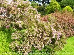
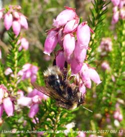
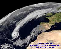
 The temperature rose to 8.0C by 1600 GMT and further in the evening, with light to moderate rain falling, reaching 9.9C at 0114 GMT next day. [Max 0.9C Min 1.7C Grass -2.5C Pptn 8.4 mm]. A dull and overcast morning and after the rain the ground was very soggy underfoot. Pressure on the 8th was 1010 mb and rising and soon brightening the morning becoming sunny later and in the afternoon. Northholt 15.1C Gorwel Heights 13.1C Cluanie Inn (33.8 mm) [Max 12.3C Min 4.3C Pptn 8.4 mm]. On the 9th pressure 1020 mb was rising rapidly as a ridge approached from the west. A mild 7.7C at 0900 GMT, 5 ocktars cloud, moderate hazy visibility and a W'ly breeze. Fine and sunny; there were a lot of honeybees, and one or two large bumble bees, on the flowers of the heather banks in the garden. Solar radiation was 10.89 MJ m -2, and maximum temperature 13.3C were highest of the month so far. [Max 13.3C Min 6.2C Pptn 0.6C]. The 10th was disappointing under thick grey low clouds giving very poor misty visibility. Later it was bright at times with occasional glimpses of sunshine breaking through as the afternoon became breezier. Chivenor 16.5C Aboyne -2.8C [Max 11.8C Min 5.9C Pptn 1.0 mm]. The temperature rose to 8.0C by 1600 GMT and further in the evening, with light to moderate rain falling, reaching 9.9C at 0114 GMT next day. [Max 0.9C Min 1.7C Grass -2.5C Pptn 8.4 mm]. A dull and overcast morning and after the rain the ground was very soggy underfoot. Pressure on the 8th was 1010 mb and rising and soon brightening the morning becoming sunny later and in the afternoon. Northholt 15.1C Gorwel Heights 13.1C Cluanie Inn (33.8 mm) [Max 12.3C Min 4.3C Pptn 8.4 mm]. On the 9th pressure 1020 mb was rising rapidly as a ridge approached from the west. A mild 7.7C at 0900 GMT, 5 ocktars cloud, moderate hazy visibility and a W'ly breeze. Fine and sunny; there were a lot of honeybees, and one or two large bumble bees, on the flowers of the heather banks in the garden. Solar radiation was 10.89 MJ m -2, and maximum temperature 13.3C were highest of the month so far. [Max 13.3C Min 6.2C Pptn 0.6C]. The 10th was disappointing under thick grey low clouds giving very poor misty visibility. Later it was bright at times with occasional glimpses of sunshine breaking through as the afternoon became breezier. Chivenor 16.5C Aboyne -2.8C [Max 11.8C Min 5.9C Pptn 1.0 mm].
The first 15-days had 58.1 mm of rainfall which already was (91%) & [68%] of the monthly total averages. It had also been a little warmer the mean temperature 7.7C was (+1.0) & [+0.7] of averages. The 16th began overcast and dull but dry at first before a little rain arrived before 0900 GMT. Pressure 1021 mb was falling slowly in a minor trough; the high pressure to the S was 1031 mb N Italy fronts lying to the NW associated with low 978 SE of Iceland. The rest of the morning was fine and became brighter with a little sunshine around noon. The breezier afternoon turned cloudy again and there was some light showery rain from 1515 GMT [Max 11.2C Min 7.3C Pptn 1.2 mm]. Another very poor spring day on the 17th for outdoor activities: overcast with rain in sight at 0900 GMT turning misty as rain started at 0905 GMT and continued most of the morning becoming a little breezy. Pressure 1017 mb was falling in a westerly airflow between low 970 mb Norwegian Sea and high 1027 mb Azores. Affecting us were fronts moving across on a westerly flow associated with low 983 mb Greenland. It turned out to be a miserable day, a little drier early afternoon then more blustery rain as the wind strengthened to near gale force later (Murlough 12.2C Stonyhurst 47.4 mm Capel Curig 29.6 mm Herstmonceaux 6.0h) [Max 9.4C Min 1.9C Pptn 9.1 mm]. Another dull and sunless day on the 18th although pressure 1010 mb was rising between low to the N (983 mb) and high to the S (1032 mb) with the jetstream set up over the UK delivering a series of frontal waves off the Atlantic. With the soil sufficiently saturated there was standing water in small pools around the garden. Did not go out; watched the rugby match on TV from Paris, France 20 Wales 18, with a controversial ending with overtime lasting 20 minutes and disputed substitution of players. (Pershore 16.1C Capel Curig 26.2 mm Lerwick 7.7h Hawarden 1.5h [Max 11.0C Min 9.0C Pptn 6.1 mm]. Continuing the wet weather theme the 19th began wet and windy and continued rain and or drizzle before fog developed later in the afternoon becoming thick before dark. Pressure 1004 mb had been falling and there was little change in the situation with low-pressure in the N (978 mb Iceland) and high-pressure in the S (1029 mb Azores and 1024 mb Spain and the Med) (Eskdalemuir 32.0 mm Capel Curig 20.6 mm) [Max 10.6C Min 9.0C Pptn 6.1 mm]. Continuous rain on the morning of the 20th was light at 0900 GMT and again plenty of standing water around in the garden and roadsides where inadequately drained. Visibility was poor to moderate. Our electricity supply failed at 0740 GMT, coffee prepared, eggs on, but the toast not cooked. Well it could have been worse, supply restored 1107 GMT after a fallen cable on feeder supply had been repaired. The afternoon turned out brighter with sunny spells and a brisk breeze. Later towering cumuli developed with some cumulonimbus over the mountains and there was thunder and lightning and 7 mm hail in Llanfairfechan at 1715 GMT. The thunder was heard here and there were ice pellets to 3 - 5 mm with heavy shower falling at up to 13.8 mm per hour at 1659 GMT. Later further precipitation fell as snow on the mountains (Writtle 14.2C Sennybridge 27.6 mm) [Max 10.5C Min 7.6C Grass 7.6C Pptn 2.2 mm]. A colder morning on the 21st with the air minimum down to 2.1C overnight and a touch of ground frost -1.1C. Bright and breezy the air temperature 4.5C (dewpoint 1.0C) at 0900 GMT. Pressure 1006 mb was rising and we were in a strong showery W'ly air flow with marine closed cell convection packed to the north-west. Snow cover had returned to the mountains with snow lying at 2500 ft on the slopes of the Carneddau. Heavy showers developed in the afternoon with hail, sleet and snow at low levels. There was a heavy sleet shower on the Dinorwic bypass about 1340 GMT and 2-3 minute 8 mm hail in Llansadwrn at 1405 GMT that almost covered the ground. Rain and sleet later in the evening from 2100 GMT till after midnight that fell as snow on the mountaintops of Snowdonia [Max 8.3 Min 2.5C Pptn 5.8 mm]. The morning of the 22nd was overcast with cloud touching the mainland mountaintops at times where there was fresh snowfall. Pressure was 1001 mb near the centre of a low positioned over Cardigan Bay 998 mb at 06 GMT and Severn Estuary 1001 mb at 0900 GMT. there was little or no wind, visibility was very good, temperature 5.7C (dewpoint 4.5C). The morning was brighter at times, although no breaks had appeared here by noon cloud was broken over the Great Orme with a little sunshine in Llandudno. Some heavy showers developed in the afternoon and again in the evening. (Northolt 11.9C Blencartha 40.0 mm Tredegar 23.8 mm Tiree 11.1h) [Max 8.1C Min 2.5C Pptn 7.3 mm]. Another night with some clear sky and bright stars but on the morning of the 23rd it was dull and overcast with mist and fog still lingering in low lying places. Pressure 1019 mb was rising in a ridge from the Azores to N Scotland. A cool 4.9C at 0900 GMT with poor visibility and a heavy dew. A little sunshine in the afternoon with a rather chilly E'ly breeze [Max 11.0C Min 1.5C Grass -1.7C Pptn nil]. A fine and sunny morning on the 24th after a cool night, but frost free with 0.2C on the grass thermometer. With 11.1h of sunshine at Valley solar radiation here was 14.78 MJ m -2, the highest of the year so far. Porthmadog 16.0C [Max 12.2C Min 3.1C Pptn nil].
The rather wet month ended with a total of 135.6 mm of rain (213%) & [159%] of averages, most in 10-years and the 8th largest in March since 1928. Largest since 2006. A warm month the mean 8.3C (+1.6) & [+1.3] of averages, but sunshine was at a premium at Valley least since 2006 and ranked 32 on the Anglesey record.
April 2017
April 1 - began mostly cloudy after a moderate shower of rain (5.8 mm/h) at 0536 GMT although now bright with some sunshine breaking through, somewhat misty visibility. Pressure 1007 mb was rising with a ridge to the W of Ireland from Atlantic-high 1027 mb lying off Iberia. The cloud was due to complex bands associated with a minor low 1003 mb over Wales. When the sun appeared it was quite pleasant; several large bumblebees were about the garden and from time to time disappearing under ground often into holes in the grass sward that for me are very difficult to spot, but for bees it seems no problem. Later they will pop up again from the 'invisible' hole hidden in the grass, they seem to like to build their nests in old tunnels left by moles which are frequent in the garden. (Gravesend 17.6C Lake Vyrnwy 22.4 mm) {Max 14.3C Min 8.0C Rain 0.3 mm].
The ridge if high-pressure moved across in the night, bright stars were visible at midnight on the 2nd and as a result there was a touch ground frost -0.7C by morning. Very good visibility with now no seen on the tops and N-facing slopes of the Carneddau Mountains. Pressure 1023 mb was rising in the ridge over the UK from high 1027 mb near the Iberian coast moving over Cap Finisterre by 0900 GMT. Fine and sunny, but a cool 8.0C, the slight white frost on the fields had disappeared and after the clear sky convection was building to the south and west and Valley reported light showers. Here the sky cleared again to give a sunny afternoon with the butterflies putting in an appearance along with the large bumble and honey bees. [Max 14.3C Min 3.5C Grass -0.7C nil rain]. A bright, mostly sunny, but breezy morning on the 3rd with good visibility. Pressure was steady on 1022 mb with highs 1028 mb S North Sea and 1027 mb Iberia. Deep low 968 mb SE Greenland meant that isobars were tight to the NW of here. The afternoon turned cloudier and slight showers of rain developed during the evening [Max 11.5C Min 5.5C Rain 1.3 mm].
A bright morning on the 10th with pressure 1028 mb rising. Pressure was high 1026 mb over Mediterranean regions and was 1035 mb W of Ireland. The fly in the ointment was low 991 mb mid-Norwegian seaboard resulting in tight isobars over Britain and a cool NNW'ly airflow and a cold front over S England. With the wind off the Irish Sea rising over the mountains the day kept mostly cloudy here with a few glimpses of sunshine (Herstmonceaux 15.9C Katesbridge -1.1C Cluanie Inn 12.8 mm Exeter 11.1h Aberdaron 9.4h [Max 11.3C Min 3.4C trace]. Beginning mostly cloudy on the 11th some weak sunshine developed and glimpses of sunshine cloud thickened in the afternoon (Heathrow 16.7C Baltasound -1.6C Resallach 73.0 mm St Athan 12.5h) [Max 12.0C Min 3.2C trace]. There was slight shower of rain at 0800 GMT on the 12th then light rain for a while with poor visibility. A dull cloudy morning on the 27th with recent slight rain continuing after 0900 GMT turning showery. High-pressure 1028 mb was still off SW Ireland and there was a low 1005 mb S Norway with a warm front over the Isle of Man and the Irish Sea [Max 10.9C Min 3.1C Grass -0.2C Rain 1.4 mm]. Not a lot of change on the 28th with overcast skies, low cloud, rain and mist. Today's maximum 9.2C, jointly with the 26th, lowest of the month [Max 9.5C Min 7.4C Rain 1.3 mm]. Brighter and breezier on the 29th with very good clear visibility under the cloud. Pressure was on 1013 mb with tight isobars and fronts to the W of Ireland while pressure was slack over England to the E (Gravesend 16.8C Drumnadrochit -1.5C Capel Curig 3.2 mm Herstmonceaux 10.5h) [Max 12.8C Min 5.7C Rain nil]. Fine, but dull and continuing cool on the 30th with pressure 999 mb falling with a low 986 mb off SW Ireland. Rain on a frontal system was sliding northwards over SW England, S Wales and Ireland did not reach here until later (Gravesend 18.4C Mount Batten 23.6 mm Milford Haven 9.8 mm Leconfield 9.5h Bala 7.5h Valley 0.0h) [Max 14.0C Min 7.7C Rain 0.7 mm]. The month ended with a total of just 22.0 mm of rainfall (41%) & [35%] of averages, least since 2010 and the 6th driest April in Llansadwrn since 1928. The mean temperature was 9.0C (-0.3) & [+0.1) of averages, highest since 2014 ranking 16th here since 1979. A disappointingly cloudy month, sunshine at Valley was lowest since 2005 and one of the 10th dullest on the Anglesey record since 1931.
May 2017May 1 - began brightly with hazy sunshine after slight rain showers in the night there was moderate visibility and a light NE'ly breeze. Increasingly sunny in the afternoon when the sky cleared giving a fine sunny evening (West Freugh 20.6C Dunkerswell Aerodrome 33.2 mm St Athan 17.2 mm Kinloss 13.1h) [ Max 16.1C Min 5.5C Rain nil]. Mostly clear sky overnight and the morning of the 2nd was very fine and sunny. An overnight minimum of 5.5C and 1.6C on the grass, good visibility with light smoke haze. Pressure 1021 mb was rising with high 1034 mb over the S Norwegian Sea. A sunny afternoon (Achnagart 21.0C Tain Range -1.6C Frittenden 5.0 mm Lerwick 14.8h Aberdaron 13.9h) [Max 16.4C Min 6.5C Rain nil]. Another fine and sunny day on the 3rd with pressure steady on 1028 mb under the influence of a ridge from Norwegian Sea high 1041 mb, good visibility with moderate smoke haze. There was a cool light to moderate NE'ly breeze, although cloud increased the afternoon was mostly sunny (Achnagart 20.2C Porthmadog 19.2C Aviemore -2.4C Manston 4.4 mm Aberdaron 14.0h) [Max 15.0C Min 6.5C Rain nil]. Mostly clear sky on the 4th with some cumulus and altocumulus lenticularis developing later to disperse. There was moderate smoke haze and moderate levels of pollutant ozone in the air; the monitor at Marchlyn Mawr indicated 101 µg per m-3 . Pressure was steady on 1026 mb with high 1024 mb over the Norwegian Sea, low 998 mb mid-Atlantic to the SW, and a complex low pressure 1015 mb over the eastern Med and 1011 mb over the western Med. Sunny again with a light to moderate ENE'ly breeze by afternoon with visibility becoming clearer and very good [Max 17.3C Min 8.1C Rain nil]. After a mostly clear night the 5th began with sunshine and a cold force 4 NE'ly wind. There was a little cumulus and cirrus clouds, otherwise a nice blue sky though somewhat hazy due to pollutant smoke (04). The solarimeter was unobscured all day with a good smooth curve: total global solar radiation was 25.54 MJ m -2 highest of the month so far, with a high of 831 W m -2 recorded in the hour 12 to 13 GMT (Kinlochewe 19.9C Porthmadog 18.8C) [Max 15.9C Min 5.8C Rain nil]. On the 6th cloud had encroached and it was a dull day with cloud bases about 2500 ft on the slopes of the Carneddau Mountains. Again with a NE'ly breeze and moderate hazy visibility. The cloud had thinned by about 1800 GMT and there was a little weak sunshine, another dry day (Tyndrum 20.4C Milford Haven 17.4C Braemar -5.0C Scilly Is. 23.6 mm) [Max 12.9C M in 7.0V Rain nil]. The sky had cleared in the night and on the 7th it was a very fine sunny morning. Zero cloud as far as I could see from the weather station, very good visibility with a light NE'ly breeze developing after a calm dawn. Pressure 1023 mb was rising with low 1012 mb S Norway and low 986 mb over the Atlantic off Iberia and S of Greenland. A few very small cumuli appeared in the SW during the morning. Tiree with 15.0h had the most sunshine with Valley coming in at 14.5h and Dublin 14.8h. The highest maximum was 21.3C at Pershore [Max 15.4C Min 6.2C Rain nil]. Similar on the 8th, again no cloud at 0900 GMT, but breezier. Very good visibility with slight smoke haze. Very fine and sunny (Castlederg 19.5C Porthmadog 18.6C Tiree 15.1h Aberdaron 14.6h) [Max 13.4C Min 6.1C Rain nil]. Very fine and sunny on the 9th with a light ENE'ly breeze, good, moderate haze [Max 12.8C Min 3.9C Rain nil]. Hardly a cloud on the 10th, moderate visibility with moderate haze. Very fine and sunny, S'ly breeze later backed NE'ly, intermittently SW'ly. The soil is now very dry and there are cracks of 2 to 3 mm in undisturbed places. Soil moisture, 2 - 8 cm under grass sward, gravimetrically determined today was 41% dry mass; the top 2 cm of grass and root mass contained 67% moisture. On the met plot where there is no grass and soil is undisturbed moisture was down to 16.8% dm close to the permanent wilting percentage of the local soil which is 15.2% dm. On the vegetable plot that has been worked, but not irrigated, the moisture content at the surface was 19.8% dm. We could do with some rain! (Sheffield 19.8C Braemar -3.8C Kinlochewe 6.4 mm Wattisham 14.5h) [Max 15.2C Min 4.3C Rain nil]. A very fine and warmer morning on the 11th with few clouds. Pressure had fallen to 996 mb with a thundery low developed 990 mb near Cap Finisterre with thunderstorms breaking out in France, S England and S Wales during the day. The temperature at Gorddinog AWS rose to 21.0C and 20.3C at Gorwel Heights. Here it become cloudier in the afternoon with a maximum of 19.1C; we had slight showers in the evening and again after midnight, not enough to dampen down the dust. The first 15-days had 30.6 mm of rainfall which was (42%) & [49%] of the monthly total averages. Temperatures had been a little lower than the monthly averages with the mean 11.4C (-0.1) & [-0.3]. The 16th began dull, wet and misty with drizzle and or rain that petered out during the morning. A mild 13.0C overnight and at 0900 GMT the temperature was 13.8C. Pressure was on 1016 mb with a large complex low pressure area 988/ 991 mb S of Iceland that covered the UK, Denmark Strait, S Norway and N Sea. High pressure was over SE Europe 1031 mb and Azores 1026 mb. In the afternoon the cloud cleared and there was sunshine (Gravesend 25.8C Hawarden 19.6C Capel Curig 38.6 mm Kirkwall 12.5h Valley 5.3h) [Max 16.4C Min 13.0C Rain 0.1 mm]. A cloudy and dull morning on the 17th with some thinner patches overhead and good visibility. Pressure was 1018 mb with the large complex low-pressure area to the NW 998 mb still dominating the scene with frontal bands traversing SE with showers following. It was not until the end of the afternoon that the cloud broke up to give some sunshine. A dry day (Langdon Bay 25.0C Braemar -1.9C Holbeach 40.4 mm Lerwick 14.1h Aberdaron 6.3h) [Max 14.3C Min 8.9C Rain nil]. The sky had cleared on the morning of the 18th giving a largely sunny morning with very good clear visibility. Pressure was on 1013 mb; the low-pressure area to the NW was filling, but still dominating the weather. Grass is growing quickly now at 8.0 g dry mass m -2 d -1 , a burst of spring growth related to flowering tiller production, and the total yield this year so far has reached 3.34 tonnes per hectare. Rain on the 15th had increasing soil moisture content to 58.6% dry mass gave a boost to growth; evaporation rates are just about balancing rainfall the PWB (potential water balance) being -0.4 mm, but the PWD (potential water deficit) indicated by lysimeter data on the 15th of the month was 23 mm. Tall native ash trees had now burst into leaf, well after the oak trees this year. The non-native horse chestnuts were in full leaf by the 4th of April. [Max 15.8C Min 8.5C Rain nil]. Pressure 1012 mb was steady on the morning of the 19th when visibility was very good and the day mostly sunny. The jetstream was fragmented with lows 1002 mb near the Western Isles and southern North Sea. (Hereford 18.2C Kinbrace -1.5C Cromer 20.4 mm Aberporth 13.9h) [Max 16.8C Min 7.3C Rain 2.3 mm]. The 20th began overcast and dull with misty cloud on the lower slopes of the Snowdonia Mountains and moderate to good visibility. Continuing unsettled pressure was on 1013 mb between low 1006 mb N Sea and low 1007 mb off the Western Isles of Scotland. It was dull, but dry and brightened up by the afternoon, Valley 3.3h sunshine (St. Helens 18.3C Bala 1.1C Fair Isle 17.6 mm Manston 13.0h) [Max 14.9C Min 7.3C Rain trace].
With 7 oktas cloud cover and a blustery S'ly breeze the 21st began fine with some sunny spells developing later. Pressure 1021 mb was rising, we were in a warm airflow from the S with high 1028 mb Germany and low 1007 mb S Portugal with a weak jetstream was aligned and there was a cloud mass lying to the north-west. Warm and sunny in SE England. (St. James Park 20.9C Braemar -0.9C Magilligan 6.4 mm Manston 13.7h) [Max 17.7C Min 10.1C Rain nil]. It was fine, dry, warmer, but cloudy on the 22nd with pressure on 1013 mb. Low 985 mb was S of Iceland and there was a frontal cloud mass lying over Ireland and the Irish Sea. The temperature at 0900 GMT was 17.5C and 62% relative humidity. There was some weak sunshine at times, several episodes of large spots of rain of little volume, and the temperature reaching 19.6C at noon St. James Park 24.9C Kielder Cs. 4.4C Tulloch Br. 16.0 mm Odiham 11.8h) [Max 19.6C Min 11.7C Grass 9.3C Rain trace]. A little brighter at 0900 GMT on the 23rd after being very murky with very poor visibility and air quality after dawn; a dusty grey deposit was evident in the routine collection. Pressure was high 1025 mb over Biscay with a warm front over S Wales and the Severn Estuary. Later fine and bright here with some sunny spells coming along, the temperature reached 20.3C being the first day having 20C, or more this year. (Hereford 23.3C Katesbridge 1.5C Kirkwall 13.8C Morecambe 12.7h Bala 10.7h) [Max 20.3C Min 11.3C Rain nil]. Continuing dull and overcast on Anglesey on the 24th, although it was warm at 0900 GMT 15.7C, with mist and fog persisting around coastal areas with no sunshine reported at Valley. Pressure 1026 mb was rising with high 1027 mb over the Severn estuary, there was a warm front over Scotland associated with low 996 mb SW Iceland. The sun did break through here later in the afternoon with the temperature rising to 21.0C; Sunny and very warm in England and S Wales (Pershore 26.6C Tredegar 24.7C Aboyne min 5.5C Loch Glascarnoch 2.8 mm Manston 14.1h St. Athan 11.3h) [Max 21.0C Min 11.3C Rain nil]. On the 25th the cloud had cleared, there was mist in the Menai Strait after dawn, but here sunny at 0900 GMT. Pressure was on 1023 mb in British high 1026 mb. Fine , sunny and warm the temperature was 20.8C in a light E'ly breeze. Overnight air minimum 9.6C the temperature went on to reach 26.5C at 1523 GMT a range of 16.9C. The rare warmth continued long into the evening (Aboyne 28.0C Rhyl 26.7C Loch Glascarnoch min 6.3C Lerwick 0.6 mm Kinloss 16.1h Aberdaron 14.8h [Max 26.5C Min 9.6C rain nil].
Showery rain had moved up from the S after midnight on the 27th and there was a light shower at 0400 GMT and and a moderate shower at 0530 GMT (4.6 mm/h) 2.5 mm observed. The overnight air minimum was 16.0C, second highest in May on record at the station, and pressure 1006 mb had been falling with the thundery low 1008 mb Cardigan Bay. The sky had partially cleared, there were some lenticular altocumulus clouds to the SE of the station, before turning cloudier again later. At first very fine and again warm at 18.6C rising to the maximum 23.1C within the hour. The afternoon was cloudy and fog developed during the evening. The early morning rain contained traces of Saharan dust, a sample collected at 0900 GMT was a light reddish-brown when wet drying to a paler pinkish-white colour. Gorwel Heights 24.7C Gorddinog AWS 28.3C (Lossiemouth 27.3C Rhyl 23.8C Ravensworth Min 6.6C Levens Hall 52.6 mm Manston 11.9h) [Max 23.1C Min 16.0C Rain 4.3 mm]. From midnight on the 28th thunderstorms were being generated on a frontal arc stretching from the Bay of Biscay, the west coast of France to southern Norway. In the evening severe storms moved again along the coast from Brittany in the vicinity of the French Channel ports towards Dover and Ramsgate during the day and into the night where spectacular lightning was observed. The day here was quiet in compariso being overcast, dull, damp with little or no wind for an unusually long spell, and no lightning or thunder. Pressure 1019 mb at 0900 GMT began to fall during the afternoon (St. James Park 24.9C Usk 22.2C Okehampton Min 6.0C Aultbea 10.0 mm Shoeburyness 10.1h) [Max 16.0C Min 11.6C Rain 1.1 mm]. Weather on the 29th was very similar. Overcast and calm with low cloud on the mountain slopes and rain in sight in the west. Though mild it was a dull miserable day on Anglesey, especially for many bank holiday makers, with drizzle and spots of rain throughout and no sunshine. (Frittenden 24.2C Kinbrace Min 4.2C Upper Lambourn 24.2 mm Lake Vyrnwy 21.0 mm Manston 5.9h Aberdaron 0.8h) [Max 18.1C Min 12.1C rain 3.4 mm]. Folloeing rain after midnight there was fog here at dawn on the 30th and, though thinned to poor visibility, by 0900 GMT it was still dull and very damp with 99% RH with a temperature of 12.8C. Pressure 1013 mb was rising, low 999 mb was SW Iceland and there was an associated frontal cloud mass over Ireland. Becoming brighter with a glimpse of sunshine by 11 GMT before a narrow band of cloud moved across from the W with some showery rain falling from 14 GMT heaviest at 1535 GMT (15 mm/h). The sky cleared later on and it was fresher (chillingham Barns 21.7C Lerwick Min 7.5C Wick 11.0 mm Tiree 8.6h) [Max 17.7C Min 12.3C Rain 3.8 mm]. It was a fine and sunny morning for the last day of spring on the 31st after a mostly clear and cool night air temperature down to 8.0C and 4.5C on the grass, a reminder for the garden that chilly nights continue here until at least the second or third week of June. There was some warm sunshine in the afternoon when grass manitenance was undertaken managing to finish just before and a surprise sharp shower of rain at 1517 GMT (34 mm/h) (Heathrow 23.0C Katesbridge Min 0.6C Llysdinam 9.8 mm Leconfield 15.4h) [Max 19.7C Min 8.0C Grass 4.5C Rain 0.7 mm] .. The month ended with a total of 48.8 mm of rainfall (67%) & [79%] of averages, least since 2010 and the 30th driest May in Llansadwrn since 1928. The mean temperature was 13.3C (+1.8) & [+1.6) of averages, highest since 2008 the second warmest May in Llansadwrn since 1979. A very sunny month, sunshine at Valley was 250.0h the fifth sunniest May on the Anglesey record since 1931.
June 2017
United States President Trump finally confirmed that the US would pull out of the Paris Climate Agreement. This was predictable, but shows his intransigence, complete mis-understanding of the facts, and unwillingness to accept what the world's and his own scientist say. Former US President Obama in a statement said ' A year and a half ago, the world came together in Paris around the first-ever global agreement to set the world on a low-carbon course and protect the world we leave to our children. It was steady, principled American leadership on the world stage that made that achievement possible. It was bold American ambition that encouraged dozens of other nations to set their sights higher as well. And what made that leadership and ambition possible was Americas private innovation and public investment in growing industries like wind and solar industries that created some of the fastest new streams of good-paying jobs in recent years, and contributed to the longest streak of job creation in our history. Simply put, the private sector already chose a low-carbon future. And for the nations that committed themselves to that future, the Paris Agreement opened the floodgates for businesses, scientists, and engineers to unleash high-tech, low-carbon investment and innovation on an unprecedented scale. The nations that remain in the Paris Agreement will be the nations that reap the benefits in jobs and industries created. I believe the United States of America should be at the front of the pack. But even in the absence of American leadership; even as this Administration joins a small handful of nations that reject the future; Im confident that our states, cities, and businesses will step up and do even more to lead the way, and help protect for future generations the one planet weve got'. The UK, EU and many other countries remain committed to the Agreement...
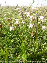
It was another fine morning on the 3rd, but cumulus clouds were already beginning to develop at 0900 GMT. Pressure was steady on 1014 mb with low 989 mb S Iceland and a frontal-wave disturbance 1011 mb off Newcastle over the North Sea. There was a fresher feeling SSW'ly breeze and visibility was good or very good with light haze. About 1115 GMT there was a short sharp shower, but the afternoon cleared up again and the evening was clear and sunny (Frittenden 22.2C Hawarden 19.8C Braemar Min 0.2C Leconfield 24.8 mm Morecambe 13.7h Aberporth 11.8h) [Max 17.0C Min 8.9C Rain trace. The 4th was also fine, bright and breezy, with little pressure change low 993 was slow-moving S Iceland and pressure high 1028 mb near the Azores. Hardly noticeable on the chart was a small frontal-wave low 1011 mb W of Cap Finisterre/ S of Iceland which by 1800 GMT was SW of Ireland 1002 mb. It was cloudier around middle of the day then sunny later and in the evening. During the afternoon pressure began to fall 1012 mb at 1800 GMT then more rapidly in the evening to 1009 mb. A cooler day everywhere - (Holbeach 20.7C Kinbrace Min -0.1C Pembrey Sands 13.8 mm Herstmonceaux 12.5 h) [Max 16.6C Min 9.3C Rain 13.2 mm]. After a mild night minimum 11.6C the 12th began a little brightly after a slight shower at 0300 GMT, even a glimpse of sunshine, but by 0900 GMT it was with overcast and dull with the mountaintops obscured. Pressure 1015 mb was rising quickly with the low 995 mb over the Orkney Islands heading rapidly for Norway. It was fine, but feeling cool in the still moderating force 4 SSW'ly breeze. A little brighter just before 14 GMT, otherwise it kept dull. Cooler in the south-east, wet in Scotland (Heathrow 20.9C Okehampton Min 8.8C Cluanie Inn 31.0 mm) [Max 16.1C Min 11.6C Rain 0.1 mm]. Overcast again on the 13th and mild overnight, cloud and mist was low on the mountainslopes in good visibility. Pressure was on 1018 mb in a transient ridge reaching Scotland from high 1020 mb over the English Channel. A low 977 mb was S of Greenland and W of Scotland tracking eastward. Dull and cool with glimpses of the sun behind cloud the dark cloud thick enough in the afternoon to produce spots of rain at times. The north from North Wales was mostly cloudy while to the south it was clearer and sunny with summer temperatures (Heathrow 24.8C Achnagart 19.8 mm Gogerddan 4.8 mm Bournemouth 15.2h) [Max 16.8C Min 12.1C trace]. The 14th had the promise of some finer weather although the morning starting brightly was beginning to turn cloudier at 0900 GMT with pressure falling. A light SE'ly breeze at first with good hazy visibility. From noon the cloud thinned and it was sunny the temperature rising to 22.1C at 1429 GMT. Warm too in Llanfairfechan with Gorwel Heights reaching 22.2C at 1650 GMT when cooler air on a cold front brought an initial 5.5C plunge, 7C in Llansadwrn. There were breaks in the cloud also in the west in the afternoon with some sunshine at Aberffraw where a few northern marsh orchids were seen at their best. There were more pyramidal orchids flowering, but most smaller than usual this year. The dune slacks were moister after the rain and the first marsh helleborines were beginning to appear, none of the flowers fully open as yet. An unusual amount of seaweed was being stranded on the beach along with 2 or 3 small jellyfish. Thicker frontal cloud encroached during the evening (Heathrow 27.1C Hawarden 25.0C Bournemouth 15.1h) [Max 22.1C Min 11.1C Rain 2.0 mm]. There was a moderately heavy shower of rain at 0418 GMT on the 15th and by 0900 GMT the sky was clearing with some sunshine. It was again breezy with a moderate SSW'ly and a temperature of 14.7C. Pressure was 1012 mb with shower troughs to the W and complex fronts associated with lows 991 mb S of Iceland and 985 mb S Greenland. The day kept fine and breezy with some sunny spells (Manston 26.0C Exeter Min 7.0C Tyndrum 22.0 mm Reading 12.9h Aberporth 12.0h) [Max 17.4C Min 12.4C Rain nil]. It had been a wet start to the month the first 15-days had 107.2 mm of rainfall which was (131%) & [159%] of the averages. Temperatures had been close to the averages with the mean 14.0C (0.0) & [0.1]. The 16th began dull, but fine and breezy. A warm front lay over the Irish Sea associated with low 988 mb S Greenland. Pressure 1023 mb, however, was rising with a high 1029 mb over the SW Approaches off Brest. The morning brightened and the afternoon though cloudy had sunny spells (Heathrow 24.3C Porthmadog Min 8.0C Harris Quidnish 6.4 mm Camborne 11.6h) [Max 19.9C Min 10.7C Rain nil]. The 17th was a very fine day, sunny and warm with little in the way of cloud cover and solar radiation 26.96 MJ m -2 highest of the year with 15.1h of sunshine recorded at RAF Valley (Heathrow 30.1C Libanus Min 8.8C Achnagart 24.2 mm Boulmer 16.0h) [Max 23.2C Min 14.6C Rain nil]. Pressure was steady on 1024 mb on the 18th with and another almost cloudless day. High 1026 mb was situated over the Severn estuary, visibility was very good and clear and it was very fine and warm. Hotting up in the south (Hampton WW 32.1C Ravensworth Min 6.7C Achnagart 8.0 mm Morecambe 16.2 h) [Max 24.7 Min 13.4C Rain nil]. The 19th was a lot cloudier, mostly high thin cirrus, so that the day was bright with a lot of sunshine and warmer (Hampton WW 32.5C Eskdalemuir Min 7.1C Lentran 5.8 mm Morecambe 15.1h) [Max 26.6 Min 13.4C Rain nil].
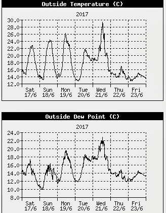
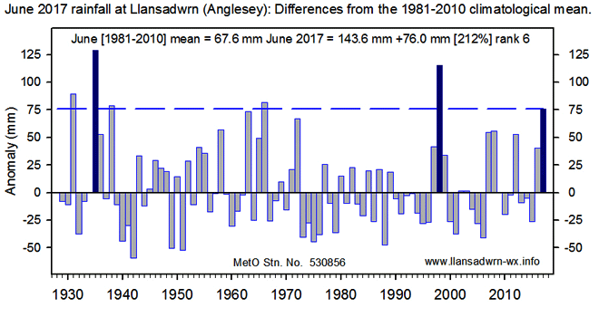
With pressure on 1020 mb on the 20th the day began fine with cloud clearing over Anglesey except for a persistent band of cloud over the eastern Menai Strait with the mountaintops showing clear. Pressure was high 1022 mb with the high 1024 mb over northern Britain, a weak frontal system had been making its way S over night. What a difference one day can make. On the 22nd with the onset of cooler weather from the NW, the temperature at 0900 GMT was 13.7C and it struggled to get briefly to a maximum of 17.2C at 1437 GMT, 12.7C lower than yesterday. Apart from a little brightness and dryness at this time the day was wet and misty with poor visibility. This ended the 5-day run of warm (>20C) summer days (graphic from AWS left). Weak cold fronts passed overnight and the morning of the 24th was dull, cool and damp. Pressure was steady on 1013 mb with a low 978 mb W of the Faeroes over the Norwegian Sea while we had frontal cloud over the Irish Sea associated with a frontal-wave W of Ireland. The afternoon was breezy, but some sunny spells developed and the temperature rose to 18.4C and was warm into the evening (Santon Downham 25.5C Aboyne Min 6.2C Cassley 18.6 mm Morpeth 11.9h) [Max 18.4C Min 11.2C rain 1.3 mm]. The 25th began dull with slight rain and moderate misty visibility. The afternoon brightened allowing lawn management to be undertaken, grass growth had slowed to 3.4 g dry mass m -2 day -1 . This does not seem like a lot in these terms, but the yield of grass accumulated this season so far amounts to 5.32 tonnes per hectare. Soil moisture content under grass (2-10 cm deep) determined today was 44% dry mass, down from 56% at the beginning of the month, while the top 2 cm of soil that includes plant bases and dense roots was 68% dm. Growth of grass has been 'middle of the road' this season, range 3 to 8.5 tonnes over the past 15 years. (Heathrow 24.2C Altnaharra Min 6.6C Cluanie Inn 15.8 mm Morpeth 12.4h) [Max 17.4C Min 11.7C Rain 0.1 mm]. There was a fine and bright start to the 26th with a NE'ly breeze, but it did not feel cold with a temperature of 15.1C (dewpoint 11.7C) at 0900 GMT. A better day here than the forecasts had suggested with some warm sunshine in the afternoon, but nothing like the continued summer warmth in the south. Rainfall this month so far totalled 130.2 mm with a ranking of 7th wettest in the Llansadwrn record book since 1929 (Hampton 25.4C Katesbridge Min 0.0C Derrylincornahoule 7.4 mm Manston 14.3h) [Max 17.5C Min 10.8C Rain 9.4 mm]. A blustery morning on the 27th and mostly cloudy after a glimpse of sunshine before 0900 GMT. Pressure 1006 mb was falling with a low 1001 mb near Shannon, Ireland. Rather ragged low clouds and occasional thinner patches was the best on offer, but with a S'ly wind the temperature 15.6C rose to 19.4C by 1300 GMT. Thicker cloud then came came along and there was a little drizzle (Thomastown 23.4C Lerwick Min 4.4C Dundrennan, Scotland 52.2 mm Valley 17.0 mm Thomastown 5.4h) [Max 19.4C Min 13.2C Rain trace]. The month ended with a total of 143.6 mm of rainfall (178%) & [212%] of averages, most since 1998 and the 6th wettest June in Llansadwrn since 1929. The mean temperature was 15.0C [(+1.1)] of averages, equal highest (with 2016 and 2010) since 2006 the warmest June in Llansadwrn.
July 2017
The 10th was disappointing beginning overcast and dull with drizzle turning to slight rain. Low 998 mb was over the Norwegian Sea with cold fronts over the Irish Sea and W Wales. The day kept more of less the same with rain at times and poor visibility. Sunniest in the far N, wet in the SE (Gravesend 27.0C Tulloch Bridge Min 4.3C Manston 24.6 mm Lerwick 15.3C ) [Max 16.0C Min 12.5C Rain 3.9 mm]. The 11th began overcast, dull and wet with slight intermittent rain or drizzle. Pressure was high 1012 mb S of Iceland with pressure here was on 1007 mb. It was a cloudy scene, however, with an occluded front over the Irish Sea and N Wales associated with low pressure over the N Sea and Baltic regions. Not a lot of change for most of the day until later in the afternoon when it was brighter and drier with a glimpse of sunshine at times. Red squirrels were at both feeding stations at times through the day (Manston 21.5C Islay Min 3.6C Chivenor 34.6 mm St Athan 24.2 mm Magilligan 14.7h Valley 1.5h) [Max 16.4C Min 12.5C Rain 0.2 mm]. A much better day on the 12th with a clearing sky through the morning it was fine and sunny with very good visibility [Max 19.7C Min 11.2C Rain nil]. Pressure 1021 mb was steady early on the 13th in a minor ridge from Continental high 1024 mb, but started to fall before noon; the day started very fine with hazy sunshine and mainly cirrus clouds and a S'ly breeze, as pressure fell a weak cold front over the Irish Sea, associated with low 1002 mb Iceland, encroached during the afternoon. The front can be seen low on the horizon looking NW over Cwyfan Bay [Max 19.9C Min 10.9C Rain 4.6 mm]. The 14th began overcast with a SW'ly breeze, fine, but dull. Pressure 1021 mb was rising in a ridge from Azores high 1030 mb, weather fronts lying to the W were associated with a low 985 mb SE Greenland. The afternoon brightened a little and there was a sunny spell later before more cloud encroached bringing some light rain during the evening [Max 18.0C Min 11.6C Rain 1.9 mm]. Continuing the cloudy theme on the 15th with rain before 0900 GMT when slight or drizzly, then heavier again soon after. There was a warm front over Wales, temperature 15.4C with RH 97%, and a cold front NW of Malin Head associated with complex lows near Greenland and Iceland. Most of the UK was cloud covered and we had drizzle until late afternoon when the sky brightened and there was a glimpse of sunshine. Aberporth had the most sunshine with 3.4h recorded (Murlough 24.6C Achnagart 27.6 mm Porthmadog 11.4 mm) [Max 20.2C Min 13.0C Rain 7.4 mm].
The first 15-days had 23.7 mm of rainfall (24%) & [34%] of the July average total.. Temperatures had been close to the averages with the mean 15.6C (0.0) & [-0.1]. After some early rain on the 16th cloud was lifting and the sky clearing to give some sunny spells. Pressure 1024 mb was rising with an Atlantic-high 1028 mb to the WSW with frontal bands clearing to the SE. Low 985 mb was N of Iceland while there was a thundery low developing over Spain [Max 19.5C Min 12.8C Rain trace]. The 17th was a very fine sunny and dry day. After a cool start with overnight minima 10.9C air and 8.0C on the grass, the temperature at 0900 GMT was 17.3C and rose to 23.1C in the afternoon [Max 23.1C Min 10.9C Rain nil]. The 18th was another very fine, sunny and warm day, there was more in the way of high cirrus clouds and a solar halo was seen
at 0900 GMT. Warmer overnight the minimum 13.1C and with the breeze ESE'ly the temperature was 21.4C rising to 26.6C in the afternoon. Warm too in Llanfairfechan where AWS at Gorwel Heights reported a maximum of 25.9C and Gorddinog 28.3C with a low relative humidity of 36%. Valley also recorded 28.3C. Thunder storms developed over Cornwall and S Wales, distant rumbles of thunder were heard at 2045 GMT with sferics reported in the Irish Seas off Llyn [Max 26.6C Min 13.1C Rain 2.8 mm]. Showers of rain overnight, the heaviest at 0213 GMT on the 19th, briefly up to 39 mm/h. The Met Office had updated its yellow warnings and indicated storms affecting N Wales counties omitting Anglesey. The 21st was overcast, dull and wet. Pressure had been at a monthly low 998.8 mb at 0619 GMT with a slow-moving depression over Ireland 992 mb at 0900 GMT and here 999.4 mb. The temperature was 14.9C and under thick cloud and rain and or drizzle generally dropped from the maximum of 15.3C, a few minutes after 0900 GMT, through the day and following night. Very wet and windy in S Wales (Coningsby 23.1C Dalwhinnie 2.2C Tredegar 69.4 mm Mumbles Head 52 mph Kirkwall 14.6h) {Max 15.3C Min 11.4C Rain 5.1 mm]. A brighter day on the 22nd with pressure 1006 mb rising with a low 1001 mb over the Celtic Sea. Fine and sunny to start, although it was wet underfoot, and soon cumuli began to develop in the west. Mostly cloudy thereafter near the mountains until later in the afternoon when the sky cleared overhead for a while (Hull 22.5C Carslisle 50.2 mm Porthmadog 19.6 mm Aberdaron 12.0h Valley 10.1h) [Max 18.4C Min 9.7C Rain 0.2 mm] ... The month ended with a total of 88.5 mm of rainfall (88%) & [127%] of averages, lowest since 2015. The mean temperature was 15.7C close to the averages, highest since 2014 ranking 18th since 1979. Sunshine at Valley was 194.9 h sunniest since 2014 and 14th on the Anglesey record since 1931.
August 2017August 1 - and a fine, mostly cloudy morning after a heavy shower of rain but, with pressure 1011 mb was rising, there was some sunshine later in the morning and in the afternoon . At times convective cloud thickened overhead and there were spots of rain. Away from the influence of the Snowdonia mountains Valley on the NW coast of Anglesey had 10.2 h of sunshine (Gravesend 24.5C Kinbrace Min 4.;4C Morecambe 29.0 mm Bala 18.6 mm Shoeburyness 12.8h) [Max 18.0C Min 13.0C Rain 1.0 mm]. The 2nd was another disappointing day with skies overcast and rain had been falling since 0550 GMT. The afternoon was drier with a little sunshine at times. Hawarden 22.9C Aboyne Min 4.5C Mt. Batten 26.0 mm Lerwick 10.4h) Gorwel Heights 22.0C Gorddinog AWS 21.6C [Max 19.2C Min 13.1C Rain 1.1 mm]. It was a very dark morning on the 3rd with thick cloud and windy. The SW'ly was force 6 on the weather side of the sheltering trees. Visibility was poor. Pressure had been 997 mb at 0451 GMT with a low 993 mb to the NW near the Western Isles and North Channel. The afternoon was brighter with a little sunshine (Holbeach 23.0C Rhyl 19.7C Baltasound Min 7.9C Capel Curig 35.8 mm Charterhall 7.9h) Gorwel Heights 20.1C [Max 18.0C Min 13.7C trace].
A more promising day beckoned on the 4th with pressure 1009 mb rising quickly. Low 994 mb was moving away over the S Norwegian Sea and there was some early sunshine. Towering cumulus clouds were in the vicinity and there were some spots of rain either side of 0900 GMT giving trace amounts for both 24-h periods. Otherwise fine with convection diminishing over Anglesey it was a mostly sunny day especially on the western shores of the island (Gravesend 23.1C Killylane Min 10.1C Harris Quidnish 17.2 mm Leconfield 11.9h) [Max 19.5C Min 13.0C trace]. The pressure 1017 mb was still rising on the morning of the 5th that began brightly although there were towering cumuli in the vicinity at 0900 GMT. Visibility was very good albeit slight hazy towards Llyn where approaching rain showers were evident. Sunny then a shower of rain here at 1035 GMT. There was a heavy shower at Gorwel Heights at 1239 GMT that fell at a rate of up to 165 mm/h and accumulated 12.2 mm with an overall 6C fall in temperature . The afternoon here was dry with some sunshine although there were passing cumuli at times (Writtle 21.9C Katesbridge Min 1.9C Keilder Castle 16.6 mm Morecambe 12.2h) [Max 18.1C Min 11.1C 1.7 mm]. The 6th began with overcast skies and a low 1006 mb west of Malin Head tracking NE that had a frontal-wave over Ireland. Breezy a S'ly force 5 strengthening to force 7 with strong down draft gusts especially in the Menai Strait causing problems for offshore dinghy racing that had already been shortened due to the conditions. One crew was rescued by the Beaumaris RNLI craft launched at 0945 GMT that also helped right seven capsized dinghies in rapidly deteriorating conditions. There were spots of rain from 1100 GMT then continuous rain all day into the night. Rainfall was 35.8 mm in the 24-h period from 0900 GMT over 15h duration. Heaviest was the 45 mm/h at fell at 2000 GMT. It's summer! (Cavendish 23.0C Kinbrace Min 1.9C Capel Curig 35.2 mm Shoeburyness 13.1C) [Capel Curig 45.8 mm Llansadwrn 35.8 mm] [Max 15.6C Min 10.5C]. Continuing fine on the 10th with pressure steady on 1027 mb. We were in a ridge from Atlantic-high 1033 mb off Cap Finisterre. Though cloudy at times the day was dry, the afternoon fine with clear skies in the evening (Hereford 22.8C Swyddffynnon Min 2.6C Manston 10.6 mm) [Max 18.5C Min 10.6C Grass 8.0C Rain 0.3 mm]. In contrast the 11th began overcast with rain and drizzle from 0730 GMT. Pressure 1016 mb was falling with low 990 mb Norwegian Sea with a warm front over Wales. The day was dull and sunless with rain or drizzle at times, none particularly heavy but over 7 h duration [Wattisham 22.8C Shobdon Min 4.0C Capel Curig 13.4 mm Shoeburyness 10.6h] [Max 16.1C Min 11.1C Rain 2.6 mm]. Little change overnight and on the morning of the 12th that was dull with slight rain at times. Pressure, however, was rising and the rain slowly eased and eventually in the afternoon we saw a little sunshine (Frittenden 23.5C Loch Glascarnoch Min 6.9C Bencathra 8.9 mm Tiree 9.8h]. The first 15-days had 72.8 mm of rainfall (73%) & [44%] of the August average total. Temperatures had been close to the decadal average but below the 30y average, the mean 15.6C (0.0) & [-0.6]. Cloudier overnight, but still bright with 5 oktas cover at 0800 GMT turning overcast by 0900 GMT 16th with a freshening S'ly breeze. Low 986 mb off W Ireland at 06 GMT was tracking N and 990 mb off the Western Isles. The morning kept dry, but breezy, the afternoon saw a glimpse of sunshine along with a slight shower of rain. Some heavier showers developed from 1830 GMT and vivid white lightning was seen across the sky as storms moved up St. George's Channel over Cardigan Bay towards S Snowdonia during the evening. Thunder and lightning here from 2225 GMT to 2330 GMT the storms then making their way over Liverpool Bay, Merseyside and Cumbria Gorwel Heights 21.1C (Heathrow 23.6C Aboyne Min 3.3C Lough Fea 15.0 mm Leconfield 9.0h)[Max 19.1C Min 12.3C Rain 4.7 mm]. A mild night and fine start on the morning of the 17th with some glimpses of sunshine. At 0900 GMT 15.9C with 97% RH. Pressure 1008 mb was rising with low 983 mb SE Iceland off Cape Wrath. A minor clear slot, then cloud developed midday and was thick enough for a few spots of rain at times. Some sunshine briefly later and into the evening, windy, then more showery rain came along (Cavendish 25.4C Katesbridge Min 5.0C Trawsgoed 30.0 mm Edinburgh 12.5h) [Max 19.0C Min 14.2C Rain 1.6 mm]. The 18th also began fine, but breezy, with a force 5 SW'ly. The jetstream was located over S Britain and with low 992 mb SE Iceland shower troughs were in the vicinity. Some sunny spells into the afternoon then a heavier shower at 1600 GMT sufficient to send me indoors from the garden. A sunny day NW Anglesey at coastal Valley (Cavendish 22.9C Kinbrace Min 6.1C Fyvie Castle 35.2 mm Sennybridge 25.0 mm Valley 9.5h). The 19th began dull and overcast with a cool feeling force 4 SW'ly breeze although the air temperature was 13.6C (dewpoint 10.9C) at 0900 GMT. Within 10 minutes there was a break in the cloud sheet, but showers were in sight crossing the Snowdonia Mountain range and Gorwel Heights caught it at 1010 GMT (20 mm/h) whereas we missed it altogether and a dry day ensued. The afternoon was bright at times and the wind moderated (Manston 21.3C Santon Downham Min 7.3C Cluanie Inn 39.6 mm Rhyl 8.6 mm Odiham 10.8h) [Max 17.1C Min (10.9C) Rain nil]. Fine and fairly bright morning, after a cool night 5.9C on the grass with moderate dew formation, on the 20th with some altocumulus overhead and a little weak sunshine. Pressure 1023 mb was rising. There was a ridge towards the UK from high 1026 mb over Biscay, but it was not to last for very long. Low 999 mb was S of Greenland and there were rain bearing fronts W of Ireland. Pressure was high 1021 mb Greenland and Spitzbergen while a low 998 mb near the North Cape was disturbing the weather in the Baltic region. A little brightness continued into the afternoon before rain set in about 15 GMT (Cavendish 21.8C Katesbridge Min 5.1C Resallach 18.2 mm Leuchars 10.2h) [Max 17.0C Min 9.8C Grass 5.9C Rain 3.9 mm]. The 21st began with overcast sky. Pressure was steady on 1020 mb with a slow-moving low 1005 mb W of Ireland and fronts over the Irish Sea. We were in moist warm sector air at 0900 GMT with a light shower of rain and a temperature 15.3C and 97% RH rising to 19.1C on what was an otherwise dry but sunless day (Usk 24.4C Tulloch Bridge Min 2.0C Shoreham 12.4 mm Kirkwall 9.1h [ Max 19.1C Min 11.9C Rain 0.1 mm]. There was early morning fog between 05 and 07 GMT on the 22nd and still very poor visibility at 0900 GMT. It was dull and humid at 0900 GMT with a temperature of 17.4C (dewpoint 17.1C) 98% RH. Fog lingered in the Menai Strait and was thick between the bridges and Bangor pier at 1000 GMT Somewhat brighter in the afternoon as the temperature rose to 23.0C just after 1500 GMT, the warmth continuing into the evening with the temperature 20.6C at midnight. Thunderstorms developed over N Ireland and the N Channel before moving on to the Western Isles. No thunder was heard here although sferics were recorded off Point Lynas. Malin Head had 77.2 mm of rain in the 24h to midnight (Bude 25.3C Porthmadog 24.9C Lough Fea 55.2 mm Lerwick 11.8h) [Max 23.0C Min 14.5C Rain 0.8 mm]. The 23rd began fine with misty good visibility, but breezy. Pressure 1012 mb was rising with a frontal low 1003 mb over the Western Isles. The afternoon was brighter with glimpses of sunshine (Weybourne 25.6C S Uist Range 63.2 mm Aberdaron 8.1h) [Max 18.4C Min 14.4C Rain 0.1 mm]. A fine, but dull and rather breezy morning on the 24th with some brief sunny spells developing later. Pressure 1015 mb was rising between low pressure 1002 mb to the NW and high pressure 1019 mb to the south. By afternoon the sky had cleared the sunshine continuing in the evening (Wisley 22.3C Braemar Min 5.6C Lerwick 25.0 mm Kirkwall 9.1h Aberdaron 9.0h) [Max 18.7C Min 13.6C Rain nil]. A dull morning with overcast sky on the 25th and with thickening cloud in moderate visibility rain was in sight. A little reached here soon after 0900 GMT, just some spots of drizzle. Fronts were lying to the NW with a low 1009 mb over the Western Isles while pressure here 1016 mb was rising. A chance of the cloud breaking appeared at one point, with a glimpse of weak sunshine, but the day kept cloudy and sunless (Monks Wood 24.6C S Newington Min 5.5C Helens Bay 29.2 mm Shoeburyness 12.9h) [Max 17.6C Min 13.5C Rain tr]. The month ended with a total of 96.0 mm of rainfall (96%) & [110%] of averages, lowest since 2015. The mean temperature was 15.2C close to the averages,lowest since 2015 ranking 16th since 1979. Sunshine at Valley was 175.3 h sunniest since 2015 and 22nd on the Anglesey record since 1931.
September 2017September 1 - began much as August ended mostly cloudy with sunshine at times. Fairly mild ay 12.9C and with pressure 1025 mb rising in a ridge from the Azores high 1028 mb. In the afternoon the sky did clear for a while and several butterflies including wall brown, speckled wood, small tortoiseshell and red admirals were seen in the garden. Red admirals were also seen along the hedgerows on ripe blackberries of which there are some good ones to be found. I collected enough for a blackberry and apple crumble. And, it was a dry day (St. James Park 22.0C Sennybridge Min 1.2C Waddington 13.8 mm Bude 12.5h Aberdaron 10.3h Valley 7.1h) [Max 18.0C Min 9.3C Rain nil]. The sky had cleared again overnight with mist forming in low-lying places by the morning of the 2nd that began very fine and sunny. There was still low cloud/ fog hanging over the western Strait and some cumuli had stated to form over the mountaintops. Weather outlook did not look good as a complex of lows and fronts lay W of Ireland tracking our way. Cloud did increase overhead mainly fair weather cumulus, but there was some good sunny spells late into the afternoon (Charlwood 22.1C Braemar Min 0.1C Writtle 12.4 mm Kinloss 11.5h Valley 0.1h) [Max 19.4C Min 12.6C Rain 6.0 mm]. The 3rd began dull and wet, a thoroughly nasty day. Pressure 1006 mb was falling with low 989 mb SW Iceland with a trough to the UK. A complex of frontal system lay to the west keeping constant cloud cover and resulting in a sunless day. It had been raining since 04 GMT and carried on with light to moderate rain between spells of drizzle of 12 hours duration through the day (Derrlin Cornahoule 21.2C Whitechurch 17.8C Kielder Castle Min 2.8C Mt. Batten 48.4 mm Aberdaron 32.4 mm Kirkwall 7.9h) [Max 17.6C Min 12.6C Rain 7.9 mm] . The morning of the 4th was fine after rain feeling warm and muggy in a light S'ly breeze the temperature at 0900 GMT 17.3C, the day's maximum, with 97% relative humidity. Visibility was very good with the sun trying to break though thinning patches of cloud, there was no bright sunshine. Pressure 1008 mb was rising with low 974 mb S Iceland having complex fronts lying to the west. There was a spell of mostly light rain from 1600 GMT to 2100 GMT and it was another sunless day (Wellesbourne 23.8C Gorwel Heights 21.8C Fylingdales Min 11.1C Baltasound 26.8 mm Tiree 5.9h) [Max 18.4C Min 13.6C Rain 22.3 mm: Capel Curig 35.4 mm largest in Europe today, Mona 16.2 mm Rhyl 13.2 mm]. The 5th began unpromisingly with overcast skies, moderate rain and very poor visibility. Pressure was on 1009 mb with a frontal-wave low 1008 mb over the Celtic sea and a cold front associated with low 978 mb S of Iceland crossing the Irish Sea. There had been 17 mm of rain since midnight heavy at 0414 GMT (up to 30 mm/h) bringing the total so far this month to 32.4 mm. We were still in the warm moist air at midnight being 13C this rising to 16C at 05 GMT before resuming a fall. At 0900 GMT the temperature was 14.3C with 98% RH. There was a little standing water at the weather station and rain continued through the morning. The afternoon was drier, but dull making it the 3rd consecutive sunless day here although there was a little (1.7h) sunshine at Valley Hereford 21.9C Braemar 5,5C Capel Curig 42.0 mm [11.8 mm] Tiree 7.6h [Max 15.2C Min 13.1C Rain 22.3 mm, largest of the month] At midnight on the 10th there was little or no wind with pressure holding on 1003 mb in a weak ridge with low 979 mb having an associated frontal cloud mass over Ireland approaching. Pressure began to fall in the early hours and a force 5 SW'ly - S'ly breeze to pick up. At 0900 GMT pressure had fallen to 996 mb and it had just started to rain. A wet morning ensued turning drier bith bright and sunny spells by afternoon. The 12 noon satillite image showed the frontal cloud over the Uk with packed closed cell marine convection to the SW and open cells to the W and NW of Wales. Showers arrived at 1630 GMT and at 1700 GMT there was a violent shower of rain and large hail (5 mm impacts were recorded on the hailometer) that fell at rates up to 78 mm/h here and 140 mm/h at Gorwel Heights that also reported violent hail. There was another heavy shower at 2100 GMT with showers continuing after midnight (Dunstaffnage 20.3C Santon Downham Min 5.7C Rochdale 25.4 mm Prestwick 9.1h) [ Max 15.8C Min 10.6C Pptn 17.5 mm Gorwel Heights 17.8 mm] . The first 15-days had 108.0 mm of rainfall (112%) & [113%] of the September averages. A bit cooler than usual with the mean temperature 13.5C ([-0.3)]. It was breezy at midnight on the 21st with the temperature 16.0C was slowly rising reaching 16.6C at 0250 GMT when the cold front arrived marked by a moderation in the wind and temperature falling to 11.4C at 0630 GMT just before dawn. There was rain from just after 0400 GMT, pressure was lowest 1007 mb at 0430 GMT, and a burst of heavy rain at 0513 GMT (25 mm/h): Rainfall in the 24-h to 0900 GMT was 5.3 mm. The morning was cloudy, but dry and the afternoon bright with sunny spells in a light SW'ly breeze (Shoeburyness 20.1C Castlederg Min 4.7C Whitechurch Pembs 24.2 mm Belfast 9.6h) [Max 15.2C Min 11.4C Rain nil] The sky had been partly clear overnight so that on the grass the temperature had fallen to 5.3C by the morning of the 22nd that had become overcast. A breezy morning the S'ly force 5. Pressure fell to 1016 mb, with a minor low 1002 mb at Shannon, and was slow to start rising. The day was mostly cloudy, but there were some brighter spells and some glimpses of sunshine in between slight showers of rain or drizzle at times. Pressure did not start rising until evening (Gravesend 19.2C Altnaharra Min -1.2C Harris Quidnish 20.0 mm Whitechurch 16.0 mm Shoeburyness 11.4h) [ Max 15.9C Min 9.3C Rain 1.0 mm]. A mild night with a minimum of 12.1C, a cloudy morning on the 23rd and it was 15.6C at 0900 GMT and recently bright. It was breezy a force 4/5 S'ly with pressure was 1017 mb squeezed between low 965 mb S Iceland and high 1024 mb Belgium and SE Europe. Isobars were tight in the W and Irish Sea. Not much in the way of sunshine here, Valley reported 1.9h, but it was the 2nd warmest day of the month (Pershore 20.7C Capel Curig 19.8C Katesbridge Min 3.0C Okehampton 2.8 mm Bournemouth 9.2h) [Max 18.9C Min 12,1C Rain 0.1 mm]. Similarly cloudy on the 24th Just before 0900 GMT slight rain had commenced and the day continued showery with the heaviest around 0930 GMT. Pressure 1016 mb was rising, but the Irish Sea and the W coast of the UK had lingering occluded frontal cloud associated with low 975 W of Iceland. A very dull day under the thick cloud with the hour from 1300 GMT having just 62 W m -2 and from 1400 GMT 28 W m -2 . Total solar radiation in the day was only 2.60 MJ m -2 lowest of the month (Northolt 22.8C S Newington Min 5.2C Dundrennan 15.4 mm Porthmadog 10.0 mm Shoeburyness 9.3 h) [Max 15.7C Min 14.4C Rain 3.2 mm]. Fog developed soon after midnight on the 25th and it was still thick at 0600 GMT. By 0900 GMT it was dispersing and visibility though still misty was moderate to good some fog lingered around the coasts. Pressure 1021 mb was rising and with an occluded front running along the spine of Britain to the E of hare we had a fine mostly sunny day (Mumbles Head 20.5C Katesbridge Min 1.3C Northampton 26.2 mm Aberdaron 10.2h Valley 8.7h) [Max 18.7C Min 10.1C Rain 0.2 mm].... The month ended with a total of 139.1 mm of rainfall (144%) & [145%] of averages, largest since 2012 contributing to the now 41 Septembers since 1928 having >100 mm. The mean temperature was 13.5C just below the averages, lowest since 2015 ranking 13th since lowest 1979. Sunshine at Valley was 113.1 h, dullest since 2013, and 34th lowest on the Anglesey record since 1931.
October 2017October 1 - it had been raining slightly overnight and the month began very much like September ended with the sky overcast and slight rain or drizzle not amounting to very much, but making for an unpleasant day. Pressure 1005 mb was falling with a low 976 mb traversing N of Scotland on track for S Norway. Several fronts passed over the Irish Sea and the day was sunless and breezy,. The jetstream in nicely set up to deliver much of the same for several days (Hereford 20.5C Braemar Min -1.8C Achnagart 38.8 mm Kinloss 3.7 h) [Max 16.7C Min 11.4C Rain 0.3 mm]. Similar on the 2nd, dull but fine and dry in the morning with a temperature of 12.5C and 85% RH. The afternoon was a little brighter with a few glimpses of sunshine later before a shower of rain about 1730 GMT (Frittenden 19.0C Aviemore Min 7.2C Cluanie Inn 52.6 mm Boulmer 10.2h) [Max 13.8C Min 11.9V Rain 0.6 mm]. The 3rd began fine, but cooler with a WSW'ly breeze. Pressure 1024 mb was rising in a minor transient ridge. At 0900 GMT the temperature was 10.9C, rising from 7.7C before dawn when the grass minimum fell to 4.0C, and would rise to 13.3C at 3 pm. An autumnal feel and with coloured beech leaves on the ground dry enough to blow around and form small drifts. I have already been out with the brush and wheelbarrow collecting leaves so autumnal has really begun! Some sunny spells and with several plants flowering the garden was still attractive. Michaelmas daisy is a mass of flowers and attracted comma and red admiral butterflies. Also in flower were Welsh poppies and a mass of the ground covering pink Polygonum vaccinifolium that always does well on the rockery banks, Verbena bonariensis flowering all summer, border Dahlias, perennial Phlox, the red flowered Brittany sage flowering all summer and will continue until the first air frost. There has been a small group of long-tailed tits along the hedgerows, but we have not seen them in the garden yet. We are still seeing a goldfinch at the sunflower heart feeder with several blue, coal and great tits, nuthatches, and greater spotted woodpeckers (Heathrow 17.3C Benson Min 5.4C Resallach 17.4 mm Yeovilton 9.0h) [Max 13.3C Min 7.7C Grass 4.0C Rain trace]. With the ridge passed and at 0900 GMT with pressure on 1020 mb the 4th was overcast with current and recent was spots of rain. Pressure was high 1028 mb sea area FitzRoy with the low now 982 mb Norwegian Sea. There was a chain of lows to the W including 990 mb S Greenland and developing W of Ireland. It remained dull with intermittent spots of rain through till the afternoon. The Met Office had issued a yellow warning of high winds and rain for N Wales. The evening was wet and windy (33 mph) with the temperature rising (13.4C at 2100 GMT) when 7.5 mm of rain had fallen (Exeter 17.2C Kinbrace Min 4.9C Cassley 30.0 mm Kirkwall 5.8h) [Max 14.3C Min 8.0C Rain 11.6 mm duration 12h]. Breezy around midnight 27 mph on the 5th with pressure fallen to 1009 mb. A cold front passed after the temperature had risen to 14.5C at 0220 GMT that then fell 5.5 degrees to 8.0C by 0600 GMT. By morning pressure 1019 mb was rising rapidly, the sky was clearing with sunshine developing. At 0900 GMT it was 9.9C with a light cool NW'ly breeze, sunny and moderate misty visibility. A day of bright even suuny spells and light showers of rain. Sunny at Valley 8.7h (Pershore 18.2C Carterhouse Min 3.3C Rochdale 29.0 mm Llyn Vyrnwy 22.6 mm Leeming 10.0h) [Max 14.1C Min 8.0C Rain 0.5 mm]. Some clear spells overnight with the air minimum 7.4C and 3.9C on the grass with heavy dew formed. The morning of the 6th was bright with much cirrus and contrails overhead, some broad others long. A pleasant morning before warm frontal cloud associated with low 995 mb SW Iceland encroached in the afternoon, thick enough for very fine spots of rain, thinner cloud then brighter conditions as the wind freshened. Warm sector air at first overnight (Usk 17.4C Katesbridge Min -0.1C Achnagart 5.6 mm Shoeburyness 9.7h) [Max 13.8C Min 7.3C Rain 5.0 mm duration 8h]. On the 7th the temperature at 0114 GMT was 13C, a following cold front arrived between 05 and 07 GMT with a small 2C fall in temperature to 11.4C at 0704 GMT. A dull sunless day the small breaks overhead at 0900 GMT closed over again. Pressure was steady on 1017 mb with a lows 1002 mb off the N of Scotland and 992 mb Finnish/ Russian border and high 1027 mb Bay of Biscay (Exeter 19.0C Shoreham Min 4.9C Cluanie Inn 21.6 mm Capel Curig 19.2 mm Charterhall 5.1h) [Max 12.6C Min 9.3C Rain 5.2 mm]. The 8th was dull with slight rain or drizzle, otherwise moderate to good misty visibility, sunless. Pressure was 1021 mb in a minor ridge in an otherwise slack pressure area. Pressure was generally low to the N and E (993 mb Baltic region) and high to the S 1025 mb sea area FitzRoy (Hurn 19.3C Giants Causeway Min 5.0C Exeter 8.1h) [Max 13.5C Min 9.3C Rain 0.2 mm]. A layer of low mist (shallow fog) formed on the old cricket field at 0645 GMT on the 9th, when the sky after dawn was fairly clear lasting 30 minutes. A fine and sunny morning at 0900 GMT it was 11.7C and RH was 97%. Visibility was moderate and still misty. With pressure on 1019 mb there were lows 984 mb Iceland and 996 mb SE Baltic region. Pressure was high N of the Azores. By afternoon cloud had encroached and there was light to moderate rain from 2100 GMT and after midnight (Writtle 18.1C Frittenden Min 5.3C Achnagart 10.0 mm Aberporth 3.9h) Max 14.5C Min 9.6C Rain 3.2 mm]. A mild morning on the 11th with the temperature hovering around 14C since before midnight in warm sector air. At 0900 GMT it was very wet underfoot with poor visibility and raining. At 0930 GMT with pressure bottoming at 1001 mb a cold front associated with low 964 m E of Iceland arrived on a blustery wind resulting in a 3C fall in temperature, but not much reduction in wind speed. Further rain moderate at times during the morning, a lull and glimpse of sunshine at 1500 GMT followed by a heavy shower 14 mm/h at 1542 GMT arriving at Gorwel Heights at 1600 GMT when falling up to 50 mm/h. Showers petered out after 1900 GMT (Weybourne 18.5C Stornoway Min 8.7C Capel Curig 69.0 mm [39.0 mm] Lerwick 5.4h) [Max 14.3C Min 12.9C Rain 12.8 mm Mona 9.4 mm]. A fine and bright start on the 12th with pressure 1017 mb rising in a minor ridge between complex depressions; 962 mb S Greenland and 990 mb Baltic region. Pressure was high 1028 mb over 'in the news' Catalonia. A fine afternoon with the SW'ly breeze strengthening and thickening cloud with a few spots of fine rain (Kew 18.3C Aboyne Min 2.7C Achnagart 13.8 mm Exeter 7.6h) [Max 15.7C Min 8.2C Rain 1.2 mm]. Overcast skies on the morning of the 13th with low 961 mb S Iceland we were in showery warm sector air with a cold front in the wings. Very dull under a thick cloud sheet, drizzle turning to rain, very wet underfoot. Visibility was poor. Llanfairfechan had been having some enhanced temperatures 17.8C at Gorddinog AWS 17.8C at midnight repeated at Gorwel Heights 17.8C at 0431 GMT. Gorddinog went on to have 18.9C AWS at 1212 GMT and 18.9C at Gorwel heights at 1650 GMT. The best on offer in Llansadwrn was 16.2C at 1559 GMT. Very wet in Snowdonia, hurricane Ophelia was in the eastern Atlantic SE of the Azores and heading our way (Cranwell 21.5C Hawarden 20.9C Frittenden Min 6.3C Capel Curig 77.0 mm Kinloss 5.7h) [Max 16.2C Min 8.6C Rain 7.3 mm].
The first 16-days had a mean temperature of 13.0C (+1.6) & [+2.1] of averages, the highest maximum 21.7C was +2.3 of the decadal average. Rainfall was 62,4 mm (52%) & [49%] of the monthly average total. High gusts continued after midnight with 77 mph at Capel Curig; 76 mph at Aberdaron; 58 mph at Valley; 57 mph at Mona; and 43 mph in Llansadwrn 0059 GMT. A fine and sunny morning, however, on the 17th with a drying wind, good hazy visibility. Pressure 1015 mb was rising and the afternoon also sunny (Pershore Coll. 17.6C Okehampton Min 5.6C Cluanie Inn 42.2 mm Leconfield 8.9h) [Max 14.0C Min 10.2C Rain nil]. Similarly the 18th was another dry day beginning fine and sunny with little (E'ly) or no wind. Pressure was on 1012 mb in a slack pressure area over Britain. Much cirrus and one expanded contrail. Overnight the temperature on the grass had fallen to 0.5C, lowest since the last ground frost on 10 May. In the afternoon mostly sunny at first before cloud encroached. The barometer reached a low point 992 mb at 2054 GMT (Hertstmonceux 18.5C Valley 15.7C Capel Curig Min -0.4C Woburn 19.6 mm Dundrennan 5.6h Valley 5.2h) [Max 15.6C Min 5.9C Grass 0.5C Rain nil]. Turning cloudier overnight the sky by the morning of the 19th was overcast. Pressure had risen and was on 1001 mb with a low 989 mb over the Celtic Sea with high pressure Scandinavia 1024 mb, N Italy 1021 mb and Spain 1014 mb. Under a mass of cloud all day, thick enough for light spots of rain at times before light to moderate rain fell later and in the evening. The day was sunless (Manston 19.2C Valley 16.3C Aviemore Min 4.4C Killowen 31.6 mm Usk 22.2 mm Kinloss 1.2h) [Max 15.9C Min 8.6C Grass 3.8C Rain 6.6 mm]. The 20th began dull with grey skies and kept on that way all day. Pressure 1003 mb was rising with a low 995 mb East Anglia with deepening named storm Brian 995 mb, S of Iceland and W of Lands End, from 967 mb at 1800 GMT yesterday. Having escaped without damage here after Ophelia we are keeping a close eye on this one just in case. At noon Brian was W of Ireland 964 mb deepening to 961 mb at 1800 GMT, again bringing storm conditions to southern Ireland. Cloud lifted off the Snowdonia mountaintops in the afternoon for a while before descending once again later. A sunless day (Strathallan 17.4C Castlederg Min 4.7C Lough Fea 23.4 mm Charterhall 5.3h) [Max 14.1C Min 10.4C Rain 3.3 mm]. Continuing the alternating theme of dull and wet and fine days today the 25th, after heavy overnight rain, was fine and sunny. Some surface water flooding and pools appearing on some of the fields in the vicinity. There had been quite a torrent running down Peacock Hill overnight judging by the debris left on the road. Pressure 1018 mb was rising quickly with Brian now faded 1004 mb over the N Sea. Clear sky early, some cloud developed around 0900 GMT, and noon, then fine and sunny again in the afternoon. And there was not a drop of rain (Wisley 19.6C Aboyne Min 4.6C Cluanie Inn 36.6 mm Capel Curig 27.8 mm Wittering 7.7h) [Max 14.0C Min 8.8C Grass 5.2C Rain nil]. Back to the overcast gloomy sky on the 26th, but it was fine and dry. The cloud would thin now and then before thickening again and producing some unmeasurable amount of drizzle. We were under slow moving warm frontal cloud across central Britain, it was cool to the north and warmer to the south (Exeter 16.7C S Newington Min 2.6C Resallach 17.4 mm Aberdeen 6.7h) [Max 13.4 Min 11C rain trace]. Today the 27th is the median date, of recent years, on which the first snow has fallen on the Snowdonia Mountains. No luck today with the weather remaining mild although cooler at 0900 GMT 9.0C (dewpoint 8.4C). There had been very heavy dew overnight under clear skies the temperature on the grass had fallen to 3.1C. It was a beautiful autumn morning with robins singing in the garden and wood. It did turn a little cloudier later, but there were good sunny spells. Clear sky early evening when the temperature fell to 7.3C the minimum and 2.0C on the grass with heavy dew forming. There after with the barometer falling cloud encroached and temperatures rose (Plymouth 17.6C Kielder castle Min -0.7C Resallach 1.0 mm Leeming 9.2h) [Max 14.3C Min 7.3C Rain trace]. In complete contrast to yesterday the sky on the 28th was grey, cloud having encroached after midnight, and there was mist and a fine drizzle and moderate visibility in the morning. This despite pressure being high 1034 mb over the Celtic Sea, but a low 973 mb near Spitzbergen resulted in a mild moist W'ly airflow. The day remained dull and sunless (Nantwich 17.4C Hurn Min 0..6C Cluanie Inn 13.0 mm Filton 6.0h Valley nil) [Max 13.5C Min 7.3C Rain 0.4 mm]. The barometer had fallen to 1021 mb at 0216 GMT with arrival of a cold front on the 29th, but at 0900 GMT it was rising quickly on 1026 mb. Some breaks were evident in the stratocumulus cloud layer and with a light N'ly breeze the morning brightened and it felt fresher. Some ice precipitation had fallen on Cairngorm Mountain and with the median date of first snowfall in Snowdonia today snow watching becomes part of the daily set of observations; there was none. Unusually, all the UK extremes appeared to be in Wales today (Usk 16.3C Capel Curig lo Max 11.2C Lake Vyrnwy Min 9.0C Swyddffynnon 7.8 mm Valley 4.3h) [Max 12.6C Min 10.8C Rain nil]. The 30th was a very nice day after a cool night and a ground frost of -1.2C a fine and sunny morning although cirrus and altocumulus clouds were increasing at 0900 GMT with a temperature of 5.8C (dewpoint 3.7C) and a light SE'ly breeze. Pressure was steady on 1032 mb with the high 1032 centred over Cardigan Bay. A low 977 mb over the eastern Baltic region had resulted in storms killing 6 people in Germany (Scilly 14.5C Tulloch Bridge Min -5.0C Fylingdales 4.2 mm Exeter 8.8h) [Max 12.4C and Min 3.6C lowest of the month Grass -1.2C Rain trace]. On the 31st pressure was low to the N (997 mb near Iceland) and E of the Baltic (971 mb Russia), but high 1030 mb N France. There was a blustery SW'ly wind with slight rain and drizzle. The temperature here at 0900 GMT was 12.2C, highest of the past 24h, and rose further reaching a maximum of 13.2C at 1318 GMT, sunless. Snow had fallen on the Alps and Pyrenees. During the evening in Llanfairfechan just after 2000 GMT there was a Föhn wind with a temperature of 16.5 C 28% RH recorded at Gorwel Heights and a screen 17.4C at Gorddinog with a remarkably low RH of 22% (Gorddinog 17.4C Drumnadrochit 16.6C Hurn Min 0.1C Achnagart 23.8 mm Camborne 2.3h) [Max 13.2C Min 5.8C Rain trace].
The month ended with a total of 121.1.1 mm of rainfall (101%) & [94%] of averages, largest since 2014 and ranking 42nd since 1928 and one of the 37 Octobers having >100 mm. Rainfall at Capel Curig was 417.2 mm. The mean temperature was 12.2C (+0.8) & [+1.3] of averages, highest since 2014 ranking 7th since 1979. A dull month with sunshine at Valley only 60.7 h, dullest since 2011, and 5th lowest on the Anglesey record since 1931.
November 2017November 1 - Fine, but dull with an overcast sky to begin the month. Pressure was on 1018 mb with a ridge extending to Wales from high 1029 mb southern Europe. By afternoon it had turned sunny (Aboyne 16.2C Porthmadog 15.0C Hurn Min 2.0C Millport 26.1 mm Exeter 5.3h) [Max 13.6C Min 10.7C rain 0.6 mm]. The 2nd began calm after recent showery rain before an air from the NNE developed. Pressure was on 1017 mb with a band of cloud across Britain with weak remnant cold fronts moving S, becoming brighter and kept dry through the day (Chivenor 16.8C Shobdon Min -0.4C Fyvie Castle 2.6 mm Dundrennan 7.9h) [Max 12.4C Min 7.8C Grass 1.5C Rain nil]. A fine, but mostly cloudy morning on the 2nd becoming brighter after an early heavy shower of rain, then keeping dry. There was a band of cloud over central parts of the UK while clear weather was both to the N and S of here (Chivenor 16.8C Shobdon Min -0.4C Fyvie Castle 2.6 mm Dundrennan 7.9h) [Max 12.4C Min 7.8C Rain nil]. The 3rd began overcast with a very light SW'ly breeze and very good clear visibility. Cloud was clear of the mountaintops in the E, but low in the W. Pressure was on 1013 mb in a slack area with the jetstream to the N. There was a cold front W of Ireland associated with low 976 mb North Sea. A sunless day with rain coming along later in the morning and turning heavy in the evening (up to 7 mm/h) and around midnight. M Piche's evaporimeter registered zero evaporation for the day (Plymouth 15.9C Aboyne Min -4.7C Dunstaffnage 11.4 mm Aberdeen 4.4h) [Max 10.8C Min 8.3C Rain 14.7 mm]. Showers and sunny spells on the 4th with moderate to good visibility. Pressure 1005 mb was rising and the afternoon had some pleasant sunshine with a maximum of 10.9C. A very ragged red admiral butterfly was warming itself on the Stevenson screen when the sun was out. It was not to last as cumulus clouds developed bringing showers of ice pellets at 1715 GMT and snow pellets at 1950 GMT. There was a clear moon seen at 2300 GMT (Shoreham 14.7C Drumnadrochit Min 0.6C Hurn 36.6 mm Gogerddan 26.8 mm Kinloss 7.3h Valley 4.0h) [Max 10.9C Min 7.2C Pptn 2.0 mm]. The 5th began mostly cloudy with cumuli and crepuscular rays looking towards the mountains. There had been showers of ice pellets and snow pellets here after midnight and the in cloud hugging the mountaintops all day the first snow of the season fell on the high summits of Yr Wyddfa, Carnedd Llewelyn and C. Dafydd, and our first brambling was seen in the garden - it did not stay around long (Swanage 11.9C Aboyne Min -2.9C Portglenone 15.4 mm Capel Curig 12.2 mm Morecambe 8.3h) [Max 10.5C Min 4.2C Grass -0.2C Pptn 2.1 mm]. Fine and bright though mostly cloudy morning on the 6th with a light cover of snow on seen on NW flanks of Carnedd Llewelyn and C. Dafydd from 8 to 9 am - an overnight ground frost (-1.5C on the grass) had all melted by then with the temperature 8.5C (dewpoint 6.3C). There was a declining ridge of high pressure over the UK from high 1030 mb W of Cap Finisterre while frontal cloud associated with low 963 mb Denmark Strait was W of Ireland, it was clear in SE England (Plymouth 14.0C Braemar Min -6,0C Harris Quidnish 25.2 mm Shoeburyness 8.3h) [Max 11.9C Min 3.5C Pptn 12.0 mm]. A mostly cloudy day on the 7th beginning overcast with light rain and misty moderate visibility. Pressure was 1015 mb in a deep trough with associated cold front lying N-S and heavy rain in S Wales. As this cleared eastward the afternoon was fine tough staying cloudy until later when some weak sunshine developed. There was a fine display of aurora seen in the evening from the Brecon Beacons (Isle of Portland 13.9C Frittenden Min -0.6C Whitechurch 26.6 mm Aldergrove 6.2h) [Max 8.5C Min 7.7C Pptn 1.2 mm]. At the obs on the 8th at 0900 GMT a fine skein of 12 noisy geese passed overhead heading SE. Fresh at 3.6C, but bright under 3 oktas of cumuli and cirrus. On the grass it had been -2.8C with an extensive white frost now melting the thermometer reading 0.0C. The soil surface was soft, but there was thin ice on water. Pressure was on 1025 mb, low 983 mb SW Iceland had a warm front over the Western Isles where it was wet and windy. Sunny at first here, while most of central Britain remained sunny, cloud encroached from the W in the afternoon (Achnagart 13.5C Braemar -5.5C Kinlochewe 19.0 mm Wellesbourne 7.9h) [Max 11.5C Min 2.7C Pptn 3.9 mm]. A mild start on the 9th with a temperature of 11.3C at 0900 GMT. A mistle thrush was making chirring sounds around the garden. Pressure was 1023 mb with low 962 mb over the Norwegian Sea and a warm front over central and southern England. A cold front was situated over the North Channel, There were signs of the cloud breaking and lifting with the ground wet and soggy after recent showers of rain. Brighter with glimpses of sunshine in the afternoon (Pershore 15.8C Benson -3.9C Cassley 36.2 mm Charterhall 5.0h Valley 4.1h) [Max 12.0C Min 3.6C Pptn 5.5 mm]. A very fine morning on the 10th, little cloud but weak sunshine as the sun was low behind mountaintop cloud at 0900 GMT. Good visibility, slightly hazy, blue sky overhead and to the north. Pressure 1022 mb was rising with high 1041 mb W of Cap Finisterre, Low 966 mb was over the Norwegian Sea with cold fronts over southern Britain. The high was extended to SW of Lands End while a trough of low-pressure was over the North Sea. Took the opportunity to work in the garden in the afternoon taking advantage of the fine weather (Shoreham 14.4C Dalwhinnie Min 1.0C Cluanie Inn 22.6 mm Tibenham 7.1h) [Max 10.4C Min 5.8C Pptn 5.4 mm]. The 11th started mostly cloudy and after just 5.4 mm of rain the ground was very soggy underfoot. Overcast at first with breaks appearing and cloud thinning, the rain had stopped and there was an intermittent ENE'ly breeze. An Atlantic frontal-wave low 1011 mb moved across from in the evening giving a spell of light rain (Swanage 14.9C Kielder Castle Min -1.8C Okehampton 38.2 mm Swyddffynnon 22.0 mm Aberdeen 5.6h Valley 0.5h) [Max 9.0C Min 6.3C Rain 2.5C]. A cooler wintry day on he 12th after recent moderately heavy showers of rain and ice pellets that had marked the hailometer the morning began blustery, especially in further frequent showers. There was a sprinkling of snow on the Snowdonia Mountains above 2750 ft. At 0900 GMT there was a force 4/5 N'ly and a temperature of 4.8C (dewpoint 3.9C). We had a flow of air from the Arctic with shower troughs heading S, pressure 1014 mb was rising, with low 988 mb over the Norwegian Sea W of North Cape, while high 1030 mb was W of Ireland at noon (Valentia 10.7C Scilly 10.6C Kielder castle -2.4C Cardinham 16.8 mm Capel Curig 10.0 mm Morecambe 16.8 mm) [Max 7.8C Min 4.3C Grass -0.6C Pptn 0.9 mm]. The air minimum temperature overnight was 1.9C and it had been -2.7C on the grass, but on the morning of the 13th there was no white frost on the grass being almost dry. Pressure was high 1031 mb over the Celtic Sea, here 1028 mb, with a ridge to Shetland. Very fine with sunny spells and a light N'ly breeze. Cloudier in the afternoon and dry until 1600 GMT when there was very slight rain (Achnagart 12.6C Valentia 11.8C Mumbles Head 10.7C Benson Min -4.9C Swyddffynnon Min -3.9C Resallach 17.4 mm Shoeburyness 6.6 mm) [Max 10.9C Min 1.9C Pptn 4.4 mm]. It was fine and brightening a little at 0900 GMT on the 14th with moderate misty visibility. Pressure was on 1021 mb with low-pressure 985 mb to the N in the region of Iceland and high-pressure to the S 1028 mb over Biscay. Mostly cloudy with banded stratocumulus and thickening later with frontal masses moving S to give a sunless day (Topcliffe 14.4C Santon Downham Min -1.4C Gogerddan 16.4 mm Morpeth CP 3.7h Hawarden 0.3h( [Max 11.9C Min 3.6C Rain 0.6 mm]. On the 15th there was a clear view of the mountaintops and here was no snow to be seen. It was very fine and somewhat bright though mostly cloudy. The afternoon remained dry with cloud bases lowering to cover the tops (Swanage 15.2C Redesdale Camp Min -2.6C Harris Quidnish 5.6 mm Aberdeen 3.0h) [Max 11.7C Min 7.0C Rain 2.0 mm].
The first 15-days had a mean temperature of 8.3C, (-0.6) below the decadal average, but above [+0.6] the 30-y climatological average. Rainfall was 55.8 mm [(44%)] of the monthly average total.
After light to moderate rain in the night it was mild morning on the 20th with the temperature 12.0C before 0900 GMT when it was 11.8C. We had a warm moist S'ly air flow and a low 1000 mb situated near the Western Isles. High 1027 was over Spain, but the eastern Med was very stormy and wet with flash floods. Although damp the day improved with some glimpses of sunshine later although valley was sunless. The mountaintops kept covered with cloud where it was wet (Nantwich 16.6C Baltasound Min -0.5C Millport 24.8 mm Capel Curig 21.8 mm Hawarden 1.8h) [Max 12.6C Min 3.7C Rain 2.0 mm]. After midnight the AWS temperatures in Llandudno at Gorwel Heights and Gorddinog read 14.2C. It was not actually raining in the morning of the 21st, but it was very damp and wet underfoot after recent rain, also mild at 11.1C and 98% humidity. Pressure was high 1026 mb over Spain and with a low 989 mb to the W tropical air was being drawn towards Britain. The temperature reached a minimum of 10.7V at 1036 GMT. Very dull with low thick cloud through the day with further rain in the afternoon turning moderate to heavy by 1500 GMT, then showery (Bude 15.1C Hawarden 14.8C Baltasound Min -0.6C Cassley 32.6 mm Capel Curig [43.0 mm] Mona [16.6 mm] Shoeburyness 1.0h Bala 0.1h) [Max 12.9C Min 11.1C Rain 29.2 mm]. The Met Office had issued yellow warnings for strong wind and heavy rain for northwest Wales including Conwy and Anglesey saying 'heavy rain could lead to... surface water flooding and delays to transport'. It was so dark at 0900 GMT on the 22nd that I needed my LED headlight to make the observations, the grey foreboding sky seeming to reach the ground. There was a strong SSW'ly wind and it was raining moderately and visibility was poor. There was already some standing water in places and on the sides of roads. Pressure 987.7 mb was falling quickly, the 0600 GMT chart indicated a frontal-low 985 mb SW Ireland with warm sector air drawn from the Azores region over the Celtic Sea towards Wales and the West; further out to the SW on the Atlantic conveyor belt was another low 990 mb over sea area With information so far to hand the rainfall in Llansadwrn appears to be the largest within the local area. The graphic shows rainfall for the 48-h period ending 0600 GMT on the 22nd; Capel Curig, second largest, reported 109 .0 mm. Flash flooding took place, with up to 1ft of water in places in Llansadwrn with ingress occurring in several properties. The moat at the Castle in Beaumaris overflowed again, and despite pumping by firefighters and sand bagging part of the High Street was flooded with water entering several buildings. The main Menai Bridge to Beaumaris road was closed, when a landslide occurred at the culvert under the road at Glyn Garth. The River Cefni burst its banks in Llangefni with between 3 and 5 ft of water reported in places in the town. Damage was caused as water entered the Post Office, several shops and the Council offices; several vehicles were submerged. The A55 on the mainland near Bangor, and between Gaerwen and Llangefni, including the A5 crossing the Cefni marsh, was flooded and closed for a while. The mainline train service to London, between Holyhead and Bangor, was again also suspended due to flooding. Local roads including the A5025 to Four Crosses and Pentraeth/ Llansadwrn to Beaumaris were again also flooded in places. Anglesey Council tweeted that they were unable to supply sandbags and with emergency services stretched to breaking point teams were brought in from outside the area, the Police asked for, and got help from the public, with volunteer private 4 x 4 vehicles and a farm tractor. On the mainland roads between Bangor and Bethesda, and around Felinheli to Caernarfon were flooded and closed. The Caernarfon Road area in Bangor was described, in a Police tweet, as looking more like a water sports arena than a road. There was flash flooding in Llanfairfechan, the River Ddu drains down through the town from a large mountainside catchment, picking up several small tributaries, before discharging onto the beach. Some properties there were damaged after an ingress of water. Cooler conditions on the 23rd brought a sprinkling of snow on the mountains including Carnedd Llewelyn, and further flurries through the day and into the evening. Not quite as cold overnight under cloudier skies and warm sector air, and mostly cloudy on the 26th although pressure 1025 mb was still rising. Low 989 mb was close to the southern Norwegian coastline while high 1034 mb extended a minor ridge towards Iceland and Ireland. Flurries of snow on the highest Snowdonia summits and thinly lying to 2500 ft on north-facing slopes. A little weak sunshine was all that was on offer with a mass of cloud in the west and over Irish Sea associated with low 1001 mb Iceland. The maximum at 1240 GMT was 7.5C. At 1800 GMT a frontal-wave low 999 mb was over the North Channel, the breeze strengthened and the temperature began rising in warm sector air (Bude 11.1C Mumbles Head 10.8C Bournemouth Min -3.5C West Freugh 22.8 mm Manston 6.8h) [Max 9.6C Min 3.0C Grass -1.5C Pptn 10.6 mm]. It was windy after midnight (gust 30 mph) on the 27th with the temperature reaching a maximum of 9.6C at 0049 GMT and similar at Gorwel Heights 9.4C, ahead of a cold front, then falling and there was a heavy shower of rain (up to 19 mm/h) at 0450 GMT. Cooler Arctic air was now being drawn down towards us and the temperature continued to fall through the day. There was a shower of wet snow pellets late in the afternoon and more of the same in the evening up to 2345 GMT (Scilly 12.5C Aboyne Min -1.9C Capel Curig 35.6 mm Charterhall 3.8h) [Max 6.8 Min 4.2C Pptn 11.0 mm].
The 28th was a day of frequent showers of rain and wet snow pellets Cold enough for snow to be lying on the lower slopes of the Carneddau at 2500 ft with some as low as 2000 ft, in the afternoon good views of the range could be had on the A5025 or A55 travelling towards the mainland. Pressure was on 1011 mb with low 987 mb Denmark with cold fronts over France and shower troughs UK. Arctic winds, brisk in the N Scotland. The month ended with a total of 209.9 mm of rainfall (164%) & [166%] of averages, largest since 2015 and ranking 8th since 1928 and one of the 61 Novembers having >100 mm. Rainfall at Capel Curig was 301.2 mm. The mean temperature was 7.5C (-1.4) & [-0.2] of averages, highest since 2015. A dull month with sunshine at Valley 48.6 h.
December 2017
The maximum of the past 24h 10.1C occurred just before 0900 GMT on the 6th. Overcast sky and a breezy morning with a mild SSW'ly airflow. Atlantic-low 989 mb was positioned W of Ireland and S of Iceland while pressure remained high 1040 mb over Europe. The temperature and wind continued to rise through the day that again was sunless with light to heavy rain falling in the evening (Achnagart 14.1C Hawarden 13.1C Fylingdales Min 4.6C Cluanie Inn 73.0 mm Boulmer 2.5n) [Magilligan 12.7C Gorddinog 14.2C] [Max 12.3C Min 6.3C Rain 18.7 mm]. At Gorwel Heights the temperature peaked at 13.8C at 2240 GMT and at 14.2C (AWS) just after midnight, while here the maximum temperature reached 12.3C around 0200 GMT on the 7th this before the arrival of a cold front that resulted in the temperature falling 7.5C. There was a burst of very heavy rain 44 mm/h at 0536 GMT. Rainfall measured at 09 GMT was 18.7 mm when it was a lot cooler at 4.8C (dewpoint 4.4C) with a cloud of gnats hanging around the Stevenson screen. A fresher feel with a WNW'ly breeze and it was fine with 5 oktas cloud cover which was a change from past days. Pressure 1007 mb was rising with low 965 mb just off N Scotland and low 998 mb S Greenland having an associated cold front and wave situated over the Severn estuary. There was a shower of small snow pellets and snow flakes at 2200 GMT (Bournemouth 13.6C Usk 12.7C Baltasound Min 2.0C Capel Curig 49.2 mm Liscombe 4.3h Aberdaron 2.9h) [Max 7.2C Min 4.4C Rain 3.1 mm]. The 8th was mostly cloudy with frequent showers of snow pellets and some snow flakes at times. Overnight the air temperature had fallen to 0.5C while on the grass it was -3.1C with icy deposits of snow pellets on the ground. Pressure 1018 mb was rising and with pressure high 1034 mb to the W and a low 962 mb S Norway the airflow was from the N and there was an Arctic chill in the air. On Snowdon at 09 GMT it was -7C the breeze inducing a chill of -20C. A little sunshine at times the wintry showers continuing through the day (Scilly 7.8C Mumbles Head 5.9C Kielder Castle Min -3.8C Kirkwall 16.0 mm Rhyl 14.8 mm Leconfield 6.8h) [Max 3.4C Min 0.5C Pptn 5.0 mm]. The 10th was dull with sleet turning to snow around 0900 GMT and settling on the ground to give a light covering. The temperature was 0.2C (dewpoint -0.5) and was to rise to just 1.2C around 1700 GMT. Heavy snow fell over many parts of Wales, at Sennybridge a 'foot of snow' recorded.
The first 15-days had a mean temperature of 4.7C, (-1.1) & [-0.7] of the averages. Precipitation was 60.4 mm (39%) of the decadal average and [50%]of the 30y average monthly total an indication of the wetter weather in recent years. Fine, damp and cool on the 16th with pressure steady on 1018 mb in a ridge extending to Ireland from Atlantic-high 1027 mb off Cap Finisterre. A sunny morning and at first in the afternoon before it came on to rain (Scilly 10.0C Cardiff 8.6C Tyndrum lo Max -0.9C Dalwhinnie Min -7.8C Sennybridge -3.6C Altnahinch 9.4 mm Manston 6.2h) [Max 8.3C Min 2.6C Grass -1.1C Pptn 2.9 mm]. Cloudy and mild overnight so there was no frost on the 17th when it was overcast with intermittent slight rain and drizzle. It was very dull and my LED headlight was needed to read the thermometers. No improvement through the day that was sunless (Derrylin Cornahoule 12.4C Rhyl 12.1C Topcliffe Min -6.9C Kinlochewe 19.0 mm Manston 2.6h) [Max 10.0C Min 3.3C Pptn 7.2C]. A fine morning on the 18th with the sun appearing above the Carneddau Mountains at 0900 GMT precisely. There was a shallow mist on the fields, the temperature 4.1C (dewpoint 3.8C) 98% RH, and the valley to the S was fog filled. Sunny at first the turned cloudier later ) Altnaharra 13.8C Topcliffe Min -5.2C Lerwick 3.4 mm Camborne 6.8h) [Max 9.0C Min 3.5C Pptn tr]. It was overcast on the morning of the 19th with a S'ly breeze and good visibility. Pressure 1033 mb was rising with high 1037 mb Normandy. Cloud, remnants of warm fronts, lingered over the UK to give a cloudy and sunless day here (Cassley 14.7C Rhyl 12.1C Bournemouth Min -4.4C Achnagart 7.4 mm Leeming 5.3h) [Max 10.4C Min 4.1C Pptn 1.9 mm]. Much of the same on the 20th beginning with very poor visibility in misty drizzle and slight rain. With saturated soils small amounts of rain lead to small pools of water on the garden and roadsides. Evaporation rates too have been very small if any the last several days. By noon there was fog and this continued into the afternoon. The day was sunless (Usk 14.5C Bournemouth Min 0.1C Achnagart 17.4 mm Kinloss 2.8h) {Max 10.8C Min 8.6C Pptn 2.6 mm]. No change on the 21st, skies overcast, but visibility was good. Pressure was steady on 1034 mb with the high 1041 mb over Biscay. With a lingering frontal system across central Britain it was mild SW England, Wales and Ireland and cooler to the NE, Lincolnshire, N England and Scotland. Very dull and sunless with fog developing again in the evening (Usk 12.3C Tyndrum Min -1.0C Stonyhurst 14.4 mm Aberdeen 3.8h) [Max 10.4C Min 9.3C Pptn 0.6 mm]. Fog had remained all night and it was still foggy and calm on the 22nd at 0900 GMT. Pressure was 1035 mb with the high 1043 mb persisting over sea areas Biscay and FitzRoy. It was very damp and the trees were dripping with moisture reminiscent of a cloud forest, there were gnats about too. There was fog everywhere except the N of Scotland, the summit of Snowdon was in the clear (Yeovilton 13.1C Rhyl 11.5C Aboyne Min -4.5C Gogerddan 12.0 mm Watnall 4.8h Hawarden 2.6h) [Max 9.5C Min 6.7C Pptn 0.4 mm]. Hooray! The sky had cleared on the morning of the 23rd and there was hardly a cloud to be seen, the sun rose above the Carnedd Dafydd at 0859 GMT, the event deserving of a photograph. Pressure remained low 995 mb on the 27th as the low 976 mb moved across E Anglia resulting in the return of a cold N'ly airflow with convective clouds moving S down the Irish Sea and sometimes across Anglesey. At 0900 GMT the temperature was 3.7C (dewpoint 1.0C) that was to rise to 5.3C just after 2 pm. A day of sunshine and showers of rain, wet snow pellets and ice pellets; large ice pellets fell at Gorwel Heights. Hail and snow affected the A5 at Ogwen and the Bethesda area making driving problematical (Scilly 7.6C Cardiff 6.1C Carterhouse Min -8.5C Weybourne 42.0 mm Whitechurch 12.8 mm Exeter 5.7h St Athan 6.6h) [Max 5.3C Min 3.1C Pptn 1.2 mm]. Wintry showers (snow pellets) continued after midnight on the 28th and it was a bright, but cold start to the day. The temperature at 0900 GMT was -0.5C (dewpoint -1.1C). Cumulus clouds were again in the vicinity with cirrus and contrails overhead. Very fine and cold, but sunny at times (Scilly 9.4C Katesbridge Min -6.4C Sennybridge -3.0C Aultbea 15.6 mm Wellesbourne 6.9h Valley 2.8h) [Max 9.2C Min -0.8C Grass -4.8C Pptn 1.3 mm]. The 29th began brightly and warmer the temperature at 0900 GMT 4.2C with a light Sly breeze, very good visibility. Pressure 989 mb was falling as a frontal system associated with low 971 mb N Ireland encroached from the west. By 1000 GMT cloud had encroached and there was a shower of rain, the afternoon was mostly cloudy (Scilly 11.5C Mumbles Head 9.1C Loch Glascarnoch Min -12.3C Bala -3.9C Libanus 31.4 mm Lerwick 3.7h Aberdaron 3.1h) [Max 9.2C Min -0.6C Grass -5.2C Rain 5.6 mm]. Light to moderate rain after midnight and beginning cloudy on the 30th with the still low pressure 990 mb. The temperature had risen over 6C from the 2.7C at 0153 GMT to 9.2 C at 0330 GMT in warm moist air and at 0900 GMT it was 7.7C (dewpoint 7.2C). The day was fine, but dull with only moderate misty visibility. Some weak sunshine at times in the afternoon through thinning cloud, the cloud had thickened by the end of the afternoon (Exeter 14,5C Cluanie Min -5.5C Mt. Batten 26.4 mm Kinloss 3.7h Aberporth 0.9h) [Max 11.5C Min 2.7C Rain 0.5 mm]. A bright morning on the 31st with pressure 989 mb rising after its low point 985.8 mb at 0032 GMT. Soon became cloudier as convective cumuli developed bring showers in the afternoon (Gravesend 12.4C Drumnadrochit Min -1.5C Lake Vyrnwy 33.0 mm Morpeth 5.2h) [Max 8.5C Min 7.6C Rain 8.8 mm]. ¤The month ended with a total of 115.6 mm of rainfall (74%) & [96%] of averages, largest since 2015. The mean temperature was 7.55.9C (+0.1) & [+0.5] of averages, lowest since 2012 ranking 19th since 1979. A dull month with sunshine at Valley 34.5 h The year ended with a total of 1266.0 mm of rainfall (109%) & [117%] of averages. The annual mean temperature was 10.7C highest since 2014 ranking 5th in station records since 1979. There had been 10 air frosts and 69 ground frosts.
|
||||||||||||||||||||||||||||||
| A |


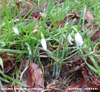
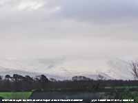

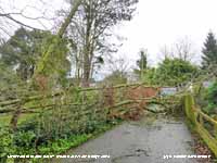


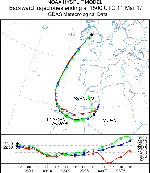

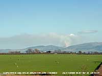


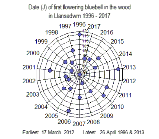
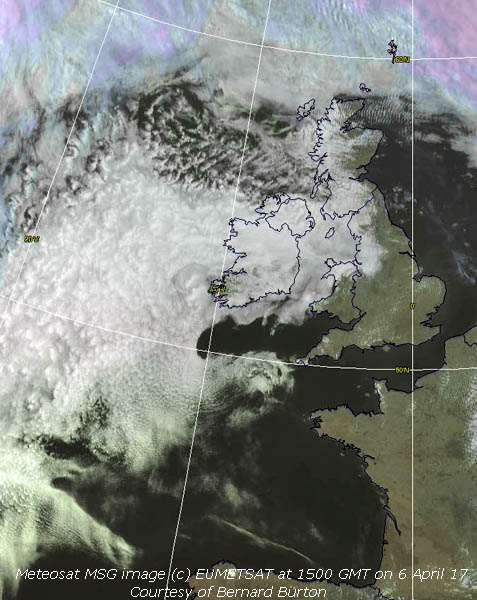
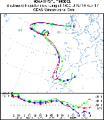
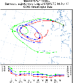
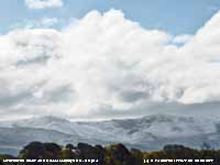
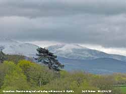
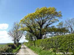

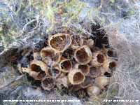

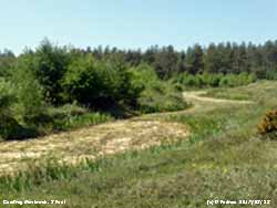
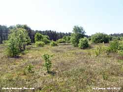

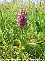
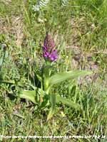

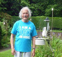

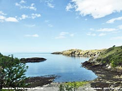
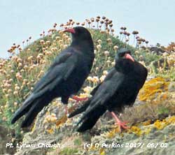
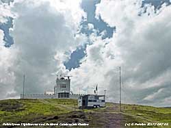
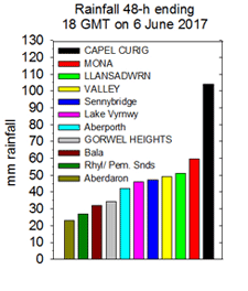 Moderate to heavy rain began at 0200 GMT (heaviest 39 mm/h at 0716 GMT) and by 0900 GMT on the 5th had accumulated 13.2 mm. It was a miserable dull and wet day; more or less continuous light rain with heavy bursts and by 1800 GMT there was another 15.6 mm had fallen 28.8 mm in all. There are many fledgelings around the garden; including sparrows, chaffinches and goldfinches and the wet may be a problem for them although there is shelter in the woodland. Worst hit could perhaps be the parents whose feathers are not in the best of condition at this time of year; the male pheasants looked particularly wet and bedraggled at the end of the afternoon. A yellow warning of heavy rain in Wales had been issued by the Met Office. Natural Resources Wales issued flood alerts for those living close to the river Conwy, the rivers Loughor and Amman, the rivers Gwendraeths, river Glaslyn and river Dwyryd.
An alert has also been issued for north Gwynedd and for the whole of Anglesey. Pressure fell to 987.4 mb at 2242 GMT as the centre of the Welsh low passed over. Rainfall in Llansadwrn since midnight totalled 45.4 mm (Shoeburyness 19.7C Resallach Min 2.7C Capel Curig 68.6 mm Llansadwrn 33.4 mm Manston 8.5h) [Max 14.3 Min 10.6C Rain 37.8 mm]. Another 5.6 mm fell after midnight (heaviest 11.6 mm/h at 0349 GMT) but had eased to a few spots by 0900 GMT on the 6th (D-Day). A very dull, cold and wet morning with a moderate to fresh WSW'ly wind. Rainfall in the event so far had totalled 51.0 mm over 28 hours duration. It was looking a little brighter by 1030 GMT and there was a patch of blue sky at noon, and the afternoon though breezy was mostly sunny (Bournemouth 17.8C Porthmadog 17.0C Okehampton Min 7.0C Edinburgh Bot Garden 65.2 mm Swyddffynnon 36.0 mm Aberdaron 11.1h) [Max 16.2C Min 8.8C Rain 16.0 mm].