
Llansadwrn (Anglesey) Weather
Diary 2006


|
Llansadwrn (Anglesey) Weather
|

|
Where you see these icons click for a pop-up graphic
![]()
![]()
![]()
![]()
![]()
![]()
![]()
Most pop-up graphics in the diary are self closing on next click of mouse. Javascript must be enabled if you are using some pop-up disabling software or a firewall. Please continue to close older graphics on some other pages as usual; they may go into your toolbar if you click something else first. You can click on most thumbnail images to see a larger version.
 1st: A damp rather dismal beginning to the year but it is January after all. Pressure was low 994 mb over the North S and East Anglia. Persistent low cloud was thick enough to give drizzle through the day until just before sunset when the sky began to clear. Along the North Wales coast eastward, from Llandudno to Merseyside and northwards, the sky was clear and it was a mostly sunny day. {Capel Curig 28.2 mm}[Rain 5.5 mm; Max 7.7C; Min 5.6C; Grass 3.5C]
2nd: A ridge of high-pressure, from high 1035 mb W of Iberia, moved across from the W the morning that was bright after clearance of shallow fog across the fields. Fog lingered in the Menai Strait but elsewhere it was mostly sunny. As the cloud lifted off the Carneddau Mountains no trace of snow could be seen, Snowdon remained obscured in cloud. The afternoon turned cloudier as a low 962 mb E of Iceland brought fronts in from the NW by 18 GMT. The wind that was a light NW'ly at first backed S'ly and strengthened to force 4. There was some drizzle before midnight. . [Rain 5.5 mm; Max 9.5C; Min 3.9C; Grass -0.2C]
![]() 3rd: Spells of heavy drizzle after midnight and moderate rain from 0400 to 0830 GMT resulted in 5.5 mm rainfall. At 09 GMT it was calm with fine drizzle in a temperature was 9.1C (100% relative humidity); the moderate fog at 07 GMT was clearing and the soon eased. By afternoon the sky cleared over Anglesey leaving high cirrus clouds and weak 'winter' sunshine. A queen wasp was spotted buzzing along a S-facing hedgerow bank near the weather station! The number of confirmed cases of cryptosporidiosis reached 225, after a slowing of the rate there were just a few more confirmed cases, see graph
3rd: Spells of heavy drizzle after midnight and moderate rain from 0400 to 0830 GMT resulted in 5.5 mm rainfall. At 09 GMT it was calm with fine drizzle in a temperature was 9.1C (100% relative humidity); the moderate fog at 07 GMT was clearing and the soon eased. By afternoon the sky cleared over Anglesey leaving high cirrus clouds and weak 'winter' sunshine. A queen wasp was spotted buzzing along a S-facing hedgerow bank near the weather station! The number of confirmed cases of cryptosporidiosis reached 225, after a slowing of the rate there were just a few more confirmed cases, see graph ![]() . A statement by the Outbreak Control Team (National Public Health Service for Wales) said that 'investigations to date support the view that water from the Cwellyn reservoir is the probable source of the outbreak. Water treatment continues to operate normally and within regulatory standards'. People still receiving water from the Cwellyn Reservoir and told to boil their water 'are advised to keep doing so'. Further investigations are continuing and the Boil Water Notice will be reviewed by 9th January . {Scilly Is. 11.7C, Cardiff MO 11.1C} [Rain 0.2 mm; Max 9.1C; Min 4.3C; Grass 1.6C]
. A statement by the Outbreak Control Team (National Public Health Service for Wales) said that 'investigations to date support the view that water from the Cwellyn reservoir is the probable source of the outbreak. Water treatment continues to operate normally and within regulatory standards'. People still receiving water from the Cwellyn Reservoir and told to boil their water 'are advised to keep doing so'. Further investigations are continuing and the Boil Water Notice will be reviewed by 9th January . {Scilly Is. 11.7C, Cardiff MO 11.1C} [Rain 0.2 mm; Max 9.1C; Min 4.3C; Grass 1.6C]
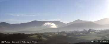
![]() 4th: Clear with mist and fog in low-lying areas overnight. Water deposits had frozen white on grass with the minimum temperature -2.1C, but there was no airfrost. Pressure had risen to 1031 mb and we were in a slot between frontal cloud to the W and SE. It was a clear sunny and calm morning with just a little cloud seen over the Carneddau Mountains at 09 GMT. There was fog over Llyn Ogwen spilling over into the valley at Ogwen Cottage; smoke haze, slight at first, developed more strongly during the morning. By 11 GMT a solitary cloud had formed, possibly over Bethesda, at the lower end of the Nant Ffrancon Pass. The sun rose above the Carneddau at 0858 and set at 1558 GMT, 7 hours of bright sunshine. Sea fog off the Irish Sea moved across NW Anglesey forming cloud over land during the afternoon. The NOAA 18 satellite image shows the finger of cloud over NW Anglesey that moved in off the Irish Sea during the afternoon. There is a cold front to the W of Ireland and remnant layered frontal cloud to the SE.
{Falmouth/Scilly 10C, Eskdalemuir 5.9h} [Rain 0.1/fr mm; Max 7.3C; Min 1.6C; Grass -2.1C] A statement issued today by the Cryptosporidium Outbreak Team confirmed another case brought the total to 226. They said '... new cases of illness are still being diagnosed and we cannot be confident that the risk of infection is no longer present. It is possible that lifting the Boil Water Notice now, could result in a resurgence of cryptosporidiosis cases. And '... has advised Welsh Water to reissue the Boil Water Notice when the current Notice runs out on 9th January. We anticipate that we will be able to lift the Notice within a few weeks'.
4th: Clear with mist and fog in low-lying areas overnight. Water deposits had frozen white on grass with the minimum temperature -2.1C, but there was no airfrost. Pressure had risen to 1031 mb and we were in a slot between frontal cloud to the W and SE. It was a clear sunny and calm morning with just a little cloud seen over the Carneddau Mountains at 09 GMT. There was fog over Llyn Ogwen spilling over into the valley at Ogwen Cottage; smoke haze, slight at first, developed more strongly during the morning. By 11 GMT a solitary cloud had formed, possibly over Bethesda, at the lower end of the Nant Ffrancon Pass. The sun rose above the Carneddau at 0858 and set at 1558 GMT, 7 hours of bright sunshine. Sea fog off the Irish Sea moved across NW Anglesey forming cloud over land during the afternoon. The NOAA 18 satellite image shows the finger of cloud over NW Anglesey that moved in off the Irish Sea during the afternoon. There is a cold front to the W of Ireland and remnant layered frontal cloud to the SE.
{Falmouth/Scilly 10C, Eskdalemuir 5.9h} [Rain 0.1/fr mm; Max 7.3C; Min 1.6C; Grass -2.1C] A statement issued today by the Cryptosporidium Outbreak Team confirmed another case brought the total to 226. They said '... new cases of illness are still being diagnosed and we cannot be confident that the risk of infection is no longer present. It is possible that lifting the Boil Water Notice now, could result in a resurgence of cryptosporidiosis cases. And '... has advised Welsh Water to reissue the Boil Water Notice when the current Notice runs out on 9th January. We anticipate that we will be able to lift the Notice within a few weeks'.
![]()
![]() 5th: The night was partly cloudy around midnight but cleared by dawn. Temperatures fell and reached -4.1C on the grass freezing dewdrops on the grass leaves, but the air temperature minimum was 0.1C at 09 GMT. Overhead the sky was almost clear, but over the mountains there was a deep flat-topped cap cloud obscuring the rising sun. During the morning cloud spilled over the mountains in the SE'ly breeze resulting in a mostly cloudy morning with a little drizzle at times. There were snow flurries across some of the mainland mountain summits during the day leaving slight deposits on the ground. During the afternoon while most of Anglesey was overcast here, in the lee of the mountains, there were holes in the cloud overhead and numerous crepuscular rays. The maximum temperature of 2.5C was lowest of the month. {Scilly Is. 8.5C, Capel Curig 1.3C, Lake Vyrnwy 0.6C}[Rain trace; Max 2.5C; Min 0.1C; Grass -4.1C]
5th: The night was partly cloudy around midnight but cleared by dawn. Temperatures fell and reached -4.1C on the grass freezing dewdrops on the grass leaves, but the air temperature minimum was 0.1C at 09 GMT. Overhead the sky was almost clear, but over the mountains there was a deep flat-topped cap cloud obscuring the rising sun. During the morning cloud spilled over the mountains in the SE'ly breeze resulting in a mostly cloudy morning with a little drizzle at times. There were snow flurries across some of the mainland mountain summits during the day leaving slight deposits on the ground. During the afternoon while most of Anglesey was overcast here, in the lee of the mountains, there were holes in the cloud overhead and numerous crepuscular rays. The maximum temperature of 2.5C was lowest of the month. {Scilly Is. 8.5C, Capel Curig 1.3C, Lake Vyrnwy 0.6C}[Rain trace; Max 2.5C; Min 0.1C; Grass -4.1C]
6th: Enough clear sky in the night to allow the temperature on the grass to fall to -5.2C freezing water deposits. Another air frost too, but by 09 GMT the temperature had risen to 0.8C with the dewpoint on -0.9C. Pressure was 1022 mb in a col between Azores-high 1030 mb and large high 1042 mb E of the Baltic. The day was mostly cloudy with extensive stratiform cloud sheets covering most of Britain and much of Europe. [Rain 0.0 mm; Max 3.0C; Min -1.2C; Grass -5.2C]
![]() 7th: A bright morning with clear sky to the W and dark cloud to the E. In a slight SE'ly wind altocumulus clouds that were overhead dispersed to give a sunny morning. A streak of clear sky (see satellite image) developed from Snowdon over Anglesey across the Irish Sea to Dundalk Bay, Ireland. The afternoon was a bit cloudier as the open streak closed over. In southern, south-west and central Britain a vortex of thick cloud in a pool of cold air brought sleet to many and 1-2 cm snow in places including the Cotswolds and Birmingham. A patch of thin cloud here in the evening did not produce any precipitation and the sky cleared again later. {Jersey 6.7 h, Valley 4 h, Scilly Is. 6.9C, Boulmer 3.8 mm, Hawarden 3.0 mm}} [Rain 0.0 mm; Max 5.8C; Min 0.7C; Grass -0.4C]
7th: A bright morning with clear sky to the W and dark cloud to the E. In a slight SE'ly wind altocumulus clouds that were overhead dispersed to give a sunny morning. A streak of clear sky (see satellite image) developed from Snowdon over Anglesey across the Irish Sea to Dundalk Bay, Ireland. The afternoon was a bit cloudier as the open streak closed over. In southern, south-west and central Britain a vortex of thick cloud in a pool of cold air brought sleet to many and 1-2 cm snow in places including the Cotswolds and Birmingham. A patch of thin cloud here in the evening did not produce any precipitation and the sky cleared again later. {Jersey 6.7 h, Valley 4 h, Scilly Is. 6.9C, Boulmer 3.8 mm, Hawarden 3.0 mm}} [Rain 0.0 mm; Max 5.8C; Min 0.7C; Grass -0.4C]
 8th: With a clear sky after midnight temperatures fell to -2.2C in the air, lowest of the month, and -6.2C on the grass, 2nd lowest. Deposition of hoar frost was a net equivalent of 0.35 mm measured by lysimeter. It was a sunny day in an almost cloudless sky with RAF Valley reporting 6.1h. Moderate smoke haze in the morning thickened during the afternoon with reducing visibility. There were new-born lambs on nearby fields
 ![]() . The night was clear and frosty. {Valley 6.1 h, Barra (Outer Hebrides) 7.3C, Capel Curig -5.9, Swanage ( Dorset) 9.5 mm} [Rain 0.0 mm; Max 3.5C; Min -2.2C; Grass -6.2C]
. The night was clear and frosty. {Valley 6.1 h, Barra (Outer Hebrides) 7.3C, Capel Curig -5.9, Swanage ( Dorset) 9.5 mm} [Rain 0.0 mm; Max 3.5C; Min -2.2C; Grass -6.2C]
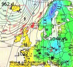
9th: Another bright and frosty morning with a heavier 0.53 mm net deposition of dew and frost. Almost a clear sky at 09 GMT with a few lenticular clouds over and S the Snowdonia Mountains. But cirrostratus and stratiform low in the W, associated with frontal cloud over Ireland, was encroaching. Heavy rain moved into W Ireland and W Scotland by 11 GMT along with strengthening winds to the N. Pressure was 1026 mb with lows 962 mb Iceland and 1022 mb Brittany. Pressure was high over most of N and SE Europe. The morning here was sunny at first with amounts of cirrus increasing, it was calm at 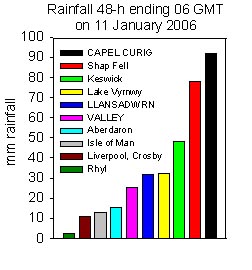 first then a light SSE/SSW wind set in later. The temperature at 11 GMT was 3.0C still in sunshine but 1300 GMT it was overcast with moderately high cloud. At 15 GMT the cloud was thicker and the temperature was 4.3C and thereafter began a further slow rise through to the night. There was a little light rain from about 22 GMT. The number of confirmed cases of cryptosporidiosis reached 230, see graph
 ![]() . Many inhabitants in S Anglesey and parts of Gwynedd have been advised to continue boiling tap water. [Rain 13.0 mm; Max 8.9C; Min -2.0C; Grass -5.6C]
. Many inhabitants in S Anglesey and parts of Gwynedd have been advised to continue boiling tap water. [Rain 13.0 mm; Max 8.9C; Min -2.0C; Grass -5.6C]
![]()
![]() .
10th: There was continuous moderate to heavy rain with a rising temperature through to 8.9C at 09 GMT. The 18.6 mm 24-h 09-09 GMT rainfall was the highest of the month. Pressure 1012 mb was falling with Atlantic-low 976 mb W of Ireland. A frontal triple-point had passed over the Irish Sea and the rain continued through the morning. The SW'ly wind was force 6 to 7 at times and visibility was poor. The soil that had been near saturation point was quickly saturated and water was standing. Thick cloud persisted during the sunless day resulting in low solar radiation (only 0.3 mv h some 1/100th of that received in a day in summer)so it was a lights on day at the weather station. Rainfall for the 24-h 18-18 GMT was 21.5 mm but it was much wetter in Snowdonia with Capel Curig reporting 62.8 mm. It was drier in the evening, but windier the SW'ly reaching near gale 7 to gale-force 8 at times. The NOAA 18 satellite image shows the vigorous deepening low NW of Scotland with thick cloud enveloping the British Isles. {Capel Curig 62.8 mm, Machrihanish, Scotland 13.7C} [Rain 18.6 mm; Max 10.5C; Min -0.5C; Grass -3.5C]
.
10th: There was continuous moderate to heavy rain with a rising temperature through to 8.9C at 09 GMT. The 18.6 mm 24-h 09-09 GMT rainfall was the highest of the month. Pressure 1012 mb was falling with Atlantic-low 976 mb W of Ireland. A frontal triple-point had passed over the Irish Sea and the rain continued through the morning. The SW'ly wind was force 6 to 7 at times and visibility was poor. The soil that had been near saturation point was quickly saturated and water was standing. Thick cloud persisted during the sunless day resulting in low solar radiation (only 0.3 mv h some 1/100th of that received in a day in summer)so it was a lights on day at the weather station. Rainfall for the 24-h 18-18 GMT was 21.5 mm but it was much wetter in Snowdonia with Capel Curig reporting 62.8 mm. It was drier in the evening, but windier the SW'ly reaching near gale 7 to gale-force 8 at times. The NOAA 18 satellite image shows the vigorous deepening low NW of Scotland with thick cloud enveloping the British Isles. {Capel Curig 62.8 mm, Machrihanish, Scotland 13.7C} [Rain 18.6 mm; Max 10.5C; Min -0.5C; Grass -3.5C]
 11th: The sky started to clear at dawn and pressure 1016 mb was rising as a small ridge of high-pressure moved across from the W. Yesterday's low was 945 mb over the Norwegian Sea and the fronts were over the Baltic, Low Countries and France. Britain enjoyed almost unbroken sunshine although north-west Scotland had heavy showers generated from convective clouds moving in from the Atlantic. The night was clear at first but was cloudier and windier by midnight. {Tenby 11C, Fishguard 6.9h}[Rain trace; Max 9.1C; Min 4.4C; Grass 1.0C]
![]()
![]() 12th: A bright but windy morning with the S'ly near gale (force 7). A deep cap cloud hung over the Snowdonia Mountains with lenticular clouds in the lee SE of here over the Menai Strait, while overhead there were bands of cirrocumulus undulatus high above lower cloud layers. Pressure 1016 mb was falling slowly with the next low in line over Iceland at 952 mb. Isobars were packed tightly to the NW where winds were strongest; Benbecula in the Outer Hebrides reported 51 mph mean wind speed (force 9) between 12 and 13 GMT. Frontal cloud was edging in from the W and there was rain over W Ireland and NW Scotland by noon but we just had a few spots here. The afternoon became overcast with a few more spots of rain as the wind strengthened to gale force 8 soon after 1500 GMT. It was a windy night mostly pushing gale force 7. {Ballykelly 12.5C, Loch Glascarnoch 15.6 mm} [Rain trace; Max C; Min 3.8C; Grass 0.2C]
12th: A bright but windy morning with the S'ly near gale (force 7). A deep cap cloud hung over the Snowdonia Mountains with lenticular clouds in the lee SE of here over the Menai Strait, while overhead there were bands of cirrocumulus undulatus high above lower cloud layers. Pressure 1016 mb was falling slowly with the next low in line over Iceland at 952 mb. Isobars were packed tightly to the NW where winds were strongest; Benbecula in the Outer Hebrides reported 51 mph mean wind speed (force 9) between 12 and 13 GMT. Frontal cloud was edging in from the W and there was rain over W Ireland and NW Scotland by noon but we just had a few spots here. The afternoon became overcast with a few more spots of rain as the wind strengthened to gale force 8 soon after 1500 GMT. It was a windy night mostly pushing gale force 7. {Ballykelly 12.5C, Loch Glascarnoch 15.6 mm} [Rain trace; Max C; Min 3.8C; Grass 0.2C]
13th: Overcast but dry in the continuing near gale force 7 S'ly. Evaporation during the past 24-h from the Piche tube was 3.1 mm. At 09 GMT pressure was 1013 mb with low 971 mb Iceland with fronts in a trough W of Ireland. The temperature was 10.3C (dewpoint 5.8C and RH 73%) having just recorded a maximum of 10.8C, the highest of the month. There was heavy rain in central Scotland ongoing from yesterday on the slow-moving front and patchy light rain Ireland and Irish Sea SW of Anglesey. The wind was strongest around noon reaching gale force 8 before slowly moderating. With the front edging E rain got heavier in mid and S Wales during the afternoon but here, in the lee of the mountains, it was intermittently slight. There was light rain here from 1915 GMT through until 0400 GMT. {Aultbea 2.2C, Tulloch Bridge 26.2 mm} [Rain 7.3 mm; Max 10.8C; Min 7.2C; Grass 6.0C]
![]() 14th: After a little showery rain between 07 and 08 GMT the sky stated to clear quickly as a clear slot moved across from the W. Visibility was good although slightly misty with a line of stratocumulus clouds over Snowdonia and far out over the Irish Sea. After an absence of snow on the mountains for a few days there was a fresh fall seen at 3000 ft, but it did not last. Pressure 1017 mb was rising again in a transient ridge; high 1040 mb was still to the E while another Atlantic low 974 mb and fronts were moving in W of Ireland. The day was sunny with clear sky into the evening. The Meteosat MSG satellite image at noon shows western parts in a clear slot between frontal systems. There are some weak convective clouds over mountain parts of Wales, S Scotland and NW England and marine convection S of Ireland and Bristol Channel. . {Mumbles 10.3C, Bodmin 20.4 mm, Capel Curig 14.2 mm}[Rain 0.0 mm; Max 8.3C; Min 4.8C; Grass 2.2C]
14th: After a little showery rain between 07 and 08 GMT the sky stated to clear quickly as a clear slot moved across from the W. Visibility was good although slightly misty with a line of stratocumulus clouds over Snowdonia and far out over the Irish Sea. After an absence of snow on the mountains for a few days there was a fresh fall seen at 3000 ft, but it did not last. Pressure 1017 mb was rising again in a transient ridge; high 1040 mb was still to the E while another Atlantic low 974 mb and fronts were moving in W of Ireland. The day was sunny with clear sky into the evening. The Meteosat MSG satellite image at noon shows western parts in a clear slot between frontal systems. There are some weak convective clouds over mountain parts of Wales, S Scotland and NW England and marine convection S of Ireland and Bristol Channel. . {Mumbles 10.3C, Bodmin 20.4 mm, Capel Curig 14.2 mm}[Rain 0.0 mm; Max 8.3C; Min 4.8C; Grass 2.2C]
15th: Progress of western fronts was slow up against high-pressure to the E. Patchy cloudy moved over after midnight but it was a bright dawn with some clear sky overhead and lenticular clouds in the lee of the mountains. At 09 GMT cloud cover was 6/8th with very good visibility in relatively dry air (64% RH) in a temperature of 7.2C. Pressure 1009 mb was falling with the twin lows 972 mb N and 990 mb S lying W of Ireland. Isobars were once again packing tight and as the sky became cloudier during the morning the S'ly wind strengthened from force 4 to force 6. There were a few spots of rain during the afternoon as cloud thickened this turning to slight showers during the evening. It was cold in the Scottish Highlands with snow on mountains and continued wet in SW England. {Scilly Is. 11.2C, Cairngorm Mountain -4.6C, Aboyne -3.6C; Bodmin 16.6 mm} [Rain 4.7 mm; Max 9.0C; Min 4.7C; Grass 1.3C]
Mid month the mean temperature was 5.0C -0.5 of average, with 4 air frosts and 8 ground frosts, the averages for the month are 5 and 13. Rainfall so far, 54.9 mm 57% of the month's average..
![]() 16th: There was a spell of moderate rain from 0500 GMT until 0800 GMT when it turned to drizzle. At 09 GMT the rain was dying out and the low stratus cloud was starting to lift. Visibility that had been poor (2 km) was moderate (4 km). Pressure 1005 mb was rising and there was little or no wind. Cloud thinned during the morning and by noon some holes appeared to give a bright and sunny afternoon. After 15 GMT frontal cloud encroached from the W associated with a frontal low 997 mb NW of Ireland. There was light rain from 1615 GMT which turned moderate to heavy before ceasing at 2000 GMT. At midnight the low 999 mb was near Valentia, SW Ireland tracking SE. {Bournemouth 10.7C, Stornoway 21.2 mm, Capel Curig 14.0 mm} [Rain 7.3 mm; Max 6.7C; Min 6.1C; Grass 5.5C]
16th: There was a spell of moderate rain from 0500 GMT until 0800 GMT when it turned to drizzle. At 09 GMT the rain was dying out and the low stratus cloud was starting to lift. Visibility that had been poor (2 km) was moderate (4 km). Pressure 1005 mb was rising and there was little or no wind. Cloud thinned during the morning and by noon some holes appeared to give a bright and sunny afternoon. After 15 GMT frontal cloud encroached from the W associated with a frontal low 997 mb NW of Ireland. There was light rain from 1615 GMT which turned moderate to heavy before ceasing at 2000 GMT. At midnight the low 999 mb was near Valentia, SW Ireland tracking SE. {Bournemouth 10.7C, Stornoway 21.2 mm, Capel Curig 14.0 mm} [Rain 7.3 mm; Max 6.7C; Min 6.1C; Grass 5.5C]
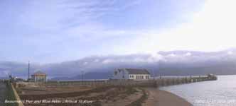 17th: Light showers of rain and drizzle at 0230 and 0730 GMT. At 09 GMT pressure 1003 mb was rising and soon after the sky started to clear as the cloud mass associated with triple point frontal low 1001 mb near the Bristol Channel. The photograph shows the rear of the cloud mass moving SE having cleared the Menai Strait at Beaumaris. The morning was mostly sunny with a light NW'ly breeze. The afternoon was cloudier, with a slight shower at 1500 GMT and, although this soon passed and there was a glimpse of the sun as it was setting, it remained mostly cloudy. During the evening there was drizzle and light rain then moderate rain from 2000 to 0030 GMT that was not indicated on rainfall radar. {Valentia, SW Ireland 11.5, Cairngorm -6.0C, Fishguard 3.3h} [Rain 5.0 mm; Max 10.0C; Min 5.8C; Grass 4.2C]
18th: As the rain ceased at 02 GMT the temperature rose to 10C in warm sector air and hovered within a few points through until morning. A slow-moving warm front was lying over N Ireland, Anglesey to SW England and it was misty with moderate visibility under the low stratus cloud sheet. Pressure 1014 mb was rising; the morning had a little fine drizzle at first and although the afternoon was dry the day was sunless. The NOAA 18 visible spectrum image, in the Bay of Biscay and off the coast of the Iberian Peninsula and Gibraltar Strait, shows ship trails within the marine stratiform cloud layers. Ship trails (tracks) occur when particles are emitted in smoke from large ships running on diesel
oil. ![]() The particles (aerosols) attract water molecules that act as seeds for cloud formation, it is called droplet nucleation, and become trapped within a moist stable layer. As the ships move across the sea they leave the trail that can be seen on visible and infra-red satellite images in air which is already cloudy . Slow ships tend to leave a wide track, faster ships leave a narrower track. The trail can be affected by wind and may not always correctly indicate the track of the ship but, under the right conditions as here, the trails are remarkably stable. Trails may also form in clear skies when the air is near saturation (with water vapour) in which case the trails can only be seen in the visible spectrum. {Great Malvern 13.9C, Malin Head 16.0 mm, Capel Curig 14.6 mm} [Rain 0.3 mm; Max 10.5C; Min 6.0C; Grass 3.5C]
The particles (aerosols) attract water molecules that act as seeds for cloud formation, it is called droplet nucleation, and become trapped within a moist stable layer. As the ships move across the sea they leave the trail that can be seen on visible and infra-red satellite images in air which is already cloudy . Slow ships tend to leave a wide track, faster ships leave a narrower track. The trail can be affected by wind and may not always correctly indicate the track of the ship but, under the right conditions as here, the trails are remarkably stable. Trails may also form in clear skies when the air is near saturation (with water vapour) in which case the trails can only be seen in the visible spectrum. {Great Malvern 13.9C, Malin Head 16.0 mm, Capel Curig 14.6 mm} [Rain 0.3 mm; Max 10.5C; Min 6.0C; Grass 3.5C]
19th: Overcast with low grey stratus. With pressure on 1016 mb the warm moist SW'ly airflow continued with temperatures within a few points of 10C for the past 48-h. The minimum temperature of 9.4C and the day's mean of 9.9C were highest of the month. A sunless day and brightness was low under the thick cloud. All stations reported sunless or <1 h of sunshine. With strengthening SW'ly wind there was slight rain and drizzle from 1630 GMT. The wind was gale force 8 each side of midnight. {Kinloss 13.9C, Isle of Skye 38.3 mm, Herne Bay, Kent 0.8h} [Rain 6.7 mm; Max 10.4C; Min 9.4C; Grass 8.6C]
![]()
![]() 20th: Pressure was lowest 1005 mb about 02 GMT and a cold front past over at 0300 GMT accompanied by heavy rain (5.5 mm) and a few small ice pellets. The temperature fell from 10.2C, close to the maximum, by 3C rapidly then more slowly to the minimum of 4.4C. With the weakening cold front over the Midlands and SW England the sky was clearing from 07 GMT and by 09 GMT was 2/8th covered with convective cumulus clouds.
20th: Pressure was lowest 1005 mb about 02 GMT and a cold front past over at 0300 GMT accompanied by heavy rain (5.5 mm) and a few small ice pellets. The temperature fell from 10.2C, close to the maximum, by 3C rapidly then more slowly to the minimum of 4.4C. With the weakening cold front over the Midlands and SW England the sky was clearing from 07 GMT and by 09 GMT was 2/8th covered with convective cumulus clouds.
 Pressure had risen to 1012 mb and the wind veered W'ly was force 5. There were wintry showers across the summits of the Snowdonia Mountains that were mostly obscured by cloud and mist. Some very low temperatures in E Europe and Russia were reported. Omyakyon in Siberia reported -54C and it was -35C in Moscow and Helsinki, Finland -16C. At 09 GMT it was 4.7C here rising to 7.0C at noon when, although a little cloudier, was mostly sunny. The afternoon in S Anglesey was mostly cloudy; the clear sky in the N of the island spread here in the evening giving a mostly clear night. {London MO 11.3C, Aultbea 26.6 mm, Valley 5.9h} [Rain 0.0 mm; Max 8.2C; Min 4.4C; Grass 1.8C]
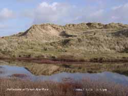
21st: With the temperature on the grass falling to -1.5C deposits of water including dew had frozen by morning. Pressure 1029 mb was rising as as a ridge from Biscay high 1031 mb moved across from the W. Visibility was 3 km and the mountains were obscured. The day was mostly sunny with a light NW'ly breeze. At this time of year the water table is high in dune systems and close to the surface of many slacks. Pools of slightly brackish water can be seen in some low areas as here at Tywyn Aberffraw.{Swanage, Dorset 7.5h, Milford Haven 11.5C} [Rain 0.0 mm; Max 9.9C; Min 2.6C; Grass -1.5C]
22nd: After a mostly clear night there was a veil of thin high altostratus at 09 GMT. Dew had frozen white on the grass. Pressure was 1034 mb within a ridge from Baltic-high 1044 mb. There were fronts lying to the NW, it was raining in the far NW of Scotland but on this occasion did not reach here. The day here was bright with a little clear sunshine in the morning. In the afternoon the sun was mostly obscured by the thin cloud, but remained visible. There were no halos seen as it was the 'wrong type of cloud'. The night too was mostly overcast with thin cloud. {Isle of Skye 21.7 mm, Scilly Is 10.8C, Weymouth 6.7h, Valley 0.1h} [Rain 0.0 mm; Max 7.5C; Min 2.2C; Grass -1.4C]
23rd: Another bright morning with a slight ground frost. Pressure was 1035 mb and the temperature 2.5C at 09 GMT. The wind was a light SE'ly and many birds were singing in the wood including the early nesting mistle thrush and a great tit. It is too early to nest yet, but territories have to be established. The greater spotted woodpeckers were also heard drumming. The cloud dispersed during the middle of the day but it turned cloudier again later. {Prestatyn 4.8h, Machrihanish 10C} [Rain 0.0 mm; Max 6.7C; Min 1.9C; Grass -1.5C]
24th: A cloudy and calm morning. The cloud was drifting from the NE, but on the ground smoke was rising vertically, a useful indicator at this time of year there being no leaves on the trees to rustle. My 'heavy' cup counter anemometer is not a good indicator of calm conditions; it takes a reasonable amount of wind to set it turning. Being overcast there was no frost here overnight but it was frosty in central and S England with air temperatures between -4 and -6C. Pressure was 1031 mb with a ridge of high-pressure 1026 mb between Iceland and Scotland. Frontal cloud was lying over the N of Scotland and moderately high cloud affected the Irish Sea and North Wales resulting in a sunless day. {Guernsey 7.8h, Barra, Outer Hebrides 11C} [Rain 0.0 mm; Max 5.5C; Min 2.5C; Grass 0.0C]

![]() 25th: Pressure was high 1035 mb to the N over the Faeroes and but frontal cloud, associated with a low 1015 mb over the S Baltic, was lying from the Western Isles over the Irish Sea through to the Midlands over the North Sea. This moved S during the day mostly clearing Anglesey in the afternoon. The wind was NE'ly and showers of rain were being blown on to the E coast of England. Here in the W it kept dry and with some good sunshine the temperature rose to 7.1C. The night had some clear spells. The Meteosat MSG image (c) EUMETSAT shows the frontal cloud over southern Britain at noon with the shallow low over Denmark and Germany, where there was snow, and convective showers of rain off the North Sea affected E England. . {Newquay, Cornwall 8.3h, Barra 9C, Redhill -9C, Valley 4.3h} [Rain 0.0 mm; Max 7.1C; Min 1.7C; Grass -0.5C]
25th: Pressure was high 1035 mb to the N over the Faeroes and but frontal cloud, associated with a low 1015 mb over the S Baltic, was lying from the Western Isles over the Irish Sea through to the Midlands over the North Sea. This moved S during the day mostly clearing Anglesey in the afternoon. The wind was NE'ly and showers of rain were being blown on to the E coast of England. Here in the W it kept dry and with some good sunshine the temperature rose to 7.1C. The night had some clear spells. The Meteosat MSG image (c) EUMETSAT shows the frontal cloud over southern Britain at noon with the shallow low over Denmark and Germany, where there was snow, and convective showers of rain off the North Sea affected E England. . {Newquay, Cornwall 8.3h, Barra 9C, Redhill -9C, Valley 4.3h} [Rain 0.0 mm; Max 7.1C; Min 1.7C; Grass -0.5C]
![]()
![]() 26th: With the sky clearing from dawn the temperature on the grass dropped to -3.3C but the air temperature kept just above zero. Pressure was 1029 mb with high 1034 mb N Scotland to S Norway. The day was sunny in Anglesey with a light to moderate E'ly wind. Cloud kept to the E and persisted over the mountains of Snowdonia where there were snow showers across the summits. A sprinkling of snow was seen lying above 2750 ft early in the afternoon. Sunny until evening with the sky turning a beautiful dark-peach and azure blue colour after sunset. Later cloud returned. {Newquay 8.2h, Valley 6.6h, Hawarden -3.3C min} [Rain 0.0 mm; Max 6.6C; Min 0.3C; Grass -3.3C]
26th: With the sky clearing from dawn the temperature on the grass dropped to -3.3C but the air temperature kept just above zero. Pressure was 1029 mb with high 1034 mb N Scotland to S Norway. The day was sunny in Anglesey with a light to moderate E'ly wind. Cloud kept to the E and persisted over the mountains of Snowdonia where there were snow showers across the summits. A sprinkling of snow was seen lying above 2750 ft early in the afternoon. Sunny until evening with the sky turning a beautiful dark-peach and azure blue colour after sunset. Later cloud returned. {Newquay 8.2h, Valley 6.6h, Hawarden -3.3C min} [Rain 0.0 mm; Max 6.6C; Min 0.3C; Grass -3.3C]
27th: It was mostly cloudy overnight with a minimum air temperature of 1.8C. At 09 GMT pressure was unchanged with high 1035 mb centred over the Western Isles NW of here. Initially it was dry with very good visibility, later showers were driven off Liverpool Bay on to the North Wales coast on the NNE'ly wind. Anglesey had slight rain showers but the mountaintops of Snowdonia had snow flurries, light snow showers and displays of crepuscular rays. Sprinklings of snow were lying above 2900 ft on the eastern Carneddau Mountains and around Snowdon. Showers continued through the night. The first flowers of the common sallow (pussy willow) were seen opening along the A5025 near Four Crosses. In years' past this might have been thought early, but now with rising temperatures occurs more often. {Valley 7.2C} [Rain 0.3 mm; Max 6.1C; Min 1.1C; Grass -1.2C]
![]() 28th: Mostly cloudy overnight with spells of drizzle or light rain, and a little snow on the mountaintops, with a weak cold front moving unusually W across Wales. But the sky cleared at dawn and the temperature on the grass dropped to -0.3C, not low enough to give silver frost with dew drops being supercooled but unfrozen. Pressure was steady on 1029 mb with the Scottish high 1033 mb to the N. The day was sunny with good visibility obscured by smoke haze with the highest summits of Snowdonia just in the clear. Valley reported 7.8 h of sunshine. It was a clear night with bright stars. With insignificant rainfall since the 20th soil moisture was 65% (dry mass), just 5% below the saturated water percentage for the soil. There has been little evapotranspiration this month, significant dew and frost depositions more than balanced any losses. [Rain 0.0 mm; Max 5.4C; Min 2.5C; Grass -0.3C]
28th: Mostly cloudy overnight with spells of drizzle or light rain, and a little snow on the mountaintops, with a weak cold front moving unusually W across Wales. But the sky cleared at dawn and the temperature on the grass dropped to -0.3C, not low enough to give silver frost with dew drops being supercooled but unfrozen. Pressure was steady on 1029 mb with the Scottish high 1033 mb to the N. The day was sunny with good visibility obscured by smoke haze with the highest summits of Snowdonia just in the clear. Valley reported 7.8 h of sunshine. It was a clear night with bright stars. With insignificant rainfall since the 20th soil moisture was 65% (dry mass), just 5% below the saturated water percentage for the soil. There has been little evapotranspiration this month, significant dew and frost depositions more than balanced any losses. [Rain 0.0 mm; Max 5.4C; Min 2.5C; Grass -0.3C]

![]() 29th: With clear skies it was a sunny morning after the sun rose over the Carneddau Mountains at 0828 GMT. There was slight hoar frost with the grass minimum down to -2.5C. At 09 GMT the temperature was 0.8C but on the summit of Snowdon the AWS was indicating 3.8C, the temperature inversion resulting in the mountaintops above 2000 ft being clearer out of the smoke haze. It was sunny all day; the sun set at 1650 GMT and the now increasing amounts of solar radiation 599 mv h. Valley reported another 7.8 h sunshine, the highest of the month . It was a clear frosty night. The MODIS AQUA visible spectrum satellite image shows Wales on the almost clear afternoon. The greyish haze seen over water is pollution 'smoke' that reduced visibility on the ground during the day. The tan coloration in the Bristol Channel, Severn, Dee and Mersey Estuaries is a combination of sediment washed down the rivers and microscopic marine organisms.{Tenby 8.2h, Valley 7.8h}[Rain 0.0 mm; Max 6.6C; Min 0.4C; Grass -2.5C]
29th: With clear skies it was a sunny morning after the sun rose over the Carneddau Mountains at 0828 GMT. There was slight hoar frost with the grass minimum down to -2.5C. At 09 GMT the temperature was 0.8C but on the summit of Snowdon the AWS was indicating 3.8C, the temperature inversion resulting in the mountaintops above 2000 ft being clearer out of the smoke haze. It was sunny all day; the sun set at 1650 GMT and the now increasing amounts of solar radiation 599 mv h. Valley reported another 7.8 h sunshine, the highest of the month . It was a clear frosty night. The MODIS AQUA visible spectrum satellite image shows Wales on the almost clear afternoon. The greyish haze seen over water is pollution 'smoke' that reduced visibility on the ground during the day. The tan coloration in the Bristol Channel, Severn, Dee and Mersey Estuaries is a combination of sediment washed down the rivers and microscopic marine organisms.{Tenby 8.2h, Valley 7.8h}[Rain 0.0 mm; Max 6.6C; Min 0.4C; Grass -2.5C]
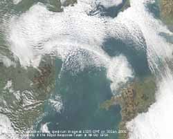 30th: Air frost of -1.8C and on the grass down to -6.5C, lowest of the month. There had been a deposition of hoar frost (water equivalent 0.29 mm) the crystals evident on fallen tree leaves and plants. The temperature inversion was stronger with the Snowdon summit AWS reporting 6.8C at 09 GMT, it was -1.2C here and -2.2C in Llanberis (readings courtesy of First Hydro). The summit station reported a maximum of 7.8C during the day. There was moderate smoke haze and some fog and cloud was forming in the Menai Strait. Pressure was 1032 mb with the anticyclone 1035 mb just offshore at Newcastle. It was a sunny morning the frost lingering in areas not receiving direct sunlight. By the afternoon cloud had enveloped Anglesey and was joined to Ireland by a rope-like cloud (see satellite image), the mainland remained in the clear. During the evening the sky cleared and there was frost. After reaching a total of 231 confirmed cases of Cryptosporidiosis in parts of Gwynedd and Anglesey with water supplied from the Cwellyn Reservoir the Boil Water Notice has been withdrawn. Although the exact source of the infection has not been identified with certainty, new equipment using ultraviolet light to kill the organisms has been installed at the reservoir. Householders received a cheque for £25 in compensation for the extra cost of water boiling. [Rain 0.0 mm; Max 6.7C; Min -1.8C; Grass -6.5C]
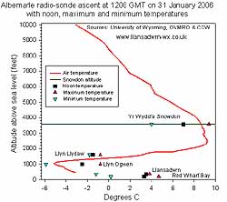
![]() 31st: Cloud returned after midnight and by morning the temperature had risen to 2.2C and there was no trace of last evening's frost. On the mountains there had been a hard frost. The AWS at Llyn Ogwen (993 ft), courtesy of OVMRO, recorded temperatures of -5.9C with frost still on the ground at 09 GMT. Pressure 1028 mb had fallen a little the anticyclone 1030 mb centred over the Wash had up-anchored and was moving S. The morning was calm and overcast with visibility just moderate in haze. The afternoon too was cloudy, but there was a light SE'ly breeze. The temperature inversion was still in place, the Snowdon AWS reported 5.8C at 09 GMT rising to a maximum of 9.4C in the afternoon with the summit in clear sunshine most if not all of the day (see webcam image taken the Elidir Fach webcam courtesy of First Hydro). The day was sunless on Anglesey with a maximum temperature of 3.8C, 3rd lowest of the month; the sky kept overcast into the night.
The radiosonde ascent at 1200 GMT at Albemarle, near Newcastle (see graphic), shows the temperature inversion together with noon, maximum and minimum temperatures recorded at some local stations courtesy of OVMRO, CCW and Keith Ledson (RWB). The temperatures on the summit of Snowdon, including the minimum, exceeded those at other stations shown. Temperatures shown at the stations at different altitude closely follow the inversion recorded by the radiosonde. The maximum temperature of 9.2C on Great Dun Fell, Cumbria, was similar to that on Snowdon. {Snowdon, summit 9.4C; Fishguard, Pembrokeshire 7.9h} [Rain 0.0 mm; Max 3.8C; Min -1.2C; Grass -4.7C]
31st: Cloud returned after midnight and by morning the temperature had risen to 2.2C and there was no trace of last evening's frost. On the mountains there had been a hard frost. The AWS at Llyn Ogwen (993 ft), courtesy of OVMRO, recorded temperatures of -5.9C with frost still on the ground at 09 GMT. Pressure 1028 mb had fallen a little the anticyclone 1030 mb centred over the Wash had up-anchored and was moving S. The morning was calm and overcast with visibility just moderate in haze. The afternoon too was cloudy, but there was a light SE'ly breeze. The temperature inversion was still in place, the Snowdon AWS reported 5.8C at 09 GMT rising to a maximum of 9.4C in the afternoon with the summit in clear sunshine most if not all of the day (see webcam image taken the Elidir Fach webcam courtesy of First Hydro). The day was sunless on Anglesey with a maximum temperature of 3.8C, 3rd lowest of the month; the sky kept overcast into the night.
The radiosonde ascent at 1200 GMT at Albemarle, near Newcastle (see graphic), shows the temperature inversion together with noon, maximum and minimum temperatures recorded at some local stations courtesy of OVMRO, CCW and Keith Ledson (RWB). The temperatures on the summit of Snowdon, including the minimum, exceeded those at other stations shown. Temperatures shown at the stations at different altitude closely follow the inversion recorded by the radiosonde. The maximum temperature of 9.2C on Great Dun Fell, Cumbria, was similar to that on Snowdon. {Snowdon, summit 9.4C; Fishguard, Pembrokeshire 7.9h} [Rain 0.0 mm; Max 3.8C; Min -1.2C; Grass -4.7C]
Rainfall for the month totalled 74.6 mm (78%) of average and there were 15 dry days (+7). Temperatures finished a little below the 10-y average with the mean 5.1C (-0.5), but it was a little above [+0.2] based on the 1971-2000 climatological average.
1st: A blanket of cloud overnight ensured that the temperatures did not fall below zero. Pressure 1023 mb had fallen a little as the high 1030 mb moved slowly SE over Europe. The wind was a light SE'ly and visibility was mostly poor in the haze through the day, that again was sunless. The day's maximum of 4.1C was the lowest of the month. {Scilly Is. 9.9C, Altnaharra -10.6C, Kinloss 6.7h} [Rain 0.0 mm; Max 4.1C; Min 1.0C; Grass 0.5C]
2nd: With the persistent cloud cover the temperature range was small and there was no frost again here. Where the cloud cleared in parts of Scotland and England some low temperatures were recorded. Pressure 1022 mb remains steady with the anticyclone over Britain and Europe little changed keeping the Atlantic lows well to the W. With cloud trapped within the high the day was overcast, with an almost featureless grey stratus; visibility was moderate in thick haze. It was sunless here but a bright patch did appear under a hole in the cloud on the N flank of the Carneddau Mountains and persisted during the afternoon. A few flakes of snow were reported in central London, small flakes in Wallingford and ice needles 400 ft up SW of the Wash. Otherwise not a lot of interest in the anticyclonic gloom in the S; Scotland seemed to have interesting extremes {Aberdeen 6.2h, Macrihanish 11.0C, Glenlivet -9.2. [Rain 0.0 mm; Max 5.5C; Min 1.6C; Grass 1.4C]
![]()
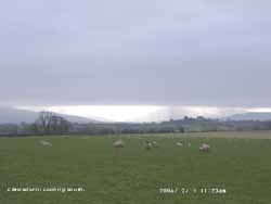 3rd: Another cloudy day but the cloud had more structure visible overhead. Nevertheless it was 8/8th again at the weather station all day and sunless. Pressure was 1026 mb in the high centred over the Irish Sea. During the day some holes appeared in the cloud over Snowdonia where there were some bright spells with glimpses of sunshine. Anglesey remained enveloped in cloud through into the night. [Rain 0.0 mm; Max 6.7C; Min 2.4C; Grass 2.1C]
4th: A clearer spell had allowed the temperature on the grass to fall to -2.0C, but there was no white frost at dawn. A somewhat brighter morning with broken stratocumulus cloud (7/8 cover) at 09 GMT. Visibility was good in that the tops of the mountains could just be seen. Haze thickened just below 3000 ft and there was fog in the Menai Strait. Pressure had risen to 1031 mb with the high still anchored over the Irish Sea. The morning was bright but there was no sunshine; the afternoon was duller with the cloud sheet closing over again.[Rain trace; Max 6.8C; Min 2.0C; Grass -2.0C]
5th: The sky was back to a low uniform grey stratus at 09 GMT with slight fine drizzle and mist visibility was poor (2 km). Pressure had risen a little more to 1034 mb highest of the month, but the centre (10-35 mb) had moved to be over the Bristol Channel. The wind direction had changed and was a light SW'ly, the first morning with a westerly component since the 21st January. It was another sunless day, the 6th in succession. [Rain 0.0 mm; Max 6.6C; Min 3.5C; Grass 3.9C]
6th: Pressure 1030 mb was falling slowly with the high 1034 mb centred off Lands End. Again there had been no frost overnight; the grass was dry except for some drops of water at leaf tips due to guttation, there was no dew recorded. The wind was light WSW'ly and the temperature at 09 GMT 6.1C (dewpoint 4.7C). The day was overcast and sunless. The wind strengthened during the night. [Rain 0.0 mm; Max 7.7C; Min 3.9C; Grass 3.4C]
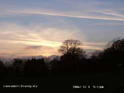 7th: By 06 GMT the high was over the Bay of Biscay 1031 mb. Pressure had fallen to 1022 mb and the WNW'ly wind was force 5. Frontal cloud was lying to the N of Britain and rain was affecting NW Scotland. Here it was still dry, the last significant rain was on the 19th January. The morning beginning the 8th sunless day in succession was overcast, the slightly hazy visibility good, with the cloudbase touching the snowless Snowdonia mountaintops. By noon the cloud had lowered and there was a little rain as the wind backed SW'ly force 6.
![]() At 1800 GMT the weak cold front passed over with a short burst of heavy rain that soon eased. There was moderate to heavy precipitation over Snowdonia and Cumbria that later turned icy on the summits. By 22 GMT there was some open sky above the weather station. [Rain 3.1 mm; Max 8.1C; Min 6.1C; Grass 5.5C]
At 1800 GMT the weak cold front passed over with a short burst of heavy rain that soon eased. There was moderate to heavy precipitation over Snowdonia and Cumbria that later turned icy on the summits. By 22 GMT there was some open sky above the weather station. [Rain 3.1 mm; Max 8.1C; Min 6.1C; Grass 5.5C]
8th: The was a touch of ground frost under clearing skies overnight. At 09 GMT pressure was 1012 mb with low 983 mb S tip of Norway. The cold front was over N France and Britain was in a cool NW'ly airstream. It kept dry and mostly sunny here but the Snowdonia Mountains were cloud covered with some ice precipitation at times. The night was mostly cloudy with clear spells. {Capel Curig 11.6 mm, Great Malvern 10.2C, Valley 5.5h} [Rain 0.0 mm; Max 8.2C; Min 3.1C; Grass -0.7C]
9th: The temperature on the grass went down to -1.2C overnight, but there was no dew or frost deposition in the moderate N'ly breeze. It was a bright morning with very good visibility and a sprinkling of snow on the highest peaks in Snowdonia. Pressure 1020 mb was rising between high 1024 mb to the W of Ireland and low 984 mb S Baltic. N'ly winds were still strong on the North Sea while here it was force 4/5. A showery trough was worked it's way S from Scotland along the E coastline of England producing some snow flurries in places. A mostly sunny day here with cloud diminishing during the afternoon. Some cloud at times during the night, but there were clear spells with frost. [Rain 0.0 mm; Max 5.2C; Min 3.0C; Grass -1.2C]

![]() 10th: A hard frost overnight, the air minimum was -1.6C and the -5.6C on the grass were lowest of the month, and the soil surface was frozen. With a low dewpoint (-3.4C at 09 GMT) there was little in the way of frost deposition (frost-pad 0.09 mm) and zero net change with lysimeters. There was silver frost; frozen drops of water at the tips of grass leaves the result of dew formation at dusk or possibly guttation. The morning was sunny and calm
with 5/8 cover of cirrus and altostratus clouds, with a few contrails overhead. Visibility was good (>10 km) and there was a little smoke haze in the Menai Strait denser at the eastern end. Pressure was 1026 mb within the anticyclone centred over Britain. The day was mostly sunny with the sky almost clear in the morning, a partial right hand sundog was seen briefly at 1010 GMT. The afternoon was cloudier with frontal cloud low in the west. By 2200 GMT there was frost on the ground and with a veil of cirrostratus cloud (RAF Valley reported overcast cloudbase at 17000 ft) there there was a complete 22 degree halo around the almost (98%) full moon. At it's strongest up to 2300 GMT there was a bright 3 degree band of milky white light, diffuse outwards, but sharply edged inside with slight reddish coloration. The halo was caused by refraction of moonlight through ice crystals in the cloud. A bright star could be seen within the inner dark ring, a folklore sign said to indicate how many days it will be before rain. There was rain after midnight so it was right!
10th: A hard frost overnight, the air minimum was -1.6C and the -5.6C on the grass were lowest of the month, and the soil surface was frozen. With a low dewpoint (-3.4C at 09 GMT) there was little in the way of frost deposition (frost-pad 0.09 mm) and zero net change with lysimeters. There was silver frost; frozen drops of water at the tips of grass leaves the result of dew formation at dusk or possibly guttation. The morning was sunny and calm
with 5/8 cover of cirrus and altostratus clouds, with a few contrails overhead. Visibility was good (>10 km) and there was a little smoke haze in the Menai Strait denser at the eastern end. Pressure was 1026 mb within the anticyclone centred over Britain. The day was mostly sunny with the sky almost clear in the morning, a partial right hand sundog was seen briefly at 1010 GMT. The afternoon was cloudier with frontal cloud low in the west. By 2200 GMT there was frost on the ground and with a veil of cirrostratus cloud (RAF Valley reported overcast cloudbase at 17000 ft) there there was a complete 22 degree halo around the almost (98%) full moon. At it's strongest up to 2300 GMT there was a bright 3 degree band of milky white light, diffuse outwards, but sharply edged inside with slight reddish coloration. The halo was caused by refraction of moonlight through ice crystals in the cloud. A bright star could be seen within the inner dark ring, a folklore sign said to indicate how many days it will be before rain. There was rain after midnight so it was right!
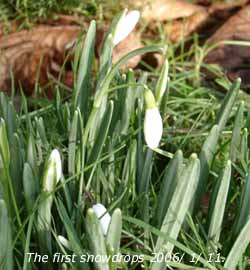
 (Snowdrops have been flowering well since the 1st, a few crocus appeared on the 6th and some have opened in today's sunshine. By the 8th last year bluebell leaves in the wood were 5 cm tall and the first primrose and cowslip flowers were out, not so this year).[Rain trace; Max 7.8C; Min -1.6C; Grass -5.6C]
11th: As frontal cloud moved across there was a little showery rain between 02 and 06 GMT but the amount was so small it just left a drop in the bottom of the raingauge bottle. This was unmeasurable and was recorded as a trace. At 09 GMT the cloud was clearing to give a mostly sunny morning. Pressure was 1024 mb with the high transferred to Normandy. Visibility was poor in persistent haze and the S'ly wind force 5. The afternoon became cloudier and there was some drizzle or occasional light rain from 1400 GMT with moderate to heavy rain from 2315 GMT. [Rain 13.8 mm; Max 8.6C; Min -0.6C; Grass -4.2C]
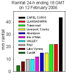
12th: Continuous moderate rain until 1500 GMT before turning to drizzle. At 09 GMT visibility was very poor in the rain and mist. Pressure 1018 mb was falling with low 956 mb mid-Atlantic SE Greenland. Although the later afternoon was drier it kept overcast. The thick layer of cloud all day allowed only a low level of solar radiation (0.8 mv h). After a few slight showers in the evening the night although overcast was dry. An Anglesey family travelling eastbound on the A55 headland near Penmaenmawr escaped injury, but their car was damaged, when they collided with 2 large rocks that fell from the cliff overhanging the road. The weather is likely to blame as freezing and thawing slowly loosens and splits off rocks from the cliff faces. It is a natural process, water finds it's way into cracks and in freezing expands splitting the rock; it occurs frequently in rocky North Wales. {Capel Curig 43.8 mm, Llansadwrn 22.2 mm} [Rain 8.9 mm; Max 8.6C; Min 4.2C; Grass 3.6C]
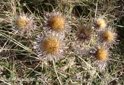 13th: Overnight the minimum was 8.0C, the highest of the month. It was overcast and misty with a few slight showers around 09 GMT and later during the morning. Pressure 1015 mb was falling only slowly with complex low-pressure 978 mb lying to the NW and frontal cloud in the vicinity. The wind was S'ly force 4 to 5 and the day on Anglesey was overcast with occasional spots of rain. The eastern end of the Snowdonia Mountains from Llanfairfechan was mostly dry and, with lee-breaks in the cloud, had some sunshine. The maximum temperature was 10.0C and the mean of 9.0C was highest of the month. The night was overcast and dry until after midnight. [Rain 3.3 mm; Max 10.0C; Min 8.0C; Grass 7.2C]
14th: Intermittent light to moderate rain from 0130 GMT on a cold front had ceased by 0830 GMT. At 09 GMT pressure 1006 mb was rising; the sky was clearing to showery cumulus clouds, but visibility towards the mountains was moderate. There was the chance of some ice precipitation over the Snowdonia summits, persistently cloud covered, as temperatures hovered near zero. The day was mostly sunny on Anglesey with the maximum reaching 10.6C, the highest of the month. By mid afternoon frontal cloud edged into the W. During the evening there was moderate to heavy rain as the S'ly wind reached gale force 8 around 22 GMT with gusts up to 60 mph with pressure falling to 992 mb. The wind moderated before midnight. {Valley 5.9h} [Rain 18.0 mm; Max 10.6C; Min 6.0C; Grass 5.6C]
![]() 15th: With a frontal triple point over Wales the heavy rain continued until 0100 GMT, accumulating 18 mm, and by dawn the sky was mostly clear. Pressure at 09 GMT was 999 mb and the morning was mostly sunny. The rain band continued SE over England giving significant rainfall in parts that have had little through the winter so far. The amounts were insufficient, however, to do much to improve water reserves that are low in the SE. As pressure began to fall again the afternoon turned cloudier with a light shower of rain, but the night was dry with some clear spells. {Capel Curig 36.2 mm} [Rain trace; Max 8.5C; Min 5.8C; Grass 3.8C]
15th: With a frontal triple point over Wales the heavy rain continued until 0100 GMT, accumulating 18 mm, and by dawn the sky was mostly clear. Pressure at 09 GMT was 999 mb and the morning was mostly sunny. The rain band continued SE over England giving significant rainfall in parts that have had little through the winter so far. The amounts were insufficient, however, to do much to improve water reserves that are low in the SE. As pressure began to fall again the afternoon turned cloudier with a light shower of rain, but the night was dry with some clear spells. {Capel Curig 36.2 mm} [Rain trace; Max 8.5C; Min 5.8C; Grass 3.8C]
 16th: It was a bright sunny morning, but pressure 978 mb continued to fall to 974 mb, lowest of the month, with complex low-pressure to the NW near Rockall. The SW'ly wind continued moderate to fresh f4/5 as it has been for the last 5 mornings. Visibility was moderate the haze preventing a clear view of the Snowdonia Mountains where temperatures continue to hover around freezing point on the tops. The morning was mostly sunny on Anglesey, the mountains were cloudier and a sprinkling of snow was seen on the summit of Carnedd Llywelyn at noon. Later in the afternoon a band of cloud moved across giving rain with ice pellets around 18 GMT and rain showers either side of midnight. {Shap Fell 14.2 mm, Milford Haven 11.6 mm} [Rain 1.7 mm; Max 9.5C; Min 4.5C; Grass 2.1C]
17th: Some clear spells developed before dawn and this was sufficient to allow the temperature on the grass to fall to -3.1C freezing deposits of water. At 09 GMT pressure 983 mb was rising and it was a mostly sunny morning although cloud had increased by 11 GMT. There was much bird activity on the fine morning; there were territorial disputes between mistle thrushes and rooks were attending their nests but I have not yet seen them carrying twigs. The afternoon was mostly cloudy although there was some weak sunshine at times. The evening saw more cloud and there was a light shower around 23 GMT. [Rain 0.1 mm; Max 9.1C; Min 0.9C; Grass -3.1C]
18th: A calm and mostly sunny morning. At 09 GMT pressure was steady on 990 mb within complex low-pressure over the British Isles (987 mb North Sea). There was a mid level inversion mist and cloud between 1000 and 2000 ft with the mountaintops (a little snow seen) and low level clear. Visibility at ground level was >20 km. There was overnight ground frost but earlier frozen deposits had mostly melted. It was a mostly sunny morning with cirrus and altocumulus clouds overhead. The afternoon was cloudier but it was high enough to keep the mountaintops in the clear. The night was mostly clear with some mist patches forming in low-lying places across the island.[Rain 0.1 mm; Max 9.8C; Min 1.5C; Grass -2.2C]
 19th: Although 6 oktas of cloud were recorded it was high cirrostratus with a few cumulus clouds mainly over Snowdonia. So it was a bright sunny morning although visibility was poor in haze; overnight frost on the grass was beginning to melt. The dew-pad recorded 0.32 mm of dew that had frozen white, there was no hoar. At 09 GMT pressure was steady on 999 mb as an Atlantic-low moved in across Brittany (990 mb at noon); we were in an easterly flow of air. It was a mostly sunny day with long clear spells giving the most solar radiation of the year so far (10.3 mv h). It started to cloud here over just before sunset giving some red banded orographic clouds in the west. The night was thereafter overcast. {Valley 8.6h, Liverpool, Crosby 8.9C} [Rain trace/dew; Max 6.8C; Min 1.8C; Grass -1.0C]
![]()
![]()
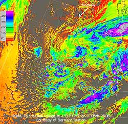
![]() 20th: With the overcast sky there was no frost on the ground (grass minimum +0.5C) this morning. In contrast to yesterday the dew-pad recorded only 0.04 mm and the grass was dry. Pressure was 1018 mb the slow-moving occluding low 997 mb centred near the Cherbourg Peninsular, N France. The NOAA 18 thermal image, courtesy of Bernard Burton, shows the depression over N France with the cloud retreating SW of Anglesey part of the rotating swirl. To the W can be seen following closed convective marine cells. Cumulonimbus cells (with cloudtop temperatures < -40C) developed on the periphery along W Iberia and the Mediterranean giving thunderstorms through the day
20th: With the overcast sky there was no frost on the ground (grass minimum +0.5C) this morning. In contrast to yesterday the dew-pad recorded only 0.04 mm and the grass was dry. Pressure was 1018 mb the slow-moving occluding low 997 mb centred near the Cherbourg Peninsular, N France. The NOAA 18 thermal image, courtesy of Bernard Burton, shows the depression over N France with the cloud retreating SW of Anglesey part of the rotating swirl. To the W can be seen following closed convective marine cells. Cumulonimbus cells (with cloudtop temperatures < -40C) developed on the periphery along W Iberia and the Mediterranean giving thunderstorms through the day ![]() . It was a mostly sunny morning with the early stratocumulus, altocumulus topped by some cirrus and a few contrails clearing over Anglesey that retained some fair-weather cumulus in the N blowing along on the fresh NE'ly wind. But Snowdonia kept cloudy with, at times, a line of stratocumulus clouds across the range. The sprinkling of snow on the N-slopes of C. Dafydd was still there with the freezing level over about 2000 ft. The temperature rose to 7.3C but the wind felt cold. It was a clear sunset with good pink to light peach colours developing later against the azure blue sky. Bluebell leaves have emerged in the micro-climate of the wood; some are 5 cm tall. At the same stage they are 12 days later than in 2005. The first 3 primrose flowers were spotted on S-facing rockery banks in the garden, last year there were some out on the 3rd January with plenty seen on the 8th February. {Aultbea 9.7C, Crosby 9.4C, Tiree, Outer Hebrides 8.5h, Hastings 31 mm} [Rain 0.0 mm; Max 7.4C; Min 2.5C; Grass 0.5C]
. It was a mostly sunny morning with the early stratocumulus, altocumulus topped by some cirrus and a few contrails clearing over Anglesey that retained some fair-weather cumulus in the N blowing along on the fresh NE'ly wind. But Snowdonia kept cloudy with, at times, a line of stratocumulus clouds across the range. The sprinkling of snow on the N-slopes of C. Dafydd was still there with the freezing level over about 2000 ft. The temperature rose to 7.3C but the wind felt cold. It was a clear sunset with good pink to light peach colours developing later against the azure blue sky. Bluebell leaves have emerged in the micro-climate of the wood; some are 5 cm tall. At the same stage they are 12 days later than in 2005. The first 3 primrose flowers were spotted on S-facing rockery banks in the garden, last year there were some out on the 3rd January with plenty seen on the 8th February. {Aultbea 9.7C, Crosby 9.4C, Tiree, Outer Hebrides 8.5h, Hastings 31 mm} [Rain 0.0 mm; Max 7.4C; Min 2.5C; Grass 0.5C]
21st: The night was cloudy at times and with the few clear spells and constant wind off the sea it was frost-free. At 09 GMT pressure had risen to 1026 mb as high-pressure off NW Scotland built to 1024 mb. Other centres were over the Azores (1029 mb) and Norway (1033 mb). With complex large low-pressure over the Mediterranean this was giving us a strong NE'ly flow of air from N Europe. There were snow flurries across the mountaintops and a shower with bright crepuscular rays was seen heading up the Nant Ffrancon Pass. But amounts of precipitation were small. The morning was mostly dull with cloud being driven in off Liverpool Bay on the fresh NE'ly wind. Flocks of redwings were working over fields SW of the weather station sheltered from the NE'ly. The afternoon saw some sunshine, but a large dark cumulonimbus cloud off Liverpool Bay crossed S Anglesey and the Menai Strait and headed for Caernarfon on the mainland. At 1515 GMT there was a moderate shower of ice pellets that covered the ground. There were ice pellets and rain at Caernarfon from 1520 GMT. The night was mostly cloudy but dry. {Tiree 9.1h} [Rain 0.5 mm; Max 6.6C; Min 3.7C; Grass 2.2C]
 22nd: The morning was bright with a little sunshine between cumulus clouds scudding along on the fresh (f4/5) ENE'ly wind. Pressure 1029 mb was rising with high 1037 mb N Scotland to S Norway. Clear and mostly sunny to the N; here there was a fresh ENE'ly wind with moderate visibility in haze. The temperature was 2.8C (dewpoint 0.1C) but no frost on the grass, it had been down to 0.0C with a slight dew. By afternoon it was cloudier with several showers of slight rain but not enough to get into the raingauge bottle! The night saw some clear spells before becoming overcast later. [Rain trace; Max 5.7C; Min 2.0C; Grass 0.0C]
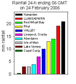
23rd: Overcast with a little rain commencing just before 09 GMT. Pressure was 1031 mb with the high 1039 mb over the Faeroes. Complex shallow low-pressure 1018 mb over the Baltic, and to the E, had associated fronts moving S over the North Sea and Britain. These brought light snow to higher ground and low ground in the SE during the morning. At 09 GMT the temperature here at 330 ft was 2.8C with a wet bulb temperature of 2.3C (dewpoint 1.5C) rising to about 4C. So it was unlikely, the temperature being more than +2C, that snowflakes would reach the ground here. The sea surface temperature in Liverpool Bay is relatively warm at between 8 to 9C and warming the air before it reaches here. On the mountains the temperature indicated by the Snowdon summit AWS (courtesy of First Hydro) was -4.7C, and had been as low as -6.8C. The light to moderate rain continued through the day with the warm front moving unusually SW; the precipitation falling as snow on the mountains upwards from about 1000 ft. By 15 GMT 8 mm had fallen here this reaching 14 mm by 18 GMT. Rainfall was intermittent into the night. With weather systems moving in from the E the usual rainfall gradient, with W'ly systems, was reversed with Hawarden, usually one of the the driest reporting stations, turning out the wettest. The 24-h (09-09) rainfall total of 20.5 mm was the largest of the month. In the Mediterranean an anticyclone over Tunisia had whipped up Saharan dust from the several point sources in deserts of Algeria and Libya. The plume of dust, seen on the AQUA MODIS satellite visible spectrum image, is blowing out across the Gulf of Sirte towards Malta, east and north towards the British Isles. The mountains of the Tassili n�Ajjer National Park (World Heritage Site), seen bottom left, has caves in which paintings depict changes in habitation and climate over several thousand years. ![]() The dust arrived over southern Britain on the morning of the 25th.
The dust arrived over southern Britain on the morning of the 25th.
![]() . {Hawarden 15.2 mm, Llansadwrn 14.0 mm, Rhyl 10.8 mm, Valley 6.5 mm} [Rain 20.5 mm; Max 5.1C; Min 0.5C; Grass -2.1C]
. {Hawarden 15.2 mm, Llansadwrn 14.0 mm, Rhyl 10.8 mm, Valley 6.5 mm} [Rain 20.5 mm; Max 5.1C; Min 0.5C; Grass -2.1C]
24th: Intermittent rain but moderate rain between 0130 and 0245 GMT with some ice pellets. At 09 GMT there were squally winds, generally ENE'ly force 6 for about 30 minutes, as a cold front passed and some small snow pellets. Snow was lying as low as 1200 ft on the Snowdonia Mountains with the tops of the Carneddau looking moderately covered on the northern aspect. With the wind soon moderating the morning saw some bright spells. There was a further slight shower of snow pellets around 1330 GMT as another group of showers moved across SE Anglesey but there was a little more sunshine later. Both ice showers produced only a trace of liquid water. The night was partially cloudy. [Rain trace; Max 4.5C; Min 2.5C; Grass 1.8C]

|
![]() 25th: With some clear spells overnight the air temperature had fallen to 0.5C and on the grass -1.6C. But there was no sign of frost and the grass was dry. The E'ly force 6 wind was roaring in the trees, but the morning was bright and sunny. Pressure was 1025 mb with high 1047 mb Iceland to Greenland. Low 1001 mb over the Bay of Biscay had associated frontal cloud lying in a curl W of Ireland to N Scotland. This, and an accompanying cold front, moved S during the day but did not arrive before late afternoon. There was light rain from 1800 GMT and the very weak cold front cleared soon after midnight. [Rain 0.5 mm; Max 6.7C; Min 0.5C; Grass -1.6C]
25th: With some clear spells overnight the air temperature had fallen to 0.5C and on the grass -1.6C. But there was no sign of frost and the grass was dry. The E'ly force 6 wind was roaring in the trees, but the morning was bright and sunny. Pressure was 1025 mb with high 1047 mb Iceland to Greenland. Low 1001 mb over the Bay of Biscay had associated frontal cloud lying in a curl W of Ireland to N Scotland. This, and an accompanying cold front, moved S during the day but did not arrive before late afternoon. There was light rain from 1800 GMT and the very weak cold front cleared soon after midnight. [Rain 0.5 mm; Max 6.7C; Min 0.5C; Grass -1.6C]
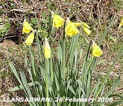 26th: After midnight there were slight showers of small snow pellets but these had cleared away before 09 GMT. The wind had moderated a little overnight and was NE'ly force 5. The sky was almost clear with diminishing altocumulus overhead and some cumulus over the Snowdonia Mountains and Irish Sea to the W. The morning was sunny at first, but soon large shower clouds moved in off the sea and at 1050 GMT there was a shower of sleet. The afternoon was mostly cloudy with some precipitation seen over the mountaintops. The first daffodils of the season were spotted on a sheltered S-facing bank in Llansadwrn. They are just over a month later than last year (23 January 2005) but about average.[Rain 0.4 mm; Max 6.0C; Min 3.2C; Grass 1.8C]
27th: It was overcast at 09 GMT with pressure 1025 mb falling as a shallow but deepening low moved into the North Sea. The much moderated wind was N'ly force 2 and soon the sky almost cleared giving a sunny morning. The temperature rising to 8.6C opening the crocus flowers that had been tightly closed for several days. It was not warm enough, however, for the mistle thrushes to resume singing! A cold front, associated with the North Sea low, moved S over Scotland and brought some snow to the Highlands during the morning. Cloud encroached from the N after noon and there was a shower of rain at 1350 GMT. The rest of the afternoon was dry but rain reached here at 1915 GMT with a spell of moderate rain around 2000 GMT that fell as snow over the mountaintops. [Rain 1.4 mm; Max 8.6C; Min 2.2C; Grass -0.1C]
![]() 28th: We were in a cold shower-packed N'ly airflow from the Arctic and there were early showers of snow pellets and at 09 GMT moderately large snow flakes falling from a cumulonimbus cloud. The temperature was 1.8C (dry bulb), with the wet bulb on 1.0C (dewpoint was -0.4C), that fell to 1.0C (minimum) and -0.1C on the grass within 20 minutes. Pressure was 1013 mb with the low 990 mb off the southern tip of Norway over the Skagerrak. A mixture of snow pellets and snow covered the ground in Gaerwen at 0900 GMT. There were further light showers of snow pellets and snow during the morning with 1 cm diameter snow pellets reported in Llanfairfechan at 1026 GMT. The temperature had risen to 2.9C by 1030 GMT here in a bright spell before more wintry showers were driven in off the sea on a freshening force 5 wind. The mountains were looking increasingly white from the succession of showers that led to moderate accumulations on the flatter tops of the Carneddau. Showers became less frequent later in the afternoon, but there were more of snow pellets before midnight.
28th: We were in a cold shower-packed N'ly airflow from the Arctic and there were early showers of snow pellets and at 09 GMT moderately large snow flakes falling from a cumulonimbus cloud. The temperature was 1.8C (dry bulb), with the wet bulb on 1.0C (dewpoint was -0.4C), that fell to 1.0C (minimum) and -0.1C on the grass within 20 minutes. Pressure was 1013 mb with the low 990 mb off the southern tip of Norway over the Skagerrak. A mixture of snow pellets and snow covered the ground in Gaerwen at 0900 GMT. There were further light showers of snow pellets and snow during the morning with 1 cm diameter snow pellets reported in Llanfairfechan at 1026 GMT. The temperature had risen to 2.9C by 1030 GMT here in a bright spell before more wintry showers were driven in off the sea on a freshening force 5 wind. The mountains were looking increasingly white from the succession of showers that led to moderate accumulations on the flatter tops of the Carneddau. Showers became less frequent later in the afternoon, but there were more of snow pellets before midnight. ![]() The NOAA 18 satellite image shows the low (988 mb) over the Skagerrak with it's associated frontal cloud stretching over Denmark, the Netherlands to central France. Another low (994 mb) can be seen in the Eastern Mediterranean and Adriatic that raised the duststorm over Libya on the 23rd (see above). The British Isles is in an Arctic airflow with well-developed convective clouds over the North Sea and Norwegian Sea while there are convective marine open cells to the W and N. [Rain 8.1 mm; Max 4.9C; Min 1.8C; Grass -0.3C]
The NOAA 18 satellite image shows the low (988 mb) over the Skagerrak with it's associated frontal cloud stretching over Denmark, the Netherlands to central France. Another low (994 mb) can be seen in the Eastern Mediterranean and Adriatic that raised the duststorm over Libya on the 23rd (see above). The British Isles is in an Arctic airflow with well-developed convective clouds over the North Sea and Norwegian Sea while there are convective marine open cells to the W and N. [Rain 8.1 mm; Max 4.9C; Min 1.8C; Grass -0.3C]
 1st:
1st: ![]()
![]()
![]() DYDD DEWI SANT: A white St. David's Day with 7 cm of lying snow at 09 GMT. There had been prolonged showers of snow pellets and moderate snow from midnight. At 0421 GMT lightning was seen and thunder heard. Fields around the weather were white with snow and sheep were standing around looking bewildered. There had been moderate to heavy snow across SE Anglesey, Bangor and Llanfairfechan and the Snowdonia Mountains. Early morning traffic on the A55 Expressway was slowed to a crawl as people struggled to get into work. Snowfall was heaviest in eastern Anglesey from Dulas to Pentraeth with up to 12 cm reported. Drivers on the A5025 near Dulas had to wait for snowploughs and gritters to clear the road. In Pentraeth minor roads were blocked with drifted snow and required snowplough clearance. As the snow packed down it became icy in some places and conditions were described as 'dangerous' with drivers abandoning their cars including on the Felinheli bypass. The Crimea Pass between Blaenau Ffestiniog and Betws y Coed was closed.
With over 400 schools in Wales unable to open children were out early to build snowmen. Pressure 1008 mb was falling slowly with the low 989 mb slow-moving past the Skagerrak to be off the west coast of Denmark at noon.
DYDD DEWI SANT: A white St. David's Day with 7 cm of lying snow at 09 GMT. There had been prolonged showers of snow pellets and moderate snow from midnight. At 0421 GMT lightning was seen and thunder heard. Fields around the weather were white with snow and sheep were standing around looking bewildered. There had been moderate to heavy snow across SE Anglesey, Bangor and Llanfairfechan and the Snowdonia Mountains. Early morning traffic on the A55 Expressway was slowed to a crawl as people struggled to get into work. Snowfall was heaviest in eastern Anglesey from Dulas to Pentraeth with up to 12 cm reported. Drivers on the A5025 near Dulas had to wait for snowploughs and gritters to clear the road. In Pentraeth minor roads were blocked with drifted snow and required snowplough clearance. As the snow packed down it became icy in some places and conditions were described as 'dangerous' with drivers abandoning their cars including on the Felinheli bypass. The Crimea Pass between Blaenau Ffestiniog and Betws y Coed was closed.
With over 400 schools in Wales unable to open children were out early to build snowmen. Pressure 1008 mb was falling slowly with the low 989 mb slow-moving past the Skagerrak to be off the west coast of Denmark at noon.
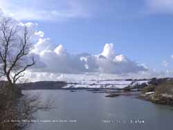 We were still within the circulation of the low with a moderate NW'ly wind. Air flowing off the relatively warm sea formed convective clouds over the colder land surface enhanced by the lift given downwind by the Snowdonia Mountains. With cumulonimbus clouds in the vicinity there were more light snow pellet and snow showers during the morning. The afternoon saw fewer showers and some good sunny spells when the snow began to thaw. There were some towering cumulus and cumulonimbus clouds with anvil over Anglesey up to 18 GMT. But with clear sky over the weather station the temperature fell rapidly and ice formed on untreated surfaces. There was a small change in wind direction that took most of the showers to the E of here. [Rain 2.6 mm; Max 4.3C; Min -1.6C; Grass -5.8C]
2nd: With clear sky the grass minimum over snow fell to -9.3C and the air minimum to -3.2C. Since midnight there had been more showers of snow pellets and leading up to 09 GMT light snow showers. Another 1 cm of snow lay on the snow board which was cleared; the average lying snow on the ground was 6 cm with a water density of 133 kg m-2. The temperature was -0.4C with the wet bulb on -1.0C (dewpoint -2.2C). Pressure 1000 mb was falling in a complex of low-pressure over Britain. The snow then turned moderate to heavy with large flakes producing another 6 cm on the board by 1300 GMT with lying snow 12 cm deep. The new snow on the board had a water density of 74 kg m-2 . Continuous road gritting was keeping the main roads open here, but icy conditions were reported on some roads in Beaumaris and Menai Bridge. Heavy snow around Colwyn Bay, Llandudno and eastward led to the closure of the A55 following several accidents that included jack-knifed lorries. There were also problems reported earlier on Rhuallt Hill and Ceredigion. By afternoon the snow was confined to the Snowdonia Mountains as a clearance crossed Anglesey. By 1630 GMT the mountains were clear and looked spectacular in the low evening sunshine. The photographs below show the the view from Llansadwrn at 1651 GMT and the opposite view, courtesy of Gordon Perkins, from Penmaenmawr at nearly the same time. This shows the snow lying on the hills and Menai Strait at spring low-tide with Anglesey beyond. There is a cumulonimbus cloud over the NE tip of the island near Point Lynas. The day's maximum of 2.3C and the mean -0.5C were lowest of the month. At 18 GMT under clear sky the temperature again dropped rapidly. [Rain 2.9 mm; Max 2.3C; Min -3.2C; Grass -9.3C]
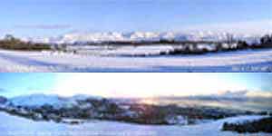 3rd: Exceptional visibility this morning. Temperature at 09 GMT was -3.8C with lying snow averaging 10 cm. In the Pentraeth frost-hollow -7.5C was recorded. Here the air temperature had fallen to -5.0C and the grass minimum -12.4C was a record low (since 1985), both lowest of the month. It was sunny with very detailed views of the backlit snow-covered mountains. It was a mostly sunny day with the temperature rising to 7.2C (giving a daily range of 12.2C), but cloudier later in the afternoon with passing cumulus clouds. By 16 GMT the snow cover here had reduced to 5.5 cm, with melt water collecting in a few trodden bare patches. Cover is still 100% on nearby fields, but has disappeared on a line W of the A55 across Anglesey.
The MODIS TERRA satellite image, using bands 7+2+1
 ![]() , shows the distribution of snowfall over Wales. The cold snow shows up blue giving good contrast with the land surface. Swathes of snow can be seen in a NW-SE direction. Note the heavy deposit in SE Anglesey and the deep penetration towards Wrexham and the Potteries, south of the Dee and Mersey. Cumulonimbus were seen approaching and moderate snowfall started as a trough arrived at 1620 GMT soon giving way to light showers; about 1 cm had fallen by 18 GMT. The night to midnight mostly clear with some passing cumulus clouds and slight snow showers. [Llyn Ogwen, Min -9C] [Rain 2.9 mm; Max 7.2C; Min -5.0C; Grass -12.4C]
, shows the distribution of snowfall over Wales. The cold snow shows up blue giving good contrast with the land surface. Swathes of snow can be seen in a NW-SE direction. Note the heavy deposit in SE Anglesey and the deep penetration towards Wrexham and the Potteries, south of the Dee and Mersey. Cumulonimbus were seen approaching and moderate snowfall started as a trough arrived at 1620 GMT soon giving way to light showers; about 1 cm had fallen by 18 GMT. The night to midnight mostly clear with some passing cumulus clouds and slight snow showers. [Llyn Ogwen, Min -9C] [Rain 2.9 mm; Max 7.2C; Min -5.0C; Grass -12.4C]
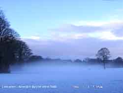 4th: Cloudier from 03 GMT with another showery, snow and snow pellets, trough passing from 0430 to 0630 GMT. Flash of lightning at 05:45:41 GMT knocked out the electricity for some seconds before a clap of thunder. There was a moderate fall of snow pellets at 0608 GMT that lay on top of the snow/ snow pellet mixture. At 0730 GMT advection fog formed over the snow fields (in the photograph it was drifting from right where forming, to the left where deepest) and at one stage reached the top of the 60 ft trees in the distance. Advection fog forms when moist air passes over a cold surface, in this case snow but it could be water. The temperature of the air falls to below the dew point and moisture condenses forming fog. It drifted across the road for at least 30 minutes making passing vehicles invisible at a distance
 ![]() By 09 GMT the temperature -0.2C was rising (dewpoint -2.6C) and the fog had cleared; the morning was mostly sunny. Depth of snow and snow pellets on the 24-h board was 2.5 cm, the total snow depth averaged 10 cm with an icy layer, corresponding to yesterday's melt and refreezing, underneath.
By 09 GMT the temperature -0.2C was rising (dewpoint -2.6C) and the fog had cleared; the morning was mostly sunny. Depth of snow and snow pellets on the 24-h board was 2.5 cm, the total snow depth averaged 10 cm with an icy layer, corresponding to yesterday's melt and refreezing, underneath.  The afternoon was cloudier with convective clouds developing and encroaching later giving showers of snow pellets and a few snow flakes at 1625 and 2330 GMT. [Rain 0.7 mm; Max 7.9C; Min -3.7C; Grass -8.0C]
5th: After more showers of snow pellets around 0500 GMT the sky cleared to give a mostly sunny morning. Well-developed cumulus clouds were passing to the E of the station and more were seen to the W over the Irish Sea. The remaining snow, averaging 7 cm, was frozen crisp together with yesterday's melt water. The soil was unfrozen, but very wet under the snow. The temperature at 5 cm was 1.0C and had fallen to 2.8C at 30 cm and 6.0C at 100 cm. Pressure 1010 mb was rising as a ridge of high-pressure from Azores-high 1030 mb moved across from the W. It was a mostly sunny day and although the temperature reached 7.6C there was snow left at the end of the afternoon. By 17 GMT it was cloudier and there were a few drop of rain with a shower at 18 GMT before the sky cleared giving another frosty night. Despite the snow cover I found this single flower of the lesser celandine out on a sunny snow-free south-facing hedge bank. [Rain 0.7 mm; Max 7.6C; Min C; Grass C]
![]() 6th: It was a bright morning and, surprisingly, there was still enough snow on the fields (60% cover) to record lying snow. It is the 6th consecutive day with snow lying and a record for the beginning of March in Anglesey since before 1965. In 1965 Valley recorded 3 days, Bryn Adda in Bangor 5 days and at the College Farm in Aber 9 days.
Snow is not unusual in March; in 1979 at this station there were 6 days (17-22) of lying snow. On the 16/17th there was heavy snow in blizzard conditions (force 8 NE'ly) with, after nearly 48-h of snow, drifts up to 6 ft deep at 09 GMT on the 17th. Spring was delayed that year with the cold weather continuing into April with snow on the 5th; snow showers were also recorded on the 4th May. But this was nothing like the snowstorm that hit Wales and S England on 9-13 March 1891. Trees were blown down in the gales and the snow was so deep that people were trapped in their houses and trains; several froze to death. At sea there were many losses of ships and over 200 people were drowned. Pressure 1019 mb had risen in a small ridge over western Britain. The morning was mostly sunny, but some cloud passed over about noon without precipitation here, then it was a little brighter again. The weather had been cold enough for Llyn Ogwen in Snowdonia, at 1000 ft, almost to freeze over
6th: It was a bright morning and, surprisingly, there was still enough snow on the fields (60% cover) to record lying snow. It is the 6th consecutive day with snow lying and a record for the beginning of March in Anglesey since before 1965. In 1965 Valley recorded 3 days, Bryn Adda in Bangor 5 days and at the College Farm in Aber 9 days.
Snow is not unusual in March; in 1979 at this station there were 6 days (17-22) of lying snow. On the 16/17th there was heavy snow in blizzard conditions (force 8 NE'ly) with, after nearly 48-h of snow, drifts up to 6 ft deep at 09 GMT on the 17th. Spring was delayed that year with the cold weather continuing into April with snow on the 5th; snow showers were also recorded on the 4th May. But this was nothing like the snowstorm that hit Wales and S England on 9-13 March 1891. Trees were blown down in the gales and the snow was so deep that people were trapped in their houses and trains; several froze to death. At sea there were many losses of ships and over 200 people were drowned. Pressure 1019 mb had risen in a small ridge over western Britain. The morning was mostly sunny, but some cloud passed over about noon without precipitation here, then it was a little brighter again. The weather had been cold enough for Llyn Ogwen in Snowdonia, at 1000 ft, almost to freeze over ![]() . By evening the partially clouded sky allowed a touch of ground frost before frontal systems moved in from the Atlantic. [Rain 3.2 mm; Max 8.1C; Min -0.6C; Grass -3.5C]
. By evening the partially clouded sky allowed a touch of ground frost before frontal systems moved in from the Atlantic. [Rain 3.2 mm; Max 8.1C; Min -0.6C; Grass -3.5C]
7th: Frontal cloud associated with low 977 mb S of Greenland and Iceland moved in across Ireland and brought rain after midnight. At 09 GMT pressure 1009 mb had fallen and under low stratus cloud there was moderate rain. There was little to be seen of the snow here, just a few patches here and there. The rain eased during the morning, but the sky kept overcast through the afternoon. At 18 GMT there was drizzle and thick fog at 20 GMT. [Rain 12.2 mm; Max 9.1C; Min 2.2C; Grass -1.2C]
8th: As frontal cloud moved across there was moderate to heavy rain from 03 GMT with 12.2 mm accumulating by 09 GMT. With saturated soil it was very wet underfoot with puddles of water around the station and large pools on surrounding fields. Pressure 995 mb had fallen with another low 990 mb over Ireland. At 06 GMT there was heavy rain over Pembrokeshire and this spread to mid Wales and S Snowdonia during the morning. Despite the rising temperature and rain there were remnants of snow on the mountains above 2500 ft and some patches as low as 1000 ft had survived. The day was sunless and thick cloud persisted all day with low brightness. In the afternoon there was fog at times otherwise rain or heavy drizzle with 10.2 mm accumulated by 1800 GMT. {Sennybridge 22.7 mm, Capel Curig 20.4 mm} [Rain 10.5 mm; Max 9.5C; Min 6.5C; Grass 5.5C]
 9th: Overcast through to 09 GMT when pressure 995 mb had risen a little as a minor ridge of high-pressure moved across overnight. Complex low pressure (979 mb) to the NW had an associated occluded front to the SW that brought a spell of rain from 1030 GMT. The afternoon was brighter, between convective clouds, with showers of rain and some ice pellets. There were further spells of rain during the evening. [Rain 7.1 mm; Max 9.1C; Min 4.7C; Grass 1.0C]
![]() 10th: There was a band of rain over North Wales and the Western Isles of Scotland associated with low-pressure 994 mb over the Humber. The wind was a moderate to fresh W'ly and visibility moderate in mist under the low stratus cloud. The temperature on the summit of Snowdon, obscured in cloud, had been just below freezing through the night (-2.0C at 09 GMT). The rain petered out and the wind moderated through the morning, but the sky remained overcast until just before noon when the cloud thinned and lifted revealing a fresh fall of snow on the mountains above 2000 ft. In a clearer slot the afternoon there were a few sunny spells before frequent slight showers of rain during the evening. The photographs are of Gallows Point west of Beaumaris. At this time of year the 'hard' has over 100 boats ashore for the winter before re-launch in the spring to lie on moorings in the Bay during the summer. It may be the last winter that cumulus clouds and snow on the Snowdonia Mountains will seen behind the forest of masts. In their wisdom Anglesey Council has chosen to develop and environmentally improve the area. Gone could be the boats, and the boat-builders sheds, as owners have been told to remove their boats by the 15th May. The decision is still in dispute with local people, who have kept their boats here for decades, following a centuries-old tradition of boat building on the Point. In a separate development to the west of the point, on the right of the photograph, proposals for the development of a marina have been made. Objections to this include possible effects on mussel beds in the Menai Strait that support a successful local fishery exporting tonnes of mussels every year. {Capel Curig 32.4 mm, Rhyl 16.2 mm. Culdrose, Cornwall 11.0C}[Rain 1.2 mm; Max 10.0C; Min 4.0C; Grass 2.1C]
10th: There was a band of rain over North Wales and the Western Isles of Scotland associated with low-pressure 994 mb over the Humber. The wind was a moderate to fresh W'ly and visibility moderate in mist under the low stratus cloud. The temperature on the summit of Snowdon, obscured in cloud, had been just below freezing through the night (-2.0C at 09 GMT). The rain petered out and the wind moderated through the morning, but the sky remained overcast until just before noon when the cloud thinned and lifted revealing a fresh fall of snow on the mountains above 2000 ft. In a clearer slot the afternoon there were a few sunny spells before frequent slight showers of rain during the evening. The photographs are of Gallows Point west of Beaumaris. At this time of year the 'hard' has over 100 boats ashore for the winter before re-launch in the spring to lie on moorings in the Bay during the summer. It may be the last winter that cumulus clouds and snow on the Snowdonia Mountains will seen behind the forest of masts. In their wisdom Anglesey Council has chosen to develop and environmentally improve the area. Gone could be the boats, and the boat-builders sheds, as owners have been told to remove their boats by the 15th May. The decision is still in dispute with local people, who have kept their boats here for decades, following a centuries-old tradition of boat building on the Point. In a separate development to the west of the point, on the right of the photograph, proposals for the development of a marina have been made. Objections to this include possible effects on mussel beds in the Menai Strait that support a successful local fishery exporting tonnes of mussels every year. {Capel Curig 32.4 mm, Rhyl 16.2 mm. Culdrose, Cornwall 11.0C}[Rain 1.2 mm; Max 10.0C; Min 4.0C; Grass 2.1C]
![]() 11th: A bright and calm morning with thin moderately high clouds exhibiting orographic waves drifting across the sky from the NW. Pressure 1017 mb had risen under the influence of a ridge from Azores-high 1032 mb towards Anglesey. We were positioned between 2 highs as high 1027 mb over S Norway also had a ridge reaching Anglesey. We were on the western edge of complex frontal cloud lying N - S along the spine of Britain but this moved further W later. The temperature was 4.8C rising to 8.2C. Visibility was poor in haze and it became cloudier by afternoon. There was a shower of rain and 3-mm spherical ice pellets at 1408 GMT. There was intermittent light to moderate rain from 18 GMT through the night. {Capel Curig 7.0 mm} [Rain 6.4 mm; Max 8.2C; Min 3.0C; Grass 0.0C]
11th: A bright and calm morning with thin moderately high clouds exhibiting orographic waves drifting across the sky from the NW. Pressure 1017 mb had risen under the influence of a ridge from Azores-high 1032 mb towards Anglesey. We were positioned between 2 highs as high 1027 mb over S Norway also had a ridge reaching Anglesey. We were on the western edge of complex frontal cloud lying N - S along the spine of Britain but this moved further W later. The temperature was 4.8C rising to 8.2C. Visibility was poor in haze and it became cloudier by afternoon. There was a shower of rain and 3-mm spherical ice pellets at 1408 GMT. There was intermittent light to moderate rain from 18 GMT through the night. {Capel Curig 7.0 mm} [Rain 6.4 mm; Max 8.2C; Min 3.0C; Grass 0.0C]
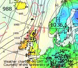 12th: With the minimum falling to 1.9C it was just not low enough for the precipitation to fall as snow here. But on the mountains above about 900 ft it was and there was light to moderate snow especially around Llyn Ogwen and the Glyders. There was a little snow on the headland at Penmaenbach and eastward the A55 was described as 'tricky', but further west it was clear. Snow had fallen in Gwent and Dyfed Powys, and on the Brecon Beacons. There was 10 cm of snow in Liverpool was falls also in the Wirral and Manchester, and the Midlands with snow in Birmingham.
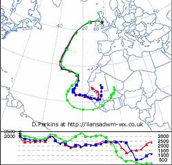 Pressure was 1021 mb with high 1036 mb over Scandinavia and low 988 mb Iceland. Isobars were packed tight in the north-west of Britain and the strong to gale-force N'ly winds the blizzards led to drifting snow. Heaviest precipitation fell to the N and E of here with heavy snow reported in Cumbria, western and central Scotland as well as the Highlands. Snow 20 cm deep with 4 ft drifts were reported. Many roads in Scotland were blocked and many more were only just passable. Glasgow and Edinburgh Airports were closed. The day was sunless the sky keeping overcast with low brightness penetrating the tick cloud. There was drizzle, heavy at times in the morning and a few spots of rain from time to time through the day with the temperature rising slowly. [Rain 0.5 mm; Max 6.8C; Min 1.9C; Grass 0.9C]
13th: There had been a moderate to heavy fall of mixed pink to reddish grey and reddish brown dust during the past 24-h that had dried on observing surfaces. Predominant colour of the heaviest dust particles was reddish brown (MUNSELL 5YR 6/4), finer dust was (MUNSELL 5YR 7/4) but there was some reddish grey (MUNSELL 2.5YR 6.1).
One of the heaviest dustfalls seen here since 14 October 2001.  Trajectory analysis, using the HYSPLIT model at the NOAA Air Resources Laboratory, indicated that parcels of air arriving between 3000 and 3500 m over Llansadwrn at 11 GMT on the 12th had come from an area between southern Mauritania and southern Mali. Dust was deposited between 09 and noon (confirmed by other trajectories giving similar routes) in heavy drizzle and light rain that accumulated most of the 0.5 mm rainfall recorded in the 24-h. Dust storms were active in the area close to the trajectory between 27 February and 1 March and dust was blown over out into the Atlantic. On the 8th the plume of dust was captured on a MODIS TERRA satellite image (visible spectrum)
 ![]() when it was off the African coast, between Western Sahara in the N and Senegal in the S, and just N of the Cape Verde islands. The blue and red routes are from S Mauritania over Senegal and The Gambia and pass close to the dust plume seen on the 8th. The green trajectory follows the route of the Harmatten winds that blow off the Sahara between December and March over Mali and Liberia. Usually the dust is blown to South America or the Caribbean, but on this occasion it headed W then N, and W again, it passed to the W of the Azores before crossing Ireland to be deposited on Anglesey. Pressure 1018 mb was falling with low 987 mb W of Ireland with associated fronts over the Irish Sea. It was another overcast and dull day, dry in the morning with a little rain in the afternoon. It was windy with the S'ly wind strengthening to force 5/6. At 1600 GMT more dust had been deposited in the rain. The wind that had been strengthening all day reached gale force 8 around 22 GMT but had moderated before midnight. [Rain 4.5 mm; Max 7.2C; Min 4.2C; Grass 3.8C]
when it was off the African coast, between Western Sahara in the N and Senegal in the S, and just N of the Cape Verde islands. The blue and red routes are from S Mauritania over Senegal and The Gambia and pass close to the dust plume seen on the 8th. The green trajectory follows the route of the Harmatten winds that blow off the Sahara between December and March over Mali and Liberia. Usually the dust is blown to South America or the Caribbean, but on this occasion it headed W then N, and W again, it passed to the W of the Azores before crossing Ireland to be deposited on Anglesey. Pressure 1018 mb was falling with low 987 mb W of Ireland with associated fronts over the Irish Sea. It was another overcast and dull day, dry in the morning with a little rain in the afternoon. It was windy with the S'ly wind strengthening to force 5/6. At 1600 GMT more dust had been deposited in the rain. The wind that had been strengthening all day reached gale force 8 around 22 GMT but had moderated before midnight. [Rain 4.5 mm; Max 7.2C; Min 4.2C; Grass 3.8C]
14th: There was intermittent rain from 0200 to 0530 GMT as frontal cloud associated with filling low 1006 mb closed in on the Western Isles of Scotland. At 09 GMT the sky was starting to clear with pressure 1017 mb rising slowly. We were into warmer air with the temperature on 7.2C, the maximum of the past 24-h. The morning was bright with a little sunshine but the afternoon was cloudier and had spells of drizzle. {Capel Curig 21.2 mm, Lake Vyrnwy 21.2 mm} [Rain 2.3 mm; Max 10.6C; Min 4.5C; Grass 3.7C]
![]() 15th: As low-pressure moved across Wales associated frontal cloud gave rain from 03 to 04 GMT. At 07 GMT there was low cloud fog with visibility down to 150 m. By 09 GMT there were signs that the cloud was lifting and visibility had improved to 500 m (moderate fog). The mountaintops were generally in the clear with the cloud in the valleys, Menai Strait and over Anglesey. Pressure 1021 mb was rising with high 1042 mb over Scandinavia while pressure was low over the Mediterranean. The day was slow to brighten and the day saw only a few glimpses of the sun. During the evening the sky cleared with bright moonlight at 22 GMT, with the moon just past full. [Rain trace; Max 8.3C; Min 4.8C; Grass 4.8C]
15th: As low-pressure moved across Wales associated frontal cloud gave rain from 03 to 04 GMT. At 07 GMT there was low cloud fog with visibility down to 150 m. By 09 GMT there were signs that the cloud was lifting and visibility had improved to 500 m (moderate fog). The mountaintops were generally in the clear with the cloud in the valleys, Menai Strait and over Anglesey. Pressure 1021 mb was rising with high 1042 mb over Scandinavia while pressure was low over the Mediterranean. The day was slow to brighten and the day saw only a few glimpses of the sun. During the evening the sky cleared with bright moonlight at 22 GMT, with the moon just past full. [Rain trace; Max 8.3C; Min 4.8C; Grass 4.8C]
At mid-month the mean temperature 4.5C was (-2.8) and [-2.2] of average. The mean was the lowest since before 1979. But 1995 had 4.8C and last year (2005) had 4.9C. The highest was 7.9C in 1991. Mean soil temperature at 30 cm depth was 4.8C (-2.5). Precipitation, rainfall, snow and hail, was 57.7 mm already (93%) and [68%] of average, but the year is running only 2 mm above 1945's total, the driest year since before 1928. The local soil was near water-saturation percentage and the water balance was well in excess with 204 mm. Days with snow were 5 (+3.4) and snow lying at 09 GMT 6 (+5.7).
16th: There was ground frost overnight (-2.4C) but no whiteness on the grass as it was dry. There were snow flurries from 08 GMT, but on melting the amount of water was so small that only traces were on raingauge funnels. Pressure 1031 mb continued to rise as high 1047 mb Norway extended a ridge across the Norwegian Sea to N of the British Isles. A low 991 mb, unusually over the Azores, was moving towards the Iberian Peninsula. We were in a force 4 E'ly airflow with showery troughs moving W. The morning was bright with some sunshine, but the with the slight small flaked snow showers increasing in frequency and flake size towards the afternoon. At 1330 there was a prolonged large flaked snow shower but even that one did not settle here and produced very little water. By 1500 GMT there was a dusting of snow on the Carneddau Mountains above 1500 ft. After some more sunshine there was a moderate shower of small snow pellets at 1700 GMT. It was a cloudy night with little or no precipitation. [Rain 0.1 mm; Max 4.3C; Min 0.0C; Grass -2.4C]
17th: With the morning ice precipitation stated again. Slight snow was falling at 09 GMT. Pressure was 1031 mb and the wind a cold-feeling E'ly force 5. Frequent slight snow and snow pellet showers at first gave way to slight drizzle, or rain, continuous through the afternoon until 1800 GMT. The was a slight deposition of dust during the day. Although the ground and concrete was wet only 0.1 mm was deposited in the raingauge. The evening and night were mostly dry but kept overcast. By 21 GMT the sky had cleared and the rising moon, to the SE over the Snowdonia Mountains, was coloured deep orange. It is likely that the N African dust in the atmosphere at the moment contributed to this effect. When low in the sky light must pass through a longer column of air with more light scattering. On rising further it turned yellowish, but had not resumed its normal pale glow by midnight. [Rain 0.1 mm; Max 3.7C; Min 1.5C; Grass 0.7C]
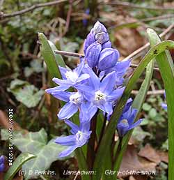
![]() 18th: A 'bitingly cold' wind, well E'ly force 6 with a temperature of 2.5C at 09 GMT. There were a few breaks overhead in the stratocumulus cloud from time to time. Pressure was 1025 mb with high 1043 mb over the Faeroe Islands and lows 991 mb Azores, and 996 mb off Cape Finisterre. The resulting pressure gradient has given the persistent strong E'ly winds. The morning saw some glimpses of sunshine; visibility was only moderate to poor in haze. The afternoon saw the sky clearing and in sunshine the temperature reached 7.4C. The evening was mostly clear and when the moon rose it was not as orange as yesterday (17th). Flowers of glory-of-the-snow Chionodoxa luciliae are now open in the garden. A bulbous plant related to the squills (Scilla), but not native in Britain. It is an early flowering alpine that occurs in Turkey and parts of Asia to a height of 6500 ft. It is naturalised on the rockery banks in the garden, but I have not yet seen it in the wild although it does seem to occur in North America. It propagates from seed as well as bulbs. Lesser celandines can now be seen in greater profusion since first appearing on the 5th. Bluebell and wild garlic leaves have grown to between 12 - 15 cm. [Rain 0.0 mm; Max 7.4C; Min 1.5C; Grass -0.5C]
18th: A 'bitingly cold' wind, well E'ly force 6 with a temperature of 2.5C at 09 GMT. There were a few breaks overhead in the stratocumulus cloud from time to time. Pressure was 1025 mb with high 1043 mb over the Faeroe Islands and lows 991 mb Azores, and 996 mb off Cape Finisterre. The resulting pressure gradient has given the persistent strong E'ly winds. The morning saw some glimpses of sunshine; visibility was only moderate to poor in haze. The afternoon saw the sky clearing and in sunshine the temperature reached 7.4C. The evening was mostly clear and when the moon rose it was not as orange as yesterday (17th). Flowers of glory-of-the-snow Chionodoxa luciliae are now open in the garden. A bulbous plant related to the squills (Scilla), but not native in Britain. It is an early flowering alpine that occurs in Turkey and parts of Asia to a height of 6500 ft. It is naturalised on the rockery banks in the garden, but I have not yet seen it in the wild although it does seem to occur in North America. It propagates from seed as well as bulbs. Lesser celandines can now be seen in greater profusion since first appearing on the 5th. Bluebell and wild garlic leaves have grown to between 12 - 15 cm. [Rain 0.0 mm; Max 7.4C; Min 1.5C; Grass -0.5C]
19th: A bright and sunny morning but there was still a moderate E'ly and the 5.0C temperature at 09 GMT still felt cold! Pressure 1019 mb was falling very slowly as declining high 1034 mb edged towards Greenland. Low 994 mb was close to Cape Finisterre and there was low-pressure 1002 mb over the Mediterranean Sea. Overhead there was jetstream cirrus with orographic waves and several contrails, unusual for here, drifting over in the E'ly from flight paths into Manchester and London. The mountains had a roll of cloud capping the summits. The day was sunny on Anglesey with the temperature here reaching 8.5C, but stratiform cloud could be seen over Liverpool Bay and persisted behind and on the top of the mountains. Honeybees were seen out for the first time this year; they found a sheltered bank of heathers in full flower to feed on. I checked the temperature there, in amongst the heather it was 16.1C and under the leaves of flowering celandines 13.6C. The top 2 cm of soil was at 9.0C. Quite a nice microclimate on a windy day; after that I found my own sheltered corner and had a beer! At 21 GMT it was mostly cloudy. {Valley 11.1h} [Rain trace; Max 8.5C; Min 2.2C; Grass -0.7C]
![]() 20th: An overcast morning with a light shower of rain around 09 GMT. Pressure was 1015 mb with low 998 mb near Cape Finisterre. Pressure was also low E of the Baltic and the Mediterranean but high 1058 mb N Greenland. We still had the E'ly, force 5 early moderating to force 3/4 later, in a temperature of 4.2C that struggled to rise to 6.0C during the sunless day. The NOAA 18 satellite image at 1348 GMT shows the low entering the Bay of Biscay. Most of Britain had a cloudy day with frontal cloud in the S and limited convection clouds developed in the N. There is marine open celled convection over the Norwegian Sea.. {Pembrey Sands 9.6C, Scilly Is. 5.8 mm} [Rain trace; Max 6.0C; Min 3.6C; Grass 2.5C]
20th: An overcast morning with a light shower of rain around 09 GMT. Pressure was 1015 mb with low 998 mb near Cape Finisterre. Pressure was also low E of the Baltic and the Mediterranean but high 1058 mb N Greenland. We still had the E'ly, force 5 early moderating to force 3/4 later, in a temperature of 4.2C that struggled to rise to 6.0C during the sunless day. The NOAA 18 satellite image at 1348 GMT shows the low entering the Bay of Biscay. Most of Britain had a cloudy day with frontal cloud in the S and limited convection clouds developed in the N. There is marine open celled convection over the Norwegian Sea.. {Pembrey Sands 9.6C, Scilly Is. 5.8 mm} [Rain trace; Max 6.0C; Min 3.6C; Grass 2.5C]
21st: Continuing overcast with the E'ly down a notch to force 4 this morning. Pressure was 1016 mb with low 999 mb in the Bay of Biscay with frontal cloud affecting S Ireland and Britain, and stretching from Brittany to Germany. Pressure remained high 1049 mb over Greenland and pressure gradients were slackening over Britain. The morning was cloudy, but the afternoon had some breaks with glimpses of sunshine. The N of the island did better for sunshine with the sky clearing. The sky started to clear during the evening. {Aberdeen 8.1h; St. Catherine's Point, IoW 9.8C,Mumbles Head 6.8C} [Rain 0.0 mm; Max 4.9C; Min 2.3C; Grass 1.8C]
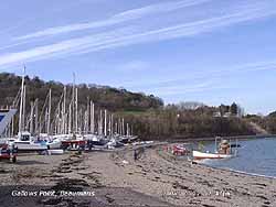 22nd: Over night 4.7 h of air frost -1.6C and -5.9C on the grass, but little frozen water deposits (0.04 mm). It was a sunny morning with the sky 6/8th covered with cirrus clouds and extensive contrails developing cirrocumulus bubbles. Pressure 1015 mb was steady with high 1017 mb centred on N England. The slow-moving low 1002 mb was over Biscay with persistent cloud France and Germany. Small frontal lows S of Iceland brought snow to NW Scotland as they tracked eastward. Here it was a sunny day with the temperature rising to 6.7C. But in the wind, a force 2/3 in the afternoon, it still felt cold at Gallows Point even in the sun
 ![]() . The evening was clear with dew forming on the grass. {Manchester 9.9h, Valley 9.2h} [Rain 0.0 mm; Max 6.7C; Min -1.6C; Grass -5.9C]
. The evening was clear with dew forming on the grass. {Manchester 9.9h, Valley 9.2h} [Rain 0.0 mm; Max 6.7C; Min -1.6C; Grass -5.9C]
23rd: The temperature fell after midnight down to -1.6C giving another 8.0 h of air frost. On the grass dew deposited during the previous evening froze as the temperature fell to -5.9C. In contrast to yesterday 0.16 mm was recorded on few-pads with the grass still white with frost at 09 GMT. The morning was sunny, but pressure 1008 mb was falling as the high moved E to be over the Netherlands 1004 mb. Frontal cloud over Scotland stretched into the Atlantic S of Iceland and delivery a wet day to the Western Isles. To the SW a band of rain was moving into SW Ireland and England ahead of a developing low 972 mb N of the Azores. Here the morning was bright and sunny and although it was overcast by 13 GMT rain kept away. {Isle of Skye 43.1 mm, London MO 11.9C, Hawarden 11.7C, Norwich 10.6h, Valley 6.4h} [Rain 3.3 mm; Max 9.5C; Min -1.2C; Grass -6.2C]
24th: There was a spell of light to moderate rain from 0515 to 0730 GMT giving 3.3 mm. At 09 GMT rain had ceased but pressure 984 mb was still falling with a train of 3 lows lying to the SW (980 mb over St. George's Channel. The wind was a blustery force 5 from the ESE and visibility was only moderate under low cloud that obscured the mountains. The morning was mostly dry but there was rain during the afternoon. With low 981 M tracking N over Ireland at 18 GMT there was moderate to heavy rain, with some ice pellets, that continued through until 0100 GMT accumulating 12.5 mm by morning. {Farnborough 15.1C, Culdrose 17.3 mm, Capel Curig 12.3 mm} [Rain 12.5 mm; Max 10.8C; Min 2.7C; Grass 2.8C]
25th: At 09 GMT pressure 996 mb was rising quickly and the sky starting to clear in a blustery force 5 SW'ly wind. The morning was bright with a little sunshine at times as the temperature rose to 12.2C, highest of the year so far, with the introduction of warm-sector air. At noon the barometer was indicating 997 mb and had started to fall. It was dry until 1500 GMT, but with thickening cloud associated with another low 985 mb W of Ireland, there was rain moderate at times, until 2100 GMT. The S'ly wind was strong (f6/7) during the evening. {Aberdeen 40.6 mm, Capel Curig 27.0 mm} [Rain mm; Max C; Min 5.5C; Grass 5.0C]
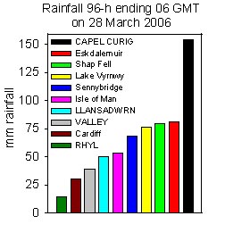 26th: A dull morning overcast with low stratus cloud; visibility was poor in mist. The S'ly wind had moderated to force 5 and the temperature was 10.0C. Pressure 998 mb was rising again. Soil temperatures are on the rise with the higher air temperatures and warm rain penetrating to 30 cm where it was 8.0C, highest of the year so far. The morning was dull at first, but it did brighten around noon, but cloud thickened again by 1230 GMT and there was rain or drizzle during the afternoon and into the evening. The day's maximum of 12.7C and the mean 10.7C were highest of the month. The wind strengthened and touched gale force 8 around 20 GMT. {Capel Curig 44.0 mm, Sennybridge 25.9 mm} [Rain 9.9 mm; Max 12.7C; Min 8.7C; Grass 9.0C]
![]()
![]() 27th: Intermittent rain through the night and pressure had fallen to 981 mb at 06 GMT with low 976 mb lying to the NW off Malin Head. The rain eased and in low cloud and fog visibility reduced to < 200 m at 0730 GMT. By 08 GMT the fog was lifting but was replaced by moderate to heavy rain. Pressure 983 mb had stated to rise and the rain eased by 10 GMT only to be replaced by more fog. The Met Office had issued a severe weather warning of heavy rain in Wales and Scotland. There was heavy rain in S and mid-Wales (Sennybridge 48 mm in 48-h to 18 GMT) this moving on to North Wales later. On the high tide (approaching springs) just after 09 GMT there was a storm surge of 0.7 m at Holyhead. The day was sunless and there were spells of rain and drizzle here, but falls were heaviest over the Snowdonia Mountains with Capel Curig reporting 92 mm in the 48-h to 18 GMT. With the soils already saturated following melting of snow and ice mountain streams turned to torrents. Walkers on Snowdon had to be rescued using ropes when they became trapped by rising water between 2 streams. There was further moderate rain from 1700 to 0100 GMT as the SW'ly wind reached strong to near gale-force (7) . {Capel Curig 39.4 mm, Lake Vyrnwy 29.4 mm} [Rain 19.1 mm; Max 9.8C; Min 9.3C; Grass 9.1C]
27th: Intermittent rain through the night and pressure had fallen to 981 mb at 06 GMT with low 976 mb lying to the NW off Malin Head. The rain eased and in low cloud and fog visibility reduced to < 200 m at 0730 GMT. By 08 GMT the fog was lifting but was replaced by moderate to heavy rain. Pressure 983 mb had stated to rise and the rain eased by 10 GMT only to be replaced by more fog. The Met Office had issued a severe weather warning of heavy rain in Wales and Scotland. There was heavy rain in S and mid-Wales (Sennybridge 48 mm in 48-h to 18 GMT) this moving on to North Wales later. On the high tide (approaching springs) just after 09 GMT there was a storm surge of 0.7 m at Holyhead. The day was sunless and there were spells of rain and drizzle here, but falls were heaviest over the Snowdonia Mountains with Capel Curig reporting 92 mm in the 48-h to 18 GMT. With the soils already saturated following melting of snow and ice mountain streams turned to torrents. Walkers on Snowdon had to be rescued using ropes when they became trapped by rising water between 2 streams. There was further moderate rain from 1700 to 0100 GMT as the SW'ly wind reached strong to near gale-force (7) . {Capel Curig 39.4 mm, Lake Vyrnwy 29.4 mm} [Rain 19.1 mm; Max 9.8C; Min 9.3C; Grass 9.1C]
28th: Another spell of rain from 0400 to 0630 GMT brought rainfall for the 24-h 09-09 GMT to 19.1 mm, largest of the month. Over the past 96-h (06-06 GMT) there was 50.5 mm here but in Capel Curig the total was 154 mm . Sennybridge in South Wales had 68 mm while Shap Fell had 80 mm and Eskdalemuir 81 mm. In contrast Rhyl had only 14 mm and Crosby, Liverpool, 17 mm, both stations in a rain-shadow area. At 09 GMT it was dry and the slowly rising pressure was 990 mb with twin lows to the N, 980 mb Western Isles and 979 mb near Shetland. The near-spring high tide at Conwy (9.7 m Liverpool), with a surge of nearly 0.5 m, held back water and the river overflowed its banks partially flooding the road between Llanwrst and Gwydir Castle. With strong winds persisting all day a speed limit of 30 mph was in force on the Britannia Bridge. What a difference 200 miles SE makes in Britain. At RAF Marham in Norfolk widespread blown dust was reported between 14 and 15 GMT. Here there was some further light rain during the afternoon and there was definitely no dust being blown around! After a light shower about 1830 GMT the night was dry. {Capel Curig 59.6 mm} [Rain 4.9 mm; Max 8.5C; Min 6.8C; Grass 6.5C]
29th: Mostly cloudy after midnight but a short clear spell resulted in a touch of ground frost. At 09 GMT pressure 1004 mb with low 977 mb NW Scotland. A train of lows was to the SW in the Atlantic tracking E. The morning was bright at first with a little sunshine. The sky was overcast by noon with the cloud thickening later as low 980 mb approached SW of Ireland. There was a band of light rain from 2100 GMT to midnight. [Rain 6.1 mm; Max 10.2C; Min 1.0C; Grass -1.3C]
![]() 30th: As the low tracked northwards over Ireland pressure dropped to 986 mb and the SSW'ly wind strengthened to force 6/7. At 06 GMT one of the centres of the complex low-pressure 982 mb was over Belfast. Dense cloud and rain was circulating on the periphery, wetter to N and S of here, and winds in the west were strong to gale-force all day. At 09 GMT pressure here 990 mb was rising with a strong SW'ly wind.
30th: As the low tracked northwards over Ireland pressure dropped to 986 mb and the SSW'ly wind strengthened to force 6/7. At 06 GMT one of the centres of the complex low-pressure 982 mb was over Belfast. Dense cloud and rain was circulating on the periphery, wetter to N and S of here, and winds in the west were strong to gale-force all day. At 09 GMT pressure here 990 mb was rising with a strong SW'ly wind.
 It was overcast with slight drizzle on the wind at times. The wind persisted, but the drizzle soon ceased and it was brighter late in the afternoon with a little sunshine to the N; another sunless day here. Almost the highest tide of the year (10.4 m [34.1 ft] 1148 GMT Liverpool Alfred) passed without any reports of flooding. Sea Level Stations, operated by the Proudman Oceanographic Laboratory, reported a storm surge of about 0.5 m on top of predicted levels around Liverpool Bay. By 17 GMT it was raining again. Warmer in the south today with 16C, or more, reported from many stations. {Capel Curig 36.2 mm, Lake Vyrnwy 19.8 mm, Milford Haven 18.8 mm} [Rain mm; Max C; Min 5.3C; Grass 5.8C]
31st: A sunny morning and with 12 sunless days here this month it was very welcome. A blackcap was heard singing in nearby trees. The wind was a moderate SW'ly and visibility was good. Low-pressure was still dominating the weather, with low 981 mb to the W of Scotland, although here pressure 1001 mb had risen and we were in a clear slot it started to fall again during the morning. The MODIS TERRA satellite image shows the comma-shape of the low with its swirl of cloud W of Scotland and frontal occlusion over N Scotland . The cloud to the W of Anglesey was a developing frontal wave with triple point near Shannon, Ireland. A warm front lay across to central Wales while a cold front (not evident on the image) stretched south-westwards into the Atlantic towards the Azores. The image is composed of sensor channels 3+6+7 that identifies ice as a vivid red and ice crystals at the top of high clouds as a reddish-orange. Liquid water droplets in clouds appear white and vegetation looks green.
The morning turned cloudier by noon and the afternoon showers of rain. There was further moderate to heavy rain in the night. [Rain 11.7 mm; Max 11.7C; Min 6.5C; Grass 4.5C]
The month was remarkable for bucking the warming-trend of recent years and being the coldest March since 1979. The mean temperature of 5.3C was (-2.0) and [-1.4] of average. The mean maximum of 8.2C was (-2.4) and [-2.0] and lowest since before 1979, the start of records at this station. The mean minimum of 2.5C was (-1.6) and [-0.8] lowest since 2001 (2.4C). Rainfall of 139.9 mm (225%) and [165%] was the 7th largest since before 1928. It was a dull month with 12 sunless days (Valley reported 5 days with 8 days of 0.5h, or less) and it was the 15th lowest sunshine duration (93.2h) on Anglesey since before 1931.
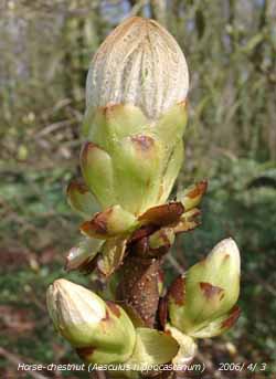
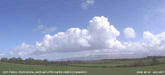 1st: A typical start to the month of 'sunshine and showers'. Just before 09 GMT a large cumulonimbus cloud moved across with a burst of heavy rain and a 3C fall in temperature to 5.8C, just what I like when making obs! There was some fresh snow on the Carneddau Mountains in the vicinity of C. Llywelyn and C. Dafydd. Pressure had risen back to 1001 mb, but low 981 mb spinning around to the W of Ireland did not move very far during the day. After the showery trough we were into a clear slot that gave some clear sunshine during the morning. A line of stratocumulus clouds, with some towering cumulus, persisted over the Snowdonia Mountains. I spotted the first buds of hawthorn I have seen opening at the church just up the road from the weather station. The afternoon was cloudier with another line of showers passing over. At 1447 GMT there was a blustery shower of ice pellets and rain that again resulted in a temperature fall of 3C. Light showers continued infrequently into the night. {Capel Curig 20.6 mm, Sennybridge 12.2 mm, Crosby, Liverpool 10.5 mm} [Rain 0.8 mm; Max 11.9C; Min 5.8C; Grass 5.0C]
2nd: Overcast with low stratus cloud obscuring the mountains and giving poor visibility. At 09 GMT there was a light blustery shower, the wind SW'ly force 6. Pressure 995 mb was falling with low 994 mb over the Irish Sea and a twin 990 mb to the NE over the North Sea. There had been no sighting or sound of the overdue chiffchaffs. Held up in France and then for over a week in SW England by the cold weather and unfavourable winds some have been reported moving up through England, a few to the N of here, but hardly any into W Wales and none here so far. The horse-chestnut is, however, showing small yellow candles, the leaves having not yet started to unfold. There are catkins on hazel and the buds are just breaking and blackcurrants on the vegetable plot have broken. The day was dull and sunless under thick cloud with light showers of rain or drizzle. In the afternoon there was a longer spell of light rain before the cloud thinned towards dusk. The night was dry. Capel Curig had headed the list of largest rainfall in Britain for 6 of the last 7 days! {Capel Curig 35.8 mm, Lake Vyrnwy 21.4 mm} [Rain 5.4 mm; Max 8.7C; Min 5.8C; Grass 5.0C]
![]()
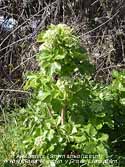 3rd: The sky started to clear before dawn and there was a touch of ground frost. At 09 GMT the sky was 6/8th covered with cumulus and stratocumulus clouds and visibility was good but somewhat hazy. The temperature had risen from an overnight minimum of 2.6C to 7.4C and pressure 1020 mb was rising. Pressure had built to the W overnight with high 1029 mb W of Scotland and 1025 mb Greenland. Pressure was also high 1026 mb in Biscay. Where has the low-pressure gone? It's off the Norwegian coast 998 mb. At 0920 GMT I heard the first chiffchaff singing, the females will take a little longer to arrive, perhaps 2 weeks later. But the bird may have just been passing through on its way north as it was not heard again. So our resident birds seem not to have arrived yet. A mostly sunny day with many fair-weather cumulus clouds in the afternoon. Clouds dispersed towards evening giving a mostly clear night. {Weymouth 11.5h, Valley 8.8h} [Rain 0.0 mm; Max 11.7C; Min 2.6C; Grass -0.5C]
 4th: An almost clear sky at dawn and at 09 GMT the only cloud I could see was over and to the S of the Snowdonia Mountains. A moderate NE'ly wind made the 4.0C (dewpoint -2.9C) feel chilly. Visibility was very good (>40 km). Pressure 1025 mb had risen with high 1032 mb to the NW. The day was sunny with clear skies over Anglesey. Several large bumblebees were seen around the garden. A few peacock and small tortoiseshell butterflies had emerged from hibernation. Hawthorn leaves are opening in the wood and some hedgerows, as well as snowberry. The first white flowers of blackthorn were spotted near the Bangor exit of the Britannia Bridge. Blackthorn flowers appear before the leaves whereas hawthorn leaves appear before the flowers. It is a tricky time of the year for greenhouse management. Although air temperatures are low the sunshine can soon raise the temperature inside. Vents must be opened and closed again before sunset. In the greenhouse the buds on our old Black Hamburg grapevine had burst open. Outdoors the maximum temperature reached only 6.4C, lowest of the month. The clear evening led to a frosty night. {Valley 11.6h, Fishguard 11.3h, Guernsey 13C} [Rain 0.0 mm; Max 6.4C; Min 1.0C; Grass -2.6C; Valley sunshine 12.2h]
5th: An early white frost on the ground with the air temperature down to -0.2 for just 2 hours. The grass minimum fell to -4.0C, joint lowest of the month (with the 10th). With the sunny morning and a light NW'ly breeze the temperature was 5.4C at 09 GMT. Pressure 1021 mb was falling as Atlantic-high 1029 declined a little. Low 988 mb was over the Denmark Strait, between Greenland and Iceland, and tracking SE brought associated fronts, and a little snow on the mountains, across N Scotland during the day. But here it was a mostly sunny day with excellent visibility and the temperature reached 12.1C.
The salt tolerant ivy-leaved scurvygrass Cochleria danica can now be seen starting to flower on the main roadsides in Llansadwrn. The warmer sunshine brought several butterflies, peacocks and small tortoiseshell, out from hibernation. They were feeding on profusely flowering Erica and lesser celandines in the garden. There was a persistent sprinkling of snow seen on the top of Carnedd Llywelyn and Snowdon. It was mostly cloudy after dusk, but the night kept dry. {Solent 12.8C, Mumbles Head 11.4C, Sennybridge min -5.7C; Kirkwall 14.2 mm} [Rain 0.0 mm; Max 12.1C; Min -0.2C; Grass -4.0C]
6th: A mostly cloudy morning with a moderate to fresh WSW'ly wind. Some breaks overhead at 09 GMT, but pressure 1013 mb was still falling as the low tracked over the Norwegian Sea. High 1026 mb was S of Greenland with low-pressure W of Iberia. Cold fronts associated with the low were over N Britain and these moved S during the day. It was dry in the morning then intermittent rain and a spell of rain from 1430 to 1600 GMT during the afternoon. The evening and night were mostly overcast. [Rain 5.1 mm; Max 9.6C; Min 4.1C; Grass 0.8C]
 7th: A touch of ground frost indicative of a clearer spell but the sky at 09 GMT was covered with variable thickness stratocumulus cloud. It was bright when the sun could be seen through thinner cloud but it was mid morning before the sky began to partially clear. Pressure was 1013 mb with complex low 980 mb circulating slowly over the Norwegian Sea. Yesterday's cold front was over the English Channel while there were showers affecting N Ireland and Scotland. By noon there were some long sunny spells that extended into the afternoon but were interrupted by a shower moving across the island about 15 GMT. At 1800 GMT low 988 mb was S of the Faeroes and a cold front was moving S over the Irish Sea. Ahead of the front a showery trough delivered 8 mm of heavy rain and ice pellets between 1855 and 1910 GMT. As the front passed over with blustery winds there was another burst of ice pellets and rain at 2237 GMT. Hail showers were also reported in Chester and Manchester. After that the night was quieter. Flowers have appeared on elm Ulmus sp and ash Fraxinus excelsior at the weather station, but you need binoculars to spot them on the tops of tall trees. Both species have flowers appearing before leaves, and at the moment the leaf buds are quite tightly closed. The hermaphrodite flowers, having stamens and ovaries together are protandrous (stamens mature first), are clustered towards the tip of 1-year old twigs. Most of the elm trees have gone, felled following the ravages of Dutch Elm Disease in the 1970's. I identified the first case on the island caused by a virulent strain of the fungus Ceratocystis ulmi spread by elm bark beetles Scolytus. In an attempt, that failed, to halt the spread of the disease infected trees had to be felled, debarked or burned (by County Council Order). Three lots of trees were felled, some 70 in all around the weather station. Some scrub elm remains and a few trees regrew from suckers in the ground, it rarely reproduces by seed. Most of these died within 15 years, but one remains is 30 feet tall and so far seems unaffected and flowers normally. Whether or not it is resistant to the fungus, or the beetles have died out through lack of hosts remained to be seen. Elm was probably introduced into Britain, but became an important part of the landscape. [Rain 13.0 mm; Max 11.4C; Min 2.8C; Grass -0.7C]
8th: The overnight rain had fallen as snow in central Snowdonia and was lying at 1200 ft in Cwm Idwal and the Carneddau. Snow was also reported, in NE Wales by David Small, in the area around Holywell and Halkyn south to Hope Mountain at about 1000 feet. Deposits from overnight showers had frozen making for some treacherous surfaces. The morning here was bright, but there was a 7/8th cloud cover at about 2500 ft on the hills. Pressure was 1005 mb with complex low over the North Sea (Dundee 993 mb) with the cold front clearing S England. The chiffchaff was back singing again, perhaps he was just resting, or did not like the cold weather. He would not have liked the afternoon. At 1255 GMT a dark cumulonimbus cloud moved across. There was a prolonged shower of snow pellets and sleet during which the temperature fell 6.8C in <30 minutes from 10.3C to 3.5C with the wet bulb reading 1.8C; at 1318 and 1332 GMT there were loud claps of thunder. After that the sky cleared again with the temperature rising to 10.0C; the end of the day was sunny and night was partly cloudy. ![]() The Meteosat MSG satellite image at noon shows the deeply convective clouds in circulation around the low over the North Sea. A secondary low moving down the east coast of England had a cold front (or showery trough) to the west over the Irish Sea; convection on this front can be seen approaching Anglesey and gave the afternoon's storm and dramatic fall in temperature. Some open celled marine convection can be seen in the far NW while the comma shaped cold front can be seen over the W Baltic to N France. {Capel Curig 19.2 mm, Rhyl 8.6 mm} [Rain 2.7 mm; Max 10.3C; Min 1.1C; Grass -1.8C]
The Meteosat MSG satellite image at noon shows the deeply convective clouds in circulation around the low over the North Sea. A secondary low moving down the east coast of England had a cold front (or showery trough) to the west over the Irish Sea; convection on this front can be seen approaching Anglesey and gave the afternoon's storm and dramatic fall in temperature. Some open celled marine convection can be seen in the far NW while the comma shaped cold front can be seen over the W Baltic to N France. {Capel Curig 19.2 mm, Rhyl 8.6 mm} [Rain 2.7 mm; Max 10.3C; Min 1.1C; Grass -1.8C]
![]() 9th: It was a bright morning but there was a cold-feeling N'ly wind and there had been recent slight showers. At 09 GMT pressure 1016 mb was rising but there were plenty of cumulus clouds in the vicinity and some were towering over the mountains. There was snow lying at 1500 ft on the N slopes of Carneddau between C. Llywelyn and C. Dafydd but was 2800 ft around Snowdon. Mistle thrushes were singing, but not the chiffchaff. The first cowslip flowers have appeared in the garden. There was a light shower of snow pellets and snow at 1030 GMT during which the temperature dropped 3C but recovered later reaching a maximum of 8.5C in a mostly sunny afternoon. There was more sleet and small flakes of snow from 19 to 20 GMT. The elm flowers had opened and the reddish anthers on the stamens were releasing pollen. [Rain 0.7 mm; Max 8.5C; Min 2.0C; Grass -1.6C]
9th: It was a bright morning but there was a cold-feeling N'ly wind and there had been recent slight showers. At 09 GMT pressure 1016 mb was rising but there were plenty of cumulus clouds in the vicinity and some were towering over the mountains. There was snow lying at 1500 ft on the N slopes of Carneddau between C. Llywelyn and C. Dafydd but was 2800 ft around Snowdon. Mistle thrushes were singing, but not the chiffchaff. The first cowslip flowers have appeared in the garden. There was a light shower of snow pellets and snow at 1030 GMT during which the temperature dropped 3C but recovered later reaching a maximum of 8.5C in a mostly sunny afternoon. There was more sleet and small flakes of snow from 19 to 20 GMT. The elm flowers had opened and the reddish anthers on the stamens were releasing pollen. [Rain 0.7 mm; Max 8.5C; Min 2.0C; Grass -1.6C]
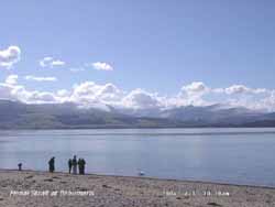 10th: The sky cleared before dawn and the air temperature fell to -0.6C, lowest of the month, and on the grass to -4.0C, joint lowest of the month (with 5th). Before the sun rose the ground was white with frozen water deposits and snow was lying as low as 750 ft. In bright sunshine and clear air visibility was exceptionally good and the mountains looked spectacular with clearly depicted features. Heavy snow had fallen in the SE from Kent to W Sussex and was lying up to 15 cm in places. At 09 GMT the white frost here had gone in a temperature of 5.0C; the chiffchaff and the mistle thrush were singing. Pressure 1024 mb had risen in a ridge from Atlantic-high 1032 mb and the day was mostly sunny with light winds with the temperature rising to 11.6C. By evening the sky was almost clear and a 42° halo was seen around the moon at 2100 GMT. {Great Malvern 12.0C, Prestatyn 12.4h} [Rain 13.5 mm; Max 11.6C; Min -0.6C; Grass -4.0C]
11th: At midnight low 970 mb Iceland had associated fronts over N Ireland and W Scotland where there was heavy rain. There was rain moderate to heavy at times from 0430 GMT to 1000 GMT before a slow clearance. At 09 GMT pressure had bottomed out on 1008 mb with the SW'ly wind strong to near gale force 7. The soil surface was wet and there was standing water in places and on nearby fields. Despite the wet soils ploughing of several fields (6) was done in Llansadwrn during the past week. Only 1 field was ploughed in the autumn last year. There was a small clearance from noon before showers moved across between 15 and 16 GMT. A rainbow was seen 1525 GMT. {Llansadwrn 14.8C, Rosslare 14.5C, Jersey 7.5h} [Rain 3.3 mm; Max 14.8C; Min 3.8C; Grass 1.0C]
12th: There were some breaks in the cloud after midnight and there was a touch of ground frost. Before 09 GMT there were light showers of rain in the vicinity with the Snowdonia Mountains obscured in low cloud and hill fog above 1500 ft. Pressure 1015 mb was rising with high 1033 mb just N of the Azores, but low 980 between Greenland and Iceland had associated frontal systems to the NW over Ireland and Scotland where there was some rain. The morning was bright at times, but with little sunshine. The afternoon was cloudy with infrequent slight rain or drizzle especially around the coast this continuing into the evening. [Rain 2.7 mm; Max 11.4C; Min 4.0C; Grass -0.2C]
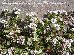 13th: The night was overcast and there was a spell of light rain from 06 GMT to just before 09 GMT. A frontal wave was clearing Anglesey, we were still in the W'ly airflow, and the morning slowly became bright and sunny as the cloud lifted and sky cleared. Pressure was 1008 mb with low 976 mb having tracked N of Scotland to be over the Norwegian Sea. The afternoon was mostly sunny and the evening and night had broken cloud cover and no rain. [Rain 0.0 mm; Max 15.5C; Min 7.6C; Grass 6.5C]
14th: Clear sky at dawn with moderate to heavy dew but no frost on the grass (min 1.2C). By 09 GMT pressure 1012 mb was rising and the W'ly breeze was force 3. Frontal cloud lay to the S and cumulus clouds had developed and a few were starting to tower. The morning was mostly sunny with fair-weather clouds over Anglesey. The afternoon was mostly sunny with clouds dispersing giving clear skies by evening. Later cloud thin encroached from the W. [Rain 0.4 mm; Max 14.3C; Min 4.9C; Grass 1.2C; Valley sun 12.1h]
15th: A bright morning with thin high cloud and some sunshine. A decaying warm front was lying across Ireland to Wales and East Anglia. Pressure was 1008 mb and the temperature 10.5C. The day was mostly cloudy but there were some sunny spells and the temperature rose to 14.5C, but in Chorlton cum Hardy in Manchester it was 16.9C. During the evening there were a few spots of rain as showers developed. [Rain trace; Max 14.5C; Min C; Grass C]
Mid-month (days 1-15) temperatures were below the April averages with the mean 7.4C (-1.5) and similar in the soil at 30 cm deep 8.4C (-1.6). Rainfall has been 47.6 mm (63%) and [82%] of the average monthly total. The highest maximum of 15.5C was (-2.8).
16th: A few more spots of rain after midnight and again around 08 GMT as a shower moved into Anglesey and tracked E over North Wales. South-west of Manchester rain was quite heavy on the M56 around 09 GMT. Here the sky was clearing with pressure 1011 mb with low 985 mb E of Iceland with associated cold front over Wales and N England. The day was mostly sunny with long spells of sunshine later in the afternoon, between cumulus clouds passing overhead on the NW'ly breeze, when the temperature rose to 15.8C, highest of the year so far! I was digging the garden vegetable plot and had to take my pullover off. The evening turned cloudier. [Rain 0.0 mm; Max 15.8C; Min 7.9C; Grass 6.2C]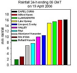 18th: Intermittent rain before 09 GMT was still falling under very slow-moving frontal cloud over Ireland and N Wales. There had been large falls of rain on North Wales with Capel Curig reporting 16.2 mm. It was a dull damp morning with low cloud and mist. Pressure was 1013 mb with high-pressure to the S (1022 mb Azores to Bay of Biscay) and low-pressure to the NE (987 mb Scandinavia and Baltic). Low 1010 mb in the Atlantic had the associated frontal cloud across Britain responsible for the dismal weather. The afternoon did brighten with a little sunshine before it turned cloudy again before evening. There was a long spell of light to moderate rain from 2000 GMT through till morning. Rainfall for the 24-h 09-09 GMT of 15.5 mm was the largest of the month. [Rain 15.5 mm; Max 12.2C; Min 6.9C; Grass 6.0C]
 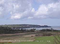 19th: The overnight rain had eased from 05 GMT then more or less ceased by 0630 GMT. Rainfall was 15.5 mm and this left the already saturated soils soggy underfoot with a little standing water in puddles and on the field next to the weather station. But there was a break in the cloud, but the morning struggled to brighten much before noon. The afternoon did have more sunshine and with the sky clearing and visibility by evening exceptional there were fine views from Anglesey of the Snowdonia Mountains. The Carneddau Mountains were reported seen by David Small from 50 miles away on the M53 south of Wallasey. The first swallow reported in Llansadwrn was spotted by Richard Edwards. The view across the Afon Nodwydd marsh and Red Wharf Bay to Castell Mawr was stunning in its clarity. The tide was still filling the Bay, but had been on the ebb for an hour. At spring-highs the marsh floods with sea water; the saltmarsh habitat has a wide variety of salt-tolerant plants and is frequented by herons and little egrets that have been making their way north in recent years including Scotland. {Capel Curig 16.2 mm} [Rain 0.0 mm; Max 11.6C; Min 7.0C; Grass 6.6C]
 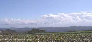 21st: After early fog it was a fine sunny morning up on the Llansadwrn ridge. At low level in the Menai Strait, Malltraeth Marsh and around Red Wharf Bay to Pentraeth sea fog persisted to late in the morning. Pressure 1017 mb was rising as filling low 1000 mb tracked across the Bay of Biscay. Pressure was high 1030 mb over the Azores to the SW. The afternoon was sunny and the evening clear with a deep orange-coloured setting sun, indicative of suspended particulates in the atmosphere. [Rain 0.0 mm; Max 14.5C; Min 6.8C; Grass 5.5C; Valley sun 11.5h]
 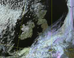 22nd: The night was clear and calm at first with dew on the grass but no frost. By dawn it was cloudier as cloud, associated with low 977 tracking N over the Denmark Strait, N of Iceland, encroached from the NW. There was rain already into NW Ireland and Scotland. The day was bright with a little hazy sunshine in the afternoon, and although cloud thickened in the evening rain did not arrive until 22 GMT with a shower then light rain from 2230 GMT. {Heathrow 18.6C, Hawarden 17.6C, Skye 9.6 mm} [Rain 5.3 mm; Max 14.7C; Min 6.1C; Grass 2.5C]
 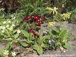 27th: A bright morning with the remnant frontal cloud lying just to the S over Wales. Pressure was 1028 mb with Atlantic-high 1031 mb to the SW of Ireland. At 09 GMT the sky was 6/8th covered with altocumulus, cumulus and stratocumulus clouds but these dispersed to give a mostly sunny afternoon. [Rain 0.0 mm; Max 14.0C; Min 7.3C; Grass 4.5C; Valley 11.7h]
 The month ended with a rainfall total of 83.4 mm 110% of the decadal and 144% of 1971-2000 averages. The mean temperature was 8.8C and finished with only -0.1C down on the decadal but was +0.2 of the 1971-2000 climatological average. The highest maximum 16.2C was -2.1 of average. It was the sunniest since 1974.
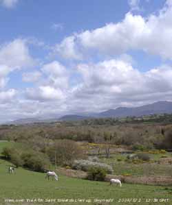 1st: With overnight rain cleared away the sky was clearing at 09 GMT. Pressure 1000 mb had just started to rise although frontal-wave lows were to the north of here, 993 mb N England and 994 mb N Scotland. The temperature was 9.2C, visibility good and cumulus clouds were scudding along on a moderate WNW'ly breeze. The day was mostly sunny and the temperature rose to 14.3C. Further east the slow-moving frontal cloud gave a mostly dull day, but cloud had cleared away over the North Sea before evening. By 21 GMT another mass of cloud associated with a deepening low 973 mb W of Ireland had encroached. A tawny owl was heard hunting in the wood close by the weather station. [Rain 0.0 mm; Max 14.3C; Min 6.8C; Grass 6.5C]
2nd: An overcast morning but the stratiform cloud was moderately high and it was dry. Pressure 1001 mb was falling with the vigorous low 968 mb tracking N towards W Scotland. The S'ly wind was force 5 and a small lee-break developed to the S and gradually increased over here through the morning; but there was a little rain on the west coast of Anglesey. Before noon it was mostly sunny and the early afternoon the sky was mostly clear. But further cloud encroached from the W by 1500 GMT. The wind strengthened during the afternoon and was strong to gale force 8 and a 20 mph speed limit was imposed on the Britannia Bridge. It kept dry here until 1800 GMT when there was light showery rain until 2030 GMT, but there was moderate to heavy rain over N Ireland and W Scotland. [Rain 1.5 mm; Max 14.5C; Min 6.7C; Grass 5.1C]
3rd: A bright morning with 4 oktas cloud cover at 09 GMT and a force 5/6 S'ly wind that moderated through the morning. Pressure 1008 mb was rising as low 965 mb S of Iceland filled. The cold front was clearing SE over S Britain; the warm front over Ireland and SW Scotland gave some more rain there during the day but had petered out by evening. Here it was a dry and mostly sunny day, a clear evening with very good visibility before more frontal cloud encroached by midnight. [Rain 1.0 mm; Max 15.8C; Min 8.1C; Grass 6.9C]
![]() 4th: A dull and damp morning following a shower of rain from 0530 GMT. A warm front was lying over Ireland and a cold front further to the W, see the Meteosat MSG image taken at 09 GMT. Pressure was 1012 mb and the wind a light E'ly. After slight rain midmorning, that included a fall of light reddish-brown coloured dust, in some warm sunshine the temperature rose to 24.7C by 1400 GMT. Convective clouds developed over Wales, N England and Scotland and there was a heavy shower of rain at 1450 GMT with thunder heard at 1454 and 1502 GMT with more dust deposited. After a little more sunshine there was another prolonged shower between 21 and 23 GMT during which there was a further deposition of dust. The dust originated from a wide area of north Africa. [Rain 1.3 mm; Max 24.7C; Min 7.9C; Grass 4.4C]
4th: A dull and damp morning following a shower of rain from 0530 GMT. A warm front was lying over Ireland and a cold front further to the W, see the Meteosat MSG image taken at 09 GMT. Pressure was 1012 mb and the wind a light E'ly. After slight rain midmorning, that included a fall of light reddish-brown coloured dust, in some warm sunshine the temperature rose to 24.7C by 1400 GMT. Convective clouds developed over Wales, N England and Scotland and there was a heavy shower of rain at 1450 GMT with thunder heard at 1454 and 1502 GMT with more dust deposited. After a little more sunshine there was another prolonged shower between 21 and 23 GMT during which there was a further deposition of dust. The dust originated from a wide area of north Africa. [Rain 1.3 mm; Max 24.7C; Min 7.9C; Grass 4.4C]
5th: A bright and sunny morning and after an overnight minimum of 7.2C the temperature was 12.4C at 09 GMT. Pressure had risen to 1020 mb with high 1023 mb over the Bay of Biscay. A low 997 mb was W of Ireland with associated fronts, but the day kept mostly sunny here. [Rain 0.0 mm; Max 17.0C; Min 7.2C; Grass 6.2C]
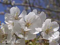 6th: With clear skies overnight the minimum fell to 6.2C and 3.6C on the grass. The morning was sunny with a temperature of 14.6C at 09 GMT rising to 19.2C during the day. The afternoon was cloudier and there was a moderately heavy shower in Bangor at 1615 GMT that was slight here. There was a colourful sunset with reddened sky set in grey and white clouds. The night was mostly clear above wispy cirrus clouds. [Rain 0.3 mm; Max 19.2C; Min 6.2C; Grass 3.6C]
7th: A sunny morning. Pressure was 1019 mb with low 1004 mb to the W of Ireland. High 1037 mb was over Scandinavia and this resulted in a cool N'ly flow of air. Although there was bright sunshine the temperature rose to only 13.8C in the light to moderate breeze. By evening it was cloudier and was overcast at night. [Rain 0.5 mm; Max 13.8C; Min 5.9C; Grass 3.0C]
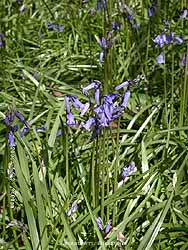 8th: At midnight with low 1006 mb W of Ireland and complex lows over the English Channel and N France there was a warm front over W Scotland, Wales and Brittany. It was raining slightly at 08 GMT and by 09 GMT had turned light to moderate and continued through the day to 17 GMT. There was further from 2300 GMT. {Cardiff 19C} [Rain 8.6 mm; Max 12.1C; Min 8.0C; Grass 7.0C]
9th: The rained petered out after 0100 GMT and the night became misty with fog later. The morning was overcast, dull and misty with very poor visibility (<1 km) at 09 GMT. There was little or no wind, but visibility began to improved around noon when the sun broke through the remnant frontal cloud. By 1430 GMT it was much brighter although the mountains remained obscured in low cloud and mist. The N of a line N England to East Anglia the day was mostly clear and sunny with temperatures just to the N the Western Isles of Scotland rising to 24C, here the maximum was 15.9C; clear sky did spread here by nightfall with some mist and fog developing in coastal and low-lying areas. {Isle of Skye 24.0C; Liverpool, Crosby 8.3 mm; Aberdeen 13.6h, Valley 4.1h} [Rain 0.0 mm; Max 15.9C; Min 9.1C; Grass 7.4C]
10th: The day began clear skied, bright and sunny but visibility was moderate in smoke haze. There was a slight deposit of brown-coloured dust. Low 989 mb was mid-Atlantic to the WSW with associated frontal cloud W of Ireland. Pressure here was 1021 mb associated with high-pressure over Scandinavia. Most of Britain was cloud-free and sunny with some limited convective clouds lingering over South Wales and central parts of Scotland. The temperature rose to 18.1C {Altnaharra 24C, Braemar 0C, Margate 2 mm, Kinloss 14.8h} [Rain 0.0 mm; Max 18.5C; Min 7.7C; Grass 4.5C]
11th: Another bright and sunny morning and in the smoke haze visibility was moderate with just an outline of the Snowdonia Mountains to be seen. At 09 GMT pressure was 1020 mb with high-pressure over the North Sea. The temperature was 18.1C with the dewpoint 12.4C and relative humidity 69%. There was little (E'ly) or no wind and the temperature rose to 21.8C about 15 GMT. The evening was sunny and calm with a temperature of 15C at 18 GMT. {Charlwood, Essex 24.2C; Lake Vyrnwy 11.0 mm, Southend 14h, Valley 11.7h} [Rain 0.0 mm; Max 18.3C; Min 11.2C; Grass 6.9C]
12th: A clear and sunny morning with a light S'ly breeze. Smoke haze persisted and visibility was moderate. The temperature rose to 22.2C, the second highest of the month. The afternoon was cloudier and by evening was overcast; there were a few spots of rain around 1800 GMT and rain from 0400 to 0530 GMT. Thunderstorms developed in many parts of the Midlands and northern Britain during the afternoon and evening. Storms were reported in Dudley, mid Wales, but not here, in Chester and York. {London MO 25.5C, Hawarden 16.0 mm, Valley 10.7h} [Rain 1.4 mm; Max 22.2C; Min 10.7C; Grass 6.6C]
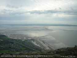 13th: At midnight slow-moving frontal cloud was situated across Anglesey and was to persist through the day. Misty heavy drizzle at 07 GMT continued up to 09 GMT. The morning was overcast and dull with the light NE'ly wind dying away. There was further rain from 1030 GMT until 1430 GMT before a minor clearance with glimpses of sunshine later. The N'ly wind strengthened through the afternoon and there was a shower of rain about 1830 GMT. The photograph shows a complex cloudy sky, including some banded altocumulus, seen across the Menai Strait from Penmaenmawr towards Anglesey. At close to low water the Lavan Sands (left), Penmaen Swatch (centre right) and Dutchman Bank can be seen and is a lesson for sailors. {Hawarden 15.2 mm} [Rain trace; Max 12.0C; Min 8.9C; Grass 8.2C]
14th: Remnant frontal cloud remained over Wales at midnight. Pressure at 09 GMT had risen to 1021 mb but the day kept overcast, dull and sunless; there was rain from 1100 GMT turning showery later with the wind strengthening from 1730 GMT. {Cardiff 18.7C, Valley 0.0h} [Rain 5.6 mm; Max 14.5C; Min 6.3C; Grass 3.0C]
15th: At midnight low 998 mb SW of Ireland was moving closer. It had been raining since 04 GMT and this continued light to moderate at times until about 15 GMT. Low 998 mb was lying just to the W of Ireland and a complex of fronts had moved over over the British Isles. Pressure here was 1000 mb and was high 1023 mb over Italy. Visibility was moderate but reduced to <500 m at times during the afternoon. There was a heavy downpour of rain at 2100 GMT ( 4 mm in just a few minutes). [Rain 10.3 mm; Max 12.8C; Min 10.2C; Grass 8.4C]
16th: With the complex frontal system moving N it was mostly cloudy at dawn with a few glimpses of sunshine before 09 GMT. But it was soon overcast again although pressure had risen to 1013 mb. The afternoon was brighter, the sun breaking through occasionally, but there were some spots of rain at 1455 GMT. The night was overcast. {Bridlington 20C, South Uist Range 21 mm}[Rain trace; Max 13.8C; Min 10.1C; Grass 10.2C]
 17th: The day began mostly cloudy with pressure unchanged. Another low 985 mb, tracking N, was deepening off SW Ireland with triple-point frontal system over St George's Channel. There was continuous moderate rain (>1 mm per hour) from 1100 GMT to 1700 GMT that turned to drizzle before ceasing at 18 GMT. It was a wet day in Snowdonia with Capel Curig reporting 36 mm of rainfall. The SSW'ly wind strengthened to strong to near gale-force during the afternoon causing very rough water in the Menai Strait. The photograph, courtesy of Gordon Perkins, shows the sea off Llanfairfechan looking towards Puffin Sound. Oystercatchers were flying low over the water into the wind. The gale-force winds continued into the night. {Capel Curig 36 mm, Lake Vyrnwy 21 mm} [Rain 7.9 mm; Max 15.0C; Min 11.3C; Grass 10.4C]
18th: At midnight the low 982 mb was off Malin Head, N Ireland. Here it was a bright morning with cloud cover decreasing up to 09 GMT. Pressure was 1001 mb, but as the low continued N to be off the Western Isles at noon isobars were tightly packed to the NW and we were in a strong to gale-force SW'ly airstream. It was a wet day in Scotland with Tulloch Bridge reporting 18 mm. At noon it was cloudier and here was a little rain; in the afternoon the blustery wind reached gale force 8 with gusts over 50 mph from 16 GMT to 1800 GMT when rain commenced; rain continued intermittently through the night. In exposed places on the island many leaves and small branches were stripped from trees that had just come into full leaf. Salt spray blown across the island would also affect tree leaves, but any effects would be evident later on. {Tulloch Bridge 18 mm} [Rain 8.8 mm; Max 14.8C; Min 10.9C; Grass 9.5C]
19th: The rain had ceased by 01 GMT but there was a heavy burst leading up to 09 GMT in time for the observations to be made. The morning was dull and overcast but the W'ly wind had moderated to force 5. The afternoon was brighter for a time, but by 16 GMT it was raining again and continued moderate to heavy until morning when 22.8 mm had accumulated.. {Capel Curig 26 mm} [Valley 20.8 mm] [Rain 22.8 mm; Max 14.0C; Min 9.9C; Grass 9.7C]
![]() 20th: Moderate rain continued up to 09 GMT before turning light with drizzle later. Pressure had fallen to 987 mb with a complex centred low passing NE over Britain. An occluded front was over the Irish Sea and the morning was overcast, but by afternoon with clearing skies there was some sunshine. Showers continued to fall over the mountains and a rainbow was seen above Llanfairfechan at 1805 GMT (see photograph courtesy of Gordon Perkins. It was clear with bright stars at midnight. {Bingley 31 mm, Valley 30.1 mm, Capel Curig 20.8 mm} [Rain 1.8 mm; Max 15.0C; Min 8.2C; Grass 8.6C]
20th: Moderate rain continued up to 09 GMT before turning light with drizzle later. Pressure had fallen to 987 mb with a complex centred low passing NE over Britain. An occluded front was over the Irish Sea and the morning was overcast, but by afternoon with clearing skies there was some sunshine. Showers continued to fall over the mountains and a rainbow was seen above Llanfairfechan at 1805 GMT (see photograph courtesy of Gordon Perkins. It was clear with bright stars at midnight. {Bingley 31 mm, Valley 30.1 mm, Capel Curig 20.8 mm} [Rain 1.8 mm; Max 15.0C; Min 8.2C; Grass 8.6C]
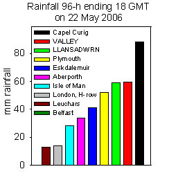 21st: At midnight yet another low 978 mb was SW of Ireland and heading our way. Associated frontal cloud encroached soon after midnight and there was more rain by morning. At noon the low had deepened a little to 975 mb, with triple point over Cardigan Bay, and rain continued until 1430 GMT. With some breaks in the cloud there was some sunshine until further cloud and rain moved in by 20 GMT for the night; the moderate to heavy rain accumulated 25.5 mm by 09 GMT next morning.. {Capel Curig 20 mm} [Rain 25.5 mm; Max 13.6C; Min 5.0C; Grass 0.9C]
22nd: The morning had further light to moderate rain, heaviest around noon when the low 985 mb was over the Midlands. The wind was N'ly force 5/6 through the day. Rain stopped around 15 GMT before turning to blustery showers. A shower about 1730 GMT contained small ice pellets. During the evening as the wind backed W'ly and moderated there breaks in the cloud and the sky began to clear by 21 GMT. Over the past 96-h to 1800 GMT total rainfall here was 58.9 mm. Valley reported 59.4 mm and Capel Curig 88.2 mm. {Buxton 31 mm, Capel Curig 22 mm} [Rain 6.6 mm; Max 10.0C; Min 9.0C; Grass 8.8C]
![]() 23rd: At midnight in a ridge of high-pressure from the S pressure 1007 mb was rising. With clear skies the minimum fell to 2.1C and -1.2C on the grass, both lowest of the month. The ground frost was the latest dated in May since before 1987. An air minimum of 1.8C was recorded on 30th May 1985, so a ground frost might have occurred on that date. But, for a change, it was blue skies over Llansadwrn this morning and with the good visibility snow could be seen on some mountaintops, Carneddau and Snowdon, above about 2800 ft. At 09 GMT with 3 oktas cloud cover pressure had risen to 1011 mb, but low 933 mb was tracking in towards the Western Isles. Associated frontal cloud was over the Isles and Ireland by noon and encroached here with rain soon after 1510 GMT. The gusty SW'ly wind reached force 6/7 and there was a heavy shower of rain and ice pellets just before 1700 GMT. There was light rain during the evening as the wind lessened to force 4/5. [Rain 6.7 mm; Max 12.7C; Min 2.1C; Grass -1.2C]
23rd: At midnight in a ridge of high-pressure from the S pressure 1007 mb was rising. With clear skies the minimum fell to 2.1C and -1.2C on the grass, both lowest of the month. The ground frost was the latest dated in May since before 1987. An air minimum of 1.8C was recorded on 30th May 1985, so a ground frost might have occurred on that date. But, for a change, it was blue skies over Llansadwrn this morning and with the good visibility snow could be seen on some mountaintops, Carneddau and Snowdon, above about 2800 ft. At 09 GMT with 3 oktas cloud cover pressure had risen to 1011 mb, but low 933 mb was tracking in towards the Western Isles. Associated frontal cloud was over the Isles and Ireland by noon and encroached here with rain soon after 1510 GMT. The gusty SW'ly wind reached force 6/7 and there was a heavy shower of rain and ice pellets just before 1700 GMT. There was light rain during the evening as the wind lessened to force 4/5. [Rain 6.7 mm; Max 12.7C; Min 2.1C; Grass -1.2C]
24th: Showers of rain (and possibly ice pellets)
on a trough moving S across North Wales between 04 and 06 GMT had cleared before 09 GMT. Pressure was 1012 mb, between low 998 mb near Shetland and high 1029 mb over Iberia. Anglesey was in a potentially showery moderately strong W'ly air flow; the day was a mixture of sunshine and passing clouds but it kept dry, the first to be dry since the 11th. The night was mostly clear with little or no wind. [Rain 0.0 mm; Max 13.2C; Min 5.3C; Grass 5.0C]
 25th: A bright morning but cloud had increased to 3 oktas to 09 GMT. Pressure was 1016 mb in a slack gradient with a force 2/3 SSW'ly wind. In the morning the temperature rose to 15.3C and after a cloudier period around noon continued to rise to reach 17.2C in the afternoon. The evening was cloudier and was overcast by 2200 GMT and it was raining by midnight. The high rainfall with temperatures below average late in May has extended the period of flowering of Rhododendrons this year at the weather station, photo courtesy of Ellen Hennessey. In warm dry Mays the flowers of Rhododendrons soon wilt as they are largely surface rooting, not so this year! They do well here because the soil is usually moist, lime-free and slightly acidic. High rainfall and acidic soils are also reasons why Rhododendron ponticum has become a pest in the mountainous parts of Snowdonia. [Rain 11.0 mm; Max 17.2C; Min 4.0C; Grass 0.5C]
26th: The moderate rain continued until 0630 GMT before turning light then into drizzle just before 09 GMT. Visibility was <500 m in low cloud that persisted through the morning. The afternoon had just a few bright spells, but parts of the North Wales coast between east of Conwy had glimpses of sunshine. There was a slight shower of rain at 1730 GMT. [Rain 0.8 mm; Max 17.2C; Min 8.9C; Grass 7.7C]
27th: A wet start to the day, but the rain died out by midmorning. Pressure was 1018 mb with high-pressure 1030 mb to the S and low-pressure 998 mb S of Iceland. Frontal cloud stretched across Wales and was slow to clear away. The S'ly wind was force 4 and with some sunshine in the afternoon the temperature rose to 16.8C almost drying the wet grass so opportunity was taken to do some mowing. [Rain 1.1 mm; Max 16.8C; Min 10.0C; Grass 10.1C]
28th: A mainly cloudy day with a W/NW'ly airflow with pressure was high to the W and SW 10-30 mb and low to the N and E of Britain. There were a few bright spells with a little sunshine from time to time and the maximum reached 17.0C. But the sky was overcast again by evening. A pair of spotted flycatchers were spotted darting between house and trees catching insects on the wing. Swallows were also seen flying low over pasture near the weather station catching insects disturbed by the grazing cattle. [Rain 1.0 mm; Max 17.0C; Min 9.0C; Grass 7.4C]
29th: Bright at first with a few glimpses of sunshine before 07 GMT. But with a showery trough developed over North Wales with rain showers around 09 GMT persisting through the morning. Pressure was 1017 mb with high 1033 mb to the W of Ireland and by afternoon the sky had cleared over Anglesey with sunshine into the evening, but some convective clouds remained S of the Snowdonia Mountains. Temperatures on the mountaintops were within 0-2C in the morning and ice precipitation was possible but none was seen on the ground. The wind was NW'ly in the morning veered N'ly and strengthened from force 3 to 5/6 by nightfall. [Rain 0.2 mm; Max 12.1C; Min 6.3C; Grass 4.3C]
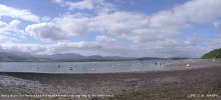 30th: A bright morning with early dark shower clouds to the W missing here, but gave showers on the coast. The fresh (force 5/6) NNE'ly wind was still strong enough to be tearing leaves off exposed trees. Pressure had risen to 1024 mb with high-pressure 1031 mb developing to the W of Ireland. With pressure over Scandinavia the N'ly flow of air from the Arctic persisted through the day. The morning was mostly sunny and there were long clear spells in the afternoon between cumulus clouds that passed by from time to time. Although sunny the temperature struggled to reach 11.5C. The evening was clear with the wind slowly moderating. [Rain 0.0 mm; Max 11.5C; Min 7.2C; Grass 5.5C]
31st: At 09 GMT the temperature 10.5C was not far below yesterday's maximum and with sunshine and less wind the day was to be a little warmer. Pressure 1028 mb was rising as the high 1032 mb centred near Valentia, SW Ireland, moved into western Britain. The wind was still from the N, but at force 3 or less. The maximum reached 14.5C. Cumulus clouds predominated, with some high cirrus, but these diminished during the afternoon and the sky was clear by evening with little or no wind. [Rain 0.0 mm; Max 14.5C; Min 6.3C; Grass 3.4C]
It was a wet month with 124.7 mm of rain, the wettest May since 2003 that with 148.3 mm was the wettest since before 1928. It was [217%] of the 1971-2000 climatological average and ranked 4th wettest. Rainfall for the year so far (Jan to May) 503.1 mm is the largest since 2003 that had 513.1 mm, ranking 2 and exceeds the 497.7 mm of 2000 that was the wettest year on record here. The mean temperature of 11.6C was very close to the averages (-0.1) and [+0.1). Soil temperature at 30 cm deep averaged 13.3C and was (-0.2). Sunshine duration at RAF Valley 175.5 h was lowest since 2003 ranking 35th since before 1930 on the Anglesey record.
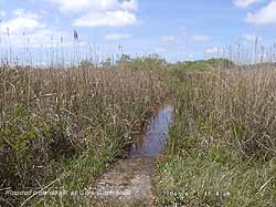 1st: Overnight the minimum temperature fell to 6.3C and to 3.4C on the grass; these were the lowest temperatures of a very warm month. At 09 GMT the temperature was 14.2C and pressure was 1030 mb within high 1032 mb over SW Britain. Fair-weather cumulus cloud predominated until the middle of the afternoon when the sky cleared. With cool air off the sea during the day the maximum was 18.3C. The evening was clear with little or no wind. At Cors Goch in woodland habitat along with ferns the early purple orchids were fading as were the last bluebells
 ![]() . On the limestone outcrop common rockroses were in flower
. On the limestone outcrop common rockroses were in flower ![]() .[Rain 0.0 mm; Max 18.3C; Min 6.3C; Grass 3.4C]
.[Rain 0.0 mm; Max 18.3C; Min 6.3C; Grass 3.4C]
2nd: The sky was clear at dawn but cumulus clouds had developed by 09 GMT and some, over the mountains, began to tower. By midmorning the cloud had began to disperse again and the afternoon was clear and sunny. Visibility was good but obscured somewhat by smoke haze that intensified during the day. In the afternoon the haze was slightly mauve coloration and seen to to about 4000 ft against the Snowdonia Mountains; overhead the weather station the sky was clear and blue. By evening the pall of haze had drifted W into Caernarfon Bay. The night was clear and the half moon positioned well in the sky to observe the side-lit craters. [Rain 0.0 mm; Max 18.3C; Min 7.7C; Grass 4.5C]
The heavy rainfall of May has ensured that the Anglesey wetlands have been abundantly supplied with water. At Cors Goch the boardwalk was at least 10-15 cm underwater on the 1st (see photo above) and some of the dune slacks at Tywyn Aberffraw were flooded on the 3rd (see below). Normally in May and June the watertable has fallen and the water is 10 cm below the boardwalk and only a few deep slacks at Aberffraw contain water. The water in the larger slacks at Aberffraw was just at the surface, foot pressure releasing some water. Numerous tadpoles were seen in pools that normally contain water. With the spring delayed by 2-3 weeks this year, from that we have been experiencing the last 10 years, the orchid season was just beginning. Early purple orchids are out and early marsh orchids were just starting to flower ![]() . Bee orchids were in bud and would open within a week. Growth is rapid, the plants emerging and flowering within a few weeks.
. Bee orchids were in bud and would open within a week. Growth is rapid, the plants emerging and flowering within a few weeks.
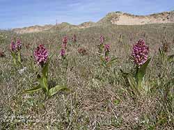
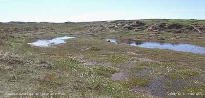 3rd: Another sunny morning and the smoke haze was evident once again. The grass was wet with dew but the soil surface was dry; the temperature at 30 cm had risen to 15.3C. Pressure was 1032 mb with high 1033 mb over Ireland. There was a light NE'ly breeze; the day sunny under variable cirrus clouds had a maximum of 21.1C. By evening high cloud started to encroach from the NW. [Rain 0.0 mm; Max 21.1C; Min 8.7C; Grass 5.0C]
4th: It was overcast at dawn but by 09 GMT the sky had stated to clear. Pressure was 1027 mb with the high 1029 mb lying to the SW. There was a S'ly force 3 breeze and the temperature 17.3C. Although the day was mostly cloudy there were plenty of sunny spells in the morning and the sky cleared by mid-afternoon; the temperature rose to 22.0C. [Rain 0.0 mm; Max 22.0C; Min 10.3C; Grass 6.4C]
5th: It was sunny at the weather station at 350 ft, but around the coast sea fog persisted well into the morning. The fog was drifting into the NE entrance of the Menai Strait and reached Bangor Pier but not as far as the bridges. Cloud was mostly fine and dense cirrus and lines of stratocumulus over the mountains of Snowdonia ![]() and to the west. Pressure was unchanged on 1027 mb and the temperature at 09 GMT was 15.5C. The temperature of the soil at 5 cm deep had reached 19.5C. The wind was a light NE'ly off the sea and this persisted through the afternoon and as a result the maximum temperature reached only 18.0C. The evening was mostly clear with little or no wind as the sea breeze faded. [Rain 0.0 mm; Max 19.0C; Min 9.0C; Grass 6.5C]
and to the west. Pressure was unchanged on 1027 mb and the temperature at 09 GMT was 15.5C. The temperature of the soil at 5 cm deep had reached 19.5C. The wind was a light NE'ly off the sea and this persisted through the afternoon and as a result the maximum temperature reached only 18.0C. The evening was mostly clear with little or no wind as the sea breeze faded. [Rain 0.0 mm; Max 19.0C; Min 9.0C; Grass 6.5C]
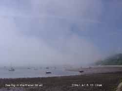 6th: With just a few cirrus clouds in the sky the morning was sunny and the temperature of 19.0C at 09 GMT had already exceeded yesterday's maximum. The wind was S'ly, occasional SSE'ly, and persisted through the day sufficient to override the sea breeze from the NE and the temperature rose to 23.5C. Relative humidity fell to 55% and was below 65% through the day. High cirrus cloud increased during the afternoon as did the smoke (pollution) haze seen to a height of about 4000 ft, as a slightly mauve coloration against the backdrop of the Snowdonia Mountains. There was Saharan dust high in the atmosphere as well and this gave the normally blue sky a milky appearance, particularly low in the W. [Valley 13.7 h] [Rain 0.0 mm; Max 23.5C; Min 10.7C; Grass 6.6C]
7th: A sunny and warm morning with a light S'ly breeze. At 09 GMT pressure was 1029 mb within the high dominating the weather around the British Isles. The temperature was 20.0C and the relative humidity 73%. There was a little cirrus and a small cumulus cloud overhead the weather station. This was bad news as it meant that the S'ly was weaker and the sea breeze off Red Wharf Bay to the NE would cut in soon. And indeed by 1000 GMT the breeze was NE'ly and the sky was mostly cloudy (7/8) with a sea breeze front developed overhead. The convergent cloud formation persisted into the afternoon with the temperature falling back to 18.0C and humidity mostly >75%. The cloud began to disperse about 1300 GMT and the temperature rose to 22.0C; the evening was clear skied. [Rain 0.0 mm; Max 22.0C; Min 13.0C; Grass 9.5C]
¤8th: Another sunny morning with cirrus cover of 5 oktas and a temperature of 20.7C at 09 GMT. It was calm and this was reflected in the smooth seas around Anglesey and Conwy Bay. A small cumulus to the S over the Snowdonia Mountains was the only evidence of any convection. But before noon cloud had formed over the station as a result of convergent SW'ly and NE'ly breezes but soon cleared in the afternoon as the NE'ly breeze gained strength. The evening was clear and the light wind, then more E'ly, persisted through the night. [Rain 0.0 mm; Max 23.6C; Min 12.0C; Grass 9.0C]
With high rates of evaporation the surface dune slacks at Tywyn Aberffraw were drier and water in pools had begun to reduce leaving moribund vegetation around the edges ![]() . On the drier fixed, or grey dunes, the Burnet rose was in flowering exceptionally well this year
. On the drier fixed, or grey dunes, the Burnet rose was in flowering exceptionally well this year ![]() (and below) . In the warmth downwind of mass of flowers there was a distinctive spicy aroma, almost of nutmegs, unlike other species of rose. The bee orchids, mentioned as being in bud on the 3rd, had begun to open and at this stage looked particularly bee-like
(and below) . In the warmth downwind of mass of flowers there was a distinctive spicy aroma, almost of nutmegs, unlike other species of rose. The bee orchids, mentioned as being in bud on the 3rd, had begun to open and at this stage looked particularly bee-like ![]() .
.
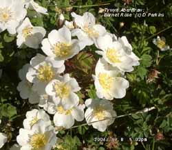 9th: With an overnight minimum of 14.3C it was a warm sunny morning with a light SE'ly breeze. Pressure remained high at 1022 mb. The temperature at 09 GMT had already risen to 23.6C and was higher than in Gibraltar, Nice and Venice. There were just a few very small cumulus clouds at first but these soon disappeared to give a clear sky; visibility was good with light to moderate smoke haze and a milkiness, looking to the S and W, due to dust in the atmosphere. With the forecast for Snowdonia warning of the risk of sunburn and dehydration the temperature rose to 28.6C, one of the highest in Britain, and the highest reached at this station on this date in the year. Previously the 29.0C recorded on 18 June 2000 was the earliest in the year; the highest June temperature here is 29.2C on the 29th in 1992. {Jersey 28.4C, Liverpool, Crosby 26.8C, Hawarden 26.7C} [Rain mm; Max 28.6C; Min 14.3C; Grass 11.0C]
![]() 10th: Overnight the minimum temperature was 17.4C, highest of the month. Sunny and warm again with the Met Office issuing a warning of a 'heatwave' in parts of Britain. But pressure 1013 mb was falling as low 997 mb off SW Ireland steamed N towards Rockall. Associated weak frontal clouds passed over during the day making it cloudier from time to time. The wind was generally force 3 SE'ly and at times gusty rising to force 5/6. The temperature climbed through the day reaching 28.5C, just 0.1C less than yesterday. But at Red Wharf Bay observer Keith Ledson reported 28.9C while 28.2C was recorded at RAF Valley. Thunder was heard to the SE at 1657 GMT. During the evening the wind dropped, but the cloud was thick enough for a few spots of fine rain to fall along with the deposition of light yellowish-brown and pale brown dust (Munsell® Color Chart 10YR 6/4 & 10YR 7.5/3). Coincidentally, red admiral and painted lady butterflies arrived in the garden today. They would have hitched a lift from the Mediterranean area on the S'ly airflow that also brought the dust. (Backward trajectory analysis (see graphic) using the HYSPLIT model, courtesy of the NOAA Air Resources Laboratory, indicated that example parcels of air arriving at 2000 m over Llansadwrn at 2000 GMT had passed over Tunisia and eastern Algeria on the 4/5th. Duststorms had been active over a wide area for some weeks and it is likely that dust came from this region of north Africa. Before arriving over Anglesey the air passed over the Atlas Mountains on the 6th and Spain on the 9th). {London, Heathrow 29.4C, Liverpool, Crosby 28.9C, Hawarden 28.4C} [Rain trace; Max 28.5C; Min 17.4C; Grass 12.5C]
10th: Overnight the minimum temperature was 17.4C, highest of the month. Sunny and warm again with the Met Office issuing a warning of a 'heatwave' in parts of Britain. But pressure 1013 mb was falling as low 997 mb off SW Ireland steamed N towards Rockall. Associated weak frontal clouds passed over during the day making it cloudier from time to time. The wind was generally force 3 SE'ly and at times gusty rising to force 5/6. The temperature climbed through the day reaching 28.5C, just 0.1C less than yesterday. But at Red Wharf Bay observer Keith Ledson reported 28.9C while 28.2C was recorded at RAF Valley. Thunder was heard to the SE at 1657 GMT. During the evening the wind dropped, but the cloud was thick enough for a few spots of fine rain to fall along with the deposition of light yellowish-brown and pale brown dust (Munsell® Color Chart 10YR 6/4 & 10YR 7.5/3). Coincidentally, red admiral and painted lady butterflies arrived in the garden today. They would have hitched a lift from the Mediterranean area on the S'ly airflow that also brought the dust. (Backward trajectory analysis (see graphic) using the HYSPLIT model, courtesy of the NOAA Air Resources Laboratory, indicated that example parcels of air arriving at 2000 m over Llansadwrn at 2000 GMT had passed over Tunisia and eastern Algeria on the 4/5th. Duststorms had been active over a wide area for some weeks and it is likely that dust came from this region of north Africa. Before arriving over Anglesey the air passed over the Atlas Mountains on the 6th and Spain on the 9th). {London, Heathrow 29.4C, Liverpool, Crosby 28.9C, Hawarden 28.4C} [Rain trace; Max 28.5C; Min 17.4C; Grass 12.5C]
 11th: Mostly cloudy (7/8th) to start the day, with drizzle or rain on the west coast, but pressure 1019 mb was rising with the low 982 mb off western Ireland. The air temperature was 17.2C and the surface soil (5 cm deep) was 19.7C still retaining heat from the previous days. As a result resetting the grass minimum thermometer (at this station it is set for 24-h readings) left the index showing 19.0C, receiving radiated heat from the ground. Sometimes this results in the grass minimum temperature being higher than the air minimum when read the next morning. Frontal cloud was lying across Britain, north to south, but here began to break-up and disperse by midmorning. The day was again mostly sunny with the temperature rising to a moderate 22.0C. The evening, clear at first, turned cloudier from the W and was overcast at 21 GMT with heavy drizzle and light rain trough until after midnight as a wave developed on the front over Wales. [Rain 2.8 mm; Max 22.0C; Min 15.5C; Grass 14.2C]
12th: Light rain stopped about 0130 GMT but it remained overcast with some drizzle that turned heavier leading up to 09 GMT. rainfall, the first measurable for 12 days was 2.8 mm. Quite a change, back to low uniform grey stratus, mist and very poor visibility. Although there were no signs of water stress the vegetable garden did need a drop of water! Pressure was 1017 mb with a cold front over western Britain with the low 993 mb S of Iceland. Temperatures were more normal this morning 13.7C here and 22C around the Mediterranean stations. The morning kept overcast and dull but began to brighten by noon as the front moved E. Thunderstorms, with heavy rain and hail in places, were generated on the front starting in S England and made their way through the Midlands to NE England in the afternoon. Hailstones over 30 mm diameter were reported falling in and around Coventry. People dashed for cover as vehicles were dented in the damaging fall. The afternoon here had good sunny spells with the maximum reaching 19.6C. By evening the sky was clear over Anglesey with a few clouds left over Snowdonia. {Dunkeswell 23 mm, Hawarden 11.2 mm, Valley 9.8 mm} [Rain 0.1 mm; Max 19.6C; Min 13.7C; Grass 10.6C]
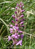 13th: After midnight there was a little mist in low lying areas then cloud encroached broken frontal cloud moved across from the NW. The morning was dull and mostly cloudy with the cloud associated with low 994 mb SE Iceland. A cold front was over SE England and there were thunderstorms in Kent, the Channel and N France through the day. The few small breaks in the cloud sheet here at 09 GMT soon disappeared and the day was dull and overcast. It was brighter along the N coast of the island and there glimpses of sunshine on the mainland. The sky began to clear at 18 GMT with the evening mostly sunny. [Valley 4.0h] [Rain 0.0 mm; Max 16.3C; Min 12.7C; Grass 11.2C]
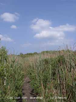 14th: An almost clear sky at first and with a grass minimum of 5.2C there was moderate to heavy dew on the ground. Pressure was 1025 mb with a ridge of high-pressure dominating the weather and the jetstream, that has been over Britain, was fragmented. Visibility was very good being >50 km in clean air affording excellent views of the Lleyn Peninsular and Bardsey Island. The sky even near the horizon was deep blue, the Saharan dust having cleared away too. But dust was not far away to the S, the University of Athens SKIRON forecast model showed dust over the English Channel and W France. It was a wet day in the SE of England with {15.7 mm}reported at Manston. The warmest was Prestwick with {23.2C}. The day here was sunny, but there was a cool N'ly breeze and the maximum reached only 15.5C. [Valley 15.5h, Isle of Man 14.4h, Cardiff 19.8C] [Rain 0.0 mm; Max 15.5C; Min 8.3C; Grass 5.2C]
15th: The night was clear and calm, and it was still clear by morning, but in contrast to yesterday visibility was only moderate in haze. A ridge of high-pressure lay across Britain with pressure here on 1023 mb. Although convective clouds increased through the morning visibility improved for a time; the afternoon was mostly sunny with light variable winds under thin patchy moderately high cloud. Further sightings of migrant insects have been made. David Small reported seeing both painted lady butterflies and humming-bird hawk-moths on the Wirral, Deeside, in Chester and Llanrwst in the Conwy Valley where he had a splendid view of several moths feeding and darting about on roadside flowers. By evening warm front cloud began to encroach from the NW. [Rain 0.0 mm; Max 20.0C; Min 8.9C; Grass 6.4C]
At Cors Goch on the 15th the boardwalk had dried with the water level a fraction below the boards. The bog bean flowers had finished and seed pods had formed. Amongst the bog beans growing in the water was the red rattle, or marsh lousewort ![]() . Broad-leaved cotton-grass had flowered
. Broad-leaved cotton-grass had flowered ![]() and had already developed its cotton-like seed heads
and had already developed its cotton-like seed heads ![]() . Honeysuckle around the margins of the fen trailing over shrubs of bog myrtle was just coming into flower
. Honeysuckle around the margins of the fen trailing over shrubs of bog myrtle was just coming into flower ![]() .
.
Mid-month (1-15) the mean temperature was 16.2C and was (+2.4) and [+2.6] of the monthly average. Compared with the average for the first 15 days the mean was (+2.8). The mean maximum showed the greatest anomaly with the mean 21.2C (+3.8) and [+3.5]. There had been little rain the 2.9 mm only 4% of average and the soil moisture content had fallen to 39.8% (dry mass).
16th: A mostly cloudy morning with frontal cloud in the vicinity and rain to the NW of us over N Ireland and S Scotland. Pressure was 1021 mb and the temperature 17.1C at 09 GMT. As cloud thickened there was slight rain by 1000 GMT, but this soon passed over and it was bright with some sunshine by 1130 GMT. There were a few spots of rain in Gaerwen around 14 GMT but otherwise the afternoon was bright with clearer skies later on and in the evening. RAF Valley reported some light showers at 20 GMT, but it kept dry here. [Rain trace; Max 21.6C; Min 11.9C; Grass 9.5C]
 17th: A sunny morning with much high cirrus and cirrocumulus clouds passing over from a westerly direction. At times the cirrus exhibited regular shear generated waves (see photograph on the right). Pressure was 1019 mb in a ridge from high 1021 mb over Belgium. The wind was S'ly force 2 to 4 through the day strengthening force 4 to 5 by evening; the maximum reached 24.4C. During the evening frontal cloud encroached from the NW. [Rain 0.7 mm; Max 24.4C; Min 12.8C; Grass 10.5C]
It is a good year for wild flowers on Anglesey. Although free-draining soils have dried, marsh and dune slack soils remain damp and, following the warmth at the beginning of the month, there has been a profusion of flowering. Although yellow-flag iris ![]() on the banks of the Cefni Estuary are beginning to finish there is plenty of ragged robin to be seen
on the banks of the Cefni Estuary are beginning to finish there is plenty of ragged robin to be seen ![]() . Orchids seen included the northern marsh
. Orchids seen included the northern marsh ![]() and Welsh marsh orchid
and Welsh marsh orchid ![]() . Under the pine trees in Newborough Forest there were some fine bee orchids
. Under the pine trees in Newborough Forest there were some fine bee orchids ![]() .
.
18th: A dull overcast day with slight rain and drizzle Pressure 1011 mb was falling 1011 mb as low 996 mb tracked towards Malin Head. It was wet in N Ireland and W Scotland {Malin Head and Isle of Skye 17 mm}. There were spells of rain through the day an a few brighter intervals, but no sunshine. The rain petered out about dusk at 22 GMT. {Gravesend, Kent 27.4C, Hastings, Sussex 13.3 h, Isle of Skye 17.5 mm} [Rain 4.6 mm; Max 16.3C; Min 14.0C; Grass 12.8C]
19th: After a dry night it was still overcast in the morning. Low 998 mb was over Scotland, but pressure here 1006 mb had risen from 1003 mb at midnight in a transient ridge. The day was mostly cloudy but there were a few brighter spells and glimpses of the sun during the afternoon that kept dry. By 18 GMT the cloud thickened and there was a little rain during the evening. {Gravesend 21.7C, Margate 6.5 h, Capel Curig 9.4 mm} [Rain 1.2 mm; Max 17.7C; Min 12.5C; Grass 11.5C]
![]() 20th: Pressure was highest 1012 mb around midnight and at dawn the sky was mostly clear, but further cloud moved across before 09 GMT. Pressure 1011 mb had started to fall slowly as low 980 mb S of Ireland moved towards W Scotland. An associated complex frontal system had brought a band of rain into W Ireland. Here it was bright with some sunny spells with a few showers over the Snowdonia Mountains; the gusty SW'ly wind was blowing at force 5. During the afternoon the wind reached force 7 to gale-force 8 at times, especially close to 17 GMT. There was drizzle or spells of rain until 20 GMT when both wind and rain eased. The NOAA 18 satellite image shows the low S of Iceland tracking towards N Scotland with frontal cloud over western Britain and Ireland. There is marine convection behind the front and convection over Germany, France and Spain.. [Rain 5.0 mm; Max 16.2C; Min 10.6C; Grass 9.1C]
20th: Pressure was highest 1012 mb around midnight and at dawn the sky was mostly clear, but further cloud moved across before 09 GMT. Pressure 1011 mb had started to fall slowly as low 980 mb S of Ireland moved towards W Scotland. An associated complex frontal system had brought a band of rain into W Ireland. Here it was bright with some sunny spells with a few showers over the Snowdonia Mountains; the gusty SW'ly wind was blowing at force 5. During the afternoon the wind reached force 7 to gale-force 8 at times, especially close to 17 GMT. There was drizzle or spells of rain until 20 GMT when both wind and rain eased. The NOAA 18 satellite image shows the low S of Iceland tracking towards N Scotland with frontal cloud over western Britain and Ireland. There is marine convection behind the front and convection over Germany, France and Spain.. [Rain 5.0 mm; Max 16.2C; Min 10.6C; Grass 9.1C]
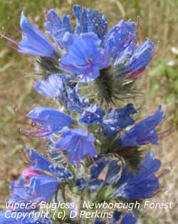 21st: A blustery morning but it was dry and bright with a few glimpses of sunshine. Pressure 1006 mb was falling slowly as the low 981 mb approached Cape Wrath at 09 GMT. We were in a fresh to strong (force 5/6) SW'ly airstream, the stratocumulus clouds showing marked orographic features. The morning was bright and dry; the afternoon had sunny spells and slight showers of rain at first before the sky cleared. The coolest day [09 - 09 GMT] of the month, so far, with a maximum of 14.9C. The clear slot did not last for long as it was cloudy again by 1730 GMT and the sky was overcast in the night. {Herne Bay, Kent 21C, Cromer, Norfolk 12.3h}[Valley 3.2h] [Rain 0.3 mm; Max 14.9C; Min 9.4C; Grass 7.9C]
22nd: A covering of rather thick cloud made it a dull morning. At 09 GMT pressure 1011 mb was rising again as the low 990 mb tracked eastward off the N coast of Scotland. The wind had veered W'ly, but was still moderate to fresh (f4/5) making it feel chilly in the 11.7C temperature having got used to higher temperatures. The day was overcast and dull and the temperature rising to 14.5C, but it was warmer than in Shetland where it was 7.5C. {London, Heathrow 21C, Kinlochewe, Scotland 24.8 mm, Isle of Wight 14.2h} [Valley 3.4h] [Rain 0.0 mm; Max 15.2C; Min 9.6C; Grass 8.3C]
23rd: A much brighter day and warmer too. At 09 GMT with 5 oktas of cumulus clouds it was sunny and the temperature had risen to 15.2C exceeding yesterday's daytime temperature. Pressure had risen to 1018 mb within a ridge from a high France to Germany. The day was mostly sunny with clear visibility (>50 km) but it turned cloudier by 1700 GMT with a clod mass encroaching from the SW. [Valley 8.0h] [Rain 1.4 mm; Max 20.2C; Min 10.0C; Grass 8.5C]
24th: There was intermittent light rain from 0315 to 0700 GMT, but by 09 GMT there were signs of the cloud-sheet breaking up over the weather station. Pressure 1014 mb had fallen a little and the hope that it would clear soon dashed as it was soon overcast again. As the cloud thickened there was a spell of heavy drizzle from 1230 to 1315 GMT, otherwise it was fine drizzle before light to moderate rain set in from 1645 GMT lasting until 2115 GMT. The day was sunless and the rainfall of 5.5 mm was the largest of the month. [Rain 5.5 mm; Max 15.9C; Min 11.7C; Grass 10.8C]
25th: An overcast morning but the stratiform cloud was thinning and the early brightness developed into sunny spells after 09 GMT. The afternoon was mostly sunny but more cloud encroached by 16 GMT giving an overcast evening with drizzle about 19 GMT. During out dull and cool spell temperature in the S of Britain have been keeping up with 24.9C at Great Malvern and 23.4C at Brize Norton. Here the maximum was 16.0C but there were lower temperatures E and N of here with Albemarle, E coast England, having 11.9C and Lerwick, Shetland 11.3C. [Rain 0.6 mm; Max 16.0C; Min 11.2C; Grass 10.4C]
26th: Overcast with stratocumulus cloud, but at least it was not raining! Pressure 1018 mb had risen a little, but visibility was only moderate in haze. The breeze was a gentle (f3) NE'ly and the morning, though cloudy, kept dry. The afternoon under thicker cloud had very fine drizzle at times into the evening, but work could be done in the garden. I had planted out cabbage plants and these were standing up well! Strawberries are ripening, but if this weather continues there is danger of the fruit damping off as the result of fungal attack. The potatoes, that have stated to flower, will have to be watched as well for any signs of blight; there is none at the moment. The maximum temperature of 14.4C was the lowest of the month. There was intermittent light rain from 1900 GMT. [Rain 2.4 mm; Max 14.4C; Min C; Grass C]
27th: The rain continued intermittently up to and beyond 09 GMT. Pressure was 1020 mb with high 1021 mb over N Ireland. Frontal cloud was lying North Wales to east Anglia and with the airflow continuing very slack and there seems little chance of the entrapped cloud clearing. Visibility was poor in mist under the uniform grey stratus cloud. Oh, and the relative humidity was 100%. The day continued sunless being overcast and damp with drizzle and, occasionally, light rain here although it was drier across the Strait and in Caernarfon. But along the North Wales coast it was wetter with Hawarden having 18.2 mm, Rhyl and Capel Curig 7.6 mm and Liverpool, Crosby 5.3 mm. {Hawarden 18.2 mm} [Valley 0.0 h] [Rain 1.8 mm; Max 15.1C; Min 11.7C; Grass 11.8C]
|
|
The month ended with a mean temperature of 15.6C and was (+1.7) and [+2.0} of average and was highest since before 1979. It was a dry month the 26.7 mm being (36%) and [40%] of average and lowest since 1988 ranked 6th since 1929.
![]() 1st: Noctilucent clouds were seen to the N and NE between 02 and 0330 GMT. By 06 GMT cirrus clouds had moved across but the noctilucent clouds above could still be seen. The night had been calm, but by 09 GMT there was a force 3 SSE'ly breeze. The day was mostly sunny with thin moderately high cloud and the temperature rose to 23.6C. [Rain 0.0 mm; Max 23.6C; Min 13.0C; Grass 9.5C]
1st: Noctilucent clouds were seen to the N and NE between 02 and 0330 GMT. By 06 GMT cirrus clouds had moved across but the noctilucent clouds above could still be seen. The night had been calm, but by 09 GMT there was a force 3 SSE'ly breeze. The day was mostly sunny with thin moderately high cloud and the temperature rose to 23.6C. [Rain 0.0 mm; Max 23.6C; Min 13.0C; Grass 9.5C]
2nd: Pressure was 1020 mb within a ridge of high-pressure across Britain. High 1033 mb was E of the Baltic while there were thundery lows over Spain and SW France moving N. This brought hot humid air into S England and S Wales. Thunderstorms had broken out over SW England and moved up through St George's Channel to the Irish Sea and on to Scotland. A patch of rain brought a few light showers on to the W coast of Anglesey early in the morning. The day here was partly cloudy but being moderately high and thin it was sunny and warm with the temperature reaching 23.6C. During the evening thunderstorms developed in Manchester, the Wright Robinson Sports College at Abbey Hey in Gorton and a textile factory on Swallow Street in Levenshulme were struck by lightning and a funnel cloud was seen. Torrential rain caused flash flooding in parts and the Manchester and 2 lanes of the M60 were closed. Fire and Rescue Service received over 630 calls during the 4-hour storm. Water between 2 and 4 ft deep was reported in places and a 90-year-old man and 6 others were rescued from 2 vehicles; planes including that carrying the England Football Team were diverted to Liverpool Airport. {London, Heathrow 32.3C; Rochdale 40 mm} [Rain 0.1 mm; Max 23.5C; Min 14.8C; Grass 12.2C]
3rd: Distant heavy thunder was heard continuously from 0200 to 0400 GMT but the storms moved to the W and E of the Snowdonia Mountains and missed out Anglesey. There was a little rain here (0.1 mm) at 0500 GMT that, by convention, was credited to the 2nd (09-09 GMT). At 09 GMT it was mostly cloudy and visibility was moderate to poor in haze or mist. As the relative humidity was 94% it when into my records as haze, if it had been 95% or more would be mist. With the 7 oktas cloud thinning during the morning the day was mostly sunny with the haze persisting. Clouds darkened to the SE over the mountains during the afternoon, the sun was obscured for a while, and thunder was heard close to 1500 GMT. Rainfall in Colwyn Bay 18-18 GMT was 25 mm. The evening was bright with some more sunshine before it turned cloudier by dusk. {London, Heathrow 31.4C; Colwyn Bay 25 mm} [Rain 0.0 mm; Max 21.3C; Min 14.5C; Grass 13.9C]
 4th: Although there was a lot of moderately high cloud the day was mostly sunny and warm. Although there was a cooling NE'ly breeze off the sea the temperature rose to 24.9C during the afternoon. Thunderstorms over Spain and France again moved into S England, S Wales and Ireland but did not reach here the sky clearing to give a sunny evening. {London, Heathrow 31.3C, St Bees Head 18.8 mm} [Rain 0.0 mm; Max 24.9C; Min 15.5C; Grass 13.0C]
5th: A sunny morning under 6/8th mainly cirrus clouds and moderate visibility in smoke haze. By 09 GMT the temperature was 21.5C with relative humidity of 80%. Pressure was 1013 mb as a thundery low over France moved into southern Britain. Frontal cloud associated with low 987 mb between Greenland and Iceland was slow moving W of Ireland. The day continued sunny and the early SE'ly breeze became a light NE'ly during the afternoon; the temperature rising to 25.6C. The sky darkened over the Snowdonia Mountains as thunderstorms moved up from the S. Thunder was heard in the distance almost continuously from 1345 to 1530 GMT and, although it become overcast the storms petered out with not a drop of rain falling here. The evening and night remained overcast. {Manchester 29C, Middle Wallop, Hampshire 26.5 mm} [Rain 0.0 mm; Max 25.6C; Min 15.4C; Grass 13.2C]
6th: The sky was mostly clear with 3/8th cover of cirrus overhead with altostratus at 30° above the horizon to the west. Far to the S there were a few weakly developed cumulus clouds. Pressure 1015 mb had risen, but stable high-pressure was far to the SW 1029 mb over the Azores and 1025 mb E Europe. Frontal cloud, associated with complex low-pressure near Greenland and Iceland, was poised to the W and this moved across Ireland and the Irish Sea during the day. Thunderstorms were again widespread in central and southern England. In the early hours heavy rain in the Forest of Dean led to local flooding. Large rainfall totals were reported from Brize Norton {54.8 mm} and Bristol {36.8 mm}. The day was sunny here, with the temperature rising to 24.5C, but on the W coast of the island it remained overcast with mist and fog during the afternoon. In a reversal of the British temperatures today Aboyne, Aberdeenshire, reported {27.5C}, not that the south was much cooler with London on {26C} but Bristol was a cooler {22C}. The cloud bank associated with the cold front over Ireland moved in closer by 1600 GMT and brought a little rain here by 1800 GMT. {Aboyne 27.5C, Brize Norton 54.8 mm} [Rain 0.1 mm; Max 24.5 C; Min 14.6C; Grass 12.2C]
7th: The morning was overcast with little (SW) or no wind. With the weak cold front passed over it was already cooler with the temperature at 09 GMT 14.8C. A cloudier day but there were some spells of sunshine during which the temperature rose to 19.9C. During the day a triple-point on a frontal system off Newfoundland tracked rapidly to mid-Atlantic with a developing low 992 mb by midnight. {Manston, Kent 24C} [Rain 0.0 mm; Max 19.9C; Min 13.5C; Grass 12.0C]
![]() 8th: Low 992 mb had moved to the W of Ireland by 0600 GMT. It was a bright and sunny morning with a moderate to fresh SW'ly wind; pressure 1015 mb had started to fall and it was cloudier by noon as the deepening low 990 mb approached Ireland. A wedge of rain, associated with the complex frontal-system over Ireland, moved eastward and light showers reached here by 1400 GMT with strengthening wind and rain by 1500 GMT. At 1800 GMT the low was 989 mb and tracking NE west of Shannon, Ireland. The rain turned moderate to heavy at times, the 11.0 mm fall largest of the month, and the wind reached gale force 8 around 2100 GMT blowing over garden furniture and potted plants. The day's maximum of 17.5C was lowest of the month, but was the highest recorded in July since before 1979. {Gravesend, Kent 24C; Valentia, Ireland 24.2 mm; Lerwick, Shetland 16.4 h} [Rain 11.0 mm; Max 17.5C; Min 12.3C; Grass 11.1C]
8th: Low 992 mb had moved to the W of Ireland by 0600 GMT. It was a bright and sunny morning with a moderate to fresh SW'ly wind; pressure 1015 mb had started to fall and it was cloudier by noon as the deepening low 990 mb approached Ireland. A wedge of rain, associated with the complex frontal-system over Ireland, moved eastward and light showers reached here by 1400 GMT with strengthening wind and rain by 1500 GMT. At 1800 GMT the low was 989 mb and tracking NE west of Shannon, Ireland. The rain turned moderate to heavy at times, the 11.0 mm fall largest of the month, and the wind reached gale force 8 around 2100 GMT blowing over garden furniture and potted plants. The day's maximum of 17.5C was lowest of the month, but was the highest recorded in July since before 1979. {Gravesend, Kent 24C; Valentia, Ireland 24.2 mm; Lerwick, Shetland 16.4 h} [Rain 11.0 mm; Max 17.5C; Min 12.3C; Grass 11.1C]
9th: The rain continued until 03 GMT before easing off and turning to drizzle as pressure 1000 mb ceased falling. It was a dull overcast morning but pressure 1002 mb had just started to rise. The wind, SW'ly force 6/5, was moderating as the filling low 995 mb tracked just N of Malin Head. The day kept overcast with drizzle at times during the afternoon with a maximum temperature of 16.1C. By 1800 GMT with pressure on 1012 mb it was brighter with the cloud thinning, but it did not clear until after midnight and the day was sunless. {Cranwell 24C; Eskdalemuir 33.5 mm, Capel Curig 27.4 mm; Torquay, Devon 10 h} [Rain trace; Max 18.1C; Min 12.5C; Grass 11.6C]
10th: A ridge of high-pressure passed over Britain during the night and the sky cleared. It was a bright sunny early morning with tufted cirrus clouds overhead. Cool enough for some dew to have formed on grass, but there was guttation present also especially on the lysimeter. By 08 GMT frontal cloud was seen on the western horizon and by 09 GMT this had quickly covered the sky. The temperature had risen to 18.1C, yesterday's (09-09 GMT) maximum, but was already dropping away and was 17.1C (dewpoint 15.2C). Pressure 1017 mb had started to fall as low 998 mb S of Iceland moved closer with it's attendant bands of frontal cloud. Cloud and mist was descending the Snowdonia Mountains and it was not long before light drizzle set in a prelude to light to moderate rain from 1100 to 1200 GMT as the cold front passed over. The afternoon was bright with a little sunshine as the sky cleared before turning cloudier again. [Rain 1.5 mm; Max 17.8C; Min 12.2C; Grass 9.1C]
11th: There was a shower of rain just after midnight but then the sky began to clear. It was clear at dawn and with the grass minimum down to 6.6C, lowest since 15th June 6.4C) some dew formed. Before 09 GMT fair-weather cumulus clouds had moved across with the sky 6 oktas cover. Pressure 1024 mb was rising as Azores-high 1033 mb extended a ridge towards Cornwall and Brest. Low 1005 mb was N Scotland and another low 979 mb SE Greenland had fronts lying W of Ireland. The morning was bright with sunny spells and the sky cleared in the afternoon giving long sunny spells well into the evening. [Rain 0.0 mm; Max 20.3C; Min 9.9C; Grass 6.6C]
![]() 12th: At midnight low 981 mb was over Iceland and an associated warm front was over Ireland with cold front further west. Cloud encroached during the early hours and it was mostly cloud by dawn. At first it was bright with a hole in the cloud to the S but this had closed by 09 GMT. Pressure was 1024 mb and the fronts were weakening entering the ridge of relatively high-pressure 1028 mb to the S of here. The day kept dry and was mostly cloudy here, but with a constant SSW'ly wind during the day clear slots appeared along the North Wales coast from Llanfairfechan to Conwy Valley (seen on the NOAA 18 satellite image) where it was mostly sunny until evening. The cold front that came trough between 1800 and 2100 GMT did give some drizzle and light rain. [Rain 1.0 mm; Max 18.1C; Min 12.8C; Grass 11.2C]
12th: At midnight low 981 mb was over Iceland and an associated warm front was over Ireland with cold front further west. Cloud encroached during the early hours and it was mostly cloud by dawn. At first it was bright with a hole in the cloud to the S but this had closed by 09 GMT. Pressure was 1024 mb and the fronts were weakening entering the ridge of relatively high-pressure 1028 mb to the S of here. The day kept dry and was mostly cloudy here, but with a constant SSW'ly wind during the day clear slots appeared along the North Wales coast from Llanfairfechan to Conwy Valley (seen on the NOAA 18 satellite image) where it was mostly sunny until evening. The cold front that came trough between 1800 and 2100 GMT did give some drizzle and light rain. [Rain 1.0 mm; Max 18.1C; Min 12.8C; Grass 11.2C]
13th: The cloud started to clear at dawn the SW'ly wind turning N'ly and by 09 GMT with 5 oktas cover of cumulus clouds it was mostly sunny. The overnight minima, 9.4C in the air and 6.2C on the grass, were lowest of the month. The 9.4C low minimum was the highest recorded in July since before 1979. Pressure 1029 mb continued to rise and the cloud to disperse giving a mostly sunny day. In the afternoon there was a moderate NE'ly sea-breeze enhanced by the general N'ly wind and this kept the temperature to a maximum of 15.0C. A line of clouds persisted along the summits of the Snowdonia Mountains these disappearing by late afternoon. The evening and night were clear. [Rain 0.0 mm; Max 17.7C; Min 9.4C; Grass 6.2C]
14th: Noctilucent clouds were seen after midnight at no more than about 20-25° above the horizon to the N they were weak at first and stronger between 04 and 04 GMT. With a clear sky overnight and a temperature of 7.2C on the grass there was heavy dew. At 09 GMT pressure 1033 mb was rising with high 1027 mb over the North Sea just off the Tay Estuary, Scotland. The temperature was 17.7C (dewpoint 10.7C), had already exceeded yesterday's daytime value, in a light NE'ly breeze. Under clear sky visibility was very good (>20 km) but there was slight to moderate smoke haze. The day continued with clear skies with the wind from just before noon turning S'ly or SSE'ly off the mountains when the temperature reached 24.3C. {Hurn Bay 24.9C, Liverpool, Crosby 24.5C} [Rain 0.0 mm; Max 24.3C; Min 10.4C; Grass 7.2C]
15th: With high-pressure 1033 mb unchanged and dominating the weather under clear skies it was another fine and sunny day. On the west coast Valley reported showers of rain at 11 GMT and again light rain and showers during the evening from 21 to 02 GMT, but the sky was clear here throughout. {Bournemouth 27C, Hurn 26.8C, Hawarden 26.0C, Kinloss 15.8 h, Valley 14.9h} [Rain 0.0 mm; Max 22.5C; Min C; Grass C]
16th: With the high 1033 mb transferred to Denmark pressure 1028 mb was falling slowly in a ridge to S Ireland. Frontal cloud was lying over the Atlantic with some reaching the NW of Scotland and N Ireland. Calm at first a light sea breeze set in during the morning reaching force 3/4 during the afternoon before dying away by evening. The day was mostly sunny with a little cirrus and high altocumulus, associated with the western fronts, moving across late in the afternoon. {London, Heathrow 30.5C} [Rain 0.0 mm; Max 24.5C; Min 12.5C; Grass 8.0C]
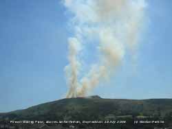 17th: Calm overnight and clear skies giving another sunny day. The sea breeze did not start until just before noon and was weak until the middle of the afternoon so that the temperature rose to 26.1C. The evening was clear, sunny and calm. {London, Heathrow 33C, Baltasound, Shetland 10.6 mm, Bournemouth 16.2h} [Rain 0.0 mm; Max 26.1C; Min 14.5C; Grass 10.6C]
18th: More of the same, sunny and hot with the temperature reaching a July record of 32.6C. The previous highest in July was 31.2C on the 14th in 2003. With little recent rainfall on the mountains surface vegetation was becoming dry, although there was still some water draining out of the wetter peaty areas. During the afternoon a large fire burning vegetation on Garreg Fawr, above Llanfairfechan, Gwynedd, that brought firefighters from as far away as Llanrwst and Pwllheli to assist those from Llanfairfechan and Bangor to bring it under control, could be seen from Anglesey. {Saunton Sands 33C, London, Heathrow 33.2C, Llandudno 32.2C} [Rain mm; Max 32.6C; Min 15.8C; Grass 11.7C]
19th: Cloudier this morning with 5 oktas of cover. But it was still warm with an overnight minimum of 17.3C it was already 27.3C (dewpoint 15.4C, RH 48%) at 09 GMT in a force 2 ESE'ly breeze. By noon the temperature was hovering around 28C and there was an intermittent breeze off the sea. During the afternoon it became hotter and hotter as the wind veered SSE'ly off the mountains and strengthened to force 4/5 at times, with relative humidity falling to 35% in a Föhn-like wind. The temperature reached 34.9C one of the highest temperatures recorded on Anglesey and in Wales, reported so far. The temperature range on the day was 17.6C. The previous highest recorded temperature at this station was 33.0C on 2 August 1990. The previously highest recorded Welsh temperature of 33.6C was in July 1976 in Usk, Monmouthshire. This was equalled at RAF Valley, but exceeded at Môna Airfield where 33.9C
was recorded. At Red Wharf Bay observer Keith Ledson reported 33.4C, after the usual sea breeze was defeated late in the afternoon. On the mainland temperatures of 34.6C in Llandudno, Conwy, 34.2C at Abergwyngregin, 34.6C at Penrhosgarnedd and 34.8C at Treborth Botanical Garden, Bangor, Gwynedd, were recorded. It was hot too in the S of England with 36.5C reported at Wisley and in Brighton eggs were fried on the bonnet of a car. The fire on Garreg Fawr was still burning being fanned by the SE'ly winds.
{Wisley 36.5C, RAF Valley 33.6C, Môna Airfield 33.9C} [Rain 0.5 mm; Max 34.9C; Min 17.3C; Grass 12.5C]
20th: A thundery trough moved up from SW England through Wales to Anglesey. Thunder was heard about 01 and 0311 GMT and was accompanied by slight rainfall of 0.5 mm. Overnight the air minimum of 17.6C was highest of the month, equalling that recorded in 1995. Overcast at dawn but by 09 GMT the sun had broken through leaving convective cumulus clouds in the vicinity. Pressure 1015 mb was rising and the wind was a light SE'ly but turning S'ly later and strengthening; the temperature was a cooler 23.3C (dewpoint 18.6C, RH 75%). Visibility was only moderate in haze under a milky-white looking sky the result of Saharan dust suspended high in the atmosphere. The day had some sunny spells and the temperature reached 24.5C. By evening the sky was clearer. [Rain 0.0 mm; Max 24.5C; Min 17.6C; Grass 15.8C]
 21st: A mostly cloudy dawn. Pressure 1019 mb was rising with the Atlantic-low 1001 mb W of Ireland slow-moving and maintaining the S'ly flow of warm rather moist, dust laden, air over Britain. Pressure was high 1022 mb S of the Azores, Sardinia and north Africa. The morning was bright and the afternoon sometimes cloudier; dark clouds were seen to the NW from 1600 GMT, but it did not rain here. The sky cleared before midnight. [Rain 0.0 mm; Max 25.7C; Min 15.7C; Grass 13.9C]
22nd: The mostly clear sky overnight and at dawn resulted in a moderate dew (grass minimum 11.1C), but you had to be about early to see it. By 09 GMT it was cloudier, but the dew had dried on the grass as the temperature rose to 20.5C. Pressure 1016 mb with complex low-pressure to the SW. Frontal cloud over Ireland was moving E while thunderstorms, associated with a 'French plume', moved from Cherbourg (at 09 GMT) across the Channel into S England, through the Midlands to be over Lincolnshire by 18 GMT. Here, the morning was bright with the moderately high cloud thinning and breaking at times. Some cloud in the early afternoon gave way to sunshine and a clear skied early evening. Later a weak cold front moved across with light rain from 2230 to midnight. [Rain 1.4 mm; Max 24.8C; Min 14.5C; Grass 11.1C]
It was reported by the BTO that swallows under metal roofed barns on Anglesey and elsewhere have been dying because of the heat. The water we put out for the birds is in demand every day by most birds on out list, but we don't see swallows, housemartins or spotted flycatchers taking it although there are plenty flying overhead on most days. With plenty of juicy insects to catch they must ingest fluids that way.
![]() 23rd: With the passage of the cold front pressure 1017 mb was rising in a ridge of high-pressure from the Bay of Biscay (1022 mb). At 09 GMT the sky was clearing leaving a line of stratocumulus over the Snowdonia Mountains. With a temperature of 17.8C and a force 4 W'ly wind there was a fresher feeling to the air, but with the day mostly sunny the maximum reached 22 8C in the afternoon. Cloud encroached from the W before midnight. [Rain 0.0 mm; Max 22.8C; Min 14.5C; Grass 11.1C]
23rd: With the passage of the cold front pressure 1017 mb was rising in a ridge of high-pressure from the Bay of Biscay (1022 mb). At 09 GMT the sky was clearing leaving a line of stratocumulus over the Snowdonia Mountains. With a temperature of 17.8C and a force 4 W'ly wind there was a fresher feeling to the air, but with the day mostly sunny the maximum reached 22 8C in the afternoon. Cloud encroached from the W before midnight. [Rain 0.0 mm; Max 22.8C; Min 14.5C; Grass 11.1C]
The 1.4 mm rainfall overnight left the grass wet, but soil and concrete were already dry with daily rates of evaporation between 2 and 5 mm soil moisture continued to be depleted. Rainfall in the month to date was 15.6 mm, 25% of average, and this following June with just 40%. Soil moisture had fallen to 24% (dm) from a saturated water percentage around 70% at the end of April. The permanent wilting percentage is around 15% for the local soil. Roadside grass verges had been yellow-coloured since the beginning of the month and grass growth on pasture fields had slowed. Some plants, and small shallow-rooted trees and shrubs, were showing signs of water stress and yellowing of leaves. The larger mature deeply-rooted trees were coping well, but some on rocky outcrops they were beginning to be stressed. Crops on the vegetable plot needed irrigation and were yielding less than usual.
24th: Partially cloudy overnight but we were in a warm S'ly airflow and with pressure 1021 mb rising the temperature at 09 GMT was 20.0C with 73% relative humidity. The high 1022 mb was centred near Gloucester and this drifted over the North Sea during the day. It was again another sunny day with some high cirrus cloud at times. At 1750 GMT a partial 22° halo was observed with left-hand parhelia (mock-sun) and a most vividly coloured upper convex arc of contact, the red colour being turned towards the sun. The sky was clearer as the sun set giving a mostly clear night. [Rain 0.0 mm; Max 26.0C; Min 14.3C; Grass 12.4C]
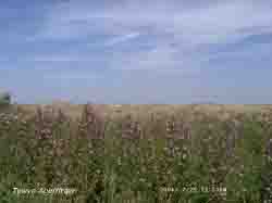 25th: Pressure was 1017 mb with the high 1023 mb over the middle of the North Sea. At 09 GMT it was sunny under 6 oktas of cirrus and cirrostratus clouds. Visibility was moderate to good during the day restricted by haze. In a light SE'ly breeze the temperature was already 24.2C and rose to 28.8C by the afternoon. Briefly, about 15 GMT, part of a 42° solar halo was seen from the west coast of Anglesey.
Tywyn Aberffraw the sand dunes were looking very dry with even the wild thyme was looking past its best. The Burnet rose, that was in full flower and photographed earlier in the season (see Diary for 8th June) was covered with the purplish-red fruits (hips) ![]() . There was a profusion of gatekeeper and painted lady butterflies, the most seen here for many years. The moistest places were the deep ditch alongside the road traversing the dune system to the north-east side, where the great hairy willow-herb and meadowsweet were in flower ( photo left), and the dune slacks with dwarf willow.
. There was a profusion of gatekeeper and painted lady butterflies, the most seen here for many years. The moistest places were the deep ditch alongside the road traversing the dune system to the north-east side, where the great hairy willow-herb and meadowsweet were in flower ( photo left), and the dune slacks with dwarf willow.
The evening was warm with the temperature keeping above 20C in little or no wind. Up to 40 chattering house martins were flying high over the treetops to be replaced, nearer the ground around 21 GMT, by brown long-eared bats taking insects and the abundant moths seen around the weather station. Later it turned cloudier. [Rain 0.0 mm; Max 28.8C; Min 14.0C; Grass 11.1C]
26th: It kept dry overnight although RAF Valley reported light showers on the north-west coast at 02 GMT and later drizzle and fog. Here, after dawn, it was bright and sunny with several contrails seen to the NE. Clouds were dark to the west and by 07 GMT cloud had drifted across the sky, but there was no rain to moisten the parched soil. Pressure was 1018 mb; low 985 mb was lying SE of Greenland. Attendant fronts were lying mid-Atlantic and well westward, but by 1800 GMT were closer to Ireland as the depression deepened to 981 mb. We were in a high-pressure area with low-pressure to the E. The sky was clearing by 08 GMT to give a mostly sunny morning and afternoon the S'ly wind moderate to fresh at times. Thunderstorms over the Cherbourg peninsular and south coast of England, and E Scotland in the early hours died out in the middle of the day only to break out again during the evening. [Rain 0.0 mm; Max 24.1C; Min 15.5C; Grass 12.3C]
27th: At midnight the low was 974 mb and progress eastward had slowed; pressure here was 1016 mb. The night was mostly clear and heavy dew formed on the grass that was still wet at 07 GMT but had dried by 09 GMT. It was a sunny morning and visibility towards the mountains was very good with clearly defined features. Off the coast visibility was poor to moderate with patches of sea fog. Cloud 2 oktas at 07 GMT reduced during the morning, the sky became temporarily overcast around noon, but this cleared again giving a sunny afternoon with clear sky by evening. On the west coast of the island the sea fog moved during the afternoon. [Rain 0.0 mm; Max 23.6C; Min 14.5C; Grass 11.5C]
![]() 28th: Another mostly sunny and warm day. At 09 GMT the temperature was 21.0C and this rose to 25.6C during the day. Pressure 1014 mb had stated to fall with slow-moving low 983 mb W of Scotland and SW of Iceland. A secondary frontal-low in mid-Atlantic, associated with the complex, deepened during the day to be 997 mb W of Brest by 1800 GMT. Frontal cloud brought rain to W Ireland and W Scotland with 23 mm falling at Lough Fea. Here, the evening was clear skied and sunny but cloud encroached before midnight. {Charlwood 30C, Fair Isle 15C, Lough Fea 23.2 mm, Buxton 14.5h} [Rain 0.0 mm; Max C; Min 13.6C; Grass 10.2C]
28th: Another mostly sunny and warm day. At 09 GMT the temperature was 21.0C and this rose to 25.6C during the day. Pressure 1014 mb had stated to fall with slow-moving low 983 mb W of Scotland and SW of Iceland. A secondary frontal-low in mid-Atlantic, associated with the complex, deepened during the day to be 997 mb W of Brest by 1800 GMT. Frontal cloud brought rain to W Ireland and W Scotland with 23 mm falling at Lough Fea. Here, the evening was clear skied and sunny but cloud encroached before midnight. {Charlwood 30C, Fair Isle 15C, Lough Fea 23.2 mm, Buxton 14.5h} [Rain 0.0 mm; Max C; Min 13.6C; Grass 10.2C]
29th: The night kept dry and there was a little early sunshine but it was mostly cloudy, but bright, at 09 GMT. Pressure 1004 mb was falling with low 986 mb W of Ireland. A weak cold front was lying over western Britain with rain falling in SW England, S Wales to N Ireland, but did not reach here until 1100 GMT when there was about 30 minutes of light rain as the temperature fell 3C to 18.0C. There was further rain from 1630 to 1700 GMT and a moderate shower at 1830 GMT. Then the sky began to clear and there was a little sunshine before nightfall. {Weybourne 30C, Lough Fea 23.6 mm. Hastings 13.6h} [Rain 3.2 mm; Max 21.3C; Min 16.7C; Grass 14.9C]
30th: A bright and sunny morning with strong convective cumulus congestus clouds developed over the Snowdonia Mountains. Pressure was 1006 mb with low 991 mb S of Iceland and the cold front passed the E coast of England into the North Sea. We were in a showery SW'ly airflow, but the day was mostly sunny with the clouds passing by without any precipitation until 2300 GMT when there was a light shower of rain. {Norwich 27C, Liscombe 22.6 mm, Colwyn Bay 12.7h} [Rain 4.2 mm; Max 22.3C; Min 13.2C; Grass 11.2C]
31st: A showery morning with a moderately heavy one at 0800 GMT giving most of the 4.2 mm rainfall for the 24-h up to 09 GMT. The low 994 mb was off the Western Isles tracking eastward over Scotland. The morning was mostly cloudy with 1 or 2 brighter spells and slight showers from time to time. {Shap Fell 36.8 mm, Capel Curig 13.2 mm, Weybourne 26C, Hastings 11.7h} [Rain 3.1 mm; Max 19.6C; Min 13.9C; Grass 11.7C]
1st: An overcast morning with light showers of rain. During the night the low had passed over the Grampian Mountains of Scotland and was over the North Sea off Fraserburgh (997 mb). Pressure here was 1005 mb and we were into a showery W'ly airstream. The morning had showers with a few sunny intervals; the afternoon was dry with longer sunny spells with the temperature rising to 20.3C. {East Malling, Kent 24C, Tulloch Bridge, Scotland 38.6 mm, Tenby, Pembrokeshire 12.6h} [Rain 0.1 mm; Max 20.3C; Min 12.5C; Grass 10.2C]
2nd: Overnight it was mostly cloudy and this carried over into the morning. At 09 GMT pressure was 1011 mb and with the slow-moving low unchanged 997 mb over the N North Sea there was a moderate to fresh NW'ly wind. The morning was mostly cloudy and the afternoon was brighter with a few sunny spells. The wind proved to be a little too strong for some in the Hoylake Sailing Club's regatta at Beaumaris, part of the Menai Strait Fortnight. In the gusty strengthening fresh to strong NW'ly one boat was holed and dinghy races were abandoned; other classes sailed shortened courses. North and E of here cloud was thicker; a frontal band of rain moved down from Scotland in the morning through N England to be over Manchester and Lincolnshire at 1500 GMT before fading and moving on to East Anglia and S England later. The best of the sunshine was seen in South Wales and SW England. {Loftus, Yorkshire 25.6 mm, Falmouth 13.5h, Bognor Regis 23C} [Rain 0.1 mm; Max C; Min 12.0C; Grass 9.0C]
3rd: A bright morning with the sky beginning to clear before 09 GMT. Pressure 1017 mb was rising as a ridge from Azores-high 1025 mb edged across from the W. Low-pressure SW Iceland had associated frontal cloud that encroached NW Britain through the day. A weakening line of stratocumulus clouds persisted most of the day over the Snowdonia Mountains. There was a fresh N'ly wind and during the afternoon, under clear sky over Anglesey, the temperature rose to 21.1C. Patchy cloud encroached from the NW during the evening. {Ross-on-Wye 27C, Weybourne 14.6 mm, Falmouth 14.6h} [Rain mm; Max C; Min 13.0C; Grass 11.0C]
4th: A dull overcast morning with the stratiform cloud just thick enough to deliver a few spots of rain from time to time. But pressure 1021 mb continued to rise slowly in the ridge from Azores-high 1025 mb. With an occluded front stretching down the spine of Britain and a warm front over the Irish Sea the day continued dull with mist, spells or drizzle or light rain affects coasts and high mountains. The wind, at first a light N'ly, backed SW'ly during the morning keeping light and this led to poor sailing conditions in the Menai Strait. Around noon there was a little brightness and some glimpses of sunshine here before turning dull again in the dry afternoon. From about 1900 GMT there were spells of drizzle and light rain up to midnight with the temperature rising from 21 GMT as the warm front moved across. {Lee-on-Solent 26C, Belfast 8.9 mm, Falmouth 14.4h} [Rain 4.8 mm; Max 18.6C; Min 13.0C; Grass 9.6C]
![]() 5th: There was further light rain and drizzle up to about 1000 GMT with the warm front edging eastward.. At 09 visibility was poor in drizzle and mist in a temperature of 18.0C. Pressure was 1022 mb within ridge from high 1026 mb lying to the SW. Low 988 mb was SW Iceland with a cold front W of Ireland. This brought some rain to Ireland and W Scotland during the day but in the E it was warm with Aboyne reporting 28.2C and Leuchars 27.1C. Here the morning was dull, but the afternoon was brighter (maximum 21.7C) and the evening sunny as the cloud eventually cleared. Coastal areas to the W remained dull with rain or drizzle at times. The NOAA 18 satellite image covers from the Arctic to Brittany. The complex low is SW of cloud-covered Iceland and S of ice-covered Greenland. There is patchy layered cloud over Britain while frontal cloud lies to the north-west.. {Aboyne, Aberdeenshire 28C, Isle of Skye 6.3 mm, Rhyl 4.6 mm, Valley 2.9 mm, Bognor Regis 13.2h} [Rain 0.2 mm; Max 21.7C; Min 14.3C; Grass 14.0C]
5th: There was further light rain and drizzle up to about 1000 GMT with the warm front edging eastward.. At 09 visibility was poor in drizzle and mist in a temperature of 18.0C. Pressure was 1022 mb within ridge from high 1026 mb lying to the SW. Low 988 mb was SW Iceland with a cold front W of Ireland. This brought some rain to Ireland and W Scotland during the day but in the E it was warm with Aboyne reporting 28.2C and Leuchars 27.1C. Here the morning was dull, but the afternoon was brighter (maximum 21.7C) and the evening sunny as the cloud eventually cleared. Coastal areas to the W remained dull with rain or drizzle at times. The NOAA 18 satellite image covers from the Arctic to Brittany. The complex low is SW of cloud-covered Iceland and S of ice-covered Greenland. There is patchy layered cloud over Britain while frontal cloud lies to the north-west.. {Aboyne, Aberdeenshire 28C, Isle of Skye 6.3 mm, Rhyl 4.6 mm, Valley 2.9 mm, Bognor Regis 13.2h} [Rain 0.2 mm; Max 21.7C; Min 14.3C; Grass 14.0C]
6th: Partly cloudy over night with a minimum temperature of 16.9C, highest of the month. A bright and sunny morning with the sky clearing before 09 GMT leaving 3 oktas cloud cover to the W and S over the mountains. The temperature was 20.5C in a light S'ly wind that strengthened to force 4/5 during the morning as the temperature rose to 25.2C, the highest of the month. Frontal cloud lying to the NW edged across just before noon and there was drizzle and intermittent light rain from 1320 GMT. We could have done with some more rain on the garden; the first of 2 weak fronts passed over about 15 GMT and the second about 2130 GMT, but both with small amounts of rain. The first front later pepped up a little over mid Wales to N England with some somewhat heavier rainfalls. {Pershore 29.7C, Isle of Skye 23.8 mm, Torquay, Devon 12.1h}{ [Rain 2.1 mm; Max 25.2C; Min 16.9C; Grass 14.0C]
7th: The sky was clearing about 06 GMT with alto and cirrocumulus clouds overhead, but by 09 GMT there were small cumulus clouds giving 5 oktas cover. Pressure was 1025 mb with high-pressure 1019 mb W of Ireland to the Azores. The wind was a force 3 NNE'ly giving a fresher feeling to the air (14.9C 76% RH) that was clear resulting in very good visibility during the morning. The frontal bands of rain were just clearing the SE and were over the English Channel and there were showers over central and SW England. Here the day was mostly sunny and in contrast to yesterday the maximum was just 17.3C. The evening and night were mostly clear. {Isle of Man 11.8h}[Valley 12.5h] [Rain 0.0 mm; Max 17.3C; Min 10.7C; Grass 7.5C]
![]() 8th: With a mostly clear sky and little or no wind overnight mist formed on flat fields and fog in valleys. On the grass the temperature had fallen to 5.0C, lowest of the month. At 0530 GMT there was shallow fog across the field adjacent to the weather station, but this cleared before 09 GMT. It was also cloudier with a cover of 6 oktas altocumulus and cumulus clouds and there was a light NW'ly breeze. Pressure was 1025 mb within a ridge lying over SW Britain. The day kept mostly cloudy with good sunny spells with the temperature reaching 21.0C. Frontal cloud encroached from the NW during the late afternoon and there was light rain and drizzle from 1730 to just before 2300 GMT accumulating 3.7 mm. {Great Malvern 27C, Braemar 3C, Port Glenone, Ballymena 6.6 mm, Bristol 13.8h} [Rain 3.7 mm; Max 21.0C; Min 9.9C; Grass 5.0C]
8th: With a mostly clear sky and little or no wind overnight mist formed on flat fields and fog in valleys. On the grass the temperature had fallen to 5.0C, lowest of the month. At 0530 GMT there was shallow fog across the field adjacent to the weather station, but this cleared before 09 GMT. It was also cloudier with a cover of 6 oktas altocumulus and cumulus clouds and there was a light NW'ly breeze. Pressure was 1025 mb within a ridge lying over SW Britain. The day kept mostly cloudy with good sunny spells with the temperature reaching 21.0C. Frontal cloud encroached from the NW during the late afternoon and there was light rain and drizzle from 1730 to just before 2300 GMT accumulating 3.7 mm. {Great Malvern 27C, Braemar 3C, Port Glenone, Ballymena 6.6 mm, Bristol 13.8h} [Rain 3.7 mm; Max 21.0C; Min 9.9C; Grass 5.0C]
9th: The sky was clearing around dawn and the morning was partly cloudy with some sunny spells. Pressure was 1021 mb with low 992 mb off the N of Scotland and high 1031 mb W of Ireland. This pattern kept a showery NW'ly flow of air over Britain. Most showers were confined to Scotland and some penetrating the Cheshire Gap between the Pennines and the Welsh Mountains to reach the Midlands and parts of S England. Here the day kept mostly cloudy with a few slight showers, just a few spots of rain at 1415 GMT, and sunny spells. {Lee on Solent 25C, Cassley, Highland 29.2 mm, Saunton Sands, Devon 12.0h} [Valley 8.6h] [Rain 0.6 mm; Max 20.3C; Min 11.5C; Grass 8.6C]
10th: A cloudier night with a moderate shower of rain at 0230 GMT. It was overcast at 09 GMT with dull grey layered stratiform cloud. But pressure 1018 mb was rising as the filling low 1000 mb over the N North Sea. The high 1029 mb over the Atlantic to the W too far away to bring a return to settled weather. Slight showers continued over Anglesey and the Snowdonia Mountains in the morning these easing during the afternoon with a sunny spell around 16 GMT. A cool day with the maximum reaching 19.5C late in the afternoon. Became cloudy again during the evening. [Rain 0.1 mm; Max 19.5C; Min 11.8C; Grass 7.4C]
11th: The showery weather pattern continued with showers from 0730 GMT and spells of drizzle. At 09 GMT it was calm with fine and slight drizzle. Light rain showers were prevalent during the morning over Wales. Heavier showers over the North Sea moved into East Anglia and the SE during the afternoon and evening. Here the drizzle soon died out and the day was dry with a few sunny spells with the evening and night seeing some clear sky at times. [Rain trace; Max 16.0C; Min 12.0C; Grass 10.1C]
12th: A dull start to the day with thick layered clouds overhead but it was brighter over Red Wharf Bay. Complex low-pressure sinking S over the North Sea towards Europe gave a blustery and wet day to parts of the East Coast from Lincolnshire to Kent. Bands of heavy showers moved in off the sea delivering thunder and some heavy falls of rain. A waterspout was spotted at 1220 GMT out to sea off Broadstairs in Kent. Pressure here was 1020 mb with the high building to 1033 mb W of Ireland at noon. With the unsettled weather keeping in the east the day brightened and the afternoon was mostly sunny. Cloud encroached from the NE again during the evening. {Weymouth 23C, Sennybridge 5C, Wainfleet, Lincs. 29.8 mm, Tenby, Pembs. 11.4h} [Rain 0.3 mm; Max 17.2C; Min 12.2C; Grass 9.3C]
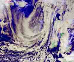 13th: There was a little rain around 0230 GMT but the 0.3 mm not enough to slake the parched soil so that at 09 GMT soil, concrete and grass were dry. The force 5 N'ly wind with 80% relative humidity although under mostly cloudy skies continued the moderately high rates of evaporation. Pressure was 1016 mb and an occluded front off the E coast of England slowly pushed W during the day. The day kept cloudy here but it brightened in the late afternoon with some sunny spells developed in the evening. Thundery troughs moved in off the North Sea and affected S England with isolated thunderstorms and heavy falls of rain in places. In Ash, in Surrey, it was reported that 102 mm fell in 4 hours causing local flooding. Flooding was also reported in Farnham. There was a little drizzle and light rain here from 2130 GMT until 02 GMT. The NOAA 18 satellite image, from Greenland to N Africa, shows the frontal cloud over Britain associated with the complex low-pressure to the E that has given stormy weather to the SE and N and central Europe in recent days. To the W and just E of the Atlantic-high is another frontal system W of Ireland on which, just S of Iceland, a low was developing. [Rain 0.7 mm; Max 16.7C; Min 12.6C; Grass 12.2C]
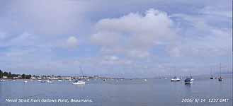 14th: After the overnight rain the sky remained overcast until after 09 GMT. Pressure 1015 mb was falling very slowly with shallow low 1010 mb Iceland with associated occluded front still W of Ireland. Low 996 mb Denmark had deepened a little while the Atlantic-high 1032 mb remained well-anchored to the W. A little brightness appeared by 11 GMT, but the day kept mostly cloudy here in SE Anglesey and over the mainland and mountains with only brief appearances of sunshine. It was much clearer with longer spells of sunshine during the afternoon elsewhere on the island. [Rain 0.2 mm; Max 19.3C; Min 12.6C; Grass 12.2C]
15th: A mostly dark threatening looking sky with spots of rain leading up to 09 GMT. Pressure was 1007 mb in a slack gradient within a complex low-pressure system between Rockall and the Baltic. Pressure remains high 1030 mb S of Greenland and the Mediterranean/ N Africa. It was a sunless day with continuous light rain or heavy drizzle that did not stop until after 1900 GMT but accumulated just 4.6 mm. The daytime temperature reached only 14.0C while the 24-h (09-09 GMT) maximum was 14.9C, lowest of the month. The night was overcast but mostly dry. [Rain 4.6 mm; Max 14.9C; Min 11.8C; Grass 11.1C]
The first 15 days was complete contrast to the warmth of July with temperatures close to the August average. The mean 15.8C was (-0.3) and [+0.4] and the highest maximum of 25.2C was (-1.1) of average. Rainfall was still running below average with 17.4 mm [22%] while the 77 h sunshine duration at RAF Valley was [48%].
16th: Pressure was 1002 mb and calm or slight SE'ly wind. Slow-moving low 995 mb was off Lands End on route for the Bay of Biscay; showers within its circulation brought rain to Cornwall and SW England and Wales through the day. The 14.9C at 09 GMT exceeded yesterday's daytime temperature. The day was mostly dull, with slight showers from time to time notably between 14 and 16 GMT, with a maximum temperature of 18.3C. After 1730 GMT the sky partially cleared giving a little weak sunshine and leaving mist across the fields at dusk. {Charlwood 24.7C,Braemar 2C, Camborne 31.2 mm, Capel Curig 11.2 mm , Eastbourne 10h} [Rain 0.9 mm; Max 18.3C; Min 11.6C; Grass 10.1C]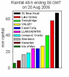 18th: Overcast by thin moderately high altostratus and cumulus clouds. Pressure was 1001 mb with the low 998 mb was tracking N over the SW entrance to the English Channel. Occluded frontal cloud lay over Ireland and the Irish Sea. At 09 GMT the sun was looming through the cloud and the morning was bright at first but no sunshine was seen. Another crop of thunderstorms was working its way N through S England and the Midlands. At noon sferics were recorded S and SE of the Snowdonia Mountains. The afternoon turned dull and increasingly murky and there was rain from 1230 GMT and was moderately heavy at 1500 GMT. But no thunder was heard the storms giving us a miss this time round. Rain, mostly light, continued intermittently through the night. {Weybourne 24C, Capel Curig 6C, Torquay 47 mm, Lake Vyrnwy 27.8 mm, Clacton 10h} [Rain 14.0 mm; Max 17.1C; Min 10.5C; Grass 8.4C]
 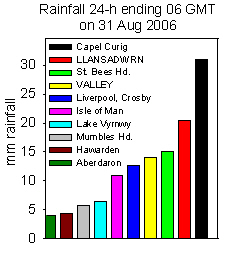 30th: Pressure was 1019 mb within a ridge of high-pressure at 09 GMT this persisting until it started to fall about 17 GMT. But it was the last of the NW'lies as at 09 GMT it was W'ly and backed SW'ly through the morning and was S'ly by evening. High 1025 mb persisted over the Bay of Biscay but mid-Atlantic low 988 mb was tracking NE west of Ireland. Although bright with some sunshine at first it was overcast by noon. Rain on a warm front over Ireland had reached Pembrokeshire but took until about 17 GMT to reach here with a spell lasting until 1900 GMT before turning to heavy drizzle. With 22.8 mm (09-09 GMT) it was the wettest day of the month. {London 21C and 11 h, Connaught AP, Ireland 14.9 mm} [Rain 22.8 mm; Max 17.2C; Min 9.4C; Grass 6.5C]
 ![]() The month ended with a rainfall total of 102.3 mm (124%) and [127%] of average. The mean temperature was 15.4C -0.7 below the decadal average but on the 1971-2000 climatological average. Sunshine was below average. The number of warm days (>=20C) and hot days (>=25C) so far this year are 50 and 11 respectively, below those observed in 1983, 1989/1990 and 1995, see histogram.
The month ended with a rainfall total of 102.3 mm (124%) and [127%] of average. The mean temperature was 15.4C -0.7 below the decadal average but on the 1971-2000 climatological average. Sunshine was below average. The number of warm days (>=20C) and hot days (>=25C) so far this year are 50 and 11 respectively, below those observed in 1983, 1989/1990 and 1995, see histogram.
1st: The midnight surface analysis chart showed frontal cloud over Anglesey, cold to the S and warm to the N, with which had broken cloud and low 991 mb S of Iceland. There was broken cloud at 09 GMT but it took the morning for it to clear eastward. Pressure was 1010 mb and the temperature 15.7C (dewpoint 14.5C). By afternoon there were some sunny spells but the SW'ly wind was fresh to strong resulting in warning signs illuminated on the Britannia Bridge. There were showers in the vicinity and over the mountains, with troughs passing to the N, but we did not see one until evening, some light rain before drizzle. [Rain 7.5 mm; Max 19.0C; Min 14.6C; Grass 14.1C]
2nd: By morning the S'ly wind had strengthened to force 6/7 and it had been raining heavily since 06 GMT. It was one of those morning when the observer got very wet! Pressure 997 mb was falling with low 992 mb tracking NE across Ireland. Complex thick frontal systems were moving E and we were underneath. By 11 GMT the wind was gale force 8 with strong gusts (RAF Valley reported a gust of 59 mph) that blew over garden furniture, more leaves and twigs off the trees and almost flattened my row of runner beans. Guy ropes were hastily improvised and the sticks straightened up. Pressure continued to fall to 994 mb at noon, the rain continued intermittently with drizzle and the wind moderated a little through the afternoon. By 18 GMT it was a little brighter but there was no sunshine. {Hawarden 21.9C, Aboyne 4C, Capel Curig 56.8 mm, Stornoway 5.8h} [Rain 12.0 mm; Max 17.2C; Min 13.3C; Grass 11.8C]
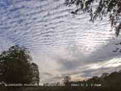 3rd: Low cloud and rain persisted through the night. There was moderate rain between about 01 and 03 GMT and fog (visibility <200m) at 0530 GMT. With complex fronts and troughs in the vicinity it was a blustery morning but the cloud was lifting at 09 GMT with some bright spells developing through the morning. Pressure 1003 mb was rising and we were still in the strong SW'ly airstream. The afternoon was drier with a few longer sunny spells. From 17 GMT the sky started to clear from the W the altocumulus clouds developing orographic waves. Nearer the horizon lenticular altocumulus clouds were seen but within an hour the sky had cleared.
 ![]() The Meteosat MSG satellite image shows development of the orographic waves in clouds over western Britain at 1500 GMT. Lenticular clouds can be seen over the Irish Sea W of Anglesey. [Rain 0.5 mm; Max 17.9C; Min 13.6C; Grass 11.8C]
The Meteosat MSG satellite image shows development of the orographic waves in clouds over western Britain at 1500 GMT. Lenticular clouds can be seen over the Irish Sea W of Anglesey. [Rain 0.5 mm; Max 17.9C; Min 13.6C; Grass 11.8C]
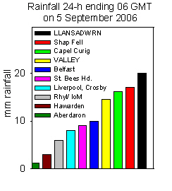 4th: There were a few spots of rain before 09 GMT. Although pressure 1022 mb had risen it was a mostly cloudy sky as frontal cloud repositioned over North Wales and Ireland. High 1028 mb was over W France being too far S to tame the general cloud-filled low-pressure to the north, The morning was cloudy with a light W'ly breeze with a little brightness and sunshine around noon. The afternoon was overcast and dull with showery rain arriving at 1700 GMT, it was moderate to heavy rain from 1900 to 2300 GMT and intermittent until after midnight. [Rain 20.0 mm; Max 18.7C; Min 12.5C; Grass 9.5C]
5th: Further intermittent rain until after 03 GMT brought the total up to 20.0 mm making Llansadwrn one of the wettest places overnight and wettest day of the month. There had been a moderate fall of light grey to very pale brown dust (MUNSELL® Color Chart 10YR 6 2.5/3).
Trajectory analyses, using the HYSPLIT model at the NOAA Air Resources Laboratory ![]() , indicated that parcels of air arriving over Llansadwrn from 17 GMT on the 4th had come at lower level from a pool of dust over the Atlantic west of the Gibraltar Strait or at higher level from the Sahara between Mali and Algeria. It was a blustery morning with a little clearance leading up to 09 GMT although there was mist and rain still around the coast on the W of the island. Pressure was 1021 mb with high 1027 mb over France and complex low-pressure W of Ireland we were still in a strong warm and moist SW'ly airstream. The day was mostly cloudy, but dry, with occasional brief sunny spells when the temperature rose to 20.7C. The night was overcast with low cloud giving misty conditions around the coast. [Rain 5.6 mm; Max 20.7C; Min 13.7C; Grass 13.3C]
, indicated that parcels of air arriving over Llansadwrn from 17 GMT on the 4th had come at lower level from a pool of dust over the Atlantic west of the Gibraltar Strait or at higher level from the Sahara between Mali and Algeria. It was a blustery morning with a little clearance leading up to 09 GMT although there was mist and rain still around the coast on the W of the island. Pressure was 1021 mb with high 1027 mb over France and complex low-pressure W of Ireland we were still in a strong warm and moist SW'ly airstream. The day was mostly cloudy, but dry, with occasional brief sunny spells when the temperature rose to 20.7C. The night was overcast with low cloud giving misty conditions around the coast. [Rain 5.6 mm; Max 20.7C; Min 13.7C; Grass 13.3C]
6th: Overnight the air minimum was 16.3C, the highest recorded at this station since before 1979 (previously 16.2C in 2000 and 2005). Low stratiform cloud and heavy drizzle gave very poor visibility at 09 GMT. There had been a further fall of the pale brown Saharan dust in the rain since 06 GMT. Trajectory analysis indicated a similar origin in the Saharan as yesterday . Drizzle and rain continued through the morning but slowly cleared on Anglesey from the W during the afternoon. It hung around mainland shores and mountains well into the afternoon and did not clear until evening in places. The night was dry and part cloudy with bright moonshine. Rainfall for the month so far is 47.3 mm and (45%) average and brought the total for the year to 706 mm (62%) of average. {Jersey 27C, Kinbrace 4C, Dunstaffnage 33mm, Jersey 10.2h} [Rain 1.7 mm; Max 17.5C; Min 16.3C; Grass 15.3C]
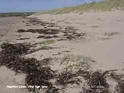 7th: A bright and sunny morning with pressure 1024 mb rising as an Atlantic high 1030 mb move across from the W of Ireland. There was a moderate N'ly wind and the day felt fresher than of late. A marked temperature contrast with the minima down 6.8C in the screen and on the grass down 9.8C on the previous night. The day was increasingly sunny as the sky cleared. By 17 GMT the sky was clear and visibility in excess of 60 km in clean, dustfree air. With almost clear sky at 21 GMT the brilliant, seemingly large full moon, had risen over the trees to the SE of the weather station. It was at its closest to earth this year because if its lopsided orbit. Usually September's full moon is the Harvest Moon, but not this year as October's is closest to the autumnal equinox and gets the name. Tides (10.5 m Liverpool) are equal highest this year this month on the 10th and 9th October. With high-pressure dominant September's, at least, was not enhanced by a large tidal-surge and, as the photograph taken after the 10.4 m tide at Aberffraw on the 9th, shows the seaweed marking the highest point amongst the strand plants below the base of the dunes. [Rain 0.0 mm; Max 16.4C; Min 9.5C; Grass 5.5C]
8th: Overnight the air minimum fell to 9.0C, the lowest of the month highest recorded since before 1979 beating the 8.0C recorded in 2001 by a whole degree. Sunny from the start with an almost clear sky. Pressure was 1031 mb with the high centred over the Pennines 1032 mb at 09 GMT. Visibility was again excellent (>60 km) but haze developed over Liverpool Bay in the afternoon, but did not reached Snowdonia. In a light NE'ly breeze the temperature rose to 22.9C. [Valley 11.9h] [Rain 0.0 mm; Max 22.0C; Min 9.0C; Grass 6.1C]
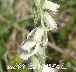 9th: After a clear night cloud encroached at dawn but the cloud was high, mainly cirrostratus and cirrocumulus, and the morning was bright and sunny. Visibility was good with moderate haze. Pressure was 1025 mb with the high (1030 mb) moved E to be over the North Sea. Shallow low 1002 mb was N of the Azores and a general S/SE'ly air flow introduced. The high cloud dispersed during the morning giving a mostly clear, sunny afternoon and evening. At Tywyn Aberffraw the autumn lady's-tresses orchids were coming into flower on the slightly drier dune slacks
 ![]() and here a closer view to see the spiral arrangement of the small delicate flowers flowers
and here a closer view to see the spiral arrangement of the small delicate flowers flowers ![]() . Also in flower for a while had been the autumn gentian, or felwort, but there were still good specimens to be seen
. Also in flower for a while had been the autumn gentian, or felwort, but there were still good specimens to be seen ![]() .[Rain 0.0 mm; Max 21.1C; Min 9.8C; Grass 6.7C]
.[Rain 0.0 mm; Max 21.1C; Min 9.8C; Grass 6.7C]
10th: Another bright and sunny morning with just 3 oktas cover of alto and cirrostratus to the W and a little cirrus clouds overhead. Pressure was 1020 mb with high 1033 mb was over SE Europe. Frontal low 1002 mb was slow-moving off SW Ireland with its cloud over W Ireland and the Outer Isles of Scotland where there was a little rain through the day. Here it was calm and the temperature was 16.8C (dewpoint 11.5C) and rose to 23.6C by afternoon before the edge of the frontal cloud brushed over Anglesey. The evening saw a little more sunshine before the cloud returned later. {London MO 27.8C, Stornoway 2.5 mm, Valentia, Ireland 2.4 mm, Cromer 10.9h} [Rain 0.0 mm; Max 23.6C; Min 12.0C; Grass 8.0C]
11th: There were some clear spells overnight and it was misty in low-lying places and around the coast. With frontal cloud lying to the W the morning was sunny with variable amounts of cloud as pressure 1017 mb continued to decline slowly. There was a variably light SE'ly wind and visibility, although good, was restricted by haze. Although cloudier than yesterday the temperature rose to 22.0C during the afternoon. Once again the sky was clearer for a while towards evening but thicker cloud arrived with a few spots of rain before midnight. {Heathrow 30.2C, Port Ellen, Inner Hebrides 22.5 mm, Eastbourne 11.2h} [Rain 0.1 mm; Max 22.0C; Min 14.4C; Grass 11.1C]
12th: Under thick cloud there was a slight shower of rain around 0130 GMT and the air temperature kept up to 15.4C in the moist warm S'ly airflow. At 09 GMT the sky was clearing a little and there were 1 or 2 sunny spells. Pressure was 1014 mb with deepening Atlantic-low 981 mb S of Greenland. We were in a showery airstream between fronts and the day had short sunny spells with with light showers in the afternoon.{Norwich 26C, Hawarden 24.2C, Rhyl 23.9C, Altnaharra 20.6 mm, Clacton 9.5h} [Rain 0.4 mm; Max 21.0C; Min 15.4C; Grass 13.0C]
13th: After a light shower of rain at 06 GMT the sky was clearing at 09 GMT. Pressure was 1005 mb with Atlantic-lows 973 W of Ireland and another 979 mb off Newfoundland. Pressure was high 1025 mb over the Azores. A band of rain stretched from St. George's Channel to the Scilly Isles but it kept dry here all day. Though mostly cloudy there was weak sunshine at times and the temperature rose to 22.0C; the S'ly wind freshened to force 5 in the afternoon. The night became overcast. {Cromer 25C, Marham 10.2 mm, Kinloss, Highland 9.4h} [Rain 3.3 mm; Max 22.0C; Min 15.5C; Grass 13.8C]
14th: Under uniform grey stratus cloud there was continuous moderate rain at 09 GMT. Pressure was 1003 mb with low 973 mb S of Iceland with associated frontal cloud nearby. Hurricane Florence, that became a large and powerful extra-tropical storm by the 12th, was 966 mb off Newfoundland. Visibility was poor in mist and rain that continued, but lightened, until noon. The afternoon kept overcast with thick cloud that produced drizzle and rain from time to time. A sunless day with the first sign of a clearance in the west at dusk with the sky clearing before midnight. The day's maximum was 15.1C, the lowest of the month. Thunderstorms moved up through the Midlands to NE England during the day. A tornado was reported as hitting Leeds where up to 300 properties suffered some damage and many trees blown over. {Hunstanton 25C, Brize Norton 39.6 mm, Southport 7.9h} [Rain 2.6 mm; Max 15.1C; Min 14.2C; Grass 13.1C]
15th: Mist and fog patches formed in low-lying parts after midnight. The grass minimum fell to 5.5C, lowest of the month, but highest on record since the 5.0C recorded in 1989. Under almost clear sky there was shallow fog lying across the fields up to 0630 GMT. At 09 GMT it was cloudier but sunny. Pressure was 1015 mb in a ridge of high-pressure over Ireland. But low 982 mb (ex-Hurricane Florence) had raced across the Atlantic and was S of Greenland. Also Hurricane Gordon in mid-Atlantic, held up by Florence, was moving E and intensifying with winds up to 138 mph. Low 999 mb was tracking E across the Mediterranean, there was cloud over France, Spain and Italy, and producing thunderstorms but mainly over the sea. The morning here was sunny with a light N'ly breeze. The afternoon was clear and sunny with very good visibility continuing into the early evening. The night was clear. [Rain 0.0 mm; Max 17.3C; Min 10.0C; Grass 5.5C]
![]() 16th: With clear skies overnight the minimum temperature dropped to 9.2C with on the grass it was 6.8C. Shallow fog had formed in the calm conditions on the fields at 0530 GMT but had cleared before 09 GMT. Pressure was 1013 mb with low 987 mb (ex-Hurricane Florence) W of Scotland with associated cold front W of Ireland (see satellite image). Under almost clear sky, in a clear slot between fronts, the day was sunny and with a light NE'ly breeze the temperature rose to 20.8C. It was cloudier over SE Anglesey for a while around 14 GMT, but this dispersed later giving another clear skied night with bright stars visible. [Rain 0.1 mm; Max 20.8C; Min 9.2C; Grass 6.8C]
16th: With clear skies overnight the minimum temperature dropped to 9.2C with on the grass it was 6.8C. Shallow fog had formed in the calm conditions on the fields at 0530 GMT but had cleared before 09 GMT. Pressure was 1013 mb with low 987 mb (ex-Hurricane Florence) W of Scotland with associated cold front W of Ireland (see satellite image). Under almost clear sky, in a clear slot between fronts, the day was sunny and with a light NE'ly breeze the temperature rose to 20.8C. It was cloudier over SE Anglesey for a while around 14 GMT, but this dispersed later giving another clear skied night with bright stars visible. [Rain 0.1 mm; Max 20.8C; Min 9.2C; Grass 6.8C]
17th: At midnight remnants of ex-Hurricane Florence were 984 mb W of Scotland but moving N towards Iceland. The morning was overcast and dull with a light SW'ly breeze. Pressure was 1010 mb in a minor ridge between complex low-pressure 980 mb to the NW (remnants of Florence) and low 1007 mb over Italy. Frontal cloud was lying over western Britain and this moved slowly E allowing brighter weather into the W by the afternoon. In the light wind it felt warm as the temperature rose to 21.5C. After some patchy cloud moved off the night was mostly clear, dry and calm. [Rain 0.0 mm; Max 21.5C; Min 9.3C; Grass 6.6C]
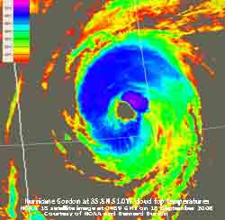 18th: The sky was still clear around dawn but with low 988 mb W of Scotland associated frontal cloud began to encroach before 09 GMT when cover had increased to 4 oktas. Pressure 1009 mb was falling slowly but the day kept mostly bright and sunny until just before 1500 GMT when, with the S'ly wind strengthening to near gale force 7, there was light to moderate rain until 1700 GMT then drizzle. Rain ceased and the wind moderated before 20 GMT and the night was dry with broken cloud. [Rain 6.0 mm; Max 19.0C; Min 12.2C; Grass 9.3C]
At 0430 GMT today Hurricanes Gordon and Helene were in mid-Atlantic ![]() . Gordon just NW of Helene was S of Nova Scotia tracking towards the Azores. It had formed on a tropical-wave off the W coast of Africa on the 1st, but did not develop into a hurricane until the 12th and began to move N. On the 13th it intensified rapidly reached wind speeds of 120 mph before stalling and weakening in mid-Atlantic to be classified as a tropical storm.
. Gordon just NW of Helene was S of Nova Scotia tracking towards the Azores. It had formed on a tropical-wave off the W coast of Africa on the 1st, but did not develop into a hurricane until the 12th and began to move N. On the 13th it intensified rapidly reached wind speeds of 120 mph before stalling and weakening in mid-Atlantic to be classified as a tropical storm.
19th: At midnight Hurricane Gordon stated moving towards the islands of the Azores while low 977 mb S of Greenland was deepening and moving E towards Britain. At 09 GMT pressure here was 1010 mb in a minor ridge but isobars were tightening to the NW and the SW'ly force 4 wind was picking up. The morning was bright and sunny, but by noon it was a little cloudier. As the Atlantic-low 968 mb moved S of Iceland frontal cloud moved across Ireland. The night was windy, but stars were visible through broken cloud and it kept dry. [Rain 0.0 mm; Max 18.5C; Min 11.3C; Grass 10.0C]
20th: Weakening Gordon, downgraded to a tropical storm, passed over the Azores after midnight while nearer home slow-moving low 964 was S of Iceland and W of Scotland with associated fronts over Ireland. The strong S'ly airflow continued and at 09 GMT was gale force 8 with moderately strong gusts. In spite of the wind cloud cover was only 3 oktas with the passing clouds scudding rapidly across the sky. The temperature had risen to 18.5C, the maximum for the past 24-h, with a dewpoint of 14.2C. There were a few large drops of rain at 0935 GMT and a prolonged shower at noon with the temperature falling back to 17.0C. The afternoon started bright, though still very windy but less gusty, before rain on a warm front crossing the Irish Sea began by 1630 GMT. The rain moderate to heavy continued until 1900 GMT before becoming intermittent and showery through till morning with the wind keeping a sustained force 6 to 7. Rainfall in the 24-h to 09-09 GMT here was 14.8 mm and at RAF Valley 12.2 mm. At Pentraeth, however, 25.4 mm was recorded while Red Wharf Bay had 23.1 mm indicative of a strong gradient NE of here. {Gravesend 23C, Coningsby 6C, Glasgow 34 mm, Herne Bay 10.4h} [Rain 14.8 mm; Max 21.8C; Min 13.5C; Grass 11.8C]
![]()
![]()
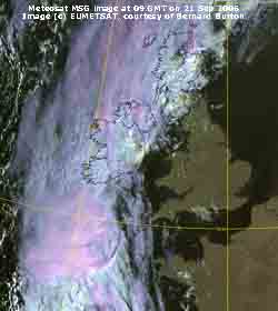 21st: The NOAA 18 satellite image shows the position of tropical storm Gordon 990 mb off Iberia at 0227 GMT merging with frontal cloud S from low 973 mb W of Scotland. The thermal sensor image shows the storm's cloud top temperatures as low as -60C. By morning the S'ly wind had moderated a little force 5 at 09 GMT and was backing SE'ly with pressure 997 mb falling as Gordon headed N into the Bay of Biscay. At noon Gordon had deepened to 978 mb and was off the French coast near Brest. Here under an almost clear sky (2 oktas) the temperature had risen to 21.8C at 09 GMT and, for the second consecutive morning, was the maximum for the past 24-h. The dewpoint was 11.9C and relative humidity 53%. The morning was sunny and feeling warm rising to 26.2C, highest on record on this date in the year, just after noon and might have risen further had not cloud encroached by 1330 GMT. It was highest of the month, but did not beat the record 28.0C on the 4th last year, 2005. Close to the centre of the storm, as it made its way past Lands End and St George's Channel to be 974 mb W of Malin Head, N Ireland by midnight, there was a large pressure gradient resulting in strong winds in the west of Britain. The wind strengthened again here during the afternoon to force 6 by 1600 GMT as pressure fell to 990 mb between 18 and 20 GMT. The Meteosat MSG satellite infrared image at 1800 GMT shows the storm heading north, over Ireland and the Irish Sea, with cloud pushing in over Anglesey
 ![]() . At 2000 GMT there was broken cloud, still windy with the SSE'ly force 6/7, and still warm with the temperature on 22.0C with the dewpoint 12.8C (relative humidity 56%). At 2100 GMT with pressure rising and temperature falling as the wind strengthened again to gale force 8 , at RAF Valley gusts of wind reached 60 mph, and there was a downpour of rain within 200 m of the station at 2137 GMT, but the raingauges here were dry! All along the west coast from Cornwall to Scotland there were gales and strong gusts reaching 70 mph in places. It was a 'wild night'. {Bedford/ Herne Bay 29C, Ballykelly 1C, Tyndrum 49 mm, Jersey 11.4h} [Red Wharf Bay 26.7C, Valley 25.5C] [Rain trace; Max 26.2C; Min 16.1C; Grass 14.9C]
. At 2000 GMT there was broken cloud, still windy with the SSE'ly force 6/7, and still warm with the temperature on 22.0C with the dewpoint 12.8C (relative humidity 56%). At 2100 GMT with pressure rising and temperature falling as the wind strengthened again to gale force 8 , at RAF Valley gusts of wind reached 60 mph, and there was a downpour of rain within 200 m of the station at 2137 GMT, but the raingauges here were dry! All along the west coast from Cornwall to Scotland there were gales and strong gusts reaching 70 mph in places. It was a 'wild night'. {Bedford/ Herne Bay 29C, Ballykelly 1C, Tyndrum 49 mm, Jersey 11.4h} [Red Wharf Bay 26.7C, Valley 25.5C] [Rain trace; Max 26.2C; Min 16.1C; Grass 14.9C]
22nd: The wind had moderated by morning and before 09 GMT was sometimes calm. There was hazy sunshine through 5 oktas cirrus clouds and visibility was good. Pressure had risen to 1002 mb with the low filling and tracking W to be S of Iceland 978 mb at noon. Thicker cloud encroached during the morning and by afternoon it was overcast, but the sky cleared later. With clear visibility there were fine views of the Snowdonia Mountains during the early evening. By 2020 GMT there was a light shower of rain. [Rain 0.1 mm; Max 19.2C; Min 14.0C; Grass 12.0C]
23rd: After a little light rain at 07 GMT the sky was almost clear by 09 GMT. Pressure was 1005 mb and the wind a light air from the SE. With frontal cloud well to the E, the day was dry sunny under the mostly clear sky and the temperature rose to 23.2C, one of the highest in Britain. The evening was cloudier and it was overcast by midnight. {Gravesend 23.4C, Loch Glascarnoch 6C, Aberdeen 9 mm, Jersey 11.2h} [Rain 0.8 mm; Max 23.2C; Min 13.0C; Grass 9.3C]
![]() 24th: The day began overcast and there was showery rain before 09 GMT. There were some thunderstorms in the south in the early hours spreading from Cornwall as far as London and up to Cheshire. Storms also broke out in SW France, Spain and the Mediterranean but not the Riviera (see graphic). It was calm with moderate visibility in moderately low cloud and mist. Pressure was 1002 mb and in a slack pressure area there was little or no wind through the day. There was a little more rain at first in the morning, but by noon the cloud began to clear and visibility improved to good with the Snowdonia Mountains in view. The afternoon was sunny with the temperature rising to 21.0C. By 1545 GMT it turned cloudier and there were some spots of rain. There was a light shower at 1740 GMT, but the night was dry with partial cloud cover. {Gravesend 23.4C, Loch Glascarnoch 5.6C, Strathallan 25.0 mm, Bognor Regis 8.9h} [Rain 0.9 mm; Max 21.0C; Min 14.9C; Grass 11.5C]
24th: The day began overcast and there was showery rain before 09 GMT. There were some thunderstorms in the south in the early hours spreading from Cornwall as far as London and up to Cheshire. Storms also broke out in SW France, Spain and the Mediterranean but not the Riviera (see graphic). It was calm with moderate visibility in moderately low cloud and mist. Pressure was 1002 mb and in a slack pressure area there was little or no wind through the day. There was a little more rain at first in the morning, but by noon the cloud began to clear and visibility improved to good with the Snowdonia Mountains in view. The afternoon was sunny with the temperature rising to 21.0C. By 1545 GMT it turned cloudier and there were some spots of rain. There was a light shower at 1740 GMT, but the night was dry with partial cloud cover. {Gravesend 23.4C, Loch Glascarnoch 5.6C, Strathallan 25.0 mm, Bognor Regis 8.9h} [Rain 0.9 mm; Max 21.0C; Min 14.9C; Grass 11.5C]
25th: The morning was sunny under an almost clear sky. There was just light air from the S and visibility was good. Pressure was 1008 mb still within a slack pressure gradient keeping winds light through the day. Slow-moving frontal cloud, with embedded deep convective clouds, kept to the eastern half of Britain and over the North Sea. The afternoon saw broken cloud cover with plenty of sunshine. In the west Tenby, with 10.6h duration, was the sunniest while places in the east saw little, if any. Later in the afternoon some patchy cloud past over but the evening and night were mostly clear and dry. [Rain 0.0 mm; Max 21.5C; Min 11.5C; Grass 7.7C]
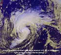 26th: Pressure 1017 mb was rising as a ridge of high-pressure moved across from the W. There was a light SE'ly breeze at first and the morning was mostly sunny. Large fluffy cumulus clouds developed around noon before declining early in the afternoon. The temperature rose to 21.0C before frontal cloud, associated with the low (ex-Hurricane Helene) moving N and filling N of the Azores, that had been over Ireland and Western Scotland encroached by 1430 GMT. But it kept dry, the wind light and visibility remained good. The evening and night were mostly cloudy with the wind veered SW'ly wind force 4. [Rain 0.0 mm; Max 21.0C; Min 11.0C; Grass 6.8C]
27th: In contrast to previous days the morning was overcast and dull with a force 3 S'ly wind. At 09 GMT pressure 1008 mb was falling slowly as in a complex, with remnants of Helene SW of Ireland, developing low 988 mb (at midnight) was deepening and tracking towards Shannon (982 mb at noon). In the afternoon there was a slight shower (1310 GMT), but also some bright spells with glimpses of sunshine with the cloud breaking up. As pressure fell further during the afternoon, to 999 mb around 18 GMT, the wind strengthened to strong to gale-force f6/7, with some strong gusts. In the evening there was some drizzle along with showers of rain at 1830 GMT and 2130 GMT. [Rain 0.8 mm; Max 20.9C; Min 13.5C; Grass 11.0C]
28th: With the frontal cloud moving NE some clearer weather started to move in after midnight. At 09 GMT pressure 1005 mb was falling with complex low-pressure lying to the NW including a deep low 965 mb SE Greenland. Cloud cover was 6 oktas, but there were orographic breaks, and this decreased with some sunshine by midmorning as the fresh (f5) SW'ly moderated during morning. Cloud increased again in the afternoon with light showers developing in the vicinity with one at 1345 GMT in Llanddona. With the wind becoming light and variable there was rain from 23 GMT until after midnight. [Rain 1.5 mm; Max 17.0C; Min 13.0C; Grass 11.6C]
29th: After midnight the sky cleared but, with Atlantic-low 972 mb lying to the W, occluded frontal cloud over Ireland and SW England moved by dawn. At 09 GMT pressure was 1000 mb and the sky overcast. It felt cold in the moderate S'ly wind, the temperature was 14.3C (dewpoint 12.1C) and in contrast to recent warm days struggled to reach 15.8C at noon. As the front cleared eastward we entered a showery airstream. There was a moderate to heavy shower of rain at 1100 GMT, but soon after the cloud began to break and there was a little sunshine. During the afternoon the wind veered SW'ly and strengthened during a further shower around 16 GMT. Later the sky cleared giving a clear and cooler starlit night. [Rain 2.4 mm; Max 15.8C; Min 11.1C; Grass 7.2C]
30th: Overnight the air temperature fell to a minimum of 10.0C, the lowest of double figures since the 9.3C on the 17th. On the grass heavy dew formed as the temperature fell to 5.8C, lowest since the 5.5C on the 7th of the month. It was a sunny morning with 4 oktas cirrus cloud, good visibility, and a gentle (f3) Sly wind. Pressure was 1001 mb with the complex swirl of cloud associated with low 984 mb lying off SW Ireland. The day saw variable amounts of patchy cloud encroaching from time to time and the afternoon turned showery. There was a light shower around 17 GMT then rain from 2130 GMT as occluded frontal cloud moved in from the Irish Sea. [Rain 4.5 mm; Max 19.9C; Min 10.0C; Grass 5.8C]
The month ended with a mean temperature of 16.3C (+1.9) and [+2.9], with the mean maximum 20.0C (+2.3) and [+3.0] and mean minimum 12.6C (+1.6) and [+2.9}. All 3 were highest on record in September since 1979. Rainfall was 85.6 mm (81%) and [93%] of average. Sunshine duration at RAF Valley was 155.1 h (121%) and [123%] and was the 11th sunniest on the Anglesey record since 1930.
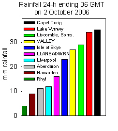 1st: It was a mostly cloudy beginning to the month with only a few bright spells and glimpses of sunshine in the morning. At 09 GMT cloud was 5 oktas and moderately high with good, but hazy, visibility. Pressure 996 mb was falling slowly with low 992 mb close to Valentia, SW Ireland. The low tracked over St. George's and was over Anglesey 993 mb at 1800 GMT. As the low moved across wind direction backed around the compass from SE at 09 GMT to W by midnight, speeds were light. The afternoon was cloudier and there was drizzle and spells of light rain. There was a spell of moderate rain between 2130 and 2230 GMT. There were thundery outbreaks to the S moving from SW England in the early hours, were in SE England midday and out over the North Sea in the afternoon. Rain continued here intermittently light to moderate through the night. Rainfall here (09-09 GMT) of 11.6 mm was affected by rain shadow in the lee of the Snowdonia Mountains, but Valley had 27.6 mm] {Jersey 21C, Aboyne 3C, Liscombe, Soms. 39.0 mm, Jersey 9.6h}[Valley 27.6 mm, 2.4h, Red Wharf Bay 17.5 mm] [Rain 11.6 mm; Max 16.8C; Min 9.4C; Grass 8.5C]
 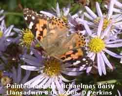 The night was mostly cloudy and there were few glimpses of the Harvest Moon. After a slight shower of rain around 06 GMT the sky began to clear and was 6 oktas at 09 GMT. We were in a moderate S'ly airflow between high 1027 mb Europe centred near N Italy and low 976 Iceland with an associated warm front over N Scotland, but here the sky cleared giving a mostly sunny day with the temperature rising to a pleasant 16.7C. Late appearing butterflies were flitting about the garden and 4 red admiral, 2 painted ladies, 1 comma as well as several speckled woods were seen on Michaelmas daisy. This is a wonderful plant to grow to attract butterflies and insects as it flowers late into autumn, until the frosts, after other plants have finished flowering. During the day a developing system near Cape Finisterre tracked rapidly across the Bay of Biscay reaching Wales by late afternoon. At 1700 GMT pressure was falling, the Sly wind freshened and there were burst of moderate rain. The wind reached strong to gale-force 8 by 2100 GMT with some strong gusts. [Rain 4.7 mm; Max 16.7C; Min 11.0C; Grass 9.2C]
 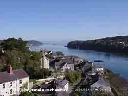 14th: Cloud cleared after midnight and by morning there was just a little seen on the NE and W horizons. Again heavy dew on the grass. Pressure was 1029 mb with the high-pressure persisting. The day was sunny with little or no wind, the water on the Menai Strait at times looking as calm as a mill pond. Smoke haze thickened here during the day as the temperature rose to 19.3C. It was cloudier elsewhere with broken stratiform or weak convective clouds. The evening and night were clear. There was thick smoke haze in Liverpool Bay, visible off the north-east entrance to the Menai Strait in the photograph on the right. Another photograph of the Britannia Bridge and Ynys Gored Goch, from the Menai Suspension Bridge taken close low water, shows the whirlpools in the tide race
 The first 15 days of the month continued with above average temperatures making the past 6 months the warmest on record. The mean temperature was 13.1C (+2.0) and [+2.6] of average. The mean earth temperature at 30 cm was 14.3C also (+2.0). Rainfall was 59.3 mm (42%) and [53%]..
 16th: Another clear skied morning with thick smoke haze making the sky milky white and visibility poor (2 km). There was moderate dew on the grass, measured by dew-pad was 0.3 mm, and a minimum temperature of 4.2C. A sunny morning with a light SE'ly breeze. Thunderstorms developed over the Channel Islands at dawn. The storms moved N through Wales during the afternoon; hail lying 1 inch thick on the ground was reported in South Wales. The sunshine continued here into the afternoon, with the temperature rising to 18.8C, until the sky darkened over the mountains and a short moderately heavy shower reached here at 1430 GMT, no thunder was heard. The evening was partially cloudy with glimpses of the setting sun. [Rain 2.8 mm; Max 18.8C; Min 7.7C; Grass 4.2C]
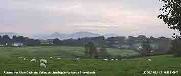 17th: In contrast to the previous 2 mornings the sky was overcast and it was still dark at 06 GMT. The cloud, mainly altostratus and altocumulus with some lower lenticular forms to the S of the weather station at 09 GMT. Pressure was 1006 mb with high 1031 mb E Europe and Atlantic low-pressure 990 mb to the SW. The morning kept dry with the sun looming occasionally through the moderately high cloud, but never shining through clearly so it was recorded as a sunless day. During the afternoon the cloud thickened and there was moderate to heavy rain from 1500 GMT to 1800 GMT. The evening was mostly dry, but overcast. Leaves of ash trees are still green but are laden with brown winged seeds
 ![]() . They will hang on the tree well after the leaves have fallen. In the spring flowers open before the leaves emerge; male and female flowers can be in separate clusters in the same flower, or may be separate on the same tree, or on different trees. {Weybourne 18.9C, Lossiemouth 0.5C, Cambourne 20.6 mm, Herne Bay 7.8h} [Rain 10.5 mm; Max 16.5C; Min 10.7C; Grass 9.2C]
. They will hang on the tree well after the leaves have fallen. In the spring flowers open before the leaves emerge; male and female flowers can be in separate clusters in the same flower, or may be separate on the same tree, or on different trees. {Weybourne 18.9C, Lossiemouth 0.5C, Cambourne 20.6 mm, Herne Bay 7.8h} [Rain 10.5 mm; Max 16.5C; Min 10.7C; Grass 9.2C]
18th: With some broken cloud at dawn it was a brighter start to the day. At 09 GMT pressure was 1003 mb in a slack area between the high 1026 mb to the E and complex low-pressure 988 mb SW of Ireland. Visibility was good with haze and there a light air from the SE. The sky cleared a little more during the day and the temperature rose to 19.9C highest of the month, and one of the highest in Britain on the day. It was a sunny end to the day, the evening was clear at first but cloud encroached later. [Rain 4.3 mm; Max 19.9C; Min 10.8C; Grass 7.7C]
19th: It was cloudy after midnight and there was rain between 0430 and 0600 GMT. Pressure 983 mb was falling with low 979 mb approaching St. George's Channel. It was a complex weather pattern with bands of showery rain in circulation around the low. We caught a shower at 09 GMT and another 3.8 mm between 1045 and 1100 GMT. As the band of showers moved N over the Snowdonia Mountains during the morning it gave blustery heavy bursts of rain along the A55 from Anglesey to Llandudno. In between there were some sunny spells, these getting longer in the afternoon, and the sky cleared over Anglesey leaving a line of stratocumulus clouds over the mountains. The setting sun, moving more southerly every day in the western sky, gave another sunny evening. Before midnight the sky was partially covered, but it kept dry through the night. {Cromer 19C, Lerwick 6C, Cardiff 29.2 mm, Hastings 5.1h} [Rain 3.8 mm; Max C; Min 11.6C; Grass 7.9C]
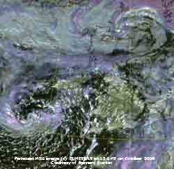 20th: With pressure on 986 mb with one of a complex of low-centres over Anglesey it was a mostly cloudy morning with showers of rain in the vicinity. Visibility was good but reduced to moderate in another prolonged shower from 1103 to 1215 GMT. The afternoon had some longer sunny spells especially the NW corner of the island. Here in the SE corner , closer to the mainland mountains, it was cloudier this lasting into the evening. [Rain 11.8 mm; Max 15.1C; Min 10.3C; Grass 7.1C]
21st: There was clear sky with stars visible after midnight, but there was moderate rain as lines of showers crosses Snowdonia and Anglesey between 0100 and 0230 GMT and between 0700 and 0830 GMT. At 0900 GMT a cumulonimbus cloud was observed to the S while towering cumulus were in the vicinity. Pressure was 989 mb in a col between low 974 mb SW Ireland and low 987 mb over the North Sea off Aberdeen. The sky had 6 oktas cover and visibility was good although showers were in sight over the Snowdonia Mountains. The temperature was 12.0C, with a dewpoint of 11.2C, and the wind a moderate (f4) S'ly. The morning was bright with frequent showers in the vicinity. The Meteosat MSG satellite image at noon shows the twin lows to the SW and NE with frontal cloud over S Scotland and convective clouds over the Irish Sea approaching Anglesey.
During the afternoon there was at times a little sunshine with the temperature rising to 16.1C but, with pressure falling again, the wind strengthened and we caught a blustery shower. At 1800 GMT the temperature had fallen to 10C, the minimum (09-09 GMT). By 20 GMT the wind reached strong to near gale-force (f7) and beech nuts whipped of the trees were peppering the windows. There was a spell of moderate rain between 2200 and 2330 GMT. {Gravesend 19C, West Freugh 6C, Jersey 26 mm, Torquay 7.7h} [Rain 11.6 mm; Max 16.2C; Min 11.6C; Grass 9.2C]
![]() 22nd: A mostly cloudy morning with cumulus clouds blowing along on the moderated fresh SSW'ly wind. Pressure was 990 mb within a complex low-pressure system. It was being brought in a westerly flow across the Atlantic under the jetstream, that stretched in a S'ly loop from S of the Great Lakes and Newfoundland and past Iberia to Britain. The morning was bright at times with a few sunny spells. The ground was littered with triangular beech nuts and their empty cases. By afternoon a flock of 50 or chaffinches had found them, some crushed on the road by passing traffic, and were enjoying the feast. By noon thicker cloud had encroached and there was a spell of rain from 13 to 15 GMT. Yesterday's rainfall had brought the total for the month to 104 mm, 85% of the October long-term-average, and 100% of the annual average January to date. [Rain 3.7 mm; Max 14.5C; Min 10.0C; Grass 7.8C]
22nd: A mostly cloudy morning with cumulus clouds blowing along on the moderated fresh SSW'ly wind. Pressure was 990 mb within a complex low-pressure system. It was being brought in a westerly flow across the Atlantic under the jetstream, that stretched in a S'ly loop from S of the Great Lakes and Newfoundland and past Iberia to Britain. The morning was bright at times with a few sunny spells. The ground was littered with triangular beech nuts and their empty cases. By afternoon a flock of 50 or chaffinches had found them, some crushed on the road by passing traffic, and were enjoying the feast. By noon thicker cloud had encroached and there was a spell of rain from 13 to 15 GMT. Yesterday's rainfall had brought the total for the month to 104 mm, 85% of the October long-term-average, and 100% of the annual average January to date. [Rain 3.7 mm; Max 14.5C; Min 10.0C; Grass 7.8C]
 23rd: There was a shower of rain around 0430 GMT as a trough moved N over N Wales, then the cloud started to thin at dawn and by 09 GMT it was bright. The sky was 6/8th covered with cirrus and a few cumulus clouds and there was a little sunshine at times. Pressure was 991 mb with a small low 987 mb off the Western Isles of Scotland, and a deepening low 973 mb off Cape Finisterre tracking across the Bay of Biscay to steam along the English Channel. There was heavy rain in Brittany and light along the S coast of England moving into S Wales, the Midlands and on to Kent by evening. Here it kept dry and mostly sunny with only thin partial cloud cover by evening. American dogwood (Cornus sp) in the garden, that has burgundy-coloured stems, has developed autumn coloured leaves. In the background is the native wild cherry with leaves that were still green. Here is a close-up of the dogwood leaves
 ![]() .{Herne Bay 17C, Aviemore 3C, Wick 39 mm, Manchester 8.0h} [Rain 0.0 mm; Max 14.1C; Min 7.4C; Grass 3.4C]
.{Herne Bay 17C, Aviemore 3C, Wick 39 mm, Manchester 8.0h} [Rain 0.0 mm; Max 14.1C; Min 7.4C; Grass 3.4C]
24th: The overnight air minimum temperature was 6.3C, lowest of the month. Another bright and sunny morning; a line of cumulus clouds were seen to the W early on but decayed by 09 GMT. With 4 oktas cover the sky was clearing as pressure 995 mb rose as a ridge moved across from the W. Low 984 mb had passed through the Strait of Dover and was off North Foreland. Low 989 mb was near Malin Head with frontal cloud over N Scotland where it was raining. The jetstream was still well S of Britain flowing over N Spain and France to the Baltic. Under its influence another deepening Atlantic-low 984 mb off Cape Finisterre was ontrack for S Britain. Although cloudy at times here there was good sunshine in the afternoon with clear views of the Snowdonia Mountains very good visibility (>60 km) into the evening. The sky was almost clear during the evening but cloud encroached from the S before midnight. [Rain 0.0 mm; Max 15.0C; Min 6.3C; Grass 2.3C]
![]() 25th: An overcast morning, but the cloud was high and visibility still very good just after dawn. At 09 GMT pressure was 1002 mb and with the jetstream moving N again twin lows (976 mb) over the Bay of Biscay with a succession of fronts moving into Ireland, SW England and Wales. A wide band of rain moved N; by 0930 GMT the cloud had thickened and, with the cloudbase lowering obscuring the mountaintops, there was light rain through the morning. In the afternoon, in little or no wind, there was moderate to heavy rain accumulating 30 mm by 1800 GMT. The temperature was 11.8C, but thereafter began to rise and reached a maximum of 15.6C about 2200 GMT before falling again. The day was sunless. {Jersey 19C, Tiree 50 mm, Lerwick 2.7h}[Rain 35.1 mm; Max 15.6C; Min 8.0C; Grass 4.6C]
25th: An overcast morning, but the cloud was high and visibility still very good just after dawn. At 09 GMT pressure was 1002 mb and with the jetstream moving N again twin lows (976 mb) over the Bay of Biscay with a succession of fronts moving into Ireland, SW England and Wales. A wide band of rain moved N; by 0930 GMT the cloud had thickened and, with the cloudbase lowering obscuring the mountaintops, there was light rain through the morning. In the afternoon, in little or no wind, there was moderate to heavy rain accumulating 30 mm by 1800 GMT. The temperature was 11.8C, but thereafter began to rise and reached a maximum of 15.6C about 2200 GMT before falling again. The day was sunless. {Jersey 19C, Tiree 50 mm, Lerwick 2.7h}[Rain 35.1 mm; Max 15.6C; Min 8.0C; Grass 4.6C]
26th: At midnight the low was over N Ireland 981 mb and the wind was S'ly force 6. A cold front developed over the Irish Sea and reached here about 0530 GMT. The wind strengthened to gale force 8 and about 0545 GMT there was a heavy squall as the wind veered W'ly. Slates rattled and windows were peppered with husks and seeds from nearby beech trees and a sheet of corrugated iron picked up and flung 10 m. There was heavy rain with ice pellets and a branch sheared off an ash tree partly obstructing the road. The Beaumaris road was reported as blocked by another fallen tree. Before 09 GMT the wind had moderated and the sky starting to clear. Rainfall for the past 24-h was 35.1 mm, wettest of the month, bringing the total for the month up to 143 mm. Pressure 995 mb was rising as the low (976 mb) tracked across Scotland. The morning here was bright and the afternoon had some sunny spells, but showers were seen in the vicinity. The evening and night were overcast. In Scotland, Western and Northern Isles there were gale to strong-gale force winds and heavy rain that brought extensive flooding; in Dingwall people had to be rescued from flooded homes. Thousands were without electricity, many roads closed and a train from Glasgow to Inverness stranded between trees fallen on the track. The line was washed away at Helmsdale disrupting trains between Wick and Inverness. In the middle of the North Sea, in force 10 gales, a trawler and 4 crewmen were reported missing 160 miles off Aberdeen. {London MO 19.6C, Kirkwall 85 mm, Falmouth 7.2h} [Rain trace; Max 14.2C; Min 9.2C; Grass 7.4C]
27th: At midnight the vigorous low 980 mb had tracked across the North sea and was over S Norway. The night was overcast and by morning had thickened there was and a slight shower of rain just before 09 GMT. Pressure 1017 mb had risen in the night as a ridge of high-pressure moved across from the W, part of a high 1025 mb N Italy. The low was deepening again over the Baltic was heading N for Lapland. Here frontal cloud associated, with another low 986 mb S of Iceland, moved across from Ireland and brought a spell of rain during the morning. The afternoon was drier and a little brighter, but the day was sunless the temperature reaching only 12.4C. In Scotland on high ground temperatures were lower and snow fell on Cairngorm Mountain at about 4000 ft, but soon melted. Overcast during the evening with drizzle and light rain before midnight. [Rain 8.3 mm; Max 14.3C; Min 9.1C; Grass 6.0C]
28th: Overcast with uniform grey stratus with drizzle and light rain. Pressure 1016 mb was relatively high under the influence of high 1029 mb over France. A slow-moving warm front, associated with low 995 mb Iceland, was affecting Wales, the West and North; the temperature had risen to 14.3C highest of the past 24-h. Visibility was poor and deteriorated during the morning as heavy drizzle and light rain continued until 1400 GMT, there was hill fog later in the afternoon with visibility was down to 100m. The evening kept overcast. With just cirrus cloud France enjoyed a sunny day; in the south temperatures rose to 29C at Hyères with locals enjoying the beaches and blue sea without summer visitors. {Hereford 19C, Capel Curig 27 mm, Aberdeen 2.3h} [Rain 2.2 mm; Max 14.6C; Min 9.6C; Grass 8.7C]
29th: After midnight with pressure rising the sky began to clear and mist and fog patches form in low-lying areas. At 09 GMT it was sunny with wavy jetstream cirrus and low stratiform clouds to the S and W dispersing. Pressure was 1026 mb in a high over the Irish Sea. The morning was sunny at first the afternoon had variable amounts of cloud and sunny spells. By dusk frontal cloud had encroached and the night was overcast. Following recent rainfalls soil moisture content has crept up to 59% dry mass well below the saturated water percentage of 70%. Although light levels (solar radiation) have been falling soil temperatures have been 1C above average and, with adequate soil moisture, growth of grass continued at a rate of 4.4 g m -2 d -1, twice the rates measured at the end of October 2004 and 2005. {Cardinham, Bodmin 19.7C, Scilly 19.4 mm, Margate 8.7h} [Rain 1.4 mm; Max 14.6C; Min 7.1C; Grass 2.6C]
![]() 30th: There was drizzle before 0500 GMT and this with some light rain continued up to 09 GMT. We were enveloped in low stratiform cloud with poor visibility. The temperature was 14.3C with 100% relative humidity. Pressure was 1016 mb with high 1025 mb to the SE over Europe. Low 988 mb was to the NW, S of Iceland, tracking towards Scotland and we were in a warm, moist force 5 SSW'ly airflow. By 0930 GMT the cloud started to lift, visibility improved to good, so that the Snowdonia Mountains were visible again, and there were glimpses of sunshine. In the afternoon the cloud thickened from time to time and there was some more drizzle with sunny spells in between. By evening it was overcast with drizzle and light rain with the wind strengthening to force 6. {Credenhall, Hereford 19.7, Isle of Skye 46.7 mm, Prestatyn 8.7h} [Rain 1.0 mm; Max 15.0C; Min 8.7C; Grass 6.2C]
30th: There was drizzle before 0500 GMT and this with some light rain continued up to 09 GMT. We were enveloped in low stratiform cloud with poor visibility. The temperature was 14.3C with 100% relative humidity. Pressure was 1016 mb with high 1025 mb to the SE over Europe. Low 988 mb was to the NW, S of Iceland, tracking towards Scotland and we were in a warm, moist force 5 SSW'ly airflow. By 0930 GMT the cloud started to lift, visibility improved to good, so that the Snowdonia Mountains were visible again, and there were glimpses of sunshine. In the afternoon the cloud thickened from time to time and there was some more drizzle with sunny spells in between. By evening it was overcast with drizzle and light rain with the wind strengthening to force 6. {Credenhall, Hereford 19.7, Isle of Skye 46.7 mm, Prestatyn 8.7h} [Rain 1.0 mm; Max 15.0C; Min 8.7C; Grass 6.2C]
![]() 31st: The SW'ly wind began to veer W'ly at midnight and was force 6/7 and only moderated to force 5 by morning. Overcast and with showery rain since 06 GMT pressure was 1006 mb at 09 GMT. The complex low 978 mb over Norway and we were into a strong cooler NW'ly airstream. The wind was already N'ly over Scotland bring cold air from the Arctic and snow had fallen on Cairngorm at 4000 ft. The temperature here was 10.1C (dewpoint 9.3C) and the morning saw light showers of rain and some sunny spells. The afternoon was dry a strong N'ly wind. I kept a look out for any sign of ice precipitation on the mountains, but did not see any. The temperature rose to 12.5C here during the afternoon, the lowest maximum of the month. [Rain 0.1 mm; Max 12.5C; Min 9.5C; Grass 6.1C]
31st: The SW'ly wind began to veer W'ly at midnight and was force 6/7 and only moderated to force 5 by morning. Overcast and with showery rain since 06 GMT pressure was 1006 mb at 09 GMT. The complex low 978 mb over Norway and we were into a strong cooler NW'ly airstream. The wind was already N'ly over Scotland bring cold air from the Arctic and snow had fallen on Cairngorm at 4000 ft. The temperature here was 10.1C (dewpoint 9.3C) and the morning saw light showers of rain and some sunny spells. The afternoon was dry a strong N'ly wind. I kept a look out for any sign of ice precipitation on the mountains, but did not see any. The temperature rose to 12.5C here during the afternoon, the lowest maximum of the month. [Rain 0.1 mm; Max 12.5C; Min 9.5C; Grass 6.1C]
The month finished with a mean temperature of 12.8C (+1.6) [+2.2] ranking 4th highest since before 1979. The mean maximum of 16.1C (+2.0) and [+2.3] was highest on record although the absolute maximum 19.9C was only (+0.2) and well below the 24.1C of October 2005 and ranking only 13th. Rainfall of 155.9 mm was (109%) and [139%] of average. Sunshine was above average.
![]() 1st: A bright and sunny morning with pressure risen to 1031 mb in an intensifying area of high-pressure 1034 mb lying to the NW off the W coast of Scotland. At 09 GMT the temperature was 7.7C (dewpoint 1.0C) and the wind was N'ly force 4. Visibility was very good in clear air. The day was mostly sunny, with just the odd convective cloud appearing from time to time, but the maximum temperature was 9.8C, lowest since 30th April. After sunset the sky above the horizon to the W was a beautiful peach colour, with azure blue above, lasting about 1 hour before fading. The evening was partly cloudy. {Solent 13.0C, Tulloch Bridge -4C, Aberdeen 8.6 mm, Aberporth 8.7h} [Rain 0.1 mm; Max 9.8C; Min 6.4C; Grass 4.2C]
1st: A bright and sunny morning with pressure risen to 1031 mb in an intensifying area of high-pressure 1034 mb lying to the NW off the W coast of Scotland. At 09 GMT the temperature was 7.7C (dewpoint 1.0C) and the wind was N'ly force 4. Visibility was very good in clear air. The day was mostly sunny, with just the odd convective cloud appearing from time to time, but the maximum temperature was 9.8C, lowest since 30th April. After sunset the sky above the horizon to the W was a beautiful peach colour, with azure blue above, lasting about 1 hour before fading. The evening was partly cloudy. {Solent 13.0C, Tulloch Bridge -4C, Aberdeen 8.6 mm, Aberporth 8.7h} [Rain 0.1 mm; Max 9.8C; Min 6.4C; Grass 4.2C]
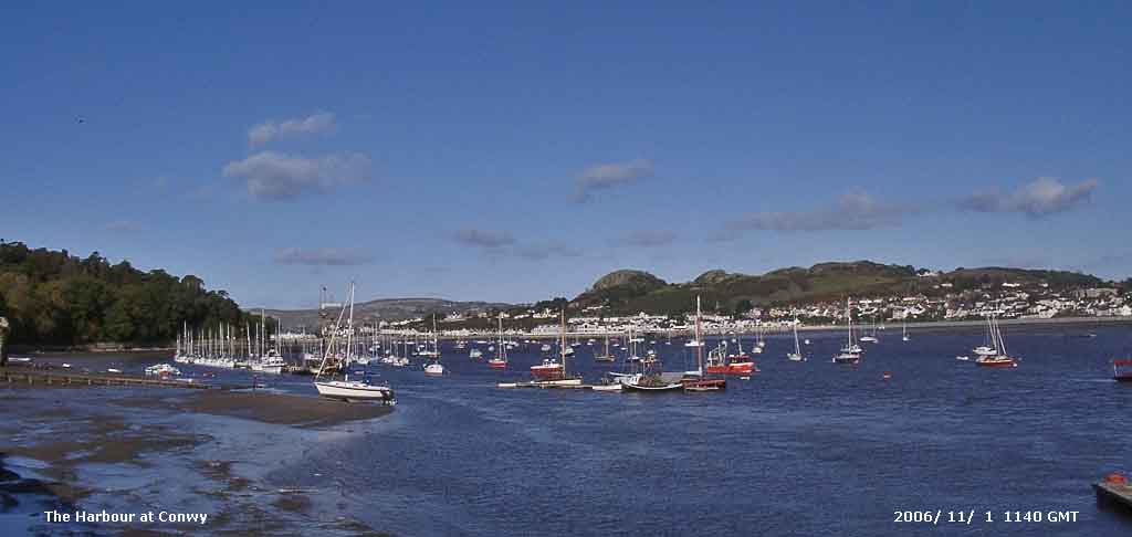 2nd: Early morning showers of rain drifted across Anglesey on the N'ly wind. Temperatures on the summits of the Snowdonia Mountains were just below freezing and light sprinklings of snow, the first of the season, were seen at 0700 GMT across the tops above 2700 ft. The temperature on the grass had fallen overnight to 0.5C, lowest since 25th May. Pressure at 09 GMT had risen to 1036 mb with the high centred over the Irish Sea. It was a mostly sunny day with cumulus clouds moving across the sky from time to time. The N'ly wind was moderate at first, but lessened through the day and was just a light air by dusk. Another peach coloured after-sunset sky. [Rain 0.0 mm; Max 9.5C; Min 2.8C; Grass 0.5C]
3rd: With almost clear skies overnight there was heavy dew and the temperature on the grass fell to -2.4C, lowest of the month, giving a moderately-thick white frost by morning; the last ground frost (-1.2C) was on 23 May. There was no air frost the minimum 0.9C was lowest of the month; frost was widespread further inland with Sennybridge in South Wales reporting -6.6C. It was a mostly sunny morning with little or no wind being well within high-pressure 1036 mb centred over Wales. There was heavy frost and mist lying in the Ogwen Valley around Bethesda; the mountains were clear and just below the summit of Carnedd Llywelyn there was a SSE'ly plume of smoke possibly a flare as there was a helicopter in the vicinity. The afternoon was a little cloudier; there was another peach coloured after sunset sky. The night was partially cloudy at times. {Solent 13.5C, Sennybridge -6.6C, Hastings 8.9h} [Rain 0.0 mm; Max 11.3C; Min 0.9C; Grass -2.4C]
4th: With more cloud around overnight there was no frost the grass minimum indicating 0.0C; there was moderate dew on the grass which did not freeze. Pressure was steady on 1036 mb but the high was sinking S and was 1037 mb S Ireland to SW England. With broken cloud the was a good display of crepuscular rays in the Nant Ffrancon Pass. As cloud encroached from the N, affecting N Wales and NW England, the day became mostly cloudy with a light W'ly breeze. [Rain 0.0 mm; Max 12.1C; Min 3.4C; Grass 0.0C]
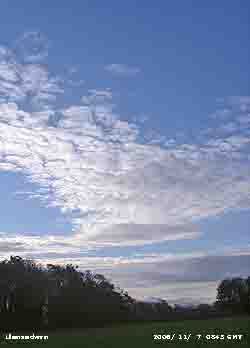 5th: Pressure 1033 mb had declined a little with the high 1035 mb centred to the SW. A mostly cloudy day with a little sunshine breaking through from time to time. Another dry day and after dark several bonfires were lit and fireworks set off in celebration of Guy Fawkes. { Guernsey 15C, Mumbles 13.9C, Pembrey Sands -2.2C, Lerwick 5.8 mm, Jersey 8.6h} [Rain 0.0 mm; Max 11.6C; Min 7.3C; Grass 3.9C]
6th: A bright morning and sunny as the sky cleared. Pressure was 1028 mb with the slowly declining high 1030 mb N France. With the jetstream over Iceland, N Scotland and the Baltic pressure was low to the N and there was a W'ly flow across N Britain; winds were strongest in N Scotland. The day was mostly sunny with a spectacular sunset and afterglow turning from dark peach to bright pink after an hour. {Scilly 14.8C, Rhyl 14.4C, Pembrey Sands -1.7C, Lerwick 4 mm, Torquay 8.8h} [Rain 0.0 mm; Max 13.5C; Min 8.5C; Grass 6.5C]
7th: Another bright but cloudier morning following a vivid red sunrise over the Carneddau Mountains at 0715 GMT. With a S'ly wind the Menai Strait was in a clearer lee-slot with plenty of sunshine between several lenticular clouds. Pressure 1019 mb continued to decline allowing frontal cloud to the NW top encroach by the afternoon. RAF Valley reported a shower of rain at 1500 GMT on the W coast, but it kept dry here in the SE corner. The night was overcast. {Falmouth & Aberdeen 16C, Aultbea 17.8 mm, Fishguard 7.7h} [Rain 14.6 mm; Max 12.8C; Min 5.6C; Grass 1.1C]
8th: An occluded front brought moderate to heavy rain totalling 14.6 mm from 0400 GMT to 0730 GMT. At 09 GMT it was overcast but had stopped raining. Pressure was 1015 mb and the wind was a light W'ly. The day saw a few more spots of rain from time to time under grey skies and was sunless. After dark the sky started to clear. [Rain 0.5 mm; Max 12.0C; Min 9.1C; Grass 7.5C]
 9th: With a clear sky overnight the air minimum reached 3.2C but on the grass it was lower at -0.2C and there was a touch of white frost. It was a clear and sunny morning and with a little mist visibility was moderate (4 km). Pressure 1033 mb was rising with a high 1035 mb to the SW over St George's Channel. During the morning it became cloudier as convective clouds developed, but there were sunny spells in the afternoon. At dusk the sky was clear again and the temperature on the grass went down to 0.7C as dew formed, but frontal cloud encroached from the NW by 21 GMT. Although many leaves on trees have fallen those that remain have developed bright autumn tints, especially beech that are dark yellow to orange coloured. The mixed woodland on the banks of the Menai Strait
 ![]() .[Rain 0.0 mm; Max 11.6C; Min 3.2C; Grass -0.2C]
.[Rain 0.0 mm; Max 11.6C; Min 3.2C; Grass -0.2C]
10th: It was a grey overcast morning but there had been no rain. Pressure 1027 mb was falling as the high 1037 mb slipped away SE over Belgium. Vigorous deepening low 956 mb near Iceland had associated fronts to the W and a warm front over Ireland. Cloud thickened during the morning, as the S'ly wind strengthened to force 5/6, and there was light rain from 13 GMT and moderate to heavy rain from 1430 to 2230 GMT. At 2100 GMT the temperature began to fall from the maximum of 12.8C as the cold front passed over. The night kept overcast. [Rain 12.5 mm; Max 12.8C; Min 3.9C; Grass 0.7C]
![]() 11th: A dull start to the day with a blustery force 5/6 W'ly wind. Pressure was 1019 mb with the maturing low now 971 mb E of Iceland crossing the Norwegian Sea. The cold front had moved SE during the night and was clearing the Channel into France. Scotland had frequent heavy showers that produced some more snow on Cairngorm. The day kept overcast and sunless and there was rain from 1730 to 2045 GMT. [Rain 3.3 mm; Max 10.6C; Min 5.5C; Grass 1.9C]
11th: A dull start to the day with a blustery force 5/6 W'ly wind. Pressure was 1019 mb with the maturing low now 971 mb E of Iceland crossing the Norwegian Sea. The cold front had moved SE during the night and was clearing the Channel into France. Scotland had frequent heavy showers that produced some more snow on Cairngorm. The day kept overcast and sunless and there was rain from 1730 to 2045 GMT. [Rain 3.3 mm; Max 10.6C; Min 5.5C; Grass 1.9C]
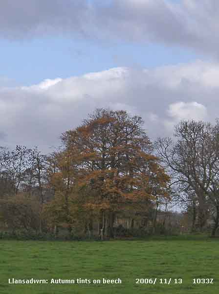 12th: Another cloudy morning with low cloud over the Snowdonia Mountains resulting in hill fog. Pressure was steady on 1022 mb in a ridge of high-pressure from high 1032 mb off Cape Finisterre With the low of yesterday now out of the way, in a complex over Norway and the Baltic, the next was already lining up W of Iceland 937 mb tracking towards N Scotland. During the morning some sunny spells developed with the temperature rising to 13.2C, but were replaced by showers and spots of rain after noon. There was a spell of light rain from 1830 to 2045 GMT with the minimum temperature 8.2C at 1830 GMT, then followed a temperature rise. {Swanage, Dorset 15C and 5.4h, Capel Curing 7.4 mm} [Rain 2.0 mm; Max 13.2C; Min 5.3C; Grass 1.8C]
![]() 13th: In warm sector air the temperature continued to rise after midnight reaching 13.2C, equalling the daytime maximum of yesterday. The early hours turned showery, after a few more spots at at 09 GMT the sky started to clear. Complex low-pressure 967 mb lay to the N of Scotland while pressure continued high 1028 mb over the Iberian Peninsula. Pressure was steady on 1006 mb and there was a fresh (f5) W'ly wind; further N around the Western Isles winds were gale-force. During the morning a clear slot developed overhead, but the Snowdonia Mountains kept enveloped in cloud. The afternoon was showery but with 1 or 2 bright spells. Soil temperatures that had been steadily falling have, except at the 100 cm depth, started to rise again and this morning were all over 10C up the profile. {Bournemouth 17C, Loftus 2C, Isle of Skye 20.2 mm, Scarborough 6.3h} [Rain mm; Max C; Min 8.2C; Grass 7.5C]
13th: In warm sector air the temperature continued to rise after midnight reaching 13.2C, equalling the daytime maximum of yesterday. The early hours turned showery, after a few more spots at at 09 GMT the sky started to clear. Complex low-pressure 967 mb lay to the N of Scotland while pressure continued high 1028 mb over the Iberian Peninsula. Pressure was steady on 1006 mb and there was a fresh (f5) W'ly wind; further N around the Western Isles winds were gale-force. During the morning a clear slot developed overhead, but the Snowdonia Mountains kept enveloped in cloud. The afternoon was showery but with 1 or 2 bright spells. Soil temperatures that had been steadily falling have, except at the 100 cm depth, started to rise again and this morning were all over 10C up the profile. {Bournemouth 17C, Loftus 2C, Isle of Skye 20.2 mm, Scarborough 6.3h} [Rain mm; Max C; Min 8.2C; Grass 7.5C]
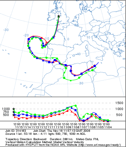 14th: Cloud was thickening from dawn up to 09 GMT, the last of any brightness receding to the NE over Liverpool Bay. Pressure was steady on 1003 mb and we were still in a moderate W'ly airflow. The reason was that we were between complex low-pressure to the N, stretching from from SW Iceland, N Scotland (970 mb) to the Norwegian Sea, and a large high-pressure system over the Mediterranean and N Africa. It was a cloudy scene and a sunless day with some showers of rain in the afternoon (1430 and 1745 GMT). [Rain 10.0 mm; Max 12.3C; Min 8.6C; Grass 7.4C]
![]()
![]()
![]() 15th: There was moderate to heavy rain from 0230 to 0800 GMT and slight rain at times leading up to 09 GMT. Pressure 997 mb was falling with the lows that had been to the N swirling edging in from the NW. But a developing low 990 mb was off Cape Finisterre and heading our way. The S'ly wind was at force 6 and visibility only moderate in low cloud and mist. The rain did ease off during the morning and I did catch sight of a brief brighter spell before noon. There was intermittent rain during the afternoon as the cloud thickened. At 1500 GMT pressure was 991 mb and the wind had strengthened to force 6. The NOAA 18 satellite image at 1301 GMT shows the position of the lows, and a broad band of frontal cloud moving across Britain and into Iberia, N Africa and the Med. The deepening low made its way over St George's Channel and the Irish Sea (see graphic). Pressure continued to fall and the wind continued to strengthen and reached gale force 8 between 2030 and 2130 GMT. Pressure was at its lowest 983 mb around 2200 GMT when the temperature had risen to 14.2C, the 24-h maximum and highest of the month. With the S'ly wind this corner of Anglesey was in a rain-shadow area and 2.2 mm fell in the 24-h 09 to 09 GMT, but more fell at Valley. Measured over the 48-h 06 to 06 GMT on the 16th 12.2 mm fell here while 23.4 mm was recorded at Valley. Hawarden reported only 2.4 mm, but Capel Curig had 31 mm (see graphic). During the day there was a moderate wet deposition of light brownish-grey dust (MUNSELL™ colour chart 2.5Y 6/2). Trajectory analysis, using the HYSPLIT model at the NOAA Air Resources Laboratory, indicated that parcels of air arriving over Llansadwrn at 15 GMT had passed over southern Tunisia and the Sahara Desert in southern Algeria, the likely source of the dust. On its way here the dust was caught by the low-pressure system off Cape Finisterre and rapidly transported across the Bay of Biscay to Anglesey. [Rain 2.2 mm; Max 14.2C; Min 8.5C; Grass 7.5C]
15th: There was moderate to heavy rain from 0230 to 0800 GMT and slight rain at times leading up to 09 GMT. Pressure 997 mb was falling with the lows that had been to the N swirling edging in from the NW. But a developing low 990 mb was off Cape Finisterre and heading our way. The S'ly wind was at force 6 and visibility only moderate in low cloud and mist. The rain did ease off during the morning and I did catch sight of a brief brighter spell before noon. There was intermittent rain during the afternoon as the cloud thickened. At 1500 GMT pressure was 991 mb and the wind had strengthened to force 6. The NOAA 18 satellite image at 1301 GMT shows the position of the lows, and a broad band of frontal cloud moving across Britain and into Iberia, N Africa and the Med. The deepening low made its way over St George's Channel and the Irish Sea (see graphic). Pressure continued to fall and the wind continued to strengthen and reached gale force 8 between 2030 and 2130 GMT. Pressure was at its lowest 983 mb around 2200 GMT when the temperature had risen to 14.2C, the 24-h maximum and highest of the month. With the S'ly wind this corner of Anglesey was in a rain-shadow area and 2.2 mm fell in the 24-h 09 to 09 GMT, but more fell at Valley. Measured over the 48-h 06 to 06 GMT on the 16th 12.2 mm fell here while 23.4 mm was recorded at Valley. Hawarden reported only 2.4 mm, but Capel Curig had 31 mm (see graphic). During the day there was a moderate wet deposition of light brownish-grey dust (MUNSELL™ colour chart 2.5Y 6/2). Trajectory analysis, using the HYSPLIT model at the NOAA Air Resources Laboratory, indicated that parcels of air arriving over Llansadwrn at 15 GMT had passed over southern Tunisia and the Sahara Desert in southern Algeria, the likely source of the dust. On its way here the dust was caught by the low-pressure system off Cape Finisterre and rapidly transported across the Bay of Biscay to Anglesey. [Rain 2.2 mm; Max 14.2C; Min 8.5C; Grass 7.5C]
The first 15 days of the month have been relatively dry (for November) with rainfall totalling only 45.8 mm (31%) and [37%] of the averages. Temperatures continue to be above average with the mean on 8.9C (+1.1). Since the beginning maxima have been rising and the mean 12.1C was (+1.5) and [+2.1]. The mean minimum was 5.8C (+0.3) and [+1.3]. Soil at 30 cm was 10.1C (+1.1); number of ground frosts 2 (-6.8).

|
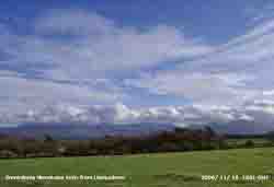 16th: Overcast and dull to start the day but under the cloud visibility was very good (>50 km). Pressure 992 mb was rising with complex low-pressure close to the N of Scotland and fronts clearing away to the SE. There was a moderate SW'ly breeze and the sky slowly cleared during the morning. The afternoon was mostly sunny with lines (or streets) of stratocumulus clouds over the Snowdonia Mountains and Anglesey. [Rain 3.4 mm; Max 10.4 C; Min 6.5C; Grass 3.9C]
![]() 17th: A showery morning; thunder was heard about 0620 GMT. With cumulonimbus in the vicinity there was a heavy squally shower of rain and ice pellets at 0900 GMT. With an active frontal low developed over the Irish Sea pressure had fallen to 985 mb and visibility was very poor. The morning was showery with flashes of sunshine between and displays of crepuscular rays under threatening looking skies; the sky cleared as showers petered out giving a sometimes sunny afternoon. Visibility was good towards the Snowdonia Mountains, there was slight ice precipitation on the summit Carnedd Llewelyn at 1630 GMT, Snowdon was obscured, and there was more later. [Rain 3.7 mm; Max 8.3C; Min 5.9C; Grass 2.7C]
17th: A showery morning; thunder was heard about 0620 GMT. With cumulonimbus in the vicinity there was a heavy squally shower of rain and ice pellets at 0900 GMT. With an active frontal low developed over the Irish Sea pressure had fallen to 985 mb and visibility was very poor. The morning was showery with flashes of sunshine between and displays of crepuscular rays under threatening looking skies; the sky cleared as showers petered out giving a sometimes sunny afternoon. Visibility was good towards the Snowdonia Mountains, there was slight ice precipitation on the summit Carnedd Llewelyn at 1630 GMT, Snowdon was obscured, and there was more later. [Rain 3.7 mm; Max 8.3C; Min 5.9C; Grass 2.7C]
![]() 18th: It was a showery start to the day with frequent light showers of rain that were falling as snow on the Snowdonia Mountains. A slight covering was seen at about 2000 ft on the northern slopes at 09 GMT. Pressure 1004 mb was rising and the temperature 6.1C after an overnight minimum of 4.0C. The dewpoint here was 3.2C and the temperature on the summits was about -2C. The morning saw sunshine and blustery showers on the moderate S-SW'ly wind. The afternoon was sunnier, but snow showers continued across the mountaintops. The evening was cloudier. [Rain 0.7 mm; Max 8.4C; Min 4.0C; Grass 1.2C]
18th: It was a showery start to the day with frequent light showers of rain that were falling as snow on the Snowdonia Mountains. A slight covering was seen at about 2000 ft on the northern slopes at 09 GMT. Pressure 1004 mb was rising and the temperature 6.1C after an overnight minimum of 4.0C. The dewpoint here was 3.2C and the temperature on the summits was about -2C. The morning saw sunshine and blustery showers on the moderate S-SW'ly wind. The afternoon was sunnier, but snow showers continued across the mountaintops. The evening was cloudier. [Rain 0.7 mm; Max 8.4C; Min 4.0C; Grass 1.2C]
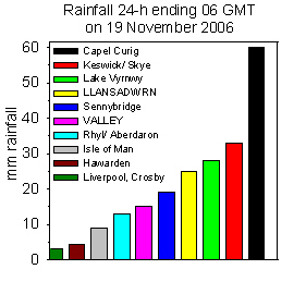 19th: A band of showers crossed North Wales after midnight, with snow on the mountains, and rain and ice pellets here. At dawn the sky was mostly clear and there was a ground frost (-2.0C) this freezing water on the grass. At 09 GMT pressure was 1012 mb, but deepening low 968 mb was tracking towards N Scotland. The morning saw sunny spells and showers with the force 5 S'ly wind beginning to strengthen. By 15 GMT cloud had thickened from the W and the wind had reached force 7. At 1700 GMT it was blowing gale force 8 with strong gusts at the commencement of heavy rain. At RAF Valley sustained force 9 was recorded over 2 h during the evening and, together with Mumbles reported, a highest gust of 71 mph. The storm produced a tidal surge along Irish Sea coasts; on the high tide close to 2100 GMT at Holyhead, also Llandudno, an 0.8 m surge was recorded (Courtesy of POL (Proudman Oceanographic Laboratory)). It was a case of 'battening down the hatches' for the rough night ahead. Rainfall for the 24-h (09-09 GMT) of 25.3 mm was the largest of the month. {Isle of Man highest gust 74 mph} [Rain 25.3 mm; Max 11.6C; Min 2.5C; Grass -2.0C]
20th: The wind started to moderated by midnight when the heavy rain eased with gales moving onto the North Sea and English Channel. The rest of the night had showers and the sky started to clear at 09 GMT. The low 953 mb was just to the N of Scotland and pressure here 999 mb had risen a little. The day kept mostly cloudy, with a few slight showers. The evening was overcast and there was a shower of rain and ice pellets at 2100 GMT. {Guernsey 15C, Loch Glascarnoch 1C, Capel Curig 52.4 mm, Torquay 5.7h}[Rain 0.6 mm; Max 9.3C; Min 3.7C; Grass 1.2C]
21st: With some clear spells appearing after midnight the temperature on the grass dropped to 0.3C. At 09 GMT pressure was 995 mb with the low slow moving 967 mb near Fair Isle, Shetland. The temperature was 5.4C, dewpoint 2.9C, and with temperatures on the mountaintops falling below below zero some more snow had fallen above 2500 ft. The wind was a light W/NW'ly and the morning was occasionally bright. Cumulus and cumulonimbus clouds were in the vicinity and there was a shower of rain and ice pellets at 1015 GMT. The day's maximum temperature of 7.5C, lowest of the month, was lowest since 4 April that had 6.4C. The afternoon was mainly cloudy as was the night. [Rain 0.3 mm; Max 7.5C; Min 4.5C; Grass 0.3C]
22nd: Overcast with almost uniform moderately high cloud. There were patches of snow remaining on the mountains mainly on Carnedd. Llewelyn. At 09 GMT there were a few spots of rain, but the morning was mostly dry ahead of frontal rain. Low 980 mb continued to fill over the North Sea off Aberdeen but pressure 994 mb was falling, after a minor ridge, as another deepening low 970 mb tracked E to the S of Iceland with a frontal low further south. As the cloudbase lowered there was drizzle and light rain by noon. The low SW of Ireland had deepened 987 mb and moved rapidly towards SW Ireland. The afternoon was overcast, but dry, and the day sunless. At 21 GMT with the low <970 mb off the coast of SW Ireland pressure here 973 mb was falling quickly. The S'ly wind strengthened to force 6/7 and there was moderate rain from 2100 to 0130 GMT. [Rain 11.3 mm; Max 11.1C; Min 5.0C; Grass 0.5C]
23rd: The temperature rose after midnight to 11.1C and the maximum was reached at 0200 GMT. Pressure fell to the unusually low 970 mb at 0330 GMT setting off the storm warning on my Oregon barometer, as the depression moved N up the Irish coast, and there was about an hour of moderate to heavy rain with strong to near gale-force SW'ly wind. By morning the sky had started to clear and pressure at 09 GMT had risen to 974 mb. The morning was occasionally bright in the fresh to strong SW'ly wind with the temperature reaching 10.6C around noon, but the afternoon was mostly cloudy and dull. The WSW'ly wind backed S'ly and was gale force 8 for a while around dusk. After dark the sky did clear and bright stars were visible at 2000 GMT. Later a band of showers passed over with a short burst of ice pellets at 2244 GMT. [Rain 1.1 mm; Max 5.8C; Min 6.7C; Grass 5.0C]
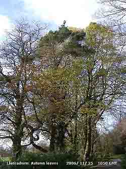 24th: Another clear spell after midnight but more showers, with 4 mm ice pellets, came across just before 0500 GMT. At 09 GMT pressure was 984 mb in a 'weak' ridge to Ireland. At the moment pressure continues to be low, or very low, with complex low-pressure to the W and N. Pressure is high over N Africa, Greenland and in the Atlantic S of Newfoundland. The wind was SE'ly and a small lee-clearance lay to the S with a little brightness, but no sunshine. All around there were dark cumulus clouds giving light showery rain from time to time. During the morning pressure began to fall again and with thickening cloud giving intermittent, but light, rain during the afternoon as frontal cloud moved into SW England towards the Irish Sea in circulation around a low near Shannon, Ireland. The day was sunless, the best of the sunshine being in N Scotland. {London 14.4C, Loch Fea 0C, Scilly Is. 27.8 mm, Valley 15.6 mm, Kinloss 5.7h} [Rain 11.6 mm; Max 11.5C; Min 5.8C; Grass 1.5C]
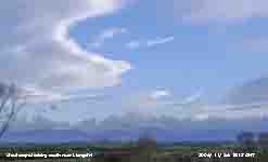 25th: Overnight intermittent light rain and drizzle had cleared away by 0500 GMT. The morning was mostly cloudy with thin altostratus, broken altocumulus and cumulus. At 09 GMT pressure 979.5 mb with low-pressure centres to the N and S of here. There was a small clearance to the S and this got larger through the morning giving a mostly sunny day. During the afternoon there were several almost stationary lenticular altocumulus clouds seen from near Llangefni with stratocumulus clouds persisting over the mountains of Snowdonia. By evening the sky was mostly clear with bright stars visible in the absence of moonlight at 2200 GMT. [Rain 4.2 mm; Max 10.6C; Min 6.5C; Grass 4.5C]
26th: Just after midnight cloud encroached bringing a band of intermittent rain and frequent showers from 0300 GMT. At 09 GMT pressure 1003 mb was rising in a transient ridge of high-pressure. But deep Atlantic-low 949 mb lay to the SW tracking N past Ireland. The morning was bright with slight showers dying away in a S'ly breeze; the afternoon was mostly sunny. By evening the wind had backed SE'ly and had strengthened to force 5/6 as pressure started to fall. [Rain 0.5 mm; Max 12.6C; Min 6.6C; Grass 4.3C]
27th: At midnight the low was 951 mb and tracking N just W of Ireland. The wind reached gale force 8 and there was showery rain until 03 GMT. At 09 GMT pressure 007.6 mb had just started to rise and the wind had moderated to force 6/7. It was blustery with slight showers of rain and some brightness but there were cumulus and cumulonimbus in the vicinity. At 0921 GMT thunder was heard and at 0921 GMT there was a heavy shower of rain and ice pellets with a squally wind. Soon after the sky cleared giving a mostly sunny, but breezy, morning. The afternoon was cloudier with more showers of rain. The storm resulted in another tidal surge on the afternoon high tide around Irish Sea coasts. At the tidegauge at Holyhead an 0.7 m surge was recorded (Courtesy of POL). [Rain 5.0 mm; Max 12.1C; Min 7.1C; Grass 6.5C]
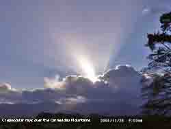
![]() 28th: At 0130 GMT a small tornado was reported having struck the curiously named Ceredigion village of 'Bow Street' which is just N of Aberystwyth. Damage after the arrival of the possible T2 tornado, that sounded like an express-train, was extensive included roofs taken off buildings and trees uprooted. It was quieter here with the SW'ly wind moderated to force 5 but it was to be a day of sunshine and showers. There was a shower of rain and ice pellets at 0200 GMT and again around 0500 GMT. Frequent cumulonimbus clouds, slow moving over the Snowdonia Mountains, passed close by or overhead all day. If you were under one there was heavy rain and ice pellets. Thunder was heard at 0924 GMT. The wind had lessened again by dusk and there were some clear spells into the evening. [Rain 1.2 mm; Max 11.0C; Min 8.0C; Grass 5.8C]
28th: At 0130 GMT a small tornado was reported having struck the curiously named Ceredigion village of 'Bow Street' which is just N of Aberystwyth. Damage after the arrival of the possible T2 tornado, that sounded like an express-train, was extensive included roofs taken off buildings and trees uprooted. It was quieter here with the SW'ly wind moderated to force 5 but it was to be a day of sunshine and showers. There was a shower of rain and ice pellets at 0200 GMT and again around 0500 GMT. Frequent cumulonimbus clouds, slow moving over the Snowdonia Mountains, passed close by or overhead all day. If you were under one there was heavy rain and ice pellets. Thunder was heard at 0924 GMT. The wind had lessened again by dusk and there were some clear spells into the evening. [Rain 1.2 mm; Max 11.0C; Min 8.0C; Grass 5.8C]
29th: With the showery weather continuing there were showers from 0445 to 0600 GMT. At 09 GMT pressure was 1019 mb with low 963 mb SW Iceland and 986 mb N Norwegian Sea. We were in a strong SSW'ly air flow with frontal cloud moving in from the Irish Sea containing embedded convection. The day continued with much of the same; short heavy showers of rain, blustery winds and almost sunless. Dry but windy into the night. [Rain 1.6 mm; Max 12.2C; Min 6.2C; Grass 2.0C]
30th: Brilliant red sky from 0745 to about 0800 GMT with strong to gale force 8 S'ly wind. At 09 GMT it was overcast with mainly moderately thin altostratus clouds and was bright at first with the sun looming through the cloud. It continuing windy through the day. The Britannia Bridge was closed to high-sided vehicles all day and there was a 20 mph limit for other traffic. Diverted vehicles have to go through the very narrow arches of the Menai Suspension Bridge; for drivers not used to this they slowly edge through causing delays. The cloud thickened through the afternoon, with no lessening of the wind, but did not rain until 1800 GMT when there was a burst of heavy rain before intermittent rain 2011 to 0200 GMT. At RAF Valley the mean wind speed was a remarkable 39.1 mph over the 24-h today (equivalent to gale force 8). This exceeded the 34.6 mph recorded during the Christmas Day storm on 25 December 1997. {Saunton Sands 14C, Skegness 5C, Tulloch Bridge 47 mm, Southend 5.0h}[Rain 5.3 mm; Max 12.2C; Min 10.9C; Grass 9.3C]
The month ended with a total of 121.6 mm (83%) and [97%] of average. The mean temperature of 8.6C was (+0.6) and [+1.4] of average. The mean soil temperature at 30 cm was 9.5C +(0.5) and ground frosts numbered only 3 (-5.8). Sunshine was 112% of average.
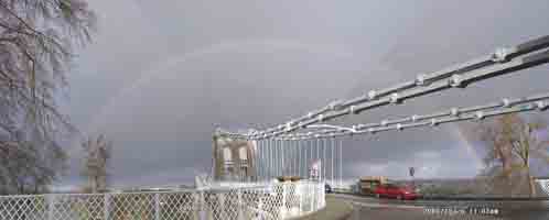 1st: After the rain the sky quickly cleared and at 09 GMT there was little cloud to be seen except over the Snowdonia Mountains. There was some mist in valleys, including the Malltraeth Marsh, and low cloud and fog was blowing on to the western coast on the SW'ly breeze. Pressure 1012 mb was rising in a temporary ridge of high-pressure to give a mostly sunny day here on the Llansadwrn ridge. The wind freshened during the afternoon and with cloud and blustery rain encroached by 1750 GMT. At 18 GMT there was a downpour of rain, 7 mm falling in under 15 minutes. Most of the leaves on exposed trees had fallen, but along the sheltered shores of the Menai Strait, between Menai Bridge and Bangor, a substantial number with autumn colours remain. {Guernsey 15C, Lough Fea 2C, Tulloch Bridge 42 mm, Kinloss 5.7h, Valley 3.9h}[Rain 10.5 mm; Max 11.7C; Min 6.4C; Grass 1.8C]
2nd: We were in a brisk and showery S to SW'ly airstream between complex low-pressure to the N of Scotland and high-pressure to the S. Just before 09 GMT there was a moderate shower of rain and ice pellets and this set the scene for the morning. Pressure 1005 mb was steady bur soon started to fall. Vigorous and deepening Atlantic low 972 mb W of Ireland was tracking NE. Just before 10 GMT there was a heavy shower of 7 mm ice pellets and thunder was heard at 1004 GMT. Showers were less frequent afternoon with some sunshine before returning by 1615 GMT with the sky overcast. At 1800 GMT the deepened low was 954 mb S of Iceland bringing severe gales to Ireland and western Britain. During the evening the wind backed S'ly and increased to gale force 8 and touching 9 at times. The Marathon Gas Platform off the coast of S Ireland reported sustained mws of 61 mph (storm force 10) between 20 and 22 GMT. With the wind roaring in the trees hatches were again battened down for the night on Anglesey. Moderate rain from 2100 GMT turned heavy later. [Rain 33.2 mm; Max 11.1C; Min 6.2C; Grass 2.3C]
3rd: Gale force winds continued with heavy rain after midnight and pressure was falling quickly at 0130 GMT, setting off the Oregon storm alarm. RAF Valley reported hourly mean wind speeds of 54 mph (top of force 9 range) and a gust of 77 mph just before 03 GMT. The 24-h mean wind speed was 43 mph (force 8). At Mumbles, near Swansea, a gust of 98 mph was reported. Pressure fell to 977 mb around 0330 GMT and there was a short lull in the roaring in the trees before freshening again. The maximum temperature of 11.1C was recorded near 03 GMT and dropped (4.9C) to the minimum of 6.2C by 05 GMT as a frontal system passed over. Between 0457 and 0517 GMT there was thunder and lightning and falls of ice pellets. At 09 GMT pressure 979.8 mb was rising slowly and the SW'ly wind was gale force 8, but it was not raining! Complex low-pressure lay to the NW with deep centre 953 mb off NW Scotland. On the morning high tides along western coasts POL tidegauges were showing about 1 m surges. Several trees were brought down including 2 in Llanfairfechan, near Pentraeth and Menai Bridge. Telephone cables were also down including on the road from Pentraeth to Talwrn, but the electricity supply held. Gusty winds continued through the morning with the sky brightening for a time just before noon. The wind was a steady force 8/9 during the afternoon with strong gusts and the occasional light shower of rain. Visibility was only poor in salt-laden haze with deposits building up on windows and windscreens. The Britannia Bridge was closed to high-sided vehicles and Irish Sea ferries cancelled. Hatches remained well battened, but the wind moderated through the night with the sky clearing. [Rain trace; Max 9.9C; Min 6.2C; Grass 4.8C]
4th: With mostly clear sky it was a sunny morning rising above the stratocumulus cloud hugging the Snowdonia mountaintops. The wind was a WSW'ly force 5 and we were still in the showery airflow but they were few and far between. Pressure 991 mb was rising in a minor ridge with low 960 mb close to the Orkneys. But low 968 mb in mid-Atlantic was tracking towards us promising another blow; warm frontal cloud encroached from the W, with rain from 1315 GMT, as pressure started to fall from 992 mb. Under thick cloud it was an almost dark and wet afternoon with moderate rain and embedded heavier bursts from 1400 GMT, and a strengthening strong to near gale-force SW'ly wind, until 1845 GMT. The Britannia Bridge was again closed to high-sided vehicles. There was further moderate to heavy rain from 2045 GMT and in warm sector air the temperature at 2200 GMT was 12.3C, second highest of the month (see 29th), with pressure on 985 mb. The wind reached gale force 8 with strong gusts, but moderated near midnight. [Rain 24.0 mm; Max 12.3C; Min 7.1C; Grass 4.4C]
![]()
![]() 5th: At midnight the temperature had reached a maximum of 12.3C then dropped 2C as a cold front passed over, the moderate rain continued until 0330 GMT then light until 0600 GMT. (The highest temperature recorded here in December to date was 15.2 in 2002). The sky began to clear and the temperature dropped to the minimum 7.1C. The clearance was short lived as we were hit by a thunderstorm between 0709 and 0719 GMT with heavy shower of rain and hail 6-7 mm diameter, one of several storms affecting N Wales and N England. At 09 GMT there was a lull, but cumulonimbus and cumulus clouds were still in the vicinity. Pressure was 982 mb with twin lows 966 mb off the NW coast of Scotland and W of Ireland. Showers continued through the morning with a brilliant complete double arc rainbow visible for 15 mins about 1030 GMT. At 1214 GMT as a band of showers cross North Wales there was a heavy shower of rain and ice pellets partially covered the ground and more thunder and lightning at 1220 GMT. The line of showers crossed over water between the Isle of Man and Dee estuary at 1315 GMT and off the Irish Sea into Cumbria by 1415 GMT. At times the afternoon was a little brighter; the strong to near gale-force W'ly persisted into the evening and night with further showers of rain and ice pellets. [Rain 9.5 mm; Max 9.3C; Min 7.1C; Grass 4.2C]
5th: At midnight the temperature had reached a maximum of 12.3C then dropped 2C as a cold front passed over, the moderate rain continued until 0330 GMT then light until 0600 GMT. (The highest temperature recorded here in December to date was 15.2 in 2002). The sky began to clear and the temperature dropped to the minimum 7.1C. The clearance was short lived as we were hit by a thunderstorm between 0709 and 0719 GMT with heavy shower of rain and hail 6-7 mm diameter, one of several storms affecting N Wales and N England. At 09 GMT there was a lull, but cumulonimbus and cumulus clouds were still in the vicinity. Pressure was 982 mb with twin lows 966 mb off the NW coast of Scotland and W of Ireland. Showers continued through the morning with a brilliant complete double arc rainbow visible for 15 mins about 1030 GMT. At 1214 GMT as a band of showers cross North Wales there was a heavy shower of rain and ice pellets partially covered the ground and more thunder and lightning at 1220 GMT. The line of showers crossed over water between the Isle of Man and Dee estuary at 1315 GMT and off the Irish Sea into Cumbria by 1415 GMT. At times the afternoon was a little brighter; the strong to near gale-force W'ly persisted into the evening and night with further showers of rain and ice pellets. [Rain 9.5 mm; Max 9.3C; Min 7.1C; Grass 4.2C]
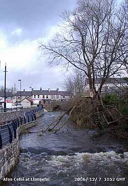
![]() 6th: A moderate shower of ice pellets around midnight and more from 0430 GMT leading up to 09 GMT. The hail-pad had heavy markings typical of ice pellets, these measured between 6 - 7 mm diameter, some were perhaps larger. Pressure was 995.9 mb at 09 GMT with 7 oktas cover of cumulus and stratocumulus clouds. Complex low-pressure 971 mb was over the Baltic and S Norwegian Sea. Visibility was poor, in an ongoing moderate shower of rain; the wind was force 4 W'ly. A Met Office severe weather warning was still in operation for Wales for continuing heavy and persistent showers. A weak ridge of high-pressure crossing from the W gave a little respite around noon with a little sunshine, showers and spectacular rainbows. Under the partial influence of the persistent and strong westerly jetstream another depression was lined up in mid-Atlantic ontrack towards Britain. At 06 GMT it was charted as 971 mb and by 18 GMT had deepened low to 966 mb and was W of Malin Head, N Ireland. The Britannia Bridge remained closed to high-sided vehicles and Irish Sea ferries were again delayed or cancelled. The daytime maximum, around noon, was 8.0C. The wind backed S'ly by 20 GMT and had strengthened to strong to gale force 8. The roaring was back in the trees and at 2315 GMT the Oregon storm alarm sounded, indicating rapidly falling pressure. [Rain 10.8 mm; Max 11.0C; Min 6.0C; Grass 2.5C]
6th: A moderate shower of ice pellets around midnight and more from 0430 GMT leading up to 09 GMT. The hail-pad had heavy markings typical of ice pellets, these measured between 6 - 7 mm diameter, some were perhaps larger. Pressure was 995.9 mb at 09 GMT with 7 oktas cover of cumulus and stratocumulus clouds. Complex low-pressure 971 mb was over the Baltic and S Norwegian Sea. Visibility was poor, in an ongoing moderate shower of rain; the wind was force 4 W'ly. A Met Office severe weather warning was still in operation for Wales for continuing heavy and persistent showers. A weak ridge of high-pressure crossing from the W gave a little respite around noon with a little sunshine, showers and spectacular rainbows. Under the partial influence of the persistent and strong westerly jetstream another depression was lined up in mid-Atlantic ontrack towards Britain. At 06 GMT it was charted as 971 mb and by 18 GMT had deepened low to 966 mb and was W of Malin Head, N Ireland. The Britannia Bridge remained closed to high-sided vehicles and Irish Sea ferries were again delayed or cancelled. The daytime maximum, around noon, was 8.0C. The wind backed S'ly by 20 GMT and had strengthened to strong to gale force 8. The roaring was back in the trees and at 2315 GMT the Oregon storm alarm sounded, indicating rapidly falling pressure. [Rain 10.8 mm; Max 11.0C; Min 6.0C; Grass 2.5C]
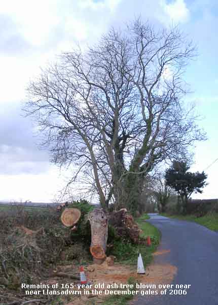 7th: At midnight pressure was 985.3 mb and the wind, down a notch to force 6/7, began to veer. The temperature was rising and reached the maximum for the 24-h period (09-09 GMT) at 0100 GMT. There was a heavy shower from 0300 to 0330 GMT. At 08 GMT the sky was an over uniform grey stratus but by 09 GMT there were some broken layers overhead. The hailometer was moderately marked typical of 3 mm diameter ice pellets. Pressure was 976.6 mb and still falling with low 963 mb tracking NE off the Western Isles of Scotland. The SW'ly wind near gale 7 to gale-force 8 with gusts up to 55 mph. There was soon a light shower of rain and spits and spots with occasional drizzle persisted into the afternoon under an overcast sky. From S Snowdonia southwards there were widespread thunderstorms during the morning. A tornado hit Kensal Rise in north west London about 11 am doing much damage. The probable TORRO T4 intensity tornado, with estimated wind speeds up to 136 mph, left 30 homes uninhabitable and damaged at least 200 more. The side of one house completely collapsed, shed and outbuildings demolished. Trees were brought down and roof tiles and flying bricks damaged many parked vehicles. By 15 GMT with pressure on 974.3 mb the wind again reached gale force 8, but moderated as it slowly veered W'ly during the evening in occasional light rain or drizzle. It was the 5th consecutive day to have gale-force winds. Apart from the roaring in the trees roof slates rattle, but it is interesting that the older slates on our house dating from 1885 do not rattle. They are chalked on the underside with a lime-mortar mix. An extension built in 1970 to 'modern' standards lies on top of a felt-lined roof. These states rattle a lot in a gusty force 8 to 9 wind, I sleep under the quieter older roof! [Rain 1.7 mm; Max 9.3C; Min 6.4C; Grass 4.5C]
This large ash tree (pictured on the right) was blown over blocking the road to Penhesgyn, near Llansadwrn, during the recent gales. It was one of several growing along the road (in photo background) was in the hedgerow and had a large hollow bole, main trunk 4 ft and base 6 ft diameter ![]() . It is typical of many large trees in the area, left to grow in the hedgerow alongside pasture fields. The tree was a mere sapling at the time of the Irish potato famine in the year 1845. It was 75-years old when rainfall records started to be kept at nearby Treffos in Llansadwrn
. It is typical of many large trees in the area, left to grow in the hedgerow alongside pasture fields. The tree was a mere sapling at the time of the Irish potato famine in the year 1845. It was 75-years old when rainfall records started to be kept at nearby Treffos in Llansadwrn ![]() . The driest year was in 1945 when it was 61-years and was still going strongly the dry 1976. It passed Millennium year 2000, that was the wettest on record, but was blown over at the age of at least 165-years on the night of 4 December 2006. .
. The driest year was in 1945 when it was 61-years and was still going strongly the dry 1976. It passed Millennium year 2000, that was the wettest on record, but was blown over at the age of at least 165-years on the night of 4 December 2006. .
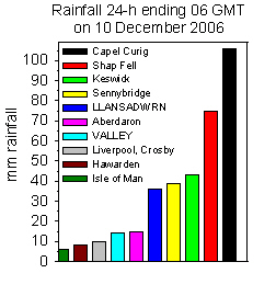 10th: Frontal cloud moved across soon after midnight and in warm sector air the temperature began to rise from the minimum of 1.7C. The low W of Iceland 937 mb was deepening and was 932 mb at 06 GMT. At 09 GMT pressure here 1015 mb was falling and the temperature had reached 8.3C, the maximum for the past 24-h. A mistle thrush was singing tentatively for a few minutes and a large flock of starlings rose and weaved their way across the sky near the weather station under a uniform grey stratus. There was drizzle and light rain, visibility was <2 km and the SSW'ly wind force 6 was freshening and reached gale force 8 either side of noon. Light rain continued through the sunless day until 1700 GMT before turning to drizzle during the evening. There was further rain from 2100 GMT as the temperature continued to rise and the SW'ly wind again reached gale force 8. [Rain 35.7 mm; Max 11.7C; Min 1.7C; Grass -2.4C]
 The mean temperature for the month 8.2C was running (+2.2) and [+2.7] above average. The mean for the year, so far, is 10.9C beating 1990 and 1997 that each had 10.7C, it will need a cold end to December to stop yet another record being broken.
15th: It kept on raining and the temperature to fall to the minimum of 5.4C just before 09 GMT. Another 23.5 mm of rain brought the total up to 159.9 mm (137%) of average. With soils waterlogged many fields have large pools of water and there was runoff on to roads where it was gathering on the sides; the road to Beaumaris was partially flooded. The frontal system was still slow-moving and developed a wave, over Anglesey and the Irish Sea, and the pressure gradient disappeared it becoming calm. Pressure was 1017 mb and visibility was very poor. There was continuous moderate rain through the day until 2100 GMT before it turned light and petered out by 2300 GMT. It had been raining moderately continuously for 26 hours since 1900 GMT on the 14th. Drizzle and light rain went on to after 2300 GMT but before midnight the cloud had broken and some stars were visible. [Rain 17.7 mm; Max 6.2C; Min 5.4C; Grass 5.0C]
The first 15 days had 177.6 mm (153%) and [155%] of the December average. The mean temperature was 8.0C (+2.2) and [+2.5] day 15 being cold enough to bring down the average 0.2C.
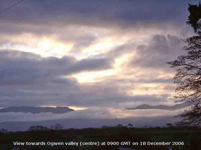 16th: The sky was mostly clear at dawn and the temperature had fallen to 1.8C in air and -2.2C on the grass partially freezing water deposits, but it did not look white. There were cumulus clouds, some towering, over the Snowdonia Mountains and towards Cumbria across Liverpool Bay. One cumulonimbus was seen to the S beyond backlit cumulus. It was a mostly sunny morning on Anglesey and after 3 days of very low light levels under thick cloud, almost darkness, it was quiet a relief. There had been a little ice precipitation over the mountaintops, and a little on the roofs of houses in Bethesda, but the extent of it was hidden under cloud with a base of about 2000 ft. The afternoon was cloudier and was mostly cloudy by 1600 GMT, but the sky cleared again during the evening. {Falmouth 12C, Aboyne -6C, Port Ellen, Inner Hebrides 11.3 mm, Bristol 6.8h} [Rain trace; Max 8.0C; Min 1.8C; Grass -2.2C]
17th: Some clear spells gave way to a cloudier sky towards dawn (08 GMT) and there was a slight shower of rain. Pressure 1025 mb had risen as a ridge extended from high 1033 mb over the Bay of Biscay. This promised a finer day with a little sunshine at first, but it was to be a disappointment as shallow low 1004 mb, SW of Iceland, brought frontal cloud across Ireland and into the west during the morning. There was a moderate shower of rain and 2-3 mm ice pellets at noon. The afternoon kept very damp with high humidity and little or no wind to aid drying. There were some clear spells before midnight and the tawny owls took advantage of the weather to hunt around the weather station. [Rain 3.2 mm; Max 8.5C; Min 3.1C; Grass -0.2C]
 18th: It was another damp and cloudy morning, an early bright red to pink sky at 0800 GMT lasted about 5 minutes, it was calm with little change in the high pressure (1025 mb). But the cloud was moderately high, just above the summits of the Carneddau Mountains where a little snow could be seen on the very tops. Banks of cloud were hanging around at lower levels; there were and mist and fog patches in valley bottoms and low lying parts. But the sky started to clear and by 1100 GMT it was mostly sunny. The afternoon was a little cloudier at first then started to clear. By 1600 GMT under clear sky mist had formed across the fields and at dusk frost on the grass. [Rain 0.0 mm; Max 9.0C; Min 4.6C; Grass 2.7C]
19th: The sky colour was more muted this morning; there was a little blue sky visible at 09 GMT as the sun rose behind thin cloud over the Carneddau Mountains. Just to the E of Carnedd Dafydd, from my usual camera position, it appeared as a golden ball with no rays. There was a white frost on the grass (min -2.3C) with frozen water deposits, but no hoar and no air frost (min 2.0C). The fall in temperature overnight prompted the salt gritter to go along the road before dawn for the first time this winter. At 09 GMT there were 6 oktas cloud cover, most high cirrus with orographic waves, some lenticular altocumulus and low stratiform cloud out in Liverpool Bay and W over the Irish Sea. There was dense fog between the Menai Suspension and Britannia Bridges (top of tower on Anglesey side just visible), but as the sun rose this began to burn off and was gone by 1030 GMT. Visibility was very good otherwise, although somewhat hazy. Pressure had risen to 1037.3 mb and we were right in the middle of the high stretching from Ireland to East Anglia. By noon the sky was almost clear and the temperature was 7.7C and with little or no wind rose to 8.4C. As the sun set the temperature dropped to 2.5C with a touch of ground frost. But by 21 GMT cloud had encroached and the temperature rose nearly 3C before midnight. {Scilly 11C, Redesdale Camp -6C, Lerwick 2.7 mm, Edinburgh 7.0h} [Rain 0.1 dew; Max 8.4C; Min 2.0C; Grass -2.3C]
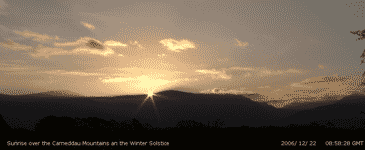 20th: The day was to remain overcast and rather dull, but visibility was good or very good with haze and smoke hanging in the Strait and valleys. Pressure 1039 mb was continuing to rise slowly and in a sunless day the temperature rose to 7.2C. The sky kept overcast into the night with no frost developing. Thick fog, with daytime temperatures keeping below zero, affected many parts of central and southern England. Internal flights were cancelled and at Heathrow, the most affected airport, many flights were cancelled or delayed and left 20,000 travellers to spend the night there under thermal blankets. [Rain 0.0 mm; Max 7.2C; Min 2.5C; Grass -1.3C]
 21st: A bright morning and leading up to 09 GMT the sky seemed to be clearing here. Overhead were wavy cirrus and cirrocumulus clouds but stratus was seen to the west and in Liverpool Bay. With some clear sky over the mountains I was able to capture the rising sun, with rays, at 08:58:00 GMT, from the weather station. Rising just to the E of Carnedd Dafydd
 ![]() this will be about as far W as it goes this year at this location. It is the 21st, but not the solstice this year which occurs officially tomorrow on the 22nd. The time is 0022 GMT, so the photo is pretty close, anyway it might have been cloudy tomorrow! Pressure was still intensifying, up to 1042.2 mb, centred over Wales so prospects for tomorrow looked good. Visibility was a bit variable, generally moderate to good with haze or smoke in valleys, but the mountain tops were in the clear with temperatures there higher due to inversion conditions. The morning turned a little cloudier, but some blue sky was present from time to time. The afternoon was mostly sunny and all the family was hoping the good weather would last until tomorrow. [Rain 0.0 mm; Max 7.6C; Min 4.3C; Grass 0.6C]
this will be about as far W as it goes this year at this location. It is the 21st, but not the solstice this year which occurs officially tomorrow on the 22nd. The time is 0022 GMT, so the photo is pretty close, anyway it might have been cloudy tomorrow! Pressure was still intensifying, up to 1042.2 mb, centred over Wales so prospects for tomorrow looked good. Visibility was a bit variable, generally moderate to good with haze or smoke in valleys, but the mountain tops were in the clear with temperatures there higher due to inversion conditions. The morning turned a little cloudier, but some blue sky was present from time to time. The afternoon was mostly sunny and all the family was hoping the good weather would last until tomorrow. [Rain 0.0 mm; Max 7.6C; Min 4.3C; Grass 0.6C]
22nd: The day dawned bright and soon was sunny with very little wind. With a clear view of the mountains I was able to capture the sun rising on the day of the Winter Solstice. The photo was timed at 08:58:28 GMT, 28 seconds later than yesterday. It was a perfect day for my daughter Rosemary's wedding today at Tre-Ysgawen Hall, on Anglesey ![]() . I had been quietly confident, after studying the charts and models, that after all the rain and gales at the beginning of the month that it would be a nice day, although the possibility of cloud appearing could not be ruled out. But, it kept clear and with very little wind the 9.2C temperature and the winter sunshine made it pleasant for outdoor photography too. [Rain 0.0 mm; Max 9.2C; Min 2.9C; Grass -1.4C]
. I had been quietly confident, after studying the charts and models, that after all the rain and gales at the beginning of the month that it would be a nice day, although the possibility of cloud appearing could not be ruled out. But, it kept clear and with very little wind the 9.2C temperature and the winter sunshine made it pleasant for outdoor photography too. [Rain 0.0 mm; Max 9.2C; Min 2.9C; Grass -1.4C]
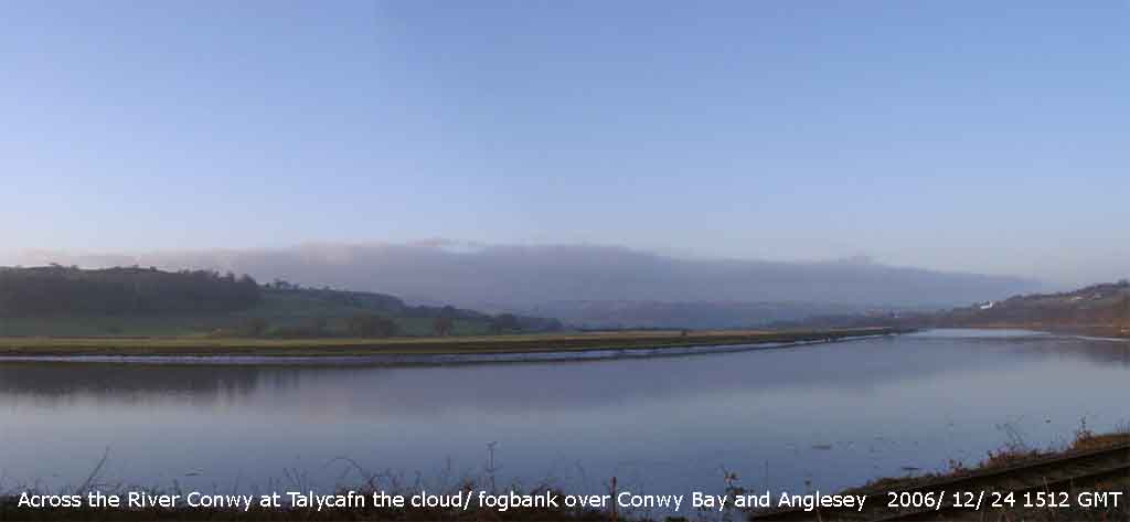 23rd: Well what a difference today, in complete contrast to the previous 2 days low cloud/ fog had moved into the west and north of Anglesey and it was dull and chilly morning. Pressure was 1042 mb within the tethered high across the UK. The morning did brighten up in the higher SE of the island, there was a little sunshine and the temperature rose to 5.3C. But during the afternoon the low cloud/ fog encroached and the gloom returned. With inversion conditions it was sunnier on the tops of the mountains and in favourable places the temperature rose to 9C. [Trace dew/fog; Max 5.3C; Min 2.0C; Grass -1.8C]
24th: The overnight minimum temperature was 1.3C, lowest of the month and unusually the grass minimum was similar 1.2C. The low cloud/ fog persisted all day across Anglesey, but it was brighter at Penmon and across the water of Conwy Bay to the Conwy Valley. Pressure remained high 1040 mb with the high 1041 mb over N England and the North Sea. In the afternoon, while Anglesey continued under the low cloud/ fog with a maximum of 4.0C, it was clear and sunny E of Conwy. The fog bank can be seen in the photograph across the River Conwy near Talycafn. The mountaintops had sunshine all day well above the inversion layer. There were some spectacular views through the day of the Snowdon and Moel Eilio peaks emerging above the cloud seen from the First Hydro webcam on Elidir Fach. The image on the right is looking SW over Llanberis with Llyn Padarn (on the right) and Llyn Peris on the (left), all under the cloud. [Rain 0.0 mm; Max 4.0C; Min 1.3C; Grass 1.2C]
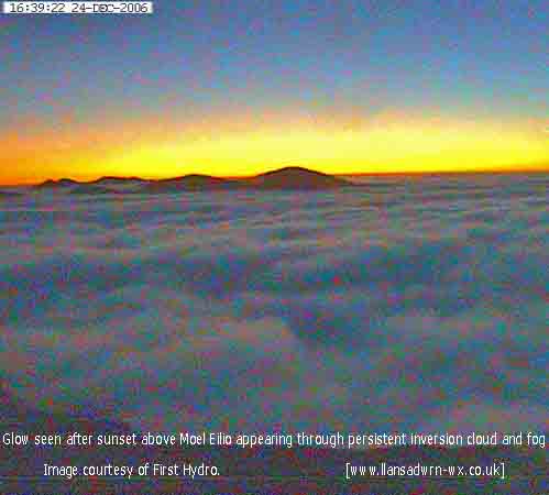 25th: With the high 1038 mb over England and Wales, and the North Sea we were still under the blanket of low cloud/ fog so it was a dull Christmas morning. The temperature at 09 GMT was 2.5C, the minimum, but there was little wind being calm, or a very light generally E'ly light air. With so little air movement relative humidity measured by wet and dry bulb thermometers in the Stevenson screen was 100%, there being no difference in the readings. But measurement by whirling hygrometer indicated 88%, a more reliable observation. So the moderate visibility, about 4 km, was due officially to haze and not mist. The distinction is fine, above 95% it's mist, below it haze. The day kept overcast and it was sunless. [Rain 0.0 mm; Max 4.1C; Min 2.5C; Grass 2.2C]
26th: Another overcast day, but the cloud was thinner and higher just nudging the summits of the Carneddau Mountains. Pressure 1034 mb was falling slowly as our high had released its tethers and was drifting across the southern North Sea to Germany. It was a little brighter, well the solar radiation instruments said it was. By afternoon there was further thinning but there was no broken cloud until after dark Between 18 GMT and midnight there was partial cover with some moonlight; the temperature on the grass fell to -2.2C. [Rain 0.0 mm; Max 6.5C; Min 2.4C; Grass 1.7C]
27th: It was overcast by daybreak and at 09 GMT. There was a light air from the SSE and visibility was good, about 12 km in haze (86% relative humidity. Pressure 1028 mb continued to fall with the high moving further SE into Europe. Low 962 mb SW Greenland looks likely to bring an end to the settled foggy spell with a frontal system moving in over Ireland. There were just small amounts of icy deposits seen on the summits of Carnedd Llewelyn and C. Dafydd around 3100 ft, also on some around the Glyders. Rain over the Irish Sea at 09 GMT arrived at the weather station at 1100 GMT and lasted into the afternoon. The day was sunless. {Scilly 12C, Albemarle 0C and Aboyne -7C, Capel Curig 19.4 mm, Aberdeen 2.3h} [Rain 8.2 mm; Max 9.5C; Min 1.7C; Grass -2.2C]
28th: There was a further spell of rain between 0430 and 0700 GMT with the temperature rising to 9.5C at 09 GMT. This brought the total for the month to 189 mm, one of the 7 wettest Decembers since before 1928. The sky was overcast but there was a little thinning and brightness to the west of the station this reaching here by 1015 GMT. The mountaintops were obscured in cloud and mist with visibility only moderate; any ice deposits are likely to have disappeared in the rising temperatures with the freezing level above the summits. Pressure 1023 mb was steady in a ridge of high-pressure, the Med has generally high-pressure (1036 mb N Africa) with sunny weather, but lows in mid-Atlantic (970 mb) are stacking-up and likely to deepen as they head our way. It was a mostly sunny day with stratocumulus clouds piled up to the S of the Snowdonia Mountains. At sunset there was thin cloud to the west this encroaching and thickening during the evening. [Rain 0.7 mm; Max 11.7C; Min 5.0C; Grass 4.1C]
29th: At midnight deepening low 964 mb was W of Ireland and with high-pressure 1033 mb over France, Spain and the Med a steep pressure gradient developed. In the small hours the S'ly wind reached gale force 8 continuing to 09 GMT when the hard hat was needed for the 'obs', there was a lot of tree debris flying around and always the chance of a dislodged slate. Pressure was 1001 mb with the low 959 mb tracking N. The maximum temperature for the past 24-h was 11.7C and was currently 11.0C, visibility was poor (2 km) in slight driving rain. The morning continued with strong winds and the day was overcast and sunless. There was a spell of heavy rain from 19 to 21 GMT when the temperature had risen to 12.4C, the highest of the month (see also similarly conditions on the 4th), then a heavy shower at 23 GMT. {Prestatyn 15C, Redesdale Camp -1C, Tulloch Bridge 22.4 mm, Belfast 0.9h} [Rain 16.6 mm; Max 12.4C; Min 8.0C; Grass 5.0C]
30th: Just before 0300 GMT the wind rose and with very strong gusts there was another heavy shower of rain and ice pellets. A cold front was in the vicinity and the temperature dropped 2C. By dawn the sky had almost cleared and was only 3 oktas at 09 GMT but soon became cloudier again. Pressure 1001 mb had risen with low 965 mb N of Shetland. We were in a moderate to fresh SW'ly airstream and more rain was working it's way N through St. George's Channel and rain reached here at 1105 GMT and continued until mid-afternoon. There was a little sunshine. The evening and night were dry. {Herne Bay 14C, Lough Fea 2C, Boscombe Down 47.6 mm, Belfast 4.9h Valley 0.2h} [Rain 6.2 mm; Max 9.4C; Min 7.0C; Grass 4.5C]
31st: An overcast beginning to the last day of the year. At midnight low 986 mb mid-Atlantic and W of Ireland was deepening and tracking NE towards N Ireland and W Scotland. At 09 GMT pressure here 1010 mb was falling with the low 978 mb. After a glimpse of sunshine towards 10 GMT the S'ly wind strengthened to force 6/7 and reached gale force 8 during the morning. There was rain from 1100 to about 1400 GMT. With the low 969 mb in the southern Norwegian Sea at midnight NW'ly winds were strongest to the N of here, and with heavy rain, New Year celebrations and fireworks displays were cancelled in Liverpool as well as Hogmanay in Glasgow and Edinburgh. There was no snow on the Snowdonia Mountains at the end of the month. [Rain 3.1 mm; Max 11.0C; Min 5.8C; Grass 2.8C]
The month finished with a mean temperature of 6.9C (+1.1) and [+1.4] of average. There were no days of air frost (-4.5), but 10 days of ground frost (-4.3). It was a rather dull month overall with 88% of average sunshine, lowest since 2003. But it was the 6th month of 2006 with above average temperatures and resulted in a record annual mean of 10.8C, the highest since before 1979. Rainfall for the month 215.7 mm was the largest fall since 1964 ranking 2nd since before 1928. It brought the annual total to 1237.0 mm, wettest since 2004 and 13th wettest since before 1928. Sunshine for the year was 118% of average and it was sunniest since 1975 and the 3rd sunniest year on Anglesey since before 193
|
|
|
These pages are designed and written by Donald Perkins © 1998 - 2006 Document first dated 27 February 2006 http://www.llansadwrn-wx.co.uk |