|
Times are GMT (UTC, Z). Observations at this station [ ] are 24-h 09-09 GMT, some others { } occasionally refer to other 24-h periods, extremes (first indications) are usually given in bold. When averages are referred to (.) compares with the last decade and [.] with the 30-y climatological average [1991-2020]. All data are subject to verification and amendment. January 2024
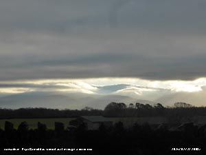
January 1 - a fine fresher morning for the New Year, but no frost. There were some fine backlit cumulus clouds over the Snowdonia Mountains now officially called Eryri, and with moderate to good visibility no snow was seen. At 0900 GMT pressure 1004 mb was rising and the temperature was 5.3C up a little from the minimum 5.1C. Soon the Coast Guard helicopter based at Caernarfon Airport was seen making its way eastward just south of the weather station, there was an emergency along the coast. Cloud increased during the morning, but there was some sunshine at times (Milford Haven max 11.5C Llysdinam min 2.9C Lake Vyrnwy rainfall 29.4 mm Hawarden sunshine 3.0h) [Max 10.7C Min 5.1C Rain 11.2 mm]. The 6th began a bit more wintry with some ice precipitation spotted on the Eryri mountaintops. A bright morning, no frost the grass minimum showing 0.1C. UKTR -3/8C N to SW England, here 3.1C. The sky with 3 oktas was clearing and the morning sunny. Pressure 1019 mb was rising in a ridge from high 1024 mb Cap Finisterre to Ireland and W Wales. Slight showers in the afternoon, with some more ice pellets at 1430 GMT while in the greenhouse cutting back the chrysanthemums, that have finished flowering, they will produce new shoots for cuttings by the spring (Usk 9.9C & -1.0C Capel Curig 8.6 mm Valley 4.8h) [Max 8.7C Min 3.0C Pptn 0.3 mm].
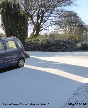
With hardly a cloud in the sky it was a sunny morning on the 9th with moderate to good visibility with a layer of inversion haze. There was a bitterly cold ESE'ly wind this forming lee-wave clouds to the south, the air temperature 1.8C but wind chill -0.1C. UKTR -11/5C N to Scilly Isles. With high 1042 Wick it was 1036 mb here. Dry and sunny (Usk 5.1C Libanus -1.7C Cardiff 0.4 mm Valley 6.0h) [Max 3.7V Min 1.8C Grass -0.2C Pptn trace in funnel]. Broken cloud at first on the 10th again with an E'ly breeze . UKTR -6/6C variously, here 3.7C. Pressure high 1035 mb with high 1043 mb over the Orkney Islands with ridge to the Celtic Sea. There was a little drizzle in the morning, but the afternoon was sunny. Set about checking and clearing nesting boxes, there had been 9 successful broods last year, 2 more than 2022, with 13 boxes used in some way out of 22 around garden and wood (Valley 7.0C Whitechurch -3.3C Lake Vyrnwy 0.8 mm Aberporth 6.1h Valley 0.7h) [Max 5.9C Min 1.6C Grass -1.0C Pptn trace]. The first 15 days of the month were drier than average with 43.1 mm rainfall (36%) & [42%] of monthly averages. The mean temperature 5.1C was (-0.6) & [-0.3] of averages. There were 6 days with ground frost. The 16th began with largely blue sky and a light SW'ly breeze. It was cold with patchy icy remnants of snow pellets and snow on grass. There was snow on the Carneddau as low as 450 ft at 0900 GMT with an air temperature of 1.4C. UKTR -7/7C lowest in SE England and highest in the north-west and Scilly. A nice sunny afternoon, but rather cold in the breeze (Milford Haven 7.8C Usk -4.5C Rhyl 2.0 mm Lake Vyrnwy 3.6h) [Max 4.6C Min 0.5C Grass -1.3C Pptn 4.2 mm]. Showers overnight with some snow pellets and the morning of the 17th was sunny the sky almost clear of cloud. Wet and windy on the 25th in warm sector air pressure was on 1019 mb with low 963 mb Reykjavik, Iceland, and a ridge of high-pressure over the North Sea from the Med and N Africa 1037 mb. UKTR 2/13C NE to SW. Sunless (Hawarden 13.3C Usk 2.5C Capel Curig 39.2 [53.8] mm Hawarden 0.2h) [Max 11.2C Min 5.3C Pptn 11.8 mm]. Respite on the 26th with a rather nice sunny day. A fresher feel in the morning at 0900 GMT, after a muggy 10.9C at 0108 GMT before a cold front passed over with a 40 mph gusty wind, with a few cumulus clouds in the sky and a light WSW'ly breeze, moderate hazy visibility. UKTR 1/10C W to SE it was 4.3C with pressure 1026 mb rising quickly in a ridge to the UK from high 1037 mb Spain. There were gnats flying near the Stevenson Screen. A mostly sunny day with a breeze picking up in the afternoon. There were some snow patches seen high on Eryri mountain ridges (Cardiff 11.0C Libanus 2.4C Capel Curig 6.2 [0.2] mm Aberporth 7.4h Valley 6.7h) [Max 8.4C Min 3.7C Grass 0.1C Pptn 0.2 mm]. A cloudy, but dry day on the 27th with pressure steady on 1029 mb with high-pressure 1038 mb SE Europe. With low 957 mb near Jan Mayen island we were in a SW'ly airflow. Overcast with moderately high altostratus cloud that thinned in the afternoon giving some bright weak sunshine (Trawscoed 9.8C Usk -0.9C NSR St Athan 0.5h) [Max 10.6C Min 4.6C Grass 2.5C Pptn nil]. Mild on the morning of the 28th with some sunshine breaking through the altostratus cloud by noon. Pressure was on 1016 mb as pressure 1041 mb over SE Europe intensified. Low 966 mb was SE Greenland and isobars were tightly packed in the west resulting in a strong airflow especially in the north of Britain. In the afternoon Föhn winds developed in Llanfairfechan where the temperature at Gorwel Heights reached 17.8C with a low RH of 44%, Gorddinog AWS registered 16.8C with a low 47% RH both highest in Wales, the gusty 34 mph wind briefly reached here resulting in only 12.7C. The Föhn wind at Kinlochewe, Scotland, reached a record for the UK in January of 19.3C shattering the previous record of 18.3C at Aboyne (Aberdeenshire) on 27th January 2003 and Aber (Gwynedd) on 28th January 1958 (Kinlochewe 19.3C Gorwel Heights 17.8C Gorddinog AWS 16.8C Bodelwyddan 14.3C Lake Vyrnwy 3.1C Capel Curig 4.8 mm Bala 3.2h) [Max 12.7C Min 7.3C Pptn 17.4 mm]. Light rain turned moderate to heavy rain after midnight on the 29th with bursts of up to 10 mm/h by morning when 17.4 mm of rain had fallen. There was standing water around the weather station at 0900 GMT when dusty moderate rain was falling. Orangy red coloured fine dust was being deposited, typical of Saharan dust, and rapidly washed away in the rain that turned heavy 11 mm/h at 11 GMT only easing a little by noon. UKTR -2/13C N to S here 6.3C. A nice day on the 30th fine and bright with little wind just right for the Tree Surgeons here dealing with dead and dying trees including firs, horsechestnut and ash in the woodland. Pressure 1029 mb was rising quickly the morning temperature 5.2C UKTR -7/9C N-SE. The evening turned rapidly cloudy pressure was at its highest 1033 mb at 2107 GMT then falling it was quite windy by midnight (Mumbles Head 9.2C Scolton 2.4C Swyddffynnon 4.4 mm Valley 5.8h) [Max 9.3C Min 4.7C Pptn nil]. A breezy morning on the 31st cloudy with moderate visibility, but still dry even concrete the grass. Fresh to strong WSW'ly wind locally a gale windward of the shelter belts. Pressure 1026 mb was still falling the temperature 7.3C UKTR 0/11C Welsh Marches to W Ireland. Pressure was lowest 1019 mb at 1352 GMT, a cold front passed over marked by a burst of rain 18 mm/h at 1754 GMT the temperature 9.7C then falling rapidly to 3.6C by midnight. The month ended with a rainfall total of 172.2 mm (142%) & [167%] of averages, largest since 2021 and standing 9th in Llansadwrn records back to 1928. The close to normal monthly mean temperature 5.7C was (0.0) & [-0.3] of averages. There were 18 days of ground frost, two of air frost and two days lying snow.
February 2024
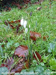
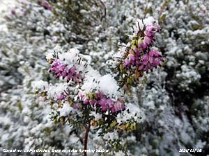
February 1 - a fine frosty morning with good, but slightly misty visibility across the fields. A complex sky with cloud developing after clearer conditions with cirrus, contra and lenticular altocumulus. Frost on the grass the minimum thermometer down to -1.6C, but no air frost. Air temperature at 0900 GMT was 2.4C the UKTR -1/9C lowest in central parts higher around coasts. Pressure 1035 mb was rising with high 1041 Biscay extending a ridge to southern Britain. Dry and sunny in the afternoon with variable cloud cover the temperature rising through the day reaching 7.8C at 2200 GMT (Cardiff 10.5C Sennybridge -1.8C St Athan 5.8h) [Max 9.1C Min 1.1C Pptn 0.2 mm]. The temperature continued to rise after midnight on the 2nd reaching 9.1C at 0237 GMT. A cloudy and damp morning with 100% RH and 9.2C in the Stevenson Screen at 0900 GMT the UKTR 5/12C SE-NW. Overnight the temperature in Llanfairfechan at Gorwel Heights at 0213 GMT reached 14.3C and Gorddinog 14.1C at 0141 GMT. The slight rain and drizzle fizzed out and there were some sunny spells in the afternoon (Hawarden 14.2C & 6.1h Libanus 4.8C St Athan 3.8 mm) [Max 11.7C Min 8.3C Pptn 0.2 mm]. The 3rd began with slight rain and drizzle, overcast with very poor visibility after earlier fog. Pressure was on 1026 mb with high 1036 mb over France while low 951 mb was transiting the Norwegian Sea. A slow-moving cold front lay to the north over the Isle of Man while another hovered over Pembrokeshire and the Wash. A bit drier for a while with a flash of sunshine, but keeping dull showery rain developed in the afternoon (Usk 13.2C Lake Vyrnwy 8.3C Cardiff 7.4 mm Hawarden 0.2h) [Max 10.7C Min 9.6C Pptn 1.7 mm]. Similar on the 4th overcast with spits and spots of rain and breezier the WSW'ly force 5. Pressure 1021 mb was falling with low 966 mb over the Baltic while pressure remained high 1035 mb France and Spain. A warm front lingering over Anglesey associated with low 994 mb Nova Scotia and low 979 mb N Finland. The UKTR was 5/12C north to south, here 9.2C. The rain petered out during the morning, but the sky remained overcast thinning from time to time when it was brighter. Breezy into the evening (Pershore 14.7C Rhyl 14.5C Gorwel Heights 13.2C Hawarden 6.2C Sennybridge 8.6 mm Aberdaron 2.1h) [Max 11.2C Min 6.8C Pptn 1.6 mm]. The poor weather continued on the 5th with a sunless day. It was mild the UKTR 1/11C far N/ W fringe and Ireland, here 8.6C rising to 10.1C. Pressure 1017 mb was falling with a train of depressions tracking N of Scotland, 995 mb SW Iceland - 981 mb over the Baltic [Max 10.1C Min 8.4C Pptn 3.0 mm] (Hawarden 12.4C Lake Vyrnwy 6.4C Capel Curig 8.4 mm Hawarden 1.5h). It was raining moderately at 0900 GMT on the 6th with standing water with trickling runoff over saturated ground. UKTR 2/13 N/S here 9.8C. Sunless day [Max 10.0C Min 8.6C Pptn 13.0 mm] (Chertsey Abbey 14.3C Bodelwyddan 12.5C Lake Vyrnwy 7.7C Capel Curig 45.4 mm Valley 0.0h). The 7th began dry after a touch of ground frost -0.7C but any whiteness had disappeared before 0900 GMT. Pressure was steady on 1007 mb a low 986 mb NW of the Azores had a frontal wave over Devon while low 979 mb was over the Baltic. Cloud was moderately high and thinning so it was fairly bright. UKTR -3/12C N/S here 3.1C. Quite a nice day for jobs around the garden [Max 7.3C Min 2.3C Pptn 3.6 mm] (Scolton 9.0C Capel Curig 0.0C Cardiff 10.8 mm Aberporth 5.2h). A somewhat colder day on the 8th with rain falling early, snow pellets or sleet in places, and just cold enough for a little snow on Eryri mountains at 1000 ft. UKTR -12/12C far N/ far SW (Altnaharra/ Newquay, Cornwall) here 3.5C. Little or no wind before 0900 GMT then an E'ly picked up along with moderate to heavy rain the next hour. Pressure 989 mb was falling rapidly. Maximum 5.8C was lowest of the month [Max 5.8C Min 2.9C Pptn 11.6C] (Milford Haven 11.3C Altnaharra -13.8C Lake Vyrnwy 0.0C Killowen 46.6 mm Capel Curig 37.4 mm Sunless). Dull and damp on the 9th with slight fine drizzle becoming intermittent. Pressure was on 973 mb having been as low as 972 mb at 0523 GMT. UKTR 0/12C, N where some snow/ S, here 4.6C with no overnight frosts. The cloud thinned from time to time and it was dry, but there was drizzle with thicker cloud at times. Sunless [Max 8.1C Min 3.1C Pptn 2.2 mm] (Usk 12.5C Lake Vyrnwy 0.7C Sennybridge 17.4 mm Aberporth 0.1h). The best day for a while on the 10th with early sunshine. A light SE'ly breeze with a few cumulus clouds and small lenticular altocumulus for a while. UKTR 1/11C, N/S, here 3.8C with no frosts, visibility good, mist and fog patches central and N England. It felt warm in sunny parts of the garden by afternoon (12.6C) and hive bees were seen on snowdrops and flowering heathers when in the sun [Max 11.6C Min 3.6C Pptn 0.1 mm] (Pershore 12.7C Cardiff 12.0C Hawarden 0.3C Scolton 4.4 mm Valley 7.5h). Disappointingly cloudy on the 11th after the sky began to clear, with the temperature on the grass dipping to -0.2C, mist formed and cloud developed. By 1030 GMT the sun was looming through for a while but the cloud remained. UKTR -1/10C N/S, here 5.5C visibility very poor at first. Brighter later in the afternoon [Max 9.6C Min 2.9C Pptn 0.3 mm] (Cardiff 11.4C Hawarden -1.5C Libanus 6.2 mm Aberdaron 5.4h). The 12th was a mostly sunny day with just 2 oktas of cumulus clouds and moderate misty visibility. UKTR -3/8C N/S rain in the NE, here 4.3C at 0900 GMT after a ground frost -1.3C. A sprinkling of snow was seen briefly on the highest Eryri summits. The WSW'ly breeze picked up during the day, it was a good drying day [Max 8.7C Min 2.3C Pptn 0.2 mm] (Cardiff 11.2C Hawarden -0.8C Swyddffynnon 5.0 mm St Athan 8.8h). Woodpeckers have been drumming these last few mornings as I make the observations. Visibility on the 13th was good so I was able to spot a few snow patches on the mountains surviving the mild weather. It was 6.7C with the UKTR 0/11C, N/S. Pressure was on 1009 mb with a low 982 mb off the N of Scotland and low 979 mb Atlantic W of Brest we were situated just N of the jetstream. Bright at times, not sunny, thicker cloud by afternoon [Max 10.8C Min 4.3C Pptn 7.2 mm] (Usk 12.1C Lake Vyrnwy 3.5C Sennybridge 18.8 mm Aberdaron 0.2h). There was a heavy shower around midnight and a gusty wind in the small hours and with recent rain at 0900 GMT on the 14th the morning was dull and mild. UKTR -2/13C NE Scotland/ widely S Britain, here 10.8C. There was a low 982 mb W of Ireland and a warm front was straddling the Isle of Man. Slight rain and/ or drizzle. Fog developed in the afternoon with Valley Airfield on RED closed for a while. The maximum temperature was the highest of the month [Max 12.8C Min 6.7C Pptn 9.8 mm] (Hawarden 14.7C and 6.7C Capel Curig 26.8 mm Sunless). Overcast with grey stratiform cloud from early on the 15th visibility was very poor with slight rain and drizzle. UKTR 2/15C N/ central N England and N Wales, here 12.7C with Gorwel Heights reaching 15.8C and Gorddinog AWS 15.6C at 1110 GMT. Air minimum here 10.1C highest of the month. A wet day with fog developing at times, Valley Airfield on RED again in the afternoon [Max 12.7C Min 10.1C Pptn 1.7 mm] (Pershore 18.1C Hawarden 16.4C Capel Curig 9.4C & 21.2 mm Hawarden 0.5h). The first 15 days of the month were rather wet with 56.4 mm of rainfall (51%) & [62%] of monthly averages. The mean temperature 7.5C way above normal was (+1.4) & [+1.9] of averages. No air frost and just 4 ground frosts (-10.6) of monthly average. A cloudy morning on the 16th with slight rain and drizzle and very poor visibility. The temperature was 8.9C the UKTR 4/12C N/SE. It kept dull and damp all day [Max 10.7C Min 8.3C Pptn 2.0 mm] (Hawarden 13.6C & 2.8h Lake Vyrnwy 6.2C Porthmadog 4.8 mm]. Similar on the 17th with pressure on 1025 mb there were complex frontal systems over the Irish Sea and to the SW associated with low 974 mb S Iceland. A mild 10.7C UKTR 1/12C N Scotland/ SW. It was drier at times, but the afternoon had drizzle turning to showery rain later [Max 12.1C Min 7.8C the sky kept overcast [Max 12.1C Min 7.8C Pptn 14.2 mm]. There was fog overnight and by the morning of the 18th visibility was very poor. a mold 10.1C and very humid 100% RH, UKTR 6/12C N/S. Pressure 1014 mb was rising there was intermittent slight drizzle in the morning, drier by noon with a little sunshine when hive bees were seen on the flowering heathers [Max 12.6C Min 8.9C Pptn 3.2C] Usk 16.4C Mona 7.1C Gogerddan 23.8 mm Aberdaron 5.3h). A weak cold front associated with low 952 mb Iceland passed over in the night and on morning of the 19th there was some early sunshine. At 0900 GMT the sky was 5 oktas covered, but bright with sunny spells. The temperature 8.3C UKTR 5/11C N/S. Pressure 1029 mb was rising, a high 1040 in the Atlantic off Cap Finisterre extended a weak ridge to the western fringe. It was a nice day allowing some work to be done in the garden. Honey bees were on the heathers again and ewes and lambs in the adjacent NE field were quite noisy at times in the sunshine [Max 12.6C Min 7.7C 0.1 mm] Cardiff 14.0C Usk 5.0C Gogerddan 4.8 mm Valley 5.8h). It was back to the usual dull morning on the 20th with intermittent slight rain and moderate to poor visibility. The temperature was 9.4C UKTR 4/12C SE/W. It was not fit for anything in the garden today. The temperature fell during the evening reaching 6.4C at midnight [Max 10.1C Min 8.0C Pptn 18.6 mm] (Hawarden 14.9C Swyddffynnon 5.1C Capel Curig 30.0 mm [41.6 mm largest in Europe] St Athan 2.3h). Heavy rain early on the 21st leaving standing water around the weather station had eased in time for the 0900 GMT readings. Rain in the raingauge measures 18.6 mm second largest of the month. The temperature was 10.1C UKTR 3/13C N/SW, it was raining almost everywhere. It was very windy force 7 with Capel Curig reporting force 9 gusting 68 mph. There were some glimpses of sunshine from time to time [Max 12.3C Min 6.4C Pptn 10.3 mm] (Bodelwyddan 15.1C Hawarden 5.5C Cardiff 32.2 mm [Capel Curig 34.0 mm Mona 10.6 mm] Valley 2.5h). Another dull morning on the 22nd, but the wind had moderated overnight with intermittent calms. The soil underfoot was very soggy after the rains, visibility was good with slight mist. Pressure was on 981 mb with very large complex lows 956 mb/ 957 mb Iceland carrying its influence as far as N Spain and the Cote d'Azur. A cold front lay across central England. UKTR 0/12C Scotland where snowing/ S coast of England, here 6.5C. Soon a little brighter, but it soon became dull again. A little fresh snow was seen in the afternoon on the Carneddau near C. Dafydd at 2850 ft [Max 7.1C Min 6.3C Pptn 0.6 mm] (Porthmadog 8.3C Sennybridge 3.7C Gogerddan 26.6 mm Aberdaron 2.7h). Snow pellets fell overnight around 0300 GMT recorded on the hailpad and it was cooler on the 23rd, the temperature 4.8C UKTR -2/8C N/S. There were complex lows to the N 966 mb and Baltic 960 mb, pressure here was on 983 mb, and we had a showery polar maritime airflow. Sunshine and showers with more snow pellets and at 1400 GMT moderate sleet when our washing on the line got wet [Max 8.3C Min 3.7C Pptn 2.2 mm] (Kew Garden 10.7C Hawarden 9.0C & 4.1h Sennybridge 0.3C Cardiff 13.2 mm) Snow had fallen on Eryri early on the morning of the 24th and was lying as low as 1250 ft in places. The temperature at 0900 GMT was 4.2C, UKTR -4/8C NE & central England/ SW. The day was cooler, but bright with sunny spells [Max 9.6C Min 2.0C Grass -1.4C Pptn trace] (Killowen 12.0C Gogerddan 10.0C Hawarden -1.4C St Athan 5.6 mm Bala 6.2h Valley 5.4h). A fine sunny morning on the 25th with an impressive 'roll' cloud developed over the top of the Carneddau, some wavy cirrus and contra. There was snow lying above 2500 ft, visibility was very good. The temperature was 3.7C UKTR -5/11C N/S, the overnight minimum 0.9C was lowest of the month. Mist and fog was widespread in central England, the north-west was having the best of the weather. Pressure was on 995 mb with low 982 mb SW Ireland while pressure was high 1013 mb Cote d'Azur. A sunny afternoon in the garden though there was a cool breeze [Max 8.2C Min 0.9C Grass -2.7C Pptn 0.0] (Hawarden 8.4C Capel Curig -2.9C Cardiff 13.0 mm Valley 6.7h). There was hardly a cloud in the sky early on the 26th with a sunny morning and moderate visibility, no frost. Pressure 1017 mb was rising quickly in a ridge towards NW Scotland from high 1034 mb N Azores. Pressure was low 990 mb over France. UKTR -2/8C N snowing/S, here 5.2C. By 10 GMT it was cloudier, the afternoon had sunny spells with a chilly breeze [Max 8.1C Min 3.6C Pptn 0.2 mm] (Usk 9.8C Libanus 1.6C NSR Valley 7.7h). A dull day on the 27th with pressure 1018 mb falling as a ridge over the Irish Sea declined. A cold front over Ireland was associated with low 964 mb Iceland. The temperature 6.6C UKTR 0/10C central England/ W Ireland. A slight shower at 0930 GMT with the WSW'ly wind picking up. Rain at times, windy [Max 9.7C Min 1.0C Grass -2.8C Pptn 3.5 mm] (Hawarden 11.8C & 1.2h Swyddffynnon -3.3C Capel Curig 10.0 mm). Cloud was low on Eryri on the morning of the 28th and visibility was poor to moderate. Pressure 1014 mb still falling with a warm front over the Irish Sea. Low 961 Norwegian Sea, high 1035 mb Azores. There was slight drizzle at 0900 GMT before the cloud thinned by 10 GMT. The sun did not break through and the SSW'ly wind freshened. UKTR 2/11C E/W, here 6.9C. Slight rain and drizzle at times at first, moderate to heavy rain in the afternoon into the evening of 9.0h duration, sunless [Max 11.1C Min 3.2C Pptn 20.3 mm] (Hawarden 12.9C Bala -0.6C Capel Curig 17.0 mm [27.6 mm] Bala 0.7h). The 29th as its Leap Year was mostly cloudy with moderate visibility. Pressure was steady on 1003 mb with low 966 mb between Iceland and Scotland. There was a cold front central England and a showery trough over the North Channel. A cumulonimbus cloud was spotted late afternoon and we had a shower of rain and 2-3 mm ice pellets at 1756 GMT with a noticeable drop in temperature [Max 8.2C Min 4.8C Pptn 2.7 mm] (Usk 9.6C Porthmadog 3.5C Gogerddan 12.0 mm Aberdaron 2.1h Valley 1.9h).
The month ended with a rainfall total of 134.5 mm (122%) & [148%] of averages, largest since 2021 and standing 13th in Llansadwrn records back to 1928. The mean temperature 7.6C was (+1.4) & [+2.0] of averages ranked 3rd in station records since 1979. There were no air frosts recorded, but there were 9 days with ground frosts this number (-5.6) of average.
March 2024
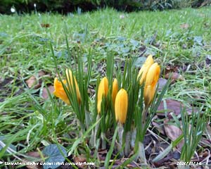
March 1 - St. David's Day and there were plenty of daffodils in flower, gone are the days when there were few or none on this day. The day began overcast with slight rain and drizzle, but this soon eased and by 0930 GMT there was a lee clearance overhead the wind being easterly. The temperature was 3.3C the UKTR -1/8C N/S.
¤ 3.2#
|
||||||||||
| A |


