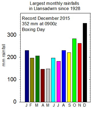
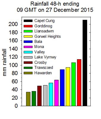
|

Times are GMT (UTC, Z). Observations at this station [ ] are 24-h 09-09 GMT, some others { } occasionally refer to other 24-h periods, extremes (first indications) are given in bold and are usually 21-21 GMT. When averages are referred to (.) compares with the last decade and [.] with the 30-y climatological average [1981 - 2010]. All data are subject to verification and amendment. January 2015
January 1 - the New Year began dull and very windy the SW'ly force 5/6 as pressure 1019 mb was falling. Rain at times with moderate or poor visibility through the morning and afternoon. We were in a warm sector airflow; the temperature had been 10.7C at 0219 GMT and was 10.2C at 0900 GMT rising again to 12.1C at 1657 GMT. Strong gusts 43 mph at 1655 GMT with 59 mph reported in Llandegfan. A cold front at midnight led to moderation of the wind the start of a fall in temperature. [Max 12.0C Min 8.0C Pptn 11.4 mm]. Murlough & Hawarden 15.1C, Gorwel Heights 14.2C; Tyndrum 86.2 mm, Capel Curig 68.8 mm; Manston 0.5h. A heavy burst of rain 9.4 mm/h and 35 mph wind at 0035 GMT on the 2nd then temperatures began to fall and in a clear slot at 09 GMT was 4.5C and 0.2C on the grass. Pressure 1028 mb was rising quickly and there were some cumulus clouds over the mountaintops and here a few spots of rain in the morning from a passing shower. The afternoon fine and mostly sunny before frontal cloud encroached during the evening. [Max 7.6C Min 4.5C Pptn 10.5 mm]. Scilly 11.2C; Cluanie Inn 24.6 mm; Wellesbourne 6.2h, Hawarden 5.7h. With recent rain now ceased at 0900 GMT on the 3rd the sky was still overcast and the wind had backed NE'ly. A fresher feel the temperature AWS 3.9C (dewpoint 3.5C) as a depression was tracking across Wales pressure 1018 mb was falling rapidly. Soon some more rain, on the mountains temperatures were low enough for precipitation to fall as wet snow at 2000 ft on the Carneddau at the Black Ladders, turning showery in the morning. The afternoon was brighter with some sunny spells coming along then cloudier around dusk before clearing during the evening. [Max 5.3C Min 3.1C Pptn 1.4 mm] Exeter 14.0C; Okehampton 26.9 mm; Leuchars 5.2h.
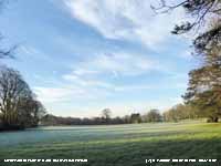
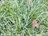
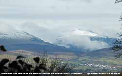
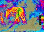
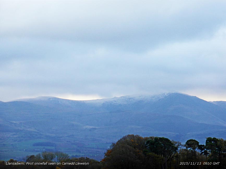
More or less a clear sky overnight and as a result the air temperature on the morning of the 4th was down to 1.3C and there was a ground frost -4.0C. There was no white frost, but clear ice frozen on grass along with frozen dew drops. The storm-cock sang for a few minutes. The sky was partly cloudy and the sun appeared over the tops of the Carneddau at 0900 GMT today. There was some fog in low-lying parts including over Llyn Tegid at Bala and coastal areas including Liverpool Bay and on the west coast of Anglesey it was cloudy. Pressure was on 1035 mb and there was a very light SE'ly breeze. It was sunny by 1030 GMT and it was fine and sunny here and on the mountains under snow it was brilliant on the tops. There was a cool breeze in the afternoon with much high cirrus cloud and smoke from a fire in the west, the temperature reached 7.6C at 1216 GMT with the day keeping dry. [Max 8.5C Min 1.3C Grass -4.0C Pptn nil] Scilly 11.0C; Lerwick 7.0 mm; Waddington 6.4h, Hawarden 5.8h. There had been a colourful read sky around 0800 GMT on the 5th and the sky at 0900 GMT had 6 oktas cover as cloud was pushing on to western hills. Visibility was good over the Carneddau where snow was lying at 2750 ft with broken snow at 2500 ft with bright sky towards Conwy. Areas of light snow were evident in places the result of recent showers. The mistle thrush sang continuously this morning from dawn. Mostly cloudy with thicker cloud by evening. [Max 9.1C Min 3.1C Grass -0.2C Pptn 3.2 mm] Achnagart 12.9C, Gorwel Heights 12.2C, Llandegfan 12.4C; Eskdalemuir 6.4 mm; Sheffield 5.0h. The 8th began brightly with a clearing sky and cool enough for a touch of ground frost (-0.6C) with some sunshine during the morning. Pressure 1016 mb at first was rising reaching 1023 mb by 1600 GMT before starting to fall. Deep low 983 mb S Iceland was deepening rapidly to 967 mb at 1800 GMT and 960 mb by midnight. Hurricane force 12 winds were experienced in NW Scotland where Stornoway had a record 119 mph gust that brought down large trees. Damage and loss of power for several days was widespread in Scotland. There were gales here too; at Valley there were force 8 gale winds reported between from 2050 GMT. Gorwel Heights and Gorddinog had a gusts of 55 mph and 54 mph from 2300 GMT while gusts of 118 mph were reported on Snowdon, and 99 mph at Mynydd Rhiw and Aberdaron (SkyLinkWeather.com). Here and at Amlwch 44 mph was recorded. Moles are very active putting up lines of mole hill in the surrounding fields. I hope they stay there! [Max 9.7C Min 5.2C, Pptn 2.6 mm] Swanage 12.0C Gorwel Heights 10.3C; Shoreham {33.0 mm} [Herstmonceux 31.2 mm, Liscombe 22.8 mm, Capel Curig 15.4 mm] Aberdeen 5.5h. Strong winds continued after midnight with gusts of 42 mph at Gorwel Heights at 0110 GMT. The 9th was a dull and sunless day. Pressure at 0900 GMT was 1018 mb was rising and there was thinner cloud looking towards the Nant Ffrancon Pass with a little brightness for a while. Rain from 1120 GMT, heavy 1250 - 1310 GMT up to 12 mm/h, ending 1400 GMT accumulated 11.0 mm. The wind also started picking up during the morning with gusts 55 mph in neighbouring village Llandegfan at 1156 GMT, 44 mph here at 1356 GMT and 49 mph at Gorwel Heights at 1330 GMT. Very mild in the warm sector: Gorwel Heights reached 14.9C at 1700 GMT and Gorddinog AWS 14.8C, Llansadwrn 12.6C AWS 12.8C at 1955 GMT, all without the aid of solar radiation. Exeter 16.5C; [Capel Curig 48.4 mm]; Hurn 3.6h, Valley nil. With no overnight frosts the 10th began bright and breezy with the W'ly force 4/5 and earlier (05 GMT) touching gale force at Valley and gusting here to 47 mph. The AWS temperature at 0010 GMT was 11.7C, but at Gorwel Heights was 13.9C; Gorddinog AWS reached 13.7C at 0230 GMT. Some extreme wind gusts were reported on the SkyLinkWeather.com website at 09 GMT over the past 24-hours: Cairngorm 144 mph, Snowdon 137 mph, Aonach 134 mph, Walsall 94 mph, Capel Curig 91 mph, Rhyl 56 mph and Hawarden 49 mph. There was a gust of 57 mph in Llandegfan PWS at 0058 GMT. The temperature began to fall from 11.0.C at 0600 GMT and was 5.7C (dewpoint 2.8C 83% RH) at 0900 GMT. The sky was clearing from 0830 GMT as a cold front cleared away. After recent high winds the drying windows were encrusted with sea salt. Kept fine and bright with some sunshine, out of the wind quite pleasant with a maximum of 6.5C; snow appeared absent on the Carneddau Mountains in the afternoon; Snowdon was obscured and probably having flurries of snow. Became very windy again by evening; Valley reported mws of 44 mph at 17 GMT and continued strengthening to mws 49 mph force 9 by 2200 GMT gusting 65 mph. [Min 5.7C Max 6.5C; Pptn nil] Shoeburyness 14.6C; Lake Vyrnwy [10.8 mm]; Leconfield 6.0h. After a little brightness seen at 0900 GMT over the Nant Ffrancon Pass the 11th was dull and sunless. There had been a touch of ground frost (-0.7C) and there was a moderate W'ly breeze with a temperature of 5.3C. Pressure 1022 mb was rising and with complex low 972 mb between S Greenland and Iceland and high 1037 mb Bay of Biscay we were in a brisk W'ly airflow. Fine most of the day with a slight shower during the afternoon. By evening the wind was strengthening again gusting 44 mph at 2228 GMT when the AWS temperature had risen to 8.3C and 8.6C at Gorwel Heights and Gorddinog. [MIn 3.4C Max 9.6C Pptn 9.0 mm]. Bude 10.1C; [Loch Glascarnoch 57.0 mm, Capel Curig 19.4 mm]; Wattisham 4.3h. Strong to gale force SSW'ly winds again after midnight on the 12th (Valley f8 between 01 and 07 GMT). Here and at Gorwel Heights gusting to 44 mph and at Gorddinog 51 mph at 0450 GMT. Mild again too; at 0900 GMT here 9.6C and 10.2 C at Gorwel Heights. Moderate rain had ceased and was slight intermittent for a while before a shower at 1000 GMT. Then the sky began to clear in the afternoon as a cold front passed through with a little mostly weak sunshine developing later. [Min 5.2 Max 9.6C Pptn 3.3 mm]. Exeter 12.5C; Capel Curig [43.4 mm]; Aberdeen 5.0h, Valley 0.1h. There had been a touch of ground frost (-0.3C) overnight and the morning of the 13th was mostly cloudy Pressure was steady on 998.8 mb and the temperature 3.5C (dewpoint 0.6C) indicating a 40% chance of some ice precipitation. There were sprinklings on the mountains and by 0930 GMT it was snowing there. Bands of snow showers moved across from the W, but with the temperature rising here we had light rain. The weather station blackbird was missing. Regular for a few years around the garden and coming for tit-bits at 0900 GMT every day and on the vegetable plot when digging. Fine and sunny in the afternoon, but with a cold wind. Small tornadoes were reported in Haverfordwest and Harrow during the day. [Min 2.4C Max 5.2C Pptn 0.3 mm]. Swanage 10.3C; Aboyne min -2.2C; Lerwick [27.8 mm]; Yeovilton 4.5h, Valley 1.8h.
A clearing sky brought a fine morning on the 15th, but it was still very windy the SW'ly gusting 42 mph at 0611 GMT. Snowdon summit had a gust of 116 mph, Aberdaron and Mynydd Rhiw 98 and Capel Curig 73 mph (SkyLinkWeather.com). Hard hat used for obs at 0900 GMT; weather too rough to go out walking today. Showers later in evening with snow pellets falling at 2330 GMT. [Min 1.4C Max 6.8C Pptn 3.5 mm]. Shoeburyness 10.0C; Tyndrum 69.4 mm, Tredegar 33.8 mm; Yeovilton 5.4h, Valley 3.4h.
A wintry morning on the 19th with early showers of snow pellets and flakes of snow covering concrete, but the grass had <50% cover. Snowing more so on the mountains with 50% cover at 1750 ft and with some as low as 750 ft on the lower slopes of the Carneddau. At 0900 GMT the temperature was 0.0C (dewpoint -1.8C). Overnight the air minimum had been -1.5C and down to -6.0C on the grass.
There were some small patches of blue sky to be seen at first on the 23rd, but these disappeared and the day was cloudy and dull. Pressure 1020 mb was falling and low 971 mb near the Denmark Strait had associated fronts over Ireland and NW Scotland. There was showery rain by 1140 GMT and slight rain in the afternoon turning to heavier rain later.
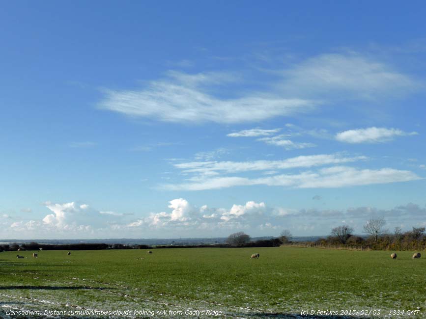
The 28th began still in warm sector air with temperatures 8.5C here at 06 GMT and 10.1C at Gorddinog AWS 0541 GMT and Gorwel Heights 9.9C 0347 GMT. A cold front began to pass over at 0730 GMT with heavy bursts of rain and small hail falling up to 44 mm/h at Gorwel Heights; 54 mm/h in Llansadwrn, and 70 mm/h at Gordinnog at 0750 GMT gusting to 45 mph and over 100 mph on Snowdon where the temperature change was +5C to -4C. The cold front introduced showery polar maritime air and there were more showers of ice precipitation from sea level up to the mountain summits where there were scatterings left on the ground by midmorning. The afternoon was windy with some sunny spells, well developed cumulus clouds were in the vicinity, a cumulonimbus over the mountains,and there were slight showers of snow pellets at times continuing into the evening [Min 4.5 Max 5.2 Pptn 0.6 mm]. Swanage 11.1C; Achnagart 32.2 mm, Capel Curig 26.0 mm; Valley 3.9h.
February 2015February 1 - began fine and sunny with snow on the Snowdonia Mountains. Pressure 1005 mb was rising as a ridge of high pressure moved in from the Atlantic.
Fine and sunny on the morning of the 4th the cloud having cleared, but no air frost. Bare soil was frozen hard with the ground minimum -7.5C. There few a few cumuli over the mountains with crepuscular rays as the sun rose over the Carneddau. Snow was lying at 1250 ft with 30% cover at 650 ft.
A bit different on the 13th as temperatures were rising reaching 8.0C here, 10.3 C at Gorwel Heights and 10.5C (screen) at Gorddinog at 0900 GMT these by convention were creditied to the 12th. Also a few spots of rain had fallen. Pressure 996 mb was falling quickly with a low 987 mb over Ireland. Turning brighter with a few glimpses of sunshine before showers in the afternoon the precipitation falling as snow pellets and snow at 1500 ft on the Carneddau Mountains. [Max 9.5C Min 4.8C Pptn 1.5 mm] Killowen 10.7C Porthmadog 10.4C; Usk 21.2 mm; Bude 2.2h, Valley 1.4h. By the morning of the 14th fog had developed and at 08 GMT visibility was 200 m, but then as the fog dispersed was very poor at 0900 GMT and soon turned sunny with Valley sunniest reporting 7.4h. [Max 8.7C Min 2.8C Grass 0.0C] Bridgefoot 12.3C Altnaharra min -6.4C; Reading Univ. 11.0 mm; Valley 7.4h. On the 15th with 5/8 of clear sky the temperature at 0744 GMT had dipped to 2.0C, on the grass -3.0C, rising to 4.2C at 0900 GMT. An air of a breeze from the SE shown by smoke drift and very good visibility the sun rising over the Carneddau at 0800 GMT. We were in a clear area between and frontal cloud to the W over Ireland, low cloud/ fog over central England and sheets of stratocumulus in the E over the North Sea. In a light SE'ly the temperature had risen to 12.6C by 1300 GMT (Gorwel Heights 11.8C and Gordinnog 12.4C). There was light to moderate rain from 2300 GMT. [Max 12.6C Min 2.0C Rain 8.0 mm] Bridgefoot 12.4C and min -1.5C; [Islay 23.8 mm Capel Curig 16.6 mm]; Morecambe 7.5C, Valley 6.6C. The 16th began dull and damp with poor misty visibility after overnight rain, but brightened up with sunshine coming along. Pressure 1012 mb was rising with low 972 Iceland and high-pressure 1046 mb Gulf of Finland and 1033 mb Azores. Shower of rain and small hail around 2100 GMT. [Max 8.6C Min 3.9C] Plymouth 9.8C; Cluanie Inn 20.2 mm; Valley & Thomastown 5.0h. Some clear sky after midnight, aurora were seen from Anglesey and along the North Wales coast including Llandudno; frost developed early on the 17th with the air minimum down to -0.5C and -5.9C on the grass. There was a shower of snow pellets just before 08 GMT and some pellets were still on the extensively frosted ground at 0900 GMT. There was a little rime on the rim of the copper raingauge. The sky was becoming mostly cloudy the frost soon melting; and there were some vertical crepuscular rays looking towards the Ogwen Valley. Visibility was clear and very good at first becoming hazy later. Pressure was 1036 mb in a ridge from high 1048 mb over the Celtic Sea. [Max 8.2C Min -0.5C] Plymouth 11.1C Topcliffe min -4.3C; Resallach 17.4 mm; Wittering 9.3h. Overcast and dull on the morning of the 18th with moderate visibility and low cloud. The sky looked lighter towards Conwy, but W Anglesey had mist and drizzle. Slow to lift and there no clearance the day sunless. Across the water the sun was shining along the coast towards Llanfairfechan where the temperature rose to 13.4C at 1320 GMT and 13.2C at Gorddinog (screen), while here under the cloud the highest was 8.5C. [Rain 7.0 mm] Fyvie Castle 15.6C Gorwel Heights 13.4C, Hurn min -4.6C; Achnagart 54.6 mm; Lyneham 9.5h. On the 19th with continuous moderate rain and standing water on saturated ground at 0900 GMT (8.6 mm/h and 12 mm/h at Gordinnog) introduced another mostly dull and wet day. Pressure was 1015 mb with low 970 mb Iceland and high 1037 mb Azores. The temperature 7.8C (the day's maximum) was falling as a cold front passed over. The rain ceased and the morning brightened with a shower of rain and soft hail at 1240 GMT. Brighter again in the afternoon with glimpses of sunshine late in the afternoon. [Rain 5.1 mm] Murlough 11.3C Frittenden min -0.6C; Capel Curig 43.2 mm; Aldergrove 6.1h. The sky had cleared for a while in the night allowing the minimum to fall to 0.5C and to -4.5C on the grass freezing the wet grass. It had turned cloudier by dawn on the 20th , but at 0900 GMT there were signs of the sky clearing again with a little sunshine at times. A little fresh snow was seen on the mountain summits. A few slight showers of rain from 1530 GMT. [Max 7.5C Min 0.5C Rain 0.5 mm]. Scilly Is. 9.4C Katesbridge min -4.1C; Herstmonceux 19.6 mm; Kinloss 7.3h. After midnight on the 21st there were slight showers ice precipitation with tell-tail snow pellets marks recorded on the hailometer. There was a little fresh snow on the Carneddau slopes as low as 1750 ft near the Black Ladders. There was a light NW'ly breeze and the air temperature 2.8C the grass minimum having been down to -3.0C. Bright with some sunshine, wintry showers continued on the mountain summits during the morning. Cumuli were in the vicinity and we had a few spots from a passing dark one in the afternoon. The sky clearer later and it was a frosty on the ground by evening. [Max 8.8C Min 1.2C Pptn tr]. Solent 9.4C; Balmoral For. 16.0 mm; Boulmer 9.2h. A fine morning at first on the 22nd, but it was overcast and precipitation was in sight at 0900 GMT this falling as snow on the mountains as low as 1500 ft. Pressure was 1001 mb, and it was windy the S'ly force 5 and strengthening. The temperature was 4.6C (dewpoint 1.8C), but only a 20% chance of ice precipitation, . We did not have any, but there was a slight rain shower at 0920 GMT when the mountains were closed in with low cloud. A frontal system moved eastward across the Irish Sea with triple point over Cumbria in the afternoon (Gorwel Height wind gust 47 mph) when the temperature here dropped to 3.8C then rising again to 8.9C at 1628 GMT and 10.5C at Gorwel Heights at 1830 GMT. Just before midnight the air temperature falling again was 4.8C and RH 80%. [Max 8.9C Min 0.3C Pptn 4.4]. Murlough 11.6C Gorddinog 11.0C, Benson min -5.9C; Threave 32.8 mm; Manston 4.9h. Strong winds continued on the 23rd with pressure on 986 mb with low 952 mb off Cape Wrath, Scotland. It was fairly bright at 0900 GMT with 6 oktas cloud cover and good, but hazy visibility, and there were some sunny spells. It was difficult to walk along the Gadlys Ridge in the afternoon the wind near gale force. I saw a flock 45 of redwings were seen on the sheltered wet field at Curlew Gate on Peacock Hill. In the evening gales were reported at Valley (Gusts at Gorddinog 49 mph, Llansadwrn & Gorwel Heights gusts 39 mph) before the wind dropped with only a small temperature fall of about 1.5C here at 2200 GMT. As a result a quieter night. [Max 7.3C Min 2.7C Grass -0.5C]. Gravesend 9.4C Valley 7.9C Cassley min -3.0C; Tyndrum 40.8 mm; Leeming 8.3h. Breezy again on the morning of the 24th, but fairly bright with good hazy visibilty. Pressure 1003 mb was rising with the low moved E to be over Shetland while pressure was high 1037 over the Atlantic W of Cap Finisterre. The afternoon had sunny spells and with some dark cumuli around a few spots of rain at 1500 GMT; Valley reported a small hail shower at the same time. [Max 7.6C Min 3.2C Grass -0.1C]. St. James Park 10.8C; Cassley 31.0 mm; Leuchars 8.6h. After midnight on the 25th there were showers of small hail and the sky was mostly cloudy in the morning. Pressure 1013 mb was rising with a new low 964 mb SE Iceland. The day kept dull, signs of brightness in the morning did not improved and the afternnon thicjer cloud brought drizzle by midafternoon thew rain later. One curlew spotted at Curlew Gate and 5 crows in another field graze by sheep; we seem surrounded by sheep and lambs at the moment. With a warm front crossing the Irish Sea temperature remained elevated in the evening being 10.0C at 2042 GMT and was 13.3C at Gorwel Heights and 13.2C at Gorddinog just after midnight. [Max 10.0C Min 3.8C 13.0 mm]. Bournemouth 14.0C Usk 13.9C Aboyne min -4.2C; Tyndrum 12.4 mm [Spadeadam 24.2 mm]; Boulmer 6.7C]. Moderate to heavy rain after 02 GMT heaviest around 07 GMT on the 26th 13.4 mm/h had ceased by 0900 GMT with 13.0 mm recorded. Enough now that the local soil is saturated to leave small puddles about the weather station. At 0420 GMT the temperature was 9.4C and this had fallen to 5.7C by 0830 GMT as a result of a cold front associated with low 944 mb SE Iceland. The sky was leaden and visibility was poor. At Gorwel Heights the temperature at 0156 GMT was 13.3C and 13.2C at Gorddinog at 0010 GMT in warm sector air Föhn-like wind, the maxima for the 24-h ending 0900 today. Slow to brighten in the morning, but brightening all through the afternoon being quite sunny later. [Max 9.0C Min 5.7C Rain nil] Max Exeter AP 11.9C; Spadeadam 32.0 mm, Bala 23.6 mm; Aldergrove 6.1h, Valley 5.5h.
The month ended with a precipitation total of 50.8 mm (72%) & [65%] of averages, lowest since 2010 ranking 28th since 1929. The mean temperature 4.6C (-0.8) & [-0.7] of averages was lowest since 2013 ranking 10th since 1979.
March 2015
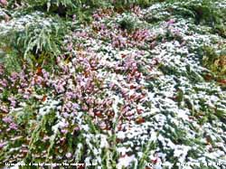
March 1 - DYDD DEWI SANT - with a moderate WSW'ly breeze, fairly mild overnight and no frost. Low 964 mb was over the S Norwegian Sea, but here pressure 997 mb was rising. Later the morning turned cloudier and in the afternoon a band of precipitation moved across from the west falling as light snow above 1250 ft on mountains from Llyn, Snowdon, and Glyderau to the Carneddau, most on the west of the range. Strong winds continued around midnight on the 8th with gusts 40 mph in Llansadwrn, 42 mph Gorwel Heights and 46 mph at Gorddinog. By morning winds had moderated and there was fog at 0730 GMT this lifted by 0900 GMT when visibility was poor in light to moderate rain resulting in a little standing water. Later a more pleasant afternoon becoming sunny the temperature rising, from the highest of the month overnight minimum of 7.6C, to 10.3C. Charlsfield 15.4C; Achnagart 29.6 mm Capel Curig 18.4 mm; Manston 6.6h. The sky had cleared in the night resulting in the hardest ground frost -4.5C of the month, and air minimum 1.0C, but the clearer sky early (that turned red at 07 GMT) on the 9th had vanished by 0900 GMT. The strong wind had returned and was S'ly force 5 soon rising to force 7/8 around 10 GMT when Valley reported mws 41 mph. Gorwel Heights reported at gust of 54 mph at 1100 GMT. Gorwel Heights again reported temperature enhancement 13.4C at 1250 GMT and 12.9C at Gorddinog compared with Llansadwrn's 10.3C. [Max 10.3C Min 1.0C Pptn 3.7 mm] Murlough 13.0C Min Topcliffe -5.4C; Achnargart 22.6 mm Capel Curig 15.4 mm; Kinloss 4.8h. The 10th began with hardly a cloud in the sky with frost on the grass (minimum -4.4C). Pressure 1031 was rising quickly and while there were cumuli to the N and the odd passing cloud the day was sunny with moderate visibility and haze.. There were masses of honeybees on the banks of flowering heathers in the garden, moving around seeking the sunniest parts during the day. I counted 15 large early bumblebees as well, these will tolerate the shade and be about on cold dull days when the honeybees are not. The population of wild bees has built up over the years since we established the bee-friendly garden and we see different species all through the spring, summer and autumn. [Max 11.4C, Min 1.1C] Herstmonceaux 14.3C min Pembray Sands -2.4C; Cassley 18.8 mm; Morecambe 10.6h, Valley 10.1h. Mostly clear sky overnight, but cloud was developing on the morning of the 11th. Pressure 1021 mb was falling with a frontal-wave low off the Western Isles and warm front over the Irish Sea. Highs 1038 mb were over N Finland and 1027 mb over Spain. There were spots of rain from 0840 GMT and the SSW'ly force 4 was strengthening. Light rain in the morning, keeping dull with slight rain at first in the afternoon, then clearing later with shallow fog formed on the fields before evening. [Max 11.9C Min 2.7C Grass -3.9C Pptn 3.2 mm] Northolt 14.7C Aboyne -6.7C; Cluanie Inn 23.4 mm Capel Curig 15.4 mm; Herstmonceaux 7.1h Valley 2.9h. A rather dull morning on the 12th with thickening cloud. Pressure 1019 mb was falling with a warm front over the Irish Sea associated with low 964 mb S Iceland. Pressure was high 1038 mb over N Finland and 1027 mb over Spain. Showery rain at first turning moderate to heavy at times in the afternoon, local roads were awash. Jointly with the 11th the maximum 11.9C was highest of the month! The day's rainfall, 18.5 mm, was the largest of the month. It rained from 1300 to 0200 GMT the 24-h having 14 hours rainfall duration. [Max 11.9C Min 3.9C Pptn 18.5 mm]. Dull again on the 13th, signs of brighter and lighter patches did not develop and we had a sunless day. An occluded front was over central England and France. Fields had pools of water on them and there was slight drizzle and or slight rain through the day, but of unmeasurable amount, it just made for a horrible day! The day's maximum 6.1C, was also lowest of the month! [Max 6.1C Min 3.6C] Cranwell 13.0C; Bainbridge 26.6 mm; Thomastown 10.9C. 3.1415 Pi Day was celebrated today on March 14th (3/14/15) around the world in honour of mathematician William Jones from Llanfechell, Anglesey who, in 1706, was the first person to use the Greek letter as the symbol to represent the constant of the ratio of the circumference of a circle to its diameter, approximately 3.14159. A much more pleasant morning with pressure 1035 mb rising with highs 1045 Norway and 1032 sea area FitzRoy. Hardly a cloud in the sky, except a line of low clouds over the mountains. There had been a frost on the grass (-1.8C) early. There was a moderate E'ly breeze and moderately hazy, moderate visibility, then turning cloudier by 1000 GMT. The day kept bright with sunny spells and was dry! The sky was overcast again by evening. [Max 7.6 Min 1.2] Kinlochewe 12.0C Aviemore min -4.6C; Kinloss 10.7h. A cloudy night and still overcast at 0900 GMT on the 15th. It was dry, even the grass. The temperature was 4.9C (dewpoint 2.7C RH 86%) and the day dull and cool with a few brighter spells. [Max 7.7C Min 1.5C] Aviemore 13.5C Aboyne min -7.5C; Kenley 2.6 mm; Kinloss 10.7h. The dull weather continued on the 16th, overcast and grey. Very hazy the visibility moderate. The cloud was thick enough for some very fine, non wetting drizzle at times in the afternoon. Sunless. [Max 6.3C Min 3.6C] Santon Downham 10.4C; Benson 9.4 mm; Tiree 4.5h. The 17th began fairly bright with 7 oktas cloud cover. Visibility was very poor and the day kept mostly cloudy with a few spots of rain here although conditions were clearer in the west where Valley reported 7.9h sunshine! [Max 9.3C Min 2.9C] Herstmonceaux 14.1C; East Malling 12.6 mm; Stornoway 8.8h. In contrast the 18th began fine and sunny after heavy overnight dew and frost on the grass (min -3.7C) . Visibility was very poor in moderate smoke haze. Some cumulus cloud formation at first, then cloud dispersing to give hazy sunshine in the afternoon and evening. Brightest day so far with 574 watts m -2 recorded at noon, with total global radiation of 13.45 MJ m -2 , and the temperature creeping above 10C after 5 rather cool days. [Max 10.3 Min 1.5C] Castlederg 13.7C Porthmadog 13.0C Katesbridge min -5.6C; Camborne 10.5h Valley 9.4h..
The 21st began with a clearing sky so it was sunny although the NNE'ly breeze felt chilly in a temperature of 6.4C (87% RH), up from a minimum of 3.6C in the night, rising to 10.0C by afternoon. A dry day, hardly any rain anywhere in UK. Sunny! The sunniest day of the month global solar radiation reaching 14.44 MJ m -2 and RAF Valley reporting 11.5 h bright sunshine. Plymouth 14.5C Porthmadog 14.3C; Houghton Hall 1.2 mm; Glasgow & Valley 11.5h. Even less cloud on the morning of the 22nd, just 2 oktas at 0900 GMT. A ground frost -3.4C early whiteness had long disappeared, and air minimum of 0.6C had risen to 5.8C and went on to 10.5C at 1321 GMT. Sunny with very good visibility, just snow patches were left on the mountaintops. St Helen's Bay 14.8C Bala 11.6C; Lerwick 16.8 mm; Morecambe 11.2h, Valley 10.7h... On the 23rd pressure was steady on 1016 mb with low 981 mb over the Norwegian Sea with associated cold front over Anglesey. Atlantic-high 1034 mb was over W FitzRoy. A dull morning, but slowly brightened and cleared up fine by afternoon with a sunny evening. Sunniest and warmest in the north today. [Max 11.0C Min 3.9C] Durham 12.7C; Writtle -4.2C; Stornoway 8.9h. Early on the morning of the 24th there was shallow fog over frost covered fields (grass minimum -4.1C), but this had all disappeared by 0900 GMT. The air minimum temperature was down to 0.1C, lowest of the month. There were cumuli clouds to the N on a showery trough and a few spots of rain came along. Pressure was 1012 mb with low 1003 mb over Faeroes. We had a shower of snow pellets at 0950 GMT and fresh light snow was seen on the Carneddau Mountains as low as 2000 ft, then some sunny spells during the day between rather dark cumuli from time to time. We caught another heavier shower of small hail (wet snow pellets) at 1802 GMT this falling at a rate up to 14.4 mm/h, with a little more snow on the mountains. [Max 9.8C Min 0.1C Pptn 1.9 mm] Boscombe Down 11.0C; Topcliffe -5.3C Bala -2.6C; Kinloss 8.9h Valley 3.9h.
Pressure 994 mb was steady at midnight on the 31st and by morning was 1008 mb and rising. Fine and bright with clearing sky at 0900 GMT and a moderate W'ly breeze the temperature was 7.0C (dewpoint 3.2C 77% RH), very muddy undefoot on grass. Sunny, but breezy in the afternoon, with a 30 mph speed restriction on the Britannia Bridge, and a couple of showers that included small hail. The wind moderated in the night. {Max 10.3C Min 5.5C] Shoreham 14.5C; Tyndrum 28.0 mm Lake Vyrnwy 13.0 mm; Boulmer 10.8h. The month ended with a precipitation total of 74.7 mm (107%) & [88%] of averages, lowest since 2013 ranking 34th largest since 1929. The mean temperature 6.4C (-0.5) & [-0.6] of averages was lowest since 2013 ranking 12th since 1979. Sunny at Valley the estimated sunshine (148h) was 9th sunniest in March on the Anglesey record since 1931. April 2015April 1 - our harbinger of spring the chiffchaff was singing strongly, but the weather was not very spring like on this mostly cloudy morning. Fine early there were spots of rain at 0900 GMT with more showers in the vicinity and mainland. A cool 5.5C. Pressure was 1024 mb with complex low 981 mb over the Norwegian Basin and a detached frontal-wave over NE Scotland. To the W was a warm front associated with low 944 mb S Greenland while pressure was high 1038 mb off Cap Finisterre. There was more rain in the afternoon and the wind strengthened during the evening. [Pptn 12.0 mm, largest fall of the month] Heathrow 12.3C; Resallach 16.6 mm; Morpeth 7.4h.
Cold enough on mountain summits for a little snow fall on the morning of the 2nd with a sprinkling seen on the NE-facing side of Carnedd Llewelyn just covering the last remaining snow patch on this flank. Overcast with moderately high altostratus. The sun broke through briefly, with the temperature struggling to 8.4C at 1252 GMT, before spots of rain mid-afternoon turned light to moderate later on with the temperature rising to 8.7C at 2121 GMT. [Pptn 3.7 mm] Scilly 13.0C, Rhyl 11.0 mm; Leconfield 10.8h, Valley 0.1h. On the 3rd a complex slow-moving frontal system with triple point over Cardigan Bay brought another dull day.
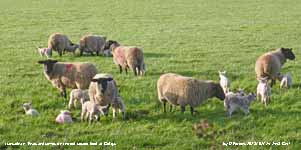
With a bright Moon (full on the 4th) in the fog the grassy fields were shining eerily white with frost. The air temperature had fallen to 1.1C and the grass minimum had been down to -2.5C, but any remaining traces of frost had disappeared by 0900 GMT on the 6th with grass very wet with heavy dew. Clouds were developing and the morning cloudy for a while before dispersal brought warm sunshine in the afternoon, and a temperature of 15.5C, bringing out honeybees to join the all-weather large early bumblebees. It was a nice evening. Fog persisted all day in parts of the Menai Strait at Llanfairfechan (photo courtesy of David Lee) and Port Dinorwic (Y Felenheli) obscuring the usual views of Anglesey where it remained sunny. Usk 19.9C Braemar -3.0C; Lerwick 1.2 mm; Nottingham 12.4h Valley 12.3h. With some cloud developed overnight the air temperature did not fall below 5.5C and to 1.6C on the grass where there was moderate dew. The morning of the 7th had bright hazy sunshine (slight haze) good to very good visibility and a temperature of 11.4C (dewpoint 7.5C 77% RH). Fog again persisted in places including the Menai Strait at Port Dinorwic Fine and sunny afternoon in Llansadwrn, warm the temperature rising to 17.6C. Plenty of bees around, now the early bumblebee Bombus pretorum, buff-tailed Bombus terrestris and Carder Bombus pascuorum along with honeybees, and peacock and small tortoiseshell butterflies were in the garden. The primroses and coloured primula hybrids are in full flower now and these are visited by the bees and butterflies as well as the massed Ericas on rockery banks. The humming, when it is quiet when traffic stops, is something to be appreciated on this warm sunny day. Usk 19.3C; Santon Downham -2.7C; Kinbrace 6.4 mm; Aberporth 12.3h. A fine bright morning on the 8th with cloud although mostly high increased during the warm morning. At 0900 GMT the temperature was 14.4C and went on to reach 17.6C by noon. Visibility was very good at first, haze (poor air quality and dust) increased in the afternoon. Northolt 19.5C Porthmadog 18.7C, Tyndrum min -3.5C; Camborne 12.3h. By the 9th cloud had decreased and with just a few over the Snowdonia Mountains the day was sunny. Visibility was poor with moderate haze the result of poor air quality and Saharan dust. Pressure was 1027 mb in a ridge of high-pressure from high 1035 mb over E Europe. Waiting in the wings were fronts associated with low 995 mb S Iceland. There was a light SSW'ly breeze and the temperature rose to 17.9C in the afternoon. Fyviie Castle 20.6C Eskdalemuir min -2.1C; Manston 0.2 mm; Aberdeen 12.6h Valley 12.3h. Fine and sunny again on the 10th after a mild night with no frost. Pressure 1015 mb was falling quickly with deepening complex low 982 mb S Iceland and tightening isobars to the north-west. After being calm a good part of the night winds were light (E - S) at first, but strengthened later. The temperature at 0900 GMT was 13.7C rising to 20.1C at 1300 GMT (Gordinnog 20.2C and Gorwel Heights 20.3C) highest of the year so far and breaking the 20C threshold for the first time! Visibility started good in the morning, but deteriorated to poor as a result of poor air quality and Saharan dust. Then turning cooler in a freshening wind in mid-afternoon. St James Park 21.9C Trawsgoed & Gorwel Heights 20.3C; Katesbridge min -3.5C; Lerwick 11.4h. Overnight frontal systems, associated with low 966 mb over SE Iceland, brought light precipitation in from the W, it was cold enough on the mountains to fall as snow with light covering at 2500 ft and sprinklings as low as 2000 ft on the Carneddau. After a pressure low of 1006 mb at 0255 GMT on the 11th pressure 1015 mb was rising quickly. A almost clear sky earlier, with fronts to the E, was turning cloudier at 0900 GMT with cumuli being blown along on a moderate to fresh W'ly breeze. In complete contrast to yesterday a warm hat and mittens were deployed for the obs, such are the vagaries of the British weather. Overnight minimum 6.2C and the maximum today - 10.1C less than yesterday! A breezy afternoon and strengthening in the evening. Langdon Bay 14.8C; Dunstaffnage 18.4 mm; St Athan 11.5h.
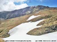
On the morning of the 14th the slight covering of snow on the mountains had disappeared leaving a few snow patches high on Snowdon and Carnedd Llewelyn. Mostly cloudy again, but moderately high and there was good, but hazy visibility. The afternoon cleared up and turned sunny with a maximum of 13.0C at 1313 GMT. At Gorwel Heights a Föhn-enhanced 17.8C with RH down to 32% was recorded and at Gorddinog screen 17.3C and AWS 30% RH. It was very wet in NW Scotland. Shoeburyness 22.8C Usk 19.7C; Achnargart 64.6C; Wattisham 13.1h. Much the same on the 15th with cloud thickening enough for intermittent fine drizzle early and in the morning, and at times to produce slight rain in the afternoon. Later the rain ceased and the sky began to clear in the evening. [Max 9.5C Min 7.2C Pptn 0.5 mm] Summer in the south-east today Frittenden 25.1C Cardiff 20.6C Capel Curig 9.3C; Shoreham min 1.9C; Achnagart 15.4 mm Mona 0.6 mm. In contrast there was hardly a cloud in the sky on the morning of the 16th, mostly well above the mountains and predominately cirrus and cirrostratus elsewhere. Sunny. Visibility was excellent in clean air the murk having moved away. Pressure was 1018 mb with high 1018 mb charted over S Scotland. Fronts were to the S of here over the Channel. The temperature at 0900 GMT was 9.3C (69% RH), up from the overnight minimum of 4.7C and a grass minimum of 0.7C, and this rose to a dizzy 12.3C just after 13 GMT. A few clouds developed later on these disappearing before evening. We have 2 chiffchaffs singing, one in the wood and the other in the garden; a female orangetip butterfly flew by. Planted 3 rows of Arran Pilot potatoes. Hurn 22.1C Cardiff 18.0C; Stornoway 3.0 mm; Morpeth 12.9h Bala 10.6h. Cloud began to encroach soon after dawn on the 17th and by 0900 GMT the sky was mostly cloud covered. Dull with poor visibility due to aerosol smoke and dust. I heard a blackcap singing for the first time here this morning. The sun occasionally broke through with some hazy sunshine and there was a brief clear sunny slot around 1115 GMT when the temperature 17.0C felt very pleasant indeed, beating Gorwel Height's 14.4C on this occasion. It did not last and the afternoon kept mostly cloudy, breezy and dry; Porthmadog with 17.4C was the warmest place today. Porthmadog 17.4C Altnaharra -3.2C; Scilly 1.4 mm; Stornoway 13.5h. A rare cloudless morning on the 18th with no significant cloud seen all day. Pressure was steady on 1030 mb; the frontal cloud of yesterday had moved S and was over Brittany and France to N of Italy. There was a light to moderate E'ly breeze, the temperature rise was from a minimum of 3.8C to 13.3C, and enhanced the drying of the garden plot. Under grass the soil moisture yesterday was 54% dm and on the bare met plot down to 36%. Usually one of the driest months rainfall this April to date has been 28.7 mm [(45%)] of average. Achnagart 17.6C Braemar min -4.3C; Scilly 0.6 mm; Tiree 13.7h Valley 13.2h. The 19th began with a little mostly high cloud and some cumulus over the mountains. Visibility was very good and there was the cool ENE'ly breeze. Overnight the air minimum was down to 3.0C and on the grass 0.3C with heavy dew formed. The damson tree is coming into flower but apple flowers have not yet appeared. Ash trees are flowering and flowers on horsechestnut are about to open. Buds on beech are still tight, some sycamore have leaves. The morning turned cloudy as a patch of remnant frontal cloud moved across from the E and did not clear until late afternoon. The maximum today 11.1C and no rain. Achnagart 16.2C Kinbrace min -4.4C Bala -3.1C; Bingley 1.6 mm; Stornoway 13.9C Valley 10.6h.
Another sunny day on the 20th with just a little cloud seen at 0900 GMT. A touch of ground frost overnight (-0.8C) and heavy dew on the grass, but the air minimum went no lower than 3.5C. A lighter breeze at first, but strengthened in the afternoon. Maximum temperature 14.5C. Otterbourne 20.2C Aviemore min -3.5C; Castlederg 3.0 mm; Morecambe 13.5h. The 21st was a sunny day, with hardly a cloud to be seen, and very good visibility. The temperature rising from an overnight minimum of 5.2C reached 15.3C in the afternoon. A male orangetip butterfly was seen in the garden along with several holly blues and a blackcap was singing in a nearby wild cherry tree just coming in to bloom here. Oak trees in the Conwy Valley have leaves opened, ash are still at the flowering stage. Early types of beech have bright light green leaves and some early sycamore are in leaf as well. Snow patches were persisting on Garnedd Ugain on Snowdon, Carnedd Llewelyn including the 'deep cut' and on Glyder Fawr at Cwm Idwal. Porthmadog 21.3C Aviemore min -3.6C; Morpeth CP 13.8h Valley 13.5h. A warmer day on the 22nd in sunshine at 0900 GMT it was 12.6C and rose to 16.7C. Drumadrochit 21.2C Porthmadog 20.3C Katesbridge min -2.1C; Morecambe 13.8h Valley 13.3h. A fine and sunny morning on the 23rd, and warm, the temperature at 0900 GMT 14.2C promised a high temperature later on, but it was not to be as a NNE'ly breeze picked up and the maximum was 17.8C. On the west coast at Aberffraw the breeze was W'ly off the sea and a little cooler (16.5C). The warmest places today were in NE England. Chillingham Barns, Northumberland 20.9C Long Benton, Newcastle 20.5C, Katesbridge min -1.3C; Resallach 2.2 mm; Glasgow 13.6C Hawarden 12.5h.
The 24th began overcast and dull and very murky with poor visibility. Pressure 1011 mb was falling with Atlantic-low 991 mb W of FitzRoy and associated occluded front over the Celtic Sea responsible for the cloudy day. It was indeed a miserable sunless day with fine drizzle at times in the morning turning to drizzle and spells of light rain in the afternoon. The garden could do with some rain the bare plot soil now showing a cracked surface, but the volume collected was only 1.1 mm. Holbeach 20.1C Katesbridge min -2.1C; Kirkwall 6.6 mm Capel Curig 4.4 mm; Morpeth 10.1h Hawarden 4.6h. And, similarly cloudy on the 25th with poor misty visibility, a moderate SW'ly wind and recent light rain. Pressure was 1002 mb with low 993 mb S Norwegian Sea and a cold front over the Isle of Man. The temperature rose to 11.0C at 1031 GMT then the cold front arrived and, with a burst of moderate rain and small hail (3.6 mm/h) the temperature began to fall rapidly at first then more slowly through the day to 3.5C at 1600 GMT (a 7.5C fall). The fall in temperature at Gorddinog was more dramatic, the AWS at 1038 GMT indicated 12.4C and fell to 3.4C by 1600 GMT (a 9.0C fall). During the afternoon rain was sleety, no more hail was recorded. At the end of the afternoon rain had ceased, it was a little brighter and after a small rise in temperature continued to fall overnight to 2.5C and as the sky cleared a ground frost. Santon Downham 19.0C Baltasound min -2.4C; Capel Curig 17.0 mm; Tiree 10.9h. A fine sunny morning on the 26th after clear sky in the night with small cumuli developed on a NE'ly breeze and some cirrus and high contrails. There was a chill in the air this morning at 7.6C and slight snow cover on the N-facing slopes of the Carneddau and Snowdon down to the railway line at 2500 ft. A sunny day. There was a light shower of rain at 2020 GMT. Pershore 14.8C Katesbridge min -5.9C; Morecambe 14.1h. A clear starlit night led to a white ground frost on the morning of the 27th with the air minimum down to -0.1C and grass minimum down to -4.7C, both lowest of the month. By 0900 GMT the frost had disappeared an the sky was cloudier as cumuli developed. There was a moderate SW'ly breeze and there were one or two light showers of rain off the Irish Sea during the day. Hampton WW 13.9C; Katesbridge min -8.0C; Dunstaffnage 10.2 mm; Leeming 11.8h Valley 10.5h. The 28th had a wintry feel about it with ice precipitation showers on the mountaintops leaving scatterings as low as 2500 ft. There had been a ground frost of -2.0C. At 0900 GMT pressure 1015 mb was rising and the temperature rising from a minimum of 1.8C was 7.5C. There were some towering cumuli earlier and there were some sunny spells later with the temperature rising to 10.0C around noon. Writtle 14.2C Kinbrace min -4.7C; Spadeadam 16.0 mm; Wattisham 12.7h Valley 8.9h. Showers with small hail just after midnight on the 29th (gusty wind and 25.8 mm/h precipitation at 0137 GMT) and an overnight minimum of 3.4C with a touch of ground frost by morning (-0.2C). A chilly morning 5.9C, with a moderate WSW'ly breeze, and a maximum of 10.4C during the afternoon. Pershore 14.3C Altnaharra -1.8C; Spadeadam 22.2 mm Sennybridge 12.4 mm; Aberporth 11.6h Valley 11.1h. A bright morning on the 30th with a light to moderate N'ly breeze. Pressure 1011 mb was rising with low 1004 mb over the North Sea. Very good clear visibility at first with hazy sunshine and halo seen in a veil of cirrostratus cloud at 0900 GMT. Sunshine in the afternoon the temperature rising to 11.7C at 1420 GMT in Llansadwrn and 9.9C at Gorwel Heights. St James Park 16.1C; Shap Fell 10.4 mm; Tiree 14.6h. The month ended with a mean temperature of 8.9C lowest since 2013 (-0.4) & [0.0] of averages. A fairly dry month with precipitation of 41.7 mm, highest since 2013 (67%) & [66%] of average. It was the sunniest April on record at RAF Valley. May 2015May 1 - and a bright morning with a little weak sunshine at first then some clear sunny spells developing later. Pressure was steady on 1012 mb in a transient ridge from the N with high 1017 mb over the Faeroes. Lows 990 mb and 997 mb were off SW Ireland and there were complex fronts over the SW Approaches and N France. Overnight very windy the wind at times near gale-force and by the morning of the 6th the ground was littered with small twigs and shredded new leaves and flowers of horse chestnut and some of the last remaining beech mast. It was raining. Pressure had risen a little to 992 mb with the low 984 mb over the North Channel and an occluded front placed over Wales. Pressure was high 1021 mb over Spain. . The day continued blustery with some bright spells and showers, the wind did moderate in the afternoon and veered more W'ly; cool for the time of year the maximum just 10.9C, lowest of the month and lowest on this day in May for over 30-years (1982 when 9.2C was the maximum). The lowest maxima in May recorded here was 7.2C on 3 days 1 & 2 May 1979 and 1 May 1983. [Pptn 5.6 mm]. Weyborne 15.3C; [Capel Curig 24.2 mm]; Camborne 7.7h Valley 1.1h. The wind continued to moderate overnight and the morning of the 7th was calm. Some breaks in the cloud in the W moved across and the morning slowly brightened with some slight showers. The afternoon was dry and the evening fine and dry. Garlic mustard is prominent at present along roadsides and hedgerows. It has been increasing in recent years and has made it way along the Llansadwrn road to the weather station; it is now in the garden as well. [Max 12.5C Pptn 0.3 mm] St James Park 19.1C; Cromer 11.0 mm; Leeming 11.6h Valley 8.1h. The 8th promised a better day starting bright after overnight minima of 5.0C and 0.9C on the grass. Visibility was very good and clear at first with the sky turning cloudier through the morning. Pressure was 1012 mb, but frontal cloud to the SW encroached in the afternoon bringing rain that continued on overnight resulting in standing water and rivulet of runoff from adjacent field across the garden. Rainfall 24-h from 09 GMT was 25.1 mm over 16 hours duration, largest of the month. St James Park 18.4 mm Braemar min -5.3C; [Capel Curig 35.6 mm Llansadwrn 25.1 mm Mona 23.8 mm Rhyl 13.2 mm]; Tiree 12.6h Valley 1.5h. A dull morning on the 9th with poor visibility, warmer overnight under cloud air minimum 7.1C and 7.0C on the grass. The low was 1002 mb North Sea off the Tyne and here 1013 mb rising. A finer afternoon with some sunshine. A few small patches of late snow could be seen hanging on around the summit of Carnedd Llewelyn. St James Park 19.3 Altnaharra min -3.8C; Kielder Castle 22.4 mm; Tiree 10.5h Valley 5.3h. Overcast with moderate S'ly breeze and slight recent rain at 0900 GMT. Pressure was 1017 mb with low 978 mb W of Ireland with frontal cloud over the UK. Pressure was high 1029 mb over Switzerland. Llanfairfechan with a Föhn-like wind had elevated temperatures 15.0C at Gorwel Heights (12.4C in Llansadwrn) rising to 15.6C at 1220 GMT. Drier spell early in the afternoon and sunny spell boosted the temperature here to 14.5C. Light rain from 2300 GMT. Santon Downham 20.4C Kinbrace -3.8C; Tyndrum 36.8 mm; Wattisham 8.4h. The temperature at Gorwel Heights at 0035 GMT was 14.0C and the rain turned moderate to heavy here on the 11th (12 mm/h at 0411 GMT and 12.5 mm was measured at 0900 GMT. By morning the sky was looking brighter and beginning to clear with sunny spells developing with more sunshine in the afternoon when the temperature rose to 14.1C. St James Park 22.7C; Cluannie Inn 26.2 mm; Kinloss 11.4h.
The 12th began brightly with pressure 1014 mb rising, it was a breezy day with sunny spells between cumulus clouds that sometimes looked dark and threatening, but it remained dry throughout. [Max 13.8C] Heathrow 18.2C; Achnagart 22.8 mm; Camborne 12.9h.
Overnight the breeze had moderated and on the morning of the 13th as the sky cleared the wind was light NE'ly. Escaping any frost the overnight air minimum was 5.9C and 1.0C on the grass. The Carneddau were clear of cloud, but Crib y Ddsgyl was capped with cloud. A sunny afternoon with very good visibility. [Max 14.6C] Kew Gardens 20.5C Katesbridge min -2.0C; Resallach 2.4 mm; Odiham 14.5h. Fairly clear overnight and if up early on the 14th it was fine, but turning cloudier the sky was overcast at 0900 GMT. With low 997 mb over the Celtic Sea pressure here was 1010 mb, the temperature was 9.0C. There was an E'ly breeze that was picking up strength and it was noisy in the trees. At Gorwel Heights a gust of 48 mph had been recorded at 0218 GMT. Most of the morning was dismal, but there was some clearance in the afternoon with glimpses of sunshine. [Max 12.3 Pptn 0.6 mm] Achnagart 17.5C Keilder Castle min -0.8C; Cardiff Bute Park 36.2 mm; Stornoway 15.1h.
Well, the May stats say it all: Rainfall 141.3 mm was second largest since 1928 and the mean temperature 10.2C the 3rd lowest at this station since 1979. The mean maximum 13.4C was (-1.8) & [-2.5] of averages and the highest 16.6C (-6.4). Sunshine at Valley not too bad at 185.1h (92%) & [95%] of averages. June 2015June 1 - and looking and feeling like May, or perhaps January. At 0900 GMT with a few spots of rain and overcast sky the temperature was 10.0C and while this did creep up a few points to 10.5C soon began falling again. At 1400 GMT it was 8.8C and 11 mm of rain had fallen. Pressure 1008 mb was falling with low 982 mb NW of Rockall a developing disturbance 986 mb was off Shannon. We were in a strong W'ly airflow and soon there was moderate with the wind strengthening with gusts of 48 mph recorded at Gorwel Heights. By afternoon the wind was gale force 8 at Valley and the Britannia Bridge was closed to high sided vehicles at 5 pm. Gorwel Heights and Gorddinog recorded 53 mph simultaneously at 1642 GMT. The temperature was still falling, rainfall was heavy at times with the 'storm' total reaching 15 mm. Pressure dropped to 993 mb at 1842 GMT and conditions worsened around 1900 GMT with the wind up to 38 mph and very heavy rain falling at a rate up to 11 mm/h. Pressure then rose to about 995 mb and bumped along around here through the night with the wind very much moderated and the temperature overall fall on the cold front was from 11.1C, the lowest maximum of the month, to 7.6C. It was reported that several trees had blown down in parts of Wales. There was a tidal surge of between 0.7m and 1 m around the coast. A 1 m surge around 2200 GMT at Liverpool brought the tide up to nearly 10 m (Courtesy of the National Oceanographic Centre), and together with the rain there was flooding in the Conwy Valley at Llanwrst and the road to Treffiw. Floodplain pastures were also flooded and animals had to be moved to higher ground. Rainfall for the 24h 09-09 GMT was 24.0 mm, largest daily rainfall of the month. Holbeach 16.8C Aboyne min -0.4C; Capel Curig 54.6 mm; Kirkwall 10.7h. The 2nd began on a quieter note, but by 0900 GMT the wind was picking up again. After the 'gardeners gale' the ground was littered with shredded leaves, flowers, petals and live twigs snapped off the trees up to 1 m long. Herbaceous borders looked a bit the worse for wear and will need more staking. Pressure was 996 mb with the low stationed over N Scotland 978 mb were conditions have been atrocious. Moderate misty visibility and very breezy again during the morning as the wind, but it wasn't raining. HSV's were again banned from the Britannia Bridge which was limited to 20 mph for other vehicles. Mostly cloudy in the morning, but cleared up bright and sunny in the afternoon although still very windy [Max 14.9C Min 7.5C Pptn 0.5 mm] Holbeach 21.4C; Liscombe 29.0 mm; Boulmer 14.6h. On the 3rd pressure 1020 mb was rising quickly and it was a bright start with a few cumulus clouds and very good visibility. Low 987 mb was over the Baltic while pressure was high 1025 mb near Cap Finisterre. By 0900 GMT the temperature was 11.2C and went on to reach 15.2C here in a mostly sunny afternoon and 17.0C at Gorwel Heights. Heathrow 20.4C; Cassley 7.6 mm; Valley 14.5h. Pressure had risen to 1025 mb on the morning of the 4th and it was a mostly sunny morning with the sky veiled with cirrus clouds. Visibility was very good, but it became very hazy later in the afternoon with Saharan dust contributing. [Max 18.9C Rain nil] Northolt 23.8C Balmoral min -1.1C; Tyndrum 5.2 mm; Wellesbourne 14.7h Valley 14.0h.
The 9th was very fine, a lovely morning, and a little warmer at 0900 GMT it was 13.3C. Visibility was very good and clear after some early fog patches in low lying areas. Sunny! The day's maximum temperature of 16.5C was still 1.4C below the average for June and way off the highest of 24.2C. Edinburgh 19.3C Katesbridge min -1.9C; Houghton Hall 1.8 mm; Valley 15.7h. Much of the same on the 10th, hardly a cloud in the sky and with pressure steady on 1032 mb, in the high 1035 mb over the UK, the fine weather was set to continue. The temperature crept up today reaching 17.2C (Valley 17.5C). Leuchars 23.1C Porthmadog 20.7C Longbenton 20.4C; Katesbridge min -0.4C; Lerwick 1.6 mm; Morecambe 16.2h. Calm overnight with a minimum of 8.3C and very fine and sunny again on the 11th with light N or NE'ly breeze developing. Pressure was falling steadily as a thundery low developed over Biscay 1011 mb with fronts over the Channel and N France encroaching S England. Soon warming up in the sunshine it was 15.2C and went on to reach 20.5C in the afternoon. At Gorwel Heights and Gorddinog the maxima were 22.1C. Yeovilton 25.3C Hawarden 22.7C Ravensworth min -0.4C; Culdrose 8.8 mm; Morecambe 16.1h. The 12th began mostly cloudy as the thundery low to the SW encroached S Britain. At 0900 GMT pressure 1012 mb continued to fall, but it was sunny and warm the temperature 17.7C (dewpoint 13.4C) soon rising to 19.3C the day's maximum. At Gorwel Heights the maximum was 20.4C at 0900 GMT. Turning cloudier through the day and becoming murky by evening the day remained dry. Thunderstorms made their way along the Channel reaching Kent later in the day. There were large thunderstorms also in S France [Cap Bear 125 mm Montpellier 79.1 mm]. Kew Gardens 26.8C; Bude 26.2 mm Milford Haven 8.2 mm; Leeming 13.5h Hawarden 3.9h. The barometer reached its lowest point 1008 mb at 0304 GMT and the morning of the 13th began overcast with little of no wind and moderate visibility. Either side of 0900 GMT it was very dull and murky with a little fine drizzle in the air and a few spots of rain insufficient to wet anything. Later there were glimpses of weak sunshine and the cloud began to thin. Pressure was 1009 mb and was low 1005 mb central England to E Anglia. Later in the afternoon there were spells of sunshine the temperature reaching 15.9C at 1641 GMT then a clearing sky in the evening. Hampton WW 21.7C Hawarden 19.0C; Nottingham 41.0 mm [33.8 mm]; Tiree 10.6h Valley 5.2h.
A fine and sunny morning on the 16th with very good visibility. There was a ridge of high-pressure over the UK with pressure here 1025 mb. Mostly sunny Gorwel heights 20.6C [Max 17.3C Rain 0.3 mm] Heathrow 24.5C Hawarden 22.5C; Isle of Skye 13.2 mm; Camborne 12.3h.
The 19th began misty and dull with the cloud low on the Snowdonia mountainsides and around the Anglesey coast in the W some slight drizzle at times. There was a warm front over the Irish Sea and North Channel associated with low 992 mb S of Greenland. The cloud was thick enough here early in the afternoon for some slight drizzle, but then the sky cleared for about 20 minutes giving some warm sunshine with a maximum temperature of 15.6C. A painted lady butterfly was spotted on the Caucasian crosswort Phuopsis stylosa, native in the Caucasus and N Iran, which is a mass of flower in the garden at the moment. [Rain 2.7 mm] Bournemouth 22.6C and 13.2h Hawarden 15.9C; Ballypatrick Forest 3.2 mm. A murky morning on the 25th with overcast sky and por visibility. There had been some spots of rain earlier and it was still spotting at 0900 GMT, but there was little in the way of volume of any rain. Low 983 mb was W of Ireland and there was a slow-moving kinked frontal system over the Irish Sea, pressure here was 1020 mb. The day kept dull and sunless here, but it was brighter in llanfairfechan where there wqas a little sunshine in the afternoon when the temperature rose to 21.0C. Under the cloud 18.7C was the best on offer. [Rain 2.3 mm]. Gravesend 26.4C; Edinburgh 16.2 mm; Bournmouth 13.9h. A wet morning on the 26th the rain a little heavier around noon then the sky began to clear with some sunshine later. The maximum here was 18.0C, but at Gorwel Heights it was 23.5C highest in Wales today. [Rain 1.4 mm]. Gravesend 27.8C Gorwel Heights 23.5C Hawarden 22.9C; Kinbrace 17.2 mm Mona 4.6 mm; Aberporth 7.7h. The 27th began fine and bright though breezy after a few spots of rain. Pressure here 1018 mb was rising with low 987 mb S Iceland and high 1024 mb Cap Finisterre. Soon sunny spells with scattered clouds and a little warmer in the afternoon 18.9C with 20.9C at Gorwel Heights. [Rain 2.5 mm]. Gravesend 25.4C; Kirkwall 11.8 mm; Boulmer 12.5h. Mild overnight with the air minimum 13.6C on the morning of the 28th. Overcast sky with slight intermittent rain after earlier rain. There was a fresh to strong SW'ly wind with frontal system and triple point over the North Channel. The afternoon was fine and sunny. [Max 19.4 trace of rain] Gravesend 22.9C Gorwel Heights 22.0C Hawarden 21.8C; Eskdalemuir 21.8 mm; Valley 8.4h . Very fine and bright on the 29th with weak sunshine then infrequent sunny spells and a few large spots of rain at 1610 GMT otherwise dry. The temperature rose to 19.1C during the afternoon, but the day's maximum, highest of the month so far, was 22.5C just before 0900 GMT next morning. Gravesend 26.7C; Kinlochewe 11.8 mm; Wattisham 14.8h. At 0900 GMT on the 30th the temperature was 22.0C on a very fine warm morning. Visibility was very good and clear before haze developed in the afternoon. At 1615 GMT the temperature had risen to 25.1C with the warmth continuing into the evening and was still 18.3C at midnight and on the sunny next day morning rose to 27.2C at 0850 GMT so counting as the maximum. The 27.2C was the highest maximum in June and of the year so far. Norfolk 30.5C Hawarden 29.0C; Stornoway 17.2 mm; Waddington 15.7h Aberporth 13.7h. A dry month with a total of 41.6 mm of rain (57%) &[62%] of averages, lowest since 2006. Temperatures overall were below average, the mean 13.5C was (-0.7) & [-0.4] of averages. Sunshine at Valley was 238.7h, the 4th sunniest June on the Anglesey record since 1931. July 2015
July 1 - and
a very warm sunny morning, a plume of warm air from the S making it feel like the Mediterranean and not Anglesey. The temperature at 0850 GMT had reached 27.2C here and 27.1C at Gorwel Heights falling back here to 27.0C 58% RH at 0900 GMT. Very fine and very warm and sunny with a S'ly breeze the temperature touching 27.2C again at 1210 GMT, enjoyed while it lasted. A record UK high temperature of 36.7C was recorded at Heathrow. Some spots of rain early in the afternoon then came on to rain about 16 GMT. [Rain 1.7 mm] Heathrow 36.7C, Usk 29.2C, Hawarden 28.5C, Rhyl 27.3C, Capel Curig 27.1C,Mona 26.7C; Durham 8.6 mm; Odiham 11.6h. Cooler on the 2nd under a veil of thin cloud the temperature at 0900 GMT 14.3C (dewpoint 13.7C) 96% RH. Visibility was poor in mist improving only a little before spots of rain and slight showers in the afternoon clearing to sunny by evening. Daytime maximum 18.0C [Max 18.9C Rain 0.6 mm]. Santon Downham 28.3C Hawarden 21.0C; Exeter AP 18.0 mm; Wattisham 8.6h. Cooler and fresher on the morning of the 2nd, in fact back to normal! Mostly cloudy sky, poor misty visibility, but pressure 1016 mb was rising with lo 992 mb SW Iceland and a frontal wave over the Faeroes while pressure was high 1029 mb Greenland and 1030 mb the Baltic. The temperature rose from 13.7C to a daytime maximum of 18.0C in. weak sunshine around 1110 GMT. Dry until the afternoon when there were spots of rain and slight showers of rain before clearing up in the evening with sunshine. [Max 18.9C 0.6 mm] Santon Downham 28.3C; Exeter AP 18.0 mm; Wattisham 8.6h. Overnight some low-lying mist formed on the surrounding fields as the temperature dipped to 12.0C had disappeared in sunshine by morning. It was still breezy on the 5th, mostly cloudy fine and at first dry. Pressure was 1015 mb with complex low 996 mb S of Iceland and 1015 Gironde, France. Light showers swept in morning and afternoon (4 mm/h fell at 1401 GMT) on separate shower fronts. Two men were treated in hospital for burns after lightning strikes in the Brecon Beacons which killed two men while walking on the Brecon Beacons near Pen y fan. Four mountain rescue teams and an RAF Sea King helicopter from Chivenor, in Devon, were called to these 4 separate incidents at the summits of Corn Du and Cribyn which were described as an unusual occurrence. [Max 18.4C at 0922z Rain 2.9 mm] Heathrow 24.7C; Ballypatrick For. 30.6 mm Scolton CP 28.0 mm; Tiree 10.9h. A very wet, windy and sunless day on the 6th after an early fine and dry start. Rain commenced at 0840 GMT and by 0900 GMT was heavy (6.2 mm/h). Heavy again at 1153 GMT falling at a rate of 10 mm/h. Pressure here was 1016 mb with highs 1031 mb Greenland and 1021 mb Tunisia. Complex low-pressure systems were to the west ( 996 mb) as a rain bearing cloud mass moved across North Wales through the day with 23.4 mm of rainfall (21-21z) recorded at Aberdaron. [Rain 11.1 mm, largest fall of the month] Gravesend 24.9C; Aberdaron 23.4 mm; Shoeburyness 13.3h Hawarden 2.2h. A dull and breezy start to the 7th with an overcast sky and moderate visibility with low cloud on the lower slopes of the Snowdonia Mountains. Brighter towards noon then a sunny spell when the temperature rose to 17.6C. Later still breezy rain bearing clouds encroached and there was rain from 1700 GMT heaviest at 1911 GMT 7.8 mm/h. [Rain 3.3 mm] Gravesend 24.7C; Aberdeen 40.8 mm where there was flooding, Capel Curig 21.0 mm; Wattisham 8.7h Aberporth 8.5h. Not much change at first on the morning of the 8th, overcast with thick cloud and early drizzle and slight rain. Soon brighter with sunny spells developing and a fine and sunny afternoon the temperature rising to 17.9C at 1540 GMT. St James Park 22.1C; Spadeadam 15.2 mm Sennybridge 13.0 mm; Valley 8.1h. A fine cool morning on the 9th with very good visibility with clear views of Lleyn and Bardsey Island. Overnight the air minimum was 7.2C and down to 4.3C on the grass. The afternoon was mostly sunny with the temperature reaching 17.6C and the day dry. Two painted lady butterflies were seen in the garden. Kew Gardens 23.6C; Derrylin Cornahoule 3.6 mm; St Athan 14.7h. The 10th began fine, sunny and warm and at 0900 GMT the temperature 18.2C was highest of the past 24h. There was a moderate S'ly breeze and visibility was again very clear the sky a complex of altocumulus and cirrus clouds with orographic waves. Pressure was 1018 mb with an Atlantic low 997 mb W of Ireland. Pressure was high 1025 mb over Belgium and 1025 mb over the Azores. A dragon fly was seen around the garden during the day and the ravens were very vocal at the top of their favourite pine tree. They mobbed a buzzard that was passing too close. The maximum temperature was 23.9C. Later in the afternoon frontal cloud, that had been over Ireland encroached, making for a dull end to the day and rain before midnight. [Max 23.9C Rain 2.3 mm] Kew Gardens 27.2C Hawarden 26.6C; Harris Quidnish 34.8 mm; Wattisham 13.6h. The sky was clearing rapidly on the morning of the 11th, after early showery rain, with a thin veil of cirrus and a few cumuli remaining. The temperature was 15.6C and the relative humidity 79%. A sunny morning and at first in the afternoon with a maximum of 18.7C. Showery rain came along midafternoon and evening before heavier rain just before (17 mm/h at 2350 GMT) and after midnight. [Rain 10.0 mm]. [Gravesend 26.2C; Capel Curig 24.0 mm; Herstmonceux 13.0h Valley 5.6h]. The rain petered out after 0230 GMT on the 12th, but the sky was still mostly cloudy at 0900 GMT. It was fairly fine and warm at 15.7C and the day brightened up with some sunshine later. [Max 18.4C Rain 6.8 mm] [Pershore 23.5C & 20.2 mm; Leconfield 9.4h Valley 3.9h]. Light showery rain after midnight on the 13th and still raining at 0900 GMT. Visibility was poor in low cloud and at times fog with slight drizzle. A sunless day here and mostly dull over southern Britain. [Max 12.9C Rain 2.7 mm]. [Hawarden 22.4C; Sennybridge 12.0 mm Lake Vyrnwy 11.0 mm Capel Curig 0.0 mm; Glasgow 2.8h Hawarden 1.3h Valley 0.5h]. Calm overnight and little or no wind on the morning of the 14th. After a shower of rain at 0845 GMT the sky brightened and by afternoon with pressure 1018 mb rising it was warm, dry and mostly sunny with light breezes. A clear evening.[Max 18.9C Rain nil]. [Charlwood 23.6C; Aboyne 9.8 mm St Athan 7.2 mm Sennybridge 5.8 mm; Glasgow 10.3h Valley 9.9h]. With mostly clear sky overnight on the 15th the grass minimum had dropped to 6.9C and the air minimum to 9.3C. Pressure was on 1021 mb. A cool start with 13.7C (dewpoint 9.6C) at 0900 GMT then warming up through the day under fairly clear skies reaching 17.4C in the afternoon. Sunniest in north-west Britain; it was the brightest day of the month for solar radiation here attaining a total of 25.75 MJ m -2 and the sunniest day of the month at RAF Valley reporting 15.0h. Another dry day. [Shoeburyness 24.9C; Aboyne 4.6 mm; Glasgow 15.2h]. Similar on the 16th with 4 oktas of thin cloud in the morning. Pressure 1017 mb was falling and cloud began to increased during the morning, but the temperature rose to 22.8C by 1330 GMT. There was showery rain at 1630 GMT and some more before midnight as the SSW'ly wind strengthened. [Rain 3.2 mm]. [Northolt 25.3C; Ronaldsway/ Spadeadam 32.4 mm; Leconfield 12.4h Valley 4.9h]. The 17th was mostly cloudy at first with glimpses of sunshine, turning sunnier by afternoon and with some passing clouds the temperature rose to 17.6C. Solar radiation was 23.39 MJ m -2 . and the day dry. [Gravesend 25.8C; Aberdeen 20.0 mm; Valley 10.0h]. A breezy morning on the 18th, but it was bright and sunny. The grass minimum had been down to 7.7C and the air minimum 10.2C so on the cool side. Pressure 1014 mb had risen, but cloud encroached during the afternoon and pressure to fall and continued breezy the SSW'ly fresh at times. The day kept dry until after midnight. [Max 18.4C 8.2 mm] [Gravesend 24.8 mm; Keswick 22.2 mm Rhyl 12.4 mm; Wattisham 12.5h Valley 12.4h]. Rain after midnight, moderate to heavy at times (11.8 mm/h at 0100 GMT), petering out after 0430 GMT. A mostly cloudy dawn on the 19th and broken cloud in the morning. At 0900 GMT the temperature was 13.2C (dewpoint 10.5C) with very good visibility. Sunny spells developing especially in the afternoon. [Max 17.4C Rain 0.3 mm]. [St James Park 25.2C; Dishforth 13.4 mm; Valley 13.6h]. An unpromising start to the 20th with overcast skies, thickening cloud, moderate visibility and showery light rain from 0840 GMT. The SSW'ly wind light at first strengthened in the afternoon becoming fresh at times. There were one or two breaks in the cloud allowing a little sunshine at times later. [Max 18.8C Rain 0.8 mm]. [Benson 25.2C; Kirkwall 13.4 mm; Leeming 6.1h] . With overcast skies continuing the 21st was a dull day with little in the way of any sunshine. Continuing fine sunny and warm in south-eastern Britain[Max 17.1C Rain 2.9 mm] [Gravesend 26.2C Manston 24.4C; Bala 6.2 mm Capel Curig 5.4 mm; Manston 14.4h Valley 0.5h]. Dull overcast and wet again early on the 22nd. After 0900 GMT (12.6C 98% RH) it kept mostly dry here, but there was a downpour in Pentraeth at 1030 GMT. Not much in the way of sunshine here either. [Max 16.4C trace]. [Gravesend 24.4C; Loch Glascarnoch/ Castlederg 6.2 mm; Lerwick 13.5h]. Brighter on the 23rd with 6 oktas of cloud cover, but still managing to squeeze a few drops of rain around 0900 GMT. Light SSW'ly wind, very good hazy visibility and brighter again later on with a maximum temperature of 16.7C. [Shoeburyness 23.1C; Culdrose 29.8 mm; Charterhall 11.5h]. A dull and sunless day on the 24th. Intermittent slight rain with a light NE'ly breeze at 0900 GMT with a little more rain around noon and early evening. Widespread heavy rain in southern Britain, fine and sunny in the north. [Max 15.6C Rain 0.6 mm]. [Carlisle 18.4C; Wattisham 40.2 mm; Glasgow 11.4h]. On the 25th pressure 1017 mb had risen a little and the morning began fine and bright with decreasing amounts of cloud. Cool, the temperature at 0900 GMT was 13.1C up from overnight minimum of 10.2C going on to reach 17.2C early in the afternoon. Rain kept away until after midnight. [Rain 0.6 mm]. [Heathrow 21.7C; Spadeadam 8.0 mm; Shobdon 13.2h Tiree 12.7h Valley 8.4h]. On the 26th the weather was back to overcast dark grey skies and rain. Light rain intermittent through the morning and again in the afternoon. There were heavy downpours in Llanfair and Llangaffo in the afternoon. Pressure fell to its lowest of the month 992.5 mb. The dullest day of the month with solar radiation 6.42 MJ m -2 . [Max 15.4C Rain 7.4 mm]. [Exeter 20.5C; Liscombe 25.8 mm Capel Curig 15.4 mm; Stornoway 9.3h Boulmer 7.9h]. Another overcast and dull day on the 27th, again sunless here with 2nd lowest solar radiation level of the month 6.94 MJ m -2 . The cloud thick enough for drizzle and spots of rain from time to time before some moderate to heavy bursts came along in the evening (20 mm/h between 1850 and 1900 GMT. [Max 15.2C Rain 4.7 mm]. [Shoeburyness 21.9C Manston 21.6C; Bingley 27.8 mm; Lerwick 9.6h]. Much the same on the 28th after early showers of rain, dull damp and cool. The 0900 GMT temperature was 11.8C with 95% RH. A little brighter in the afternoon with a little sunshine and sunnier in the W of the island with 5.3h recorded at RAF Valley. [Max 16.1C Rain 2.2 mm]. [Shoeburyness 20.9C; Dishforth 21.2 mm] Shobdon 11.1h]. Continuing dull, damp and cool on the 29th after moderate to heavy rain between 0700 GMT and 0730 GMT (heaviest 13 mm/h). At 0900 GMT the temperature was 11.7C (lowest of the month) rising from a minimum of 8.9C reaching 14.5C that was the lowest maximum of the month. [Rain 1.1 mm]. [St James Park/ Heathrow 20.3C; Capel Curig 9.8 mm; Ronaldsway 10.2h Valley 6.7h]. Overnight the air minimum on the 30th had dropped to 7.2C and on the grass to 3.5C, both lowest of the month. There had been zero evaporation recorded by the Piche evaporimeter 24-h 09-09 GMT today (quite rarely). Mostly cloudy, but the sun was breaking through from time to time. A little warmer 12.2C this rising to 16.6C in the sunnier late afternoon. A dry day. [Gravesend 20.6C; Skye 11.8 mm; St Athan 13.0h Valley 6.4h]. The 31st began brightly with 6 oktas of thin cloud cover decreasing. After an overnight minimum of 8.3C and 4.1C on the grass it was warmer too at 0900 GMT with the temperature risen to 14.6C 79% RH and later to 17.2C in the afternoon in some spells of sunshine. Later cloud thickened and there was rain with heavy bursts either side of midnight, highest 18 mm/h at 0040 GMT . [Rain 4.4 mm]. [Northolt 23.2C; Prestwick 13.4 mm; Bournemouth 13.9h]. The month ended with a mean temperature of 14.8C (-1.2) & [-1.0] of averages, lowest since 2012 ranking 10th since 1979 and 23rd since 1941. In a cool month the highest maximum was 27,2C (+1.3) on the 1st. Rainfall 78.4 mm (85%) & [112%] of averages was lowest since 2012 rank 40th since 1928. Sunshine at Valley was lowest since 2012. August 2015
August 1 - began mostly cloudy after overnight rain, with the sun was breaking through over the Carneddau Mountains. Pressure was low 1000 mb off the Western Isles and here 1013 mb with a frontal band of cloud over central Britain. With an overnight minimum of 11.1C, and 9.3C on the grass, the temperature rose to 16.8C as the day brightened from the W by afternoon with some sunshine [Rain 2.0 mm] . Writtle 23.7C; Capel Curig 15.0 mm; Valley 5.6h. A warmer day on the 2nd though starting mostly cloudy at 09 GMT in a S'ly breeze it was 15.8C and rose to 21.3C at 1610 GMT in a sunnier late afternoon. Charlwood 26.6C Hawarden 24.7C; Scilly Is. 8.0 mm; Shoeburyness 12.5C. Pressure 1012 mb was falling on the grey morning of the 10th in a trough from low 986 mb over Iceland. Cloud was low although there were some thinning patches with glimpses of the sun in a blustery S'ly breeze. Visibility was misty and poor, the temperature was 16.5C and there were spots of rain from time to time. By afternoon conditions had improved and it was sunny though still breezy with a maximum of 18.3C. A line of cumulus clouds persisted over the Snowdonia Mountains. Norwich 26.8C Hawarden 22.5C Gorwel Heights 20.6C Rhyl 19.7C; Lusa 34.0 mm Capel Curig 16.0 mm [10.2 mm]; Boulmer 12.2h. On the 11th with low cloud on the hills the morning began fine, but dull. Pressure 1021 mb was rising, but cloud persisted here all day. At times cloud was thick and dark, where as on the W coast there was sunshine. It was the first day of the Anglesey Show that also was mostly cloudy with a slight shower in the morning. The cloud sheet edged eastward in late afternoon giving a little sunshine. The temperature here was 15.6C at 09 GMT and rose to 15.7C soon after, the highest of daylight hours and lowest of the month, whereas at Valley's maximum was 19.2C [6.5 h sunshine]. Today's maximum 15.7C, being lowest of the month, was repeated at 09 GMT on the 12th! Newport (Salop) 22.7C; Lossiemouth 10.2 mm; Aberporth 10.1h. Cloud had cleared overnight and in the early morning of the 12th and there was a low mist on the fields with a grass minimum of 5.5C a very heavy dew had formed. Pressure was steady on 1026 mb. The day was very fine and sunny with very good visibility with view of Bardsey Island possible, and a maximum of 19.9C in early afternoon. Solar radiation was 23.10 MJ m -2 highest of the month. Coton-in-the-Elms 25.8C; Herstmonceux 21.0 mm; Morecambe 14.1h Valley [12.5h]. The 13th also began fine and mostly sunny with pressure fallen to 1018 mb. Low 871 mb was SW Iceland and a thundery low had developed over Biscay. Cloud soon encroached from the S, but the sky kept clear to the N of here then dispersing to give more sunshine in the afternoon before some showery rain in the evening. Thunderstorms moved up from France into S England , Sussex and Kent with flooding reported in Brighton. [Max 19.9C Rain 8.0 mm] Carlisle 23.9C Porthmadog 23.3C Valley 22.0C Gorwel Heights 21.7C Mona 20.1C; Herstmonceux 35.4 mm Capel Curig [9.4 mm]; Leuchars 13.3h Valley 9.4h. The 14th was a sunless day here with fog at 06 GMT thinning to moderate fog by 0900 GMT. Very dull and damp with drizzle and slight rain at times in the morning. Drier during the middle of the day, but no sunshine and keeping cool. Slight rain in the evening. It was very wet again in Staffordshire and S Wales. [Max 16.4C Rain 0.8 mm]. Weybourne 25.6C Porthmadog 18.3C Gorwel Heights 15.6C; Keele 52.4 mm Usk 28.6 mm; Thomastown 5.4h. ¤ A brighter morning on the 15th, after overnight minima of 7.7C in the air and 3.9C on the grass, both lowest of the month. with some a band of cumuli developing across the Snowdonia Mountains. A little sunshine before the sky turned mostly cloudy and a spell of sunshine came along around 1530 to 1600 GMT. A dry day; soil moisture under grass determined today was 48.9% dm and on the bare met plot 26.4% dm. The yield of grass at the weather station so far this year is 8.3 tonnes per hectare, about average over the past decade. [Max 16.9C rain nil] Frittenden 22.7C; Balmoral 15.8 mm; Morecambe 12.8h. The 16th began fine, but dull under overcast sky, with the temperature at 0900 GMT 15.0C. There was a glimpse of sunshine around 10 GMT otherwise with cloud persisting over the eastern half of Anglesey a rather dull day here. It was sunnier again on western coasts with Valley reporting 9.7h duration. [Max 19.2C Pptn trace] Northolt 21.8C; Stornoway 3.8 mm; Lerwick 13.4h . The sky had cleared overnight and the early morning of the 17th was almost cloudless, while there was very good visibility at height there had been mist and fog patches around the coasts. Pressure was steady on 1020 mb and in the sunshine the 16.0C at 0900 GMT felt very pleasant indeed. Some cloud developed, mostly fair weather cumulus here, and there were good sunny spells in the afternoon the temperature reaching 20.0C. The have been several butterflies around the garden in recent days; comma, peacock, red admiral, white and speckled wood. Cavendish 23.2C; Castlederg 9.6 mm; Kinloss 13.9h Valley 13.4h. Much the same on the 18th, a very fine morning with wisps of cirrus clouds, one patch with a sundog (right parhelia), and contrails overhead at 0900 GMT. A mostly sunny day with maxima here of 19.4C and Gorwel Heights 22.1C. The best of the sunshine and warmth today was in western Britain and Ireland. Killowen 23.9C Phoenix Park 24.2C Dublin 23.3C; Fair Isle 43.4 mm; Tiree 13.4h Valley 13.0h. It could not last and with a low pressure area 995 mb to the NW on the 19th cloud and rain encroached had by 0750 GMT. Breezy too and already piles of autumn tinted beech leaves lay on the ground. As the cloud thickened the morning turned dull with light rain; the afternoon continued overcast, but dry. [Max 18.6C]. Kinlochewe 24.4C; Pembrey Sands 25.8 mm [26.0 mm] Mumbles Head [25.4 mm] Plymouth [22.8 mm]; Shoeburyness 8.1h. The 20th began warm and sunny as with a S'ly breeze small clearances had formed in the lee of the Snowdonia Mountains. Sunshine was variable as the cloud cover changed from time to time. Pressure 1016 mb was steady with low 989 mb S Iceland. At 0900 GMT the temperature was 17.3C and this rose to 21.6C in the afternoon and to 24.5C in Llanfairfechan at Gorwel Heights at 1520 GMT, highest of the month. Llanfairfechan, Gorddinog 24.0C Rhyl 23.2C; Shoreham 16.0 mm; Aberdeen 9.9h Valley 3.7h. A cloudy night with air temperature not falling below 15.5C and 15.3 on the grass. Overnight the minima did not fall below 15.5C in the air and 15.3C on the grass, highesdt of the month. It was a damp morning on the 21st with recent slight showers up to 0900 GMT when the sky was brightening. Again with a S'ly wind the sun was breaking through from time to time with a temperature of 17.4C. Visibility was moderate to poor with mountaintops obscured in cloud and fog. Soon closing again there were spots of rain during the morning with some light rain and drizzle in the afternoon. Gravesend 27.6C Hawarden 22.6C Gorwel Heights 22.3C Rhyl 22.2C; Preston Moor Pk 19.2 mm; Charlwood 9.1h. Overcast and calm on the 22nd, another very disappointing sunless 'summer' day here again. Earlier slight rain was petering out and the afternoon was drier, but still overcast and dull. Heavy showery rain in the evening (heaviest fell at up to 12 mm/h at 2140 GMT) [Max 19.6C Rain 5.0 mm]. Gravesend 30.9C Cardiff 25.2C; Bramham 62.4 mm Hawarden 28.8 mm [32.8 mm] [Capel Curig 10.2 mm]; Wattisham 13.1h. As for the 23rd more of the same. Pressure was 999.6 mb with the low here over Anglesey and the Irish Sea. It was warm; the temperature at 0900 GMT was 19.1C and rose to 19.3 just after and this was the day's maximum (20.2C at Gorwel heights). Thereafter it was downhill with continuous drizzle or rain, and heavy showers (heaviest falling at up to 26 mm/h at 1330 GMT0 easing off a little later in the afternoon. Cloud was mostly low, and visibility moderate to poor at times when misty in rain or drizzle. Solar radiation was only 4.61 MJ m -2 , lowest of the month. [Rain 12.3 mm, largest of the month]. Sutton Bonnington 27.0C Hawarden 23.5C Mona 19.7C; Katesbridge 65.2 mm Aberdaron 37.8 mm Dublin 33.5 mm; Kirkwall 13.2h St Athan 4.5h. Some respite came along later on the 24th. Starting mostly cloudy pressure 1001 mb had risen a little and the breeze W'ly. Slowly the sky cleared and by afternoon it was fine with sunny spells. [Max 17.9C trace]. Kinlochewe 22.9C Porthmadog 19.3C; Thorney island 45.6 mm; Lerwick 7.1h .
Mostly cloudy overnight so little chance of a clear view of the 'super moon'. A mostly cloudy start to the 30th with clouds building from dawn. Pressure was steady on 1020 mb with frontal cloud still lingering over the Channel and the S edging northwards. There was an area of heavy rain over the Severn estuary and SW England kept away from here. The morning kept fine and there was some brightness at times, but it was a cool day here the maximum 15.9C near noon (Gorwel Height 16.0C). Local farmers were kept busy harvesting the cereals on nearby fields while it was still dry with full wagons trundling by all day. Later geese were heard flying over on the way to glean the fields. Herstmonceux 23.5C Porthmadog 19.2C; Katesbridge min 4.3C; Achnagart 17.4 mm; Leuchars 8.7h Valley 0.7h. The 31st, end of the month and meteorological summer, a Bank Holiday and a fine day in Anglesey and N Wales. The many visitors made good use of the beaches and mountains. Pressure 1017 mb was steady with low 1013 mb North Sea. The warm front was still lingering over E Anglia, the SE and N France and Channel. Valley reported 12.3h of sunshine, highest in the UK today. [Max 18.2C Rain 2.6 mm]. Threave 19.7C Porthmadog 19.1C; Eskdalemuir min 2.8C; Santon Downham 27.4 mm Sennybridge 15.8 mm [Gorwel Heights 27.2 mm, Weybourne 25.2 mm]; Valley 12.3h. The month ended with a mean temperature of 15.2C (-0.1) & [-0.4] of averages, highest since 2013 ranking 15th lowest since 1979. The highest maximum was 21.6C (-1.0) on the 20th. Rainfall 65.0 mm (67%) & [75%] of averages was lowest since 2010 rank 23rd lowest since 1928. Sunshine at Valley was most since 1995 ranking 6th on the Anglesey record since 1931. September 2015September 1 - and after midnight thunderstorms broke out over Liverpool Bay. There was thunder and lightning here from 0319 to 0337 GMT resulting in 3 shorts breaks in the electricity supply, accompanied by heavy rain at 0324 GMT that fell at a rate up to 16 mm/h. An electrical surge protector on the phone line was blown saving connected equipment from damage. There was a deluge at Gorwel Heights with rain falling at a rate of 129 mm/h at 0515 GMT with 27.2 mm accumulated by 0900 GMT, credited to 31st August. At nearby Gorddinog 11.6 mm had fallen (32 mm/h at 0521 GMT) and in Llansadwrn just 2.6 mm fell - an indication how variable shower rainfall volumes and intensities can be over relatively short distances. At 0900 GMT with cumulonimbus and cumuli in the vicinity there was slight showery rain with the sky remaining dark over Red Wharf Bay. A further burst of heavy rain 34 mm/h at 1014 GMT. It was a wet morning with light rain at times before turning drier in the afternoon and glimpses of sunshine from 1500 GMT onwards. [Max 14.2C Rain 10.0 mm]. Swanage 20.2C Achnagart min 4.3C; Aviemore 17.0 mm Capel Curig 10.2 mm; St Athan 10.2h. The 2nd began mostly cloudy and calm, or with a variable NW'ly breeze. There had been a shower recently and there were some more to come at 0900 GMT and later. Pressure was steady on 1020 mb with low 996 mb S Norway and high 1031 mb over the Atlantic to the north-west. A NW'ly breeze did set in by the afternoon it was brighter and there was a glimpse of sunshine (1330 GMT), otherwise dull. [Max 14.5C Rain 2.0 mm]. Writtle 20.4 Benson min 4.0C; Hawarden 40.4 mm; Bournemouth 8.8h.
The 3rd began with slight showers of rain and it was damp and rather cool in a N'ly breeze.
On the 10th there was a band of cloud associated with frontal-wave low 1007 mb W of Ireland. At 0900 GMT pressure was 1021 mb and the temperature 16.1C 78% RH, a light ESE'ly breeze dominated through the day with a little cloud formed in the vicinity mainly in the E during the afternoon. Later the band of cloud and rain encroached on W Ireland, but the day kept dry here. [Max 21.3C Min 10.6] Gorwel Heights 20.5C [Chivenor 22.9C; NSR; Shoeburyness 12.2 h Valley 10.8h]. A bright start on the 11th as the band of cloud and rain on a warm front moved slowly across Ireland and the Celtic Sea. At 0900 GMT pressure was 1013 mb and the temperature 15.7C (dewpoint 10.8C) rising to 21.2C early in the afternoon. A little rain came along by 2210 GMT with more falling after midnight accumulating [6.2 mm] by morning. A windy day at Gorwel Heights with an average wind speed of 12 mph and wind run of 240 miles (00-00z) in a dominantly SE'ly breeze compared with an average speed of 0.8 mph in Llansadwrn [Max 21.2 Min 12.2C]. [Northolt 22.5C; Min Aonach 4.1C, St Helier 1.0C; Mace Hd. 44.0 mm, Glennanne 24.0 mm, Camborne 23.6 mm; Wattisham 10.7h Valley 5.1h]. On the 12th after a heavy burst of rain at 0620 GMT the day was mostly dry. Pressure was 1003 mb with low 994 mb NW of Malin Head the band of cloud had transferred to the North Sea by afternoon. Showers were moving in off the Irish Sea on a W'ly breeze towards North Wales and there was a line of cumuli topping the Snowdonia Mountains. Sunny at times with a slight shower in the afternoon. [Max 15.5C Min 11.0C Rain 0.6 mm] [Writtle 23.0C; Ballypatrick Forest 32.6 mm, Whitechurch 20.8 mm; Bournemouth 8.4h Valley 5.5h. Pressure on the 13th was low 991 mb between Iceland and Cape Wrath, Scotland and 996 mb off S Ireland. Weather was very unsettled in W France and Iberia as well. Pressure here was 1003 mb with a detached warm front over the Irish Sea. The day was mostly cloudy, but bright with a little sunshine at times. [Max 18.1 Min 10.6C Rain 1.6 mm] [Heathrow 20.0C Capel Curig min 1.0C; Montelimar, France 160.7 mm, Mace Hd. 57.0 mm, Valentia 45.0 mm, Dublin 2.1 mm; Kirkwall 9.4h Valley 3.8h]. On the 14th there was little change in the general unsettled situation with frontal-wave low 989 mb over South Wales. Light rain and drizzle 1.6 mm since midnight and further light to moderate rain during the morning. At 0900 GMT pressure was 993 mb and with an occluded front over the Irish Sea. The temperature was 11.2C (dewpoint 9.6C RH 90) and the rain petered out by early afternoon that turned out brighter with glimpses of sunshine later. There was further rain becoming moderate then heavy before midnight (33 mm/h at 23.50 GMT). It was the wettest day of the month. [Max 13.8C Min 10.8C Rain 16.2 mm] [Heathrow 19.8C Altnaharra min -0.3C; Milford Haven 58.6 mm, Chivenor 46.6 mm, Cranwell 32.8 mm, Pembrey Sands 25.2 mm; Stornoway 10.3h Valley 1.4h]. Moderate to heavy rain at times on the 15th after midnight (40 mm/h at 0010 GMT) and again at 0410 GMT (98 mm/h) before dying out. Low cloud and mist persisted over 0900 GMT and cleared only slowly through the morning with some brightness and sunshine at times in the afternoon. After an overnight minimum of 7.2C it was 12.1C (dewpoint 11.4C 96% RH) at 0900 GMT and rose to 16.3C early in the afternoon the day keeping dry. [Max 16.3C Min 11.5C] (Pershore Coll. 20.3C, Braemar min 0.2C; Loftus 52.2 mm Whitechurch 22.2 mm; Morecambe 8.1h) [Valley 4.1h]. At midnight on the 16th low 990 mb was off Rockall, Scotland, while deepening low 982 mb was off Cap Finisterre with a frontal-wave developing off the Charente Maritime, France. Pressure here was 993 mb falling to 991 mb by 1600 GMT. With an overnight minimum of 6.5C the morning was bright and convective clouds persisted in the afternoon as the temperature rose to 16.2C. In the Charente Maritime with a cold front over the Gironde estuary there was heavy rain and prolonged thunder and lightning from the early hours. The River Charente was in flood and in the afternoon a series of cumulonimbus clouds with very black funnels developed near Le Gua. Inland, a tornado shown on French TV, hit Matha 30 miles NE of Le Gua about 1400 GMT, taking the roofs off several houses, uprooting trees and damaging vehicles (prob. cat. 2). Another 2 tornadoes developed later and caused more damage. [Max 16.2C Min 6.5C] [Jersey 18.8C, Crosby 18.2C; Mins Capel Curig 0.9C Topcliff 1.0C Mona 2.4C; Isle of Portland 37.8 mm; Wattisham 28.2 mm; Boulmer 11.6h Valley 8.4h]. A mostly cloudy morning on the 17th after another cool night with a minimum of 6.9C. At 0900 GMT with pressure 999 mb rising the temperature was 11.4C (dewpoint 11.0C with 97% RH) going on to reach 15.4C in a brighter afternoon. [Pershore Coll. 18.7C; Shap min 0.0C; Montellimar, France 67.2 mm, Lentram 17.8 mm; Wittering 8.4h Valley 4.7h]. On the 18th there was complex low-pressure 988 mb over the Baltic with high 1023 mb W of Iberia. At 0900 GMT pressure had risen to 1011 mb having a ridge W of Ireland. A bright morning with some connective clouds around reducing, but persisting in the afternoon especially over Snowdonia. A dry day. Warmest and sunniest in the north. [Max 17.1C Min 11.1C Pptn 0.2 mm]. [Glasgow 20.0C Aonach Mor min 3.5C; Wattisham 16.4 mm; Tiree 10.8h Valley 7.5h]. On the 19th pressure had increased to 1026 mb as the ridge of high-pressure moved across from the west by noon with a high 1028 mb centred over Biscay at noon. A cool morning to start with an overnight minimum 0f 8.8C rising to 11.8C at 0900 GMT. Mostly sunny with increasing amounts of high cirrus clouds. [Max 18.1C Min 8.8C] [Leeming 20.7C Loch Glascarnoch min 1.1C; NSR; St Athan 10.9h & 17.9C Leuchars 10.7h & 18.5C Valley 10.3C & 16.2C]. Pressure 1024 mb was falling on the morning of the 20th as a band of cloud moved across from the west. Somewhat brighter at times and dry during the day. There was showery light rain from 2020 GMT that became heavy after midnight. [Max 15.2C Min 10.3C Rain 13.6 mm] [Gravesend 20.9C Capel Curig min 2.6C; Dundrennan 20.8 mm Valentia 20.0 mm; Jersey 11.1h, Shoeburyness 10.3h, Valley 0.8h]. Rain turned heavy from 0550 GMT on the 21st and fell at rates of 24 to 35 mm/h before petering out before 0900 GMT. Soon brightening the morning was partly cloudy with the sun breaking through as frontal bands of rain moved eastward. Pressure 1021 mb was had fallen a little with low 997 mb S Iceland while pressure was high 1031 mb N of the Azores. There was a showery trough over Ireland, but in the event the day kept dry until heavy showers came along at 1910 to 1920 GMT that fell at rates up to 43 and 45 mm/h. [Max 15.4C Min 12.0C Rain 5.6 mm] [Hereford 17.6C Cairngorm min 5.1C; Bala 30.2 mm Mumbles Hd. 20.0 mm; Ronaldsway 6.4h Valley 4.4h. After a heavy shower at 0730 GMT the morning of the 22nd was bright with some sunny spells before noon. Pressure had fallen to 1004 mb with low 997 mb over the North Sea with associated cold front over France. At times the afternoon was partially cloudy. [Max 14.5 Min 7.9 Pptn nil] [Cranwell 17.5C Eskdalemuir min 0.4C; Manston 20.2 mm Capel Curig 15.0 mm; Glasgow 9.5h Valley 4.0h. The 23rd began overcast after an overnight minimum of 6.6C. With pressure on 1011 mb a frontal triple-point was over the Irish Sea associated with low 980 mb S Iceland and was moving eastward. There was light rain from 1140 GMT then the cloud band began to clear about 15 GMT to give some sunshine late in the afternoon. [Max 14.5C Min 6.6C Rain 2.2 mm] [Bournemouth 18.5C Eskdalemuir min 1.7C; Aultbea 10.0 mm; Manston 7.9h & 17.7C, Valley 1.6h]. The 24th began brightly with pressure 1011 mb unchanged from yesterday. Complex low-pressure 993 mb was over Iceland and with high 1024 mb S Brittany and Biscay we were in a cool W'ly airflow. A little cloud at times through the day with long spells of sunshine. [Max 14.7C Min 9.7C Pptn nil] [St James Park 18.9C Cairngorm min 0.1C; Dubrovnik 155.0 mm Loch Glascarnoch 17.6 mm; Boulmer 10,2h Valley/ Hawarden 8.9h]. A bright and sunny morning on the 25th with pressure risen to 1023 mb associated with high 1026 mb persisting over the SW Approaches. A W'ly airflow persisted and it was mostly sunny with a line of cumuli forming across Anglesey and the Snowdonia Mountains in the afternoon. [Max 15.7C Min 8.4C Pptn nil] [Larkhill 22.3C Cairngorm min 0.5C; Argostoli, Greece 140.1 mm, Altnaharra 5.6 mm; Leuchars 10.7h St Athan 10.5h Manston 9.6h Valley 9.4h]. The 26th was another fine and sunny day again across much of Britain after a cool start and some early fog patches in the N had cleared. Pressure was on 1030 mb. [Max 19.2C Min 7.4C Pptn nil] [Gravesend 19.3C Trawsgoed 18.8C Rhyl/ Crosby 18.1C Sennybridge min 0.1C; Baltasound 3.8 mm; Valley & St Athan 11.3h]. On the 27th pressure had risen here to 1034 mb with the high 1037 mb moved over the S North Sea off Lincolnshire. After an overnight minimum of 7.7C the temperature rose to 19.1C in a mostly sunny and dry day with a little high cirrus cloud at times. [Heathrow 19.3C Carlisle 19.1C Shobdon min 0.5C; Stornoway 1.4 mm; Jersey 11.2h, Manston 10.7h, Valley 10.3h. Similarly, the 28th was very fine and sunny again with pressure 1037 mb with the North Sea high 1040 mb. [Max 18.7 Min 8.5C Pptn nil] [Mona 19.9C Redesdale Camp min 0.2C; NSR; Jersey 11.5h Valley 10.9h. Pressure 1037 mb was unchanged on the morning of the 29th before the high 1940 mb drifting towards S Sweden later in the day. Mostly sunny. [Max 20.1C Min 9.7C Pptn nil] [Edinburgh 21.2C Redesdale min 1.3C; NSR; Jersey 11.3h Valley 8.9h]. And much of the same on the 30th with pressure little changed on 1036 mb. Mostly sunny with highest temperatures in the north of the country. [Max 16.7C Min 8.4C Pptn nil] [Aviemore 22.4C & Min 0.6C; NSR; Odiham 11.1h Valley 10.8h]. The mean temperature of 13.1C (-1.0) & [-0.7] of averages, was lowest since 2013 and September ranked 8th coolest since 1979. A fairly dry month, the 68.8 mm (70%) & [72%] of averages was least since 2013 and ranked 23rd driest since 1928. A remarkably sunny month at RAF Valley with 187.8 h sunniest on the Anglesey record since 1931. The sunniest day was on the 21st with 12.0h. October 2015October 1 - a very fine, clear and sunny morning on Anglesey, in Snowdonia and most of Britain with some fog patches in the Welsh Marches and Midlands. Pressure was still high on 1034.6 mb within UK high 1037 mb and after an overnight minimum of 7.8C the temperature at 0900 GMT was 10.9C (dewpoint 9.7C). Low 1003 mb was over the western Mediterranean where it was unsettled with storms developed in Corsica and Sardinia with damaging winds and large precipitation, storms also affected S coast of France. A sunny dry day mostly everywhere in Britain. [Max 19.1C Min 7.8C] [Aviemore/ Charterhall 20.8C Mona 19.5C Shap min -1.6C; Sardinia 161.6 mm Corsica 80.5 mm Nice 63.0 mm Lerwick 1.6 mm; Valley/ Boulmer 11.1h Jersey 10.9h]. [Ny Alesund Max -3.1C Min -5.7C]. On the 2nd some coastal cloud/ fog affected Anglesey in the morning and although this had burnt off during the afternoon sunshine amounts were reduced. More heavy rain on the Cote d'Azur in France and Barcelona in Spain. [Max 16.7C Min 6.2C Grass 1.4C]. [Boulmer 19.9C Mona 17.3C Keswick min 0.3C Bala & Mona min 1.4C; Nice 63.0 mm Barcelona 48.1 mm Lerwick 1.4 mm; Jersey 11.0h Valley 6.6h]. An overcast day on Anglesey on the 3rd with no sunshine reported in the west at RAF Valley, the first sunless day since 23 August! It was brighter on the mainland along the North Wales coast from Llanfairfechan. Storms, including a tornado at Le Ciotat, continued in S France. In 1 hour between 1900 and 2000 GMT 107 mm of rain fell on Cannes; 174 mm in 2 hours and 196 mm over 24-hours. Large amounts of precipitation occurred in places on the Alpes-Maritime east of St. Tropez including Antibes, Mandelieu, and Nice devastating infrastructure, many homes and businesses over a wide area. At least 22 died, many were drowned including in a tunnel. Power supply was lost in over 9000 dwellings and the A8 Autoroute and railway were closed. The catastrophe dominated French TV channels, except for the rugby match where Australia beat England 23 pts. to 13 pts. at Twickenham ensuring that Wales went through to the quarter finals, during the evening and for several days following. French Meteo experts on TV accounted for the exceptional precipitation by saying cold air from the N over Britain moving S met warm humid air from both the SW (W Med) and SE (E Med) over the Alpes-Maritime. Storms of this nature occur at this time of year, but are usually more localised. This event seems to have affected a much wider area of the Alpes-Maritime than usual. [Max 14.0 Min 6.2]. [Plymouth 18.4C Valley 13.5C West Freugh min 0.1C; Cannes 195.5 mm Nice 111.7 mm Montelimar 29.7 mm, South Uist 1.8 mm; Camborne 10.1h. On the 4th pressure 1014 mb was falling with several lows assembled over the Atlantic set to move eastward across Europe. It was calm before the storm at 0900 GMT with fine and bright weather. A mass of cloud associated with low 989 mb N Biscay was moving NE and brought rain to W France and the SW of England and S Wales later. A windy day at Gorwel Heights gusting 34 mph with a run of SE'ly wind of 230 miles and a maximum temperature of 17.8C and 4.2 mm of rain. [Mona & Crosby 16.5C]. [Max 16.9C Min 8.8C Rain 0.2 mm]. [Charlwood 18.6C Charterhall min 1.2C; Nantes, France 15.6 mm Dunkerswell 13.4 mm; Shoeburyness 9.2h Valley 5.7h]. Very windy in the early hours of the 5th and at 0900 GMT whole trees were in motion in the force 7 S'ly. Pressure had fallen to 996 mb with a low 991 mb over N Ireland at noon and complex lows 987 mb off SW Ireland. Windy again at Gorwel Heights the SE'ly gusting 37 mph with a maximum temperature of 21.0C reached in the Föhn-like wind that reached Llansadwrn at times 17.1C. A mostly cloudy day everywhere except in the far north. [Max 17.1C Min 10.4C Rain 0.7 mm] [Gorwel Heights 21.0C Hawarden 20.6C Valley 16.2C Aviemore min -1.4C; St Catherine's Point 20.8 mm; Lerwick 3.4h. After a showery night a fine and sunny morning on the 6th although pressure 995 mb was still low parts of Wales and N Ireland were in the clear, with most other parts cloudy with rain.. Low 991 mb was over Cornwall. [Max 19.1C Min 13.0C Rain 12.3 mm Gorwel Heights 20.8 mm] [Blackpool 20.2C Cairngorm min 6.5C; Trawsgoed 29.8 mm Blackpool 25.4 mm Aberdeen 23.0 mm Valley 4.8 mm; St Athan 5.1h Belfast 4.9h Valley 4.3h]. Cloud cover remained overnight so the minima on the 7th under the blanket, though cooler, were 9.8C in the air and 9.9C on the grass. At 0900 GMT the sky was dark and the temperature was 10.6C and the air humid at 97%, and surface soil temperature (5 cm) was 12.9C up 0.2C was yesterday. Soon brighter with the cloud dispersing to give a sunny afternoon in the north-west, and a dry day. [Max 14.4C Min 9.8C] [Manston 17.4C Aonach Mor min 3.1C; Leeming 21.8 mm; Tiree 8.4h Belfast 8.3h Valley 7.2h]. A mostly clear night with lower temperatures and down to 2.7C on the grass with heavy dew. A very fine morning on the 8th with pressure risen to 1021 mb and a mostly sunny day. [Max 16.7C Min 8.3C, Gorwel Heights 17.1C] [Hereford 17.9C Cairngorm min 0.1C; Mumbles 2.6 mm; Kinloss 10.5h Valley 6.7h]. In contrast, the 9th began overcast and dull although pressure had risen to 1023 mb and it was calm. High 1026 mb was over the North Sea and an area of low cloud/ fog developed over the Irish Sea persisting before a mass of cloud, on a warm front over Ireland, moved across later in the afternoon ensuring a sunless day. Elsewhere, mostly sunny. [Max 16.3C Min 8.6C] [St James Park/ Northolt 18.2C Aboyne min -2.0C; Stornoway 7.8 mm; Shoeburyness 10.5h Hawarden 9.4h Valley 0.0h]. Continuing with the anticyclonic gloom on the 10th with another sunless day, but dry mostly everywhere. Pressure was unchanged on 1023 mb in a ridge from Baltic high 1030 mb while low 997 mb was off Cap Finisterre remnant of hurricane Joaquin that had crossed the Atlantic. [Max 13.6C Min 8.3C] [ Kinloss 16.8C Shobdon min 3.5C; St Helier 5.2 mm; Kirkwall 7.0h]. A similar day on the 11th being overcast, dull and sunless. [Max 15.0C Min 10.6C Rain 0.3 mm] [Castlederg 16.8C Cairngorm min 1.4C; Aboyne 10.4 mm] Waddington 8.2h]. On the 12th there was some slight rain from 0840 GMT running over 0900 GMT observations before dying out. The morning remained dull then the afternoon was brighter with some sunshine in a clear slot after passage of a weak front from the north. [Max 14.4C Min 9.9C Rain 0.2 mm] [Plymouth 17.1C Sennybridge -0.7C; Nimes, France 76.9 mm Charterhall 4.6 mm; Bude 9.6h]. In contrast the 13th began very fine and sunny with good visibility. Pressure 1028 mb was rising with high 1030 mb to the NW and Scotland. A mostly sunny day with little or no wind in the afternoon. Soil moisture determined today was 54.2% dm under grass and 22.1% on the bare plot. [Max 13.9C Min 9.9C trace]. [Killowen 17.3C Altnaharra -3.7C; Fylingdales 1.8 mm; Aberporth 9.5h Valley 7.9h]. Another bright morning on the 14th after being mostly clear overnight so that the temperature on the grass had fallen to 1.0C lowest since 0.8C on the 30 May. We have yet to have a grass frost this autumn, the last in the spring was -0.2C was on 29 April. There was moderate dew and this had dampened the soil surface that was dry yesterday, but it dried quickly later. It was calm at first before a gentle cool NE'ly picked up and with pressure on 1028 mb the settled weather continued. In the warm sunshine many hoverflies and honey bees were in the garden visiting the late flowering plants. The Michaelmas daisy, late flowering this year, attracted several butterflies including comma, small tortoiseshell , red admiral and many speckled woods. There are still some ripening tomatoes on the vegetable plot to be picked, any green ones will be used for chutney. [Max 13.4C Min 5.1C] [Plymouth 15.3C; Manston 7.4 mm; Aberporth 9.5h Valley 8.2h]. Mostly clear skies at night with air minimum of 5.5C on the morning of the 15th that had 1 okta of cloud cover, some cumuli to the NE and starting to form over the mountaintops There was a low mist on the fields at 06 GMT and heavy dew that looked from the distance to be frost (also dampened the soil surface), but the station's grass minimum read 1.6C. Several UK stations had reported air and ground (grass frost) already this autumn. A sunny day with good, but moderately hazy, visibility. A few clouds formed over E Anglesey during the afternoon. [Max 13.8C Min 5.5C ] [Murlough 15.8C Porthmadog 15.7C, Katesbridge -2.6C; Holbeach (9.0 mm) Weybourne 4.8 mm; Valley 9.4h]. A very dull morning on the 16th with cloud having encroached and recent slight rain. Pressure was steady on 1025 mb and there was a gentle NE'ly breeze. The day was sunless and moisture was felt in the air at times when the cloud thickened, dullest day since 11 February with solar radiation of 2.82 MJ m -2. At Ny Ålesund, Svarlbard, 12 cm of snow was recorded today with maximum temperature -0.4C and minimum -1.0C. [Max 12.0C Min 7.7C] [Wick 15.9C Pembrey Sands 14.4C, Braemar -3.9C; Herstmonceaux 3.0 mm Manston 2.8 mm; Leuchars 8.7h]. Much the same starting the 17th, fairly dull with good hazy visibility. Pressure was unchanged on 1025 mb with high 1029 mb N Scotland. A clear patch before dawn allowed temperatures to dip a little, air 7.2C at 0625 GMT and to 3.3C on the grass. Brighter later with glimpses of sunshine in the afternoon. [Max 12.7C Min 7.2C Rain 0.6 mm] [Helens Bay 15.6C Braemar -5.0C; Fylingdales 1.4 mm; Loch Glascarnoch 9.0h Valley 4.1h]. Another grey sunless day after recent slight rain on the 18th with high 1027 mb stationed N Scotland pressure had fallen a little here 1024 mb. Low 993 mb was off Cap Finisterre and it was raining in the S France and showery in the west. No further precipitation here. [Max 12.0C Min 6.9C Grass 2.6C] [Camborne 17.7C Katesbridge -1.0C; Port Glenone 3.4 mm, Manston (2.4 mm); Prestwick 6.9h. Another dull and sunless day on the 19th. Pressure 1027 mb was rising within UK high 1027 mb centred over the Tay Estuary. Visibility was good although there was moderate haze and cloud was high enough to be over the mountaintops. Light rain was reported at Valley at 19 & 21 GMT and Gorwel Heights 21 to 22 GMT 0.8 mm. [Max 13.4C Min 10.0C Grass 9.3C trace of dew] (Plymouth 17.2C Mumbles Hd. 16.9C; Stornoway 6.8 mm; Rostherne 7.6h). A bright morning on the 20th with early mist and poor visibility. There was heavy dew with the grass minimum down to 2.7C and traces in the raingauges. Very fine, a nice autumnal day a little cloud around noon cleared to give a sunny afternoon. Autumn colours are well developed on beech and horsechestnut trees. With the last of the tomatoes picked, still green ones will be turned into chutney the chrysanthemums, that have been growing in the garden in pots, were moved into the greenhouse as var. Lilian Shoesmith has well formed buds and flowers opening. There is a good crop of Bardsey apples this year. Getting colder in Ny Ålesund max -5.7C min -7.7C snow lying 12 cm. [Max 14.4C Min 7.1C Rain 23.5 mm] [Cardiff 16.5C; Mona 23.6 mm, Isle of Man 22.8 mm, Valley 18.0 mm; Lyneham 8.4h Valley 5.6h]. Much the same on the 21st, overcast and very grey and misty with moderate visibility. Pressure was steady on 1016 mb and there was a cold front over the Irish Sea and cloud was slow to clear. Low 975 mb was SE Iceland and another 977 mb over the Norwegian Sea was moving eastward. Brighter in the afternoon with a or 2 glimpses of sunshine, hardly 6 mins so almost a sunless day. [Max 14.6C Min 9.1C Rain 0.5 mm] (Aberdeen 21.0C Santon Downham 3.1C; Gogerddan 35.8 mm; Boulmer 5.7h Hawarden 1.1h). At midnight on the 22nd low 937 mb was between Cape Wrath and Iceland and strong winds were affecting N Scotland.
Here a gentle W'ly breeze with pressure 1015 mb rising at 0900 GMT with the low 978 mb N of Shetland and high 1027 mb Azores. Bright with a clearing sky and good visibility. Soon it was sunny and it was a nice afternoon when grandchildren were here gathering conkers. Playing with conkers is banned in most school these days! Fewer this year and rather smaller than usual. Also, very few beech nuts on or off the trees: last year there was a very heavy crop. Holly berries generally seem in short supply too although a tree here is well covered, but there are plenty of sweet chestnuts. [Max 14.4C Min 10.7C] (Altnaharra 15.3C Santon Downham -1.5C; Isle of Skye 23.6 mm; Lerwick 3.3h Valley 1.1h). A fine and sunny start to the day on the 26th with several lenticular altocumulus clouds to the S of the station. There was a light ESE'ly breeze and pressure was steady on 1010 mb. Low 977 mb was W of Ireland with high 1038 mb over Germany. Cloud encroached during the afternoon and there was slight rain from 1545 GMT that amounted to very little, but contained a trace of pinkish white and a dark grey dust. Soil moisture measured today was 56% under grass and 31% on the bare plot. [Max 16.1C Min 5.9C] (Kew 17.8C Valley 17.7C South Newington -1.1C; Camborne 8.4 mm; Rostherne, Cheshire 7.6h). Fine and bright on the 27th and becoming sunny in a developing lee break in the cloud cover. Sunny and warm in Bangor where pavement cafes in the High Street were busy. The afternoon turned cloudier and there was a little rain. Wet in Cornwall and S Wales. [Max 16.5C Min 9.8C Rain 2.3 mm] (Charlwood 19.9C Braemar 0.0C; Cardinham 26.8 mm Whitechurch 17.2 mm; Kinloss 6.4h). Pressure was high 1031 mb over the Baltic and low 970 W of Ireland. A bright morning on the 28th with a clearing sky in a light SSE'ly breeze and pressure of 1006 mb. The afternoon began sunny then turned cloudier later. At Ny Ålesund, Svarlbard the maximum temperature today was -9.6C and the minimum -15.7C. [Max 14.9C Min 8.6C Rain 1.6 mm] (Kew 17.2C Porthmadog 16.2C; Sheffield 34.0 mm; Bournemouth 5.7h). On the 29th it was showery and very blustery at 0730 GMT as a frontal system, associated with deep low 956 mb SW of Iceland, passed over. At Gorwel Heights the temperature fell nearly 6C from 16.2C to 10.4C by 0900 GMT. Pressure 1005 mb was rising quickly and the day though overcast turned brighter with weak sunshine through thin cloud cover. (Lossiemouth 16.2C [16.3C] Usk 15.2C; Machrihanish 18.0 mm; Magilligan 7.2h). The 30th began grey and overcast with light rain before 0900 GMT. Visibility was very good and the sky looked brighter towards Conwy. By 1030 GMT sunny spells had developed and there was a light SE'ly breeze. A warm day with the temperature rising from a minimum of 6.6C to 16.5C during the afternoon in a Föhn wind. There was slight drizzle in the evening and with the Föhn wind continuing the temperature was 17.4C at 2330 GMT and 17.7C at 0157 GMT, highest since the 6th of the month (19.1C). David Lee at Gorddinog, Llanfairfechan, said that his screen temperature peaked at 19.0C just after midnight; in close agreement at Gorwel Heights the temperature reached 18.9C at 0030 GMT. (Nantwich 19.3C Braemar 6.2C; Plymouth 21.4 mm Tredegar 17.6 mm; Aberporth 3.7h). There was light rain around 0320 GMT on the 31st and it was dull and damp in the morning. Another drier than average month with rainfall of 70.1 mm least since 2007 and (48%) & [55%] of averages ranking 13th since 1928. The mean temperature 11.4C was lowest since 2012 with the 30-y anomaly positive for the first time this year [+0.6] with the decadal anomaly remaining negative (-0.1). Sunshine at Valley was 105.2 h duration most since 2010 ranking 22nd highest on the Anglesey record since 1931. November 2015November 1 - and at 0157 GMT the temperature was 17.7C. With hardly a cloud in the sky there was a clear view of Venus, Jupiter and Mars in close alignment to the SE just before dawn. At 0900 GMT visibility was moderate with some mist in the Menai Strait. Pressure on 1028 mb was rising with high 1045 mb SE Europe; pressure was low 977 mb Greenland and Iceland. A sunny day with the temperature reaching 17.0C, but it rose to a November record of 22.4C at Trawscoed beating the 21.7C recorded in Prestatyn on 4 Nov 1946. (Trawscoed 22.4C Aboyne -1.6C; Baltasound 2.2 mm; Aberporth 8.9h). The 2nd started very fine and sunny before thick fog closed in by 1000 GMT. Fog had dispersed by afternoon that was again sunny before returning at dusk as the temperature reached a minimum of 8.5C around 2000 GMT before rising. Widespread fog caused problems at several UK airports with some flights delayed or cancelled. Cooler today with a maximum of 13.9C, but Trawscoed reached 22.3C the 2nd highest November temperature on record! (Trawscoed 22.3C Aboyne -0.4C; Camborne 8.8h Aberporth 7.6h). There was clear sky overnight and just after midnight the temperature had risen to 11.6C, but on the morning of the 3rd at 0900 GMT it was 10.4C. Mostly cloudy and dull with poor misty visibility and just one or two glimpses of sunshine in the afternoon. In Llandudno the Great Orme was in sunshine as was Bala and Porthmadog. (Braemar 17.0C Porthmadog 13.8C Aboyne -2.2C; Mumbles Head 9.2 mm; Kinloss 7.6h Bala 5.2h. A dull morning on the 4th with some drizzle and light rain at first. Visibility was improving as the mist cleared and the sun broke through by 11 GMT for a while. The afternoon was overcast, but dry. [Max 14.4 Min 8.2 Rain 2.2 mm] [Rhyl 16.4C Braemar min -3.8C; Plymouth 18.0 mm; Stornoway 5.4h]. The 5th saw a complex fronts associated with low 975 mb S of the Denmark Strait and an occluded front over Wales. This gave us a dull and sunless day with showery rain at times. [Max 14.4C Min 8.2C Rain 8.8 mm] [Frittenden 16.4C Magilligan min 0.6C; Capel Curig 23.6 mm; Kinloss 1.7h]. The 6th continued mild, with the minimum temperature 11.6C and 10.5C on the grass, but again an overcast and sunless day. Pressure 1006 mb was falling and there was a blustery fresh to strong S'ly wind with showery rain at times. [Max 15.2C min 11.6C Rain 21.2 mm] [St James Park 17.8C Hawarden 17.2C Kinbrace min 1.4C; Capel Curig 25.4 mm Gorddinog 23.7 mm; Magilligan 2.8h]. Rain from 04 GMT on the 7th turned very heavy falling at a rate of up to 73 mm/h at 0752 GMT accumulating 21.2 mm by 0900 GMT when there was a little standing water. Heavy rain also fell over Snowdonia with 25.4 mm in Capel Curig. At Gorwel Heights 23.4 mm had fallen since midnight with 29.2 mm falling in 24-h (00-00z). There was a frontal-wave over St George's Channel and pressure 1006 mb was still falling with low 968 mb Iceland and high 1029 mb over the Mediterranean. The rain eased and there were some glimpses of sunshine by 1030 GMT, but the sky remained mostly cloudy with showers. At the end of the afternoon there was some brilliant sunshine as the setting sun appeared in the W under the cloud sheet. [Max 12.5 Min 10.2 Rain 7.8 mm] [Hull 18.3C Manston/ Gravesend 18.2C Fyvie Castle min 1.6C; Capel Curig 36.4 mm; Stornoway 4.3h Valley 2.4h].
At midnight on the 8th Atlantic-low 997 mb was off SW Ireland tracking north. There were strong to gale force winds around coasts and mountains from midnight on the 9th. Valley reported force 8 gales from 00 to 08 GMT. The 11th saw a 3rd day with the 30 mph speed restriction set on the Britannia Bridge and fast ferries out of Holyhead cancelled. Overcast grey skies and a fine drizzle with very poor visibility at 0900 GMT. A frontal system was lingering over the Irish Sea while Atlantic-low 998 mb was S Greenland. Blustery showers and breezy at times in the afternoon, sunless day. Little variation in temperature, high grass minimum 12.8C. [Max 13.5C Min 12.8C Grass 12.5C Rain 0.5 mm] [Hawarden 17.2C Braemar 2.2C; St Bees Head 24.4 mm Spadeadam 18.6 mm; Kirkwall 4.1h Hawarden 3.6h]. The 12th began brighter, but very windy the S'ly blowing force 6. Pressure was falling on 1016 mb with low 982 mb S of Iceland and W of Scotland. High 1029 mb was over Spain. During a little sunshine in the morning in a sheltered patch in the garden I spotted a small tortoiseshell butterfly. There were showers in sight at 1300 GMT and we had a few light ones later in the afternoon. Windy at Gorwel Heights with a gust of 48 mph at 1213 GMT while at Caernarfon Airport a gust of 71 mph was recorded at 1337 GMT. A bright and cooler morning on the 13th with a little snow spotted on the top of the Carneddau Mountains, the first of the season. The dates of first snow have been creeping later in recent years. The first 15-d of the month had a mean temperature of 11.2C (+2.7) & [+3.5] of averages, clearly much warmer than recent months. The soil at 30 cm averaged 11.6C (+2.5). Rainfall 125.3 mm was (102%) & [99%] of averages. . The temperature at 0030 GMT on the 16th was 12.4C and as a cold front passed over had fallen to 5.9C at 0720 GMT Another bright morning with pressure 1007 mb rising, a light WSW'ly breeze and good visibility. Low 964 mb was SE Iceland while the cold front was in the SE over Kent. Quite a change on the 20th with cooler air and some clear spells overnight the first ground frost of -1.2C of the season. The air minimum was 4.2C at 0350 GMT and at 0900 GMT had risen to 5.6C.
A mostly cloudy start on the 22nd with snow persisting on the mountains. Pressure 1015 mb was rising quickly with lows 994 mb Baltic & Kiel Canal and high 1037 mb Azores with Atlantic-ridge to W of Ireland. We had had a recent moderate shower and showers were in sight over the mountains, wintry in nature. A few glimpses of sunshine and light showers. By mid-afternoon the cloud lifted sufficiently to give a view across the mountain range (above) and in more detail sunshine picking out the moderate cover between Carnedd Dafydd and Penyrole Wen Overcast and raining with poor visibility on the 24th. Pressure 1012 mb was falling and there was an unattached warm front over the North Channel through Wales to the Isle of Wight and over to France. Low 971 mb was over the North Sea. There was frequently showery rain and no sun, a moderate shower about 1615 GMT included a few ice pellets. [Max 8.8C min 4.1C Pptn 7.2 mm] [Scilly Is. 12.0C Aboyne min 1.0C; Capel Curig 29.4 mm; Leuchars 4.5h]. Much the same on the 25th; visibility was very poor but improving after recent showers. Pressure 1014 mb was rising and it was brighter by 11 GMT with light WNW'ly breeze. Notable were 2 or 3 glimpses of sunshine in the afternoon in between slight showers of rain! Small daily range in temperature. [Max 10.7C Min 10.2C Rain 1.6 mm] (Swanage 13.6C Kielder Castle min -0.8C; Rhyl 12.2 mm [Capel Curig 7.6 mm]; Wattisham 6.0h). Dull and damp again on the 26th with further drizzle and slight rain at times. Drier at first in the afternoon with further rain and thick fog as cloud descended between 1630 and 1730 GMT. Rain continued into the evening as warm sector air pushed in before midnight. [Max 11.6C Min 7.9C Rain 4.4 mm] [Aberdeen 15.1C Santon Downham min -2.2C; Tulloch Bridge 10.2 mm; Leuchars 5.0h] . On the 27th as pressure 1007 mb was falling the moderate to fresh WSW'ly wind was backing. Pressure was low 964 mb Norwegian Sea and Italy 996 mb. A trough and cold front was over the Irish Sea with the barometer reaching a low of 1000 mb at 1328 GMT there was a gusty wind and a very heavy downpour of rain and ice pellets at 1328 GMT falling at a rate up to 124 mm/h. The intense band of precipitation moved eastward in the afternoon. [Max 11.1C Min 8.9C Pptn 19.6 mm] [Hawarden 14.4C Manston min 5.5C; Capel Curig 39.2 mm; Sheffield 1.8h] . Overnight the air temperature had fallen to 3.0C and there had been slight frost on the grass min -0.5C. Continuing overcast and dull on the 28th with strong to gale force SSW'ly wind. Pressure 1007 mb was falling quickly with complex lows 974 mb Iceland and a frontal wave over the North Channel. A very windy day with a wind run of 275 miles and 135 miles at Gorwel Heights. [Max 10.4C Min 3.0C Rain 8.0 mm] [Scilly Is. 12.0C Braemar min -1.0C; Shap 38.4 mm Capel Curig 26.8 mm Lake Vyrnwy 34.0 mm; Manston 4.0h] . Gale force winds around coasts and mountains continued on the 29th with pressure 999 mb falling. There was a frontal-wave 985 mb off Malin Head and low 966 mb over the Faeroes. The barometer here bottomed at 998 mb at 1106 GMT; at 1144 GMT the wind was gusting 46 mph while 65 mph was reached at Caernarfon Airport at 1214 GMT. The Britannia Bridge was closed again to HSV's with a 20 mph limit for other traffic. Several trees down in Snowdonia; the A5 was closed near Betwsycoed and the A470 at Talycafn until cleared. The wind moderated late afternoon and the evening was quite and dry. [Max 11.9C Min 6.6C Rain 16.4 mm] [Shoeburyness 13.8C Balmoral min -0.5C; Shap 25.4 mm Capel Curig 16.9 mm; Boulmer 2.4h] . Restrictions continued on the Britannia Bridge on the 30th the last day of the month. Very dull with moderate rain. Pools of water on the fields hereabouts and on the flood plain of the Cefni Marsh with roads awash with runoff. With swollen rivers there was flooding in many parts of Wales. With the jetstream lined up to deliver more of the same there was a frontal-wave over Shannon and a warm front over Wales to the Isle of Wight. The SW'ly wind was gusting to 40 mph and the temperature was rising quickly and reaching 11.9C at 1359 GMT before the cold front arrived. A heavy shower 53 mm/h at 1400 GMT then wind moderated and backed NNE'ly. [Max 11.9C Min 3.9C Rain 7.4 mm] [Pershore 14.8C Rhyl 14.3C Aboyne min -3.0C; Lake Vyrnwy 59.8 mm Capel Curig 49.4 mm Sennybridge 46.2 mm Bala 43.6 mm; Kinloss 5.1h. The month ended with total rainfall of 245.3 mm the largest in November since 2007 ranking 3rd since 1928. The wettest year 2000 had 250.5 mm in November. A mild month with the mean temperature 9.5C ranking 3rd highest after the 10.3C in 2011 and 10.1C in 1994 . A very dull month with 16 sunless days.
December 2015
December 1 - a ridge of high-pressure moved across in the night, but the wind was picking up again with Aberdaron reporting force 9 and 56 mph gusts. More trees were down and reports of flooding, including at Conwy Valley at Llanwrst and Dyfi estuary, with 8 persons in Wales having to be rescued from their stranded vehicles, one by helicopter. Pressure was on 1017 mb with low 980 mb at the head of the Gulf of Bothnia and 961 mb over the Denmark Strait. Dull, but dry for a time in the afternoon before rain later. Warm sector air moved in during the evening and night. [Max 12.0C Min 4.4C Rain 2.4 mm] [Murlough 15.0C Hawarden 14.2C; Achnagart 44.3 mm; Shobdon 4.4h. It was dry at first on the 2nd, but soon raining with moderate fog and at 0900 GMT the observer got drenched as it fell down at 62 mm/h. There was some standing water around and roads again soon awash with some lanes in Llansadwrn partially flooded. High gusts again with 40 mph recorded here at 0625 GMT, 48 mph at Gorwel heights at 0622 GMT and at Caernarfon Airport 59 mph 0533 GMT. A sunless day.[Max 11.8C Min 10.7C Rain 14.4 mm] (Hereford 14.2C Braemar min 5.5C; Capel Curig 47.0 mm; Wattisham 5.5h) . Quiet again overnight and a light NE'ly breeze at 0900 GMT on the 3rd after recent rain. Cloud in the Menai Strait slow to lift, but and the morning mostly dry. With pressure 1004 mb falling by noon and with a developing frontal-wave over the Celtic Sea steaming up St George's Channel towards Anglesey and Liverpool Bay 1000 mb at 1800 GMT, the wind strengthened markedly in the afternoon and a 20 mph speed restriction was put on the Britannia Bridge. Light rain from 1300 GMT turning moderate to heavy and a particularly heavy burst 59 mm/h at 1731 GMT as a cold cold passed over. Rain petered out about 2100 GMT; in all 22.0 mm fell over 10 hours duration. A sunless day.
[Max 12.5C Min 6.7C Rain 22.0 mm][Bude 14.6C Gogerddan 13.9C Balmoral min -3.2C; Ronaldsway 47.8 mm Capel Curig 43.4 Keswick 42.0 mm Shap 37.4 mm Mona 26.8 mm; Lerwick 1.4h]. The 4th dawned bright and breezy with a clearing sky. A moderate to fresh SW'ly backing from NW'ly. The wind strengthened in the afternoon with gusts of 47 mph at 1633 GMT here, 50 mph at Gorddinog and 53 mph at Llangristiolus. The temperature rose through the afternoon and and evening reaching 11.8C at 2215 GMT. During the evening and night the wind reached gale force around coasts and high ground with a gust of 58 mph here at 2258 GMT. Caernarfon Airport had a gust of 75 mph at 2231 GMT.
The 7th began mostly cloudy with pressure steady on 1018 mb at 0900 GMT. Pressure was high 1040 mb Italy and the Med while a deepening Atlantic-low W of Ireland was tracking northwards. There was a general SE'ly airflow over Britain although local winds had a more S'ly flow. The temperature was 12.7C (dewpoint 11.2C) and relative humidity 91% and pressure began to slowly fall reaching 1015.8 mb at noon as did the relative humidity with some north and west Wales stations including Rhyl, Capel Curig and Trawscoed reporting lower values by afternoon. The day brightened with a lee clearance developing over the eastern Menai Strait. [Max 15.7 station December record Min 5.1C Pptn 1.6 mm] [Llanfairfechan Gorwel Heights 17.7C Gorddinog 17.5C Gogerddan 16.4C Aboyne min -0.9C; Eskdalemuir 28.4 mm; Wellesbourne 4.6h] A remarkable Föhn-like wind event happened on the 7th in Llanfairfechan. The temperature at Gorwel Heights weather station (AWS) reached a maximum of 17.7C at 1328 GMT (below left) and a low relative humidity of 50% (below right) with the force 7 wind descending the mountain gusting to 54 mph (courtesy of Gordon Perkins). Gordon Manley (1902-1980) the late eminent geographer and climatologist writing in The Guardian of 18 January 1971 about the highest January temperature of (65F) 18.3C recorded at Aber on 10 January 1971 said "... From Colwyn Bay, near by, 63F was reported; this has previously been attained at Rhyl, and has stood for 40 years as the January record for the British Isles.
We have yet to learn whether, somewhere along or near that favoured North Wales coast, 65F may even have been exceeded last Sunday. At Rhyl, Aber, and Botwnnog, near Caernarvon, records are kept by official standards. Perhaps there are others in places where the gentle to moderate south to south-east wind coming over the mountains, descended on the leeside so that air was compressed and warmed in the manner of the anti-cyclonic föhn so well known in the Eastern Alps.
For you must have something to push the air down once it has found its way past the summits; past that crowning erection upon Yr Wyddfa (Snowdon); past Y Ffoes Ddyfn on Carnedd Llewelyn, that gully where the snow lingered until late in 1951, and into August in 1879. To push the air downhill again requires a high-altitude inversion such as develops from time to time when pressure rises; the anticyclone towards the Baltic moved a very little westward.
The 13th began with overcast grey skies and a very light E'ly breeze and drizzle with slight rain at times. Visibility was poor, but the standing water had disappeared one advantage of being on a patch free-draining glacial drift. Not so in some surrounding fields which are still very wet with standing water. Further somewhat heavier rain later, a sunless day. The AWS raingauge is out of commission. The raingauge is on the ground with its rim at standard height along side the copper gauge. Investigation found it had been invaded by several small and a large slug, probably seeking refuge from rising water level in the flooded soil below, although it would be possible for a slug to squeeze through the drainage hole in the funnel. The reed switch activated by the tipping bucket no longer works, a small slug depositing slime had lodged itself on the reed switch... so it was manual readings only, that are done anyway for the 'official raingauge', until replaced. This involved a soldering job, and of course it started to rain during the operation and had to be finished under an umbrella, fortunately it was not windy at the time. [Max 9.7C MIn 3.2C Grass 0.0C Rain 3.4 mm] (Thorney Island 13.4C Dalwhinnie min -8.7C; Suddeley Castle 19.6 mm; Morpeth Cockle Park 1.9h). There was a red sky over the mountains around 08 GMT on the 14th so sailors and shepherds should take heed. A bright morning with high Ac As and Ci clouds leaving the mountaintops in the clear; there was no snow to be seen. The temperature was 5.4C and the pressure steady on 1012 mb. Low 984 mb was off SW Ireland with high-pressure 1029 mb over the Bosporus and 1038 mb Greenland. Cloud encroached during the morning and there were spots of rain from 1230 GMT only to turn drier later in the afternoon. [Max 9.1C Min 5.1C Grass 0.4C Rain 2.4 mm] (Scilly 13.7C Milford Haven 12.1C Dalwhinnie min 0.0C; Dunstaffnage 19.4 mm; Stornoway 4.9h Bala 0.1h). The 15th began fine, but fairly dull with cloud thickening during the morning. The breeze was SE'ly and the temperature at 0900 GMT 8.9C rose through the day reaching 13.9C here at 2131 GMT and 15.3C at Gorwel Heights at 2150 GMT in the Föhn-like wind. [Max 13.9C Min 5.3C Grass 1.3C Rain 4.2 mm] [Llanfairfechan Gorwel Heights & Gorddinog 15.3C Bude 15.3C Gogerddan 14.3C Aviemore min -6.7C; Capel Curig 34.6 mm Lake Vyrnwy 20.6 mm; Stornoway 2.8h] The 16th again began overcast with a moderately high uniform grey cloud, the mountaintops were clear enough and it seemed hardly necessary to check for snow. There wasn't any! At 0900 GMT the temperature was 11.2C (dewpoint 10.8C) RH 97% and pressure 1012 mb was rising quickly. By 1115 GMT in a S'ly breeze the sky had brightened and there were some glimpses of sunshine, but this did not last and by afternoon there was moderate fog and a little rain. Later the wind strengthened. At 1800 GMT the temperature was 12.1C and this rose to 14.0C at 2100 GMT (dewpoint 12.5C) RH 92%. At Gorwel Heights the temperature had risen to 16.8C at 1956 GMT and at Gorddinog 16.4C at 2010 GMT in the warm sub-tropical air. [Max 14.0C Min 8.0C Rain 1.8 mm] [Llanfairfechan Gorwel Heights 17.9C Gorddinog 17.4C Kew Gardens 16.4C Hawarden 15.3C Drumnadrochit min 1.3C; Eskdalemuir 21.4 mm Capel Curig 12.4 mm (39.2 mm)]; Kinloss 2.9h). After midnight on the 17th temperatures rose again in Llanfairfechan in another interesting Föhn wind. At Gorwel Heights with the wind gusting to 39 mph the temperature at 0246 GMT was 17.9C with the relative humidity down to 48%, and at Gorddinog at the same time, but with a not quite so favourable wind direction, there was a Stevenson screen recorded maximum temperature of 17.4C (RH 50%) as the wind gusted to 35 mph (courtesy of David Lee). According to TORRO the previous highest recorded temperature on the 16th December (24-h ending 0900 GMT on the 17th) was 17.0C at Aber in 1972, the temperatures recorded this December exceed this by a good margin. In Llansadwrn the temperature was a cooler 12.8C with a relative humidity of 89%; the temperature continued to rise a little to 13.7C (RH 87%), nevertheless one of the higher recorded here in the month of December, between 0500 and 0610 GMT, but we did not get the best wind direction for full effect. At 0900 GMT the temperature was 12.2C with a moderate SSW'ly breeze and pressure 1007 mb falling. There was light rain and poor visibility. Overnight minima 21-09 GMT were 14.1C at Gorwel Heights, 14.0C at Gorddinog and 12.3C in Llansadwrn. Keeping overcast the rain petered out and the afternoon was drier. [Max 12.3C Min 11.3C Rain 2.0 mm] (Achnagart 15.2C Braemar min 6.6C; Capel Curig 24.0 mm [31.2 mm]; Kirkwall 2.2h) Dusting off my bookshelf copy of Gordon Manley's book 'Climate and the British Scene', 3rd impression 1955, No. 22 in the New Naturalist Series, (then Professor of Geography at the University of London and President of the Royal Meteorological Society), on p 130 writing about British Föhn winds he said "... Somewhat rarely maritime tropical air reaches us in November to give temperatures over 60°. But in December and January it is interesting to observe that practically no example of a day-time maximum above 60° has ever occurred except in the lee of mountains when the air-stream was descending over them... these instances affords a reminder that with a moist air current under stable conditions, generally round the margin of an anticyclone with warm subsiding air at some higher level, the air will descend on the lee side of a mountain range in much the same manner as the Swiss föhn...". ¤ It will be interesting to follow weather events over the next few days with the warm sub-tropical air flow forecast to continue. The 18th began much the same with overcast skies and a moderate S'ly breeze. Pressure was steady on 1012 mb with complex lows 971 mb W of Ireland. There was drizzle and slight rain at times in the morning and the day wet and windy. The temperature at 0900 GMT was 11.2C generally rising through the day. By 2100 GMT the highest was 15.6C at Gorwel Heights in a strong S'ly wind and went on to reach 16.9C at 0140 GMT and 16.8C at Gorddinog on the 19th with the highest 14.7C at 0217 GMT in Llansadwrn. [Max 14.7C Min 11.0C Rain 8.0 mm] (Llanfairfechan Gorwel Heights 16.9C Gorddinog 16.8C Achnagart 15.2C Rhyl 14.3C Kinbrace min 5.3C; Achnagart 47.6 mm Capel Curig 22.0 mm; Wittering 1.1h). Keeping overcast , dull, wet and windy on the 19th as pressure 1001 mb was falling there had been rain since 0330 GMT soon ceasing. Once again there was a speed restriction on the Britannia Bridge which was closed to HSV's. The near gale SW'ly was gusting here to 41 mph around noon when at Gorwel Heights the temperature was 15.6C. More moderate to heavy rain from 1300 GMT through the afternoon, night to morning. Rainfall 24-h to 09 GMT was 20.6 mm over 17 h duration. [Max 13.5C Min 11.2C rain 20.6 mm] [Gravesend 17.1C (17.3C) Hawarden 16.0C Rhyl 15.8C Magilligan hi min 13.4C Baltasound min 7.3C; (Whitechurch 55.0 mm) Capel Curig 76.2 mm; Kirkwall 1.5h]. A brighter morning on the 20th with cumuli and towering cumuli in the vicinity. A light shower at 0900 GMT and the day was bright with sunshine at times with showers. At 1332 GMT there was a heavy shower of wet snow pellets that left faint indentations on the hail pad and for a while a sprinkle of 'white' ice precipitation around the summit of Carnedd Llewelyn. Mostly cloudy here in the evening when aurora were seen from the north of Anglesey and places in the north including Whitby on the east coast of England. A cooler day, but still 'mild' for December. [Max 10.7C Min 8.5C Pptn 4.6 mm] [Santon Downham 14.0C Cassley min 3.6C; (Capel Curig 45.6 mm) Shap 23.8 mm Capel Curig 14.8 mm; Leeming 5.3h]. Another very wet day on the 21st as rain began at 0850 GMT with light to moderate rain morning and gale force winds for a time around coast and mountains. Bright, with some sunshine in the afternoon after clearance of the cold front. With a rising temperature there was further rain from 2300 GMT through till morning when 18.6 mm was measured at 0900 GMT. This brought the total for December so far up to 255.0 mm making it the wettest December on record in Llansadwrn beating the 242.1 mm recorded at Gadlys Cottage in 1964. Rainfall at Capel Curig reached 742 mm while 641 mm had been recorded at Shap Fell. The maximum 12.4C was at 0635 GMT. [Max 12.4C Min 7.2C Rain 18.6 mm] [Exeter AP 14.3C Hawarden 13.6C Killylane min 2.8C; Capel Curig 55.0 mm Shap 45.4 mm; Aldergrove 3.6h Valley 3.0h]. There was no let up on the 22nd with more rain and gales. At 0900 GMT conditions were atrocious
with rain sheeting across the fields and garden. Pressure was 1001 mb with complex lows Iceland 949 mb with associated cold fronts moving over from the west. The wind gusting to 41 mph and visibility very poor; rain turned light during the morning dying out by afternoon. Remaining overcast the day was sunless. Some showers around midnight. [Max 12.1C Min 7.9C Rain 2.3 mm] (Writtle 16.2C Aboyne min 1.6C; Capel Curig 62.6 mm; Aberdeen 3.4h). In contrast the 23rd began bright and breezy with very good visibility. At first there were towering cumuli in the vicinity, but these diminished through the morning with spells of sunshine developing and a mostly sunny afternoon. Temperatures rose during the evening that became very windy again gusting 40 mph at 2039 GMT [Max 11.0C Min 5.9C Grass 1.5C Rain 14.6 mm] (Swanage 12.9C Milford Haven 11.7C Aviemore min 0.6C; Tyndrum 38.6 mm; Leconfield 6.3h). At 0227 GMT on the 24th Christmas Eve the temperature had risen to 11.0C. At Gorwel Heights the temperature was 12.4C with the wind gusting to 50 mph at 0150 GMT. There was light to moderate rain from 03 GMT with a heavy burst at 0530 GMT, along with some ice precipitation, and a 39 mph gust of wind. Rainfall 24-h ending 0900 GMT was 14.6 mm bringing the total for December up to 271.9 mm [226%] of average. During the evening there was another Föhn wind event here and in Llanfairfechan. In Llansadwrn the temperature just before midnight was 13.8C 74% RH and at Gorwel Heights it had been 16.4C at 2310 GMT. After midnight on the 28th the temperature at Gorddinog around 0200 GMT reached 16.9C a UK record for the 27th (09-09z) previous highest 16.7C in Ashburton in Devon in 1921 (courtesy of TORRO). Gorwel Heights highest remained at 16.4C while in Llansadwrn, with a bit more E in the S'ly breeze (gusting 29 mph) around 03 GMT, the temperature reached 16.1C (Stevenson screen), a station record for December, with a low humidity of 44%. Pressure was 1008 mb and the temperature 13.6C 45% RH at 0900 GMT. At Gorwel Heights the temperature at 1010 GMT was 15.9C 44% RH. A bright sometimes sunny day with good drying conditions, water finally receded around the weather station and evaporation, PE measured by the Monsieur Piche's evaporimeter in the Stevenson Screen, was 4.0 mm. Washing on the line was bone dry in the afternoon, something that has not happened for ages. At 1330 GMT in at Gorddinog in Llanfairfechan the temperature reached 16.5C with RH about 50%. At 1800 GMT frontal-wave low 999 mb was over Shannon, Ireland. During the evening as frontal waves tracked NE pressure dropped to 1000 mb and for a couple of hours there was a very gusty wind that was very noisy in the trees with some showers of rain. [Max 15.5C Min 3.6C Grass -0.2C Rain 7.1 mm] [Gorddinog 16.5C Gorwel Heights 15.9C Valley 15.0C Capel Curig 13.5C] (Bridgefoot 15.6C Cassley min 0.7C; Castlederg 22.8 mm; Manston 4.7h) . After midnight on the 29th as a cold front passed there were more very heavy bursts of rain these accumulating 7.1 mm by 0900 GMT and brought the month's total up to 387.1 mm. There were some towering cumuli and a Cb in the vicinity at first, then a fine brightening morning with some sunshine. The A 545 between Menai Bridge and Beaumaris was closed just after Gallows Point due to a landslip of earth and trees, there was a diversion through Pentraeth and Llandegfan. There had been landslides here on previous occasions. By noon the breeze had strengthened; Atlantic-storm Frank was on its way heading N close to Ireland and brought storm force winds and heavy rain to western areas later. [Max 13.5C Min 8.3C Rain 4.6 mm] [Gorddinog 16.0C Gorwel Heights 15.0C Marham 13.5C Mumbles Hd. 12.4C Loch Glascarnoch min 2.5C; Cork 62.0 mm Tulloch Bridge 52.2 mm; Wellesbourne 5.8h]. Storm Frank arrived on the 30th and caused widespread damage in North Wales and N England. Caernarfon Airport recorded a gust of 86 mph at 0209 GMT, Capel Curig 74 mph, and Valley/ Mona 66 mph. Pressure 997 mb at 0900 GMT was rising after a heavy squall on a cold front. At Gorwel Heights the wind was on gale force 8 recorded at 10-min intervals between 0520 and 0800 GMT (2h 40m), the mean gust speed from 0340 to 0820 GMT was 58 mph (10-min intervals) with a high gust of 78 mph (a station record) at 0710 GMT; this wind caused structural damage to several houses in Llanfairfechan. Several roads in SE Anglesey were closed due to fallen trees including in near the Church in Llansadwrn, where the telephone line was cut, and again on the Pentraeth to Beaumaris road effectively cutting off Beaumaris as the A545 was closed near Gallows Point due to the landslip. Ferries on the Irish Sea were cancelled. According to the BBC Wales 1400 Welsh properties were left without power. [Max 9.7C Min 7.6C Rain 10.6C] (Nantwich 14.2C Rhyl 13.9C Dalwhinnie min 4.5C; Tyndrum 82.0 mm Libanus 45.0 mm; Shoeburyness 1.6h). The 31st began brightly enough with 5 oktas cloud cover at 0900 GMT, but the sky was already darkening as convective shower clouds developed. Pressure 1005 mb was rising with low 992 mb over the North Sea off Aberdeen, Scotland. A cooler day with a maximum of 7.5C, lowest of the month. There was a heavy 'sleety' looking shower here at 1319 GMT that AWS recording a burst of 34 mm/h; the hailometer was finely marked indicative hail. At 1515 GMT to the SE thunder was heard; thunder and lightning was reported at Gorwel Heights. [Max 7.5C Min 4.3C Pptn 13.5 mm] [Isle of Portland 11.9C Loch Glascarnoch min -4.4C; Shap 26.2 mm; Wattisham 6.3h]. The remarkable month ended with total rainfall of 415.8 mm the largest in December on record since 1928 in Llansadwrn. The wettest year 2000 had 153.6 mm in December. Equally remarkable was the warmth, the mean temperature of 9.2C the highest in station records and comparatively back to 1945. The station December temperature record was broken twice, first on the 7th then broken again with 16.1C on the 27th. A very dull month with 15 sunless days. The year ended with a total rainfall of 1425.1 mm which ranked 3rd largest in Llansadwrn since records began in 1928, just behind the largest 1483.9 mm in year 2000 recorded at this station and the 1451.9 mm recorded by the late Mr. Dic O'Connor at Treffos in 1954. 12.9¤
|
