
Llansadwrn (Anglesey) Weather
Diary 2009


|
Llansadwrn (Anglesey) Weather
|

|
Where you see these icons click for a pop-up graphic
![]()
![]()
![]()
![]()
![]()
![]()
![]()
Most pop-up graphics in the diary are self closing on next click of mouse. Javascript must be enabled if you are using some pop-up disabling software or a firewall. Please continue to close older graphics on some other pages as usual; they may go into your toolbar if you click something else first. You can click on most thumbnail images to see a larger version.

|
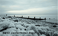 1st: A bright and frosty New Year with just a little cloud in the sky and a light E'ly breeze. Overnight the air temperature had fallen to -4.1C and on the grass to -8.2C. There were small ice crystals on the ground together with frozen previous deposits. There was a thick frost deposit on the grass minimum thermometer and on fallen leaves while ice crystals in the shade had grown some more. Frost deposited measured from 1 hour before sunset to 09 GMT was a WE (water equivalent) of 0.26 mm; there was 0.1 mm in the copper rain gauge. On the beach at Llanfairfechan stones were covered with thick frost with long growing ice crystals
 ![]() .. Visibility was very good with some mist and or smoke in the bottom of Valleys. The afternoon was cloudier, but the sky cleared again during the evening when it turned frosty. {Scilly Is 8.3C, Sennybridge -8.4C, Aberdaron 6.9h} [Rain 0.0 mm; Max 4.6C; Min -4.1C; Grass -8.2C]
.. Visibility was very good with some mist and or smoke in the bottom of Valleys. The afternoon was cloudier, but the sky cleared again during the evening when it turned frosty. {Scilly Is 8.3C, Sennybridge -8.4C, Aberdaron 6.9h} [Rain 0.0 mm; Max 4.6C; Min -4.1C; Grass -8.2C]
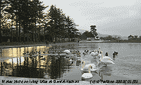 2nd: It was a clear night with frost adding to the crystal growth with 0.19 mm water equivalent deposited by morning. Just before dawn the sky was still clear, but then cloud encroached so and was overcast soon after 09 GMT. Pressure was 1031 mb with high 1037 mb over the N of Scotland. The morning stayed cloudy, but the sky cleared in the afternoon leaving a line of stratocumulus over the mountains. There was moderate haze imparting an orangy colour colour to the setting sun. Another clear frosty evening. [Rain 0.0 mm; Max 3.1C; Min -2.3C; Grass -6.8C]

3rd: Clear sky overnight with air (-2.6C) and ground frost (-7.9C) keeping the shaded grassy areas of the garden a frosty white, but there was little hoar frost to be seen on taller vegetation. Ice crystals were continuing to grow making some strange formations in the garden around the weather station ![]() . Pressure was 1032 mb with the high centred over Wales, a sunny day with the temperature -2.3C (dewpoint -5.7C) at 09 GMT rising to 4.7C by afternoon. Visibility was very good and there was little or no wind so that chimney smoke rose vertically, or sometimes drifted from the NE. One or 2 bonfires were lit in Llansadwrn in the afternoon and this smoke drifted from the NW. Frost remained all day in the shade and washing hung out to dry froze as stiff as boards. Later some cloud was spotted in the west this encroaching slowly during the evening, giving beautiful colours at sunset, so that the sky was overcast by 2200 GMT, but not before the grass minimum temperature had fallen to -8.0C. {Fair Isle 7.0C, Braemar -10.7C, Aberdaron 7.7h} [Rain 0.0 mm; Max 4.7C; Min -2.6C; Grass -7.9C]
. Pressure was 1032 mb with the high centred over Wales, a sunny day with the temperature -2.3C (dewpoint -5.7C) at 09 GMT rising to 4.7C by afternoon. Visibility was very good and there was little or no wind so that chimney smoke rose vertically, or sometimes drifted from the NE. One or 2 bonfires were lit in Llansadwrn in the afternoon and this smoke drifted from the NW. Frost remained all day in the shade and washing hung out to dry froze as stiff as boards. Later some cloud was spotted in the west this encroaching slowly during the evening, giving beautiful colours at sunset, so that the sky was overcast by 2200 GMT, but not before the grass minimum temperature had fallen to -8.0C. {Fair Isle 7.0C, Braemar -10.7C, Aberdaron 7.7h} [Rain 0.0 mm; Max 4.7C; Min -2.6C; Grass -7.9C]
4th: Overcast at dawn and the temperature had risen to 1.5C, but did not rise any further during the day that kept cloudy and sunless. There was a little rain at 1215 GMT on a narrow band heading south ahead of a cold front, I could see no ice precipitation here, but it fell as snow above 1000 ft on the mountains giving a light covering at 2500 ft. Another cold day in the south of Britain, the highest temperatures being in the north. {South Uist 8.3C, Benson -9.0C, Sennybridge -8.6C, Valley 0.0h} [Rain 1.2 mm; Max 3.2C; Min -2.3C; Grass -8.0C]
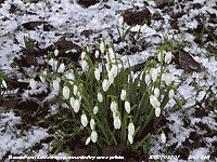
 5th: There was precipitation from 0100 to 0400 GMT with a rapid rise in temperature at 0200 GMT to a 24-h maximum of 3.2C. There were marks on the hailometer indicative of snow pellets, but whether or not there was snow as well was uncertain. There was more snow on the mountains with fresh snow lying generally above 2000 ft and as low as 1000 ft near Ogwen. Pressure 1024 mb was rising with the high 1030 mb situated off Aberdeen, Scotland. The sky had cleared sufficiently for the temperature on the grass to fall to -4.0C and there was a glaze of ice on concrete paths. It was a sunny morning with the sky continuing to clear, the afternoon was clear and sunny with frost returning before dusk. We have been seeing snowdrops out by this time, even the end of December in recent years, short plants with bits of the white flowers appearing amongst grass and fallen leaves. {Scilly Is 8.2C, Milford haven 4.5C, Altnaharra -8.2C,Sennybridge -6.5C, Valley 6.2h} [Rain 0.0 mm; Max 4.0C; Min -0.6C; Grass -4.0C]
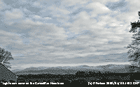
6th: With high pressure 1030 mb over southern Britain and cold air from Europe the cold and icy weather persisted. Overnight the air minimum fell to -5.0C, lowest since 8th January 1997 (-4.9C), but the lowest records here are -8.0C on 12/13th February 1985 and -7.5C on 12th January 1987. In 30-years at this station there have been just 31 days with a temperature of -5.0C, or less. Overnight frost deposition on the ground was a WE of 0.17 mm. Frost penetration into the soil had reached at least 10 cm with the thermometers reading -1.7C at 5 cm and -0.1C at 10 cm depth. The 20 cm was reading 0.8C and falling at lower depths with 5.8C at 100 cm. In 1963 frost penetrated far enough into the ground in Bangor to freeze water pipes entering houses that were without water as a result for several weeks (6 weeks if I remember correctly). Eventually the Water Board thawed out the then copper pipes by connecting a supply of low voltage, high current AC electricity to each end of the pipe, the electrical resistance causing heating and eventual melting of the ice. Don't try that at home folks, and remember it would not work with modern alkathene pipes! It was a bright morning with much cirrus cloud and contrails visible in the sky at Beaumaris ![]() . Buildings were bathed in morning sunshine, but the children's paddling pool was frozen
. Buildings were bathed in morning sunshine, but the children's paddling pool was frozen ![]() . It was flat calm on the Menai Strait, there were no ice flows (some were seen in 1963, being broken off from frozen sheets from brackish water at Cadnant creek) with boats on the hard on Gallows Point
. It was flat calm on the Menai Strait, there were no ice flows (some were seen in 1963, being broken off from frozen sheets from brackish water at Cadnant creek) with boats on the hard on Gallows Point ![]() despite owners being given instructions 2-years ago by the Council to remove them pending developments. Later cumulus and altocumulus encroached; the temperature struggled to reach 1.3C before starting to fall soon after 1300 GMT and was freezing again by 1500 GMT. There was light cover of snow across the Snowdonia Mountains as seen on the northern slopes of the Carneddau under cumulus clouds from Llansadwrn in the afternoon. [Rain 0.0 mm; Max 1.4C; Min -5.0C; Grass -9.7C]
despite owners being given instructions 2-years ago by the Council to remove them pending developments. Later cumulus and altocumulus encroached; the temperature struggled to reach 1.3C before starting to fall soon after 1300 GMT and was freezing again by 1500 GMT. There was light cover of snow across the Snowdonia Mountains as seen on the northern slopes of the Carneddau under cumulus clouds from Llansadwrn in the afternoon. [Rain 0.0 mm; Max 1.4C; Min -5.0C; Grass -9.7C]
7th: Some clear spells overnight so another frosty morning with the grass minimum reading a low of -7.3C. Pressure was 1027 mb in the high 1029 mb SW of St. George's Channel. The morning was bright with some sunshine and a light SW'ly breeze; the afternoon cloudier at times was then mostly sunny until later when there was some red sky in the west at sunset. The moles are back ![]() . Well they never went away, but with the cold weather they have been digging furiously putting up numerous large hills. It may be because temperatures in the soil have been falling they are seeking deeper somewhat warmer accommodation, or it's time to look for a mate! Variable cloud amounts during the evening with the air temperature keeping above zero. [Rain 0.0 mm; Max 3.2C; Min -4.4C; Grass -7.3C]
. Well they never went away, but with the cold weather they have been digging furiously putting up numerous large hills. It may be because temperatures in the soil have been falling they are seeking deeper somewhat warmer accommodation, or it's time to look for a mate! Variable cloud amounts during the evening with the air temperature keeping above zero. [Rain 0.0 mm; Max 3.2C; Min -4.4C; Grass -7.3C]
 8th: Some clear spells overnight with bright moonlight and stars, enough to ensure another ground frost (-3.2C), but the air temperature had kept above zero for the 24-h to 09 GMT, breaking the spell of 11 days with air frost recorded (-0.1C, or below). At 09 GMT today it was 2.0C and the morning was bright with increasing cloud and a light SW'ly breeze. The rest of the day was mostly cloud covered and dull except that the mountaintops were in sunshine later in the afternoon with light snow cover shining bright. The evening was mostly cloudy. [Rain 0.0 mm; Max 5.2C; Min 0.0C; Grass -3.2C]
9th: A bright morning with the sun rising clearly over the mountains just before 09 GMT. Visibility was moderate with some early mist, but the sky overhead was blue and the morning sunny. Pressure was 1028 mb in a ridge from the high 1040 mb SE Europe and Black Sea. There had been no air frost overnight, but with clear sky at dawn the grass minimum had fallen to -4.0C. The sky was clear and the day sunny with moderate haze in the afternoon in the west ![]() the temperature rising to 4.3C. The evening was clear and frosty with 6.5 h of air frost, minimum -2.5C between 17 - 21 GMT, and on the grass to -7.2C. By 2100 GMT the temperature was rising as cloud encroached. [Rain 0.0 mm; Max 4.3C; Min 0.4C; Grass -4.0C]
the temperature rising to 4.3C. The evening was clear and frosty with 6.5 h of air frost, minimum -2.5C between 17 - 21 GMT, and on the grass to -7.2C. By 2100 GMT the temperature was rising as cloud encroached. [Rain 0.0 mm; Max 4.3C; Min 0.4C; Grass -4.0C]
10th: The sky had turned red by 0800 GMT, a sailors' warning as it turned out, as with pressure 1020 mb falling it was to be a rough day. Low 958 mb was S of Iceland with occluded frontal cloud over the Irish Sea. The temperature at 09 GMT was 3.8C and rose slowly through the dull and sunless day as the S'ly wind strengthened to gale force by afternoon. During the evening Capel Curig reported a mws of 51 mph (force 9) with 69 mph gusts. Highest temperatures were in the north while south-east England continued with cold and sunny weather. {Kinlochewe 10.1C, Valley 9.1C, Kenley -10.0C, Tyndrum 39.2 mm, Manston 4.2h} [Rain 0.9 mm; Max 8.0C; Min -2.5C; Grass -7.2C]
11th: A wet and windy morning. There was showery rain from just before 05 GMT and at 09 GMT it was raining and misty under low stratus cloud with moderate visibility. Pressure 1013 mb had been falling between complex low 963 mb S of Iceland and high 1042 mb to the SE over Europe. There had been a rise in temperature to 7.8C and in the soil at 5 cm a rise of 5.5C from the 0.0C yesterday morning. Although the surface was soft it was still hard under previously frosty grassy areas. A few snow drops had sprung up between the large mole hills on the lawn. We were in warm sector air with tightening isobars and fronts stacking up to the north-west. The wind already force 6/7 S'ly strengthened to gale force 8 at times, with strong gusts, and into the afternoon and evening. It was severe over the mountains with the AWS at Clogwyn on Snowdon recording force 11 with gusts of 126 mph. The rain turned heavy at 1900 GMT becoming moderate at 2230 GMT. [Rain 21.8 mm; Max 9.6C; Min 3.6C; Grass 2.0C]
12th: The wind moderated after midnight, but the rain continued through until after 05 GMT. Pressure was 1004 mb with the low 968 mb slow-moving N of Scotland. Continuing overcast, apart from one bright opening to the SE, the day was dull and sunless. Before dusk there were some spots of rain with showers developing during the evening as the wind moderated some more. {Hawarden 11.7C, Sennybridge 7.6C, Capel Curig 61.6 mm, Aberdaron 1.4h} [Rain 6.5 mm; Max 9.3C; Min 7.5C; Grass 7.0C]

|
 13th: A showery morning and mostly overcast. The soil surface was saturated again and there were pools of water in fields and in places on the road to Beaumaris. The temperature 5.2C at 09 GMT was the minimum for the last 24-h and continued to fall for a time although did rise again reaching 6.9C. In the garden the first crocus and snowdrops
 ![]() gave the first splash of colour between fallen beech leaves on the lawn. There was a bright rainbow seen towards Pentraeth around 1330 GMT, but in Caernarfon at Victoria Dock
gave the first splash of colour between fallen beech leaves on the lawn. There was a bright rainbow seen towards Pentraeth around 1330 GMT, but in Caernarfon at Victoria Dock ![]() it was dry, but looking out over Abermenai, the south-west entrance to the Menai Strait, and across to Anglesey it was a rather grey scene. Showers persisted over the Snowdonia Mountains turning wintry with ice deposition seen at 2500 ft later in the afternoon with more to follow. Further showers during the evening before the sky began to clear. [Rain 2.3 mm; Max 7.5C; Min 5.2C; Grass 4.2C]
it was dry, but looking out over Abermenai, the south-west entrance to the Menai Strait, and across to Anglesey it was a rather grey scene. Showers persisted over the Snowdonia Mountains turning wintry with ice deposition seen at 2500 ft later in the afternoon with more to follow. Further showers during the evening before the sky began to clear. [Rain 2.3 mm; Max 7.5C; Min 5.2C; Grass 4.2C]
 14th: Clear spells after midnight led to the freezing of wet deposits on grass fields that glistened white in the moonlight. By dawn the sky was overcast with a red glow over the mountains just after 08 GMT. Fresh snow had fallen and was lying above 2000 ft, but there was some as low as 1250 ft near Ogwen. Pressure 1011 mb was falling, there was a light SE'ly breeze as low deep low 972 mb approached SW Ireland. Visibility was good and at first it was bright with the sun looming through moderately high altostratus clouds. Soon the cloud was thickening with cumulus developing over the summits and stratus encroaching from the west. There was a warm front over SW Ireland and a band of rain already over the Irish Sea. [Rain 0.6 mm; Max 9.8C; Min 1.1C; Grass -3.5C]
15th: An overcast, rather blustery with the S'ly wind reaching strong to gale-force during the morning. There were spots of rain at times and the day was sunless. [Rain 1.7 mm; Max 9.7C; Min 2.1C; Grass 0.2C]
The first 15-days had a mean temperature of 2.8C (-3.1) and [-2.1] of the monthly decadal and 30-y averages. The mean maximum was 5.8C (-2.4) and [-1.6] while the mean minimum was -0.3C (-3.8) and [-2.7]. Rainfall was 35.0 mm (29%) and [36%] of the January averages.
16th: A mostly cloudy day with just a few bright spells and a glimpse of sunshine in the morning. The afternoon had thicker cloud and was blustery with showery rain from 1300 GMT including some ice pellets at 2130 GMT. Showers continued into the night. [Rain 10.0 mm; Max 9.2C; Min 6.4C; Grass 4.8C]

|
 26th: A fine morning with hazy sunshine and good visibility. Pressure was 997 mb in a ridge over Ireland and the west of Wales. Remnant frontal cloud persisted over the Irish Sea with a spiral of cloud associated with a small low over the south-west approaches to the English Channel. Frontal cloud was moving in across Ireland. The day here was sunny, with a little cloud over the Snowdonia Mountains in the afternoon, with 7.2h duration recorded at RAF Valley, highest of the month. Global solar radiation reached 6.37 MJ m -2 also highest of the month. {Valentia 11.1C, Aboyne -5.2C, Aberporth 6.6 mm, Tain Range 7.6h, Valley 7.2h}[Rain 0.0 mm; Max 10.1C; Min 2.1C; Grass -1.4C]
 The month ended with a mean temperature of 4.3C (-1.6) and [-0.6] of average, lowest since 2001 one of the 8 lowest since before 1979. Rainfall was 95.2 mm (78%) and [97%] of the January averages. At RAF Valley sunshine duration was 60.5h (102%) and [111%] of average.
1st: With clear sky overnight there was an air frost -0.5C and with the temperature on the ground falling to -2.4C the soil surface was frozen. It was a fine sunny morning with almost clear sky and good hazy visibility. Pressure here was 1013 mb and high 1036 mb over Scandinavia. With low 981 mb off Cape Finisterre there was an E'ly airflow across Britain. In a moderate to fresh E'ly wind the temperature rose to 4.5C in sunshine that continued into the afternoon before a flurry of snow at 1500 GMT here and was snowing in Llanddona at 1540 GMT. With few clouds before dusk in the west 7.3 h hours sunshine were recorded Valley. During the day snow showers moved into North Wales, the Midlands and SE England off the North Sea with several centimetres seen in the London area by the end of the day. It was snowing again just before midnight. {Valentia 8.4C, Valley 7.3h} [Rain 0.6 mm; Max 4.5C; Min -0.5C; Grass -2.4C]
![]() 2nd: By morning the sky was cloud covered and the temperature 0.4C (dewpoint -1.6C) recovering from an overnight minimum of -1.8C. There was a light dusting of snow on some fields and was lying as low as 150 ft in places on the Snowdonia Mountains. At 09 GMT there was a snow shower, but the quantity lying on the ground here was unmeasurable . A hare was spotted in the garden. The day was mostly cloudy with more snow falling at low levels over the mountains and frequently here during the afternoon. The temperature reached 1.7C, lowest maximum of the month, before starting to fall after 1400 GMT and by 1530 GMT was -0.5C. At 1545 GMT heavier 'dry' snow was being driven along by the force 5/6 NE'ly wind, visibility was poor with the mountains obscured. At 2115 GMT snow was lying to a depth of 2.5 cm, but with the temperature rising snow turned 'wet' and began to thaw. Precipitation 24-h to 09 GMT on the 3rd was 4.1 mm, largest of the month. [Rain 4.1 mm; Max 1.7C; Min -1.8C; Grass -3.3C]
2nd: By morning the sky was cloud covered and the temperature 0.4C (dewpoint -1.6C) recovering from an overnight minimum of -1.8C. There was a light dusting of snow on some fields and was lying as low as 150 ft in places on the Snowdonia Mountains. At 09 GMT there was a snow shower, but the quantity lying on the ground here was unmeasurable . A hare was spotted in the garden. The day was mostly cloudy with more snow falling at low levels over the mountains and frequently here during the afternoon. The temperature reached 1.7C, lowest maximum of the month, before starting to fall after 1400 GMT and by 1530 GMT was -0.5C. At 1545 GMT heavier 'dry' snow was being driven along by the force 5/6 NE'ly wind, visibility was poor with the mountains obscured. At 2115 GMT snow was lying to a depth of 2.5 cm, but with the temperature rising snow turned 'wet' and began to thaw. Precipitation 24-h to 09 GMT on the 3rd was 4.1 mm, largest of the month. [Rain 4.1 mm; Max 1.7C; Min -1.8C; Grass -3.3C]
![]() 3rd: A frosty morning, mostly clear over Anglesey, with a light patchy covering of mainly snow pellets remaining on the ground in places
3rd: A frosty morning, mostly clear over Anglesey, with a light patchy covering of mainly snow pellets remaining on the ground in places ![]() . Anglesey was almost snow-free, but snow was lying on the cloud-covered Snowdonia Mountains, deep in places with wind-blown drifts as low as 150 ft with sprinklings to almost sea level in Llanfairfechan. Some areas were clearer with the snow blown off the smoother slopes and fields. Pressure was 990 mb with a low 985 mb over St. George's Channel. At 0910 there was a flurry of snow and snow pellets. The day was mostly sunny with cloud hugging the mountaintops in the afternoon. [Rain trace; Max 3.6C; Min -0.9C; Grass -2.3C]
. Anglesey was almost snow-free, but snow was lying on the cloud-covered Snowdonia Mountains, deep in places with wind-blown drifts as low as 150 ft with sprinklings to almost sea level in Llanfairfechan. Some areas were clearer with the snow blown off the smoother slopes and fields. Pressure was 990 mb with a low 985 mb over St. George's Channel. At 0910 there was a flurry of snow and snow pellets. The day was mostly sunny with cloud hugging the mountaintops in the afternoon. [Rain trace; Max 3.6C; Min -0.9C; Grass -2.3C]
![]()
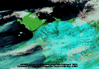
 4th: Another cold and frosty morning with a clear view of snow lying on the Snowdonia Mountains. The temperature on the grass had fallen overnight to -5.3C, lowest of the month, with water deposits freezing on grass and leaving the soil surface still frozen. It was calm and as a result the -0.4C (dewpoint -2.5C) temperature did not feel too bad in the sunshine. The day was fine and sunny with very clear visibility and the temperature rose to 8.0C during the afternoon. It was the sunniest day in what was a very dull month. Sunshine duration at Valley was 7.8h and solar radiation here was 8.84 MJ m -2, highest of the month. A mostly clear sky in the evening with the temperature falling quickly and frost again forming on the grass before thin cloud encroached before midnight. The MODIS satellite images left, courtesy of NASA/ GFSC show the distribution of the snow in North Wales and a snow-free Anglesey. Using bands 7-2-1 snow and coldest cloudtops show up pale blue against the green of land surface or black coloured sea. The second image shows snow cover in N England, the Midlands, London area and South-east. SW England and the Bristol area that also had snow is cloud covered. [Rain trace; Max 8.0C; Min -1.9C; Grass -5.3C]
5th: A mostly clear and frosty night and a bright morning with sunshine through thin clouds. There was a light NE'ly breeze and the morning was duller than of late. By afternoon the cloud was thicker and there was a 20-min snow shower at 1430 GMT but did 'not stick' turning to rain. Further snow showers at 1620 and 1730 GMT when there were signs of 'sticking' with light snow falling from 2130 GMT. [Rain 0.4 mm; Max 1.9C; Min -1.0C; Grass -2.7C]
6th: A sunny morning with a slight ground frost leaving frozen precipitation on the grass. Pressure was 995 mb within a complex slow-moving area of low-pressure over Britain. With a breeze from the NE the air felt cold in a temperature of 1.5C (dewpoint -3.3C) and more ice precipitation was to be expected. By noon the sky was cloudier and at 1250 GMT there was a little snow with a heavy shower of snow pellets at 1320 GMT nearly covering the ground. There were snow pellet and snow showers at 1450 GMT, snow at 1510 and heavier snow at 1530 GMT with much reduced visibility. In between showers the afternoon was bright and sunny and ended with a shower of snow pellets and snow at 1745 GMT. During the evening there were more showers of snow pellets and snow (1920 GMT). There was little in the way of snow accumulation here, but on the mountains deposits in places were moderate. [Rain 1.8 mm; Max 5.0C; Min 0.4C; Grass -0.9C]
 7th: With some clear skies overnight there was air frost (-1.1C) and ground frost (-4.4C) so that a fall of 2-3 mm snow pellets were still lying on the ground. Snow was lying as low as 600 ft on the mountains. A bright morning with a temperature of 2.8C, but it felt raw in the strong NNE'ly breeze and was soon cloudier and dull by noon. There were showers of rain in the afternoon and the setting sun did break through before dusk. By evening the wind had died away and with the sky clearing the mountains were well lit by the moon before midnight. [Rain trace; Max 4.2C; Min -1.1C; Grass -4.4C]
8th: Overnight the minimum temperature of the air fell to -1.9C, lowest of the month. A dull morning and feeling cold in the 1.2C temperature (dewpoint -1.7C) with a good chance of seeing some ice precipitation. Some breaks appeared in the cloud with some sunshine before a little snow fell at 1048 GMT and heavier snow at 1130 GMT for a few minutes. The afternoon was mostly cloudy with light snow at 1330 GMT, but rain at 1730 GMT. The sky cleared in the evening (3 oktas at 2130 GMT with the W'ly wind strengthening a little). [Rain 1.7 mm; Max 3.4C; Min -1.9C; Grass -4.8C]
9th: Pressure 996 mb had fallen with low 987 mb over the South-west Approaches. With its associated mass of cloud over southern Britain it was a mostly cloudy and damp day with little in the way of sunshine, but kept dry until around 1730 GMT in the evening when there was a shower of rain. [Rain 0.4 mm; Max 5.2C; Min 0.8C; Grass -1.4C]
10th: Pressure 1004 mb had risen with low 982 mb over the Netherlands and high 1033 mb off Iberia. We were in a showery NW'ly airflow and there were showers of snow pellets during observations at 09 GMT and again at 1015 GMT. Snow was lying generally about 1500 ft on the mountains with patches thawing slowly as low as 150 ft. Later the morning became bright, with some sunshine, this brighter weather extended into the afternoon and the temperature rose to 8.0C. The sky was mostly clear during the evening and, with little or no wind, frost formed on the grass. [Rain 1.0 mm; Max 8.0C; Min 1.9C; Grass -0.2C]
11th: A fine and bright morning with little or no wind. At 09 GMT the temperature was 3.9C and this rose to 8.6C during the day that kept mostly cloudy with an occluded front moving S across North Wales. There was some rain during the afternoon, then the sky began to clear with frost once again forming on the grass during the evening. [Rain 0.5 mm; Max 8.6C; Min 4.7C; Grass -2.6C]
12th: With some clear spells and light winds overnight there had been air frost (-1.2C) with a moderate ground frost (-4.6C). Visibility was very good with good views of the Snowdonia Mountains with crepuscular rays shining through cloud. The mountaintops were still well covered with snow and remnant snow patches were still to be seen, some as low as 150 ft. The cloud was thick enough to produce steady drizzle during the afternoon between Benllech to Moelfre. The evening was damp and cold with some clearance in the cloud allowing stars to be seen in the sky at 2130 GMT. [Rain 0.6 mm; Max 6.9C; Min -1.2C; Grass -4.6C]
13th: A dull overcast morning, no overnight frost, with a little rain around 09 GMT. Pressure was 1024 mb within a general area of cloud-filled high-pressure 1027 mb over Britain with light winds. Frontal cloud lay over Wales and, not going anywhere, led to a sunless day with only moderate visibility. There was a little more rain at dusk and the evening was similarly overcast and damp. [Rain 0.4 mm; Max 6.3C; Min 0.9C; Grass 0.4C]

|
The first 15 days had temperatures well below the average. The mean was 2.8C (-3.0) and [-2.5], but there were only 13.0 mm of precipitation (14%) and [18%] of the average for the month.
 16th: There were dark lenticular stratocumulus clouds as the sun rose over the Carneddau Mountains before a brightening morning with some sunshine breaking through later on. There was a light SW/ WSW'ly wind and very good visibility with a slight haze. The temperature rose to 11.6C, highest of the month. By afternoon cloud over the mountaintops was increasing and the sky was overcast by the end. In the wood bluebell leaves have already grown to a height of about 4 cm.
There are still patches of snow to be seen at 150 ft on the northern slopes of the mountains between Aber and Talybont, and >60% cover around the summits of Carnedd Llywelyn, C, Dafydd and Snowdon. . [Rain trace; Max 11.6C; Min 4.7C; Grass 1.3C]
17th: A calm morning, overcast at first then slowly brightening, but patches of blue sky were few. Feeling mild the 7.4C temperature at 09 GMT rising to 11.0C soon after 1300 GMT. At 1730 GMT the sky began to clear from the west and although there was broken cloud at 22 GMT was soon overcast once more. With rainfall below average soil moisture today was 64% dry mass, little different from mid January, and keeping below the 70% saturated-water percentage since December. [Rain 0.0 mm; Max 11.0C; Min 4.8C; Grass 3.2C]
 18th: Another calm and overcast morning with little change in pressure 1028 mb within the high 1029 mb over the Irish Sea and South-west Approaches. Despite lack of sunshine, and in a temperature of only 9.2C, some honeybees were seen on flowering Ericas on the rockery banks in the garden. Winter heliotropes are in flower and early blue crocus have appeared. [Rain 0.0 mm; Max 9.2C; Min 4.5C; Grass 0.6C]
19th: A variation today in the persistent anticyclonic gloom. Although the morning was dry the cloud thickened by noon and there was slight rain and drizzle from 1300 GMT. Not a lot, just 1.3 mm, and by 1603 GMT was drier and broken cloud by 22 GMT with the sky clearing later. [Rain 1.3 mm; Max 8.0C; Min 4.6C; Grass 0.5C]
20th: A brighter morning with thin wavy cirrostratus, altocumulus and contrails in the sky. The temperature on the grass under clear sky overnight fell to -3.0C freezing wet deposits, but there was no air frost. The day continued bright with 4.5h sunshine recorded at Valley before cloud encroached before dusk. Many linear snow patches were persisting on the mountains, the remains of deep snow drifts ![]() . The evening and night were mostly cloud covered, but there were occasional clear spells and a touch of ground frost. [Rain 0.0 mm; Max 10.3C; Min 1.1C; Grass -3.0C]
. The evening and night were mostly cloud covered, but there were occasional clear spells and a touch of ground frost. [Rain 0.0 mm; Max 10.3C; Min 1.1C; Grass -3.0C]
21st: High pressure 1033 mb still dominates with high 1036 mb over southern Britain. Mostly cloudy at first the moderately high altostratus thinning during the morning and a little sunshine developing during the afternoon. A light SW'ly breeze and good, but hazy visibility. [Rain trace; Max 10.9C; Min 2.5C; Grass -0.2C]
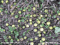 22nd: Pressure remained high 1038 mb to the SW off Brest. With a low 993 mb over the Norwegian Sea it was windy in NE Scotland. A mostly cloudy morning low enough to obscure the mountaintops, but showing signs of clearing a little later. The wind here today was a light NW'ly and there were a few brighter spells and glimpses of sunshine in the afternoon. Despite the cold weather fallen crab apples and more surprisingly some red holly berries
 ![]() remained unconsumed by birds. The holly berries were on a tree 300 m from the garden where they were all taken as early as December. The sky was overcast by evening and there was little or no wind. [Rain 0.0 mm; Max 10.3C; Min 5.2C; Grass 5.0C]
remained unconsumed by birds. The holly berries were on a tree 300 m from the garden where they were all taken as early as December. The sky was overcast by evening and there was little or no wind. [Rain 0.0 mm; Max 10.3C; Min 5.2C; Grass 5.0C]
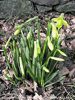
23rd: An overcast sunless day the cloud-filled high-pressure 1032 mb to the south-west still dominating the weather. There was little or no wind and it was a dry day, one for getting some jobs done around the garden before the spring. There are plenty of signs already with the yellow lesser celandines in flower at St. Sadwrn's Church and along the hedgerows. Catkins on hazel are abundant and the larger daffodils, that have been in bud for a while, are beginning to open. The snowdrops, that have been good for over a month, are fading a little and multicoloured crocuses are coming to the fore, but need some sunshine to encourage them to open. There was some broken altocumulus clouds to the south just after midnight allowing a few stars to be seen. [Rain 0.0 mm; Max 9.8C; Min 6.2C; Grass 3.0C]
24th: Unbroken uniform grey cloud again this morning, there was a light SSE'ly wind at 09 GMT, but this faded away during the morning and was replaced by a light to moderate NW'ly breeze in the afternoon. Another sunless day with a little rain around 2200 GMT. [Rain 0.2 mm; Max 9.0C; Min 6.3C; Grass 3.5C]
 25th: A little more rain fell between 0100-0130 GMT as a weak cold front passed over. Pressure 1027 mb was falling very slowly with low 990 mb between NW Scotland and Iceland, encroaching upon the high 1032 mb to the south, and tracking across N Scotland during the day. At dawn in a following clear slot there were just 3 oktas cloud cover, the morning was bright with a little weak sunshine at first. It was not to last, and there was some light drizzle by 1030 GMT. The afternoon was brighter, and dry again, with a few sunny spells from 1230 GMT. By the end of the afternoon the sky had more or less cleared over Anglesey and the evening and night were clear with bright stars shining with just a touch of ground frost. [Rain 0.3 mm; Max 10.7C; Min 5.5C; Grass 3.2C]
26th: The sky was overcast at dawn. The filling low 993 mb was over the North sea near S Norway, pressure here 1024 mb was falling only slowly. It was wet and windy in NE Scotland, but here with the cloud soon thinning the sky was brighter by 10 GMT with a little sunshine later. By afternoon the cloud had thickened and there were a few spots of rain then spells of drizzle or light rain through until 2130 GMT. [Rain 1.3 mm; Max 10.7C; Min 3.2C; Grass -0.4C]
27th: Overcast at night so frost-free. A damp and dull morning with only moderate visibility the almost uniform grey sheet of cloud hanging low over the mountains. The afternoon was drier, but kept overcast and sunless with a moderate at times SW'ly wind. [Rain 0.5 mm; Max 9.4C; Min 6.5C; Grass 6.2C]
28th: There was drizzle and at times light rain from 03 GMT petering out about 0930 GMT. Pressure 1013 mb continued to fall very slowly in a ridge from high-pressure 1022 mb N Italy. Complex low-pressure (4 centres) 992 mb lay to the north-west. The morning was overcast with poor visibility improving to moderate when the rain stopped. There was a little brightness around 1300 GMT, a few patches of blue were seen, but the sky was soon overcast again. [Rain 1.0 mm; Max 8.4C; Min 6.1C; Grass 4.7C]
It was a dry month with just 17.8 mm rainfall (19%) and [24%] of average, lowest since 1986 and ranks 8th lowest in February since before 1928. The mean temperature 4.9C (-0.9) and [-0.4], was lowest since 1996 and ranks 11th lowest since before 1979. It was the dullest February since 1980 and was the 2nd dullest recorded at RAF Valley having 46.8 h sunshine duration and 9 sunless days.
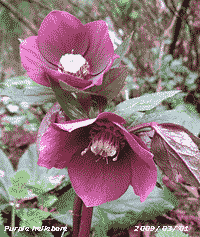 1st: After a shower of rain from 0600 to 0645 GMT it was a mostly sunny day, with the sky clearing towards the end of the afternoon. The sky was clear in the evening and into the night with frost forming on the grass as the temperature dropped to -3.5C. [Rain 0.0 mm; Max 11.2C; Min 5.6C; Grass 3.5C]
2nd: The sky was becoming cloudier from dawn, you had to look out early to see the white frost on the fields as, by 09 GMT, it had melted. Pressure 1015 mb had been rising, but the small ridge was moving eastward as low 972 mb SE Greenland tracked east towards Iceland. With an associated warm front over the Irish Sea the sky was soon overcast and there was a little light rain from 1230 GMT. By 1600 GMT the rain had ceased and there were some breaks in the cloud, then there were showers of rain from 1830 GMT as a following weak cold front passed over. [Rain 3.3 mm; Max 7.8C; Min 0.8C; Grass -3.5C]
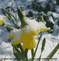
![]()
![]() 3rd: The morning started fine with variable thickness cloud cover and occasionally the sun just visible behind. Pressure 1001 mb was falling with our low 971 mb near Iceland and high-pressure 1042 mb well to the SW in mid-Atlantic. The temperature at 09 GMT was 5.9C (dewpoint 3.3C) with a 50% chance of ice precipitation. There was moderate rain from 1100 GMT, snow was falling in NW Scotland. The afternoon was dull and with thickening cloud as a low developed over the Irish Sea. There was heavy rain with ice pellets at 1600 GMT as pressure began to fall rapidly to 975 mb at 1800 GMT. Soil was soon saturated and there was a lot of water on sides of roads. Later the sky clear and with temperatures falling black ice formed on wet surfaces. [Rain 10.3 mm; Max 6.8C; Min 4.7C; Grass 0.8C]
3rd: The morning started fine with variable thickness cloud cover and occasionally the sun just visible behind. Pressure 1001 mb was falling with our low 971 mb near Iceland and high-pressure 1042 mb well to the SW in mid-Atlantic. The temperature at 09 GMT was 5.9C (dewpoint 3.3C) with a 50% chance of ice precipitation. There was moderate rain from 1100 GMT, snow was falling in NW Scotland. The afternoon was dull and with thickening cloud as a low developed over the Irish Sea. There was heavy rain with ice pellets at 1600 GMT as pressure began to fall rapidly to 975 mb at 1800 GMT. Soil was soon saturated and there was a lot of water on sides of roads. Later the sky clear and with temperatures falling black ice formed on wet surfaces. [Rain 10.3 mm; Max 6.8C; Min 4.7C; Grass 0.8C]
4th: It was a bright frosty morning with the sun rising over Foel-fras at 07 GMT. By 0730 GMT the sky had darkened with cumulonimbus clouds in the vicinity; there was a moderate fall of 2 mm snow pellets followed by snow that covered bare soil, concrete and tarmac to a depth of 1 cm. Grass was 80% covered with some longer tufted grass showing through. There was a moderate covering of snow over 2000 ft on the Snowdonia Mountains especially on the tops of the Carneddau. By 0800 GMT snow had stopped, but the roads were covered and treacherous. There were several road accidents: two crashes were outside the weather station; and the A5 was closed near Capel Curig and the A55 across Anglesey was closed near Gaerwen for a time in both directions because of a jackknifed lorry. With the sun appearing again the ice soon began to melt. There was a moderate covering of snow on the mountains above 1500 ft. After the snow the rest of the day was mostly sunny with the temperature rising to 7.8C. There were showers of snow pellets and snow in the west before dusk, but they missed here. The evening was mostly clear with the temperature turning frosty. [Rain 0.2 mm; Max 7.8C; Min -1.1C; Grass -5.2C]

|

 9th: A bright morning with a moderate to fresh W'ly breeze. Pressure had risen to 1008 mb and we had a temperature of 5.2C at 09 GMT. Keeping mostly cloudy there were sunny spells at times these extending into the afternoon, but soon turned cloudier as moderately high altostratus encroached from the west. At first the sun was just about shining through then thicker cloud arrived by 1530 GMT with some light rain before 1800 GMT. There was moderate rain from 2100 GMT. Rainfall for the 24-h to 09 GMT on the 10th was 11.5 mm, largest in the month. [Rain 11.5 mm; Max 9.3C; Min 3.4C; Grass -0.2C]
 The first 15-days had a mean temperature of 6.4C (-0.6) and [-0.4] of average. Rainfall was 36.5 mm (54%) and [43%] of the average monthly total.
16th: Thin high cloud with some sunshine early in the morning. At 09 GMT with 6 oktas cloud cover there was weak sunshine, but it was duller by 1030 GMT. Pressure was 1031 mb and the temperature 7.3C, rising from a minimum of 4.9C overnight, reached 12.8C during the mostly sunny day. The sky was partly cloud covered at 2200 GMT, but cleared again later. [Rain 0.0 mm; Max 12.8C; Min 4.9C; Grass 1.1C]
17th: A touch of ground frost overnight. At 09 GMT there were high cirrus clouds, a few altocumulus to the S and contrails. It was a bright morning with the temperature 9.7C and no wind. The temperature rose to 14.5C during the afternoon, highest of the year so far, before a very light sea breeze form the NE set in. Solar radiation was 14.30 MJ m -2. There were hundreds of honeybees on the heathers, preferring the white ones today, together with several large and medium sized bumblebees. The humming could be hear all around the garden. The warmth is bringing on the flowers on the dwarf rhododendrons ![]() ; the opening horse-chestnut buds are developing small yellow candles. Snowberry leaves are unfolding and the first blue flowers of speedwell were appearing in the the lawns, an indication that mowing was necessary. Sparrows have been looking into their usual nesting hole in the eaves and rooks tending their nests, but I have not seen them carrying twigs. {Aberdaron 11.8h} [Rain 0.0 mm; Max 14.5C; Min 4.6C; Grass -1.2C]
; the opening horse-chestnut buds are developing small yellow candles. Snowberry leaves are unfolding and the first blue flowers of speedwell were appearing in the the lawns, an indication that mowing was necessary. Sparrows have been looking into their usual nesting hole in the eaves and rooks tending their nests, but I have not seen them carrying twigs. {Aberdaron 11.8h} [Rain 0.0 mm; Max 14.5C; Min 4.6C; Grass -1.2C]

![]() 18th: Another summer-like morning, dew on the grass, but no frost. Less cloudy this morning, but the haze had increased and visibility was only moderate with Saharan dust high in the atmosphere joining any other aerosols trapped within the high. The route the dust took has been over the Canaries and west of Ireland and then south over the north of Britain. A little cooler at 09 GMT (8.5C, dewpoint 5.6C) with the hint of a sea breeze developing during the morning. The afternoon was sunny with the sea breeze strongest around 1500 GMT, just turning the cup anemometer, before dying away again. Peacock butterflies were spotted together with numerous bees around different patches of Ericas so were assumed to be two. A group of 4 buzzards were circling high above the station on a thermal. The evening was clear and cool with dew forming on the grass. {Aberdaron 11.8h} [Rain 0.0 mm; Max 14.2C; Min 5.3C; Grass 1.8C]
18th: Another summer-like morning, dew on the grass, but no frost. Less cloudy this morning, but the haze had increased and visibility was only moderate with Saharan dust high in the atmosphere joining any other aerosols trapped within the high. The route the dust took has been over the Canaries and west of Ireland and then south over the north of Britain. A little cooler at 09 GMT (8.5C, dewpoint 5.6C) with the hint of a sea breeze developing during the morning. The afternoon was sunny with the sea breeze strongest around 1500 GMT, just turning the cup anemometer, before dying away again. Peacock butterflies were spotted together with numerous bees around different patches of Ericas so were assumed to be two. A group of 4 buzzards were circling high above the station on a thermal. The evening was clear and cool with dew forming on the grass. {Aberdaron 11.8h} [Rain 0.0 mm; Max 14.2C; Min 5.3C; Grass 1.8C]
![]() 19th: A clear and still night with heavy dew on the grass. Pressure 1028 mb was falling slowly, but the sky was clear and there was hazy sunshine. Visibility was better this morning with the mountaintops somewhat clearer (see photo below). There was fog in the Midlands early in the day. Ploughing was being done on several fields in the village and on the road to Beaumaris, the plough being followed as usual by numerous seagulls. Hazy sunshine through the day, a slight intermittent sea breeze in the morning and constant in the afternoon with the temperature rising to 17.8C, highest of the month, 3rd highest at this station on this date and 4th highest in March since before 1979. At 1530 GMT there was a dust devil, 15 ft S of the Stevenson screen, about 5 ft wide at the base lifting dried beech leaves in a swirl over treetop height to about 100 ft. The leaves remained in the thermal for some minutes before drifting away. The wind then changed direction from ENE force 1 to SSW force 2 for about 20 minutes before the ENE resumed. Several butterflies had been seen around the garden including comma, pair of peacocks and small tortoiseshell. {Kinlochewe 17.0C, Aberdaron 12.0h} [Rain 0.0 mm; Max 17.8C; Min 3.8C; Grass 0.6C]
19th: A clear and still night with heavy dew on the grass. Pressure 1028 mb was falling slowly, but the sky was clear and there was hazy sunshine. Visibility was better this morning with the mountaintops somewhat clearer (see photo below). There was fog in the Midlands early in the day. Ploughing was being done on several fields in the village and on the road to Beaumaris, the plough being followed as usual by numerous seagulls. Hazy sunshine through the day, a slight intermittent sea breeze in the morning and constant in the afternoon with the temperature rising to 17.8C, highest of the month, 3rd highest at this station on this date and 4th highest in March since before 1979. At 1530 GMT there was a dust devil, 15 ft S of the Stevenson screen, about 5 ft wide at the base lifting dried beech leaves in a swirl over treetop height to about 100 ft. The leaves remained in the thermal for some minutes before drifting away. The wind then changed direction from ENE force 1 to SSW force 2 for about 20 minutes before the ENE resumed. Several butterflies had been seen around the garden including comma, pair of peacocks and small tortoiseshell. {Kinlochewe 17.0C, Aberdaron 12.0h} [Rain 0.0 mm; Max 17.8C; Min 3.8C; Grass 0.6C]

|
20th: Another fine morning; on stepping outside to begin the obs I was greeted by the first chiffchaff of the season calling strongly from the willow tree, the buds on which are just opening. The chiffchaff's arrival was much earlier than last March (27th). A sunny, but rather hazy day giving mostly poor visibility, with a more definite ENE'ly breeze. {Altnaharra 18.5C, Thorney Is 12.1h, Aberdaron 12.0h} [Rain 0.0 mm; Max 13.4C; Min 4.6C; Grass 0.9C]
21st: Clear overnight with a touch of ground frost, bright at first, but mist and stratiform cloud thickening by 09 GMT. Pressure 1031 mb was rising with high 1041 mb SW of Ireland. The low cloud persisted until the afternoon when it was bright at times with a little sunshine. The wind light and variable W'ly at first strengthened and veered N'ly later when the sky cleared and cloud eventually lifted from the mountaintops. At 1700 GMT visibility was very good and clear as clean air was introduced from the N. [Rain 0.0 mm; Max 13.0C; Min 3.5C; Grass -0.1C]
22nd: Bright and clear at first with a touch of ground frost, but soon cloudier the 5/8th cover at 09 GMT increasing to overcast within an hour. Pressure was 1034 mb with the high 1042 mb SW of Ireland. Another dry day with the soil surface drying out through the day. There was plenty of blackthorn flowers on bushes along the A55 near the bridges. These flowers appear before any leaves in contrast to hawthorn that is already in leaf but has nor flowers yet. It will be a while before we see blackthorn flowers in windswept Llansadwrn which is just over at 300 ft. There was a little broken cloud at 2200 GMT, but not frost overnight. [Rain 0.0 mm; Max 11.6C; Min 3.3C; Grass -0.4C]
23rd: A mostly cloudy morning with pressure 1019 mb falling. The high was 1036 mb west of Brest and low 989 mb over the Gulf of Bothnia meant tightening isobars over the UK. The W'ly wind at 09 GMT was force 5 and there was a shower rain from 1100 GMT, on a weak cold front moving S, before turning brighter. There was a little sunshine in the afternoon that kept dry, but it was cool with a maximum temperature of 9.2C. [Rain 1.6 mm; Max 9.2C; Min 6.0C; Grass 2.7C]
24th: A bright morning with some sunshine; a light and cool NW'ly breeze. Visibility was only moderate with haze making it difficult to see the mountains. Pressure 1022 mb was rising in a ridge, from high 1033 mb lying to the SW, extending over N Scotland. Low 992 mb was over Iceland with associated fronts just to the west of Ireland and Scotland. Some sunshine around midday, clear mountaintops where slight ice precipitation was seen with remnant patches of snow on the NE flank of Carnedd Llewelyn, becoming cloudier after 1500 GMT with slight rain and drizzle from 1600 GMT. Showery rain as fronts passed over, heaviest at 1900 GMT the last ending at 2130 GMT. [Rain 2.3 mm; Max 10.3C; Min 3.2C; Grass 0.3C]
25th: Slight showers of rain before 09 GMT then the sky was clearing a little. Pressure had fallen to 1005 mb with the low 989 mb over the N North Sea while pressure remained high 1029 mb W of Biscay. Deepening low S of Iceland was moving towards N Scotland and was 989 mb by 1800 GMT. No more rain, but the morning kept mostly cloudy. There were a few spots of rain, together with brief sunny spells, in the afternoon that later become dull and overcast. [Rain 3.5 mm; Max 11.7C; Min 6.1C; Grass 4.1C]
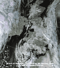
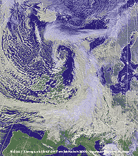 26th: Spells of rain 01 to 03 GMT and from 0700 GMT although accumulating just 3.6 mm by 09 GMT left standing water in puddles in places around the garden. There was a fresh SW'ly wind driving the rain across the fields and visibility was very poor. Pressure was 997 mb with the low 972 mb over the Orkney Islands. The NOAA satellite image shows the low, with comma shaped spiral of clouds. Frontal cloud was over the Channel and N France and we were in a showery north-westerly airstream with convective clouds over Britain and to the north-west over the sea. There is a little ice at the head of the Gulf of Bothnia and snow on the Pyrenees, Alps, Norway and Iceland.
The rain soon eased and by 1100 GMT there was blue sky overhead. We were in a showery airstream and the afternoon had sunshine and showers with 2-3 mm ice pellets at 1350 GMT with a little ice precipitation on the mountain slopes above 2000 ft. There was a slight shower at 1900 GMT with a few ice pellets striking the windows. Later the sky was mostly clear. [Rain 2.2 mm; Max 10.5C; Min 7.0C; Grass 5.8C]
27th: Bright and mostly cloudy with the barometer reading 995 mb, but the low off NE Scotland 974 mb was beginning to fill. Overnight the grass minimum fell to 0.2C and at 09 GMT, under overcast skies, the air temperature was 6.6C
(dewpoint 2.0C). The sun was shining through thin patches of cloud, visibility was moderate with a slight shower of rain and a fresh W'ly breeze. The afternoon was brighter with the cloud lifting from the mountaintops a sprinkling of fresh snow could be seen above 2000 ft. There were showers of rain at 2000 GMT and again at 2330 GMT, these falling as snow on the mountains. [Rain 1.2 mm; Max 10.3C; Min 3.5C; Grass 0.2C]
28th: A bright morning becoming increasingly sunny. The temperature at 09 GMT was 6.1C (dewpoint 2.2C), but there was a fresh N'ly breeze and the temperature struggled to rise to 8.1C. Cloud persisted over the mountaintops and there was some further snow during the day. By evening the sky had mostly cleared here although some patchy cloud did cross over before dusk. The wind moderated at pressure was rising in a ridge developing from the south-west. [Rain 0.0 mm; Max 8.1C; Min 5.0C; Grass 2.8C]
 29th: With clear skies overnight there was an air frost (-0.7C) and on the ground the temperature dropped to -4.8C. There was no sign of any white frost on the grass at 06 GMT and it was a sunny morning with a light S'ly breeze. In the sunshine cloud had lifted from the Carneddau (see photo below) and for once Snowdon revealing the snow. In the morning light the railway track and footpath to the summit can be seen in the photograph, together with Hafod Eryri, the new visitor centre. The day was mostly sunny (Valley 10.4 h duration) with some small cumulus clouds developing by the afternoon
 ![]() , with a lot of reflectivity solar radiation was a high 19.56 MJ m -2. By evening frontal cloud was encroaching from the west. {Hawarden 10.5C, Lake Vyrnwy 11.5h} [Rain 2.3 mm; Max 10.4C; Min -0.7C; Grass -4.8C]
, with a lot of reflectivity solar radiation was a high 19.56 MJ m -2. By evening frontal cloud was encroaching from the west. {Hawarden 10.5C, Lake Vyrnwy 11.5h} [Rain 2.3 mm; Max 10.4C; Min -0.7C; Grass -4.8C]
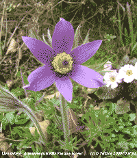 30th: Air temperature overnight did not fall below 6.0C and began to rise from midnight under the frontal cloud. There was heavy drizzle from 0130 GMT and light rain from 0730 to 0800 GMT that in all accumulated 2.3 mm. At 09 GMT rain had petered out, but there was there was hill fog. Pressure 1017 mb was rising slowly; occluded frontal cloud, slow-moving over the Irish Sea through N England to the North Sea, was associated with low 973 E Iceland. By 0930 GMT the fog began to clear in a light SW'ly breeze. There were one or two times when the sky seemed to be brightening, but then thickened again so that the day was sunless. [Rain 0.1 mm; Max 10.6C; Min 5.3C; Grass 4.0C]
31st: Mild again overnight, so that we are beginning to put out plants from the greenhouse to harden off. Mostly cloudy with just the odd patch of blue. The altostratus cloud was moderately high and the tops of the Carneddau Mountains were clear, but Snowdon had its own cumulus cloud. There were patches of snow still to be seen, snow has been present on the mountains every day since the 22nd November. Pressure 1022 mb was still rising within the developing high 1026 mb just to the south of Britain. The morning was fine and becoming a little brighter, but still no sunshine. The afternoon too saw little sunshine cloud persisting over SE Anglesey and the mountains. The west was clear of cloud and mostly sunny. The chiffchaff was in good voice and some rooks were breaking off twigs from the tops of the trees to build their nests. Most of the 2 local colonies of some 50 nests have decided to move trees and headed further away this year. They have been in the trees closeby for some years, but in recently the nests have been subject to raids by ravens and buzzards. Muck spreading ![]() and ploughing
and ploughing ![]() continues apace in Llansadwrn. Little was done in the wet autumn and there has been a lot of catching up to do in fine spring weather. [Rain 0.0 mm; Max 13.3C; Min 6.8C; Grass 4.0C]
continues apace in Llansadwrn. Little was done in the wet autumn and there has been a lot of catching up to do in fine spring weather. [Rain 0.0 mm; Max 13.3C; Min 6.8C; Grass 4.0C]
The month ended with a mean temperature of 7.4C (+0.4) and [+0.6] of average. There were 4 air frosts (+1.2) and 11 ground frosts (-0.6). Rainfall was 49.7 mm (37%) of the decadal and [59%] of the 30-year averages. It was a sunny month at Valley with 142.9 h duration (111%), sunniest since 2007 and ranking 12th on the Anglesey record since 1931..
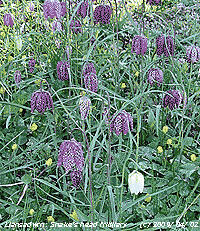 1st: A fine sunny morning after the overnight cloud began to clear about 0530 GMT. Pressure was 1025 mb in a ridge from Anglesey over the North Sea to S Norway. The morning remained sunny, but the afternoon turned cloudy. [Rain 0.0 mm; Max 14.0C; Min 5.5C; Grass 0.9C]
2nd: Another fine and sunny morning with alight SE'ly breeze. Visibility was very good with cloud filling the heads of the mountain passes, and spilling over the mountaintops ![]() , before clearing away about 10 GMT
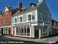
, before clearing away about 10 GMT ![]() . The east coast of England south from Whitby experienced fog off the North Sea; the temperature in Kent at Manston was only 8C. Here the day was warm and sunny with the temperature rising to 18.6C (range 13.9C) , exceeding that in the South of France 15C. If you had fancied an icecream then the newly opened Red Boat in Beaumaris would have been the place. The icecream shop replaces the old established corner Newsagents that in autumn 2008 closed for owners' retirement. Mist formed on the fields here at dusk about 19 GMT. {Edinburgh 19.0C, Hawarden 16.2C, Aberdaron 12.9h} [Rain 0.0 mm; Max 18.6C; Min 4.7C; Grass -0.1C]
. The east coast of England south from Whitby experienced fog off the North Sea; the temperature in Kent at Manston was only 8C. Here the day was warm and sunny with the temperature rising to 18.6C (range 13.9C) , exceeding that in the South of France 15C. If you had fancied an icecream then the newly opened Red Boat in Beaumaris would have been the place. The icecream shop replaces the old established corner Newsagents that in autumn 2008 closed for owners' retirement. Mist formed on the fields here at dusk about 19 GMT. {Edinburgh 19.0C, Hawarden 16.2C, Aberdaron 12.9h} [Rain 0.0 mm; Max 18.6C; Min 4.7C; Grass -0.1C]
 3rd: A clear sky morning, but it was hazy and visibility was poor. The sun rose about 0630 GMT and was an orange colour. At 09 GMT the sky was milky sky to the S with Saharan dust high in the atmosphere and possibly some in the stratosphere from the eruptions of Mount Redoubt in Alaska; to the N it was a little bluer. The day was mostly sunny with a little cloud at times and with a dark and threatening look to the sky to the NW in the afternoon. The wind was SE'ly at first, but veered SW'ly later. There were spots of rain just before 2100 GMT. [Rain 2.4 mm; Max 14.5C; Min 4.3C; Grass 0.3C]
4th: At midnight deepening frontal-wave low 1009 mb crossed N Ireland pushing twin weak cold fronts on to the west. We had 2 bursts of rain around 01 and 03 GMT, but it amounted to just 2.4 mm in total. The morning was bright with a little sunshine, but the clear slot had disappeared by 09 GMT and it was mostly cloudy. There was a fresher feel to the day, the temperature 8.3C (dewpoint 6.8C) with a moderate SW'ly breeze. The temperature of the soil at 30 and 50 cm reached 10C for the first time this year. The first bluebell has appeared in the wood, but it has not opened yet and there is little colour. The sapling, regenerated, sycamore have fully expanded leaves as do the small hawthorn trees. The horse-chestnut leaves are expanding rapidly with as yet unopened flowers. Cloud slowly lifted during the afternoon that had increasing sunshine and there was a clear sunny evening. [Rain 0.0 mm; Max 13.5C; Min 6.0C; Grass 4.6C]
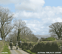 5th: Almost a ground frost overnight, but there was heavy dew glinting on the grass in the early sunshine. Pressure was 1023 mb in a ridge that was to give us another fine day. Cloud increased during the morning that had a light to moderate cool S'ly breeze. It felt a bit warmer in the afternoon with less cloud and a little more sunshine. There are still some patches of snow on the northern slopes of the mountains. The evening was lightly cloud covered and there was a complete 22 deg halo around the moon at 2100 GMT. [Rain 0.0 mm; Max 12.6C; Min 2.8C; Grass 0.1C]
6th: Overcast and grey with a drying light to moderate S'ly breeze. The temperature at 09 GMT was 9.4C (dewpoint 2.9C) and the grass was dry and the soil surface almost dry. Pressure 1008 mb was falling with deepening low 991 mb just W of Shannon, Ireland; a band of rain was over the Irish Sea, but yet to reach here. There were a few spots of rain at 1300 GMT and slight rain from 1600 to about 1730 GMT, otherwise dry but a sunless day. There was a little broken cloud at 2100 GMT. [Rain 0.6 mm; Max 10.6C; Min 5.0C; Grass 2.6C]
7th: Overnight mostly cloudy, but cloud breaking up after dawn with convective cumulus clouds in the vicinity at 09 GMT. Precipitation was in sight over the mountains and we had some slight showers from 0910 GMT with some sunshine in between. So a case of April showers! Pressure was 1003 mb with low 984 mb off NW Scotland and developing low 992 approaching SW Ireland. There are now 3 bluebells up and showing a little blue, but not quite open. It was a mostly sunny afternoon, but with a freshening S'ly wind. At 1800 GMT low 982 mb was over Shannon tracking towards the North Channel unchanged by midnight; there was an occluded front over North Wales and triple point over the Bristol Channel. During the evening the wind was strong to gale force 8 between 21 and 23 GMT accompanied by rain; and, beating against windows sounded more than what was collected in the raingauges (2.4 mm). The wind moderated at midnight. [Rain 2.4 mm; Max 12.3C; Min 5.8C; Grass 3.8C]

|
The first 15 days of the month were dry with just 10.2 mm (13%) and [18%] of the monthly averages. Temperatures were above average with the mean 9.8C (+0.7) and [+1.2] of the monthly averages.
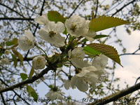 16th: Another overcast morning with poor visibility. Pressure was 1008 mb between low 999 mb off Lands End and high 1032 mb over Iceland. We were in an ENE'ly airflow with a band of patchy rain from Anglesey to Kent. There was some very light rain at 0945 GMT that did not last long, but the morning and afternoon remained dull and murky with haze persisting. There was a little more slight rain or drizzle about 1900 GMT and again between 2100 and 2300 GMT. The day was sunless. {Pembrey Sands 15.9C, Aberdaron 12.0 mm} [Rain 0.7 mm; Max 12.0C; Min 8.6C; Grass 7.9C]
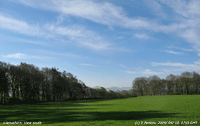 17th: The wind had moderated and there had been no more rain since midnight. It was a raw sort of morning with poor visibility and overcast skies. The temperature was 9.0C (dewpoint 7.5C) and pressure 1013 mb had risen a little between low 1000 mb anchored off Lands End and high 1028 mb Iceland to the Faeroes. The birds did not mind the dull weather; there was plenty of singing, especially by blackbirds and thrushes, around the garden and woodland, but the woodpeckers were quiet. There was a little rain soon after noon then the sky brightened as the frontal cloud began to move south. By the end of the afternoon there was a little clear sunshine before a deep orange setting sun to the north-west. The sky cleared some more in the evening with a fresher feel in the air. {Crosby 17.0C, Hawarden 16.2C, Kenley 14.6 mm, Sennybridge 7.8 mm, Tiree 13.2 h, Valley 2.1h} [Rain mm; Max C; Min 7.5C; Grass 6.6C]
18th: A mostly clear sky overnight, but it was windy and the temperature even on the grass kept above freezing (2.8C). A fine sunny morning with good, but hazy visibility and yes, mostly cloud-free except for high cirrus clouds. These had cleared completely by 09 GMT leaving a little more haze. Pressure 1020 mb was rising in a ridge from developing high 1027 mb over the Norwegian Sea. The trees are beginning to show a little more green, see in the 'over the hedge view' to the west ![]() , in particular understorey saplings, sycamore and birch. The horse-chestnut have been in leaf for a while. A little cirrus appeared later in the afternoon and there was not a lot of colour in the sky or setting sun. A red admiral butterfly was spotted and the pipistrelle bats have returned to their nursery roost in the west gable. [Rain 0.0 mm; Max 13.2C; Min 4.8C; Grass 2.8C]
, in particular understorey saplings, sycamore and birch. The horse-chestnut have been in leaf for a while. A little cirrus appeared later in the afternoon and there was not a lot of colour in the sky or setting sun. A red admiral butterfly was spotted and the pipistrelle bats have returned to their nursery roost in the west gable. [Rain 0.0 mm; Max 13.2C; Min 4.8C; Grass 2.8C]
19th: Another clear sky morning with smoke haze and a warm sunny day with a light S'ly breeze. Several orange tip butterflies were seen around the garden. There was a clear yellow sunset and again little colour in the sky. Solar radiation reached 23.40 MJ m -2 while Aberdaron, recording 14.2 h of sunshine, was the sunniest place in Britain. {Ballykelly 18.1C, Rhyl 17.3C, Scilly Is 0.4 mm, Aberdaron 14.0h} [Rain 0.0 mm; Max 16.8C; Min 4.0C; Grass 0.2C]
20th: The third morning to have cloudless skies, blue at first then turning milky during the morning. Visibility was moderate with smoke haze with moderately high levels of ozone in the air developed as the result of the action of bright sunshine on pollutant aerosols in the air. There were 4 or 5 pairs ( 1 pair in cop) of orange tip butterflies around the garden, the most I can remember seeing here. Light generally S'ly breezes and with the lack of a sustained sea breeze in the afternoon the temperature reached 18.7C (-0.2 average), highest of the year so far. {Hawarden 18.7C, Aberdaron 13.6h} [Rain 0.0 mm; Max 18.7C; Min 5.4C; Grass 1.0C]
21st: A bright start, but the wind had picked up overnight and before 09 GMT the sky was covered with clouds. There was a break overhead with a flash of sunshine during observations. Pressure was steady on 1027 mb with the high 1031 mb over Biscay. Frontal cloud was encroaching the west and rain was affecting Scotland and just south of the Borders. There was a slight shower of rain around 0930 GMT and the morning kept dull and overcast. The afternoon was brighter with a little weak sunshine towards the end. Sea fog encroaching the west coast at 16 GMT reached here at 18 GMT and persisted during the evening. {London 20.7C, Isle of Skye 15.8 mm, Thorney Is 12.4 h}[Rain 0.1 mm; Max 14.6C; Min 6.1C; Grass 2.1C]
22nd: Fog after midnight was dense for several hours, but had cleared by 05 GMT. There was weak sunshine at 06 GMT as the sun rose under cloud, then remaining cloud here and in Bangor mostly dispersed leaving several contrails and cirrostratus clouds. It was bright and sunny until about 1100 GMT when thicker stratiform cloud again encroached from the west. Pressure was 1027 mb within high 1029 mb Scotland to Brittany. Low 972 was SE Greenland and Wales had some of the frontal cloud stretching from N Ireland to the North Sea. There were a few small spots of rain on the breeze in the afternoon, otherwise it stayed dry, but dull. [Rain trace; Max 13.7C; Min 4.6C; Grass 1.3C]
23rd: Still overcast and dull, the soil, concrete and grass were dry. The most exciting thing to mention was the guttation droplets at the tips of the grass leaves in the lysimeter, not seen on other grass! A sign that the soil is drying out elsewhere. There was a little rain over the mountaintops and along the western coast of Anglesey. The morning kept dull here, but across the Straits between Llanfairfechan and Conwy it was brighter with a little sunshine. The afternoon did brighten here, but not by very much. There were a few glimpses of sunshine. [Rain trace; Max 15.6C; Min 9.1C; Grass 7.8C]
![]() 24th: Some brightness at first with some weak sunshine before the cloud thickened once again before noon. Visibility was moderate with smoke haze. Pressure was 1012 mb with low 986 mb over Iceland and high 1029 mb over the Baltic. The cause of the dull weather has been frontal cloud to the west over Ireland and Irish Sea. A small frontal-wave low was developing over Ireland, with warm front to the N and cold front to the south. This slowly moved towards SW England through the day. It kept dry here once again, but we did have a little light rain around 2000 GMT, this damped the concrete, but had evaporated before morning. The water content of the soil under the grass to 5 cm deep, measured today, has fallen to 56% dry mass. [Rain 0.1 mm; Max 15.5C; Min 9.7C; Grass 6.3C]
24th: Some brightness at first with some weak sunshine before the cloud thickened once again before noon. Visibility was moderate with smoke haze. Pressure was 1012 mb with low 986 mb over Iceland and high 1029 mb over the Baltic. The cause of the dull weather has been frontal cloud to the west over Ireland and Irish Sea. A small frontal-wave low was developing over Ireland, with warm front to the N and cold front to the south. This slowly moved towards SW England through the day. It kept dry here once again, but we did have a little light rain around 2000 GMT, this damped the concrete, but had evaporated before morning. The water content of the soil under the grass to 5 cm deep, measured today, has fallen to 56% dry mass. [Rain 0.1 mm; Max 15.5C; Min 9.7C; Grass 6.3C]
![]() 25th: A little brightness in the east again this morning, with some weak sunshine, but before 09 GMT the sky was looking darker and we had some spots of rain. Low 997 mb was over the Celtic Sea and there were bands of rain within its circulation. One band was moving N and was over the mountains, but we were in rain-shadow and had little; there was more to the east and west. The morning and early afternoon had some sunny spells before well developed cumulus clouds developed were seen over the Snowdonia Mountains. There were showers of rain from 1521 GMT and rumbles of thunder from 1540 GMT, in SE Anglesey and mainland, with brief showers of rain and ice pellets (<5 mm) at 1521 and 1550 GMT. The temperature fell 5C to 10.0C during this time. Residents at Gorwel in Llanfairfechan heard loud cracks as large hail, agglomerated conical shaped up to 7 mm clear ice, fell on slate roofs at 1552 GMT and again at 1724 GMT, the latter up to 6 mm. Amounts of precipitation were small, with just 1.0 mm recorded here. The evening was bright with the sky clearing towards midnight. [Rain 1.0 mm; Max 15.3C; Min 9.2C; Grass 8.0C]
25th: A little brightness in the east again this morning, with some weak sunshine, but before 09 GMT the sky was looking darker and we had some spots of rain. Low 997 mb was over the Celtic Sea and there were bands of rain within its circulation. One band was moving N and was over the mountains, but we were in rain-shadow and had little; there was more to the east and west. The morning and early afternoon had some sunny spells before well developed cumulus clouds developed were seen over the Snowdonia Mountains. There were showers of rain from 1521 GMT and rumbles of thunder from 1540 GMT, in SE Anglesey and mainland, with brief showers of rain and ice pellets (<5 mm) at 1521 and 1550 GMT. The temperature fell 5C to 10.0C during this time. Residents at Gorwel in Llanfairfechan heard loud cracks as large hail, agglomerated conical shaped up to 7 mm clear ice, fell on slate roofs at 1552 GMT and again at 1724 GMT, the latter up to 6 mm. Amounts of precipitation were small, with just 1.0 mm recorded here. The evening was bright with the sky clearing towards midnight. [Rain 1.0 mm; Max 15.3C; Min 9.2C; Grass 8.0C]
26th: The sky was mostly clear during the early hours (grass minimum 2.0C) and it was sunny at first. Before 09 GMT convective cumulus clouds had developed giving 6 oktas cover. Pressure was 1008 mb with the slow-moving low 1001 mb filling near Lands End. An occluded front, drifting eastward, was giving rain over Ireland and western Scotland. Visibility was very good in clearer air and the morning was sunny at times. The afternoon had variable amounts of sunshine, well developed cumulus were seen over the mountains, but yesterday's weather did not repeat. Thicker frontal cloud encroached during the evening. [Rain 16.4 mm; Max 15.3C; Min 4.8C; Grass 2.0C]
27th: At midnight low 986 mb was off NW Scotland with associated triple frontal systems over the Irish Sea. There was light rain from midnight turning moderate by 01 GMT, rain was heavy between 03 and 04 GMT on a cold front, and died out just after 07 GMT. The 16.4 mm (09-09 GMT) was largest fall since 11 January (21.8 mm). Overcast at first clearer sky worked its way over from the west by 09 GMT when there were 6 oktas cover of cumulus clouds. Pressure was 993 mb with the low 989 mb to the NW. The day had a few sunny spells; cloud lifted from the mountaintops in the afternoon to reveal a sprinkling if ice precipitation above 3000 ft on Carnedd Llewelyn and Snowdon. The evening and night were mostly clear. [Rain 0.0 mm; Max 12.8C; Min 6.5C; Grass 5.9C]
28th: There was no overnight frost and the sky was cloudier from dawn with 6 oktas cover of cumulus and altocumulus clouds at 09 GMT. Pressure was 1002 mb in a general area of low-pressure over Britain and N France. The morning was mostly cloudy and there were 1 or 2 longer bright and sunny spells in the afternoon, the maximum temperature of 10.8C was just after noon Later the sky turned cloudier again with steady light rain from 2100 GMT. [Rain 10.7 mm; Max 10.8C; Min 3.5C; Grass 0.5C]
29th: Light rain continued until 1100 GMT. By 09 GMT there was 10.7 mm in the raingauge and the temperature was 7.0C. The sky was overcast and clouds and mist were hanging low over the mountains, under this visibility was good. Pressure 1004 mb was showing signs of rising, but the morning and early afternoon were slow to brighten. Only at the end of the afternoon did the cloud begin to thin and sunshine to break through. [Rain 2.5 mm; Max 12.4C; Min 5.6C; Grass 5.1C]
30th: A wet morning, the light rain started about 0700 GMT and at 09 GMT was light to moderate before easing and turning to drizzle by 1100 GMT. Under skies overcast with low stratus clouds visibility was moderate with mist on the lower slopes of the mountains. The temperature at 09 GMT was was 10.4C (dewpoint 9.6C). There was a long and wide area of patchy rain over the west of Britain that made only slow progress eastward during the day. There were spells of light rain or drizzle here and the day was sunless, but on the mainland near Caernarfon in the afternoon it was brighter with glimpses of sunshine. {London 19.1C, Capel Curig 16.4 mm, Manston 12.8h} [Rain 1.0 mm; Max 12.1C; Min 6.4C; Grass 5.6C]
The month ended with a mean temperature of 10.0C (+0.9) and [+1.4] highest since 2007 ranking 4th since before 1979. Rainfall was 42.9 mm (54%) and [74%] of average, lowest since 2007 and ranking 24th driest in records since 1928. It was a sunny month with 188.3 h duration recorded at RAF Valley (117%) and [120%] of average.
1st: A fine morning, and to prove summer was on the way a swallow was seen over the weather station. One swallow does not make a summer, but we have seen some more nearby within the last week. Visibility was very good and some small patches of snow could still be seen on Carnedd Llewelyn and Snowdon above about 3000 ft. Pressure 1019 mb was rising with high 1030 mb Azores to N Spain, low 975 mb was S of Iceland with fronts over Ireland and Irish Sea. There were some spots of rain at first with a little sunshine and rain from 1100 to nearly 1400 GMT; there was a little more late in the afternoon as the sky was clearing. [Rain 4.1 mm; Max 12.9C; Min 6.8C; Grass 3.6C]
 2nd: Starting bright with cumulus clouds around before the sky began to clear to give a mostly sunny day. It was the beginning of the NSPCC Plant Sale held annually here so it was good to have a fine day. In sunshine the temperature reached 15.1C during the afternoon. Later some cloud encroached from the west. [Rain 4.2 mm; Max 15.1C; Min 5.2C; Grass 2.1C]
3rd: There was light rain from midnight to 0200 GMT with 2.9 mm in the raingauge in the morning. A bright sunny morning with cumulus clouds well developed over the Snowdonia mountains, some were towering at 09 GMT. Pressure 1029 mb had risen and the day was set fair with sunshine at first in the afternoon then turning cloudier for the evening. A pair of house martins were spotted over the garden. A cooler day with a moderate NW'ly breeze the temperature reaching 13.6C. [Rain 2.9 mm; Max 13.6C; Min 4.7C; Grass 2.0C]
4th: At midnight fronts associated with low 992 mb were encroaching from the north-west and there was light rain from just before 04 GMT. With overcast skies and light rain rain the morning until noon and afternoon the day was not pleasant with the temperature struggling to reach 9.9C. Despite the cold and rain some hardy gardeners turned out buy some plants, perennials were in demand, but sales of bedders were slow, must be the weather! Two fine days out of 3 was not too bad. By 1800 GMT the temperature had risen to 10.0C and later to 10.8C. Solar radiation was only 7.22 MJ m -2 , 2nd lowest of the month.[Rain 3.6 mm; Max 10.8C; Min 6.3C; Grass 4.2C]
5th: The temperature hovering around 10.8C during the night and the morning was overcast with low cloud and mist on the lower slopes of the mountains. Pressure 1021 mb was falling slowly with low 980 mb E of Iceland and high 1036 mb W of Biscay. This was keeping the moist westerly airflow across northern Britain. The day kept dull and sunless with slight rain at times and a fresh SW'ly breeze; solar radiation was only 7.15 MJ m -2 , lowest of the month. [Rain 0.3 mm; Max 11.5C; Min 7.9C; Grass 7.9C]
![]() 6th: Overcast, grey and dull with spots of rain at times. Pressure had fallen to 1016 mb and we still had the cloudy SW'ly airflow with the jetstream positioned over northern Britain. It was brighter in Bangor at 0930 GMT, this did not extend to SE Anglesey that kept dull, but the spots of rain had stopped. The afternoon remained overcast but a little brighter with thinner clouds and kept dry. The strong winds continued reaching force 6/7 at times. There was some rain on a cold front passing over from 2100 GMT to just after midnight. [Rain 4.0 mm; Max 13.3C; Min 10.0C; Grass 9.1C]
6th: Overcast, grey and dull with spots of rain at times. Pressure had fallen to 1016 mb and we still had the cloudy SW'ly airflow with the jetstream positioned over northern Britain. It was brighter in Bangor at 0930 GMT, this did not extend to SE Anglesey that kept dull, but the spots of rain had stopped. The afternoon remained overcast but a little brighter with thinner clouds and kept dry. The strong winds continued reaching force 6/7 at times. There was some rain on a cold front passing over from 2100 GMT to just after midnight. [Rain 4.0 mm; Max 13.3C; Min 10.0C; Grass 9.1C]

|
The first 15-days had 46.5 mm of rain (65%) and [81%] of the monthly average. The mean temperature was 10.0C (-2.0) and [-1.5] of average; maximum temperatures were low with the mean 13.2C (-2.5) and [-2.8] with the highest so far 15.2C significantly down (-8.2) on the average for May
![]() 16th: Pressure had fallen overnight to 995 mb, lowest of the month, with deep low 985 mb over Shannon, Ireland at 06 GMT. It was windy with the S'ly force 5/6, but visibility was good. The day had some bright spells with slight showers of rain with the strong winds continuing into the afternoon. [Rain 3.3 mm; Max 12.5C; Min 6.0C; Grass 3.4C]
16th: Pressure had fallen overnight to 995 mb, lowest of the month, with deep low 985 mb over Shannon, Ireland at 06 GMT. It was windy with the S'ly force 5/6, but visibility was good. The day had some bright spells with slight showers of rain with the strong winds continuing into the afternoon. [Rain 3.3 mm; Max 12.5C; Min 6.0C; Grass 3.4C]
17th: Overcast and dull with slight rain at first turning moderate to heavy during 2-h from 09 GMT. Then dry with some sunshine until 2000 GMT when showery rain up to midnight. [Rain 9.8 mm; Max 14.6C; Min 6.2C; Grass 4.2C]
18th: Another shower of rain around 01 GMT then heavy rain from 0300 GMT (5 mm in the hour) before easing and ceasing around 07 GMT. Rainfall in the 24-h to 09 GMT was 9.8 mm, largest of the month. Pressure 1000 mb was rising and the SSE'ly wind had freshened to force 6; the day soon brightened with some sunny spells developing the fresh to strong wind persisting. [Rain 2.5 mm; Max 13.8C; Min 6.1C; Grass 6.0C]
19th: A showery and mostly cloudy morning with a heavy shower just before 09 GMT then soon becoming dry. Pressure was 1012 mb with complex low-pressure 1004 mb off NW Scotland. Pressure was high 1024 mb E Europe and 1021 mb Mediterranean and N Africa. The day was mostly bright with sunny spells. [Rain trace; Max 14.1C; Min 8.3C; Grass 7.2C]
20th: With the sky slowly clearing it was a fine and bright morning with some sunny spells. There was light rain from 1130 to just after 1300 GMT. The afternoon was mostly cloudy and there was a slight shower at 19 GMT. [Rain 4.8 mm; Max 13.7C; Min 9.4C; Grass 8.3C]
21st: There was moderate to heavy rain from 0500 GMT until 0700 GMT giving a dull and damp start. Before 09 GMT the sky had begun to clear (3 oktas) with a gentle SW'ly breeze. The day became bright with sunny spells the temperature rising to 15.3C, highest of the month so far! The sky was cloudier by 1800 GMT and there was a moderate shower of rain at 2100 GMT. [Rain 2.6 mm; Max 15.3C; Min 8.3C; Grass 7.8C]
22nd: Showery rain continued after midnight and the morning was overcast with light rain and drizzle at 09 GMT. There was a strong S'ly wind under the low cloud it was misty on the lower slopes of the mountains; most of Wales was wet, but it was bright and sunny in Cardiff in the afternoon. There was a slow-moving frontal-wave low with triple point over the Irish Sea and light rain continuing here until 1500 GMT. Although the rain stopped the sky did not brighten here and the day was sunless with solar radiation of 8.71 MJ m -2, 3rd lowest of the month. [Rain 3.6 mm; Max 12.8C; Min 8.4C; Grass 7.7C]
23rd: A mostly cloudy morning. Pressure 1016 mb was rising in a ridge of high-pressure from the SW, but there was frontal cloud along western Britain moving slowly east. There was a freshening S'ly (force 5) breeze. At 2100 GMT the sky was mostly clear with very good visibility and light breezes. [Rain 0.0 mm; Max 15.0C; Min 10.0C; Grass 9.1C]
24th: With mostly clear sky overnight the temperature on the grass fell to 2.6C, 3rd lowest of the month. Pressure had risen to 1021 mb in a ridge over southern Britain while low 980 mb was just S of Iceland. Under clear skies the day was fine and sunny with a light S'ly breeze. The temperature rose to 19.8C and solar radiation was 27.96 MJ m -2 , and the 15.0 h of bright sunshine recorded at Valley was joint 2nd highest of the month. [Rain 0.0 mm; Max 19.8C; Min 5.7C; Grass 2.6C]
25th: Clear skies again overnight with a grass minimum of 3.3C. Pressure was 1017 mb in a col between high 1029 Azores and 1022 mb S Sweden/ Denmark. A sunny morning and with some cirrus clouds overhead the temperature at 09 GMT had already risen to 15.7C (dewpoint 8.2C) rising to 19.9C during the day. Visibility was very good with clear views of Snowdonia and Lleyn Peninsula. There was frontal cloud to the NW and SE, the latter pushing NW during the day so that by late afternoon the sky was cloudier although the deep thundery convection kept well to the south. There was light rain from 2200 GMT. [Rain 3.6 mm; Max 19.9C; Min 5.7C; Grass 3.3C]
26th: The rain continued until 0200 GMT the sky then slowly clearing as the disturbed frontal system moved N over the North Sea. Pressure was high 1033 mb to the SW with low 1001 mb off S Norway. The morning was fine with some bright spells, but it was cooler with the temperature at 09 GMT 11.5C (dewpoint 7.8C). The afternoon was mostly sunny the temperature rising to 15.6C with cumulus clouds developing. Visibility was good to very good through the day. [Rain 4.9 mm; Max 15.6C; Min 7.2C; Grass 5.2C]
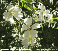 27th: There was light rain from 0300 GMT turning moderate from 08 GMT stopping at 09 GMT. The sky was overcast, the S'ly wind force 6 and a temperature 11.3C (dewpoint 10.9C; 97% relative humidity). Pressure had fallen to 1014 mb with a complex frontal system over the Irish Sea associated with low 967 mb S of Greenland, but pressure 1033 mb to the S over Biscay was building. The morning was mostly cloudy and the afternoon had only a few bright spells with no sunshine here (Valley saw 0.1 h). Apart from a trace residue left from rain early in the day it was dry. [Rain trace; Max 16.0C; Min 8.7C; Grass 6.4C]
28th: Pressure had risen to 1029 mb at 09 GMT. Although the sky was overcast early the morning slowly brightened with stratiform cloud thinning and clearing westward by afternoon it was mostly sunny here with the temperature rising to 19.9C. The force 5 S'ly wind moderated through the day dying away during the evening. [Valley 15.9C, 6.6h] [Rain 0.0 mm; Max 19.9C; Min 11.0C; Grass 10.4C]
29th: With pressure 1032 mb, highest of the month, with high 1036 mb over the North Sea. Under mostly clear sky and light S'ly breezes the temperature at 09 GMT was 16.2C (dewpoint 13.6C) and the soil surface was partly dry. Visibility was good with slight haze and the temperature rose to 21.8C by afternoon. It was a fine evening with very good visibility and a light NE'ly breeze. [Valley 22.3C, 11.2h] [Rain 0.0 mm; Max 21.8C; Min 10.6C; Grass 6.8C]
30th: Another sunny morning, just 1 okta of cirrus clouds and very good visibility. The surface of the soil was dry and there was a light SE'ly breeze off the mountains; the temperature at 09 GMT was already 19.8C (dewpoint 8.8C, RH 49%) and rose to 24.0C at noon with relative humidity falling to 33%. Although an intermittent sea breeze developed the temperature continued to rise reaching 25.3C around 1400 GMT,highest of the month and year so far, with relative humidity as low as 43%. The temperature at 1800 GMT was 16.5C and relative humidity was 74%; the evening was mostly clear with little or no wind. [Inverness &Altnaharra 25C, Valley 22.5C, 15.5h] [Rain 0.0 mm; Max 25.3C; Min 12.3C; Grass 6.7C]
31st: Another fine and sunny morning, but pressure had fallen to 1018 mb with the high 1034 mb now to the N of Scotland; pressure was low 1010 mb over Spain. The sky was clear, visibility very good, but there was a strong NE'ly breeze. Despite the wind the temperature at 09 GMT was 17.4C (dewpoint 11.4C) and in clear sunshine rose to 20.8C, the 3rd consecutive day to see 20C, or more. The evening too was clear with with a gentle NE'ly breeze.[Rain 0.0 mm; Max 20.8C; Min 10.8C; Grass 6.4C]
The month ended with a total rainfall of 81.4 mm (114%) and [142%] of average, highest since 2006. The mean temperature was 11.4C (-0.6) [-0.1], lowest since 2005. It was sunnier than average, the 205 h duration at RAF Valley was (108%) of average.
1st: June began with a continuation of the fine warm weather. Clear sunny skies with a light to moderate cooling breeze off the sea from the north-east and very good visibility. The temperature at 09 GMT was already 19.5C (dewpoint 10.5, RH 56%) and reached 22.0C during the afternoon. With the constant wind off the sea relative humidity fell no lower than 56% during the day. Global solar radiation for the 24-h to 2100 GMT was 27.56 MJ m -2. The skies were clear in the evening and night, the wind dying away after dark. [Valley 24.4C, 15.4h] [Rain 0.0 mm; Max 22.0C; Min 12.1C; Grass 7.8C]
2nd: A fine and sunny morning, still very good visibility with a little high cirrus clouds and haze developing. The temperature at 09 GMT was 20.1C and, despite a constant light to moderate NE'ly breeze off the sea during the day, rose to 22.9C with a relative humidity 56%. The evening was mostly clear, a little cirrus was seen, with the wind dying away. [Rhyl 25.7C, Capel Curig 23.9C, Valley 23.1C, 15.0h] [Rain 0.0 mm; Max 22.9C; Min 13.6C; Grass 8.8C]
3rd: The sky was clear until morning when mist rolled in on a N'ly breeze, thickening to moderate fog between 0710 and 0740 GMT it had began to clear by 09 GMT but visibility was still poor. As a result the temperature was 14.8C (dewpoint 12.8C), but did go on to reach 17.6C around 14 GMT under partly cloudy skies. Relative humidity went no lower than 78% today. Mist returned at low levels by 1700 GMT with the mountains barely visible, otherwise the evening was mostly clear with the temperature falling feeling cool in the breeze. [Valley 19.5C, 11.4h] [Rain 0.0 mm; Max 17.6C; Min 11.1C; Grass 6.9C]
 4th: Overnight the temperature on the grass fell to 4.2C, so there was no frost to affect the potatoes coming through on the garden plot. It was bright and sunny from the start with little wind at first. The sky was almost covered with high cirrus clouds and although there was a little haze visibility was very good. A sunny day, the wind light N'ly at first giving way to a light SE'ly during the morning with the temperature rising to 18.0C and relative humidity down to 50% just after noon. Then the sea breeze cut in the relative humidity rising quickly to 74% and the temperature falling to 14.5C. A N'ly breeze persisted during the evening that was mostly clear with a little mist developing. [Valley 17.7C, 14.4h] [Rain 0.0 mm; Max 18.0C; Min 8.1C; Grass 4.2C]
5th: Overcast at first with the odd brighter spell and glimpses of sunshine in breaking cloud cover towards 09 GMT. There was a light variable, generally E'ly, breeze and the temperature was 14.1C. During the morning the cloud thickened and the wind backed N'ly strengthening to force 4 with a shower of rain at 0945 GMT. By 1020 GMT it was bright and sunny. Wintry precipitation was reported with snow falling on the Pennines as low as 1900 ft during the early afternoon with some on the A686, and on Cairngorm. The afternoon (maximum temperature 13.9C) kept mostly cloudy; during the evening with the cloud thickening and wind freshening there were a few spots of rain then a shower at 2230 GMT. [Rain 6.8 mm; Max 13.9C; Min 7.5C; Grass 4.4C]
6th: Drizzle and light rain at 05 GMT becoming moderate to heavy at 0800 GMT including some ice pellets, becoming light and intermittent after 1000 GMT continuing into the afternoon. It was a cool day sunless day with the temperature at noon hovering around 9C and the wind freshening during the afternoon. Solar radiation was a low 5.96 MJ m -2. There was a further spell of light rain from just before 1800 GMT only ceasing at 2100 GMT. [Valley 10.3C, sunless] [Rain 2.8 mm; Max 10.6C; Min 7.2C; Grass 6.6C]
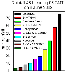 7th: The morning was still overcast and following an overnight minimum of 8.2C the temperature 10.6C was rising at 09 GMT. This was the highest of the past 24-h and became yesterday's maximum 10.6C, lowest of the month. Low 999 mb was over the SW English Channel with a spiral of occluded frontal cloud over Brittany and central England. There were thunder storms in southern Britain resulting in flash flooding in parts of London and SW England and South Wales. In Wembley lightning set fire to a block of flats, but all residents were got out safely with 75 firefighters tackling the blaze. The day was mostly cloudy with little in the way of sunshine and spots of rain in the afternoon. The evening was brighter with some sunshine at times. In the 48-h to 06 GMT on the 8th 76 mm of rain fell in Liscombe, Somerset, 58 mm in St. Athan and 16 mm at Valley, here we just had 3 mm, but nothing wrong with the observations! It was a dry place for once, Rhyl had just 5 mm and Liverpool Crosby just 4 mm too. [Rain 0.9 mm; Max 13.2C; Min 8.2C; Grass 7.7C]
![]() 8th: There was slight rain around midnight and by dawn the sky was clearing with 6 oktas cirrus and cumulus clouds at 09 GMT. Pressure was 1008 mb with low 993 mb just W of the Bay of Biscay; pressure was high 1025 mb over Greenland and Iceland. The jetstream is keeping well to the S; it was over Spain and France where the weather was unsettled also. The morning was mostly cloudy and rather dull, but the afternoon was bright with glimpses of sunshine for a while becoming sunnier and feeling somewhat warmer by evening. Soil moisture has fallen to 54% dry mass (the saturated water percentage for the local soil is 70%). [Rain 0.0 mm; Max 14.2C; Min 8.9C; Grass C]
8th: There was slight rain around midnight and by dawn the sky was clearing with 6 oktas cirrus and cumulus clouds at 09 GMT. Pressure was 1008 mb with low 993 mb just W of the Bay of Biscay; pressure was high 1025 mb over Greenland and Iceland. The jetstream is keeping well to the S; it was over Spain and France where the weather was unsettled also. The morning was mostly cloudy and rather dull, but the afternoon was bright with glimpses of sunshine for a while becoming sunnier and feeling somewhat warmer by evening. Soil moisture has fallen to 54% dry mass (the saturated water percentage for the local soil is 70%). [Rain 0.0 mm; Max 14.2C; Min 8.9C; Grass C]
9th: The sky was clearing before 09 GMT when there were 2 oktas cover of cumulus and cirrus with stratocumulus over the mountains. The temperature was 10.7C (dewpoint 6.7C) feeling chilly in the light to moderate NE'ly breeze. The morning turned cloudier although thin and moderately high at first there was some weak sunshine. There was plenty of birdsong around the garden and woodland including thrushes, blackbirds and chiffchaff. Peacock and painted lady butterflies were seen. The afternoon became dull as the cloud thickened, but it kept dry. Later there was a little brightness with some weak sunshine before sunset. Coastal areas in the W and N of the island had some good sunshine. [Valley 9.6h] [Rain 0.0 mm; Max 13.7C; Min 8.3C; Grass 5.8C]

|
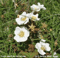 11th: Overcast near dawn then beginning to clear the sky had 6 oktas cover at 09 GMT. Pressure 1018 mb was rising in a weak ridge with Atlantic-low 996 mb to the SW. There was a light to moderate NW'ly breeze and visibility was very good. The morning was mostly cloudy with cumulus clouds persisting downwind of the Snowdonia Mountains. Cloud amounts reduced towards the W and N coastal areas where it was mostly sunny. The panoramic photo above taken near Hermon, Anglesey with WW2 pillbox on the left, shows the cloud seen to the SE across the Cefni Estuary at 1416 GMT. Another photo again looking SE, taken from Tywyn Aberffraw, shows the cloud persisting at 1617 GMT
 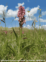 12th: Mostly cloudy at dawn becoming overcast with altostratus by 09 GMT. The . Pressure was 1022 mb in a col between low 996 mb off Ireland and low 997 mb S Baltic Sea. It was calm with the odd puff of ENE'ly wind and becoming duller as the cloud thickened giving a few spots of rain by 0930 GMT. The cloud over Wales and the South-west was on a warm frontal system with triple point over the Celtic Sea. There were a few spots of rain in the morning, but the afternoon was bright at first with glimpses of sunshine. Cloud thickened by 1610 GMT and when there was drizzle and showers of light rain until 1820 GMT. The evening remained overcast. [Rain 1.2 mm; Max 16.8C; Min 5.9C; Grass 3.1C]
 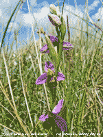 14th: The sky was mostly cloud covered at 0530 GMT, but breaks had appeared before 09 GMT with cumulus clouds developing with spells of sunshine. There were 1 or 2 forming small towers to the S, visibility was hazy but good. Pressure was 1021 mb with the slow-moving low 1007 mb off SW Ireland, there was a cold front over N France. The soil surface and grass was dry, only the lysimeter showed guttation water droplets at the ends of the grass leaves. A mostly sunny day, a little more cloud around the middle of the day diminishing towards evening and becoming clear. [London St James Pk. 24.3, Hawarden 20.3, Stornoway 15.4h] [Rain 0.0 mm; Max 20.0C; Min 11.1C; Grass 9.7C]
 The first 15 days had 22.5 mm of rain (33%) and [34%] of the average total for June. Temperatures were all below the average with the mean 13.0C (-1.3) and [-0.6] of the averages..
16th: The sky was clear at dawn, but was becoming cloudier by 09 GMT as cumulus clouds developed. Pressure 1021 mb had risen, in a ridge from high 1026 mb Brittany, and it was a mostly sunny day although some cloud did persist over SE Anglesey and the mountains. On the island's west coast high cirrus predominated; an area of cirrostratus provided a complete circular 22° solar halo at 1340 GMT lasting about 15 minutes. The sky was then mostly clear ahead of an encroaching frontal system associated with low 990 mb S of Greenland. Although thin altostratus reached the west coast by 1600 GMT weak sunshine continued into early evening. Cloud had thickened before dusk. [Hawarden 22.6C, Valley 12.3h] [Rain 6.5 mm; Max 21.2C; Min 8.3C; Grass 5.6C]

|
 18th: Cloudier again after midnight and overcast in the morning. Pressure 1017 mb was rising and with complex low-pressure to the north we were in a strong SW'ly airstream. There was a little brightness at times through the morning, but little in the way of sunshine. The afternoon was brighter with a few sunny spells and it was dry until a moderate shower of rain at 1900 GMT. The sky was partly clear at 2100 GMT. [Rain 1.6 mm; Max 16.0C; Min 8.8C; Grass 6.0C]
 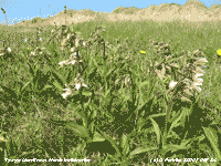 24th: The sky was clear at dawn and there was dew, the grass minimum was 9.4C. Pressure 1024 mb was falling with the high moving slowly NE introducing a SE'ly airflow. The temperature at 09 GMT was 19.8C (dewpoint 9.0, RH 51%). The morning was clear skied and sunny, the afternoon was a little cloudier with some cirrus and cumulus clouds to the S and W of the mountains. Here, it was mostly sunny and was clear in the evening such that twilight and northern-glow went on well after midnight. Solar radiation for the 24-h 21-21 GMT was 29.24 MJ m -2 , highest of the month. [Valley 23.3C, 15.5h] [Rain 0.0 mm; Max 22.1C; Min 12.6C; Grass 9.4C]
 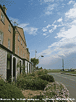 27th: There was a spell of moderate rain from 0115 to just after 0400 GMT. There was a little rain up to 09 GMT and the 24-h total of 15.1 mm, was the largest fall in the month. The morning was enveloped in low cloud and with further slight rain visibility was very poor and at times <500 m; cloud as low as 100 ft was reported in Llanfairfechan. Low cloud persisted through the morning and did not start to clear until 1600 GMT when the sun began to break through. The evening was bright with some sunshine. There were heavy thundery showers of rain in the south with parts of London seeing local flash flooding of roads. {London MO 27.8C, Trawsgoed 22.1C, Hawarden 20 mm} [Rain 0.5 mm; Max 20.7C; Min 14.0C; Grass 12.9C]
|
30th: The morning was mostly cloudy, but there was some sunshine at times. Pressure was 1021 mb in a slack area between high 1024 mb over the North Sea and low 994 mb W of Ireland. There was moderate cumulus cloud development to the S and over the mountains, and cirrostratus to the west. Haze persisted below about 1500 ft seen against the darker mountains, while the tops remained clearer. It was another warm day with the temperature rising to 25.4C. Possible thunder was heard during the afternoon, sferics indicated that there were storms S of the mountains, but planes from RAF Valley were flying in the vicinity and the observation remains unconfirmed. The first of the new Hawk T2 jet trainers are now at the base, perhaps they were being tried out! The evening was fine and warm, but mostly cloudy. [Heathrow 31.2C, Trawsgoed 26.4C & 10.4 mm, Copley 87.9 mm] [Rain 0.0 mm; Max 25.4C; Min 13.4C; Grass 11.6C]
The month ended with a rainfall total of 67.1% on the average with (99%) and [101%]. Although the month began with temperatures well below normal it was warm at the end and the mean for the month 14.5C was (+0.3) and [+0.9] of average. There were 14 days with a maximum of 20C, or more, most since 2006 and ranking 4th since before 1979. There were 9 days with >=20C consecutively at the end of the month. It was the sunniest June since 1975 at Valley (234.7 h) and 6th sunniest on the Anglesey record since 1930.
 1st: With the 'level-3 heatwave' continuing in some parts of Britain into July the overnight minimum of 16.3C had risen to 21.7C by 09 GMT. There were 6 oktas of altocumulus, some lenticular to the S of the station, cirrus and small cumulus clouds over the mountains. There was a light SE'ly breeze, but the direction did vary through the day. Visibility was good and smoke haze was evident. The soil temperature at 5 cm was 22.4C, and reached 19.5C at 30 cm. At 100 cm it was a cool 16.0C and when the thermometer was removed from the tube the glass immediately 'steamed up' with condensation and had to be wiped dry before reading. There were some good sunny spells, cumulus were weak during the morning, and the temperature rose to 28.1C, highest of the month, in a light S'ly breeze in the afternoon. Cumulus clouds to the S and SE began to develop and by 1743 GMT with large cumulonimbus thunder was heard to the south-east. Thunder was almost continuous until 1845 GMT when the last cumulonimbus passed by to the SE almost reaching overhead the station. No lightning was seen, sferics were confined to the mainland SE of here. The sky to the NE remained clear and it was a sunny evening, and with not a drop of rain. {Heathrow 30.9C, Albemarle 37 mm } [Rain 0.0 mm; Max 28.1C; Min 16.3C; Grass 13.5C]
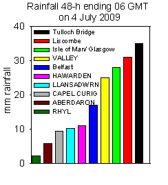 2nd: Another warm night with the minimum 18.0C (15.5C on the grass) and with broken cloud and sunny spells had risen to 22.2C at 09 GMT. The temperature in the soil at 30 cm had reached 20.0C. Pressure 1018 mb had started to fall and there was a band of frontal rain affecting the SW, Ireland and western Scotland. At 11 GMT it was still mostly sunny here with the temperature on 24.7C rising to 25.7C during the early afternoon. Soon becoming cloudier, with a few spots of rain that evaporated quickly on the warm concrete, but keeping reasonably bright until overcast and thickening by 1825 GMT when there were more spots of rain. The front over western Britain was making very slow progress eastward, rain sliding NNE giving us a miss in the shadow of the Snowdonia Mountains. Valley (out of the shadow area) caught some of the heavier rain with 25.0 mm (09-09 GMT), see similar event on 7th June 2009. Light rain eventually fell here from 2200 GMT. {Heathrow 30.6C, Hawarden 28.4C, Belfast Aldergrove 22 mm}[Liscombe 28.2 mm, Tulloch Br. 23.4 mm, Valley 25.0 mm] [Rain 10.3 mm; Max 25.6C; Min 18.0C; Grass 15.5C]
![]() 3rd: Light rain until 0300 GMT then mist and moderate fog before moderate to heavy rain from 0600 to 0700 GMT, heavy over the mountains where Clogwyn AWS reported 11.2 mm per hour. The rain turned light up to 09 GMT when there were 10.3 mm (09-09 GMT) in the raingauge. With a weak cold front passing over there was a fresher feel with the temperature falling to 15.6C. Pressure 1012 mb too was falling slowly and there was a gentle SW'ly breeze picking up. Slight rain turning to drizzle petered out before noon as the sky began to clear. Although some fair-weather cumulus formed later, and a line of stratocumulus persisted over the mountains, Anglesey was mostly sunny. The temperature rose to 20.6C. The clear weather moved only slowly eastward, but pepped up with heavy rain in Somerset, Manchester and thunderstorms in Scotland. Clearer weather reached Manchester by the middle of the afternoon and it was a mostly sunny end to the day. {Weybourne 26.7C, Glasgow 28.2 mm, Valley 24.6 mm} [Rain 2.3 mm; Max 20.6C; Min 15.6C; Grass 15.5C]
3rd: Light rain until 0300 GMT then mist and moderate fog before moderate to heavy rain from 0600 to 0700 GMT, heavy over the mountains where Clogwyn AWS reported 11.2 mm per hour. The rain turned light up to 09 GMT when there were 10.3 mm (09-09 GMT) in the raingauge. With a weak cold front passing over there was a fresher feel with the temperature falling to 15.6C. Pressure 1012 mb too was falling slowly and there was a gentle SW'ly breeze picking up. Slight rain turning to drizzle petered out before noon as the sky began to clear. Although some fair-weather cumulus formed later, and a line of stratocumulus persisted over the mountains, Anglesey was mostly sunny. The temperature rose to 20.6C. The clear weather moved only slowly eastward, but pepped up with heavy rain in Somerset, Manchester and thunderstorms in Scotland. Clearer weather reached Manchester by the middle of the afternoon and it was a mostly sunny end to the day. {Weybourne 26.7C, Glasgow 28.2 mm, Valley 24.6 mm} [Rain 2.3 mm; Max 20.6C; Min 15.6C; Grass 15.5C]
 4th: The sky clear after midnight allowed the temperature to fall to 14.0C around 04 GMT (11.8C on the grass) before cloud on a shower front encroached. There was moderate rain from 08 GMT reducing to slight rain and drizzle after 09 GMT. Pressure was 1010 mb with complex low-pressure 999 mb W of Ireland. Pressure was high 1018 mb over France with a ridge to S England. A patch of blue sky to the S soon disappeared; the morning was rather dismal with moderate visibility and cloud low on the mountains, the afternoon began in similar fashion before the cloud began to lift and clear after 1330 GMT. The late afternoon and evening were fine and mostly sunny, the temperature reached just 19.8C, the first day <20C since 21st June. The Sweet William in the garden have been attracting many large Silver Y moths (photo left) these last evenings. It is a migrant species that has been common this year arriving earlier with Painted Lady butterflies on southerly airflows, that sometimes bring dust as well. They have been on flowering sage, but this has finished. There were heavy showers of rain at 2300 GMT and midnight. [Hawarden 23.4C, Valley 16.6 mm, 3.7h] [Rain 5.0 mm; Max 19.8C; Min 14.0C; Grass 11.8C]
5th: It was a bright early morning with a little sunshine before showers encroached before 09 GMT. Pressure was 1008 mb with low 997 mb W of Ireland seemingly going nowhere at the moment. We were in a showery airflow, but the day kept bright with some sunny spells here until there was a slight shower at 1800 GMT. The temperature reached 20.2C, bringing the number of days seeing 20C, or more, this year to 22; the average number of days is 38 here, the highest was 66 in 1990. Showers were frequent from 2200 GMT. {Coningsby 25.9C, Hawarden 22.6C, Aberporth 15.2 mm} [Rain 1.7 mm; Max 20.2C; Min 13.1C; Grass 11.0C]
6th: Showers continued until 0200 GMT. At 06 GMT it was bright and sunny, but soon became overcast with a light showers beginning in the hour before 09 GMT. Pressure was 1003 mb with the low 999 mb now over N Ireland. We were in a cloudy centre of the low, hanging low on the mountains with mist on the lower slopes. There were heavy thundery showers to the SW England and S Wales, Clogwyn AWS on Snowdon reported 10 mm in the hour before 09 GMT. The morning continued mostly cloudy with odd spots of rain up to 1130 am, then brightened with sunny spells in the afternoon. Although there were cumulus clouds in the vicinity at times showers kept away. The evening was sunny, but cloud encroached before midnight. [Heathrow 22.8C, Hawarden 20.3C, Aviemore 32.6 mm, Rhyl 18.6 mm] [Rain 10.5 mm; Max 20.2C; Min 11.9C; Grass 10.8C]
7th: There was a shower of rain around midnight then heavy rain at 0300 GMT (9 mm in < 1h). After a shower at 06 GMT there was low cloud, poor visibility , light rain and drizzle easing just before 09 GMT. Pressure was 1004 mb with the low 998 mb moved over to the N Sea. High 1024 mb was extending a ridge W of Ireland. The morning was overcast, but visibility improved moderate to good before noon. The afternoon slowly brightened up and the evening was sunny at first the sky clouding over again before 2100 GMT. Convective clouds were strongly developed during the day in England with heavy showers of rain in places. {Shoeburyness/ Manston 22.0C, Milford Haven 19.2C, Herstmonceux
42.2 mm, Capel Curig 17.6 mm}[Rain trace; Max 17.1C; Min 12.2C; Grass 9.8C]
8th: One or 2 breaks in the cloud, but the morning was dull with the NW breeze keeping the mainland mountaintops and western and north-facing slopes cloud covered. Cool under thick cloud and in the light to moderate NW'ly breeze, the temperature at noon just 15.0C rising to 16.3C in the afternoon. Brighter in the afternoon with a little sunshine turning cloudier again during the evening. In the W and N of the island it was much sunnier, Valley reported 8.5 h of sunshine, highest in Britain today. {Pembrey Sands 18.6C, Hawarden 11.8 mm, Valley 8.5h}[Rain trace; Max 16.3C; Min 11.5C; Grass 9.1C]
9th: Cool during the cloud covered night with the minimum 10.0C, 7.3C on the grass. Pressure 1018 mb had risen in the western-ridge 1022 mb from Finisterre to Iceland. Low 987 mb was over the Baltic Sea, winds were strong off NE Scotland, and low 1007 mb over the Atlantic S of Greenland. Visibility was good but cloud cover persisted during the morning, the cloudbase was higher today with most summits, except Snowdon, in the clear. The afternoon was fine, but sunshine was at a premium before the end. The evening sunny at first had become cloudy before 21 GMT. [Rain trace; Max 15.8C; Min 10.0C; Grass 7.3C]

|
Rosebay willowherb was in full flower, attracting hover flies ![]() , on a previously felled area and along open exposed sides of tracks. Orchids, including the common spotted orchid, were still abundant in a few grassy areas and remnant dune slacks
, on a previously felled area and along open exposed sides of tracks. Orchids, including the common spotted orchid, were still abundant in a few grassy areas and remnant dune slacks ![]() , under the some pine trees where sufficient light and moisture could penetrate. It was a good day to see butterflies, dozens were flying up from grassy tracks including orange coloured skippers
, under the some pine trees where sufficient light and moisture could penetrate. It was a good day to see butterflies, dozens were flying up from grassy tracks including orange coloured skippers ![]() , meadow browns
, meadow browns ![]() , gatekeepers
, gatekeepers ![]() and fritillaries. The marsh helleborines, and the very rare native dune helleborine
and fritillaries. The marsh helleborines, and the very rare native dune helleborine ![]() known only on Anglesey
known only on Anglesey ![]() and NW England, were both in flower.
and NW England, were both in flower.
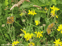 11th: Deepening low 988 mb was off SW Ireland with associated warm and following cold fronts encroaching the west. The morning was overcast and dull with cloud spilling over and hanging low on the western summits of the Snowdonia Mountains. Visibility under the cloud was very good, here the cloud was thinner and it was relatively bright with the temperature rising to 18.2C at 09 GMT, the highest of the past 24-h. The weak sunshine, I did not see any bright sunshine, was sufficiently strong to warm the soil surface (5 cm depth) to 18.8C, yesterday morning it was 15.3C. The temperature went on to reach 19.5C before the cloud thickened and there was a very fine drizzle. This could be felt on the face, but it did not wet the ground. Heavier drizzle and light rain did begin to fall at 1015 GMT then petered out and there were more bright spells with intermittent fine drizzle. A band of heavy rain lay to the west and had been forecast to give a wet day in Cardiff for the 4th day of the 1st Ashes Test Match between England and Australia. It was the first cricket test match to be held in Wales at the new SWALEC Stadium in Cardiff. Progress of the rain was slower than expected so that play was able to continue until about 3.50 pm, then restart about 6.15 pm for 6 overs. Rain was heavy in SW Ireland with Valentia reporting 37.7 mm (00-00 GMT), the Scilly Isles 44.4 mm {21-21 GMT}and Milford Haven 23.8 mm {21-21 GMT}. The evening was windy with the S'ly reaching force 6/7, rain was mostly light here from just before 1700 GMT to 2300 GMT.. [Rain 7.7 mm; Max 19.5C; Min 12.8C; Grass 11.4C]
 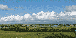 14th: A bright morning with some sunny spells. Pressure was 1005 mb with the shower-packed low 990 mb slow-moving lying to the SW. Showers swept across the Snowdonia range during the afternoon, but it kept dry here until 1540 GMT. There was a heavy shower in Beaumaris at 1600 GMT. There was a noticeable drop in temperature from 19.8C to 14.0C in less than an hour. The evening was a little brighter with some sunshine, there were cumulonimbus clouds in the vicinity and thunder was reported. The sky was overcast by 2100 GMT. [Rain 3.1 mm; Max 12.9C; Min 11.8C; Grass 9.5C]
 At Tywyn Aberffraw it was a sunny afternoon. Most of the orchids in the slacks had finished flowering. On some fixed dunes a few pyramidal orchids were seen, but the Burnet roses (see 11 June) had finished as well. At first glance at this fixed dune ![]() there appeared to be nothing of interest, but a closer examination revealed the rather inconspicuous, yet freely flowering wood sage
there appeared to be nothing of interest, but a closer examination revealed the rather inconspicuous, yet freely flowering wood sage ![]() . On the flatter fixed dunes further from the sea some wild carrot was seen in flower
. On the flatter fixed dunes further from the sea some wild carrot was seen in flower ![]() . Seen in close-up the central flower of the large umbel is usually as here coloured red
. Seen in close-up the central flower of the large umbel is usually as here coloured red ![]() . Plants of ragwort, frequent on the fixed dunes, were being consumed by hundreds of caterpillars of the cinnabar moth
. Plants of ragwort, frequent on the fixed dunes, were being consumed by hundreds of caterpillars of the cinnabar moth ![]() . Settling on the ragworts were dozens of the daytime flying six-spot Burnet moths
. Settling on the ragworts were dozens of the daytime flying six-spot Burnet moths ![]() , cinnabar moths are nocturnal and around earlier in the season as demonstrated by presence of their caterpillars. Several linnets were seen, this is a pair keeping watch from some tall willows around the willow slack
, cinnabar moths are nocturnal and around earlier in the season as demonstrated by presence of their caterpillars. Several linnets were seen, this is a pair keeping watch from some tall willows around the willow slack ![]() .
.
In the first 15-days of the month the mean temperature was 16.5C (+0.6) and [+0.9] of averages. The mean maximum was 20.1C [(+0.6)]. The mean minimum 13.0C was (+0.7) and [+1.3]. Rainfall totalled 44.8 mm (70%) and [71%] of monthly average. .
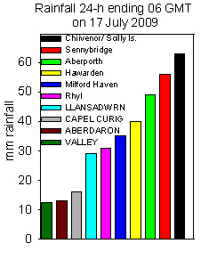
![]() 16th: Slight showers of rain after midnight persisting until morning. A glimpse of sunshine before 09 GMT then overcast. Despite the frequent spots of rain only 0.2 mm was collected in the raingauge. Pressure 1017 mb was rising, but developing low 1013 mb over Biscay was tracking NE towards the English Channel. An associated band of moderate rain with embedded patches of heavy rain moved into SW England and S Wales. The morning here remained dull, and with more of those spots of rain around noon. The afternoon though keeping dull was dry at first. Darkening clouds to the SE brought a shower of rain at 1430 GMT then moderate to heavy rain continuous from 1600 GMT. Rainfall (06-06 GMT) was largest in the south with the Scilly Isles and Chivenor having up to 63 mm while Sennybridge had 56 mm. Hawarden had 40 mm and here we had 29 mm. The overnight rainfall of 29.6 mm, largest of the month, brought the month's total here up to 74.3 mm [(117%)]. In contrast to the 2nd, Valley reported 12.6 mm again emphasising the effect the mountains have on the SE corner of the island.{Gravesend 25.6C, Cardinham 66.8 mm, Manston 13.6h}[Copley 64.2 mm, Valley 12.6 mm] [Rain 29.6 mm; Max 18.8C; Min 14.2C; Grass 12.3C]
16th: Slight showers of rain after midnight persisting until morning. A glimpse of sunshine before 09 GMT then overcast. Despite the frequent spots of rain only 0.2 mm was collected in the raingauge. Pressure 1017 mb was rising, but developing low 1013 mb over Biscay was tracking NE towards the English Channel. An associated band of moderate rain with embedded patches of heavy rain moved into SW England and S Wales. The morning here remained dull, and with more of those spots of rain around noon. The afternoon though keeping dull was dry at first. Darkening clouds to the SE brought a shower of rain at 1430 GMT then moderate to heavy rain continuous from 1600 GMT. Rainfall (06-06 GMT) was largest in the south with the Scilly Isles and Chivenor having up to 63 mm while Sennybridge had 56 mm. Hawarden had 40 mm and here we had 29 mm. The overnight rainfall of 29.6 mm, largest of the month, brought the month's total here up to 74.3 mm [(117%)]. In contrast to the 2nd, Valley reported 12.6 mm again emphasising the effect the mountains have on the SE corner of the island.{Gravesend 25.6C, Cardinham 66.8 mm, Manston 13.6h}[Copley 64.2 mm, Valley 12.6 mm] [Rain 29.6 mm; Max 18.8C; Min 14.2C; Grass 12.3C]
17th: At midnight the low 1006 mb was centred over the English Channel near the Isle of Wight. Rain bands continued to circulate within it and moderate rain continued here until 07 GMT when it became light. At 09 GMT pressure here was 1009 mb when the low was over the Wash. During the morning low cloud and mist with moderate visibility partially obscured the mountains; there was intermittent slight rain and drizzle at times here. The maximum temperature of 15.7C was lowest of the month. There was heavy rain in NE England and a narrow band of heavy thundery showers affecting S England and S Wales. Long-lasting and spectacular storms were reported in Ramsgate, Kent. In Wales heavy rain caused flooding of homes in Llanelli and Swansea; some train services were suspended. A landslip and flood water damaged a house in Caswell ; in Gower the Scurlage to Knelston road was closed. An 80 ft oak tree dating from 1760 was brought down by rain and strong winds at Picton Castle in Pembrokeshire. Here, slight rain continued until 1430 GMT, but kept overcast until clearing skies over Anglesey gave a sunny evening. {Bridlington 21.2C, Stornoway 13.7h, Valley 18.0C}[Valley 4.0h] [Rain 4.3 mm; Max 15.7C; Min 10.9C; Grass 10.3C]

The vase of sweet peas was cut from the garden and so far they have been doing well. Raspberries and blackcurrants have been picked despite the attentions of 2 families of blackbirds. The garden is quieter now as the birds finished off the last of the blackcurrants. The warm and moist weather has helped along the peas and potatoes, bees have pollinated the broad beans and small beans are growing. Runner beans are slow, they are always a problem here. Strawberries have been another matter, loads of strawberries, but few were picked as they seemed to disappear overnight. There are no grey squirrels since the trapping to assist the reds and the disappearance was a mystery until caches of ripe and unripe strawberries were found ![]() . Further investigation revealed they were being picked and stored by wood mice! We have a lot of those, and a lack of tawny owls this year does not help.
. Further investigation revealed they were being picked and stored by wood mice! We have a lot of those, and a lack of tawny owls this year does not help.

|

The rain kept away and it was mostly sunny at Tatton Park (above right) on Saturday 25th for the 4th day of the RHS Show. The Manchester Allotment Societies built a garden in raised beds to show what a wide variety of edible crops can be grown ![]() these included potatoes, cabbages and beans. Sheffield Blooms had a bedded out garden featuring 'Tom'
these included potatoes, cabbages and beans. Sheffield Blooms had a bedded out garden featuring 'Tom' ![]() , representing a steel worker pouring molten steel from his crucible and named after Thomas Vickers, a steel works founder in the city. The colours represent changing colours as the steel cools in the casting. Attracting much attention was Chris Beardshaw's Garden
, representing a steel worker pouring molten steel from his crucible and named after Thomas Vickers, a steel works founder in the city. The colours represent changing colours as the steel cools in the casting. Attracting much attention was Chris Beardshaw's Garden ![]() . The garden, celebrating Cheshire's Gardens of Distinction, is circular and represents a magnified cross section through the stem of a herbaceous plant
. The garden, celebrating Cheshire's Gardens of Distinction, is circular and represents a magnified cross section through the stem of a herbaceous plant ![]() but was not immediately obvious even from the top of a turf amphitheatre due to the crowds. At the centre is a sculpture depicting an exploding pollen from Primula bulleyana, a plant named after A K Bulley, a wealthy 'plant hunting' merchant in the late 1890's who created a garden which became the Ness Botanic Garden in 1898. After the show the garden will be moved to Ness, near Chester.
but was not immediately obvious even from the top of a turf amphitheatre due to the crowds. At the centre is a sculpture depicting an exploding pollen from Primula bulleyana, a plant named after A K Bulley, a wealthy 'plant hunting' merchant in the late 1890's who created a garden which became the Ness Botanic Garden in 1898. After the show the garden will be moved to Ness, near Chester.
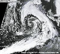 26th: At midnight low 990 mb was off Shannon, Ireland, and cloud associated with an occluded front over SW Ireland had begun to encroach. There was light to moderate rain from 0400 GMT to 0910 GMT. There was a strong (f6) S'ly breeze and moderate visibility. There was no more rain during the morning, showers persisting over the mountains and along the N Wales coast with the best of the sunshine around Cheshire and between Llandudno and Llanfairfechan. There were some short sunny intervals here, but the sky was mostly cloudy by noon becoming overcast during the afternoon. With the frontal cloud sliding slowly along the English Channel it was wet in SW England and S Wales. In Brittany apart from the odd shower it was mostly sunny. The strong wind continued into the evening moderating later. {Gravesend 23.6C, Chivenor 20.8 mm, St Athan 18.6 mm} [Rain 0.4 mm; Max 17.5C; Min 13.7C; Grass 11.7C]
A wet month with 135.8 mm of rain (212%) and [214%] of average, wettest since 1967 ranking 8 since 1928. The mean temperature was 15.8C (-0.1) and [+0.2] highest since 2007 ranking 13 since 1979. Sunshine duration at Valley was 175.8 h [(104%)] ranking 21 on the Anglesey record since 1930. .
1st: The unsettled weather continued into August, but it was a fine and bright morning after a little rain between 0345 and 0545 GMT. There were some cumulus clouds over the Snowdonia Mountains with cirrus and altocumulus overhead. Low 994 mb was off Cape Wrath and pressure was high 1026 mb over the Azores while here it was 1006 mb. The sky was cloudier around noon with some spots of fine rain and little in the way of sunshine until 17 GMT before more cloud encroached by evening. {Norwich AP 25.9C, Capel Curig 23.8 mm, Aberporth 9.4h} [Rain trace; Max 19.0C; Min 13.3C; Grass 11.8C]
2nd: Low 997 mb was N of Scotland and pressure here 1010 mb had risen. At first it was a mostly cloudy scene, but with thinning during the morning there was weak sunshine with spells of clear sunshine before noon. Cloud persisted over the mountaintops with some passing cumulus here during the afternoon. The evening was cloudier again, but there were clear patches in which the gibbous moon could be seen. There has been very little moonlight or views of the stars of late due to persistent cloud cover. {Andrewsfield 22.3C, Cassley 16.4 mm, Leuchars 13.5h} [Rain 0.0 mm; Max 19.2C; Min 10.2C; Grass 7.7C]
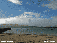 3rd: Again mostly cloudy, but with a SE'ly wind there was a lee clearance over Bangor (where it was mostly sunny) and the Menai Strait that extended briefly to here. Yet another low 986 mb (S of Iceland and W of Ireland) had associated frontal cloud over Ireland, Wales and SW England. There was a moderate to fresh wind and before noon the sky was mostly cloudy. From time to time during the afternoon there were some spots of rain and a few sunny intervals. There were showers of rain from 1830 GMT through the evening. [Rain 1.9 mm; Max 19.5C; Min 13.5C; Grass 12.1C]
4th: Slight showers persisted until 0115 GMT and the morning was mostly cloudy. A small lee clearance gave some sunshine in Beaumaris when showers were in sight across the Snowdonia Mountains. With warm air to the south the temperature at 09 GMT was 19.5C, the maximum of the past 24-h, soon rising to 19.8C before falling as a cold front moved across. There were spots of rain at times during the morning that remained cloudy. The afternoon was cooler with persistent slight rain and drizzle with very poor visibility until just before 1500 GMT. The cloud thinned but did not clear, there was a slight shower of rain around 1800 GMT. It was a sunless day here, but not in Beaumaris or at Valley. {Manston 25.0C, Shap Fell 21.2 mm, Lerwick 8.1h. Valley 1.0h} [Rain 1.3 mm; Max 19.8C; Min 14.7C; Grass 13.6C]
5th: The sky was clearing just before dawn when there was little or no wind. There was a line of stratocumulus clouds over the mountains with the odd small cumulus overhead. Pressure 1015 mb was rising in a ridge of high-pressure with the large-area low 983 mb S of Iceland and off Cape Wrath, still dominating the weather in the NW. The cold front was lingering over the Midlands and SE England. Clouds and a S'ly breeze increased during the morning, but clouds were of the fair-weather type and the day kept fine and mostly sunny. Later in the afternoon the sky was clearer, but there were some high clouds around during the evening that later slightly obscured the full moon rising to the SE over the mountains. Solar radiation was 22.70 MJ m -2 , highest of the month.{Gravesend 28.9C, Hawarden 23.6C, Lyneham 22.4 mm, Leuchars 12.8h, Valley 12.0h}[Rain 0.0 mm; Max 20.8C; Min 14.2C; Grass 12.4C]
6th: There was some early morning low-lying mist on some of the fields at dawn, there was moderate dew still on the grass at 09 GMT, but the soil surface was dry. Pressure 1020 mb had continued to rise under the influence of high 1025 mb to the S off Cape Finisterre, the maturing low 991 mb was over SW Iceland. Almost clear sky at first there were some moderate cumulus clouds in the vicinity, but mainly it was a sunny morning with a light SSW'ly breeze with good, but hazy, visibility. The afternoon was mostly sunny with a veil of cirrus clouds extending into the evening. The temperature rose to 21.8C, highest of what was to be a rather cool month. Holly blue butterflies were seen around the garden, also red admirals and peacocks. Further south and east there were thundery outbreaks with torrential rain in places as the slow-moving front edged NE towards the North Sea. {E. Malling 29.2C, Boscombe Dn. 47.6, Aviemore 13.0h, Valley 10.8h} [Rain 0.0 mm; Max 21.8C; Min 11.4C; Grass 7.9C]
7th: A clearing sky gave heavy dew on the grass early in the morning, and a rare cloud-free view of the summit of Snowdon. Visibility was very good and the sky deep blue in clean air. The view did not last as convective cumulus clouds, a few towering, developed by 09 GMT. Pressure was 1021 mb in a ridge from high 1026 mb off Cape Finisterre. There was frontal cloud off the east coast over the North Sea and developing Atlantic-low 1008 mb to the W of Ireland. Although there was some cloud at times, and cirrus encroached from the W later in the afternoon, it was a mostly sunny day with the temperature rising to 20.8C. {Thorney Is. 23.9C, Church Fenton 23.8 mm, Yeovilton 13.1h, Valley 10.5h}[Rain 0.0 mm; Max 20.8C; Min 10.8C; Grass 7.1C]
 8th: A bright morning with a few sunny spells at first turning cloudier later on Anglesey. It was sunnier along the North Wales coast from Llanfairfechan with blue sky over Liverpool Bay most of the day. A few more sunny spells in the afternoon that brought out several peacock butterflies
 ![]() to feed on the Buddleia. Also in flower now are the teasels and were attracting several bumblebees and hoverflies. Teasels are well worth growing in odd places in the garden, they will self-sow from seed too if the birds don't have them all. At present there do not seem to be an honeybees in the garden, wasps have been few also. When the sun was out it felt warm, but the SW'ly breeze seemed cool and this was confirmed by the maximum temperature just fleetingly reaching 20.0C. {London 26.3C, Hawarden 21.0C, Filton 13.4h, St. Athan 11.4h} [Rain 0.0 mm; Max 20.0C; Min 11.0C; Grass 7.2C]
to feed on the Buddleia. Also in flower now are the teasels and were attracting several bumblebees and hoverflies. Teasels are well worth growing in odd places in the garden, they will self-sow from seed too if the birds don't have them all. At present there do not seem to be an honeybees in the garden, wasps have been few also. When the sun was out it felt warm, but the SW'ly breeze seemed cool and this was confirmed by the maximum temperature just fleetingly reaching 20.0C. {London 26.3C, Hawarden 21.0C, Filton 13.4h, St. Athan 11.4h} [Rain 0.0 mm; Max 20.0C; Min 11.0C; Grass 7.2C]
9th: Bright at dawn with clouds increasing, altocumulus at first then stratocumulus developing from the west. Dew was heavy on the grass and there was some condensation on the taller autographic raingauge, but none on the octapent.. Pressure was 1020 mb. There was a little drizzle on the A5 past Ogwen at 0645 GMT when some overnight campers were emerging from their tents, the sky was brighter towards Capel Curig. Drizzle and slight rain reached here by 1030 GMT and there was more in the afternoon. At 09 GMT the temperature was 15.0C (dewpoint 12.8C) and this rose to 18.7C by afternoon; under thick cloud solar radiation was a low 12.98 MJ m -2.. {London 27.2C, Hawarden 22.3C, Salsburgh, Lanarkshire 27.2 mm, St. Athan 12.7h}[Rain 7.4 mm; Max 18.7C; Min 13.1C; Grass 10.7C]
10th: Drizzle turned to moderate rain soon after 03 GMT. At 09 GMT it was still raining, visibility was very poor with 100% relative humidity (temperature 15.3C). Rain petered out, but the morning remained dull with drizzle at times extending into the afternoon. From 1500 GMT lighter sky was seen in the west, with some thinning of the cloud there was a short bright spell with a little weak sunshine then overcast again. Solar radiation was 9.43 MJ m -2 , lowest since 17 June. During the evening the cloud did clear, there were bright stars at 2100 GMT the moon having not yet appeared. {Manston 25.1, Eskdalemuir 30.8 mm, Capel Curig 16.4 mm, Tiree 11.9h, Valley 1.4h} [Rain 1.1 mm; Max 18.7C; Min 13.6C; Grass 13.2C]
11th: A brighter morning with variable amounts of broken cloud and the odd glimpse of sunshine. Pressure 1022 mb was rising with high 1029 mb over the Atlantic to the south-west. There was light to moderate W'ly breeze and good, but hazy, visibility. With the cloud continuing to break and clear by early afternoon there was a long spell of clear sunshine when the temperature reached 20.5C. It was the first day of the Anglesey Show and with a fine, but breezy day there was a good attendance. The wind freshened and frontal cloud was seen approaching from the north-west. This reached here by 16 GMT and there were some spots of rain by 1630 GMT. A frontal wave low was moving, with little change in pressure, SE towards the North Channel at 09 GMT and by 15 GMT was over N England, with occluded frontal cloud approaching N Anglesey, and reached the North Sea by 21 GMT. Rainfall was light to moderate here from 2315 GMT with a slow-moving weak cold front sliding SE. {Pershore 25.8C, Rhyl 22.5C, Shawbury 14.6h} [Rain 11.5 mm; Max 20.5C; Min 10.8C; Grass 8.4C]
12th: Rain through the night was beginning to ease just before 09 GMT when 11.5 mm was collected in the raingauge. There was a slight deposit of pink to light reddish-brown Saharan dust. The sky was a uniform grey stratus, misty in drizzle with poor visibility. There was little (SW'ly) or no wind through the day that kept overcast and dull with spots of drizzle at times. There was a shower of rain at 1630 GMT. There was no sunshine here, but coastal Valley reported 0.9h. Solar radiation was a low 8.07 MJ m -2, lowest since 6 June (5.96 MJ) It was a dull, but mainly dry day for the 2nd day of the Anglesey Show. {Wainfleet 23.2, Hawarden 20.6C, Trawsgoed 17.2 mm, Leuchars 10.6h, Valley 0.9h} [Rain 0.4 mm; Max 17.2C; Min 14.6C; Grass 14.4C]
13th: Mostly cloudy with brief bright and sunny spells in the morning. Pressure 1021 mb was rising with a small high 1022 mb, a bulge from high 1026 mb over the Azores. This promised a fine day, but was to be another transitory event in this disappointing summer. The afternoon was brighter at times, and quite pleasant because there was little or no wind, and it did not rain. Partial cloud cover prevented seeing anything of the expected Perseid meteor showers. {St. James Park 24.1C, Mumbles Hd. 22.2C, Shawbury 14.8h, Aberporth 11.2h, Valley <1h} [Rain 0.0 mm; Max 17.3C; Min 11.7C; Grass 9.8C]
14th: Moderately high cloud mainly altostratus with the sun looming through at times at first, soon thickening. Pressure 1015 mb was falling with low 996 mb off the Western Isles and a block of heavy rain NW Ireland and W Scotland, Glasgow reported 27.8 mm of rain. Visibility was very good and the S'ly breeze freshened to force 3/4 and force 4/5 during the afternoon. The day was sunless, but mostly dry with spots of fine rain on the wind at times and more of a shower around 1530 GMT. {Norwich AP 25.3C, Glasgow 27.8 mm, Capel Curig 13.4 mm, Manston 9.9h} [Rain 4.0 mm; Max 17.5C; Min 11.0C; Grass 8.3C]
15th: With low 987 mb off NW Scotland pressure here 1007 mb was falling. Not a pleasant morning with moderate to heavy rain being blown across the fields on the strong SW'ly wind as a band of rain moved across N Britain. It was wet in Cumbria and Snowdonia. The rain eased here by 10 GMT, but the morning remained very dull, and windy with spots of rain. A rapid clearance began soon after 15 GMT with clear sky late afternoon into the evening. {Wainfleet 25.3C, Hawarden 22.6C, Shap Fell 36.2 mm, Capel Curig 27.6 mm, Manston 7.4h, Valley 4.7h} [Rain 2.5 mm; Max 18.0C; Min 15.8C; Grass 15.3C]
Rainfall for the first 15 days was 30.1 mm (31%) and [37%] of the monthly average. The mean temperature was 15.9C (+0.2) and [+0.6] of average, the highest maximum 21.8C was (-3.5) of the average. The mean minima 12.8C (+0.3) and [+1.2] reflects the blanketing effect of the cloudy nights we have been having.
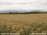 16th: Cloud encroached after 03 GMT and the sky was overcast at dawn. The SW'ly wind had moderated a little, but was fresh again (f5) by 09 GMT. Pressure 1014 mb was rising with yesterday's low moved across N Scotland and was centred 990 mb over the Baltic. This morning's cloud, affecting western Britain, was due to a frontal wave to the north-west associated with low 1005 mb S of Greenland. The succession of lows, associated with the jetstream that has been over Britain these last weeks, shows no sign of clearing. Barley on several fields around Llansadwrn was looking ripe and awaiting harvest. The newer shorter growing varieties have stood up well to the weather. Grass was still being cut and baled, mostly large polythene covered grass, but some traditional small rectangular bales of dried hay are made in a few places. The morning was dry under slightly thinner broken cloud and there was a bright spell with glimpse of sunshine early in the afternoon. After that it was dull and overcast with thick cloud the fresh wind continuing. {Manston 25.7C, Lerwick 11.4 mm, Wattisham 11.8h} [Rain 1.3 mm; Max 16.7C; Min 12.2C; Grass 10.0C]
17th: Some light rain between 0030 and 0245 GMT then with remnant frontal cloud breaking up it was a brighter morning with a little sunshine. Pressure was 1014 mb with high 1021 mb near Cape Finisterre and Atlantic-low 988 mb SW of Iceland. The afternoon had some good spells of sunshine with the cloud lifting from the mountaintops and clearing by evening. A dry, but breezy day, farmers took advantage to mown grass on a field next to the weather station. {Shoeburyness 24.6C, Wick AP 19.2 mm, Aberporth 9.7h} [Rain trace; Max 20.1C; Min 13.2C; Grass 11.8C]
18th: Cloud encroached after midnight and it was a cloudy dawn with a few spots of rain around 06 GMT. One or two breaks in the cloud at 09 GMT when the temperature was 17.2C (dewpoint 13.7C). It was still breezy, the S'ly force 5; the mountaintops were in cloud, but visibility was very good. Slow-moving low 985 mb SW of Iceland was filling the Atlantic while pressure was high 1022 mb over Europe to the SE. The low was keeping it breezy in the NW; there was patchy rain on a complex frontal system moving NE over N Ireland and W Scotland. Another breezy day, reaching force 6/7 at times, mostly bright with some weak sunshine and glimpses of clear sunshine, but darker clouds at times with spots of rain never enough to wet the ground. The highest temperature 20.3C was late in the afternoon. The mown grass on the field was turned several times before the farmers working to bale it until after dusk. The grass at weather station was mown and sampled today. The freshly cut grass was 318 g per sq. metre which when dried was just 47 g. Rate of growth since last sampling (11 days ago) was 4.3 g dry mass per sq. metre per day, that does not seem a lot, but over the season so far and worked out per hectare 7 tonnes had accumulated. Growth in the spring was slow, almost the lowest in recorded over 6 years, only since mid-July had the amount began to exceed the lowest in recorded 2004 (see graphs below). {Norwich AP 26.2C, Hawarden 22.5C, Eskdalemuir 15.0 mm, Manston 13.2h} [Rain trace; Max 20.3C; Min 14.2C; Grass 11.8C]
19th: Windy through the night, with odd spots of rain, but a bright morning with a complex sky. The minimum temperature overnight was 16.6C, highest of the month, and at 09 GMT was 18.3C (dewpoint 15.6C) and the soil and grass in the strong (f6) S'ly breeze were dry. Pressure 1011 mb was falling slowly, the deep low 984 mb S of Iceland dominating. Soon becoming cloudier as several fronts moved in across the Irish Sea bringing more spots of rain and strong gusts of wind by 11 GMT. Earlier in strong to gale-force winds off the north Anglesey coast near Middle Mouse a 24 ft yacht with crew of 2 that, after engine failure, was dragging it anchor. Unable to restart the engine or put up the sails up, because of what was described as 'atrocious' weather, the yacht was towed into harbour by the Holyhead lifeboat. The day was sunless here with moderate to heavy bursts of rain around 1300 and 1630 GMT, between the showers. A line of showers on a slow-moving wavy front was stationed over the west of the island. In the lee of the mountains at Llanfairfechan it was a 'hot sunny day' as it was so in SE England. Strong winds and light showers persisted into the evening and night. {Gravesend 30.3C, Hawarden 24.5C, Eskdalemuir 42.8 mm, Valley 11.8 mm, Manston 13.8h}[Rain 10.6 mm; Max 19.7C; Min 16.6C; Grass 16.2C]
![]()
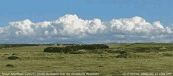 20th: Strong S'ly winds persisted after midnight, a spell of heavy rain at 0430 GMT with the wind strengthening reaching gale force 8 at times between 06 and 08 GMT, with gusts over 50 mph. Garden furniture and heavy potted plants blown over and the ground was strewn with small branches, leaves and beech nuts. Just like Autumn, but no it's still August. Gales in August are not unknown: in 1985 and 1986 several gales recorded. On 25/26th 1986 severe gales force 10 closed the Britannia Bridge and 37 mm of rain fell at the weather station. Today, pressure 1003 mb was rising with complex low-pressure 982 mb close to Iceland. A cold front was stationed over the Irish Sea on a line through the isle of Man and Anglesey; the temperature at 09 GMT was 15.9C, lowest of the past 24-h, rose to 18.7C during the morning . The cloud thinned and the wind moderated, by 1030 GMT there was a little blue sky appearing. During the afternoon, with the fresh breeze continuing, after the cold front had passed the temperature was falling although there was plenty of sunshine between slight showers of rain. The evening was cloudier with another slight shower of rain. {Norwich AP 27.5, Hawarden 21.3C, Eskdalemuir 47.2 mm, East Malling 8.2h, Valley 6.7h} [Valley 20.7 mm] [Rain trace; Max 18.7C; Min 15.9C; Grass 15.5C]
21st: Almost calm in the morning with clearing skies over Anglesey. There were a few cumulus clouds over Snowdonia mostly to the SE of here. Pressure 1016 mb was rising to give a mostly sunny day. The SW'ly wind freshened to force 5/6 during the afternoon when a line of cumulus clouds developed over the Snowdonia Mountains (above right) and for a panorama looking across across the entire range look here ![]() (click image in window to enlarge, Snowdon is central under the highest cloud formation). Anglesey had mostly clear skies with Valley the sunniest location in Britain with 9.5 h duration. Some cloud encroached for a time during the evening, but this mostly cleared during the night. Taking advantage of a dry day combines were out in the fields harvesting the barley crops. {Manston 22.6C, Hawarden 19.2C, Tyndrum 28.0 mm, Valley 9.5h} [Rain 0.0 mm; Max 18.0C; Min 11.5C; Grass 9.9C]
(click image in window to enlarge, Snowdon is central under the highest cloud formation). Anglesey had mostly clear skies with Valley the sunniest location in Britain with 9.5 h duration. Some cloud encroached for a time during the evening, but this mostly cleared during the night. Taking advantage of a dry day combines were out in the fields harvesting the barley crops. {Manston 22.6C, Hawarden 19.2C, Tyndrum 28.0 mm, Valley 9.5h} [Rain 0.0 mm; Max 18.0C; Min 11.5C; Grass 9.9C]
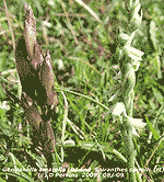 At Tywyn Aberffraw autumn flowering gentians and lady's-tresses orchids were just appearing on the dune slacks. The gentian, that has been more numerous in recent years, has been out for a while and there have been some early flowers. The orchid, easily missed, is just appearing and is very local. I was on this occasion lucky enough to find both growing close together to photograph
 ![]() Also in flower on the slacks was the round-leaved wintergreen, this too seems to have been increasing in some places
Also in flower on the slacks was the round-leaved wintergreen, this too seems to have been increasing in some places ![]() . Giving a blue tint to the willow slack amongst silverweed was a mass of flowering mint
. Giving a blue tint to the willow slack amongst silverweed was a mass of flowering mint ![]() and here in close-up
and here in close-up ![]() . The leaves of ragwort had been entirely consumed by caterpillars of the cinnabar and six-spot Burnet moths, but some flowers had escaped and had already formed seed
. The leaves of ragwort had been entirely consumed by caterpillars of the cinnabar and six-spot Burnet moths, but some flowers had escaped and had already formed seed ![]() . On the beach the sea was rough and with the onshore force 5 wind too inclement for swimmers, but it was good for flying a kite
. On the beach the sea was rough and with the onshore force 5 wind too inclement for swimmers, but it was good for flying a kite ![]() . Sand was being blown off the beach and being trapped by the marram grass.
. Sand was being blown off the beach and being trapped by the marram grass.
 23rd: After some early glimpses of weak sunshine dark clouds were already approaching from the west and rain began before 09 GMT. We were in warm sector air with 17.1C (dewpoint 14.7C) at 09 GMT pressure was 1010 mb and the S'ly wind was blowing force 5/6. Anglesey and western facing mountain slopes were enveloped in low cloud and light rain, it was drier with some sunshine at times along the North Wales coast east from Llanfairfechan, that continued until after 1600 GMT. Then drier with thinner cloud until the cold front arrived at 2200 GMT bringing 30 minutes of heavy rain (15 mm per hour), then easing but not clearing until after 0130 GMT. A sunless day with solar radiation a low 6.38 MJ m -2 , lowest since 6 June. A wet day too in Ireland where the 3rd day of the Ireland Tour cycle race took place, many riders abandoned the stage to Cork. Valentia had 45.3 mm and Malin Head 26.2 mm (00-00 GMT). Fine in Manchester until 5 pm and a full day's play with blue skies at the Oval in London where England beat Australia to win the ashes in 2-1 matches. {Weybourne 28.4C, Hawarden 20.2C, Tiree 44.2 mm, E Malling 12.8h} [Valley 14.8 mm] [Rain 16.0 mm; Max 17.9C; Min 14.4C; Grass 14.6C]
 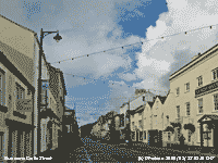 24th: A fine and sunny morning with mostly high cirrostratus clouds and the odd small cumulus from time to time. The air minimum overnight here was 11.8C, lower in Capel Curig 8.9C while in Katesbridge it was down to 4.2C. Pressure was 1006 mb and to the NW was low 983 mb off the Western Isles. All chart-followers eyes are on ex-hurricane Bill at present 989 mb off Nova Scotia and heading our way. The day was mostly sunny, the light S'ly wind freshened force 3/4 by afternoon. Fine weather continued into the evening before patchy cloud with showers of rain arrived by midnight. Brown long-eared bats have been about at dusk taking moths attracted by the Cornish (deep rose-cerise E. vegans Mrs. D F Maxwell) and Corsican Heaths (pink E. terminalis) growing in the garden and flowering for some weeks (see photo below). Though not so profuse the Corsican heath repeat flowers and will continue well into the autumn. These heaths grow well in the mild climate here, air frosts are few in the winter {Norwich AP 28.2C, Hawarden 20.0C, Carlisle 20.6 mm, Stornoway 11.3h, Valley 11.2h} [Rain 1.9 mm; Max 19.3C; Min 10.8C; Grass 8.5C]
  25th: Showers through the night, but some clearance around 08 GMT with glimpses of sunshine. Showers were seen over the mountains of Snowdonia and while I began the obs in the dry there was rain by 0906 GMT. Pressure was steady on 1006 mb, but this is likely to change through the day as ex-hurricane Bill 982 mb, had been filling but currently deepening again, S of Greenland ontrack for the Irish Sea. It was a wet morning with merging showers of rain that began to clear by noon. The afternoon turned out to be quite sunny, the temperature rising to 19.0C, with a freshening SW'ly wind force 5 by 1600 GMT. Increasing cirrus clouds with altocumulus and cirrocumulus indicated the approach of 'Bill'. The low was filling again 985 mb at 18 GMT approaching SW Ireland, latest indications were that it would track just to the N of here. The evening was cloudier. {Heathrow 22.5C, Mumbles Hd. 15.2 mm, Kinloss 10.3h, Valley 8.2h} [Rain 6.7 mm; Max 19.0C; Min 11.8C; Grass 10.2C]
  27th: Some clear sky from around midnight, but already cloudier by dawn. Variable amounts of cloud up to 09 GMT with some sunshine at times, some clouds just touching the highest mountain peaks with very good visibility. Light winds overnight were picking up again the S'ly reaching f4, and bands of thicker cloud arrived during the morning. Some sunshine later on between further bands of cloud with a few spots of rain at times. Windy in the afternoon, force 5/6. During the evening the sky cleared, the waxing moon had not risen so the stars shone brightly. {Norwich AP 24.4C, Tiree 15.2C, Leconfield, E Yorkshire 3.2h} [Rain 3.6 mm; Max 17.8C; Min 11.4C; Grass 7.7C]
 August had 17 (+3.9) wet days and a total of 112.1 mm of rain (116%) and [139%] of average, wettest since 2004, ranking 24 since 1928. The mean temperature was 15.6C (-0.1) and [+O.3] highest since 2005, ranking 11 since 1979. There were 8 days with a maximum temperature of 20C, or more, most since 2006, but the absolute maximum 21.8C was lowest since 1992 ranking 3 since 1979. Sunshine duration at Valley was 136.0h (90%) and [83%] of average.

|
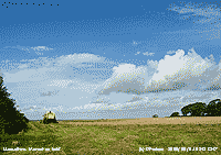 1st: There were some patches of clear sky between showers of rain overnight. We were still in a very vigorous showery airstream although pressure 1002 mb was rising with complex low 990 mb N Scotland. The cold front of yesterday was moving Se over central France sparking some torrential showers and thunderstorms. After the large rainfalls at the end of August some fields had pools of water on them and the harvest was on hold. There was standing water too on the Green in Beaumaris. The morning was bright and sunny at times, this view shows the north-east entrance to the Menai Strait with Puffin Island, the Great Orme and Penmaenmawr Head
  4th: A bright morning with 6 oktas cloud cover at 098 GMT. With some clear sky overnight the grass minimum had fallen to 6.8C and there was heavy dew. Visibility was good with cloud hugging the mountaintops. Pressure 1006 mb was rising with low 982 mb S Norway and high 1027 mb NE Atlantic off the coast of Iberia. There were a few sunny spells in the morning, but the sky was cloudier in the afternoon with a occasional spots of rain. The WNW'ly wind encouraged cloud formation as moist air off the sea rose on the facing upslopes of the mountains. Mainland mountaintops, and the SE corner of Anglesey, is subject to persistent cloud formed in this way. Whereas Valley on the W coast received 8.0 h of bright sunshine, but in Llansadwrn there was an estimated 2.7 h. The Michaelmas daisy in the garden was attracting at least 8 red admiral butterflies in pristine condition
|
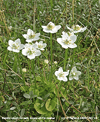 The curiously named grass-of-Parnassus Brial y Gors not a grass at all, but belongs to an isolated family named Parnassia L. by Carl Linnaeus in 1753, after Mount Parnassus in Greece where he first identified it. There are several species, some in Europe, mostly found in China. The habitat in which Parnassia palustris grows within Newborough Forest is one of the few last dune and marsh locations in Wales to find this plant
 ![]() . Previously more frequent, it has declined, due to drainage and loss of habitat, in the last 75-years. It has been recorded at Aberffraw, but has not seen there in recent years; some plants occur in a few of the remaining Anglesey marshes. The sand dune habitat was afforested in the 1950's, this remnant slack (within what is now called Newborough Forest) has been declining recently due to encroachment of pine trees by natural regeneration
. Previously more frequent, it has declined, due to drainage and loss of habitat, in the last 75-years. It has been recorded at Aberffraw, but has not seen there in recent years; some plants occur in a few of the remaining Anglesey marshes. The sand dune habitat was afforested in the 1950's, this remnant slack (within what is now called Newborough Forest) has been declining recently due to encroachment of pine trees by natural regeneration ![]() . These small trees and seedlings could easily be removed as part of a management plan to maintain this unique habitat and conserve the plant for future generations to enjoy
. These small trees and seedlings could easily be removed as part of a management plan to maintain this unique habitat and conserve the plant for future generations to enjoy ![]() .
.
The mass of rosebay willowherb (photographed in full flower on 10th July ![]() had by today formed seeds (photo taken of the same area)
had by today formed seeds (photo taken of the same area) ![]() with white hairy plumes
with white hairy plumes ![]()
The first 15 days had a mean temperature of 13.6C (-0.8) and [+0.2] of the September averages. The highest maximum was 19.0C, this was (-4.9) of the average. Rainfall was 37.6 mm (32%) and [41%] of the month's averages, dewfall from 9 - 15th was 1.7 mm.
16th: The sky was clear at 06 GMT and there was heavy dew on the grass (0.3 mm). By 09 GMT there were a few cumulus clouds and cirrus to the S that increased during the morning. Some cumulus looked dark and threatening, but there was no precipitation. There were a few sunny spells in the afternoon with 6 oktas cloud cover most of the time. At 1700 GMT the sky was overcast. At 21 GMT the sky was clear for a while with temperatures falling quickly before cloud encroached again. [Rain 0.0 mm; Max 15.8C; Min 10.0C; Grass 8.0C]
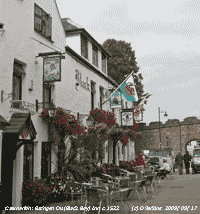 17th: Some clear spells after midnight, but overcast again by 03 GMT. Despite the low overnight grass minimum temperature of 5.5C there was little net dewfall recorded by drosometer, but the grass was wet with guttation droplets at the tips of the leaves. At Valley the grass minimum fell to 1.1C, lowest of the month. Pressure 1027 mb continued to decline slowly. The day was mostly cloudy with a few sunny spells. In Beaumaris and Caernarfon
 ![]() it was mostly sunny around the middle of the day, but few visitors around to enjoy the 'Indian Summer'. There was time to read the local paper and rest your dog at Cloc Cofio (Remembrance Clock) at Doc Fictoria
it was mostly sunny around the middle of the day, but few visitors around to enjoy the 'Indian Summer'. There was time to read the local paper and rest your dog at Cloc Cofio (Remembrance Clock) at Doc Fictoria ![]() . The new clock, unveiled on 17th April 2009, commemorates the well-known Fletcher firm that made slate billiard tables on the site that were exported all over the world. The electrically run chiming clock, that plays several tunes, is made of a cast iron pillar with a fibreglass casing gilded with gold leaf. [Rain 0.0 mm; Max 16.5C; Min 8.5C; Grass 5.5C]
. The new clock, unveiled on 17th April 2009, commemorates the well-known Fletcher firm that made slate billiard tables on the site that were exported all over the world. The electrically run chiming clock, that plays several tunes, is made of a cast iron pillar with a fibreglass casing gilded with gold leaf. [Rain 0.0 mm; Max 16.5C; Min 8.5C; Grass 5.5C]
![]() 18th: Although mostly cloudy at first with sunny spells in the morning skies cleared in the afternoon giving hazy sunshine. The temperature rose to 19.5C, highest of the month, before a light sea breeze set in. Frontal cloud encroached from the west by 18 GMT to give an overcast evening. In France waves of intense thunderstorms swept across the south through the day. In Bayonne (nr Biarritz SW France) 267 mm of rain fell with 147 mm between 1200 and 1500 GMT) while in Marseilles 104 mm of rain was recorded in 24-h. The Basque and Var regions were particularly badly affected, said to be the worst in 50-years, with flash flooding in Sainte Maxime, Fréjus and Montoroux. A train was derailed by a mudslide in Berre-l'Etang and in St Maxime flood water running suddenly through the town from a narrow gorge was described by the Mayor as an ocean swell like 'a tsunami'. Over 400 cars were swept away, houses flooded and filled with silt. Roads were closed including the main road from St Tropez to the autoroute that passes through St Maxime The graphic of lightning sferics (courtesy of meteocentre.com) shows the storm approaching St Maxime, east of Marseilles and west of Nice, at 2045 GMT. The flooding in the town occurred between 19 and 22 GMT. It is not unusual to have storms in S France at this time of year, rainfall totals can be very high and flash floods running down narrow gorges carry away anything in its path, including trees that have grown up since the last event, roads and any property inadvisably built below the flood line. {Herstmonceux 21.1C, Trawsgoed 19.4C} [Rain 0.0 mm; Max 19.5C; Min 9.6C; Grass 7.3C]
18th: Although mostly cloudy at first with sunny spells in the morning skies cleared in the afternoon giving hazy sunshine. The temperature rose to 19.5C, highest of the month, before a light sea breeze set in. Frontal cloud encroached from the west by 18 GMT to give an overcast evening. In France waves of intense thunderstorms swept across the south through the day. In Bayonne (nr Biarritz SW France) 267 mm of rain fell with 147 mm between 1200 and 1500 GMT) while in Marseilles 104 mm of rain was recorded in 24-h. The Basque and Var regions were particularly badly affected, said to be the worst in 50-years, with flash flooding in Sainte Maxime, Fréjus and Montoroux. A train was derailed by a mudslide in Berre-l'Etang and in St Maxime flood water running suddenly through the town from a narrow gorge was described by the Mayor as an ocean swell like 'a tsunami'. Over 400 cars were swept away, houses flooded and filled with silt. Roads were closed including the main road from St Tropez to the autoroute that passes through St Maxime The graphic of lightning sferics (courtesy of meteocentre.com) shows the storm approaching St Maxime, east of Marseilles and west of Nice, at 2045 GMT. The flooding in the town occurred between 19 and 22 GMT. It is not unusual to have storms in S France at this time of year, rainfall totals can be very high and flash floods running down narrow gorges carry away anything in its path, including trees that have grown up since the last event, roads and any property inadvisably built below the flood line. {Herstmonceux 21.1C, Trawsgoed 19.4C} [Rain 0.0 mm; Max 19.5C; Min 9.6C; Grass 7.3C]
19th: An overcast and dull morning with moderate visibility in thick haze. Pressure was 1017 mb with high pressure 1025 mb over the Azores and Baltic. Pressure was low (1013 mb) over France and the Med with continued unsettled weather there with frequent thunderstorms in the south within circulation of the low. At 09 GMT about 40 geese passed over in V-formation heading NW, they visit and pick over nearby fields that have had the grain harvested. The morning kept dull with some rain falling over the Snowdonia Mountains. By the afternoon it was brighter as a clear slot moved across from the west with some sunny spells when the temperature rose to 18.2C. Overcast and dull again by 17 GMT with some heavy drizzle around 1800 GMT. There was broken cloud at 21 GMT. [Rain 0.4 mm; Max 18.2C; Min 12.5C; Grass 9.8C]
20th: Some broken cloud overnight with a shower of rain around 0600 GMT before the sky began to clear. By 09 GMT there were just 2 oktas of cumulus clouds, mainly over the mountains. Pressure 1025 mb was rising in a ridge from high 1029 mb Azores-Biscay to the south-west. The 0.4 mm rain was insufficient to wet the dry soil surface, but concrete and grass were wet. During the morning more cumulus clouds developed, but there were many sunny spells with little or no wind. Still some cloud around here in the afternoon, but the sky was clear over the rest of Anglesey. During the evening broken cloud encroached from the west. A dry day. [Rain 0.0 mm; Max 18.0C; Min 9.5C; Grass 7.3C]
21st: An overcast morning, but the cloud was generally moderately high (altostratus) although low cloud was beginning to encroach the lower slopes of the Snowdonia Mountains in the west. Pressure at 09 GMT was 1023 mb with the high 1029 mb over the Bay of Biscay. Low 982 mb was to the N near Iceland and low 983 mb S of Greenland. On the chart the isobars were tightening over the N of Britain; we had a fresh to strong SSW'ly wind. Frontal cloud lay to the N and NW and there was rain in N Ireland, W Scotland and N England. The day kept dry with some sunny spells, the wind strengthening to near gale to gale force during the afternoon. It was the windiest day of the month at Valley where the 24-h mws was 25.1 mph. It was still blowing a bit in the evening, but had begun to moderate by midnight. [Rain 2.2 mm; Max 16.5C; Min 10.0C; Grass 7.5C]
22nd: There was drizzle, sometimes heavy with light rain from 0230 GMT, but the amount collected in the raingauge at 09 GMT was only 2.2 mm. With a weak cold front passing over the temperature had fallen to a minimum of 13.5C. The morning was dull with drizzle at times and did not begin to clear until afternoon. Then with a sharply defined back edge of the front retreating S over Snowdonia ![]() there was some sunshine in a following clear slot. With fallen leaves on the ground the first ripe conkers were seen shining in the sunshine
there was some sunshine in a following clear slot. With fallen leaves on the ground the first ripe conkers were seen shining in the sunshine ![]() . Later some orographic wave clouds reduced the sunshine, but there was no further rain. [Rain 0.6 mm; Max 17.7C; Min 13.5C; Grass 12.5C]
. Later some orographic wave clouds reduced the sunshine, but there was no further rain. [Rain 0.6 mm; Max 17.7C; Min 13.5C; Grass 12.5C]
23rd: It was a mostly cloudy night so there was just a little dew on the grass. A cloudy morning and a shower of rain at 09 GMT. With pressure 1025 mb remaining high the day brightened and there were a few sunny spells before noon these continuing into the afternoon. After sunset (not much in the way of colour) the sky was clearer. A meteorite was seen as 2038 GMT in a shallow trajectory moving north-north-west. [Rain 0.3 mm; Max 17.2C; Min 10.7C; Grass 7.5C]

|
It was a dry month with 42.6 mm of rainfall, least since 2002, (36%) and [46%] of average. It was the 10th driest September in Llansadwrn since 1928. The mean temperature was 13.7C, highest since 2006, (-0.7) and [+0.3] of average. The mean maximum 16.7C , lowest since 1992, (-0.9) and [-0.3] of average ranked 10th lowest since 1979. The highest maximum 19.5C, lowest since 1992, (-4.4) ranked 4th lowest. The mean minimum 10.6C, equal highest since 2007, (-0.5) and [+0.9] of average, ranked 13th highest. Sunshine at Valley was 127.1h, sunniest since 2006, close to the average and ranked 31st on the Anglesey record since 1930.
1st: A clearing sky from dawn brought a mostly sunny morning. Pressure was 1022 mb with high 1030 mb over the Atlantic W of Ireland/ S of Greenland. Pressure was uncharacteristically low 997 mb over the Azores with developing lows over Greenland and low pressure 989 mb over the Baltic, cooler air was being drawn from the N. The morning felt fresher than of late with the temperature 10.3C, dewpoint 9.7C. There was a light SW'ly breeze and in the morning sunshine rose to 13.8C. The sky was cloudier in the afternoon, turning overcast and thick enough to produce a few spots of drizzle around 15 GMT. Later the cloud thinned and broke, there was no further sunshine the sky. There was some broken cloud at times during the evening. [Rain 0.6 mm; Max 13.8C; Min 9.9C; Grass 8.2C]
2nd: A mostly cloud covered, but dry night and little, or no, dew had formed on the grass. There were a few spots of rain by 0645 GMT that developed into light rain by 09 GMT. Visibility was moderate to poor under the uniform grey stratus. Pressure 1020 mb was falling slowly with the elongated high 1027 mb (Biscay to Nova Scotia) being squeezed by the developing low 992 mb near Iceland. The low was still over the Azores and filling 998 mb. It was a dull morning with drizzle or slight rain at times with a light SW'ly breeze. After noon it was brighter for a time with a glimpse of sunshine before a spell of light rain around 14 GMT. The SW'ly wind strengthened to force 5 during the afternoon and the evening was overcast. [Rain 1.0 mm; Max 14.5C; Min 8.2C; Grass 5.9C]
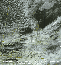 3rd: The low moving across the Norwegian Sea N of Scotland had deepened to 969 mb with resulting gale-force winds to the N of here. Pressure 1004 mb was falling and there was a gusty force 5/6 SW'ly and the sky was mostly cloudy at first then starting to clear the morning became bright and breezy with some sunshine. At noon the sky darkened the gusty wind strengthened suddenly and there was a heavy shower of rain as a cold front passed over. The temperature had just reached the day's maximum of 15.2C and fell rapidly to 10.5C. Following was almost clear sky with the temperature recovering to 14.2C while the relative humidity in drier air dropped from 92% to 65%. The Meteosat MSG satellite image at noon shows the narrow band of frontal cloud over S Anglesey that produced the short burst heavy rain. The following clear slot is over the Irish Sea to the N with heavy shower convection over Scotland and marine convective cells to the west. There are plenty of orographic clouds over Cardigan Bay and the Midlands with remnant cloud associated with an front passing here earlier over S England and the Channel. The evening was partially cloudy allowing good view of the bright almost full Harvest Moon. Later some cloud encroached, but rain kept away, and the Moon was seen above quite spectacular altocumulus undulatus clouds. [Rain 1.6 mm; Max 15.2C; Min 10.2C; Grass 10.0C]
4th: After a slight shower of rain at 0720 GMT it was a bright morning with sunny spells developing. Pressure 1010 mb was rising again and although there were some convective clouds in the vicinity the day was mostly sunny. In the afternoon a few well-developed cumulus passed to the S of the station towards Snowdonia. Later even these diminished and the sky began to clear. The evening was clear with the Harvest Moon rising to the SE; it was high in the sky at 21 GMT with stars shining brightly with patches of backlit altocumulus to the south. [Rain 0.0 mm; Max 14.8C; Min 6.4C; Grass 3.8C]
 On sunny afternoons there have been up to 8 red admirals, 4 comma, small tortoiseshell, painted lady and several speckled wood butterflies emerged from shelter and seen on the Michaelmas daisy. A late invasion of clouded yellows, rarely seen here, has been reported in S England. It has been one of the best seasons for butterflies here with good numbers of several species seen throughout.
![]() 5th: A mostly clear night, but moderately high altocumulus and altostratus cloud encroached before dawn. Tropical Storm Grace developed overnight at 41.2° N, at midnight it was just N of the Azores having passed closeby Ponta Delgarda. There have been few such storms in the northern hemisphere this year and it was unusual for one to develop where the temperature of the water was about 23C, normally 26C is required. At 06 GMT compact Grace, storm-force winds did not extend far from its centre that had nevertheless formed a clear eye and eye-wall (see satellite image) was W of the Iberian Peninsular tracking NE bringing warm moist tropical air towards us. At noon Grace was W of cape Finisterre and by 18 GMT the downgraded storm ex-Grace was 991 mb W of the Bay of Biscay. At 09 GMT pressure here was 1010 mb and it was calm, not a leaf was moving on the trees now taking up their autumnal tints. It was a mostly sunny, albeit at sometimes times weak through thin cloud, but with little or no wind and the temperature rising to 17.3C it was very pleasant. It was the brightest day of the month with solar radiation of 15.72 MJ m -2 . The butterflies were out again, 5 commas joining the red admirals today. It was a mostly clear sky at sunset that looked a rather watery yellowish colour. There was a moderate peach coloured twilight with dew forming on the grass under bright Moon and stars at 21 GMT. [Valley 7.2h] [Rain 7.6 mm; Max 17.3C; Min C; Grass C]
5th: A mostly clear night, but moderately high altocumulus and altostratus cloud encroached before dawn. Tropical Storm Grace developed overnight at 41.2° N, at midnight it was just N of the Azores having passed closeby Ponta Delgarda. There have been few such storms in the northern hemisphere this year and it was unusual for one to develop where the temperature of the water was about 23C, normally 26C is required. At 06 GMT compact Grace, storm-force winds did not extend far from its centre that had nevertheless formed a clear eye and eye-wall (see satellite image) was W of the Iberian Peninsular tracking NE bringing warm moist tropical air towards us. At noon Grace was W of cape Finisterre and by 18 GMT the downgraded storm ex-Grace was 991 mb W of the Bay of Biscay. At 09 GMT pressure here was 1010 mb and it was calm, not a leaf was moving on the trees now taking up their autumnal tints. It was a mostly sunny, albeit at sometimes times weak through thin cloud, but with little or no wind and the temperature rising to 17.3C it was very pleasant. It was the brightest day of the month with solar radiation of 15.72 MJ m -2 . The butterflies were out again, 5 commas joining the red admirals today. It was a mostly clear sky at sunset that looked a rather watery yellowish colour. There was a moderate peach coloured twilight with dew forming on the grass under bright Moon and stars at 21 GMT. [Valley 7.2h] [Rain 7.6 mm; Max 17.3C; Min C; Grass C]
![]()
![]() 6th: At midnight ex-tropical storm Grace 995 mb was part of a complex low SW of Ireland and as it moved NE deepened and was 993 mb at 06 GMT. Ahead was a frontal system that brought drizzle and rain from just after 04 GMT. By 09 GMT pressure here was 999 mb with moderate rain falling and 7.6 mm in the raingauge. With 100% humidity and a temperature of 15.7C, the day's maximum, the air had a tropical feel. There were bursts of heavy, sometimes very heavy tropical-like rain through the morning; by noon another 25.3 mm was in the raingauge here. Grace was then close to SW Ireland heading towards S Wales. Rain eased in the afternoon, but there was heavy rain again around 17 GMT. By 1800 GMT the total had risen to 35.7 mm and in the morning totalled 37.1 mm (09-09 GMT). This was the largest fall so far this year and largest since the 52.8 mm on 25 October 2008. Rainfall for the event here totalled 44.7 mm, in the nearby village Pentraeth it was 42.9 mm, Capel Curig and Sennybridge both had 49 mm while in Aberdaron it was 15.6 mm (see graphic). The day was sunless with solar radiation 5.48 MJ m -2. [Capel Curig 44.2 mm, Valley 26.6 mm] [Rain 37.1 mm; Max 15.7C; Min 8.1C; Grass 5.4C]
6th: At midnight ex-tropical storm Grace 995 mb was part of a complex low SW of Ireland and as it moved NE deepened and was 993 mb at 06 GMT. Ahead was a frontal system that brought drizzle and rain from just after 04 GMT. By 09 GMT pressure here was 999 mb with moderate rain falling and 7.6 mm in the raingauge. With 100% humidity and a temperature of 15.7C, the day's maximum, the air had a tropical feel. There were bursts of heavy, sometimes very heavy tropical-like rain through the morning; by noon another 25.3 mm was in the raingauge here. Grace was then close to SW Ireland heading towards S Wales. Rain eased in the afternoon, but there was heavy rain again around 17 GMT. By 1800 GMT the total had risen to 35.7 mm and in the morning totalled 37.1 mm (09-09 GMT). This was the largest fall so far this year and largest since the 52.8 mm on 25 October 2008. Rainfall for the event here totalled 44.7 mm, in the nearby village Pentraeth it was 42.9 mm, Capel Curig and Sennybridge both had 49 mm while in Aberdaron it was 15.6 mm (see graphic). The day was sunless with solar radiation 5.48 MJ m -2. [Capel Curig 44.2 mm, Valley 26.6 mm] [Rain 37.1 mm; Max 15.7C; Min 8.1C; Grass 5.4C]
7th: Yesterday warm tropical air, today cool arctic air! The temperature at 09 GMT was just 9.5C and the dewpoint 6.3C (relative humidity 80%) so it felt quite different with light airs from the north. Pressure 1014 mb had risen in a high-pressure ridge from the west. Low 980 mb was over Scandinavia with a shallow low 1004 mb over the Bay of Biscay with associated fronts linking the lows over the Channel. The sky was overcast with moderate to high altostratus with the sun shining weakly through. There were 1 or 2 patches of blue to the N, but nothing came of these, but the day was bright with almost continuous weak sunshine the temperature reaching 12C in the afternoon. There was no sign of the butterflies today. [Rain 0.0 mm; Max 12.0C; Min 7.5C; Grass 5.4C]
8th: There was broken cloud overnight and by morning the sky was clearing to 3 oktas at 09 GMT. Pressure 1018 mb was still rising and it was a sunny day with just a light NW'ly breeze. The sunshine encouraged the butterflies to appear again although the maximum was just 12.7C. Convective clouds developed over mid Wales and the Midlands with a few showers, but the North Wales coast kept sunny. Visibility in the afternoon was >50 km with exceptionally good views of the Strait, and Puffin Island with calm blue sea, and the Snowdonia Mountains to Bardsey Island. Solar radiation reached 15.28 MJ m -2 . The evening was mostly clear at first with dew forming; cloud encroaching later. {Valley 8.2h}[Rain 0.0 mm; Max 12.7C; Min 6.1C; Grass 3.3C]
9th: Overnight the minimum temperature was 4.7C, lowest of the month and the grass minimum fell to 1.8C, lowest since 22 April (1.3C). It was a mostly cloudy morning, but bright at first with a little weak sunshine around 0730 GMT, and moderately high altostratus cloud. Soon, with a light SE'ly breeze, some altocumulus lenticularis formed in the lee of the mountains and cap clouds began to form over the Carneddau. Pressure 1015 mb was falling with deepening slow-moving low 974 SW Iceland, and high 1025 North Sea drifting eastward. A band of heavy rain was moving across Ireland and showery rain affecting Scotland. The day here was overcast, but dry until 15 GMT when there was the first of several showers of rain that continued into the evening. Amounts of rain were small compared with larger falls in Ireland (Valentia 14.8 mm 00-00 GMT), and Helens Bay {19.6 mm}. {Valley 0.4h} [Rain 1.2 mm; Max 14.5C; Min 4.7C; Grass 1.8C]
10th: A damp and dull morning and the low stratus cloud thick enough to produce slight drizzle from time to time and consequent poor visibility. The low anchored S of Iceland was filling 987 mb; pressure here 1014 mb was rising. The day kept mostly cloudy with some slight showers of rain, but there were some sunny intervals during the afternoon when 2 or 3 butterflies briefly put in an appearance. By evening the sky was overcast again. [Rain 1.9 mm; Max 14.2C; Min 10.3C; Grass 8.9C]
11th: With a blanket of cloud overnight reflecting any radiation from the ground the air minimum did not fall below 10.9C; likewise the grass minimum was 10.0C. There was heavy drizzle and light rain from before 0630 GMT continuous until after 100 GMT. Visibility was poor in mist and drizzle. A warm front was moving S and the sky brightened when this began to clear by noon and the afternoon had some sunny spells between light showers of rain. Later the sky cleared and the evening was clear before a few fair weather cumulus clouds clouds appeared before midnight. [Rain 0.8 mm; Max 14.3C; Min 10.9C; Grass 10.0C]
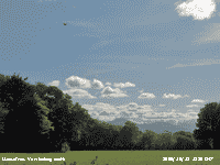 12th: The night was partly cloudy at first but the sky was clear at dawn. Pressure 1030 mb had risen within a high over Ireland and western Britain. In contrast to yesterday there had been radiative cooling and the grass minimum was down to 3.7C with moderate dew (0.15 mm). At 09 GMT some cirrus (jetstream) was overhead moving SSE with 1 or 2 small cumulus seen to the S over the mountains. On the surface here the wind was a light S-SE'ly off the mountains. The day was mostly sunny with a few more clouds developed to the S over the mountains in the afternoon. The temperature rose to 17.3C (Föhn-like effect) one of the highest in Britain today. Solar radiation reached 14.85 MJ m -2 . At sunset the few clouds in the sky were briefly coloured pink. {Solent MRSC 17.7C, Milford Haven 16.6C, Pentraeth 16.1C, Valley 14.6C, Bristol 10.2h, Valley 10.0h} [Rain 0.0 mm; Max 17.3C; Min 6.8C; Grass 3.7C]
13th: Some clear spells overnight so the grass minimum was down to 3.5C and again moderate dew (0.16 mm) had formed. After dawn the sky began to cloud over, mainly cirrus and numerous contrails drifting over with cirrocumulus developing. Pressure 1031 mb had risen with the high 1032 mb over Cornwall. To the north there was frontal cloud giving a lot of rain in Scotland. We were just on the edge of the cloud that was stationed to the N over the Irish Sea. The day was mostly bright with some clear sunny spells with the temperature rising to 16.6C. As the cloud edged further S the evening and night were cloudier, but there was no rain. {Plymouth 17.4C, Cassley 21.4 mm, Aberporth 6.7h} [Rain 0.0 mm; Max 16.6C; Min 6.8C; Grass 3.5C]
14th: A mostly cloudy morning, a patch of blue sky to the W at 08 GMT did not enlarge so the morning turning overcast. Pressure was 1030 mb with persistent slow-moving frontal cloud associated with low-pressure to the N ( low 990 mb was near Iceland). Pressure was high 1037 mb over Scandinavia; there was been some light snow and with low temperatures under mostly clear skies was persisting. There was little or no wind here and, except for a short bright spell with weak sunshine, the day was dull with overcast skies. The temperature keeping around 15C and not falling very much at dusk; it was 13C at 18 GMT. [Rain trace; Max 15.1C; Min 10.8C; Grass 9.0C]
15th: Overcast and mild at night with spots of drizzle; a spell around 0700 GMT was just enough to dampen concrete, but there was none in the raingauge. At 09 GMT pressure was 1033 mb and the moderately high cloud began to break up during the morning to give some pleasantly warm sunshine. It was calm, and a quiet morning with little traffic passing. It was quiet enough to hear leaves falling which are now spread thinly on the ground. The quietness being broken by the rasping croak of a raven and occasionally distance sounds of geese. Unusual to see, moribund or dead aphid-like insects are falling from the trees and leaving a light scattering on flat surfaces, like the leaves with no wind to blow them away, or rain heavy enough to wash them off. The afternoon turned overcast and the cloud thick enough to produce a fine drizzle. There was none in Beaumaris around 14 GMT where it was brighter. The evening remained calm and overcast, but the drizzle had dried up. [Rain trace; Max 15.5C; Min 11.3C; Grass 8.4C]
The first 15 days had 51.8 mm of rainfall (33%) and [46%] of the October averages, apart from the 37.1 mm on the 6th amounts were small or none. The mean temperature was 11.6C (+0.4) and [+1.1] and even the mean maximum 14.9C (+0.6) and [+1.1] was above the decadal average for the first time since May.
16th: It was a dull start under moderately high wavy stratocumulus cloud just touching the tops of Carnedd Llewelyn and Snowdon, but visibility was very good with only slight haze. With cloudy skies overnight and a minimum of 11.5C and 9.6C on the grass wetness was guttation, not dew. Pressure 1036 mb was rising and soon the sky began to clear to give a mostly sunny day. There was a light NE'ly breeze and this persisted all day until after 21 GMT when it fell away and with clear sky temperatures were falling. [Valley 6.4h] [Rain 0.0 mm; Max 14.2C; Min 11.5C; Grass 9.6C]
17th: Just a patch of cloud seen to the SE after midnight, otherwise clear. A cold one at last with the minimum down to 4.9C and to 0.9C on the grass, lowest of the month and lowest since 28 April. In contrast to yesterday there was moderate dew (0.22 mm). Pressure was 1034 mb in the high persisting over Britain and the sky was almost clear with an expanding contrail overhead and patchy cloud over Liverpool Bay. A most sunny day with a few cumulus developing in the middle of the day; winds were light and variable. Solar radiation reached 14.59 MJ m -2 . Absent for as while, a group of long-tailed tits were noisily making their way through the trees. They usually stay around during the winter and nest here in the spring. Chaffinches and sparrows are scarce at the moment, but I expect they will turn up soon. The holly berries have turned red and await the thrushes. The sky was clear at sunset and there was a pale peach coloured twilight for over an hour. In the absence of moonlight there were bright stars and Jupiter at 21 GMT. [Valley 7.6h] [Rain 0.0 mm; Max 13.2C; Min 4.9C; Grass 0.9C]
18th: The clear sky lasted until just after 06 GMT when frontal cloud began to encroach from the west. Again moderate dew on the grass (0.22 mm) with the grass minimum reading 2.1C. Pressure 1023 mb was falling with the high-pressure beginning to weaken. Cloud thickened on the slow-moving warm front and there was very fine drizzle from 0920 GMT. This was intermittent during the morning and slow to wet the ground, but by afternoon was heavier and more persistent was wetting the ground, but the amount was small. The temperature rose to just 11.5C, lowest of the month and the lowest since 6 June (10.6C), then hovered around 10.5C through the night. The day was sunless and there was continuous light rain from 1930 GMT. [Rain 8.0 mm; Max 11.5C; Min 5.4C; Grass 2.1C]
19th: Light rain through the night only stopping at 0700 GMT with 8.0 mm in the raingauge. The morning was dull with low cloud and hill fog on the mountain slopes. Pressure 1011 mb was falling with deepening low 975 mb S of Iceland approaching W Ireland. It was looking very autumnal with wet fallen tree leaves almost covering the ground in places. There was no more rain and the morning brightened with sunny spells developing around noon. It was mostly sunny here (maximum 14.0C) and in Caernarfon, duller in the NW of the island with cloud encroaching later in the afternoon. Overcast by evening but dry. [Liverpool, Crosby 14.9C] [Rain 0.0 mm; Max 14.0C; Min 9.8C; Grass 9.2C]

|
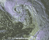 24th: At midnight a deepening low 989 mb was tracking northwards off SW Ireland. There was a very gusty SSE'ly wind at 07 GMT and some bright spells with glimpses of sunshine before the cloud thickened and was overcast at 09 GMT. Pressure here was 996 mb with the low 981 mb off Shannon and there was soon drizzle and slight rain with poor visibility. The day continued blustery with the veered SW'ly wind strongest reaching near gale to gale-force at times between 1500 and 1800 GMT accompanied by continuous light rain. The Meteosat MSG image at 1500 GMT shows the filling low centred off Malin Head with associated cloud front with band of rain over Anglesey and west Wales. Winds were strongest over the mountains (Capel Curig reported a gust of 69 mph) and the Lleyn Peninsular where force 9 was experienced at Aberdaron with a gust of 67 mph. There was a bright sky in the west at dusk, but it did not reach here. Rainfall on Anglesey was small with most falling over the Snowdonia Mountains; . [Capel Curig 34.2 mm, Lake Vyrnwy 25.8 mm, Valley 1.8 mm] [Rain 3.8 mm; Max 16.3C; Min 11.0C; Grass 8.6C]
  27th: Overcast with a complex of cloud types including some low-level lenticular altocumulus in the west. In good visibility clouds were touching western mountains while the Carneddau were clear. The sun remained obscured behind thinning cloud in the morning, but broke through in the afternoon with cloud rising above the mountaintops. Continuing warm for the time of year the temperature at 09 GMT was 15.7C (dewpoint 12.1C) this rising to 18.8C during the day. The AWS in Pentraeth reported a maximum of 19.3C. Several butterflies were seen around the garden. Later cloud thickened and there was slight rain on a weak cold front between 2000 and 2300 GMT. {Gravesend 19.6C, Pembrey Sands 18.2C} [Rain 3.9 mm; Max 18.8C; Min 11.2C; Grass 9.2C]
 After an earlier leaf fall remaining leaves on trees have been more tenacious, but autumn colours have been rather muted here ![]() . Best colours have been seen on horse chestnut and beech trees
. Best colours have been seen on horse chestnut and beech trees ![]() .
.
October ended with a mean temperature, highest since 2006, of 12.2C (+0.9) and [+1.6] of the decadal and 30-y averages. Rainfall overnight on 31/1st brought the month's total up to 91.8 mm (58%) and [82%] of average, but the 736.6 mm so far this year was the least since 2003. The 87.6 h of sunshine duration recorded at Valley was (88%) and [92%] of average.
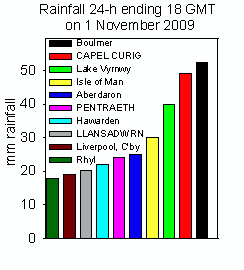 1st: November is the wettest month of the year on the long-term average and, true to form, began wet. There was moderate to heavy rain from 0200 GMT as rapidly deepening low (988 mb at 06 GMT) moved through St George's Channel into Cardigan Bay. At 09 GMT 17.3 mm was measured but, by convention observations 09-09 GMT are credited to the 31 October. The rain continued until 1100 GMT with another 2.8 mm bringing the total for the event up to 20.1 mm. The graphic on the left shows rainfall at selected stations between the hours 18-18 GMT today. At 09 GMT pressure here 987 mb was falling rapidly with the centre of the low near Bardsey Island, then crossing over Anglesey about 1000 GMT, with pressure falling to 984 mb, and still deepening heading across Liverpool Bay. Near the centre of the low here winds were mostly light, SE'ly force 3/4 veering SW'ly and blowing force 5/6 later on. It was a different matter on the mainland with gale to severe gale force 8/9 reported in Capel Curig and Aberdaron these winds spreading eastward with gales reported in Liverpool, Crosby and Shawbury. With heavy rain on near water saturated ground countrywide flood warnings were issued. Heavy rain in S and W Wales brought flooding in Birchgrove in Swansea and Landore; 100 incidents were reported with 13 people were rescued from vehicles and flooded homes. Fewer incidents reported in N Wales, but included ones in Bodedern and Amlwch on Anglesey. {Boulmer 52.2 mm, Capel Curig 49 mm} [Rain 2.8 mm; Max 14.8C; Min 10.1C; Grass 9.8C]
2nd: A fine morning after a partially cloud covered night with bright moonlight. From dawn the sky was becoming cloudier with cirrostratus spreading from the west with convective cumulus clouds developing over the mountains. Pressure 999 mb at first was rising, yesterday's low 968 mb was N of Scotland and high 1035 mb was over the Azores, but soon began to fall with another low 971 mb developing off SW Iceland . There was a little sunshine during the morning before light showers of rain began. The afternoon was overcast and showers more frequent merging into continuous spells of light rain. There was a moderate to heavy shower soon after 1800 GMT. During the evening there was broken cloud with full moonshine at times, and some more showers. On moving north the heavy rain brought flooding to Scotland with roads impassable, train services cancelled and homes flooded. After 53 mm of rain falling in Aberdeen on the 1st Stonehaven and Arbroath, in Angus, were badly affected as were the Grampian and Tayside regions. {Kinlochewe 30.4 mm} [Rain 15.8 mm; Max 11.0C; Min 6.9C; Grass 3.5C]
![]() 3rd: Moderate showers overnight and the sky was overcast at dawn, but brighter soon with signs of the sky clearing. There were towering cumulus clouds over the mountains and rain in sight at 09 GMT. Pressure 983 mb was falling with the Icelandic-low 970 mb approaching Rockall to the north-west. The morning soon turned mostly cloudy again. After very low numbers of birds in the garden in October with the arrival of cooler weather birds are appearing more frequently. Great spotted woodpeckers, nuthatches and tits have been seen on the feeders. There were groups of long-tailed tits twittering amongst the trees, but they have not as yet visited the feeders. The afternoon had brief spells of sunshine and showers, heaviest around 1300 GMT. Despite frequent checks of the Snowdonia mountaintops I did not see any ice precipitation on the ground. I was eventually rewarded to see some clear ice pellets (small hail) 2 -3 mm diameter here at 1720 GMT, of course it was then dark so observation of the mountains was not possible. Falls of ice have been meager of late, the last was on 28 August. Showers petered out overnight. [Rain 1.8 mm; Max 10.5C; Min 7.3C; Grass 6.3C]
3rd: Moderate showers overnight and the sky was overcast at dawn, but brighter soon with signs of the sky clearing. There were towering cumulus clouds over the mountains and rain in sight at 09 GMT. Pressure 983 mb was falling with the Icelandic-low 970 mb approaching Rockall to the north-west. The morning soon turned mostly cloudy again. After very low numbers of birds in the garden in October with the arrival of cooler weather birds are appearing more frequently. Great spotted woodpeckers, nuthatches and tits have been seen on the feeders. There were groups of long-tailed tits twittering amongst the trees, but they have not as yet visited the feeders. The afternoon had brief spells of sunshine and showers, heaviest around 1300 GMT. Despite frequent checks of the Snowdonia mountaintops I did not see any ice precipitation on the ground. I was eventually rewarded to see some clear ice pellets (small hail) 2 -3 mm diameter here at 1720 GMT, of course it was then dark so observation of the mountains was not possible. Falls of ice have been meager of late, the last was on 28 August. Showers petered out overnight. [Rain 1.8 mm; Max 10.5C; Min 7.3C; Grass 6.3C]
4th: A mostly cloudy night with light showers of rain resuming at 0400 GMT. Pressure was 982 mb with the rather slow-moving low 971 mb off NW Scotland. We were still in the showery airflow, but none reached here during the morning that had little in the way of sunshine. The moderate SW'ly breeze felt chilly with an air temperature of 8.3C rising to 11.0C by noon. A band of showery rain moved slowly over from 1300 GMT, there were a few glimpses of sunshine from midafternoon to dusk. The evening had more showers and a moderately heavy shower between 22 and 23 GMT. [Capel Curig 36.0 mm, Lake Vyrnwy 26.0 mm] [Rain 13.3 mm; Max 11.0C; Min 6.9C; Grass 3.8C]
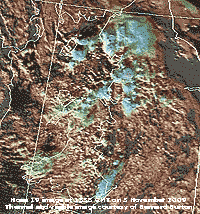 5th: A little broken cloud in the morning with low cloud and fog on the mountaintops of Snowdonia. Pressure was 992 mb with maturing low 987 mb over the North Channel tracking SE across Liverpool Bay. Occluded frontal cloud lay from the Western Isles over Cumbria, Cheshire and as far as S England. The Met Office had issued flash warnings of severe weather for North Wales and NW England regions. There were frequent light showers of rain in Llansadwrn from 1300 GMT and the temperature rose to just 9.9C, lowest since 28 March. From morning convective clouds developed over Liverpool Bay and moved over the North Wales coast, Cheshire and Manchester bringing torrential downpours of rain. The NOAA 19 satellite image at 1353 GMT shows the convective clouds as a combination of visual and thermal sensors, processed by Bernard Burton, with cloudtop temperatures (blue) down to -50C.
Early in the day some flooding was reported in Towyn, Conwy, the scene of severe flooding in February 1990 when storm-force winds and a 1.5 m tidal surge caused a 400m long breach in the sea defences that incorporate the mainline railway. Later heavy rain and poor visibility brought difficult driving conditions and traffic to a crawl in places on the M56 and A55 with the low (992 mb) near Chester at 1800 GMT. The showers continued into the evening in places before dying out later. {Capel Curig 38.6 mm}[Rain 3.1 mm; Max 9.9C; Min 7.7C; Grass 5.2C]
6th: At midnight the low had moved to be over East Anglia and there was at dawn a red sky with broken cloud over the Carneddau Mountains. Pressure was 998 mb and there was a light to moderate SSW'ly breeze. Some mountaintops were clear of cloud at first, but low cloud was affecting western peaks including Snowdon. Bright at times with glimpses of sunshine before thicker cloud encroached by 1345 GMT bringing rain on a strengthened SW'ly wind. The sky cleared for a while after dusk before further showers of rain and some small ice pellets arrived. [Capel Curig 14.2 mm, Shap Fell 8.2 mm] [Rain 11.0 mm; Max 10.2C; Min 7.3C; Grass 4.1C]
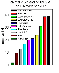
![]() 7th: Some clear spells overnight allowed the air temperature to fall to 4.0C and 0.2C on the grass. The sky was mostly clear at 07 GMT, but cloud was increasing. At 09 GMT with 5 oktas cloud cover the temperature was 6.5C (dewpoint 5.4C) with a moderate SW'ly breeze. Pressure was 991 mb in a complex low-pressure system moving SE across Wales. There was some cloud around the mountaintops clearing occasionally to reveal a little snow on Carnedd Llewelyn, the first of the season, but it did not last very long. Showers continued to traverse the mountains during the morning and merged to give a wet afternoon here. There was a spell of moderate to heavy rain from 1700 to 2100 GMT bringing the total for the past 24-h (21-21 GMT) to 18 mm, local roads in the SE corner of the island were awash some on the way to Beaumaris partially flooded. Later the sky cleared with the air temperature falling to 5.5C before rising again as cloud encroached bringing more rain. Rainfall 09-09 GMT today was 20.0 mm and brought the total for the first week 69.4 mm (51%) and [55%] of the month's average. [Shap Fell 30.6 mm, Capel Curig 9.8 mm, Valley 1.0 mm] [Rain 20.0 mm; Max 9.3C; Min 4.0C; Grass 0.2C]
7th: Some clear spells overnight allowed the air temperature to fall to 4.0C and 0.2C on the grass. The sky was mostly clear at 07 GMT, but cloud was increasing. At 09 GMT with 5 oktas cloud cover the temperature was 6.5C (dewpoint 5.4C) with a moderate SW'ly breeze. Pressure was 991 mb in a complex low-pressure system moving SE across Wales. There was some cloud around the mountaintops clearing occasionally to reveal a little snow on Carnedd Llewelyn, the first of the season, but it did not last very long. Showers continued to traverse the mountains during the morning and merged to give a wet afternoon here. There was a spell of moderate to heavy rain from 1700 to 2100 GMT bringing the total for the past 24-h (21-21 GMT) to 18 mm, local roads in the SE corner of the island were awash some on the way to Beaumaris partially flooded. Later the sky cleared with the air temperature falling to 5.5C before rising again as cloud encroached bringing more rain. Rainfall 09-09 GMT today was 20.0 mm and brought the total for the first week 69.4 mm (51%) and [55%] of the month's average. [Shap Fell 30.6 mm, Capel Curig 9.8 mm, Valley 1.0 mm] [Rain 20.0 mm; Max 9.3C; Min 4.0C; Grass 0.2C]
8th: More showery rain after midnight and some of these were moderate with small ice pellets falling between 0130 and 03 GMT. The sky remained overcast until just before 09 GMT. Pressure 1007 mb was rising with the low moving SE over the English Channel and filling. By 11 GMT there were some sunny spells between cumulus cloud moving along on a moderate to fresh N'ly breeze. The afternoon was mostly sunny with a few small cumulus clouds passing overhead, but some well developed clouds starting to tower were seen to the south. By evening apart from some decaying cumulus seen on the western horizon the sky was clear and the temperature starting to fall with dew on the grass. [Rain trace dew; Max 10.0C; Min 5.5C; Grass 2.1C]
9th: Clear sky overnight and by morning the fields were white with frozen dew (0.19 mm). The first ground frost, or grass frost as it it sometimes referred to these days, just -0.4C despite the extensive white covering. The last grass frost was on 12th April, giving 210 frost-free days in the year, and was latest since 2005 (14 November). It was sunny from 0755 GMT when the sun rose over the Carneddau Mountains. Pressure had risen to 1021 mb, but soon started to fall. There was a light SE'ly breeze and the temperature rose to 12.3C. Cloud in the west, associated with frontal wave moving in over the Irish Sea, had encroached by 1600 GMT and there was a short spell of slight rain from 2300 GMT. {Scilly Is. 12.8C} [Rain 1.6 mm; Max 12.3C; Min 3.3C; Grass -0.4C]
10th: Overcast with layered threatening clouds that broke briefly just after 09 GMT, but the small patch of blue was soon gone. Pressure was 1010 mb and there was a light to moderate S'ly breeze soon veering SW'ly. There was a little drizzle and light rain during the morning as an occluded front over western Britain slowly moved eastward. There was moderate rain at 1630 GMT then the sky cleared during the evening and was mostly clear at 22 GMT with dew forming. [Rain 8.6 mm; Max 9.8C; Min 4.3C; Grass 0.2C]
 11th: With clear sky overnight again there was a touch of frost and the dew (0.22 mm) that had partially frozen. A mist formed on a nearby field over the frosted grass at 0738 GMT. The photo also includes altocumulus castellanus coloured pink by the sun still behind the Carneddau Mountains; the sun rose today at 0803 GMT. These clouds can be seen in winter ahead of advancing Atlantic weather systems. The mountaintops were in the clear at first then with an E'ly wind cloud began to spill over
 ![]() and some small lenticular altocumulus formed later in their lee. The morning was sunny with the mountaintop cloud increasing in depth.. The afternoon turned cloudier with the freshening wind veering SW'ly as occluded frontal cloud, associated with low 975 mb W of Ireland, encroached. There were a few spots of drizzle towards dusk and light showery rain on a blustery wind backing SE'ly around 20 and 21 GMT. [Rain 1.2 mm; Max 11.0C; Min 3.5C; Grass -0.3C]
and some small lenticular altocumulus formed later in their lee. The morning was sunny with the mountaintop cloud increasing in depth.. The afternoon turned cloudier with the freshening wind veering SW'ly as occluded frontal cloud, associated with low 975 mb W of Ireland, encroached. There were a few spots of drizzle towards dusk and light showery rain on a blustery wind backing SE'ly around 20 and 21 GMT. [Rain 1.2 mm; Max 11.0C; Min 3.5C; Grass -0.3C]
12th: Mostly cloudy at night with a slight shower around 06 GMT then with some well-developed cumulus cloud still over the mountains a clearing sky here with some sunshine. At 09 GMT there was a veil of thin cirrus overhead with weak sunshine. Pressure was 995 mb, but the low 967 mb winding up W of Ireland and an associated band of heavy rain over S Ireland. The rain crossed St George's Channel during the morning reaching W Wales midmorning. With the moderate Sly breeze freshening to force 5/6 some rain reached here just before noon. Heavy showery rain and ice pellets with gusty wind as front crossed over here between 1330 and 1425 GMT. Further light showers with some clear spells through the night. [Rain 13.4 mm; Max 12.2C; Min 4.0C; Grass 2.5C]
13th: Mostly clear sky at dawn then cloudier towards 09 GMT. Pressure was 996 mb with complex triple Atlantic-lows advancing towards southern and western Britain. The morning was nice enough in calm weather with some sunshine and, although thin moderately high cloud encroached, weak sunshine continued until afternoon. With thickening cloud the sunshine disappeared and there was light rain from 1530 GMT in a light E'ly breeze. The Met Office had issued severe weather warnings of heavy rain and severe gale force winds for southern England and Wales. There was heavy rain from 1700 to 2030 GMT and pressure was dropping rapidly to 978 mb by 20 GMT when the rain was heaviest. The temperature began to rise and at 2100 GMT with a triple point over Cardigan Bay (Aberporth marine buoy was reporting 981.0 mb) the warm front was over Anglesey, the cold front over S Wales while an occluded front was over Ireland. There was a sudden veer of wind to SSE'ly and freshening to gale force for 8 the trees bending with very strong gusts. Strong winds (f8) first struck the Scilly Isles and SW England at 1600 GMT strengthening to f9 by 1700 GMT. At 1800 GMT S Wales was next with f9 at Mumbles Head and at 1900 GMT Pembray Sands f9 with a peak gust of 78 mph. At 2000 GMT Aberdaron (Lleyn) reported f9 with a peak gust of 71 mph while Capel Curig recorded a gust of 80 mph and Aberdaron 75 mph at 2100 GMT. By then the wind was moderating in the south and was moving on to the north with Gt. Dunn Fell reporting f9 and a gust of 63 mph at 2300 GMT. The temperature went on to rise 8C to 13.3C the day's maximum close to midnight. [Rain 28.8 mm; Max 13.3C; Min 6.0C; Grass 3.4C]
14th: Soon after midnight the first of 2 cold fronts passed over, the temperature falling to 9.2C within an hour, rose to 11.8C then started to fall again around 03 GMT. At 0325 GMT I was wakened by sudden strengthening of wind with very strong gusts the windows being peppered with beech nuts. Lasting about 20 minutes there was heavy rain with 3 - 4 mm ice pellets and thunder was heard at 0346 GMT. Webcams operated by FirstHydro on Elidir Fawr with views of Moel Eilio and Snowdon stopped working at 0315 GMT and could have been affected by lightning. The temperature had fallen to 7.5C at 04 GMT. There was another spell of rain on another weaker front passing over around 08 GMT. At 09 GMT pressure was 977 mb with a force 5/6 S'ly wind. There were 28.8 mm of rain in the raingauge and more rain in sight. This soon cleared away with the wind moderating there was a little sunshine; with clear views of the mountains (no snow) a torrent of water was seen on the waterfall beneath Llyn Idwal at Ogwen Cottage (Capel Curig reported 38 mm of rain in 24-h to 06 GMT). To spoil the morning's sunshine a band of light rain moved across around 13 GMT and the afternoon was mixed with few bright spells. Later the sky began to clear and after dusk was clear with the temperature on the grass falling to 1.8C. It was the turn of the Channel coastline to experience the strong winds today. Gale-force winds with gusts of 85 mph at Sevenstones, 94 mph at Newhaven, 100 mph at the Needles and 80 mph at Dover. The sea was so rough that the harbour was closed for over 4 h during the day with ferries left to ride out the storm in the Channel. Inland heavy rain, strong winds and lightning strikes affected southern England from Cornwall to Kent with flooding, trees brought down and in places electricity supply disrupted. [Rain 17.3 mm; Max 11.0C; Min 6.6C; Grass 3.5C]
15th: Showers picked up again from 0100 GMT with some heavy and with ice pellets. There was a shower with more ice pellets at 0838 GMT contributing to the 17.3 mm measure at 09 GMT. With broken cloud another shower resulted in a bright rainbow against dark clouds to the north-east. There was standing water and runoff from an adjoining field made a small stream running across the garden. There were a few sunny spells in the morning with the cloud continuing to hug the mountaintops. In the afternoon the cloud lifted there were more sunny spells and by evening the sky was clear. With no Moon the stars and Jupiter were bright. [Rain 3.6 mm; Max 12.6C; Min 5.7C; Grass 1.8C]
The first 15 days of the month had 144.5 mm of rainfall, more than the average for November (106%) and [115%]. It was mild too with the mean temperature 8.6C (+0.3) and [+1.3] of average.
16th: The sky was partly cloudy at 03 GMT and the night was dry. Early morning brightness soon gave way to a sky overcast with almost uniform grey stratus. At 09 GMT pressure 988 mb was falling with low 983 mb over Ireland and there were slight showers of rain. Soon the sky was brighter and with the heaviest rain keeping to the S of the mountains heading north-east we just caught the fringe of a few showers. The afternoon was sunnier, just a few spots of rain, but becoming windier. [Shap Fell 38.2 mm, Lake Vyrnwy 35.8 mm, Valley 11.6 mm] [Rain 2.2 mm; Max 10.6C; Min 9.0C; Grass 6.5C]

|
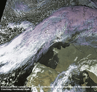
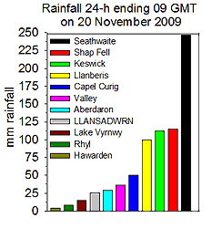 An extreme rainfall event occurred in Cumbria with devastating flooding in Cockermouth, at the confluence of the River Derwent draining from Bassenthwaite Lake, and the River Cocker, and coastal town Workington. There was a surge tide of about 0.8 m recorded on the spring tide just after noon by the tide gauge at Workington (POL UK Tidegauge network), that would have held back some of the water in the town. As water rushed through Cockermouth, described by one resident as 'like white water rapids', it rose over 8 feet to upper stories with cars floating away. Large amounts of debris, including farm animals from flood plain fields, were reported being washed rapidly down the River Derwent. Around 200 people were rescued through the night by local emergency services including from rooftops by RAF Sea King helicopters from RAF Valley, Anglesey, mountain rescue teams, including the Ogwen Valley Rescue Team, and by water in boats brought in by the RNLI . The RNLI North Wales flood rescue team attending included members from Moefre and Beaumaris Lifeboats. In all over 300 rescuers from around Britain were on the scene. One of the shops devastated in Cockermouth was a wool shop and the balls of wool were at times tangling with the outboard motors of the rescue boats. A policeman, PC Bill Barker, died when the Northside Bridge in Workington he was on stopping people and traffic crossing was washed away. Four bridges have been washed away, and 18 of the other 1800 bridges in Cumbria undergoing inspection were damaged and closed to all traffic, resulting long detours some of 90 miles between villages. The stone built Calva Bridge in Workington was moving with foundations undermined by the water and will have to be dismantled and replaced. Water and electricity supplies are carried by the bridge. Over 1000 homes and shops were estimated to have been affected by the flooding. A tipping bucket raingauge at Seathwaite Farm, Borrowdale, was reported to have recorded 314 mm in 24h one of the largest, if not the largest, falls in Britain that would depend on the over which the data are summed. The magnitude of the amount of rainfall can be seen in the graphic on the left far exceeding, by a factor of 2.5, what would be regarded as a 'normally' high amount of 100 mm in 24-h 09-09 GMT. Large falls are experienced from convective storms usually in summer, but this was different and due to a very slow-moving wavy front over the Irish Sea that was stalled over the Cumbrian Mountains for many hours with Snowdonia on its southern edge and SW Scotland on its northern edge. As the warm moist air arrives at mountains it rises and rain falls on the leeward or upslopes, but this process cannot account for all the rainfall measured. In addition clouds formed over the mountaintops (called feeder clouds) can be seeded with ice crystals or small rain droplets from higher level clouds (seeder clouds) can account for the heavier rain. The seeder-feeder effect, first proposed in the 1950's by the Swedish meteorologist and cloud physicist Tor Bergeron (1891-1977) and with more research in recent years has gained credence, may have occurred in Cumbria. If the situation persists, as it can over any mountain system, then the result is extremely large falls of rain. No doubt the event will be the series of much discussion and further research and has already been termed a 1: 1000 year event. {Seathwaite 314.4 mm, Llanberis 123.4 mm} [Shap Fell 114.6 mm, Keswick 112.0 mm, Llanberis 100 mm, Capel Curig 50.2 mm, Valley 36.0 mm] [Rain 25.3 mm; Max 13.0C; Min 7.6C; Grass 7.2C]
 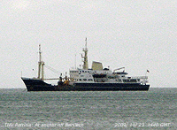 23rd: Overnight the wind had moderated and at 09 GMT was a light SSW'ly. Skies were overcast and visibility good but hazy. The last shower of rain at 0130 GMT had dried off concrete and grass, but respite was not long as showers soon restarted as a band of showery rain tracked northeastwards on a freshening SW'ly wind. After a moderate shower around 13 GMT the afternoon was brighter and briefly with some blue sky and sunshine before skies darkened again by midafternoon. In sheltered waters anchored off Benllech was spotted the Trinity House Vessel PATRICIA (right). The 86-m, 2541 tonne ship built in 1982, has a helicopter pad and is equipped with a 20 tonne main crane, a 28 tonne bollard and towing winch. Available 24/7 for a wide range of duties including maintaining the now automatic lighthouses, including the Skerries off NW Anglesey, and navigational buoys around Britain's coastline. Further light showers of rain at 18 and 21 GMT. {Eskdalemuir 40.6 mm, Lake Vyrnwy 30.4 mm} [Rain 13.4 mm; Max 11.8C; Min 7.5C; Grass 6.2C]
 The month ended with rainfall of 261.9 mm (192%) and [209%] of average, the previous largest fall in November was 250.5 mm in the exceptionally wet autumn 2000. It was the 2nd largest fall of any month in Llansadwrn since before 1928, only beaten by October 2008 with 282.8 mm. The mean temperature 8.6C (+0.3) and [+1.3] of average was highest since 2007 and ranked 7 since 1979. Small hail fell on 12 days (+7.1), most in November since before 1979; November 2000 had 11 days.
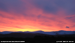 1st: Clear and frosty overnight with dew (0.17 mm measured by drosometer) frozen white on the grass. The minimum air temperature had fallen to -0.5C, the first frost of the season having been frost-free since the last on 29 March. On the grass it had fallen to -4.9C, but thin altostratus cloud encroached from the west by 07 GMT and with rising temperature all the frost had disappeared by 09 GMT (3.8C, dewpoint -1.8C). There had been a spectacular red sky earlier over the Carneddau Mountains with the sun yet to rise over snow lying at 1500-1800 ft. Pressure was 1013 mb at midnight in a ridge, but had fallen to 1009 mb with lows 971 mb S Iceland and 989 mb E of Iceland. A S'ly breeze was picking up and there was rain over Ireland advancing towards the Lleyn Peninsular. Although cloudy the day was more or less dry, just a few spots at times until 1645 GMT when there was a little more as the wind, slowly strengthening, reached force 6/8 by early evening. [Rain 1.8 mm; Max 8.0C; Min -0.5C; Grass -4.9C]
2nd: The sky overnight was partly cloudy, despite some clear spells with bright moonlight there was no ground frost. Pressure 994 mb was falling with low 988 mb SW Ireland. A bright morning with a light SE'ly breeze soon turning cloudier and was overcast around noon. The afternoon was brighter with a little sunshine before thicker cloud associated with the low moved across from the west. [Rain 5.2 mm; Max 9.5C; Min 3.8C; Grass 2.2C]
 3rd: There were moderate to heavy showers of rain at 0045 and 0245 GMT with slight rain and showers up to 09 GMT. There was a cumulonimbus cloud to the S with cumulus and altocumulus in the vicinity. A hare was spotted in the wood and the sun was rising above a bank of clouds over the snowclad Carneddau Mountains, and a few spots of rain were not long arriving. It was a day of sunshine and light showers these falling as snow on the mountains. Around 1400 GMT there was a heavier shower of rain that contained some ice pellets here and in Beaumaris. Towards evening the sky cleared and the temperature on the grass was soon below freezing. It was a frosty night with little wind, in the moonlight tawny owls were hunting in the wood. [Rain 0.2 mm; Max 6.3C; Min 3.9C; Grass 0.0C]
![]() 4th: There was a moderately thick white frost on the grass and vehicle windscreens, but concrete and road surfaces were just wet. Clear sky at 07 GMT gave way to a complex cloudy sky by 09 GMT with no bright sunshine; the sun had not yet risen above the mountains. With a developing low 979 mb S Greenland and high-pressure 1027 W of the Azores to Iberia there was giving a light W'ly airflow. Pressure had been rising through the night in a ridge ahead of a warm front over SW Ireland, but soon began to fall. The thicker frontal cloud arrived over the station just after 09 GMT resulting in a duller, but dry morning, the bright sky remaining longer beyond Conwy and Llandudno (photo below left). There were a few spots of rain around 1300 GMT then slight rain from 1500 GMT petering out before 1800 GMT. The evening was overcast and damp. [Rain 3.9 mm; Max 10.0C; Min 0.3C; Grass -5.2C]
4th: There was a moderately thick white frost on the grass and vehicle windscreens, but concrete and road surfaces were just wet. Clear sky at 07 GMT gave way to a complex cloudy sky by 09 GMT with no bright sunshine; the sun had not yet risen above the mountains. With a developing low 979 mb S Greenland and high-pressure 1027 W of the Azores to Iberia there was giving a light W'ly airflow. Pressure had been rising through the night in a ridge ahead of a warm front over SW Ireland, but soon began to fall. The thicker frontal cloud arrived over the station just after 09 GMT resulting in a duller, but dry morning, the bright sky remaining longer beyond Conwy and Llandudno (photo below left). There were a few spots of rain around 1300 GMT then slight rain from 1500 GMT petering out before 1800 GMT. The evening was overcast and damp. [Rain 3.9 mm; Max 10.0C; Min 0.3C; Grass -5.2C]
 5th: Mild with showers of rain from 0015 GMT up to 0635 GMT. Some broken cloud by 07 GMT with well-developed cumulus clouds, one towering at 09 GMT, over the Snowdonia Mountains. With rising temperature there had been a thaw of snow, but there was patchy snow lying on the northern slopes above 1800 ft and around the summits of the Carneddau. After falling since 09 GMT yesterday to 991 mb, pressure 993 mb had risen only a little. With complex low-pressure to the NW deepening low 965 mb was SW of Ireland. There was some sunshine during the morning with a clearer spell over Anglesey at 11 GMT. There was a light shower of rain before noon with some weak sunshine before thicker cloud on a warm front brought more or less continuous rain from 1400 GMT through until next morning accumulating 18.7 mm, largest of the month. [Rain 18.7 mm; Max 11.3C; Min 2.0C; Grass -0.7C]
6th: The rain stopped just before 09 GMT and the sky had begun to clear. The temperature had been falling, from a maximum of 11.3C at 2300 GMT yesterday, as a cold front passed over, and was 5.7C, the lowest of the last 24-h, and fell a little more to 5.5C (a fall of 5.8C), the minimum of the next 24-h. Pressure was 985 mb with low 951 mb off the Western Isles of Scotland. We were in a SW'ly airflow with cumulus clouds in the vicinity and at 1112 GMT we duly had a shower of rain with small hail (ice pellets spherical 2 mm, hard and opaque). The afternoon was mostly cloudy and by evening the wind had strengthened; showery rain at 2230 GMT gave way to light rain from 2300 GMT. [Rain 9.3 mm; Max 9.0C; Min 5.7C; Grass 4.3C]
7th: Rain was heaviest around 02 GMT before easing and becoming intermittent before 09 GMT. Overcast with ragged low clouds, strong to gale force 8 S'ly wind and poor visibility. Pressure was 988 mb with low 962 mb SE Iceland and associated front passing slowly eastward. More moderate rain (another 11 mm) turned small puddles into standing water around the weather station during the morning. At 1330 GMT there was a heavy shower of rain and 2-3 mm clear ice pellets when I was working in the greenhouse. The woodmice have installed themselves and are generally causing the head gardener problems digging up seeds and plantlets from pots and storing them elsewhere. A little clearance in the sky brought some brightness and a little sunshine before the now almost 16-h darkness at this time of year. The owls were noisily about again close to the house around 22 GMT (overcast but not raining). [Rain 16.5 mm; Max 8.8C; Min 5.5C; Grass 4.0C]
8th: The sky was clear at 07 GMT, but it had been a mild night with the air temperature not falling below 4.2C in an occluded frontal system. There was a red sky at 08 GMT and by 09 GMT the sky was mostly covered with moderately high altostratus, cirrostratus and altocumulus. The sun was just rising over the mountaintops, but that was the last glimpse of it as the day was then overcast with a warm front moving across associated with a triple point over the Irish Sea. The day was dry, with a maximum temperature of 11.5C, highest of the month, becoming windier by evening when the cold front arrived at 1845 GMT bringing slight showers of rain and ice pellets. [Rain 1.0 mm; Max 11.5C; Min 4.2C; Grass 0.3C]
9th: Still overcast at 07 GMT with broken cloud developing by 09 GMT. The overnight minimum air temperature was 6.3C, highest of the month. Pressure was 1012 mb with lows 956 mb Greenland and 980 mb mid-Atlantic W of Iberia. Pressure was high 1028 mb from Iberia to Russia. There were sunny spells and slight showers of rain in the morning. The afternoon was mostly cloud and at 1700 GMT a frontal system passed over giving burst of rain and a temperature fall of 4C. Later the sky was partly cloudy. [Rain 1.7 mm; Max 10.8C; Min 6.3C; Grass 5.0C]
10th: A mostly clear dawn with shallow mist forming briefly on the fields at 0820 GMT. It was misty at low levels with moderate visibility towards the mountains. The sun rose over a bank of cumulus clouds on top of the Carneddau at 0855 GMT. It was a mostly sunny day, the cloud persisted over the mountaintops but lifted and dispersed during the afternoon. Smoke was rising vertically from chimneys and in contrast to the 2 previous evenings dew on the grass began to freeze. [Rain trace dew; Max 9.2C; Min 3.8C; Grass 0.5C]
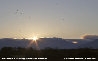 11th: There was frozen water and dew with a minimum of -0.7C on the grass. A mackerel sky had developed by 09 GMT with altocumulus streaming across the sky from the Carneddau Mountains above Llanfairfechan; cloud drifted westward through the day with clear sky from here eastward. The temperature rose to 8.7C, another day with little of no wind and very good visibility giving clear views of the mountaintops Another cooling evening with dew and frost forming on the grass. [Rain 0.0 mm; Max 8.7C; Min 1.9C; Grass -0.7C]
12th: Clear overnight with strong katabatic winds off the Carneddau reported locally in Llanfairfechan. Deposits of water and dewdrops were frozen on the grass with a minimum of -2.4C, but no air frost the temperature in the screen dropping to 1.2C. There was a low line of backlit cumulus clouds over the mountains with the sun rising at 0853 GMT. There was a light E'ly air and a mostly sunny day with very good, slightly hazy visibility. The sun set at 1553 GMT and 6.1h of sunshine was recorded at Valley. {Scilly Is. 10.5C, Mumbles Hd. 10.5C, Manston 14.0 mm, Valley 6.1h} [Dew 0.1; Max 7.6C; Min 1.2C; Grass -2.4C]
13th: The sky was clear overnight only beginning to cloud over about 06 GMT. At 09 GMT there were 5 oktas of cumulus, altocumulus and cirrus with an expanding contrail overhead thrown in for good measure. White frost on the grass was melting and 0.1 mm of dew condensation was collected in the raingauge although 0.26 mm dew was measured by drosometer; no air frost here, but at low levels there had been a frost (Pentraeth -1.8C) with earlier mist still lingering. At higher levels visibility was good and after the cloud began to clear away again the morning was sunny at times. Cloudier once again in the afternoon, but there was a brief red sky at sunset with a partly cloudy sky during the evening. A dry, but rather damp day. [Rain 0.0 mm; Max 6.4C; Min 1.1C; Grass -2.5C]
 14th: Once again some clear spells overnight with a touch of ground frost. By morning cloud had encroached as a frontal-waves low developing off NE Scotland moved south. There was slight rain during the morning falling as sleet on the mountains. Further light rain from 1530 GMT fell as wet snow on the mountaintops leaving a slight covering on Snowdon above 2500 ft by dusk. The rain had petered out by evening and there was little or no wind. The temperature rose 3C about 2230 GMT as a warm front arrived associated, unusually, with a triple point low 1015 mb to the E over the North Sea tracking SSW off Scarborough. [Rain 3.7 mm; Max 7.5C; Min 2.1C; Grass -0.8C]
15th: After midnight the air temperature rose to a maximum of 7.2C before falling back to 6.8C at 09 GMT. Pressure was 1018 mb with the low over the Bristol Channel (1015 mb) heading for Lands End to be off Brest by 1800 GMT with no change of pressure. It was a bright morning with cloud clearing leaving towering backlit cumulus clouds over the Mountains of Snowdonia and a complex sky including altocumulus, lenticular altocumulus and cirrus overhead the weather station. The day kept mostly cloudy with some sunshine at times becoming cloudier by dusk as a narrow band of precipitation encroached to the north-west. From 1800 GMT, as the temperature fell to a minimum of 3.0C, there were intermittent falls of small (1 - 2 mm) snow flake crystals blowing about on a light air leaving no deposit on the ground. The temperature of the water in the Irish Sea around Anglesey is still relatively warm, about 11.9C. [Rain 0.4 mm; Max 7.2C; Min 3.4C; Grass 2.3C]
The first 15 days had a mean maximum temperature of 8.8C (+0.6) and [+0.9] and a mean minimum of 3.0C (-0.4) and [+0.1} of average. There were 8 ground frosts and 1 air frost. Rainfall was 66.2 mm (51%) and [58%] of the monthly average. .
16th: After midnight the air temperature rose quickly by about 3C and hovered around 6.0C through the night. At 09 GMT it was 5.7C (dewpoint 3.8C) with pressure on 1015 mb. Low 1003 mb was over the S North Sea and Baltic. Pressure was high 1035 mb Iceland and low 998 mb over the Azores. Eyes are turning towards the Russian high 1035 mb where daytime temperatures are minus 22C. The sky was mostly cloudy with layered ragged stratiform clouds although cumulus cloud be seen to the NE over Cumbria. There was some patchy light precipitation over Morecambe Bay, the Midlands and SE England. Here it kept there were a few spots of drizzle until there was slight rain between 1300 and 1500 GMT. The tips of snowdrops and early daffodils have been appearing above the soil surface for the past week or two, but at the moment with the surface frozen progress is halted. It is necessary to learn again where they are so that when walking around the garden they are not trodden on. During the evening there was slight drizzle or rain with sleet around 2200 GMT. [Rain 3.3 mm; Max 6.8C; Min 3.0C; Grass 0.1C]

|
 18th: There were slight showers of snow pellets and small flaked snow before dawn and at 09 GMT there were some well-developed cumulus clouds in the vicinity. There was a force 4 NE'ly breeze and the temperature 0.7C (dewpoint -4.3C). Visibility was good or very good with slight haze, views of the Snowdonia Mountains with slight snow as low as 1200 ft were partially obscured as broad crepuscular rays moved across as clouds moved westward across the mountain range. There were some sunny spells through the morning, the afternoon was cloudier with frequent very slight showers of small snow pellets. The maximum temperature was 1.8C, lowest of the month. There was a flurry of snow at 2230 GMT.
 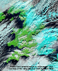 Heavy snow fell in Yorkshire and counties of SE England from Sussex to Kent with 15 - 20 cm snow in places causing traffic chaos with vehicles abandoned on the M2 and M20. Some roads closed altogether and motorists were advised not to travel; rail services were also delayed or disrupted. About 350 schools were closed and both Gatwick and Luton airports were closed for some hours. Electricity supply to some areas was also disrupted following faults on overhead cables likely to be caused by snow. Passengers on 5 EuroStar trains returning from Paris and Brussels were trapped for hours in the Channel Tunnel. The trains broke down on entering the tunnel due to intake of snow in N France, despite fitted snow screens, that melted when in the tunnel causing electrical problems; the Port of Calais was also closed. The MODIS TERRA satellite image left, courtesy of NASA/ GFSC shows the distribution of the snow in N and SE England, and N France and Belgium. Using bands 7-2-1 snow and coldest cloudtops show up pale blue against the green of land surface or black coloured sea. [Pptn 2.3 mm; Max 1.8 C; Min 0.6C; Grass -0.7C]
 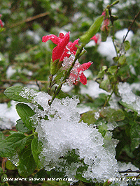 19th: Intermittent light snow from midnight gave a covering by morning of between 1.0 and 2.0 cm (snow lying) on grass, rather less on concrete. There had been some thawing, under snow the temperature of the soil at 5 cm was 1.2C, as snow was 2.5 cm deep on cold surfaces and snow board. The temperature of the soil at 5 cm was 1.2C. At 07 GMT there was advection fog over the snow as warmer moist air moved in off the Irish Sea on a light NW'ly breeze. The fog began to clear at 0830 GMT and visibility was moderate at 09 GMT; there was a little more snow before precipitation turned to sleety rain at 1030 GMT before dying out. There was a little sunshine around noon with more sleety rain showers just before 1300 GMT. Frequent mixed showers of precipitation continued through the afternoon these turning into snow pellets and small snowflakes during the evening. After further failures of the EuroStar trains the service was suspended. Some people in parts of Norfolk were facing their 3rd night without a supply of electricity. [Pptn 4.8 mm; Max 4.0C; Min -1.1C; Grass -4.8C]
 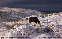 23rd: A cold and frosty morning with frozen precipitation still on the ground including remnants of the large snowflakes that fell yesterday on concrete paths. The air temperature had hovered around zero overnight and there was no evidence of any fresh precipitation. Towering convective cumulus clouds could be seen low in the sky to the NE (Liverpool Bay/ Cumbria) and to the SSW beyond Lleyn. Visibility was very good and it was another mostly sunny day as cloud overhead dispersed. By evening it was cloudier and kept dry until a spell of sleet between 2000 and 2200 GMT falling as snow on the higher ground of the mountains. [Pptn 1.8 mm; Max 5.0C; Min -0.7C; Grass -3.7 C]
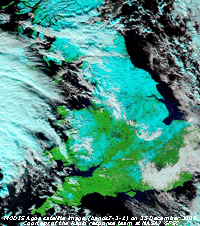
 28th: A heavy white frost on the grass with a minimum of 4.3C and at 09 GMT -0.4C in the screen. Cloudier since dawn the sun rise was muted as altostratus had moved across, but clearing again by 1030 GMT with some bright sunshine. Pressure was 1004 mb in a declining ridge, but eyes were turning towards low 972 mb N of the Azores heading our way with a warm moisture laden front which on reaching colder air has the potential of producing more snow on high ground. It was a mostly sunny day, with little or no wind, the sunshine was at times weak with moderately high thin cloud persisting. Although there felt little warmth in the sun the temperature rose to 5.3C. Frost remained in shaded parts of the garden and before dusk the temperature was falling and freezing washing on the line that had not dried during the day. The evening was frosty and partially cloudy the air temperature was 0.0C at 2300 GMT. [Rain trace; Max C; Min -0.4C; Grass -4.3C]
|
The month ended with a mean temperature of 4.1C (-1.8) and [-1.4] of average, lowest since 1996 ranked 5th since before 1979. The mean maximum 6.6C (-1.6) and [-1.3], lowest since 1995 ranked 3rd. There were 10 days with air frost (+6.4), highest since 1996 rank 6th. The 18 days with ground frost (+2.9), were equal lowest since 2007 rank 7th since before 1985. Precipitation, mostly rain, was 116.9 mm, largest since 2007, (90%) and [102%] of average ranked the 38th since before 1928. There were 12 days with sleet or snow, and hail, both highest in December since before 1979.
|
|
|
These pages are designed and written by Donald Perkins © 1998 - 2009 Page first dated 20 February 2009 |