
Llansadwrn (Anglesey) Weather
Diary 2008


|
Llansadwrn (Anglesey) Weather
|

|
Where you see these icons click for a pop-up graphic
![]()
![]()
![]()
![]()
![]()
![]()
![]()
Most pop-up graphics in the diary are self closing on next click of mouse. Javascript must be enabled if you are using some pop-up disabling software or a firewall. Please continue to close older graphics on some other pages as usual; they may go into your toolbar if you click something else first. You can click on most thumbnail images to see a larger version.
 1st: The year began with an overcast sky and a temperature of 9.5C, dewpoint 7.9C. Pressure was 1020 mb with high 1051 mb N Finland and complex Atlantic-lows 992 mb W of Ireland. We were in a moderate to strong S'ly airflow with a little early drizzle around coasts. It was a dry day here and was a little brighter in the afternoon as the cloud thinned, but the day was sunless. During the evening the wind backed SE'ly and there was a little broken cloud with one or two standing-waves over the weather station around 21 GMT. [Rain 0.0 mm; Max 9.5C; Min 8.0C; Grass 6.9C]
2nd: A very complex cloudscape at 09 GMT, the result of an ESE'ly wind breaking up the cloud in the lee of the mountains, light at first freshening to force 3/4 by 1130 GMT. Pressure was 1014 mb between intensifying high 1061 mb over Russia, SE of the White Sea and low 968 mb was mid-Atlantic to the W. The result - a cool airflow from SE Europe. The Met Office had issued severe weather warnings of low temperatures and heavy snow for eastern parts of Britain, particularly NE Scotland, the midlands and SE England. Wales had the best of the day with broken cloud, some sunshine and the temperature here reaching 7.3C as the sky cleared some more during the afternoon. Just before sunset there were some fine lenticular clouds to the S ![]() and looking to the SW into the setting sun more lenticular, contrails and standing-wave clouds looking dark against the blue of the sky (photo above right). During the evening and night the force 3/4 E'ly wind strengthened to force 6/7 and roared in the trees throughout the night. [Valley 3.0h] [Rain 0.0 mm; Max 7.3C; Min 3.0C; Grass -1.0C]
and looking to the SW into the setting sun more lenticular, contrails and standing-wave clouds looking dark against the blue of the sky (photo above right). During the evening and night the force 3/4 E'ly wind strengthened to force 6/7 and roared in the trees throughout the night. [Valley 3.0h] [Rain 0.0 mm; Max 7.3C; Min 3.0C; Grass -1.0C]

|
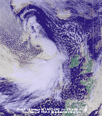
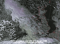 6th: With almost clear skies moisture and dew had frozen white on the grass with the minimum thermometer own to -2.3C. When reset at 09 GMT it read -1.8C. The sun was somewhat delayed appearing over the Carneddau as there was a line of stratocumulus and 1 or 2 towering cumulus clouds obscuring its appearance. The frost on the grass was slow to thaw as the morning became cloudier. Pressure was 1007 mb and a deep low 994 mb 100 miles W of Shannon was one to watch. The NOAA 18 satellite image captured at 1316 GMT shows the developing low tracking towards the Irish Sea. The afternoon had some variable cloud, but there was some sunshine as the light SW'ly wind backed SE'ly. During the evening pressure was falling and my Oregon storm alarm sounded just before 2100 GMT as pressure 992 mb was falling rapidly with the low 989 mb over NW Ireland. Before midnight the SW'ly was force 6/7. [Valley 2.4 h] [Rain 4.6 mm; Max 9.0C; Min 2.6C; Grass -2.3C]
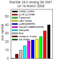
  10th: Severe gales and heavy rain over Snowdonia and Anglesey overnight brought several reports of flooding. There was plenty of water standing around the weather station, a small stream was running across the garden and along the road outside. Several local roads were partially flooded, including the Britannia roundabout in Menai Bridge. The Gazelle Hotel, between Menai Bridge and Beaumaris, was flooded out again having just finished repairs of the last flood on 21 September 2007. The A4086 road in Nant Peris was closed and here, and Bethesda on the A5, cars were caught in flood water. The A55 between St Asaph and Abergele was closed westward for over 5 h causing traffic chaos for commuters. Electricity supply was disrupted to several areas on Anglesey and there were problems on the railway due to water on the track at Gaerwen. Flooding was widespread in North Wales; at Talysarn near Caernarfon there was 3 ft of water while the A299 in Pwllheli was flooded. With spring tides, and a tidal surge of about 0.5 m at the mouth of the Conwy at midnight (data courtesy of Proudman Oceanographic Laboratory)
runoff water from the mountains flowing down the river was held back. There was flooding in Llanwrst, where the River Conwy was overflowing, and villages along its length to it's mouth at Conwy. With the next high tide, with even more runoff water arriving in the river, was at noon and with a surge of 0.6 m more flooding could be expected, but no more problems were reported. A low developing W of Ireland was responsible bringing complex fronts and warm frontal-wave across North Wales and a large area of slow-moving rain. Obs precisely at 0900 GMT were done in a S'ly gale and driving rain; 48.8 mm of rain was
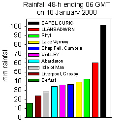
measured for the past 24-h, the observer getting wet! It was the largest fall recorded at this station in January and third largest of any month. It was very wet in Snowdonia, at Llyn Llydaw, Snowdon 102.3 mm of rain was recorded during the same period [ECN AWS, data courtesy of CCW]. In the 48-h to 06 GMT Llyn Llydaw accumulated 118 mm, Capel Curig 101 mm and Llansadwrn 60 mm. Winds over the mountains were severe, Capel Curig reported mean wind speeds of over 50 mph (force 9) while on Snowdon the AWS at Clogwyn (courtesy of FirstHydro)
gusts of 114 mph were recorded. Rain and wind began to slacken by 10 GMT and one or two patches of blue sky appeared briefly overhead before noon. As the cloud thinned and lifted there were glimpses of sunshine and views of the Snowdonia summits revealing little remaining snow. The sky cleared during the evening and there was a touch of ground frost. {Capel Curig 87.6 mm} [Rain 2.8 mm; Max 9.2C; Min 3.9C; Grass 2.2C]
 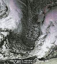 11th: A quieter night some clear sky at first, but overcast with moderately high altostratus clouds. Visibility was good and there was a fresh sprinkling of snow around the summits of the Snowdonia Mountains, particularly Carnedd Dafydd and Snowdon. Pressure 993 mb was falling within a slack area of low-pressure in a most unsettled looking chart, the most significant being the low 987 mb near Brest, Brittany. Rain within its circulation was falling over South Wales and S England moving N only slowly. The Atlantic is the place to watch for here and another blow is expected soon as a low makes its way across from S of Greenland. The NOAA 18 satellite image shows the low near Brittany with cloud affecting S Britain. Ireland had clear skies and to the west there was a large area of marine convection. Further W is the developing low and cloud mass S of Greenland heading our way.. The temperature at 09 GMT was 2.9C with a dewpoint of 1.9C giving a 60% chance of ice precipitation if there were to be any, but the day kept dry and overcast until late afternoon. Cloud had been building S of the mountains and there was heavy rain, flooding and snow in southern England and South Wales. Trains to South Wales were disrupted because of flooding around Swindon, the M5 had problems as well as Bristol Airport where several flights were cancelled and passengers were stranded at Bristol Temple Meads station. Here we had a few small ice pellets (424 per m2) at 1620 GMT as some cumulus clouds moved across, and later a beautiful azure blue sky in the west as the sky started to clear - too late for any sunshine, but Valley on the north-west coast had 0.5 h though. The clear sky reached here after dark and there was ground frost. [Rain trace; Max 5.4C; Min 2.3C; Grass -1.2C]
  14th: Overcast, but showery rain from 08 GMT. Pressure was 983 mb with the low still to the NW 982 mb. Visibility was poor, but when the rain stopped about 10 GMT improved and breaks in the cloud appeared overhead by 1030 GMT, but they did not last very long. By afternoon the wind was freshening and there was slight rain at times. There was further light to moderate rain from 2130 to 0300 GMT. [Rain 14.8 mm; Max 8.6C; Min 6.1C; Grass 4.5C]
 The first 15 days of the month had 112.9 mm of rainfall 114% of average. The mean temperature was 5.6C this running just 0.1C above the decadal average, but 0.7C above the 30-y average.
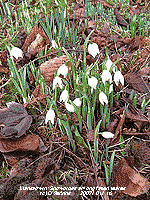
![]() 16th: A bright morning with glimpses of sunshine. Water on the grass had frozen mostly clear, not white. Concrete paths, the road and windscreen were not frozen. Cloud was touching the mountain summits above 2600 ft, otherwise visibility was good although a little misty. Pressure 987 mb was rising within low-pressure centred over St. George's Channel. There was little or no wind and with partly clearing skies turned out to be quite a nice day. Snowdrops, that first appeared on the 9th, are well into opening their flowers (above) and there were a lot more lambs in the fields. Later in the afternoon the light SE'ly wind veered N'ly and convective cumulus clouds were moving across. Fog was seen blowing along the Menai Strait from the NE entrance and there was fog around the NW coast of the island. The evening turned cloudier and showery by 2000 GMT. [Rain 6.6 mm; Max 8.1C; Min 2.4C; Grass -1.6C]
16th: A bright morning with glimpses of sunshine. Water on the grass had frozen mostly clear, not white. Concrete paths, the road and windscreen were not frozen. Cloud was touching the mountain summits above 2600 ft, otherwise visibility was good although a little misty. Pressure 987 mb was rising within low-pressure centred over St. George's Channel. There was little or no wind and with partly clearing skies turned out to be quite a nice day. Snowdrops, that first appeared on the 9th, are well into opening their flowers (above) and there were a lot more lambs in the fields. Later in the afternoon the light SE'ly wind veered N'ly and convective cumulus clouds were moving across. Fog was seen blowing along the Menai Strait from the NE entrance and there was fog around the NW coast of the island. The evening turned cloudier and showery by 2000 GMT. [Rain 6.6 mm; Max 8.1C; Min 2.4C; Grass -1.6C]
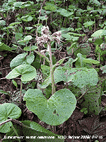 17th: Overcast with ragged low clouds, some cumulonimbus in the vicinity, and heavy showers of rain led up to 09 GMT. The rising temperature 8.1C in the Stevenson Screen was the highest of the past 24-h. Visibility was poor and the S'ly wind force 5. There was water standing in puddles in muddy places and there was the semi-permanent pool of water on an adjacent field. There were a few brighter times with glimpses of sunshine between rain showers through the day as a ridge of high-pressure moved across from the west. [Rain 12.0 mm; Max 10.0C; Min 2.7C; Grass -0.6C]
18th: There was a spell of moderate rain between 0500 and 0700 GMT, accumulating 5.5 mm, becoming intermittent and slight leading up to 09 GMT. Rainfall for the month now 132 mm, [134%]. Pressure 999 mb was falling with the ridge of high-pressure
moving E as low 977 mb to the NW approached. A warm front over the Irish Sea bringing the rain resulted in the temperature being 10.0C, highest of the past 24-h rising to 10.7C. The S'ly wind was force 7 at 09 GMT and was strong to gale-force at times during the day before moderating by evening. A dull 'lights-on-in-the-house' day. {Hawarden 14.1C} [Rain 7.1 mm; Max 10.7C; Min 6.1C; Grass 4.1C]
19th: A spell of light rain from midnight until 07 GMT then intermittent up to 09 GMT. Pressure 1015 mb was rising, but there were slow-moving fronts straddling Wales and there was little change during the morning. The afternoon was no better and the day was sunless; there was rain from 1500 to 2100 GMT. [Rain 9.5 mm; Max 10.5C; Min 8.8C; Grass 8.5C]
20th: Cloud was low enough to give hill fog here up to 09 GMT after which it began to lift. The waterlogged ground was muddy with standing water seeped away, but there was the usual pool in the middle of the field. Pressure 1015 mb was rising but of little consequence
as light rain continued through the morning under slow-moving frontal cloud. Another very dull sunless day, but the first yellow and purple crocuses appeared to brighten the day. There was more rain from 1900 GMT until morning. It was very wet in the mountains of Snowdonia, in the past 72-h to 1800 GMT Capel Curig clocked up 148 mm of rain. [Rain 21.7 mm; Max 10.4C; Min 9.0C; Grass 8.4C]
21st: Much of the same with the barometer on 1004 mb falling again. A frontal-wave low 998 mb was over north Ireland and we were having showery rain at 09 GMT under uniform grey stratus cloud. Visibility was poor and the wind force 6/7 SSW'ly. Rainfall for the month had reached 169.8 mm, exceeding the 145 mm recorded in 2000 (the wettest year on record here), but so far only the 6th largest in January since 1928. At Llyn Llydaw, Snowdon, 537 mm had fallen [ECN AWS, data courtesy of CCW]. With the rain petering out there were some patches of blue sky overhead by noon, with some flashes of sunshine around
1300 GMT, before it turned cloudier. In Northern Ireland there was heavy rain and flooding, but in S Scotland and parts of N England moderate to heavy snowfall. As the low moved E across Britain colder air and showery precipitation was brought down from the N during the evening there was a little sleet, with snow in places above 1000 ft mainly on eastern mountains, before the sky cleared giving frost on the ground and icy roads in some untreated places. [Rain 0.6 mm; Max 10.3C; Min 9.4C; Grass 9.1C]
 22nd: A bright start if you were up early, but soon cloudier with a red sky over the mountains from 0755 to 0815 GMT. By 09 GMT the sky was overcast with moderately high altostratus cloud. There was a sprinkling of snow above 2500 ft on the Carneddau Mountains, less if any in the west and around Snowdon. Pressure 1021 mb was rising in a minor ridge crossing from the W. The temperature was 3.2C with a dewpoint of 1.9C( indicating a 60% chance of ice precipitation if there were
to be any). Temperatures were rising when thicker cloud encroached from the W during the morning with slight rain here from 1030 GMT (5.3C rising to 8.1C by afternoon). The afternoon was very dull, but there was not a lot of rain. There are now quite a lot of crocuses up in the garden, but they need some sunshine to look their best. There was light rain from 1600 to 2300 GMT, and windier. [Rain 3.5 mm; Max 10.6C; Min 1.6C; Grass -2.1C]
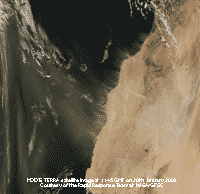
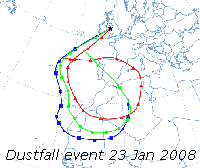 23rd: Overcast with uniform grey stratus and misty too with visibility poor. Pressure was 1019 mb with complex low-pressure to the NW up against high 1035 mb Iberia to Netherlands. Deep low 953 mb was S Greenland while frontal-waves were straddling N Britain in a moist warm SW'ly airflow. A light deposit of reddish-yellow Saharan dust was collected at 09 GMT having fallen about 06 GMT in drizzle. More drizzle and spots of rain containing dust during the morning on a moderate to strong SSW'ly wind.
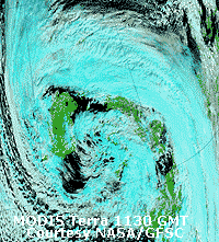
The house windows facing SW when drying were showing a light covering of dust. The afternoon continued very dull, almost dark and there was further rain from 1800 GMT, and a heavy fall of the reddish-yellow dust (MUNSELL� Color Chart 5YR 6.5/8). (Trajectory analysis (see right), using the HYSPLIT model at the NOAA Air Resources Laboratory, indicated that parcels of air arriving at between 250 and 3500 m over Llansadwrn at 18 GMT at the onset of the deposition). The MODIS TERRA satellite image (above left, courtesy of the Rapid response team at NASA/GFSC) shows dust
being blown off the coasts of Western Sahara south of the Canary Islands at 1145 GMT on the 20th. Trajectories of parcels of air that arrived over Anglesey on the 23rd were in the area at this time and brought the dust). The rain and dust deposition petered out after 2300 GMT. [Rain 4.9 mm; Max 10.8C; Min 3.0C; Grass 1.6C]

![]() 24th: There was a shower of ice pellets (2-4 mm) at 0755 GMT. Soon after the sky started to clear and the temperature fell to 3.5C in the screen by 09 GMT. The heavy fall of Saharan dust was evident especially on the corner and bottom edge of the Stevenson screen (see left), any horizontal objects in the garden and my previously clean car. Dust was widespread over Wales (reports from Pembrokeshire, Carmarthenshire and Abergavenny) and southern England (Epping, Essex), although the heaviest falls were in the north. The sky cleared leaving cumulus over the Mountains of Snowdonia and a thin covering of hail on some of
the eastern summits, there was no snow observed. Pressure 1023 mb was rising and it was a mostly sunny morning and sunny afternoon under clear skies. It was a breezy day with the SW'ly wind persistently around force 5. The temperature rose to 8.1C with relative humidity of 61% at 1400 GMT. It was a bright day with global solar radiation of 4.85 MJ per m2. The evening and night were mostly clear with bright moonlight. [Rain 0.0 mm; Max 8.8C; Min 3.5C; Grass 0.6C]
24th: There was a shower of ice pellets (2-4 mm) at 0755 GMT. Soon after the sky started to clear and the temperature fell to 3.5C in the screen by 09 GMT. The heavy fall of Saharan dust was evident especially on the corner and bottom edge of the Stevenson screen (see left), any horizontal objects in the garden and my previously clean car. Dust was widespread over Wales (reports from Pembrokeshire, Carmarthenshire and Abergavenny) and southern England (Epping, Essex), although the heaviest falls were in the north. The sky cleared leaving cumulus over the Mountains of Snowdonia and a thin covering of hail on some of
the eastern summits, there was no snow observed. Pressure 1023 mb was rising and it was a mostly sunny morning and sunny afternoon under clear skies. It was a breezy day with the SW'ly wind persistently around force 5. The temperature rose to 8.1C with relative humidity of 61% at 1400 GMT. It was a bright day with global solar radiation of 4.85 MJ per m2. The evening and night were mostly clear with bright moonlight. [Rain 0.0 mm; Max 8.8C; Min 3.5C; Grass 0.6C]
![]() 25th: An overcast morning, but a few breaks appeared here by noon. Pressure was 1030 mb with the high 1043 mb over France and lows to the N, 965 mb Denmark Strait (N Iceland) and 974 eastern Norwegian Sea. The SSW'ly wind was strong to gale-force at times and there were speed restrictions in force on the Britannia Bridge. The winds in the north and north-east of England led to 11 lorries being blown over in north Yorkshire closing the A1, Here it was dry, with cloud just touching the mountaintops that had gale-force winds; a few breaks in the cloud by noon gave a little sunshine in the afternoon. [Rain
0.0 mm; Max 9.6C; Min 3.5C; Grass 1.1C]
25th: An overcast morning, but a few breaks appeared here by noon. Pressure was 1030 mb with the high 1043 mb over France and lows to the N, 965 mb Denmark Strait (N Iceland) and 974 eastern Norwegian Sea. The SSW'ly wind was strong to gale-force at times and there were speed restrictions in force on the Britannia Bridge. The winds in the north and north-east of England led to 11 lorries being blown over in north Yorkshire closing the A1, Here it was dry, with cloud just touching the mountaintops that had gale-force winds; a few breaks in the cloud by noon gave a little sunshine in the afternoon. [Rain
0.0 mm; Max 9.6C; Min 3.5C; Grass 1.1C]
 26th: Overcast but with a good drying wind (force 4 SW'ly) both grass and concrete were surface dry at 09 GMT. The altostratus was moderately high and just touching the mountaintops, visibility was good although hazy with some dust still in the air. There was a little sunshine in the afternoon and if you cloud find a sheltered spot felt pleasantly mild in the 10.4C air temperature. {Aberporth 6.7h, Pershore 12.9C} [Rain 0.0 mm; Max 10.4C; Min 7.8C; Grass 6.0C]
27th: Another overcast morning with dew on the grass and the condensation had made concrete damp. Pressure was 1032 mb with high-pressure
1037 mb Lands End and Brittany. Mostly dull, but a little sunshine in the afternoon and clearing sky later brought a sunny end to the day. Daffodils are in bud in the garden and I spotted the first bloom out in a hedgerow bank near the village, earliest out since 2005. Buds on honeysuckle and alpine clematis, always early, had opened over the few weeks. The evening and night were partly cloudy with some bright moonlight at times. {Aberporth 7.0h, Milford Haven 11.9C}[Rain 0.0 mm; Max 9.8C; Min 6.6C; Grass 4.3C]
 28th: Overcast with wavy moderately high cloud and a few breaks. The mistle thrush sang briefly at 0745 GMT, from his usual treetop position. I saw him yesterday surveying the scene and thought he might start soon. Later a bullfinch was taking buds from the plum tree in the garden. A pair of bullfinches are regular visitors to the garden at this time of year, we rarely see them at other times. The sun rose over the mountains and shone briefly leaving bright weather across the Straits from Bangor to Conwy. Pressure was steady on 1032 mb with the high 1039 mb France and Spain and low 961 mb was E of Iceland. The afternoon saw a few more sunny spells before the cloud thickened by 1600 GMT; the S'ly wind freshened during the evening. [Rain 0.3 mm; Max 10.1C; Min 5.5C; Grass 2.1C]
29th: A mild night with the temperature slowly rising to 10.1C in a moist warm air stream. There was a light shower of rain around 04 GMT. At 09 GMT pressure 1022 mb was falling as a frontal wave low 1018 mb moved across the Irish Sea had brought rain to NW Ireland and W Scotland. Visibility was poor (2 km) with low cloud moving along on the moderate to fresh SW'ly breeze. There was no singing from the mistle thrush this morning that remained mostly dry with odd spots of rain from time to time. Rain set in from 1215 GMT and at first turned moderate before easing later in the afternoon and stopping around 1700 GMT. The sky was slow to clear during the evening. [Rain 5.7 mm; Max 10.3C; Min 7.2C; Grass 6.1C]
30th: The sky almost cleared after midnight and with the temperature falling (air to 0.5C) water on the grass (-3.6C) and windscreens froze. It was a sunny morning, the mistle thrush decided to give a burst of song and the snowdrops and crocuses were standing proud on the lawn. The sky was deep blue the Saharan dust having moved off SE, but at low level it was misty and the mountaintops were obscured. The morning was sunny with a light NW'ly breeze; the afternoon bright at first became overcast later with rain edging into the west by nightfall. During the evening the SW'ly wind strengthened to force 6/7. [Rain mm; Max C; Min 0.5C; Grass -3.6C]
![]()
![]()
![]()
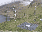 31st: At midnight low 970 mb was tracking E off NW Scotland with gales or severe gales in the north-west. The wind soon reached gale force 8 with strong gusts. At RAF Valley the mws between 03 and 05 GMT was a sustained force 9 with a peak gust of 71 mph recorded. A weak cold front crossed over about 06 GMT with the temperature falling from 7.8C to 5.0C at 09 GMT. At 0820 GMT there was a shower of rain and small 2-3 mm diameter ice pellets. There was ice precipitation on the summits of the Snowdonia Mountains, with slight snow on the NW-facing slopes of Crib-y-ddysgyl. The morning has some brief sunny spells with most showers confined to the mountains; the Britannia Bridge was closed to high-sided vehicles, but the restriction was largely ignored with few making the crossing through the narrow arches of the Menai Suspension Bridge. There were broad crepuscular rays seen over Caernarfon Bay at 1015 GMT. In the afternoon there were frequent light showers of snow pellets and slight snow. There were a few sunny intervals then with a temperature of 2.1C a moderate shower of snow pellets at 1620 GMT followed by large flaked snow that almost covered the ground for 20 minutes before melting. At Llyn Llydaw, Snowdon, rainfall for the month totalled 651 mm [ECN AWS, data courtesy of CCW]. I set up the first weather station on this site (1600 ft, 488 m) in 1966; it was used in research on grassland ecosystems in connection with the International Biological Programme (IBP) 1967-1971 Weather averages. Rainfall data first appeared in a 'new' paper-back Met Office publication that replaced British Rainfall in 1969, sadly no longer published. The modern tipping bucket raingauge, within the grid at ground level in the photo above seen along side the original octapent with rim at 1 ft above ground, achieves a better catch of rain. Data are now sent by radio to Bangor and can be seen on the web Snowdon, Llyn Llydaw ECN Station. [Rain 1.5 mm; Max 6.0C; Min 0.9C; Grass -2.5C]
The month ended with a rainfall total of 189.9 mm 168% of the decadal and 194% of the 30-y averages. It was the largest since 1999 and ranks 3rd wettest since before 1928. Temperatures were again above average, the monthly mean of 6.5C was (+0.7) and [+1.6]. Only 2 (-1.7) airfrosts were recorded and 12 ground frosts (+0.3). There were gales on 8 days .
1st: A bright morning with frozen deposits of water on the grass with the minimum thermometer covered in a glaze of ice, but concrete was just damp. There was slight snow lying on the N-facing slopes of the Snowdonia Mountains at about 1800 ft, but in parts was as low as 1200 ft. Pressure was 996 mb with low 958 mb approaching S Sweden. Winds were strong over the North Sea, but were moderating here with the NW'ly force 3. The day had some sunny spells turning showery later; we had a moderate shower of snow pellets almost covering the ground between 1700 and 1715 GMT. [Rain 0.9 mm; Max 6.6C; Min 1.8C; Grass -2.0C]
2nd: Mostly cloudy to begin the morning with stratocumulus and a few cumulus clouds over the mountains and altostratus and altocumulus overhead. There were quantities of snow pellets lying in patches on the ground. Overall <50% cover, but in places >70%. Pressure was high 1023 mb over the Bay of Biscay with complex low-pressure 982 mb approaching W Scotland. Pressure 1010 mb had risen in a transient ridge and there was a light SW'ly breeze. Visibility was good with snow still lying on the mountains. The morning kept dry with some sunny spells; there were light showers of rain in the afternoon and a heavier one at 2300 GMT. [Rain 1.5 mm; Max 7.5C; Min -0.5C; Grass -5.0C]
3rd: Slight showers of rain just after midnight and at 03 GMT. Pressure 992 mb had fallen again as low 966 mb neared the Western Isles. The S'ly wind was force 6 and strengthened through the day reaching strong to gale-force 8 at times. There were 1 or 2 lulls and brief sunny intervals enjoyed by the birds, especially the long-tailed tits, feeding on food hanging under the trees. There are several (up to 15 seen) male blackbirds in the vicinity, they often feed in a group along the edge of the adjacent field. These are winter visitors and include 1 ringed juvenile. We have normally 2-3 resident pairs, but in past weeks just 1 female has been regular and ruling the garden. Today we spotted another 3 females in the garden. With the arrival of a cold front there was light to moderate rain from 1600 GMT to about 1900 GMT. The temperature fell from 8.9C to around 4C and ice precipitation was just about possible, certainly over the mountains. There was more precipitation from 21 GMT petering out before midnight. [Rain 9.5 mm; Max 8.9C; Min 1.8C; Grass -0.2C]
4th: A bright at times morning with frequent light showers of rain here, but of ice precipitation above 2000 ft on the mountains. Pressure 989 mb was rising was low 970 mb was filling near the Western Isles of Scotland. The morning was mostly cloudy with showers dying out and the afternoon mostly sunny with a moderate to strong breeze. A waterspout was seen offshore at Aberystwyth about 1100 GMT this morning. A windy evening and night with slight rain from 2300 GMT. [Rain 0.8 mm; Max 9.4C; Min 1.9C; Grass -0.9C]

|
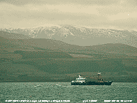 6th: At 03 GMT there was a shower of rain and small ice pellets, but soon after the sky began to clear. By 06 GMT there was clear sky overhead and the temperature was falling. With the clearance the tawny owls were hooting until daybreak, now about 0730 GMT on a clear morning. By 09 GMT dew drops on the grass had frozen clear and hard with the grass temperature falling to -2.5C. The sun rose over stratocumulus over the maintains at 0830 GMT, some 30 minutes earlier than at the winter solstice. Pressure 10-22 mb had risen and it was an almost clear sky sunny morning, moderate to good visibility although somewhat misty. The afternoon was sunny, with the temperature rising to 11.5C, and the sun set soon after 1630 GMT. Valley reported 8.1 h of sunshine, the highest on the day. There was a touch of ground frost (-1.5C) before cloud encroached and there was a shower at 2315 GMT. [Valley 8.1 h] [Rain 1.5 mm; Max 11.5C; Min 1.7C; Grass -2.5C]
  10th: A foggy morning with the sky obscured. Above the fog the sky was clear and it was a morning when the Snowdonia mountaintops were in the clear and sunny. Low cloud and fog persisted in many places bordering the Irish Sea, but it was a clear sunny day over land to the SE of here. We were high enough for the fog to clear leaving a 6/8th cover of cirrus clouds at noon giving some sunshine in the afternoon before the fog closed in again by 4 pm. There were places around the island and Menai Strait where fog persisted through the day. [Rain trace dew; Max 8.4C; Min 3.1C; Grass -0.5C]
  12th: Another sunny morning the slight white frost of frozen dew soon melting in the sunshine. Under clear skies the temperature rose to 14.1C by the afternoon with a light NE'ly off the sea. It rose to a summer-like 18.2C at Trawsgoed, Ceredigion, and 17C at Capel Curig. The record highest February temperature for Wales is 18.6C at Velindre on 23rd in 1990, with 18.3C recorded at Pen-y-ffridd, Bangor on the 28th in 1960. There was a fine orange-ball sunset and after sunset colours. The evening and night were clear with little or no wind. {Trawsgoed 18.2C} [Rain 0.0 mm; Max 14.1C; Min 5.2C; Grass -1.3C]
 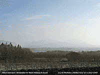 15th: More extensive white frost on the grass and fields ( grass -4.5C), mainly frozen dew but there was a little hoar frost as well with melted droplets on the raingauge funnel. Sunny with haze and with little or no wind. Pressure was 1039 mb with high 1046 mb over S Norway. A cold front was over the North Sea with cloud affecting parts of England. Another cold fronts over Iceland too far away to affect the sunny west. It was sunny all day with global solar radiation reaching 10.67 MJ per m2 and 8.0h of sunshine recorded at RAF Valley. Some patchy cloud arrived from the E during the evening, but soon passed over to giving a clear night. [Valley 8.0h, Scilly Is 9.8C] [Rain 0.0 mm; Max 10.6C; Min -0.1C; Grass -4.5C]
 The first 15 days had a mean temperature of 6.8C (+0.9) and [+1.5] of average. Notable was the mean maximum 10.7C (+2.1) and [+2.2], the 16.8C recorded on the 11th being the highest by this date in the year. Rainfall was 20.7 mm (22%) and [28%]..
16th: A white frost on the grass by morning with the air temperature down to -0.8C and -5.8C on the grass. It was a cloudless sky and calm at 09 GMT with pressure risen to 1042 mb. There was a light air (force 1/2) at times from the ENE during the day with continuous sunshine the temperature rose to 10.1C. Clear and frosty during the evening. [Rain 0.0 mm; Max 10.1C; Min -0.8C; Grass -5.8C]
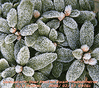 17th: Frost overnight with the air temperature falling to -1.0C and to -6.9C on the grass. There was light to moderate hoar frost on vegetation, raingauge rim and long crystals on grass thermometer
 ![]() . Soil was frozen and the 5 cm thermometer was down to 0.8C, the 30 cm was on 4.2C and at 100 cm 7.5C. A sunny day with pressure on 1040 mb, moderate visibility in haze and light E'ly breeze, the temperature rising to 6.1C. As the sun set mist formed across the fields and concrete at first dampened then later froze. It was another clear and frosty evening and night. [Rain 0.0 mm; Max 6.1C; Min -1.0C; Grass -6.9C]
. Soil was frozen and the 5 cm thermometer was down to 0.8C, the 30 cm was on 4.2C and at 100 cm 7.5C. A sunny day with pressure on 1040 mb, moderate visibility in haze and light E'ly breeze, the temperature rising to 6.1C. As the sun set mist formed across the fields and concrete at first dampened then later froze. It was another clear and frosty evening and night. [Rain 0.0 mm; Max 6.1C; Min -1.0C; Grass -6.9C]
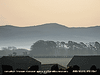 18th: A white frost on grass with the grass minimum down to -7.5C. There had been 6.3 h of air frost too with the minimum -1.3C, both were lowest of the month. Frost, thickly deposited on drosometer pads exposed overnight, was equivalent to 0.35 mm of precipitation. Inversion haze and mist was in valley bottoms and along the Menai Strait (Valley reported freezing fog at 07-08 GMT), but the mountaintops were in the clear. At 09 GMT the temperature here (330 ft, 107 m) was 0.8C while at Clogwyn on Snowdon (2526 ft, 770 m) it was 6.3C while in the valley bottom in Llanberis it was -1.3C (data courtesy of FirstHydro). Colorations of the sky at dawn to early sunrise, caused by the sun's rays passing at low angle through aerosols in the atmosphere and relatively dry air, have been remarkable and like that seen over north African deserts or California. The diffuse orange colour can be seen in the photograph (right). Another sunny day with relative humidity a low 44% and temperature rising to 12.2C and 14.1C at Capel Curig; there were fires on the mountainside to the S during the afternoon and in SE Anglesey producing much smoke. More remarkable sky colorations developed after sunset, possibly enhanced by local fire smoke, transposed through diffuse yellows, orange and dark peach lasted for over an hour. Clear sky during the evening and night with bright moonlight. {Capel Curig 14.1C, Aberporth 9.3h} [Rain 0.0 mm; Max 12.2C; Min -1.3C; Grass -7.5C]
 19th: Clear overnight but relative humidity was < 60 % and there was less frost (0.15 mm measured) although the grass minimum fell to -5.5C. Bare soil remains frozen with the temperature at 5 cm 0.7C. A sunny morning with weaker inversion and pressure 1024 mb continuing to fall. The afternoon was sunny with a light S'ly breeze, that overcame the NE'ly breeze off the sea; in a Föhn-like effect the relative humidity fell to 34% and the temperature rose to 13.5C, one of the highest in Britain today. Sunset and after sunset colours were normal and short-lived this evening. With clear sky extending into the evening and night there was frost on the ground with the minimum falling to -5.5C. It is the sunniest February since 1986, so far. {Capel Curig 12.1C, Aberporth 9.3h} [Rain 0.0 mm; Max 13.5C; Min 0.6C; Grass -5.5C]
20th: After 9 consecutive days of clear sky sunshine, with solar radiation increasing each day, this morning was disappointingly overcast with grey stratus. Visibility was poor (2 km) in haze and overnight frost had long disappeared. The dewpads recorded only 0.09 mm, but it was likely that some had already evaporated. Pressure was steady on 1017 mb with high 1019 mb dissipating to the S and complex low-pressure SE Greenland. A cold front was lying over W Ireland and NW Scotland. By 11 GMT the cloud was breaking with some blue sky returning giving a little sunshine. Cloud was thin and moderately high at first in the afternoon, but thickened with light drizzle by 1700 GMT. The evening and night were mostly cloudy. {Valley 9.8C, Sennybridge -6.3C, Aberporth 2.5h} [Rain 2.8 mm; Max 9.0C; Min 0.6C; Grass -5.5C]

|
21st: The sky was overcast between 03 and 04 GMT so that the total eclipse of the moon (last until Dec 2010) could not be seen. There was some rain around 04 GMT and leading up to 09 GMT. Pressure was 1017 mb with a warm front over Britain and we were 'back to the usual' moist moderate to strong SW'ly airflow. There was little variation in temperature through the day that remained sunless. In the garden the first blue flowers of Chionodoxa luciliae (Glory-of-the snow) have appeared. There was heavy rainfall in Scotland that also had the highest temperatures. {Kinlochewe 76.4 mm; Dyce 15C, Hawarden 11.8C} [Rain 12.5 mm; Max 9.5C; Min 3.4C; Grass 2.0C] The month ended with 68.9 mm of rainfall [92%] of the 30-y average, but only (74%) of the past 10-years. The mean temperature was 6.6C (+0.7) and [+1.3] of average. Sunshine duration at Valley was 120.8 h the most since 1986 and 5th on the Anglesey record since 1930. .
![]() 22nd: There was moderate to heavy rain from just after midnight until just before 0700 GMT that accumulated 12.5 mm. Overcast with low stratus cloud and mist with visibility poor (2 km). Pressure was 1015 mb with high-pressure 1033 mb now well S of Britain. With the blocking high dissipated the jetstream had reconnected and was over Britain once more (see graphic). Low 950 mb was over the N Norwegian Sea while developing low with triple point was over central Scotland. Isobars were tight in the north with strong to gale-force winds around coast and mountains. The day was overcast and sunless, but the cloud lifted and thinned during the afternoon and the sky cleared during the evening as pressure rose. [Rain trace; Max 10.0C; Min 7.7C; Grass 7.0C]
22nd: There was moderate to heavy rain from just after midnight until just before 0700 GMT that accumulated 12.5 mm. Overcast with low stratus cloud and mist with visibility poor (2 km). Pressure was 1015 mb with high-pressure 1033 mb now well S of Britain. With the blocking high dissipated the jetstream had reconnected and was over Britain once more (see graphic). Low 950 mb was over the N Norwegian Sea while developing low with triple point was over central Scotland. Isobars were tight in the north with strong to gale-force winds around coast and mountains. The day was overcast and sunless, but the cloud lifted and thinned during the afternoon and the sky cleared during the evening as pressure rose. [Rain trace; Max 10.0C; Min 7.7C; Grass 7.0C]
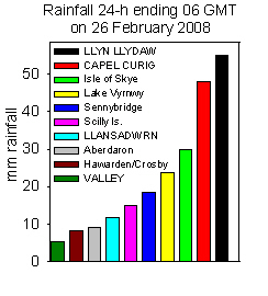 23rd: There was bright moonlight until after midnight but the sky was overcast by morning. The SW'ly wind was a blustery force 5/6 and there were spots of rain on the raingauge funnel although the bottle was dry. Pressure 1019 mb was falling again with low 964 mb S of Iceland moving NE, high 1033 mb was over central France. The day was windy, dull and sunless, but it kept dry until just after 1700 GMT. Slight rain continued until 2015 GMT before petering out; there was broken cloud in the night. [Rain 2.6 mm; Max 10.1C; Min 5.9C; Grass 1.4C]
24th: Another spell of slight rain between 0645 and 0830 GMT as a weak cold front passed over heading SE'ward. Pressure was 1013 mb and there was some more intermittent rain around 09 GMT that lasted into the morning. Before noon with the rain stopped it was brighter with a few beaks appearing in the thinning cloud. At the end of the afternoon there was a little sunshine as the setting sun finally appeared below the cloud with clear sky approaching in the west. With much little or no wind in the evening there was a ground frost. [Rain 1.2 mm; Max 8.6C; Min 7.1C; Grass 6.5C]
25th: Before dawn cloud encroached and wind was strengthening. At 09 GMT pressure 1015 mb was falling with Atlantic-low 960 mb tracking NE'ward S of Iceland. The SSW'ly wind was force 5/6 and cloud thickening. Cumulus clouds were over the western Snowdonia Mountain range and a sprinkling of snow from a showers was seen on C. Llewelyn Nearing the end of the month the mean temperature continued above average (+0.6) and [+1.4] and rainfall just 39.8 mm (42%) and [53%] of average. The morning was dry before the S'ly wind strengthened to gale force 8 as showery rain arrived, on a frontal system, around 1500 GMT and continued until 1700 GMT. There was moderate to heavy rain from 2030 to around midnight and very heavy rain over the mountain of Snowdonia with Llyn Llydaw, Snowdon clocking up 55 3 mm in the 24-h to 06 GMT on the 26th. [Rain 11.8 mm; Max 9.4C; Min 1.7C; Grass -2.7C]
26th: A much brighter morning with the sky clearing rapidly at 09 GMT. Pressure 1001 mb was rising with the fronts to the SE passing over England. The SW'ly wind was force 5 and the temperature 6.5C, dewpoint 4.2C. After the clear slot it was cloudier with spells of sunshine although there was a slight shower at 1530 GMT. Cloud was moderately high with views of the summits of the Carneddau Mountains, there was no snow except a few small patches to be seen. Later the sky started to clear giving a moonlit night. [Rain trace; Max 9.8C; Min 5.2C; Grass 2.9C]
27th: At 0057 GMT there was an earthquake of 5.2 on the Richter scale beneath Market Rasen in Lincolnshire. It was felt widely through Britain in some places up to 10 seconds, including slightly in Anglesey, and caused minor damage estimated at over £10 million. It was the largest since the 5.4 magnitude earthquake near the Lleyn Peninsular in 1984 that was followed by several months of aftershocks up to magnitude 3. After a clear night the grass minimum was down to -1.5C, there was moderate dew, but no frost was seen at 09 GMT. Although staring off sunny the day soon became mostly cloudy, but there were sunny spells and it kept dry. Cloud persisted through the evening and into the night. [Rain 0.0 mm; Max 11.3C; Min 2.6C; Grass -1.5C]
28th: There was no frost overnight under a blanket of moderately high cloud. The morning was bright with pressure 1019 mb with a ridge of high-pressure extending from the SW. The morning was bright with a light SW'ly breeze while the afternoon was cloudier with lines of dark stratocumulus and a few spots of rain before dusk. The lesser celandines were well out in the garden and along hedgerows where 1 or 2 dandelions were spotted; there was no sign of leaf buds breaking on the hedges. A cloudy frost-free evening. [Rain 1.0 mm; Max 10.5C; Min 4.3C; Grass 0.5C]

29th: For our extra day this leap-year the SSW'ly wind was strengthening and pressure 1011 mb falling as deepening low 964 mb approached NW Scotland. It had started to rain at 0815 GMT and there was 1 mm in the gauge at 09 GMT. A letter to The Times reported a bluebell out in Llandeilo in Carmarthenshire, but a careful look in the wood here revealed just leaves up 10 cm, or more, but no buds. Several blue flowers of the 'Glory-of-the-snow' are now out, but there has been no snow. Rain continued through the morning and was moderate to heavy at times until 1300 GMT and was accompanied by strong to gale-force winds. In Llandudno winds dislodged part of a theatre and conference centre roof closing part of the promenade. The afternoon was drier, but sunless. The evening turned showery with a moderate shower of rain and small ice pellets around 2000 GMT, and slight showers until midnight. Rainfall of 16.3 mm over 5.9 h duration ending 09 GMT on 1 March was largest of the month. [Rain 16.3 mm; Max 10.0C; Min 4.9C; Grass 0.9C]
![]()
![]()
![]()
![]()
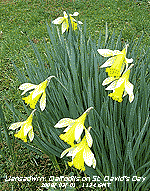
 1st: DYDD DEWI SANT: And spoiled for choice for a photograph as there were plenty of daffodils, in several varieties, in flower in the garden. The morning was bright at 09 GMT with pressure 1010 mb rising with a moderately NW'ly breeze. With 5 oktas cover of cirrus, altostratus and a few cumulus clouds the sun was breaking through, but by 11 GMT the sky was overcast. Cloud thickened during the afternoon and there was some drizzle and slight rain as the wind strengthened. The evening was overcast. [Rain 0.1 mm; Max 10.2C; Min 5.3C; Grass 2.1C]
2nd: With cloudy skies the air temperature did not fall below 6.3C, the highest minimum of the month noteworthy because it was the lowest minimum in March since 1984 (6.1C). From dawn the sky started to clear giving a bright morning although variable patchy cloud moved across from time to time. Pressure was 1011 mb and visibility moderate in haze. The sky gradually cleared so that by afternoon it was mostly sunny. The temperature reached 11.5C and global solar radiation reached 9.93 MJ per m2. During the evening showers moved in off the Irish Sea and there was precipitation around 1930 GMT. [Rain 1.2 mm; Max 11.5C; Min 6.3C; Grass 3.6C]
![]()
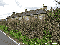
![]() 3rd: Around midnight there was a moderate shower of sleet and later conical-shaped snow pellets up to 5 mm diameter that covered the ground. By morning pellets were still lying on the grass and piled in roof gutters. The morning was bright with sunny spells between cumulus clouds blown in off the Irish Sea on a fresh W'ly wind. The temperature was 3.0C, dewpoint (-0.3C) indicative of the chance of more wintry weather. The morning continued with cumulus clouds moving across the sky with sunny spells. Alexanders (see photo above and right) was seen flowering on the roadside at the old (1613) Almshouses near Beaumaris, and on a nearby field a flock of redwings were spotted. Ice precipitation was dusted around the summits of the Snowdonia Mountains above 2500 ft and there were more showers in the afternoon, but amounts deposited on the ground were very small.
3rd: Around midnight there was a moderate shower of sleet and later conical-shaped snow pellets up to 5 mm diameter that covered the ground. By morning pellets were still lying on the grass and piled in roof gutters. The morning was bright with sunny spells between cumulus clouds blown in off the Irish Sea on a fresh W'ly wind. The temperature was 3.0C, dewpoint (-0.3C) indicative of the chance of more wintry weather. The morning continued with cumulus clouds moving across the sky with sunny spells. Alexanders (see photo above and right) was seen flowering on the roadside at the old (1613) Almshouses near Beaumaris, and on a nearby field a flock of redwings were spotted. Ice precipitation was dusted around the summits of the Snowdonia Mountains above 2500 ft and there were more showers in the afternoon, but amounts deposited on the ground were very small.
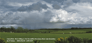 Pressure was 1011 mb with Atlantic-high 1038 mb building W of the Bay of Biscay. The morning was mostly sunny; the afternoon was cloudier and over the mountains cumulonimbus brought frequent snow showers, but again amounts on the ground were small and soon disappeared. At 1925 GMT there was a spell of sleet here (air temperature was 1.7C) that soon turned to rain, but snow did settle on the mountains at higher levels. [Rain 1.2 mm; Max 8.1C; Min 1.3C; Grass -2.2C]
4th: ![]() There were a few slight showers of snow pellets after midnight and with clearing sky the temperature fell to 1.2C and -2.0C on the grass. It was a clear sunny morning and light snow was lying generally at 1000 ft and down to 500 ft in places on the north-facing slopes of the Carneddau. Pressure 1030 mb was rising with high 1042 mb lying to the SW off the Scilly Isles. In the sunshine the temperature rose to 11.7C; the afternoon was cloudier, but no showers were seen today. The evening was clear with bright stars and the temperature on the grass dropped to -3.8C, lowest of the month, with the dewfall freezing. {Hawarden 10.9C} [Rain 0.0 mm; Max 11.7C; Min 1.2C; Grass -2.0C]
There were a few slight showers of snow pellets after midnight and with clearing sky the temperature fell to 1.2C and -2.0C on the grass. It was a clear sunny morning and light snow was lying generally at 1000 ft and down to 500 ft in places on the north-facing slopes of the Carneddau. Pressure 1030 mb was rising with high 1042 mb lying to the SW off the Scilly Isles. In the sunshine the temperature rose to 11.7C; the afternoon was cloudier, but no showers were seen today. The evening was clear with bright stars and the temperature on the grass dropped to -3.8C, lowest of the month, with the dewfall freezing. {Hawarden 10.9C} [Rain 0.0 mm; Max 11.7C; Min 1.2C; Grass -2.0C]

|
 8th: There was drizzle and slight rain from midnight and a moderate shower around 07 GMT. At 09 GMT pressure 995 mb was falling with low 968 mb slow-moving near NW Scotland. The SW'ly wind had freshened to a gusty force 6 and the morning was overcast with low stratus, but it kept dry. The afternoon too was cloudy here, although there was some sunshine in the west of the island. A weak cold front passed over from 1400 GMT bringing showery rain and ice pellets at 1635 GMT. [Rain 4.0 mm; Max 9.4C; Min 5.6C; Grass 2.5C]
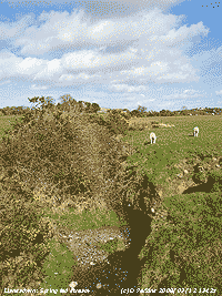 12th: After midnight it was a very rough night with a strong gale force 9 for several hours only moderating a little just before 09 GMT. At 0400 GMT the AWS at Clogwyn recorded a gust of 95 mph and mws of 65 mph (force 11). A tree was blown down in the wood here and several large branches sheared off others in the area while the road was littered with debris. The Britannia Bridge was closed to high-vehicles all night and was still closed in the morning with a 20 mph speed limit into the afternoon . Lorries on the busy A55 were diverted over the narrow arched Menai Suspension Bridge.
 14th: Before dawn the sky had covered with moderately high altostratus cloud. At 09 GMT pressure 1011 mb was rising, visibility was a very good 40 km and there was a light variable generally S'ly breeze. By 1000 GMT the sun was seen looming through the cloud, but not shining brightly. The day was overcast and sunless. [Rain 0.2 mm; Max 9.8C; Min 1.3C; Grass -3.2C]
 The 20.6 mm on the 15th brought rainfall for the first 15 days up to 50.3 mm (68%) and [59%] of the month's average. The mean temperature was 6.8C (-0.4) and [+0.1] of the average.
16th: The low had steamed up the English Channel and was 994 mb over the Dover Strait at 0900 GMT. Pressure here 1006 mb was rising and we had a moderate NNE'ly breeze. The sky was still overcast but soon the cloud was thinning and a few blue patches were overhead by 1000 GMT. There was a sprinkling of fresh snow on the mountaintops of Snowdonia. The afternoon had a clearing sky and sunshine the cool wind persisting with a maximum temperature of 7.7C. The evening was clear with a touch of ground frost, but the sky turned cloudier later. [Rain 0.1 mm; Max 7.7C; Min 5.3C; Grass 4.2C]
![]() 17th: A slight shower of rain around 03 GMT then a clearing sky to dawn and a sunny morning. Pressure 1020 mb was still rising slowly with Icelandic-high 1027 mb extending to NW Scotland. Pressure was low 1002 mb to the SW of Britain. The morning was sunny with just a few fair-weather cumulus clouds passing on the light E'ly breeze. The afternoon was mostly clear and sunny with global solar radiation reaching 17.52 MJ per m2, highest of the year so far. The evening and night were clear with a light NE'ly breeze. [Rain 0.0 mm; Max 8.6C; Min 3.5C; Grass -0.4C]
17th: A slight shower of rain around 03 GMT then a clearing sky to dawn and a sunny morning. Pressure 1020 mb was still rising slowly with Icelandic-high 1027 mb extending to NW Scotland. Pressure was low 1002 mb to the SW of Britain. The morning was sunny with just a few fair-weather cumulus clouds passing on the light E'ly breeze. The afternoon was mostly clear and sunny with global solar radiation reaching 17.52 MJ per m2, highest of the year so far. The evening and night were clear with a light NE'ly breeze. [Rain 0.0 mm; Max 8.6C; Min 3.5C; Grass -0.4C]

On sunny afternoons the garden has been humming with honeybees foraging on banks of flowering pink and white Ericas in the garden. There is not a lot for bees at this time, but they always come for the 'heather' flowers. Horse-chestnut buds continue to open and begin to look like small yellow candles, and there are some green buds appearing on a few sycamores. The glory-of -the snow is now in full flower and flowers of alpine clematis are showing signs of opening.
18th: The air temperature fell to -0.1C, the lowest minimum of the month, and on the grass -3.7C, but the air was relatively dry and there was little dew and I did not see any white frost. Temperatures were lower in Valley bottoms (Llanberis -1.5C). The sky was overcast at dawn, but had begun to break at 09 GMT and there was soon a little sunshine. Pressure 1024 mb was rising with Icelandic-high 1027 mb extended over Ireland. Pressure remained low 1011 mb to the SW and 989 mb S Baltic. Several rooks were busy breaking off twigs from trees to rebuild their nests nearby. The goat willow has started to flower. By noon it was cloudier with dark cumulus passing overhead giving frequent, but light, showers. These hardly wetted the ground being identified only by the spots. During the evening the cloud mostly cleared away and there was ground frost. [Rain trace; Max 7.6C; Min -0.1C; Grass -3.7C]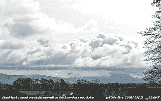 22nd: The NE'ly still strong (force 6/7) was buffeting the Stevenson screen at 09 GMT. Pressure 1008 mb was rising between the high 1031 mb to the W of Ireland and low 979 over Poland. Isobars were tight over Britain with airflow from the arctic; the temperature was 3.8C (dewpoint -1.8C and RH 67%). Ms Albert Piche's evaporimeter showed evaporation of 4.9 mm over the past 24-h, unusually high for here. The grass and concrete were dry and the soil surface looked almost dry too. The day was mostly fine with some sunny spells between the cumulus shower clouds as the wind moderated slowly. The temperature reached a maximum of 6.8C, and with tomorrow's was lowest of the month. There flurries of very small snowflakes at 1545 GMT and later, very small amounts here, but the north-face of C. Llewelyn and Dafydd were finely dusted, like icing sugar sprinkled on a cake. The evening was mostly cloudy with the grass minimum falling to -0.5C. [Rain 4.7 mm; Max 6.8C; Min 2.9C; Grass 2.2C]
|
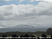 24th: There was a moderate fall of snow pellets and sleet from 0530 GMT with further slight showers of sleets around 0900 GMT. This was all falling as snow as low as 800 ft on the Snowdonia Mountains under low cloud. Pressure 1002 mb was rising with large Atlantic-high 1031 mb to the SW. pressure remains low 984 mb over Scandinavia resulting in the flow S of the cold air from the Arctic. By 0930 GMT the sky had started to clear and cloud to lift. There were some sunny spells before noon before more slight showers of snow pellets moved across on the N'ly breeze. Later these cleared away and there were some fine views of the mountains in sunshine under cumulus clouds. Partly cloudy evening and at night. [Rain 0.5 mm; Max 7.8C; Min 2.1C; Grass 0.2C]
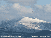
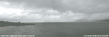 28th: The temperature had fallen to 4.4C at 01 GMT before a warm front led to rising temperature. The was drizzle then light rain from 0500 GMT with strong to gale-force S'ly wind. At 09 GMT pressure 987 mb was rising and the temperature fallen back a little 8.9C with 99% relative humidity. Visibility was very poor in drizzle and light rain and the wind moderated to force 4 SW'ly. The rain soon eased and by 11 GMT, visibility was good and it was bright with some breaks appearing in the cloud and was sunny before noon. It did not last long as the sky was soon overcast again and there was showery rain from 1500 GMT, with small ice pellets at 1558 GMT, until about 1900 GMT this falling as snow on the mountains. Later the sky partially cleared.[Rain 7.1 mm; Max 11.4C; Min 4.4C; Grass 2.4C]
 The month ended with a mean temperature of 6.5C (-0.7) and [-0.2] of average. The highest maximum 14.6C on the last day was (-1.9) of average while the lowest minimum -0.1C on the 18th was (+1.8) the only day with air frost was (-1.7). Ground frosts 11 were close to average (-0.3). Rainfall was 96.1 mm (131%) and [113%] of average and sunshine duration was an estimated 125.2 h with 8 sunless days.
1st: A bright morning and with the sky clearing from 6 oktas stratocumulus and cumulus clouds the morning became sunny with fair-weather clouds predominating. Pressure 1014 mb was rising with low 993 mb just N of Scotland. The SW'ly wind was force 5 and continued force 5/6 through the day. The temperature reached 14.3C and with relative humidity 60% was a good drying day. The soil is still very wet and still unfit for cultivation, a few fields have been ploughed and sown, but local opinion was they were taking a chance. The afternoon continued mostly sunny and the evening clear so that there was a fine view of the European ATV, just ahead of the International Space Station the brightest object in the sky, overhead the weather station between 2028 and 2034 GMT. (Global solar radiation 15.08 MJ m-2.)[Rain 1.4 mm; Max 14.3C; Min 7.3C; Grass 4.8C]
 2nd: A dull morning with drizzle, fine to light and interspersed with light rain from 06 GMT accumulating 1.4 mm by 09 GMT. Pressure 1025 mb was still rising in a ridge with high 1023 mb over the Bay of Biscay and low 999 mb SW Iceland with low-pressure extending into mid-Atlantic. Pressure was also low over the North Sea and Baltic. The morning kept dull with the poor visibility improving to moderate as drizzle petered out for a while before returning by noon for a while. Later the afternoon was dry and mostly windless, but with a strong gust that disturbed a pile of dry leaves I had gathered in the garden! At the end of the afternoon the sun appeared obscured by thin cloud, but there was no bright sunshine (Global solar radiation 7.64 MJ m-2.). The evening was clear at first, but was overcast again before 21 GMT. [Rain 0.1 mm; Max 13.7C; Min 7.0C; Grass 2.8C]
3rd: Pressure 1033 mb was rising, but we had anticyclonic gloom again today. At least the drizzle had stopped and paths were dry although the grass was wet with dewdrops, probably guttation. Soil temperature was 10.1C at 5 cm and the air temperature 9.7C 1.2 m above ground inside the Stevenson screen. Pressure was high 1035 mb to the SW and there was little (SW'ly) or no wind, visibility was poor counting as mist as the relative humidity was 97%. The salt tolerant ivy-leaved scurvy grass Cochleria danica was just coming into flower along the A5025 Menai Bridge to Pentraeth road; it had plenty of salt put on during the winter! More cutting of flowering gorse along the A55 near the Britannia Bridge has been taking place. The need for cutting here seems obscure to me and anyway was being done out of season (after the end of March) when birds have started to nest. Nesting is getting earlier and gorse is a favoured habitat. More flowers had opened on the damson tree in the garden and the wild cherry flowers were just starting to open. There was plenty of birdsong around the weather station and in the wood, with declining interest in the food provided. This usually happens went birds turn to nesting activity, but they come back later. Great tits and long tailed tits have been gathering nesting material and blue tits have been inspecting nesting boxes. By afternoon the cloud was thinning becoming bright with the temperature reaching 14.8C. The sun finally broke through giving some sunshine and for a while a clear evening when brown long-eared bats were seen flying for the first time this year. Later patchy cloud encroached. [Rain 0.0 mm; Max 14.8C; Min 8.0C; Grass 4.6C]

![]()
 4th: With partially clear skies fog form after midnight and was thickest between 04 and 06 GMT. By dawn it was clearing and at 09 GMT these was very good visibility of >40 km. Pressure 1029 mb was falling as the high 1031 mb over the SW Approaches declined. Complex low-pressure to the N was expected to move S to bring colder arctic air and wintry showers over the next few days, such are the vagaries of the weather. Hopefully, there will not be frosts to affect flowers on the fruit trees that are just appearing. The sky was beginning to clear and the day turned mostly sunny. Mist off the sea affected the west coast and western Menai Strait during the afternoon, but here it kept sunny. Two small tortoiseshell butterflies were seen around the garden. Later cloud encroached as the wind veered N'ly and there was showery rain from 1830-2100 GMT as a cold front moved S. (Solar radiation 12.70 MJ m-2. Valley 2.9h) [Rain 1.9 mm; Max 13.8C; Min 8.1C; Grass 6.0C]
5th: There were a few clear spells overnight and the grass minimum fell to -2.3C. After a spell of rain between 0500-0530 GMT on another cold front heading S the sky started to clear just before 09 GMT. Pressure 1020 mb was falling with low 998 mb over the Baltic and high 1045 mb Greenland. We were in a brisk and showery N'ly airstream. The sky further cleared giving sunny spells in the morning with cumulus clouds in the vicinity. The afternoon had mostly clear sky overhead, a line of stratocumulus clouds persisted over the Snowdonia Mountains. During the evening cloud began to move in off the Irish Sea and we had a moderately heavy shower of 5-7 mm snow pellets at 2210 GMT almost covering the ground but quickly melting. [Rain 1.5 mm; Max 8.8C; Min 2.3C; Grass -2.3C]
 6th: Bright with sunny spells with hail and or snow lying on the Snowdonia Mountains, including Moel Eilio and summits westward. Further showers of small snow pellets (1-3 mm) soon melting on the ground here with further light accumulations above 400 ft on the mountains. Pressure 1010 mb was falling and showers were moving in off the Irish Sea on the light to moderate N'ly wind. Opening the door to the garden before 09 GMT to do the observations it sounded like summer with the chorus of birdsong including chiffchaff, and blackbirds singing particularly strongly with females sitting on eggs in early nests, but the temperature of 1.7C told a different story. The overnight minimum temperature was -0.1C, lowest of the month and only air frost. There were frequent showers of snow pellets and a few flurries of snow (1340 and 1555 GMT) through the day, but insufficient here to lie on the ground. In between there were spells of sunshine and with the temperature reaching 5.5C, lowest in April since 2000 and 4th lowest since before 1979, it felt cold in the persistent force 3/5 N'ly wind. Early in the day in the west of Anglesey there was snow lying in Brynsiencyn and sufficient at Trearddur Bay for children to build snowmen; parts of England had several centimetres with snow was reported on the beach in Brighton. Snow closed Gatwick Airport and there were problems clearing runways at Heathrow and a shortage of de-icing fluid for aircraft. The day's maximum temperature 5.7C was the lowest of the month. [Rain 0.5 mm; Max 5.7C; Min -0.1C; Grass -2.5C]
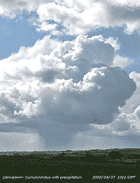
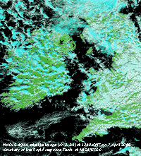
![]() 7th: A band of showers moved in off the Irish Sea after midnight and there was a shower of snow pellets and snow around 0130 GMT, but the air temperature did not fall below 0.5C. Temperature on the grass dropped to -3.8C, lowest in April since 2006. It was a fine morning with sunny spells with snow lying on the mountains as low as 1000 ft near Llyn Ogwen. The temperature at 09 GMT had risen to 5.7C and and attributed to past 24-h was ranked 5th lowest in April since 1979. Pressure 1004 mb was falling slowly and there was a force 3/4 NNE'ly wind. The day was marked by sunshine and showers, mostly light snow pellets here missing out on any heavy ones that occurred further west. Towering cumulus , or cumulonimbus with precipitation were seen in the vicinity such as in the photo moving to the left (S) across central Anglesey. The MODIS Aqua satellite image (below right) captured at 1340 GMT shows the development of the convective clouds over Ireland and the west, with a line of cumulonimbus off Anglesey. Clouds coloured blue stand out against the green of the land surface in this image using sensor channels 7-2-1. Marine open celled convection can be seen to the north-west of Ireland. Another was the earlier NOAA 18 image at 1224 GMT showing the convective clouds over Anglesey and Wales
7th: A band of showers moved in off the Irish Sea after midnight and there was a shower of snow pellets and snow around 0130 GMT, but the air temperature did not fall below 0.5C. Temperature on the grass dropped to -3.8C, lowest in April since 2006. It was a fine morning with sunny spells with snow lying on the mountains as low as 1000 ft near Llyn Ogwen. The temperature at 09 GMT had risen to 5.7C and and attributed to past 24-h was ranked 5th lowest in April since 1979. Pressure 1004 mb was falling slowly and there was a force 3/4 NNE'ly wind. The day was marked by sunshine and showers, mostly light snow pellets here missing out on any heavy ones that occurred further west. Towering cumulus , or cumulonimbus with precipitation were seen in the vicinity such as in the photo moving to the left (S) across central Anglesey. The MODIS Aqua satellite image (below right) captured at 1340 GMT shows the development of the convective clouds over Ireland and the west, with a line of cumulonimbus off Anglesey. Clouds coloured blue stand out against the green of the land surface in this image using sensor channels 7-2-1. Marine open celled convection can be seen to the north-west of Ireland. Another was the earlier NOAA 18 image at 1224 GMT showing the convective clouds over Anglesey and Wales ![]() . After the showers passed over the mountains clouds of advection fog formed over the summits, this was seen well on Mynydd Perfedd and Elidir Fawr at 1235 GMT
. After the showers passed over the mountains clouds of advection fog formed over the summits, this was seen well on Mynydd Perfedd and Elidir Fawr at 1235 GMT ![]() , but was on Carnedd Dafydd as well. Between the mountains standing out because of the snow the 'buzzard eyed', we have no eagles, will have spotted the Marchlyn Mawr reservoir
, but was on Carnedd Dafydd as well. Between the mountains standing out because of the snow the 'buzzard eyed', we have no eagles, will have spotted the Marchlyn Mawr reservoir ![]() the upper storage reservoir of the Dinorwic Pump Storage Station. The rim of the reservoir is about 2100 ft above sea level. The station within the mountain Elidir Fawr was commissioned in 1984 and is the largest of its kind in Europe. Towards evening the showers died out and the sky cleared with frost on the grass. [Rain 2.6 mm; Max 9.5C; Min 0.5C; Grass -3.8C]
the upper storage reservoir of the Dinorwic Pump Storage Station. The rim of the reservoir is about 2100 ft above sea level. The station within the mountain Elidir Fawr was commissioned in 1984 and is the largest of its kind in Europe. Towards evening the showers died out and the sky cleared with frost on the grass. [Rain 2.6 mm; Max 9.5C; Min 0.5C; Grass -3.8C]
 8th: After midnight cloud moved across and there were showers of snow pellets and unknown precipitation from 0300 to 0600 GMT. The temperature at the start of precipitation was 1.5C and it is likely it would included ice, sleet or possibly snow at the beginning before the temperature rose and latterly rain. There was fresh snow on the mountains lying at 1500 ft down to 1000 ft at 09 GMT. The grass minimum of -4.4C was lowest of the month. Pressure 1003 mb was rising and there was a light SE'ly wind. The morning was bright with occasional glimpses of the sun and light showers. The afternoon was cloudier with moderate to heavy shower commencing 1300 GMT included snow pellets and sleet. The temperature fell 3C during the precipitation; there was further snowfall on the mountains above 2500 ft. Later the sky more or less cleared, as convection died down, and the evening was clear with temperature on the grass falling to -3.4C. [Rain 6.4 mm; Max 8.5C; Min 1.1C; Grass -4.4C]
9th: With a showery trough passing over Anglesey there were showers of ice pellets and rain from 0750 GMT and snow pellets and rain around 09 GMT. The temperature fell to 3.6C and visibility moderate to poor. Pressure was 999 mb in a low-pressure area surrounding Britain. Soon it was brighter, but the sky was slow to clear to give a few sunny spells by the end of the morning. Convection was not as strong today and while the sky remained mostly cloudy in the afternoon cumulus clouds developed weakly. The sky was cleared for a while in the evening when there was a touch of ground frost (-1.3C). Rain 0.5 mm; Max 11.5C; Min 1.3C; Grass -3.4C]
![]() 10th: A fine sunny morning at first with layered altocumulus clouds. Dark clouds could be seen in the west as there was a band of showers on an approaching cold front. There was a little fresh snow on the tops of the Carneddau Mountains and snow was persisting at 1500 ft and at 1300 ft in Cwn Idwal. At 09 GMT pressure 999.5 mb was falling with low 985 mb to the NW; there were towering cumulus to the S. Rain was reported at Valley, but it took another 2 hours for fine drizzle to arrive here. The afternoon, once again, was brighter and there were good sunny spells. With a light Föhn-like SSE'ly breeze off the mountains relative humidity dropped to 52% and the temperature rose to 12.8C around 15 GMT; temperatures on the snow-covered mountain summits were below freezing. There were further shower in the evening with rain and small ice pellets close to 1900 GMT. {Hawarden 10.7C} [Rain 5.4 mm; Max 12.8C; Min 3.3C; Grass -1.3C]
10th: A fine sunny morning at first with layered altocumulus clouds. Dark clouds could be seen in the west as there was a band of showers on an approaching cold front. There was a little fresh snow on the tops of the Carneddau Mountains and snow was persisting at 1500 ft and at 1300 ft in Cwn Idwal. At 09 GMT pressure 999.5 mb was falling with low 985 mb to the NW; there were towering cumulus to the S. Rain was reported at Valley, but it took another 2 hours for fine drizzle to arrive here. The afternoon, once again, was brighter and there were good sunny spells. With a light Föhn-like SSE'ly breeze off the mountains relative humidity dropped to 52% and the temperature rose to 12.8C around 15 GMT; temperatures on the snow-covered mountain summits were below freezing. There were further shower in the evening with rain and small ice pellets close to 1900 GMT. {Hawarden 10.7C} [Rain 5.4 mm; Max 12.8C; Min 3.3C; Grass -1.3C]
11th: After a lull from midnight there were further showers and small ice pellets from 0300 GMT, but these had cleared by dawn. It was bright at first with even a little weak sunshine before another band of showers arrived just before 0900 GMT. Pressure was 989 mb near the centre of a low over the Irish Sea and it was calm. The temperature was 4.5C, dewpoint 3.0C and in the rain shower visibility was good to moderate. Snow was falling as low as 1000 ft in the Nant Ffrancon Pass and snow was lying moderately thickly at 2500 ft and thinly at 1800 ft. When it could be seen earlier, between showers, Moel Eilio had a nice white cap with snow as low as 1500 ft. David Small reported that snow on the Clwydian hills at about 1000 ft could be seen from Chester for the second times this week, but not unusual for April. The morning had further slight showers with a few bright spells, and a heavier one at noon of rain and small ice pellets, well it is April. The soil is still very wet and unworkable in the garden, cattle have were put on some drier fields about a week ago. The afternoon was mostly cloudy with a few sunny spells and kept dry here. There was showery rain from 1900 GMT containing small ice pellets at times. {Hawarden 10.0C Capel Curig 23.6 mm} [Rain 9.9 mm; Max 11.0C; Min 3.1C; Grass -0.5C]
12th: Rain continued after midnight with a moderate to heavy burst just before 01 GMT containing more small ice pellets. It was a bright enough morning with brief sunny spells between cumulus clouds, some towering and one cumulonimbus over the mountains of Snowdonia. Despite some snow overnight at higher levels the main snowline had retreated to 2500 ft on some mountain slopes but on the north-facing Carneddau it was still at 1800 ft , and lower in places near Cwm Idwal. The afternoon was mostly dull with a few spots of rain later. At 1825 GMT there was heavy rain and medium ice pellets. [Rain 11.0 mm; Max 11.0C; Min 2.8C; Grass -0.6C]
 13th: A slowly falling temperature overnight from 6C to 3.7C, but no ground frost. There was wet snow on the mountains at 1000 ft and at 800 ft for a while on the eastern range of Carneddau Mountains. The wind was E'ly and pressure 1008 mb rising as the frontal-wave low that had been slow-moving over North Wales in the night moved away. The sky was starting to clear and by 1015 GMT mostly sunny on Anglesey. Although there was some cloud around noon the afternoon sky was mostly clear with stratocumulus left over Snowdonia. The evening was clear too and the day dry. [Rain 0.0 mm; Max 10.1C; Min 3.7C; Grass 2.8C]
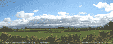 14th: There was a white frost on the grass at dawn with the grass minimum reading -2.5C. It was a bright morning with cumulus clouds increasing up to 09 GMT. Pressure 1020 mb was rising with high-pressure building to the SW of Britain. Although the morning turned cloudier with showers in the vicinity it kept dry here with sunny spells with good visibility. The sky started to clear in the afternoon leaving a bank of stratocumulus cloud over the mountains. The mountain snow at sunset turned a pink colour; the evening and most of the night were dry and clear. [Rain 3.4 mm; Max 10.1C; Min 2.2C; Grass -2.5C]
15th: Dew on the grass froze, as the temperature dropped to -4.1C, and was there at sunrise, but melted rapidly. By 07 GMT showers were moving across and there was a prolonged shower of rain and medium sized ice pellets from 0730 GMT making up the 3.4 mm rainfall recorded for the past 24-h. At 09 GMT the sky was clearing again with pressure 1023 mb rising. The day was mostly sunny, with the temperature rising to 13.2C. The evening and night were mostly clear with frost on the grass. [Rain trace; Max 13.2C; Min 1.1C; Grass -4.1C]
The first 15 days had a mean temperature of 7.3C (-1.8) and [-1.3] of the April average with the highest maximum 14.8C (-3.8). Rainfall was 44.6 mm (57%) and [77%].
16th: Frozen dew on the grass persisted after sunrise until just before 09 GMT in shady places. The sky was mostly clear, but for here there were an unusual number of contrails drifting across with an E'ly air flow. Pressure 1021 mb was falling with high-pressure 1027 mb over the North Sea and S Norwegian Sea and low pressure 979 mb S of Greenland. Cloud did increase during the morning, but mostly cleared in the afternoon with the temperature rising once again to 13.2C in a light E'ly breeze. Solar radiation of 23.20 MJ m-2 was highest of the year so far. The evening was clear, but there was no frost. [Rain trace; Max 13.2C; Min 1.2C; Grass -3.1C]
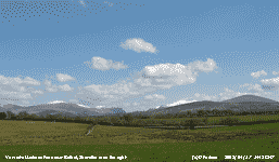 17th: Cloudier after midnight and a slight shower of rain at 0745 GMT hardly wetted the ground and was unmeasurable. Pressure 1012 mb continued to fall with the high 1026 mb N Scotland and S Norwegian Sea with low 988 mb on an occluded front off the Bristol Channel to the SW. The morning was mostly cloudy with the odd bright spell. Visibility was just good (10 km) obscured by moderate smoke haze. The afternoon was sunnier with the cloud mostly clearing and the temperature rose to 10.7C, moderated by the moderate to fresh E'ly. The evening was mostly clear. [Rain 0.0 mm; Max 10.7C; Min 3.1C; Grass 1.8C]
18th: Overcast with low stratocumulus clouds, sometimes looking dark. Visibility was good with moderate smoke/dust haze. No frost again overnight and the grass dry with the soil surface looking drier too. The moisture content is currently an average 66% of dry mass, down from 75% a month ago. Parts of the garden are drier (58%) and some still very wet (76%). Pressure 1002 mb was falling with complex low-pressure 975 mb over the Bay of Biscay and high 1024 mb SE Iceland. In between we were experiencing the easterly air flow (force 4 to 5) resulting partly in the poor air quality with moderate levels of pollutant ozone, and suspended dust. The morning kept cloudy with moments of brightness as the cloud thinned revealing an obscured sun. The afternoon was overcast with patches of brightness seen sometimes over the mountains where snow persisted, but visibility improved. The evening and night were similarly cloudy, dry and windy. [Rain 0.0 mm; Max 9.0C; Min 2.9C; Grass 1.2C]
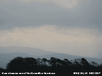 19th: Little had changed in the synoptic situation, we still had the ENE'ly wind at force 5 with pressure low to the S (991 mb Channel) and high 1021 mb Iceland. Pressure here 1001 mb was rising and the temperature at 09 GMT 6.8C, dewpoint 3.8C. An occluded front was lying from S Ireland through Wales to E Anglia and the sky was overcast and the day sunless, just to the N in Tiree Is there was 13.6 h of bright sunshine. The surface soil continued to dry, the tops of mole hills were dry with undisturbed soil on the observation plot almost dry. Evaporation over the past 5 days has been 8.4 mm measured by the Piche evaporimeter. [Rain 7.9 mm; Max 9.1C; Min 5.5C; Grass 4.5C]
20th: There was light to moderate rain from midnight until 0730 GMT then drizzle. It was a very murky morning with further fine drizzle and the odd spot of rain. The occluded front had moved a little N and was over Anglesey and Merseyside. Pressure was 1005 mb and the wind still force 4 ENE'ly. The slight drizzle and spots of rain continued in the afternoon without wetting much even when you were out in it. The temperature rising from a minimum of 5.5C struggled to reached 8.3C during the day and falling to 5.5C again overnight. In parts of S England temperatures soared reaching 18.6C in the Solent, even Pembrey Sands had 14.8C. Stornoway was sunniest with 13.0h sunshine duration. The 3rd sunless day with solar radiation of 5.36 MJ m-2 lowest of the month and since 20 March ! With the frontal cloud drifting N and fragmenting the evening was drier and by midnight the full moon was seen in a hazy sky. {Solent 18.6C, Lake Vyrnwy 3.7C (day 6.2C, Stornoway 13.0h} [Rain 0.2 mm; Max 9.2C; Min 5.5C; Grass 4.8C]
21st: A bright hazy morning, the first for 3 days, with some sunshine breaking through cirrus clouds (6 oktas cover). We still had the E'ly wind, force 4, but pressure 1009 mb was rising with high 1023 mb Norwegian Sea and complex low 993 mb N France. There were some patches of snow still to be seen on the mountaintops. The morning was sunny with the temperature at 09 GMT 9.2C the maximum of the past 24-h. The afternoon had further hazy sunshine with visibility deteriorating from moderate to poor and temperature rising to 12.3C. {Hawarden 15.2C, Stornoway 12.0h, Valley 5.8h} [Rain 0.0 mm; Max 12.3C; Min 5.5C; Grass 4.1C]
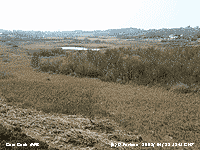 22nd: A clear sky morning with hazy sunshine, but poor visibility with dust high in the atmosphere. Pressure was 1010 mb and there was a light NE'ly breeze. Our first swallow was seen near Llanbedrgoch on the way to Cors Goch where grasshopper warblers were heard singing like sewing machines across the mire. The mire itself was still looking very brown with standing died back reeds yet to begin this season's new growth and the boardwalk was flooded with several inches of water
 ![]() . Some of the trees were beginning to look green and some wood anemones were seen in woodland
. Some of the trees were beginning to look green and some wood anemones were seen in woodland ![]() . The afternoon was sunny and in a light variable, but sometimes SE'ly, breeze off the mountains the temperature rose to 19.2C, highest of the year so far. The evening was clear with pipistrelle bats around at dusk, but encroaching frontal cloud was seen in the west.{Southampton 20.7C, 11.4h, Trawsgoed 18.7C, Fair Isle 8.7C}
[Rain 1.2 mm; Max 19.2C; Min 5.3C; Grass 3.2C]
. The afternoon was sunny and in a light variable, but sometimes SE'ly, breeze off the mountains the temperature rose to 19.2C, highest of the year so far. The evening was clear with pipistrelle bats around at dusk, but encroaching frontal cloud was seen in the west.{Southampton 20.7C, 11.4h, Trawsgoed 18.7C, Fair Isle 8.7C}
[Rain 1.2 mm; Max 19.2C; Min 5.3C; Grass 3.2C]
23rd: There was light rain between 01 and 02 GMT and at 0630 GMT thick fog with visibility only 100m across the fields. At 0800 GMT the cloud started lift and with visibility 4 km the sun began to break through. At 09 GMT pressure 1015 mb was rising; there were 6 oktas of mainly cumulus clouds, but visibility was restricted by low cloud and mist on lower slopes of the mountains.
By 11 GMT there were just 3 oktas cover of cumulus clouds and very good visibility. A few more bluebells have opened over the last few days and sycamore leaves are expanding rapidly, but there is no sign of leaves on beech or ash. Flowers on the wild cherry were opening this morning, trees in sheltered locations at sea level have been in flower for about a week. The day became mostly sunny, but windier in the afternoon the SW'ly reaching force 4/5. The sky was almost clear later just before frontal cloud encroached. {Hawarden 16.6C, Aberporth 9.9h, Valley 9.0h, Milford Haven 7.3 mm} [Rain 3.1 mm; Max 16.0C; Min 8.0C; Grass 5.9C]
 24th: There was rain between 0315 and 0345 GMT on a gusty cold front then showers around 05 GMT before starting to clear. At 09 GMT the S'ly wind was force 5 and pressure 1015 mb was rising and the day became mostly sunny with solar radiation of 24.60 MJ m-2 and 9.9 h sunshine duration recorded at RAF Valley. {Hawarden 15.4C, St Athan 10.5h} [Rain 0.1 mm; Max 14.9C; Min 8.0C; Grass 5.9C]
25th: It was a damp and grey morning setting the scene for the day. Soil temperatures down to 1 m were all 10C, or more, for the first time this year. This notable event occurred on 9 April 2007 and on the 21st in 2006. It was dull with slight rain at times m most between 1730 and 1830 GMT, the day was sunless. The evening and night were drier, but rather windy. [Rain 2.0 mm; Max 12.6C; Min 7.6C; Grass 4.8C]
26th: The overnight air minimum temperature of 9.7C was highest of the month. A little brighter this morning with a hole in the cloud sheet. The cloud 7/8th comprised mainly moderately high altostratus with under layers of altocumulus and cumulus. Pressure 1020 mb was rising and the afternoon had good visibility with some brighter spells developing, but remained sunless. [Rain 4.0 mm; Max 13.4C; Min 9.7C; Grass 8.4C]
27th: At midnight frontal cloud stretched from W of Iberia through St George's Channel and Irish Sea to Norway, associated with low 987 mb over the Norwegian Sea. At 09 GMT pressure 1014 mb was falling slowly in a slack pressure area and it was calm. It was one of those mornings that had Anglesey enveloped in low cloud and mist. There was 100% relative humidity and visibility very poor, 1 km. All thermometers in the screen were reading 9.8C, as they should after resetting the maximum and minimum. It was calm and a good time to check that all were reading the same and agreeing with the NPL certificated thermometer. With 100% RH the dry and wet bulbs read the same, in fact they were all acting as wet bulbs. Blackbirds and thrushes were singing, the males having little to do at the moment with females sitting on eggs. There was little change until late in the afternoon when the sky brightened from the W and some sunshine broke through by 16 GMT, but it did not last long and the evening was dull once again. With the morning very dull, despite a little sunshine, solar radiation was 7.02 MJ m-2 2nd lowest of the month. The evening turned cloudy again and there was a moderate shower of rain from 2230 GMT and continued showery through the night [Rain 8.9 mm; Max 12.0C; Min 9.5C; Grass 8.9C]

|
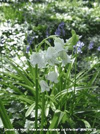
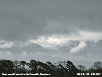 30th: With the low 986 mb at midnight slow-moving over SW England moderate rain continued until 0400 GMT. By morning there was a fresh fall of snow on the mountains above 2700 ft. It was a dull morning, although pressure 988 mb was rising and the slight rain eased by 11 GMT the morning remained dull. The afternoon had further slight rain from 1500 to 1930 GMT and the day was sunless with the temperature rising to only 7.7C. Before midnight there were a few holes in the cloud sheet. [Rain 2.4 mm; Max 9.2C; Min 6.0C; Grass 5.5C]
 The month ended with a rainfall total of 86.2 mm (110%) and [149%] of the monthly averages. The mean temperature was 8.3C (-0.8) and [-0.3], the mean maximum was 11.9C [(-0.9)] on both averages while the mean minimum was 4.7 (-0.8) but [+0.3] of the 30-y average. Sunshine duration was an estimated 168h with 7 sunless days.
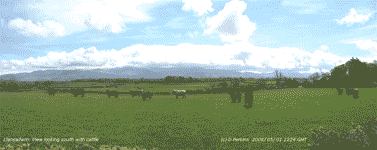 1st: A cloudy morning with 1 or 2 blue patches appearing as the cloudbase lifted. Overnight the air minimum was 4.8C and grass minimum 1.7C, both lowest of the month, in what was going to be a record warm May. The temperature at 09 GMT was 8.7C and had just been on 9.2C, the maximum of the past 24-h. Pressure 1001 mb was rising and visibility was good. There were sunny spells in the afternoon with the sky clearing over Anglesey leaving a line of stratocumulus clouds over the mountains of Snowdonia, similar views can be seen left (across a field of cattle) and right (across a field of sheep). Take your pick! In a lane nearby I spotted this fine peacock butterfly on dandelion
 ![]() . [Rain 2.7 mm; Max 14.2C; Min 4.8C; Grass 1.7C]
. [Rain 2.7 mm; Max 14.2C; Min 4.8C; Grass 1.7C]
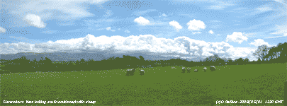 2nd: There were showers of rain from 05 GMT that accumulated 2.7 mm by 09 GMT. With 6 oktas of cumulus clouds the morning began brightly with a gentle S'ly breeze. Pressure 1017 mb was rising slowly; the temperature was 11.3C, dewpoint 7.6C, and visibility was very good >30 km. Pressure was high 1024 mb to the SE over central Europe and low 987 mb W of Iberia with trough to W of Ireland giving us a S'ly flow of air. Another mostly sunny day with mainly cumulus clouds and an increasing amount of cirrus in the afternoon. Later the cumulus decreased and the evening was mostly sunny. [Rain 0.0 mm; Max 15.6C; Min 6.1C; Grass 2.3C]

|
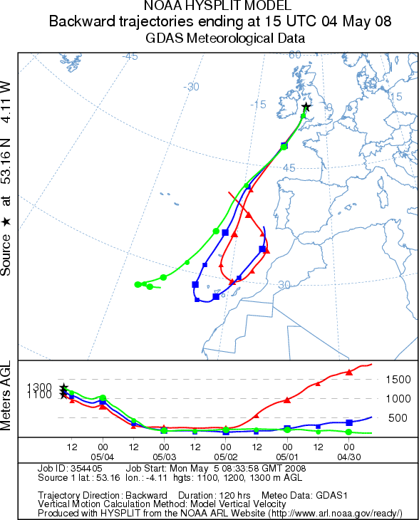 4th: Overcast with moderately high mainly altostratus cloud. It had been a warm night with the air minimum not falling below 15.4C, second highest in May, highest of the month, and highest this early in the year since before 1979 (17.0C on 17 May 2002). There had been a slight deposition of light reddish-brown dust associated with initially with dry deposition including pollen and then a few spots of rain. In previous days deposits have been greyish (grime) with yellow (pollen). At 0900 GMT pressure 1017 mb was rising and the temperature was 17.7C, dewpoint 11.1C. There were a few more spots of rain and dust from 0915 GMT and the morning kept overcast. There was further moderate rain in the afternoon as 2 cold fronts passed over before brightening up soon after 1500 GMT. Further light reddish-brown dust (MUNSELL ® 5YR 7/3) had been deposited in the rain without much pollen. Trajectory analysis, using the HYSPLIT model at the NOAA Air Resources Laboratory, indicated that parcels of air arriving over Llansadwrn at 15 GMT had come from a pool of N African dust around the Canary Islands. Soon after the sky cleared rapidly giving a sunny end to the day. With 8.3 mm rain was the wettest 24-h of the month. [Rain 8.3 mm; Max 18.8C; Min 15.4C; Grass 12.2C]
 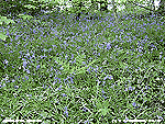 6th: The morning had hazy (with dust and smoke) sunshine with 5 oktas of cirrus clouds. There was a light ENE'ly breeze and the temperature at 09 GMT 16.5C had exceeded yesterday's daytime temperature. Pressure 1024 mb was falling with high 1031 mb E North Sea and low 989 mb W of Ireland. There was a clear sky most of the day, some convergent cloud developed over the station for a while, but the S'ly won and the temperature reached 24.1C with relative humidity falling to 42%. The temperature, exceeding any last year, was the highest recorded since 21 September 2006 with 26.2C. Soil moisture determined today was 67% dry mass, a little drier at just below the saturated water level of 70%. The evening and night were mostly clear. [Rain 0.0 mm; Max 24.1C; Min 11.1C; Grass 7.3C]
  7th: A fine sunny morning with smoke and dust haze. Pressure was 1020 mb and there was a light ENE'ly breeze. A cloudier day, with some weak convective clouds seen mainly to the W and S. Here the battle between the cool NE'ly off the sea and warmer S'ly air took place over the weather station in the afternoon. The effect was variable, the cloud coming and going
  9th: There was a shower of light rain at 0300 GMT that left paths damp in places in the morning and another deposition of the fine north African reddish-brown dust. There was also local gritty dust and tree pollen that is now appearing in increasing amounts. An overcast sky with poor visibility and a slight S'ly breeze at 09 GMT. The temperature was 14.8C and with 5 cm depth soil temperature of 16.0C soil and concrete were dry. Pressure was 1012 mb in a slack area over Britain with decaying frontal cloud over the west. The day was sunless and very dull but kept dry. Early purple orchids are flowering, the example right was found growing on a roadside near Brynsiencyn in Anglesey. Unfortunately, within a few days, more than 30 blooms in the short grass were mown to the ground by Council verge cutting. At least I have the photographs; it would have been against the law to have picked them! [Rain 0.0 mm; Max 17.2C; Min 13.4C; Grass 12.1C]
 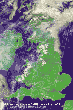 11th: Some clearer sky overnight and dew on the grass by morning. It was bright with mostly high cirrus clouds the front having moved westward. Pressure 1021 mb was rising and the temperature at 09 GMT was 15.7C (dewpoint 13.6C) in a light NE'ly breeze. Visibility was just good in smoke and dust haze with north African dust and photochemical smog, the blue of the sky was milky. The Met Office issued a severe weather warning of heavy rain for Wales and NW England. The NOAA 18 satellite image at 1310 GMT shows the convective clouds developing over Wales and Cumbria. The east coast of Scotland and NE England was affected by 'the Haar', fog off the North Sea. .
In the event thunderstorms developed over Wales and moved north through the afternoon. Distant thunder was first heard to the SE at 1335 GMT, rumbling increased almost continuously through the afternoon with the sky darkening. At 1528 GMT a flash of cg lightning was seen close SE of here and soon after we had some slightly dusty rain, then the storm suddenly abated and apart from another rumble at 1850 GMT ceased. {Great Malvern 27.5C, Hawarden 25.1C, Capel Curig 5.2 mm} [Rain 2.4 mm; Max 20.8C; Min 10.6C; Grass 8.2C]
  14th: Visibility had improved and was very good >30 km) with much of the sky overhead and to the N much bluer than of late with the dust moving away to the west. Pressure 1018 mb was falling with high-pressure 1026 mb around the Faeroes declining. Pressure remains low in the Bay of Biscay and, with low 1006 mb near Cape Finisterre, much of the Mediterranean region has been having rather cloudier, cooler and wetter weather than here. Associated frontal cloud would slowly head north through the day bringing unsettled weather to south-west England. Here it was another sunny day, somewhat cooler in the moderate NE'ly breeze the temperature reaching 15.6C. Haze built up again during the day, by afternoon the faintly coloured haze was seen up to 4000 ft against the backdrop of the Snowdonia Mountains and darker over Liverpool Bay. Solar radiation measured 26.70 MJ m-2, a little less than the 26.84 MJ m-2 on the 5th, with little or no haze. A mostly clear and dry evening and night. {Milford Haven 21.4C, Valley 14.5h} [Rain 0.0 mm; Max 15.6C; Min 8.8C; Grass 7.5C]
 The first 15 days were mostly sunny with sunshine duration at RAF Valley a provisional 142 h 75% of the May LTA and already exceeding that recorded in May 1998. It was dry with rainfall 13.6 mm (19%) and [24%] while the mean temperature was 14.7C (+2.8) and [+3.2] of the monthly averages.
 17th: A spell of drizzle from midnight and a shower of rain about 05 GMT amounted to just 0.5 mm. There were a few holes in the cloud about 0830 GMT, but these had disappeared by 09 GMT. Soil and concrete were dry, the temperature of the soil (15.0C at 5 cm deep) ensured evaporation of the small amount of rain. Pressure was 1010 mb and we still had the NE'ly breeze. The day was overcast and sunless with a maximum temperature of 12.0C, lowest of the month, but as a low maximum higher than last year's 10.4C on the 27th and still highest since 6 May 1990 with 13.4C . There was slight rain from 1600 GMT until midnight. {Lusa 16.0C, Pembrey Sands 15.7C, Altnaharra 2.5C, Camborne 18.0 mm, Stornoway 15.1h} [Rain 2.9 mm; Max 12.0C; Min 9.4C; Grass 8.6C]
 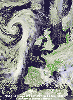 18th: A bright start with the sky clearing. Pressure 1017 mb was rising with a ridge of high-pressure extending from the high 1037 mb over N Greenland. Pressure remains low 1004 mb over the Mediterranean. A sunny morning, and yes we still had the NE'ly breeze force 3/4 that continued through the day. The afternoon also sunny saw the wind lessened towards evening and the temperature on the grass fall to 1.9C. The fields are drying up now, on the 1st this field that usually has iris growing on it was very wet with a pool of standing water
  21st: A bright morning under high cirrus and cirrostratus clouds giving weak sunshine. Pressure was 1017 mb with slow-moving complex lows 992 mb to the W with 1018 mb over the Baltic and 1004 mb Italy. There were highs 1035 mb over the Greenland Sea and 1018 mb Black Sea. We had a SE'ly breeze that was very gusty at times around the garden. The temperature at 09 GMT was 13.5C, dewpoint 6.0C. There was no dew on the grass with the minimum reading 7.1C overnight. The day had variable cloud cover with good spells of sunshine the maximum reaching 18.2C. By evening some of the cloud in the west had encroached, but there was no rain. The winning by the Alpine Garden Society of a gold medal and the President's Award at the RHS Chelsea Flower Show has inspired me to photograph (left) our alpine garden at the weather station. There are more than 50 species on this patch. . [Rain 0.0 mm; Max 18.2C; Min 9.0C; Grass 7.1C]
 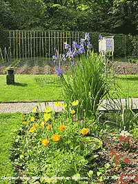 23rd: Overcast and dull. Pressure was 1013 mb with the filling low 1000 mb off SW Ireland. The occluded front was lying North Channel to Kent and showing little signs of moving away.
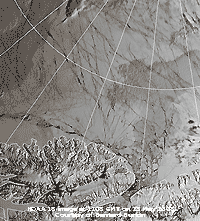 Visibility was good although with moderate haze looking towards the mountains. The morning was mostly cloudy with the frontal cloud decaying more or less in position. Later convective cloud developed in places inland, but it was a mostly sunny here becoming overcast gain in the evening. You can see in the photograph that I have the vegetable plot dug over and beans, peas and potatoes planted. The peas and potatoes are beginning to show through, but they need some rain! The NOAA satellite image today shows an area if ice north of Greenland. According to the BBC website further evidence of the break-up of Arctic ice was revealed by a recent Canadian expedition that found major new cracks north of Canada. Last year was a record for melting Arctic ice. [Rain 0.0 mm; Max 18.9C; Min 11.0C; Grass 9.9C]
 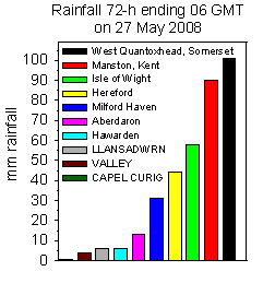 The day was mostly cloudy with 1 or 2 brief sunny spells in the morning. The afternoon was duller with light rain from 1530 GMT into the evening when it was a little less windy here. In Barmouth, Gwynedd, 3000 campers had to be accommodated overnight in emergency shelter as 300 tents were flattened by the near gale-force winds. There was some heavier rain in the south of England and Wales; Manston in Kent had 32 mm (06-06z) . The first data from NASA's Phoenix Mars Lander at 68 degrees north, 234 degrees east, has arrived on Earth today. One of the first images (below right) shows the development of stone polygons, thought to be the result of the action of freezing and thawing. You don't have to go too far to see similar weather induced patterns, stone stripe effects can be seen on the top of the Carneddau Mountains. {Little Rissington 29 mm, Sennybridge 15.2 mm, Tiree 15.8h, Valley 2.3h} [Rain 1.6 mm; Max 15.6C; Min 8.8C; Grass 7.6C]
 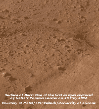 26th: The weather on Mars (graphic left) relayed from the automatic weather station on the Phoenix Lander, developed by the Canadian Space Agency, was sunny with clear skies, pressure was 8.5 mb and there was a force 3/4 breeze from the north-east. Temperatures recorded on Sol 1 of the mission were a maximum of -30C and minimum -80C. Using a laser-reflection tool Lidar and a suite of temperature, wind and pressure sensors, the instruments will track daily weather patterns, seasonal climate changes, ice and dust clouds, sand storms and even surface fog. Here on Anglesey it was dull and overcast to start, but at 09 GMT in the fresh to strong NE'ly wind some lee breaks were overhead with altocumulus lenticularis clouds forming. Pressure was 1017 mb with the high 1031 mb over the Faeroes. With 3.4 mm evaporation the 1.6 mm rainfall had done little to alleviate the water deficit now running at 42 mm. With sunshine in Scotland heavy rain continued in parts of southern England; Woodside Orchards in West Quantoxhead taking part in the MetLink project reporting 51 mm. Over 3-days rain totalled over 100 mm and at Manston in Kent 90 mm. Here over the same period we had 5.8 nn while Capel Curig usually noted for high rainfall totals reported just 0.8 mm. The day here was mostly cloudy with a few bright interludes in the morning, but not enough to report bright sunshine. It was very windy with the NE'ly at strong to near gale-force tearing off more leaves from the trees. The Piche evaporimeter lost 5.5 ml over the 24-h period 09-09 GMT. Although the rainfall radar was indicating rain on Anglesey we had none here until after midnight. {West Freugh 19.2C, Liscombe 49.4 mm, Lerwick 15.8h} [Rain 4.2 mm; Max 14.0C; Min 10.3C; Grass 8.8C]
|
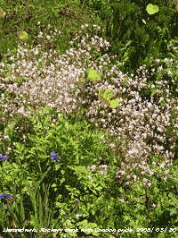 30th: After a slight shower of rain at 06 GMT, leaving just a few spots in the bottle of the raingauge, it was bright and sunny at 09 GMT with 6 oktas cloud cover. This was mainly altocumulus, with a little altocumulus castellanus to the S, and a few small developing cumulus clouds. After enjoying the warmth (18.2C) along with honeybees buzzing on a mass of rockroses flowering in the garden, within an hour the sky was overcast. Pressure 1015 mb remains low within the large low-pressure complex covering the north Atlantic and most of Europe. The jetstream is still fragmented, usually by this time of year it has settled it's position largely determining the kind of weather we have for the summer, it needs to be to the N of Britain for good weather. The cloud dispersed for the afternoon that was mostly sunny and with light breezes the temperature reached 18.6C. The north and west again had the best of the weather N Ireland having the highest temperature 23.5C and Stornoway with 14.1h the most sunshine. {Castlederg 23.5C, Valley 20.6C, Stornoway 14.1h, Valley 9.1h, Okehampton 16 mm} [Rain 0.0 mm; Max 18.6C; Min 12.1C; Grass 9.9C]
 The month ended with a record mean temperature of 13.6C (+1.7) and [+2.1] of average putting 1990, that had 13.4C, into second place. It was a dry month with 33.4 mm (48%) and [58%] of average, driest since 1998 ranking 6th since 1928. It was sunniest since 2000 with a sunshine duration of 232 h at RAF Valley, the 6th sunniest May in Anglesey since before 1930. .
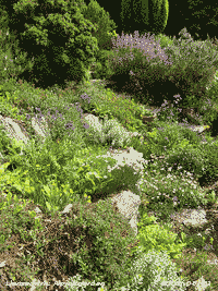 1st: Overcast at first brightening to give a few sunny spells later in the morning. Pressure was 1017 mb with high 1024 mb to the N of Scotland and complex low-pressure over Europe and the Mediterranean. Low 1025 mb S North Sea moved NE during the day into the Midlands and North bringing rain. Here it was another dry day with a light NE'ly breeze and a temperature of 16.1C. [Rain 0.0 mm; Max 16.1C; Min 11.8C; Grass 9.5C]
2nd: Pressure 1014 mb was falling and the sky was overcast with moderately high and thin cloud. At 09 GMT it was fairly bright and with further thinning and dispersal the day became mostly sunny with the temperature rising to 17.2C. Visibility was moderate with haze and a milky sky indicative of a dusty atmosphere. The evening was bright at first before thicker cloud encroached bringing a little rain at 2100 GMT. It was not enough to wet the warm dry ground. [Rain 0.2 mm; Max 17.2C; Min 10.8C; Grass 10.4C]
3rd: There was a little more rain at 0300 GMT, but the total 0.2 mm did nothing to restore the soil water balance. Mostly cloudy early in the day, but beginning to disperse at 09 GMT (6 oktas of altostratus, cumulus and cirrus). Pressure 1015 mb was rising and the day was mostly sunny and less hazy with good visibility. In the light SW'ly breeze the temperature reached 19.5C. Occluded frontal cloud associated with low 988 mb S Iceland was slow-moving along the spine of Britain. There was heavy rain and flash flooding in parts of the Midlands and S England. A teenager died trapped in a culvert in a flooded meadow in Witney, Oxfordshire, another was rescued by emergency services. {Helens Bay 21.7C, Benson 47.4 mm, Camborne 13.6h, Valley 10.7h} [Rain 0.0 mm; Max 19.5C; Min 11.8C; Grass 11.5C]
4th: After a mostly clear night, with the temperature on the grass reaching a minimum of 6.1C, the sky was cloudier by 09 GMT. Pressure was 1015 mb and there was a fresh S'ly wind. The morning had sunny spells between passing cumulus clouds. The afternoon was cloudier, but kept bright with some sunshine. The evening saw thickening cloud and the coastal mainland had showers of rain from 19 GMT, but it kept dry here until just before midnight. [Rain 1.8 mm; Max 17.3C; Min 9.2C; Grass 6.1C]
 5th: There was light rain from 04 GMT that accumulated 1.8 mm by 09 GMT. It was sufficient to wet the ground; the plants in the garden and vegetable plot already looked better for it. Pressure was still around 1015 mb with a low 1014 mb on a wavy occluded front over Wales, this was associated with slow-moving low 995 mb SW Iceland. The Azores high is now reassuringly back in position, but the north-Atlantic jetstream is pointing over Spain and the western Mediterranean, with a streak from Iceland to NW Britain. Our summer is still in the balance. The morning was dull with slight rain in a light NE'ly with moderate visibility. In a burst of heavy rain around 1300 GMT there were some small ice pellets. The rain stopped by 1515 GMT and there was a slow clearance giving a little sunshine during the evening. The day's maximum was 13.9C At 2100 GMT low mist had formed on the fields with the grass minimum down to 6.1C. [Rain 3.9 mm; Max 13.9C; Min 11.1C; Grass 10.3C]
6th: A fine and sunny morning with cumulus clouds in the vicinity moving along on a light to moderate SW'ly breeze. Pressure 1020 mb was rising in a ridge of high-pressure moving in from the W with remnant frontal cloud transferred eastward. There were some good spells of sunshine in the afternoon. [Rain 0.0 mm; Max 15.5C; Min 8.5C; Grass 6.1C]
7th: A bright morning with cloud increasing after 09 GMT, but then turning sunnier again. Pressure 1022 mb was rising and the wind SW'ly force 2 at first turned NE'ly off the sea during the afternoon with just a few small cumulus clouds seen. The sea breeze pegged the temperature rise to 17.6C, but Kinlochewe in W Scotland had 22.6C. Valley reported 12.8h sunshine duration this being exceeded in Camborne that had 14.9h[Rain 0.0 mm; Max 17.6C; Min 7.7C; Grass 4.6C]
8th: Pressure was 1026 mb with a high 1029 mb lying to the SW of Ireland. Another sunny day with very good and clear visibility and some cirrus clouds that increased in the NW late in the afternoon and evening. The sky was deep blue as well so that solar radiation was high reaching 28.34 MJ m-2. Valley reported 15.1h of bright sunshine. [Rain 0.0 mm; Max 22.0C; Min 9.2C; Grass 6.2C]
9th: A fine and dry night with just a little cirrus and a few cumulus clouds to the S and W. With blue sky overhead it was another sunny morning with very good visibility and the temperature rising to 19.0C at 09 GMT. Pressure was on 1028 mb and there was a gentle SSW'ly wind. The afternoon was mostly sunny with passing clouds and with the S'ly wind persisting and no sea breeze the temperature rose to 22.8C, highest of the month, and relative humidity falling to 65%. Sunshine continued into the evening. [Rain 0.0 mm; Max 22.8C; Min 10.3C; Grass 7.4C]

|
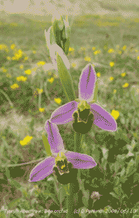 11th: A mostly cloudy morning with a few bright spells and some sunshine at times. Pressure 1026 mb was falling with the high 1032 mb in position SW of Ireland and complex low-pressure 998/988 mb Oslo and N Finland. Later the cloud thickened from the NW and there were a few spots of rain from 15 GMT but not enough to wet the ground in an hour. By 1700 GMT the rain was just about wetting the ground continuing until 1900 GMT when it turned showery up to 01 GMT, in total 1.3 mm. Interest in such small amounts of rainfall stems from the need for a substantial amount to water the garden, on this occasion by no means was there enough. Rainfall this month has been 5.9 mm, with PE (potential evapotranspiration) of 31.7 mm there is a (PWB) negative water balance of 25.8 mm. While the flowering plants and vegetables could do with water at least the grass does not have to be cut as growth has slowed. [Rain 1.3 mm; Max 18.2C; Min 11.5C; Grass 10.9C]
 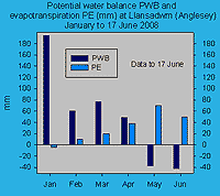 14th: Pressure 1017 mb continued to decline along with high-pressure 1025 mb over Greenland. There was a weak low 1003 mb over the S Norwegian Sea and had associated fronts over the North Sea and Britain. This corner of the island had the most cloud during the day, while the western coast saw the most sunshine. [Rain 0.0 mm; Max 19.2C; Min 6.6C; Grass 4.3C]
 The first 15 days statistics show an average month for temperatures, so far. The mean temperature 13.6C (-0.9) on the month's 10-y, but spot on the 30-y average. Rainfall, however, just 7.5 mm is only 11% of the average. Potential evapotranspiration to the 16th (last day of dry spell, was 49.3 mm resulting in a negative potential water balance of 41.8 mm .

|
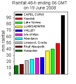
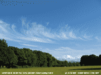 20th: Cloudier around dawn, but the sky was clearing up to 09 GMT. Pressure 1017 mb was rising because low 989 mb was filling over the S Norwegian Sea, and developing complex frontal lows Azores to SW Ireland, heading our was, were 1006/ 1110 mb were effectively extending a ridge of higher pressure towards Britain. Further bad news, and ominously like last year, the jetstream (graphic left) seems established over Britain. The day had variable amounts of cumulus clouds and intermittent sunshine, but the wind strengthened to force 5 at times. Around 1700 GMT with the sky clearing there was cirrus uncinus, some hooked resembling mares' tails, to the south. During the evening the wind dropped and at 2100 GMT the sky was mostly clear and light enough to read outside. The sky in the north kept bright and noctilucent clouds were seen before midnight. {Milford Haven 17.9C, Valley 14.5h} [Rain 2.4 mm; Max 18.0C; Min 9.5C; Grass 6.8C]
  22nd: My hard hat was required for the obs at 09 GMT. There were a lot of debris and twigs flying around with the S'ly wind around force 7/8; strong gusts (55 to 60 mph) were bending the trees in full leaf in an alarming manner. Aberdaron reported force 9, but Valley automatic METAR observations had been offline since yesterday so observations were unavailable, but a gale was not reported. At least it was not raining. Pressure had just bottomed out at 1000.1 mb, lowest of the month, with the low 991 mb over the North Channel. Conditions did not improve during the morning. In a strong gust a branch was torn off an ash, 20 m from the Stevenson screen, and a large limb split off a horse chestnut on the edge of the wood; and the electricity supply failed. North Wales was particularly badly hit with 8000 homes without electricity and hundreds of calls made to emergency services as the winds brought down trees and blocked roads . Speed restrictions were in force on the Britannia Bridge. A cable was brought down in Malltraeth and branches of a tree went through a roof of a house in Wrexham, but no one was hurt. In Flintshire one person was hurt when a marquee collapsed. The sea around the Anglesey coast was white with spray off the large waves. Gales in June are rare, the Anglesey long-term average is 0.3 gales, but 0.1 over the last decade. Usually just 1 or 2 gales in the month are recorded, but there were 4 in 1944. The afternoon saw moderating winds, the return of electricity and a little brightness developing, but there were slight showers of rain from 1700 GMT. [Rain trace; Max 14.7C; Min 10.2C; Grass 11.1C]
 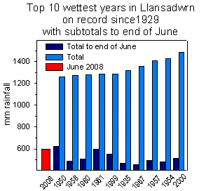 23rd: A better morning with pressure 1019 mb rising in a ridge crossing Wales, and the wind - a light south-westerly! The temperature at 09 GMT was 14.7C exceeding yesterday's highest of 14.2C. There were some sunny spells during the morning that, at first had wavy cirrus clouds overhead and cumulus clouds some of which were towering over the Snowdonia Mountains. Sunnier, with the sky clearing in the afternoon with the temperature rising to 19.0C. By evening the sky was clear except for a line of diminishing stratocumulus over the mountains. At 21 GMT the sky overhead was clear but there was cloud approaching in the NW associated with approaching Atlantic-low 997 mb off SW Ireland . {St Athan 18.5C, Sennybridge 5.3C, Aberporth 12.4h} [Rain 0.0 mm; Max 19.0C; Min 7.5C; Grass 4.6C]
 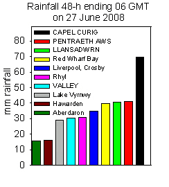 25th: After a spell of rain between 0445 and 0515 GMT it was dry and overcast at first. Overnight the minimum temperature had not fallen below 13.0C, highest of the month. Showers were in sight around 09 GMT and we had a little rain before 10 GMT. Low 994 mb was lying to the W with pressure here 1008 mb rising. There was a fresh to strong S'ly wind that persisted into the afternoon. The sky was brighter by noon and we had an increasingly sunny afternoon. During the evening, with a mostly clear sky, the wind eventually moderated. [Rain 6.3 mm; Max 18.8C; Min 13.0C; Grass 11.1C]
 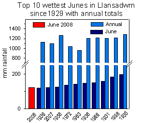 27th: Well, early in the morning it was bright and I spotted a little sunshine, but it was soon gone and by 09 GMT the sky was overcast again. Pressure was 1005 mb with complex low pressure centres to the north. We were in a moist westerly airstream, with warm fronts moving in across, and the rest of the day was dull with rain or drizzle most of the time with, occasionally, a moderate to fresh breeze. At 1530 GMT the wind had moderated, rain eased and there was low cloud fog. Although the fog disappeared for a while around 17 GMT it was still overcast and very dull. With nothing better to do on the disappointing summer day I rearranged the rainfall figures for past Junes. The wettest in Llansadwrn was in 1925 with 196.3 mm, the ten top previous wet Junes are shown in the graphic (right) along with the total rainfall at the end of the year. There is, perhaps, some justification to think a wet June leads to a high total at the end of the year, but 1963 was a little drier. Don't bank on it for the rest of the summer as the dry months in '63 were January, February and December! Fog returned during the evening. [Rain 5.4 mm; Max 14.7C; Min 8.9C; Grass 6.6C]
  28th: Thick fog after midnight, with visibility of 100m, had cleared by dawn and early on it was bright with weak cloud obscured sunshine. By 09 GMT the cloud was thick again and the morning was dull. Pressure was high 1029 mb over the Azores with a ridge over the Bay of Biscay. Too far to the S, and with the jetstream still above us, pressure here 1015 mb was unchanged. With low-pressure (998 mb) anchored to the N resulting in continuation of the moist westerly airflow. The afternoon at first was occasionally bright with even glimpses of sunshine, later the sky became overcast with the wind strengthening as an occluded front associated with the low to the NW approached. The evening was dull as the cloud thickened. [Rain 0.6 mm; Max 17.5C; Min 12.2C; Grass 12.0C]
 The month ended with total rainfall of 123.5 mm (168%) and [186%] of average, wettest since 2006 ranking 9th in Llansadwrn since 1929. The mean temperature was 13.5C (-1.0) and [-0.1] of average, the mean maximum 17.2C showed the greatest anomaly [(-0.5)] . Soil temperature at 30 cm averaged 15.8C (-0.3). Sunshine duration estimated from solar radiation was 209h, highest since 2006.
1st: A sunny morning with a fresh to strong S'ly wind. Pressure 1009 mb was falling with low 987 mb off NW Scotland. A cold front lay over the Irish Sea to the west, but the morning was sunny and warm. The temperature at 09 GMT 19.2C had already exceeding yesterday's temperature and by 11 GMT had reached 21.8C and went on to 22.5C. During the afternoon the sky turned cloudier with the approach of the cold frontal from the west. The wind moderated and there was slight rain from 1700 GMT and moderate rain 1800-2000 GMT. [Rain 1.1 mm; Max 22.5C; Min 12.9C; Grass 11.3C]
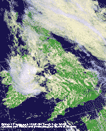 2nd: A fine and sunny morning to at first. At 09 GMT pressure was 1006 mb but the sky was already beginning to cloud over and within the hour it was overcast. The S'ly wind was force 4/5 and visibility good, but hazy. The afternoon began cloudy, with a few spots of rain around 1330 GMT and a light shower at 1530 GMT, before becoming less windy with some sunny spells developing. There were storms in the south and in mid Wales, but they did not reach here. There was a heavy shower just before midnight. [Rain 0.9 mm; Max 17.4C; Min 12.0C; Grass 10.2C]
3rd: There had been a slight shower of rain at 06 GMT and at 09 GMT the sky was mostly covered with cumulus and altocumulus clouds. Pressure was 1006 mb in a surface low over the Irish Sea and convective clouds (see satellite image left) continued to darken. At 1100 GMT there was a thunderstorm, there were several bursts of thunder and lightning and a few minutes of heavy rain and lighter rain lasting 15 minutes overall with 9.0 mm rainfall accumulating. Later there were a few sunny spells and spots of rain before the sky began to clear during the evening. [Rain 9.0 mm; Max 18.3C; Min 11.5C; Grass 8.5C]
4th: A fine and sunny morning with 2 oktas cover of cumulus clouds, confined to the S over the mountains, cirrus and altocumulus. Pressure 1015 mb was rising in a ridge from high-pressure 1018 mb over NE France. Low 997 mb was to the SW over the Bay of Biscay with associated fronts moving into SW England. Here it was a mostly sunny morning, cloudier at times especially around noon, but similar in the afternoon. The light to moderate S'ly breeze backed E'ly by afternoon and strengthened during the evening with occasional light showers from 2200 GMT. [Rain 1.7 mm; Max 18.3C; Min 10.5C; Grass 8.8C]
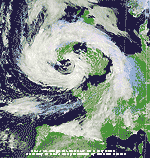 5th: Rain showers continued at times through until morning. At 09 GMT with pressure steady on 1004 mb there had been a light shower in the past hour, but then it was sunny with cumulus in the vicinity. Visibility was good with a light to moderate veering S'ly breeze. Low 996 mb was off SW Ireland approaching St George's Channel and heading slowly our way. The NOAA 18 satellite image at 1339 GMT (right) shows the position of the low with its associated spiral of cloud with mostly cloud-free centre. Part of Ireland, Irish Sea, central and SE England and NW France are in a clear slot between the frontal cloud band. It was a day of frequent slight shower of rain and brief sunny spells, more like April than July! Winds were strongest and rain heaviest on the periphery of the depression, near the centre winds were light. The temperature rose to 19.5C; the most significant showers were at 1430 and 2100 GMT. [Rain 0.6 mm; Max 19.5C; Min 13.2C; Grass 10.8C]
6th: A fairly bright morning with showers in the vicinity and a slight one at 09 GMT. Pressure had fallen to 996 mb, lowest of the month, as the low 995 mb was over the Irish Sea off Holyhead. The wind was S'ly force 2 and visibility good with cloud around the mountaintops. Although it was a mostly cloudy day here there were bright and sunny spells most of the rain again falling on the periphery of the depression - up to 100 mm on the moors of Dartmoor were reported. It was sunnier, as frequently happens, in the north-west corner of the island where RAF Valley recorded 10.4 h of sunshine, highest in Britain. There was a slight shower around 17 GMT. [Rain 1.0 mm; Max C; Min 10.8C; Grass 7.8C]
7th: There was just over 0.5 h rain from about 08 GMT, at 09 GMT there was a break in the stratocumulus cloud over the weather station, but it soon closed over again. Pressure was 996 mb with the low 993 mb moved a little to the NE and over the North Sea. The morning was dull and damp, with a light NNE'ly breeze and only moderate visibility with low cloud on the mountains. The afternoon had just a few sunny breaks, but there were some spots of fine rain at times. [Rain 0.7 mm; Max 16.6C; Min 11.4C; Grass 8.5C]
8th: A fine and bright morning with 6/8 cover of mainly cumulus and altocumulus clouds. Pressure 1006 mb was rising in a minor ridge extending from high 1021 mb Spain and SW France. Looking to the low 993 mb S of Greenland had frontal cloud W of Ireland. A disappointingly cloudy day (solar radiation 16.94 MJ m -2) with the temperature rising to 16.6C in the rather few sunny spells. It a dry day the grass drying in the moderate to fresh SW'ly breeze. The sky was overcast for a while around 17 GMT then partially cleared for the late evening. Grass has not needed mowing for 14 days; growth has been 3.0 g m -2, fairly slow for July affected by the still relatively dry soil (50.4% dry mass) and somewhat below average temperatures (mean 15.0C (-1.1) and [-0.6] ). [Rain 0.3 mm; Max 16.6C; Min 9.5C; Grass 6.4C]
9th: Overcast and still dry at 06 GMT, but there soon a light shower of rain. Keeping dry around 09 GMT the day turned duller with rain or drizzle at times. With a temperature reaching 17.4C and little (E) or no wind it was damp and muggy; suitable conditions for the development of potato blight. There was no further rain after a moderate shower at 2100 GMT. [Rain 3.9 mm; Max 17.4C; Min 11.1C; Grass 9.6C]
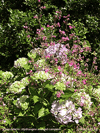 10th: Overcast and dry with a moderate to fresh SSW'ly breeze in a temperature of 14.5C (dewpoint 12.1C; 86% RH); vegetation and potatoes were drying off nicely. Pressure was 1001 mb with complex low-pressure over Britain. Frontal cloud, and embedded low 998 mb was over the Irish Sea to the NW, but visibility was good and some breaks appeared in the cloud by 10 GMT and by noon it was mostly sunshine. With some passing fair-weather cumulus clouds, the only well-developed ones were seen to the S of here, the afternoon was mostly sunny and the temperature rose to 19.3C. By evening the sky was overcast once again with the frontal cloud returning . {Hawarden 20.7C, Valley 7.8h} [Rain 4.9 mm; Max 19.3C; Min 12.9C; Grass 12.3C]
11th: Overcast with low stratus cloud, very poor visibility in mist and rain. Pressure was rising slowly with the low 995 mb moving NE to be off Aberdeen, but we were under the slow-moving occluded front. The morning had intermittent rain or drizzle that began to ease by 1300 GMT. During the afternoon the cloud lifted and visibility improved to good; the sky remained overcast but some brightness appeared by early evening with further thinning. The day's maximum of 13.5C was lowest of the month. The night was mostly cloudy. [Rain 3.5 mm; Max 13.5C; Min 12.1C; Grass 12.0C]
12th: Some early morning brightness and a glimpse of sunshine before a light shower of rain at 0745 GMT. Pressure 1011 mb was rising with a minor ridge moving in from the west. The morning was mostly overcast, but dry. There was a light shower of rain around 1230 GMT and a few spots and drizzle early in the afternoon before once again turning dry. There were some glimpses of sunshine before evening that was mostly cloudy. {Milford Haven 17.0C, Valley 4.7h}[Rain 0.3 mm; Max 16.5C; Min 9.6C; Grass 8.3C]
13th: Dull at first, but becoming brighter with some sunshine by 09 GMT. Pressure 1015 mb was still rising in the ridge now centrally placed over Britain. The morning was partly cloudy with sunny spells and a light S'ly breeze and very good visibility. The afternoon was sunnier, the line of clouds over E Anglesey persisting while the W was clear. Despite this it was the bright day with solar radiation reaching 24.73 MJ m -2. Cloud, associated with fronts to the W, encroached by 18 GMT dulling the evening. {Great Malvern 21.4C, Hawarden 19.7C}. {Hawarden 19.7C, Aberporth 12.1h} [Rain trace; Max 20.7C; Min 10.2C; Grass 7.1C]
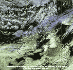 14th: A dull and damp start to the day with low uniform grey stratus and visibility < 2 km. It was misty at first with specks of drizzle on the moderate S'ly wind. Pressure 1020 mb was rising and the remnant frontal cloud began to lift and break before noon giving a little sunshine in a temperature of 18.7C. The afternoon was mostly cloudy, but the temperature reached 20.1C. {Rhyl 22.8C, Valley 1.2h} [Rain 0.0 mm; Max 20.1C; Min 12.9C; Grass 11.5C]
15th: Pressure 1024 mb had risen with Azores-high 1034 mb and Biscay 1030 mb. Deep low 994 mb was crossing eastward N of Scotland so we were under the influence of a warm and moist W'ly airstream. It had been a warn night, minimum 15.1C, exceeding anything in July 2007, but well below the 18.9C minimum of July 2003. The morning was dry, overcast and rather dull here with a strengthening WSW'ly wind; there was some clear sky over the Irish Sea to the NW and this part of the island had clear sunshine (see satellite image right). The afternoon here and in Snowdonia was partly cloudy with few sunny spells and the temperature rose to 22.5C, the evening was mostly sunny with the wind moderating. {Hawarden 23.5C} [Valley 9.9h] [Rain 0.0 mm; Max 22.5C; Min 15.2C; Grass 14.4C]
The first 15 days had a mean temperature of 15.1C (-1.0) and [-0.5] of the averages for the month. The mean minimum 11.7C was on the 30-y average, but (-1.2) of the past 10-years. The mean maximum 18.5C was (-0.8) and [-1.0] while the highest maximum so far 22.5C was (-3.0). Rainfall was 27.9 mm 44% of the average for the month.
![]() 16th: Overcast with stratocumulus clouds and a light to moderate W'ly breeze. Pressure was little changed on 1024 mb with high 1039 mb N Azores and low 994 mb Norwegian Sea we were still in the W'ly airstream. A succession of fronts were strung out across the Atlantic all seemingly headed under the jetstream established over southern Britain (see chart left). The morning kept dull with a few spots of rain in the vicinity. The afternoon was little better, after a few brighter spells the frontal cloud encroaching from the west thickened and there was light rain later. [Rain 10.5 mm; Max 17.8C; Min 11.2C; Grass 8.0C]
16th: Overcast with stratocumulus clouds and a light to moderate W'ly breeze. Pressure was little changed on 1024 mb with high 1039 mb N Azores and low 994 mb Norwegian Sea we were still in the W'ly airstream. A succession of fronts were strung out across the Atlantic all seemingly headed under the jetstream established over southern Britain (see chart left). The morning kept dull with a few spots of rain in the vicinity. The afternoon was little better, after a few brighter spells the frontal cloud encroaching from the west thickened and there was light rain later. [Rain 10.5 mm; Max 17.8C; Min 11.2C; Grass 8.0C]
17th: Under uniformly grey low stratus cloud it was a dull sunless day with light rain or drizzle at times. Visibility was moderate to poor and SW'ly winds generally light. There was only a 1.4C variation in temperature over the 24-h 09-09 GMT. Solar radiation was only 5.85 MJ m -2 , lowest of the month. [Rain 4.5 mm; Max 14.2C; Min 11.5C; Grass 11.2C]
18th: More of the same; moderate drizzle interspersed with light rain making visibility very poor (1 km). Pressure 1009 mb was falling with Azores-high 1034 mb well to the SW and low 994 mb Norwegian Sea continuing the moist W'ly airflow with little change in prospect. There was more drizzle and occasional light rain through the day. Another sunless day with solar radiation of 6.20 MJ m -2. [Rain 2.4 mm; Max 15.6C; Min 12.8 C; Grass 12.7C]
19th: Overcast sky at first with the occasional bright spell and glimpse of sunshine. At 09 GMT it was overcast with a light shower of rain in progress. Pressure was 1006 mb with low 994 mb S Norwegian Sea and ridge of high-pressure from the Azores-high to the W of Ireland. Hurricane Bertha was on the 06 GMT analysis chart positioned SW of Nova Scotia west of the high-pressure; according to the GFS Model remnants eventually heading for Iceland. The morning had a few bright and sunny spells with the cloud lifting and breaking up. The afternoon was similar cloudy at times, but it kept dry. The evening was clearer for a while only to turn cloudier again by 2100 GMT. [Rain trace; Max 17.5C; Min C; Grass C]
20th: After a cool night there was dew on the grass with the grass minimum recording a minimum of 5.4C; in the screen the air minimum fell to 7.8C, lowest of the month. Pressure had risen to 1020 mb under the influence of the Azores-high expanding northwards. Again a day of infrequent sunshine, cumulus clouds giving a few spots of rain before noon, and with a cool N'ly breeze off the Irish Sea the temperature rose to 16.6C. The afternoon had variable but reducing cloud cover towards evening that was mostly sunny. It was mostly cloud covered by 2100 GMT, but there were sufficient clear spells at night to give bright moonlight. [Rain 0.0 mm; Max 16.6C; Min 7.8C; Grass 5.4C]
21st: Another cool night for the time of year, again much dew on the grass with a minimum of 5.2C, lowest of the month. Pressure was 1027 mb, highest of the month. A fine sunny morning with very good visibility under a few cumulus and cirrus clouds. The afternoon was less cloudy before turning cloudier by 17 GMT as a narrow band of rain approach the north-west and the Isle of Man, but it kept dry and mostly sunny here. Solar radiation reached 25.97 MJ m -2 , highest of the month. [Rain 0.0 mm; Max 20.4C; Min 8.0C; Grass 5.2C]

|
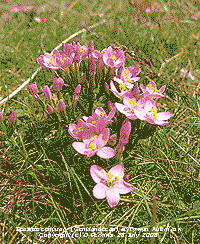 23rd: Another overcast morning at first, but with holes appearing in the cloud here it was sunny and warm by the 11 GMT. Sea fog in Red Wharf Bay affected the Benllech area that remained cold until the afternoon, but here the temperature rose to 23.3C. [Rain 0.0 mm; Max 23.3C; Min 13.4C; Grass 10.3C]
 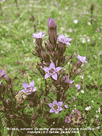 25th: Overcast with a few spots of rain just before 09 GMT. Overnight the air minimum did not fall below 17.6C, highest of the month. Pressure was 1010 mb with low 992 mb W of Ireland and high 1029 mb over Scandinavia. Frontal cloud was lying to the W with a shower trough with 2 narrow bands of rain gave a few spots of dusty rain here. Soon, the cloud was beginning to break and there was a little sunshine. Another warm morning with the temperature 20.7C (dewpoint 11.6C) rising to 24.3C during the day. [Rain trace; Max 24.3C; Min 17.6C; Grass 14.5C]
 At Tywyn Aberffraw 2 members of the gentian family were in flower, the red seaside centuary (Centaurium littorale, above right) and an early autumn gentian, the felwort (Gentianella amarella, above left). In places the dunes were carpeted with pink wild thyme ![]() and sometimes interspersed with white eyebright
and sometimes interspersed with white eyebright ![]() . There were plenty of butterflies around including gatekeepers
. There were plenty of butterflies around including gatekeepers ![]() and pearl-bordered fritillaries.
and pearl-bordered fritillaries.
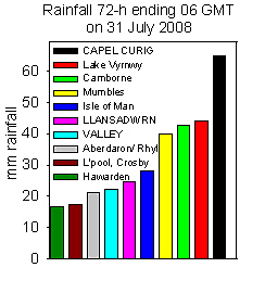 29th: A muggy night with a minimum air temperature of 15.7C. Thunder, preceded by vivid distant white coloured lightning, at 0300 GMT brought another 7.6 mm of moderate rain in 2 h. The sky was still overcast with slight rain at 06 GMT, but soon after with cloud breaking there were a few sunny spells. At 09 GMT pressure 1010 mb was rising and visibility was good. There were cumulus clouds in the vicinity and a few spots of rain. The morning kept mostly cloudy with a light S'ly breeze before passage of a cold frontal trough around noon. There was a heavy shower of rain as the temperature plunged 3C to 16C only to soon rise again to the day's maximum of 19.8C. A dark cumulonimbus approached later and there was thunder at 1553 GMT with a further shower of rain, but small fall in temperature. By 1730 the sky was cleared to give a sunny evening before more showers at 1930 and 2100 GMT. {Capel Curig 36.0 mm, Aultbea 26.7C, Lerwick 12.8h} [Rain 6.0 mm; Max 19.8C; Min 15.7C; Grass 15.2C]
 The month ended with a rainfall total of 81.5 mm (131%) and [128%] of average. Rainfall in the year so far 679.5 mm, largest since the 720.8 mm in 1958, ranks 2nd since before 1929. The mean temperature was 15.9C (-0.2) and [+0.3] highest since 2004 (17.0C) ranking 9th highest since before 1979. There were 20 days that reached 20C, or more. Sunshine duration in Llansadwrn estimated from global solar radiation values was 183h, most since 2006 with 4 sunless days.
1st: Bursts of heavy rain within long spells of drizzle under uniform grey stratus began August as July had ended. At 09 GMT it was overcast with very poor visibility with no chance of seeing the partial solar eclipse. Pressure 1005 mb was falling close to the complex low 1000 mb lying just to the NW. Most of the day was very dull with slight rain and drizzle from time to time with the daytime temperature a maximum of 16.4C. It was windy too with the S'ly reaching strong to near gale. Late in the afternoon the sky began to clear, the wind to moderate and there was some early evening sunshine before cloudier skies developed once again. Solar radiation was a low 7.73 MJ m -2 despite evening sunshine. Heavy rain in SW Ireland had led to flooding and power failures in Limerick and Cork. Cars were abandoned and water entered at least 20 houses. [Rain 4.2 mm; Max 17.6C; Min 12.2C; Grass 10.1C]
2nd: Overcast at dawn, but soon breaks in the cloud gave early brightness and some sunshine. With 6 oktas cover at 09 GMT the temperature had reached it's maximum of 17.6C for the past 24-h. Pressure 1011 mb was rising and it was a bright morning with a moderate SSW'ly breeze. There was a slight shower of rain around 1130 GMT, otherwise it was mostly sunny and the solar radiation 21.24 MJ m -2 was the highest of the month. Thin cloud encroached later in the afternoon and apart from 1 or 2 brighter spells the evening was overcast. The night was cloudy with light winds. [Rain trace; Max 20.0C; Min 13.7C; Grass 12.5C]
3rd: Overcast at first with some breaks appearing around 09 GMT. Pressure was little changed on 1009 mb, the temperature was 16.1C in a light SW'ly breeze. Visibility was moderate to good with cloud on the mountaintops. The morning and afternoon were dry, best sunshine was early in the afternoon when a bank of convective clouds developed over Snowdonia. Later it was cloudier and dull as thicker cloud encroached and there was slight rain between 18-19 GMT. By midnight the sky was almost clear for a while. A tornado hit Hautmont in NE France near the Belgian border, S of Lille, flattening buildings and killing 3 including the Deputy Mayor and his wife. Thirteen others were reported injured with cars overturned and trees uprooted. There was damage also in several other villages in the area. [Rain 0.1 mm; Max 19.5C; Min 14.3C; Grass 13.8C]
4th: The sky was overcast by dawn and there was a light W'ly breeze. At 09 GMT pressure was 1010 mb with highs 1019 mb over Spain and 1022 mb Greenland. Low 993 mb was over the Baltic and another 998 mb N of the Azores likely to head our way. The morning was dull with a slight shower of rain at 1050 GMT. There was a little sunshine in the afternoon and early evening before a cloudier night. In Renfrewshire, Scotland, there has been heavy rain and flooding in some towns. People living near the reservoir at Lochwinnoch were advised to leave their homes and farms as there was concern that the dam might breach. [Rain 0.7 mm; Max 19.7C; Min 12.2C; Grass 11.0C]
 5th: Overcast was uniform grey stratus. Low 998 mb was slow-moving SW of Ireland and we had a warm front over Anglesey. In the most warm sector air visibility remained poor or very poor through the day that had intermittent rain and drizzle. The day was sunless and very dull under deep cloud with solar radiation a low 7.46 MJ m -2. [Rain 6.3 mm; Max 18.2C; Min 12.7C; Grass 11.0C]
6th: Not a lot better early in the day. Low stratus with rain and drizzle continuing until 09 GMT when the rain had stopped. Pressure was 1008 mb with the low 997 mb SW of Ireland with a warm front hanging over Anglesey and North Wales. There was 6.3 mm in the raingauge and little in the way of evaporation over the past 24-h the Piche recording just 0.2 ml (mm). The morning had further spells of drizzle, sometimes light rain. The afternoon was drier with some brief sunny spells when the temperature rose to 22.0C, highest of the month, and brought out several butterflies including wall browns, a newly emerged peacock and red admirals. The evening was cloudier with some more slight rain showers, with a bright rainbow seen to the SSE about 1930 GMT, before broken cloud around midnight. [Rain 1.7 mm; Max 22.0C; Min 14.5C; Grass 14.2C]
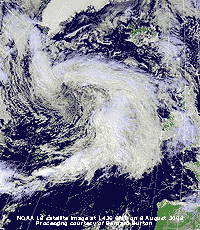 7th: There was a little blue sky early on with a few altocumulus lenticularis clouds to the S. By 09 GMT the sky was overcast and there was intermittent drizzle. Light rain had set in by 10 GMT this continuing into the afternoon before clearing away. A few bright and sunny intervals with the temperature rising to 18.8C, again bringing out the butterflies, before a return to dark overcast skies and slight drizzle into the evening. Heavy rain {Edinburgh, Gogarbank 53 mm 24-h to 06 GMT} to the north of here with east coast mainline rail services disrupted in Scotland [Rain 4.2 mm; Max 18.8C; Min 13.4C; Grass 10.8C]
8th: Overcast, but dry early in the morning. Pressure 1015 mb was rising and at 09 GMT there were patches of thinner cloud through which the sun was just about showing through. The wind was a light NE'ly and there was a fresher feel to the air with the temperature on 14.2C (dewpoint 11.6C). Remnant frontal cloud persisted through most of the day with some brief glimpses of sunshine. Late in the afternoon the sky did clear giving a sunny end to the day. At 21 GMT the half moon low in the sky to the SW was coloured light orange. The NOAA 18 satellite image shows the cloud mass associated with low 986 mb S of Greenland approaching Ireland and the west. Although there was a minor ridge of high-pressure over Britain it was cloudy most of the day in Anglesey until evening.
[Rain 4.7 mm; Max 17.5C; Min C; Grass C]
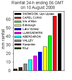 9th: Cloud on a warm front had encroached by morning and there was light rain from 0600 GMT with some moderate bursts. The SSW'ly wind was force 4 to 5, but reached a gusty force 6 at 0900 GMT with potted plants in the garden blown over. Pressure 1005 mb was falling as the complex low 985 mb to the NW pushed away the ridge of yesterday. The day was wet, mostly driving heavy drizzle and showery rain from 1530 to 2200 GMT, and windy with the SW'ly strong to near gale-force at times. It was wet in Snowdonia with 66.9 mm falling at Llyn Llydaw in the 24-h 06-06 GMT. Here the rainfall was just 17.5 mm during the same period. The day was sunless with solar radiation a low 5.38 MJ m -2. [Rain 12.8 mm; Max 16.6C; Min 11.5C; Grass 8.6C]
10th: A much better day although overcast at first the sky had started to clear before 09 GMT. It was still windy, force 5 to 6, but it was pleasant in the sunshine. By late afternoon it was cloudier and overcast by 1745 GMT when there was a light shower of rain. The night kept overcast. [Rain trace; Max 18.9C; Min 13.3C; Grass 12.2C]
11th: Overcast, but dry at first although the sky was dark and threatening to the west as a band of rain was moving N along the Irish Sea. There were a few spots of rain around 09 GMT with the cloud beginning to thin. The morning was bright with some blue sky and glimpses of sunshine by 1030 GMT. It was less windy, the fresh SW'ly moderating. There was a shower of rain around 1300 GMT with the rest of the day seeing several slight showers and glimpses of sunshine. The wind backed SE'ly by evening with pressure falling quickly as low-pressure moved across. [Rain 10.5 mm; Max 16.8C; Min 13.4C; Grass 12.4C]
12th: Rain from 0200 turning moderate to heavy from 0300 to 0700 GMT. Rain was again heavy in the Snowdonia Mountains, Capel Curig reported 42 mm (06-06 GMT) but here, on this occasion being in the lee of the mountains, rainfall was 10.5 mm (09-09 GMT with the AWS's at Pentraeth reporting 10.3 mm while at Llandegai, near Bangor, 11.7 mm. Out of rain shadow in the west Valley had 16.0 mm. Pressure was 986 mb with low 984 mb centred to the NW over the Irish Sea. Pressure recorded by marine buoy 62091 East of Lambay at 06 GMT was 983.8 mb and St Angelo (Co. Fermanagh) reported 983.3 mb, rather low for August. By 09 GMT it had stopped raining and the sky began to clear slowly. The day had frequent slight showers of rain and brief sunny spells. [Rain 2.2 mm; Max 17.7C; Min 12.3C; Grass 11.7C]
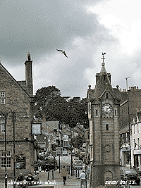
![]() 13th: Pressure 993.4 mb had risen, but we were still near the centre of the low-pressure and at 09 GMT it was calm. Winds at the periphery were strong especially in the English Channel. A mostly clear sky after dawn had given way to cloudier with a slight shower of rain at 0630 GMT and 7 oktas cover at 09 GMT. Overnight the air minimum had been down to 9.8C, lowest in August at this date since the 9.2C on the 11th in 1999. Sub-10C temperatures in the beginning of August were more frequent before 1990 here, but have been rare so far in the 21st century. The day was mostly cloudy with stratocumulus and cumulus clouds predominating (see photo left, south from Llangefni). At this location can be seen the disused railway line now covered with brambles
13th: Pressure 993.4 mb had risen, but we were still near the centre of the low-pressure and at 09 GMT it was calm. Winds at the periphery were strong especially in the English Channel. A mostly clear sky after dawn had given way to cloudier with a slight shower of rain at 0630 GMT and 7 oktas cover at 09 GMT. Overnight the air minimum had been down to 9.8C, lowest in August at this date since the 9.2C on the 11th in 1999. Sub-10C temperatures in the beginning of August were more frequent before 1990 here, but have been rare so far in the 21st century. The day was mostly cloudy with stratocumulus and cumulus clouds predominating (see photo left, south from Llangefni). At this location can be seen the disused railway line now covered with brambles ![]() . This line ran from the main London-Holyhead line at Pentre Berw, near Gaerwen, through Llangefni
. This line ran from the main London-Holyhead line at Pentre Berw, near Gaerwen, through Llangefni ![]() then crossing the Cefni Reservoir on its way to Amlwch. The track can still be seen in places; there was some interest shown by enthusiasts in recent years considering the possibility of reopening. There was a spell of showery rain from 2115 to midnight. [Rain 2.5 mm; Max 17.4C; Min 9.8C; Grass 7.4C]
then crossing the Cefni Reservoir on its way to Amlwch. The track can still be seen in places; there was some interest shown by enthusiasts in recent years considering the possibility of reopening. There was a spell of showery rain from 2115 to midnight. [Rain 2.5 mm; Max 17.4C; Min 9.8C; Grass 7.4C]
14th: A mostly cloudy morning with pressure 1011 mb rising as the low moved out over the North Sea. The afternoon had clearing skies over Anglesey with a line of stratocumulus persisting to the S. {Hawarden 20.7C, Mumbles 7.2 mm, Kinlochewe 12.5h, Valley 12.0h} [Rain 0.0 mm; Max 19.0C; Min 11.3C; Grass 10.3C]
¤
15th: A clear night, but at 09 GMT overcast with cirrostratus, with solar halo (large 22° ring with slight colouration) that persisted for 2h, and some cumulus clouds to the south. Pressure 1015 mb was still rising slowly and there was a moderate S'ly breeze. Some thicker cloud partially obscured the sun around noon then the afternoon was bright with weak sunshine later. By 1700 GMT thick cloud had encroached and there was a slight shower of rain at 1720 and a moderate shower at 2100 GMT. [Rain 1.0 mm; Max 16.9C; Min 10.7C; Grass 8.8C]
The first 12 days had 50.9 mm rainfall (55%) and [63%] of the monthly total. The mean temperature was 15.5C close to the August averages (-0.3) and [0.1]. Maximum temperatures have been on the low side with the highest so far 22.0C (-3.9) of the average .
16th: Showers of rain in the hour leading up to 09 GMT. Pressure 1003 mb was falling with low 993 mb approaching near Shannon, Ireland. Another low 976 mb was lined up S of Greenland. The morning remained cloudy, but warm feeling with warm moist air being brought on a light SE'ly breeze. The afternoon saw some sunshine before more cloud encroached bringing rain by 1630 GMT. Heavy rainfalls led to widespread flooding in Northern Ireland including Belfast, Lisburn, Newtownstewart, Antrim, Ballymona and Glengormley. As well as property farmland was flooded and crops including potatoes and cereals (harvesting already delayed because of the bad weather) were damaged. {Portglenone NI 73 mm, Mullinger IRE 48 mm, Capel Curig 32 mm} [Rain 11.5 mm; Max 19.5C; Min 12.7C; Grass 11.4C]
![]() 17th: There was a spell of heavy rain around 0300 GMT and then heavy rain and some light rain by morning. The sky was overcast with low uniformly grey stratus and visibility was poor. Low 971 mb was deepening S of Iceland (see NOAA 17 satellite image), but pressure here 1003 mb was rising, temporarily, and the afternoon had some sunshine. Before the end of the afternoon the cloud band associated with the low had encroached and there was showery rain by evening. [Rain 2.9 mm; Max 18.2C; Min 11.9C; Grass 10.0C]
17th: There was a spell of heavy rain around 0300 GMT and then heavy rain and some light rain by morning. The sky was overcast with low uniformly grey stratus and visibility was poor. Low 971 mb was deepening S of Iceland (see NOAA 17 satellite image), but pressure here 1003 mb was rising, temporarily, and the afternoon had some sunshine. Before the end of the afternoon the cloud band associated with the low had encroached and there was showery rain by evening. [Rain 2.9 mm; Max 18.2C; Min 11.9C; Grass 10.0C]
18th: Showers had died out by about 0530 GMT, but there was rain with visibility deteriorating to poor just before 09 GMT. Pressure 997 mb was falling with the low 984 mb over SW Ireland. Rain in circulation around the low was moving northwards over the Irish Sea and the west. While winds here remained light they were strong along the coast from Lleyn to Mumbles. At Abersoch 50 small boats and yachts were damaged, some seriously, in force 7 winds. Peaks gusts of 60 mph were reported at Mumbles and 55 mph at Pembrey Sands. The day was dull and sunless with light rain or drizzle most of the time turning heavy for 30 minutes at 1500 GMT. Intermittent rain continued on into the night. [Rain 21.1 mm; Max 17.5C; Min 12.3C; Grass 12.0C]
![]() 19th: At midnight the low was over the Irish Sea with marine buoy 62091 East of Lambay
reporting 989.8 mb, low enough for August but not as low as on the 12th. There was further very heavy rain at 0230 GMT with the subsequent light rain and drizzle petering out only after 06 GMT. At 09 GMT there was 21.1 mm rainfall in the gauge brought the month's total up to 86.4 mm (93%) and [107%] of average. Pressure 999.7 mb was rising with the low moved across to the North Sea just off the Tees Estuary. Visibility was moderate with mist and low cloud over the mountains slow to lift. Further dampening drizzle and occasional rain through the dull morning with a somewhat brighter afternoon with even some weak sunshine before the end. It was back to more drizzle during the evening. Despite this the solar radiation was a low 5.43 MJ m -2. [Rain 1.1 mm; Max 15.7C; Min 13.7C; Grass 13.3C]
19th: At midnight the low was over the Irish Sea with marine buoy 62091 East of Lambay
reporting 989.8 mb, low enough for August but not as low as on the 12th. There was further very heavy rain at 0230 GMT with the subsequent light rain and drizzle petering out only after 06 GMT. At 09 GMT there was 21.1 mm rainfall in the gauge brought the month's total up to 86.4 mm (93%) and [107%] of average. Pressure 999.7 mb was rising with the low moved across to the North Sea just off the Tees Estuary. Visibility was moderate with mist and low cloud over the mountains slow to lift. Further dampening drizzle and occasional rain through the dull morning with a somewhat brighter afternoon with even some weak sunshine before the end. It was back to more drizzle during the evening. Despite this the solar radiation was a low 5.43 MJ m -2. [Rain 1.1 mm; Max 15.7C; Min 13.7C; Grass 13.3C]
20th: There was no further rain after midnight and the concrete was showing signs of drying by 09 GMT. There was a chink of blue in the sky and pressure 1009 mb was rising. The morning slowly brightened and there were some glimpses of sunshine around noon. By afternoon the sky was overcast again and there was showery rain from 1500 to 1800 GMT. The evening was drier with some broken cloud. [Rain 3.8 mm; Max 17.8C; Min 13.2C; Grass 12.4C]
 21st: Cloudier again by midnight and rain from 0230 GMT, heavier at first turning to heavy drizzle slackening off by 0730 GMT. Pressure 1012 mb continued to rise, but we were in a slack area filled with cloud on a slow-moving occluded front. Visibility was moderate with mist and cloud low on the mountains. A few spots of rain at 0920 GMT, otherwise dry with the cloud thinning and starting to break a little 1045 GMT. When the sun did shine it felt pleasantly warm in a temperature of 18.0C, otherwise under lingering dark cumulus clouds not like summer at all. There are several red admiral, comma and peacock butterflies around in the garden They are seen on buddleia or marjoram flowering in the garden at the moment. It was a dry afternoon and evening. {Lossiemouth 41.8 mm} [Rain 3.7 mm; Max 18.0 C; Min 13.2C; Grass 11.9C]
22nd: After a moderately heavy shower just after 0100 GMT there was broken cloud and the day began brightly. Pressure 1017 mb was rising in a ridge passing over from the west. There were cumulus clouds in the vicinity with one towering to the S, but the morning was dry. Sunshine again was infrequent and there was a cool NW'ly breeze the temperature rising to 17.8C. Cloudier at times although the sky partially cleared later in the afternoon with clear spells into the evening. Only the second dry day this month, so far. [Rain 0.0 mm; Max 17.8C; Min 9.8C; Grass 7.6C]
23rd: As the ridge of high-pressure passed over during the night there were clear spells; with the grass minimum falling to 7.3C there was moderate dew on the grass by morning. A bright start with little of no wind the next batch of frontal cloud poised to the west. By 09 GMT pressure 1015 mb had started to fall and the S'ly wind began to freshen. The morning was bright with some sunshine, but as frontal cloud encroached the afternoon became dull with showery rain starting just after 14 GMT. It was drier from 1600 until 2100 GMT, when the wind had strengthened to force 6/7, before more spells of light rain during the night. [Rain 3.4 mm; Max 17.7C; Min 10.2C; Grass 7.3C]
24th: Drizzle at 06 GMT petered out and by 09 GMT there was a little blue sky over the weather station. With cirrus and altocumulus clouds it was bright and there were some sunny spells before noon. Pressure was 1008 mb with low 972 mb S of Greenland and frontal cloud lying W of Ireland. The afternoon was mostly sunny, but the evening was cloudy but dry, as remnant frontal cloud encroached, with the SW'ly wind strengthening again to force 5.6. [Rain 0.3 mm; Max 19.0C; Min 13.3C; Grass 12.2C]
25th: Overcast with low stratus cloud with drizzle and or light rain at times. The S'ly wind was force 5/6 and the day was sunless and very dull with a low solar radiation of 3.90 MJ m -2 , lowest of the month and least since 17 March. The temperature range was very small, just 0.5C, the thermograph trace almost flat throughout the 24 hours. With visitors to the island deciding to go home early there were long tailbacks at the bridges before midday. [Rain 1.9 mm; Max 15.9C; Min 13.7C; Grass 12.5C]
26th: More of the same, fog and light drizzle at 06 GMT with a spell of light rain before 09 GMT. This brought the rainfall total to over 100 mm for the month, the 3rd consecutive, and the 33rd August to reach this in Llansadwrn since before 1928. Adding to the misery, it is the 6th in the past decade! Pressure 1017 mb was rising, but there was no improvement through the day that remained dull and sunless. Local farmers have been struggling to harvest the cereal crop, grain has been ripe and ready to harvest for a while. The problem has been dryness of the grain. Suitable dry sunny days have been very few and far between. Local soils, except certain low-lying ones, have been well below saturation percentages and not been waterlogged as in many other parts of the UK. [Rain trace; Max 16.0C; Min 14.7C; Grass 14.5C]
27th: The gloom continued although pressure 1020 mb had risen. Dry at first, but around 09 GMT there was a little rain. Visibility was moderate with a misty view of the mountains under low stratus cloud covering the sky and there was drizzle from time to time. Another sunless day, solar radiation only 5.23 MJ m -2. [Rain 0.3 mm; Max 16.5C; Min 14.7C; Grass 14.5C]
28th: Well, what can I say? Recent heavy drizzle brought the total precipitation up to 0.3 mm fro the past 24-h. It does little to record the dismal nature of this weather. Pressure was 1020 mb and we were still under the thick extensive cloud sheet. This gives gloomy skies and dampness ideal for the many large slugs, some at least 10 cm long, around the garden at the moment. It means their eating hours are increased, usually we only see them at night, but for the past 4 days they have been out all day threatening the lettuces! The afternoon was a little better with some brightness and a little sunshine by early evening. It did not last long and cloud encroached again later. [Rain trace; Max 18.8C; Min 14.7C; Grass 14.5C]
29th: Grey fairly low stratus cloud cover with good but hazy visibility. Pressure was steady on 1020 mb and there was a light S'ly breeze. The day was sunless with spots of fine drizzle from time to time. [Rain trace; Max 18.8C; Min 15.1C; Grass 14.4C]
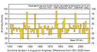
![]() 30th: Another disappointing morning under the grey skies. Pressure 1016 mb had fallen a little and it was calm. The grass was very wet with large guttation droplets at the ends of the leaves. By the afternoon it was brighter with a little sunshine and the temperature rose to 21.0C, second highest of the month and only the third with 20C, or more. It was a very humid day and late in the afternoon flying ants appeared in the garden. Soon eight or more large dragonflies were overhead picking them off, it was a spectacular flying display. Not to miss out on the feast a young robin would was darting out from behind large pots to take several ants. [Rain 0.6 mm; Max 21.0C; Min 15.3C; Grass 15.0C]
30th: Another disappointing morning under the grey skies. Pressure 1016 mb had fallen a little and it was calm. The grass was very wet with large guttation droplets at the ends of the leaves. By the afternoon it was brighter with a little sunshine and the temperature rose to 21.0C, second highest of the month and only the third with 20C, or more. It was a very humid day and late in the afternoon flying ants appeared in the garden. Soon eight or more large dragonflies were overhead picking them off, it was a spectacular flying display. Not to miss out on the feast a young robin would was darting out from behind large pots to take several ants. [Rain 0.6 mm; Max 21.0C; Min 15.3C; Grass 15.0C]
31st: More of the grey stuff with light showers of rain in the night around 02 and 0330 GMT and showers and drizzle leading up to 09 GMT. This only produced 0.6 mm in the rain gauge, but enough to dampen everything once again. Pressure was 1012 mb with low 991 mb S Iceland and a cold front lying from Scotland, through Wales to SW England. The wind was a light S'ly and temperature of 14.7C, dewpoint 13.8C. The day was dull with drizzle at times or rain at times with one drier and brighter spell in the middle of the afternoon; maximum temperature 16.5C. Another sunless day, the 8th in the month. [Rain 6.0 mm; Max 16.8C; Min 14.2C; Grass 12.7C]
The month ended the dullest since before 1930 with sunshine duration at RAF Valley only 826.2h. Warm days were very few and far between with 3 reaching 20C, or more, lowest since before 1979. Rainfall was 107.5 mm (115% and [134%] of average; total for the year January to August was running at 787 mm which was 68.8 mm more than at the end of August 2000.
1st: A showery, but bright, morning with 6 oktas of cumulus clouds. Pressure was 1008 mb with complex low-pressure 996 mb to the NW resulting in a showery SW'ly airflow. Showers were frequent, but slight, with sunny spells in between with the temperature rising to 18.3C. There was heavier shower about 1330 GMT and the the sky was clearing at 1830 GMT. Despite the showers it was the brightest day of the month with solar radiation of 17.53 MJ m -2. Solar radiation is often greater, as today, when cumulus clouds reflect some of the light to the ground. The sun rapidly gets lower in the sky this month and solar day (sunrise to sunset) decreases by about 100 minutes by the end of the month. Solar radiation received at the ground each day can be expected to reduce significantly this month independent of the weather. [Rain 0.3 mm; Max 18.3C; Min 11.1C; Grass 9.4C]
2nd: Another bright morning with a complex sky of cumulus, altocumulus and in the west some altostratus. There was dew on the grass with the grass minimum having been down to 8.0C. Still in the showery airflow showers developed in the morning and afternoon, but there were some sunny spells. There was heavy downpour at 1825 GMT with the sky clearing after a light shower at 20 GMT. [Rain 5.3 mm; Max 17.0C; Min 10.3C; Grass 8.0C]
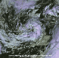 3rd: Cloud had increased since dawn and there was light to moderate rain from 09 GMT. Pressure had fallen to 995 mb with low 988 mb in the NW shown in the Meteosat MSG image at noon tracking across the North Channel towards the Isle of Man. At 1100 GMT with the temperature, that had reached the day's maximum of 14.4C, began to fall quickly to 10.4C. There was heavy rain with strong gusts in the strong to near gale-force SW wind here (a gale was recorded at Valley). The wind and rain moderated in the afternoon and the temperature recovering to 13.2C before a shower of ice pellets then rain fell at 1645 GMT. At 1710 GMT there was further heavy rain with more ice pellets. By 1800 GMT the sky was clearer, but another moderate shower passed over around 2100 GMT and distant thunder and a few flashes of lightning were reported at 2110 GMT. [Rain 14.4 mm; Max 13.2C; Min 9.2C; Grass 7.7C]
4th: Pressure was still low 995 mb and we were still in a showery airstream. The centre of yesterday's had moved over the North Sea, we in a slack area between this and another low 987 mb lying to the SW of Ireland. After an early shower of rain the morning and afternoon were dry here with some good sunny spells, but there was a shower reported to the E of here in Llanallgo at 1330 GMT. Visibility moderate at first improved in the afternoon giving clear views of the Snowdonia Mountains. The evening was mostly clear and sunny with broken cloud at first in the night. [Rain 7.5 mm; Max 17.8C; Min 9.1C; Grass 6.5C]
5th: Soon after midnight frontal cloud encroached and there was light to moderate rain from 0400 GMT accumulating 7.5 mm by 0900 GMT. Pressure had fallen to 990 mb with low 981 mb between Lands End and S Ireland. The NE'ly wind was force 4 and visibility poor. Rain continued more or less continuously becoming intermittent after 1900 GMT. After a short lull there was moderate to heavy rain from 2300 GMT with a line of slow-moving precipitation over Anglesey. In the 24-h 09-09 GMT the autographic raingauge recorded 31.1 mm of rain over 18.2 hours duration. There had been very heavy rain in Wales and south-west England. In the 24-h 06-06 GMT Liscombe in Devon had 65 mm of rain and, unusually, Hawarden 63 mm and Liverpool, Crosby 35 mm. There were 2 severe flood warnings and and 64 flood warnings in operation. In Powys a 17-year-old girl died when a 4X4 overturned on a ford on a swollen river near Llyn Brianne reservoir. [Snowdon, Llyn Llydaw 59.3 mm, Valley 29.4 mm] [Rain 31.1 mm; Max 14.8C; Min 9.1C; Grass 5.8C]
6th: Rain eased after midnight turning intermittent or showery in nature. Pressure 992 mb had risen a little with the low over northern England and occluded frontal cloud over Wales and NW England. The N'ly wind was blowing strong to near gale-force with strong gusts and visibility was poor. Dead branches from treetops had been broken off and the ground was strewn with fallen leaves. Light rain continued intermittently becoming more intense again for a while around 1330 GMT. At 1400 GMT there was hard driving rain on the near gale-force wind, as visibility became very poor. The rain soon eased, but the wind continued into the evening. A sunless day under thick cloud with solar radiation of only 3.63 MJ m -2 , lowest of the month. .Heavy rain caused flash flooding in the Midlands and northern England. In Pickering, North Yorkshire, and Morpeth, Northumberland, several properties and roads were flooded. Lifeboat crews from the east coast to helped with hundreds of evacuations in Morpeth as flood water flowed from the North York Moors. Helicopters rescued several families from rooftops as river levels reached the highest for 40 years. [Valley 7.8 mm] [Rain 2.9 mm; Max 13.2C; Min 12.0C; Grass 12.2C]
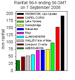 7th: An overcast dull and damp morning, the filling low 996 mb had passed over East Anglia at midnight on its way to the North Sea. Pressure here at 09 GMT had risen to 1007 mb, but the day remained cloudy, dull and sunless except at sunset when a glimpse was seen beneath the sheet of cloud. The wind NE'ly at first force 5 moderated to force 3 by 1630 GMT. The day was dry until 2300 GMT when there was a shower of rain. It had been very wet in parts of North Wales over the past 96-hours. Rainfall totals for Wales (see graphic right) show that Snowdon was wettest with 192 mm, Liscombe (not shown) had 120 mm. Hawarden with 72 mm was not far behind Sennybridge that had 75 mm. [Rain 1.2 mm; Max 14.1C; Min 11.2C; Grass 10.7C]
8th: Pressure 1012 mb continued to rise with a minor ridge developing and it was a brighter morning. The temperature was 14.3C (dewpoint 12.7C) visibility good and light SE'ly wind. By noon more patches of blue sky had appeared and cloud was lifting from the mountaintops. The temperature rose to 16.9C and relative humidity to fall to 66% in the afternoon. After some patchy cloud cleared away around 18 GMT the evening was warm and pleasant in light breezes. [Rain 2.0 mm; Max 16.9C; Min 11.8C; Grass 11.2C]
9th: Cloud encroached again after midnight and there was rain from 05 GMT, heavy for a time in Pentraeth and Benllech, stopping by 0810 GMT. With low 992 mb over S Ireland pressure had fallen here to 1002 mb. The morning brightened in the E'ly breeze and there was some sunshine early in the afternoon with the temperature rising to 18.0C. Later the strengthening wind veered SW'ly reaching strong to near gale force and cloud encroached bringing a little rain about 17 GMT (a gale was recorded at Valley and a mean wind speed for the day of 24.8 mph). There was a 3-h spell of light rain from 20 GMT. [Rain 2.0 mm; Max 18.0C; Min 11.4C; Grass 9.8C]
10th: The day began brightly with some sunny spells before 09 GMT. Pressure was 1006 mb but low 978 mb was W of Ireland with associated frontal cloud moving across the Irish Sea. The wind was S'ly force 4 and there was a little light rain by 1110 GMT. The afternoon was mostly cloudy, some dark clouds and a few sunny spells. By 15 GMT the wind had freshened to force 6 and there was light rain from 2300 GMT. with a heavier spell just after midnight. At RAF Valley a mean wind speed of 24.8 mph was recorded and a peak gust of 54 mph was recorded, highest of the month. [Rain 1.5 mm; Max 17.4C; Min 10.3C; Grass 7.8C]
11th: At midnight the low was 978 mb and tracking N off Donegal, Ireland. Closely packed isobars in the west indicated strong winds in the west. Just after midnight there was a heavier spell of rain marked the passage of a cold front. The temperature had been steady on 17.2C through the evening before falling rapidly to 13.5C, then rising again to remain steady on 14.1C until morning. The 13.5C was the highest minimum of the month. It was mostly cloudy with strong winds continuing and a few spots of rain just before 09 GMT. The winds overnight had brought down some big branches from trees on to the road. Pressure was 999 mb was rising and it was bright at times with some sunshine through the day, but the wind continued strong to near gale-force bringing down more tree branches on to nearby roads. There was a heavy shower at 1605 GMT with light showers continuing until 23 GMT. Valley recorded a mean wind speed of 27.0 mph for the day, highest of the month. [Rain 1.0 mm; Max 17.8C; Min 13.5C; Grass 11.3C]
12th: The sky was mostly clear by morning the remnant occluded frontal cloud passing eastward and dispersing to the N; pressure 1015 mb had risen as a ridge of high-pressure extending from Azores-high 1029 mb passed across from the west. Convective cumulus clouds developed through the morning and the frontal cloud edged back westward in the afternoon. It was mostly cloudy in Llandudno, and over the Snowdonia Mountains, with less over Anglesey particularly late in the afternoon and evening. Winds, generally N or NW'ly, were light through the day that was dry. [Rain 0.0 mm; Max 16.0C; Min 11.0C; Grass 6.9C]
13th: A cloudier start to the day with a light W'ly breeze. In the N of Britain the ridge of high-pressure was being squeezed between high 10345 mb over Scandinavia and low 984 mb S of Greenland. Pressure 1018 mb here was rising in the persistent ridge, and the day was mostly sunny and turned warm with the temperature rising to 19.8C, second highest of the month. Another dry day too and a calm and mostly clear evening with a little cloud on the tops of the Snowdonia Mountains. [Rain 0.0 mm; Max 19.8C; Min 11.0C; Grass 7.5C]
14th: A bright morning with early sunshine and 2 oktas cloud cover soon increasing. Pressure had risen to 1023 mb, but there was frontal cloud edging closer from the west. The temperature rose to 19.1C before cloud encroached at noon. The afternoon was mostly cloudy and there were spots of rain in Holyhead by 1630 GMT and light rain arrived here by 1800 GMT continuing into the night with little or no wind. [Rain 6.3 mm; Max 19.1C; Min 9.7C; Grass 4.5C]
The first 15 days have had 87.7 mm of rainfall and already 95% of the 30-y average. Temperatures have been close to the 30-y average [mean +0.4], but lower than those in September over the past 10 years (mean -0.8).
15th: A wet morning with continuous light rain leading up to 09 GMT before easing. Pressure was little changed with slow-moving frontal cloud lying N to S over Britain. A light SSE'ly breeze freshening to force 4 persisted through the day that was dry until spots of rain at 1450 GMT. There was light rain from 19 GMT turning to heavy drizzle 21 GMT lessening by midnight. [Rain 12.2 mm; Max 14.4C; Min 12.6C; Grass 12.2C]
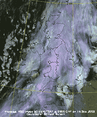 16th: Rain turned moderate from 03 GMT only easing by 07 GMT. At 09 GMT pressure was 1023 mb and there was continuous drizzle, mist and poor visibility, the Meteosat MSG image (left) shows the slow-moving band of thick cloud still persisting over Britain. Rain became moderate to heavy from 0939 GMT for an hour before becoming light intermittent or drizzle, then heavier again for an hour from 1530 GMT. Later in drizzle and mist visibility was very poor, but the rain eventually stopped at 1900 GMT and the sky was starting to clear by 2200 GMT. Rainfall during the event 15/16th totalled 19.7 mm over 17.0 h duration. [Rain 7.5 mm; Max 14.0C; Min 12.0C; Grass 11.6C]
17th: There was broken cloud after midnight with the frontal cloud moving eastward. Pressure was little changed and there had been some rain from 0530 GMT turning to drizzle but stopping just before 09 GMT. The day was mostly cloudy the best of the brightness in the west of Anglesey with Valley having 3.7 h sunshine. The sky was mostly clear by evening. [Rain 0.3 mm; Max 16.0C; Min 9.8C; Grass 4.9C]
18th: With clear spells overnight the grass minimum temperature fell to 4.0C with dew on the grass. It had been fine overnight and concrete was dry by morning. With just a little cloud to the N and W the morning was sunny with moderate visibility in smoke haze. Pressure 1023 mb was unchanged with high-pressure 1025 mb developing across southern Britain. Sunshine continued into the afternoon, the temperature rising to 19.3C, 3rd highest of the month. Although cloud began to encroach in the W late in the afternoon sunshine duration recorded at RAF Valley was 9.0h; solar radiation recorded here 17.07 MJ m -2 was 2nd highest of the month. The sky was overcast by 2100 GMT and there was a shower of rain at 2310 GMT. [Rain 0.1 mm; Max 19.3C; Min 9.2C; Grass 4.0C]
19th: At midnight there was a band of cloud overhead, associated with low 979 mb far to the N over the Greenland Sea, and this was still in the vicinity by morning. At 09 GMT there were 6 oktas of cloud cover and good or very visibility. Pressure was 1027 mb with high-pressure persisting over Britain. The day became bright and sunny at times with a light to gentle S'ly breeze the temperature rose to 18.3C. Sunshine was variable, in Penisarwaun, near Llanrug in Gwynedd, at 1330 GMT it was bright, sunny and warm with very clear views of the mountains. As the wind increased to force 4 some later in the afternoon more cloud developed (4 oktas) particularly over the mountaintops where there was a line of stratocumulus. At Valley the day was cloudier with only 0.6h of sunshine recorded. In the evening here both cloud and wind decreased. [Valley 0.6h] [Rain 0.0 mm; Max 18.3C; Min 11.3C; Grass 7.3C]
20th: There was patchy broken cloud during the night and this was still around in the morning (5 oktas). The grass minimum had been down to 6.3C and there was dew. The temperature at 09 GMT had risen to 15.4C (dewpoint 12.3C) from the overnight minimum of 10.9C. Pressure had risen to 1030 mb with the high 1033 mb over the southern North Sea. Pressure was low 980 mb to the NW over Greenland and there was associated frontal cloud fringing Scotland, but this moved northwards during the day. Broken cloud persisted, however, over in eastern Anglesey and much of North Wales so although bright and dry it was not quite as sunny as other parts. Valley reported 8.4h of sunshine while solar radiation in Llansadwrn was 11.30 MJ m -2 lower than that expected on a clear day. [Valley 8.4h] [Rain 0.0 mm; Max 18.5C; Min 10.9C; Grass 6.3C]
21st: Pressure 1028 mb had fallen, but it was a fine and sunny morning with 3 oktas of cloud cover and a light S'ly breeze. The temperature at 09 GMT was 14.0C (76% relative humidity) and soon rose to 18.9C with relative humidity falling to 59%, lowest of the month. Variable amounts of cloud took the edge off the temperature in the afternoon and convective clouds developed over Snowdonia. The evening was mostly cloudy as a weak cold front encroached from the north-west. It was another dry day. [Rain 0.0 mm; Max 18.9C; Min 12.1C; Grass (11.8C)]
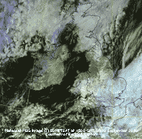 22nd: A mostly cloudy morning with the broken cloud associated with the cold front dispersing as it moved SE. Pressure was 1029 mb with Atlantic-high 1037 mb W of Ireland. There was a moderate to fresh N'ly wind and it felt cool even in brief sunshine and a temperature rising to 16.8C. Visibility poor in the morning improved a little in the afternoon, although cloud increased there were some bright spells. The evening was mostly cloudy with the wind moderating . [Rain 0.0 mm; Max 16.8C; Min 11.2C; Grass 10.4C]
23rd: After midnight the sky cleared and the temperature fell to 8.1C and to 3.9C on the grass with formation of dew. The morning was sunny with little or no cloud in the sky and good visibility. Pressure 1030 mb had risen a little with the high 1033 mb over the N of Scotland. There was a light NE'ly breeze and a temperature if 11.8C at 09 GMT. The day was mostly sunny, but with the cooling breeze off the sea strengthening to force 4 the temperature only rose to 15.6C. Light rain fell in parts of SE England during the day, it was sunniest in coastal areas in the west and around the Irish Sea (see Meteosat MSG image at 15 GMT right). The 11.1 h sunshine duration recorded at RAF Valley was highest in Britain and of the month in Anglesey. Solar radiation of 16.14 MJ m -2 in Llansadwrn was 4th highest of the month. [Valley 11.1h] [Rain trace; Max 15.6C; Min 8.1C; Grass 3.9C]
24th: Cloud cover returned westward before dawn and it was thick enough to give a few spots of light rain at 0745 GMT. High pressure continued to dominate giving mostly dry weather, but the persistent weak frontal cloud did not allow much sunshine in many parts of Britain. The cloud broke slowly during the morning and the afternoon was brighter with a little sunshine, but it kept cool in the moderate NE'ly wind. Later in the afternoon the sky cleared giving a sunny end to the day as the wind lessened. {Valentia 9.8h} [Rain 0.0 mm; Max 15.9C; Min 10.0C; Grass 4.5C]
25th: There was little or no wind overnight, but cloud returned not log after midnight and it was a dull morning. Although pressure 1034 mb had risen as the high 1037 mb intensified over the North Sea the day was overcast, but kept dry here. Although brighter at times in the afternoon with glimpses of sunshine here none was recorded at Valley. Relative humidity fell to 60% as the temperature reached 17.5C. For the second day the sunniest place was Valentia in SW Ireland. {Valentia 8.8h, Valley 0.0h} [Rain 0.0 mm; Max 17.5C; Min 10.4C; Grass 5.3C]
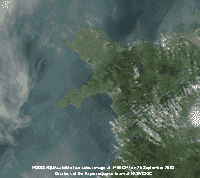 26th: With the sky beginning to clear after midnight it was a cooler night with an air minimum of 8.8C and down to 3.0C on the grass with dew. At 09 GMT there were 2 oktas of reducing cloud cover and a temperature of 13.1C. Pressure had risen to 1036 mb, highest of the month, with the high 1038 mb over the middle of the North Sea. It was a sunny morning with moderate visibility in smoke haze. In a light generally SE'ly breeze the day was sunny and warm, relative humidity dropped to 60% and the temperature rising to 19.9C, highest of the month. Smoke haze (due to pollutant aerosols) thickened through the day in bright sunshine with the outline of the Snowdonia Mountains disappearing as visibility became very poor in the afternoon. The MODIS Aqua satellite true colour image shows the haze developed around Anglesey and North Wales. Clouds are white while the haze is seen as a greyish colour against the darker blue of the sea. Haze can be seen faintly over land, but the mountaintops around Snowdon look clearer the haze thinning at higher altitude. [Valley 9.7h] [Rain 0.0 mm; Max 19.9C; Min 8.8C; Grass 3.0C]
27th: Another clear night, grass minimum 2.6C with dew. At 09 GMT an almost clear sky (1 okta) with moderate, still hazy visibility, and a light S'ly breeze. Pressure remained high across central Britain although it had fallen a little here to 1031 mb. As the S'ly increased to force 4 cloud developed during the morning. The afternoon was bright with some darker clouds (4 oktas) at times before the sky started to clear. At 1700 GMT there were just 2 oktas of cloud cover, but with the sun low in the sky the temperature had fallen to 11C giving a fine, but rather cool evening. Visibility had improved, but views of the mountains was still far from clear. [Rain 0.4 mm; Max 18.3C; Min 8.8C; Grass 2.6C]
28th: The air temperature rose about 02 GMT to 12.5C before falling back to 11C and there was a shower of rain at 03 GMT. A mostly cloudy morning (6 oktas cover) with pressure 1028 mb falling in a ridge from Atlantic-high 1037 mb. The was a weak cold from lying to the NW associated with low 973 mb N Norwegian Sea. There was a light N'ly breeze and a temperature of 12.1C. The morning was bright with sunny spells (4 oktas cover) as the wind strengthened to force 4. Visibility improved from moderate to good by noon, the mountains were again clear. Cloud increased during the afternoon (6 oktas cover) with cloud touching the mountaintops. At 17 GMT it was brighter with a sunnier evening as the cloud started to clear over Anglesey leaving the cloud around the mountaintops. [Rain trace; Max 13.6C; Min 10.8C; Grass 4.7C]
29th: A cloudy morning, the cloud thick enough to give a few spots of rain at 0715 GMT. Overnight in clear spells the air temperature fell to 7.1C and to 0.8C on the grass, both lowest of the month. At 09 GMT the sun was trying to break through, but it started to rain at 0940 GMT. Pressure 1020 mb was still high, in a ridge from Atlantic-high 1035 mb. Although yesterday's front was moving S an occluded front to the NW, associated with low 996 mb between Iceland and Scotland, was moving SE. There was a little more rain during the morning and the afternoon was brighter with some sunshine. Later the moderate W'ly wind strengthened and there was light to moderate rain from 2000 GMT. [Rain 13.9 mm; Max 13.9C; Min 7.1C; Grass 0.8C]
30th: The was a lull in the rain after 03 GMT before moderate to heavy rain from 0500 GMT. Low 988 mb was tracking eastward to the N of Scotland while frontal-lows were strung out over Ireland, N Wales and N England. It was still raining at 09 GMT after 13.9 mm had fallen over 10.5 h duration, and continued turning lighter from noon then intermittently through the afternoon into the evening. The day was sunless and under the thick cloud the temperature reached a maximum 12.8C, lowest of the month. The was a heavier burst around midnight. Rain falling over 14.0h in the 24-h period beginning 09 GMT today was 10.5 mm. [Rain 10.5 mm; Max 12.8C; Min 10.3C; Grass 9.8C]
The month ended with a total rainfall of 120.3 mm (106%) and [131%] of average, highest since 2004. The mean temperature was 13.6C, highest since 2006, but along with 2007 the lowest since 2001. The mean was (-1.0) of the decadal average, but [+0.2] of the 1971-2000 average. Sunshine at RAF Valley with 124.8 h was closed to average..
1st: A mostly cloudy day with frequent light showers of rain with a few bright or sunny spells. Pressure 998 mb was rising with low 981 mb off NW Scotland and cooler air, in circulation around the low, was being brought from the N as the W'ly wind veered NW'ly through the day. The evening had further frequent showers of rain. [Rain 2.4 mm; Max 11.5C; Min 7.2C; Grass 4.4C]
![]() 2nd: With some clear spells overnight the air temperature fell to 4.9C and on the grass to -0.5C giving the first ground frost of the autumn. The last ground frost was on the 16 April and there were 168 frost-free days in-between. The temperature at 09 GMT had risen to 8.0C (dewpoint 6.3C). The morning was bright with just 3 oktas cover of cumulus clouds, a few were weakly towering over Snowdonia where the temperature around the summits was 2.5C. There had been early showers of snow on the mountains in Scotland and melting snow was lying on Cairngorm. The morning here kept mostly sunny with a moderate NW'ly breeze. Showers were confined to the mountains and the N Wales coast and Wirral, some penetrating the Cheshire Gap as far as East Anglia. We were not so lucky in the afternoon having frequent showers of rain then from 1810 GMT they included 3-5 mm ice pellets. During the evening the NW'ly strengthened and was strong to near gale-force at 2100 GMT with a squally shower of ice pellets at 2125 GMT. [Rain 8.1 mm; Max 12.5C; Min 4.9C; Grass -0.5C]
2nd: With some clear spells overnight the air temperature fell to 4.9C and on the grass to -0.5C giving the first ground frost of the autumn. The last ground frost was on the 16 April and there were 168 frost-free days in-between. The temperature at 09 GMT had risen to 8.0C (dewpoint 6.3C). The morning was bright with just 3 oktas cover of cumulus clouds, a few were weakly towering over Snowdonia where the temperature around the summits was 2.5C. There had been early showers of snow on the mountains in Scotland and melting snow was lying on Cairngorm. The morning here kept mostly sunny with a moderate NW'ly breeze. Showers were confined to the mountains and the N Wales coast and Wirral, some penetrating the Cheshire Gap as far as East Anglia. We were not so lucky in the afternoon having frequent showers of rain then from 1810 GMT they included 3-5 mm ice pellets. During the evening the NW'ly strengthened and was strong to near gale-force at 2100 GMT with a squally shower of ice pellets at 2125 GMT. [Rain 8.1 mm; Max 12.5C; Min 4.9C; Grass -0.5C]
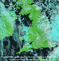 3rd: Shower frequency lessened in the early hours, but resumed after dawn. There was a moderate shower of rain and hail up to 7 mm diameter at 0745 GMT and more at 0733 and 0749 GMT. Temperatures were a little higher overnight, but with frequent wintry showers on the mountains of Snowdonia snow was seen lying ay 2750 ft with a little falling as low as 1200 ft neat Ogwen at 09 GMT. The temperature in the force 5/6 N wind was 7.0C (dewpoint 5.2C). Pressure 1015 mb was rising with low 989 mb S Norway and Atlantic-Azores high 1030 extending a ridge W of Ireland. The result was the bringing down of a cool northerly airstream packed with showers. (The MODIS Terra satellite image (courtesy of NASA/GFSC) captured at 1045 GMT shows the persistent line of showers running through the North Channel, W of the Isle of Man and across Anglesey, Wales and SW England). The morning was bright with glimpses of sunshine between the showers, but the temperature was slow to rise to 10.6C by the afternoon that was sunniest. The cloud lifted to clear the mountaintops, including Snowdon briefly, leaving a line of stratocumulus E-W across the range. Later it was cloudier again with a light shower of rain before evening that at first had mostly clear sky with the grass temperature falling to 1.3C before frontal cloud encroached around 2200 GMT leading to rising temperatures through the night. [Rain 2.9 mm; Max 10.6C; Min 5.6C; Grass 3.6C]
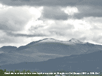 4th: Overcast and a dull dawn with rain from 0700 GMT. Pressure 1006 mb was falling with complex low-pressure to the N, and low 990 mb Cape Wrath tracking NE. Pressure was high 1030 mb over Spain and the Azores. With several fronts moving in from the W the morning had rain and a strengthening SW'ly wind (force 5/6). As deepening low 996 mb SW of Ireland made rapid progress towards the Bristol Channel light to moderate rain continued more or less continuously in the afternoon; the SW'ly reaching strong to gale-force between noon and 15 GMT. Irish Sea ferries were affected and speed restrictions were in force on the Britannia Bridge. There was more rain in the evening with the temperature rising, in warm sector air associated with the approaching low, to a maximum of 13.8C at 2200 GMT. The day was sunless with a low solar radiation value of 2.58 MJ m -2. It was wet in Snowdonia, the ECN AWS on Snowdon at Llyn Llydaw recorded 105.5 mm of rain in the 24-h 09-09 GMT (data courtesy of CCW) compared with the 41.6 mm here in Llansadwrn over the same period. [Rain 41.6 mm; Max 13.8C; Min 4.1C; Grass 1.3C]
5th: With a cold front, associated with low 974 mb Norwegian Sea, moving S across Anglesey the temperature began a rapid fall of over 7C towards the minimum of 6.5C around 05 GMT. The rain ceased just after 0530 GMT and the sky began to clear; by 09 GMT most cloud was banked to the S over the mountains. There was a moderate to fresh NE'ly wind and the temperature was 8.7C (dewpoint 4.1C). The ground was wet, water squeezing out underfoot with no standing water. Just along the road water had gathered up in the corner of a field and was running onto the road. Pressure was 999 mb with frontal-low 991 mb over the Bristol Channel. It was a mostly sunny and dry day; the wind moderated during the afternoon with little or no wind during the evening and night. [Edinburgh 9.6h, Valley 9.0h] [Rain 0.0 mm; Max 11.3C; Min 6.5C; Grass 6.0C]
6th: The sky was clear around dawn and it was a sunny morning at first, but cloud associated with an occluded front seen low in the west soon encroached and it was overcast by noon. The afternoon was mostly dull with a few brighter spells before some spots of drizzle before dusk. During the evening the sky cleared and the SSE'ly breeze had strengthened to force 5 ahead of the approaching front. [Rain 2.9 mm; Max 15.8; Min 4.8C; Grass 1.0C]
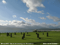 7th: Frontal cloud had reached here by midnight and there was light rain from 0600 GMT that accumulated 2.9 mm by 09 GMT. Pressure was 994 mb with low 872 mb SW Iceland. Developing frontal low 995 mb to the SW off Brest tracking NE had reached the Bristol Channel. The day was dull with intermittent light to moderate rain or drizzle, and poor or very poor visibility. The rain turned to drizzle about 2000 GMT before dying out around 2100 GMT. The day was sunless. [Rain 14.8 mm; Max 15.7C; Min 11.4C; Grass 11.0C]
8th: The sky had started to clear by midnight and it was a cooler night with a grass minimum of 3.8C. Almost clear sky at dawn with a line of cumulus clouds across the Snowdonian range of mountains to the S, a few over Liverpool Bay to the NE and Irish Sea to the W at 08 GMT. By 09 GMT the convective clouds had started to increase and were 5 oktas cover at 10 GMT. It was a fine and sunny morning with pressure 1017 mb rising in a ridge extending from Azores-high 1027 mb. A mostly sunny afternoon with a line of stratocumulus clouds developing over the mountains. A mostly clear evening with less cloud there were good views of the mountaintops. [Rain 0.0 mm; Max 16.1C; Min 7.1C; Grass 3.8C]
9th: The sky was mostly clear and blue after dawn then variable, but small, amounts of cloud developed mainly to the SW. At 09 GMT there were 3 oktas increasing to 6 oktas by 1100 GMT. Pressure 1027 mb had risen with the high 1031 mb now centred over Brittany, France, covering S England and N Spain. Deep, but filling, low 950 mb was S of Greenland and isobars were packed tight to the NW. Warm frontal cloud, associated with the low, lay to the W and rain was moving across Ireland and western Scotland. With only brief glimpses of sunshine in the morning the sky became overcast by afternoon. The wind strengthened to force 6/7 and there were spots of rain by 15 GMT falling intermittently into the evening. [Rain 0.9 mm; Max 15.2C; Min 7.5C; Grass 4.3C]

|
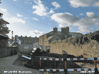 11th: The rain became moderate to heavy between 0200 and 0300 GMT before easing and finally stopping just before 0700 GMT. The temperature was constant on 14.0C on the thermograph chart except for a dip of 1.5C between 2300 and 0100 GMT. At 09 GMT pressure was 1023.1 mb and, with the slow-moving front positioned over Anglesey and N England, we were still under the uniform grey stratus merging to mist. Visibility had improved from very poor at dawn to moderate (4 km). The ground was very wet underfoot, the local soil having reached water saturation point, there was a pool of water developing on the 'cricket field' adjacent to the weather station. Some 'wetter' fields reached saturation earlier in the month. Total rainfall for the year had reached 1004 mm. The afternoon was a little brighter and we even had about 10 minutes of sunshine around 1430 GMT. Later it was cloudier again with some fine drizzle for a while with the front slow to move away. [Rain trace; Max 15.5C; Min 12.2C; Grass 12.0C]
  13th: The morning was mostly cloudy at first, 7 oktas of stratocumulus began to break allowing some sunshine by midmorning. Pressure was 1015 mb with pressure high to the S (1025 mb) Azores to N Italy. Lows 985 mb Norwegian Sea and 983 mb SE Greenland were to the north. In the middle we had a slack SW'ly airflow. Frontal cloud to the NW made its way SE during the middle of the day, but just produced a few spots of drizzle. Maize for cattle fodder was being cut in a field not far from the weather station, some of the cobs looked well developed. Trails of 100 existing and new early maturing varieties are being carried out in Deeside; the use of early varieties being seen as important particularly in such poor weather we have had this year. In the UK maize is just 5% of the production, but in America it is used much more and often with the controversial genetically modified corn. Later the sky cleared to give a fine evening, and the bats were out again. [Rain 12.0 mm; Max 16.5C; Min 12.0C; Grass 8.8C]
 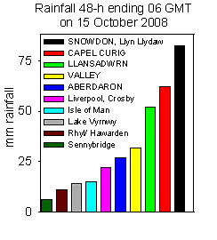 14th: The frontal cloud gave us rain from midnight, it was light to moderate at times but gave way to drizzle just before 09 GMT. It was misty with poor visibility and 100% relative humidity in a temperature of 13.0C. Pressure was steady on 1015 mb and there was a light SW'ly wind. There was a slow-moving wavy front over Anglesey and a band of moderate to heavy rain moved NE during the day. Rainfall was largest in an area from Llansadwrn in SE Anglesey, Bangor, Capel Curig, Waunfawr - a raingauge overflowed on reaching 41.8 mm, and Snowdon. With the soil now saturated with water there was runoff on to roads. A stream of water from higher ground was running across the garden and roads near the weather station were partially flooded. By 1800 GMT 27.5 mm of rain had fallen since 0900 GMT, although lighter the rain continued until 2300 GMT before turning to heavy drizzle. Rainfall for the day 40.3 mm, 52.3 mm in past 48-h; Snowdon had 82.7 mm. There was flood water on the A55 Expressway westbound between Abergwyngregin and Talybont and he railway from Holyhead to London was flooded between Llanfairpwll and Bodorgan. In Bangor 2 students had a lucky escape when their car was washed away fording the Afon Cegin. With the car stuck between 2 trees they clambered on to the roof and called the emergency services on their mobile phone. The Fire Service dealt with several calls to flooding incidents on both the mainland and Anglesey, including Beaumaris where flood prevention measures are being undertaken. [Snowdon, Llyn Llydaw 62.5 mm] [Rain 40.3 mm; Max 13.7C; Min 10.7C; Grass 7.1C]
 The first 15 days saw more than the monthly average of rainfall. The 155.6 mm were (107%) of the past 10-years and [139%] of the 1971-2000 averages. The mean temperature 11.4C was average (0.0) on the decadal, but [+0.8] on the 30-y average a continuation of the warming trend .
16th: Bright at first, but soon becoming cloudier with cumulus clouds developing moderate towering over the Snowdonia Mountains. Pressure was 1015 mb with a weak Atlantic-ridge moving across from the west. We were still in a cool showery NW'ly airflow with some spells of sunshine and a few spots of rain, mostly in the evening at 1915 and 2015 GMT. [Rain 0.6 mm; Max 12.5C; Min 6.1C; Grass 3.0C]
17th: Pressure 1021 mb had risen in the ridge and the wind was more W'ly today. Variable amounts of cloud with showers in the vicinity and here at 1015 GMT. By afternoon it was sunnier and with mostly clear skies overhead at times it was a drying day the Piche evaporimeter indicating 1.2 mm, the most for 5 days! Slight showers returned during the cloudier evening. [Rain 0.3 mm; Max 13.5C; Min 5.3C; Grass 1.8C]
18th: A bright morning, at times, with variable amounts of cloud. Pressure 1015 mb was falling with a weak cold front just to the NW associated with low 973 mb passing over the Denmark Strait N of Iceland. Deepening low 985 mb was in mid-Atlantic and heading our way, so we can expect some rough weather over the next few days. The morning was mostly cloudy with brief glimpses of sunshine, golden beech leaves were falling and being blown along on the moderate to fresh SW'ly wind. During the afternoon the weak front was over giving a little rain before the sky started to clear in a clearer slot during the evening. A bank of cloud in the west advanced slowly reaching here by dusk when several bats were seen, temperature at the time was 11C. [Rain 0.4 mm; Max 12.5C; Min 8.3C; Grass 5.7C]
19th: Pressure 1012 mb was falling with the still deepening low 964 mb S of Iceland. It was windier the S'ly fresh to strong and there was a shower of rain in the hour to 09 GMT. Ragged clouds were low on the mountains with mist on the lower slopes. During the afternoon the wind strengthened to gale force 8, sustained and gusty through to evening. Speed restrictions were in force on the Britannia Bridge and Irish Sea ferry services affected. Rain was light to moderate from 2000 GMT with the wind moderating to near gale-force 7. Rainfall for the month here is 171.4 mm and for the year so far 1079.8 mm; on Snowdon rainfall this month has been 455.9 mm. [Snowdon, Llyn Llydaw 87.9 mm, Capel Curig 52.9 mm] [Rain 14.5 mm; Max 13.6C; Min 10.7C; Grass 8.9C]

|
 22nd: Overnight the air minimum fell to 6.0C and 1.5C on the grass. By morning the W'ly wind was force 2 and the sky mostly clear with cumulus clouds developed mainly over the Snowdonia Mountains. Pressure was 1019 mb and the morning was mostly sunny although there was a slight shower of rain at 1130 GMT. The afternoon was cloudier with some sunny spells with the SW'ly wind freshening to force 5. Four recently emerged red admiral butterflies in perfect condition were seen on the Michaelmas daisy in the garden. A good drying day with 2.4 mm evaporation indicated by the Piche evaporimeter. The soil remains wet, however, with water standing in the hoof marks of cattle left on some surrounding fields. The evening was mostly cloudy with a frontal cloud mass encroaching from the north-west. [Rain 3.0 mm; Max 13.2C; Min 6.0C; Grass 1.5C]
  Pressure 1011 mb was falling and with tight isobars and packed fronts lying to the NW we were in for another wet and windy day. The S'ly wind freshened again in the afternoon reaching gale to strong gale force in heavy rain bringing down a 65 ft limb, 18 inches in diameter at the base, from the beech tree at the weather station. This tree has featured from time to time in the diary over the years. The wind also brought down a tree across the road leaving Pentraeth on the Beaumaris road that passes through Llansadwrn. The road was closed and 2 other trees had to be felled. The AWS at Clogwyn on Snowdon (courtesy of FirstHydro) recorded a gust of 109 mph at 1300 GMT shortly before the trees fell in Llansadwrn. Speed restrictions were again in force on the Britannia Bridge most of the day. Rain was heavy from 1300 to 1500 GMT before turning lighter continuing until 2100 GMT, the 19.5 mm bringing the total for the month up to 198 mm [176%]. [Rain 19.5 mm; Max 13.3C; Min 6.2C; Grass 2.0C]
 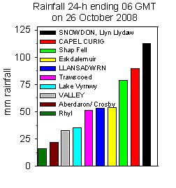 25th: Partial cloudy around midnight, but by morning the sky was mostly overcast with red sky briefly around 07 GMT. The S'ly wind had freshened to strong to gale-force with mws of 46 mph recorded at RAF Valley (top of the force 8 scale) soon reached force 9 with 60 mph gusts. Deep low 972 mb was off Cape Wrath, Scotland, and pressure here 1019.7 mb was falling. Fast ferry services on the Irish Sea had been cancelled as had the Steam Packet Company boats to the Isle of Man; most Scottish island ferries were cancelled or delayed. A 4-day cruise from Liverpool to Dublin and Cork was also cancelled due to the weather, but most of the 1200 passengers decided to stay on board or visit the city instead. Moderate to heavy rain, and strong winds, continued all day from 0830 GMT and into the night only ceasing at 0600 GMT on the 26th, 21.5 h duration. By evening the small stream was running across the garden yet again! Roads in Llansadwrn were partially under water with warning flood signs being set up. We remained in warm sector air through the night, the wavy warm front over the Irish Sea. The 24-h maximum temperature was 13.4C around midnight, it had been about 11C during the day, and the temperature did not begin to fall significantly until 05 GMT with weak cold fronts moving across. The 24-h rainfall 09-09 GMT was 52.8 mm, largest of the month and the second largest daily fall in October at this station (86.0 mm on 22nd in 2004 was largest). It brought the monthly total to within 8 mm of the largest October total of 259.3 mm recorded here at Gadlys Cottage in 1967. [Snowdon, Llyn Llydaw 113.4 mm] [Rain 52.8 mm; Max 13.4C; Min 8.0C; Grass 5.4C]
|
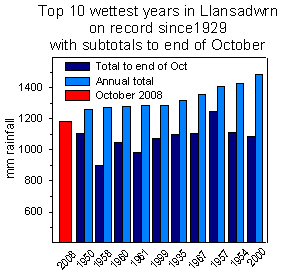 29th: The sky was still cloudy at midnight, but was clear at 04 GMT with the temperature on the grass falling to -3.4C, lowest of the month. The air minimum was 0.0C, lowest of the month and just missing an air frost. A bright start, but cloud on the next frontal system encroached before 09 GMT. Pressure 1008 mb was falling with lows 996 mb over the Western Isles, deepening and tracking S over N Ireland and the Irish Sea, and 992 mb N North Sea. There was a large area of high-pressure (1040 mb) to the SW almost covering the entire Atlantic Ocean. The temperature had risen to 1.8C (dewpoint 0.7C with a 55% chance of snow). Snow was lying on the mountains above 600 ft with moderate accumulations on some slopes. The morning was overcast with light rain commencing at 1330 GMT (temperature 3.6C rising to 5.1C) too high for snow here, but on the mountains with temperatures of -2C around the summits precipitation was of snow. The rain eased by 1730 GMT with showers at 1930 GMT and 2330 GMT. There was some small ice precipitation marks recorded by the hailometer between 0900 and 2200 GMT. [Rain 3.5 mm; Max 5.1C; Min 0.0C; Grass -3.4C]
  30th: At midnight the low 989 mb was over the Bristol Channel and at 09 GMT was 986 mb over Brittany. Pressure here 998 mb was rising and there was a fresh E'ly wind. It was mostly cloudy with lenticular altocumulus clouds in the lee of the Carneddau Mountains. Visibility was good but moderate at first looking towards the Carneddau with snow lying above 1000 ft. The temperature was 4.5C (dewpoint 1.4C with a receding 20% chance snow). There were 1 or 2 glimpses of sunshine during the morning that felt chilly went out in the wind. The afternoon was overcast with a slight shower of rain about 1530 GMT. [Rain trace; Max 31C; Min 1.8C; Grass 0.4C]
 The month ended with rainfall of 282.8 mm, the largest amount in ANY month on record in Llansadwrn since before 1928, that is over 11 inches in 'old money'. It was 195% of the average of the last 10-years and 252% of the 1971-2000 average. Temperatures were below average, the mean 10.1C -1.2C on the decadal and -0.4 on the 30-y averages.
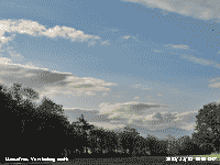 1st: It was a bright beginning of November with snow persisting on the Snowdonia Mountains. Frontal cloud lay in the far N and S of Britain and the day was wet in the SE with 28.2 mm of rainfall reported at Manston. Here, with pressure 1014 mb rising in a ridge of high-pressure from the Atlantic building across Ireland and S Scotland, it was a fine and dry day. There was light to moderate E or NE'ly breeze and evaporation indicated by the Piche evaporimeter was 3.0 mm (09-09 GMT). By evening the sky cleared with bright stars at night. {Manston 28.3 mm, Valley 6.3h} [Rain 0.0 mm; Max 8.2C; Min 3.0C; Grass -0.9C]
2nd: Although clear at night the minimum temperature did not fall below 5.5C and 3.6C on the grass that was dry in the morning. It was a sunny morning with a little variable cloud (3 oktas) blowing along on the moderate NE'ly wind. Pressure had risen to 1019 mb in the high ridge from the Atlantic 1030 mb to S Scotland 1023 mb. Pressure was low 1111 mb over Cherbourg and 990 mb over Spain. The day was mostly sunny and there was a fine evening with a peach coloured sky after sunset usually indicative of aerosols in the atmosphere ![]() . Later cloud encroached and the sky became overcast. [Rain 0.0 mm; Max 9.6C; Min 5.5C; Grass 3.6C]
. Later cloud encroached and the sky became overcast. [Rain 0.0 mm; Max 9.6C; Min 5.5C; Grass 3.6C]
![]()
 3rd: Variable amounts of cloud with clear sky earlier, but by 09 GMT was almost covered with stratus cloud moving in off Liverpool Bay before clearing again. Pressure was 1020 mb within the high established over northern Britain 1023 mb. Pressure was also high 1038 mb W of Iberia with low 1002 mb over the Bay of Biscay with frontal cloud in its circulation affecting France and S Britain. Frontal cloud also lay to the NW, but too far away to spoil another mostly sunny day. There was a light NE'ly breeze with the temperature reaching 9.8C. Visibility during the day was restricted by haze, as seen from Gaerwen
 ![]() . With clear sky in the west there was a spectacularly coloured sunset with a peach afterglow. Saharan dust was high in the atmosphere over southern Britain (see graphic left) and was at least partly responsible for the colours. The sky was overcast before midnight. [Rain 0.0 mm; Max 9.8C; Min 6.4C; Grass 3.9C]
. With clear sky in the west there was a spectacularly coloured sunset with a peach afterglow. Saharan dust was high in the atmosphere over southern Britain (see graphic left) and was at least partly responsible for the colours. The sky was overcast before midnight. [Rain 0.0 mm; Max 9.8C; Min 6.4C; Grass 3.9C]
4th: There was some clear sky around 02 GMT, the grass minimum reading in the morning was 3.4C and there was dew on the grass. At 09 GMT the sky was overcast with moderately high cloud, it was murky in haze with visibility moderate. Pressure 1020 mb was steady with high 1026 mb N Scotland to S Norway. Pressure was low 1009 mb over Biscay and the western Med while W of Iberia it remains high 1025 mb. Deepening low 955 mb was tracking N towards SE Greenland. It was a dull day with no sunshine, but it kept dry. The sky began to clear after dusk. [Valley 12.1C, Tiree Is 5.8h] [Rain trace-dew; Max 9.2C; Min 6.1C; Grass 3.4C]
5th: Under initial clear skies the temperature on the grass fell to 0.7C and there was heavy dew. Before dawn the sky became overcast and there was mist making visibility poor. We were still in the high-pressure area and pressure had risen to 1022 mb. With anticyclonic gloom the morning remained very dull with some spots of fine drizzle and just the hint of a NE'ly breeze. The cloud thickened in the afternoon and there was slight drizzle, just enough to wet the ground. The day was sunless with low solar radiation of 3.03 MJ m -2. Similar into the evening and night.[Rain 0.1 mm; Max 9.6C; Min 6.0C; Grass 0.7C]
6th: A grey dawn, but by 09 GMT there were some breaks appearing over most of the sky. Pressure 1014 mb was falling with a developing Atlantic-low 996 mb W of Ireland. There were extensive snow patches, and gully streaks, remaining on the northern slopes of the mountains. Although a brighter day, any glimpses of sunshine were through thin cloud in the morning. The afternoon remained overcast, but dry with the temperature rising to 10.5C. The 3rd consecutive sunless day. [Rain 1.7 mm; Max 10.5C; Min 7.5C; Grass 6.5C]
7th: There was a spell of rain between 04 and 05 GMT and the morning was showery, but there were sunny spells in between. Pressure 998 mb with the low 988 mb deepening over NW Ireland. It was a day of frequent blustery showers of rain with some sunny spells. The S'ly wind was fresh to strong and touching gale force 8 between 1500 and 1600 GMT; the showers continued into the evening with a moderate to heavy one at 2300 GMT. In the 24-h 09-09 GMT 12 shower events (>0.1 mm) were recorded by the autographic raingauge. [Rain 7.5 mm; Max 11.1C; Min 7.2C; Grass 4.0C]
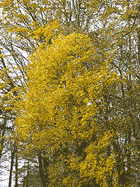 8th: With complex low pressure between Greenland and Iceland, and low 980 mb W of Ireland the morning had more rain showers. Cloud was moderately low and in rain visibility was poor. The wind strengthened around 09 GMT in a shower was SW'ly force 5/6. By noon we were into a small clear slow between frontal systems, so there was about 2 hours of bright sunshine with the temperature rising to 11.8C. Later in the afternoon the next front had encroached. The SW'ly wind strengthened to strong to near gale-force; there was heavy rain from 18-19 GMT with a 2C fall in temperature as a weak cold front passed over. After a few light showers the night was dry and partly cloudy. [Rain 9.8 mm; Max 11.8C; Min 8.1C; Grass 5.8C]
![]() 9th: Pressure 1001 mb was rising as the low 958 mb off NW Scotland was filling. Winds were strongest around the N of Scotland and SW England and the Channel coast. Here the SW'ly was fresh to strong and there were a few breaks in the cloud. Visibility was good, but hazy. There were heavy showers of rain and 3-4 mm ice pellets at 1120, when thunder was heard, and 1220 GMT. The afternoon was very dark under the thick cloud and there was a further heavy shower of rain and ice pellets at 1600 GMT with light rain continuing until 1900 GMT. The SW'ly wind was strong to gale-force in the late afternoon and evening moderating a little before midnight. Rainfall of 15.5 mm (09-09 GMT) was the largest of the month. [Rain 15.5 mm; Max 8.5C; Min 5.0C; Grass 1.9C]
9th: Pressure 1001 mb was rising as the low 958 mb off NW Scotland was filling. Winds were strongest around the N of Scotland and SW England and the Channel coast. Here the SW'ly was fresh to strong and there were a few breaks in the cloud. Visibility was good, but hazy. There were heavy showers of rain and 3-4 mm ice pellets at 1120, when thunder was heard, and 1220 GMT. The afternoon was very dark under the thick cloud and there was a further heavy shower of rain and ice pellets at 1600 GMT with light rain continuing until 1900 GMT. The SW'ly wind was strong to gale-force in the late afternoon and evening moderating a little before midnight. Rainfall of 15.5 mm (09-09 GMT) was the largest of the month. [Rain 15.5 mm; Max 8.5C; Min 5.0C; Grass 1.9C]
10th: A showery morning with a cumulonimbus cloud to the S of the station at 09 GMT and a gusty SW wind. There had been recent showers of rain and ice pellets and soon after a little snow was seen on the top of Carnedd Llewelyn The snow patches, remnants of the deep snow were persisting on the northern slopes with small patches as low as 2300 ft cliffs of Ysgolion Duon. Pressure was 997 mb with the slow-moving low 967 mb just off Cape Wrath, NW Scotland and high 1031 mb over Spain. The morning had some sunshine between the passing convective clouds. The afternoon had some light showers of rain with some sunny spells. During the evening the SW'ly wind freshened to force 6/7, but moderated by midnight. [Rain 2.4 mm; Max 8.5C; Min 4.6C; Grass 1.8C]
11th: A brightening morning, but cloud was slow to lift from the Snowdonia Mountains. Pressure 1001 mb was rising with the Scottish low 984 mb moving E over Aberdeen to the North Sea. The morning saw a little sunshine, the temperature at 09 GMT was 6.8C (dewpoint 5.0C). Trees that have some leaves still attached after the high winds have developed their autumn colours. Beech trees have been looking colourful in any sunshine and the Norway maples (left) have turned golden yellow. The afternoon was mostly sunny across Anglesey, the orographic cloud persisted over Snowdonia. The evening was cloudier. [Rain trace; Max 10.7C; Min 5.9C; Grass 3.2C]

|
Rainfall for the first 15 days was 51.2 mm (37%) and [41%] of average. The mean maximum was 10.5C (-0.2) and [+0.5] while the mean minimum was 6.4 (+0.8) and [+1.9] of the averages for the month as a whole..
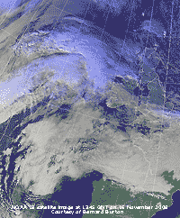 16th: There was slight rain from 0230 to 0800 GMT and at 09 GMT visibility was very poor under low stratus and mist. Pressure 1030 mb had risen in a ridge over western Britain from high 1035 mb slow-moving over the Bay of Biscay. Cloud from an Atlantic frontal-system with developing low W of Ireland stretched over Wales and the Midlands, but was moving south. By afternoon the sky had cleared and with the cloud band S of the Snowdonia Mountains it was a sunny afternoon. The NOAA 18 satellite image shows the frontal cloud over S Britain and the mass of cloud associated with the developing system to the north-west. There is a sheet of stratiform cloud over France and westward.
At dusk more cloud could be seen moving in from the west but nor before the temperature on the grass fell to 0.1C just missing out on a ground frost. As cloud encroached the temperature began to rise from an air minimum of 4.5C. [Rain 1.2 mm; Max 10.1C; Min 8.4C; Grass 6.0C]
17th: With the temperature rising to 9.6C at 09 GMT light rain from 0445 GMT had turned to drizzle. Visibility was poor in drizzle and mist. Pressure 1027 mb was falling with shallow low-pressure (1008 mb W Scotland) and complex frontal system over the British Isles, but pressure remained high 1037 mb to the S. Groups of long-tailed tits have been moving through the trees on the edge of the woodland, 1 or 2 have ventured into the garden and we have seen them on the feeders. It was a dull sunless day, with solar radiation a low 1.54 MJ m -2, about the only sunshine seen today was far to the north, just over an hour in Lerwick. Drizzle at times then intermittent light to moderate rain from 1300 to 2330 GMT. [Rain 10.0 mm; Max 10.3C; Min 4.5C; Grass 0.1C]
18th: The sky had begun to clear towards 09 GMT, above some cumulus overhead were many contrails and cirrus clouds. Pressure 1020 mb was rising with Atlantic-high-pressure 1040 mb becoming dominant. Low 970 mb was over N Norway with further lows 975 mb Greenland and 1008 mb Iceland. The wind had veered N'ly and visibility was moderate. Mistle thrushes have returned to the garden and between them and the blackbirds a good crop of red holly berries had already been finished off. The day had broken cloud with sunny spells. The evening and night were partly cloud covered with the half moon appearing from time to time. [Rain 0.0 mm; Max 10.6C; Min 8.1C; Grass 6.1C]
19th: The morning looked bright at first with the weak sun appearing through cloud over the Snowdonia Mountains. The sky was soon cloudier and the sun did not make another appearance, best of the sunshine today was in SE England. Pressure was 1025 mb and the rest of the day dull with a few spots of misty drizzle from time to time. With airflow during the night still over the relatively warm Atlantic the maximum temperature of 11.3C occurred between 01 and 05 GMT. {Manston 6.7h, Solent 15.1C} [Rain trace; Max 11.3C; Min 6.7C; Grass 1.5C]
20th: Another bright morning at first, then variable amounts of patchy cloud passing over on the light NW'ly wind. Pressure 1020 mb had fallen, the Atlantic-high 1038 mb was still in position with lows far to the N over Iceland (1004 mb) and Lapland (966 mb). The temperature at 09 GMT was 8.8C (dewpoint 7.1C), one of the mistle thrushes did a few notes of voice training at the top of highest tree. It was a dry day with a little sunshine at times. By evening it was overcast and there was rain from 2000 to 2200 GMT, then showery through the night. [Rain 3.6 mm; Max 11.0C; Min 8.0C; Grass 3.8C]
21st: At 09 GMT the sky was overcast, but soon was brighter with some weak sunshine behind cirrostratus clouds. Pressure was 1019 mb with the Atlantic-high 1041 mb. Lows to the E from N Scandinavia 974 mb, Gulf of Bothnia 972 mb and 993 mb S North Sea with a cold front moving S stretching from East Anglia to the Western Isles of Scotland. The temperature had started falling from 2300 GMT yesterday and was 6.6C (dewpoint 4.5C). It was a bright morning with the wind still NNW'ly here and precipitation, possibly wintry, within sight on the Snowdonia Mountains. There were frequent light showers here from 1400 GMT, less in the evening. [Rain 6.7 mm; Max 9.0C; Min 6.0C; Grass 2.6C]
22nd: Showers were frequent again from 0230 GMT, including some small ice pellets, these falling as snow on the Snowdonia Mountains, at 09 GMT snow was lying at 2600 ft on Carnedd Llewelyn. The temperature was 5.5C (dewpoint 3.6C with a 45% chance of snow falling). The day was mostly cloudy with glimpses of sunshine, a prolonged shower of rain from noon, and a falling temperature up to midnight. [Rain 8.5 mm; Max 9.5C; Min 5.0C; Grass 3.6C]
23rd: At midnight the temperature had fallen to a minimum of 3.1C before warm sector air encroached. A warm front associated with low 989 mb had moved across from the west and the temperature started to rise to a 24-h maximum of 9.5C around 0600 GMT. There was rain, moderate to heavy at times, from 0200 GMT with 7.3 mm in the gauge at 09 GMT. At 09 GMT the temperature was 6.5 C (dewpoint 5.1C) and the sky had begun to clear. The NW'ly wind was force 5 and cumulus clouds were in the vicinity. Pressure was 997 mb with low 983 mb over the N of Scotland and high 1038 mb over the Atlantic. It was a windy day with showers and few sunny spells; there was a shower of ice pellets at 1739 GMT. The strong wind continued into the evening. There was a spell of moderate rain from 2200 GMT. [Rain 7.3 mm; Max 8.4C; Min 3.1C; Grass 2.1C]
24th: The rain had eased just after midnight with showers continuing until morning. Further snow had fallen on the mountains and was as low as 1600 ft in central parts of the range. At 09 GMT pressure 1003 mb was rising with Atlantic-high 1037 mb extending a ridge to Iceland. With low 965 mb over the Baltic and S Finland isobars were tight over Britain bring cold air from the Arctic. The temperature was 6.1C, the NE'ly wind force 5, so it felt chilly if you were out in it. Cumulus clouds were in the vicinity, but it kept dry during the morning with a few glimpses of sunshine breaking through. The afternoon had some good spells of sunshine and continued windy and dry. Rainfall 88.5 mm to date was running 51.7 mm behind the wet year 2000. Mean temperature 8.3C was close to the 10-yr average, but +1.0 of the 30-y average. [Rain 0.0 mm; Max 6.9C; Min 4.0C; Grass 0.5C]

|
 27th: Broken cloud and showers of rain from about 04 GMT, just before 09 GMT the sky was almost clear except the Snowdonia mountaintops where the snow had disappeared. Pressure 1007 mb was falling with high 1041 mb now S of Greenland and deepening low 973 mb N of Scotland. Another shower of rain before a band of rain on a cold front moved across from the NW to give a wet blustery morning with a strong SW'ly wind. The temperature at 09 GMT was 9.0C and by 1100 GMT had started to fall and on the mountains was low enough after noon for some precipitation to fall as snow. At noon the sky stated to clear here to give a mostly sunny afternoon. The evening was clear with bright stars and with Venus and Jupiter in close conjunction low in the western sky. [Rain 5.5 mm; Max 9.0C; Min 8.5C; Grass 7.4C]
  30th: The sky was clear after midnight and with falling temperatures another air (-0.4C) and 'white' ground frost (-4.1C). It was the 11th ground frost of the month (+4.9). At 0500 GMT there was light freezing rain that left a glaze of ice on concrete making the paths slivery at 09 GMT, the treated road surface seemed just wet. The temperature had risen to 1.2C (dewpoint -0.2C) and pressure to 1000 mb. High 1027 mb was over the Atlantic and low 988 mb over N France moving NE from the Bay of Biscay. This brought fronts and some rain into S Britain during the morning. Here, it was mostly sunny with a complex sky, mostly cirrus with some cirrocumulus (probably expanded contrails moving over from the NE), stratocumulus and cumulus over the mountains and Irish Sea and some altocumulus as well. I could just see some fog in the Menai Strait near the bridges moving along from the NE. We have a 'big' sky to watch looking all around here! Sunshine continued into the afternoon and with the temperature reaching no higher than 5.0C, lowest of the month, it was chilly out in the wind. Showers affected the west coast, but it kept dry here until 2225 GMT when there was a 'sharp' shower of rain with small 2-3 mm ice pellets. [Rain 0.9 mm; Max 5.0C; Min -0.4C; Grass -4.1C]
 It was a drier month with rainfall 98.5 mm, the first month below average since May (71%) and [79%]. Sunshine 65.3h at Valley was (123%) of average. The mean temperature was 7.7C (-0.5) of the decadal average, but [+0.4] of the 30-y average. There were 2 air frosts (+1.8) and 4 ground frosts (-3.9), hail with 5 days was average.
1st: A fine and bright morning, no air frost but with -1.3C on the grass there were some ice pellets remaining. The ground was unfrozen, but there was some ice formed on water. Sunny spells continued through the day with any showers keeping away. At 1830 GMT there was a good view, between variable cloud, very low in the western sky of an orange coloured crescent moon with Venus and Jupiter close by. At 2200 GMT there was a moderate shower of small wet snow pellets that covered the ground with slush, this was followed by sleet and a few very small flakes of snow. [Rain 4.6 mm; Max 6.0C; Min 0.8C; Grass -1.3C]
![]() 2nd: The minimum air temperature of 0.4C occurred around midnight, then the temperature started to rise reaching 3.5C during precipitation beginning 0230 and ending 0445 GMT. By morning with a clearing sky the temperature had fallen to 1.2C and there were frozen deposits of water on the grass, but not concrete or soil. Pressure was 1006 mb with complex low-pressure over Scotland, S Norway and S Baltic (990 mb). With a mostly clear sky the morning was sunny although cumulus clouds were in the vicinity and passed overhead from time to time. Fresh wet deposits of snow were seen on the northern slopes of the Snowdonia Mountains as low as 1000 ft. There were light to moderate deposits above about 2500 ft on the Carneddau and Snowdon. By noon it was cloudier and there were a few spots of rain and the afternoon was dull with a little broken cloud. During the evening it turned colder and from 2100 GMT there showers of snow pellets, sleet and a few very small flakes of snow later with the temperature on 1.3C. {Valley 6.6C, Sennybridge -4.4C, Hawarden 13.4 mm} [Rain 1.8 mm; Max 4.7C; Min 0.4C; Grass -3.4C]
2nd: The minimum air temperature of 0.4C occurred around midnight, then the temperature started to rise reaching 3.5C during precipitation beginning 0230 and ending 0445 GMT. By morning with a clearing sky the temperature had fallen to 1.2C and there were frozen deposits of water on the grass, but not concrete or soil. Pressure was 1006 mb with complex low-pressure over Scotland, S Norway and S Baltic (990 mb). With a mostly clear sky the morning was sunny although cumulus clouds were in the vicinity and passed overhead from time to time. Fresh wet deposits of snow were seen on the northern slopes of the Snowdonia Mountains as low as 1000 ft. There were light to moderate deposits above about 2500 ft on the Carneddau and Snowdon. By noon it was cloudier and there were a few spots of rain and the afternoon was dull with a little broken cloud. During the evening it turned colder and from 2100 GMT there showers of snow pellets, sleet and a few very small flakes of snow later with the temperature on 1.3C. {Valley 6.6C, Sennybridge -4.4C, Hawarden 13.4 mm} [Rain 1.8 mm; Max 4.7C; Min 0.4C; Grass -3.4C]
 3rd: The air temperature hovered around 2C during the night and was 2.1C (dewpoint -0.1C) at 09 GMT. The sun had risen above the Carneddau Mountains at 0840 GMT and there was light snow lying above 1500 ft with sprinklings as low as 1000 ft. With a grass minimum of -1.7C there were some frozen deposits still to be seen. Pressure 1004 mb was rising in a minor ridge, but soon began to fall as low 968 mb associated fronts to the NW approached. The morning was bright, the wind NE'ly at first became S'ly during the afternoon that continued dry with some sunshine. By dusk cloud had encroached and there were some spots of rain during the evening as the wind strengthened. There was a spell of rain from 2200-2300 GMT. [Rain 6.2 mm; Max 7.6C; Min 1.2C; Grass -1.7C]
![]() 4th: The S'ly wind was strong to gale-force after midnight with rain from 0130 to 0430 GMT. Severe winds affected parts of Snowdonia with mws force 10 and gusts of 75 mph reported in Capel Curig at 06 GMT, and a peak gust of 81 mph. The AWS on Clogwyn, Snowdon, reported gusts up to 95 mph and mws force 11 between 0515 and 0530 GMT. In Llanfairfechan the wind blew over and damaged a garden trampoline. The temperature rose to a maximum of 7.6C around 0500 GMT when pressure had fallen quickly to 971 mb. None of the precipitation here was wintry, even over the mountains was probably mostly rain, the remaining snow looked patchier on the Carneddau. Snow had fallen in Scotland and NE England where driving conditions were difficult and several school were closed. Pressure 977 mb here at 09 GMT was rising and there were a few breaks appearing in the cloud, but these did not develop and the day was dull and sunless. The wind was light to moderate W'ly and there were showers of wet snow pellets at 1345 and 1455 GMT, the latter almost covering the ground. There was intermittent rain from 1700 to 2000 GMT. The soils in Llansadwrn continue to be saturated with water and some fields have standing water on them. [Rain 10.2 mm; Max 6.5C; Min 1.5C; Grass -1.6C]
4th: The S'ly wind was strong to gale-force after midnight with rain from 0130 to 0430 GMT. Severe winds affected parts of Snowdonia with mws force 10 and gusts of 75 mph reported in Capel Curig at 06 GMT, and a peak gust of 81 mph. The AWS on Clogwyn, Snowdon, reported gusts up to 95 mph and mws force 11 between 0515 and 0530 GMT. In Llanfairfechan the wind blew over and damaged a garden trampoline. The temperature rose to a maximum of 7.6C around 0500 GMT when pressure had fallen quickly to 971 mb. None of the precipitation here was wintry, even over the mountains was probably mostly rain, the remaining snow looked patchier on the Carneddau. Snow had fallen in Scotland and NE England where driving conditions were difficult and several school were closed. Pressure 977 mb here at 09 GMT was rising and there were a few breaks appearing in the cloud, but these did not develop and the day was dull and sunless. The wind was light to moderate W'ly and there were showers of wet snow pellets at 1345 and 1455 GMT, the latter almost covering the ground. There was intermittent rain from 1700 to 2000 GMT. The soils in Llansadwrn continue to be saturated with water and some fields have standing water on them. [Rain 10.2 mm; Max 6.5C; Min 1.5C; Grass -1.6C]
5th: At midnight with complex lows 972 mb off the Tay estuary and 975 mb over Ireland there was a spell of light to moderate rain from 0300 to 0500 GMT. A moderate shower of 3-4 mm ice pellets fell at 0615 GMT, then the sky was tending to clear with the temperature on the grass falling to -0.5C. At 09 GMT there were further shower in the vicinity moving in on the NW'ly wind off the Irish Sea. Pressure 986 mb was rising with the slow-moving low off the Tay filling to 978 mb. The morning was mostly cloudy with a few slight showers of rain and brief sunny spells. The afternoon was fine and sunnier, but turned cloudier by evening. [Rain 0.2 mm; Max 7.5C; Min 3.2C; Grass -0.5C]
 6th: With a mostly cloudy sky overnight there was no frost. It was a bright morning with well broken cloud and broad crepuscular rays over the Nant Ffrancon Pass. Pressure 1015 mb was rising as high pressure built over Britain with Atlantic-low 998 mb SW of the Bristol Channel. The afternoon was mostly sunny with clear skies with some patchy cloud encroaching in the west by dusk. Another fine view of Venus and Jupiter low to the SW with the half moon shining brightly to the SSE now higher in the sky. [Rain trace/fr; Max 6.8C; Min 3.0C; Grass 0.8C]
7th: Largely clear sky overnight with the temperature on the grass falling to -5.5C. The fields were covered with white frost, mainly frozen moderate dew, I did not see any hoar frost; the air temperature remaining just above freezing at 0.1C. Pressure 1027 mb continued to rise and it was a sunny morning, cumulus and altocumulus clouds at first increasing then decreasing by 1100 GMT. Visibility was good, but becoming hazier through the morning although clearer by afternoon. The afternoon, sunny at first, became overcast later as frontal cloud encroached from the north-west. [Rain 1.1 mm; Max 7.8C; Min 0.1C; Grass -5.5C]
8th: No overnight frost, the grass minimum reading (24-h) of 0.0C was at 09 GMT yesterday. Light rain commenced just before 07 GMT and at 09 GMT visibility was very poor in the low cloud, mist and rain. Pressure 1019 mb was falling in a trough associated with low 970 mb over the N Norwegian Sea. A slow-moving cold front was moving SE and rain continued, moderate at times, until 1700 GMT with slowly falling temperature. It was cold enough (about 4C here) for the precipitation to fall as snow on the mountains. During the evening there were frequent showers of rain mixed with small (2-3 mm) ice pellets, these died out by midnight. The day was sunless with a low solar radiation of 1.26 MJ m -2. Rainfall of 21.0 mm was the largest of the month. [Rain 21.0 mm; Max 7.8C; Min 2.3C; Grass 0.0C]
 9th: There were some clear spells overnight and the temperature on the grass fell to -1.5C. Showers of rain and ice pellets resumed from first light; there was one at 09 GMT with the temperature on 3.7C (dewpoint 3.2C). Pressure 1022 mb was rising and, with the cold front over the English Channel, there were some bright spells in the morning then turned cloudier again by noon. There was a light shower of snow pellets at 1310 GMT, the cloud was slow to clear allowing a few brief sunny spells later. When the cloud lifted from the mountains fresh snow was seen above 1800 ft. [Rain 1.2 mm; Max 6.3C; Min 2.2C; Grass -1.5C]
10th: A bright morning, but there were wintry showers around moving in off the Irish Sea. There had been a light shower at 02 GMT and another of small (2 mm) hard opaque ice pellets at 09 GMT. Pressure 1022 mb was falling and between a ridge high-pressure (1033 mb) over the Atlantic to the west and low-pressure (1008 mb) over the North Sea we we in a cool northerly airflow. The morning soon brightened and the afternoon was mostly sunny over SE Anglesey. Cloud persisted over the mountains of Snowdonia, where some more snow added to the then moderate accumulations around the summits. The sky was mostly clear during the evening when there was bright moonlight; the Moon is nearing its 'biggest and brightest' of the year (on the 12th) reaching its perigee (closest to Earth). It is 14% bigger and 30% brighter than lesser full Moons seen earlier in the year. [Rain 0.1 mm; Max 6.8C; Min 3.0C; Grass -0.7C]

|

|
The first 15 days had 67.0 mm of rain (51%) and [58%] of the monthly average. The mean temperature was 4.2C , lowest since 1989 (first 15-days data) and ranking 4th since before 1979, (-1.8) and [-1.3] of the monthly average. There were 12 ground frosts.
16th: Cloud was increasing after dawn leaving the only brightness beyond Conwy along the North Wales coast. There had been a thaw of mountain snow overnight leaving some cover around the summits and quite large patches down to 1600 ft. Low grey stratus with mist had encroached by 09 GMT to give a sunless day, solar radiation of 0.81 MJ m -2. Slight drizzle at times in the morning and rain in the afternoon from 1400 to 1800 GMT. The electricity supply was off all day, Scottish Power said potential problems had been identified in the area and needed to be rectified, power was restored before dusk. The sky began to clear during the evening. [Rain 12.2 mm; Max 9.5C; Min 2.2C; Grass -1.2C]
17th: With mostly clear sky after midnight the temperature on the grass fell to -3.7C freezing the dew that had formed. Concrete was damp, but unfrozen and the air temperature had fallen no lower than 0.8C keeping the month frost-free so far. The morning was sunny at first with almost clear sky over Anglesey with a line of stratocumulus over the mountains of Snowdonia. The afternoon was cloudier and became overcast later on, just thick enough to give a few spots of drizzle at dusk. There was a brief and small patch of red sky in the west. [Rain trace; Max 9.6C; Min 0.8C; Grass -3.7C]
 18th: A bright enough start to the day with moderately high altostratus cloud, a bank of stratocumulus over the mountains with altocumulus cloud. I gave it a 6 okta cover, there was some blue sky, but the sun kept behind the cloud and the day was recorded as sunless. Pressure was 1013 mb with high-pressure 1034 mb W of Iberia and complex low-pressure 961 mb Well to the N of Scotland. There was a moderate SW'ly wind and visibility was poor; cloud thickness increased and there was some showery rain from 1430 to 1630 GMT as a cold front passed over around 1600 GMT. There was some broken cloud later with occasional glimpses of the waning moon. {Hawarden 12.8C, Shoreham -0.6C, Tulloch Bridge 31.4 mm, Capel Curig 12.6C, Aberdaron 1.0h}
[Rain 1.7 mm; Max 10.1C; Min 1.0C; Grass -2.2C]
 19th: Some clear sky overhead at first with stratocumulus over the mountains, but soon overcast with moderately high altostratus although this did not prevent seeing the weak sun rise over the Carneddau Mountains, the closest to this year's cloud covered winter solstice. Pressure 1022 mb had risen in a weak ridge over Britain, pressure was still high 1034 mb W of Iberia, but deep low 972 mb was S of Iceland and W of Scotland and with tightening isobars the SW'ly wind force 3 at 09 GMT was soon strengthening with pressure falling. Cloud thickened and by afternoon the wind had reached strong to gale force 8. At Aberdaron force 10 with a gust of 74 mph was logged at 1500 GMT, force 9 at Capel Curig, force 8 in Llansadwrn and in Beaumaris shoppers were struggling against the wind and rain. [Rain 9.0 mm; Max 9.9C; Min 2.3C; Grass -1.2C]
20th: Overcast with moderate fog that was becoming denser from dawn. The day kept very dull with drizzle at times and a strengthening SW'ly wind. A very low solar radiation value of 0.07 MJ m -2. [Rain 0.3 mm; Max 10.1C; Min 4.6C; Grass 3.5C]
21st: Another misty day with moderate visibility. Trees were dripping with moisture from the mist, visibility deteriorated during the afternoon with fog into the evening. [Rain 2.6 mm; Max 10.0C; Min 7.8C; Grass 6.8C]
22nd: Anglesey was enveloped in low cloud and fog all day. Another day of dripping trees with the ground surface very wet and soil saturated with water. The temperature during the morning reached 10.3C, highest of the month. There was light to moderate drizzle, not showing up on the rainfall radar, that accumulated 1.4 mm in the raingauge. [Rain 1.4 mm; Max 10.3C; Min 9.4C; Grass 9.2C]
23rd: Pressure 1033 mb continued to rise slowly here with high 1037 mb over SE England and N France. A little brighter this morning, still overcast, but the cloud lightening over the mountains and the trees had stopped dripping. A light to moderate S'ly breeze and good, but hazy visibility and cloud hugging the mountaintops. I glimpsed a little sunshine as the cloud broke at the head of the Nant Ffrancon Pass in the morning, but here another dull sunless day, the 5th in succession. At least it was a dry day with a little evaporation. [Rain 0.0 mm; Max 7.7C; Min 6.4C; Grass 5.6C]
24th: With pressure 1035 mb within the high 1036 mb centred over Britain the sky began to clear before 09 GMT, by 1000 GMT there was sunshine. There was a bank of cloud over the mountains, but the clearing sky over Anglesey led to the temperature falling (5.8C, dewpoint 4.6C at 09 GMT) to 5.0C. A sunny morning with little (SE'ly) or no wind with chimney smoke rising vertically. By afternoon the cloud had returned and it was overcast into the evening. A dry day. [Rain 0.0 mm; Max 8.7C; Min 5.8C; Grass 0.8C]
25th: There was some clear sky overnight and the temperature on the grass fell to 0.1C, so no frost, and there was very little dew formed. Christmas morning was fine, but not very bright at first, with moderately high cloud the mountaintops were visible where some patches of snow remained. A flock of starlings were twittering in the tops of the trees and 2 male blackbirds were waiting for some tit bits at the weather station. Later a male bullfinch was seen, a regular visitor to the garden this winter, and the long-tailed tits made their usual visits to the fatty-cake. Remnant frontal cloud, over Wales and SW England, broke up in the lee of the mountains and the day was mostly bright with a little weak sunshine on the coast between Conwy and Bangor, and later in SE Anglesey. The evening and night were clear with frost and mist forming early in valleys and hollows. [Rain 0.0 mm; Max 8.5C; Min 3.9C; Grass 0.1C]
26th: Dew had frozen white on the grass with the grass minimum falling to -3.0C. Pressure 1038 mb was rising in the high 1048 mb S Scandinavia and Baltic. The sky was mostly clear with the sun rising over the mountaintops at 0905 GMT. Visibility was good with some haze and the wind a light ENE'ly. The day was sunny having the maximum possible sunshine, here 6.8h the sun rising above the mountains at 0905 GMT and setting at 1555 GMT. Solar radiation was 4.24 MJ m -2. At Tywyn Aberffraw some of the dune slacks were filled with water and as there was no wind to form ripples dunes were clearly reflected. Water was seeping out of the slacks on to the beach ![]() that had moderate amounts of seaweed washed up on the neap tides
that had moderate amounts of seaweed washed up on the neap tides ![]() . On the fixed dunes mosses were luxuriant and looking very green. {Scilly Is 7.7C, Valley 6.8C, Thorney Is 7.6h, Aberdaron 6.8h}[Rain 0.0 mm; Max 7.3C; Min 1.2C; Grass -3.0C]
. On the fixed dunes mosses were luxuriant and looking very green. {Scilly Is 7.7C, Valley 6.8C, Thorney Is 7.6h, Aberdaron 6.8h}[Rain 0.0 mm; Max 7.3C; Min 1.2C; Grass -3.0C]

|
 28th: Another clear night with ground frost -2.7C leaving the soil surface frozen and a temperature down to 0.6C at 5 cm deep. Several altocumulus lenticularis clouds (lee-waves) to the SE and S of the station from dawn, some coloured red in the rising sun. A sunny morning with a moderate E'ly wind. Pressure 1032 mb was falling with the high 1046 mb over Norway declining. The afternoon was sunny with the wind moderating, another sunny day. A clear blood-red sunset and an azure blue and peach afterglow, photo (right) taken nearly an hour after sunset. {Scilly Is 8.2C, Llansadwrn 6.0C, Hawarden -2.9C, Aberdaron 7.6h} [Rain 0.0 mm; Max 6.0C; Min 0.6C; Grass -2.7C]
 With a mean temperature of 4.6C (-1.5) and [-0.9] of average, lowest since 1996, the month ended one of the 7 coldest Decembers since 1979. There were 3 days (-0.6) with air frost and 22 days (+8.1) of ground frost. Despite the absence of snow locally there were 9 days with hail (+3.0). Rainfall totalled 94.3 mm (71%) and [82%] of average, lowest since 2005, and one of the 26 driest Decembers since 1928.
At the end of the year the mean temperature was 10.2C (-0.30 and [+0.3] of the decadal and 1971-2000 averages respectively, lowest since 2005 ranking one of the 7 lowest here since before 1979. Rainfall totalled 1382.9 mm (117%) and [135%] of average, highest since 2000 and ranking 4th largest in Llansadwrn since before 1928.
|
|
|
These pages are designed and written by Donald Perkins © 1998 - 2008 Page first dated 3 February 2008 |