
Llansadwrn (Anglesey) Weather
Diary 2007


|
Llansadwrn (Anglesey) Weather
|

|
Where you see these icons click for a pop-up graphic
![]()
![]()
![]()
![]()
![]()
![]()
![]()
Most pop-up graphics in the diary are self closing on next click of mouse. Javascript must be enabled if you are using some pop-up disabling software or a firewall. Please continue to close older graphics on some other pages as usual; they may go into your toolbar if you click something else first. You can click on most thumbnail images to see a larger version.
1st: After a shower of snow pellets at 0350 GMT the year began calmer and brighter, the sky almost clear at 07 GMT was cloudier by 09 GMT. There was a light SW'ly breeze and pressure 1012 mb was rising with the maturing low 971 mb over the coast of S Norway. The strong winds had transferred to the N North Sea. The morning was mostly cloudy, with convective clouds developing and sferics recorded to the S over the mountains, and there was a little light rain around noon. The afternoon was mostly dry with the sky starting to clear towards sunset. The evening was mostly clear with moonshine. [Rain 0.5 mm; Max 7.4C; Min 4.6C; Grass 0.8C]
2nd: It turned cloudier after midnight but kept dry. At 09 GMT with pressure 1020 mb rising, as a ridge of high-pressure moved across from the W, the sky started to clear. Pressure was low over the Atlantic and over Italy and the Adriatic. The morning was bright in the moderate NW'ly wind; the mountains remained obscured with cloud on the summits above 2500 ft. The afternoon had some good sunshine but turned cloudier by 15 GMT. The evening was clear at times with the minimum temperature 4.2C and 0.5C on the grass about 1800 GMT. Thereafter warm frontal cloud encroached, the temperature rose steadily, and there was intermittent light rain from 2230 GMT. [Rain 3.0 mm; Max 10.5C; Min 4.2C; Grass 0.5C]
 4th: Another overcast and dull morning. Visibility was poor in mist under the low stratus cloudbase, there was drizzle and light rain at times. Pressure 1010 mb was rising as another minor ridge moved across from the W. But, another low 966 mb S of Greenland had associated fronts W of Ireland with the threat of some more wet and windy weather to come. A few breaks appeared in the cloud from time to time, but no sunshine broke through until a glimpse under the cloud at sunset. With temperatures keeping up there was little sign of any colder air to bring any snowfall to the mountains, which so far this season, have seen little. {Capel Curig 22.8 mm} [Rain 2.0 mm; Max 9.7C; Min 7.5C; Grass 5.1C]
 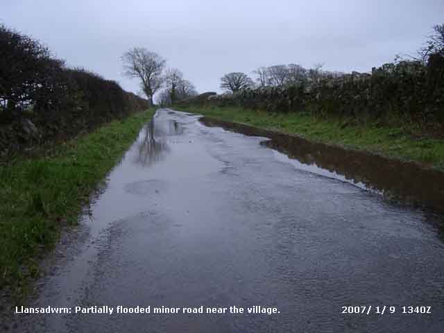 8th: The sky partially cleared after midnight and the air temperature fell to 4.3C and on the grass to 0.6C. In January it would be expected that such a clear spell at night would result in a frost, but there has been no air frost this winter, so far. Before dawn frontal cloud had encroached from the SW bringing a band of rain off the Irish Sea by 09 GMT. Pressure 996 mb was falling quickly as the night's ridge gave way to more Atlantic low-pressure. There was light rain through the morning drying up before noon, but it kept overcast with the S'ly wind freshening to force 5/6. During the afternoon, that was mostly dry, pressure bottomed at 988 mb. There was intermittent drizzle and some during the evening as the wind once again freshened. {Prestatyn 15C, Capel Curig 35.6 mm} [Rain 6.4 mm; Max 11.7C; Min 4.3C; Grass 0.6C]
 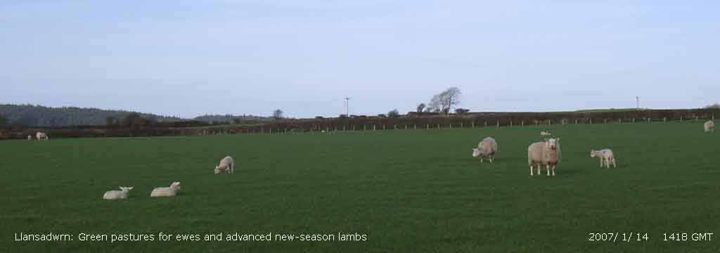 14th: A sunny morning! With just 2 oktas of cloud cover. Visibility was a hazy 12 km and the SW'ly wind force 5. There was slight dew on the grass with the minimum down to 0.1C, so again no frost, and drying off in the wind. The day kept bright and sunny although thin cloud developed during the afternoon and was notable because no gale was recorded; solar radiation measurement indicated that it was the brightest day since 26th November. A line of stratocumulus clouds formed over the green-looking Snowdonia Mountains, seen in this photograph
 Temperatures during the first 15 days ran (+2.4) and [+3.0] of average with the mean on 7.9C. Rainfall was 82.4 mm, (83%) and [84%] of the average. There was no air frost and there has not been an air frost this winter so far, and there have been very few days with any snow on the mountains..
16th: It was still overcast at dawn but the cloud had thinned a little and there were 1 or 2 holes appearing at 09 GMT. Pressure 1014 mb was rising and the morning slowly became bright and by noon there was some sunshine. Visibility was good, or very good, but most of the mountains remained obscured with the cloudbase about 1600 ft; no ice precipitation was seen. By 1400 GMT the sky was overcast and there was drizzle and light rain. As another complex frontal system began to cross the Irish Sea the wind strengthened during the evening, but the sky was clear at 2200 GMT. [Rain 10.3 mm; Max 9.5C; Min 5.0C; Grass 3.2C] 18th: Rain continued after midnight with pressure 994 mb falling. At 0245 mb the Oregon storm warning sounded as pressure 982 mb was falling quickly. The wind had eased but rain continued 0430 GMT. Between and soon the wind strengthened to gale force 8, with strong gusts rattling the slates, and the temperature rose to the maximum of 11.2C at 0700 GMT. At 0900 GMT pressure 977 mb had bottomed and had started to rise with the low 960 mb off Malin Head ontrack for Scotland. The WSW'ly wind had eased to force 7 and the sky starting to clear. By 0930 GMT there was a clearly define edge to the cloud heading SE and had cleared to 3 oktas cover. The wind then notched back to force 8; it was a rough morning and with tree debris flying about on the wind the observer retreated to the weather house. The electricity supply failed between 1040 and 1300 GMT, thousands more were affected across Wales; in N England many households in Yorkshire were still without power the next day.. The morning was bright with sunny spells between mainly cumulus clouds; the wind strengthened to force 9 at times and RAF Valley reported a gust of 77 mph at 1300 GMT.
 As the low crossed S Scotland the wind veered more NW'ly and high wind gusts were experienced along the North Wales coast from Rhyl 82 mph and Hilbre Island 83 mph at 1300 GMT, and 84 mph at Liverpool, Crosby at 1400 GMT. Several trees had been blown over or damaged in the area. During a high gust a large pine tree 50 m away from the weather station screen was sheared 2 m from the ground and fell in a SE'ly direction (80 degree magnetic). It was across the other side of the passing road and, although near the roadside, it fell safely away from the road just catching the stay of a communications pole that remained standing but slightly off-vertical. Another tree, an 18 m tall rowan, was uprooted and blown over in the wood
 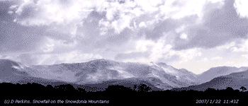 22nd: At midnight there was a moderate shower of snow pellets some snow flakes and sleet. There was further precipitation around 0300 GMT before the sky started to clear. At 09 GMT there was snow lying on the Snowdonia Mountains generally above 1000 ft, but a sprinkling was seen in the Ogwen valley as low 500 ft. Pressure 1008 mb was rising with the Atlantic-high 1045 mb SE Iceland. The low-pressure had moved E over Russia and, between the two, a colder NE'ly airflow from the Arctic had been introduced. The morning was mostly sunny and, with further sky clearance by 11 GMT, it was a mostly sunny day with solar radiation brightest since 9 November 2006. The wind lessened and backed N'ly during the afternoon. It was a mostly clear evening. [Rain trace; Max 5.7C; Min 2.1C; Grass 0.7C]
 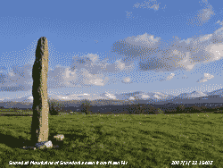 23rd: There was a little moderately high cloud around at night and with a light breeze the air temperature kept above 1.8C. The temperature on the grass, exposed to the N/NE'ly wind, did not fall below 0.2C but I did find a thin layer of ice on a sheltered tray of water kept for the birds. I found a sprinkling of small, 1-2 mm diameter perfectly conical snow pellets on the ground. It was a sunny morning with good views of the snow lying on the Snowdonia Mountains above 1000 ft. Pressure was 1028 mb with the high 1043 mb to the W, a shallow low 1022 mb was tracking S over the Norwegian Sea bringing a warm front on to NW Scotland. Low 998 mb was over the S France. The day turned out to be cloudier than yesterday with a daytime maximum of 3.6C. At dusk with pressure falling the approaching warm front was over the Irish Sea; from 1800 to 1830 GMT with the temperature falling to 1.7C there was precipitation of small snowflakes turning to sleet. The temperature fall was likely due to the snowflakes melting and extracting heat from the air. With the precipitation turning increasing to rain the temperature rose again. [Rain 2.6 mm; Max 5.5C; Min 1.8C; Grass 0.2C]
 The month ended with a mean temperature of 6.9C (+1.4) and [+2.0] of the January average. It was the warmest January on record here since before 1979 and, the Met Office says, in the UK since 1916. Rainfall was 138.2 mm (138%) and [141%] of average. There was only 1 air frost, this -4.0 days of average, but we had no air frosts in Januaries of 1990, 2000 and 2005 so it's not that unusual. Ground frosts numbered 4, this (-9.8) of average. The soil temperature at 30 cm was 7.0C, (+1.8) and the grass grew throughout the month, again not that unusual here. Sunshine was near average.
![]()
![]()
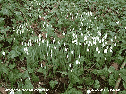 1st: Another rather murky morning overcast with altostratus cloud and fog in the Menai Strait. The overnight minimum temperature was 7.5C, highest of the month. The temperature here was 8.2C and would be higher on the mountaintops today. Radio-sonde upper air readings at Nottingham at midnight indicated a lower temperature around 4.6C at 2750 ft, but 11.2C at 3400 ft. The photograph taken at 1113 GMT shows a view of the Carneddau Mountains (3485 ft) from the weather station. Snowdon was in the clear too this morning! Pressure 1030 mb was rising and some clearer sky could be seen later to the SE beyond the mountains, but it never reached here, the day was sunless but the temperature rose to 10.7C. As the cold front began to move heading SE during the evening, there was no precipitation, but as the cloud began to break up fog formed from 2100 GMT reducing visibility to 100 m. [Rain trace fog/dew; Max 10.7C; Min 7.5C; Grass 3.8C]
 4th: Most of the night was clear, with frost on the ground and bright moonlight, but I did see fog around between 03 and 04 GMT. It was another bright and sunny morning with some beautiful colours, ranging from peach to dark red, before sunrise over the Carneddau. At 09 GMT visibility was good >12 km, but there was fog in the vicinity (Red Wharf Bay) and rolling up the Menai Strait from Liverpool Bay. At over 300 ft we miss this but it did come across for a while between 0920 and 1030 GMT reducing visibility to 1 km at times. Over night deposition of frosted dew and fog averaged 0.4 mm, measured by micro lysimeters. There was a trace in the rain gauge bottle. Pressure 1034 mb was falling with a slack ridge persisting across Britain W to E. For a time the sky was cloudier, but started to clear again by 1100 GMT giving another mostly sunny afternoon. The maximum temperature
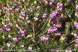
  reached in the Stevenson screen was 9.5C. The light NE'ly off Red Wharf Bay persisted, but in the garden humming sounds attracted me to look at flowering Ericas on a sheltered rockery bank. It was covered with honeybees, attracted out of a neighbours hives by the sunshine. There was a large bumble bee too. We have different Ericas, somewhat out of favour in gardening circles at the moment, in flower in every month of the year. They are thoroughly recommended providing interest all the year round, and good for bees and flying insects. And, nothing to do with climate change I must say! So there is something for the bees to find any day they fancy a flight, it does seem a little early for them as the last 2 years have seen them about in March. At 1700 GMT the fog was blowing in again off the sea, visibility was down to < 500 m. The temperature was 2.9C and dewpoint 2.6C, theoretically a 25% chance of ice precipitation but there was none. [Rain trace dw+fg; Max 9.5C; Min 0.5C; Grass -2.9C]
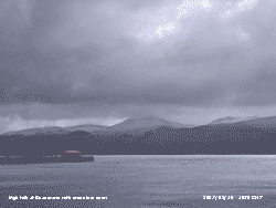
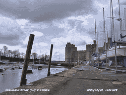
 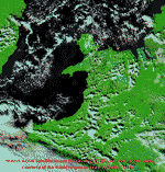 Pressure 1010 mb was still falling. The sky was clear apart from some cumulus and cumulonimbus clouds passing to the north of us over Liverpool Bay. The morning was mostly sunny and with little or no wind at SW entrance to the Menai Strait at Caernarfon the water had barely a ripple under the blue sky. One of the passing cumulonimbus clouds can be seen in the photograph. The maximum temperature struggled to reach 4.9C and the afternoon was at times a little cloudier, but the visibility was exceptionally good and being over 80 km the Isle of Man could be seen. The evening was mostly clear with bright stars visible and the air temperature had fallen to -0.2C by 2000 GMT. [Rain 0.0 mm; Max 4.9C; Min -2.0C; Grass -6.3C]

 10th: There was light sleety rain from just before 06 GMT. At 09 GMT the temperature was 2.3C (dewpoint of 1.8C) and a 40% chance of ice precipitation. Wet snow was lying on the mountains at 750 ft and down to 500 ft on slopes near Bethesda and in the Ogwen Valley. As the sky cleared moderate accumulations could be seen on the mountaintops where, in the E'ly wind, small cornices had developed on some rocky ridges on the Carneddau. With the temperature rising (to 9.0C here) thaw of the snow was rapid so that at 1300 GMT it was looking very patchy at 1500 ft and at the end of the still sunny day even the mountaintops. By evening more cloud was moving across the sky and there was slight rain from 2200 GMT. Precipitation over the 24-h (09 to 09 GMT) was 11.1 mm, largest of the month. {Guernsey 13C, Southend -4C, Newcastle 20 mm, Hawarden 17 mm, Lerwick 4.6h} [Rain 11.1 mm; Max 9.0C; Min 0.9C; Grass -0.5C]
  11th: Frontal cloud moved across during the night the slight rain at midnight becoming showery with heavy bursts around 04 and 0630 GMT included small ice pellets. At 09 GMT the sky had cleared to 2 oktas and pressure 984 mb was rising. The view towards the mountains was misty with visibility only moderate. It was a sunny morning with a deep blue sky and a light SW'ly breeze. During the afternoon there was broken cloud but it kept bright although the SW'ly wind freshened to force 5. By evening frontal cloud associated with low 974 mb SW Ireland encroached and there was drizzle followed by rain from 2300 GMT. {Guernsey 13C, Buxton 0C, Aboyne 32 mm, Valley 4.6h} [Rain 3.8 mm; Max 10.5C; Min 2.3C; Grass -0.6C]
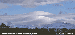
  13th: Pressure 1004 mb had risen in a transient ridge and once again the sky had cleared a little (6/8), but the brightness soon passed by. At first in the light S'ly wind cloud was high and some lenticular clouds (lee-wave) were seen upwind of the summit of Snowdon and, in a patch of blue overhead, some jetstream cirrus. In the far west low darker frontal cloud, associated with Atlantic-low 964 mb SW of Iceland, had already brought a band of rain over SW Ireland and the Celtic Sea. The afternoon was increasingly gloomy as thicker cloud moved in slowly from the W. There was fine drizzle in Caernarfon at 1530 GMT but it did not reached here until 1700 GMT. There was intermittent and showery light rain from 1730 to 2300 GMT. [Rain 1.2 mm; Max 8.6C; Min 5.5C; Grass 3.2C]
 The first 14 days had a mean temperature of 4.9C (-1.0) of the decadal and [-0.4] of the 1971-2000 average. Rainfall was 20.1 mm (19%) and [27%] of average.
 18th: A bright morning with heavy dew on the grass that was slightly frosted with many clear frozen dewdrops. There was mist lying in the Menai Strait but the mountaintops were in the clear. The mistle thrush was singing from the tallest tree and a greater spotted woodpecker was drumming on a resonant branch of another. A buzzard flew past within 20 m of the screen being chased by a large number of rooks, although not yet nesting the rooks are protective of their nest positions. Pressure 1020 mb was rising as a ridge of high-pressure passed over from the W. There was just a light air from the NE and the temperature rose to 12.6C in the sunshine. A red admiral butterfly tempted out of hibernation was flying around and rested on the n louvres of the Stevenson Screen. I had seen it on flowering Erica that was also covered with hundreds of honeybees. As different patches of Erica came into sunshine around the garden the bees and butterfly followed making the most of the sunshine. The temperature rose to 12.6C, one of the highest in Britain. It was a good day to go on the house roof and replace the missing slate too. Just before sunset the next batch of Atlantic-cloud was moving in from the west giving an overcast evening. {Colwyn Bay 12C, Tulloch Bridge -5C, Lerwick 2.7 mm, Scarborough 7.3h} [Rain 0.0 mm; Max 12.6C; Min 2.3C; Grass -0.9C]
  26th: After a slight shower of rain at 0630 GMT the sky started to clear and at 09 GMT was mostly clear with only 2/8th cover. Pressure 1015 mb had risen, in a minor ridge from the S, but low 969 mb S of Greenland was moving in closer with more fronts close to W Ireland. At first there was stratocumulus over the Snowdonia Mountains, but by 0945 GMT cumulus clouds were moving across Anglesey on a light N/NW'ly breeze. Visibility was good and became clearer during the day with good views across the Strait to the Snowdonia Mountains. There were a few snow patches remaining in gullies and a sprinkling of ice deposition on the tops at midday. The day was mostly sunny giving the highest solar radiation of the year so far (10.58 mv h), but cloud encroached during the evening and there was rain from 2330 GMT. [Rain 5.8 mm; Max 11.7C; Min 4.9C; Grass 2.4C]
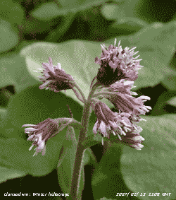
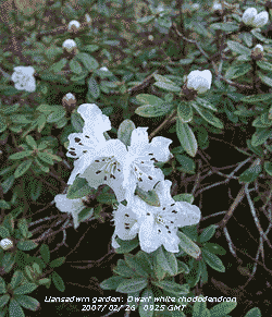
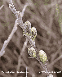
 After the cold spell temperatures rose to above average bringing forward the development of several indicator plant species. Bluebell leaves had emerged and were standing 5 cm tall in the wood on the 25th. Lesser celandine was flowering in hedgerows and garden on the 14th while the sticky buds on horse chestnut were showing the first signs of bursting on the 25th. The white flowers of blackthorn appeared and the first fluffy catkins of willow were opening on the 27th. Comparable flowering dates in 1996 were 2 months later in April, blackthorn on the 12th and 'pussy' willow on the 16th. On the 26th flowers of the Glory-of-the-snow, a bulbous plant related to the squills (Scilla) but not native, were starting to emerge ![]() . Last year, after the heavy snow in early March they were flowering on the 18th. The dwarf white rhododendron is always early and the first of its type to come into flower.
. Last year, after the heavy snow in early March they were flowering on the 18th. The dwarf white rhododendron is always early and the first of its type to come into flower.
Although the first 14 days temperatures were below average the end of the month had above average. The month finished with a mean of 6.4C (+0.5) of the decadal and [+1.1] of the 30-y average. It was highest since 2002. The soil temperature at 30 cm averaged 6.3C (+0.4). Rainfall continued below average and totalled 52.7 mm (50%) and [70%] of average, smallest since 2003.

 1st: DYDD DEWI SANT: It was a bright morning that greeted St. David's Day, and there were daffodils out in the garden and I have seen a few around the village since St. Valentine's Day, on the 14th February. But there was no snow this year, the 1st March 2006 was white and snow lay on the ground for the first 6 days of the month. As well as daffodils in flower the Glory-of-the-snow flowers have opened. Pressure 990 mb was rising as a maturing low, N of Scotland yesterday, tracked SE across the North Sea. Sunny spells that developed through the morning continued into the afternoon. There were showers about and people were caught unawares in a 'sunshine' shower in Caernarfon about 3 pm and I caught sight of a snow shower on the mountains that left a sprinkling of snow across Drum and Foel-fras, there may have been other peaks with some, but they, including Snowdon, were obscured in cloud. It kept dry here until 1845 GMT when there was slight precipitation. There was a hint of sleet, but the temperature was rather high on 5.8C with a dew point of 4.4C indicative of a 35% chance of ice precipitation. I would not be surprised to find a little more on the mountains the next morning. [Rain trace; Max 10.4C; Min 3.7C; Grass 0.5C]
2nd: Pressure 1002 mb at midnight was rising as a ride of high-pressure began to cross from the W. The night was mostly clear and on the grass the temperature fell to -3.2C so freezing deposits of rain and dew. At 07 GMT the grass was white, but by 09 GMT the temperature had risen to 6.0C and the frost had melted. I was not disappointed when I saw a snow on the mountaintops, but the amount was too small! Patchy cloud was moving along on the force 3/4 S'ly wind and, at times, altocumulus lenticularis (lee-wave) clouds were seen over the eastern end of the Menai Strait at Beaumaris.
 The morning was mostly sunny at first but it was cloudier by noon. The next weather system, associated with low 978 mb S of Greenland, had already brought rain across Ireland and halfway across the Irish Sea, but the afternoon had just a few spots of rain at times. There was light rain from just before 2100 to 2300 GMT. [Rain 3.0 mm; Max 10.6C; Min 1.2C; Grass -3.1C]
3rd: After a shower of rain around 04 GMT the sky slowly cleared and the morning on Anglesey became mostly sunny under a blue sky; stratocumulus clouds persisted over the Snowdonia Mountains. Pressure 1004 mb was rising at 09 GMT. There was a moderate SW'ly breeze. The day was mostly sunny with only a little cloud at times; in the afternoon visibility was clear. By evening the sky was clear and there were great views of the eclipsed moon. Starting about 2224 GMT it was totally eclipsed by 2245 GMT taking on a pale copper appearance, but I have seen a darker colour during past eclipses. [Rain 0.0 mm; Max 12.0C; Min 4.2C; Grass 0.1C]
4th: Overcast at dawn and pressure 1002 mb at 09 GMT was falling with deepening low 964 mb tracking N west of Ireland. Rain spread in from the SW reaching here at 0930 GMT and continued until 1700 GMT. The wind was strong to gale-force at times. At 2154 GMT we were hit by a violent gust, heavy rain and ice pellets. All over in 10 minutes, but it broke off a branch from another pine tree the other side of the road. [Rain 8.1 mm; Max 11.4C; Min 3.6C; Grass 0.3C]
5th: Further shower of rain and ice pellets about 02 GMT then things were quieter until morning. It was still overcast at dawn, but before 09 GMT the sky was clearing and there was a little sunshine. With the low 953 mb between Cape Wrath and Iceland pressure 1001 mb here rose until noon then started to fall. Another Atlantic-low 976 mb, developing rapidly W of Ireland, was tracking towards us and the afternoon turned stormy with the wind backing S'ly and strengthening to gale force 8. There was rain from noon turning moderate to heavy rain from 1500 GMT as the wind reached severe gale force 9 at times moderating just after midnight when gale-force 8. If it can be believed, the AWS at Clogwyn on Snowdon 2526 ft (courtesy of First Hydro), logged gusts of 106 mph at 1615 GMT and 111 mph at 1915 GMT. (The summit station was offline as the 80-year old 'Cafe' on which it was housed has been demolished in preparation for a replacement building presently under construction. It is costing £8.3 million; it is being prefabricated in a warehouse in Flintshire and will be taken in pieces to the summit (3560 ft) during the summer on the Mountain Railway. Prince Charles once described the old building as 'Wales' highest slum'. The new building, to be know as Hafod Eryri, has been described as 'unusual and beautiful'). It was a wild night even at 330 ft. [Rain 18.8 mm; Max 9.7C; Min 4.4C; Grass 2.2C]
6th: The calm after the storm, well not quite calm as the SW'ly was force 4/5, but it was sunny under an almost clear blue sky. Total rainfall was 18.8 mm, 13.8 h duration (09-09 GMT), not an outstanding amount for here, but the largest fall of the month and of the year so far, enough to saturate the soil surface. Pressure 992 mb was rising as complex low-pressure N of Scotland moved away filling slowly. The morning was sunny and although the afternoon was a little cloudier there was plenty of sunshine until later. At 1740 GMT there was a slight shower of ice pellets and the evening was mostly cloudy. [Rain 2.4 mm; Max 11.3C; Min 5.5C; Grass 3.3C]
7th: A bright morning with pressure 1000 mb rising. Visibility was moderate with a misty outlook towards the Snowdonia Mountains. There was a lot of activity amongst large birds around the weather station. Rooks were carrying twigs, some quite long ones, building their nests and a female blackbird was gathering material for nest building in an old shed. After a few fine spots of rain about 0945 GMT the day was dry and bright with some sunshine at times. Later in the afternoon it turned cloudier. {Falmouth 14C, Shrewsbury 1C, Isle of Skye 15.2 mm, Jersey 10.3h} [Rain 0.5 mm; Max 12.5C; Min 4.0C; Grass 0.8C]
 8th: Some rain after midnight that included some ice pellets as there were marks left on the hail pad. The morning was bright with cirrus clouds predominating at first, but cumulus clouds soon developed. Pressure 1022 mb was still rising as a ridge of high-pressure crossed Britain. There was little if any precipitation to be seen on the rainfall radar at 09 GMT, but low 952 mb just S of Greenland had a large frontal system approaching the W of Ireland. The morning was sunny at times but frontal cloud moved across afternoon. The wind backed S'ly and strengthened to force 5 by 1500 GMT and to force 6 by 1700 GMT when rain arrived. There was light to moderate rain until 1900 GMT and a further shower around 21 GMT. [Rain 8.8 mm; Max 10.5C; Min 3.7C; Grass 0.2C]
9th: After midnight there were some clear spells and the temperature dropped to 3.6C but there was no ground frost with 0.0C recorded by the grass minimum thermometer. The sky was clear at 05 GMT but had become overcast by 07 GMT. At 09 GMT pressure 1025 mb was rising as high 1038 mb developed over the Bay of Biscay. Clearance could be seen in the west and this arrived during the morning. The afternoon saw mostly clear skies over Anglesey with stratocumulus clouds persisting over the Snowdonia Mountains. At dusk it was again overcast, but it had been a dry day. [Rain 0.0 mm; Max 11.8C; Min 3.6C; Grass 0.0C]
10th: There were one or two breaks in the cloud overhead at 09 GMT. Pressure was steady on 1033 mb with high 1041 mb over the Bay of Biscay but was to decline a little through the day. Deepening low 956 mb S of Greenland tracked slowly NNE to be 944 mb at midnight . Low cloud and occasional drizzle persisted in coastal areas of Anglesey most of the day, but there was some sunshine here in the afternoon. In contrast it was mostly sunny day on the mainland from Llanfairfechan to Conwy. It was windy with the S'ly wind force 5/6. {Aberdeen 15C, Thorney Is. 0C, Loch Glascarnoch 44 mm, Weymouth 10.4h} [Rain trace; Max 11.2C; Min 5.3C; Grass 1.6C]
11th: Overcast with a little drizzle and spots of rain early in the day. At 09 GMT pressure 1024 mb was falling and the S'ly wind force 6. The day kept overcast and windy, but dry right almost up to midnight when there was some drizzle. {London 17.2C and 10.7 h, Capel Curig 9.9 mm} [Rain 1.2 mm; Max 10.6C; Min 7.6C; Grass 6.3C]
12th: A very weak cold front brought some light rain from 0315 to just before 0700 GMT. It was a damp morning but by 09 GMT the cloud was thinning and starting to break up. Pressure 1026 mb was rising and the cloudbase, at 2000 ft viewed against the mountains, soon began to lift and the sky cleared to give sunshine by 1030 GMT. Some patchy cloud came along late in the afternoon, but this clear away again during the evening to give a clear starry night. {East Malling 18.5C, Northolt 0.7C, Drumalbin 19.8 mm, Herne Bay 10.4 h, Valley 8.1h} [Trace/dew; Max 11.8C; Min 6.5C; Grass 6.0C]
13th: There was moderate dew on the grass with the minimum down to 1.0C. The sky, clear before dawn was mostly cloudy leading up to 09 GMT. The temperature 7.4C had risen from the overnight minimum of 4.0C and there was a little sunshine. Pressure 1029 mb had risen with high 1036 mb to the SW and low 968 mb S of Greenland. With high-pressure to the S this is keeping the depressions to the N maintaining the moderate SW'ly airflow. Cloud cover increased during the morning and there was a little drizzle. The afternoon was dry but did the sky did not start clearing until later to give just a few sunny spells before sunset. There was a further spell of cloudiness, and drizzle around 18 GMT, that persisted up to midnight. [Rain 0.3 mm; Max 10.0C; Min 4.0C; Grass 1.0C]
14th: The sky cleared after midnight; there was heavy dew, but no frost (grass minimum 0.0C). At 09 GMT pressure 1036 mb had risen with high 1037 mb to the S. It was a sunny morning with variable cloud of 3 oktas cover. Visibility was moderate (4 km) in mist but improved during the morning. It was a mostly sunny day with clear views of the mountains, but visibility was restricted across the island towards Holyhead. After some cloud passed over at dusk it was clear again at 22 GMT, when the temperature was 6.6C. {Norwich 16C, Shawbury -2C, Lerwick 5.0 mm, Weymouth 11.1h; Hawarden 14.3C, Valley 8.7h} [Rain 0.0 mm; Max 13.0C; Min 4.3C; Grass 0.0C]
15th: Frontal cloud encroached after midnight and the temperature rose slowly until morning. Overcast and dull with a moderate SW'ly wind. Pressure 1027 mb was falling as the high-pressure to the S declined. There were a succession of depressions tracking E over Greenland (982 mb) and Iceland. A cold front tracking SE over W Scotland brought moderate to heavy rain there during the morning. When it reached here the front had weakened and there was only light rain and drizzle from 1130 GMT into the afternoon. By dusk cloud had begun to clear over the west of the island clear sky reaching here during the evening. [Rain 0.9 mm; Max 10.1C; Min 6.6C; Grass 3.9C]
The first 15 days of the month had a mean temperature of 7.8C (+0.5) and [+1.1] of average. Rainfall was 44.0 mm (61%) and [52%] of average. .
16th: There was dew that froze on the grass in the night (grass min -3.3C with 0.17 mm measured deposition), but at daybreak most frost had melted. Pressure 1028 mb was falling slowly as the sky became cloudier towards 09 GMT. Temperatures around the mountaintops were low enough to see a little transient ice precipitation on Snowdon, but rose again during the day. The early brightness turned into a dull overcast day with a little rain and drizzle around 1300 GMT. Drier later and with the temperature rising from the minimum 6.6C at 1400 GMT, but there was a further spell of light rain from 2200 GMT. The blue flowers of glory-of-the-snow in the garden are fully developed, just waiting for the expected cold plunge and snow forecast for Sunday 18th/ Monday 19th. I visited the log store and took inside enough to see us over the next few days. [Rain 1.4 mm; Max 9.6C; Min 1.3C; Grass -3.3C]
17th: A bright morning with breaks in the cumulus clouds. Waiting for 09 GMT observation time I watched a female sparrowhawk trying to catch a breakfast around hanging bird-feeders under a tree in the garden. One of a pair in the area they visit here and near neighbours who also feed the birds. Numbers of greenfinches are well down this year, probably as a result of predation. Collared doves also get taken keeping the numbers down as well. Smaller birds also get taken from time to time, but the larger ones are the main target. Pressure 1024 mb had risen a little and the temperature was on 9.6C (dewpoint 8.4C). With winds likely to turn NW'ly and soon introduce the expected colder arctic air the change will be a shock to the system. At the moment, with a morning temperature of 10C, which is on the long-term average for this date in March, in the sunshine the force 5 W'ly wind did not feel too cold. It did rise to 11.3C, but then the sky become overcast with a little rain in the afternoon. The evening was windy, force 6 to 7 with the temperature around 9.0C. [Rain 6.5 mm; Max 11.3C; Min 6.6C; Grass 5.8C]
![]()
 18th: The temperature kept up to 9.0C until 01 GMT, but then began to fall as a cold front passed over. There was precipitation of snow pellets and possible snow before the sky mostly cleared and a minimum of 3.4C was reached close to 07 GMT. There was a slight shower of snow pellets at 0745 GMT. At 09 GMT pressure 1006 mb was falling with low 948 mb just E of the Faeroes in the S Norwegian Sea. Some very strong wind were being reported, buoy 62147 recorded 78 mph at 0600 GMT while Fair Isle AWS reported a 10-min mws of 49 mph (force 9) at 0840 GMT. The shipping forecast on the radio this morning forecast the chance of hurricane force 12 in sea area Viking and, something not hear much these days, light to moderate icing in SE Iceland. Also mentioned was a 'polar low' near S Iceland expected to run SE over Northern Ireland and into the Irish Sea by Sunday night. Well, the morning here was bright with a little sunshine, but the NW'ly was force 6/7 and roaring in the tall trees. Readings at 09 GMT indicated a 30% chance of more ice precipitation, but the temperature had risen to 5.0C at 10 am. The morning was sometimes sunny before a shower of snow pellets and snow arrived at 1205 GMT. While most of the mountain summits were obscured in cloud and similar snow showers were seen around some summits. There was a prolonged shower of snow and snow pellets slightly covering the ground at 1330 GMT during which the temperature fell 1.5C from the maximum of 7.2C and the humidity rose from 68% to 82%. When large flaked snow fell around 15 GMT the temperature fell from 6.8C to 2.5C and the humidity rose from 66% to 82%. Snow settled at 500 ft on the mountains, but not here as the end of the afternoon saw more sunshine in a break from the showers. At dusk showers of snow pellets and snow returned and, with temperatures falling, left a sprinkling on the ground but continued to melt. [Rain 4.2 mm; Max 7.2C; Min 3.4C; Grass 0.6C]
![]() 19th: There were further slight showers of snow pellets and snow through the night, but there was very little left on the ground in the morning. The hail-pad showed light markings typical of snow pellets. On the Snowdonia Mountains thin snow cover was generally at 750 ft and was down to 400 ft in the Nant Ffrancon Pass near Bethesda, but nearer 800 ft in the Llanberis Pass. Pressure 1001 was rising with the low 961 mb over the Gulf of Bothnia while Atlantic-high 1044 mb was N of the Azores. This meant that we were in a strong N'ly air flow that was packed with showers. The mountaintops, clear at first, soon were enveloped and further light snowfall occurred during the morning. Showers were also going through the Cheshire Gap on the NNW'ly wind and penetrating deeply into England. I tracked a shower cloud that passed through just after 0900 GMT on the rainfall radar. At noon it was S of Birmingham and reached the Isle of Wight around 1400 GMT. Crossing the Channel it was approaching the N coast of France near Caen about 1600 GMT. Here, there was a sleet shower about 1030 GMT then the rest of the day was mostly sunny and dry with the temperature reaching 7.0C.
19th: There were further slight showers of snow pellets and snow through the night, but there was very little left on the ground in the morning. The hail-pad showed light markings typical of snow pellets. On the Snowdonia Mountains thin snow cover was generally at 750 ft and was down to 400 ft in the Nant Ffrancon Pass near Bethesda, but nearer 800 ft in the Llanberis Pass. Pressure 1001 was rising with the low 961 mb over the Gulf of Bothnia while Atlantic-high 1044 mb was N of the Azores. This meant that we were in a strong N'ly air flow that was packed with showers. The mountaintops, clear at first, soon were enveloped and further light snowfall occurred during the morning. Showers were also going through the Cheshire Gap on the NNW'ly wind and penetrating deeply into England. I tracked a shower cloud that passed through just after 0900 GMT on the rainfall radar. At noon it was S of Birmingham and reached the Isle of Wight around 1400 GMT. Crossing the Channel it was approaching the N coast of France near Caen about 1600 GMT. Here, there was a sleet shower about 1030 GMT then the rest of the day was mostly sunny and dry with the temperature reaching 7.0C.
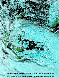
 Showers persisted over the mountaintops, and over central Wales, but by the end of the afternoon the snowline had receded to 1500 ft. There were slight showers of snow pellets during the night. The NOAA 18 satellite image shows the extensive showery airflow with marine open and closed (to far W) convective cells, lines of convection E of Iceland. There is further convection over France associated with the low with frontal cloud near N Italy. {Bournemouth 10C, Spadedam -3C, Jersey 13.6 mm, Bognor Regis 8.7C} [Rain trace; Max 7.3C; Min 0.9C; Grass -1.0C]
 20th: A fine and dry morning with some sunshine but the strong NE'ly wind made the 3.0C feel very cold. Relative humidity was down to 57% and the Piche evaporimeter indicated 3.2 mm evaporated in the past 24-h, so the grass was dry, but the soil was still moist. Pressure 1020 mb was rising with Atlantic-high 1041 to the SW and lows 981 mb over the Ligurian Sea (N of Corsica) and 984 mb Lapland. This meant we were still in the cold Arctic airflow (strongest in the N North Sea), but the wind had edged to the NE with showers continuing to affect the mainly the N and E of Scotland and E coast of England. The day was mostly sunny and dry here, but there were wintry showers reported at RAF Valley. The day's maximum temperature of 5.0C, was the lowest of the month. {Isle of Man 10.5h, Valley 5.9h }[Rain 0.0 mm; Max 5.0C; Min 2.5C; Grass 1.5C]
21st: At midnight a ridge of high-pressure moved across from the W, with pressure here 1023 mb the wind moderated. With some clear spells overnight there was an air (-0.9C) and ground frost (-5.2C), both lowest of the month. The grass, vegetation and roads were dry so there was no 'white frost' to be seen. Ice could be seen glinting in the morning sunshine on the snow-covered (above 1500 ft) Snowdonia Mountains that were clearly depicted in very good visibility (> 40 km). At 09 GMT the wind here was a light N'ly and at lower levels, especially near the Menai Strait it was calm and there was hardly a ripple on the high spring tide. The morning was mostly sunny and remained so until 1500 GMT when frontal cloud, associated with a low E of Greenland, encroached as the wind backed SW'ly. At 2100 GMT with the temperature on the minimum of 3.2C and wet bulb 2.0C (dewpoint 0.0C) there was light sleet that soon turned to moderate rain. {Barra, Outer Hebrides 10C, Loch Glascarnoch -8C, Suffolk 7.8 mm, Weymouth 11.1h} [Rain 4.1 mm; Max 8.0C; Min -0.9C; Grass -5.2C]
22nd: The rain turned to drizzle after midnight. At 09 GMT visibility was 100 m in low cloud fog. Pressure 1019 mb was rising and the temperature 7.2C (100% relative humidity). By 0930 GMT there was drizzle, but the fog started to lift. The low cloud and occasional drizzle persisted until after 1400 GMT and even then the cloud was slow to clear. It began to clear in Caernarfon and spread along the Menai Strait early in the afternoon, but here not until after 1600 GMT (Valley reported only 0.1h sunshine), the photograph of the Menai Strait shows the cloud lingering over the N of Anglesey. During the front went on south-eastwards into England where slight snow was reported, but Chivenor managed to reach 13C and Kent to have a sunny day with Herne Bay reporting 10.2h sunshine. The evening and night were partly cloudy and dry. {Chivenor 13C, Benson -6C, Milford Haven 10.4 mm, Herne Bay 10.2h} [Rain 0.8 mm; Max 9.3C; Min C; Grass C]

|
 25th: Overcast at dawn and there were only just a few thin patches and hint of milky-blue sky at 09 GMT. Yes, it's summertime again (GMT + 1 hour, daylight saving) so the observations were at 10 am. There had been no rainfall, but there was a light apparently dry deposition of light yellowish-brown dust (MUNSELL� Color Chart 10YR 6/4). Preliminary trajectory analyses indicated that the dust over Anglesey may have originated from a pool of dust within low-pressure over the Mediterranean and southward in an area from Libya to Egypt. Wet deposits of various coloured dust were reported from a wide area of S England including Kent, Surrey, Berkshire and the Midlands. Orange spots were seen in Ramsgate and reddish-brown dust in the Cotswolds. Pressure was steady on 1023 mb with high 1039 mb over the Baltic and low-pressure 983 mb over the Denmark Strait. Remnant frontal cloud broke-up and the day turned sunny with a moderate NE'ly breeze. The haze persisted through the day with the sky at best milky-blue to white. Anglesey (some 6 km away) and Puffin Island viewed across the Lavan Sands from near Llanfairfechan was almost obscured in the afternoon. The setting sun in the evening was an intense red colour the sky remaining clear at night. [Rain 0.0 mm; Max C; Min 3.9C; Grass 0.8C]
  28th: The fog at 06 GMT was dense with visibility <100 m. Trees were dripping steadily with the sound of gentle rain. The raingauges were wet, recording a trace, but the dewpads collected 0.22 mm. At 09 GMT visibility had improved to 200 m, and the trees had stopped dripping. The morning was calm and, with low cloud and fog persisting over the Irish Sea, no further clearance. The afternoon saw the fog thin a little, but it remained sunless with the temperature struggling to reach 8.3C. By late afternoon the fog had cleared, but the sky was overcast. There was a little light rain from 2230 GMT that contained a little pink to light reddish-brown dust . [Rain 0.2 mm; Max 8.3C; Min 1.4C; Grass -1.8C]
  30th: A shower at 06 GMT with a few small ice pellets and light rain and heavy drizzle in low cloud blowing in off Liverpool Bay persisted to after 10 GMT. Visibility was very poor (<1 km) at first and the NE'ly wind was force 3. The day was slow to brighten but the mist thinned and although the afternoon was hazy there was a little sunshine. Later the sky became overcast once again. [Rain 0.2 mm; Max 10.0C; Min 4.9C; Grass 3.8C]
 The end of the month was drier so that the rainfall total reached only 62.7 mm, (87%) and [74%] of average. Temperatures were close to average and finished with a mean of 7.1C (-0.3) and [+0.3]. There was 1 (-1.6) air frost and 10 (-1.4) ground frosts. It was the 6th sunniest since before 1930.
1st: An almost cloud-free morning, I had to look hard to find some clouds and spotted a small cumulus to the NE over Liverpool Bay and a line of stratocumulus beyond low on the horizon like to be over Cumbria. Pressure was 1035 mb with high 1038 mb Scotland and Baltic; pressure was low 1009 mb over Iberia with unsettled weather continuing around the Mediterranean. Between the high and low pressure we were in a NE'ly airflow, strongest in S England and least in Scotland. The day was mostly sunny, 1 or 2 cumulus did blow in on the f4 wind during the morning, but dispersed overhead. The afternoon was sunny with good to moderate visibility later in the persistent haze. A very deep red sunset to the NW was close to 1825 GMT and soon to the SE the moon rose with a pale orange colour. As it got higher in the sky the colour paled and at 21 GMT, when high in the sky, was whiter and bright. [Rain 0.0 mm; Max 10.8C; Min 2.5C; Grass 0.2C]
 2nd: Another hard-to-spot clouds morning, there was some altostratus to the NE over Liverpool Bay and this got a 1 okta rating. I had not got to the screen when I heard the first chiffchaff singing in the willow tree, a sure sign that spring had arrived. We still had the cool moderate NE'ly and visibility was only moderate with smoke and dust haze. Pressure was 1034 mb with the high 1039 mb to the NW off the Western Isles of Scotland. The soil surface, just moist at at 09 GMT, became dry during the day. The morning became cloudier as thin high cloud moved across the sky, but kept mostly sunny into the afternoon. By evening the cloud cleared away and at 21 GMT, with the moon high in the sky, there were several brightly-lit contrails crossing the sky. [Rain 0.0 mm; Max 12.6C; Min 4.1C; Grass 1.4C]
 3rd: The sky remained mostly clear until after 02 GMT when remnant frontal cloud moved over from the N and was overcast by dawn. At 09 GMT with pressure 1032 mb still high a chink of blue sky was seen and the cloud gradually moved away giving a sunny morning leaving frequent contrails. Visibility to the S was very good in clearer air, but the afternoon was cloudier and although there were sunny spells the temperature struggled to reach 10C, lowest of the month, in the fresh (f5) NE'ly. During the evening the sky cleared again and the night was clear. [Rain 0.0 mm; Max 10.0C; Min 4.2C; Grass 2.6C]
4th: Almost a clear sky, and blue too, as the haze had cleared and visibility was good to the S and W, but smoke haze was seen to the E. Overnight measured dewfall was 0.17 mm and if you were about early enough a white frost with the grass minimum reading -1.4C, lowest of the month. At 09 GMT with pressure on 1030 mb there was 3/8th cover of cirrus clouds and these increased to 6/8 cover at times in the afternoon. Along with much of the western seaboard it was a very sunny day with Valley reporting 12.1 h. The end of the afternoon was hazier once more and after some patchy cloud passing during the evening the sky was clear at 21 GMT. [Trace, dew and fog; Max 12.4C; Min 1.8C; Grass -1.4C]
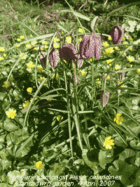
Lesser celandines have increased in abundance around the garden and roadside verges the last 10 years. Here they are seen massed in the garden around snowdrops that have finished flowering ![]() and on the right around garden Fritillaries.
and on the right around garden Fritillaries.
5th: After midnight fog and cloud developing over Liverpool Bay encroached and by dawn visibility was <200 m. By 09 GMT visibility had improved but it was still misty and the morning re,aimed overcast. Pressure 1026 mb continued to decline slowly, but the high 1027 centred W of Shannon, Ireland, still dominated the weather. At 1130 GMT the cloud began to break up and by 1300 GMT had almost cleared away to give a sunny afternoon. Smoke haze was seen over the Snowdonia Mountains possibly the result of gorse and grass fires. It felt a little warmer out of the light NNE'ly breeze with the temperature reaching 14.5C. The evening and night were clear with some mist developing in low-lying areas. [Rain 0.0 mm; Max 14.3C; Min 3.2C; Grass -0.2C]
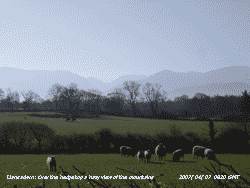 6th: A sunny morning with high cirrus clouds, a few small cumulus and cirrocumulus. Pressure was 1028 mb and visibility was good with slight haze. Cattle have been put out on the surrounding fields and the sheep, that have been around through the winter and lately with their lambs moved off. Taking advantage of the dry spell of weather some fields have been ploughed and will be seeded with barley. I looked hard at my vegetable plot this year, could I manage another year? Out came the fork to test the soil and with less below average rainfall it was lighter than usual. A few test rows showed that my back seemed up to the job for another year! We have grown vegetables for years and there is none better for flavour than those picked from your own plot. Apart from the cirrus clouds it was a sunny day, Valley reported 11.1 h. [Rain 0.0 mm; Max 13.1C; Min 3.7C; Grass 1.1C]
7th: Another sunny day, less cirrus and good visibility with some smoke haze. We were within the anticyclone 1030 mb stationed over the Irish Sea so the weather continued settled. The light NE'ly breeze off Liverpool Bay persisted through the day with the temperature rising to 12.7C. Although the hedges are starting to look a bit green the trees are not as seen in the over-the-hedgetop hazy view of the Snowdonia Mountains. [Rain 0.0 mm; Max 12.7C; Min 3.6C; Grass -0.3C]
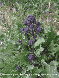 8th: High-pressure was still in charge, but it had sunk a little southwards and was 1029 mb over SW England and was 1027 mb here. A sunny morning with a little moderately high altostratus and cirrus clouds and a little more cloud in the afternoon encroaching from the NW. The wind was SW'ly at first and turned NW'ly by the afternoon and the temperature rose to 16.9C, highest so far. I finished digging the vegetable plot and planted 3 rows of potatoes. Two speckled wood butterflies were seen in the garden, together with the peacock that has been around for a while. Vegetables have flowers too and worth a photograph. On the right can be seen a fine head of the edible early purple sprouting broccoli on the vegetable plot, the final crop of last year's plantings. The evening and night were overcast and dry. [Rain 0.0 mm; Max 16.9C; Min 5.2C; Grass 1.1C]
9th: There was a little sunshine at first with the sun low in the sky but by 09 GMT it was overcast. Pressure 1022 mb was falling slowly. All 6 of the thermometers in the soil profile down to 100 cm depth read 10C, or more this morning, the earliest date looking back over 7 years. Last year it was reached on 21st April and the latest was 2 May 2001. At 0930 there was a short spell of very fine drizzle, not enough to wet the ground, but heavy enough from 1130 GMT. There was light rain from 1200 to 1300 GMT followed by some drizzle then started to clear with some glimpses of sunshine by 1600 GMT. After the sunshine of recent days it was a disappointing Easter Monday Holiday. There was little more clearance and the evening and night were overcast. [Rain 0.7 mm; Max 12.2C; Min 5.3C; Grass 1.4C]
10th: Overcast early, but it kept dry overnight with a little dew forming on the grass (0.05 mm recorded). At 09 GMT with pressure on 1024 mb there was a small break overhead. This was not an indication that the day would turn sunny it remaining mostly cloudy with the cloud thinning at times giving some brighter spells. The wind was light to moderate WSW'ly and the sun tried to break through in the afternoon, but failed. Cracking on with planting I sowed a row of peas and put in a row (of 3 lines) dwarf broad beans. Despite the 0.7 mm rain yesterday the soil surface was dry. Patricia beat me to it this year and spotted the first bluebells to flower in the wood. Seven days earlier than last year, but 6 days later than in 2005. [Rain 0.0 mm; Max 15.1C; Min 8.0C; Grass 5.3C]
 11th: Calm at first with the sky clearing through the morning. High 1026 mb was positioned over Wales and stretching SE over Belgium. Overnight with the grass minimum not falling below 7.7C, there was negligible dew but there were guttation drops at the tips of grass leaves. By 10 GMT it was mostly sunny with fair-weather cumulus clouds overhead. There was a light S'ly breeze until the middle of the afternoon when, with the sky then clear, a slight sea breeze set in from the NE. [Rain 0.0 mm; Max 17.1C; Min 9.2C; Grass 7.7C]
12th: It was a mostly cloudy start to the day with moderately high altocumulus and some altostratus cloud over this part of the island and the mainland mountains. This slowly cleared leaving high cirrus and a milky look to the blue sky. Visibility was good at first, but became moderate as the haze enhanced with dust blowing in from north Africa. There was little or no wind at first, but by midmorning there was a SE'ly breeze. The afternoon was mostly sunny with the temperature reaching 17.9C before an intermittent sea breeze set in. Pipistrelle bats have returned to their summer maternity roost in the house. The evening was clear. [Rain 0.0 mm; Max 17.9C; Min 7.0C; Grass 1.8C]
13th: By morning there was a covering of thin high cirrus cloud. It was sunny but visibility was poor in the moderate haze that included dust. There was a light SE'ly breeze and the morning and early afternoon were mostly sunny with just a few small cumulus cloud seen through the haze. Once again a slight sea breeze set in late in the afternoon but not before the temperature had climbed to 19.8C. By then the sky was looking rather murky and there was no sight of the setting sun. Showers had affected SW England during the morning just spreading into S Wales by the afternoon, here another dry day. [Capel Curig 22.0C] [Rain 0.0 mm; Max 19.9C; Min 7.0C; Grass 4.0C]
The wild cherry is just starting to open it's pinkish-white flowers on lower branches and we spotted 2 holly blue and an orange tip butterfly around the garden. The blackthorn has, and still is, in full flower and more bluebells have come out. The damson is also in full flower, but I could see no bees them. At dusk I counted 40 bats emerging from their roost, there are probably more as I did not start counting early enough.
14th: After a mostly clear night with minimum temperature 10.9C and 7.0C on the grass. Grass was moderately wet, but most of this was due to guttation as dew deposition was only 0.03 mm. Another sunny morning under a milky-blue sky with some cirrus and north African dust in the atmosphere above us. Pressure was 1026 mb in a ridge from high 1031 mb over the Baltic. There was a light ENE'ly breeze and the temperature rose to 21.0C during the afternoon, highest of the month and year so far. [Trawscoed 24.1C, Capel Curig 7.4C, Pembrey Sands 0.4 mm, Valley 10.7h] [Rain 0.0 mm; Max 21C; Min 10.9C; Grass 7.0C]The first 15 days had temperatures above and rainfall well below average. The mean temperature was 10.4C (+1.4) and [+1.8] while the mean maximum 15.1C was (+2.5) and [+2.3]. Minimum temperature with a mean 5.7C were closer to average. With only 0.7 mm rainfall it was the driest beginning to April since 1997 that had only 0.5 mm.
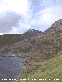 16th: With high 1031 mb anchored off Shannon, Ireland, a weak cold front passed south-eastwards over Anglesey during the morning. A uniform grey sky and still dry at 08 GMT, with slight dew on the grass, gave way to fine drizzle that cleared away slowly during the morning. Pressure was 1029 mb and overnight the minimum was 8.6C and this rose to a modest 13.0C during the afternoon that was mostly sunny with mostly cirrus clouds. Moderate visibility in the morning improved to very good (>40 km). On Snowdon the cloud began to clear the summit at noon and with much clearer air than of late clear views of the Snowdonia Mountains from Anglesey by 1730 GMT. [Rain trace; Max 13.0C; Min 8.6C; Grass 6.1C]
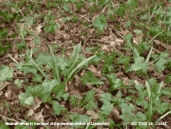
 It was nature in the raw at the nearby rookery during the day. Several successful raids were made by ravens. Normally rooks can defend their treetop nests against predators and even give approaching buzzards a hard time mobbing then in numbers. Not so the larger ravens that fly directly to the nests, alight on them before carrying away a killed chick. There are always adult rooks around the nests, but some would be away from the nests at the time of the attack, gathering food off the fields. At 21 GMT a pair of tawny owls were heard in the wood.
17th: Overnight it turned cloudier and at 09 GMT the sky was 7/8th covered with moderately high altostratus and some cumulus clouds. Pressure was 1031 mb with high 1033 mb still anchored off W Ireland. Yesterday's cold front was over the English Channel and moving into France. Visibility was very good here (>40 km) with slight haze and the mountain summits clear. There was a light sprinkling of snow on Cairngorm early, but soon disappeared during the morning. The afternoon here saw some sunshine with even clearer visibility. [Rain 0.0 mm; Max 14.8C; Min 5.2C; Grass 2.8C]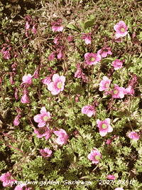 19th: Somewhat cloudy at dawn the sky had stated to clear by 09 GMT and was then 5 oktas covered. Pressure was 1022 mb with the high moved to be over the Bristol Channel. Another mostly sunny day with a little high cloud at times. There was further snow on Cairngorm, at 4000 ft remember, that lasted through the day. The evening was clear and the new moon was seen at dusk in the north-west with crescent upturned a sign, it is said, of dry weather. I counted out 31 pipistrelle bats from their usual roost, there are other roosts and the numbers do vary from night to night. There were also several brown long-eared bats about, these circle the weather house whereas the pipistrelles fly off into the trees. At night the stars were very bright in the absence of much moonlight and, fortunately, little light pollution although the lights on the A55 since its construction give a glow to the S. [Rain 0.0 mm; Max 17.5C; Min 5.1C; Grass 0.8C]
 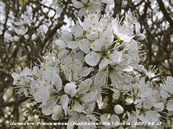 20th: A mostly clear sky this morning, some altostratus cirrostratus and one small cumulus. Pressure was still on 1022 mb and the breeze was calm or variable at first. The morning was mostly sunny and here the breeze settled into a light (force 2) S'ly. My neighbour 250 m across the field to the NE flies a Welsh Dragon flag on a well-exposed flag pole. This was constantly extended (force 3) from the N with air off the sea. This difference is a frequent occurrence and the strength of the opposing winds influences the temperature and humidity recorded at the weather station. During the morning the S'ly was strong enough to hold back the sea breeze and the temperature rose from 4.3C to 18.4C, a range of 14.1C. Humidity kept around 65% from 1115 to 1500 GMT. Then the the sea breeze strengthened and the temperature began to fall and the humidity rise. Sometimes the convergent air over the weather station results in the formation of Llansadwrn cloud, a small sea breeze front. Not so today, and I have not seen this phenomenon during this spell of weather. Another dry day and already there has been mention in the press of the possibility of hosepipe bans in Wales. But according to the Environment Agency (Water Situation report for March) overall storage increased in March by 1% to 96% of capacity. During the evening the sky in the west looked rather dark and murky as frontal cloud encroached over Ireland and NW Scotland during the day. [Rain 0.0 mm; Max 18.4C; Min 4.3C; Grass -0.2C]
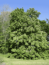
 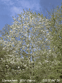 25th: Overnight the air minimum temperature was 11.7C, highest of the month. The morning started bright with the sky clearing at first with the cumulus and altocumulus moving rapidly overhead in the force 6 SSW'ly wind. Pressure was 1006 mb with low 999 mb between Malin Head and the Western Isles of Scotland. Soon after 09 GMT the sky clouded over and the wind strengthened to strong to gale-force 8 here and on higher ground. Capel Curig reported force 9 (47 mph) with a gust of 60 mph. Leaves and recently opened flowers were being torn from horse-chestnut trees, well they were the earliest out and are not a native species. Wild cherry, full in bloom, was not so badly affected. The wind moderated in the afternoon and keeping overcast the temperature rose to 13.0C. By evening there was some broken moderately high cloud with the moon shining through with coloured edge effects. [Rain trace; Max 13.0C; Min 11.7C; Grass 10.5C]
 Despite yesterday's gale the flowers out on the wild cherry suffered little damage ![]() , the leaves of which are starting to unfold at the top of the tree. The weather station beech is also leafing, it is later than some here that have been out for a week or two. Beech leaves look light green and translucent in sunlight, but they will darken considerably as the season progresses. Some sycamores are advanced, but there is considerable difference in phenology between trees so recording dates need to be done on the same tree, or group of several trees, each year. There are leaves on oak trees but ash trees, in flower on the topmost branches, still have no leaves hereabouts. Most of the seeds from last year, that were hanging dried out on the branches, blew off in the gale. The first early purple orchids of the season were spotted on roadsides near Brynsiencyn and in Llansadwrn.
, the leaves of which are starting to unfold at the top of the tree. The weather station beech is also leafing, it is later than some here that have been out for a week or two. Beech leaves look light green and translucent in sunlight, but they will darken considerably as the season progresses. Some sycamores are advanced, but there is considerable difference in phenology between trees so recording dates need to be done on the same tree, or group of several trees, each year. There are leaves on oak trees but ash trees, in flower on the topmost branches, still have no leaves hereabouts. Most of the seeds from last year, that were hanging dried out on the branches, blew off in the gale. The first early purple orchids of the season were spotted on roadsides near Brynsiencyn and in Llansadwrn.
The month ended with a mean temperature of 11.3C (+2.3) and [+2.7] of average, the highest since before 1979 and only the third April mean to reach double figures. It was a dry month with 30.4 mm rainfall (39%) and [53%] of average, 22.8 mm on 1 day, there were 19 (+9.9) completely dry days. It was the driest April since 1984 and 8th driest since before 1928. Despite 3 sunless days it was one of the sunniest Aprils on record with 227.4 h (K&Z) of sunshine recorded at RAF Valley, an estimated equivalent 255.8 h if it had been recorded on a Campbell-Stokes instrument, highest on the Anglesey record since before 1930.
 1st: A gloriously sunny beginning to the month. A little cirrus and cirrocumulus clouds overhead at 09 GMT. Pressure was steady on 1015 mb and there was a moderate NE'ly breeze. The cloud cleared away to give a sunny and warm day with the maximum reaching 21.8C, highest of the month. [Pembrey Sands 22.8C, Hawarden 2.1C, P. Sands 0.6 mm, Valley 13.9h] [Rain 0.0 mm; Max 21.8C; Min 8.5C; Grass 4.8C]
2nd: A cloud-free sunny morning with moderate slightly coloured (light brown or fawn) smoke haze visible on all horizons, but visibility was >50 km with Bardsey Island obscured. The temperature was 13.0C and dewpoint 8.0C, there was slight dew early, but it had dried off the grass. Oh, and it was raining in the Var, France and Gibraltar! Another clear sky day with 25.03 MJ m-2 total solar radiation. At dusk it was a fine night for the bats and I counted out 106 pipistrelles heading for the trees starting at 2007 GMT. The brown long-eared bats are more difficult to count, but there were several about that hunt at lower level around the house. Later I heard a pair of tawny owls nearby. About 2100 GMT the full moon had risen over the Carneddau Mountains, strongly coloured orange at first it became paler white around midnight as it got higher in the sky with less aerosols for the light to pass through. [Rain 0.0 mm; Max 17.2C; Min 8.5C; Grass 5.5C]
3rd: Clear skies overnight and with the temperature on the grass down to 4.8C there was moderate dew (0.22 mm measured). At 09 GMT pressure 1020 mb was rising and the temperature was 13.7C in a moderate NE'ly breeze. In the hazy sunshine the temperature reached 14.8C. In the afternoon the haze thickened and visibility was poor and < 1 km. Again another good night for the bats, 132 counted out pipistrelles between 2000 and 2030 GMT was likely to be the full complement. [Rain 0.0 mm; Max 14.8C; Min 8.4C; Grass 4.8C]
 4th: The third successive clear sky morning and again lasting all day. The smoke haze is persistent and visibility varies between good > 10 km to moderate 4 km but sometimes poor 2 km through the day. There have been deposits of dust on observing surfaces, that are cleaned every day, for some days but this morning they were clean except for pollen. There was a moderate dewfall, 0.22 mm. Pressure was 1019 mb with high 1023 mb centred to the NW between NW Scotland and Iceland. Despite the sunshine it felt chilly in the light to moderate NE'ly breeze that kept the temperature in the Stevenson screen on 14.3C, but out of the wind it was warm enough. [Rain 0.0 mm; Max 14.3C; Min 7.8C; Grass 4.1C]
5th: The 4th successive clear sky morning and, unusually the 8th so far this year, but by 10 GMT some high cirrus clouds were seen to the W. Pressure was still high (1020 mb) in a ridge over Wales, but there was a change in wind direction - after being calm in the small hours it was S'ly force 2. The morning was sunny, but visibility was only moderate in the smoke haze, and the afternoon sunny at first with cirrus increasing. During the afternoon smoke haze increased and by 18 GMT visibility was very poor (< 1 km), according to the Welsh Air Quality website, total suspended particulates in the air on Anglesey exceed 500 µg m-3. By evening with frontal cloud over Ireland and the Irish Sea, thicker cloud was encroaching. [Rain trace; Max 17.5C; Min 6.0C; Grass 1.7C]
6th: There was drizzle or rain around 05 to 06 GMT and concrete looked a little damp, but there was only a spot in the raingauge and the vegetable plot was dry. There was a pink to pinkish-grey coloured dust deposit left on previously clean surfaces. It was overcast and the SW'ly was force 5. Pressure 1014 mb had fallen, but was on the rise again. The morning kept overcast with occasional specs of drizzle on the wind, but there was light showery rain from 1230 GMT. A sunless and much cooler day with a temperature of 12.5C. [Rain 1.9 mm; Max 12.5C; Min 11.0C; Grass 10.2C]
7th: There was a spell of light rain from midnight until just before 02 GMT. Pressure was 1009 mb and the morning was overcast and dull, but brightened just before noon. Early in the afternoon some bright spells and glimpses of sunshine before the sky darkened from the W and there was a moderate to heavy shower of rain around 1400 GMT. The rest of the day was dull with the SW'ly wind freshening to force 5/6. [Rain 3.9 mm; Max 14.7C; Min 8.4C; Grass 7.3C]
8th: Frequent light showers of rain from 0200 to 0600 GMT brought the total rainfall up to 3.9 mm by 09 GMT. It was overcast, but visibility was good with cloud and mist on the mainland mountaintops. Pressure was 1006 mb with complex low-pressure to the N and low 989 mb off the SW Norway. With the jet stream re-established across the UK, and high-pressure 1030 mb building over Spain and the Med, the weather is back to normal here and there is sunny weather and temperatures 23-25C along the coast of the Var, France. The morning here was dull with a few slight showers from time to time, the afternoon was little better and although dry was sunless. There were further showers of rain about 1800 and 2030 GMT. [Rain 1.3 mm; Max 14.2C; Min 9.0C; Grass 6.6C]
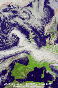 9th: Some clear patches after midnight, but there was no danger of frost with the temperature above grass falling to 4.6C. It was just as well as the early potatoes were well advanced. Thirty years ago we would have been rushing out with newspapers to cover them over to protect them from ground frosts. The peas and broad beans are also doing well as are the first rows of lettuce. We still germinate the runner beans in pots in the greenhouse for planting the first week in June. This year they will go out at the end of May and could yet get earlier in the future. We are also trying climbing French beans for the first time. We have not had success with low growing French beans in the past, or tomatoes in the open ground, it being too cold here, but again we may try them as the temperature rises and frost are so few with an extended growing season. We have had outdoor vines for a few years now, but they rarely fruit. We remain hopeful. Recently the most northern olive grove was planted on Anglesey and joins some already established vineyards. Well, they should be in a good position to take advantage of any further warming! Before dawn the sky had clouded over and at 09 GMT was 8 oktas. The cloud, mostly altostratus and cirrus, was thin and it was bright. Pressure 1012 mb had risen and there was a gentle S'ly wind. During the morning the cloud thickened with more cumulus clouds appearing in the sky, there were some fine spots of rain from time to time. The NOAA 18 satellite image captured at 1310 GMT shows a low 993 mb W of Ireland with classic comma frontal cloud, occluded to the NW and cold to the SW, affecting Wales and SW England and a warm front over the English Channel and NE France. Spain and the western Med has high pressure and clear skies. There was light rain from 1500 to 1700 GMT and 1900 to 2200 GMT. The day was sunless here, but Valley on the coast to the W reported 2.4h. [Rain 4.0 mm; Max 13.5C; Min 7.5C; Grass 4.6C]
10th: It was a blustery morning, but the sky was clearing and at 09 GMT with 5 oktas cloud cover; there were sunny spells and we were in a showery moderate to strong SW'ly airflow. Pressure was 1002 mb with low 992 mb over Scotland and frontal cloud lying over the English Channel. The SW'ly wind was force 6 at first, but moderated through the day. The afternoon saw sunny spells and showers kept away; a line of stratocumulus clouds persisted over the Snowdonia Mountains. The early purple orchids, noted flowering on the A5025 roadside in Llansadwrn on 26 April, have been mown off in roadside maintenance! Perhaps they just about had time to set seed. The evening was cloudier, but was dry. {Bridlington 18C, Dalwhinnie 1C. Eskdalemuir 28 mm, Leeming 11.1h} [Valley 7.6h, Llansadwrn 23.86 MJ m-2] [Rain 0.5 mm; Max C; Min 9.2C; Grass 7.8C]
11th: There was a shower of rain around 03 GMT and the sky was mostly cloudy until after dawn. Before 09 GMT it was bright with cumulus and altocumulus clouds predominating. The blackcap was singing almost continuously during the observations, he has taken over dominant singing duties at the moment. The song thrushes are too busy with fledglings nearby, the blackbird usually has a sing from the top of the electricity pole later on, and the chiffchaff is only intermittent - perhaps he's busy too. There has been no sign yet of spotted flycatchers, they are overdue. Pressure 1002 mb was rising and there was a moderate W'ly breeze through the morning that had some sunny spells. The jet stream today was further S again, over the English Channel and N France, with the outlook for further unsettled weather. By afternoon the sky was overcast, and there was light rain from 1330 GMT, as low 991 mb off SW Ireland brought triple-point frontal cloud over the Bristol Channel. The showery rain died out by about 20 GMT. [Rain 2.5 mm; Max 15.0C; Min 8.5C; Grass 8.0C]
12th: At midnight low 993 mb was over the Irish Sea and at 09 GMT pressure was 999 mb with the low 995 mb over NE England on its way to the North Sea. There was a shower of rain around 03 GMT; there was an estimated 5 cm of fresh snow on Cairngorm overnight, but temperatures in Snowdonia were not low enough. The wind was force 3 SW'ly and the morning and afternoon were bright, with good visibility, until 1600 GMT when the sky became overcast. There were showers over Snowdonia under persistent stratocumulus clouds with just a slight shower here at 1730 GMT. [Rain 0.6 mm; Max 16.2C; Min 9.4C; Grass 8.0C]
![]() 13th: After a shower of rain at 04 GMT the sky was clearing a little by 09 GMT. Pressure was 1000 mb and the wind, S'ly at 08 GMT, had veered and was NE'ly as low 992 mb worked its way into the SW Approaches of the English Channel. Frontal cloud was moving N over SW England and with heavy rain expected, and swelling already well topped-up moorland streams and peatland, the second day of the annual Ten Tors expedition on Dartmoor was cancelled. Using helicopters, the army and other personnel, assisted in bringing off nearly 2000 well trained young people, in what has been described as the largest rescue operation of its kind in Britain. Here the morning was bright with occasional glimpses of sunshine [Valley 1.6h]. The cloud thickened by afternoon and light drizzle arrived by 1430 GMT and light to moderate rain from 1500 to 2300 GMT. {Linton on Ouse 16C, Altnaharra -2.1C, Camborne 38 mm, Tiree 15.1h} [Rain 13.5 mm; Max 12.5C; Min 10.1C; Grass 9.2C]
13th: After a shower of rain at 04 GMT the sky was clearing a little by 09 GMT. Pressure was 1000 mb and the wind, S'ly at 08 GMT, had veered and was NE'ly as low 992 mb worked its way into the SW Approaches of the English Channel. Frontal cloud was moving N over SW England and with heavy rain expected, and swelling already well topped-up moorland streams and peatland, the second day of the annual Ten Tors expedition on Dartmoor was cancelled. Using helicopters, the army and other personnel, assisted in bringing off nearly 2000 well trained young people, in what has been described as the largest rescue operation of its kind in Britain. Here the morning was bright with occasional glimpses of sunshine [Valley 1.6h]. The cloud thickened by afternoon and light drizzle arrived by 1430 GMT and light to moderate rain from 1500 to 2300 GMT. {Linton on Ouse 16C, Altnaharra -2.1C, Camborne 38 mm, Tiree 15.1h} [Rain 13.5 mm; Max 12.5C; Min 10.1C; Grass 9.2C]
14th: Showery rain after midnight and around 07 GMT brought the total to 13.5 mm by 09 GMT. Rain had been much heavier around Shrewsbury to the SE where, at Preston Montford, 79 mm was recorded. Shawbury reported 48 mm and Hawarden 26 mm while Capel Curig had 23 mm and here 14 mm. With the rain cleared away the morning was sunny with cumulus clouds dominating the sky. It was cloudier for a while around noon before the sky mostly cleared. The evening was clear at first but soon clouded over again and there was light rain from 2230 GMT. [Rain 1.8 mm; Max C; Min 7.5C; Grass 6.8C]
15th: The rain petered out about 0445 GMT and the sky was still overcast at 06 GMT. Pressure was 1010 mb and the sky 7/8th covered with thin moderately high altostratus and cumulus clouds. The wind was force 3 from the NE and visibility towards the mountains was only moderate with cloud and mist hugging the lower slopes. By 10 GMT it was brighter with glimpses of sunshine and, with the sky continuing to clear over Anglesey, the rest of the day was mostly sunny with cloud confined to the mainland mountains. The evening was clear at first, but soon became overcast. [Rain 3.4 mm; Max 14.2C; Min 8.2C; Grass 6.1C]
The first 15 days of the month had a mean temperature 11.9C (-0.1) and [+0.4] of average. Daytime maxima have been low with the mean 15.2C (-0.5) and [-0.8] of average, with the highest 21.8C (-1.8). Rainfall of 33.4 mm was about average reaching (46%) and [58%] of the monthly total.
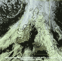 16th: It had been raining lightly since about 04 GMT and continued most of the morning. Pressure 1013 mb was rising at 09 GMT in a minor ridge, but soon started to fall. A dismal grey day with poor to moderate visibility. Fronts associated with lows to the NW, sliding SE, brought further almost continuous slight rain or drizzle into the afternoon and evening. The day was sunless and the 16.3 mm rainfall made it the wettest day of the month. [Rain 16.3 mm; Max 13.2C; Min 8.0C; Grass 4.0C]
  19th: Overcast early and blustery with spots of rain on the force 6 SW'ly wind at 09 GMT. But pressure 1007 mb was rising with slow-moving, but filling, low 974 mb N of Scotland. The webcam on Cairngorm, that I monitor for snowfall, caught a rainbow at 0935 GMT. There was a slow clearance during the morning but passing cumulus shower clouds, some dark, continued into the afternoon. The sky had cleared over Anglesey by 16 GMT leaving stratocumulus clouds over the mountains of Snowdonia. Most trees now have an almost full canopy with leaves losing their bright translucent colour and becoming darker as their pigments develop. The wind had moderated and the evening and night were quiet and mostly clear. [Rain trace; Max 15.0C; Min 9.2C; Grass 7.7C]
  20th: With the temperature above grass falling to 2.2C there was dew by morning (0.20 mm). The sky had 6 oktas cover of cirrus, cumulus and stratocumulus (over the mountains) clouds, visibility was good and the day was mostly sunny with the temperature rising to 17.0C. Solar radiation was 23.18 MJ and at RAF Valley 13.8 h of bright sunshine were recorded. The red lantern flowers on the Crinodendron in the garden are now fully open, the tree was affected by the dry weather in April and lost some of its leaves. Late sycamores are beginning to open their leaves and are only a little behind the ash that still have hardly any leaves on lower branches. [Rain 0.0 mm; Max 17.0C; Min 5.8C; Grass 2.2C]
 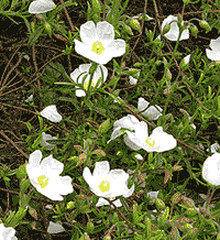 25th: There was a shower of rain around 0030 GMT and the sky was still overcast at 09 GMT. Pressure was 1012 mb in the persisting ridge from Azores-high 1032 mb. Frontal cloud over Wales was slow to sink SE during the day and it was dull until 1530 GMT. Clear sky encroached from the NW and the rest of the afternoon was sunny though cooler than of late with a maximum of 13.0C. Visibility was very good (> 50 km) and there were clear views of Snowdonia and the Lleyn Peninsula well into the evening. Later the sky became cloudier. [Rain 0.0 mm; Max 13.0C; Min 9.8C; Grass 8.8C]
 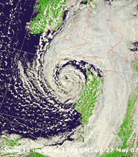 26th: With some broken cloud overnight the temperature on the grass dropped to 1.4C, a testing time for flowering garden annual and vegetable plants brought on by the warm April. The morning was mostly cloudy with pressure 1009 mb falling. The high-pressure ridge over Britain was declining with depressions lining up over the Atlantic to the W. Things were not that bad during the day as before noon it was bright with some weak sunshine early in the afternoon. By the end of the afternoon it was mostly cloudy and there was showery rain by 2330 GMT as deepening low 998 mb tracked SE close to S Ireland. [Rain 2.3 mm; Max 14.5C; Min 5.5C; Grass 1.4C]
 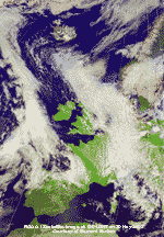 29th: Well, there was a ground frost -0.5C, the latest in the year since before 1985. Previously the latest in the season was on 13 May 1996 also having -0.5C. The air minimum dropped to 3.5C, lowest of the month and the lowest on this date at this station since before 1979, previously the lowest was 4.2C in 1985; the next night was lower with 1.8C, and this was the latest in the year. Pressure was 1012 mb and there was a light to moderate NW'ly breeze. Visibility was exceptionally good, >50 km. Convective clouds were the order of the day in the slot, stretching from E of Iceland to S of France, between low-pressure systems in the Atlantic (997 mb) to the W and Europe (995 mb) to the E. At first the clouds were well-developed, a cumulonimbus cloud was spotted over Snowdonia around 08 GMT, but as the day went on convection diminished, cover reduced and it was mostly sunny by afternoon. Cool air continued to be drawn from the Arctic, but it was a little warmer with the temperature rising to 14.5C. The sky was clear in the evening and it was out with the protective fleece blanket to cover tender plants. The brown long-eared bats were out early (2030 GMT), when it was still quite light, hunting for insects just above the treetops. [Hawarden 14.3h] [Rain trace; Max 14.5C; Min 3.5C; Grass -0.5C]
 The month ended with 72.8 mm rainfall (101%) and [127%] of average, not as wet as some parts of England with near record falls. Temperatures were closer to normal than of late with the mean 11.8C (-0.2) and [+0.3] of average, but hid larger difference in the mean maximum 15.3C (-0.7) and mean minimum 8.3C (+1.3). Sunshine was a little above average and sunniest since 2001.
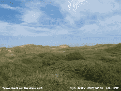 1st: A mostly sunny morning with cirrus and contrails overhead the weather station. There were a few towering cumulus clouds to the S at first. Pressure was 1017 mb in a slack area of with high-pressure to N and S and low-pressure E and W. Winds were light SE'ly and cloud built up here, close to the Snowdonia Mountains, in the afternoon, but the sky kept clear to the W and Valley reported 14.1 h of sunshine. [Rain 0.0 mm; Max 19.2C; Min 8.6C; Grass 4.1C]
2nd: It was bright with some glimpses of sunshine early, but by 09 GMT it was overcast. Pressure was 1022 mb, but low 984 mb SW Iceland had associated fronts over the Irish Sea and westward over Ireland. The morning was occasionally bright with the sun sometimes visible through thin cloud. By 1500 GMT the cloud had thickened but the day kept dry. Rain over Ireland moved into W Scotland and to the E of here the sky was clear and the day sunny. [Rain 0.0 mm; Max 18.7C; Min 10.4C; Grass 8.0C]
3rd: With frontal cloud unmoving over the Irish Sea the day was overcast and sunless. There was slight rain from 1615 GMT until just before 2100 GMT. [Rain 1.6 mm; Max 17.8C; Min 14.2C; Grass 12.7C]
4th: At 04 GMT there was thick fog (visibility < 100 m) but this thinned slowly to moderate fog (visibility 500 m) at 09 GMT. The Irish Sea front was weakening, breaking up and beginning to move W. Pressure 1027 mb had risen with high 1031 mb building to the SW and 1033 mb over Scandinavia. The fog cleared during the morning the day was mostly sunny with a light NE'ly breeze. [Rain 0.0 mm; Max 17.7C; Min 11.4C; Grass 8.9C]
At Tywyn Aberffraw pools in the dune slacks had all dried (see photo above right and refer back to January to see them flooded) and a variety of plants were emerging. Early marsh orchids were in abundance ![]() , and the first bee orchids were spotted
, and the first bee orchids were spotted ![]() . On the fixed dunes dune pansies were plentiful
. On the fixed dunes dune pansies were plentiful ![]() . Also seen in flower on lime-rich parts of the dunes was hound's-tongue
. Also seen in flower on lime-rich parts of the dunes was hound's-tongue ![]() and here is a close up of the flowers
and here is a close up of the flowers ![]() .
.
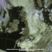 6th: The cloud was still around early in the morning, 6 oktas at 08 GMT, but within an hour it had stated to clear to give another sunny day. The NE'ly breeze felt cool, but in the sunshine the 17.3C felt pleasantly warm. The best of the sunshine was once again best in the west. The E coasts of of Scotland, England and N France were affected by low cloud and fog off the sea. The cloud stretched inland across England as far as Birmingham, see Meteosat MSG image. [Rain 0.0 mm; Max 17.3C; Min 10.3C; Grass 7.0C]
 The first 15 days saw temperatures above the monthly average with the mean on 15.2C (+1.1) and [+1.6]. There were 3 days (9 - 11) that had 20C, or more. Rainfall was 41.8 mm and this was (58%) and [63%] of the monthly average. Sunshine was 70% of the average for June. .
16th: With the sky overcast and dull it was another day of rather boring weather. Pressure was 1000 mb with low 990 mb centred over Manchester. There was no real change through to the afternoon with the most exciting event a few spots of rain at 1545 GMT. The day was cool with temperature reaching 13.5C. During the evening visibility deteriorated and the day remained sunless. [Rain 0.9 mm; Max 13.5C; Min 11.0C; Grass 11.2C]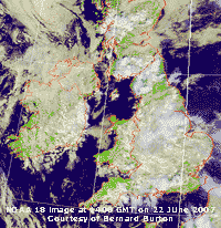 A sunny day with a cool light NE'ly breeze. Pressure was 1007 mb with low 1004 mb over southern England. Convective clouds in circulation around the low brought showers from N France over S England in the early hours and on into the Midlands to S of Manchester by afternoon. Starting with 5 oktas cover here the cumulus clouds that were towering over Snowdonia at 11 GMT diminished in the afternoon with the sky clearing over Anglesey making the island the sunniest place in Britain. During the evening the sky became overcast and murky, but it kept dry. [Valley 11.3 h] [Rain 0.0 mm; Max 18.2C; Min 13.0C; Grass 10.2C]
  24th: A dull and wet morning, but the rain stopped just before 09 GMT and there was a patch of blue sky over the weather station. The promise of a brighter morning was dashed when the cloud soon closed over again. Pressure was 1007 mb and the temperature 12.5C in a light W'ly breeze. Cloud was low on the Snowdonia Mountains and there was light rain before noon; the afternoon dull with intermittent drizzle or rain at first brightened later with sunny spells from 16 GMT. The evening was mostly clear with light wind and chattering housemartins hunted insects above the weather station around the treetops. Some were still flying at 2117 GMT when they were joined by emerging bats and for several minutes both occupied the sky. By 2130 GMT the martins had retired to their nests and roosts leaving the sky clear for the bats and perhaps the odd owl or two. [Rain 14.5 mm; Max C; Min 10.9C; Grass 10.2C]
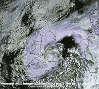
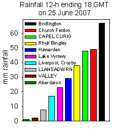 In a complete reversal of the usual west to east rainfall gradient across North Wales and Northern England, Bridlington (E coast England) reported 67 mm in the 12-h to 18 GMT, whereas Aberdaron (W coast Wales) had only 1 mm. Valley reported 2 mm and Llansadwrn 8 mm in the same 12-h period. Capel Curig reported 48 mm just behind Church Fenton (N Yorkshire) but more than Bingley 38 mm (W Yorkshire). In Hull a 28-year old man died, despite rescue attempts, trapped while trying to clearing a drainage gully. South Yorkshire, and Sheffield in particular was badly hit as the River Don rose very rapidly and flooded low-lying areas with several feet of water.
A 13-year old boy was swept away and drowned, but in Lincolnshire, a 9-year old boy was rescued by passers-by. Three Sea King helicopters were flown in to assist in the rescue of trapped people in the Brightside area of Sheffield. Many had to spend the night on upper floors of business premises in the City. Later in South Yorkshire hundreds of people were evacuated from their threatened homes in villages near the Ulley reservoir, near Rotherham, after cracks appeared in the dam. In North Wales, the A5 at Corwen was closed due to flooding and in parts of the town centre some properties were also flooded. Strong to near gale-force winds persisted all day and several trees were blown down in NE Wales; at Aberporth gale force 8 was recorded with gusts of 58 mph in the afternoon. At Capel Curig 81 mm of rain had fallen in the 72-h to 18 GMT. By then the rain had eased off and the wind moderated. [Rain 8.3 mm; Max 13.4C; Min 10.4C; Grass 7.6C]
 The month ended with a rainfall total of 122.1 mm (169%) and [184%] of average, ranking the 8th wettest June since 1928. The mean temperature was 14.6C (+0.5) and [+1.0] lowest since 2004, but ranking 8th since 1979. Sunshine was a little above average..
 1st: Another month and the unsettled weather continued. With complex low-pressure centres near Shannon and over the Irish Sea pressure at 09 GMT was 995 mb. Recent showers of rain had passed and there was a bright spell, but they were not far away (in sight to the S). Showers were indeed frequent during the morning but lessened in the afternoon. From 14 GMT it was reasonably sunny for a while, but it kept cool with the temperature rising to 16.6C. [Rain 6.2 mm; Max 16.6C; Min 12.8C; Grass 10.4C]
2nd: There were further showers at 0115 and 0530 GMT and it was still overcast at 09 GMT. A slow-moving low 990 mb was W of Scotland, but pressure 999 mb had risen a little and some breaks appeared in the cloud during the morning, but yes there were more showers. A little sunshine early in the afternoon before cumulonimbus clouds were seen which led to a more showers during the evening. [Rain 7.5 mm; Max 18.7C; Min 13.5C; Grass 13.1C]
![]()
![]() 3rd: The low W of Scotland was well-anchored but had filled to 988 mb. The jetstream continues to be S of Britain across the Bay of Biscay and over France. This is lining up the lows well S of the usual pattern that would give us settled summer weather. The morning soon turned bright with a few sunny spells that lasted into the afternoon before a further cloud and rain, in circulation around the low, encroached by 16 GMT. [Rain 6.0 mm; Max 16.5C; Min C; Grass C]
3rd: The low W of Scotland was well-anchored but had filled to 988 mb. The jetstream continues to be S of Britain across the Bay of Biscay and over France. This is lining up the lows well S of the usual pattern that would give us settled summer weather. The morning soon turned bright with a few sunny spells that lasted into the afternoon before a further cloud and rain, in circulation around the low, encroached by 16 GMT. [Rain 6.0 mm; Max 16.5C; Min C; Grass C]
 4th: Overcast with almost uniform grey stratus. Visibility was poor in mist and light rain as pressure continued to rise slowly. Our Scottish low had up-anchored and moved E towards Aberdeen, but there was persistent showery rain through the morning into the afternoon. In the west of the island and as far as Gaerwen there were a few sunny spells, but in the east we just had glimpses of sunshine. [Rain 3.9 mm; Max 15.3C; Min 11.4C; Grass 10.2C]
![]() 5th: Another overcast morning, again with almost structureless grey cloud frontal cloud over the Irish Sea. Pressure was 1010 mb with yet another low 997 mb approaching Mizen Head Ireland's most SW point; associated fronts were again moving into S England. A little fine drizzle along the Menai Strait gave way to about an hour of sunshine before normal service resumed around noon with more light rain and drizzle persisting into the afternoon. [Rain 2.8 mm; Max 16.0C; Min 11.8C; Grass 9.2C]
5th: Another overcast morning, again with almost structureless grey cloud frontal cloud over the Irish Sea. Pressure was 1010 mb with yet another low 997 mb approaching Mizen Head Ireland's most SW point; associated fronts were again moving into S England. A little fine drizzle along the Menai Strait gave way to about an hour of sunshine before normal service resumed around noon with more light rain and drizzle persisting into the afternoon. [Rain 2.8 mm; Max 16.0C; Min 11.8C; Grass 9.2C]
6th: Overcast sky and spots of rain before 09 GMT when there was a moderate shower of rain. Visibility was very poor and slight showers or drizzle persisted until afternoon that saw fewer showers and some sunny spells with the temperature rising to 18.7C. The evening turned dull and there was a further slight shower. [Rain 1.4 mm; Max 18.7C; Min 11.4C; Grass 10.5C]
7th: With pressure 1015 mb rising the chink of blue sky seen at 09 GMT, between cumulus clouds, enlarged during the morning. Although a little cloudier around noon the afternoon was mostly sunny with the temperature reaching 19.3C. For solar radiation it was the brightest day of the month recording 22.22 MJ per m2. The evening was again cloudier, but it remained sunny until after 20 GMT. [Rain 0.0 mm; Max 19.3C; Min 11.3C; Grass 9.4C]
 8th: The morning was mostly cloudy with cumulus clouds, well-developed to the SE over the Snowdonia Mountains. By afternoon it was mostly sunny and with the temperature rising to 19.7C comma (see right), red admiral and small tortoiseshell butterflies were seen around the garden. Cloud encroached by 16 GMT and a dark cumulonimbus cloud approached from the S, but there was no rain here. Later the sky cleared for a while and at dusk several bats emerged and seen around the treetops at 2120 GMT. The night was mostly cloudy. [Rain 0.0 mm; Max 19.7C; Min 11.3C; Grass 8.6C]
9th: Towering cumulus clouds were closeby before 09 GMT. Visibility was very good and by midmorning the convective clouds had diminished and it became mostly sunny. Fair-weather cumulus clouds were prominent from noon before a cloud mass over N Ireland, associated with low 1005 mb off the Northern Isles of Scotland, encroached from the west. There was rain on the W coast of the island by 16 GMT and it had reached here by 1645 GMT. The evening was wet with spells of light to moderate rain. [Rain 8.2 mm; Max 18.3C; Min 10.3C; Grass 7.4C]
10th: The morning was mostly cloudy with spells of slight drizzle. Pressure was 1013 mb between low pressure 998 mb S Norway and the Baltic and low 988 mb S of Greenland with frontal cloud was lying to the west. During the afternoon the cloud thinned and there were some bright spells with about 1.5 h of sunshine. The evening was overcast and there was some rain around 2230 GMT. [Rain 0.2 mm; Max 16.8C; Min 11.1C; Grass 9.5C]
11th: With frontal cloud continuing to affect the west the morning was again overcast. Between fronts there was a little sunshine in the afternoon before becoming overcast again by 1600 GMT. There was light rain from 2300 GMT through until morning. [Rain 1.9 mm; Max 18.7C; Min 11.2C; Grass 10.6C]
12th: At 0730 GMT the sky was obscured in fog and fine drizzle persisting up to 09 GMT when visibility began to improve. Drizzle and rain continued until 1400 GMT before the afternoon turned drier. Spots of rain continued into the evening; the mountaintops were seen at 2120 GMT above low cloud and mist off the sea. [Rain 4.7 mm; Max 16.8C; Min 12.5C; Grass 12.6C]
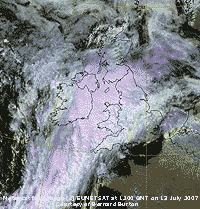 13th: Rain from 03 GMT was light up to 09 GMT, but then turned moderate to heavy through the morning well into the afternoon before easing during the evening. Pressure was 1008 mb with a low 1002 mb off SW Ireland on a frontal system stretching from the North Sea to the Azores (see Meteosat MSG image at noon) with a warm front was over Wales. The S'ly wind freshened to force 5 to 6 by the evening. {Gravesend 24.9C, Pembrey Sands 42.5 mm, Valley 0.0} [Rain 17.6 mm; Max 16.6C; Min 12.8C; Grass 10.1C]
14th: The rain stopped in the early hours but the sky was still overcast leading up to 09 GMT when it stared to clear. With 6 oktas cover there was some blue sky and more appeared during the morning. Low 994 mb was off NE Scotland and pressure here 1009 mb was rising as a transient ridge moved across from the west. The SSW'ly wind force 4 persisted all day as the cloud cleared over Anglesey with a line of stratocumulus clouds remaining over the mountaintops of Snowdonia in the afternoon. In the sunshine the temperature rose to 20.0C and the day kept dry. The evening was cloudier. [Rain 0.0 mm; Max 20.0C; Min 13.0C; Grass 12.5C]
15th: Overnight the minimum air temperature dropped to 11.1C and to 7.4C on the grass. A bright morning with a moderate NE'ly wind making the 16.0C temperature at 09 GMT feel on the cool side. Visibility was good, but with broken cloud at a premium during the day the temperature rose only a little to 16.9C. There were some spots of rain at Llanddona about 14 GMT and showery rain here from 1630 GMT continued through until after 03 GMT. [Rain 2.4 mm; Max 16.9C; Min 11.1C; Grass 7.4C]
The first 15 days had a mean temperature of 14.7C (-1.1) and [-0.9] of average. Rainfall was 62.8 mm (109%) and [99%] of average. .
16th: Low-pressure was straddling Britain and with low 1004 mb over the North Channel pressure here at 09 GMT was 1006 mb. Frontal cloud was lying to the N and S, but it was a fine and sunny morning to start before cloud had increased to 6 oktas by 09 GMT, when there was some showery rain. There was a moderate S'ly breeze and the day continued shower-free with partly cloudy skies and the temperature rose to 20.3C. There was a shower of rain at 1025 GMT and lightning was seen and thunder heard at 2329 GMT. Isolated sferics were recorded extensively moving N over Wales and there were storms over East Anglia and the Wash. [Rain 2.3 mm; Max 20.3C; Min 13.8C; Grass 13.4C]
17th: Pressure was 1008 mb with a low 1004 mb off the Western Isles of Scotland with associated frontal cloud to the north. Convective cumulus clouds were well-developed over Britain and the day was showery around 09 and 15 GMT, but with sunny spells and broken cloud in between the temperature rose to 19.9C. {Weybourne 22.5C, Lerwick 22 mm, Valley 10.5h}[Rain 3.2 mm; Max 19.9C; Min 13.0C; Grass 11.0C]
18th: There was a heavy shower of rain at 01 GMT, but by morning it was bright and sunny with 3 oktas cloud cover and a gentle W'ly breeze. Pressure was 1015 mb with low 1013 mb over Ireland. Cloud increased during the morning, but with broken cloud in the afternoon the temperature rose to 19.7C and the day was dry here. Elsewhere there were some heavy showers, with flash flooding reported in North Yorkshire where 3 ft of water entered some homes in Filey. [Rain 0.0 mm; Max 19.7C; Min 13.1C; Grass 11.6C]
19th: A mostly sunny morning with a temperature of 17.6C at 09 GMT. Pressure was 1020 mb over Wales and Ireland, but there were showers around associated with convective clouds and a slow-moving one fell on the weather station at 1115 GMT giving about an hour of light rain. The afternoon was brighter, with some sunshine, and the temperature rose to 20.8C; the evening was cloudier. Further thunderstorms affected SW England and S Wales during the day. There was flooding in Alston and the railway line between between Brampton in Cumbria and Haltwhistle in Northumberland was closed following landslips after heavy rain.
{Gravesend 25.5C, Lough Fea 23 mm, Manston 13.8h, Valley 13.0h}[Rain 5.5 mm; Max 20.8C; Min 11.8C; Grass 7.9C]
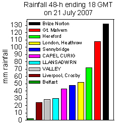 20th: Pressure was high 1025 mb to the N of Scotland but thunderstorms over France and Germany were making their way N into S England and Wales. There was showery rain from 04 GMT and it was still raining at 09 GMT. Pressure was 1017 mb with a light NE'ly breeze and by 0930 GMT it was brighter for a while. There was moderate to heavy rain from 1045 GMT through the day becoming intermittent into the evening; the day was sunless. Rainfall here was nothing like that experienced in other parts of Britain. At Pershore College 135 mm fell, while at Brize Norton 118 mm was recorded. Rain was heavy in many places with over 50 mm recorded in an hour at some. This lead to extensive flooding from South Wales to the Thames Valley. {Gravesend 21.5C, Pershore College 135 mm, Brize Norton 118 mm, Heathrow 38 mm, Stornoway 14.8h} [Rain 24.5 mm; Max 14.4C; Min 12.1C; Grass 8.9C]
21st: Heavy rain resumed at 0300 GMT and moderate to heavy rain continued up to 09 GMT. In the 24-h (090-09 GMT) rainfall was 24.5 mm, the largest fall of the month. There was further light rain during the morning ceasing around 14 GMT. The afternoon was drier, and a little brighter, but the temperature struggled to reach 13.0C; the evening was cloudier again with light showers of rain from 2300 GMT. [Rain 1.8 mm; Max 16.0C; Min 11.0C; Grass 10.7C]
22nd: Light showers of rain continued until 08 GMT when the sky started to clear. At 09 GMT the temperature had risen to 16.0C and was the maximum for the past 24-h. The morning has good sunny periods with good visibility. Pressure was 1008 mb in a slack area between low 998 mb SW Ireland and complex low-pressure Scotland to S Sweden and Denmark The afternoon saw some showers of rain at 15 GMT and 1715 GMT here. There was a downpour on the mainland between the Britannia Bridge and Penrhyn Castle with a rainbow over the Menai Strait between 1615 and 1650 GMT. With little or no wind drizzle and light rain settled in for the evening. [Rain 1.4 mm; Max 19.4C; Min 10.4C; Grass 7.8C]
23rd: On what was to be a dry day the day began overcast and dull with a moderate NE'ly breeze. Pressure was 1002 mb with low 995 mb over the SW Approaches to the English Channel. The afternoon was brighter with some sunshine here although the Snowdonia mountaintops remained cloud-covered. Broken cloud at dusk resulted in a colourful sunset and a moonlit sky at night. [Rain 0.0 mm; Max 17.8C; Min 12.6C; Grass 10.3C]
24th: In a NW'ly breeze cloud increased at first during the morning. Pressure was 1009 mb in a ridge of high-pressure between complex low-pressure to the W, and similar to the E over S Sweden and Denmark. Before noon it was mostly sunny and by afternoon the temperature had reached 20.2C. The daytime was dry, but frontal cloud moving in from the W, brought more light rain by midnight. [Rain 7.7 mm; Max 20.2C; Min 10.2C; Grass 5.5C]
25th: At dawn it was still raining and continued up to 09 GMT accumulating 7.7 mm. With the passage of the cold front a clearance brought some sunshine for a while during the morning. By noon the sky was mostly cloudy but it kept dry. [Rain 2.5 mm; Max 18.7C; Min 12.0C; Grass 9.8C]
26th: There was light rain from 01 GMT and by 09 GMT 4.9 mm had accumulated. Rain continued through the morning in moderate visibility. Pressure was 998 mb, lowest of the month, with a low 991 mb off NW Scotland tracking E. The afternoon was drier, with a moderate S'ly breeze, and there was a little sunshine around 1730 GMT before a spell of showery rain developed. A rainbow was spotted at 1630 GMT, the sun was visible at sunset and there was no further rain. {Sennybridge 32 mm} [Rain 4.9 mm; Max 16.0C; Min 13.8C; Grass 12.3C]
27th: A bright morning with 4 oktas cloud cover at 09 GMT. Pressure 1008 mb had risen with the low having moved across the southern Norwegian Sea to be near Bergen, Norway, with associated frontal cloud over the Baltic Sea. The day had variable amounts of sunshine with convective orographic clouds over the mountains of Snowdonia. There were moderate showers of rain from 1800 to 2000 GMT. Later the sky cleared and the night was dry. [Rain 3.3 mm; Max 19.0C; Min 12.0C; Grass 9.5C]
28th: It was a bright morning and with broken cloud there was some sunshine. Pressure was low 990 mb to the E over Scandinavia and 1004 mb W over the Atlantic. Here pressure was 1015 mb in a minor ridge and the day was sunny at times with blue sky and good visibility. By 1500 GMT it was cloudier with a developing frontal low moving in across Ireland and the Irish sea. There were spots of rain by 1515 GMT then slight rain and heavy drizzle up to 2300 GMT, but the accumulated total was only 0.5 mm. [Rain 0.5 mm; Max 19.5C; Min 9.0C; Grass 4.1C]
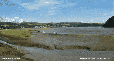 29th: The morning was mostly cloudy at first with a light NW'ly breeze. By 11 GMT with a moderate NW'ly breeze the sky had cleared except for a line of stratocumulus clouds over here, the mountains of Snowdonia and SE over the Severn to the Isle of Wight. It was a dry day, the first of 3, ending with a deep orange coloured sunset. {Solent 21.6C, Manston 20.6 mm, Valley 12.8h} [Rain 0.0 mm; Max 18.8C; Min 8.1C; Grass 3.6C]
30th: With mostly clear sky overnight the air temperature fell to 7.9C and on the grass to 2.2C, both lowest of the month. The grass minimum was the lowest recorded at this station in July since observation commenced in 1968. Pressure was 1025 mb, highest of the month, with high 1026 mb over Ireland. There were some cumulus clouds over Snowdonia and the day was mostly sunny. There was a cool N'ly breeze and this kept the temperature to a maximum of 17.8C. The evening was sunny and later, with the cloud over the mountains clearing, the moon rising from behind at 2130 GMT. {Mumbles Head 19.5C, Aberporth 12.3h} [Rain 0.0 mm; Max 17.8C; Min 7.9C; Grass 2.2C]
31st: A clear bright and sunny morning, but pressure 1022 mb had stated to fall with high-pressure sinking southwards as deep low 990 mb tracking E over Iceland. Frontal cloud was moving SE over NW Ireland and Scotland, but the day here was sunny and warm with the temperature rising to 21.9C, highest of the month. Visibility during the afternoon was very good, some high cirrus clouds encroached during the evening ahead of the frontal cloud. {London 23.9C, St. Mawgan 14.7h} [Rain 0.0 mm; Max 21.9C; Min 9.1C; Grass 3.9C]
The month ended with a mean temperature of 14.9C (-1.0) and [-0.7] of average, lowest since 2002 and 10th lowest since before 1979. The grass minimum of 2.2C on the 30th was the lowest recorded in July since before 1986. Rainfall totalled 120.4 mm (209%) and [190%] of average, largest since 1974 and 10th wettest since 1928. Wet days (1.0 mm, or more) were 21 (+10.8) and were most at this station since 1979.
1st: An overcast and dull beginning to the month with the the sun looming through the moderately high altostratus cloud. Pressure was 1015 mb with low Norwegian Sea E of Iceland. Pressure was high 1029 mb over the Azores and 1020 SE Europe. I did not see any clear bright sunshine so the day was recorded as sunless. Narrow bands rain showers moved S across Anglesey and North Wales during the evening. Rain was here between 20 and 21 GMT, but there more frequent and prolonged showers on the Snowdonia Mountains. The showers made slow progress S being over mid-Wales at midnight and reaching Cardiff at 0530 GMT. [Rain 0.6 mm; Max 18.5C; Min 10.5C; Grass 5.8C]
2nd: The sky began to clear just before 09 GMT, a complex of cumulus (one was towering to the S and more to the W), altocumulus and altostratus. Visibility had been poor in mist at 0530 GMT, but was improved to moderate. It was mostly sunny on Anglesey during the afternoon with visibility very good. With just a little cloud left around Snowdon and Carnedd Llewelyn the cliffs at Ysgolion Duon, the Black Ladders, were clearly depicted in the low evening sunlight. {Mumbles Head 21.1C and 18.6 mm} [Rain 0.0 mm; Max 21.3C; Min 13.0C; Grass 11.6C]
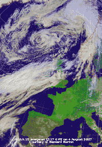 3rd: Another dull overcast morning. Pressure at 09 GMT was 1019 mb with ridge of high-pressure 1025 mb over the Bay of Biscay, but vigorous low 964 mb was SW Iceland. Associated frontal systems had brought rain into NW Ireland and W Scotland, turning heavy through the day. Here cloud thickened with a strengthening force 6 S'ly wind, there were drizzle and light rain from 1130 GMT persisting into the afternoon. The day was sunless here, but further along the North Wales coast it was sunny and warm and at Hawarden the temperature reached 24.3C. Here it was 17.3C and at Aberdaron on the Lleyn Peninsula 16.4C. From 20 GMT there was heavy drizzle turning to moderate rain by 2300 GMT and persisted through the night accumulating 6.0 mm by morning. {London 26.1 mm, Hawarden 24.3C, Aberdaron 16.4C; Isle of Skye 27.2 mm, Capel Curig 10.2 mm; Hurn Bay 13.3h} [Rain 6.0 mm; Max 17.3C; Min 12.6C; Grass 9.8C]
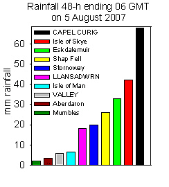 4th: It was still raining at 09 GMT and rain was being blown across the fields on the moderate (f5) SW'ly wind. Visibility was very poor (< 1 km) in the rain and misty low cloud. Low 976 mb was off NW Scotland, pressure here was 1016 mb with high pressure 1025 mb over Germany. With the slow-moving frontal cloud over Anglesey rain was continuous through the dull (3.03 MJ per m2) and sunless day, only easing and turning to drizzle after 1900 GMT. The daytime temperature reached a maximum of 16.1C and was still 15.5C at 2100 GMT.
The NOAA 18 satellite image (left) shows low 976 mb off NW Scotland with frontal cloud affecting Ireland, Wales, SW and NE England. Clear skies over SE England, Spain and France resulted in another marked contrast NW-SE in rainfall and temperatures today, in cloud-free parts temperatures over 25C were common. {Capel Curig 57.6 mm; London 27.3C, Hawarden 23.8C, Aberdaron 15.5C, Kinbrace 10.5C; Manston, Kent 14.3h} [Rain 12.1 mm; Max 18.7C; Min 15.4C; Grass 15.1C]
5th: A much brighter morning with 4 oktas cover of cirrus and altostratus with cumulus seen to the S over Moel Eilio on the mainland. Pressure was 1010 mb with low 1006 mb on the front over St George's Channel. The edge of frontal cloud to the W was overhead and moved away to the W sufficient to give a mostly sunny morning with very good visibility. The temperature rose to 23.6C, highest of the month, just to show what we have been missing! At Valley it was cloudier [1.2h sunshine] with a maximum of 19.6C. The front moved back again later with drizzle and light rain from 1630 GMT into the evening. [Rain 4.2 mm; Max 23.6C; Min 14.9C; Grass 13.8C]
![]() 6th: A fine and sunny morning, but cover of cumulus had been increasing since dawn. High 1029 mb was mid-Atlantic and pressure here was 1009 mb with frontal low 1001 mb near Aberdeen, Scotland. The front had moved eastward in the night and was over the North Sea; the day had some good sunny spells. The Meteosat MSG satellite image at 12 noon shows cloud associated with the low near Aberdeen and the decaying cold front over the North Sea. Convective clouds are developed over land in Ireland and the west, and over the sea to the SW.. Stratocumulus cloud capped the Snowdonia Mountains in the afternoon; about 16 GMT cumulus were more developed and cumulonimbus were spotted. Here it kept sunny and the sky was clear overhead about 1630 GMT. [Valley 9.5h] [Rain 0.0 mm; Max 19.0C; Min 11.0C; Grass 7.6C]
6th: A fine and sunny morning, but cover of cumulus had been increasing since dawn. High 1029 mb was mid-Atlantic and pressure here was 1009 mb with frontal low 1001 mb near Aberdeen, Scotland. The front had moved eastward in the night and was over the North Sea; the day had some good sunny spells. The Meteosat MSG satellite image at 12 noon shows cloud associated with the low near Aberdeen and the decaying cold front over the North Sea. Convective clouds are developed over land in Ireland and the west, and over the sea to the SW.. Stratocumulus cloud capped the Snowdonia Mountains in the afternoon; about 16 GMT cumulus were more developed and cumulonimbus were spotted. Here it kept sunny and the sky was clear overhead about 1630 GMT. [Valley 9.5h] [Rain 0.0 mm; Max 19.0C; Min 11.0C; Grass 7.6C]
7th: Cloud encroached from the N during the night and it was overcast at dawn. By 09 GMT some breaks had appeared although there were a few spots of rain in the vicinity. Pressure was 1017 mb with the low 1005 mb persistent over NE Scotland. High 1030 mb W of Biscay was struggling to head off low 996 mb with associated fronts S of Greenland. Cloud cover reduced during the day; it was mostly clear in Anglesey, with a line stratocumulus persisting over Snowdonia, into the afternoon. The evening was mostly clear. [Rain trace; Max 16.6C; Min 10.6C; Grass 8.9C]
8th: Pressure 1023 mb had risen with high 1026 mb Bay of Biscay extending a ridge northwards to Britain. With just 2 oktas of altocumulus lenticularis to the SE at 08 GMT of the weather station it was a sunny morning with a light E breeze. A few cumulus were seen over Liverpool Bay at 09 GMT and it did turn cloudier around noon as the wind turned NW'ly and fair weather cumulus developed overhead. One or 2 darker clouds passed over, but there was no rain. The rest of the afternoon and evening were mostly clear and sunny on Anglesey with very good visibility. [Valley 12.3 h] [Rain 0.0 mm; Max 16.9C; Min 8.3C; Grass 5.8C]
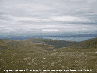 9th: Another sunny morning with a light S'ly breeze and very good visibility. Pressure 1019 mb had fallen as the high over Britain was being squeezed against low-pressure 1005 mb S of Iceland and Germany. Frontal cloud lay W of Ireland, but here clouds were very few and far between, some cirrus and cumulus to the S early on and some stratocumulus over the eastern part of the Snowdonia range later. The temperature rose to 21.3C and global solar radiation was 16.57 MJ per m2, highest of the month. Fresh snow fell on part of the Swiss Alps today! [Aberporth 13.6h, Valley 11.2h] [Rain 0.2 mm; Max 21.8C; Min 8.5C; Grass 6.1C]
10th: Frontal cloud encroached from the W in the early hours and the sky was overcast by morning. Under uniformly grey low stratus there was drizzle and slight rain at times. It was misty on the mountain slopes with moderate visibility here. Pressure was 1018 mb with complex low-pressure to the W and an occluded front over Wales. It was drier by midmorning when it was brighter with even the odd sunny interval extending into the afternoon. The sky brightened some more around 17 GMT, just in time to have a family BBQ with grandchildren in attendance. Drizzle came on again at 19 GMT. [Rain trace; Max 20.6C; Min 13.4C; Grass 11.7C]
 11th: Overcast with moderately high cloud, but touching the tops of the Snowdonia Mountains at first. Pressure was 1015 mb with high-pressure to the S over the English Channel and N France. Frontal cloud was massed to the W and there was rain over the Irish Sea and SW Scotland. During the morning the cloud lifted off the tops and with a few breaks in the cloud W and central Anglesey enjoyed a few sunny intervals. The day here in the SE corner was sunless (see photo above taken from the Carneddau). Brighter weather could be seen eastwards from the summit of Foel Fras. There were slight shower of rain from 1500 GMT before the cloud thickened and descended again giving light to moderate rain from 1900 GMT. {Glenanne 42 mm, Capel Curig 21.2 mm, Valley 13.0 mm}[Rain 22.4 mm; Max 18.2C; Min 13.5C; Grass 11.5C]
12th: There were spells of heavy after midnight, around 0100 and 0300 GMT, then eased to light rain and then heavy drizzle at 0500 GMT. Rain stopped about 0700 GMT and there were then some breaks in the cloud. Rainfall accumulated (09-09 GMT) was 22.4 mm. The sky was overcast again at 09 GMT and there was some more drizzle. There had been some standing water on a nearby field, this morning the pools were larger. During the morning the cloud started to break and the rest of the day was fairly sunny with the temperature reaching 18.5C. [Valley 5.6h] [Rain 0.1 mm; Max 18.5C; Min 12.5C; Grass 11.8C]
13th: A bright morning but showery morning with cumulus clouds in the vicinity. Pressure was 1007 mb with low 990 mb near Cape Wrath, Scotland. Deep low 986 mb was S of Greenland and ahead of it another developing frontal low heading our way. Visibility was good and there was a moderate S'ly wind. The morning kept mostly cloudy, but by afternoon it was mostly sunny with the sky clearing overhead for a while. Later cloud encroached from the west and there was showery rain from 2100 GMT until midnight. [Rain 5.2 mm; Max 17.5C; Min 11.3C; Grass 9.0C]
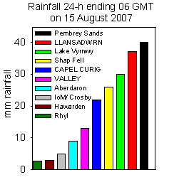 14th: There was more rain from 02 to 03 GMT bringing the total (09-09 GMT) to 5.2 mm. With plenty of cumulus clouds around the morning was bright at times with slight showers. Pressure was 996 mb in a slack area between low 992 mb was off N Scotland and low 983 mb off SW Ireland. The morning was dull with slight rain at times and was either calm or with a very light SE'ly wind. The cloud thickened some more in the afternoon and there was light to heavy drizzle and bursts of moderate to heavy rain with cyclonic wind direction. At 2100 GMT the wind had picked up and was SW'ly force 5 and there was moderate rain from 2200 GMT. Rainfall for the period 09-09 GMT ending on the 15th was 41.0 mm and was the wettest day in August since records began in 1979 at this station. The wettest day in Llansadwrn, in any month, was the 127 mm which fell in 3 h during a thunderstorm on 10 August 1957. [Rain 41.0 mm; Max 17.8C; Min 12.2C; Grass 9.2C]
15th: At midnight pressure here was 989 mb with low 983 mb was off Dundee, Scotland, and a pair of occluded fronts were charted over the Irish Sea. Rain turned heavy from 0300 GMT to 06 GMT before easing somewhat and was still raining slightly at 09 GMT. Visibility was poor in low cloud and mist and there was a large pool of water on the field adjacent to the weather station. The ground was soggy and pressed water underfoot indicative of near saturation. Pressure 994 mb was rising and by midmorning the rain had stopped, as frontal cloud cleared SE, and the afternoon was mostly sunny. Cumulus clouds were in the vicinity; some were towering, sferics were recorded to the S of here. At 1700 GMT the sky was briefly clear, but was cloudier again by 1800 GMT. [Rain 1.6 mm; Max 17.3C; Min 12.6C; Grass 11.7C]
The first 15 days were wet having a total of 93.4 mm of rain that was (106%) of the decadal and [116%] of the 30-y averages. The mean temperature was 15.5C (-0.6) and [+0.1].
16th: After a slight shower at midnight there were spells of drizzle from 04 to 07 GMT. Low 975 mb was N of Scotland over the Norwegian Sea while high 1031 mb was N of the Azores. An occluded front was lying from Anglesey to the Western Isles. Pressure 1010 mb was rising and we were in a WNW'ly airflow. The morning stayed mostly cloudy, but the afternoon was brighter with some sunny spells, but a shower crossed the SW corner of the island later. The evening was fine and mostly sunny. [Rain 0.0 mm; Max 15.8C; Min 10.1C; Grass 7.2C]
17th: A mostly cloudy morning with moderate to heavy dew with the grass minimum falling to 5.2C. Pressure 1015 mb had risen with low 985 mb filling off the SW tip of Norway. We were in a ridge of high-pressure , but low 977 mb with attendant frontal cloud was approaching W of Ireland. The morning was soon overcast with moderately high cloud. There was a shower of rain in NW Anglesey before cloud thickened and lowered here later in the afternoon with intermittent light rain from 2000 GMT. The day was sunless. [Rain 3.2 mm; Max 17.7C; Min 8.8C; Grass 5.2C]
18th: At midnight the low 999 mb was W of Shannon, Ireland, and filling was ontrack for the Irish Sea. Overcast with slight rain at first in moderate visibility with low misty stratus cloud. Pressure 1003 mb had fallen with the low 1000 mb centred near Dublin. It was a murky sunless day with the rain moderate to heavy around 1300 GMT. [Rain 11.0 mm; Max 17.0C; Min 12.5C; Grass 11.8C]
19th: No improvement overnight, the sky still overcast with almost uniform grey stratus, moderate visibility in the mist. Pressure was 1010 mb was rising with the low 1003 mb having crossed over and was near Hull on its way to the North Sea. Intermittent drizzle through the day and of course it was sunless, the third sunless day in succession. Not the kind of day that one hopes for in August, there were even leaves falling off nearby beech trees making the day look very autumnal indeed! The day's maximum temperature was 13.6C, lowest of the month. After sunset the sky began to clear. [Rain trace; Max 13.6C; Min 12.2C; Grass 11.8C]
20th: In the clear slot between fronts the temperature on the grass fell to 4.5C and was lowest of the month. By 04 GMT more cloud had encroached and there were a few spots of rain at 0845 GMT. An area of heavy rain, on a frontal system over Ireland and St George's Channel, slid SE affecting N Ireland, S Wales {Milford Haven 31.6 mm} and SW England from 05 to 09 GMT. We escaped here with just a few drops! The morning was mostly cloudy at first but brightened in the afternoon with fair-weather cumulus developing then the sky clearing by 17 GMT. A patch of cloud moved across off the Irish Sea from the N during the evening, there was no rain here, but it did look dark and threatening over the NE corner of the island. The daily mean temperature of 12.1C was lowest of the month. {Lerwick 39.2 mm, Milford Haven 31.6 mm} [Valley 6.0h, 0.4 mm] [Rain trace; Max 15.6C; Min 8.5C; Grass 4.5C]
21st: There were a few clear spells overnight and the morning was mostly cloudy with cumulus clouds developing. Pressure 1020 mb had risen and there was a light NE'ly breeze and good visibility. During the afternoon cumulus clouds diminished and it was mostly sunny with the temperature reaching 17.2C. Patchy cloud encroached from the NE during the evening and there were lenticular clouds over NW Anglesey. There was a fine red sunset as the sun set behind Holyhead Mountain. {Aberporth 10.4h} [Rain trace/dew; Max 17.2C; Min 11.5C; Grass 9.2C]
 22nd: Although the sky was mostly clear it had been a mild night with minima 13.6C in air and 11.6C on the grass. Pressure was 1023 mb in ridge 1028 mb from the Azores to N Scotland moving across from the W. There was heavy dew with a trace inside the raingauge funnel. The day was sunny with a moderate NNE'ly wind, visibility was moderate in haze, with the temperature reaching 18.1C. {St Athan 24.6C}[Valley 12.5h, max 20.5C] [Rain 0.0 mm; Max 18.1C; Min 13.6C; Grass 11.6C]
23rd: Another fine and sunny morning with 4 oktas complex cloud cover comprising fair-weather cumulus, altocumulus and cirrocumulus developed from contrails drifting across from the NE. More heavy dew on the grass with the minimum 6.5C. Somewhat cloudier today, but the cloud was moderately high and there were clear sunny spells with little or no wind by evening. Flying ants had taken to the air during the afternoon, some got caught in spiders' webs on the washing line (see left). [Rain trace; Max 18.5C; Min 11.0C; Grass 6.5C]
24th: Pressure 1028 mb remained high with high 1031 mb to the SW, but the sky was overcast with uniform grey stratiform cloud in common with much of the Irish Sea, N Wales and W Scotland. At 09 GMT there was a very fine drizzle and little or no wind. Although a few small breaks in the cloudsheet appeared from time to time there was intermittent drizzle too. The afternoon was drier, but kept the covering of cloud. On the NW coast of the island at 15 GMT the sky had cleared and it was calm; smoke from Anglesey Aluminium's 400 ft stack was rising vertically. This clearance slowly headed S and reached the weather station at 1800 GMT. NE Scotland had a fine sunny day 'the best of the summer so far in Dundee' with the temperature reaching 25C. [Valley 5.6h] [Rain 0.2 mm; Max 20.7C; Min 12.8C; Grass 12.5C]
25th: Cloud returned around 02 GMT and the sky was overcast by 05 GMT and light drizzle from 0530 GMT.. The morning was dull with poor visibility in low coastal cloud that affected the Lleyn Peninsula, Anglesey and mainland bordering the Menai Strait. Some breaks appeared overhead late in the afternoon. The cloud was thinner and some weak sunshine, around 17 GMT, was just in time for a family BBQ before sunset. [Rain trace; Max 18.8C; Min 13.8C; Grass 11.1C]
26th: A brighter morning with 5 oktas of cloud cover. Cloud was rather persistent here near the Snowdonia Mountains. With a N'ly breeze off the sea the day seemed rather cool with the temperature reaching 16.6C. Elsewhere along the N coast of the island, from Holyhead to Point Lynas, it was sunny with Valley reporting the sunniest day of the month. [Valley 12.7h] [Rain 0.0; Max 16.6C; Min 10.0C; Grass 6.9C]
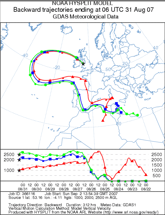 27th: Pressure was 1032 mb within the high 1033 mb stationed to the W of Ireland. The N and W continued to be affected by persistent stratiform cloud. [Rain 0.0 mm; Max 16.5C; Min 9.8C; Grass 6.2C]
28th: The morning began sunny enough with cloud clearing from dawn. At 09 GMT 3 oktas of cumulus clouds, fair-weather but some were towering to the S. During the morning the convective clouds built up and showers threatened. A few spots of rain were seen and there was a light shower near Llangefni just before 1400 GMT. There was a cool NE'ly breeze and the temperature reached 16.6C. [Rain trace; Max 16.6C; Min 12.0C; Grass 9.5C]
29th: A mostly cloud covered sky again this morning. Pressure was 1024 mb with the high 1033 mb still anchored W off Ireland. A warm from stretching from Iceland lay over W Scotland and encircling Ireland and SW England. There might have been a few drops of rain early in the morning, but there was heavy dew as well. Although the day was rather poor for sunshine here it kept dry, with any convective clouds weakly developed, until about 22 GMT when there was a slight shower of rain.[Rain trace; Max 16.2C; Min 10.9C; Grass 8.1C]
30th: Another overcast morning and the cloud was thick enough around noon for some drizzle to fall. The cloud thinned in the afternoon and kept dry, later some breaks gave a few sunny spells. Cloud closed in again during the evening. [Rain 0.6 mm; Max 19.5C; Min 12.8C; Grass 10.5C]
31st: Overcast and dull after some drizzle and light rain between 0400 and 0600 GMT. There was a slight deposit of a mixed pinkish-white to pale red dust (MUNSELL� Color Chart 2.5YR 8/2 and 2.5YR 7/2) on observing surfaces. Backward trajectory analysis of parcels of air arriving between 1000 m and 2000 m over Llansadwrn (see right), using the HYSPLIT model courtesy of NOAA (ARL), indicated that the dust originated from north Africa. The dust could have been picked up between the 22 and 25 August somewhere along the coast of northern Libya, or Tunisia and NE Algeria, perhaps accounting for the distinct colour mixture. After blowing out over the Mediterranean Sea, and reaching the Gibraltar Strait, the dust was carried N over Spain before turning W. Then circled around high-pressure W of Ireland to reach Anglesey and be washed out by the rain. The day kept overcast with slight fine drizzle at times (no further dust was observed) lasting into the evening. The day was sunless. [Rain trace; Max 17.5C; Min 13.5C; Grass 12.8C]
The month ended with a mean temperature of 15.6C (-0.6) and [+0.1] of average, tenth coolest since 1979. The second half was drier so that the total rainfall was 108.4 mm (123%) and [135%] of average.
1st: Starting the month pressure was high 1032 mb over the Atlantic to the SW, but here was 1023 mb. Low 988 mb was E of Iceland with associated fronts lying well to the NW, but remnant cloud lingered over Britain. It was dry during the day, but beginning overcast it kept mostly cloudy with some brief sunny spells when the temperature reached 17.7C. [Rain 0.5 mm; Max 17.7C; Min 14.2C; Grass 12.8C]
2nd: As the Icelandic low moved E over the Norwegian Sea fronts pushed SE and there was light rain from 07 GMT. Pressure was 1017 mb and slight rain continued intermittently with drizzle during the morning. The afternoon was wetter with light rain continuing on a weak cold front until after 1700 GMT. The day was sunless, after dusk lighter sky was seen in the NW and broken cloud appeared during the night with glimpses of a half moon. [Rain 3.5 mm; Max 16.0C; Min 14.0C; Grass 13.2C]
 3rd: A brighter morning with 6 oktas cover of cumulus and cirrus clouds. Pressure 1022 mb was rising as the Atlantic high 1030 mb, lying to the SW, moved over western parts of Britain. A slight fall of pinkish red dust (MUNSELL� Color Chart 2.5YR 7.5/8) was observed to have fallen in yesterday afternoon's rain. It was spotted dried on the corner of the Stevenson screen and raingauge. Backward trajectory analysis for parcels of air arriving between 1500 m and 2000 m over Llansadwrn (see right), using the HYSPLIT model courtesy of NOAA (ARL), indicated a north African origin. The most likely source was in Tunisia or NE Algeria between 22-25 August. From there the dust was carried over Spain and France, then W over the Atlantic around an area of high-pressure N towards Greenland before turning E towards Anglesey. It was similar in origin and colour, and possibly part of the same event, as the dust that fell here on the 31st August.. Visibility was good with the cloud just touching the highest summits of the Snowdonia Mountains. It was a mostly sunny day with cumulus diminishing during the afternoon and the sky clearing by evening. There was a cool N'ly breeze that pegged the temperature back to a maximum of 15.5C. Tawny owls were heard during the day, fairly unusual, but they will call when they are roosting in daylight from time to time. [Rain trace/dew; Max 15.5C; Min 9.6C; Grass 7.0C]
4th: With the sky mostly clear overnight there was heavy dew on the grass and even condensed inside the funnel of the raingauge. The 4 oktas cover of cloud was moderately high altostratus, and cirrus. It was calm at first, but later the N'ly breeze picked up and some cumulus clouds formed. These dispersed by noon to give a mostly sunny afternoon, with the temperature rising to 20.4C (second highest of the month), before cloud encroached again by dusk with rain after midnight. [Rain 1.1 mm; Max 20.4C; Min 8.0C; Grass 5.5C]
5th: There was drizzle and light rain from 02 to 06 GMT and it was overcast with low cloud and mist on the mountains at 09 GMT; visibility was moderate. Earlier in mist and very poor visibility the trees had been dripping with moisture catching the mist like a rain forest does. Pressure was 1032 mb with the high 1033 mb over the Bristol Channel. The day was mostly cloudy, there was no further rain, but little in the way of sunshine. [Rain trace; Max 19.6C; Min 10.2C; Grass 9.8C]
6th: Pressure 1034 mb had risen as the high established over Britain and Ireland. It was a bright morning with the cloud lifting and sky clearing to give a mostly sunny day. The temperature rose to 20.5C, the highest of the month. Solar radiation was 16.57 MJ m-2, highest of the month. By 1630 GMT cloud increased again, but there was a nice sunset. [Rain trace; Max 20.5C; Min 15.1C; Grass 14.5C]
7th: The morning was sunny with blue skies with only 2 oktas cloud cover. Pressure was still high at 1034 mb with the high drifting westward. Visibility was very good and there was a light NE'ly breeze off the sea; the temperature rose to 18.9C. After dark, with the temperature falling under the still-clear sky and very light wind, mist patches formed in some low-lying areas of the island.[Valley 12.2 h] [Rain trace; Max 18.9C; Min 10.8C; Grass 7.6C]
8th: Overnight cloud encroached so that by morning the sky was overcast and dull. There was a little rain around 07 GMT, but this had stopped before 09 GMT. Pressure 1031 mb was falling as the high edged further over the Atlantic W of Ireland. A band of cloud lay from N Ireland across the Irish Sea to Anglesey and on into SE England. The day kept mostly cloudy with very little sunshine, but was dry. [Rain 0.0 mm; Max 16.1C; Min 11.0C; Grass 7.7C]
9th: The morning was overcast and calm with not a leaf moving on the treetops. Pressure had fallen to 1027 mb with the high 1033 mb now well out over the Atlantic. The day was sunless, with the result that the temperature only rose to 15.2C. [Rain 0.0 mm; Max 15.2C; Min 13.9C; Grass 9.7C]
 10th: A brighter start to the day with some breaks in the cloud by 09 GMT. Pressure had fallen to 1023 mb; the high was still in position 1033 mb W of Ireland, but low 994 mb S Sweden resulted in more closely packed isobars over Britain and a moderate N'ly breeze. There was more in the way of sunshine today and solar radiation reached 10.90 MJ m-2 and the temperature 16.1C. During the evening the NNE'ly breeze freshened, under mostly clear skies, but the Snowdonia mountaintops were cloud covered. [Rain 0.0 mm; Max 16.1C; Min 13.4C; Grass 11.7C]
11th: Under clearer skies the overnight minimum had fallen to 8.9C and on the grass to 5.4C with moderate dew forming. Pressure had risen to 1028 mb and there was a light NW'ly breeze. The hazy morning, with moderate visibility, was mostly sunny and the temperature rose to 18.0C. After noon it was cloudier for a while as cloud moved in from the NW off the Irish Sea. It was brighter again before dusk, but during the evening cloud encroached once again. [Rain 0.0 mm; Max 18.0C; Min 8.9C; Grass 5.4C]
12th: The night remained mostly cloudy so that the minimum kept up to 13.2C and to 12.9C on the grass. The morning was overcast and dull and there was little or no wind. The afternoon remained dull until 1530 GMT when the sky began to clear with a little sunshine coming along. After a nice sunset mist formed on surrounding fields. [Rain 0.0 mm; Max 17.0C; Min 13.2C; Grass 12.9C]
13th: Pressure 1026 mb was falling as the high 1027 mb over S Britain was being squeezed by Icelandic lows 986 mb tracking eastward across N Scotland. The morning was overcast with frontal cloud associated with the low encroaching on the NW. Some breaks in the cloud allowed the sun to break through for a while in the afternoon when the temperature rose to 18.8C. [Rain 1.8 mm; Max 18.8C; Min 10.5C; Grass 6.5C]
14th: By morning the cloud was clearing giving a sunny start. Pressure was 1020 mb with deep lows 980 mb off the Norwegian coast. The high 1030 mb had moved SW and was W of the Bay of Biscay. The day had variable amounts of convective clouds passing across the sky with some good sunny spells in between. Late in the afternoon the clouds cleared giving a clear evening with little or no wind. [Rain 0.0 mm; Max 18.1C; Min 11.9C; Grass 11.6C]
15th: With clearer skies the temperature above the grass had fallen to 5.1C by morning, with moderate dew formation. Pressure was 1024 mb with another Icelandic low 997 mb passing eastward N of Scotland. High-pressure was 1028 mb over S Britain. The morning was bright and sunny, although frontal cloud was lying not far to the NW. Here, and over the Snowdonia Mountains, there were some convective clouds at times, but these diminished through the afternoon. [Rain 0.0 mm; Max 18.8C; Min 9.0C; Grass 5.1C]
The first 15 days of the month had a mean temperature of 14.7C just (+0.1) of the average of the last decade, but [+1.3] on the 30-y average. It had been dry with only 6.9 mm rain 6% of average. Winds were light and mostly NE'ly; there were 6 days when it was calm at 09 GMT..
16th: An overcast morning and with lack of sunshine the 15.2C temperature felt cold in the fresh (force 5) S'ly wind. It had kept dry overnight and the grass minimum read 10.2C; the dewpoint at 09 GMT was 11.9C (81% relative humidity). The grass, concrete and soil surface were dry with the Piche evaporimeter indicating 2.0 mm evaporation over the past 24-h.. Pressure 1010 mb had fallen with low 986 mb off the S Norwegian coast with a mid-Atlantic high 1033 mb S of Greenland. A cold front lay over the Irish Sea and the day kept mostly cloudy with a moderate to strong S/SW'ly gusty wind. Rain started around 1400 GMT and was light to moderate until 1600 GMT (3.6 mm) with the temperature falling off from its 15.8C maximum. After passage of the front the wind moderated and the sky cleared to give some sunshine. By 1830 GMT the sky was cloudier for a while before another clearance around 1030 GMT when the breeze was light. [Rain 4.3 mm; Max 15.8C; Min 12.7C; Grass 10.2C]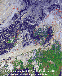 17th: After midnight there were showers of rain bringing the rainfall total up to 4.3 mm by 09 GMT. With 6 oktas cloud cover it was a showery morning with some bright and sunny spells in between and a NE'ly breeze. Pressure 1014 mb was rising as the low 977 mb had crossed over Sweden to be near Kemi at the head of the Gulf of Bothnia. High 1035 mb was mid-Atlantic so that we were in a showery N'ly airstream. The NOAA satellite image shows the low over Swedish Lapland at the head of the Gulf of Bothnia and frontal cloud over S Britain and the English Channel. Convective clouds had developed over Britain while there was extensive marine open cell convection to the N and NW. Showers were encroaching Anglesey blown in off the Irish Sea. The afternoon was similar, breezy with showers and sunny intervals with the temperature 14.0C at its maximum. There was a heavy shower in Benllech at 1510 GMT. .Showers continued into the evening with the temperature falling quickly to 7.5C around 17 GMT. With the last about 20 GMT the temperature rose to 9.0C before midnight under partly cloudy skies. [Rain 1.6 mm; Max 14.0C; Min 8.0C; Grass 4.3C]
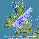
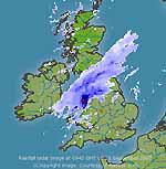
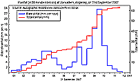 21st: There was moderate to heavy rainfall from just before 0100 GMT. The rain eased around 0600 GMT before turning very heavy around 0900 GMT and ceased soon after 1400 GMT. In total the rainfall was 62.9 mm, 43.9 mm fell in the 24-h period 09-09 GMT ending at 09 GMT, and a further 19.0 mm followed. Visibility was very poor and there was little of no wind. The temperature was 11.6C with 100% relative humidity. There was water standing, with 2 in or more in places around the house. Rainfall radar (archived images courtesy of meteox.com) showed a band of rain over the Irish Sea to NE England with heavy rain (dark blue) in North Wales in areas bordering the Menai Strait (first left). This heavy rain contained pulses of very heavy rainfall (red, second left). Rainfall in Llansadwrn was very heavy around 0900 GMT, deputy observers on duty at the time were soaked through in the cause of duty! Their dedication in measuring the rainfall and maintaining the autographic record enabled the rate of rain falling to be determined. The figure (right) shows the rate of fall (mm per hour) at 30 minute intervals and the accumulated fall (mm). Rate of fall around 09 GMT was over 16 mm per hour, with the highest 23.6 mm per hour recorded in the 30 minutes after the hour. The rain at 0940 GMT was described as 'not as torrential' as the heaviest moved eastwards; at 1145 GMT it was 'still raining, but the sky was brightening and visibility improving'. The high rate of fall resulted in serious flash flooding in Beaumaris ('water waist deep'), Menai Bridge (High Street) where Ysgol David Hughes was closed and pupils sent home early when the school lost its electricity supply, and Bangor. The A548 between Beaumaris and Menai Bridge was closed. The flooding in Mill Lane in Beaumaris occurred despite the recent £1m spent since the last flood on 22 October 2004
 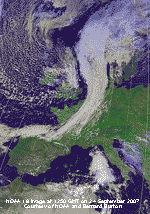 24th: The rain continued moderate to heavy at times on a complex frontal system until 06 GMT. At 01 GMT the temperature began to fall on a cold front from 15C to a minimum of 8.9C around 07 GMT. Following the heavy overnight rain the A5 was closed following a rock fall between Bethesda and Llyn Ogwen. By 09 GMT the sky was still mostly covered with cloud (a small occluded front), but the temperature had risen to 9.8C. Pressure had fallen to 1010 mb with twin lows 987 and 990 mb surrounding the N of Scotland. We were in a fresh to strong S/SW'ly airstream with the Atlantic to the NW packed with mainly open-celled convective shower clouds. The NOAA satellite image (right) shows the marine convective clouds to the W and the small front that cleared Anglesey eastward. The cold front, that crossed England during the morning, stretches from over the North Sea over France to the Bay of Biscay. A low over the Mediterranean has associated cloud approaching Italy. . After a shower of rain the day was brighter and dry, with the temperature reaching 14.9C. At 1645 GMT there was more showery rain that continued into the evening. Several places in England suffered damage during the day as a result of 11 damaging squalls or small tornadoes. [Rain 4.3 mm; Max 14.8C; Min 8.9C; Grass 6.7C]
 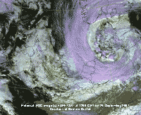 28th: A bright and calm morning with 5 oktas cloud cover and still very good visibility. The temperature at 09 GMT was 11.7C and was the maximum of the past 24-h. Pressure 1020 mb had fallen in a ridge of high-pressure from high 1033 mb over Scandinavia and the Baltic, while there was complex low-pressure 1000 mb over Germany. The Meteosat MSG satellite image (left) shows the low over Denmark with associated cloud over western Britain.. The day was mostly cloudy with a light to moderate NE'ly breeze picking up by noon. A dry and warmer day with the temperature reaching 13.1C. [Rain 0.0 mm; Max 13.1C; Min 9.1C; Grass 7.8C]
 The month ended, after a wet second half, with 118.7 mm (109%) and [129%] of average. It was cooler than recent Septembers with the mean temperature 13.5C (-1.0) decadal but (+0.2) compared with the 30-y average. A record low maximum for September of 10.9C was recorded on the 26th.
1st: A dull start to October with intermittent fine drizzle around 09 GMT, and a light air from the east. Pressure was 1023 mb in a ridge extending from SE Europe over Britain and the North Sea 1027 mb, but low 999 mb near Cape Finisterre had attendant fronts over Biscay, Brittany and SW England. Leaves were falling from tall sycamore trees as the wind strengthened during the morning. Visibility towards the mountains was good, but hazy. The afternoon was brighter at first with a little sunshine, but was cloudier by 16 GMT and into the evening. [Rain 0.0 mm; Max 15.3C; Min 9.2C; Grass 4.3C]
2nd: At midnight the low off Finisterre was filling 1006 mb and there was an occluded front South Wales to Kent. It was a calm morning at 09 GMT, and under the moderately high thin cloud the temperature was 12.5C, dewpoint 10.6C and 88% relative humidity, rising to 15.6C during the day. Pressure was 1022 mb with high 1026 mb over the North Sea. With the mountaintops of Snowdonia covered with cloud the day was sunless. [Rain 0.0 mm; Max 15.6C; Min 9.9C; Grass 5.0C]
3rd: An overcast morning with moderate visibility. There was a light SW'ly breeze and the temperature 14.6C at 09 GMT. Pressure was 1016 mb with low 1008 mb NW of Malin head and frontal cloud over the Irish Sea. Dry at first there was light to moderate rain from 1050 GMT. After a lull around 1330 GMT, when it was a little brighter, there was further rain during the afternoon easing by 1700 GMT and becoming bright and sunny as the sky cleared. By 2000 GMT the sky was clear with the temperature falling away from a maximum of 14.8C. [Rain 4.7 mm; Max 14.8C; Min 11.4C; Grass 6.6C]
4th: With clear skies overnight the air minimum fell to 6.2C and on the grass to 0.7C with heavy dew forming. The sky was mostly clear at 09 GMT, when the temperature had risen to 10.7C, and there was a force 3 W'ly breeze. Pressure 1021 mb was rising with a high 1024 mb developing over the Bristol Channel by noon. The morning had variable amounts of cloud, but there were some sunny spells. Cloud persistent over the mountaintops in the morning and SE Anglesey lifted during the afternoon and as the cumulus clouds decreased the afternoon became bright and mostly sunny. During the evening skies cleared and became calm. [Valley 10.0h] [Rain 0.0 mm; Max 17.3C; Min 6.2C; Grass 0.7C]
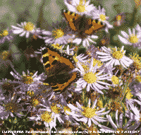 5th: The sky was almost clear before 09 GMT with just 2 whisps of cirrus clouds to be seen. Visibility was very good in clear air affording excellent views of the Lleyn Peninsula and Bardsey Island. Pressure was 1025 mb in a ridge of high-pressure extending from Scandinavia and North Sea 1028 mb. Pressure was low over Spain and France, where it was mostly cloud covered in the S, and Corsica where it was stormy. Here, it was a sunny day and with cirrus increasing during the afternoon the temperature rose to 19.7C, highest of the month. A large plant of Michaelmas daisy in the garden attracted 6 small tortoiseshell and 4 comma butterflies (see photo left). Late in the afternoon frontal cloud over Ireland, associated with low 992 mb over Iceland, was seen low in the western sky. [Valley 9.6h] [Rain 0.0 mm; Max 19.7C; Min 7.0C; Grass 2.0C]
6th: Another sunny morning with just a little cirrus and contrails to the NE of the weather station. There was heavy dew on the grass, with a minimum of 4.8C, and was condensed on the taller recording raingauge, but not on the check gauge at the standard 1 ft (30 cm) above ground. Visibility was good with light smoke haze developing. Pressure was steady on 1025 mb in high 1029 mb Sweden and S North Sea. Calm at first, during the day there was a light NE'ly breeze off the sea with the temperature reaching 17.4C. The day was sunny here, but to the S it was cloud covered. During the afternoon smoke haze intensified and the sky turned a peachy colour after sunset. Brown long-eared bats were seen flying at dusk, about 1830 GMT. [Valley sunniest with 9.5h] [Rain trace/dew; Max 17.4 C; Min 8.4C; Grass 4.8C]
 7th: Overnight there were mist and fog patches in low-lying areas and the morning was again sunny with just 1 okta of cloud low in the W. There was heavy dew, and this morning there was condensate inside the funnel of the raingauge so a trace was recorded. Pressure was 1024 mb with the high 1025 mb sinking S to be over Germany. The morning was sunny, with visibility just good in moderate smoke haze. In the light breezes leaves were falling almost vertically from sycamore trees. The afternoon saw some cloud at times associated with convergent airflow over the weather station (the Llansadwrn cloud) becoming mostly cloudy by 16 GMT. Valley in the west had more sunshine with 7.7h duration recorded, but did report 0.2 mm rain. Autumn colours are starting to develop on nearby trees. So far there are good rusty red colours on the horse-chestnut. Sycamore are the usual uninteresting brown and dropping fast; although there has been a limited fall of beech leaves they too are beginning to turn a nice golden colour. Ash are still bright green, see to the left of the horse-chestnut photo on the right). The evening and night were overcast, tawny owls were heard calling in the woods at 2000 GMT. [Valley 7.7h] [Rain mm; Max C; Min 8.0C; Grass 4.5C]
8th: There was some broken cloud overhead at first, mainly altocumulus. There was slight dew on the grass and the raingauges were dry. Visibility was only moderate with thicker smoke haze. It was calm, leaves on the trees were not moving and leaves not falling. Pressure was 1026 mb with high-pressure 1028 mb over the North Sea and English Channel, and 1029 mb over the Azores. Low 999 mb was W of Ireland and associated frontal cloud pushing in to the NW. The morning and early afternoon were mostly sunny before turning mostly cloudy by 15 GMT. The sky was overcast by 1700 GMT when it had started to rain in NW Ireland. [Valley 5.0h] [Rain 6.1 mm; Max 18.8C; Min 9.0C; Grass 5.7C]
 9th: There was light to moderate rain on a warm front from 01 to 0445 GMT that accumulating 6.1 mm. Pressure was 1021 mb with a shallow low developing on a front W of Scotland. Crossing Scotland during the day it moved down the E coast of England to be over the English Channel by midnight. The day here began overcast with low cloud hanging over the Snowdonia Mountains with poor visibility. By 10 GMT there were breaks in the cloud and it was brighter with some sunny spells. The afternoon was mostly sunny at first before some well developed cumulus clouds appeared, especially to the S over Snowdonia. It was cloudier by 1600 GMT when there were a couple of slight showers. Later the sky cleared and at 1930 GMT bright stars and the milky way were seen. [Valley 3.7h] [Rain 0.4 mm; Max 16.8C; Min 10.8C; Grass 9.0C]
10th: Pressure 1028 mb had risen as the low of yesterday moved over France and high-pressure re-established over Britain. The day began calm and sunny with some shallow fog in low lying areas soon clearing. The sky had 4 oktas of cirrus with some cirrocumulus clouds formed from expanded contrails overhead the station. Visibility was good, but somewhat hazy, and there was a light NE'ly breeze later in the morning. The afternoon was sunny with the temperature reaching 18.0C. The evening was clear and again calm. [Rain 0.0 mm; Max 18.0C; Min 9.4C; Grass 6.3C]
11th: Although pressure 1028 mb remained high warm sector frontal cloud had encroached overnight from the W. Still dry, apart from dew on the grass, visibility was good under cloud hugging the mountaintops of Snowdonia. The were a few small breaks in the cloud and indeed some bright spells, but no sunshine, during the morning. By noon the cloud had thickened and there was some fine drizzle around 1345 GMT. The evening and night were overcast. [Rain 0.2 mm; Max 15.7C; Min 10.0C; Grass 6.5C]
12th: At dawn there was heavy drizzle and fog (visibility < 200 m) this slowly clearing by 09 GMT. The drizzle had stopped but visibility was poor with mist; it was calm. Pressure remained high at 1028 mb, but with an infill of cloud it made for a sunless day. At times it was brighter, but then misty drizzle set in again. There was little or no wind through the day, and it was sunless. The day's mean temperature 14.8C was highest of the month. [Rain 0.8 mm; Max 16.0C; Min 13.5C; Grass 12.9C]
13th: There was fog at 0600 GMT, following drizzle earlier on, and the trees were dripping moisture in the almost calm wind. An overcast sky at 09 GMT with the temperature 13.0C and 98% relative humidity. Overnight the minimum temperature was 13.5C, highest of the month. Pressure was 1027 mb with high 1031 mb Poland and complex low-pressure 977 mb over the Denmark Strait between Greenland and Iceland. A wavy occluded front W of Ireland did not bode well for much improvement. Although the cloud seemed to be thinning and lifting at times through the day it did not clear. There were spells of drizzle of light rain, heaviest from 13 to 21 GMT, and of course the day was sunless. A little broken cloud was seen later at night. [Rain 1.7 mm; Max 14.8C; Min 12.9C; Grass 12.5C]
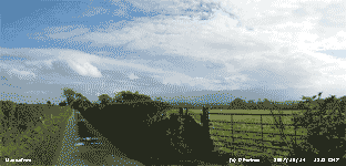 14th: The occluded front cleared away and by morning it was bright and sunny. Pressure was 1020 mb with high 1031 mb tethered over Poland low 981 mb SW Iceland. The sky became cloudier later, but it was bright and at times sunny and kept dry. The evening was cloudier again and dull with a noticeable drawing-in of evening light as the nights get longer. Well, I suppose it gives bats and owls longer time to feed. [Rain 0.0 mm; Max 17.4C; Min 10.2C; Grass 7.0C]
15th: There was some brightness and glimpses of sunshine early in the morning, but at 09 GMT with 7 oktas cover (remnant frontal cloud still around) prospects for the rest of the day did not look good. Pressure was 1011 mb and low 984 mb approaching the Western Isles of Scotland and an occluded frontal system over Ireland heading our way. The cloud thickened by noon and there were showers followed by moderate to heavy rain from 1300 to 1800 GMT with the front passing eastward before midnight. [Rain 9.6 mm; Max 15.3C; Min 11.1C; Grass 7.7C]
The first 15 days had only 23.5 mm of rain (16%) and [21%] of monthly averages. Temperatures were well above the averages with the mean 13.2C (+2.0) [+2.7], and the mean maximum 16.7C (+2.4) [+2.9]. The mean minimum 9.8C was also above the averages (+1.6) and [+2.5].
 16th: There was further heavy rain from 0400 to 0530 GMT accompanied by a temperature rise, from a low of 10.3C at 01 GMT, to 12.3C at 0530 GMT associated with another developing frontal low SW of Ireland. The minimum of 10.1C was around 08 GMT and there was more rain starting at 09 GMT. Pressure was 1011 mb with deep low 972 mb Norwegian Sea. The complex frontal system giving us the rain was mainly affecting areas area along the English Channel. Heavy rain moved into South Wales and SW England during the morning reaching Gloucester and the Midlands in the afternoon. Here the sky started to clear slowly at 1430 GMT and by dusk there was a fine evening sky at sunset followed by a peachy afterglow. [Rain 0.6 mm; Max 12.7C; Min 10.1C; Grass 8.0C]
17th: Pressure 1021 mb was rising with high-pressure 1024 mb building to the SW of Britain. Frontal cloud had cleared the SE coast of England and stretched from Brittany to the Baltic. The morning began showery with a few slight showers here, on the mountains and coast of the mainland from Llandudno to Caernarfon showers were more frequent and heavier. Showers were also penetrating the Cheshire Gap, moving south of Manchester into the Midlands. There was a light NW'ly breeze and, with good visibility, the day was mostly sunny with long sunny spells in Holyhead and along the N coast to Cemaes Bay with a few fair-weather cumulus clouds. The S of the island had more cloud at times, but even here the afternoon was mostly sunny and dry. Cloud persisted over Snowdonia late into the afternoon. The evening and night were mostly clear with little or no wind. [Rain 0.0 mm; Max 14.4C; Min 5.6C; Grass 1.0C]
18th: With a mostly clear night temperature were lower than of late and on the grass fell to 0.5C with heavy dew formation. Clear at dawn, apart from a few contrails overhead, the morning was sunny with very good visibility. Pressure had risen to 1034 mb within the high over Britain. By 09 GMT the sky had a covering of cirrostratus cloud and there was a complete solar halo that persisted, at least partly, through the morning. The afternoon was mostly sunny; near the high tide at 1440 GMT in Caernarfon the Menai Strait was calm and looked very blue in the sunshine. By evening some cloud had encroached. [Rain 0.0 mm; Max 14.7C; Min 5.5C; Grass 0.5C]
19th: The patchy cloud at dawn was clearing slowly at 09 GMT to give a sunny morning. Pressure 1035 mb had risen a little with the centre 1037 mb central England. The afternoon too was sunny, although with increasing haze, the temperature rising to 16.6C. There has not been much further development of autumn colours. Many trees in exposed places on the island have lost most of their leaves. In more sheltered places beech are losing golden leaves as well leaving the trees looking greener than they did at the beginning of the month. [Rain 0.0 mm; Max 16.6C; Min 6.7C; Grass 1.8C]
 20th: After another clear night the temperature on the grass went down to 1.1C, we have yet to see the first frost. Pressure was unchanged and there was very little wind through the day. Sunset at 1700 GMT was a deep orange colour and was followed by a fine afterglow of changing colours from pale lime green to a darkening peach near the horizon at 1800 GMT. Grass is growing well, it had slowed in September, but with temperatures this month running more than 2C above average growth increased again keeping lawn mowers busy. Snow was reported falling on the Austrian Alps. [Rain 0.0 mm; Max 15.8C; Min 6.0C; Grass 1.1C]
21st: Sunny again although there was more cloud, mainly cirrus overhead, and a moderate S'ly breeze. Pressure 1031 mb had fallen as the high began to drift SE over France and decline 1033 mb. Icelandic low 985 mb had an associated front over Ireland and cloud was seen in the W. During the afternoon thin moderately high cloud moved across thickening by dusk. The cloud was thin enough to be able to see the half moon looming through at 21 GMT. Brown long-eared bats have not been seen flying for the past 2 cooler evenings; pipistrelles have not been seen for a while. Snowfall was reported in Germany. [Rain 0.0 mm; Max 13.7C; Min 7.1C; Grass 3.6C]
22nd: A spectacular red sky before sunrise, but the sky was overcast with moderately high cloud and the day was dull with no bright sunshine. Pressure had fallen to 1021 mb and there was a moderate S'ly wind. With relative humidity 67% the grass was dry at 09 GMT and it was a good drying day for washing despite the lack of sunshine. Visibility was good and the wind lessened by afternoon. There were a few breaks in the cloud after dark. [Rain 0.0 mm; Max 12.2C; Min 8.5C; Grass 5.6C]
 23rd: A sunny and calm morning with slight dew on the grass, but no frost. Birds visiting the garden have been scarce so far this month, no doubt because of plentiful food in the wild and favourable weather. A few blackbirds have put in an appearance the last few days joining the robins that have been here all the month. One chaffinch was seen on the birdtable, but this week 50 or more were seen on the drive feeding on beech seed crushed by passing traffic. Tits have been very few and far between, but greater spotted woodpeckers were taking hanging peanuts. Butterflies are still around too, the comma was on the Michaelmas daisy again (right, photographed on the 5th). Sunny all day with light variable winds and a maximum of 16.2C, solar radiation 10.05 MJ per m 2 . [Valley 9.0 h] [Rain 0.0 mm; Max 16.2C; Min 6.2C; Grass 2.1C]
24th: After a mostly clear skied night there was frost on the grass. Moderate dewfall had frozen and the fields looked white. Overnight the minimum temperature was 2.7C, lowest of the month. The ground frost (-1.2C) was the first since 30 May (-0.6C). It was another calm morning with some cirrus and expanded contrails overhead. Visibility was good in moderate haze. Pressure had risen to 1030 mb in the ridge of high-pressure extending from high 1036 mb S Sweden. The day was sunny with just a light air from the E in the afternoon a few leaves were falling from the trees. By 17 GMT cloud was beginning to encroach from the west. In the evening cloud was sufficiently broken to see the near perigee full moon, biggest and brightest of the year being closest to earth at this time. The day's mean temperature of 8.6C was lowest of the month. [Rain 0.0 mm; Max 14.5C; Min 2.7C; Grass -1.2C]
25th: Overcast and calm once more this morning, later there was a light E to SE'ly breeze with again just a few leaves falling from the trees. Pressure 1028 mb was falling slowly with the declining high 1033 mb over the Baltic, about to disappear from the charts, leaving high 1039 mb over Russia to dominate. Cloud was just high enough to see the summits of the Snowdonia Mountains in good, but hazy, visibility. The day's maximum temperature was 11.9C, lowest of the month. The day was sunless. [Rain 0.0 mm; Max 11.9C; Min 5.9C; Grass 2.0C]
26th: A somewhat brighter morning with some thin patches in an otherwise overcast sky. There was a moderate (f4) S to SW'ly wind. Pressure was 1020 mb with complex lows filling over the Denmark Strait, NW of Iceland. The cloud was associated with frontal systems encroaching from the NW with rain already into the Western Isles of Scotland and Ireland. The sun did not break through and as the cloud thickened there was fine drizzle on the wind from 16 GMT becoming heavier with light rain before dusk. At 21 GMT there was broken cloud with some moonshine. [Rain 4.2 mm; Max 13.0C; Min 8.4C; Grass 7.8C]
27th: There was rain from 0100 GMT that turned heavy from 0245 GMT to 0300 GMT then moderate to heavy until 0700 GMT before easing and stopping 0730 GMT. Rainfall, for the period 09-09 GMT, was 16.4 mm over 8.8 h duration, largest of the month. There were a few breaks in the cloud to the E at dawn, but by 09 GMT the sky was overcast. The cloud thickened during the morning and there was fine drizzle by noon. During the evening the SW'ly wind strengthened to force 6/7 and there was showery rain from 1900 GMT. We were in warm sector air the temperature rising to a constant 14.7C during the night. The day was sunless with 2.71 MJ per m 2 solar radiation. [Rain 16.4 mm; Max 14.7C; Min 10.4C; Grass 9.9C]
![]() 28th: There was moderate to heavy rain from 0200 to 0700 GMT accumulating 16.4 mm in the 24-h 09-09 GMT. The cold front moved across about 06 GMT with the temperature falling to 11.8C. The ground was soggy underfoot, but the sky was clearing and the misty low cloud starting to lift from the lower slopes of the Snowdonia Mountains. There was a light W'ly breeze. By noon there were some sunny spells and the temperature rose to 13.0C. As a narrow band of showers, on a trough line from the Pembrokeshire islands through Anglesey to Edinburgh, passed over when nearly dark at 1700 GMT there was a short very heavy shower of rain. Such was the intensity that the roof gutters soon overflowed with cascades of water. During the evening the sky began to clear; there was no further rain. [Rain 5.6 mm; Max 15.3C; Min 11.8C; Grass 11.2C]
28th: There was moderate to heavy rain from 0200 to 0700 GMT accumulating 16.4 mm in the 24-h 09-09 GMT. The cold front moved across about 06 GMT with the temperature falling to 11.8C. The ground was soggy underfoot, but the sky was clearing and the misty low cloud starting to lift from the lower slopes of the Snowdonia Mountains. There was a light W'ly breeze. By noon there were some sunny spells and the temperature rose to 13.0C. As a narrow band of showers, on a trough line from the Pembrokeshire islands through Anglesey to Edinburgh, passed over when nearly dark at 1700 GMT there was a short very heavy shower of rain. Such was the intensity that the roof gutters soon overflowed with cascades of water. During the evening the sky began to clear; there was no further rain. [Rain 5.6 mm; Max 15.3C; Min 11.8C; Grass 11.2C]
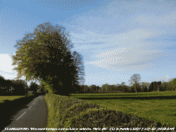 29th: With the sky clearing after midnight the temperature on the grass fell to 1.5C. At 08 GMT a few towering cumulus clouds were seen to the S and NE, but these dispersed by 09 GMT. Pressure 1014 mb was rising and it was sunny with just 2 oktas cloud cover. Visibility was good with moderate haze. There was a sprinkling of snow on Cairngorm. The day was mostly sunny with some cumulus clouds in the vicinity later in the afternoon. There were light showers of rain at 1630 GMT and 1845 GMT. The night was partly cloud covered with a small corona around the moon, seen through thin broken about 2300 GMT. [Rain 0.6 mm; Max 13.0C; Min 5.4C; Grass 1.5C]
30th: Another fine and sunny morning with pressure on 1023 mb. High-pressure was not far away to the S with high 1033 mb off Cape Finisterre, but low 981 mb was SW of Iceland with an associated warm front encroaching the north-west. N Ireland and W Scotland were affected first and later the Irish Sea coasts. In the early morning sunshine beach and horse chestnut trees stood out with golden yellow autumn tints against the still dark green of wild cherry and ash. Most of the hedges in the area have been neatly trimmed. By noon it was cloudier and there was drizzle at times extending into the evening, and light rain at 1400 GMT and 1800 GMT. There was a slight deposition of light grey dust (MUNSELL� Color Chart 7.5 YR 6.5/7) in light rain at 14 GMT the source of which is under investigation. [Mumbles Head 16.1C] [Rain 0.4 mm; Max 14.2C; Min 6.5C; Grass 2.6C]
31st: A cloudy and dull morning with just 1 or 2 breaks appearing from time to time and broad crepuscular rays filling the Nant Ffrancon Pass. Pressure 1027 mb was rising with high 1033 mb Bay of Biscay and including S Wales and N France. Further N low 976 mb Norwegian Sea brought frontal cloud moderate to strong winds over N Britain. The day was dry with some sunny spells early in the afternoon before turning cloudy again by 1630 GMT. [Rain trace; Max 14.0C; Min 7.7C; Grass 5.8C]
The month ended with a rainfall total of 51.1 mm, just (35%) of the decadal and [46%] of the 30-y averages. It was the 6th driest October since before 1928. Temperatures finished well above average with the mean 11.9C (+0.7) and [+1.4]. October was the 5th sunniest on the Anglesey record since before 1931.
 1st: An overcast and dull morning with slight drizzle blow on the wind. The overnight minimum temperature of 11.5C was highest of the month. Pressure was 1031 mb with high 1033 mb over the SW approaches to English Channel. Low 979 mb was SW Iceland and associated frontal cloud was lying over N Scotland and the Irish Sea. The day was mainly overcast and dull. One or 2 holes appeared in the cloud late in the afternoon and there were some glimpses of sunshine before dusk. The sky was overcast again at 2200 GMT. [Rain trace dew&fog; Max 14.8C; Min 11.5C; Grass 10.1C]
2nd: The sky began to clear and the temperature to start falling from 04 GMT. At 07 GMT fog was blowing across nearby fields, on a light W'ly breeze, from that filling the Menai Strait. The sun, obscured by thin cloud resulting in a diffuse golden colour, rose over the Carneddau Mountains, behind Foel Fras, at 0745 GMT. The point of rising will traverse the Snowdonia Range, in a westerly direction as seen from Llansadwrn, until the winter solstice when it will rise just before 0900 GMT. At 09 GMT today fog was still along the Menai Strait and in Liverpool Bay, but was clearing here leaving 5 oktas of low cloud, giving a bright start to the morning. Pressure was 1035 mb with high 1037 mb centred near Lands End. Low stratiform cloud blew across off the sea from time to time during the day, the best sunshine was early in the afternoon. Later it was cloudier and was overcast at 22 GMT. Snow has fallen in northern Finnish Lapland, high on the Pyrenees and Alps as well as a little on the Puy de Dome in central France. [Rain 0.2 mm; Max 14.1C; Min 10.0C; Grass 5.4C]
3rd: Overcast with uniform grey stratus with frontal cloud lingering over the Irish Sea and central Britain. At 09 GMT it was calm with moderate drizzle and poor visibility. Pressure was 1034 mb within high 1035 mb Ireland and W Britain. The anticyclonic gloom continued all day with intermittent drizzle. There was some brightness as the cloud thinned a little overhead early in the afternoon, but there was no sunshine. After dark the sky cleared and there were stars to be seen at 2200 GMT. Slight snowfall made its way further S in Lapland today with snow falling in temperatures of -9C near Kemi at the head of the Gulf of Bothnia. [Rain 0.1 mm; Max 13.4C; Min 11.1C; Grass 9.0C]
4th: After a red sky over the Carneddau Mountains at 0700 GMT there was a golden-yellow sunrise at 0745 GMT, but the sky was already cloudier and 5 oktas cover by 0900 GMT. With the temperature on the grass down to 1.5C overnight there was moderate to heavy dew. It was misty at low levels but the mountaintops were clearer. Pressure was 1032 mb close to the high centred over Cumbria. Remnant frontal cloud was in the vicinity and in broken cloud the temperature rose to 13.1C in the light N'ly breeze. There were plenty of flowering plants around the garden including Penstemon, Cistus, Welsh Poppy and red Salvia gregii (Autumn Sage). Cloudier later in the afternoon and overcast at 22 GMT. [Rain 0.0 mm; Max 13.1C; Min 5.9C; Grass 1.5C]
 5th: Overcast skies in the morning and pressure 1027 mb was falling. With cloud thickening a band of slight rain moving SE crossed here from 1130 to 1330 GMT. Afterwards the sky partially cleared for a while before turning cloudier again later. [Rain 1.1 mm; Max 12.3C; Min 7.3C; Grass 5.4C]
6th: A bright morning with a clearing sky and good visibility; pressure 1035 mb was rising with high-pressure 1041 mb establishing to the SW of Ireland. The day with variable amounts of cloud and sunny spells kept dry. The sky was briefly clear during the evening, but cloud returned again before midnight. [Valley 5.5 h] [Rain 0.0 mm; Max 12.7C; Min 5.9C; Grass 1.2C]
7th: A mostly sunny morning with a gentle W'ly breeze. Pressure was 1028 mb with Atlantic-high 1037 mb lying SW of the Bristol Channel. Low 983 mb over the Norwegian Sea at midnight tracked SSE towards the Baltic introducing some strong winds in the North Sea during the day. An associated cold front over Scotland headed S, but the day here had pleasant sunshine and a temperature of 15.0C, highest of the month, in which to enjoy the now well-developed autumn colours. On the 19 October an initial fall of golden leaves had left the trees looking greener than earlier in the month. The photo shows the colours of horse-chestnut (left) and beech (right). [Rain 0.5 mm; Max 15.0C; Min 7.0C; Grass 1.9C]
8th: At midnight vigorous deepening low 980 mb was SE of Iceland tracking N of Scotland. At 06 GMT the MO chart had twin centres 975 mb mid-Norwegian Sea; gale-force winds were affecting N Scotland and North Sea and there were fears of a tidal-surge developing on the high spring tides along the E coast of England and E Anglia later in the day. Conditions were similar to that that caused the severe flooding and 300 lost lives in 1953. Here, recent drizzle and slight rain had ceased at 09 GMT, and there was a small hole in the cloud above the weather station. Pressure 1017 mb was falling and it was not long before the sky was overcast again and there was more rain. A cold front associated with the low was beginning its passage SE and was over the North Channel just to the NW of Anglesey.
![]() It arrived here at 1130 GMT with gusty wind and very heavy rain, containing a few ice pellets, lasting for 10 minutes that accumulated 5 mm of rainfall falling at (more than 30 mm per hour at its peak). The temperature at 09 GMT was 11.4C, dewpoint 10.8C, reached 11.7C then began to fall to 6.5C by the end of the afternoon, making the day much cooler than of late. At 1300 GMT the front was over mid-Wales and Birmingham and the sky here had cleared to give some sunny spells. Temperatures were just not low enough for the precipitation to fall as snow on the mountains of Snowdonia, but snow was reported on Shetland and there were significant falls on Cairngorm. At 1800 GMT the front was just beginning to clear Ramsgate in SE England and reached the French coast at 1900 GMT. At 2100 GMT the POL tide gauge at Lowestoft was already indicating a 1.3 m surge (on top of the normal tide level prediction). Flood alerts were issued covering virtually the
entire east coast from Northumberland to Kent, with authorities predicting a possible 3 metre (10 ft) surge on the narrowing southern North Sea. Several flood warnings were in operation in Norfolk and Suffolk; 7500 homes in Great Yarmouth alone were deemed to be at risk in and people were advised to seek shelter on higher ground. Thirty thousand sandbags were distributed in the town. The Dartford Creek and Thames barriers were closed to protect
London from the surge of water. [Rain 5.5 mm; Max 11.7C; Min 10.5C; Grass 9.0C]
It arrived here at 1130 GMT with gusty wind and very heavy rain, containing a few ice pellets, lasting for 10 minutes that accumulated 5 mm of rainfall falling at (more than 30 mm per hour at its peak). The temperature at 09 GMT was 11.4C, dewpoint 10.8C, reached 11.7C then began to fall to 6.5C by the end of the afternoon, making the day much cooler than of late. At 1300 GMT the front was over mid-Wales and Birmingham and the sky here had cleared to give some sunny spells. Temperatures were just not low enough for the precipitation to fall as snow on the mountains of Snowdonia, but snow was reported on Shetland and there were significant falls on Cairngorm. At 1800 GMT the front was just beginning to clear Ramsgate in SE England and reached the French coast at 1900 GMT. At 2100 GMT the POL tide gauge at Lowestoft was already indicating a 1.3 m surge (on top of the normal tide level prediction). Flood alerts were issued covering virtually the
entire east coast from Northumberland to Kent, with authorities predicting a possible 3 metre (10 ft) surge on the narrowing southern North Sea. Several flood warnings were in operation in Norfolk and Suffolk; 7500 homes in Great Yarmouth alone were deemed to be at risk in and people were advised to seek shelter on higher ground. Thirty thousand sandbags were distributed in the town. The Dartford Creek and Thames barriers were closed to protect
London from the surge of water. [Rain 5.5 mm; Max 11.7C; Min 10.5C; Grass 9.0C]
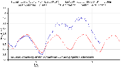
![]() 9th: At midnight the low 974 mb was over the Skagerrak with gale-force NW'ly winds over the North Sea. Overnight and early morning the tidal surge on the North Sea brought levels to within a few feet of the top of some tidal defences, but no serious flooding was reported. At Lowestoft the tide gauge, part of the UK network operated by the Proudman Oceanographic Laboratory, indicated a peak surge of 1.8 m about 0830 GMT (see graphic left courtesy of POL), below the worst case level and flooding was averted. Thousands of people were able to return to their homes during the day.
Here pressure 1029 mb was rising with the low filling (984 mb) over the Baltic and Atlantic-high 1039 mb W of Ireland. With a complex sky comprising stratocumulus, cumulus and altocumulus clouds the day was mostly cloudy, but there were periods of bright sunshine and it was dry. With temperatures lower than of late there was the possibility of some 'wintry' ice precipitation on the Snowdonia Mountains, but none was seen. Most showers were confined to the E along the North Wales coast and through the 'Cheshire Gap' into the Midlands. [Rain 0.0 mm; Max 10.5C; Min 5.6C; Grass 1.0C]
9th: At midnight the low 974 mb was over the Skagerrak with gale-force NW'ly winds over the North Sea. Overnight and early morning the tidal surge on the North Sea brought levels to within a few feet of the top of some tidal defences, but no serious flooding was reported. At Lowestoft the tide gauge, part of the UK network operated by the Proudman Oceanographic Laboratory, indicated a peak surge of 1.8 m about 0830 GMT (see graphic left courtesy of POL), below the worst case level and flooding was averted. Thousands of people were able to return to their homes during the day.
Here pressure 1029 mb was rising with the low filling (984 mb) over the Baltic and Atlantic-high 1039 mb W of Ireland. With a complex sky comprising stratocumulus, cumulus and altocumulus clouds the day was mostly cloudy, but there were periods of bright sunshine and it was dry. With temperatures lower than of late there was the possibility of some 'wintry' ice precipitation on the Snowdonia Mountains, but none was seen. Most showers were confined to the E along the North Wales coast and through the 'Cheshire Gap' into the Midlands. [Rain 0.0 mm; Max 10.5C; Min 5.6C; Grass 1.0C]
![]() 10th: A mostly cloudy morning although there was clearer sky to the N over Benllech and Amlwch. Pressure was on 1025 mb with low-pressure 983 mb over the Baltic and high-pressure 1035 mb to the SW. Frontal cloud associated with shallow low 1006 mb Iceland lay along the length of Britain and we were still in the predominately NW'ly airflow. There was little bright sunshine, the best late in the afternoon as the sun set below cloud in the west. The mean temperature so far this month 10.6C was running well above average, (+2.4) of the decadal and [+3.4] of the 30-year average. The Meteosat MSG satellite image at noon shows the frontal cloud over Britain with extensive orographic waves in the west. Marine open celled convection can be seen over the North Sea and closed cell convection to the south-west. [Rain 1.2 mm; Max 12.0C; Min 7.2C; Grass 4.2C]
10th: A mostly cloudy morning although there was clearer sky to the N over Benllech and Amlwch. Pressure was on 1025 mb with low-pressure 983 mb over the Baltic and high-pressure 1035 mb to the SW. Frontal cloud associated with shallow low 1006 mb Iceland lay along the length of Britain and we were still in the predominately NW'ly airflow. There was little bright sunshine, the best late in the afternoon as the sun set below cloud in the west. The mean temperature so far this month 10.6C was running well above average, (+2.4) of the decadal and [+3.4] of the 30-year average. The Meteosat MSG satellite image at noon shows the frontal cloud over Britain with extensive orographic waves in the west. Marine open celled convection can be seen over the North Sea and closed cell convection to the south-west. [Rain 1.2 mm; Max 12.0C; Min 7.2C; Grass 4.2C]
11th: A bright morning with 6 oktas cover of cumulus and altocumulus clouds. The wind was NW'ly and although visibility was good the mountaintops were obscured. With shower clouds in the vicinity there were some sunny spells, but it was not surprising to catch a shower about 1315 GMT before sunny spells returned for the rest of the afternoon. [Rain 0.4 mm; Max 11.7C; Min 8.7C; Grass 5.9C]
12th: With some clear spells overnight the temperature in air fell to 2.8C and to -2.1C on the grass. I did not see any white frost vegetation was dry except the grass that had unfrozen dew drops at the ends of the leaves. Pressure 1028 mb had risen with high 1029 mb to the west. The NW'lies had given way to light E'ly winds. The sky was a complex of broadening contrails moving across from the NE, cirrus, altocumulus and moderately high altostratus clouds. With the cloudbase above the summits of the Snowdonia Mountains, and very good visibility, I spent sometime searching for traces of ice precipitation. I found none. It was a mostly sunny day with global solar radiation of 4.69 MJ m-2, highest of the month so far. The sun set as a large orangy-red ball across the field to the W and the temperature was at its lowest (2.7C) about 1800 GMT and there was a touch of ground frost. Later the sky turned cloudier and there was a little rain by 2200 GMT. [Rain 2.2 mm; Max 9.0C; Min 2.8C; Grass -2.1C]
13th: Slight rain continued through to about 01 GMT on fronts associated with low 1000 mb near Iceland and, although there was no more, the sky was overcast by morning with mountaintops obscured. Pressure 1018 mb was falling and with high 1030 mb to the SW and low 994 mb over the Baltic we had a light NW'ly airflow again. By 0930 GMT the cloud was beginning to thin and before noon there were some clear patches with a little sunshine. Later in the afternoon more cloud encroached in a strengthening wind and there were slight showers of rain before dusk that extended into the evening. [Rain 0.4 mm; Max 11.6C; Min 2.7C; Grass -0.7C]
14th: As the night was mostly cloudy there was no frost on the grass. There was slight intermittent rain before 09 GMT when it was calm. The cloud was moving overhead from the N, but there was no movement in leaves on the trees. There are still some leaves remaining on the colourful beech and the Norway maple are beginning to turn yellow. Scientists at Southampton University suggest in new research that the delay in leaf fall extending into the autumn and earlier spring re-growth, noticeable here and elsewhere (Diary 19 Oct & 7 Nov), is due to increase CO2 not increased global temperatures. Over the past 30-y CO2 has increased 13.5%. The work used poplar (Populus) trees, grown with enhanced CO2 levels and monitored by remote sensing. The poplars, retained their leaves for longer and also experienced a smaller decline in end of season chlorophyll content than controls. More CO2 allows the tree to generate carbon rich compounds that are known to prolong the life of leaves. Further work on the genetics of Populus revealed that a group of genes are switched on during delayed senescence in elevated CO2 . Source: Press Release University of Southampton ![]() . The day was overcast and sunless with a warm front wave over the Irish Sea and western Britain. [Rain 1.6 mm; Max 8.9C; Min 8.0C; Grass 5.7C]
. The day was overcast and sunless with a warm front wave over the Irish Sea and western Britain. [Rain 1.6 mm; Max 8.9C; Min 8.0C; Grass 5.7C]
15th: A calm sunny morning with smoke rising vertically from chimneys. On the grass the minimum had fallen to -2.6C with water deposits frozen looking slightly white. There was some mist and smoke in the bottom of the Ogwen Valley and here the sky was almost clear with contrails overhead. Pressure was 1028 mb with the high situated over England and Wales. It was a sunny day and the temperature rose to 11.0C. The roof of the new visitor centre Hafod Eryri, under construction near the summit of Snowdon and put on in July, was seen (from Gaerwen) shining in the low afternoon sunshine. [Rain 0.0 mm; Max 11.0C; Min 2.4C; Grass -2.6C]
The first 15 days had a mean temperature of 9.6C (+1.4) and [+2.4] of average. Rainfall was well below average the 13.2 mm (9%) and [11%]. In the soil at 30 cm the mean temperature was 10.7C (+1.6)..
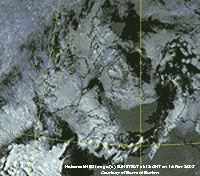 16th: The moderately high cloud overhead was showing signs of breaking at 09 GMT. Visibility was very good and slight frost or ice deposits could be seen on the N-facing aspects of Snowdon and Carnedd Llewelyn. The cloud cleared enough to give some good sunny spells in the eastern-half of Anglesey during the day, but low cloud off the sea affected western-arts. Cloud encroached by dusk and there was a slight shower of rain during the evening. [Rain trace; Max 12.4C; Min 3.4C; Grass -1.7C]
17th: After slight rain and drizzle about 06 GMT the sky was clearing before 09 GMT. It was breezy and the force 4 S'ly had dried the grass. Pressure was 1021 mb with high 1028 mb over N France. Low 982 mb was NE Iceland and associated fronts were lying to the NW. A band of heavy rain was over W Ireland and NW Scotland. The brightness did not last long and the morning turned showery. The afternoon was increasingly dull with light to moderate rain from 1400 GMT with the S'ly wind strengthening to force 7 with gales over high ground. The rain eased off before midnight. [Rain 12.2 mm; Max 9.6C; Min 6.0C; Grass 4.2C]
 18th: There was further showery rain after midnight but there were some breaks in the cloud at 09 GMT. There was snow around the summits of the Snowdonia Mountains, the first lying snow of the season. Pressure 998 mb was falling quickly with developing frontal-wave low over the Irish Sea tracking S. The morning was bright at first with a little sunshine, but by noon it had become dull and overcast. As the rain moved into England it turned to snow in the Midlands. The light SE'ly wind backed NE'ly by evening with slight snow here between 2100 and 2200 GMT followed by sleet and light rain. [Rain 2.0 mm; Max 8.6C; Min 4.6C; Grass -0.5C]
19th: With a lee opening in the cloud above the weather station it was a bright morning. Cloud banks over the Snowdonia Mountains looked dark against light lee-waves clouds hanging in the sky to the S. The wind was SE'ly force 5 and pressure 996 mb was rising with the low 992 mb over the Bristol Channel. There were some heavy outbreaks of rain with thunder in the south, but here the day was dry and sunny at times with variable amounts of cloud. At times dark cumulus clouds were seen to the NE and over the mountains. The evening was mostly cloudy. [Rain 0.0 mm; Max 8.5C; Min 2.3C; Grass 1.6C]
20th: A bright morning with hazy sunshine and moderate visibility. Pressure 1004 mb was rising as low 990 mb drifted SW to be W of Brest. There was moderate to heavy dew on the grass, but no frost. With the haze clearing during the morning visibility was very good by noon and it was a sunny afternoon. Solar radiation was 6.33 MJ m-2, highest of the month. Cap clouds persisted on the summits of the Snowdonia Mountains, but there were clear views of the cliffs below 3000 ft. Patches of snow could be seen in gullies as low as 2250 ft below Carnedd Llewelyn There was a colourful red reflection in clouds of the setting sun. There was rain from 2200 GMT that turned moderate to heavy at 2300 GMT. [Rain 11.5 mm; Max 11.3C; Min 4.9C; Grass 1.2C]
21st: Rain continued after midnight and began to ease just before dawn and there was fog (visibility <100 m) at 07 GMT. At 09 GMT with fog thinning, but still moderate (visibility <500 m), there was slight drizzle. Low 995 mb (tracking NE) was over Liverpool Bay twinned with low 993 mb still anchored off Brest. Some patches of blue appeared in the sky over the weather station at 10 GMT and there was a little sunshine midmorning. By noon the sky was overcast again and the afternoon was dull with rain at times. There was very heavy rain in South Wales with Milford Haven reporting 92.4 mm in the 24-h to 2100 GMT. [Rain 2.6 mm; Max 8.7C; Min 5.6C; Grass 2.6C]
22nd: There were some light showers between 04 and 05 GMT. The sky was still overcast at 09 GMT with low cloud and mist on the lower slopes of the mountains. Pressure was 1001 mb with low 994 mb now off Aberdeen. The sky cleared a little during the morning, but there were some showers about and there was a heavy one in Bangor about 1045 GMT. The afternoon was cloudier, but it kept dry. [Rain 1.8 mm; Max 9.7C; Min 6.6C; Grass 4.2C]
23rd: A brighter morning with 5 oktas cover of cumulus clouds. Pressure 1025 mb was rising as a ridge of high-pressure crossed over from the west. The cloud and haze cleared to give a mostly sunny day with the maximum temperature reaching 7.5C, lowest of the month. There were some spectacular views of Snowdonia in the afternoon; some small snow patches remaining at 2800 ft. The evening was clear skied and the temperature was falling soon reaching -6.5C on the grass and from 1830 GMT air frost the temperature falling to -1.1C from 2200 GMT to midnight, both lowest of the month. Although frost occurred on the 23rd by convention the temperatures were credited to the 24th as, usually, minima occur after midnight in the small hours. [Rain 3.8 mm; Max 7.5C; Min 2.6C; Grass 0.6C]
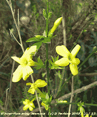 24th: As high-pressure (1036 mb) moved S, as lows 987 mb near Iceland tracked NE towards the Norwegian Sea, cloud encroached and the temperature rose reaching 7.5C at 09 GMT. There had been rain since 05 GMT and there was a moderate to strong S'ly wind. Pressure was 1021 mb with the low 979 mb over the Norwegian Sea at noon. Fronts moved SE across Britain and there were strong to gale-force winds in NE Scotland. There was a 30 mph speed restriction on the Britannia Bridge in the morning. Rain stopped about 11 am and it was brighter, but there was no sunshine. There was more slight rain in the very dull afternoon and showers continued into the evening. [Rain 1.7 mm; Max 9.5C; Min -1.1C; Grass -6.5C]
25th: A much brighter morning with the sky clearing overhead leaving a rather dark bank of clouds to the S over the Snowdonia Mountains. It was just cold enough for ice precipitation over the summits, but none was seen. Pressure 1027 mb was rising with high 1037 mb lying to the SW and complex low-pressure Norway and Baltic Sea. There was a little sunshine during the morning and, with the north-westerly wind, showers were once again penetrating the 'Cheshire Gap' into England. It was dry here, but the afternoon was dull and overcast with just a little brightness appearing before sunset. In the garden the yellow winter-flowering Jasmine is flowering (photo left).[Rain 0.6 mm; Max 11.5C; Min 4.8C; Grass -0.6C]
26th: There was drizzle from midnight until about 04 GMT with shallow fog forming after dawn. Pressure was 1032 mb, but there was nothing much moving with a pair of fronts stationed along the spine of Britain. High 1038 mb was still to the SW and low-pressure 990 mb Gulf of Bothnia and Baltic Sea. At 09 GMT it was calm, but there looked a chance of improvement as low level cloud and mist had started to lift. A clearance was not to be and the sky resumed its overcast appearance as more low cloud and mist moved in. Later, another attempt at clearing brought a brief veiled appearance of the sun, but not clear so the day kept it sunless status. There was heavy drizzle and light rain from 1900 to 2300 GMT. [Rain 1.8 mm; Max 11.2C; Min 6.6C; Grass 2.3C]
With just a few more days in the month to make a difference, with a total of 219 mm rainfall, it had been the driest autumn since 1955 (202 mm) and the 3rd driest in records since 1928
27th: A mild night and another dull and damp morning. There was zero evaporation shown by the Piche evaporimeter in the 24-h to 09 GMT. The day was overcast and sunless, but there was brighter sky before evening then rain from 2300 to 0200 GMT. [Rain 4.5 mm; Max 10.5C; Min 8.5C; Grass 5.9C]
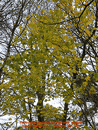 28th: Drizzle from 08 GMT ensured another damp morning with the ground soggy underfoot. There was a small pool of water standing on one of the fields adjacent to the weather station. Pressure 1013 mb was falling with a frontal-wave low over Ireland produced another dull and sunless day with spells of light rain up to 1515 GMT. Again the sky was a little clearer before dusk. There was more rain though by 2200 GMT and turned heavy between 2330 and midnight. With 16.7 mm, largest daily rainfall of the month, added to the autumn rainfall brought the total to 242.2 mm, but it was still the driest since 1989 and 6th driest since before 1928. [Rain 16.7 mm; Max 10.7C; Min 7.8C; Grass 5.2C]
![]() 29th: The rain petered out by 0015 GMT and by 09 GMT the sky had cleared to 2 oktas and the morning was sunny and dry. Pressure 1008 mb was rising as a ridge of high-pressure moved across from the west. The sun rose over a bank of stratocumulus cloud over the Snowdonia Mountains (photo left), cloud that persisted there all day obscuring most of the summits. Most leaves have now fallen from the trees, but there are still some on beech and lower branches of ash. There are more leaves on the Norway maples, that are slowly yellowing (right), but some have fallen giving a yellow carpet in places in the wood. Snowdrop leaves are showing 2 cm above the soil. The day was sunny on Anglesey with a maximum of 11.7C around noon; in the afternoon some cirrus clouds appeared before thicker cloud encroached from the W after dusk, but not before the temperature had fallen to 4.4C and -1.2C on the grass. The cloud was ahead of a warm front over Ireland associated with deep low 954 mb S of Greenland. With a strengthening SW'ly wind there was moderate rain by 2100 GMT. [Rain 5.9 mm; Max 11.7C; Min 4.1C; Grass -1.0C]
29th: The rain petered out by 0015 GMT and by 09 GMT the sky had cleared to 2 oktas and the morning was sunny and dry. Pressure 1008 mb was rising as a ridge of high-pressure moved across from the west. The sun rose over a bank of stratocumulus cloud over the Snowdonia Mountains (photo left), cloud that persisted there all day obscuring most of the summits. Most leaves have now fallen from the trees, but there are still some on beech and lower branches of ash. There are more leaves on the Norway maples, that are slowly yellowing (right), but some have fallen giving a yellow carpet in places in the wood. Snowdrop leaves are showing 2 cm above the soil. The day was sunny on Anglesey with a maximum of 11.7C around noon; in the afternoon some cirrus clouds appeared before thicker cloud encroached from the W after dusk, but not before the temperature had fallen to 4.4C and -1.2C on the grass. The cloud was ahead of a warm front over Ireland associated with deep low 954 mb S of Greenland. With a strengthening SW'ly wind there was moderate rain by 2100 GMT. [Rain 5.9 mm; Max 11.7C; Min 4.1C; Grass -1.0C]
30th: Rain continued until 0300 GMT and with every mm bringing the autumn rainfall total up to 247.8 mm and into 9th position after 1995. The morning was overcast with uniform grey stratus and misty moderate visibility. Pressure 1000 mb continued to fall and the SW'ly wind was force 5 to 6. During the afternoon the cloud thickened and it was very dull. Solar radiation was only 1.15 MJ m-2, lowest of the month. There were moderate showers of rain at 1700, 1900 and heavy rain from 1130 to 1230 GMT. [Rain 7.5 mm; Max 12.5C; Min 4.4C; Grass -1.2C]
The month ended with a rainfall total of 85.8 mm (59%) and [69%] of the averages. It was driest since 1995 and ranked 14th in the 78-years records. Autumn rainfall rose to 255.6 mm, driest since 1995 and 10th driest overall. The mean temperature was 8.6C (+0.3) and [+1.3] of the averages.
1st: There was a sprinkling of fresh snow on the summits of the Snowdonia Mountains with cloud just touching in places. Pressure was 995 mb with complex low-pressure to the N principally low 974 mb off the Western Isles of Scotland. It was not a bad day here with some bright sunshine in the middle of the day. A showery trough went over at 1645 GMT with some heavy showers of rain that included a few ice pellets. During the evening the sky cleared with bright stars visible at 22 GMT. [Rain 15.5 mm; Max 10.5C; Min 5.0C; Grass 3.3C]
![]() 2nd: There was a spell of moderate to heavy rain from 0400 GMT to just before 09 GMT that accumulated most of the 15.5 mm in the raingauge. Low 979 mb was lying to the NW and pressure here 982 mb was not falling so quickly and the sky was clearing slowly. The SW'ly wind had risen to force 5/6, but there were strong gales being reported further S from Aberdaron, Mumbles Head and the Seven Stones light vessel. The wind soon strengthened to strong to gale force 8 for a while before moderating here to force 6 to 7 during the afternoon as it veered more W'ly and NW'ly. Speed restrictions were in force on the Britannia Bridge. At 1333 pm there was a shower of ice pellets and this set the scene for the afternoon with several showers of rain and ice pellets dying out by evening. Remaining mostly cloudy there was a final shower of ice pellets at 2300 GMT. [Rain 6.4 mm; Max 10.1C; Min 5.8C; Grass 2.8C]
2nd: There was a spell of moderate to heavy rain from 0400 GMT to just before 09 GMT that accumulated most of the 15.5 mm in the raingauge. Low 979 mb was lying to the NW and pressure here 982 mb was not falling so quickly and the sky was clearing slowly. The SW'ly wind had risen to force 5/6, but there were strong gales being reported further S from Aberdaron, Mumbles Head and the Seven Stones light vessel. The wind soon strengthened to strong to gale force 8 for a while before moderating here to force 6 to 7 during the afternoon as it veered more W'ly and NW'ly. Speed restrictions were in force on the Britannia Bridge. At 1333 pm there was a shower of ice pellets and this set the scene for the afternoon with several showers of rain and ice pellets dying out by evening. Remaining mostly cloudy there was a final shower of ice pellets at 2300 GMT. [Rain 6.4 mm; Max 10.1C; Min 5.8C; Grass 2.8C]
3rd: Another showers day, but of rain only. Mostly cloudy before 09 GMT with showers in the vicinity and we soon caught one during observations. Pressure 1002 mb was rising as a minor ridge passed over from the west. Pressure was low 978 mb Norwegian Sea and 972 mb Baltic. In the Atlantic S of Greenland ominously deepening low 960 mb was tracking slowly NE. Another day of a few showers early and bright spells with a few sunny intervals thrown in before a slight shower at 1700 GMT. The daytime maximum was 8.0C and the evening started cloudy, but a clearer spell before 2200 GMT allowed the air temperature to fall to 3.2C with a touch of ground frost (-1.4C). The temperature then stated to rise through to morning. [Rain mm; Max C; Min 3.8C; Grass -0.6C]
4th: A dull overcast morning with a covering of low stratus cloud and poor visibility. With intermittent drizzle before 07 GMT it was dry just before 09 GMT then started again. Pressure 1008 mb was falling with Atlantic-low 954 mb S of Greenland and Iceland. There was a moderate SSW'ly wind. The day kept dull, sunless and windy with slight rain at times. From 1500 to 1900 GMT there were 4 significant showers recorded on the autographic recorder. During the evening the SW'ly wind strengthened to gale force 8 and there was more rain from 2330 GMT. The maximum temperature of 12.8C was highest of the month. [Rain 8.8 mm; Max 12.8C; Min 3.2C; Grass -1.4C]
 5th: Gale force winds continued after midnight and rain until 0300 GMT. The morning had a 7/8th covering of ragged layered stratus clouds and although the wind had moderated there were strong 50 mph gusts at times. The minimum air temperature for the past 24-h recorded at 09 GMT was 10.9C, highest of the month, the only to be above 10C. Pressure 996 mb was rising a little with complex lows to the N (lowest 960 mb Norwegian Sea) and Azores-high 1033 mb to the S. Visibility was poor with the low cloud persisting over Anglesey during the morning. In Llanfairfechan it was brighter with the cloud breaking up giving glimpses of sunshine. A little sunshine broke through here too before the end of the afternoon. The evening was overcast again. [Rain 9.7 mm; Max 11.6C; Min 10.9C; Grass 10.0C]
6th: There was continuous rain from just before 03 GMT and it was still raining at 09 GMT with 9.7 mm accumulated over the 24-h period. It was very wet underfoot with small puddles of standing water as the soil had reached saturation point. In the rain visibility was very poor, but began to improved by 10 am with the rain easing. Pressure 1001 mb was falling again, with low 979 mb off NW Scotland, and associated frontal cloud with triple point was lying over North Wales. The Met Office had issued a severe weather warning for Wales, gales and heavy rain. The SW'ly wind was force 5 and the day remained sunless under thick cloud with a low solar radiation value of 0.45 MJ m-2. There was hardly any sunshine anywhere; the most reported was at Aldergrove 0.3h. There was moderate to heavy rain here from 1600 to 2100 GMT then showery until about 04 GMT. [Rain 16.5 mm; Max 12.7C; Min 8.9C; Grass 6.9C]
7th: There was some sign of the a few breaks appearing in the cloud at 09 GMT. Low 971 mb was over the southern Norwegian Sea and pressure 1001 mb here was rising, but any improvement was very slow coming along. Cloud was on the summits of the Snowdonia Mountains where showers were wintry, but no snow was seen on the ground. There were a few bright spells, a slight shower and a little bright sunshine later in the afternoon. At Llyn Llydaw, Snowdon 63.9 mm of rainfall was recorded [09-09 GMT, ECN AWS, data courtesy of CCW]
{Capel Curig 50 mm, Aberdaron 11 mm 21-21 GMT}[Rain 3.5 mm; Max 7.2C; Min 6.0C; Grass 4.2C]
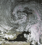 8th: An overcast sky and a moderate S'ly wind and feeling a little chilly in the 4.2C at 09 GMT. There after the temperature rose and the wind strengthened during the morning to strong to gale force 8 between 10 and 11 GMT. There was a moderate shower around 1300 GMT, but there were some glimpses of sunshine in the afternoon and the temperature had risen to 11.3C by 1400 GMT. [Rain 6.6 mm; Max 11.3C; Min 3.5C; Grass -0.3C]
![]() 9th: Pressure here was 971 mb as a deep twin-centred low tracked SE across the North Wales. There were a few breaks in the cloud and there was a shower of rain under cumulus clouds. The hail pad was marked by small ice pellets that had fallen in the past 24-h. Visibility was moderate as the view towards the mountains was misty. Earlier there was little or no wind, being near the centre of one of the the lows, but a NE'ly had picked up just before 09 GMT then settled into a moderate to strong NW'ly. Winds were strongest during the day in NE Scotland and SW England with gales and gusts of 80 mph recorded in Guernsey and 71 mph at Mumbles Head. The NOAA 18 satellite image at 1305 GMT shows the deep low over S Britain. To the W a large area of marine open celled convection stretched from just S of Greenland into the Bay of Biscay. The day kept mostly cloudy and showery with a few bright spells and a little sunshine. There was a moderate shower of rain and ice pellets at 1650 GMT. During the evening the sky was clear with bright stars and a view of Mars, but the temperature was slow to fall.. [Rain 7.5 mm; Max 8.4C; Min 4.2C; Grass 1.0C]
9th: Pressure here was 971 mb as a deep twin-centred low tracked SE across the North Wales. There were a few breaks in the cloud and there was a shower of rain under cumulus clouds. The hail pad was marked by small ice pellets that had fallen in the past 24-h. Visibility was moderate as the view towards the mountains was misty. Earlier there was little or no wind, being near the centre of one of the the lows, but a NE'ly had picked up just before 09 GMT then settled into a moderate to strong NW'ly. Winds were strongest during the day in NE Scotland and SW England with gales and gusts of 80 mph recorded in Guernsey and 71 mph at Mumbles Head. The NOAA 18 satellite image at 1305 GMT shows the deep low over S Britain. To the W a large area of marine open celled convection stretched from just S of Greenland into the Bay of Biscay. The day kept mostly cloudy and showery with a few bright spells and a little sunshine. There was a moderate shower of rain and ice pellets at 1650 GMT. During the evening the sky was clear with bright stars and a view of Mars, but the temperature was slow to fall.. [Rain 7.5 mm; Max 8.4C; Min 4.2C; Grass 1.0C]
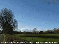 10th: Despite the mostly clear overnight sky there was no frost. A bright morning with cumulus clouds clearing. The temperature at 09 GMT was 6.0C (dewpoint -0.6C) and 63% relative humidity. Pressure 1015 mb had risen with a ridge from high 1030 mb W of Iberia moving across from the west. Low 990 mb was over the Netherlands resulting in a northerly airflow over Britain. The moderate N'ly wind lessened through the day. Visibility was very good and it was a sunny day with solar radiation accumulating 3.69 MJ m-2. The evening was clear and by 2200 GMT the temperature had fallen to 1.4C. [Rain 0.0 mm; Max 7.5C; Min 5.3C; Grass 2.8C]
11th: Overnight the air temperature minimum was 1.0C and on the grass it was -4.2C, but there was no sign of any white frost by 09 GMT. Pressure was 1031 mb with high 1034 mb over the Bay of Biscay and ridge northwards to Britain. It was a cloudier day with mostly thin high cloud and plenty of sunshine. At dusk the temperature on the grass fell to -0.1C. [Rain 0.0 mm; Max 9.2C; Min 1.0C; Grass -4.2C]
12th: Mostly cloud covered overnight so the temperature keeping above 6C. At 09 GMT the grass was dry in a moderate S'ly and temperature of 7.5C, dewpoint 4.0C. There was a covering of moderately high cloud, but it was bright and was another dry day. [Valley 0.1h] [Rain 0.0 mm; Max 9.1C; Min 3.5C; Grass -0.1C]
13th: Close to 09 GMT the sun was rising over a little cloud above the Carneddau Mountains. A little more cloud in the low in the W was associated with fronts border Ireland and NW Scotland. Pressure was 1035 mb with high 1044 mb over Denmark and the Baltic. Some cumulus clouds persisted through the day S of the mountains otherwise the sky was clear giving a mostly sunny day. At 09 GMT there S'ly wind was force 5 and the temperature was 6.2C, dewpoint 2.0C and 75% relative humidity, and rose to 8.4C. By evening the wind had dropped and there was some clear spells. [Valley 4.0h] [Rain 0.0 mm; Max 8.4C; Min 5.6C; Grass 2.5C]
14th: There was a spectacular red sky over the mountains after dawn, but the rose clearly just before 09 GMT. There was slight white frost on the ground and ice on water with a minimum of -3.3C recorded by the grass minimum thermometer, but the air temperature did not fall below 1.4C. Cloud cover was 7 oktas with altostratus, cumulus and cirrus clouds. Pressure was 1036 mb with high 1043 mb S North Sea and low 945 mb S Greenland. The day was mostly sunny, but only a little bright sunshine. [Valley 0.2h] [Rain trace dw/fr; Max 7.7C; Min 1.4C; Grass -3.3C]
15th: A mostly overcast day but dry here on Anglesey; a little sunshine on the upper slopes of the Carneddau Mountains and in Gorwell Heights in Llanfairfechan in the morning, but in the lower village a little drizzle or rain was reported. Pressure was 1035 mb with high 1044 mb centred near Malmo, S Sweden. Pressure was low in the Atlantic (984 mb) and S Greenland (974 mb). The afternoon was brighter with a glimpse of sunshine here too, but it was a colder day with the temperature rising to just 4.3C. [Valley 0.0h] [Rain 0.0 mm; Max 4.3C; Min 0.0C; Grass -5.6C]
The first 15 days had 94.7 mm of rainfall (71%) and [82%] of the averages. Temperatures were above average with the mean running at 7.0C (+0.9) and [+1.5] of the monthly averages. There had been 7 ground frosts.
 16th: With the sky clearing overnight the air temperature had fallen to -3.1C and on the grass to -8.2C, both lowest of the month. At 09 GMT there was slight hoar frost on vegetation and dew had frozen on the grass. The sky was clear and there was a light E'ly breeze and air pressure was 1035 mb. The day was sunny with little, or no, wind and frost persisted in the shade only thawing where the sun reached. The temperature of the soil at 5 cm deep in the bare plot which is in the sun was 1.2C. The temperature rose to 4.6C, but was above zero for only 4.8h there being 19.2h of frost recorded midnight to midnight. The colder weather brought more birds to feed in the garden. Tits and nuthatches were going mainly for black sunflower seeds from hanging feeders while greater spotted woodpeckers and jays were going for peanuts. Blackbirds, sparrows and chaffinches go mainly on the birdtable where a variety of seed is provided. Greenfinches are rather scarce this winter. Holy berries have taken from trees near the house by thrushes and blackbirds. In the wood berries on one tree have, so far, escaped. At dusk it was freezing again with an air temperature of 2.0C at 1930 GMT. Big snow storms in E Canada and NE United States caused several deaths and brought the transport system to a standstill as 40 cm snow fell. [Rain 0.0 mm; Max 4.6C; Min -3.1C; Grass -8.2C]
 17th: Another clear sky morning before a little cloud appeared over the tops of the mainland mountains by 09 GMT. Overnight the air temperature dropped to -2.6 (7.1 h frost since midnight) and was again -8.2C on the grass, joint lowest of the month. Ice crystals had formed on vegetation leaving interesting patterns on living green and dead fallen leaves. In the soil temperature were falling and was just 0.2C at 5 cm deep. There was little (NE'ly) or no wind at first and there was smoke haze in the Menai Strait and valley bottoms with the mountaintops a little clearer. During the morning the wind backed E'ly and freshened to force 5/6 into the afternoon. Anther sunny day, but the maximum temperature of 3.7C was lowest of the month. When setting the sun imparted a red glow to the clear cloud-free, but hazy, sky (see photo below). [Valley 5.9h] [Rain 0.0 mm; Max 3.7C; Min -2.6C; Grass -8.2C]
18th: Overnight the slowly falling temperature was 0.0C at 09 GMT, so there was no air frost recorded. On the grass it had fallen to -3.5C and there were frozen white deposits of water, but no hoar. The sun rose over a narrow line of stratocumulus clouds over the mountaintops. The air temperature continued to fall, however, for about 30 minutes reaching -1.0C before stating to rise to 4.4C by 1300 GMT. The ground was still frozen, although the 5 cm thermometer had risen to 0.6C. The 20 cm bent stem thermometer had broken due to frost heave, this is a hazard with bent stem thermometers in the soil that are now difficult to replace because of the EU ban on use of mercury. Subsequent readings at 20 cm will revert to an in-tube thermometer under grass. Another sunny day, but hazier due to Saharan dust suspended high in the atmosphere. [Valley 5.8h] [Rain 0.0 mm; Max 4.4C; Min 0.0C; Grass -3.5C]
 19th: Overnight an air frost (-1.5C) with slight hoar frost deposited. On the grass, with the temperature down to -7.5C, water deposits were frozen white and remained so all day in the shade. The sky was clear and it was another sunny day. Less hazy than yesterday with mountaintops clearer in inversion conditions; the AWS on Clogwyn (courtesy of FirstHydro) reported temperatures between 7-8C. Several patches of snow still remain on the north-facing slopes of the summits. [Valley 5.9h] [Rain 0.0 mm; Max 7.3C; Min -1.5C; Grass -7.5C]
20th: Frosty overnight again with more extensive 'white frost' and some hoar frost at 09 GMT. The 5 cm thermometer in the bare plot was indicating 0.0C. Several plants were wilting (physiological wilt) due to the frost including lace-cap hydrangeas, and purple sprouting broccoli and leeks on the vegetable plot. The latter are able to withstand frost, but the hydrangea may suffer. The sky had a 6 okta cover of altocumulus and cirrus at first and at low level in the Menai Strait there was smoke haze and Liverpool Bay also looked murky. The cloud and haze cleared during the morning giving another sunny day with the temperature rising to 8.8C. [Valley 5.8h] [Rain 0.0 mm; Max 8.8C; Min -1.8C; Grass -7.2C]
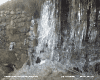 21st: A clear sky morning with overnight frost. Visibility was good, but again it was murky at low levels. This morning the 5 cm soil thermometer was reading -0.4C, both 5 and 10 cm thermometers were surviving the frost! The 21st is sometimes the winter solstice, but this year again it is tomorrow. It was photographed today as the 22nd was expected to be overcast! The sky today remained clear all day and into the evening, but cloud encroached by midnight. [Rain 0.1 mm; Max 7.3C; Min -1.1C; Grass -6.5C]
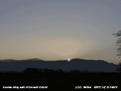
22nd: The cloud ensured that the overnight air temperature did not fall below 0.4C, but the clear evening resulted on ground frost. The sky was overcast and there had been drizzle and slight rain in the past hour. The soil was still frozen below the surface (at 5 cm deep 0.1C), but the surface was thawing and no freezing was seen on concrete with the temperature at 7.3C. Rain continued until about 13 GMT, but the afternoon although still overcast and sunless was dry. [Rain 4.1 mm; Max 7.7C; Min 0.4C; Grass -5.2C]
![]() 23rd: A bright morning with thin high wavy cirrus clouds. There was frost on the ground and soil was still frozen, although at 5 cm depth the temperature had risen to 0.9C. Pressure was 1026 mb under the influence of S European high 1034 mb. Low 972 mb was over Iceland and isobars were tightly packed to the NW of here. There was a light SE'ly breeze and the temperature rose to 7.2C by afternoon with some sunshine at times. The evening and night were mostly cloudy with rising temperature, it was 8.8C at midnight. [Rain 2.9 mm; Max 10.0C; Min 2.2C; Grass -3.0C]
23rd: A bright morning with thin high wavy cirrus clouds. There was frost on the ground and soil was still frozen, although at 5 cm depth the temperature had risen to 0.9C. Pressure was 1026 mb under the influence of S European high 1034 mb. Low 972 mb was over Iceland and isobars were tightly packed to the NW of here. There was a light SE'ly breeze and the temperature rose to 7.2C by afternoon with some sunshine at times. The evening and night were mostly cloudy with rising temperature, it was 8.8C at midnight. [Rain 2.9 mm; Max 10.0C; Min 2.2C; Grass -3.0C]
24th: The temperature continued to rise reaching 10.0C at 04 GMT and there was rain from 0500 GMT. The S'ly wind had freshened and was force 3 at 09 GMT, but had been force 6/7 earlier. Pressure was 1016 mb with a slow-moving cold front over the Irish Sea. The temperature at 09 GMT was 8.2C, dewpoint 7.8C. The soil seemed to have completely thawed and it was soggy and underfoot pressing out water. Rain continued until 1400 GMT when it was drier, but kept overcast and sunless. There was further rain around midnight. [Rain 8.3 mm; Max 8.5C; Min 2.9C; Grass 0.0C]
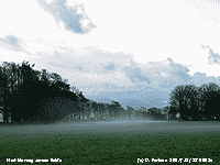 25th: With the cold front having passed over it was a bright Christmas morning. Shallow mist was moving across the fields in a light W'ly breeze and lying in hollows. The 6 okta cover of cumulus and altocumulus clouds cleared during the morning giving a mostly sunny day. At dusk another cold front moved across from the W bringing rain from 1830 to 1950 GMT. [Rain 4.1 mm; Max 7.2C; Min 2.2C; Grass -1.0C]
26th: A bright morning with a sprinkling of fresh snow seen on the summits of the Snowdonia Mountains. Pressure was 1020 mb with high 1032 mb W of Iberia and low 966 mb Iceland, deepening low 974 mb was S of Greenland tracking towards N Scotland. The morning had variable cloud amounts and a little sunshine, the afternoon was mostly cloudy. The SW'ly wind freshened through the day reaching strong to gale-force during the evening and night. [Rain 1.2 mm; Max 11.0C; Min 2.4C; Grass -1.9C]
27th: The strong SW'ly wind continued through the night and strengthened around 5-6 GMT to gale-force 8. By morning the ground was littered with twigs and small branches. The sky was overcast and it was raining at 09 GMT. Pressure was 1017 mb between low 963 mb E of Iceland and high 1039 mb SE Europe. The strong SW'ly wind persisted all day between force 6 and 7 with rain at times in bands slow-moving around the Irish Sea. The day was sunless with low solar radiation. [Rain 21.8 mm; Max 10.5C; Min 6.7C; Grass 5.4C]
¤
28th: Overcast with uniform grey stratus cloud. And yes, it was raining with 21.8 mm in the gauge at 09 GMT, largest fall of the month, with the SSW'ly force 6. The wet ground was saturated and small pools of water were evident around the weather station and on fields. At Llyn Llydaw, Snowdon 123.8 mm of rain was recorded during the same period [ECN AWS, data courtesy of CCW]. Pressure was 1010 mb with frontal-wave low 994 mb near Malin Head, N Ireland. During the past 24-h there had been very little temperature change, the mercury hovering around 10C. Rain continued through the morning becoming intermittent or showery in the afternoon. As the cold front moved slowly SE the temperature began to fall at 1700 GMT and the rain eased by 1930 GMT, but the wind persisted, somewhat moderated, at force 5/6. It was another lights-on sunless day, with solar radiation of only 0.20 MJ m-2. {Capel Curig 103 mm, at 21z} [Rain 16.8 mm; Max 10.7C; Min 9.5C; Grass 9.0C]
![]() 29th: At 0015 GMT there was a shower of hail between 5 - 9 mm diameter (MO code 5) that punctured foil on the hailometer in several places; the hail when melted was 4.8 mm. By morning the wind had strengthened again to force 6/7 and the sky was a little broken around 09 GMT. There was a dusting of ice precipitation over the Carneddau Mountains, some as low as 2000 ft, with snow showers seen. With complex low-pressure to the N pressure 1004 mb here was rising as a ridge moved in from the W. The SW'ly wind was back to force 6/7 and the small breaks in the ragged clouds closed in again during the morning. The wind strengthened between 12 and 13 GMT reaching gale force 8. A little blue sky, hardly sufficient to patch a sailor's trousers, appeared overhead around 1430 GMT, but the day was again sunless. During the evening when the wind had eased the sky cleared and there was a touch of ground frost. [Rain trace dew; Max 7.8C; Min 3.8C; Grass 1.2C]
29th: At 0015 GMT there was a shower of hail between 5 - 9 mm diameter (MO code 5) that punctured foil on the hailometer in several places; the hail when melted was 4.8 mm. By morning the wind had strengthened again to force 6/7 and the sky was a little broken around 09 GMT. There was a dusting of ice precipitation over the Carneddau Mountains, some as low as 2000 ft, with snow showers seen. With complex low-pressure to the N pressure 1004 mb here was rising as a ridge moved in from the W. The SW'ly wind was back to force 6/7 and the small breaks in the ragged clouds closed in again during the morning. The wind strengthened between 12 and 13 GMT reaching gale force 8. A little blue sky, hardly sufficient to patch a sailor's trousers, appeared overhead around 1430 GMT, but the day was again sunless. During the evening when the wind had eased the sky cleared and there was a touch of ground frost. [Rain trace dew; Max 7.8C; Min 3.8C; Grass 1.2C]
30th: By morning the sky was mostly cloudy and although pressure 1026 mb had risen the morning turned out to be very disappointing. Overcast with drizzle, mostly light, but at times heavy. A brighter spell early in the afternoon, with the sun trying to break through, soon disappeared with more rain around 1630 GMT. Another sunless day was recorded; during the evening I caught sight of clear sky before some light showers came across about 2200 GMT. [Rain 1.3 mm; Max 8.3C; Min 2.8C; Grass -1.8C]
31st: By morning there was a little broken cloud overhead and cloud was above the summits of the eastern Carneddau, but low cloud was being driven on to mainland mountaintops in the west as frontal cloud, associated with low 960 mb S Greenland, over Ireland encroached. Pressure 1037 mb was building over Scandinavia, but low pressure under a vigorous jetstream continued to buffer the west. A band of rain affected Ireland and W Scotland, but we received only remnants here. Another sunless day with occasional spells of drizzle or light rain under thickening layers of cloud. [Rain 1.6 mm; Max 10.1C; Min 5.0C; Grass 1.3C]
The month ended with a rainfall total of 137.4 mm, lowest since 2005, 103% of the decadal and 120% of the 30-y averages. The mean temperature was 6.0C (-0.1) and [+0.5] of the averages. There were 18 (+4.7) ground frosts and 4 (+0.7) air frosts. First indications are that it was the 10th sunniest on the Anglesey record since 1930, despite 9 sunless days.
|
|
|
These pages are designed and written by Donald Perkins © 1998 - 2007 Page first dated 1 March 2007 http://www.llansadwrn-wx.co.uk |