|


|
Llansadwrn (Anglesey)
Weather:
Snowdonia Snowline Report
|

|
Snowdonia Mountains Winter Season 2018- 19
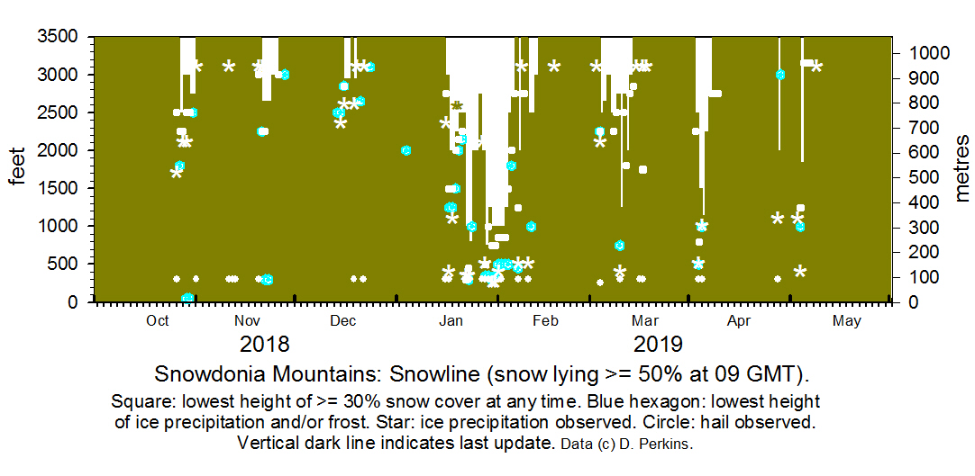
 Snowline
histogram Snowline
histogram

October
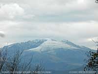
 Wintry weather arrived on the 26th with showers of hail and snow around the summits, heaviest in the afternoon. On the 27th snow was lying thinly on the northern slopes of the Carneddau with icy deposits as low as 1800 ft in places. Slight snow lying above 3000 ft with ice at 2250 ft on the 28th and ice precipitation showers in the evening. Frost at low levels especially valley on the 29th with further wintry showers at times turning summits briefly white.
Frost again at low levels on the morning of the 30th slight snow generally above 2500-2750 ft on northern slopes including Snowdon this persisting until the morning of the 31st. Wintry weather arrived on the 26th with showers of hail and snow around the summits, heaviest in the afternoon. On the 27th snow was lying thinly on the northern slopes of the Carneddau with icy deposits as low as 1800 ft in places. Slight snow lying above 3000 ft with ice at 2250 ft on the 28th and ice precipitation showers in the evening. Frost at low levels especially valley on the 29th with further wintry showers at times turning summits briefly white.
Frost again at low levels on the morning of the 30th slight snow generally above 2500-2750 ft on northern slopes including Snowdon this persisting until the morning of the 31st.
November
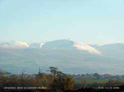
On the 1st no snow could be seen on the mountains. Wintry conditions returned on the 20th with ice precipitation on the summits with a little snow at times. On the 21st overnight precipitation rain at low levels, but cold enough to leave slight snow lying at 2650 ft and icy deposits as low as 2250 ft in places. The snow persisted on Carnedd Llewelyn and other summits on the 22nd in hazy afternoon sunshine will small amounts and ice remaining up to the 28th then absent during a very mild spell to the end of the month.
.
December
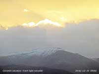
In very mild weather snow was absent at the beginning of the month. With summits conditions continuing mild, only occasionally wintry up to the 8th, no snow. Icy conditions prevailed on the tops especially on Snowdon on the 14th and 15th and during the day showers became wintry once again.  Overnight 15/16th rain turned to snow by morning leaving sprinkling of snow generally above 2850 ft and light covering snow on Foel-fras, Carnedd Llewelyn and Snowdon where in places on previous ice. Slight snow persisted on the tops on the 17th then overnight 17/18th temperatures rose to 6C as a warm front with rain moved across melting much of the snow. Overnight 18/19th a little fresh wet snow on summits over 2950 ft including C. Dafydd and Llewelyn. Snow patches were persisting on Snowdon and small pockets of ice on summits including Carneddau and Glyderau. Various forms of ice precipitation occurred up to the 22nd among the summits. Shallow patches were persisting on the 24th on the NE flank of Garnedd Ugain. Overnight 15/16th rain turned to snow by morning leaving sprinkling of snow generally above 2850 ft and light covering snow on Foel-fras, Carnedd Llewelyn and Snowdon where in places on previous ice. Slight snow persisted on the tops on the 17th then overnight 17/18th temperatures rose to 6C as a warm front with rain moved across melting much of the snow. Overnight 18/19th a little fresh wet snow on summits over 2950 ft including C. Dafydd and Llewelyn. Snow patches were persisting on Snowdon and small pockets of ice on summits including Carneddau and Glyderau. Various forms of ice precipitation occurred up to the 22nd among the summits. Shallow patches were persisting on the 24th on the NE flank of Garnedd Ugain.
January
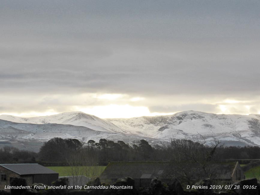
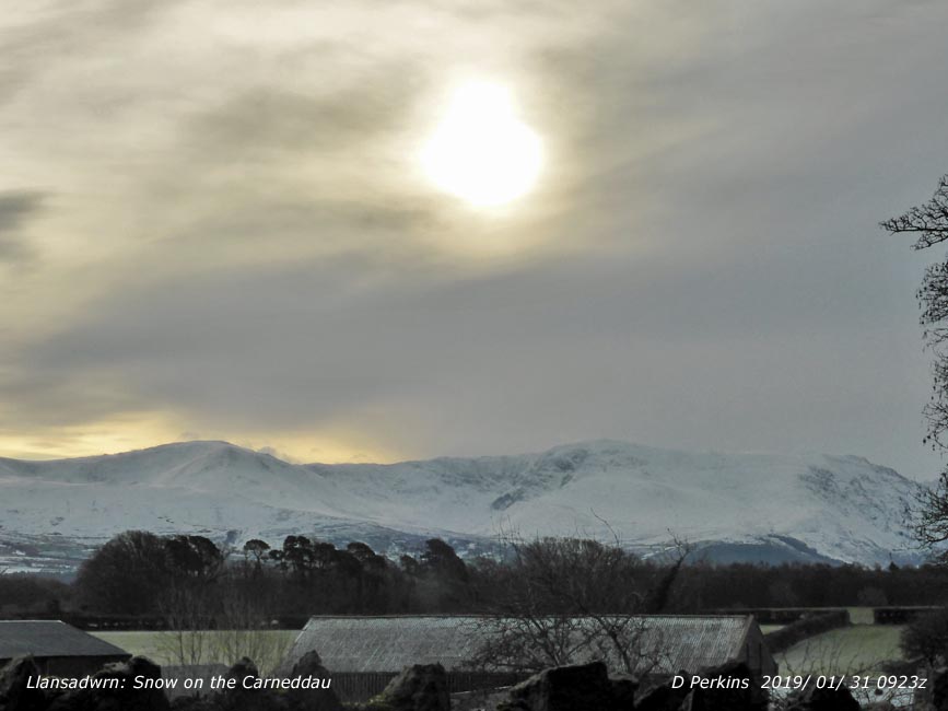
There was no lying snow on the mountains at the beginning of the month. There were heavy depositions of frost on Snowdon above about 2000 ft on the 4th covering vegetation and rocks. It was a long wait, but early on the 16th there was light snow fell above about 2750 ft and showers later in the day. On the 17th with more showers overnight snow was lying above 2000 ft and 30% cover around 1500 ft with some as low as 1250 ft including the Ogwen Valley. Further showers occurred on the 18th, 19th and 20th with snow settling around the summits. On the 21st snow was lying (>50% cover) above 2500 ft on the slopes of the Carneddau with broken snow cover 30% at 2250 ft with some remaining as low as 2150 ft. Early on the 22nd there was light snow in places at low levels including on Cadair Idris.  Again on the 23rd snow was lying as low as 800 ft on the slopes of the Carneddau while on the tops it was very cold -4C with -10C wind chill with frozen snow and ice. In the afternoon warmer air moved across and fog developed over the cold ground. The snowline on the 24th was at 2000 ft with a 30% cover at 2250 ft and although temperatures had risen to about zero snow with ice persisted around the summits. There was broken snow in areas around 1250 ft. On the 25th the national Park Warden reported snow over 600 m on the PYG track with drifts in places and unstable cornices forming on cliff edges. Slopes and paths wre covered in hard snow and ice. Major paths obscured making navigation difficult. Saturated and unstable snowpack at higher levels on SE aspects. On the 26th during the day rain, then freezing rain and ice pellets preceded snow in the afternoon with snow showers overnight 26/27th leaving a sprinkling as low as 2000 ft by the morning. Again on the 23rd snow was lying as low as 800 ft on the slopes of the Carneddau while on the tops it was very cold -4C with -10C wind chill with frozen snow and ice. In the afternoon warmer air moved across and fog developed over the cold ground. The snowline on the 24th was at 2000 ft with a 30% cover at 2250 ft and although temperatures had risen to about zero snow with ice persisted around the summits. There was broken snow in areas around 1250 ft. On the 25th the national Park Warden reported snow over 600 m on the PYG track with drifts in places and unstable cornices forming on cliff edges. Slopes and paths wre covered in hard snow and ice. Major paths obscured making navigation difficult. Saturated and unstable snowpack at higher levels on SE aspects. On the 26th during the day rain, then freezing rain and ice pellets preceded snow in the afternoon with snow showers overnight 26/27th leaving a sprinkling as low as 2000 ft by the morning.  Snowdon AWS reporting -2C with a wind chill of -12C; snow was being blown on the strong wind during the day. Fresh snow fell overnight 27/28th, light to moderate at higher levels, light snow lying as low as 750 ft generally. There had been a slight thaw and snow was broken at 1250 ft on the 29th before more snow fell after rain as it turned colder later. A large operation was launched to rescue a climber who had been caught in an avalanche in a gully on Snowdon sustaining a leg injury. Mountain rescue, search dogs and a coastguard helicopter took part in a seven hour rescue mission in very difficult conditions. Further snow at times on the 30th and on the 31st snow was lying at 1000 ft with 30% cover at 750 ft. Further snow fell later in the day. Snowdon AWS reporting -2C with a wind chill of -12C; snow was being blown on the strong wind during the day. Fresh snow fell overnight 27/28th, light to moderate at higher levels, light snow lying as low as 750 ft generally. There had been a slight thaw and snow was broken at 1250 ft on the 29th before more snow fell after rain as it turned colder later. A large operation was launched to rescue a climber who had been caught in an avalanche in a gully on Snowdon sustaining a leg injury. Mountain rescue, search dogs and a coastguard helicopter took part in a seven hour rescue mission in very difficult conditions. Further snow at times on the 30th and on the 31st snow was lying at 1000 ft with 30% cover at 750 ft. Further snow fell later in the day.
February
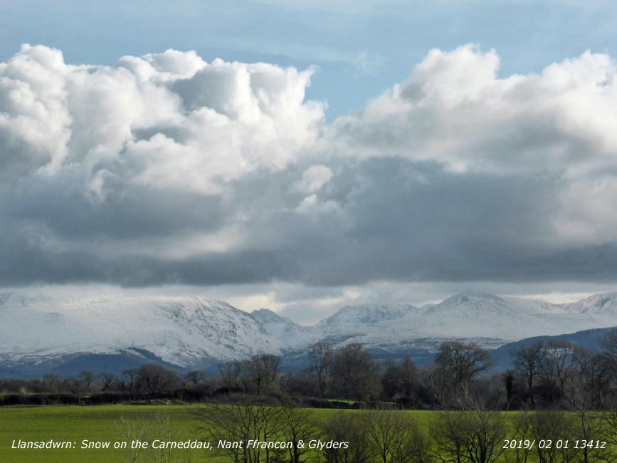
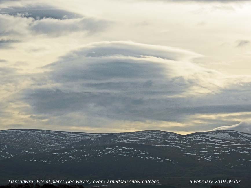
 On the 1st there was plenty of snow on the mountains with deep drifts in places and unstable cornices on some cliffs. On the 1st there was plenty of snow on the mountains with deep drifts in places and unstable cornices on some cliffs.  Snow was generally lying above 1000 ft (300 m) and there had been snow showers at lower levels. Similar on the 2nd and remaining cold -4C on Snowdon summit with significant wind chill -11C at 09 GMT conditions were icy. There was a good white cap of snow on Moel Eilio and mountains westward and on Cadair Idris in the south. Frosty at low altitude in the morning. Snow was more broken at lower altitudes on the 3rd, remaining cold on the summits with snow lying at 1250 ft (400 m). The weather was changing with warmed Atlantic air moving in and by 1500 GMT had risen to 7C on Anglesey and 3C on the mountaintops. On the 4th there had been a thaw and snow cover was all broken with lines of old drifts evident at lower altitude; higher up there was plenty of snow and ice remaining. By the 5th there was less snow with snow patches, old drifts, frequently above 1750 ft (530 m) and broken lying snow above 2750 ft on the north-facing slopes of the Carneddau. Thawing continued by the 6th and only areas of broken snow and patches remaining over 2000 ft. Overnight 6/7th turning colder again fresh wet snow fell as low as 450 ft by the morning, colder on the tops -2C with light to moderate snow. Heavy rain and rising temperature on the 8th melted much of the snow leaving snow patches above 2150 ft and small areas of snow in places on the 9th at higher altitude; snow showers overnight around the summits. Ice pellets at low levels and further snow showers on the 10th with snow around the summits and a little more by the 11th lying around the summits mostly over 2750 ft (840 m). Rising temperatures again thawed much snow and by the 13th patches remained. On the 14th it was 6C on the summit of Snowdon at 09 GMT. Snow patches persisted until the end of the month. Snow was generally lying above 1000 ft (300 m) and there had been snow showers at lower levels. Similar on the 2nd and remaining cold -4C on Snowdon summit with significant wind chill -11C at 09 GMT conditions were icy. There was a good white cap of snow on Moel Eilio and mountains westward and on Cadair Idris in the south. Frosty at low altitude in the morning. Snow was more broken at lower altitudes on the 3rd, remaining cold on the summits with snow lying at 1250 ft (400 m). The weather was changing with warmed Atlantic air moving in and by 1500 GMT had risen to 7C on Anglesey and 3C on the mountaintops. On the 4th there had been a thaw and snow cover was all broken with lines of old drifts evident at lower altitude; higher up there was plenty of snow and ice remaining. By the 5th there was less snow with snow patches, old drifts, frequently above 1750 ft (530 m) and broken lying snow above 2750 ft on the north-facing slopes of the Carneddau. Thawing continued by the 6th and only areas of broken snow and patches remaining over 2000 ft. Overnight 6/7th turning colder again fresh wet snow fell as low as 450 ft by the morning, colder on the tops -2C with light to moderate snow. Heavy rain and rising temperature on the 8th melted much of the snow leaving snow patches above 2150 ft and small areas of snow in places on the 9th at higher altitude; snow showers overnight around the summits. Ice pellets at low levels and further snow showers on the 10th with snow around the summits and a little more by the 11th lying around the summits mostly over 2750 ft (840 m). Rising temperatures again thawed much snow and by the 13th patches remained. On the 14th it was 6C on the summit of Snowdon at 09 GMT. Snow patches persisted until the end of the month.
¤
March
A few snow patches remained on the 1st on Snowdon, Carneddau and Glyderau. Light snow fell on the 4th and ice precipitation on the 6th around the highest summits. Fresh snow fell on the 7th and on the 8th was lying at 2500 ft and on the 9th broken snow lying at 2750 ft with remnants as low as 2500 ft. On the 10th there was fresh wet snow lying at 1250 ft with some at 750 ft in places on the eastern Carneddau. On the 11th snow lying at 2500 ft and on the 12th fresh snow lying at 2000 ft. On the 13th snow patches were at 2250 ft below the Black Ladders with 30% snow cover at 2750 ft. The 14th had further ice precipitation at times during the day. On the 17th snow fell was at 1750 ft on Y Garn in the afternoon following a thunderstorm over the eastern Carneddau at 1600 GMT. Snow patches persisted in various places on the Carneddau and Snowdon until the end of the month.
April
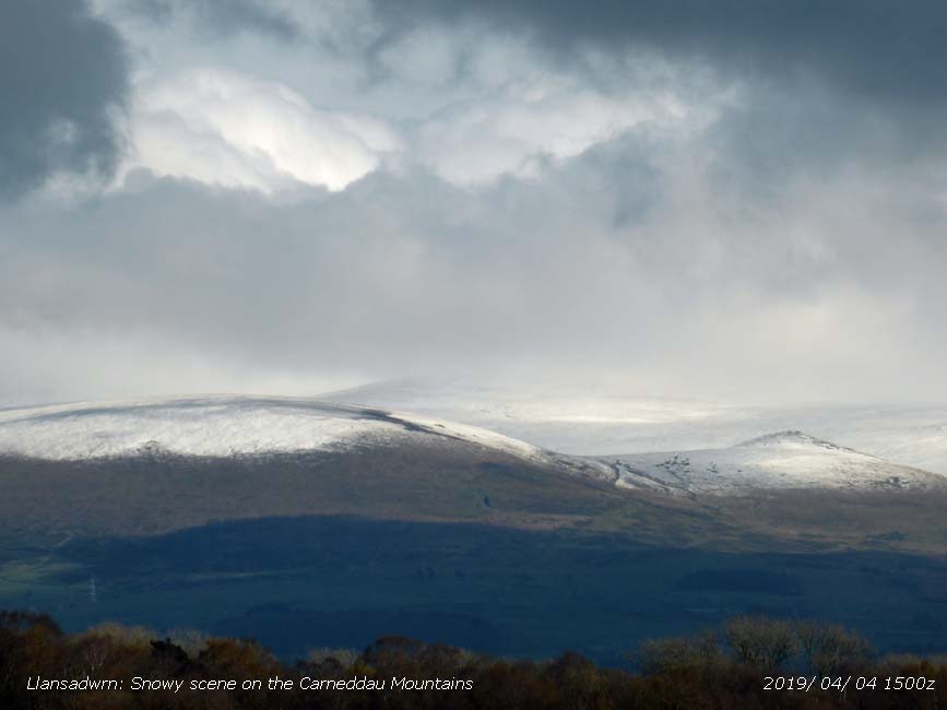
A few snow patches and cornices had persisted to the 1st high on the Carneddau and Snowdon. Overnight 1/2nd with the introduction of colder air from the Arctic, rain turned to snow leaving a covering above 2250 ft in the morning.  Later heavy ice precipitation (including snow pellets, ice pellets and snow) fell before and after midnight 2/3rd with snow lying on the 3rd above 1500 ft in the morning. Snow was as low as 500 ft in the west of the range exposed to the north-west, and around Cadair Idris. Further showers of ice precipitation fell during the day with sleet and snow showers in places at low levels (including SE Anglesey) in the middle of the day, continuing later around the summits. On the morning of the 4th snow was lying above 1250 ft with a little in places at 1000 ft. On the 10th broken snow at 30% cover was present on the summits of the Carneddau with patches as low as 2250 ft; there were frequent snow patches on the south-facing side of Yr Wyddfa. Snow patches persisted at various heights. On the 26th there was ice precipitation late in the day at altitudes over 100 m and on the 27th there was further precipitation at 1000 ft with fresh snow lying above 2000 ft. There were remnants over 2500 ft on the 28th along with older snow patches in places over 2750 ft. Later heavy ice precipitation (including snow pellets, ice pellets and snow) fell before and after midnight 2/3rd with snow lying on the 3rd above 1500 ft in the morning. Snow was as low as 500 ft in the west of the range exposed to the north-west, and around Cadair Idris. Further showers of ice precipitation fell during the day with sleet and snow showers in places at low levels (including SE Anglesey) in the middle of the day, continuing later around the summits. On the morning of the 4th snow was lying above 1250 ft with a little in places at 1000 ft. On the 10th broken snow at 30% cover was present on the summits of the Carneddau with patches as low as 2250 ft; there were frequent snow patches on the south-facing side of Yr Wyddfa. Snow patches persisted at various heights. On the 26th there was ice precipitation late in the day at altitudes over 100 m and on the 27th there was further precipitation at 1000 ft with fresh snow lying above 2000 ft. There were remnants over 2500 ft on the 28th along with older snow patches in places over 2750 ft.
May
Snow patches were present on north-facing Carneddau Mountains above 2750 ft on the 1st having survived the warm spell in April. On the 3rd the weather turned colder, after passage of a cold front from the north and the introduction of air from the Arctic. Ice precipitation from showers left snow on the ground over night 3/4th and in the morning snow was variously lying as low as 1250 ft in places with frost in the valley bottoms.
-
You
can view the snowline histograms for previous years here:
 Winter 2017-2018 Winter 2017-2018
 Winter 2016-2017 Winter 2016-2017
 Winter 2015-2016 Winter 2015-2016
-
You can view complete snowline reports for previous years here:
 Winter 2017-2018 Winter 2017-2018
 Winter 2016-2017 Winter 2016-2017
 Winter 2015-2016 Winter 2015-2016
-
For earlier archived reports refer to the Site Map.
Notes
Observations
were made as near to 0900 GMT as possible. I have a good view from Llansadwrn,
weather permitting, across the Menai Strait towards the Snowdonia Mountains. I
can see the northern slopes of the mountain range from Moel Eilio (west of Snowdon),
Snowdon summits (Yr Wyddfa and Crib Goch), the Glyderau and Carneddau to Foel-fras and
Drum to the east of the range near the Conwy Valley. With the aid of binoculars I make
daily records that include any ice precipitation observed, the lowest altitude
of snow lying at ( >= 50% cover), at ( >= 30% cover) and snow patches.
|


