|
Click once on camera and graphic icons to see the image (some panoramas need another click to enlarge). Javascript must be enabled. Times are GMT (UTC, Z). Observations at this station [ ] are 24-h 09-09 GMT, some others { } occasionally refer to other 24-h periods, extremes (first indications) are given in bold and are usually 21-21 GMT. When averages are referred to (.) compares with the last decade and [.] with the new 30-y climatological average [1981 - 2010]. All data are subject to verification and amendment.
January
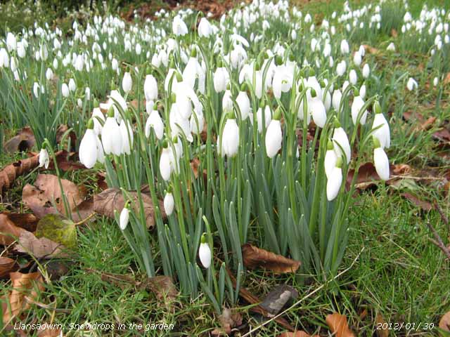
1st: Fifty-years on and it was a mild day with an overnight minimum of 9.1C 48F on Anglesey, highest of the month, 11.5C 53F in London rising to 13.1C 56F during the day. Pressure here 999 mb was falling slowly between complex low 992 mb over Iceland and high-pressure to the S (1032 mb Spain and 1025 mb Croatia). We were in a vigorous SW'ly airflow and there had been showers of rain at 0835 GMT in Llanfairfechan (18 mm/h) and here at 0753 GMT (10.6 mm/h), but at 0900 GMT the sky was showing signs of opening up. This was not to be as soon the darkening there were rumbles of thunder and heavy rain and some ice pellets falling at a rate of 52 mm/h at 1040 GMT. Most of the snow that fell on the Snowdonia Mountains in December had melted leaving a few small patches high up near Foel-goch. The first snowdrops were starting to appear between fallen leaves on the lawn, joining the early spring-like appearance of some of the Azalea bushes. A dull sunless day. {London 13.1C, Hawarden 11.5C, Llanfairfechan 11.2C, Capel Curig 28.4 mm, Kinloss 4.3h} [Rain 2.9 mm; Max 9.6C; Min 9.1C; Grass 7.9C]
14th: An almost clear sky at 09 GMT, again extensive white frost on fields, there was ice on water, the grass minimum had fallen to -4.2C and there was 0.19 mm of dew/ frost deposition. Calm, with very good visibility and the morning sunny. Mostly sunny afternoon, cloudier by 1600 GMT with light breezes at times, clearing and becoming calm later. Clear at night with an orangy coloured moon rising over Carnedd Llewelyn just before midnight. {Scilly 9.7C/ Benson -7.4, Woodford 7.2h, Aberporth 6.9h} [Pptn trace; Max 7.3C; Min 0.0C; Grass -4.2C] 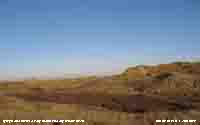 17th: Mostly cloudy in the morning, but it had kept dry overnight. Despite being warmer the ground was still frozen especially in shaded parts with the soil temperature 0.5C at 5 cm deep, 0.1C down from yesterday. As it had not rained the drosometer measurement was valid and indicated a dew/ frost deposition of 0.17 mm. Pressure was 1025 mb with the high 1032 mb over France with a ridge towards southern Britain. Light variable breezes, brightening before noon it was sunny for a while in the afternoon then turned cloudier again The evening was overcast, but dry. [Llanfairfechan 13.9C, Dublin 11.5C, Plymouth 11.4C, Valley/ Aberdaron 8.1C, Aberporth 3.6h] [Rain 3.2 mm; Max 10.0C; Min -0.5C; Grass -5.1C]
 18th: In a SW'ly breeze of up to 24 mph the temperature at Gorwel Heights in Llanfairfechan at 0430 GMT was 13.9C and here 9.9C (AWS) at the same time. The result of a warm front associated with low 995 mb over Iceland passing over giving light to moderate rain from 0530 to 0730 GMT. At 09 GMT there was low cloud fog and a temperature of 9.5C and 100% relative humidity while at Gorwel Heights it was 11.8C and 68% RH. The fog began to lift during the morning with a following cold front with the afternoon brighter, but the sky remained overcast. There were quite long new shoots on Clematis Ville de Lyon, in the garden, that had completely died back for the 'winter'. [Shobdon 13.4C, Hawarden 12.4C, Llanfairfechan 11.8C, Aberdeen 3.5h, Valley 0.0h] Rain 5.1 mm; Max 9.8C; Min 3.7C; Grass 1.0C] 19th: Light rain from midnight until 0500 GMT and a slight shower at 07 GMT. Signs of the sky starting to clear at 0900 GMT, but there was rain in sight and with sunny spells there were showers of rain and small ice pellets before clearing and becoming sunny at 1045 GMT. The afternoon was sunny over Anglesey, but convective clouds with wintry precipitation continued over the Snowdonia Mountains. Buds were appearing on roadside daffodils on 'peacock hill' and redwings (about 40) were amongst starling (about 200) on 'church field in the afternoon. The starlings would fly up into trees, when passing traffic disturbed them, leaving the redwings on the ground. The evening was cloudier with blustery showers especially at Gorwel Heights at 1800 GMT (shower 14 mm/ h). We have had no sighting of bullfinches this winter, they were regular visitors at this time of year. {Exeter 12.5C, Cassley 22 mm, Leconfield 5.3h} [Rain 1.5 mm; Max 7.9C; Min 5.2C; Grass 1.8C] 20th: Overcast with the temperature rising to 7.9C at 09 GMT, the highest of the past 24-h. Although overcast the day kept dry, but rather dull. The SW'ly breeze picked up during the evening force 3/5. {Exeter 11.5C, Ballypatrick Forest 26 mm, Lake Vyrnwy 14 mm, Lerwick 2.0h} [Rain 0.6 mm; Max 9.8C; Min 4.1C; Grass 0.9C] 21st: Slight shower of rain at 07 GMT then signs of the sky clearing as a patch of blue developed to the NE over Red Wharf Bay. Visibility was good, but very misty on the mountaintops. Pressure was 1012 mb and with low 971 mb N of Shetland and we were in a WNW'ly showery airstream. Bright spells with a glimpse of sunshine, and light showers of rain were the orders of the day. {Otterbourne WW 13.5C, Cluanie Inn 30 mm, Aberdeen 4.2h, Aberporth 0.9h} [Rain 2.2 mm; Max 8.2C; Min 7.5C; Grass 6.5C] 22nd: Some clear sky after midnight, but not enough to give a ground frost. Mostly cloudy in the morning with moderate visibility in thick haze. Pressure 1012 mb was rising slowly as low 994 mb N Scotland drifted SE over the North Sea with little change. A weak cold front was in the vicinity; the temperature at 09 GMT was 8.2C (dewpoint 4.3C). The morning brightened only a little, there was a glimpse of sunshine after noon with the temperature rising to 9.8C at 1300 GMT. The rest of the afternoon was dull; the evening and night remained mostly cloud covered. {Swanage 12.7C, Cluanie Inn 30.4 mm, Leuchars 6.2h} [Rain 0.1 mm; Max 9.8C; Min 4.8C; Grass 1.1C] 23rd: With signs of the sky starting to clear before 09 GMT it was a bright morning on Anglesey with a bank of cumulus cloud (base 1500 ft) persisting over the mountains. A quiet morning, the birds were twittering and lambs were bleating across the fields. With the low over the Norwegian Sea filling 998 mb, pressure here 1019 mb was rising as a ridge of high pressure from the Azores (1030 mb) moved across from the west. Bright with the odd sunny spell in the afternoon with a warm frontal cloud associated with complex low 980 mb Iceland encroaching later from the W bringing slight rain by 2300 GMT. {Scilly 11.6C, Leconfield 6.6h} [West Freugh 11.2 mm, Aberdaron 11.0 mm, Capel Curig 8.0 mm] [Rain 11.4 mm; Max 9.1C; Min 3.5C; Grass -0.2C] 24th: Moderate rain, heavy at times during the night, easing off to drizzle when 11.4 mm was recorded in the 24-h to 09 GMT. Fog early, the then moderate fog was decreasing. There were small pools of water around the station, the overnight rain enough to saturate the surface soil, the ground was very soggy and muddy underfoot. Fine drizzle during the morning dying out, but keeping very dull and sunless. Intermittent slight rain from 1700 to 2030 GMT. It was a wet day in Nantlle, Gwynedd, on the upslope of the Snowdonia mountains with 24.9 mm (AWS 00-00z), but in Llansadwrn 11.6 mm (AWS 00-00z) and at Gorwel Heights in Llanfairfechan in rain-shadow 5.2 mm (AWS 00-00z). {Usk No 2 13.5C, Porthmadog 22.6 mm} [Llanfairfechan 12.1C, Hawarden 11.9C, Rhyl 9.9C] [Rain 1.7 mm; Max 10.6C; Min 2.0C; Grass -1.6C] 25th: Overcast with spots of rain on the moderate and gusty S'ly breeze. Visibility was good to very good under the cloud sheet that was lower on the mountain slopes in the W, but towards Conwy the sky looked brighter. Pressure 1010 mb was falling slowly with complex low 983 mb Iceland and high 1026 mb Spain maintaining a warm sector airflow 8.8C (dewpoint 6.9C) at 09 GMT. On the summit of Snowdon the temperature was 4C and there had not been any snow this month so far. There were strong S'ly winds over the North Sea. The day kept mostly dull here, but there were broad crepuscular rays seen along the mountains from the Nant Ffrancon Pass eastward in the morning with a brief glimpse of sunshine before a shower of rain at 1100 GMT. A cold front arrived during late afternoon with strong gusts 39 mph at 1613 GMT (at Gorwel heights 40 mph at 1724 GMT) before moderate to heavy heavy rain from 1915 to 2315 GMT (heaviest 45 mm/h at 1946 GMT falling with ice pellets). Rainfall in the 24-h from 09 GMT today was 15.7 mm, largest of the month. [Hawarden & Llanfairfechan 12.1C, Capel Curig 17.2 mm, Valley 0.0h] [Rain 15.7 mm; Max 9.5C; Min 8.5C; Grass 7.5C] Llanfairfechan 12.1C, Capel Curig 17.2 mm, Valley 0.0h] [Rain 15.7 mm; Max 9.5C; Min 8.5C; Grass 7.5C] 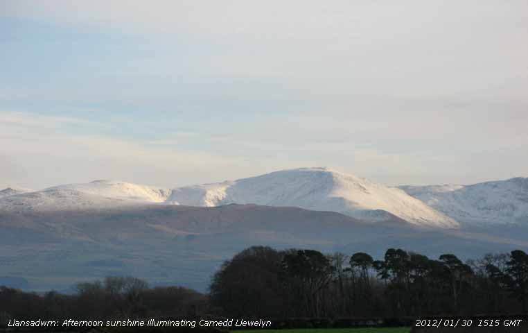 26th: A slight shower at 05 GMT, a moderate to heavy shower of rain around 07 GMT (10 mm/h) and again at 09 GMT (6 mm/h) and with wet snow pellets falling visibility was moderate. At higher levels sleet and snow above 1000 ft. Snow was lying on the mountains at 1800 ft, but was as low as 1250 ft on the SE-facing slopes of Y Garn. The ground again was saturated with pools of standing water on the fields. A passing showery trough was slow to clear, but the afternoon was brighter at times and kept dry. Another shower with ice perception at 2200 GMT (12 mm/h). [St Athan 8.8C, Hawarden 7.0C, Capel Curig 10.4 mm, Valley 2.5h] [Rain 2.6 mm; Max 5.6C; Min 2.3C; Grass -0.5C]
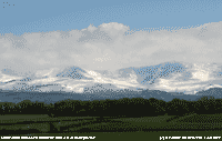
 27th: A mostly cloudy morning with a slight fall of snow pellets at 09 GMT. Snow was lying still at 1800 ft centrally on the Carneddau Mountains. Visibility was good, but slightly misty. Pressure 1017 mb was rising slowly with low 1007 mb N Scotland and high 1031 mb Cape Finisterre. A showery morning with brief sunny spells and wet snow pellets at 1215 GMT. A male bullfinch was spotted in the 'wild garden' the first seen for a while In the afternoon the temperature popped up to 6.7C (AWS 6.3C) between 1430 and 1500 GMT when the sun came out. Otherwise the temperature kept around 5C in a light WSW'ly breeze. During the late afternoon with further showery rain (fresh snow on the mountains) the wind backed NNE'ly and pressure 1019 mb at 1800 GMT continued to rise. {Swanage 10.5C, Cardiff 9.9C, Stoneyhurst 16.4 mm, Capel Curig 14.6 mm, Wattisham 7.9h, Valley 0.9h[Rain 4.9 mm; Max 6.7C; Min 2.4C; Grass -0.8C] 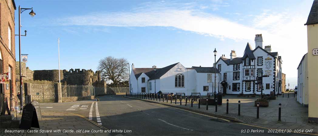 28th: At midnight pressure had risen to 1026 mb and with broken or scattered clouds the temperature on the grass fell to -1.8C by morning. The ground was not white with frost, but dew drops were frozen. Pressure 1032 mb was still rising slowly in a ridge from high 1032 mb Cape Finisterre; it was calm with occasional airs from the south-east. Pressure was also intensely high 1058 mb over NW Russia where it was also very cold, the temperature at Kojnas today -35.7C. Visibility was good, or very good looking towards the Lleyn, but there was smoke haze in the east and low-lying mist in the Menai Strait. The morning was bright with weak sunshine, the afternoon sunnier with sun shining on the white topped Carnedd Llewelyn (above right) with lying snow generally at 2000 ft, as low as 1600 ft in places and 1250 ft near Cwm Idwal. {Cardiff 8.3C/ Sennybridge -2.7C, Aberporth 4.0h, Valley 0.8h} [Rain 0.1 mm; Max 5.4C; Min 1.6C; Grass -1.8C]
 29th: Overcast with light rain and/ or drizzle most of the day precipitation falling as snow on the Snowdonia Mountains. Pressure had fallen a little 1031 mb,but was still under the influence of the intense high 1059 mb over NW Russia; the temperature in Kalevala today was -37.2C. Dry during the evening, some clear sky for a while. No sunshine here, but 7.2h was recorded at Kinloss in Scotland. {Scilly 9.3C, Killowen 37.4 mm, Whitechurch 22.0 mm, Kinloss 7.2h} [Rain 8.2 mm; Max 4.1C; Min 1.1C; Grass -2.5C]
 31st: The coldest night since the 16th with the air minimum falling to -1.4C, lowest of the month, and on the grass to -5.5C. Snow was lying at 1000 ft on the mountains and the temperature on the summit of Snowdon was between -9C and -5C. A bright start with a little altocumulus cloud drifting across on the light E'ly breeze. Pressure 1027 mb was rising slowly with high 1051 mb S Sweden dominating while frontal wave low 1004.1 mb in the SW Approaches was moving over the Bay of Biscay. Anglesey was temporarily in the clear, but low stratiform cloud encroached from the E by 1030 GMT obscuring the sun and with a persistent E'ly breeze giving a rather raw feeling to the afternoon. The maximum temperature of 1.7C (screen and AWS) was lowest of the month. {Scilly 7.1C & 16.8 mm, Pershore min -6.2C, Capel Curig -5.8C, Aviemore 5.2h, Valley 3.6h} [Rain 0.0 mm; Max 1.7C; Min -1.4C; Grass -5.5C]
 The month ended with a mean temperature of 5.9C (+0.5) & [+0.8] of average, highest since 2008 and ranked 9 since 1979. Rainfall of 86.4 mm was (81%) & [85%] of average and was highest since 2009, but ranked 33rd lowest since 1929. Sunshine was a little below average, sunshine duration at Valley was 55.8h (92%) & [96%] of average, lowest since 2008. Sunniest day was on the 16th having 6.9h and there were 8 sunless days.
February
1st: A clear and frosty morning although not a lot of 'white' on the grass as moisture levels in the air (80%) were relatively low. Just below freezing -0.4C at 0900 GMT with the ground hard underfoot. A light E'ly breeze and just the odd small cumulus cloud appearing overhead soon to disappear again. Visibility was good with moderate smoke haze, good views of the snow on the mountains in the afternoon Sunny all day, the temperature rising to 4.3C, then a blood red sunset at 1655 GMT followed by a peach and azure blue twilight. {Lossiemouth 5.6C/ Aviemore -7.6C, Gogarddan 4.3C/ Hawarden -5.9C, Aberporth 8.6h} [Rain 0.0 mm; Max 4.3C; Min -1.1C; Grass -3.8C]
2nd: After a mostly clear frosty night with air temperature down to -3.1C and to -7.5C on the grass the ground looked slightly white with frost. Another sunny morning the sun rising over the mountains at 0825 GMT. At 0900 GMT there were many long and expanding contrails overhead (3 oktas), otherwise clear over Anglesey and there was some cloud over the mountaintops of Snowdonia. Snow was still lying between 1000 and 1200 ft although it was looking thinner at lower levels there having been some thawing and/ or sublimation during yesterday's sunshine. More sunshine today with the temperature rising to 4.2C in the screen although the ground remained frozen. The mountains looked spectacular in afternoon sunshine and the evening was clear with temperatures falling rapidly. {Valley 4.6C/ Pembrey Sands -8.1C, Shap Fell -9.4C, Aberporth 8.3h}[Pptn trace; Max 4.2C; Min -3.1C; Grass -7.5C] The month ended with rainfall totalling 67.4 mm (85%) & [86%] of averages, driest since 2010 and ranking 41 since 1928. The mean temperature was 5.6C, lowest since 2010, spot on the decadal average and [+0.4] on the 1981-2010 climatological average. |

|
4th: A trough of low pressure moved eastward off the Irish Sea during the night bringing showery precipitation after midnight, snow pellets were recorded in Llansadwrn; in Llanfairfechan (with heavy bursts between 15 to 21 mm/h) 16.4 mm were recorded in the 24-h to 09 GMT this morning. Temperatures were low enough for the precipitation to fall as snow above 800 ft on the N-facing slopes of the Carneddau Mountains and in Ogwen Valley at 1000 ft. Mostly cloudy at first bright and sunny spells developing by afternoon and ground frost by evening. {St James Park 10.2C/ Loch Glascarnoch -3.1C, Hurn 26.8 mm, Aldergrove 8.3h} [Rain trace dew; Max 8.5C; Min 2.5C; Grass 2.0C]
5th: Variable amounts of cloud after midnight, little in the way of frost on the ground by morning although the grass minimum had fallen to -2.7C the previous evening. A moderate to heavy dewfall overnight. A calm morning, or occasional light breezes from the NE. A bright morning with long spells of sunshine in the afternoon the sky clearing by evening. Some honey bees and large bumblebees were about again for a while in warmest part the afternoon. Buds on willow trees are opening as are horse-chestnut with dwarf yellow candles high up on the trees. Buds on early sycamore trees are large and green, but no leaves yet. The best of the weather in the north-west again today, a frontal-wave low gave a wet cold day with strong to gale-force winds in Thanet and the SE of England. {Killowen 11.9C, Norwich AP 29.0 mm, Glasgow 10.1h}[Rain tr dew; Max 9.4C; Min 1.2C; Grass -2.7C]
 6th: Overnight the minimum air temperature was 1.1C, lowest of the month. There was an extensive white frost on the fields at dawn, the grass min had fallen to -3.0C, lowest of the month, but most had melted by 09 GMT. Pressure was 1026 mb in a ridge of high pressure from high 1033 mb over Spain. A fine sunny morning to start the day, but as low 976 mb SW Iceland moved closer and deepen (961 mb at noon) pressure began to fall and the afternoon, though keeping dry, was cloudier and windier. Snow on the mountains from the 4th was retreating rapidly; that remaining at 1300 GMT on the tops of the Carneddau between C. Gwenllian and C. Llewelyn was photographed in a spell of brief sunshine. At 1800 GMT pressure 1019 mb was falling rapidly. {Hawarden 11.9C, West Freugh 13.6 mm, Brize Norton 10.2h} [Rain 7.6 mm; Max 9.6C; Min 1.1C; Grass -3.0C]
7th: Overnight rain on a warm front had left the ground very wet and muddy, but a weak cold front had passed over just before 07 GMT and the sky was starting to clear at 0900 GMT. Pressure 1011 mb was rising rapidly and the morning was soon sunny although visibility was moderate. The afternoon was cloudier as convective cumulus clouds moved across off the Irish Sea on a light to moderate W'ly breeze. I could not see any snow left on the mountains at noon. We had a light shower of wet 4 - 5 mm snow pellets at 1420 GMT, then some more sunshine as the sky became clearer by the end of the afternoon with a ground frost developing in the evening. {Llanfairfechan 12.2 (0250z), Cardiff 12.0C, Capel Curig 24.4 mm, Valley 7.8h} [Pptn trace; Max 10.2C; Min 4.9C; Grass 3.4C]
8th: Variable amounts of cloud from few to scattered overnight. Any frost on the grass at melted by 0900 GMT. The sky was almost clear and there was weak sunshine before more clouds came along within the hour. Pressure 1030 mb was still rising slowly with high 1037 mb over the Bay of Biscay and deep low 968 mb over the Denmark Strait between Greenland and Iceland. With thin wavy (orographic) cloud the afternoon was bright. {Usk2 12.7C, Manston 10.0h, Aberporth 4.9h} [Rain 0.8 mm; Max 10.2C; Min 2.9C; Grass -1.4C]
9th: Overcast with moderate fog at first decreasing by 0900 GMT. There had been drizzle, heavy at times, during the past 2 hours and fine drizzle ceased within an hour. The morning kept dull, the afternoon was brighter with a glimpse of sunshine before cloud thickened once again. The best of the sunshine was in the N and W today. {Aboyne 16.4C, Hawarden 14.6C Llanfairfechan 14.4C, Kinlochewe 38.8 mm, Leuchars 6.2h, Valley 4.0h} [Pptn 0.1 mm; Max 12.7C; Min 6.0C; Grass 5.2C]
10th: Dull at first, but a patch of blue sky over Red Wharf Bay and Llandudno spread across to Llansadwrn after 09 GMT. Pressure 1037 mb was rising slowly with high 1040 mb over the Bay of Biscay and France. A little brightness with brief sunshine in the afternoon before the cloud closed over again. {Usk2 17.7C, Leconfield 9.3h, Aberporth 4.6h} [Pptn tr dw; Max 14.3C; Min 8.5C; Grass 7.5C]
11th: Fog and shallow fog at 07 GMT soon clearing in a very light SW'ly breeze with a short bright spell with a glimpse of sunshine, but by 0900 GMT overcast again with moderate misty visibility. There had been heavy dew and with the fog the grass was very wet. Overcast, warm enough in the afternoon for honeybees to be out joining the large bumblebees that are seen all day long. Blackbirds have started to sing again during the day, the thrushes seem to sing at dawn and at dusk. Moderate fog developed again late afternoon and early evening before lifting. {Nottingham 18.6C, Boulmer 10.7h} [Rain 0.0 mm; Max 11.6C; Min 7.0C; Grass 3.3C]
12th: Overcast with moderate hazy visibility. Calm. Pressure was 1036 mb within the high stationed over North Wales. The day remained overcast and sunless, but dry with little or no wind. Where cloud cleared in the E and S temperatures reached up to 18.1C. {Hertsmonceux 18.1C, Tredegar 17.0C, Leeming 10.2h, Bala 4.3h} [Rain 0.0 mm; Max 9.8C; Min 6.9C; Grass 6.6C]
13th: Under low sheets of stratocumulus cloud it was overcast and dull, but the mountaintops of Snowdonia over 2000 ft were in the clear in bright sunshine most of the day. Pressure was steady on 1035 mb and it was calm. The day was sunless here, the temperature at 09 GMT was 6.9C and only rose to 8.0C during the day, lowest of the month. In places to the E and S where the cloud cleared temperatures reached 15.3C in S Wales. {Tredegar 15.3C, Woodford 3.9h, Bala 2.7h} [Rain 0.0 mm; Max 8.0C; Min 6.2C; Grass 5.1C]
14th: Pressure had weakened and was steady on 1031 mb as the high 1033 mb slipped away eastward towards E Anglia. Another overcast and dull morning, again the mountaintops were above the cloud and it was sunny in Llanberis and at Bala where there were 7.7h of bright sunshine. It was bright for a while early in the afternoon, but there was no sunshine for the 3rd day. {Wisley 14.0C, Sennybridge 11.5C, Bala 7.7h}.[Rain 0.1 mm; Max 10.6C; Min 5.5C; Grass 5.3C]
15th: More of the same, but the cloud had been thick enough for a little drizzle to fall before 09 GMT. The sheets of stratocumulus remained covering western coastal areas all day. The mountaintops started the day in bright sunshine, but hill fog had developed by 0930 GMT. Visibility was very poor, sometimes 500 m (moderate fog) with spells of fine drizzle, not wetting the ground, during the early afternoon. Yet another sunless day here the day time temperature struggling to reach 8.0C here and 9.1C in Llanfairfechan. A little brighter, but no sunshine, later in the afternoon when the wind began to pick up. With the high pressure 1033 mb slipping away over SE Europe fronts, associated with complex low pressure to the NW (985 mb S Iceland), were encroaching SW Scotland and the Western Isles by evening. {Gravesend 19.0C, Cardiff 9.6C, Manston 9.3h} [Rain trace; Max 9.4C; Min 5.8C; Grass 5.5C]
16th: Much of the same, overcast and dull, but it was windier the SW'ly force 3/4 at 09 GMT. The sky was lighter in the E, but cloud was low on hills in the W. Pressure 1016 mb was falling with complex lows 997 mb Iceland and N Scotland. A wavy cold front stretched from Scotland through Dublin and over the Celtic Sea and reached Anglesey by 1800 GMT. There was drizzle and light rain here during the afternoon, but it was dry in Caernarfon, before light rain from 1700 GMT (heaviest around 20 GMT and 23 GMT) through to midnight. Rainfall of 13.3 mm was largest of the month. There is very little ice left on the Baltic Gulf of Bothnia this spring, that remaining was in the N near Kemi. {Fyvie Castle 15.6C, Hawarden 14.4C, Llanfairfechan 14.0C, Tyndrum 25.2 mm, Church Fenton 4.3h} [Rain 13.3 mm; Max 9.7C; Min 6.6C; Grass 4.1C]
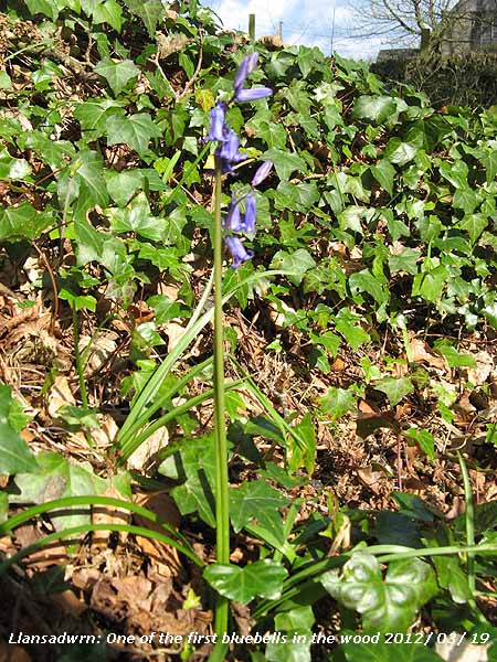 17th: A mistle thrush was singing at 06 GMT and with a bright morning there were signs of the sky clearing in the hour before 09 GMT. In the better light this morning trees across the fields have begun to take on a greenish hue as buds break. The first bluebells to appear in the wood this year were spotted. Pressure was steady on 1011 mb as the cold front moved eastward, but shower troughs associated with another disturbance over Ireland were moving across the Irish Sea. A little sunshine than a moderate to heavy (up to 11 mm/h) shower of rain and small ice pellets arrived at 1135 GMT. There were further showers between sunny spells in the afternoon, at 1501 GMT rain fell at a rate up to 14 mm/h. Precipitation falling on the Snowdonia Mountains fell as snow above 2500 ft. Not a day for being out of doors, but it did not matter as I watched the rugby match on TV from Cardiff (maximum temperature 12.4C), Wales beat France 16 - 9 to take the Championship and Grand Slam. Tawny owls were about in the wood at 2200 GMT. {Hereford 13.4C, Okehampton 16.6 mm, Leuchars 10.3h} [Rain 7.1 mm; Max 11.0C; Min 4.9C; Grass 1.5C]
18th: A moderate shower of rain at 0523 GMT, the hailometer was unmarked. A sunny start with the sky clearing, but it was feeling fresh in the force 2/3 N'ly breeze. There had been a touch of ground frost (-0.8C) and there was light snow lying above 2500 ft on the Carneddau Mountains this morning. Pressure 1017 mb was rising quickly as Atlantic-high 1034 mb off Iberia intensified with a ridge extending to SW Ireland. Coastal areas bordering the Irish Sea had the best of the sunshine today with Morecambe Bay reporting 10.7 h. It was sunny most of the day here although temperatures were on the cool side with the N'ly breeze persisting until 1930 GMT when it veered SW'ly. A clear evening with the owls about from dusk. {Stormont Castle 13.5C, Gringeley on the Hill 27.4 mm, Morecambe Bay 10.7h, Valley 10.3h} [Rain trace; Max 10.1 C; Min 3.7C; Grass -0.8C]
19th: I saw white frost on the fields earlier, but it had all melted by 09 GMT. A sunny morning and a newly arrived chiffchaff was singing weakly nearby; 5 days earlier than last year on 24 March 2011. Just a little cloud, a few cumulus were bubbling up over the mountains and there were some contrails. Pressure 1032 mb was rising slowly with high 1037 mb over the Bay of Biscay and low 971 mb was over the Denmark Strait with associated fronts lying to the NW of here. A sunny morning turning cloudier in the afternoon catching the edge of a warm front affecting W Scotland where there was a wet day. {Killowen 14.6C, Kinlochewe 31.0 mm, Bristol 11.1h} [Rain 0.0 mm; Max 11.7C; Min 1.9C; Grass -2.9C]
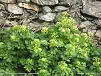
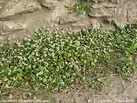 20th: A mostly cloudy morning mostly moderately high altostratus thinning to give some bright spells with weak sunshine during the morning with very good visibility. High 1039 mb over Biscay and near Brest was moving north-eastwards while complex lows lay to the north-west of here with pressure on 1034 mb. There were some sunny spells in the afternoon although some thicker clouds could be seen in the west. A mass of ivy-leaved scurvy grass Cochleria danica was seen on the roadside
 ![]() on the way to Beaumaris as were Alexanders Smyrnium olusatrum in full flower on the roadside at the Old Almshouses ( 3 weeks earlier than in 2011). [Rain 0.0 mm; Max 14.6C; Min 6.7C; Grass 4.2C]
on the way to Beaumaris as were Alexanders Smyrnium olusatrum in full flower on the roadside at the Old Almshouses ( 3 weeks earlier than in 2011). [Rain 0.0 mm; Max 14.6C; Min 6.7C; Grass 4.2C]
21st: An overcast morning, but the rested chiffchaff was singing more strongly. Pressure was steady on 1035 mb , the large high stretching from Austria 1040 mb to S Wales 1035 mb while low 978 mb was over the Denmark Strait. The day kept dull with little, or no wind. Keeping mostly cloudy, Valley reported 1.3h sunshine, the cloudbase lifted to be well over the mountaintops by afternoon and with good visibility no snow was seen. {Aberdeen 18.2C, Isle of Skye 9.6 mm, Manston 11.4h} [Rain 0.0 mm; Max 10.6C; Min 7.8C; Grass 6.5C]
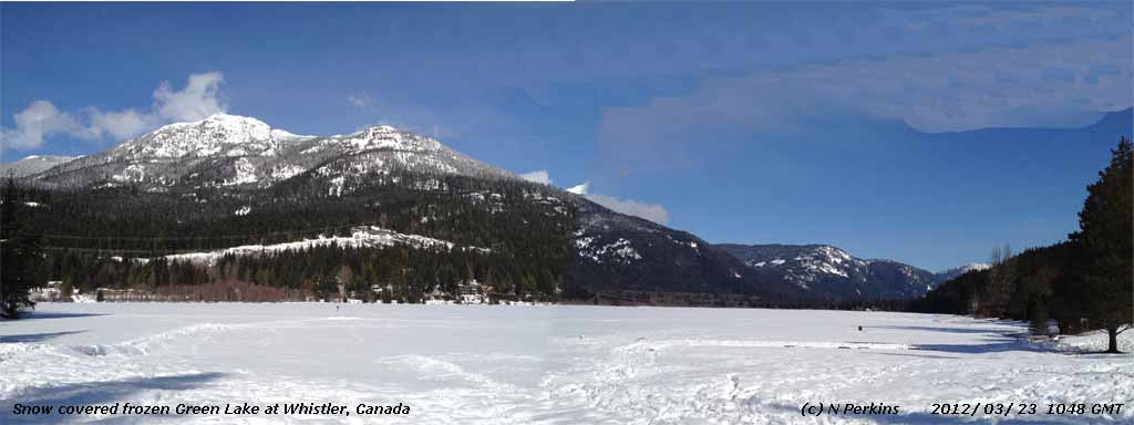
|
|
|
23rd: There were a few spots of rain around 07 GMT enough to moisten the ground. By 09 GMT most of this had dried off concrete with a trace remaining in the raingauge There was a moderate deposit of a dark dust having lighter coloured undertones. The high 1033 mb had drifted across the North Sea and was over Norway while complex lows 962 mb were near S Greenland. Fog, slow to clear, was affecting parts of southern England. Visibility was poor here with moderate haze, but the day was bright with weak sunshine. The first white flowers of blackthorn were seen in a hedgerow on the A5025 in Llansadwrn.. Several fields around the village were being ploughed today. {Otterbourne WW 20.1C/ Ravensworth -4.2C, Cardinham 4.2 mm, Leuchars 11.1h}[Rain 0.0 mm; Max 17.5C; Min 8.4C; Grass 5.7C]
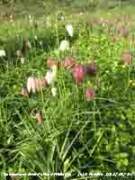 24th: A sunny morning with a little cirrostratus cloud and expanded contrails in the sky to the north-east. A moderate to heavy dew with traces of condensation on the black coloured Davis raingauge, but not on the copper gauge. There was less haze this morning and visibility was good or very good. Pressure was 1027 mb with high 1031 mb was still over the North Sea and a large deep low 953 mb was S of Greenland. A further dry deposit of darkish grey dust with a light coloured undertone had occurred in the past 24-h. Dense fog in parts of central England early in the day; likely to have contributed to cause of an accident on the M5 involving many vehicles in which 2 people died and 40 injured.. Sunny all day here, with a light E or SE'ly breeze the temperature rose to 22.1C, highest of the month and year so far. The highest temperature recorded here in March was 23.0C on 20 March 2006. The Snake's Head Fritillaries growing in the garden meadow are flowering early. Last year we had just one or two flowers because they were all eaten by a family of pheasants. This year they were fenced, but the semi-resident male has shown no interest, so far. Some primroses have flowered throughout the winter, now there are many on the rockery banks
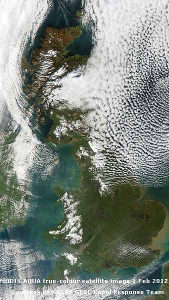
 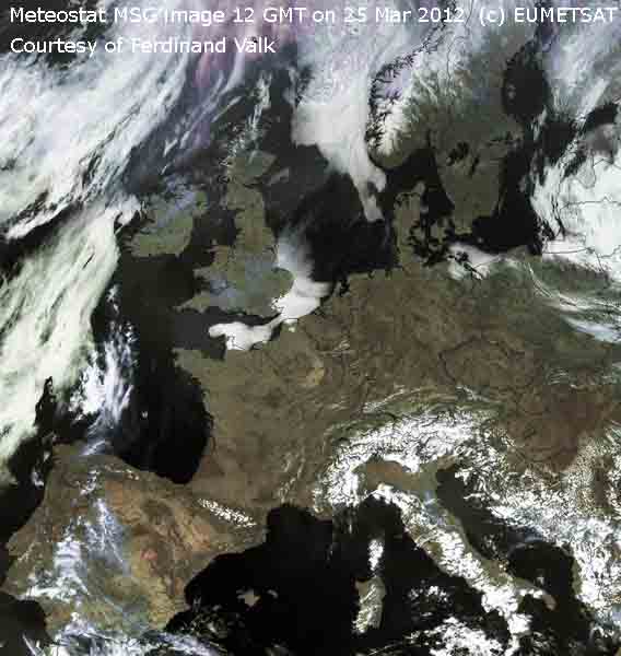 25th: Patchy cirrus and cirrostratus clouds to the S with a veil over the sun, but clearer sky to the north. Visibility was poor a combination of Saharan dust and pollutant aerosols, but another warm day with hazy sunshine. The surface soil of the tilled vegetable plot was looking dry as I planted early potatoes Aran Pilot. The best of the warmth and sunshine were in the N and W again with a record Scottish March temperature of 22.8C recorded at Fyvie Castle. In contrast in SE England with fog off the North Sea the maximum temperature at Manston was just 6.3C. Unusually most of Europe was cloud free (see satellite image left) this resulting in a remarkably widespread area of numbers of hours of sunshine (
 26th: After a bright orange pre-sunrise in the direction of Conwy a clear blue sky and calm, visibility was very good any dust and pollutant aerosols having moved away for the moment. Pressure was 1036 mb with the high 1038 mb over Britain and the southern North Sea. The temperature at 09 GMT was a pleasant 14.3C and in the sunny warm day rose to 21.8C. Female orange tip butterflies were seen in the garden. In Scotland records continue to be broken with a maximum of 22.9C recorded in Aboyne. To remind us what time of year it is in some low lying places overnight there was frost; Bala reported -1.2C while Ravensworth (Yorkshire) had -3.0C. {Aboyne 22.9C/ Ravensworth -3.3C, Manston 0.2 mm, Morecambe 12.1h}, [Rain 0.0 mm; Max 21.8C; Min 7.7C; Grass 2.6C]
27th: Clear skies with very good visibility and slight haze. It was sunny all day in common with most of Europe, haze increased during the afternoon. With the temperature rising to 20.1C a holly blue butterfly was spotted. Leaves on horse chestnut were opening apace with the tops of trees looking very green. More bluebells had appeared in the wood in numbers greater than normal at this time of year. {Aboyne 23.6C, Altnaharra -3.6C, Aberporth 12.2h} [Rain 0.0 mm; Max 20.1C; Min 9.0C; Grass 3.2C]
28th: A calm and clear night with the high 1037 mb centred over Wales at midnight. Another clear sky morning the air minimum temperature no lower than 7.3C and on the grass 2.3C. There was moderate dew and visibility was good with smoke haze. A sunny day, rising at 0610 GMT over Conwy and setting 1820 GMT over 12 hours of bright sunshine. Buds of plum and damson were bursting open with one or two flowers already open. A clear evening and night with little or no wind. {St James Park 22.8C/ Katesbridge -3.0C, Aberporth 12.1h} [Rain 0.0 mm; Max 20.5C; Min 7.3C; Grass 2.3C]
29th: High 1035 mb had drifted W of Ireland to be over the Atlantic and cooler air and cloud from the NW was being drawn S across Britain. At 09 GMT there were 6 oktas of moderately high altostratus and high cirrus clouds, the first cloud for a remarkable 3-day spell of clear skies. It was bright with some weak sunshine, but visibility was only moderate to poor in haze. Another dry dry, with some spells of sunshine early and late afternoon with cloud encroaching again overnight. Snowberry has greened up and where present on woodland edge gives a light green hue to the understorey in any sunshine. Cattle (Welsh Blacks) are now in an adjoining field replacing overwintering sheep that lambed earlier in the year. Welsh Water have begun replacing the old water main through the village - a job scheduled to last up to 10-weeks. Pipes in Pentraeth have been replaced in recent weeks. [Rain 0.0 mm; Max C; Min 6.6C; Grass 1.5C]
|
This week the first results from the climateprediction.net BBC climate change experiment, that Llansadwrn-wx took part in in 2006, were published in Nature Geoscience. The experiment ran an ensemble of simulations on 'home computers' using a complex coupled atmosphere-ocean climate model. Results from the experiment suggest 'that a global warming of 3 degrees Celsius by 2050 is as equally plausible as a rise of 1.4 degrees (relative to the 1961-1990 average). This range is derived from the range of simulations in the ensemble that accurately reproduce observed temperature changes over the last 50 years and suggest that the world is very likely to cross the '2 degrees barrier' at some point this century'.. |
31st: Starting overcast and dull with a little rain along the North Wales coast and Llanfairfechan, here just a little drizzle to dampen concrete evaporating away before 09 GMT. Weak frontal cloud was moving southwards over N Britain; pressure was steady on 1021 mb with high 1029 mb S of Iceland declining while low 997 mb Estonia (S Baltic near Tallinn) slow-moving. A dull morning but becoming brighter by afternoon was glimpses of sunshine the sky clearing later into the evening. {Porthmadog & Helens Bay 14.3C, Ballypatrick For. 1.8 mm, Stornoway 10.4h} [Rain 0.0 mm; Max 10.6C; Min 7.1C; Grass 7.0C]
The month ended, having had 25 dry days (each <0.2 mm) and ranking 11th driest March in Llansadwrn since 1928, with 38.6 mm of rainfall (58%) & [45%] of averages. Temperatures were highest on record at this station since 1979: with the mean maximum 13.0C and mean minimum 5.9C the mean finished on 9.4C (+2.4) & [+2.5] of averages. Provisional data for Valley indicated 147.4 h of sunshine (108%) & [130%] of averages. .
April
 1st: A sunny morning, an almost clear sky with a few small cumulus and whisps of cirrus clouds, good visibility and a little smoke haze. Pressure was steady on 1023 mb. There was no rain and as this is the 15th day without significant rain (<0.2 mm) it is an 'absolute drought'. Previous recent droughts here were between 7 - 23rd 2010 (17-days) and the 18-day spell 9th to 29th May 2004. There had been some white frost on the grass with the minimum temperature -1.6C. The afternoon was cloudier at times with cloud developing over the Snowdonia Mountains; the sky cleared again here late in the afternoon. A clear evening. [Rain 0.0 mm; Max 14.5C; Min 3.2C; Grass -1.6C]
2nd: No rain overnight, so it was the 16th day of drought, but was to be the last of this spell. Overcast and dull with intermittent slight rain during the afternoon and a heavier shower just after 17 GMT ending the drought. Wild cherry was in flower. [Rain 2.7 mm; Max 10.6C; Min 6.3C; Grass 4.8C]
 3rd: A frontal wave developing over Scotland at midnight moved S to be N England by morning. Pressure had fallen to 1002 mb and there was light rain from 07 GMT with 2.7 mm in the raingauge at 0900 GMT. More rain during the morning, then brightening with a glimpse of sunshine by 1300 GMT, and a shower in the afternoon. Rain from 19 GMT and with a strengthening NNE'ly wind a 30 mph speed restriction was in force on the Britannia Bridge. A gust of 32 mph was recorded here at 1940 GMT. The German owned 269 ft freighter Carrier, with 8 Polish crew, went aground at the height of the storm in heavy seas after being holed in 3 places, having just loaded limestone at the Llanddulas quarry terminal, between Colwyn Bay and Abergele. Llandudno and Rhyl lifeboats were launched, and an RAF rescue helicopter called. The A55 eastbound was closed as the crew were rescued by helicopter, and fears of fuel leakage. Breaking waves hitting the lit up vessel, which was close inshore on the beach adjacent to the A55. Such was the ferocity, were seen by motorists sending water and spray over the road on to the westbound carriageway. After 6 rescues the helicopter winch broke and another helicopter from RAF Leconfield was needed to rescue the remaining crew and winchman who was left stranded onboard. This is the second vessel using the Llanddulas jetty within months to be lost transporting stone. The freighter Swanland sunk in a storm off Bardsey Island on 27th November 2011. At 2200 GMT rain had turned to sleet then some wet snow fell here before midnight. [Pptn 9.6 mm; Max 9.9C; Min 6.5C; Grass 4.2C]
4th: Sleet, snow pellets and snow continued after midnight not settling here, but at 350 ft on the mainland snow was lying in the morning. Gusts of 37 mph were recorded here at 0540 GMT and Llanfairfechan at 0600 GMT. Snow in Llanfairfechan and snow lying in Llandegai, Bethesda and Llanberis with moderate amounts on the mountains over 2500 ft. Continuous sleet at low levels and a strong to gale-force NNE'ly wind closed the Britannia Bridge to high-sided vehicles during the morning,. Blizzard conditions on the mountains. There was a wind chill factor of -5.6C, lowest of the year so far. With the storm slow to abate there were environmental concerns over 40,000 litres of fuel aboard MV Carrier, aground at Llanddulas, being pounded by large waves. The Maritime and Coastguard Agency were working to limit pollution and remove the fuel as soon as possible. It was reported that some fuel oil had leaked, but the main tanks remained intact. Early leafing and flowering horse-chestnut trees were battered leaving twigs, leaves and flowers scattered on the ground. Still windy in the afternoon, but some sunny spells with views of the snow-clad Snowdonia Mountains. Several roads, including the Horseshoe Pass in Denbighshire, the A57 Snake Pass in the Pennines, and in Yorkshire, were closed or difficult as a result of the snow. Many power lines were down and properties were without electricity in parts of North Wales including Anglesey, and NE England. The M62 was closed for several hours; lorries were stranded near Huddersfield being unable to ascend a hill. The wind started to moderate during the evening. [Pptn 0.8 mm; Max 7.0C; Min 1.2C; Grass 0.6C]

|
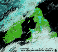 5th: The wind moderated steadily through the night and by morning there was a light E'ly with an almost clear sky. A touch of air frost -0.1C, but on the grass it had been down to -3.4C. Stunning views of deep drifted snow on the northern slopes of the Carneddau Mountains above 250 ft. With a warm front over N Ireland and N England, and sheets of stratocumulus to the S, we were in a clear slot giving a sunny day and a clear sky into the evening before cloud encroached later. The MODIS Terra satellite image shows snow cover in North Wales and N England (bands 7-2-1 show snow as blue colour) in the clear slot between frontal systems N and S. Hundreds of starfish (below left) had been washed up along the shoreline on the beach at Llanfairfechan following the 'Carrier storm' on the 3rd. Starfish predate the mussels on the banks in the Menai Strait, but it is unusual to see so many. There were also complete razorfish, large clams and a brittle star. [Rain trace; Max 8.5C; Min 2.5C; Grass 0.2C]
 6th: Overcast, the cloud thick enough to have given some spots of rain dampening the ground before 0900 GMT. Soon brighter with a glimpse of sunshine, but with a warm front stretching over Wales to the North Sea the day was mostly cloudy with rain at times in the afternoon. Spurred on by the rain a female blackbird is busy gathering material from the rockery bank and building a nest in bushes nearby. The evening remained overcast with slight rain at times as the SSW'ly wind backed NE'ly by 2300 GMT. [Rain 1.3 mm; Max 11.0C; Min -0.1C; Grass -3.4C]
 7th: Overcast with fine drizzle and poor visibility. Pressure 1015 mb was rising slowly, but the morning kept dull with drizzle and slight rain at times. Brighter with brief sunny spells in the afternoon before thicker cloud bringing drizzle and slight rain returned during the evening. [Rain 0.8 mm; Max 11.0C; Min 7.3C; Grass 7.4C]
 8th: An overcast, dull and sunless day. Showery in the evening. [Rain 11.5 mm; Max 11.5C; Min 8.0C; Grass 8.0C]
9th: At midnight pressure 1003 mb was falling quickly. Light to moderate rain from 01 GMT through to morning with 11.5 mm in the raingauge at 0900 GMT. Puddles were beginning to form. Pressure 993 mb was still falling quickly with low 978 mb SE Iceland. Continuous light rain, turning intermittent the sky remaining overcast into the afternoon. Pressure had been falling all day and reached its lowest 981.0 mb at 2140 GMT. A complex occlusion lay to the N and a frontal-wave low was passing over Anglesey. There were heavy showers of rain with a lot of small ice pellets here at 1950 GMT (13.8 mm/ h) and at Gorwel Heights at 2007 GMT (34.8 mm/ h). AWS rainfall totals for 00-00z were Llansadwrn 19.0 mm, Gorwel Heights 20.8 mm and Nantlle 30.2 mm. [Rain 12.9 mm; Max 8.6C; Min 6.4C; Grass 6.0C]
10th: Frequent showers overnight died out after 0210 GMT. A bright morning with a light to moderate W'ly breeze with cumulus clouds in the vicinity. Pressure 986 mb was rising with low 977 mb over the North Sea off the Tay Estuary. We were in a cool and showery flow of air, but showers kept away until late in the breezy afternoon. Some hi-tech equipment was in use today on the roadway. Welsh Water are renewing the water main through Llansadwrn past the weather station. They have had difficulty in finding the pipe installed in 1963, old maps suggested that it went through the garden. Using 'divining rods' the operative was convinced it came into the garden. I assured them it did not and a couple of holes dug proved the point. The pipe is in fact in the field opposite, on the opposite side to that shown on the map. I was assured that now found they would be using GPS to make a more accurate map (I may not be on hand to provide local knowledge in 50-years time). Temporarily we are connected to a very long blue hose that snakes up the road and on top of the stone wall edging the field. A contrast in garden weather across Britain today. In Kew Gardens it was sunny and warm with a maximum of 14.9C; here a bright and breezy 11.1C; and in Edinburgh Botanic Garden a cool 10.6C with 34.4 mm of rain. A shower of rain with a few small ice pellets fell at 2257 GMT. [Rain 0.9 mm; Max 11.1C; Min 3.8C; Grass 2.2C]
11th: Some fresh snow fell on the mountaintops and large old drift patches were evident from 1500 ft upwards. A shower of rain with squally wind at 0823 GMT. At 08 GMT the sky was clearing with 6 oktas of cumulus clouds. Showers in the vicinity with sunshine in between a rainbow seen from Four Crosses at 0938 GMT and heavy shower in Upper Bangor. More light showers through the morning, frequent sunny spells in the afternoon and dry until later. Storms in northern, central and southern England. Scattered cloud in the evening, few by midnight. Hawthorn leaves have been appearing in the hedgerows. [Rain 0.6 mm; Max 14.0C; Min 2.5C; Grass -0.4C]
12th: Shallow mist on the fields at 06 GMT soon clearing. Bright and sunny with a cool N'ly breeze and cumulus clouds in the vicinity. Pressure 1004 mb was rising with low-pressure 994 mb N Norway. Visibility was very good in the morning. Sunny spells, longer in the afternoon and kept dry all day. A pair of goldfinches were spotted on the vegetable plot. We do not see many here, but in the village many frequent garden feeders. Storms developed again in central and southern England. Best sunshine today (> 10h) was around the Irish Sea coast [Aldergrove 11.3h, Valley 10.1h], Isle of Man [11.6h] and the Western Isles of Scotland. A clear evening with a few clouds developing overnight. [Rain 0.0 mm; Max 11.5C; Min 3.8C; Grass 0.0C]
13th: There was some white frost on the grassy fields at 06 GMT with the grass minimum down to -2.5C. A bright morning with 5 oktas of cumulus, altocumulus and cirrus clouds. Low 997 mb was over the Baltic while Atlantic-high 1031 mb was W of the Gibraltar Strait. Saharan dust was being drawn across the Mediterranean and northwards to the Baltic. Sunny spells in the morning, fewer by noon and turning mostly cloudy in the afternoon thick enough at times to produce slight rain. A cloudy evening. [Rain trace; Max 10.3C; Min 1.4C; Grass -2.5C]
14th: Pressure 1011 mb was rising slowly and with mostly fair-weather cumulus in the sky the morning was bright with weak sunshine at first. The jetstream was keeping well W of the UK at the moment; low 991 mb was slow moving over the Baltic and this resulted in a NE'ly airflow with showers off the southern Norwegian Sea and North sea affecting mainly the eastern coastal regions of Scotland and N England. An occluded front did make its way S reaching here by 1500 GMT producing a few light showers. [Rain 0.8 mm; Max 8.7C; Min 3.5C; Grass 0.6C]
15th: There was a trough over North Wales at midnight producing some showery precipitation over the mountains and a sprinkling of snow was seen in the morning on the Carneddau Mountains as low as 1200 ft; the large patches of old snow could clearly be seen. Pressure 1024 mb was rising slowly, but the jetstream over the Atlantic was edging closer with the Baltic low-pressure filling 1008 mb. High 1032 was over the Azores with low 978 mb S Greenland. Bright with sunny spells in the morning becoming mostly sunny in the afternoon, but cool in the N'ly breeze. With visibility improving through the afternoon there were clear views of the mountains. Mistle thrushes were fending off attacks by a crow on their nest in the wood. A nearby nest had been abandoned after an attack by crows and magpies. Mistle thrushes are formidable birds when attacked and normally can defend their nests. But a joint attack was too much for them. Towards evening the breeze moderated and with a clear sky the temperature on the grass fell away quickly as radiative cooling took effect. Some early potatoes had appeared on the vegetable plot, but they had been 'earthed up' just in case. Owls were heard at 2200 GMT. [Rain 0.0 mm; Max 8.2C; Min 1.0C; Grass -1.3C]
It had been a cool first 15-days with the mean maximum 10.4C (-3.1) & [-2.5] of average and mean minimum 3.8C (-2.6) & [-1.1] of average. Rainfall was 41.9 mm [(66%)] of average, while sunshine at Valley had accrued 67 h (38%) & [42%] of the month's averages.
16th: Pressure 1025 mb was falling slowly, but it was a fine morning with some jetstream cirrus overhead and a few contrails to the south-west. A SSE'ly breeze at 09 GMT and the temperature 8.2C (dewpoint 0.7C) was highest of the past 24-hours. Soon a small cumulus cloud formed to the S and within an hour a line had formed over the Snowdonia Mountains. High 1035 mb was over the Azores and pressure was low 1010 mb over the Baltic. The one to watch was low 991 mb S of Greenland deepening to 975 mb at 18 GMT, that had an associated frontal-wave W of Ireland. Cloudier in the afternoon and moderate to heavy rain with strengthening wind from 20 to 22 GMT. At 2100 GMT pressure here 1021 mb was falling quickly and reached 1004 mb at midnight. [Rain 7.6 mm; Max 11.7C; Min 1.0C; Grass -3.1C]

|
 A wild night, especially at Gorwel Heights in Llanfairfechan where a gust of 57 mph was recorded at 0117 GMT during force 6/7 winds off the mountains. Capel Curig reported a gust of 63 mph and Valley 54 mph during gale-force winds. Several large pots of plants were overturned here together will garden tables and chairs. A breezy morning and a clearing sky with the low 976 mb off the Western Isles of Scotland and pressure here 996 mb.
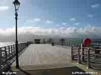
 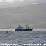 At Beaumaris the water on the strait at high water was choppy with the flag at the Blue Peter lifeboat station flying tautly in the strong SW'ly. One of the mussel dredgers, the shallow draft Mare Gratia (43.5 m x 10 m) was at work on the banks off red buoy B10, opposite the pier. Built in 2003 by Scheepswerf Reimerswaal Hansweert, Netherlands, is operated by Deepdock to farm the mussels on the banks. Over 10,000 tonnes of mussels are harvested annually in the Menai Strait, this being over 50% of the UK's production. On land restoration of the pier continues, today I was able to walk out over the new deck restored in width to that seen in 1890
 18th: Overcast and dull with recent drizzle and light rain showers. Pressure had fallen to its lowest 979 mb at 0445 GMT as the low passed nearby. Pressure was now rising 980 mb but the slow-moving low seemingly taking a fancy to hang around the UK for a while, was stationed over the Severn Estuary 975 mb at 09 GMT. There was a moderate to fresh NE'ly breeze and a lot of cluster flies were taking shelter in the Stevenson screen. These overwinter in lofts, we have them in ours, but tempted out by the recent warm spell they are now unhappy, like the observer, about the current conditions.
 Little change here during the sunless day on the NW-edge of cloud circulating within the low, slight rain at times - breezy - cool, but across the island the cloud cleared with 4.0 h of sunshine at Valley. The Western Isles were sunniest, Stornoway had 13.6h; it was very wet in the NW of England with Fylingdales having [29.8 mm]. [Rain 0.9 mm; Max 8.2C; Min 4.5C; Grass 3.5C]
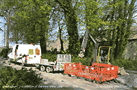
 19th: Signs of the sky clearing towards 09 GMT, but it was very slow. We were under an occluded front spiral over the Isle of Man and North Wales in circulation within the low 981 mb tracking N over East Anglia. Pressure here was 987.6 mb rising slowly; there was a stiff NNE'ly breeze (f3/4) making the 8.2C feel very cold with recent showers. Visibility was moderate with cloud and mist hanging low on the Snowdonia Mountains. The jetstream is keeping well S over Iberia and the Gibraltar Strait. Not as cold here as the N of Scandinavia and Lapland where minimum temperatures of -20C are not uncommon at the moment. It is still cold with some ice on the Gulf of Bothnia near Kemi. Brightening by noon, the afternoon becoming sunny with a clearing sky from the north. Progress has been made with installation of the new water supply pipe. Hi-tech today, a state of the art 'water mole' has been used to work its way along the old pipe expanding and breaking it open to insert the new pipe, now past the church and has reached a hole in the road here where the mystery of 'where is the pipe' occurred on the 10th. A clear evening lighter wind and a slight ground frost developing. [Rain 9.1 mm; Max 11.6C; Min 5.5C; Grass 4.8C]
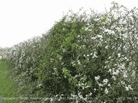
 20th: Cloud encroached after midnight bringing showery rain by 0530 GMT heavy at times with small ice pellets at 0612 GMT (23 mm/h) and at Gorwel Heights at 0832 GMT (23 mm/h). It was still raining lightly under leaden skies at 09 GMT with some standing water around the station. Cluster flies in the Stevenson screen were not happy tightly gathered in the louvers. Pressure was steady on 992 mb with our resident low over NE England 989 mb; the rain had eased and the sky lightening before noon when fresh snow at 1800 ft was seen on the Carneddau Mountains. Weak sunshine in the afternoon, sky clearer with a few clouds later and in the evening. Hawthorn leaves are appearing in the hedgerows of Llansadwrn The green is in contrast to the white flowers of blackthorn that have been out for a while and whose leaves appear the flowers. [Rain 5.3 mm; Max 9.2C; Min 3.6C; Grass -0.4C]
  21st: A touch of ground frost overnight and some low mists on the fields at 06 GMT before cloud encroached. At 09 GMT the cloudbase was low and ragged with visibility poor towards the mountains, but otherwise good. The cluster flies gathered in the louvers of the Stevenson screen were still. One or two slight showers of then the brighter in the afternoon, a few more showers but longer sunny spells coming along by 1530 GMT. Mostly clear at first in the evening with little or no wind the grass minimum hovering just above zero. Covered the early potatoes, now shooting out of the ridges, with fleece. [Rain 0.2 mm; Max 11.6C; Min 3.6C; Grass -0.4C]
 22nd: A bright morning scattered clouds were reducing after a few spots of rain and, with a little sunshine to warm the Stevenson screen, there was some movement in the cluster flies. The low 997 mb was filling over the North Sea and pressure here 1001 mb rising slowly. Bright with some sunshine at times and feeling a bit warmer today in the light SSW'ly breeze. The temperature rose to 14.1C in the afternoon; enjoyed by bees and holly blue butterflies. The dark-blue flowering bugle Ajuga is now out on the rockery banks and looking splendid. Welsh Poppies are in bud, but the fritillaries have more or less finished and seed pods formed (very early). .Mostly cloudy evening and night. [Rain 2.1 mm; Max 14.1C; Min 4.3C; Grass 0.2C]
 23rd: Good visibility with patchy cloud hanging around and below some mountaintops with a shower trough moving eastward. Temperatures just low enough for precipitation to fall as snow on the highest mountains. There was a light covering of fresh snow on Snowdon and sprinklings on the Carneddau above 2800 ft. Some large patches of old snow remain with the lowest getting fewer in number at 2250 ft on N-facing slopes. Here, a mild night with air minimum 5.9C and on the grass 5.0C. One or two cluster flies were out of the louvers on their feet. Pressure 994 mb was falling slowly as a new low developing on a frontal-wave around 03 GMT near Lands End. With the jetstream is persistently to the S, over the Bay of Biscay, I would expect more of the same over the next few days. Bright with some weak sunshine after rain at 0730 GMT, very good visibility and a light NE'ly breeze. A band of rain over Cornwall, S Wales and Isle of Wight was moving northeast; Plymouth had (23.8 mm) of rain. Fine and dry here with some sunshine in the afternoon, sunny at Valley 8.2h with Tiree reporting the most 11.4h. There is plenty of garlic mustard in flower now (left). Stable for over 40 years, now increasing markedly in the last 3 years along roadsides
  24th: A fine and mostly sunny morning, weak sunshine at first clear spells later. At 09 GMT there were 5 oktas of cloud cover, some well developed cumulus clouds were moving quickly across on to the mountains the sky clearer to the north. Low 993 mb filling was now over Belgium, but another mass of cloud associated with developing low 993 mb was over the Atlantic to the south-west. A pleasant afternoon here with very good visibility. Also around the hedgerows where damp and shady is the brilliant blue-flowered green alkanet (right). Not as numerous as garlic mustard favouring lime-rich soils, just a few plants hereabouts. Numerous snow patches, old drifted snow and in gullies remain on the mountains with a little around the flatter summit of Carnedd Llewelyn 3485 ft and col to C. Gwellian. 3038 ft. Clear evening with not much wind. [Rain 0.6 mm; Max 11.8C; Min 4.3C; Grass 0.2C]
 25th: Dry overnight, but rain began just before 08 GMT in a moderate to fresh E'ly breeze. It seemed more like the beginning of March than the end of April, but 10 minutes outside I changed my mind. January would be more like it with the temperature 5.6C and wind-chill temperature of 3.8C (had been to 3.3C). A wet unpleasant morning, wind roaring in the trees, with precipitation falling as snow for a time on the mountaintops in a strong ENE'ly wind. Low 972 mb was over the SW Approaches at 09 GMT with pressure here 984 mb falling quickly. Deepening and tracking N it was over the Bristol Channel 975 mb at 1800 GMT when pressure here had fallen to 979 mb. A wet day in Wales, 41 mm in Tredegar (21z) and in Snowdonia the AWS in the Nantlle Valley clocking up over 60 mm (00z) of rain with 19 mm in Llanfairfechan (00z). [Rain 8.2 mm; Max C; Min 4.3C; Grass -0.2C]
26th: At midnight pressure had bottomed out and was rising 980 mb with the low near Aberystwyth 979 mb. Overcast with ragged low cloud in the morning with a few spots of rain. Pressure was rising quickly on 989 mb and soon there was a patch of blue sky overhead, enough to patch a sailor's trousers but not a lot else. Remaining mostly cloudy and low on the mountains, but dry into the afternoon the temperature struggling to rise to 10.2C. There was rain from 2330 GMT. [Rain 4.7 mm; Max 10.2C; Min 5.4C; Grass 5.2C]
27th: Much of the same: recent rain with ragged stratiform cloud layers with some thinning patches. Occluded frontal systems were over the Irish Sea. Pressure was high in mid-Atlantic 1034 mb and N Italy 1023 mb with low 995 mb over the E North Sea. Visibility improving through the morning with cloud lifting. Bright at times in the afternoon snow patches (lowest c. 2350 ft NW-facing under C. Llewelyn) and light snow seen on the mountaintops especially the col between C. Llewelyn and C. Gwellian. Even cooler today the highest temperature 9.4C and 8.9C in Llanfairfechan. [Rain trace; Max 9.4C; Min 5.7C; Grass 5.4C]
28th: A grey start at 06 GMT, but with cloud decreasing a bright morning with sunny spells developing. A cool 7.7C (dewpoint 3.2C) at 09 GMT and a keen force 3/4 E'ly drying breeze. The soil surface moist at first dried considerably through the day as the temperature rose to 11.4C. The afternoon very breezy, but when the sun came out and you found a sheltered spot warm enough to admire the multi-coloured primulas. The best plants are those that seed themselves, and some magnificent colour combinations appear in the resulting crosses. More flowers have come out higher up on the wild cherry that has been slow to develop this year and not as showy as usual. A few spots of rain fell later in the afternoon and evening. Warmest in Culdrose 13.2C and Porthmadog 13.1C. Wet in SE England, Manston reported 16.4 mm (21z), that will make the grass grow, and sunniest in Kinloss 14.0h. [Rain trace; Max 11.4C; Min 5.4C; Grass 3.5C]
29th: Pressure 1013 mb was falling quickly and there were recent spots of rain. A moderate to fresh NE'ly wind with slight rain turning moderate to heavy during the afternoon with straightening wind. South Wales was badly affected with 57 trees reported down by mid-afternoon and several roads closed due to fallen trees or flooding (including the A470 Ganllwyd and A 487 at Corris. The M48 over the Severn Bridge was closed while the Britannia Bridge had a 30 mph speed limit all day. Power supplies were disrupted to over 5000 properties in the Swansea and Cardiff areas. Large amounts of rain in places Liscombe in Devon 51 mm (21z) and Tredegar S Wales 43 mm (21z). In Llanfairfechan 25.6 mm (00z) while in the Nantlle Valley 60.0 mm fell (00z). Capel Curig had 23.0 mm (09z), but here just 14.4 mm, largest of the month, and at Valley 4.2 mm. [Rain 14.4 mm; Max 9.7C; Min 4.8C; Grass 4.0C]
30th: Showers in the night (01 - 02 GMT) with a lot of fine marks on the hailometer indicative ice precipitation. Some breaks in the cloud were appearing at 09 GMT although there were a few spots of rain as well. Low 996 mb was over the Scilly Isles and pressure here was 1011 mb rising rapidly. With the cloud lifting during the morning the afternoon was fine and bright with a few sunny spells. Pleasantly warm in the light SE'ly breeze reaching 15.9C here and 16.5C at Gorwel Heights in Llanfairfechan; highest of the month, but lower than April's maxima. At the end of a mostly dry day the month's rainfall was just short of 100 mm (99.4 mm). [Rain 0.7 mm; Max 15.9C; Min 4.3C; Grass 3.8C]
A wet month the 100.1 mm,topped-up by rain just before 09 GMT on the 1 May, (159%) & [158%] of averages, most since 2005, but in some places the wettest April for over 100 years. The mean temperature 7.5C (-2.2) & [-1.4] lower than March and lowest in April since 1986 (R3 since 1979). Provisional sunshine duration at Valley was 144.6h (83%) & [92%] of averages.
May
1st: A dull beginning to May with low stratiform clouds looking ragged over the Snowdonia Mountains. There had been a little rain since 0700 GMT and slight rain continued at times through the morning. A cloud mass associated with deepening low 997 mb off Cape Finisterre was edging northwards and giving Cardiff 31.4 mm (21z) of rain. The afternoon was drier, but kept overcast as the cloud slowly lifted. Sunless here, but Tiree Island clear of cloud and to the N had 15.0h. Warmest was Dunstaffnage with 19.8C[Rain 0.6 mm; Max 10.3C; Min 8.8C; Grass 7.8C]
 2nd: A clearing sky in the morning with few cirrus and small cumulus clouds. After a mild night (min 6.3C and grass 3.4C) at 09 GMT the temperature was 12.3C (dewpoint 9.3C) and sunny a bank of smoke haze (500 - 2000 ft) could be seen against the mountains. The afternoon was fine and sunny and hardly any wind by evening. Azaleas are in flower in the garden now. I am particularly fond of the pink variety (left) that I purchased from Percy Thrower at his garden centre in Shrewsbury, about 40-year ago, as a very small potted plant. Warmest today was Kinlochewe in Scotland reaching 20.1C, Stornoway was sunniest with 14.5h, and Valley 8.6h. [Rain 0.0 mm; Max 13.3C; Min 6.3C; Grass 3.4C]
3rd: A bright morning with 6 oktas of altocumulus and cirrus clouds allowing some weak sunshine. Visibility was good, but hazy a combination of moderate levels of ozone and fine particles of Saharan dust. Pressure was 1015 mb with slow-moving low 997 mb off Cape Finisterre and a ridge 1018 mb over Scotland. An occluded front over S England and S Wales gave a wet day in Charsfield, Suffolk 32 mm and Cardiff 21 mm. Soil temperatures in the profile 5 to 100 cm deep were all reading 10C, or more, this morning for the first time this year. Though with increasing haze it was more or less weak sunshine all day with a cool E'ly breeze and a maximum temperature of 11.7C. Tyndrum was warmest with 20.9C. As the soil surface was dry I hoed off weed seedlings that had appeared between rows of peas, broad beans, onions and shallots. [Rain 0.0 mm; Max 11.7C; Min 7.2C; Grass 6.5C]
4th: Back to a cloudy and very dull morning. A cooler night with an air temperature 4.2C and 1.5C on the grass. There was frontal cloud to the N and S of here and the afternoon did brighten up with some weak sunshine breaking through. Pressure was 1008 mb with high-pressure over Iceland 1028 mb and low 998 mb over the Baltic. It felt cold in the light to moderate NE'ly breeze the arctic airflow coming from the North Cape. Maximum temperatures here are running 4 to 5C below the average. Dry except for a few spots of rain later in the afternoon not enough to wet the ground. With broken cloud in the evening there were views of the (Perigee) Moon low in the sky and looking larger normal (14%) due to being closest to the Earth at this time. [Rain trace; Max 11.4C; Min 4.2C; Grass 1.5C]
5th: A cold night with air temperature down to 1.4C and -2.0C on the grass the 3rd lowest on record here. The long-term average of ground frosts is 0.8, there were none last year and the most were 5 days in 1996. The sky was clear at 06 GMT, but increasingly cloudy towards 09 GMT. A breezy morning the NE'ly force 3/4 and visibility was very good. It's the time of year again and the date of the annual plant sale in aid of the NSPCC so everyone was hoping for a fine day. Pressure 1014 mb had risen as a ridge of high-pressure extended across NW Britain from Icelandic-high 1030 mb. Pressure was low over the Baltic 992 mb and North Cape 997 mb resulting in the cool airflow from Arctic regions. Frontal cloud was affecting the south coast of England, there were 9 mm of rain in Shoreham (21z), and N France with a low 1004 mb over Biscay. The day was mostly fine, sunny spells were few and we did have a few spots of rain from time to time. Despite the cold breezy day the head gardener was pleased with the numbers of muffled up gardeners purchasing plants mostly perennials grown here over the year. By evening there were scattered clouds and the large Moon was visible at times. Warmest in Plymouth 12.1C, Anglesey was sunniest with 10.3 h duration recorded at Valley. [Rain trace; Max 9.0C; Min 1.4C; Grass -2.0C]
6th: The sky was clearer towards dawn and there was another slight ground frost (-0.5C). The wind turned SSW'ly between 0600 and just before 0900 GMT, but was now back to NNE'ly. Cumulus clouds were developing and there was a shower of wet 5 mm snow pellets (rain and snow pellets). This was to be the pattern for the day, showers and a few sunny spells with more snow pellets falling at 1431 GMT. With slack pressure today across Britain winds were light and variable all day. By evening showers had died out and scattered clouds were moderately high. Mean temperatures for the first 6-days are running between 4 and 5 degrees below average. The mean maxima 11.2C being (-4.3) & [-4.7] of the May averages. Warmest in Cardiff today with 13.5C, wettest in Baltasound 4.6 mm (21z) and sunniest in St Athan 7.6h. [Rain 2.7 mm; Max 11.4C; Min 2.9C; Grass -0.5C]
7th: Cloudier overnight so temperatures were a little higher with no ground frost. Cold in places with a minimum of -5.9C in Kinbrace. The wind was SE'ly force 2/3 and some lenticular altocumulus clouds were hanging in the lee of the mountains under sheets of altostratus and stratocumulus (8/8 cover). There was slight fresh snow on the tops of the Carneddau Mountains and another showery day in the offing. A frontal-wave low developed off SW Ireland and an occlude front was moving N over Wales and the Irish Sea. Brighter by 1100 GMT and a little sunshine in the afternoon in clearer weather. Warmest in Exeter 16.0C, wettest in Chivenor (21z) and sunniest in Kirkwall 10.4h. [Rain 0.6 mm; Max 13.2C; Min 4.9C; Grass 1.8C]
8th: A little broken cloud in the morning after slight showers of rain. A few sunny spells coming along in the morning and more in the afternoon. After dropping below 10C for the past 3 morning soil temperature at 5 & 10 cm were back above this morning again. After recent slight showers of rain at 09 GMT the air temperature was 10.4C (dewpoint C). Bright with a few sunny spells and a light to moderate SW'ly wind. Longer sunny spells in the afternoon the temperature creeping up to 13.5C, but in Usk 16.5C was reached and a dizzy 18.5C in St James Park, London. A quiet evening; much more birdsong heard than of late, several blackbirds and thrushes were singing around the wood and spread out along the shelter belts across the fields. A pair of gold finches were seen around the garden in the afternoon. [Rain 0.0 mm; Max 13.5C; Min 6.6C; Grass 4.8C]
9th: Increasing cloudiness before 09 GMT, the sky was clearer earlier with some mostly weak sunshine. As cloud thickened there was light rain from noon, turning moderate to heavy from 1800 GMT continuing on into the night. Warm in the SE, Manston had 17.2C; sunny at Prestwick 9.3h. [Rain 24.2 mm; Max 12.3C; Min 6.6C; Grass 6.8C]
10th: It was still raining in the morning, sheets driving across the fields on the moderate SW'ly wind. A wet and miserable day with puddles formed around the garden, roadsides with pools and partial flooding of the road to Bangor between the Antelope and the new Bangor City football stadium at Nantporth. Rain most of the day with occasional strong gusts of wind, 35 mph at 1640 GMT. A wet day, 63 mm (21z) fell at Shap while in Snowdonia Capel Curig reported 56.6 mm (21z) and 62 mm in Nantlle Valley (00z). Norwich reported a maximum of 21.1C while Hawarden had 18.9C. [Rain 13.2 mm; Max 12.6C; Min 9.0C; Grass 8.9C]
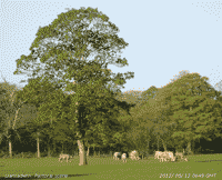 11th: Mostly cloudy, but not raining. A few breaks appeared in the cloud just before 09 GMT, but stalled and the hope for sunny day did not develop. Visibility was very good and clear under the cloud sheet. Many of the snow patches had disappeared after the rain, but there were several left on cliffs and gullies under Carnedd Llewelyn and a solitary small patch hanging on at 2450 ft under the Black Ladders. A few spots of rain during the afternoon, but not heavy enough to curtail work in the garden. . [Rain trace; Max 12.2C; Min 6.1C; Grass 5.1C]
12th: The sky was clear at dawn and there was another ground frost (-1.0C) the 3rd this month. Cumulus clouds developed before 09 GMT (4 oktas) and visibility was still very good. Sunny spells in the morning the sky slowly clearing through the afternoon with the screen temperature rising to 15.1C. Valley reported 13.9 h of sunshine topped by Camborne with 14.6h. A clear evening with light SW'ly breeze. [Rain 0.0 mm; Max 15.1 C; Min 3.0C; Grass -1.0C]
13th: A bright and breezy morning the SW'ly force 3/4 strengthening before 09 GMT and kept breezy into the afternoon. Sunny at first then when cloudier around noon sunny spells and weak sunshine. Later the sky began clearing and there was sunshine from late afternoon into the evening. There were strong winds during the day in N Scotland and out over the N North Sea and an occluded front associated with low 984 mb SE Iceland over the NW tracked SE arriving here during the evening with rain from 1900 GMT. Wet in Kinlochewe where 97 mm fell in 24-h to 21 GMT. [Rain 7.1 mm; Max 12.8C; Min 5.8C; Grass 3.0C]
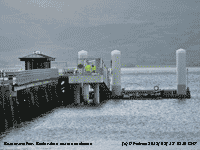 14th: Rain easing by 01 GMT with 7.1 mm collected at 09 GMT. The sky was clearing , but visibility was moderate with low cloud on the mountains, The morning brightened with sunny spells developing into the afternoon. Frontal cloud moving SE during the night was over the Bristol Channel and eastward to E Anglia. Low 975 mb was over the Norwegian Sea N of Scotland while pressure was high 1032 mb over the Atlantic to the SW; strong winds were persisting over the N North Sea. During the evening a showery trough moved across the the Isle of Man, Irish Sea and Wales bringing a shower of rain and ice pellets at 2230 GMT. High temperatures in Spain (38.3C) and the Canary Islands (34.5C) where 2 British holidaymakers died thought to be heat related. [Rain 0.5 mm; Max 13.7C; Min 6.0C; Grass 4.0C]
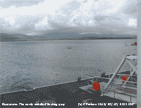 15th: Early slight showers of rain and ice precipitation continued into the morning. At 09 GMT the temperature was 8.5C (dewpoint 5.4C) and there were further showers in sight across the mountains where a sprinkling of snow was seen on the summits. A heavy shower of rain and ice or snow pellets at 1214 GMT (23 mm/h) and further snowfall on the mountains as low as 2250 ft. Later with scattered clouds there were 1 or 2 bright spells. A cool day or May with a maximum of 10.5C. In Beaumaris the restoration of the pier was nearing completion with the installation of the new floating quay. The quay will adjust to the large tidal range experienced in the Menai Strait allowing boats access at any state of the tide. [Rain 3.1 mm; Max 10.5C; Min 4.5C; Grass 2.5C]
The first 15-d have been much cooler than usual with the mean temperature 8.9C (-2.9) & [-2.8] of averages. In particular, the mean maximum 12.2C (-3.2) & [-3.7] well below both decadal and 30-y averages for May. Wetter too, with rainfall of 52.0 mm reached (71%) % [84%] of averages. There have been 3 ground frosts.
 16th: A fine and sunny morning, after a clear dawn, with very good visibility and sight of broken snow patches on Snowdon and a sprinkling on the Carneddau with a solitary snow patch surviving at 2750 ft on N-facing cliffs of C. Llewelyn Cloud was increasing towards 09 GMT, but it was pleasant when the sun came out. The maximum today was 13.5C; the warmest place was in Usk with 15.0C and St Athan was sunniest 14.2h. The sky was clearer again late afternoon and evening before cloud encroached. [Rain 1.2 mm; Max 13.5C; Min 2.6C; Grass 0.3C]
17th: Pressure 1018 mb was falling slowly with low 1004 mb Bay of Biscay and high 1027 mb over Belgium with a ridge towards Britain. The sky was overcast with an occluded front over Wales and Ireland. Brightening during the morning with some weak sunshine, a glimpse of sunshine around 1425 GMT then with the cloud thickening again drizzle and slight rain before the end of the afternoon and continuing into the evening. A wet day on Skye 19.8 mm (21z). [Rain 0.3 mm; Max 11.8C; Min 5.5C; Grass 2.5C]
18th: A dull morning with sky overcast and continuous spots of rain and moderate visibility. An ENE'ly breeze strengthened during the morning. There were heavy showers of rain moving along the mainland coastal strip near Penmaenmawr around noon and light rain from 2100 GMT heaviest between 2200 and 2300 GMT. [Rain 4.6 mm; Max 11.4C; Min 7.6C; Grass 6.4C]
19th: Intermittent light rain after midnight with a dull and damp morning. The afternoon was brighter with a little sunshine later. Tiree had 15.8h of sunshine and Valley 2.0h. Charlwood had a maximum temperature of 19.0C. [Rain 0.3 mm; Max 12.1C; Min 7.1C; Grass 6.3C]
20th: A few clouds from 02 GMT and a fine bright morning. At 09 GMT the temperature was 11.8C (dewpoint 8.7C) and although cloudier around noon the afternoon was sunnier with a maximum temperature of 15.1C. Haze, aerosols and Saharan dust, was moderate through the day with poor visibility. [Rain 0.0 mm; Max 15.1C; Min 6.1C; Grass 4.9C]
21st: The sky was clear at dawn and there had been a moderate to heavy dewfall, but some cumulus clouds were forming to the S at 09 GMT soon dispersing again. A sunny day with a light NE'ly breeze and a maximum temperature of 15.3C. The Isle of Skye had 20.6C and Aberporth reported 14.4h of sunshine beaten by Lerwick with 15.9h. [Rain 0.0 mm; Max 15.3C; Min 6.7C; Grass 4.0C]
 22nd: Another mostly clear night, but milder with a minimum air temperature of 7.1C and 3.9C on the grass. Another sunny day, a few patches of cirrus at times, and feeling warmer with the temperature rising to 20.1C in Stevenson screen during the afternoon. The temperature reached 24.8C in Usk and 26.7C in the Solent.. Valley had 14.2h of sunshine with Lerwick again highest with 14.5h. [Rain trace; Max 20.1C; Min 7.1C; Grass 3.9C]
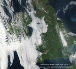 23rd: Cloud and fog moved in from the Irish Sea overnight; visibility was 100 m at 06 GMT. Fog began to lift before 09 GMT when moderate fog 500 m. There was slight fine drizzle before thinning out and turning brighter during the morning. Stratiform cloud and fog was affected western Britain, including Anglesey, and some east coastal areas, Lincolnshire and Kent through the day. The Isle of Man was in the clear. Temperature at 09 GMT 12.8C (dewpoint 12.4C) did rise to 16.2C during the afternoon despite the cloudiness. Sunless until the evening when cloud and mist retreated back to the coastal. Most of the UK was in sunshine and at Altnaharra the temperature rose to 27.3C while 25.5C was recorded in S Wales at Llysdinam. [Rain 0.0 mm; Max 16.2C; Min 10.3C; Grass 8.1C]
24th: Misty at first, but soon clearing to sunshine before 09 GMT. A light NE'ly breeze pushing cloud and fog back to the Irish Sea leaving some cirrus clouds overhead. The temperature was 15.6C and visibility moderate to good. Pressure was steady on 1028 mb as a ridge of high-pressure reached across the North Sea to the UK from high 1035 mb over Scandinavia. Almost unbroken sunshine during the day and into the evening with 13.9h duration recorded at Valley.[Rain 0.0 mm; Max 20.6C; Min 8.6C; Grass 6.6C]
25th: A mild night albeit with a clear sky, the air minimum 137C and on the grass 12.1C. At 09 GMT in a NE'ly breeze there were a few altocumulus lenticularis clouds to the S hanging in the lee of the low hills of SE Anglesey, and a little cirrus. At first visibility was poor the combination of smoke and dust haze, but improved later. Another sunny and warm day the temperature rising to 26.2C here, 26.1C in Llanfairfechan, where a very gusty wind off the mountains developed during the evening, and at Valley, but in Kinlochewe in Scotland 28.7C was reached and not far short 28.2C at Pembrey Sands. Sunniest was Tiree with 16.0h with Valley 14.2h. [Rain 0.0 mm; Max 26.2C; Min 13.7C; Grass 12.1C]
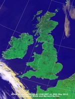 26th: Clear skies overnight and clear at dawn on what was to be a day almost clear of cloud over the UK, Ireland and much of France. Pressure 1021 mb was falling slowly with a ridge over Scotland from high 1034 mb west coast of Norway. Low 1000 mb was over W Biscay with a cold front SW of Brest with a few clouds nudging Scilly and SW Cornwall at times. The NOAA 19 satellite image shows clear skies over the UK, Ireland and N France. The cold front to the SW is associated with the Biscay low 1003 mb at noon.. A very warm day here the temperature rising here to 26.6C (2nd highest in May since records began in 1979), 25.8C at Gorwel Heights in Llanfairfechan and 25.6C at Valley. Kinlochewe again was provisionally warmest reporting 28.1C while 27.1C was reported at Pembrey Sands. I have to look back to May 1989 and 1990 for comparable figures recorded here. In 1989 was a 5-day spell 25.6C (20th), 26.4C (21st), 2.4C (22nd), 24.8C, (23rd) and 23.2C (24th); in 1990 another 5-day spell 26.8C (1st), 27.6C (2nd), 25.6C (3rd), 25.6C (4th) and 20.0C (5th). [Rain 0.0 mm; Max 26.6C; Min 13.5C; Grass 11.0C]
27th: Clear skies for the 2nd morning, a rare event here. Pressure was steady on 1019 mb with ridge from high 1025 mb N North Sea while slow-movng low 100 mb remained over Biscay. A light E'ly breeze, visibility as good very good with smoke haze with the temperature rising to 23.8C. At Gorwel Heights a maximum of 26.8C was reached while Porthmadog was provisionally the UK highest at 27.9C. The surface soil looks very dry; high evaporation these last days 3.8 mm (24th), 4.5 mm (25th), 4.4 mm (26th) and 3.9 mm today (27th) (AWS ET 09-09z). Tiree was sunniest 16.5h; there was some rain around from isolated thundery showers, Camborne reported 12.4 mm (21z).[Rain 0.0 mm; Max 23.8C; Min 12.5C; Grass 9.9C]
28th: Cloudier this morning with some altocumulus and cirrus giving weak sunshine at first. A light SW'ly breeze and a temperature at 09 GMT was 17.2C (dewpoint 14.4C). The sky soon cleared to give another sunny blue-sky day. Breezy at times in the afternoon. A temperature of 27.7C was reported in Santon Downham and 15.9h of sunshine on Tiree. [Rain 0.0 mm; Max 22.1C; Min 9.6C; Grass 8.0C]
29th: A fine sunny morning in Beaumaris for the start of the Olympic Torch Relay. Leaving the Castle the Torch was carried through the town along Castle Street then to the Pier to be taken by the Beaumaris Lifeboat, accompanied by a flotilla of boats and the RAF Rescue Helicopter, to St George's Pier in Menai Bridge and on to the mainland over Thomas Telford's 1826 Menai Suspension Bridge. Later, the flame was carried to Snowdon on the railway in a Davy Lamp, invented in 1815 by Sir Humphry Davy, and used to light a Torch carried to the summit by Sir Chris Bonington. Luckily, the summit was in the clear above a few clouds! Bright with weak sunshine then sunny spells through the morning. [Rain 0.1 mm; Max 20.5C; Min 10.0C; Grass 7.0C]

|
31st: With Atlantic-low 986 mb to the W a rain-bearing cloud mass was moving across northern Britain. Misty with light rain here, heavier over N England, made for a very dull morning again after the bright and sunny mornings of late. The rain had wetted the soil surface and with high relative humidity evaporation would be low, so good for the garden! Light rain continued on and off most of the day. Misty during the evening visibility reducing to <500 m (moderate fog) later. [Rain 2.5 mm; Max 15.0C; Min 12.4C; Grass 7.0C] <
The month ended with a mean temperature of 11.3C [ (-0.4)] of average, lowest since 2010. Rainfall totalled 62.3 mm (85%) & [100%] of averages. It was a sunny month with Valley reporting 221.1h duration [(114%)] of average, most since 2010 and 14th sunniest on the Anglesey record since 1930.
June
1st: There was thick fog at dawn, visibility 100 m, so I could not see across the fields. At 09 GMT visibility had improved to moderate (4 km) an the mountains could not be seen. The temperature was 14.4C (dewpoint 13.6C) and it felt muggy with everything very damp. Pressure was steady on 1020 mb with fronts associated with low 980 mb S Greenland straddling Britain, N France and into Europe. Some patches of blue were spotted and the sky began to slowly clear with weak sunshine developing during the morning. By afternoon with more clearance the temperature rose to 18.6C; there was clear sunshine lasting into the evening [Wisley 21.7C, Valley 11.1 h sunshine]. The approaching full moon, coloured orange, was seen low in the sky in the W after midnight. [Rain 0.0 mm; Max 18.6C; Min 11.9C; Grass 12.2C]
2nd: Cloud had encroached by morning, but it was a warm morning with the temperature 16.1C (dewpoint 13.6C). A mostly cloudy morning near the mountains with moderate hazy visibility, brighter with some weak sunshine in the early afternoon (maximum 19.5C, highest of the month, and 19.9C at Gorwel Heights in Llanfairfechan and 20.2C at Valley) before turning dull again with slight rain by 1500 GMT. Rain was light to moderate at times from 2200 GMT. [Otterbourne WW 22.2C, Shannon AP 42.0 mm, Manston 23.0 mm, Capel Curig 13.8 mm, Llanfairfechan 11.8 mm, Tiree 15.1h] [Rain 9.1 mm; Max 19.5C; Min 9.8C; Grass 8.2C]
3rd: Rain through until morning when 4.0 mm was collected (13 wet hours precipitation) in mist and sight rain at 09 GMT. Cooler at 9.5C the rain easing during the morning, but resuming just after noon stopping around 17 GMT in what was a sunless day. A day after the highest temperature the day's maximum was 10.3C lowest of the month, but on Cairngorm it was -0.5C lowest in Europe on this day. [Middle Wallop 18.6C, Rhyl 9.5C, Blackpool 9.1C, Stornoway 13.5h] [Rain 4.0 mm; Max 10.3C; Min 8.8C; Grass 8.7C]
4th: Another dull morning, but brightening by 09 GMT with some sunshine breaking through. A cool NNE'ly breeze, good visibility and a temperature of 9.5C. Cloud decreased through the day with the afternoon fine and sunny and the temperature rising to 13.9C here, but only 12.6C in Llanfairfechan. Valley reporting 8.2h sunshine. [Castlederg 17.0C, Prestwick 14.5h] [Rain 1.0 mm; Max 13.9C; Min 5.8C; Grass 4.3C]
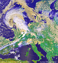 5th: After recent rain the morning was dull and damp under a mostly cloudy sky. Becoming overcast with light showery rain in the afternoon, a little brighter in the evening with cloud and mist remaining on he mountaintops all day. A sunless day. The lowest UK overnight minimum temperature of the month -3.5C was recorded at Loch Glascarnoch. In Llanfairfechan rainfall was [9.1 mm] with a maximum rate of fall of 77 mm/h. [Scilly & Church Fenton 16.3C, St Bees Hd 23.2 mm, Kinloss & Stornoway 9.7h] [Rain 1.4 mm; Max 14.6C; Min 6.7C; Grass 3.8C]
6th: A bright morning with a clearing sky, good visibility and a light S'ly breeze. Pressure 999 mb had fallen with frontal-wave low 996 mb over S Scotland. Cloudier with showers around noon, then brighter again with some good sunshine; Valley 7.9h.. [Rain 7.0 mm; Max 16.9C; Min 10.3C; Grass 10.4C]
7th: A wet morning after a clear dawn at 0330 GMT. Rain with thick cloud cover and a very light E'ly wind. Pressure was 993 mb with low 997 mb to the SW heading for St George's Channel. More rain from noon through the afternoon and another sunless day. At 1800 GMT the low 980 mb starting to fill was over the Pembrokeshire Islands. The NOAA satellite image (left) shows cloud mass over Britain associated with the low tracking NE near St George's Channel. Much of Europe including Italy, and Scandinavia were clear of cloud while narrow cold fronts, with some convection in the NE, were moving across France reaching as far as the central Pyrénées giving a mostly cloudy but dry day there, and Spain.
[Dunkeswell 40.6 mm] [Rain 3.7 mm; Max 15.4C; Min 10.3C; Grass 8.9C]
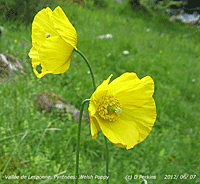
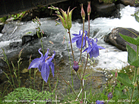 The Welsh Poppy grows at 3854 ft, a higher altitude than Snowdon, in the Vallée de Lesponne in the French Pyrénées . Rose-pink coloured Alpenrose is spectacular at this time of year
![]() Along the banks of the river Adour in the valley was the Pyrenean Columbine (right) and nearby Pyrenean Rock-jasmine
Along the banks of the river Adour in the valley was the Pyrenean Columbine (right) and nearby Pyrenean Rock-jasmine ![]() . Alpine meadows, grazed by small herds of cattle and calves, with tuneful alpine bells attached, contained many flowering plants, including the Pyrenean Horned Pansy
. Alpine meadows, grazed by small herds of cattle and calves, with tuneful alpine bells attached, contained many flowering plants, including the Pyrenean Horned Pansy ![]() . Near the head of Valley at 4500 ft was Asphodel
. Near the head of Valley at 4500 ft was Asphodel ![]() that in places covered the mountain slopes with flowers.
that in places covered the mountain slopes with flowers.
9th: Overcast and on the cool side with spots of rain and slight showers soon coming along during the morning. As a result of the heavy rain yesterday severe flooding occurred in the area around Aberystwyth with roads and property, including Morrisons supermarket, under up to 5 feet of water. A large area of mid-Wales in an area stretching from Ceredigion into Powys and Gwynedd was affected in what was described as a 'once in a century event'. Several caravan sites and holiday parks, including the Riverside Caravan Park in Llandre, were inundated leaving holiday homes and vehicles underwater. A helicopter was used in rescue work during the major incident when over 1000 residents and holidaymakers had to leave their homes.. After a small breach occurred in the wall of a 6 million gallon reservoir dam following a landslide, six hundred people were evacuated from the village of Pennal in Gwynedd downstream of the dam. [Rain 1.3 mm; Max 13.4C; Min 9.0C; Grass 8.7C]
10th: A brighter day with some blue sky around after a cool night, air minimum 7.8C and down to 4.2C on the grass. It was calm in a slack area of pressure 1010 mb between 6 low pressure centres surrounding Britain. An occluded front lay to the north while a complex of fronts were massed to the south-west. A much drier day of sunny spells with a slight shower of rain at 1405 GMT. The villagers of Pennal were allowed to return home, with no further danger of the reservoir wall collapsing, after the controlled discharge of water had been carried out successfully. [Rain trace; Max 16.3C; Min 7.8C; Grass 4.2C]
11th: A fine and bright start to the day with a clearing sky. Pressure had fallen to 1006 mb in a slack low-pressure area centred 999 mb near Dover, visibility was good and there was a light NE'ly breeze increasing in strength through the morning. With much of Britain and Europe, including the Pyrenees cloud covered, it was a mostly sunny day on Anglesey and around some Irish Sea coastal areas, with Valley 10.6h and Aberporth 9.7h sunniest and some other Irish Sea coastal areas having the best of the sunshine. The temperature rose to 16.3C and solar radiation 27.16 MJ m -2 was highest of the month. [Rain 0.0 mm; Max 16.3C; Min 8.2C; Grass 5.6C]
12th: Another fine and sunny morning with 3 oktas of cloud cover. Pressure was 1011 mb and the temperature at 09 GMT was 13.0C (dewpoint 7.9C RH 71%). Again mostly sunny in the west, Wales, SW England and Tiree having the most [Aberporth 13.7 h sunniest, Valley 9.7 h]. Light E'ly breeze backing NE'ly later; the temperature rose to 16.2C during the day. [Rain 2.2 mm; Max 16.2C; Min 9.7C; Grass 8.9C]
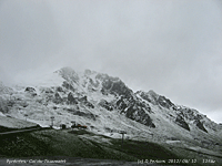
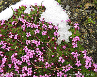 Snow fell on the Col du Tourmalet in the French Pyrénées. Large snow patches remain on the mountaintops, including ones on the roadside at 6939 ft that is the highest in this part of the Pyrénées and is a favourite cycling challenge in the Tour de France. Tundra-like vegetation and stone stripes are common formed as a result of frequent freezing and thawing
![]() . Alpine plants are common around the summit that is grazed by Lamas and Pyrenean sheep in the summer the latter were being returned to some mid-altitude pastures.
. Alpine plants are common around the summit that is grazed by Lamas and Pyrenean sheep in the summer the latter were being returned to some mid-altitude pastures.
14th: A bright and breezy morning with very good visibility. A deep low 985 mb was lying to the SW tracking NE with associated occluded fronts; cloud had encroached by noon and by 1530 GMT with strengthening wind it was raining (heaviest 1750 GMT 13.6 mm/h). Petering out light rain resumed after 2100 GMT, but ceased around midnight. Wetter again in Llanfairfechan where the rainfall was [20.0 mm]. A violent thunderstorm in Old Colwyn led to loss of telephones in Min y Don Avenue when a large tree was struck by lightning splitting it in two. The storm also knocked out the telephone system at the North Wales Police Headquarters, a spokesman was reported to say 'There was a big purple and yellow flash which was dramatic enough but this was accompanied almost simultaneously by a loud bang'. [Rain 3.3 mm; Max 17.2C; Min 9.7C; Grass 6.2C]
15th: Overcast and calm so that rain was falling vertically just before 09 GMT. Visibility was moderate to good, the outlines of the mountains just to be seen through low cloud and mist. With a slow-moving low 985 mb SW Ireland there was a thick mass of cloud covering Britain giving a sunless day for most. By 09 GMT a light S'ly breeze had commenced this soon strengthening; light rain in the morning becoming a little brighter and drier around noon (even a glimpse of weak sunshine) before turning moderate to heavy again later and continuing through the day and night. The AWS clocked up 22 wet hours and for the 24-h (09-09z) 18.5 mm the largest of the month. Wettest in Scotland, Dundrennan [45.4 mm], but Snowdonia not far behind Capel Curig having [42.4 mm]. [Rain 18.5 mm; Max 14.2C; Min 10.9C; Grass 9.5C]
16th: Another dull and overcast morning with a moderate to strong S'ly wind gusting 21 mph) was noisy in the swaying trees now in full leaf. At 09 GMT with slow-moving low over the Irish Sea pressure here was 997 mb. Continuing very windy with rain heavy at times in the morning easing to light rain by noon. Drier, dull afternoon. Sunless day. Low rainfall here, but a very wet day just to the north across the Irish Sea in Dumfries and Galloway at Threave {60.8 mm} and in Snowdonia Capel Curig {52.8 mm}[40.0 mm] [Rain 5.4 mm; Max 13.3C; Min 11.4C; Grass 10.8C]
17th: As the filling low (1004 mb) moved away over the North Sea pressure overnight had risen to 1016 mb. A bright morning with 6 oktas cover of mostly thin high cloud, with some cumulus over the mountaintops, and good visibility. Sunny in the afternoon (Valley 7.5h), a good drying day ET 2.7 mm and a maximum temperature of 16.2C. No precipitation recorded. [Rain 0.0 mm; Max 16.2C; Min 9.6C; Grass 8.9C]
18th: Overnight with low amounts of cloud cover the air temperature had fallen to 7.2C and to 3.2C on the grass, lowest of the month. Low for the time of year, and no good at all for runner beans on the garden plot that are turning yellow. The 4th sub 5.6C (42F) grass temperature this month, so far. It was warm in the sun (maximum 17.7C) , but there was a cool breeze. The afternoon and evening had sunny spells with the mountains mostly clear. There were a few spots of rain around midnight. [Lerwick 14.3h, Valley 12.4h] [Rain trace; Max 17.7C; Min 7.2C; Grass 3.2C]
19th: With 5 oktas of cloud cover it was bright and sunny one minute then dull the next; a moderate SW'ly wind into the bargain. There was a line of cumulus clouds over Snowdonia. Pressure was on 1018 mb under the influence of European-high 1022 mb to the east; frontal-wave low 10014 mb was over the N of Scotland. A dry mostly sunny day and the sunniest day of the month at Valley with 12.8h duration. [Isle of Man 14.7h] [Rain 0.0 mm; Max 17.5C; Min 10.1C; Grass 5.8C]
20th: High pressure was maintained overnight; another night with limited cloud cover allowing ground cooling, the grass minimum down to 3.4C. At 09 GMT 6 oktas of cirrus clouds thickening during the taking the edge off the sunshine morning. Pressure at 09 GMT was 1019 mb; there as a light N-NE'ly breeze, but the temperature rose to 18.6C in the afternoon and in Llanfairfechan 19.9C was reached. By 18 GMT a mass of cloud had encroached from the S and there was rain just before midnight. [Heathrow 22.7C, Yeovilton 20.2 mm, Kirkwall 16.3h] [Rain 2.9 mm; Max 18.6C; Min 7.9C; Grass 3.4C]
21st: A dull, calm and damp and cool morning; temperature at 09 GMT was 11.2C (dewpoint 10.0C). With a low over the English channel the sky kept overcast during the morning and into the afternoon before light rain began at 1500 GMT ceased by 2200 GMT. Sunless day. Wetter day in Llanfairfechan with [15.8 mm] recorded. [Strathallen 42.6 mm, Aberdaron 34.8 mm, Capel Curig 25.4 mm, Valley 11.0 mm] [Rain 11.1 mm; Max 16.6C; Min 9.9C; Grass 9.4C]
22nd: Rain recommenced around 01 GMT and was still raining at 09 GMT with 11.1 mm in the raingauge. Under thick cloud it was a dark morning with drizzle or light rain into the afternoon. Drier in the evening becoming windy. Another sunless day. A very wet day in the north-west, Cumbria and the Isle of Man. [Keswick 90.2 mm, Walney Is 67.6 mm, Bingley 53.6 mm, Ronaldsway 49.2 mm, Capel Curig 14.8 mm] [Rain 5.8 mm; Max 13.8C; Min 10.6C; Grass 8.9C]
23rd: A mostly cloudy, but dry morning, with a strong SW'ly wind moving large branches and making a lot of noise in the trees. Cloud increased during the morning and afternoon with few sunny spells. Light to moderate rain began about 19 GMT. Another wet day in Scotland [Eskdalemuir 32.6 mm], Cumbria [Blencathra (Saddleback) 93.8 mm], and Somerset [Liscombe 37.2 mm]. [Gravesend 20.6C, Blencartha 93.8 mm] [Rain 7.2 mm; Max 14.9C; Min 10.8C; Grass 7.7C]
24th: Rain until morning stopping just before 09 GMT. Visibility was good, but hazy and the moderated wind was force 3 S'ly Mostly cloudy with some sunshine with convective clouds persisting over the Snowdonia Mountains. A dry day with the temperature rising to 17.0C here and 17.5C in Llanfairfechan. Cloud and fog lingered off NW France, the N Brittany coastline and into the Channel. Sunshine was at a premium, but Aberporth had 8.7h. The temperature reached 20.9C in St James Park and Heathrow. [Rain 0.0 mm; Max 17.0C; Min 9.8C; Grass 9.7C]
25th: A bright with a light N-NW'ly wind. With 5 oktas of cloud cover there were warm sunny spells through another dry day. Clearer skies at sunniest Valley where 11.2h of sunshine was recorded; while Manston in Kent had 11.1h. [Hereford 23.5C, Culdrose 6.0 mm, Valley 11.2h, ] [Rain 0.0 mm; Max 17.3C; Min 10.8C; Grass 7.9C]
26th: An overcast and calm morning with drizzle and spells of slight rain. The afternoon was drier with one brighter spell and brief sunshine. The temperature here 18.1C, but in sunnier Llanfairfechan 21.9C was reached. [Gravesend 24.6C, Hawarden 21.2C, Kirkwall 13.0h, Aberporth 1.1h, Valley 0.0h] [Rain 3.3 mm; Max 18.1C; Min 9.9C; Grass 6.0C]
27th: With a covering of low uniformly grey cloud the day began with continuous light rain this dying out by afternoon that was bright at times. No sunshine again at Valley, but in Llanfairfechan with sunshine at times in the afternoon the Föhn-enhanced temperature rose to 24.7C, just behind Shawbury that reported 24.8C and Llysdinam with 23.6C. Cloud thickening during the evening brought rain by midnight. [Shawbury 24.8C, Manston 24.3C, Llysdinam 23.6C, Prestwick 20.6 mm, Manston 5.9h, Aberporth 5.1h, Valley 0.0h] [Rain 3.7 mm; Max 15.1C; Min 14.2C; Grass 14.0C]
29th: A windy morning the SW'ly gusting to 29 mph with ragged low clouds, a small patch of blue sky overhead rapidly disappeared soon after 0900 GMT. Low 986 mb was stationed off the Western Isles of Scotland with pressure here 995 mb rising slowly. Mostly dull, but a few glimpses of sunshine while the afternoon was overcast with a few spots of rain. Late in the afternoon the sky began to clear giving some sunshine by evening. [Santon Downham 22.C, Eskdalemuir 20.4 mm, Wattisham 8.9h, Valley 7.9h] [Rain 2.5 mm; Max 16.1C; Min 12.9C; Grass 11.7C]
30th: A brighter dawn, but already turning cloudier with 6 oktas cover at 09 GMT. There were well developed cumulus clouds in the vicinity moving briskly along on the moderate to strong SSW'ly. The slow-moving, filling low 994 mb was still off NW Scotland with showers in its circulation. The afternoon was cloudier with a shower of rain at noon and some sunny spells. There were some sharp showers in Llanfairfechan at 1350 and 1730 GMT (both up to 43 mm/h), but most of the day's 10.0 mm rainfall fell in the early hours of the 1st July. [Weybourne 22.2C, Capel Curig 17.8 mm] [Rain 4.8 mm; Max 16.3C; Min 11.8C; Grass 10.3C]
With mean British rainfall largest for over 100 years Llansadwrn was a little drier, ranking 11th in records since 1928, the 120.4 mm (177%) & [178%] of averages, was most since 2008. The mean temperature 13.1C (-1.3) & [-0.8] was lowest since 1994 and ranked 7th. While minimum temperatures 10.0C were closer to average(-0.7) & [0.0] maxima averaging 16.1C were (-2.0) & [-1.7]. Outstandingly low was the highest maximum 19.5C (-5.3). Sunshine at Valley was 145.1h, lowest since 2004 ranking 16th on the Anglesey record since 1930. .
July
1st: Change of month, no change in the weather. Overcast, cloud was low as low as 800 ft on the mountains, and dull with occasional spots of rain through the morning. The afternoon was a little brighter with some sunshine breaking through eventually. More light rain and drizzle in the evening carried on through the night. {Gravesend 19.8C} [Rain 1.7 mm; Max 15.6C; Min 9.6C; Grass 7.5C]
2nd: Overcast with low cloud and mist on the mountains again, recent rain and still a few spots falling at 09 GM. Pressure here was 1009 mb with low 994 mb S of Iceland with an associated occluded front over central Scotland stretching to the English Channel where there was a triple-point. A trough over Ireland and in between a tick cloud mass with embedded showers, all moving slowly eastward. Nice. Dull at first, brightening a little, but slight showers continued during the sunless day. Stornoway had 11.7 h sunshine and Bala 2.3h while Cardiff had 20.0 mm of rain. [Rain 3.4 mm; Max 16.9C; Min 11.3C; Grass 11.5C]
3rd: Dull and damp, spots of rain and showers in the morning. Drier in the afternoon ten with darkening skies another heavier shower at 1620 GMT. {Kinloss recorded 22.6C while Plymouth had 15.0 mm and Mumbles Head 11.2 mm of rain. Another sunless day here, Boulmer had 5.7h of sunshine}.[ Rain 4.5 mm; Max 17.4C; Min 13.3C; Grass 13.0C]

|
5th: Uniformly grey nimbostratus cloud low on the mountains with moderate to good visibility underneath. Pressure was steady on 1009 mb and the morning kept dull with a few spots of rain at times. Brighter in the afternoon then clearing sky over Anglesey (Valley 4.9h as clouds persisted over the Snowdonia Mountains. {Santon Downham 24.6C, Hawarden 22.6C, Gringley on the Hill 36.4 mm, Tiree 8.5h} [Rain 3.2 mm; Max 19.5C; Min 11.9C; Grass 11.1C]
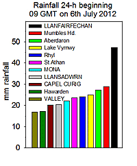 6th: Showery rain at 01 GMT then moderate rain 0330 to 0600 GMT. A brief respite to just before 0900 GMT when pressure was 1008 mb, then moderate to heavy rain as a slow-moving frontal-wave low developed over North Wales in the afternoon. Continuous rain through the day until 1800 GMT here, a total of 20.5 m. Rain was locally much heavier at Gorwel Heights in Llanfairfechan with 47.4 mm falling over 10 hours (09-09z), rain was heavy or very heavy from 1240 GMT into the evening, with the highest rate of fall 42.4 mm/h at 1300 GMT. Pressure 1002 mb was lowest at 1930 GMT before the deepening low began to track southwards. The river through the village of Llanfairfechan was a torrent and boulders could be heard rumbling in the flow. [Isle of Skye 24.0C, Llanfairfechan 47.4 mm, Boscombe Down 42.2 mm, Kirkwall 10.5h] [Rain 20.5 mm; Max 15.1C; Min 11.8C; Grass 8.5C]
 7th: Pressure had risen to 1007 mb with the low 997 mb over Cornwall. At 09 GMT the sky was clearing quickly with some lenticular altocumulus formed overhead soon sunny. A mostly sunny day the temperature rising to 19.7C, and dry here too although there were some spots of rain in Llanfairfechan and along the A55 in the evening .. [Crosby 22.7C, Porthmadog 22.2C, Isle of Portland 37.4 mm, Valley 14.2h] {Dunkeswell 54.4 mm, St Athan 28.2 mm} [Rain 0.0 mm; Max 19.7C; Min 10.3C; Grass 6.9C]
8th: After a dry night there were variable amounts of cloud in the morning with poor to moderate hazy visibility. Some bright spells, on or two glimpses of weak sunshine, earlier in the morning before thickening cloud brought a few spots of rain by noon and light rain from 1500 GMT into the evening and night. At Gorwel Heights there were 9.2 mm of rain with 14 wet hours recorded . [Rain 7.3 mm; Max 16.1C; Min 12.6C; Grass 10.2C]
9th: Much of the same, ragged low cloud, slight rain and moderate visibility. Becoming drier, but keeping overcast and dull through the day. There was a shower of rain at 1830 GMT. Sunless. [Rain 0.9 mm; Max 14.9C; Min 11.4C; Grass 10.4C]
10th: No change, overcast with light showery rain and poor misty visibility. The rain had stopped for a while by 1000 GMT, but further spells of light rain or showers came along through the day. There was a flash of sunshine about 1700 GMT, a few minutes, soon overcast again. [Rain 7.5 mm; Max 14.1C; Min 10.9C; Grass 10.8C]
11th: There was a heavy shower of rain at 0206 GMT, heavy enough 19.2 mm/h to sound on the roof of the house. A fine morning, the rain had stopped and the sky had started to clear. Pressure 1011 mb was rising slowly under the influence of a high 1022 mb over Iceland. A complex low pressure 1001 mb was over the Baltic with a frontal-wave over Newcastle giving another wet day in NE England. There were showers in circulation in the west, but it was a mostly fine day with some sunshine [Valley 8.8h]. Some dark cumulus clouds appeared in the afternoon and there were a few spots of rain at 1830 GMT. [Gravesend 20.5C, Redesdale Camp 31.6 mm, Church Fenton 10.7h] [Rain trace; Max 16.1C; Min 10.3C; Grass 10.4C]

|
|
|
13th: Rain by morning and spells of mostly light rain through the day. The month's rainfall at Gorwel Heights, Llanfairfechan, topped 100 mm today; here 54 mm. Another occluded frontal-wave low was tracking slowly SE over N Wales. More rain through the day, sometimes moderate to heavy. Occasionally brighter, hinting of clearing up, but soon back to mist and rain the day ending sunless. There were flash floods in parts of Powys, Newtown, Montgomery and Knighton, Holywell in Flintshire and Shropshire where the A49 was underwater. Rainfall in Snowdonia was heavy also [36.6 mm] at Lake Vyrnwy and [25.4] mm in Capel Curig. {Pershore 21.3C, Pennerley, Shropshire 33.8 mm, Lake Vyrnwy 29.6 mm [36.6 mm] , Magilligan 10.7h} . [Rain 20.3 mm; Max C; Min 12.1C; Grass 11.6C]
14th: Overcast and dull at first with a moderate shower of rain just before 0900 GMT, but the only one of the day. Pressure 1006 mb was rising slowly and the sky starting to clear although there were plenty of cumulus clouds in the vicinity drifting along on the cool showery N'ly airflow. Bright with few sunny spells in the morning. At noon the wind was SW'ly and during a clearer spell the temperature rose to 17.1C. Cloudier in the afternoon with brief sunny spells, some dark clouds passed by but no rain. Fine evening. Sunnier in the west Valley [6.5h]. [Rain 0.0 mm; Max 17.1C; Min 10.6C; Grass 9.5C]
|
|
15th: Cool overnight the air minimum temperature down to 8.6C. A fine and sunny morning with cloud decreasing over Anglesey with cumulus clouds persisting over the Snowdonia Mountains and generally Wales through the day. Sunnier in the west of the island, but sunny spells in which the temperature rose to 16.3C in the afternoon. Patchy thin cloud began to encroach in the west late afternoon the evening keeping fine and dry. [Morecambe 12.2h, Valley 8.1h] [Rain 5.7 mm; Max 16.3C; Min 8.6C; Grass 5.5C]
In the first 15-d rainfall was 80.3 mm (91%) & [115%] of averages. The mean temperature 13.8C was running [(-2.0C)] of averages. The highest maximum temperature 19.7C so far was 6.3 degrees below average for July.
16th: As thicker warm front cloud moved in from the W there was rain from 07 GMT accumulating 5.7 mm by 0900 GMT when falling moderately. Pressure 1014 mb was falling slowly; there was a cold front over Ireland. Rain continuous light to moderate through the morning; dull with more rain at times in the afternoon resulting in a sunless day {Helens Bay 21.8C, Porthmadog 19.6 mm, Tiree 11.2h} . [Rain 7.5 mm; Max 15.8C; Min 12.3C; Grass 11.8C]
17th: Grey and overcast skies in the morning with slight drizzle and spots of rain and poor visibility, Pressure was steady on 1022 mb and the jet stream had moved northwards and was now placed over centrally over the British Isles. Pressure was high over Biscay 1031 mb but low 1004 mb was W of Ireland with an associated warm front moving slowly across N Wales. The afternoon brightened and with some sunny spells in a clearer slot after the front had passed later in the afternoon the temperature rising to 19.5C at 1420 GMT. At Gorwel Heights in Llanfairfechan a warm Föhn-like wind off the mountains developed and the temperature rose to 23.2C (dewpoint 17.5C) at 1540 GMT, one of the highest in Britain on the day (Hawarden 22.1C). During the evening a developing shower front crossing the Irish Sea, ahead of a cold front, brought heavy bursts of rain at 1820 GMT (24 mm/h) and 1910 GMT (44 mm/h). In Llanfairfechan there was a heavy burst at 1820 (61 mm/h) with the temperature falling back to 17.7C. {Kew Gardens 24.0C, Morecambe 17.2 mm, Bala 8.4h}, } [Rain 8.8 mm; Max 19.5C; Min 13.4C; Grass 13.1C]
18th: As heavy thundery showers passed to the N of Anglesey around midnight (sferics) there were several further bursts of rain here (23 mm/h 0010 GMT) and Llanfairfechan (20 mm/h). In the morning very low but broken cloud hanging around the mountains and Anglesey. Visibility remained poor with several showers of rain through the morning. It did brighten by early afternoon, lighter showers and some sunny spells, then dull again with spots of rain during evening. A single dragonfly was spotted in the garden. {Pershore 21.8C, Edinburgh Botanic Gardens 55.0 mm, Leeming 9.3h} [Rain 1.1 mm; Max 18.5C; Min 13.8C; Grass 13.7C]
19th: Much of the same; dull, overcast drizzle, heavy at times, during the 4-h up to 09 GMT. A slow-moving occluded front stretching N Wales to E Anglia reluctant to move away. Becoming drier through the morning, but remaining overcast in the afternoon so it was a sunless day. {St James Park 21.8, Bradford 18.0 mm,Tiree 10.5h} [Rain 0.1 mm; Max 14.4C; Min 11.5C; Grass 10.5C]
20th: Although pressure 1017 mb was rising the slow-moving occluded front was still around and had an upper level low developed just to the N that was drifting across ESE'wards. Very good visibility under the cloud, very light variable wind. Keeping dull, there was heavy showery rain in the afternoon. {Exeter 20.8C, Gringley on the Hill 26.8 mm, St Athan 11.5h, Valley 3.3h} .[Rain 3.3 mm; Max 15.2C; Min 10.5C; Grass 9.3C]
21st: Calm overnight from 2200 GMT to 0700 GMT. A fine morning with mostly weak sunshine breaking through a complex sky including cumulus, altocumulus and cirrus. Turning cloudier from noon then cleared later to give a spell of warm sunshine. It did not last with the evening cloudier again, but it did not rain. Sunnier on the north-west coast with Valley reporting 8.5h duration. {Rothampsted 21.7C, Camborne 14.2h, Aberporth 11.3h} [Rain 0.0 mm; Max 18.3C; Min 8.2C; Grass 4.5C]
22nd: Scattered clouds at times with some clear sunny spells in the afternoon. Cloudier later with spots of rain during the evening. A windy day, the dominant moderate to strong SSW'ly had a 24-h mws of 11.5 mph. Mostly cloud-free with wall to wall sunshine England and Wales, apart from Anglesey. {Sheffield 24.6C, Hawarden 23.9C, Camborne 15.0h, St Athan 13.6h} [Rain trace; Max 19.9C; Min 12.7C; Grass 11.5C]
23rd: Another overcast and dull morning with a few spots of rain on the still moderate to strong SSW'ly wind. Dry, but still overcast into the afternoon until later when the cloud broke and there was sunshine into the evening as the wind moderated a little. During the day there were orographic clouds along North Wales coast in the lee of the Snowdonia Mountains. Overcast by midnight. Sunny and hot in SE Britain; cloudy, cool and wet in the NW, on the fringe here. {St James Park 28.1C, Cardiff 25.5C, Eskdalemuir 49.6 mm [32.6 mm], Capel Curig 9.0 mm, Wattisham 15.1h, St Athan 14.8h} [Rain trace; Max 19.8C; Min 14.8C; Grass 14.3C]

|
25th: Under low uniform grey stratiform cloud at 09 GMT there was slight drizzle and poor visibility. The drizzle petered out during the morning and the afternoon was brighter with a little sunshine. Sunny and hot in many places. {St James Park 30.7C, Cardiff 27.8C, Glasgow 15.6h, St Athan 14.3h, Valley 1.1h} [Rain trace; Max 18.4C; Min 13.9C; Grass 11.0C]
26th: We, and much of the north-west and central Britain, were still under the low cloud and fog and visibility was poor and rather murky. During the morning the cloud thinned a little with the sun trying to break through, there was a flash at 09 GMT. In Bangor it was sunnier the cloud breaking in the valley and along the Menai Strait. The afternoon kept dull and dry turning brighter late in the afternoon with a glimpse of weak sunshine in the evening. {Middle Wallop 28.5C, Aberporth 16.7C, Aldergrove 13.7h, St Athan 9.9h, Valley 2.3h} [Rain 0.0 mm; Max 19.7C; Min 14.0C; Grass 12.7C]

|
|
|
29th: Mostly cloudy with well developed cumulus and I spotted a cumulonimbus over S Snowdonia at 09 GMT. A W'ly breeze with cloud piling up against the mountains. Pressure was 1010 mb with low 1001 mb N Scotland and high 1025 mb over the Azores. Later in the afternoon there was sunshine as the sky cleared. Sunnier with less showers in the west of Britain today. {Cambridge 22.1C, Kinlochewe 21.2 mm, Camborne 12.2h, Valley 7.8h} [Rain 0.4 mm; Max 16.2C; Min 10.1C; Grass 9.0C]
30th: A fine and sunny morning with some well developed cumulus clouds towering over the mountains at first. Pressure was 1014 mb with the slow-moving low 1000 mb N of Scotland continuing the cool showery airstream. High 1018 mb was over Svalbard while high 1024 mb was over the Azores. Some sunny spells through the day, showers keeping away. Clearer sky in the evening. Pipistrelle bats have been in residence and brown long-eared bats were seen at 2100 GMT {St James Park 21.2C, Aviemore 19.4 mm, Valley 11.4h} [Rain 0.2 mm; Max 16.4C; Min 9.8C; Grass 7.3C]
31st: Some light showers after midnight. Visibility this morning was very good and exceptionally clear with Bardsey Island in view. With another low 990 mb was off SW Ireland pressure here was 1011 mb with an occluded front was to the N and a warm front to the S. The jetstream overhead had a SE'ly axis. Cloud was increasing and it turned out tot be a mostly cloudy day with light rain during the afternoon with a heavier burst during the evening. Wet in Ireland, Valentia 32 mm (00-00z) {Exeter 21.4C, Kinloss 12.0h} [Rain 4.5 mm; Max 17.8C; Min 10.8C; Grass 7.5C]
A cool month ending with a mean temperature of 14.4C [(-1.4)] of average, lowest since 1993 ranking 5th. The highest maximum 21.8C was -4.2C based on the decadal average. Rainfall was 109.4 mm, largest since 2010, (124%) & [157%] of average. Sunshine duration at Valley was 112.0h lowest since 2002 and ranked 6th lowest on the Anglesey record (K&Z adjusted values).
¤ 7.7
August
1st: Overcast with ragged low clouds, very dull. Light rain and or drizzle through the blustery morning. Another month of summer, but nothing much seems to have changed weatherwise. Deep low 980 mb was off the Western isles of Scotland at 09 GMT with a frontal system over the west moving ENE. The wind was S'ly and at 1142 GMT at Gorwel Heights the temperature rose to 21.2C dewpoint 15.6C with RH of 64%, rising to 21.7C at 1550 GMT. Continuing here with slight showers and a few sunny spells in the afternoon with a maximum of 19.2C. {Charlwood 24.6C, Eskdalemuir 35.8, Manston 6.4h} [Rain 1.4 mm; Max 19.2C; Min C; Grass 14.1C]
2nd: Some broken cloud overhead the station at 09 GMT as low cloud and mist covered the mainland mountains. Showers and sunny spells, when the sun was out it felt warm and in central Anglesey and west coast it was mostly sunny with folk enjoying the beaches in the afternoon. {Holbeach 23.2C, Lyneham 21.0 mm, Tiree 13.6 mm, Valley 12.0h }[Rain 0.8 mm; Max 19.1C; Min C; Grass 11.2C]
3rd: Slight showers continued through the night and early morning with low stratiform cloud hanging over Snowdonia. Vicinity was misty, but just good and cloud thinned with sunny spells before noon. Thicker cloud came in the afternoon and there was more slight rain. {Cavendish 23.4C, Tiree 12.6h} [Rain 0.8 mm; Max 19.0C; Min C; Grass 10.2C]

|
5th: A bright start to the day, but there were towering cumulus clouds over the Snowdonia Mountains. Pressure here as 1006 mb in slow-moving low over Britain. Soon darkening clouds as cumulonimbus encroached and there was thunder from 1116 GMT for about 30 minutes. Torrential rain with hail fell on the outskirts of the village towards Mynydd Llwydiarth and 33.0 mm was recorded in Pentraeth. Sunny spells in the afternoon. {Donna Nook 22.8C, Bradford 38.0 mm, Hurn 9.2h} [Rain 2.9 mm; Max C; Min C; Grass 9.0C]

|
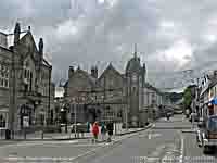 7th: A fine and bright morning with a clearing sky. Pressure 1017 mb had risen as a result of high-pressure building S Iceland 1018 mb at 09 GMT. Some cloud during the day with cumulus over the mountains, but sunny in the afternoon as the sky cleared towards evening. {Donna Nook 22.1C, Hawarden 21.0C, Topcliffe 16.8 mm, Glasgow 14.5h} [Valley 9.2h] [Rain 0.0 mm; Max 19.1C; Min 12.3C; Grass 10.2C]
 8th: Another fine morning with 4 oktas of mostly fair-weather cumulus clouds and cirrus overhead. It was calm with pressure on 1027 mb under the influence of high 1023 mb to the north-west. With the temperature on the grass falling to 9.3C overnight there was very heavy dew. Visibility was very good with Bardsey seen. Sunny and warm especially in the afternoon the temperature rising to 20.1C. Sea fog in Red Wharf Bay encroached in the eastern end of the Menai Strait and affected coastal areas the maximum temperature was 18.6C at Gorwel Height in Llanfairfechan. Mist came across the fields here late in the afternoon and fog by 1900 GMT in the evening visibility 150 m. {Church Lawford 24.0C, Porthmadog 22.5C, Prestwick 13.8h, Valley 12.1h} [Rain 0.0 mm; Max 20.1C; Min 11.6C; Grass 9.6C]
9th: Fine and sunny with an almost clear sky and heavy dew on the grass the minimum down to 8.5C. More or less sunny all day the temperature at Gorwel Heights 21.2C, 22.3C here and Valley the sunniest place with 13.7h duration. Warm Britain and Ireland. Some convective clouds in parts of southern Britain and the southern Pennines, sea fog affected parts of south coast of England from Kent to Sussex and across the channel to Calais most of the day. {St James Park 27.8C, Cardiff 24.8C,, Shannon 23.7C, Valley 13.7h} [Rain 0.0 mm; Max 22.3C; Min 10.7C; Grass 8.5C]

|
 11th: A bright 'summer' morning with high cirrus clouds; visibility was moderate in smoke haze, a mixture of pollutant and possibly some Saharan dust aerosols, thickening through the day. Ozone levels at Marchlyn Mawr (Welsh Air Quality Forum) had been rising and peaked around 110 µg per m-3. The SKIRON dust model (University of Athens) had forecast a narrow band of dust to move NE across Wales later in the day. Pressure 1019 mb had been falling as the high 1026 mb moved over the N Sea and S Baltic. There was a light to moderate SE'ly breeze, persisting all day at Gorwel Heights (wind run 210 miles, 00-21z) where the temperature at 09 GMT 19.4C rose to 23.5C. Highest temperatures today were in the west and on Anglesey the 24.9C at RAF Valley (Bodorgan 24.9C, Mona 24.2C, Pentraeth AWS 23.9C, Hawarden 23.1C, Llanfairfechan 22.8C, Capel Curig 21.4C, Aberdaron 20.7C) were, in the lee of the Snowdonia Mountains, unusually the highest in Britain. Convective cloud, on a showery trough, began to encroach from the W before midnight together with some Saharan dust at high level confirmed by HYSPLIT trajectory analysis. {Valley 24.9C, Stornoway 13.4h} [Rain 2.1 mm; Max 23.2C; Min 14.6C; Grass 11.4C]
 12th: A mild night the temperature at Gorwel Heights at midnight was 18.2C falling to 15.2C by morning; the overnight minimum here was 14.7C and 13.4C on the grass. Showery rain arrived over Anglesey around 02 GMT and 2.6 mm fell in Llanfairfechan and 2.1 mm here. Ozone levels at Marchlyn Mawr peaked at 120 µg per m-3 and were falling. A mostly cloudy and dry day. {Northolt 27.2C, Wattisham 10.4h, Valley 0.3h} [Rain 1.9 mm; Max 21.4C; Min 14.7C; Grass 13.4C]
13th: With slow-moving low 995 mb off NW Ireland, pressure here was 1005 mb, there was an occluded front over the Irish Sea giving light showers and slight rain. Cloud slow to clear on the mountains and Anglesey, but brighter in the west and along the coast at Llandudno by afternoon when the front had cleared. The temperature at Gorwel Heights reached 23.8C (dewpoint 17.8C) in a S'ly breeze off the mountains, one of the highest in Wales and highest of the month. {Santon Downham 24.9C, Lough Fea 48.6 mm, Lerwick 12.7h, Valley 4.4h} [Rain 1.8 mm; Max 20.7C; Min 14.8C; Grass 12.7C]
14th: A light shower of rain at 0845 GMT, but the sky began clearing soon after 0900 GMT and with sunny spells developing another warm day with a maximum of 22.1C here and 21.5C in Llanfairfechan. {Cambridge 26.3C, Fyvie Castle 27.6 mm, Odiham 8.9h} [Rain 0.0 mm; Max 22.1C; Min 14.4C; Grass 11.8C]
15th: A very dull day with a spell of heavy rain from 1100 GMT to 1400 GMT, heaviest 1230 to 1240 GMT falling at a rate of 25 mm/ h. Windy and sunless. {Marham 26.0C, Stormont Castle 31.6 mm, Stornoway 10.2h} [Rain 5.7 mm; Max 20.1C; Min 15.3C; Grass 11.8C]
The first 15-days were warmer than of late having a mean temperature of 16.7C [(+1.1)] of average. Rainfall was just 20.5 mm (23%) & [24%] of averages.
16th: A dry fine start with some early sunny spells before a shower of rain at 0937 GMT. Some bright spells later the temperature rising to 20.4C. Showery rain during the evening. {Cambridge 24.6C, Portglenone 19.2 mm, Tiree 10.1h} [Rain 3.0 mm; Max 20.4C; Min 14.7C; Grass 12.6C]17th: Rain around 05 GMT, dull, overcast and sunless with light to moderate rain through the day. Heavier bursts during the evening up to 33 mm/h at 2040 GMT; 24.5 mm, with 18 wet hours, in the 24-h period 09-09 GMT was largest of the month.{Northolt 28.7C,Whitechurch 35.8 mm, Manston 10.2h} [Rain 24.5 mm; Max 18.2C; Min 16.4C; Grass 14.1C]
18th: Overcast with steady light drizzle and poor visibility to start the day. Becoming dry with brightening sky and sunny spells in the afternoon with a maximum temperature of 20.1C. {Cavendish 32.4C, Levens Hall 19.4 mm, Manston 13.1h}.[Rain 0.4 mm; Max 20.1C; Min 16.5C; Grass 16.5C]
19th: Overcast with light rain during the morning and into the afternoon before turning dry later although sunshine was at a premium. There were 7 wet hours with 4.4 mm of rain (09-09 GMT). The temperature at 0900 GMT was 16.1C rising to a maximum of 18.2C (17.4C at Gorwel Heights, Llanfairfechan). {Cambridge 31.1C, Warcop 14.4 mm, Heathrow 11.0h} [Rain 4.4 mm; Max 18.2C; Min 12.1C; Grass 8.4C]

|
|
|
20th: After a shower of rain around 05 GMT it was a bright morning with sunny spells coming along a mostly sunny day, although there were a few spots of rain at 1405 GMT. A sunny day at Valley the 9.5h making it the sunniest place in Britain. {Cavendish 26.1C, Harris Quidnish 20.8 mm, Valley 9.5h} [Rain 3.3 mm; Max 20.1C; Min 13.2C; Grass 9.5 C]
21st: Rain from 05 to 0700 GMT becoming brighter after 0900 GMT with a little sunshine later. Pressure was 1016 mb, visibility good. A dry day. [Rain 0.0 mm; Max 18.8C; Min 14.2C; Grass 12.4C]
22nd: Dull at first, a decrease of cloud cover to 6 oktas with orographic waves around 08 GMT in alight S'ly breeze. Pressure was 1015 mb with a ridge of high-pressure over S England from Azores-high 1026 mb. Low 1006 mb was to the NW with a shower trough over N Ireland. A mostly sunny day with mostly fair-weather cumulus clouds; there were a few showers of rain during the evening the sky clearing later for a while before cloud encroached from the south-west.. [Rain 0.6 mm; Max 18.5C; Min 12.5C; Grass 8.8C]
23rd: Deepening low 997 mb SW of Ireland had brought moderately high cloud to the W. Dull and overcast at 0900 GMT with a S'ly breeze. Visibility was good and the day kept dry, maximum temperature 15.9C.[Valley 0.3h] [Rain 0.9 mm; Max 15.9C; Min 11.8C; Grass 7.4C]
24th: At midnight low 993 mb was off SW Ireland tracking towards the Bristol Channel and becoming slow-moving. There was light rain and moderately heavy drizzle from 0140 GMT petering out by 0500 GMT.. At 0900 GMT pressure 1004 mb was falling and a band of cumulonimbus ahead of an occluded front had already reached Pembrokeshire. The day started bright enough, but soon turned dull as cloud encroached bringing rain during the afternoon. Pressure at 1800 GMT had fallen to 998 mb, rain was heaviest in bursts from 19 GMT (35 mm/h) to 22 GMT after which the sky began to clear. Lightning flashes were seen, but thunder was not heard. Pressure was lowest 997 mb at 2310 GMT. [Capel Curig 42.6 mm, Valley 38.6 mm, Mona 25.8 mm,Valley 2.8h] [Rain 20.0 mm; Max 19.2C; Min 11.9C; Grass 10.8C]
25th: Further heavy rain from 0140 GMT to 0330 GMT (up to 32 mm/h at 0320 GMT) , especially on the mountains of Snowdonia where Capel Curig reported 42.6 mm 24-h (09-09 GMT today. Valley also had 38.6 mm, less at Mona 25.8 mm and here 20.0 mm. At 0900 GMT pressure was 999 mb, but the sky was a little brighter. A mostly cloudy day, not much in the way of sunshine and a maximum temperature of 15.5C. At 2200 GMT it was calm with mostly clear sky and very good visibility. [Rain 0.8 mm; Max 15.5C; Min 12.9C; Grass 10.1C]
26th: A bright morning and feeling warm in sunshine. Pressure had risen to 1016 mb under the influence of Iberian high-pressure 1024 mb moving into France. A mostly sunny day with cumulus clouds developed here and over the mountains in the afternoon. [Valley 7.5h] [Rain 0.2 mm; Max 17.4C; Min 10.8C; Grass 6.2C]
27th: Overcast sky with a freshening moderate S'ly breeze and rain. An early slight shower of rain at 0720 GMT, dull and damp at 0900 GMT and soon rain with freshening S'ly wind. Drier, but keeping overcast around noon, then wet and windy from 1340 GMT into the evening before turning drier. Windy too at Gorwel Heights in Llanfairfechan with the highest gust of the month 48 mph recorded at 1150 GMT and in the SSE'ly a maximum temperature of 20.5C at 1230 GMT. A sunless day, but just to the N Tiree had 5.3h of sunshine, Valley 0.3h. {Heathrow 22.6C, Whitechurch 43.4 mm, Tiree 5.3h} [Rain 7.1 mm; Max 17.8C; Min 12.9C; Grass 8.9C]
28th: A clearing sky at dawn left a line of cumulus clouds over the Snowdonia Mountains with scattered clouds over Anglesey. Visibility was good, though hazy and there were sunny spells before noon and into the afternoon that was breezy. A temperature of 20.0C was recorded at Gorwel Heights at 1220 GMT. Cloudier later in the afternoon and evening. {Heathrow 24.2C, Kinlochewe 39.0 mm, Odiham 10.4h} [Rain 7.1 mm; Max 16.0C; Min 11.9C; Grass 9.0C]
29th: Heavy rain including a few ice pellets fell at 0359 GMT at a rate up to 48 mm/h. A thundery trough was moving eastward off the Irish Sea and thunder was heard at 0738 GMT. There were signs of the sky beginning to clear at 09 GMT, but with well developed cumulus and cumulonimbus clouds in the vicinity 3 claps of thunder were heard nearby again at 1021 GMT and closeby at 1039 GMT as an active cell passed overhead. A large temperature change took place; after earlier rising to 16C during the storm fell to 10.6C and went on to rise to 17.9C again afterwards. Rain fell at up to 46 mm/h. By 1100 GMT the sky was clearing, but distant thunder continued to be heard 1119 GMT. The afternoon with well developed cumulus clouds had some sunny spells with a slight shower of rain. Cloudier later with light rain in the evening. {Weybourne 22.3C, Cardiff 18.8C, S Uist 35.2 mm, Sennybridge 27.2 mm. Valley 6.0h} [Rain 7.6 mm; Max 17.9C; Min 12.3C; Grass 11.5C]
30th: A heavy shower at Gorwel Heights, Llanfairfechan, at 0006 GMT fell at a rate of up to 64 mm/h. It was an unpromising start in the morning with overcast skies and moderate visibility with an occluded front just to the N, but pressure was rising under the influence of Atlantic-high 1029 mb off Brest, France, with a ridge extending in the west to Iceland. Soon brighter with some sunshine and with a clearing sky over Anglesey a sunny afternoon with good visibility. There was a rather chilly NE'ly breeze with a maximum temperature of 15.4C. A clear sky during the evening with bright moon. {Solent 22.3C, St Bees Hd. 42.6 mm, Glasgow 12.2h, Valley 8.4h} [Rain 0.0 mm; Max 15.4C; Min 10.6C; Grass 10.1C]
31st: Mostly clear overnight resulting in the air and ground minima of 8.2C and 5.8C being lowest of the month, but by no means exceptional here. Some places in the north, including Braemar with -2.4C, had air frost and ground frosts. Becoming cloudier since dawn at 09 GMT 4 oktas cover, with moderately high thin cloud encroaching the sky was overcast by afternoon. Pressure 1031 mb was highest of the month with Atlantic-high 1036 mb off SW England, but with low 989 mb W of Iceland pressure was falling before the end of the day. Thickening cloud late in the afternoon brought slight showers of rain around 17 GMT and 20 GMT. {Solent 19.6C, Manston 10.3h} [Rain 0.5 mm; Max 15.6C; Min 8.2C; Grass 5.8C]
The month ended with a mean temperature of 15.9C highest since 2004 ranking 9th since 1979. Rainfall was 100.9 mm (111%) & [116%] of averages, largest since 2009 ranking 33rd largest since 1928. Despite Wales and England summer averages being largest for 100y the total here was 330.7 mm, most since 2007 ranking 9th. It was a sunny month at Valley with 175.7 h duration, sunniest since 2005.
September
1st: An overcast and dull morning, but there were thinning patches and occasional glimpses of weak sunshine through the breezy morning. A warm front had passed over and a clearer slot had developed ahead of a cold front approaching NW Ireland and the Western Isles of Scotland. By noon some clear sunny spells, warm sunshine at Gorwel Heights with a temperature of 20.1C, and later in the afternoon the wind moderated, but the sunshine disappeared as cloud thickened again towards evening. [Rain 1.6 mm; Max 17.4C; Min C; Grass 11.5C]
2nd: A murky morning with low uniform grey stratiform cloud drizzle and slight rain, with moderate visibility. Pressure 1023 mb was rising slowly with high-pressure over Biscay and complex low-pressure N Norwegian Sea, but we were on the north-western edge of the cold front sliding reluctantly E'wards and cloud was slow to clear. Some brief glimpses of sunshine here and Benllech in the morning, more in the afternoon with the sky clearing over Anglesey by 1500 GMT. Clear skies extended into the calm evening and at dusk 0730 GMT several brown long-eared bats were seen around the garden. [Rain 0.2 mm; Max 19.4C; Min 14.4C; Grass 14.0C]
3rd: A fine and sunny morning with high cirrus clouds increasing so that at 0900 GMT sun-dogs were seen. Pressure was steady on 1027 mb and the temperature on 16.0C. A mostly sunny day, breezy in the afternoon and keeping fine into the evening. Fronts associated with deepening low 968 mb over Iceland at 1800 GMT were affecting N Scotland. [Rain 2.1 mm; Max 19.4C; Min 11.2C; Grass 7.8C]
4th: The Icelandic-low was 964 mb at midnight and an associated cold front was moving in off the Irish Sea. The was light rain from just after 03 GMT and it was still raining a little at 0700 GMT. At 0900 GMT pressure 1025 mb was rising again after bottoming 1022 mb at 0337 GMT, it had stopped raining and the sky looking brighter. Slow to clear in the morning, and reluctantly with some breaking through the afternoon was sunnier later and less breezy. [Rain 0.0 mm; Max 17.7C; Min 14.5C; Grass 13.4C]

|
|
|
6th: A fine bright morning with moderately high altostratus clouds and good visibility. Pressure was 1027 mb within high 1031 mb over the Celtic Sea. A mostly sunny day. [Northolt 22.0C, Hawarden 20.4C, Valley 17.4C, Aberporth 12.1h, Valley 9.5h]
7th: Pressure continued high 1027 mb over southern Britain and N France, but was falling slowly 1024 mb over N Wales. A cloudier morning with low stratiform cloud and fog off the Irish Sea affecting much of Anglesey and Lleyn in the morning clearing in SE Anglesey and North Wales coast in the afternoon. Global solar radiation 16.43 MJ m -2 was highest of the month. The temperature reached 21.3C at Gorwel Heights in Llanfairfechan, 22.6C in Rhyl and 18.7C in Llansadwrn. [Rhyl 22.6C, Hawarden 22.5C, Aberporth 12.1h, Valley 17.8C & 2.3h]
8th: Pressure 1021 mb had declined as the high 1023 mb slipped further S over France, low 984 mb was W of Ireland. Low stratiform cloud and sea fog again affected much of Anglesey and Lleyn early in the day, but soon began to burn off to give a largely sunny afternoon and evening. Warm and sunny in southern Britain. [St James Park 28.2C, Hawarden 23.1C, Valley 16.6C, Manston 11.9h, Valley 7.8h]
9th: As the high moved further away SE'wards towards Italy, low 994 SE Iceland at 0900 GMT was deepening 987 mb by noon. Pressure here 1007 mb was falling slowly. A cold front over Ireland was moved eastward during the morning and arrived over Anglesey around 1500 GMT bringing a band of showery rain. After a maximum of 21.2C at 1350 GMT a gust of 30 mph was recorded at Gorwel Heights at 1520 GMT as the front passed over. Continuing sunny and very warm in southern Britain. {Writtle & Cambridge 29.3C, St James Park & Weybourne 28.6C, Manston 28.4C, Capel Curig 14.8 mm, Camborne 11.9h, Manston 10.8h, Valley 1.5h]
10th: At midnight deep low 977 mb was E of Iceland moving over the Norwegian Sea with an occluded front over the Irish Sea. Overcast with a moderate to strong SSW'ly wind it turned very wet over the mountains of North Wales and at Gorwel Heights in Llanfairfechan where 38.6 mm of rain fell in the 24-h 09-09 GMT. Rain was intense from 1720 to 1740 GMT falling at rates up to 97 mm/h with further heavy bursts at 1950 to 2000 GMT 18 mm/h and 0130 GMT 20 mm/h. [Gravesend/ Shoeburyness 23.6C, Manston 23.1C, Llanfairfechan 38.6 mm, Capel Curig 25.4 mm, Lake Vyrnwy 20.6 mm, Manston 8.7h]
11th: Light showers of rain continued after midnight and the showery theme persisted as a trough moved across N Wales and N England through the morning {Rochdale 14.6 mm}. Soon with showers petering out the day was mostly sunny [Valley 7.9h] and fresher the maximum at Valley 15.2C, Gorwel Heights 14.7C and elsewhere struggling to reach 20C. [Shoeburyness 19.4C. Machrihanish 23.6 mm, Leuchars 9.8h, Hawarden 9.6h]
12th: A largely cloudy start to the day as a warm front moved SE across N Wales. Pressure was steady on 1012 mb in ridge from large Atlantic-high 1032 mb to the south-west; the fronts were associated with deep low 967 mb S Greenland. Light rain with some heavier bursts at times during the morning particularly over the mountains; the afternoon was brighter with sunny spells on Anglesey as showers persisted over the mountains as a cold front developed over mid-Wales. [Manston 19.3C & 6.5h, Capel Curig 9.6 mm, Valley 2.5h]
13th: Atlantic-high 1028 mb extended over the Bay of Biscay while low 968 mb over Iceland has associated warm frontal cloud over Scotland. Pressure here was 1020 mb with light to moderate S'ly breeze. A mostly cloudy day in the north and west of Britain; wet at Kinlochewe in Scotland where 46.4 mm fell in the 24-h to 2100 GMT, but drier and sunnier on the east coast [Leuchars 10.0h] . Brighter and breezier in the afternoon when cloud thinned and burnt-off over the Irish Sea with a little sunshine on Anglesey [Valley 3.7h] and along the North Wales coast with Hawarden reporting 6.0h and 17.7C (Gorwel Heights 17.2C). [Killowen 19.9C, Kirkwall 28.6 mm, Hurn 11.3h]
14th: After showers of rain around 04 GMT a bright morning with some sunshine. Pressure was 1011 mb was rising after a low of 1009 mb at 0230 GMT; low 973 was W Norway while the Atlantic-high was 1026 mb. We were in a W'ly flow of air with good visibility. Mainly fair-weather and orographic clouds persisted through the day, especially over the Snowdonia Mountains, but it kept dry on Anglesey. The temperature rose briefly to 16.6C in the afternoon at Gorwel Heights in Llanfairfechan [Mumbles had 17.8C and Valley 17.2C] [Solent 21.1C, Tulloch Bridge 7.6 mm, Leconfield 8.9h, Valley 5.3h]
15th: After a bright start, particularly on the mainland and E of Conwy, cloud soon encroached from the W and the day was dry, but sunless at Valley. [Heathrow 22.9C, Sule Skerry 11.8 mm, Odiham 11.1h] [Rain 16.5 mm; Max 14.8C; Min 9.3C; Grass 5.1C]
16th: A wet and windy morning. Pressure 1009 mb had been falling as a warm front moved ESE across Wales and NW England. By 1400 GMT the first of 2 weak cold fronts passed with a 2C fall in temperature and the second cold front about 1700 GMT with a slower 3C fall in temperature. Pressure fell to 1006 mb at 1430 GMT and at Gorwel Heights there was a burst of heavy rain at 1450 to 1500 GMT falling at a rate up to 46 mm/h as the first front passed followed later by a partial clearance of the sky. There was no more precipitation. {Holbeach 20.3C, Capel Curig 28.6 mm, Llanfairfechan 11.0 mm, Lerwick 7.8h, Hawarden 0.8h, Valley 0.0h}
17th: A mostly cloudy, but bright morning with glimpses of sunshine and a moderate SW'ly wind. Pressure had risen to 1009 mb and we were in a showery W'ly airflow. Bright and breezy, showers in the evening with isolated lightning and thunder heard around 1850 GMT. [Manston 20.4C, Loch Glascarnoch 15.6 mm, Charlwood 8.1h, Valley 4.4h]
18th: A fine and bright morning with convective clouds over the Snowdonia Mountains. Pressure 1013 mb was rising with Atlantic-high 1028 mb to the south-west and with low-pressure N Norway there was a cool showery WNW'ly airflow. A mostly sunny day on Anglesey, but cooler with maximum temperatures 13/14C and with heavy showers in Llanfairfechan at 1350 GMT (up to 32 mm/h) and 1450 to 1500 GMT (up to 66 mm/h). [St James Park 19.3C, Loch Glascarnoch 14.6 mm, Capel Curig 8.6 mm, Lyneham 10.3h, Valley 8.8h]
19th: A fine bright morning with some convective clouds especially over SE Anglesey and the Snowdonia Mountains. Pressure was steady on 1023 mb with high 1028 mb to the south-west. A mostly sunny and dry day [Valley 9.7h] with maxima around 15C. Cloud on a warm front, associated with a low W of Ireland, moving N encroached later bringing a band of showery rain before midnight. [Heathrow 17.8C & 10 3h, Prestwick 13.6 mm, Lake Vyrnwy 8.2 mm]
20th: A mostly cloudy day on Anglesey [Valley 1.2h sunshine], although brighter along the North Wales coast. [Shoeburyness 18.2C, Prestwick 62.2 mm, Manston 5.0h]
21st: At midnight a detached cold front moved S across North Wales. At Gorwel Heights the temperature at 0110 GMT was 13.3C, but this dropped to 9.4C by 0630 GMT as the front cleared. Moderate to heavy showery rain after midnight dying out by 09 GMT when 10.4 mm had accumulated (8.4 mm since midnight). A day of sunshine and showers. A band of showers moved in off the Irish Sea during the afternoon before some bright and sunny spells during the evening as a ridge of high-pressure moved in from the west. [Chivenor 17.3C, Little Rissington 8.5 mm, Glasgow 10.7h, Valley 5.3h]
22nd: At 0900 GMT pressure had risen to 1022 mb within high developed over Britain. Overnight the air minimum temperature dropped to 4.7C, lowest in September since 1993 and 6th lowest recorded in September, and on the grass to 0.3C lowest in September on record here (Valley -1C). Several places in Britain reported air frost and ground frost. A dry sunny day; cirrus clouds encroached from the W during the afternoon with pressure starting to fall (1019 mb at 1800 GMT) as the high drifted eastward. [Solent 17.2C, Yeovilton 9.3 mm, Aberporth 10.9h, Valley 9.8h] [Rain 15.0C; Max 14.4C; Min 4.7C; Grass 0.3C]
23rd: An overcast morning. Pressure had fallen to 1012 mb at 09 GMT between low 994 mb S Iceland and low 992 mb off Cape Finisterre tracking NNE towards the English Channel. Becoming increasingly dull during the day as a cloud mass in a wedge between the two lows thickened. There was moderate to heavy rain from 1800 GMT with 15.0 mm falling at Gorwel Heights up to midnight. [Jersey 16.8C, Braemar Min -4.1C, St Athan 38.2 mm, Llanfairfechan 37.6 mm, Aldergrove 9.4h] [Rain 49.5 mm, Max 12.5C, Min 5.7C; Grass 1.4C]

|
In contrast to the weather at home, it was a sunny day at La Coubre in the Charente-Maritime in western France. The panorama above was taken at 3/4 tide from the top of La Phare de la Coubre ![]() , there are 300 steps and final vertical metal ladder. The light is now automatic, it was closed to the public, but this year had reopened. The Bonne Anse, a fine saltmarsh of International ecological importance, protected by a sand spit and dunes, the Pointe de la Coubre
, there are 300 steps and final vertical metal ladder. The light is now automatic, it was closed to the public, but this year had reopened. The Bonne Anse, a fine saltmarsh of International ecological importance, protected by a sand spit and dunes, the Pointe de la Coubre ![]() , borders the Foret de la Coubre and the Cote Sauvage
, borders the Foret de la Coubre and the Cote Sauvage ![]() that experience full exposure to Atlantic storms. The marsh supports waders including little egrets, white storks and marsh harriers; it is an important habitat for autumn and spring migrations of birds and butterflies; and there are deer and wild boar in the forest. On the wetter part of the marsh subject to frequent inundation in September the common sea lavender Limonium vulgare was at its best and in full flower imparting a purple haze to a large section of the marsh
that experience full exposure to Atlantic storms. The marsh supports waders including little egrets, white storks and marsh harriers; it is an important habitat for autumn and spring migrations of birds and butterflies; and there are deer and wild boar in the forest. On the wetter part of the marsh subject to frequent inundation in September the common sea lavender Limonium vulgare was at its best and in full flower imparting a purple haze to a large section of the marsh ![]() , this tall species has large leaves
, this tall species has large leaves ![]() and here the flowers in close-up
and here the flowers in close-up ![]() . On a drier part of the marsh, subject to less frequent inundation, can be found the shorter smaller leaved sea lavender Limonium binervosum ssp dodartii
. On a drier part of the marsh, subject to less frequent inundation, can be found the shorter smaller leaved sea lavender Limonium binervosum ssp dodartii ![]() , similar to that found on the Cefni saltmarsh, that had more or less finished flowering. Also flowering on the marsh was the tall sea aster, present in a zone of more frequent inundation than the common sea lavender
, similar to that found on the Cefni saltmarsh, that had more or less finished flowering. Also flowering on the marsh was the tall sea aster, present in a zone of more frequent inundation than the common sea lavender ![]() and on the day were attracting pale yellow and light orange coloured butterflies. Another plant attracting small bees, hoverflies and butterflies was sea rocket. A painted lady butterfly was spotted
and on the day were attracting pale yellow and light orange coloured butterflies. Another plant attracting small bees, hoverflies and butterflies was sea rocket. A painted lady butterfly was spotted ![]() , an unlikely habitat perhaps to find a painted lady, but may be important as a stopping off point in the recently discovered 'high altitude' migrations of British butterflies. Work done using radar at Rothampsted Research Station in Hertfordshire showed the average height travelled was over 500 m at up to 30 mph with favourable winds. The total migration route involving 6 generations from the Arctic to Africa (9000 miles) is longer than the well-known monarch butterfly route from Mexico to Canada. An important plant stabilising the mobile dunes system is the semi-prostrate dune wormwood Artemisia campestris ssp maritima
, an unlikely habitat perhaps to find a painted lady, but may be important as a stopping off point in the recently discovered 'high altitude' migrations of British butterflies. Work done using radar at Rothampsted Research Station in Hertfordshire showed the average height travelled was over 500 m at up to 30 mph with favourable winds. The total migration route involving 6 generations from the Arctic to Africa (9000 miles) is longer than the well-known monarch butterfly route from Mexico to Canada. An important plant stabilising the mobile dunes system is the semi-prostrate dune wormwood Artemisia campestris ssp maritima ![]() . This is a typical plant of western Atlantic coast habitats
. This is a typical plant of western Atlantic coast habitats ![]() . Having small yellow flowers, in this close-up the petals have dropped being late in the season
. Having small yellow flowers, in this close-up the petals have dropped being late in the season ![]() . Thought not to occur in Britain it has recently been discovered at sand dunes at Crosby and added to the British list. Dr John Twibell, curator of the National Artemisia Collection, has been attributed as saying the plant shows a 'distinct progression of form' from Portugal/Spain to N France and Britain. The dune pansy, familiar on Anglesey, is absent here, but is made up for by the annual Linaria thymifolia 'Linaria à feuilles de thym' another western Atlantic
. Thought not to occur in Britain it has recently been discovered at sand dunes at Crosby and added to the British list. Dr John Twibell, curator of the National Artemisia Collection, has been attributed as saying the plant shows a 'distinct progression of form' from Portugal/Spain to N France and Britain. The dune pansy, familiar on Anglesey, is absent here, but is made up for by the annual Linaria thymifolia 'Linaria à feuilles de thym' another western Atlantic ![]() and here in close-up
and here in close-up ![]() . Late on our last day we found the minute mat-forming perennial fringed rupturewort Herniaria ciliolata growing on moister sand
. Late on our last day we found the minute mat-forming perennial fringed rupturewort Herniaria ciliolata growing on moister sand ![]() and here in magnified close-up on another plant the flowers
and here in magnified close-up on another plant the flowers ![]() .
Another plant of western European Atlantic coastline, rare in the British Isles, present in the Channel Islands, Cornwall and Lancashire.
.
Another plant of western European Atlantic coastline, rare in the British Isles, present in the Channel Islands, Cornwall and Lancashire.
25th: At 0900 GMT pressure was 980 mb with the low 976 mb centred over N England. In Llansadwrn rainfall for the past 24-h at 0900 GMT was 49.5 mm and at Gorwel Heights 50.8 mm. And still it was raining; the temperature was 10.2C (dewpoint 9.7C).. There were heavy bursts (up to 29 mm/h at 0720 GMT) at Gorwel Heights where a further 22.6 mm were added by noon; the 'storm event' total then standing at 96.2 mm. Lanes of the A55 in both directions were flooded, near Llanfairfechan, between Talybont and Abergwyngregin for most of the day. By evening there was major disruption to North Wales rail services from Chester to Holyhead with flooding on the line westward from Colwyn Bay including the Conwy Valley line. Services in N England and Scotland's East Coast mainline were suspended. There was flooding again in Newcastle; Tyne & Wear Metro services were affected. Very windy in Scotland where at Inverbervie, Kincardineshire, a gust of 72 mph was recorded. Another very dull and sunless day, global solar radiation 1.53 MJ m -2, second lowest of the month. [Aberdaron 34.4 mm, Mona 28.8 mm, Capel Curig 26.8 mm, Llanfairfechan 25.0 mm, Valley 23.2 mm] {Heathrow 17.1C, Bainbridge 63.2 mm, Aberdaron 40.0 mm, Wattisham 8.3h} [Rain 5.4 mm; Max 10.7C; Min 9.9C; Grass 9.5C]
26th: Low 981 mb over Wales was tracking towards the Bristol Channel; pressure here at 0900 GMT 991 mb was rising slowly. The temperature was 10.6C (dewpoint 9.8C) rising from a minimum of 8.9C just before. Mostly cloudy with showers of rain with brighter spells (much brighter than 24/25th) and a light ENE'ly breeze, drier in the afternoon and a little brighter by evening.{Walney Is. 17.1C, Wiggonholt 23.4 mm, Aldergrove 5.6h} [Rain 1.3 mm; Max 14.4C; Min 8.9C; Grass 7.9C]
27th: Pressure was high 1028 mb over the Azores and pressure had risen to 1009 mb, but with deep low 978 mb S Iceland occluded frontal cloud lay over the Irish Sea. Early showers of rain as a narrow trough crossed over between 0200 and 0500 GMT. Overcast and dull at first with showers continuing over the mountains, there were some brighter spells in the afternoon. By 1500 GMT thicker cloud on an occluded front over Ireland was encroaching from the west. {Solent 17.9C, Milford Haven 9.0 mm, Bristol 7.8h} [Rain 3.6 mm; Max 13.4C; Min 8.9C; Grass 5.9C]
28th: Rain after midnight dying out before 09 GMT. Pressure was steady on 1010 mb with the low 980 mb N of Scotland and high 1020 Azores giving a W'ly airflow with marine open cell shower clouds to the north-west and closed cells to the south-west. Bright and sunny at times with a few light showers during the afternoon and in the early evening. [Shoeburyness 18.3C, Tulloch Bridge 28.6 mm, Leuchars 8.2h, Valley 4.6h] [Rain 0.5 mm; Max 14.8C; Min 9.3C; Grass 5.8C]
29th: A fine and bright morning with cumulus clouds over the Snowdonia Mountains. Pressure had risen to 1019 mb as a transient ridge of high-pressure over Ireland, an extension from Azores high 1031 mb, mover across from the west. Mostly sunny and dry, orographic convective cloud persisting over the mountains in the afternoon. Cloud on a warm front associated with low 978 mb W of Ireland began encroaching from the west before midnight. {St James Park 17.0C, Cassley 28.6 mm, Manston 10.8h, Valley 8.4h} [Rain 7.9 mm; Max 14.6C; Min 7.0C; Grass 1.7C]
30th: A few spots of rain after midnight and cloudy morning. Low 977 mb was S of Iceland with falling pressure here 1012 mb. There was a strengthening moderate to fresh SSW'ly breeze with a gust of 33 mph (1020 GMT) and (36 mph (1040 GMT) at Gorwel Heights on a weak cold front, both strongest of the month. Light to moderate rain from 1100 GMT into the afternoon. Turning drier later but a dull sunless day here, global solar radiation just 1.63 MJ m -2, third lowest of the month. [Aberdeen 18.2C, Capel Curig 43.4 mm, Sennybridge 20.6 mm, Llanfairfechan 10.6 mm, Kinloss 6.9h] [Rain 1.5 mm; Max 14.3C; Min 10.2C; Grass 6.7C]
The month ended with a mean temperature of 12.6C, lowest since 1995 rank 5. Rainfall was 161.6 mm, largest since 2004 rank 10 since 1928. Sunshine duration at Valley was 134.6h (106%) & [105%] K&Z adjusted. Sunniest day 10.5h on the 5th; 5 sunless.
October
After a moderate shower of rain at 0730 GMT the sky began to clear and at 09 GMT in a moderate S'ly breeze was 3 oktas cover. The day was fine with sunny spells the temperature reaching 15.2C and 15.6C at Gorwel Heights in Llanfairfechan. The wind moderated during the evening. [Holbeach 18.8C, Cardiff 17.1C, Capel Curig 19.0 mm, Lerwick 5.2h][Rain 1.5 mm; Max 15.2C; Min 11.2C; Grass 8.6C]2nd: Early showers of rain then a bright morning with a few sunny spells. Becoming cloudier; the afternoon which was dull had further light showers of rain. [Gravesend 18.4C, Shap 47.2 mm, Kirkwall 6.6h] [Rain 0.9 mm; Max 13.6C; Min 10.0C; Grass 5.4C]
3rd: A fine morning with an almost clear sky. Pressure was 1001 mb with low 98 mb southern North Sea with an associated occluded front to the north moving south. During the afternoon a narrow band of thundery showers moved in off the Irish Sea. There was a downpour or of rain and small hail in Pentraeth at 1440 GMT, here at 1500 - 1510 4 mm fell at a rate up to 38 mm/h with thunder reported, and heavy rain 1530 (up to 44 mm/h) and thunder and lightning with ice pellets reported at Gorwel Heights at 1555 GMT with more heavy rain at 1830 GMT (50 mm/h). [Crosby 19.0 mm, Hawarden 8.7h, Valley 4.9h] [Rain 7.3 mm; Max 12.7C; Min 8.9C; Grass 5.6C]
4th: Another fine and bright morning after a touch of ground frost, the first here of the season (-0.1C), the last ground frost was on the 12th May (-1.0C). There was a slight SE'ly breeze and good visibility. Cloudier by noon and showers by 1730 GMT (up to 33 mm/h at 1830 GMT) and a spell of rain from 2100 GMT until after midnight. [Rain 8.8 mm; Max 12.9C; Min 5.4C; Grass -0.1C]
5th: Rain had stopped by 0300 GMT and there was some brightness with patches of blue sky over Red Wharf Bay at first. The day kept dull and cloudy with little in the way of sunshine. There was light rain and drizzle during the evening. [Rain 0.6 mm; Max 11.3C; Min 8.1C; Grass 5.2C]
6th: Cloud cleared SE'wards just after midnight and the rest of the night was clear. The air temperature dropped to 5.7C and to 0.0C on the grass. A fine sunny morning with good hazy visibility and a very light S'ly breeze. Lines of convective clouds built up across Anglesey and the mountains during the day that remained mostly sunny and dry. The temperature rose to 15.6C here and 14.1C at Gorwel Heights. [Rain 0.0 mm; Max 15.6C; Min 5.7C; Grass 0.0C]
7th: Mostly clear overnight with the temperature on the grass down to 0.4C with moderate dew formation. Perjure was 1024 mb at the centre of the high developed over Britain. A fine sunny morning turning hazier with encroachment of some high cloud, clouds thickened in the afternoon over Anglesey and mountains. [Rain 0.7 mm; Max 13.4C; Min 6.1C; Grass 0.4C]
8th: With a warm front pushing up from the S there was drizzle and slight rain from 02 GMT to 0800 GMT amounting to 0.7 mm. At 0900 GMT the sky was still overcast, but visibility was good though misty towards the mountains. With frontal cloud slow moving over central Wales the day was sunless though a little brighter in the afternoon when the front began to retreat southwards again leaving patchy thin cloud cover at midnight [Rain 0.0 mm; Max 14.1C; Min 7.3C; Grass 2.3C]
9th: A fine and sunny start with a covering of fine cirrus clouds. There was a slight SE'ly breeze and good visibility. A mostly sunny day with the temperature rising to 15.3C in the afternoon when small tortoiseshell (2) and red admiral (1) were seen on the Michaelmas Daisy in full flower at the moment. Leaves on the windward (SW'ly) side of trees hereabouts look browned and withered the result of salt spray, so far there has not been many leaves falling. Autumn colours are not far developed here or in Capel Curig, although beech are beginning to yellow. [Rain trace; Max 15.3C; Min 5.7C; Grass 0.6C]
10th: Overcast with a thin cover of moderately high altostratus, it was dull with little or no wind; there was a drift of from from the south-east. Pressure was 1014 mb in the the high 1016 mb over the southern North Sea. During the afternoon a warm front moved eastward and by evening the cloud was thick enough to give some drizzle. [Rain 7.8 mm; Max 12.8C; Min 5.7C; Grass 2.4C]
11th: Overnight under thick cloud and in warm sector air the temperature kept around 12C and there was light rain from 0330 GMT. Soon turning moderate with heavier bursts 7.8 mm had accumulated by 09 GMT. Pressure 1014 mb was falling as low 999 mb tracked slowly along St George's Channel over Cardigan Bay. It was calm with smoke rising vertically from the chimney, visibility was moderate and rain continued (heavy bursts 1030 - 1040 17 mm/h and 1120 - 1140 GMT 32 mm/h) before turning to drizzle and light rain with poor visibility during mid-afternoon, as a frontal-wave developed pressure was lowest here 997 mb at 1600 GMT, later rain light to moderate until after midnight. Rainfall here 00-00z was 29.0 mm while at Gorwel Heights in Llanfairfechan 33.6 mm fell where the temperature rose to 15.2C at 1440 GMT (13.6C in Llansadwrn). A sunless day here and wet over much of Britain. [Eskdalemuir 50.6 mm, Capel Curig 41.4 mm, Boulmer 38.6 mm, Mona 28.2 mm, Rhyl 26.0 mm] [Rain 26.3 mm; Max 14.3C; Min 9.4C; Grass 8.8C]
12th: Rain was petering out after midnight and with a cold front passing the sky began to clear about 03 GMT, the air temperature dropping away to 6.0C at 0630 GMT and on the grass 4.7C, so that at 09 GMT cloud cover was 3 oktas with towering cumuli to the SW and soon developing over the Snowdonia Mountains. Cloudier by noon as convective clouds continued to increase and there was a heavy shower (23 mm/h) of rain from 1405 GMT and 6 mm hail at 1414 GMT the hailstones lasting on the ground for several minutes before melting. More showers of rain during the evening 2120 -2150 GMT up to 16 mm/h [Crombie, Angus 70.4 mm][Rain 9.3 mm; Max 12.2C; Min 6.0C; Grass 4.7C]
13th: A mostly cloudy morning with dark convective clouds in the vicinity and spots of rain at 09 GMT. Pressure was 1005 mb with low 998 mb near the Western Isles of Scotland. There was a showery trough lying through Wales and it obliged with showers, especially in western parts of the island, and a few sunny spells. The afternoon was brighter with more sunshine, but there was a slight shower of rain as well. Towards evening the sky cleared and temperatures began to fall. [Mona 15.2 mm, Valley 10.8 mm] [Rain 3.2 mm; Max 9.4C; Min 5.8C; Grass 2.8C]
14th: Overnight the air temperature had fallen to 4.2C and on the grass to 1.4C. Mostly cloudy, after a recent shower of rain, some breaks had appeared overhead and there was a large patch of blue over Red Wharf Bay. Pressure was 1004 mb within a large complex low-pressure area Irish Sea (Anglesey) 1001 mb, France 998 mb and southern North Sea 992 mb. Dark clouds persisted over the Irish Sea as convective rain bearing clouds formed over the North Channel around 02 GMT tracked slowly S to be off South Stack at 0800 GMT over Cardigan Bay and reaching the Pembrokeshire islands by noon. Despite promising signs of a clearance the day kept mostly cloud covered, but dry. There was one opening around noon producing a spike of solar radiation and a small temperature rise to 11.3C, otherwise dull with a temperature around 9C. [Rain 0.6 mm; Max 11.3C; Min 4.2C; Grass 1.4C]

|
The first 15-days had 73.6 mm of rainfall (50%) & [57%] of the monthly averages. Cool so far, the mean temperature 10.0C (-1.3) & [-0.8] of averages.
16th: Intermittent and showery rain from 0400 to 0530 GMT; high gust 33 mph at 0402 GMT. At 09 GMT the sky was becoming brighter with thinning patches and low cloud on the mountains was beginning to lift. Pressure was 996 mb with low 986 mb Newcastle and deepening low 985 mb off SW Ireland. Not a lot of wind here, but on the mountains and further to the S winds were fresh to strong over the Celtic Sea and English Channel. There was precipitation to the N and it was cold enough for more snow to fall on Cairngorm Mountain with a sprinkling on the top of Ben Nevis. Fine with sunny spells here during the afternoon. The moderate SW'ly wind backed SE'ly during the evening and, falling light, to the N by midnight. [Rain 2.2 mm; Max 11.1C; Min 7.2C; Grass 6.0C]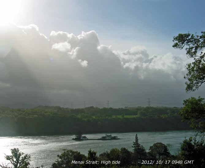 17th: At midnight low 972 mb was slow-moving off SW Ireland and pressure here was falling rapidly 996 mb reaching a low of 987 mb at 0522 GMT. A band of showery rain associated with the low was moving N and at Gorwel Heights 18 mm of rain fell between 0230 and 0545 GMT, with a gusty wind 28 mph at 0309 GMT, at a rate up to 62 mm/h at 0415 GMT. This brought the total rain for the year up to 1060.8 mm. Rainfall here was much less. A blustery morning with frequent cumulus clouds moving rapidly on the moderate to fresh S'ly breeze (max gusts 26 mph; 34 mph at Gorwell Heights) with showers of rain (bright rainbow seen across the fields near Treffos). It was the highest tide of the autumn today (10.0 m Liverpool) and once again tested the sea defences at Ynys Gored Goch
 18th: Slight showers of rain from 02 GMT and continuing through to 09 GMT. Variable amounts of cloud as cumulus clouds passed closeby and blustery with strong gusts. Pressure 991 mb was rising slowly with low 990 mb filling and tracking slowly N over Ireland. There was a shower trough stretching S from the North Channel to Wales. During the morning there were towering cumuli over the Snowdonia Mountains reducing by afternoon, but a line persisted with a base above the tops later. A fine evening. [Rain 3.7 mm; Max C; Min C; Grass 8.2C]
19th: Early light showers had cleared and the morning was mostly sunny. Mistle thrushes were around the trees making chirring noises and checking out the holly berries that are now mostly red. There are not many birds in the garden or taking food, most are sparrows and chaffinches taking increasing amounts of seed at the bird table; a female greater spotted woodpecker visited the peanuts today. Goldcrests and tits have been heard and seen in the trees and bushes. Consumption of black sunflower seeds is low and there are no tits taking food at present, there is plenty of natural food available. Pressure 1007 mb was rising slowly and we were in a clear slot between slow-moving frontal systems to the NW and SE; the pleasant autumnal day was mostly sunny with the temperature reaching 14.6C at noon. Some patchy stratocumulus cloud encroached from NW before dusk. There was drizzle and light rain from 1930 GMT, heavier at 2300 GMT [Rain 1.5 mm; Max 14.8C; Min 9.2C; Grass 6.2C]
20th: Cloudy at night, a dull and damp morning with the evening rain still wetting the ground and guttation droplets at the tips of grass leaves. Pressure 1014 mb was rising rapidly and the temperature 11.4C (dewpoint 10.7C) 95% RH. Brighter later in the morning with glimpses of sunshine and sunny in the afternoon with a clearing sky. A patch of thin cloud drifted across late afternoon, but then cleared again before sunset. Twilight was a pale greenish-blue colour, with a narrow band of pale peach on the horizon. [Rain trace dw; Max 14.6C; Min 9.8C; Grass 8.5C]
21st: A fine sunny morning with heavy dew on the grass the minimum down to 2.8C. The only clouds in the sky (2 oktas) were some cirrus and some old partial contrails overhead, and cirrostratus to the east. Visibility was very good and clear, no snow on the mountains here, but there was a sprinkling on the top of Ben Nevis. Sunny all day. Another clear evening with a pale coloured twilight. Dull (sunless) and wet in SE England. [Whitechurch 17.0C, Manston 9.4 mm, Aberporth 9.8h, Valley, 9.7h] [Rain 0.0 mm; Max 16.2C; Min 6.1C; Grass 2.8C]
22nd: Clear sky until after midnight, then patchy cloud encroached from the east. Some brightness with weak sunshine at 0900 GMT with a light ENE'ly breeze; moderate visibility with haze including some Saharan dust particles. Becoming overcast through the morning and a dull afternoon with further encroachment of a slow-moving warm front. Glimpses of sunshine before sunset with the sun under the cloudbase in the west. Slight rain and drizzle 2100 - 2200 GMT and a slight shower at 2330 GMT. Mild, overnight air temperature around 11.5C. [Langdon Bay 19.2C, Tiree 8.7h] [Rain 0.9 mm; Max 12.3C; Min 7.8C; Grass 3.8C]
23rd: Moderate fog had formed by morning, at 0700 GMT and was still thickening. By 0900 GMT fog had lifted and there was a hole in the cloud overhead the station and it was bright. Pressure 1026 mb was rising in a ridge 1031 mb over Scotland from high 1033 mb S Sweden. A slow-moving warm front was lying near the Welsh border to the Mersey. After a glimpse of sunshine the cloud closed over again and the rest of the day was dull with a light NE'ly breeze. Brighter just before sunset, but no sunshine under the cloud base as yesterday. [Porthmadog 17.6C, Stornoway 7.8h] [Rain trace; Max 13.0C; Min 9.8C; Grass 8.8C]
24th: Overcast overnight with little variation in temperature the air minimum 11.4C. Dull with moderate misty visibility 12.0C (dewpoint 11.4C) at 0900 GMT. Pressure was steady on 1022 mb the high 1033 mb Iceland while there was a low 994 mb off Iberia and 989 mb Lapland where there is snow on the ground. With a warm front over the Irish Sea it was a sunless but dry day, kept busy stacking logs near the house for expected colder weather! [Shoreham 17.5C, Mumbles Head 17.1C, Tiree 9.1h] [Rain trace dw; Max 13.6C; Min 11.4C; Grass 10.8C]
25th: At dawn the sky here had almost cleared here and it was sunny, unusually it was cloudy in Llandudno. Pressure 1018 mb had fallen as the ridge from Greenland 1044 mb was declining. Cloud was increasing by 1000 GMT with sunny spells, but became overcast by afternoon and although thickening by dusk remained dry. Cut up more dry logs for firewood! [Bude 16.6C, Tiree 6.2h] [Rain 0.0 mm; Max 12.1C; Min 9.8C; Grass 8.3C]
26th: A chilly morning with the air minimum down to 4.6C; I used mittens during obs for the first time this autumn! Pressure 1019 mb was steady and a ridge was persisting from high 1024 mb over Iceland, but increasingly cooler air was being drawn over the North Sea from Arctic regions; light snow had fallen in widely in Norway including Honningsväg in the N and and Bergen in the S, also in Kemi in Lapland at the head of the Gulf of Bothnia. Fine and sunny to start with cumulus clouds in the vicinity coming in off the Irish Sea on a NE'ly breeze. Cloudier during the morning with lessening sunny spells. A shower of snow pellets at 1300 GMT (melted rapidly) with frequent showers mainly rain and small ice pellets in the afternoon as the wind backed NNE'ly. Slight ice precipitation was seen at times on some Snowdonia summits. There was a sprinkling of ice precipitation and ice deposited (rime) on vegetation on Cairngorm in the morning and light snow in the afternoon. Wintry showers off the North Sea affected E Scotland and NE England in the afternoon. There was a light covering of snow in Newcastle during the late evening. {Scilly 10.8C, Manston 9.8 mm, Leuchars 6.5h} [Pptn 0.2 mm; Max 6.9C; Min 4.9C; Grass 2.7C]
27th: A fine and bright morning with a chilly NNE'ly breeze. A few cumulus clouds around with very good almost clear visibility; the mountains being clearly depicted. High 1031 mb was W of Ireland while low 987 mb was over the Cote d'Azur the ending the 'summer' spell of weather. Deepening low 1007 mb was over Iceland tracking E and associated warm fronts were being pushed on to NW Scotland bring rain and some snow to the Cairngorms. Pressure here was 1024 mb and was steady until about 1800 GMT. If you were out of the breeze the day was very pleasant in the sunshine. After dusk the sky clouded over pressure was falling and the expected warm fronts from the NW arrived bringing light rain soon after 2000 GMT. [Helens Bay 10.7C, Capel Curig 13.0 mm, St Athan 9.1h, Valley 6.1h] [Rain 7.3 mm; Max 9.6C; Min 3.3C; Grass 1.5C]
28th: Overcast with fairly low cloud, moderate rain and poor visibility. We were in warm sector air between slow-moving frontal systems and rain continued most of the sunless day, sometimes moderate or heavy. It was breezy during the evening with the weak cold front passing through around midnight. Rainfall 24-h to midnight here 19.0 mm and at Gorwel Heights 22.2 mm. {Bude 11.6C, Stonyhurst 34.6 mm, Capel Curig 33.0 mm, Manston 2.8h} [Rain 14.2 mm; Max 8.6C; Min 4.1C; Grass 0.1C]
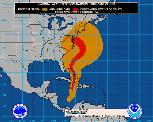 29th: Moderating breeze and partially clearing sky after midnight and calm at times. At 0700 GMT a low mist had formed on the fields, but had disappeared within 30 minutes Low 995 mb S Sweden with pressure here 1008 mb was rising slowly at 0900 GMT; 3 oktas cloud cover, the sky still clearing and visibility good. The roof slates were 'steaming' in low sunshine. Sunny spells through the morning into the afternoon. Cloudier mid-afternoon, the wind backing SSE'ly and a slight shower of rain at 1530 GMT. By 1700 GMT the wind was NNE'ly and there were a few clear spells around midnight. Hurricane Sandy that had caused over 60 deaths when tracked across the Caribbean was now on course for the E coast of the United States (graphic left courtesy of US NWS & NOAA). Although downgraded to a tropical storm it was expected to pick up again as it passed over warmer water of the Gulf Stream (27C) before turning westward and hitting the coast between New Jersey and New York. Dire warning were being issued by authorities including President Obama and the mayor Bloomberg of New York that the storm was dangerous. Low lying area of New York were being evacuated. The storm deflected by high pressure near Nova Scotia was expected to hit cold fronts coming eastward from NW USA and Canada{Pershore College 13.7C, Lake Vyrnwy 20.2 mm, Valley 5.1h} [Rain 0.5 mm; Max 12.7C; Min 4.6C; Grass 2.5C]
 30th: Overcast with recent spots of rain cloud was as low as 800 ft on the slopes of the Carneddau. Beginning to lift and thin at 0900 GMT soon brighter with some weak sunshine coming along before the cloud thickened again. Pressure 1005 mb was falling slowly with deepening low 988 mb SE Iceland; pressure was high 1033 mb Nova Scotia and 1016 mb over the Adriatic Sea. A band of rain over N Ireland and W Scotland was moving slowly our way. The afternoon was dull and there was light rain between 19 and 21 GMT. Hurricane Sandy, now called a 'superstorm' hit the E coast of the US overnight and with a storm surge of over 14 ft, more than expected. Pressure fell to 940 mb the lowest recorded in NE USA, the previous lowest was 946 mb during 1938 hurricane at Bellport, Long Island. Large parts of New York including the subway system that had already been closed down were flooded. Sub stations exploded and electricity outages left parts of the city in darkness. Substantial damage had been caused in New York and coastal area around New Jersey where houses were either washed or burnt in fires stated by electrical failures. Trees were brought down in hundreds and at least 40 people have died. Inland in the area of Appalachian Mountains as the warm air met the cold at least 3 ft of snow had fallen causing further disruption and electricity outages. [Swanage 12.7C, Tulloch Bridge 25.4, Skye 23.2 mm, Wittering 7.3h] [Rain 4.4 mm; Max C; Min 3.7C; Grass 0.2C]
31st: Slight showers of rain from 0400 GMT and at 0900 GMT the sky was mostly cloudy with towering cumuli over the Snowdonia Mountains; rain was in sight and it was blustery. A deep (964 mb) large low was N of Scotland and a narrow band of rain on fronts with upper wave was moving over St George's Channel and Irish Sea towards Anglesey. With strengthening wind (gust 32 mph; 38 mph at Gorwel Heights, 46 mph at Valley) there was moderate to heavy rain. Valley reported a gale and there were speed restrictions on the Britannia Bridge. Rain continued most of the day (12 wet hours recorded); a heavy burst at 1640 GMT contained 4 mm ice pellets and there was ice precipitation on the mountains. Wind and rain moderated in the evening and some broken cloud appeared. Wet in many parts of Britain. The death toll in NE US as a result of 'superstorm' Sandy reached 60 persons. [High Wycombe 32.0 mm, Mumbles 24.4 mm, St Catherine's Point 23.8 mm, Eskdalemuir 23.4 mm, Keswick 23.6 mm, Capel Curig 20.8 mm] [Rain 18.7 mm; Max 9.4C; Min 7.4C; Grass 6.3C]
The month ended with near average rainfall of 127.8 mm (88%) & [99%] of averages, most since 2008 (rank 37). The mean temperature 9.9C was (-1.5) & [-1.0] of averages. Sunshine at Valley was 90.1h duration, most since 2010. Sunniest day was on the 21st with 9.7h and there were 5 sunless days.
November

|
 1st: A wintry start to November. Some clear spells overnight and a cool showery airstream around the low from Arctic regions. Air temperature down to 2.2C and -0.5C on the grass and there was snow on the mountaintops of Snowdonia. The sky was clearing although a bank of clouds was over the mountains there was some weak sunshine. Pressure had been down to 974.6 mb at 0355 GMT, but was now rising slowly 975 mb. There were twin lows 9765 mb off NW Scotland (Rockall) and 971 mb of NE Scotland near Aberdeen, both slow-moving .A day of sunshine, showers and rainbows. Showers continued wintry on the mountains in the afternoon and at 3 pm visitors (there were many as it was half-term school holidays) to Beaumaris were treated to a rainbow over the Castle
 ![]() . A band of rain and a few ice pellets passed over during the evening (1830 - 1930 GMT) and with strengthening wind a 30 mph speed restriction was in force on the Britannia Bridge. The death toll as a result of' 'superstorm' Sandy hitting the NE coast of the US approached 100 people. [Rain 1.7 mm; Max 8.4C; Min 2.2C; Grass -0.5C]
. A band of rain and a few ice pellets passed over during the evening (1830 - 1930 GMT) and with strengthening wind a 30 mph speed restriction was in force on the Britannia Bridge. The death toll as a result of' 'superstorm' Sandy hitting the NE coast of the US approached 100 people. [Rain 1.7 mm; Max 8.4C; Min 2.2C; Grass -0.5C]
2nd: Bright soon after dawn and there was a line of backlit cumuli over the mountains. Turning cloudier by 0900 GMT as one or two cumulus clouds towered in the vicinity. Pressure 985 mb was rising slowly; visibility was good and a sprinkling of fresh snow was seen on the mountaintops. An occluded front lay to the NW and the day was showery with sunny spells. Breezy in the afternoon, 30 mph on the Britannia Bridge, light shower then heavier shower 1710 GMT with small ice pellets. The wind moderated during the evening, some clear spells. {Pembrey Sands 10.8C, Tyndrum 33.6 mm, St Athan 16.0 mm, Hawarden 5.6h} [Rain 3.8 mm; Max 9.4C; Min 3.5C; Grass 1.9C]
3rd: Showers continued after midnight. Heavy shower with ice precipitation recorded on the hailometer (probably snow pellets) at 0346 GMT and further slight showers 0530 & 0730 GMT. The sky clearing overhead at 09 GMT, towering cumuli seen over Snowdon and looking across Liverpool Bay towards Cumbria. Visibility very good, almost clear; fresh snow seen on the mountaintops of Snowdonia. A sunny morning; pressure 992 rising slowly 3.3C (dewpoint 2.7C). Low 975 mb was off NW Ireland and we were in a showery airflow. Becoming cloudier as convective clouds developed during the morning with further ice precipitation here and on the mountains. Large conical shaped snow pellets fell from 1400 GMT and hail 4 - 6 mm ice pellets at 1530 GMT. Pellets of 5 mm, or more, clearly impacting the hailometer, were counted and worked out as 908 m -2 . The sky clearing again with fewer clouds during the evening and night. {Solent 11.3C, Isle of Skye 25.0 mm, Lerwick 6.0h} [Rain 2.4 mm; Max 8.6C; Min 2.7C; Grass -0.5C]
4th: A few slight showers of rain between 02 & 03 GMT with the temperature around 5C, the sky almost clear at dawn and the temperature fell to 2.7C and there was a touch of ground frost. At 09 GMT 3.8C (dewpoint 2.2C) with very good visibility. Some cloud in the W was encroaching slowly and a contrail was forming and disappearing again overhead. Pressure was steady on 992 mb with low 982 mb SW Ireland and 987 mb Isle of Wight. Pressure was high 1027 mb mid-Atlantic and 1020 mb Croatia. A sunny morning then the moderately high cloud seen in the W arrived and the afternoon was mostly cloudy with some weak sunshine at times. A dry day. [Rain 0.0 mm; Max 10.0C; Min 2.7C; Grass -0.5C]
5th: Another fine and sunny morning with frozen dew on the grass some fields looking somewhat white. Pressure 1009 mb was rising with low 994 mb near the Scilly Isles. An occluded frontal cloud lay to the N. Convective clouds soon developed and were towering over the mountains. The afternoon was a mixture of sunshine and showers of rain and ice pellets (from 1545 GMT) with rainbows and heavy thunder at 1557 GMT. During the evening intermittent light rain continued until after midnight. {Porthmadog 11.1C, Milford Haven 6.4 mm, Hawarden 8.4h} [Rain 4.1 mm; Max 10.5C; Min 2.4C; Grass -0.8C]
6th: In the night the wind had been light and variable and at 09 GMT was light W'ly. Pressure was steady on 1020 mb with low 992 mb Greenland and high 1035 mb over the Atlantic off Cape Finisterre with ridge to Britain; we were in warm sector air. A uniform grey cloud sheet with moderate visibility mist and drizzle. The day was dull, damp and sunless. {St Athan 11.5C & 2.9h, Resallach 38.2 mm, Whitechurch 8.6 mm} [Rain 0.2 mm; Max 9.4C; Min 3.2C; Grass 0.2C]
7th: Starting overcast and still in the warm sector airflow pressure was steady on 1024 mb Low 991 mb was SE Iceland and pressure was high 1036 mb over the Azores. A weak cold front lay just to the NW (Malin Head to Cape Wrath) and this passed over during the morning, there was little temperature change. Brighter in the afternoon, windy; rain during the evening. {Aboyne 14.3C, Hawarden 13.2C, Cluanie Inn 31.4 mm, Manston 7.6h } [Rain 1.7 mm; Max 10.4C; Min 7.7C; Grass 5.9C]
8th: A misty morning with low cloud affecting the mountains. Signs of the sky clearing with crepuscular rays seen in the Nant Ffrancon Pass and a little blue over Red Wharf Bay. This was about the best it got in the morning as there was soon some drizzle, but the afternoon was brighter with some glimpses of sunshine, and later a brief spell of weak sunshine. {Swanage 13.9C, Cluanie Inn 20.0 mm, Boulmer 7.6h} [Rain 3.2 mm; Max 9.6C; Min 7.8C; Grass 6.2C]
9th: With persistent layers of thick cloud the temperature range the past 3-days has been small. Much of the same being overcast with poor visibility at 0900 GMT. Pressure 1005 mb was falling,low 965 mb was still SE Iceland and we had a cold front over the Irish Sea with developing wave over Morecambe Bay. It was wet and windy during the morning, the cold front passed over about 1600 GMT, again there was little in the way of a change in temperature, but significantly the wind dropped. There was a heavy shower of rain and ice pellets at 2335 GMT {Solent 12.7C, Isle of Skye 39.6 mm, Capel Curig 28.6 mm, Lerwick 4.7h, Hawarden 0.2h} [Rain 12.8 mm; Max 9.4C; Min 7.9C; Grass 6.2C]
10th: A fine bright morning with good hazy visibility. Low 974 mb was N of Scotland and pressure here was 995 mb. Cumulus cloud were in the vicinity and were bubbling up over the Snowdonia Mountains. A sunny morning, but a shower trough developing over Ireland reached here by noon. Showery rain continued through the afternoon until 1830 GMT then the sky began to clear. {Manston 12.2C, Dunstaffnage 21.0 mm, Mumbles Hd. 16.8 mm, Boulmer 5.5h,Hawarden 4.8h} [Rain 4.5 mm; Max 9.2C; Min 4.1C; Grass 0.5C]
11th: A cooler night with some clear spell so that there was a slight ground frost (-0.7C) with frozen water on the grass. It was a calm morning pressure risen to 1011 mb in ridge from Azores high 1032 mb. Lows 959 mb were SW Greenland and 986 mb Norwegian Sea. The day was fine and mostly sunny under cirrus and cumulus clouds, but with little wind it was not a good drying day. Cloud encroached during the evening and there was rain before midnight. There are more birds including nuthatches taking food in the garden, but numbers remain low except sparrows that are numerous. Despite being sunny and 10.8C no bees or butterflies were seen in the garden. {Valentia, Ireland 12.3C, Nantwich 11.9C, Loch Glascarnoch 17.6 mm, Wellesbourne 8.2h, Valley 4.8h} [Rain 1.2 mm; Max 10.8C; Min 2.2C; Grass -0.7C]
12th: Dull and overcast with ragged low stratiform cloud and moderate misty visibility. There were spots of rain on the wind. Pressure 1013 mb was falling slowly with slow-moving low 962 mb SW Iceland. A warm front was over the Irish Sea and the West and we were in warm sector air. A little brightness at times otherwise a sunless day. The cloud lifted from eastern Carneddau Mountains mid-afternoon then with thickening cloud there was drizzle and light rain from 1600 GMT into the evening. The temperature rose reaching a maximum of 12.0C here at 1354 GMT, only falling back a little to 11.5C during the evening and night. At Gorwel Heights the temperature continued to rise reaching 14.4C at 2350 GMT. [Murlough NI 14.7C, Gorwel Heights 14.6C, Capel Curig 21.4 mm, Lerwick 2.8h] [Rain 6.0 mm; Max 12.0C; Min 4.3C; Grass 1.8C]
13th: The temperature at Gorwel Heights at 0030 GMT was 14.6C, the day's maximum. Light rain until 0230 GMT. Dull and overcast again in the morning with slight rain at times. The temperature at 09 GMT was 11.2C (dewpoint 10.2C) in the warm sector air, the moderate SSW'ly wind gusting to 28 mph. Pressure here was 1019 mb with low 982 mb SW Iceland and high 1035 mb Adriatic. Slight rain and or drizzle through the sunless day. {Kew Gardens 16.4C, Tyndrum 32.6 mm, Wattisham 4.8h} [Rain 0.9 mm; Max 11.7C; Min 9.8C; Grass 9.4C]
14th: Mild the past 24-h and overnight temperatures varying little; the minimum air temperature 10.7C was highest of the month. A dull morning with the cloud thick enough for a few spots of rain (Bangor) or drizzle from time to time. Pressure 1024 mb was rising in a ridge westward from high 1038 mb over Russia, low 1007 mb was lying off Iberia. Overcast, dull and drier in the afternoon. {Wisley 15.1C, Eskdalemuir 24.2 mm, Camborne 6.4h} [Rain trace; Max 11.7C; Min 10.7C; Grass 9.5C]
15th: The sky began clearing and the temperature to fall from 06 GMT and it was a calm sunny morning to appreciate the fine autumn colours on the leaves remaining on the beech trees. Leaves on the Norway maples and have turned yellow, those that have fallen are turning the woodland floor yellow as they cover the already fallen sycamore and beech leaves. Jays were noisy along the woodland edge, a raven was croaking standing guard on the the top of the tallest pine tree and the sparrowhawk had paid a visit leaving plucked feathers of a chaffinch near the Stevenson screen. Visibility was generally very good although inversion smoke haze could be seen against the mountains along the Menai Strait where water was like a mill pond with tidal swirls around rocks and islands between the bridges the only movement to be seen. Pressure was steady on 1023 mb; low 970 mb was over Iceland and Atlantic-low 998 mb off Iberia. Fog had developed in the Midlands and S Britain and France. Here a mostly sunny day with the temperature rising to 13.3C just after noon, one of the highest, and to 12.3C at Gorwel Heights in Llanfairfechan. {Murlough NE corner of NI 14.8C, Dublin 12.9C, Trawsgoed 12.7C, Rhyl 12.6C, Aberporth 6.6h} [Rain 0.0 mm; Max 13.3C; Min 6.7C; Grass 3.2 C]
The first 15-days had been fairly dry for November having had just 42.5 mm of rain (32%) & 34%] of averages. The mean temperature 7.7C was on the 30-y average, but (-0.7) of the decadal average.

|
16th: Another calm night and morning, mostly cloudy and dull at first, but brighter sky over the mountains to the S moved over during the morning with a few holes developing allowing a little sunshine especially in Caernarfon earlier, later Gaerwen and here by the afternoon. Pressure 1014 mb was falling slowly; we were between frontal systems, to the NW was a cold front with an upper wave over Scotland while there was a warm front over S England. A slight shower around 1815 GMT then rain from 2100 GMT, moderate to heavy at first becoming lighter and intermittent by 2300 GMT. {Swanage 12.6C, Gorwel Heights 10.7C, Milford Haven 10.1C, Cluanie Inn 15.4 mm, Boulmer 3.9h, Hawarden 2.0h} [Rain 12.1 mm; Max 10.2C; Min 4.8C; Grass 1.1C]
17th: Light rain petering out by 06 GMT then a quickly clearing sky since 0730 GMT. At 0900 GMT there were a few towering cumuli to the NE and far W, otherwise mainly cirrus overhead. Soon a line of cumuli developed over the mountains and persisted all day. A sunny morning here turning cloudier by afternoon with a heavy shower of rain and ice pellets at 1515 GMT (14.2 mm/h) then a clearing sky with few clouds in the evening. {Frittenden 14.6C, Sennybridge 11.8 mm, Kinloss 6.1h, Aberporth 4.4h} [Rain 1.7 mm; Max 9.2C; Min 4.4C; Grass 1.6C]
18th: With clear sky and little wind overnight there was ground frost in the morning (-2.2C with water deposits on grass frozen) although the air minimum did not go below 1.3C. There had been frost in places with -4.1C in Katesbridge and -3.2C at Usk. A sunny morning with just cirrus and contrails overhead. Pressure 1013 mb was still rising slowly in a transient ridge from Azores high 1024 mb. Low 984 mb was tracking eastward across the Norwegian Sea , but the one to watch was deepening low 988 mb off SW Ireland tracking north. The afternoon was cloudier and the wind was strengthening. By evening the gusty SSW'ly was moderate to fresh with gusts of 31 mph here and 48 mph at Gorwel Heights at 2340 GMT. {Milford Haven 10.5C, Cork, Ireland 27.9 mm 00-00z, Hawarden 5.7h} [Rain 0.8 mm; Max 10.1C; Min 1.3C; Grass -2.2C]
19th: Windy, roaring in the trees all night, windows were being rattled by beech nuts and there are plenty this year. In the morning many broken twigs and piles of beech nuts on the ground, not many leaves left on the trees now, things in the garden were blown about. The wind had reached gale force in exposed locations; at Gorwel Heights wind speed had been a sustained force 6/7 through the night with a gust of 53 mph was recorded at 0706 GMT. Speed restrictions were in force on the Britannia Bridge. With the low 978 mb at 09 GMT pressure here 999 mb was falling and reached its lowest 997 mb at 1310 GMT. In warm S'ly air temperatures had risen to 10.2C; a little brightness with glimpses of weak sunshine at first before much of the same; wet and windy. Highest gust here 37 mph (1334 GMT), Valley 54 mph, Mona 48 mph and Capel Curig 65 mph. Highest temperatures during the day were 11.5C here and 13.8C at Gorwel Heights, but reached 12.9C and 14.9C by 09 GMT on the 20th. The wind began to moderate in the afternoon that had slight rain or drizzle at times. In rain shadow here; very wet in Scotland with flooding in places, Glasgow 55.2 mm {Killowen 14.4C, Gorwel Heights 13.8C [14.9C], Rhyl 13.0C, Glasgow 55.2 mm, Kinloss 2.7h} [Rain 3.3 mm; Max 12.9C; Min 3.5C; Grass 1.5C]
20th: The wind continued to moderate, but we were still in the S'ly airstream and air temperatures overnight kept above 10C. Low 978 mb,associated with large low 976 mb SE Greenland, was slow-moving off the Western Isles. A frontal system, with triple point lay over the Irish Sea. A dull and damp morning, overcast with drizzle, slight rain and poor visibility. Breezy, the force 3/4 S'ly strengthened a little during the morning that with the rain dying out brightened with the odd glimpse of sunshine in the lee of the Snowdonia Mountains. Gathered a large black-bucket-full of beech nuts and seeds at the front door. The maximum temperature here was 13.4C, highest of the month, and at Gorwel Heights reached 15.3C at 0922 GMT in the Föhn-like wind off the mountains, one of the highest in Britain today. Dull, but dry in the afternoon and evening. {Nantwich 15.4C, Gorwel Heights 15.3C, Shawbury 15.2C, Rhyl & Hawarden 15.1C, Tyndrum 20.6 mm, Tiree 3.7h} [Rain mm; Max 13.4C; Min 10.1C; Grass 8.9C]
21st: Overcast and dull at first, but brightening soon after 09 GMT as a clear slot to the W moved across the island. Calm at the moment, some inversion smoke hanging over the eastern Menai Strait and calm water between the bridges except for swirls around the Swellies rocks. Some clear sunshine here and the temperature rose to 10.6C. Pressure was 1007 mb rising slowly in a transient ridge. Lows 974 and 976 mb were S of Iceland while a frontal wave low developing over S England was tracking towards the North Sea. But, another Atlantic-low W of Ireland was deepening 975 mb and gale and severe weather warnings had been issued. With the wind strengthening in the afternoon a barrow load of twigs and small branches were gathered from the lawn. Some clear sky in the late afternoon and evening as it was becoming breezy. {Swanage 13.2C, Usk2 27.0 mm, Aldergrove 6.5h} [Rain 2.7 mm; Max 12.1C; Min 6.6C; Grass 5.3C]
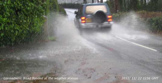
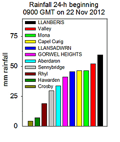 22nd: Windy. The SW'ly had backed S'ly after midnight with showers. A hard hat morning for the obs! A squall arrived at 0900 GMT so the observer did not linger; bird feeders did not get topped up until later. Gales around the coast (Aberdaron and Valley) and mountains (Capel Curig gusting 85 mph and on Snowdon summit over 100 mph); frequent gusty winds recorded by PWS's locally 61 mph in nearby Llandegfan, 53 mph at Gorwel Heights and 49 mph in Bodorgan. A 30 mph speed restriction was in force on the Britannia Bridge. Heavy rain with ice pellets here at 1125 GMT (up to 95 mm/h), with wind gusting to 36 mph, caused immediate flooding through the garden
 ![]() and road outside the weather station. The B5102 between Beaumaris and Pentraeth, that passes through Llansadwrn, was closed due to flooding. Thunder was heard at 1257 GMT and again at 1315 GMT. At 1300 GMT rainfall was 28 mm, this falling on water saturated ground resulted in flash runoff. There was flooding in several villages in Gwynedd including Rhosgadfan, Rhostryfan and Llanberis where over 100 properties were damaged when the Afon Goch above the village broke its banks sending a sudden cascade of water,several feet deep, and mud through the village. Llanfairfechan, described as 'a no-go area' and parts of Anglesey were also affected. At 1500 GMT rainfall here had reached over 40 mm then turning lighter, but not stopping. Rainfall totals were highest in the west; Llanberis had [59.4 mm] over 24-h, most, over 40 mm, fell between the hours 1100 and 1400 GMT (data courtesy of FirstHydro), and Valley 52.0 mm (Met Office). Nantlle Valley, on the upslope, reported over 79 mm 24-h 00-00z (courtesy Plas Gwernoer AWS). The 45.5 mm total rain here in the 24 h 09 - 09 GMT was the highest of the month and year. It was largest since 25th October 2008 when 52.8 mm fell. Anglesey roads were awash, the ditches drains under walls were kept clear in the past by 50 Council workers. The A55 was closed due to flooding yet again (a proper job should be done about this long-standing problem on what is after all the main route from Holyhead to Europe), the Conwy Tunnel was also affected in both directions. In Talybont 25 properties were reported to have been flooded in a surge of water. The railway line between Bangor and Holyhead was closed because of flooding on Anglesey that was extensive with many roads impassable. Hundreds were caught in the floods unable to make their way home in the evening by road or train. The RNLI and RAF helicopter was involved in the rescue operations. A school bus from Llanfairfechan trapped on the A55 was unable to collect children at Friars School in Bangor stranding them in Bangor as trains were also not running, several were housed overnight by local residents. The school was closed on the 23rd, along with schools in Caernarfon and Llandudno, being used as an emergency centres. Ambulances to and from Ysbyty Gwynedd along the A55 were also affected as were hospital staff getting to and from work. The rain eased off and did stop in the evening, but there were more heavy showers from 2200 GMT with ice pellets falling at 2220 GMT. Single lanes of the very muddy A55 were opened about 9 pm allowing drivers who had been trapped, some for up to 8 hours, to escape the flood and resume their journeys. {Gravesend 14.4C, Shap 44.4 mm, Capel Curig 43.2 mm, Herstmonceux 4.1h} [Rain 45.5 mm; Max 11.8C; Min 6.9C; Grass 5.5C]
and road outside the weather station. The B5102 between Beaumaris and Pentraeth, that passes through Llansadwrn, was closed due to flooding. Thunder was heard at 1257 GMT and again at 1315 GMT. At 1300 GMT rainfall was 28 mm, this falling on water saturated ground resulted in flash runoff. There was flooding in several villages in Gwynedd including Rhosgadfan, Rhostryfan and Llanberis where over 100 properties were damaged when the Afon Goch above the village broke its banks sending a sudden cascade of water,several feet deep, and mud through the village. Llanfairfechan, described as 'a no-go area' and parts of Anglesey were also affected. At 1500 GMT rainfall here had reached over 40 mm then turning lighter, but not stopping. Rainfall totals were highest in the west; Llanberis had [59.4 mm] over 24-h, most, over 40 mm, fell between the hours 1100 and 1400 GMT (data courtesy of FirstHydro), and Valley 52.0 mm (Met Office). Nantlle Valley, on the upslope, reported over 79 mm 24-h 00-00z (courtesy Plas Gwernoer AWS). The 45.5 mm total rain here in the 24 h 09 - 09 GMT was the highest of the month and year. It was largest since 25th October 2008 when 52.8 mm fell. Anglesey roads were awash, the ditches drains under walls were kept clear in the past by 50 Council workers. The A55 was closed due to flooding yet again (a proper job should be done about this long-standing problem on what is after all the main route from Holyhead to Europe), the Conwy Tunnel was also affected in both directions. In Talybont 25 properties were reported to have been flooded in a surge of water. The railway line between Bangor and Holyhead was closed because of flooding on Anglesey that was extensive with many roads impassable. Hundreds were caught in the floods unable to make their way home in the evening by road or train. The RNLI and RAF helicopter was involved in the rescue operations. A school bus from Llanfairfechan trapped on the A55 was unable to collect children at Friars School in Bangor stranding them in Bangor as trains were also not running, several were housed overnight by local residents. The school was closed on the 23rd, along with schools in Caernarfon and Llandudno, being used as an emergency centres. Ambulances to and from Ysbyty Gwynedd along the A55 were also affected as were hospital staff getting to and from work. The rain eased off and did stop in the evening, but there were more heavy showers from 2200 GMT with ice pellets falling at 2220 GMT. Single lanes of the very muddy A55 were opened about 9 pm allowing drivers who had been trapped, some for up to 8 hours, to escape the flood and resume their journeys. {Gravesend 14.4C, Shap 44.4 mm, Capel Curig 43.2 mm, Herstmonceux 4.1h} [Rain 45.5 mm; Max 11.8C; Min 6.9C; Grass 5.5C]
23rd: No more precipitation after midnight. A fine morning, the water in the garden had drained away. After inspections the A55 was still partially covered with a thick layer of mud washed down from the mountainside requiring clearing and hosing off to make the road safe for traffic, the railway line between Llanfairpwll and Bodorgan was also still affected by flood water. A sprinkling of snow was seen on Snowdonia mountaintops as low as 2800 ft in places on the Carneddau. Some sunny spell interspersed in the morning with frequent showers of rain and 2 mm diameter spherical pellets, but volumes were small. Wintry showers also swept across the mountaintops, but there was little more accumulation on the ground. A quiet night, with mostly clear skies and ground frost. [Rain 0.6 mm; Max 9.0C; Min 5.3C; Grass 0.8C]
24th: Just before dawn cloud encroached, but there were frozen deposits of water vegetation near the ground the grass minimum having fallen to -1.6C. No air frost here, but in low-lying places frost occurred including Mona -1.1C and Pentraeth -0.9C; and in Capel Curig -1.8C. Pressure was steady on 1014 mb, low 979 mb Iceland was filling,but low 993 mb over the Bay of Biscay heading towards the English Channel was deepening. A sunless day with light NE'ly breezes and kept dry until 1600 GMT with drizzle and slight rain that turned heavier from 2100 GMT and continued after midnight. Rain was heavy in Llanfairfechan, at Gorwel Heights 20.6 mm fell in the 24-h 00-00z compared with the 4.8 mm here. It was a very wet day in SW England with extensive flooding reported. [St Catherine's Point max 12.3C, Aboyne min -5.7C, Plymouth 56.6 mm, Scilly Isles 55.4 mm, Cardinham 49.0 mm, Capel Curig 20.4 mm, Rhyl 20.0 mm, Kinloss 4.4h] [ Rain 9.9 mm; Max 7.2C; Min 1.8C; Grass -1.6C]
 25th: The sky was cloudy most of the night (grass minimum 0.0C), but was clearing from dawn to give a fine sunny start to the day. At 09 GMT 4 oktas of cumulus clouds, some backlit looking towards the mountains; good or very good visibility. The soil underfoot was very soggy and muddy. Pressure 1003 mb was rising slowly between twin lows 994 mb off SW Ireland and 984 mb over the North Sea both continuing to track north-east. Cloud associated with a warm front (a triple point was over S Ireland) was encroaching over the Irish Sea (see MSG image left). Anglesey was in a small clear-free zone between the zones, but the western low encroached during the afternoon and there was rain from 1600 GMT that soon turning moderate to heavy. By 2130 GMT there was again runoff water flowing across the garden, but the rain eased as the band of heavy rain, in circulation around the low, took up position off South Stack so falling mostly on the sea. [Mona 30.0 mm, Capel Curig 28.6 mm, Valley 27.8 mm] [Rain 25.2 mm; Max 9.0C; Min 2.1C; Grass 0.0C]
26th: Rain reduced to heavy drizzle stopped about 0600 GMT and the sky cleared quickly and fog formed. At 0700 GMT cloud returned and the fog reduced to poor visibility in intermittent slight rain at 0900 GMT. Pressure had been lowest 996 mb at 0200 GMT, with the low 997 mb over the Isle of Wight pressure here was rising rapidly 1000 mb. The area of heavy rain was still off South Stack with another area affecting the North Wales coast from Conwy eastwards later. Northerly winds were moderate to strong during the day with local station reporting gusts in excess of 30 mph. In Bangor a large sign at a retail park was blown away injuring a woman and damaging 5 cars. With soils remaining saturated with water relatively small amounts of rain result in immediate runoff. Many roads in Conwy, Gwynedd and Anglesey were only 'just passable' due to the amount of surface water. Roads at Llanberis A4086 and on the A5 Llangollen and Corwen were 'difficult'. Trains were not running between Holyhead and Bangor. Wind moderate to strong continued into the night with intermittent rain heavy in places and later falling as snow in blizzard-like conditions above 2500 ft on the Snowdonia Mountains. [Capel Curig 50.4 mm, Rhyl 24.4 mm, Mona 20.4 mm] [Rain 18.5 mm; Max 6.8C; Min 4.6C; Grass 2.5C]
27th: North Wales was more or less cut off this morning due to flooding with all normal routes either closed, or difficult just passable. The A55 was closed near St Asaph, where the river Elwy had overflowed and 500 residents advised to leave their properties. Flooding occurred rapidly on the Glasdir Estate in Ruthin where newly built houses were inundated with several feet of water despite flood defences. Many properties were soon flooded with several feet of water. Flooding occurred in the Conwy Valley, Tal y Cafn and Bodnant area where the National Trust gardens were damaged, and Llanwrst area where some properties were flooded. Rail services were suspended. The A5 was closed at Waterloo Bridge and at Corwen and the A4086 at Llanberis remained just passable. Railways are still affected the result of flooding at Gaerwen, Anglesey and, yes, it was still raining or snowing on the mountains as low as 2000 ft, but precipitation stopped here just before 0900 GMT continuing on the mountains [Capel Curig 5.4 mm]. With the low 1000 mb filling over the Dover Strait pressure here 1011 mb was rising rapidly. High 1033 mb was N of the Azores W of Cape Finisterre and between we were still in the cool N'ly air flow from Arctic regions. A few sunny spells in the breezy dry day the temperature rising to 8.0C; the breeze was moderating by evening and over night. [Scilly Is. 9.8C, Fylingdales 14.6 mm, Capel Curig 5.4 mm, Aldergrove 6.6h] [Rain 0.0 mm; Max 8.0C; Min 5.2C; Grass 4.4C]

|
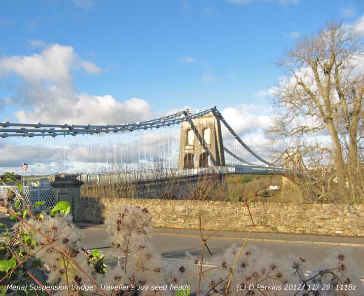
Most noticeable this month have been the seed heads of Clematis particularly on the road along the Menai Strait from Menai Bridge to Beaumaris in the old woodland, less so in hedgerows that are trimmed back. At the Antelope Inn the seed heads gave a fine foreground for a picture of Telford's 1826 Suspension Bridge, but were trimmed back within the week. .The seed heads can also be seen in many gardens at this time of year, here in our garden in Llansadwrn is the yellow lantern-shaped flowered Clematis tangutica |
30th: Light showery rain overnight, just cold enough to sprinkle a little more snow on the mountaintops. The sky was starting to clear slowly and there were some sunny spells by 1100 GMT. The declining ridge of high-pressure from Azores high 1024 mb was far west of Ireland, there was a frontal-wave low development over Shannon tracking SSE with occluded front over the Irish Sea. Pressure here was steady on 1012 mb and the temperature 3.4C (dewpoint 3.0C). Brief sunny spells in the afternoon, some dark shower clouds in the vicinity especially to the north-east and mountains where wintry, we caught a shower of rain at 1515 GMT with complete rainbow arc seen across the fields. Cold at first in the evening with ground frost (-1.3C). {Scilly Is. 10.2C, Shap -7.0C, Tredegar -3.6C, Aultbea 13.4 mm, Rhyl 1.0 mm, Lyneham 7.5h, Aberporth 1.8h} [Rain 0.9 mm; Max 7.1C; Min 0.8C; Grass -2.0C]
The month ended with above average rainfall the 166.8 mm (126%) & [132%] of averages most since 2009 ranking 20 since 1928. Temperatures finished below average the mean 7.3C (-1.1) & (-0.4] lowest since 2010. Valley sunshine close to averages was lowest since 2009 (103%) & [109%].
December
1st: An almost calm morning with smoke drift from the north-west. A recent shower of rain and small soft hail had passed; a narrow line of showers was moving in off the Irish Sea and further precipitation was in sight. A ridge of high-pressure lay to the W and the barometer was steady on 1016 mb. Low 1006 mb was over the North Sea and an occluded front was moving S from N Wales and N England. Soon the sky started to clear with brief sunny spells coming along. There was a light shower of rain in the afternoon with a little fresh snow seen falling on the mountains. [Jersey 10.4C, Shap -6.0C, Bridlington 9.6 mm, Glasgow 6.8h] [Rain 1.3 mm; Max 7.2C; Min 1.8C; Grass -1.3C]
2nd: A fine bright morning with the sky clearing, after a shower of rain and soft small hail at 0300 GMT, and little of no wind again this morning. There had been a ground frost (-1.0C) and the 09 GMT temperature was 1.6C (dewpoint 1.0C) the air minimum. Pressure was steady on 1017 mb in ridge to the Irish Sea with high-pressure 1032 mb Azores and Spain 1027 mb. Lows 979 mb S Greenland and 1004 mb N Sea. A sunny morning before cloud encroached by afternoon bringing drizzle and light rain. Rain during the evening and night the temperature rising from 4C. [Scilly 11.7C, Loch Glascarnoch -8.2C, Islay 14.6 mm, Manston 6.9h] [Rain 9.1 mm; Max 9.7C; Min 1.6C; Grass -1.0C]
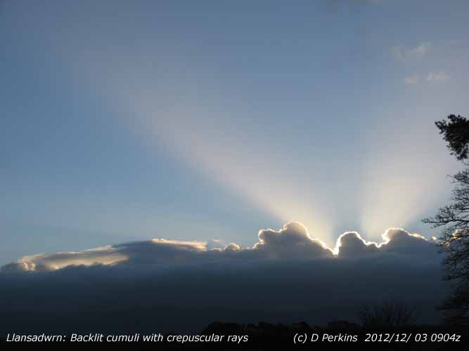 3rd: The temperature continuing to rise after midnight to 9.7C at 0138 GMT. At Gorwel Heights the highest was 10.3C at midnight having risen from 4.3C at 2030 GMT. A clear sky apart from a line of backlit cumuli over the mountains with spectacular light-displays of upward crepuscular rays, sometimes one, two or three wide rays. The temperature had fallen to 5.4C at 0900 GMT, but the 24-h minimum was 1.6C the temperature at 0900 GMT yesterday. Sunny when the sun had risen above the clouds over the mountains. Low 992 mb S Iceland had a trough to Scotland, but pressure here 1007 mb was rising slowly. Showers developed in the afternoon, there was a moderate shower of 2 - 3 mm ice pellets at 1650 GMT and again around 1900 GMT. [Isle of Portland 11.3C, Braemar -6.7C, Loch Glascarnoch 17.6 mm, Capel Curig 12.6 mm, Aldergrove 5.6h, Valley 4.6h] [Rain 1.6 mm; Max 8.2C; Min 1.6C; Grass -0.1C]
4th: A fine morning with clouds decreasing. The hailometer was well covered with fine marks typical of 'light' snow pellets that fell around 0330 GMT. There was no frost overnight and the morning sunny with moderate hazy visibility. Pressure was steady on 1005 mb with low 998 mb over the Western Isles of Scotland associated with low 988 mb over the Baltic. The sky turned cloudier before noon and there was showery rain in the afternoon, mostly light. The barometer reached a low of 1002 mb about 1800 GMT. Showery rain during the evening with the W'ly wind veering N'ly and freshening. [Swanage 9.1C, Capel Curig 14.2 mm, Wellesbourne 6.7h, Hawarden 5.6h] [Rain 9.6 mm; Max 7.7C; Min 3.7C; Grass 0.0C]

|
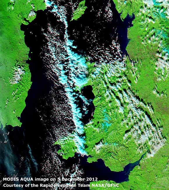 5th: A fine morning with fresh snowfall seen on the mountains as low as 1200 ft in places and piles of snow pellets in roof gutters and some on the ground here from a shower around 04 GMT. Sunny with little or no wind at first then becoming breezy by midmorning. There was again a persistent convergent cloud line to the west, with precipitation in places shown on rainfall radar, stretching from the North Channel past South Stack over Cardigan Bay, Bristol Channel to the Scilly Isles and beyond
6th: Cold overnight with an air frost of -1.1C around midnight before cloud encroached, the first of the winter here, and a ground frost minimum on the grass -4.8C. The last air frost was on 6 April (-0.1) so there were 242 frost-free days in between on the this SE corner of Anglesey. The minimum at Gorwel heights was 0.7C, so still no frost. Overcast with snow showers across the mountaintops at 0900 GMT and a shower of snow pellets here at 0920 GMT. Pressure 1013 mb was falling with low 989 mb between Iceland and Scotland and frontal systems lying to the north-west. Strong to gale-force winds resulted in a 30 mph speed restriction on the Britannia Bridge. Frequent showers of rain and/ or soft hail (mixtures of wet snow pellets) through the day, some heavy 20 mm/h at 1940 GMT, only stopping just before 2200 GMT (14 wet hours 09-09z). One westward lane of the A55 was closed between Abergwyngregin and Talybont during the evening because of flooding. [Scilly 9.7C, Braemar -12.9C, Sennybridge -6.2C, Capel Curig 47.2 mm, Manston 2.5h] [Rain 19.0 mm; Max 6.3C; Min -1.1C; Grass -4.8C]
7th: Temperatures under cloud kept above zero during the night that had showers of rain at 0100 and 0415 GMT. Spots of rain at 0900 GMT with more precipitation in sight , visibility was moderate to good,and with snow falling on the mountaintops there was a good cover from Foel-fras in the east to Snowdon in the west. Pressure 1006 mb was rising quickly with low 992 mb moving over the N sea off East Anglia while high 1026 mb was W of Ireland. A mostly cloudy day,there was a brief sunny spell and it was a good drying dry. Broken cloud with clear spells overnight. [Bude 9.5C, Kinbrace -6.8C, Fylingdales 20.4 mm, Nottingham 6.0h] [Rain 0.2 mm; Max 7.7C; Min 2.8C; Grass 0.1C]
8th: A fine and sunny morning with frozen water deposits on the grass (grass min -2.0) after the cloud cleared. At 0900 GMT a line of backlit cumuli over the mountains delayed sunrise until 0910 GMT. Low 994 mb E Iceland was tracking SSE and an associated warm front lay not far to the north-west. Sunny at first before moderately high cloud encroached by afternoon bringing drizzle and on thickening later light rain. {Mumbles Hd. 9.1C, Trawsgoed -3.2C, St Athan 6.5h} [Rain 2.1 mm; Max 7.9C; Min 2.2C; Grass -2.0C]
9th: Overcast with low clouds at 800 ft and mist on the lower slopes of the Snowdonia Mountains. Dull and damp after recent slight rain and there was more of the same at times during the morning. There was a weak cold front just to the N over the Irish Sea stretching across N England. The cloud moved S and the afternoon brightened up and sunny spells developed with a few clouds left by the evening. {Pershore 10.2C, Mumbles Hd. 9.7C, Shoreham -1.5C, Cleaning Inn 22.2 mm, Leeming 6.0h}[Rain 1.1 mm; Max 8.2C; Min 2.2C; Grass -1.0C]
10th: Variable amounts of cloud overnight that after dawn were clearing to give a mostly clear sky by 0900 GMT. No frost this morning, a light NNE'ly breeze and very good visibility. Pressure 1026 mb was rising slowly with high 1033 mb over N Scotland, with ridge to the Celtic Sea,. and low 1001 mb Germany. A fine sunny day with clear views of the snow topped mountains. The Carneddau and Snowdon was well covered and there were sprinkles on Cadair Idris further south. A clear end to the day and with temperatures falling frost developing. [Scilly Is. 9.9C, Katesbridge -5.2C, Yeovilton 7.1h, Aberporth 6.8h, Valley 5.9h] [Trace of frost; Max 6.8C; Min 3.1C; Grass 0.9C]

|
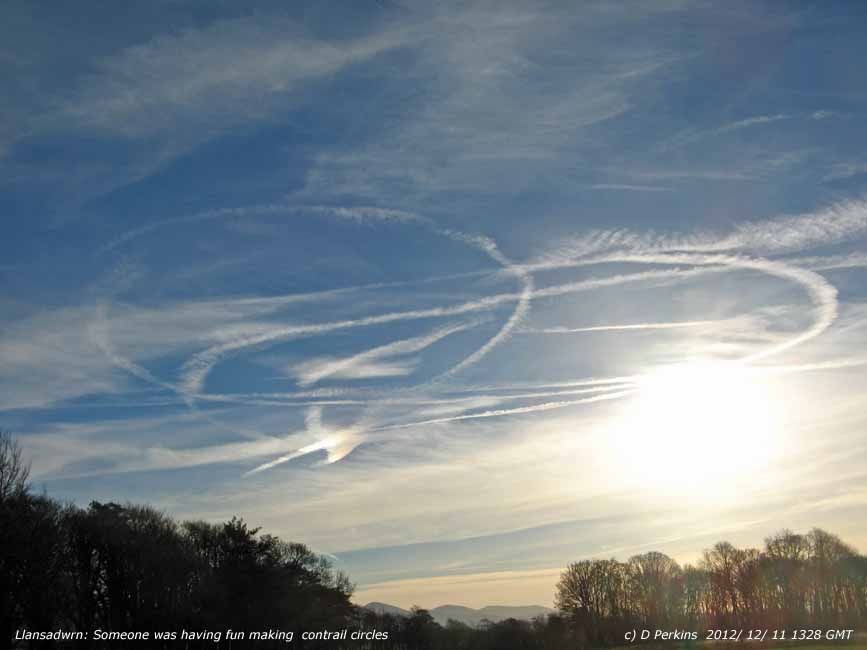 11th: A cold calm morning with cirrus and contrails in the sky and very good visibility. On the grass the temperature had fallen to -5.1C, there was heavy frost on windscreens this morning, and in the air -0.6C. In Pentraeth the air minimum shown by the AWS was -4.5C. Sunny, -0.1C at the 0900 GMT observations, but soon rising once the sun reached the instruments and reaching 5.8C around noon . Frost remaining on the ground all day in shady places. Frost and fog lingered all day in parts of central England. Contrails increased in the afternoon, someone was having fun making circular patterns in the sky. A fine end to the afternoon and again turning cold. {Scilly Is. 8.3C, Tulloch Bridge -10.6C, Aberporth 6.9h, Valley 5.4h} [Trace of frost; Max 5.8C; Min -0.6C; Grass -5.1C]
 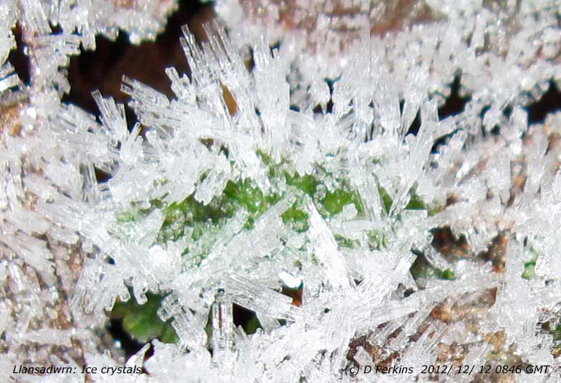 12th day 12th month 12th year: Well we won't be seeing that again this century. Some cloud around at 0900 GMT after a frosty night (12.3 h frost duration 24-h to 09z today. Pressure 1020 mb was falling and continued to fall through the day as the ridge, now from S Europe high 1028 mb declined. It has been cold in Europe, parts Germany have seen a metre of snow and sub zero daytime temperatures and -12C at night. Snow continues to fall in Scandinavia, there is a metre of snow in Norway. Low 979, very large covering the N Atlantic, will bring a marked change to our weather. But today, another sunny day with an intermittent light S'ly breeze in the afternoon. A patch of cloud encroached later in the afternoon this associated with a front over Ireland, but cleared soon after dark so that once again temperatures were falling {Scilly 8.4C, Braemar -11.3C, Manston 5.1h} [Rain 0.0 mm; Max 5.9C; Min -1.5C; Grass -5.6C]
 13th: Clear skies overnight and a cold frost morning the air minimum -2.2C and -6.0C on the grass (7.5h frost duration). There was little white frost this morning, but the ground was hard. Visibility was good, there was a little smoke haze at the eastern end of the Menai Strait, and there was a very light E'ly breeze. The temperature continued to fall for a while reaching -2.4C and -6.1C on the grass, lowest minimum of the month (by convention credited to the 24-h ending 0900 GMT on the 14th). A mostly sunny day, the temperature rising to just 4.8C (lowest in daytime of the month), and a clear evening with air temperature falling to -2.4C at 2023 GMT. There after cloud encroached and temperatures rose as somewhat warmer Atlantic-air began to be drawn in around the low overnight. {Scilly 10.4C, Braemar -12.5C, Aberporth 7.0h} [Rain 0.4 mm; Max 5.1C; Min -2.2C; Grass -6.0C]
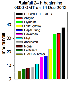 14th: The temperature continued to rise reaching 5.1C at 0735 GMT the maximum 24-h ending 0900 GMT today. Slight rain had begun in the past hour and in places, including Powys and the A5 between Corwen and Llangollen, had fallen as freezing rain making roads treacherous and a number of accidents were reported. Slight rain continued here in Llansadwrn through the morning and the electricity failed at noon (a large part of SE Anglesey was affected), but came back on at 1405 GMT, but internet communications were intermittent through the afternoon. A very dull and sunless day. At Gorwel Heights in Llanfairfechan in strong to gale SE wind there was very heavy local rainfall during the morning with 43.0 mm recorded in the 24-h ending at midnight. At the morning high tide (9.9 m 0942 GMT Liverpool) in Beaumaris, where a tidal flood warning had been issued, waves broke over the sea wall whipped up by the SE wind, along the A545 to Menai Bridge and there was flooding at West End and Gallows Point, and the B5109 between Beaumaris and Llanfaes. The Green was flooded with water and the tide rose up to the level of the Pier decking. Two wagon loads of sand bags were deployed in the town. The new floating pontoon at the end of the Pier was damaged by the wind and waves. With rainfall in the area of 40 mm,and minimal tidal surge, things could have been worse as the major flooding incident on 22 October 2004 there were 86 mm rainfall in SE Anglesey and a surge tide of 0.5 m at Holyhead. As it was there was a torrent running down Red Hill in to the town and tested the upgraded drainage system around the Castle. Police had advised residents to be prepared to leave their houses on the front, but there was no need in the event the water receding when within inches of disaster. Trains on the mainline between Bangor and Llandudno were suspended due to flooding of the track. At midnight on a smaller tide (9.7m Liverpool) there was a tidal surge of 0.5 m measured at Llandudno (data courtesy of the Proudman Oceanographic Laboratory). [Exeter AP 11.7C, Bainbridge -7.5C, Capel Curig -5.9C, Gorwel Heights, Llanfairfechan 38.0 mm, Aboyne 33.8 mm, Capel Curig 17.2 mm, Camborne 0.4h] [Rain 6.0 mm; Max 8.1C; Min -2.4C; Grass -6.1C]
 15th: A brighter morning with the sky starting to clear in alight to moderate SW'ly breeze. Atlantic-low 968 mb was to the NW, a triple centre system stretching to N Scotland. In the North Sea 120 m off Aberdeen a crewman died and 11 others were taken off supply vessel the 43 m Vos Sailor when hit by a large wave in very rough seas. The gale-force winds and high and surge tides also caused severe damage in northern and eastern coastal areas of Scotland. Here visibility was just moderate with low cloud and mist on the lower slopes of the mountains; soon lifting cumulus clouds developed over the mountains some towering. A fine days with spells of sunshine and not very windy. {St James Park 12.1C, Aberdeen 23.2 mm, Waddington 4.8h} [Rain 0.1 mm; Max 9.4C; Min 4.3C; Grass 3.1C]
The first 15-days had 50.5 mm of rain [(42%)] of the monthly average total. The mean temperature 4.3C was [(-1.1)] of averages.
16th: Mostly cloudy overnight, rain in sight at 0900 GMT and soon a shower of rain. Complex low 979 mb was to the NW of Malin Head with an occluded front near the W Irish coastline. Showery day and heavier showers in the evening as a shower trough moved across W Wales. At 1800 GMT the low was 984 mb off Malin Head. There was a heavy shower of ice pellets at 2340 GMT (fell at a rates up to 37 mm/h here and 35 mm/h at Gorwel Heights). {Plymouth 11.9C, Rhyl 10.7C, Gorwel Heights 9.5C, Capel Curig 22.0 mm, Wattisham 5.8h, Hawarden 4.6h} [Rain 7.6 mm; Max 8.7C; Min 6.0C; Grass 3.4C]17th: The sky was mostly cloud covered overnight and there had been variable breaks seen since dawn. At 0900 GMT some blue patches, but soon disappearing again. The 7.6 mm of precipitation were enough to make the still- saturated ground surface wet and muddy with water pressing out underfoot. Pressure was 997 mb with low 991 mb slow-moving over the North Channel. We were in a confined showery airflow within the circulation of the low, there were bands of convective shower clouds over the Irish Sea . Showers were frequent in the morning that was breezy. A bright spell around 1400 GMT then back to more showers from 1600 GMT in a more vigorous band, similar to a small cold front, that turned heavy at times with ice pellets. Heaviest were 60 mm/h at Gorwel Heights at 1657 GMT and here 23 mm /h at 1714 GMT. Wind speed moderated quickly and air temperature fell to a minimum of 3.9C. There were no more showers, after a small clearance the sky was mostly cloudy into the night. {Scilly Is. 10.9C, Altnaharra -4.5C, Rochdale 24.8 mm, Capel Curig 17.0 mm, Brize Norton 6.1h} [Rain 14.0 mm; Max 7.7C; Min 6.2C; Grass 3.7C]
18th: Cloud began to break up at dawn and by 0900 GMT there were 5 oktas of altocumulus clouds and very good visibility. Anemometers were not turning, but there was a drift of chimney smoke from the north-west. We were in a ridge of high-pressure from Iberia (1025 mb) and it was a fine mostly sunny day in SE Anglesey, cloudier in the west. Fronts associated with large Atlantic-low 972 SE Greenland were moving into the SW. Cloudy with rain in SW England and S Ireland. {Trawsgoed 11.3C, Okehampton 11.4 mm, Lyneham 5.9h, Bala 5.3h, Valley 1.7h} [Rain 0.0 mm; Max 9.3C; Min 2.4C; Grass 0.3C]

|
20th: Moderate rain, 16.5 mm measured at 0900 GMT, with soil saturated there was some standing water around the weather station. Pressure 996 mb was falling slowly with low 985 mb tracking NE over Cardigan Bay and Bristol Channel in a trough from low 963 mb SE Greenland. Pressure was high S Norway 1034 mb and eastward where, in Russia it was intensely cold with a minimum -34C recorded in Jarensk, and Iberia 1029 mb. Continuous light rain through the day. A bridge in Deiniolen collapsed leaving a huge hole in the roadway over the river. Another dull sunless day, unusually the second day in Britain and Ireland without any sunshine reported at official stations. There was low cloud fog in the afternoon. The wind E'ly light at first veered SW'ly around 1500 GMT and the rain eased with 1 or 2 slight showers in the evening.. {Hurn 11.5C, Tyndrum 76.2 mm, Tredegar 44.0 mm, Nil sunshine} [Shap 48.0 mm, Capel Curig 29.2 mm, Hawarden 21.6 mm] [Rain 7.6 mm; Max 8.0C; Min 5.9C; Grass 5.5C]
21st: Dull and overcast although at 0900 GMT the sky was brighter in the west. There was an unattached occluded front over North Wales while a ridge of high-pressure from high 1027 mb over the Gibraltar Strait stretched to southern Britain. Wet in the north, Tyndrum {23.4 mm}. There was sunshine today in S Wales and S England, not here where we had another sunless day. [Swanage 10.9C, Plymouth 49.2 mm, Hurn 4.8h, Aberporth 2.6h] [Rain 8.4 mm; Max 9.6C; Min 6.9C; Grass 5.2C]
22nd: More of the same, very dull and wet, wet, wet. With just 8.4 mm in the past 24-h there was standing water around the weather station more so as the day went on. Light to moderate rain with poor visibility through much of the day. Pressure 997 mb was falling quickly with low 976 mb NW of Ireland and with high 1027 mb Iberia we were in a warm moist S'ly airflow. The temperature kept steady on 11C through the day rising to 11.7C at 2300 GMT, the highest maximum of the month. At Gorwel Heights the temperature rose to 13.5C at 2320 GMT, highest of the month. Windy too, force 5 to 7, in late afternoon and into the night with a 30 mph speed restriction on the Britannia Bridge.. And, it was still raining. Flooding continued in many parts of Britain, several places being repeatedly flooded. In S Wales a woman was rescued from a car crossing a ford, by ex RM. using a ladder, after it was swept into a river before going under a bridge . There were landslides reported from Cornwall, two landslides in Looe, and the village of Hannafore was cut off. The Liverpool to Manchester railway line was affected by a landslip and trains between Chester and Crewe suspended due to flooding of the track. Services are also suspended in parts of Scotland. [Exeter AP 14.1C, Gorwel Heights 13.5C, Liscombe 62.0 mm Aberdeen 47.8 mm, Sennybridge 45.2 mm, Insignificant sunshine] [Rain 20.5 mm; Max 11.7C; Min C; Grass 1.8C]
23rd: Temperatures continued unusually high after midnight, 11.5C here and 13.2C at Gorwel Heights. A fine breezy morning, the temperature, was down to 7.8 C the 24-h minimum, highest of the month, starting to rise was 7.9C at 0900 GMT as the sky was beginning to clear. A drying wind, and after all the rain the concrete and grass leaves were dry. Good visibility, with just a little cloud hugging the tops of the Snowdonia Mountains, the temperatures overnight not helping the remnant snow to survive. Some spells of sunshine through the day and clear sky during the evening, but not very cold. {St James Park 12.9C, Cassley 43.8 mm, Boulmer 5.2h} [Rain 0.0 mm; Max 8.8C; Min 7.8C; Grass 6.2C]
24th: Overcast and dull, but not raining. Slight rain from noon. Orange breasted brambling, visitors from Scandinavia, and siskin, that have distinctive yellow stripe on its black wings, have been seen in the garden. [Rain 12.5 mm; Max 8.2C; Min 6.6C; Grass 4.8C]
25th: Christmas Day was mostly cloudy after overnight rain had stopped by 0800 GMT. Occasionally bright with glimpses of sunshine in the morning, and dry apart from a slight shower just after noon, brighter later. A heavy shower of rain from 1930 GMT falling at a rate up to 23 mm/h at 1940 GMT. My hailometer was well marked with fine indentations typical of small soft hail (snow pellets). [Rain 2.6 mm; Max 7.1C; Min 5.9C; Grass 4.9C]
26th: The day began mostly cloudy with a spell of light rain from 1230 GMT turning moderate to heavy at 1330 GMT and ending at 1500 GMT. {Spadeadam 37.0 mm, Keswick 37.0 mm,Capel Curig 12.0 mm} [ Rain 8.7 mm; Max 8.6C; Min 4.3C; Grass 0.6C]
27th: Brightening up during the morning there were some sunny spells by noon. The afternoon cloudier, but dry with little or no wind. The cloud cleared away by evening with clear view of the moon rising in the east and temperature on the grass falling to zero. Cloud and rain from midnight. {Gorwel Heights 12.4C, Scilly 10.3C, Spadeadam 27.0 mm, Hurn 3.7h, Valley 0.1h} [Rain 2.3 mm; Max 10.2C; Min 4.7C; Grass 1.7C]
28th: With the large deep low 970 mb S Iceland dominating the weather it was a wet and windy day, but very mild day. The temperature in warm sector air at 0900 GMT was 10.2C, the maximum of the past 24-h, with moderate to strong SSW'ly wind. Winds reaching gale force around coasts, SE Anglesey and mountains, there was a 30 mph speed restriction on the Britannia Bridge, and strengthening through the sunless day. Gusts of 112 mph and 107 mph were reported on Cairngorm and Aonach Mòr; 80 mph at Capel Curig and 48 mph at Gorwel Heights and 46 mph here in Llansadwrn. Temperatures continued in double figures reaching 13.9C in Kinlochewe and 12.8C at Hawarden and Gorwel Heights in 24-h to 2100 GMT. Met Office statistics issued for rainfall in England in 2012 indicate the wettest year on record, while here on Anglesey year 2000 with its remarkable wet autumn remains the 'hard to beat' wettest year on record. {Kinlochewe 13.9C, Hawarden & Gorwel Heights 12.8C, Cluanie Inn 52.8 mm, Capel Curig 27.8 mm , Kinloss 0.6h} [Rain 27.3 mm; Max 10.8C; Min 3.5C; Grass 0.0C]
29th: Moderate to heavy rain after midnight with wind slow to moderate. At 0900 GMT with 27.3 mm in the raingauge, the largest 24-h fall of the month, there was standing water with a minor stream flowing across the garden. Wind and rain had lessened; low 948 mb was SE Iceland and pressure here 994 mb was falling slowly. The afternoon was fine with the sky clearing for awhile. As a shower trough moved across during the evening from 2000 GMT there were showers of rain and soft snow pellets followed by small ice pellets. Showers were frequent also at Gorwel Heights. Clouds were fewer by midnight. [Dishforth 12.7C, Capel Curig 28.0 mm, Thomastown 2.6h, Aberporth 0.8h] [Rain 1.1 mm; Max 8.3C; Min 6.9C; Grass 6.5C]
30th: A breezy morning with with cumulus and altocumulus clouds reducing before 09 GMT only to increase again by 1100 GMT. Pressure 1003 mb was rising slowly from a low of 998 mb at 0038 GMT. Low 967 mb N of Scotland and we were in a strong W'ly showery airflow. Slight showers and intermittent rain in the afternoon, there was a 30 mph speed restriction on the Britannia Bridge. Rain turned moderate to heavy in the hour from 1900 GMT and after a short respite more showers continuing into the night. Heavy rain in Snowdonia, the A489 at Machynlleth was closed due to flooding, and Cumbria. [Hereford 11.6C, Gorwel Heights 11.4C, Capel Curig 66.0 mm, Shap 59.8 mm, Wattisham 5.4h] [Rain 12.0 mm; Max 9.9C; Min 4.2C; Grass 1.6C]
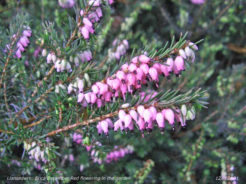
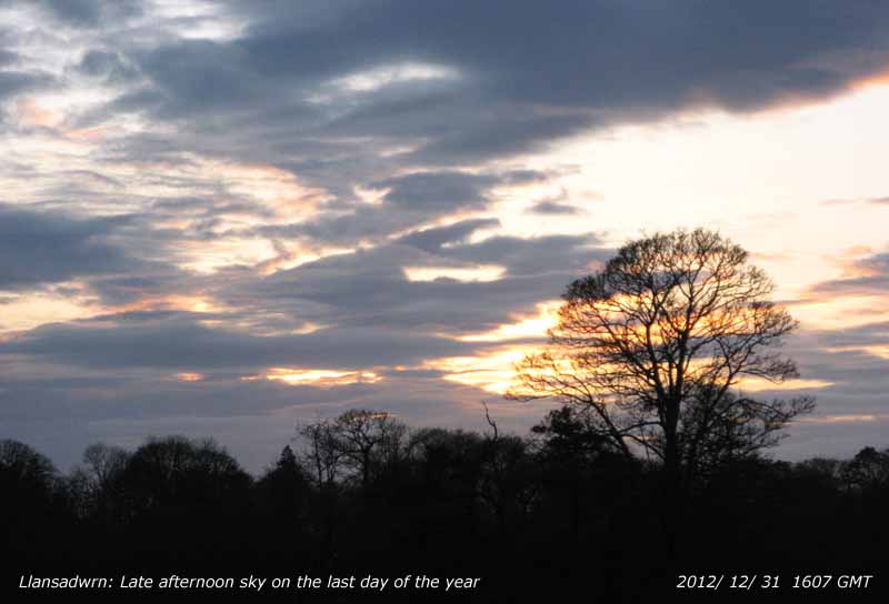 31st: Overcast and so dull that I required to use the LED headlamp to read the thermometers at 0900 GMT. Very windy with gusts up to 47 mph recorded at Gorwel Heights 42 mph here in Llansadwrn accompanied by bursts of heavy rain. Traffic on the Britannia Bridge continued to be restricted to 30 mph. More heavy rain in north and south Wales. The B5106 in the Conwy Valley was closed between Llanrwst and Trefriw due to flooding; rail services were disrupted. The road at Dyfi Bridge remained closed and a man had to be rescued from a van caught in flood water in Bishopston, Gower... Not much more to say about this mild, but wet sunless last day of the year so two photos instead. {Church Fenton 12.1C, Capel Curig 53.0 mm, Stornoway 2.5h} [Rain 1.3 mm; Max 10.1C; Min 5.3C; Grass 3.6C]
 With a total of 192.9 mm of rain December was wettest since 2006 ranking 7 since 1928. The mean temperature 5.8C [(+0.4)] was lowest since 2010, but 18th highest since 1979.
>
Pages are designed and written by Donald Perkins: Copyright © 1998 - 2012Disclaimerhttp://www.llansadwrn-wx.co.uk
|


